In General
Getting Here
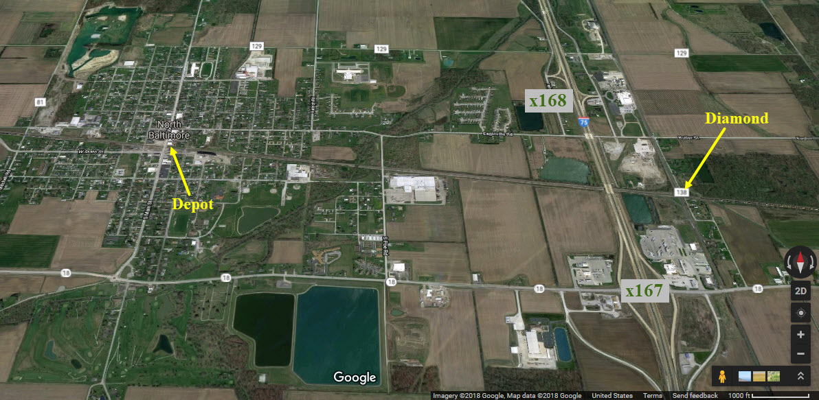
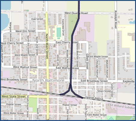
Map
Sights
Signals
Floobydust
Histories
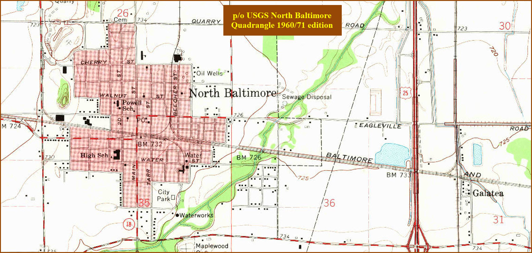
USGS Maps
RAILROAD SIGNALS HOME
Location / Name:
North Baltimore OH, Wood County
What's Here:
Former B&O Depot
Huge "new" Intermodal yard to the west of town
Grade crossing with the CSX
Runaway CSX 8888 passed by here on the diamond just to the east
Data:
GPS Coordinates: below, as needed
ZIP: 45872
Phone A/C: 419
Access by train/transit:
None
The Scoop:
North Baltimore is on CSX's E-W line known as the Willard Subdivision (Deshler to Willard). It is part of CSX's Great Lakes Division. The double track line runs between Cleveland and Chicago.
The town hosts an ex B&O depot and a couple of signals to both the west and east of Main St.
The B&O came through North Baltimore in 1873, when it was called Peters Crossroads. The first ticket office was set up in a store owned by B. L. Peters. Later in the year the B&O opened their first station. The town changed it's name to Baltimore in 1874, but soon changed it to North Baltimore to prevent confusion with a town of the same name. The original depot burned down in 1888, but the next one they built is the one you see today. In 1923, the town and the B&O celebrated the Golden Jubilee of the railroad coming to town.
I don't believe that the connecting track was here when these were two competing railroads. (needs confirmation)
Liberty Hi Ave crosses the E/W mainline just east of the yard, and you may be able to get a few good shots from the overpass.
However, I would park off the overpass road somewhere NOT near the bridge, cause I got scolded by a sheriff's deputy in Bellevue for doing that a few years ago :-(
Under Signal 2, there is an aerial shot with a suggestion where to park if you want to shoot from the bridge.
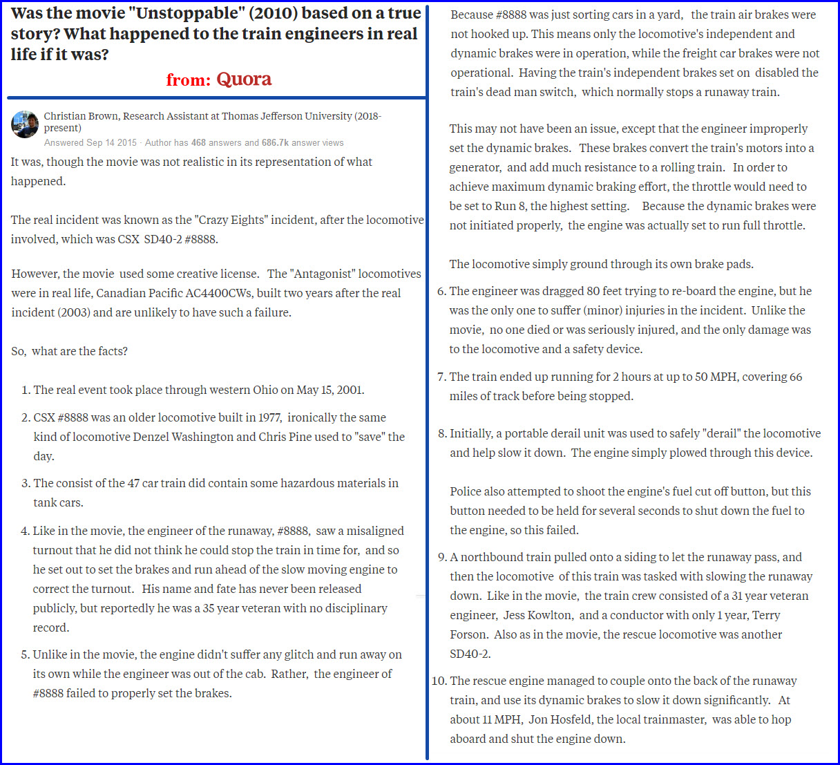
The infamous "lucky 7's" / "crazy 8's" runaway train went across the diamond on it's way from Stanley Yard (Walbridge/Toledo OH) toward Columbus.
The train number was 777 in the movie, while the real engine on that train was SD40-2 #8888.
In a little other local info.... The Toledo, Bowling Green & Southern Electric Interurban (streetcar) Line through North Baltimore was completed in 1902, but abandoned in 1930 due to competition from automobiles (and pressure from the Great Depression).
Acknowledgements:
Denver Todd
Regan Rickson
Bonnie Knaggs
Barry Lennon
Craig Sanders
Freightwaves.com
Google Maps
Bing Maps
Toledo Blade
Websites and other additional information sources of interest for the area:
http://www.csx.com/index.cfm/media/press-releases/northwest-ohio-terminal-begins-service/
And a PDF fact sheet is at: http://www.csx.com/share/wwwcsx_mura/assets/File/Media/Northwest_Ohio_Terminal_Fact_Sheet.pdf
https://en.wikipedia.org/wiki/CSX_8888_incident
Quora Reference One
Quora Reference Two
https://www.youtube.com/watch?v=UFzF9OWRnUw excellent video of Deshler and North Baltimore
https://www.freightwaves.com/news/progress-continues-on-construction-of-csx-intermodal-terminals
https://www.toledoblade.com/local/transportation/2018/10/27/csx-boosts-service-plan-northwest-ohio-terminal-transportation/stories/20181026127
https://www.west2k.com/ohpix/northbaltimore.jpg
https://www.abandonedrails.com/tontogany-to-north-baltimore
From the north or south of town, the easiest way is to take exit 167 off of I75, and then head west on OH18 about a mile.
From the east, say, coming from Fostoria, take OH18 out of town and all the way into North Baltimore, however, now, if you want to go
into town, you will have to go to the right at the traffic circle.
Signals
From the west, again, it's OH18, but just after you pass Liberty Hi Ave, you will need to take a left onto Business 18/Deshler Rd.
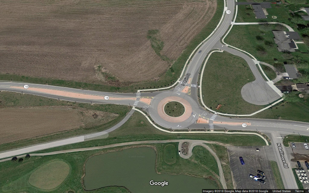
Notice: They have built a bypass around N Baltimore, and on the south side of town, there is now one of them dam traffic circles on OH18, but at least, if you're not
planning on stopping in N Baltimore, you don't have to go thru town. Business 18 takes you thru town.
If you're into chasing the E-W line, OH18 is the only game in town, but it is not always that close.
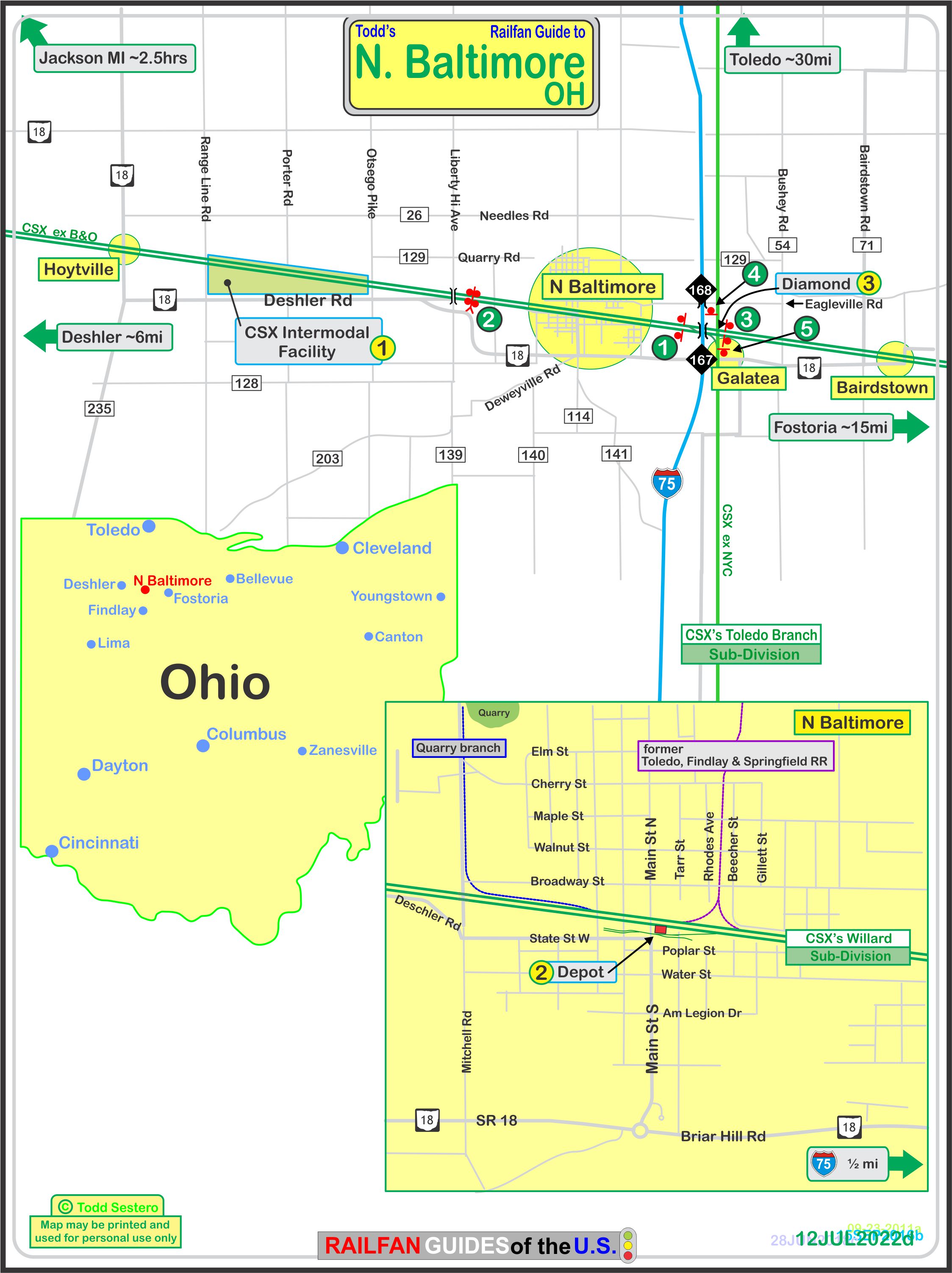
Click
here for the PDF version of the above map
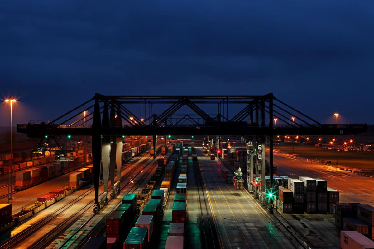
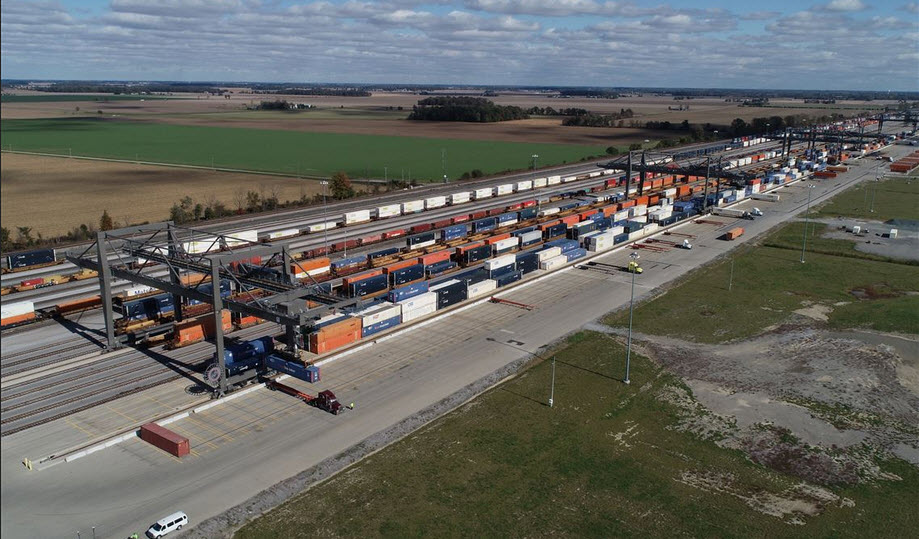
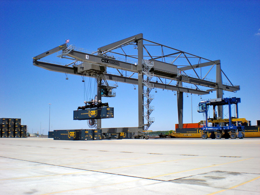
![]() CSX Intermodal Facility
CSX Intermodal Facility
CSX's new Intermodal Facility in Henry Township, between North Baltimore and Deshler (or more correctly, Hoytville), opened in February of 2011 - construction started in 2009.
One of the major roles of the facility is to act as a classification yard for stack trains.
An additional role is to take double stack trains from the west and convert them to single levels for their trip to points east like Baltimore because of the low tunnel clearances to get there.
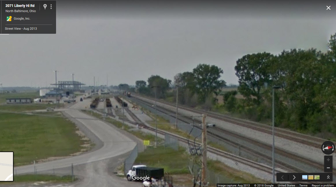
From the Liberty Hi Road overpass.
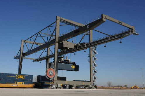
Picture from CSX's PDF about the facility.
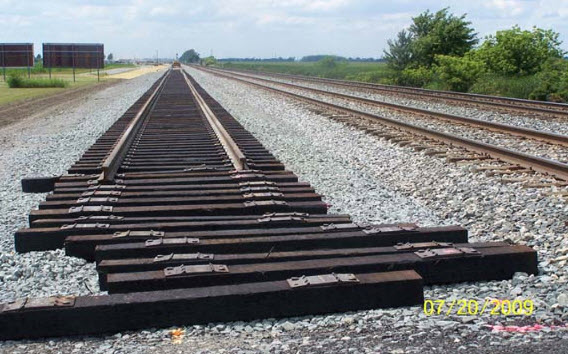
New track going in for the intermodal facility (photo by Bonnie Knaggs)
Looking east towards North Baltimore, a WB freight waits for a favorable indication.
There is a 90 degree curve in the road coming from N Baltimore, and you can pull off here...
this is looking west towards the facility, with interlocking signals for going into and coming out of the yard.
CSX photo via the Freightwaves page.
 Toledo Blade
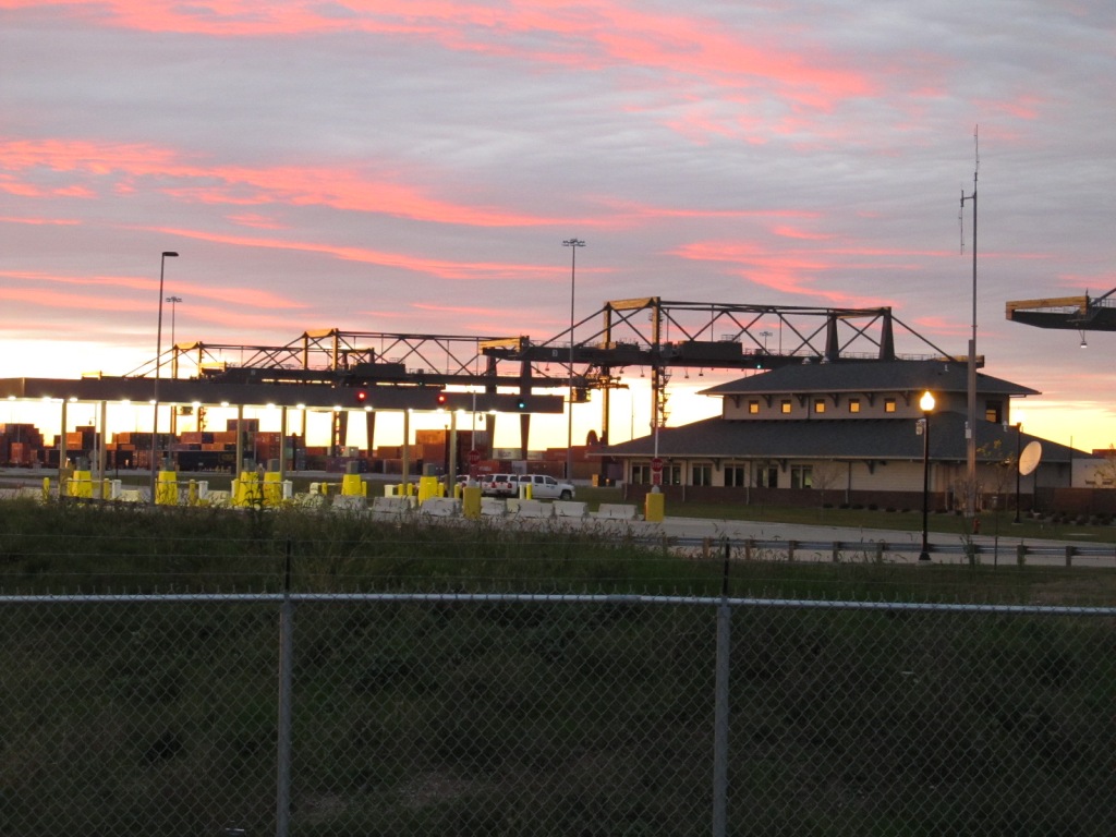
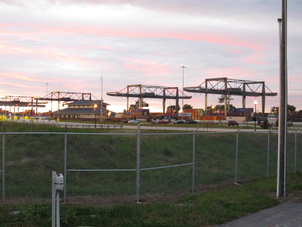
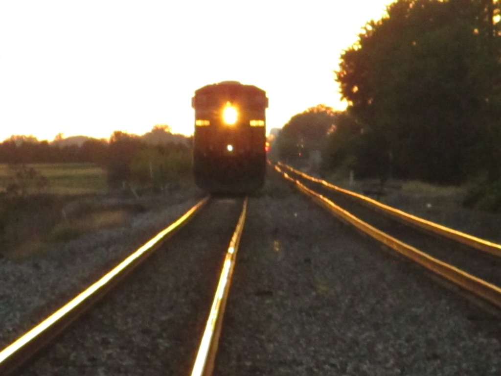
 June 2011, Craig Sanders
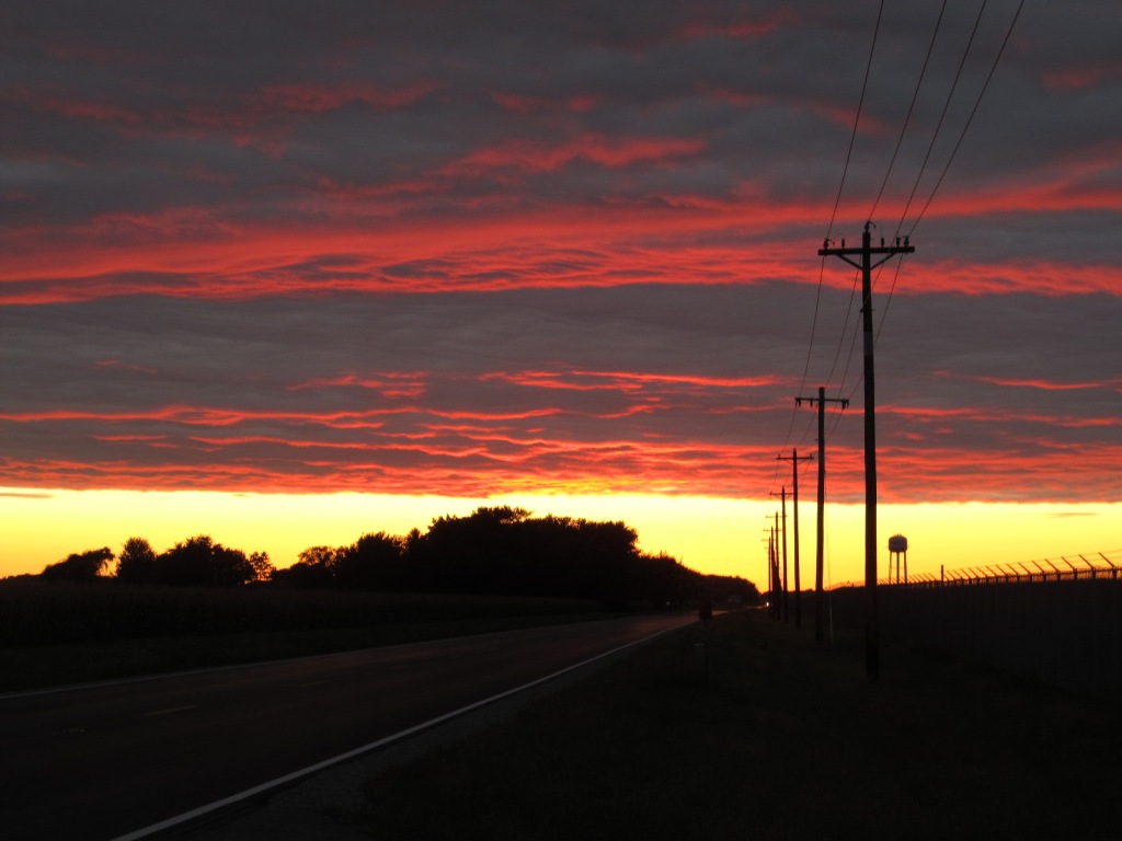
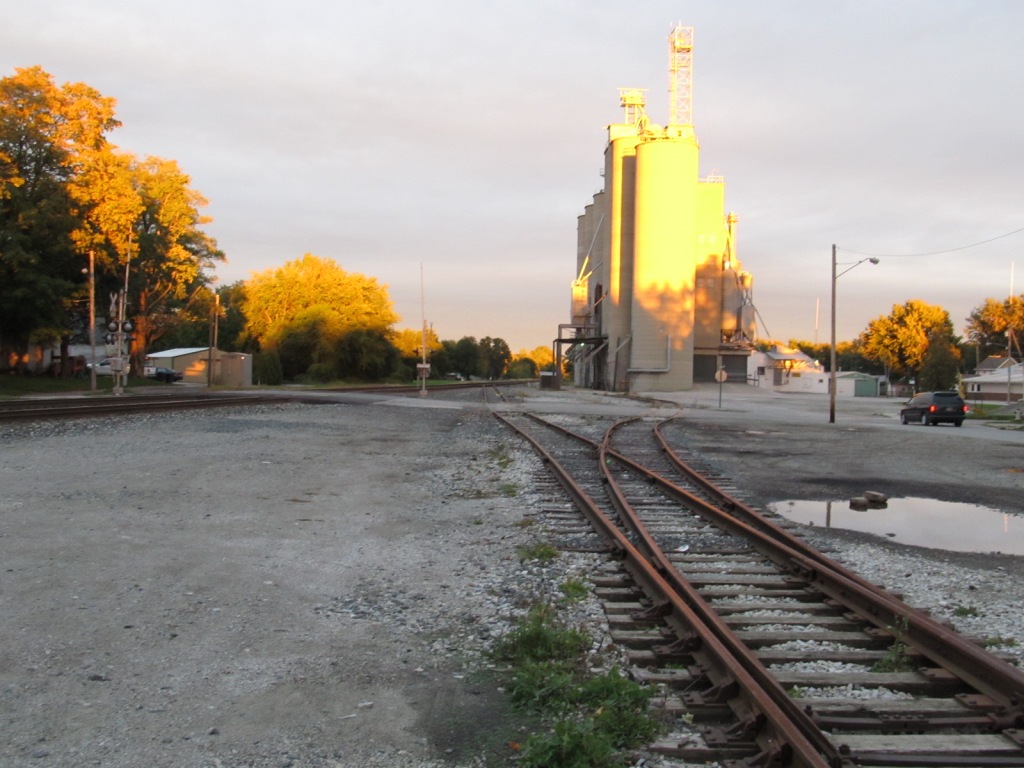
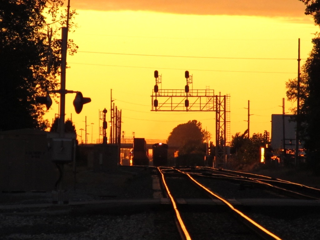
After 2 days of clouds and rain, we finally get a clear sky appearing at sunset.....
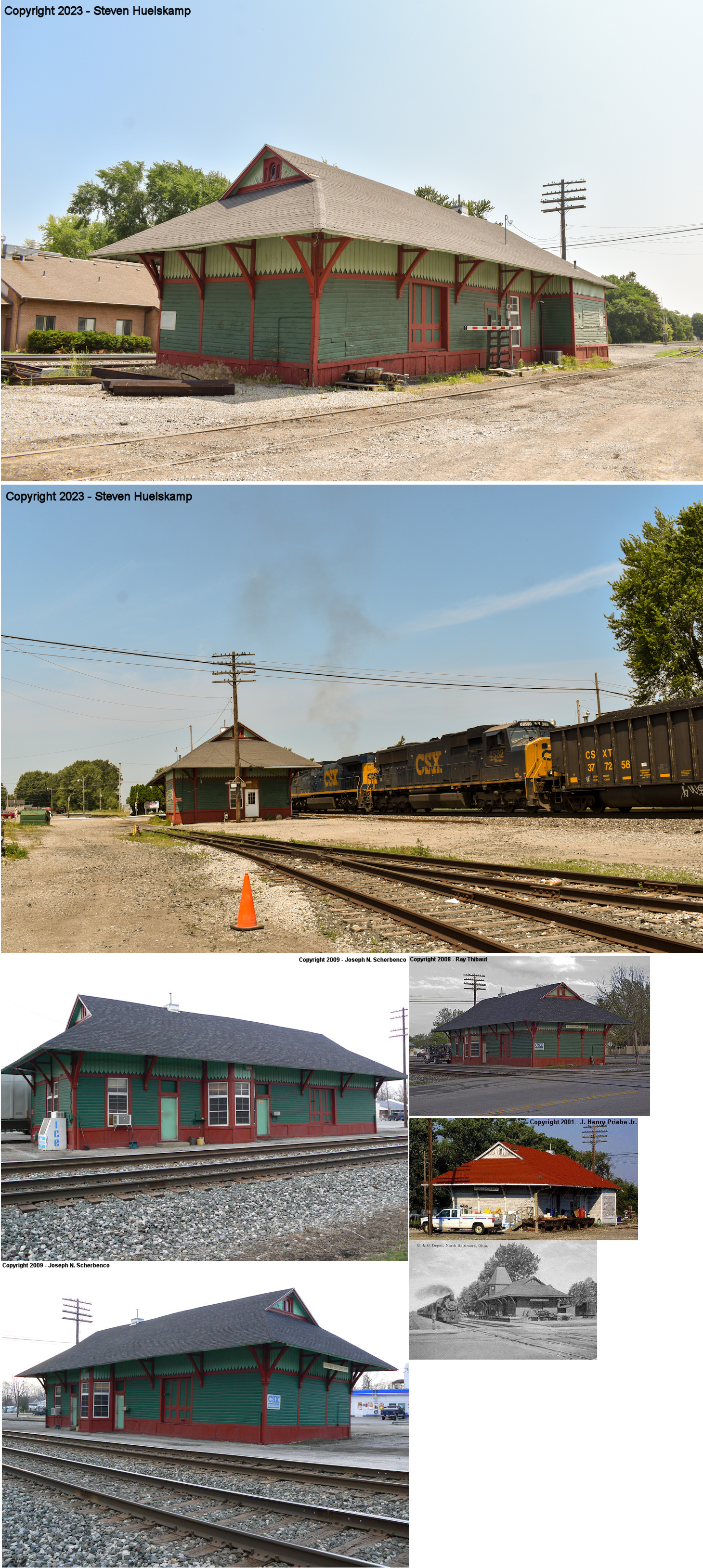
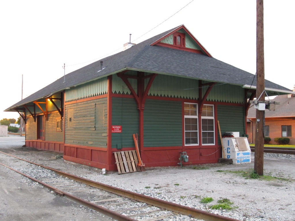
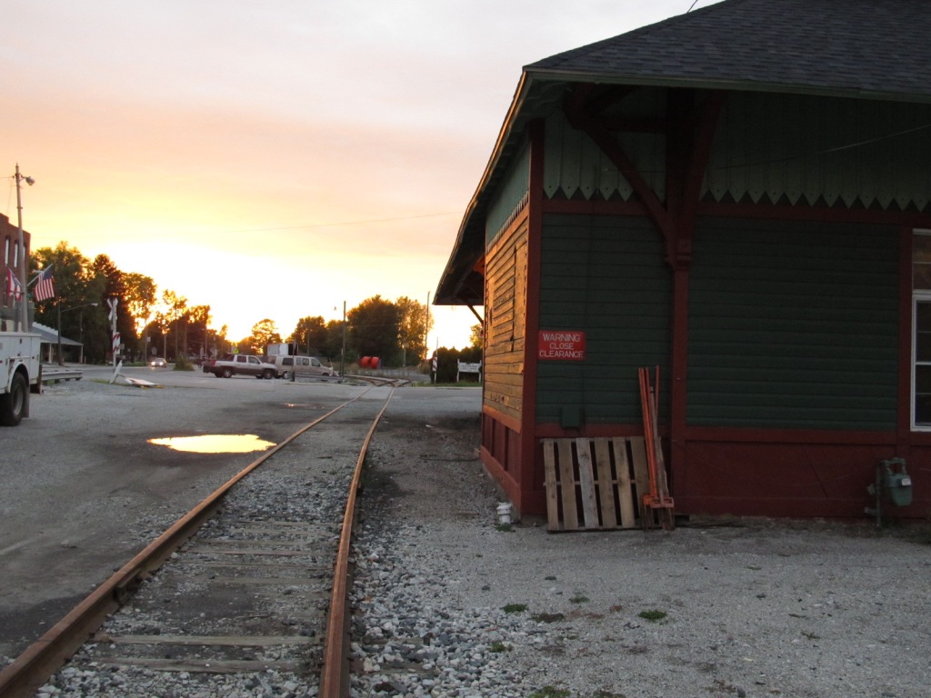
![]() the North Baltimore Depot
the North Baltimore Depot
GPS Coordinates: 41.181315, -83.677923
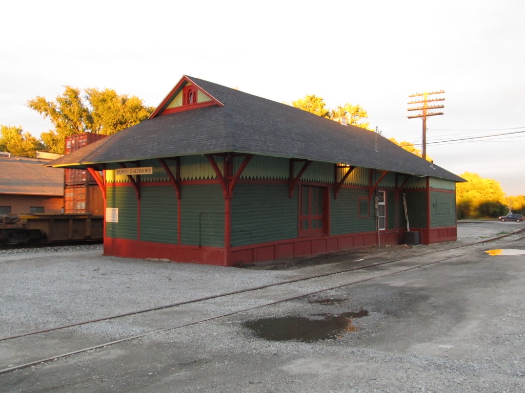
Q509 with an L&N U23B and a Chessie GP30 rolls by the depot in North Baltimore OH
while in the process of a few switching moves.
Date 9/17/94. Photo by Barry Lennon
Looking east past the siding side of the depot.
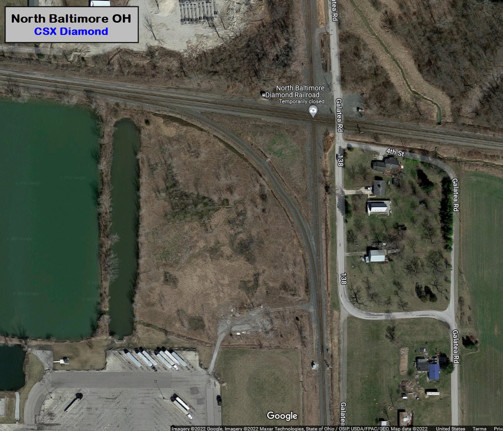
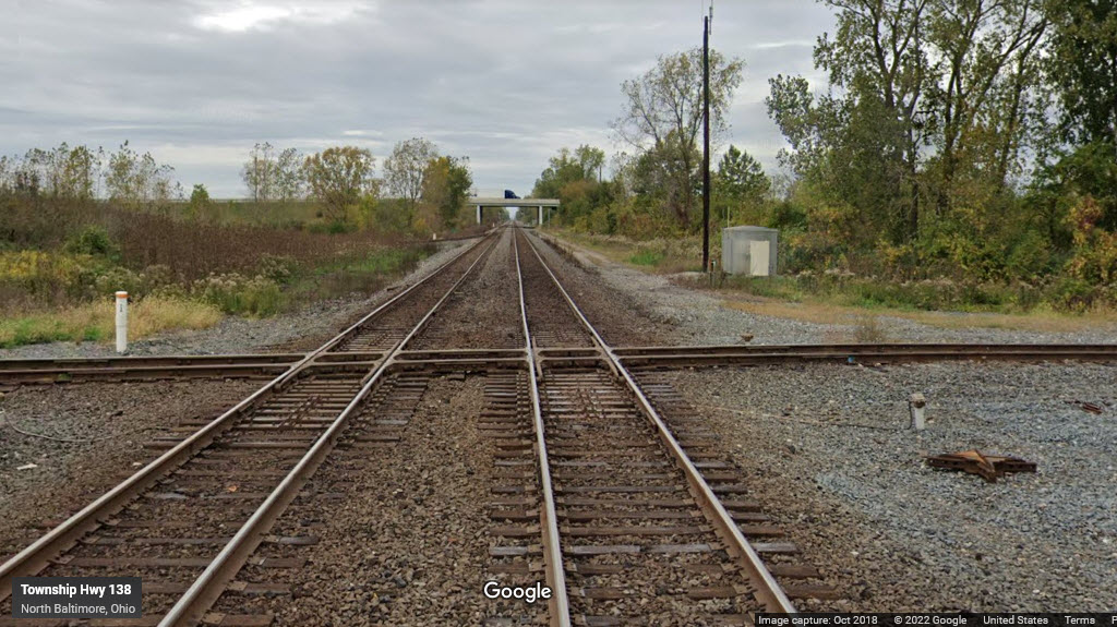
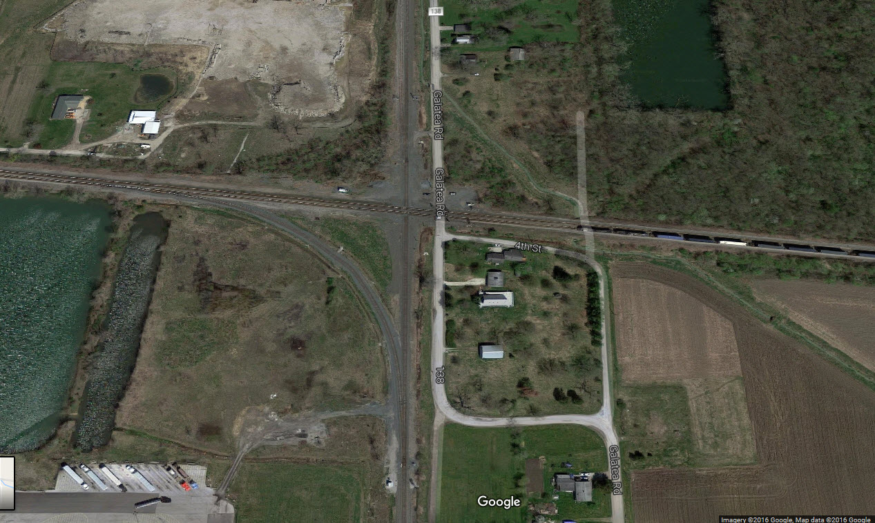
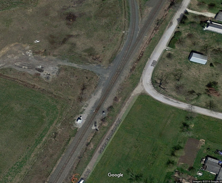
![]() Diamond
Diamond
GPS Coordinates: 41.17810, -83.64516
The diamond is technically in Galatea. The N/S track used to be the New York
Central (Penn Central, and then Conrail); the E/W line, of course, the B&O.
Really good pictures can be had from the Galatea Rd grade crossing. Anyone have any they would like to share?

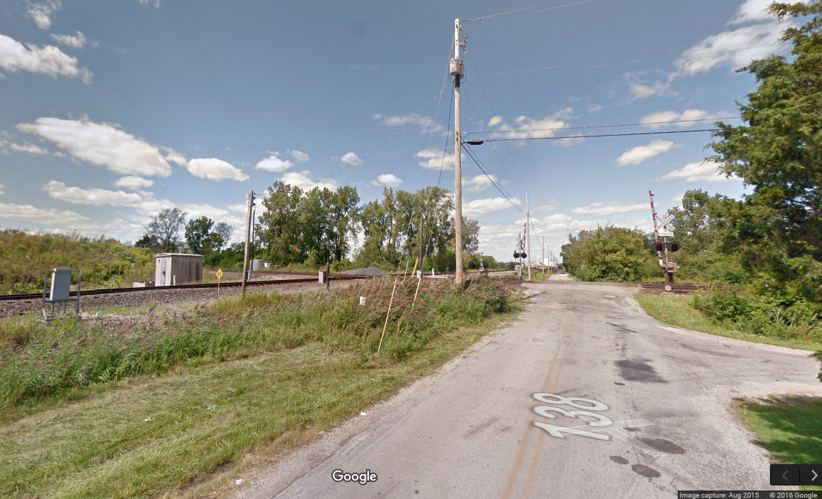
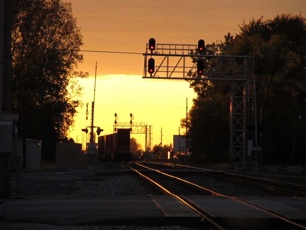
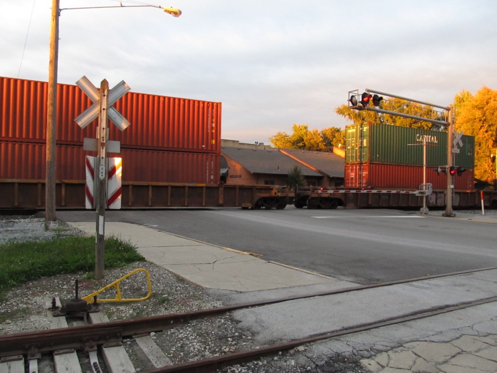
![]() EB Colorlights
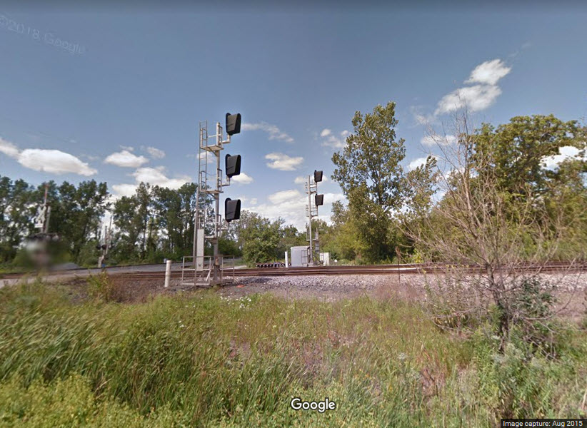
EB Colorlights
This and the next set are shot from the Main St grade crossing in North Baltimore.
Looking down the track to the east from here, you can see the next two sets of signals (just barely). The overpass is I-75.
Beyond the interstate, you can almost see the interlocking signals for the diamond with the N-S line. That diamond is fully signaled.
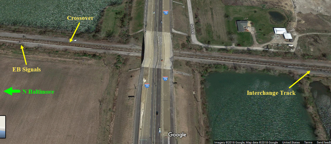
The EB interlocking signals not only handle the diamond, but a crossover and the interchange track.
If anyone has ventured out into the field for some pictures, I would be greatly appreciative for a copy.
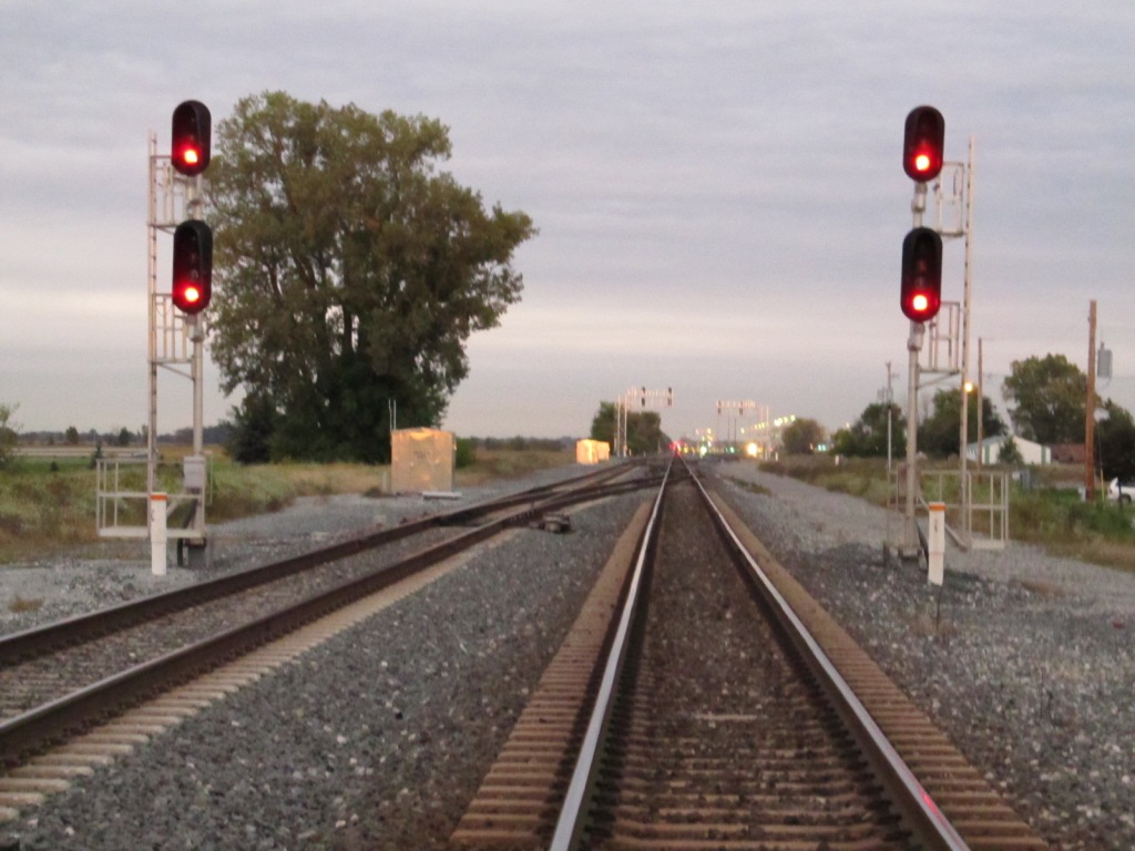
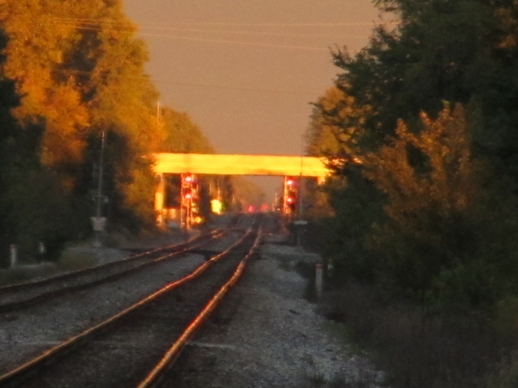
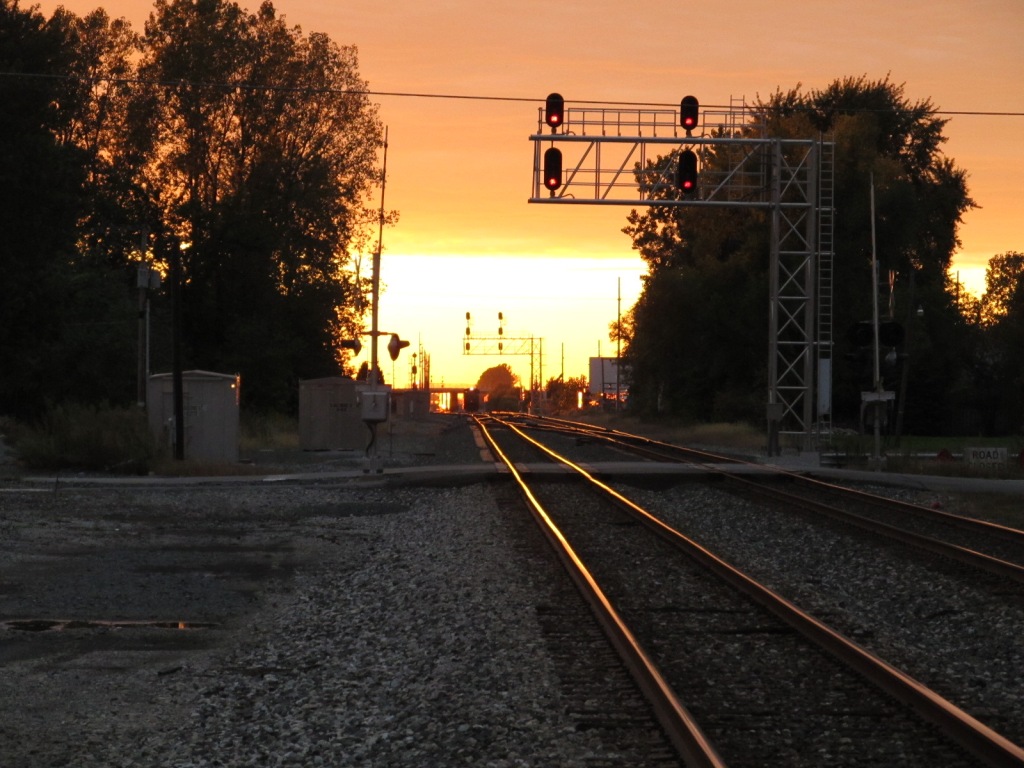
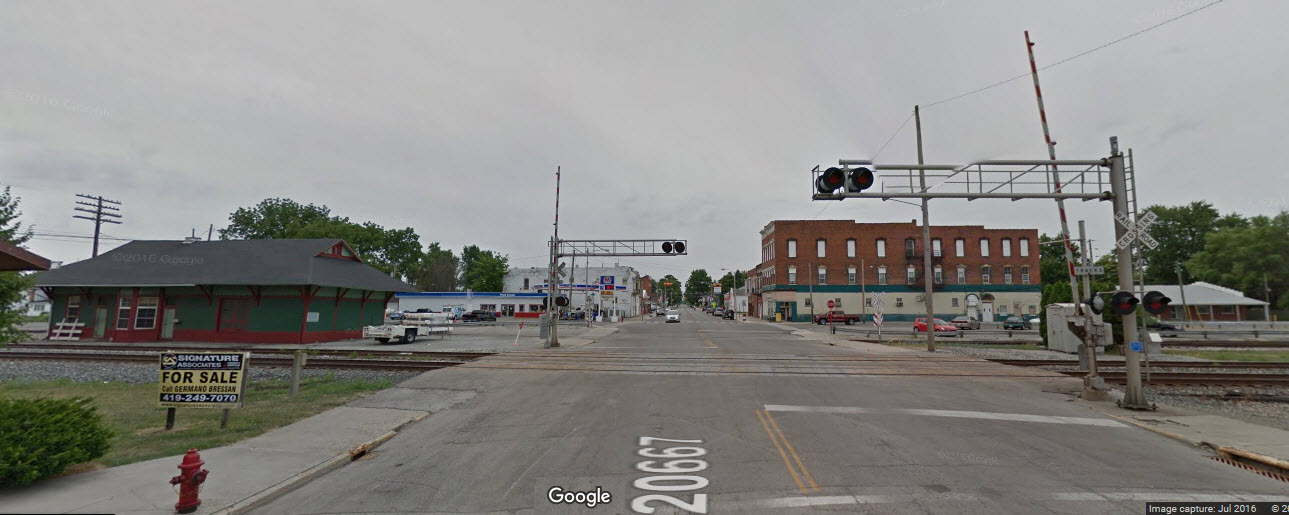
![]() EB/WB Interlocking Colorlights
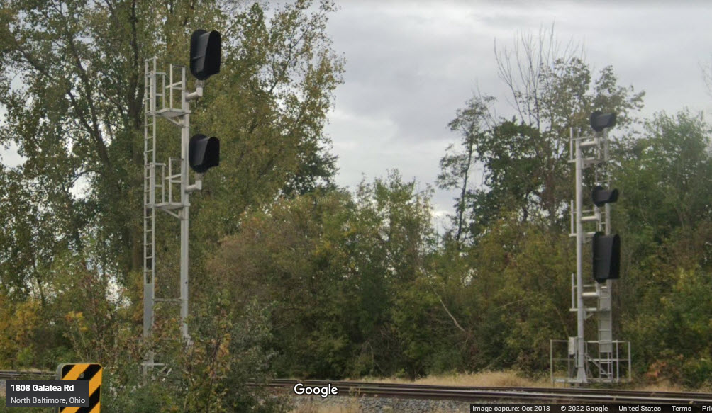
EB/WB Interlocking Colorlights
There is a set of EB signals beyond the immediate set of WB signals, protecting a crossover for traffic approaching the yard.
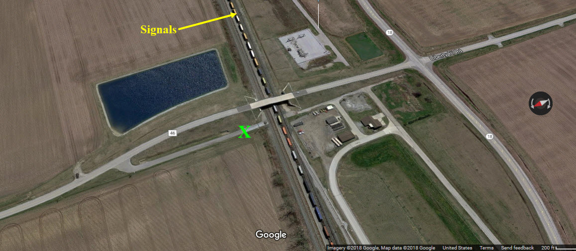
These pictures were taken before the Liberty Hi Ave overpass was put in!
If you want to get pictures from the overpass, I would park at the green "X" in the aerial shot below, and climb the embankment,
to avoid getting yelled at by the local gendarmes!!!
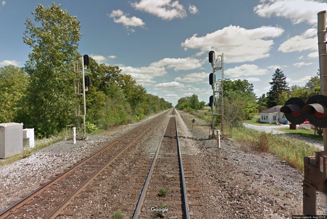
![]() WB Interlockers at the Diamond
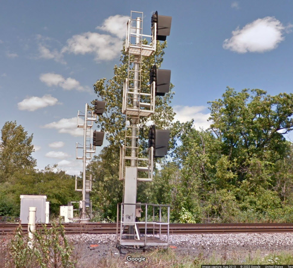
WB Interlockers at the Diamond
GPS Coordinates: 41.17810, -83.64516
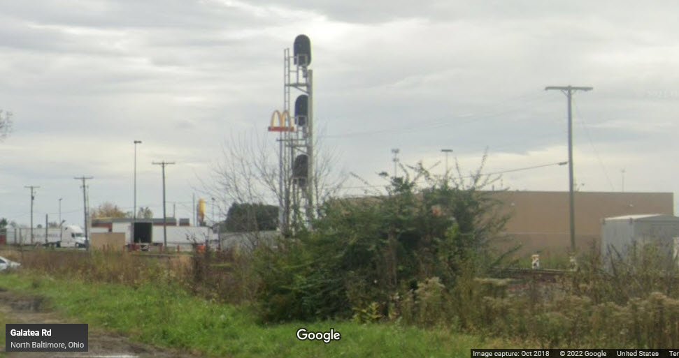
![]() SB Colorlights for the Diamond
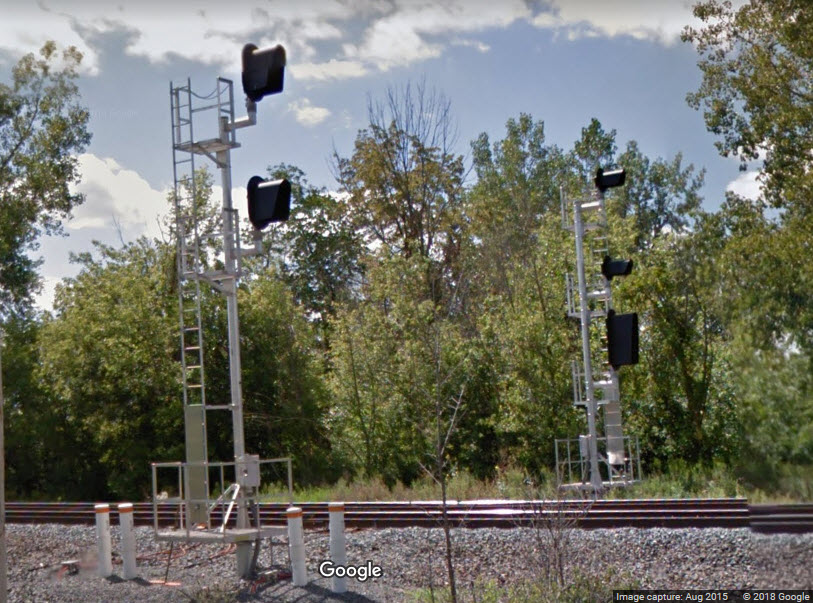
SB Colorlights for the Diamond
GPS Coordinates: 41.17913, -83.64522
Two SB tracks converge into one to cross the diamond.

![]() NB Colorlight for the Diamond and Interchange
NB Colorlight for the Diamond and Interchange
GPS Coordinates: 41.17617, -83.64498
This signal controls movements for the interchange track, the diamond, and
the 1 to 2 split on the far side of the diamond.

Aerial View
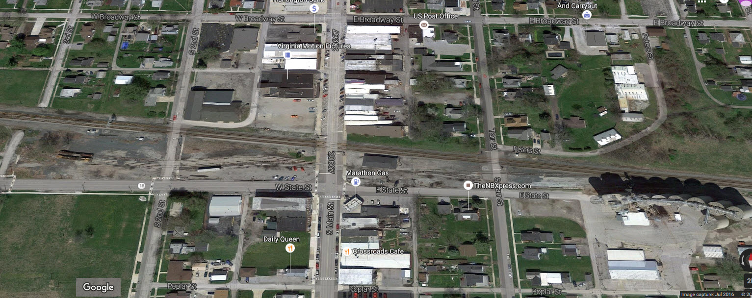
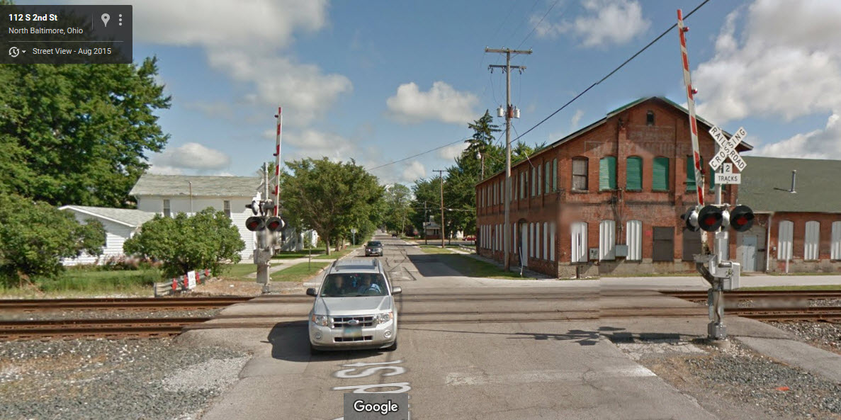
2nd Street Grade Crossing
Main Street Grade Crossing
CSX's Runaway Train
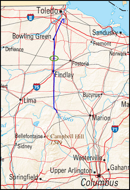
In 2001, CSX had an engine that got away from them - SD40-2 #8888. It got away from it's engineer while being switched in Stanley Yard in Walbridge OH (just outside Toledo to the east). The train headed south out of the yard and came down thru Ohio, passing North Baltimore on the diamond to the east, on it's way towards Columbus. Altho some of the highlights of the movie Unstoppable were correct, many were not. They used the train number 777. According to Wikipedia, the train only got up to 51MPH. They DID try to shoot out the fuel stop on the side of the engine, however, it needs to be held in for a few seconds in order to properly function. They also tried derailers, which, like in the movie, did not work. There was a local working further down the line, which took a siding, uncoupled the engine, and then coupled to the runaway train to slow it down to 10MPH, where a railroad employee was able to then hop on the train and stop it in the proper manner.
This is a map of the route the runaway train took, the green circle is where N Baltimore and Galatea are:
the Toledo, Findlay and Springfield Railroad
According to the abandoned rails page: This railroad began as the Bowling Green Railroad Company in 1874, as a link between Tontogany and Bowling Green OH. The terminus in Tontogany was at the Cincinnati, Hamilton, and Dayton Railroad (CH&D), and the line continued southeast to Bowling Green. In 1887, the line was purchased by the CH&D. In 1890, the company purchased the Toledo, Findlay and Springfield Railroad, extending its line to North Baltimore OH. The line was later purchased by the Baltimore and Ohio Railroad, and operated until it was abandoned in 1978. Today, a trail now runs on the right of way from North Baltimore to Bowling Green. Named the Slippery Elm Trail, it is 13 miles in length.
Courtesy of the USGS, click here for their index page.
Disclaimers:
I love trains, and I love signals. I am not an expert. My webpages reflect what I find on the topic of the page. This is something I have fun with while trying to help others.
Please Note: Since the main focus of my two websites is railroad signals, the railfan guides are oriented towards the signal fan being able to locate them. For those of you into the modeling aspect of our hobby, my indexa page has a list of almost everything railroad oriented I can think of to provide you with at least a few pictures to help you detail your pike.
If this is a railfan page, every effort has been made to make sure that the information contained on this map and in this railfan guide is correct. Once in a while, an error may creep in :-)
My philosophy: Pictures and maps are worth a thousand words, especially for railfanning. Text descriptions only get you so far, especially if you get lost or disoriented. Take along good maps.... a GPS is OK to get somewhere, but maps are still better if you get lost! I belong to AAA, which allows you to get local maps for free when you visit the local branches. ADC puts out a nice series of county maps for the Washington DC area, but their state maps do not have the railroads on them. If you can find em, I like the National Geographic map book of the U.S..... good, clear, and concise graphics, and they do a really good job of showing you where tourist type attractions are, although they too lack the railroads. Other notes about specific areas will show up on that page if known.
Aerial shots were taken from either Google or Bing Maps or as noted. Screen captures are made with Snagit, a Techsmith product... a great tool if you have never used it!
By the way, floobydust is a term I picked up 30-40 years ago from a National Semiconductor data book, and means miscellaneous and/or other stuff.
Pictures and additional information is always needed if anyone feels inclined to take 'em, send 'em, and share 'em, or if you have something to add or correct.... credit is always given! Please be NICE!!! Contact info is here
Beware: If used as a source, ANYTHING from Wikipedia must be treated as being possibly being inaccurate, wrong, or not true.
RAILFAN GUIDES HOME
RAILROAD SIGNALS HOME
NEW 10/15/2011, SEP16/2016, JUL11/12/13/2022
Last Modified 14-Jul-2022