RAILFAN GUIDES of the U.S.
Todd and Denver Todd's Railfan Guide to
GLENDALE OH
In General
Getting Here
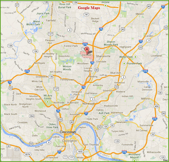
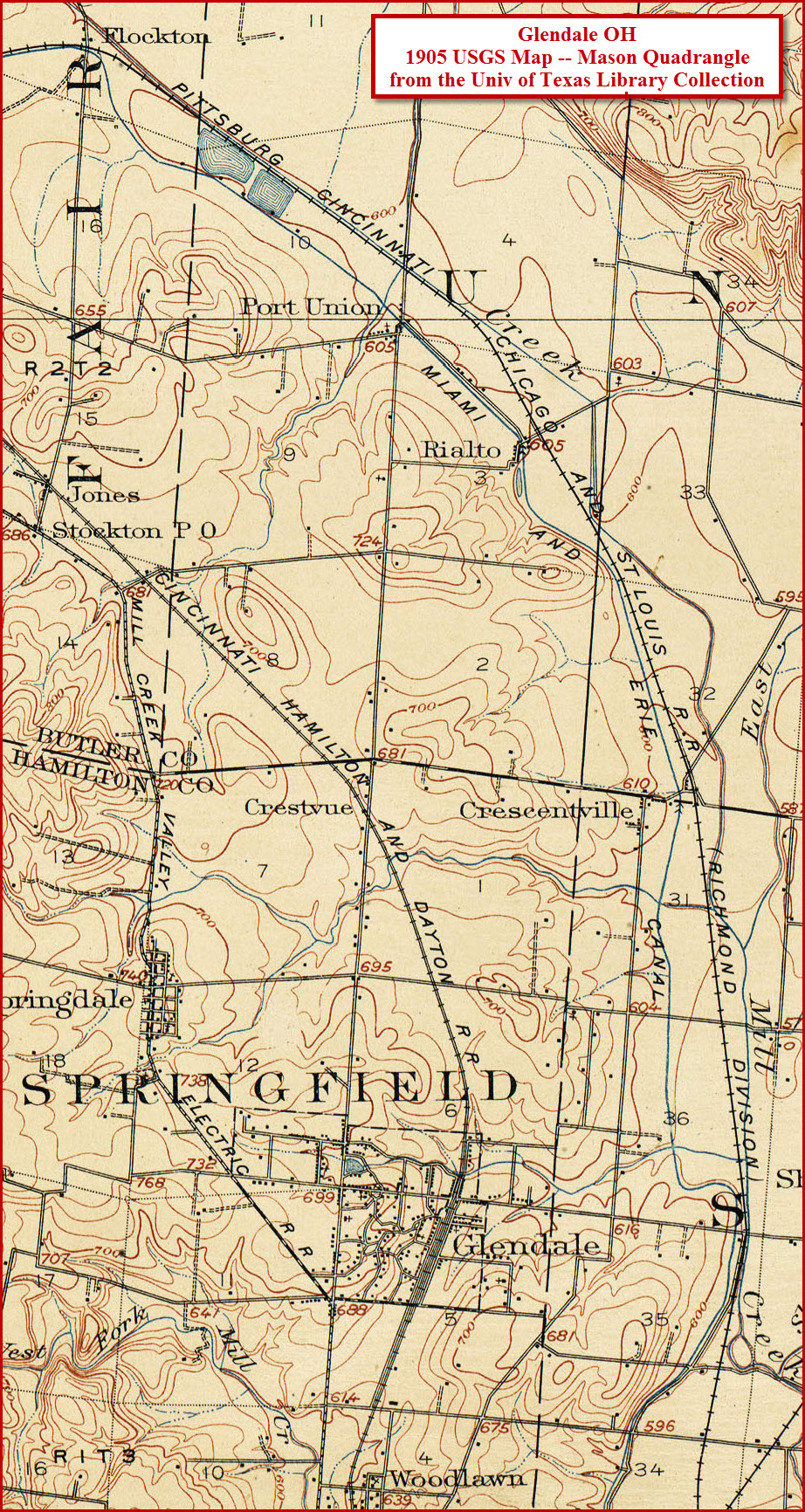
Map
Sights
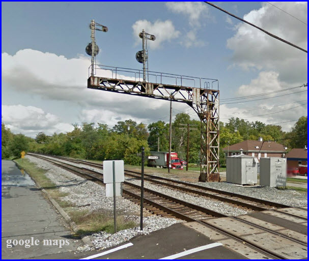
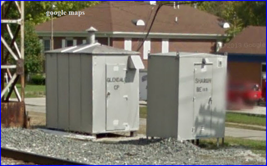
Signals
Fire & Police
Floobydust
USGS Maps
RAILFAN GUIDES HOME
RAILROAD SIGNALS HOME
Location / Name:
Glendale OH
What's Here:
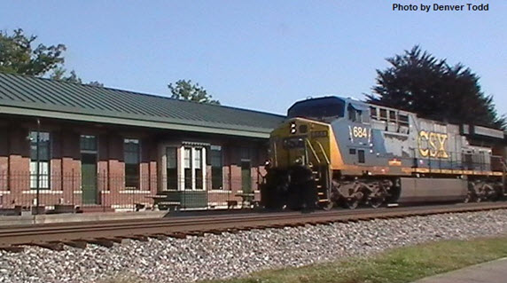
CSX and NS freights.
The
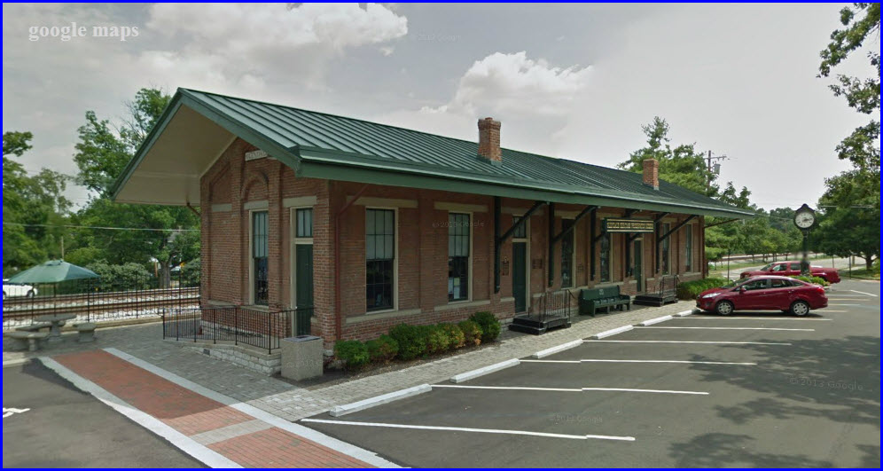
Glendale Heritage
Preservation Museum, a restored
railroad depot.
Data:
GPS Coordinates: 39.27209, -84.45831
ZIP: 45246
Scanner Frequencies:
CSX:
160.230,
161.100
Access by train/transit:
None.
The Scoop:
Glendale
OH (population: 2155) is
a northern suburb of
Cincinnati, just west of
I-75, exit 15.
CSX travels through Glendale northbound with generally directional running. The trackage in Glendale is double-track CSX, and comes north out of Queens Gate Yard in Cincinnati. Norfolk Southern has trackage rights here, and shares their tracks farther to the east for southern running. The line is part of CSX’s Cincinnati Terminal Sub.
Head on photo shots of north bounders can be problematic during the day on sunny days, but you are close to the trains with plenty of side shots available.
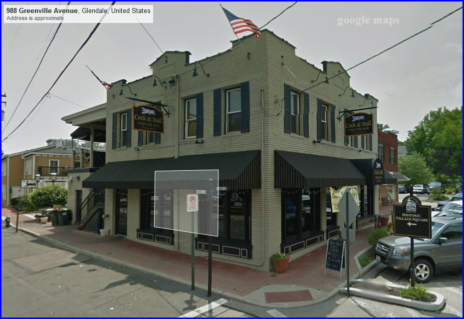
There is a great restaurant/pub, The Cock & Bull, with a second floor outdoor deck on Sharon Road right next to the tracks with a view of the NB B&O Signals. Perfect for having a snack or drink while watching trains sail through about once an hour, sometimes more often.
There is ample parking across the tracks off Sharon Road in a public lot.
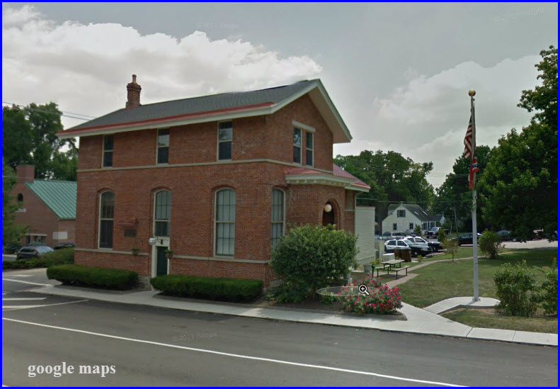
Just south of the Cock & Bull is a restored Cincinnati, Hamilton, & Dayton depot. It is now a railroad museum, the Glendale Heritage Preservation Museum, open to visitors every Thursday and Sunday from 11-3pm. The museum houses many artifacts of Glendale railroad history.
Additional lodging and fast food are available back at exit 15 on I-75. Glendale train watching is probably one of the most comfortable and safe spots that a railfan could ever dream of.
The access road going around Tri-County mall runs parallel to the CSX tracks on the backside of the mall, altho you will have to peak thru the trees. The track is nice and straight here, with good site lines in both directions. There are two sidings on the far side of the tracks from this side.
From the other side of the tracks, off Kemper Commons Circle, you also have access to the tracks, altho if something is sitting on the sidings, SB freights wouldn't be easy to catch. There's plenty of easy parking here tho. There also appears to be a access point thru the trees down by the Kemper Road overpass.
Acknowledgements:
Thanks to Denver Todd for his help with my railfan
guides and suggesting welcome changes to help all ya'll.
Websites and other
additional information
sources of interest for
the area:
Chamber:
http://www.glendaleohiochamber.com/
Exit 15, E Sharon Rd, from I-75, about a mile south of
I-275. Head west into the downtown Glendale area.
The majority of the area hotels is off this exit.
Exit 42 off of I-275, Princeton Pike, OH 747, head
south.
Most of your food and shopping is off of this road, there are 5 shopping
centers just off the interstate.
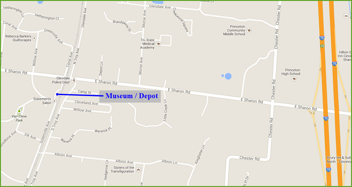
1 Glendale Heritage Preservation Museum / Depot
GPS Coordinates: 39.271218,-84.459258
http://www.glendalemuseum.com/museum.html
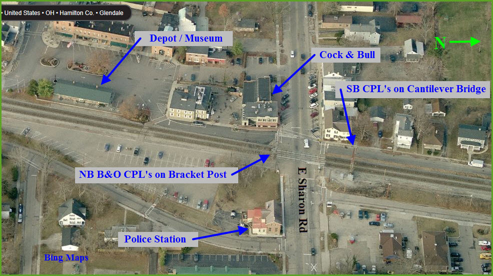
1 the NB B&O CPL Signals
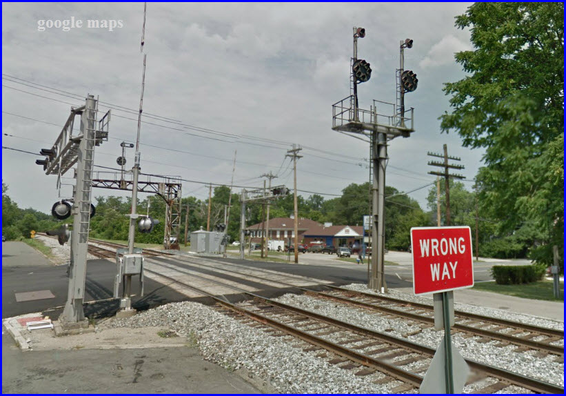
2 the SB B&O CPL Signals
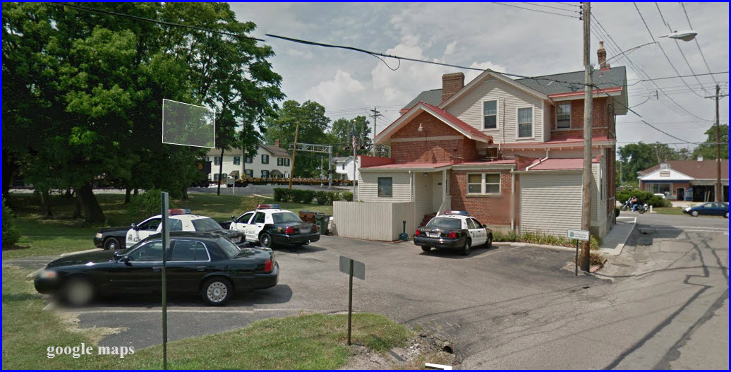
Glendale Police Station
GPS Coordinates: 39.271923,-84.458095
the Cock & Bull Pub
GPS Coordinates: 39.272014,-84.45891
There is a lot happening in this quadrangle, so I included more of the map from north of Glendale.
Disclaimers:
Every effort has been made to make sure that the information contained on this map and in this railfan guide is correct. Once in a while, an error may creep in, especially if restaurants or gas stations open, close, or change names. Most of my maps are a result of personal observation after visiting these locations. I have always felt that a picture is worth a thousand words", and I feel annotated maps such as the ones I work up do the same justice for the railfan over a simple text description of the area. Since the main focus of my website is railroad signals, the railfan guides are oriented towards the signal fan being able to locate them. Since most of us railheads don't have just trains as a hobby, I have also tried to point out where other interesting sites of the area are.... things like fire stations, neat bridges, or other significant historical or geographical feature. While some may feel they shouldn't be included, these other things tend to make MY trips a lot more interesting.... stuff like where the C&O Canal has a bridge going over a river (the Monocacy Aqueduct) between Point of Rocks and Gaithersburg MD, it's way cool to realize this bridge to support a water "road" over a river was built in the 1830's!!!
Beware: If used as a source, ANYTHING from Wikipedia must be treated as being possibly being inaccurate, wrong, or not true.
RAILFAN GUIDES HOME
RAILROAD SIGNALS HOME
NEW 01/16/2014
Last Modified
16-Jan-2014