In General
Getting Here
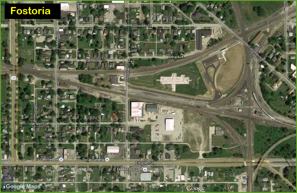
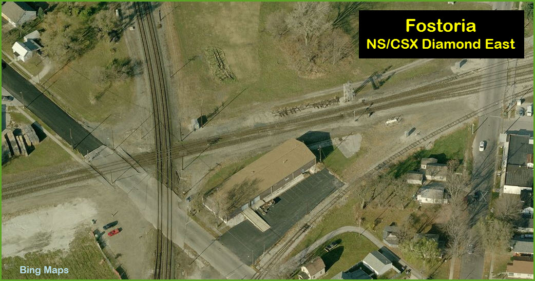
Map
Pictures
Sights
Signals
USGS Maps
RAILROAD SIGNALS HOME
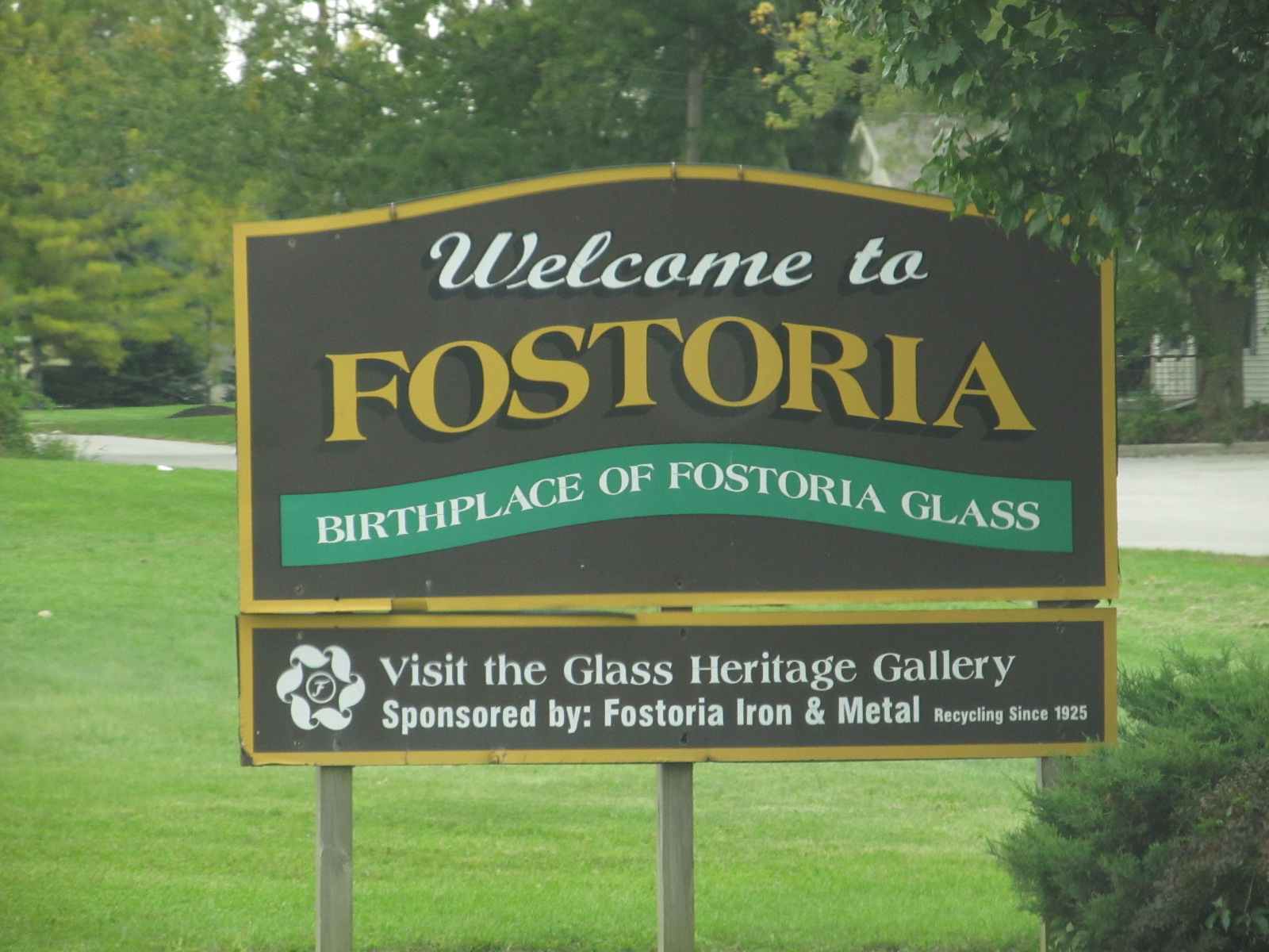
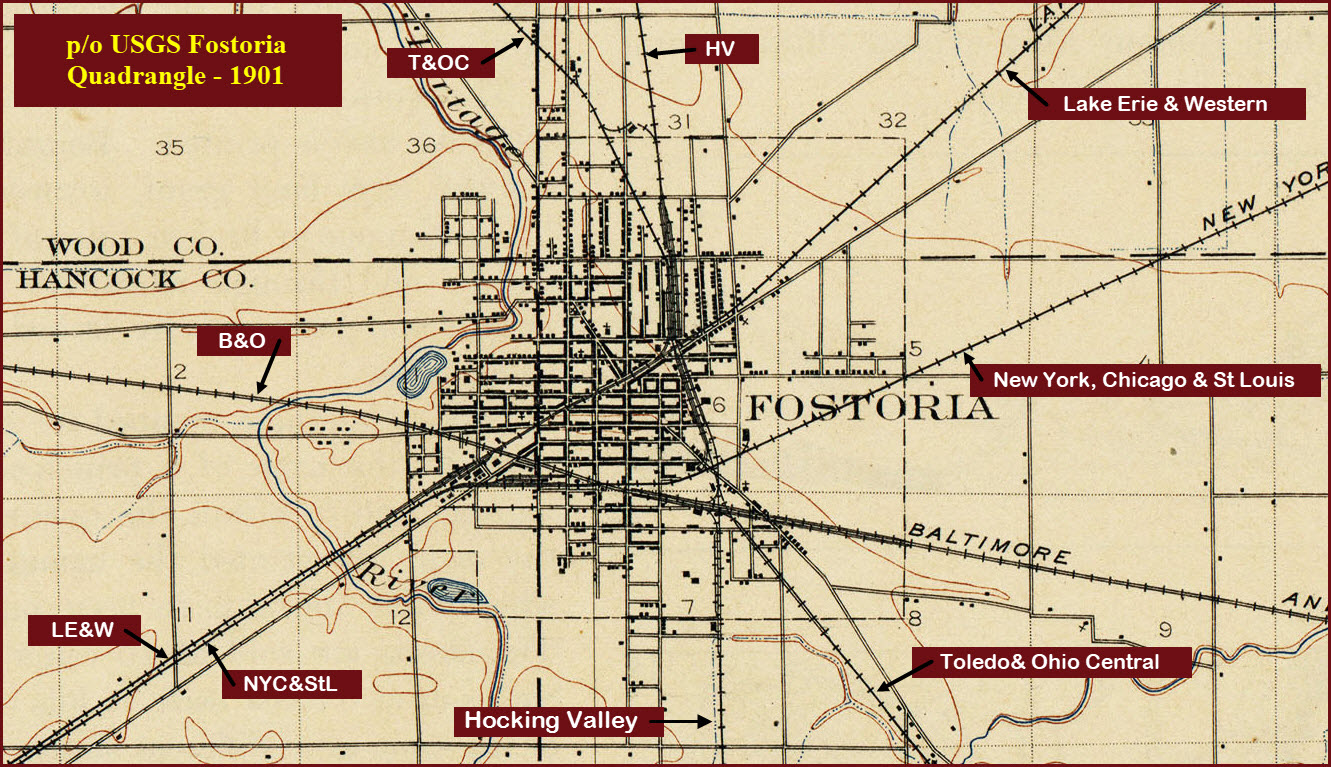
Location / Name: A Little History Fostoria is named for Charles Fostoria,
the 35th governor of Ohio. So what came before the Norfolk Southern
and CSX? Well, until the "major" mergers started in
the 60's, Fostoria hosted the Nickel Plate Road (NKP), the Baltimore and
Ohio RR (B&O), and the Chesapeake and Ohio Rwy (C&O). Online accounts of who reached Fostoria
when differ, and I don't have any books outlining the history of any of the
affected railroads.... So here goes with what I can find. The first railroad to come thru was Lake
Erie & Western RR in the 1850's. The railroad was taken over by the
NYC in 1899, and then the NKP in 1922. The C&O came thru Fostoria in 1872,
originally as the Columbus and Toledo RR, then the Hocking Valley RR. The B&O reached here the following year in
1873. In the 1880's, the New York, Chicago, & St
Louis Rwy came thru, this eventually became the NKP. There is one other railroad mentioned: the
Mansfield, Coldwater, and Lake Michigan RR, which paralleled the B&O, but
nothing else can be found about when it came to Fostoria, or when it
disappeared or got absorbed by someone else..... The NKP line was the southernmost of the
two western routes out of
Bellevue,
and heads over to Lima, and parallels I-75 as you near Lima. This is
now the Norfolk Southern line thru town. The line is NS's Fostoria
district between Bellevue OH and Ft Wayne IN. It was originally part
of NKP's mainline to Chicago. Six miles west in Arcadia, the line
splits with the Lima District line heading south to Lima. The B&O east-west line is on the mainline
to Chicago, and is the CSX Willard Sub-Division. This is the old
"traditional" B&O line that originated in Philadelphia, and went thru
Baltimore and Pittsburgh. It is now CSX's gateway to the entire east
coast from Chicago. The ex C&O line is now CSX's
Columbus
Sub-division. Northbound coal from Kentucky and West Virginia head up
towards the Toledo
docks via
Walbridge Yard. North of Fostoria, it's double track, south to
Columbia it is mostly single track. According to a 2006
Trains Magazine online article about Fostoria, about half of the trains
coming thru Fostoria change directions. More history is here at: Map GPS Coordinates: 41.152688,
-83.413800
GPS Coordinates: 41.151891, -83.406351
GPS Coordinates:
41.159006, -83.409310
GPS Coordinates:
41.161568, -83.410035
GPS Coordinates: 41.167221, -83.411182
Courtesy of the University of Texas Library, click
here for
their index page. NEW
DEC17/2011, DEC29/2015, JUN18/2018
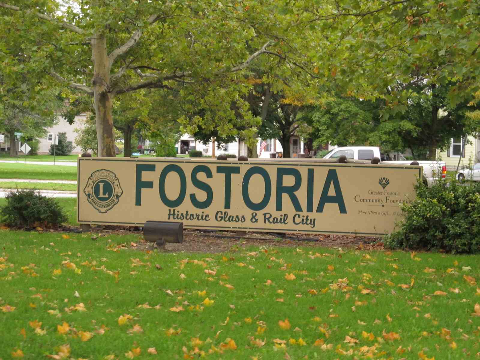
Fostoria OH, Hancock, Seneca, and Wood Counties
What's Here:
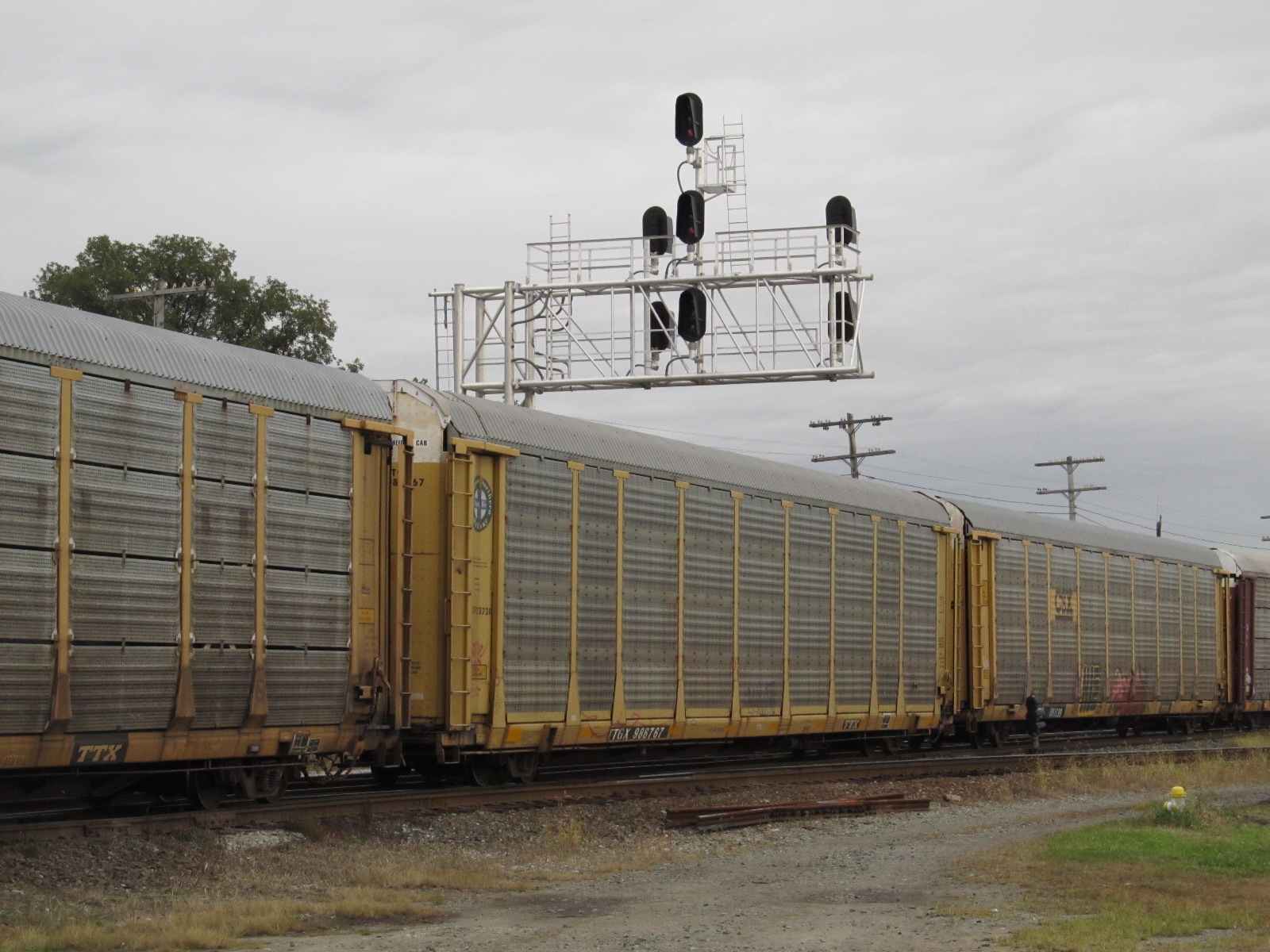
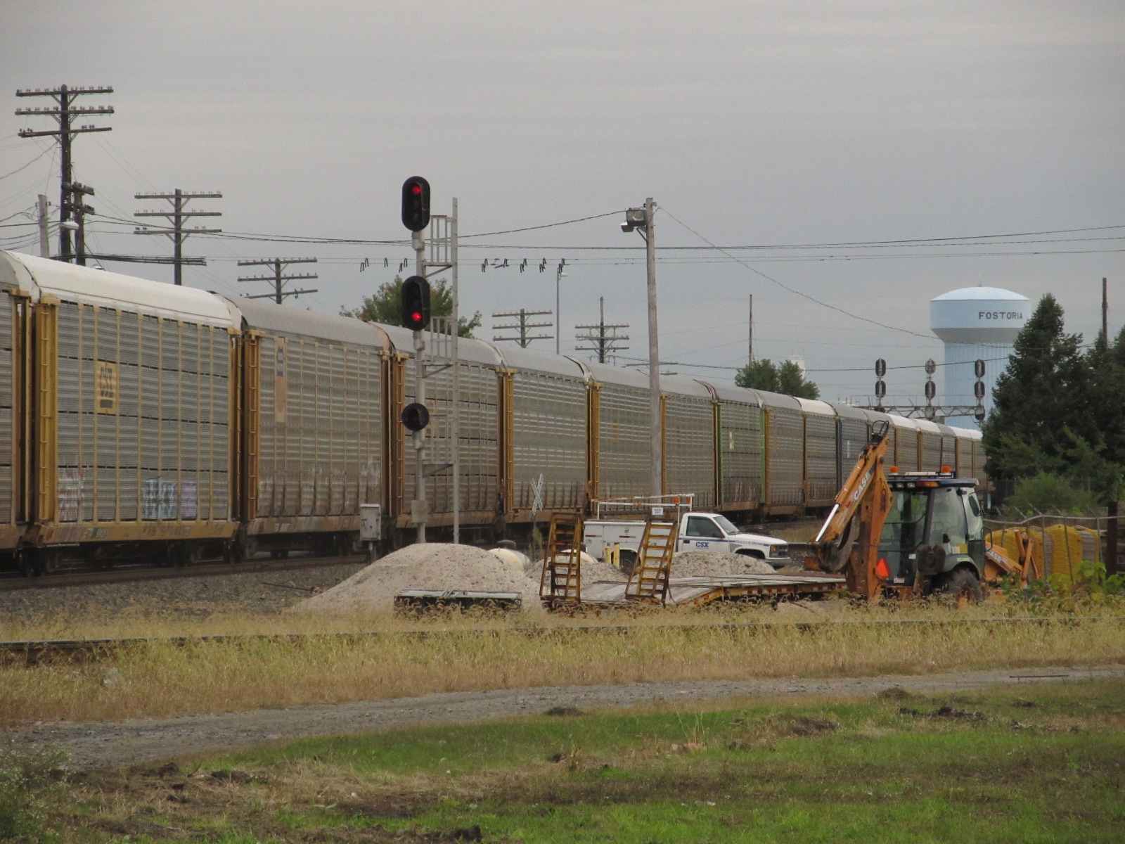
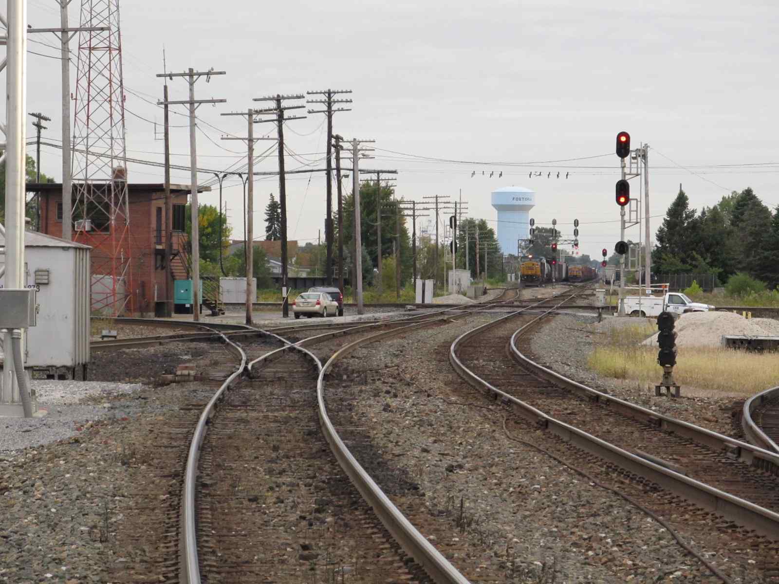
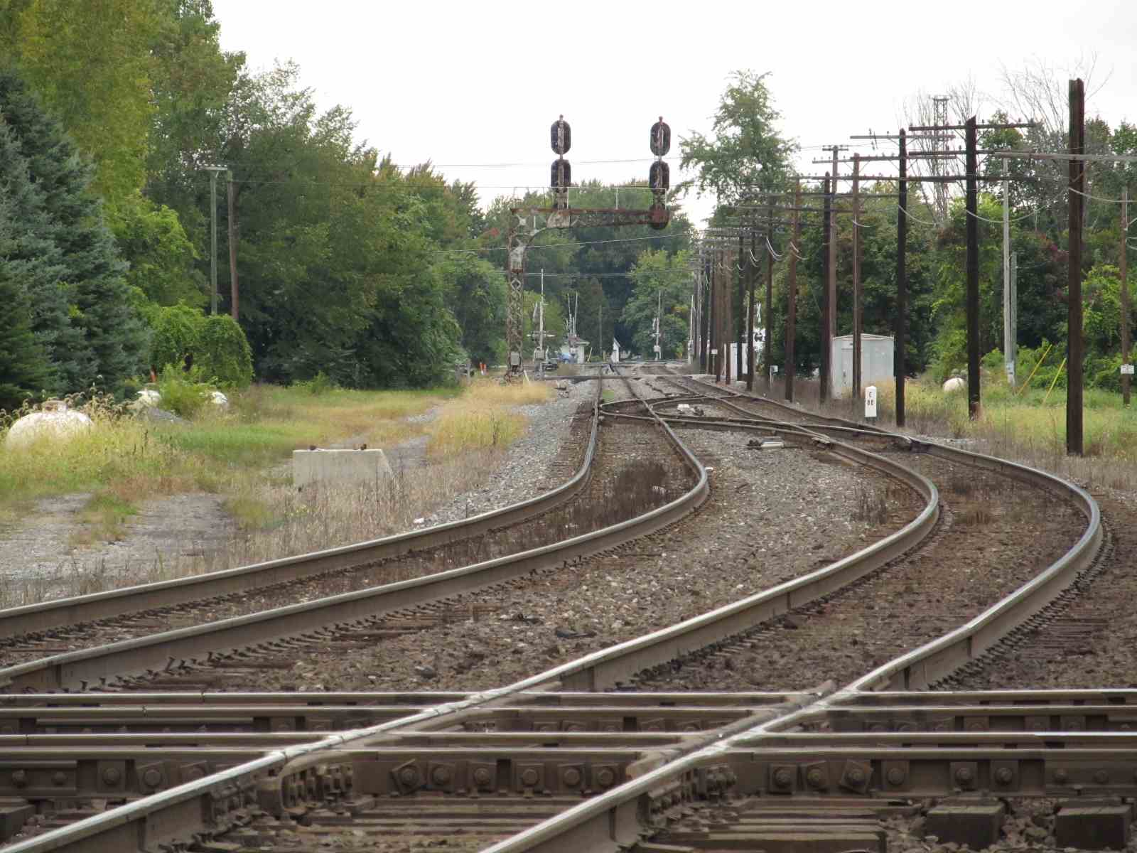
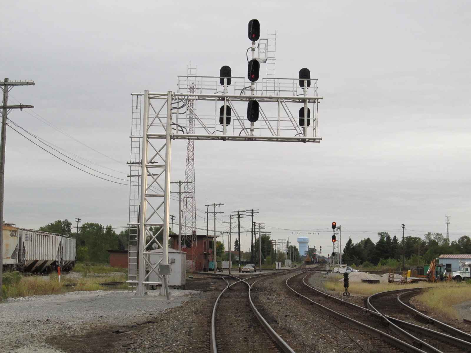
Triple Double-Tracked Diamond Crossings
Railfan Park
About 100 Trains a Day
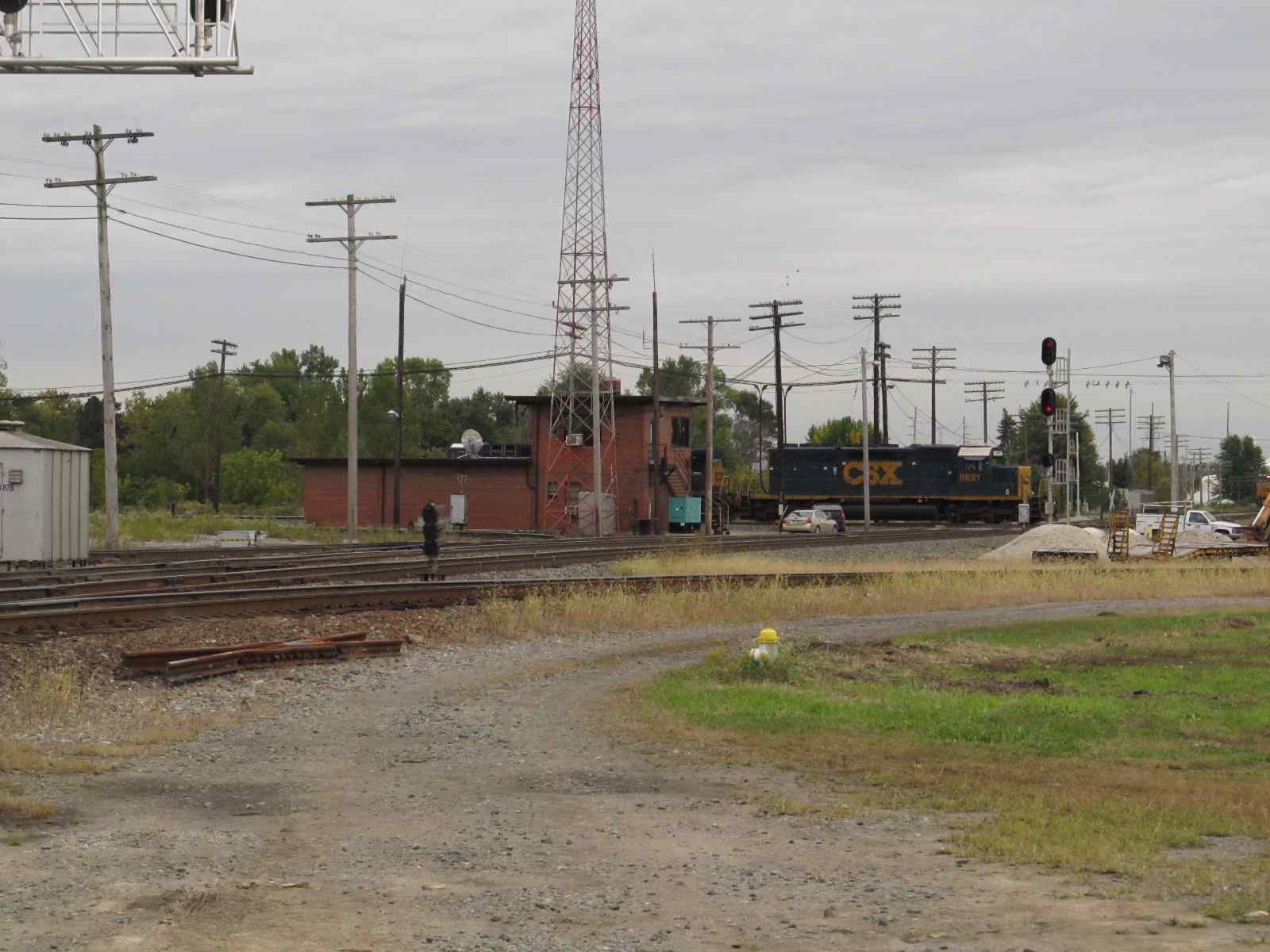
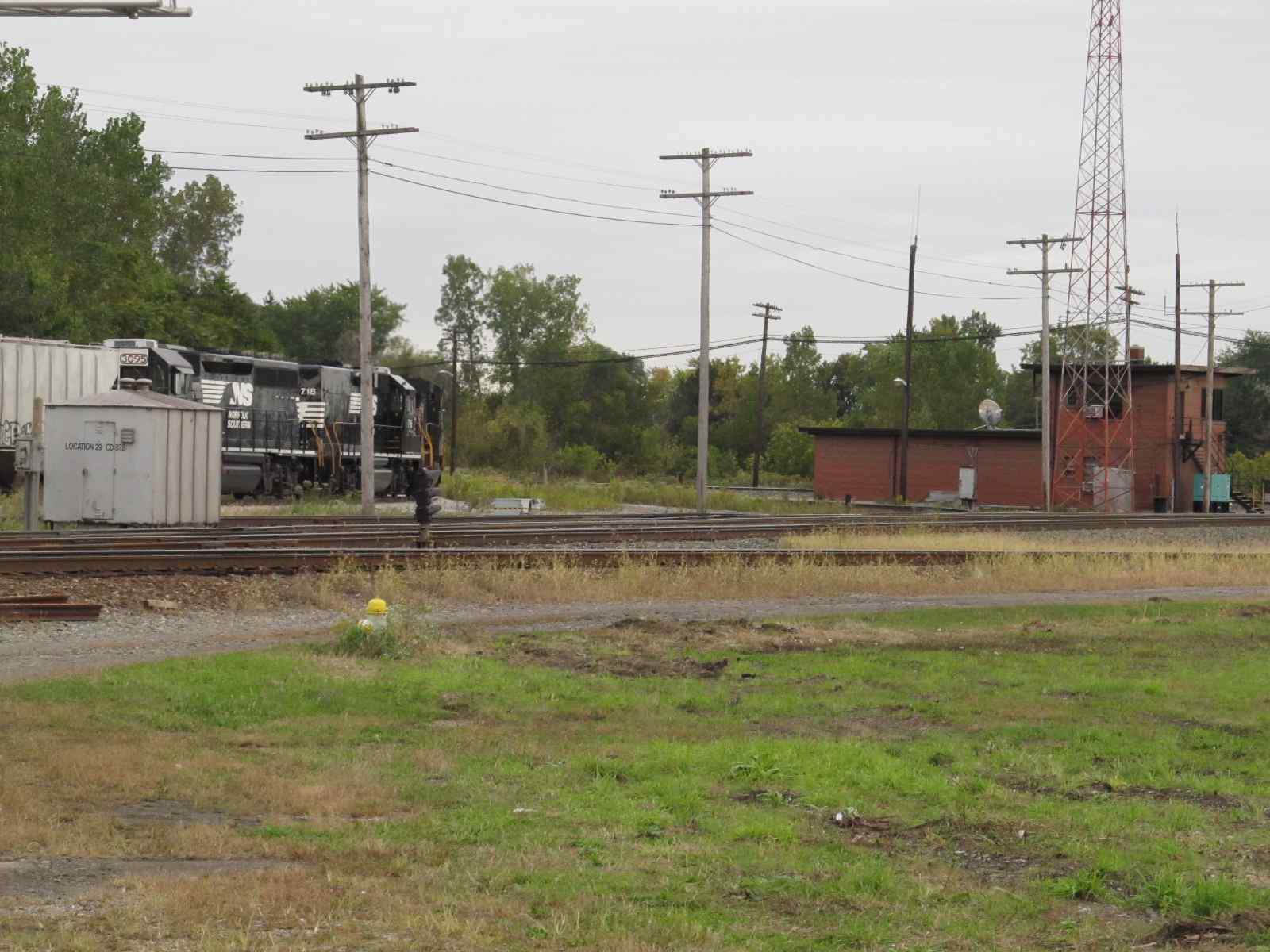
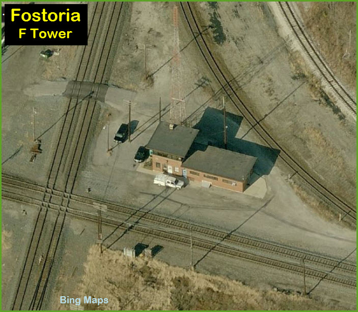
Tower F (closed and inaccessible)
Former NYC Jackson Street Tower
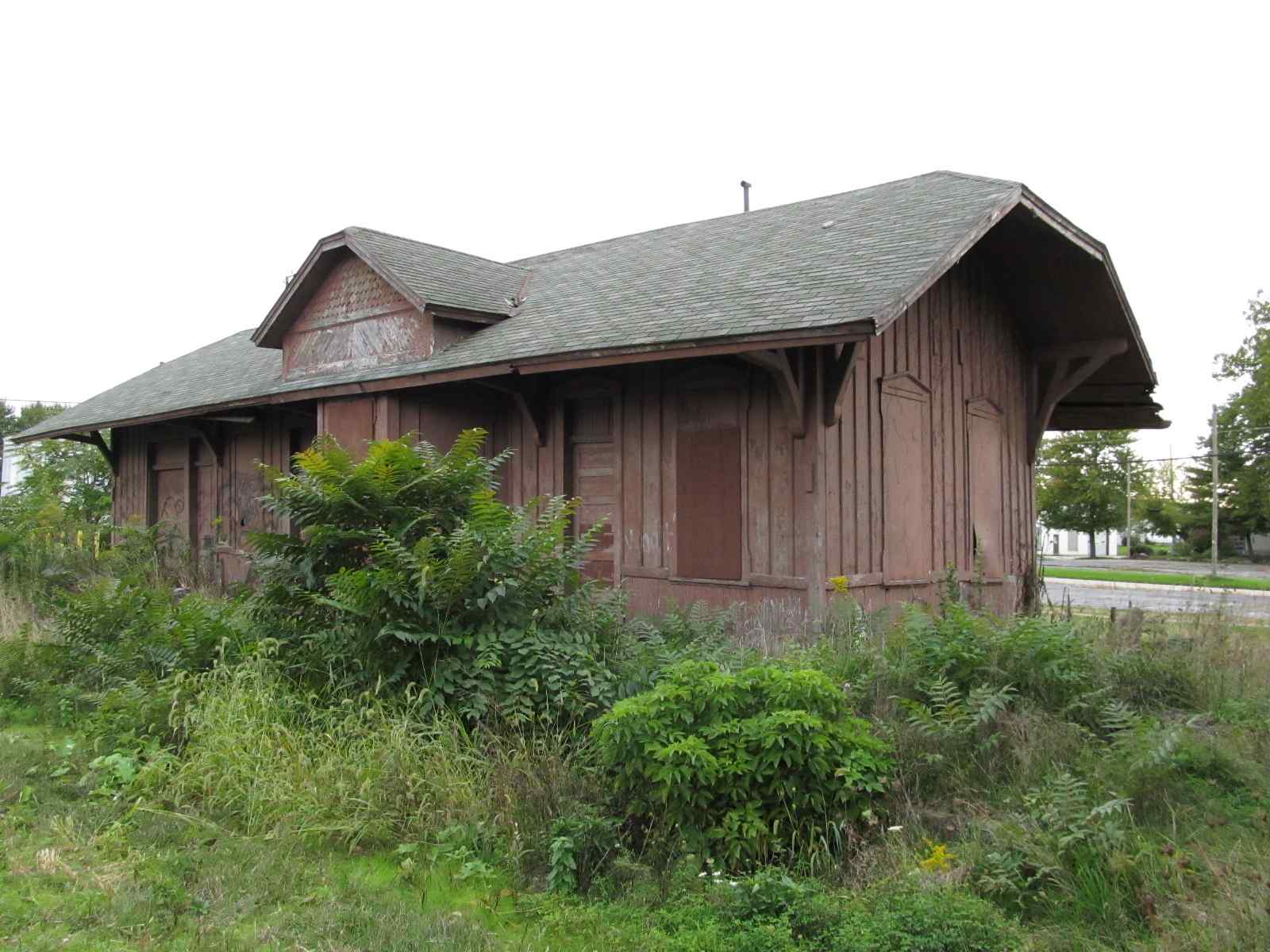
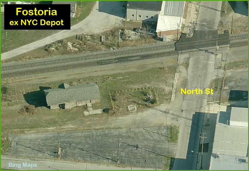
Former NYC Depot
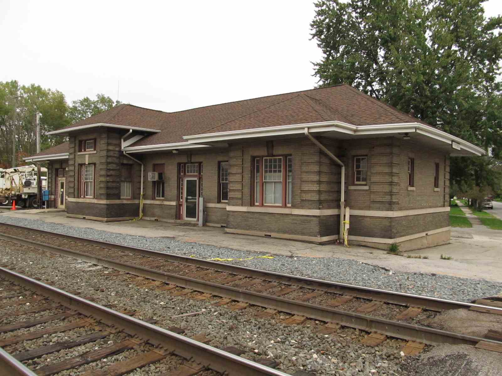
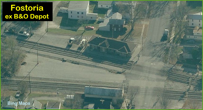
Former C&O Depot
Data:
GPS Coordinates: 41.152871, -83.408998
Phone A/C: 419
ZIP: 44830
Access by train/transit:
None
The Scoop:
Fostoria, like Deshler, is one of those towns, that if you have never been here before, you ask yourself, "why didn't I get here sooner?"
Situated about 40 miles south of Toledo OH, some say it is the busiest railfan spot east of the Mississippi.
If you are a railfan, you WILL NOT be disappointed by coming here.
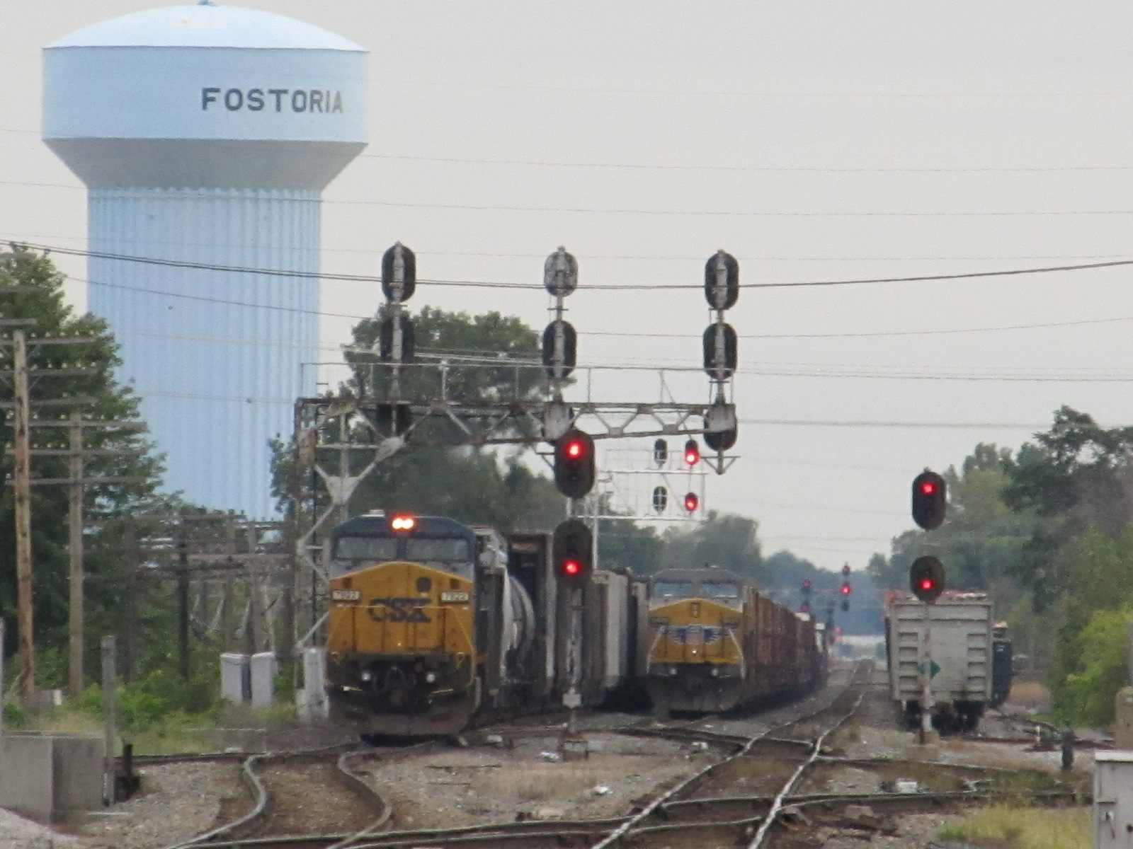
The big attraction to Fostoria are the three diamonds the town sports, along with almost non-stop activity somewhere along one of the three main lines. CSX has
two lines, and NS has one. Because of the three diamonds, Fostoria is
aptly named "The Iron Triangle"!
As for the F Tower, there is no access to it, so you need to shoot it from a distance... please don't wander into the diamond area at the tower! (people have tested
the policy and have not liked the outcome). There are plenty of other legal photo ops. Tower was closed in March of 2015, and control was transferred
to Indianapolis. There is an article in the July 2015 issue of Trains magazine.
Train frequency is about 100 trains a day, with CSX having the lions share at about a 3:1 ratio. There are about 30 or so hotshot intermodals going E-W on the CSX.
According the the Weebly page, there is a The Best Western motel about 10-minutes up US-23 that is run by a railfan, and according to Weebly: is the best kept motel in town.
You can buy railroad related Iron Triangle souvenirs there, plus there is a photo album in the lobby of the trains of Fostoria! They also have a Railfan Sign-In log book!
It's not often I use info from Frograil's tours, but they do have some particularly
pertinent info about the less traveled roads in Ohio, which are the TR and CR numbered roads:
TRs and CRs, the correct distinction is probably only understood at the county courthouse or transportation departments. Even GoogleMaps in some places will have
something like "Road 123", "T Road 123", and "C Road 123" all on the same stretch of road that is less than a mile long. In the end, it
really doesn't matter whether it's TR or CR -- just pay attention to the number. If the map or road sign says "xx-107", and that's the number of the road you
need to get on, do so.
Another bit of advice which Frograil has also concerns chasing or photographing trains as they make there way thru the rural interludes between towns, is all of the farm
activity. Beware of the large machines and 18 wheelers using those roads during harvest time, and if you can, plan your trips around those times of the year!
Also remember that rural means rural, and you will not find a McDonald's or Walmart outside of the larger towns. Make sure you have what you need before heading out! :-)
As the pictures below show, there is a lot more going on than action at the diamonds, so be prepared to spend many, many hours in Fostoria.
Acknowledgements:
Thanks to Denver Todd for many of the tidbits of info on this page.
Websites and other additional information sources of interest for the area:
http://fostoriairontriangle.com/links.htm
https://en.wikipedia.org/wiki/Fostoria,_Ohio
http://railfanlocations.weebly.com/fostoria-oh.html
https://www.facebook.com/fostoria.railpark
http://www.frograil.com/tours/ns/fortWayneFostoria.php
(only gives you info on 6 grade crossings on their E/W tour)
http://trn.trains.com/photos-videos/hotspots/2006/07/fostoria-ohio
Listening In
Radio freqs for CSX are: 160.230, 161.520, 160.320.
CSX F Tower: AAR 08 - 160.230
CSX Willard Sub: AAR 94 - 161.520
CSX Columbus Sub: AAR 12 - 160.320
CSX Yard: AAR 70 - 161.160
CSX Pemberville Sub: AAR 35 - 160.635
CSX Bascom Detector: MP 31.1
(about 5 miles east)
NS's radio frequencies are:
NS Mixing Center: AAR 92 - 161.490
NS Yard: AAR 56 - 160.950
NS Fostoria District: AAR 76 - 161.250
NS Detector Ilers: MP 275.4 (6 miles east)
NS Detector Arcadia: MP 285.5 (5 miles west)
Here is a "Google Guide" prepared by a railfan for people who want to listen in but are unfamiliar with the radio callouts:
https://www.google.com/maps/d/viewer?mid=zEAb_ot6zATE.kAtuq0itz2aQ&hl=en_US
If you are the person who did this and want credit, pls contact me via the contact page, link at the bottom of this page.....
http://www.docstrains.com/fostoria_content.aspx
From the north, come down I-75 if convenient, take exit 167, and head east on OH18.
From far west points, like MI or upper IN/IL, take I-80 till you meet up with I-75 and then head south as above.
From the east, like NY, PA, or MD, come out the Ohio Turnpike, I-80/90, and take exit 91, which is OH53... head south on it. Take US 6 west (it's also OH53) before
getting into Fremont, and follow it as it circles the town. US 6 will leave you at Hayes Road, but stay on the highway as OH53 till you hit OH12,
which heads off to the SW. OH12 enters Fostoria as Sandusky St. from the NE side. Along the way in Bettsville, you'll pass a RR crossing
with an interesting approach signal.
From due east, it's OH18 and US224.
From due west, take OH18 east from, say, Deshler, or exit 167 off of I-75 (which is 28 miles south of Toledo and I-80/90).
If you're in Bellevue, I usually head out of town to the SW on Killbourne St, which is OH18, and follow it to Fostoria. Maybe not the quickest route,
but it takes you thru Tiffin, which is on the main CSX E-W line. Be careful in Republic where OH18 takes a right turn, the intersection is well
marked however!
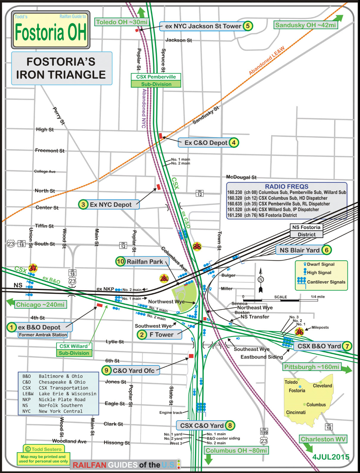
the above map in a PDF is here
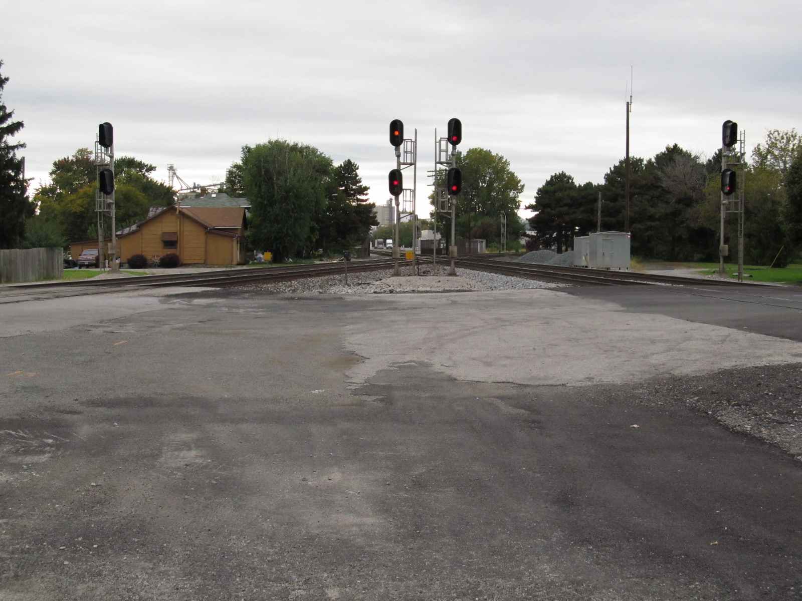
From Columbus Ave at the CSX Crossing
 Looking West across the diamonds, with the depot on the FAR left
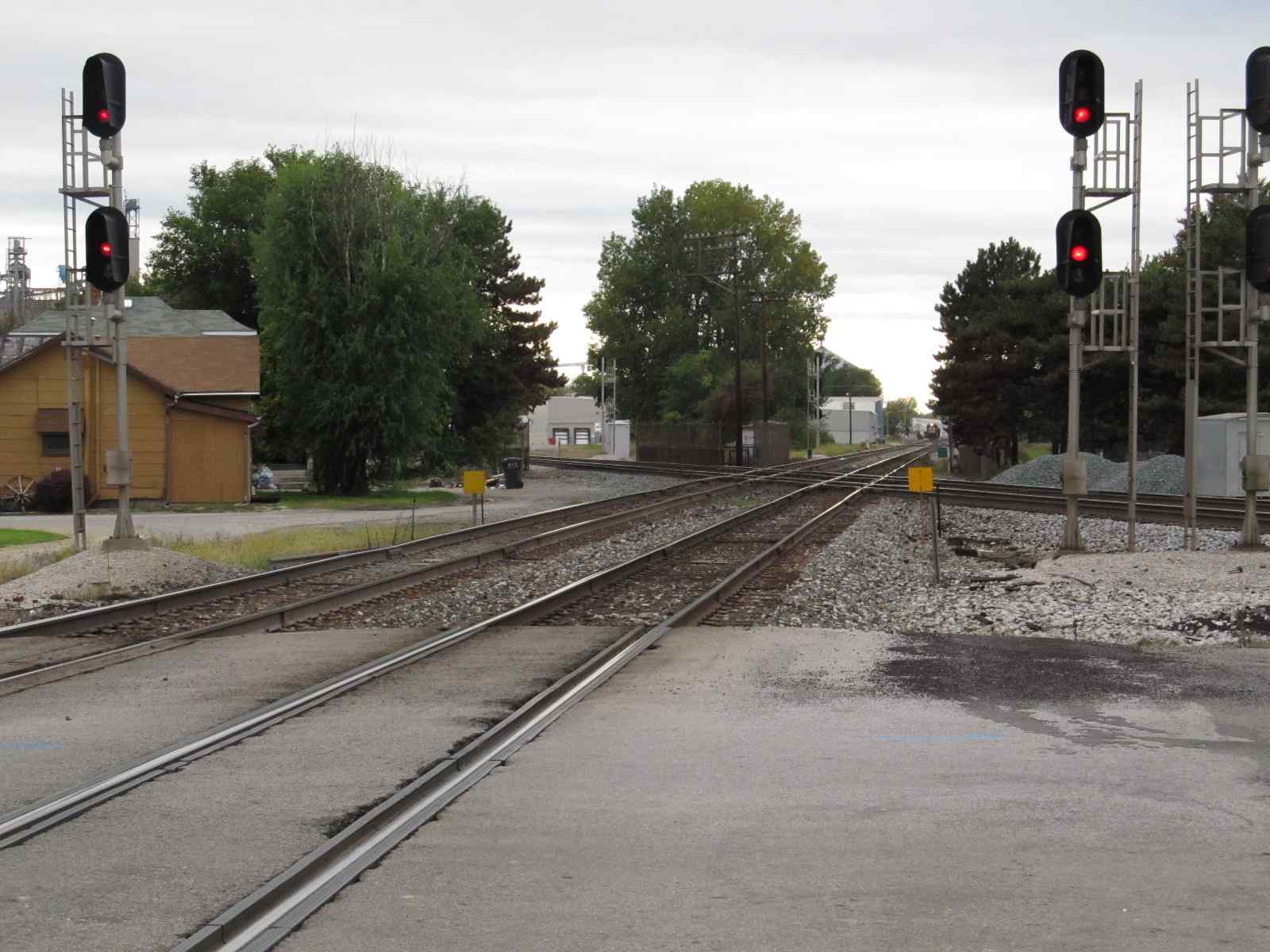
 Looking East
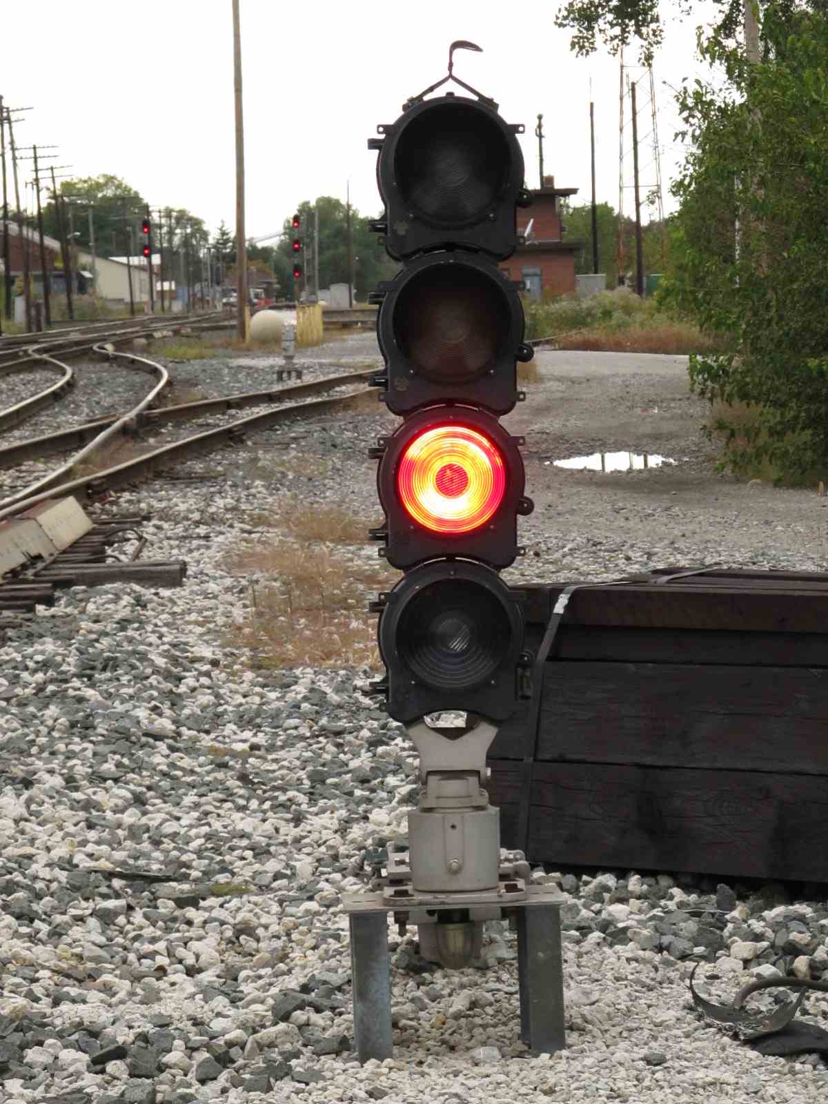
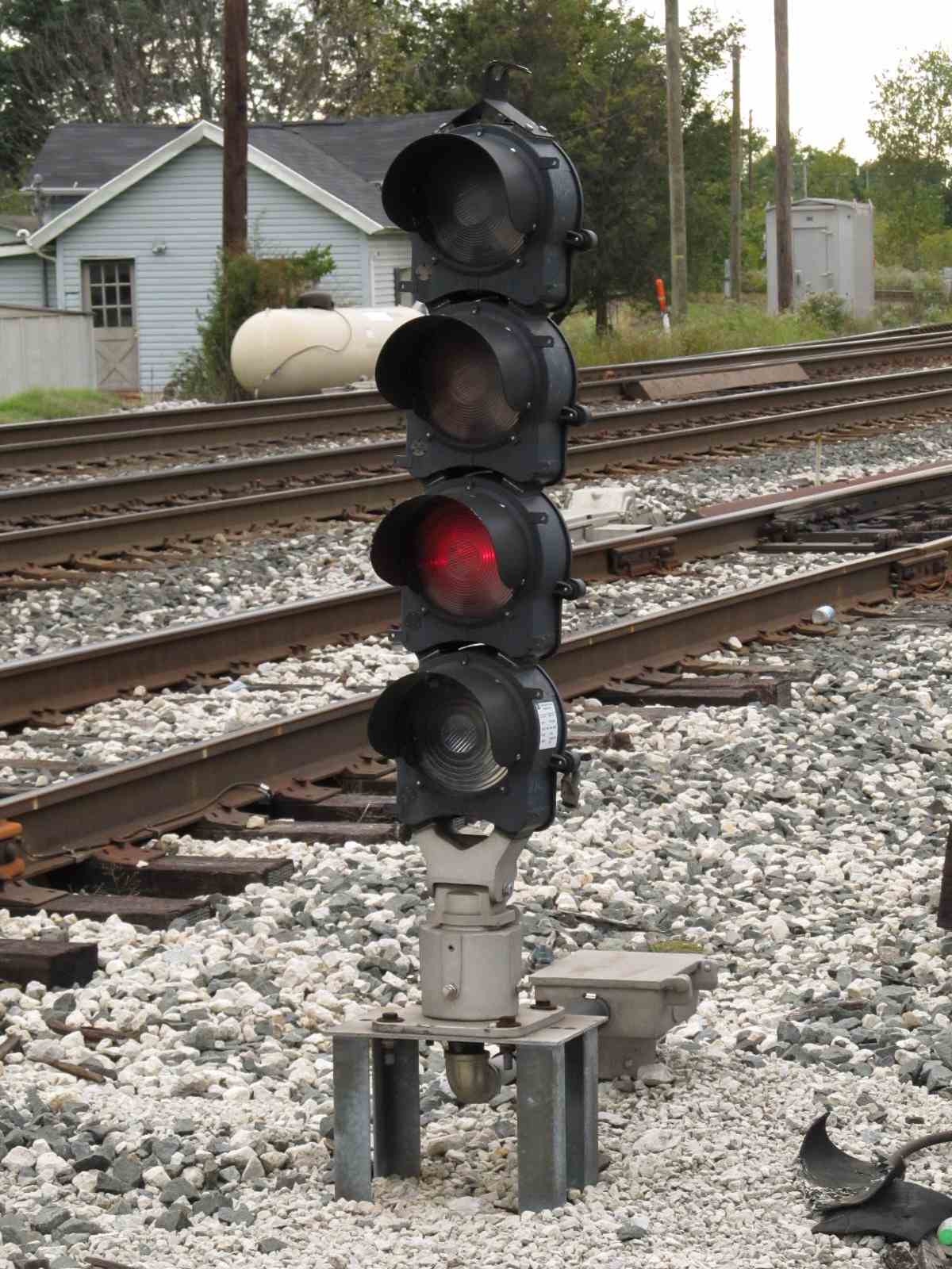
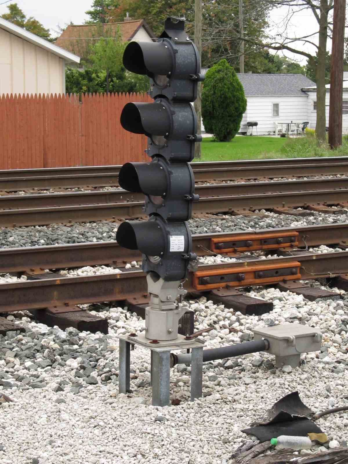
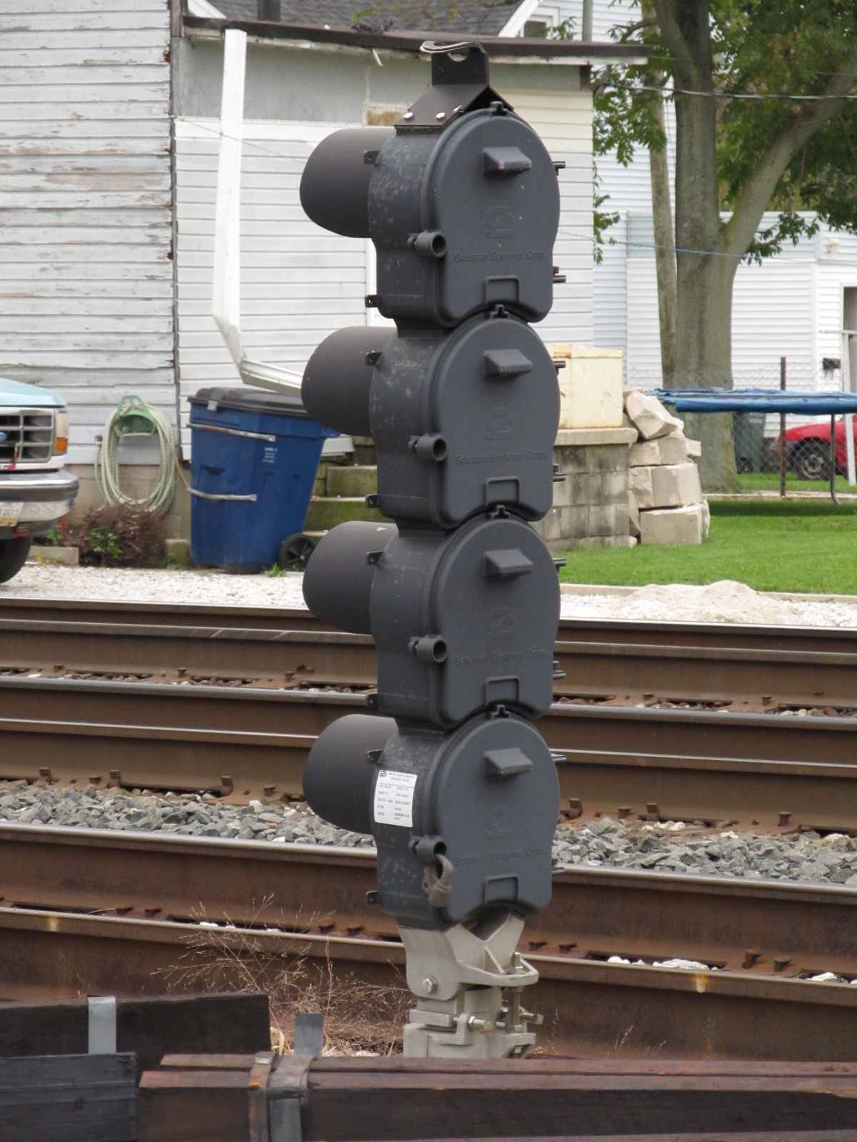

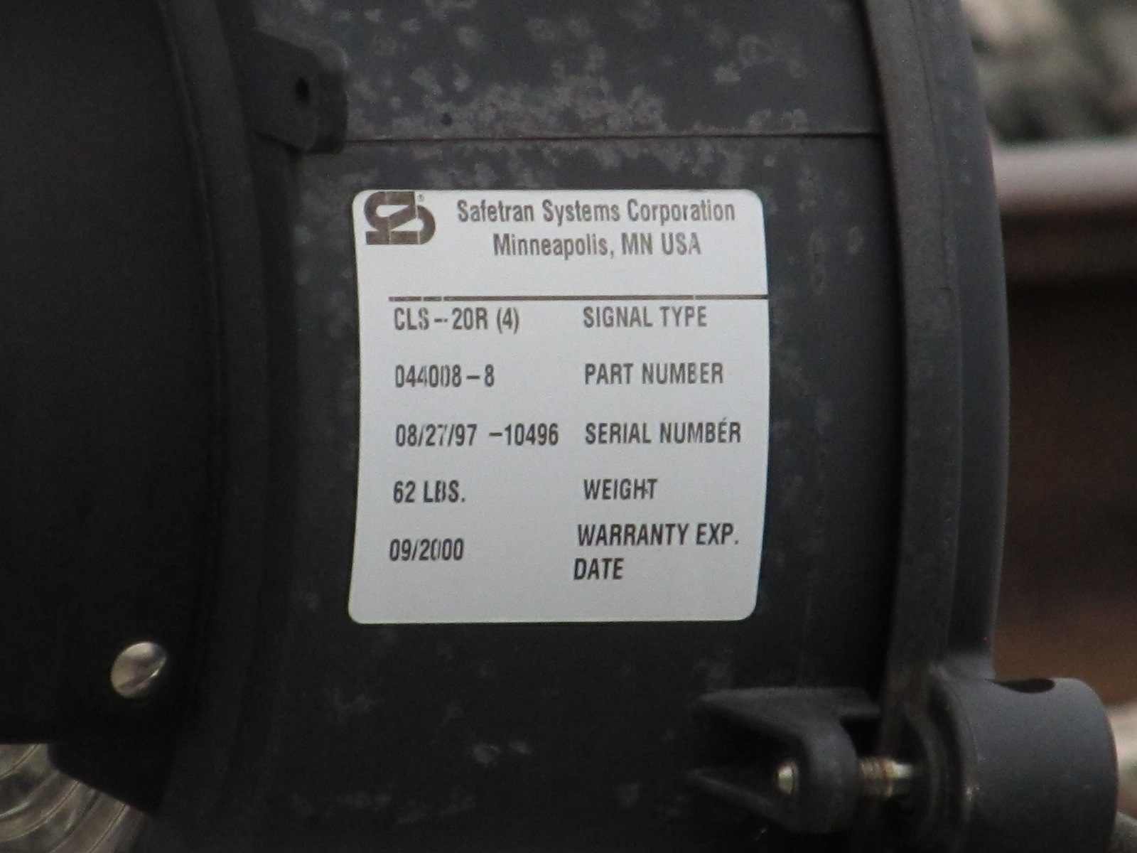
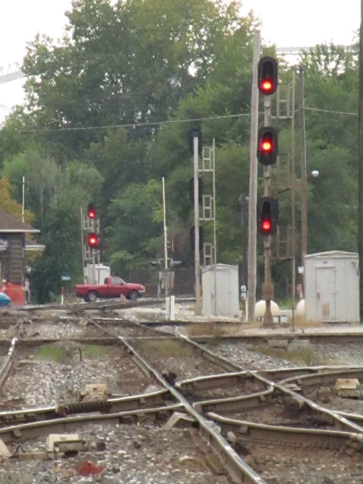
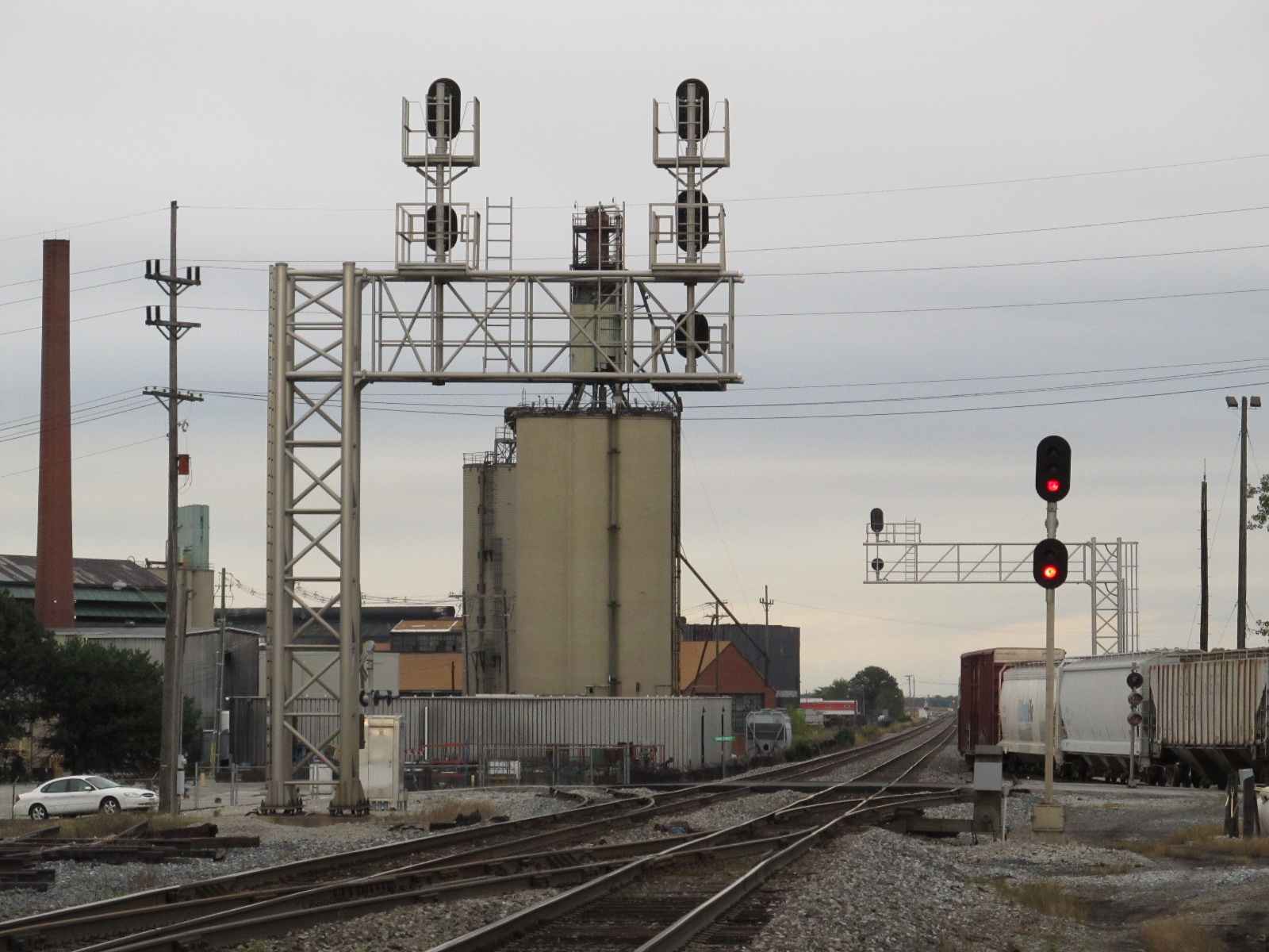
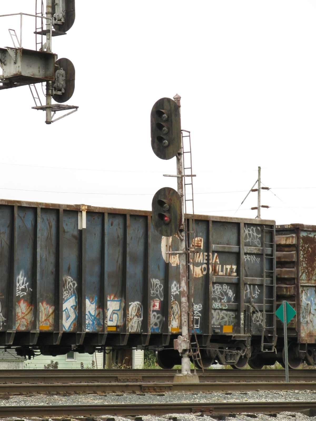
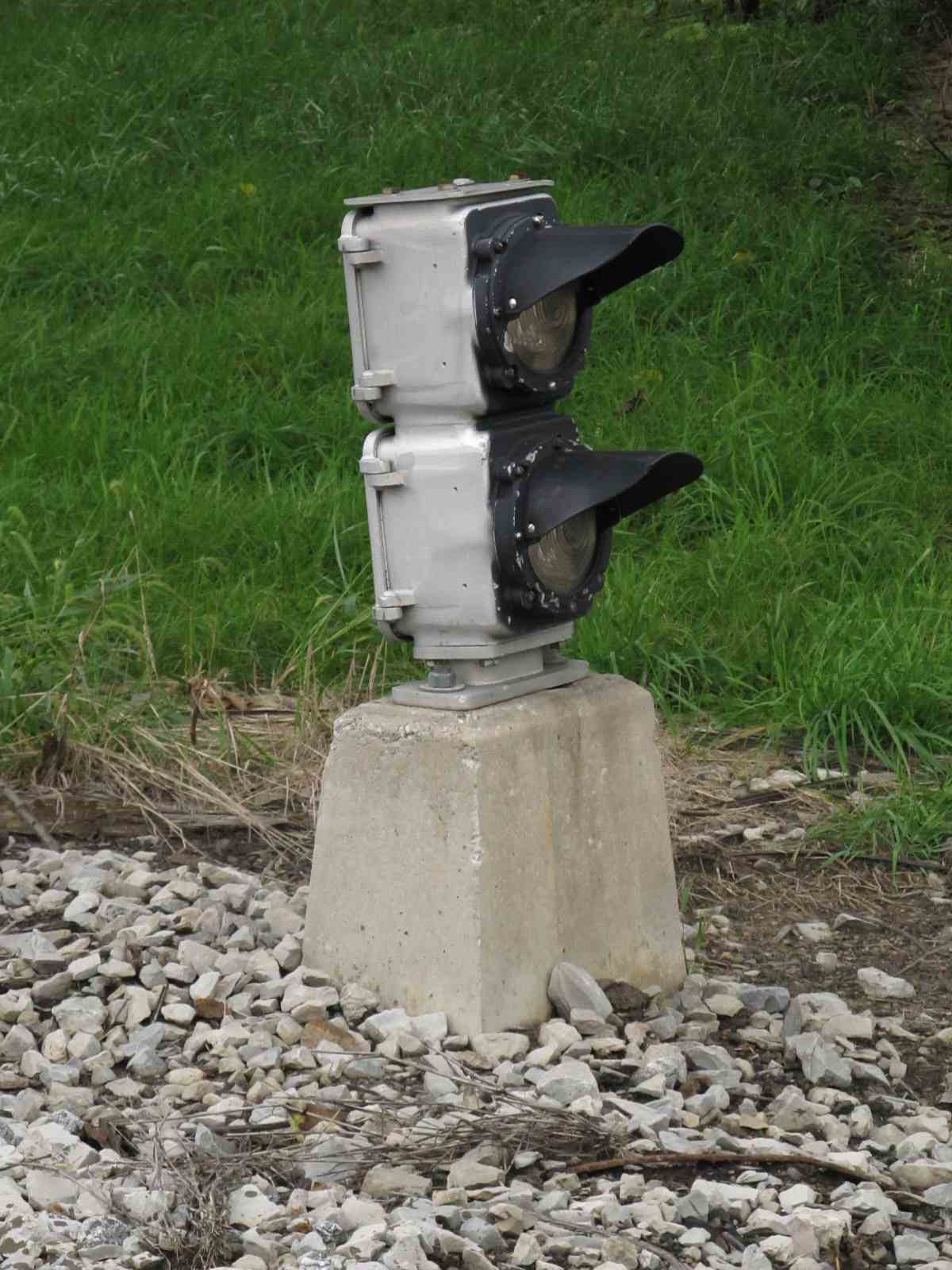
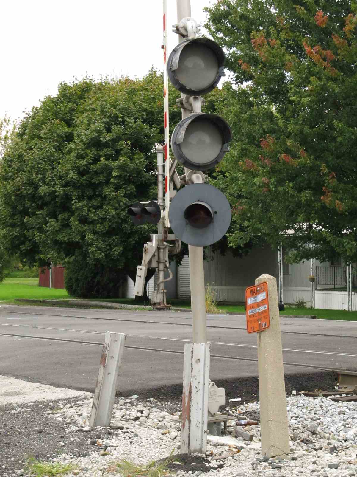
A Safetran type CLS-20R (4) color light dwarf signal guarding the NE Transfer
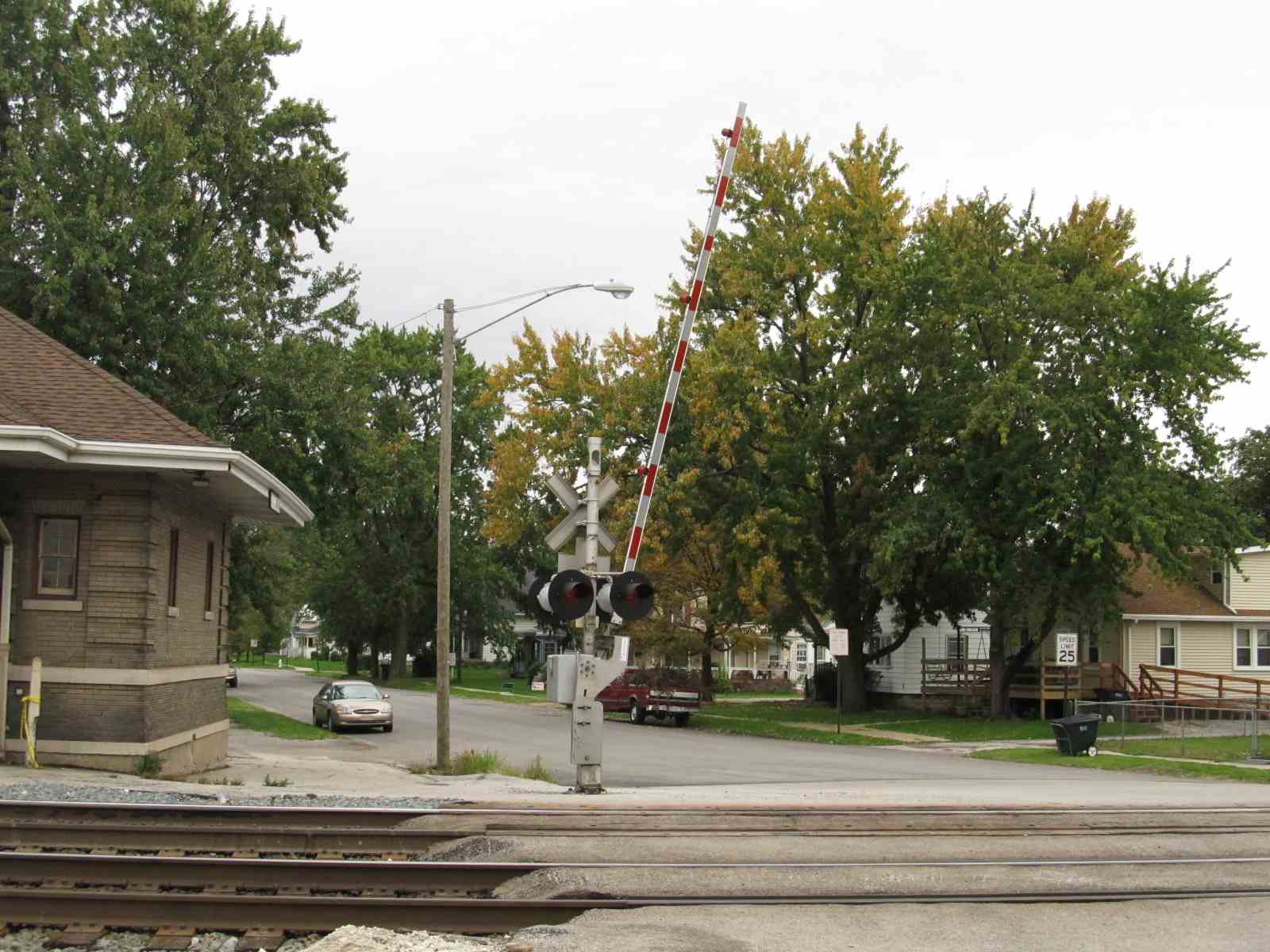
 Crossing gate at Columbus looking south across the tracks
From Columbus Ave and the NS Crossing
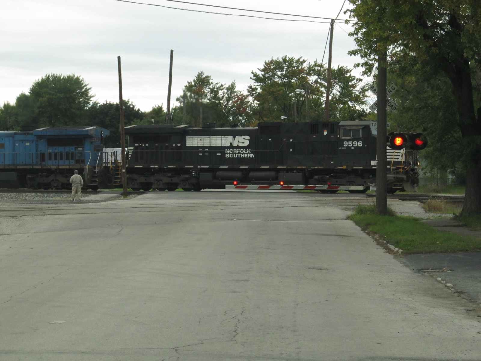
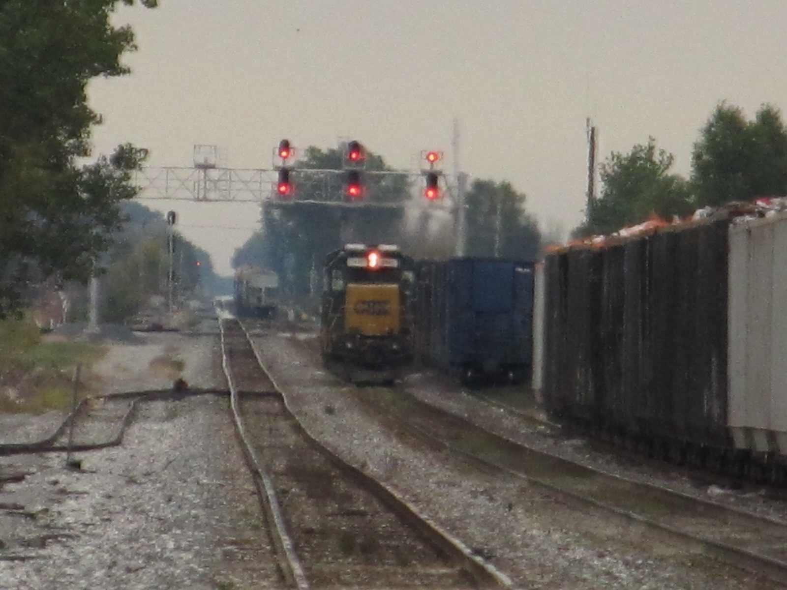
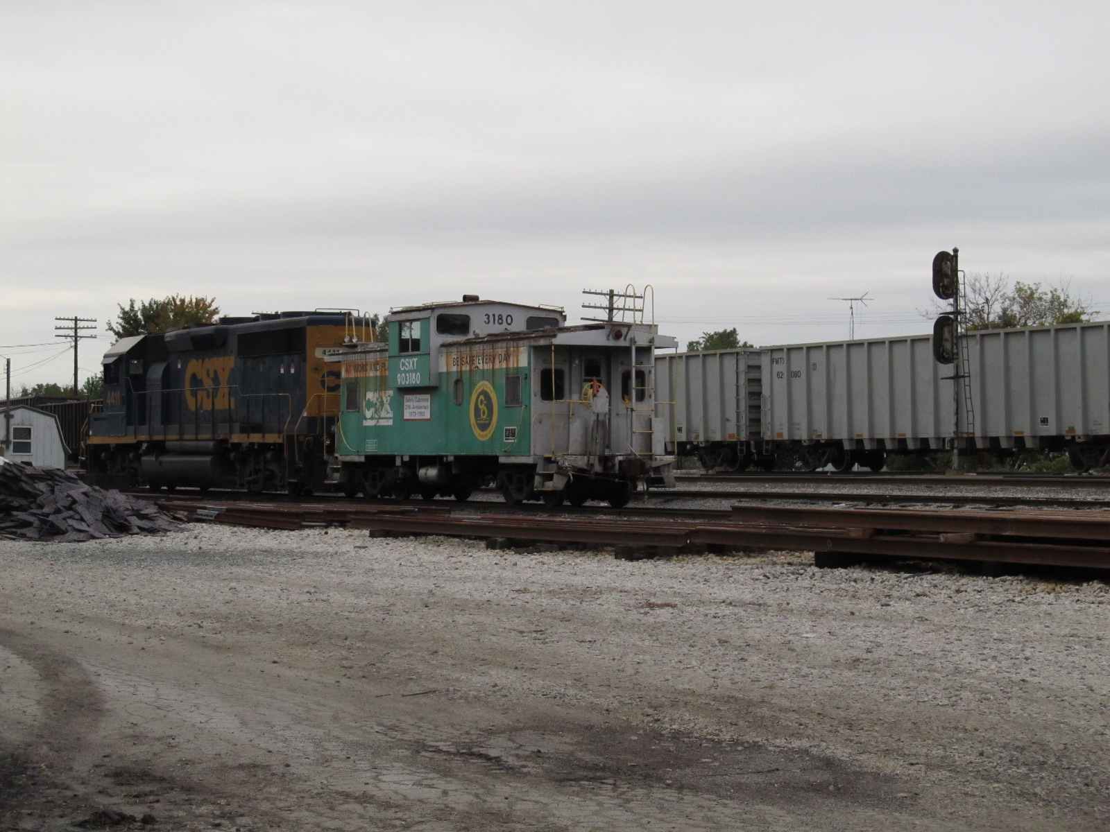
 A couple of EB freights crossing Columbus Ave
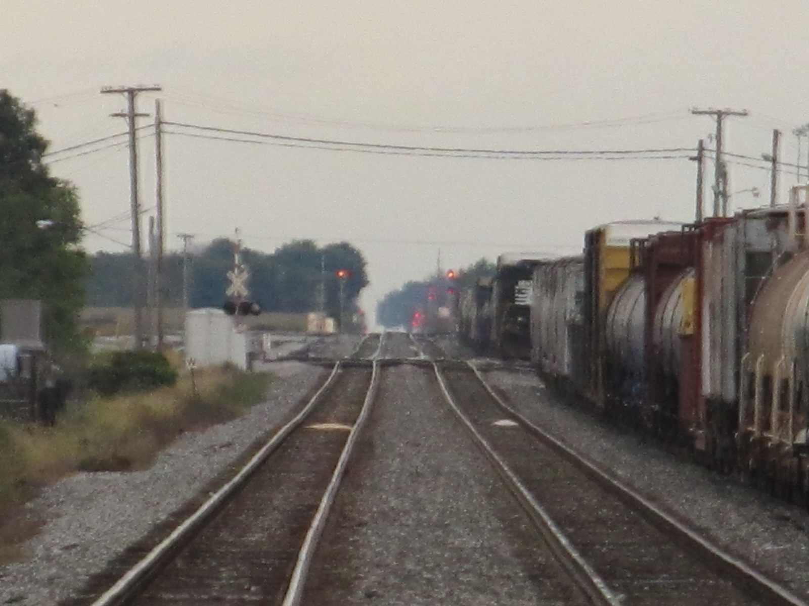
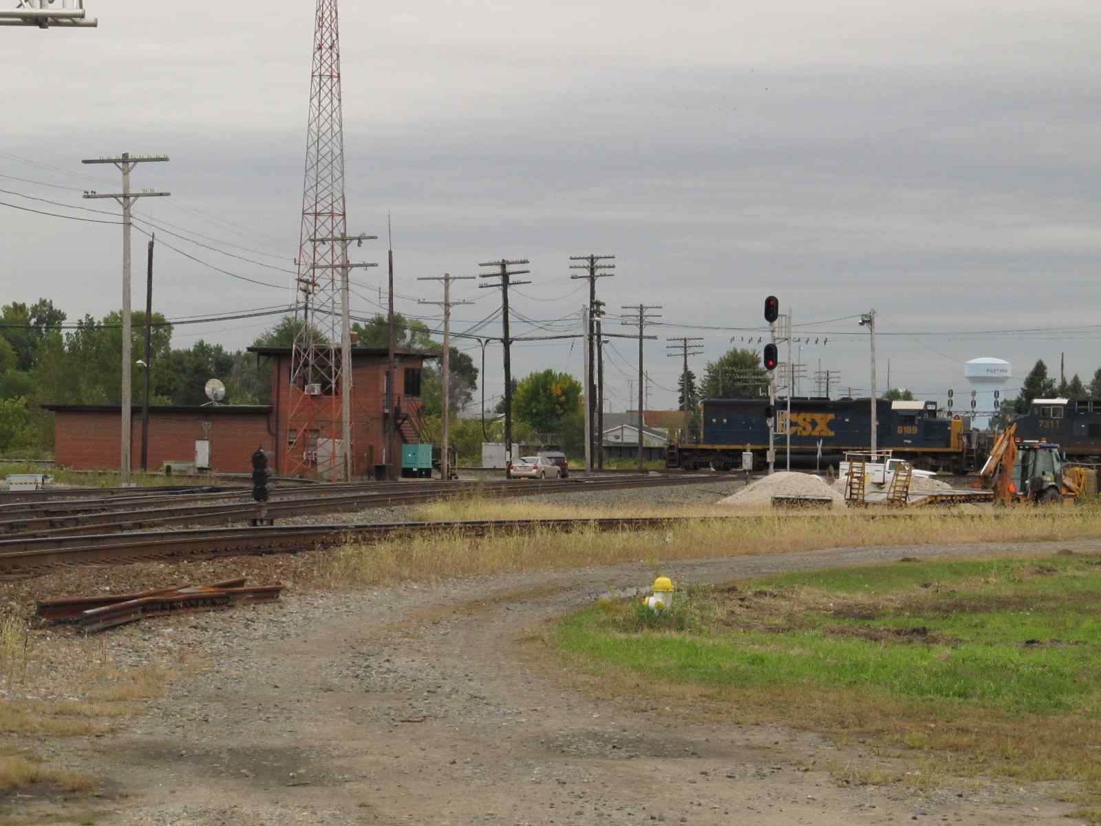
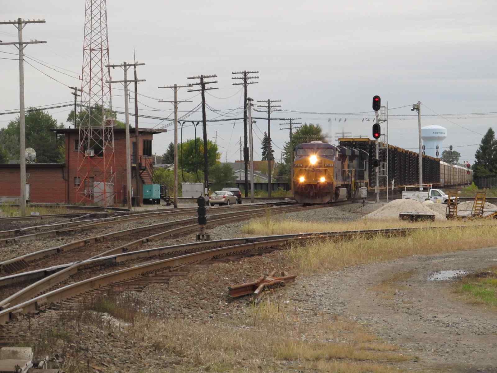
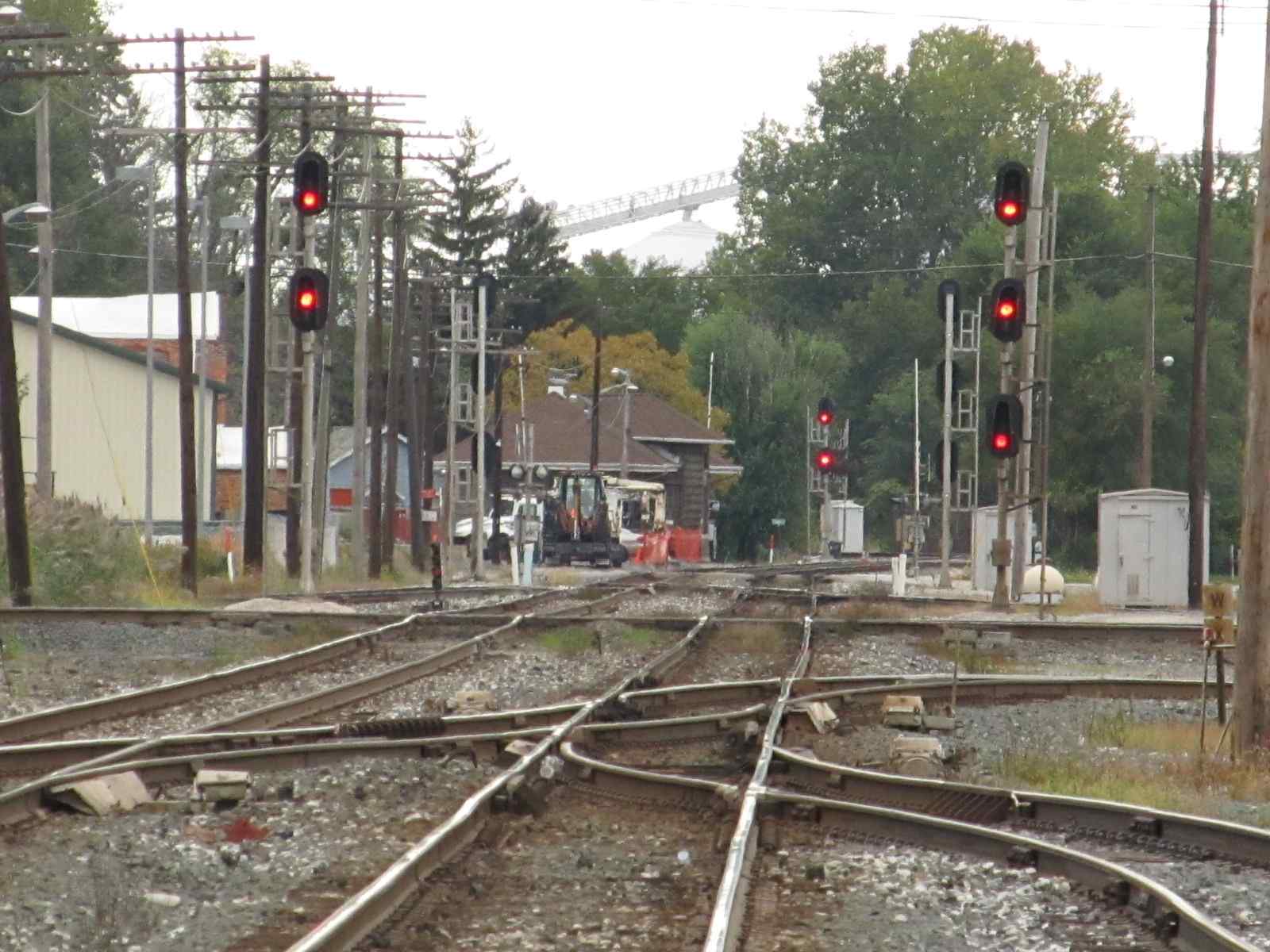
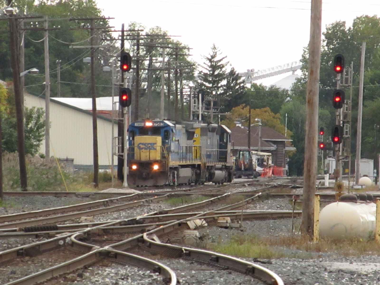
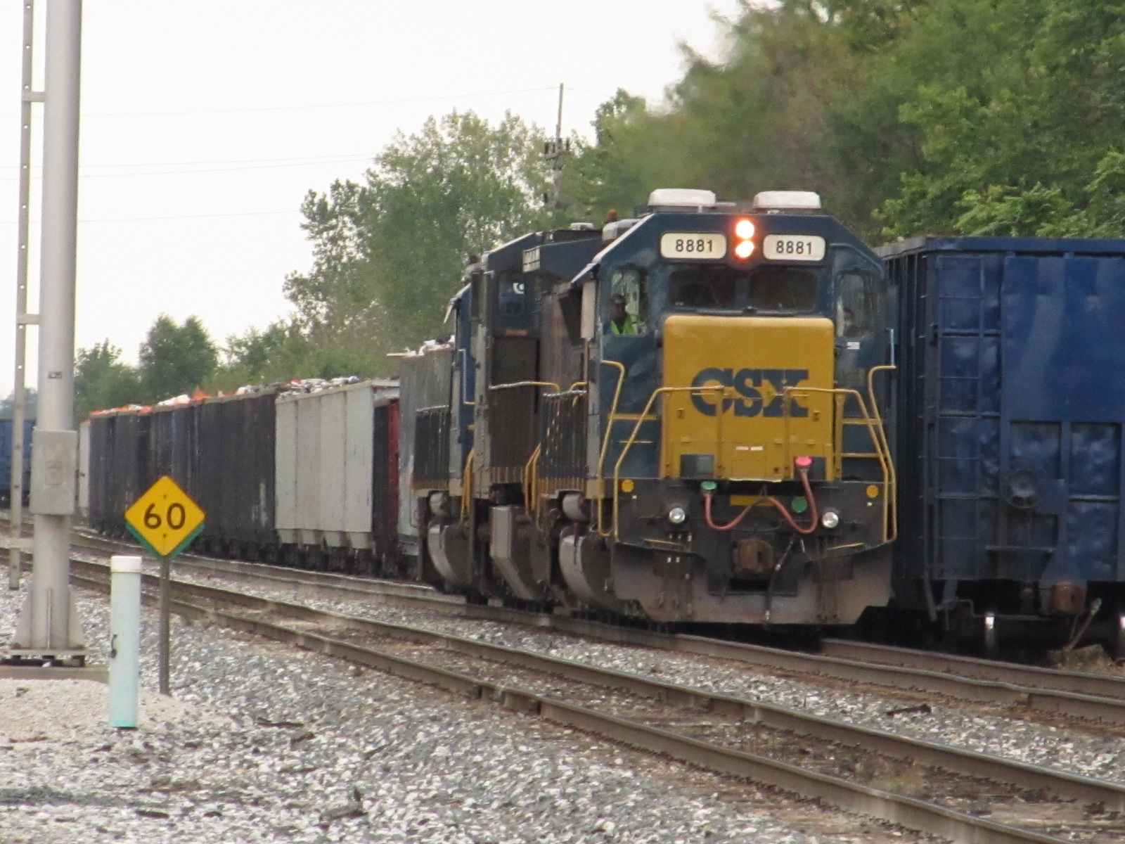
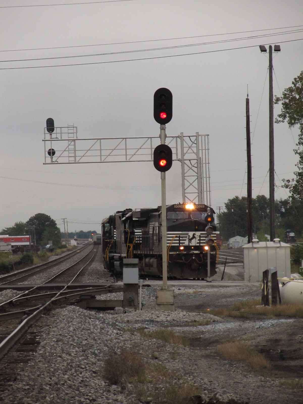
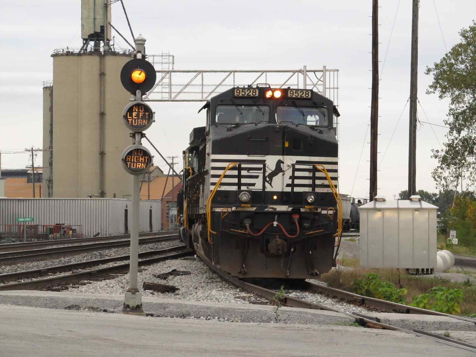
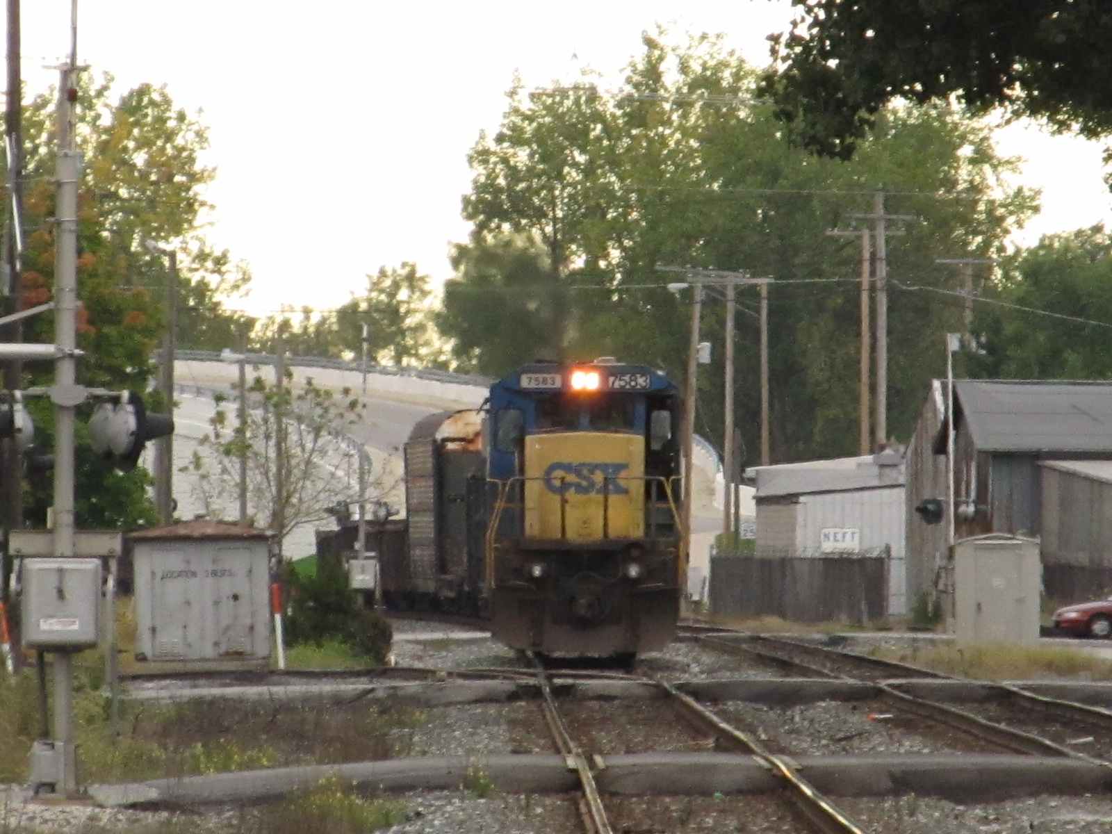
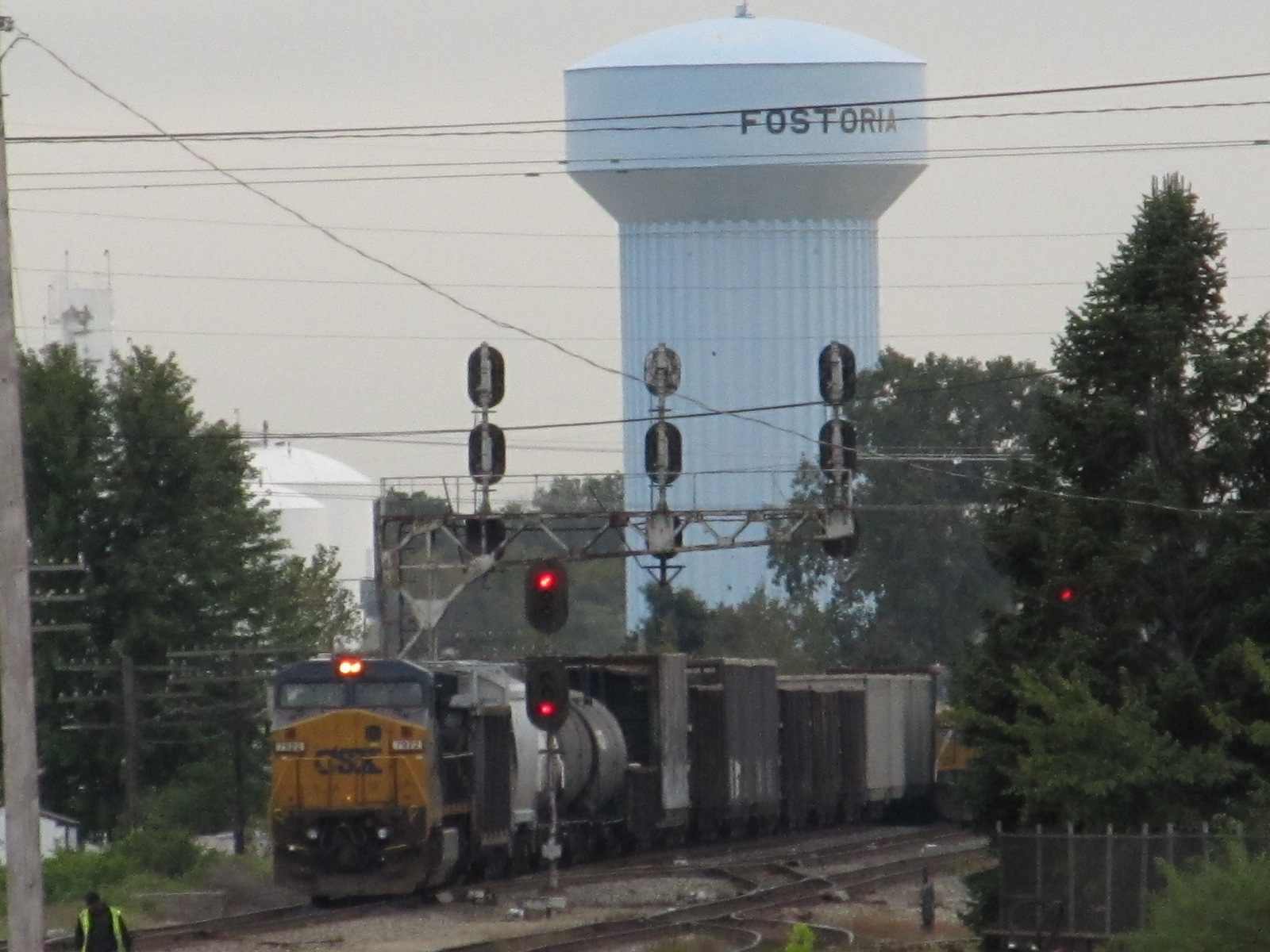
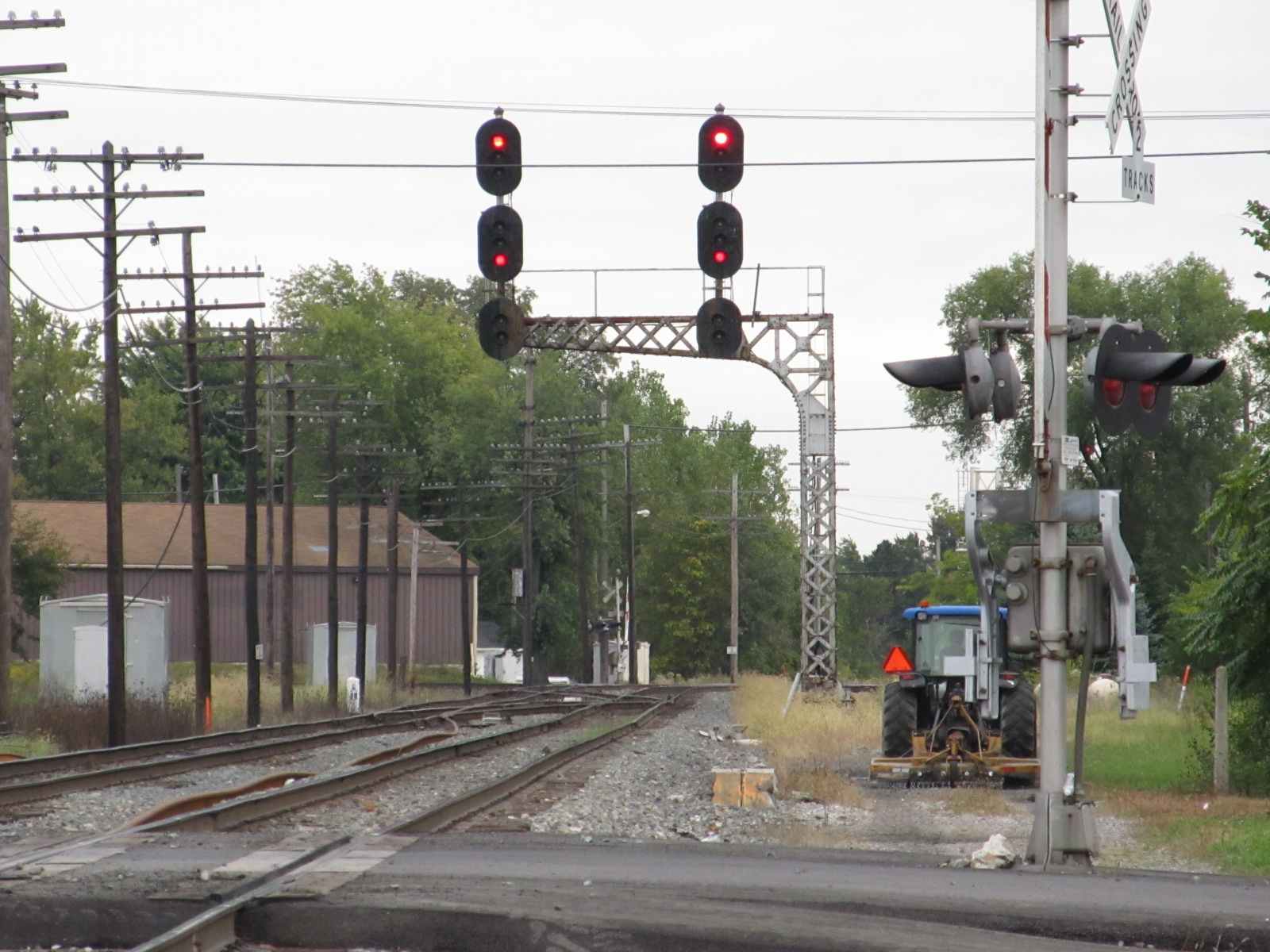
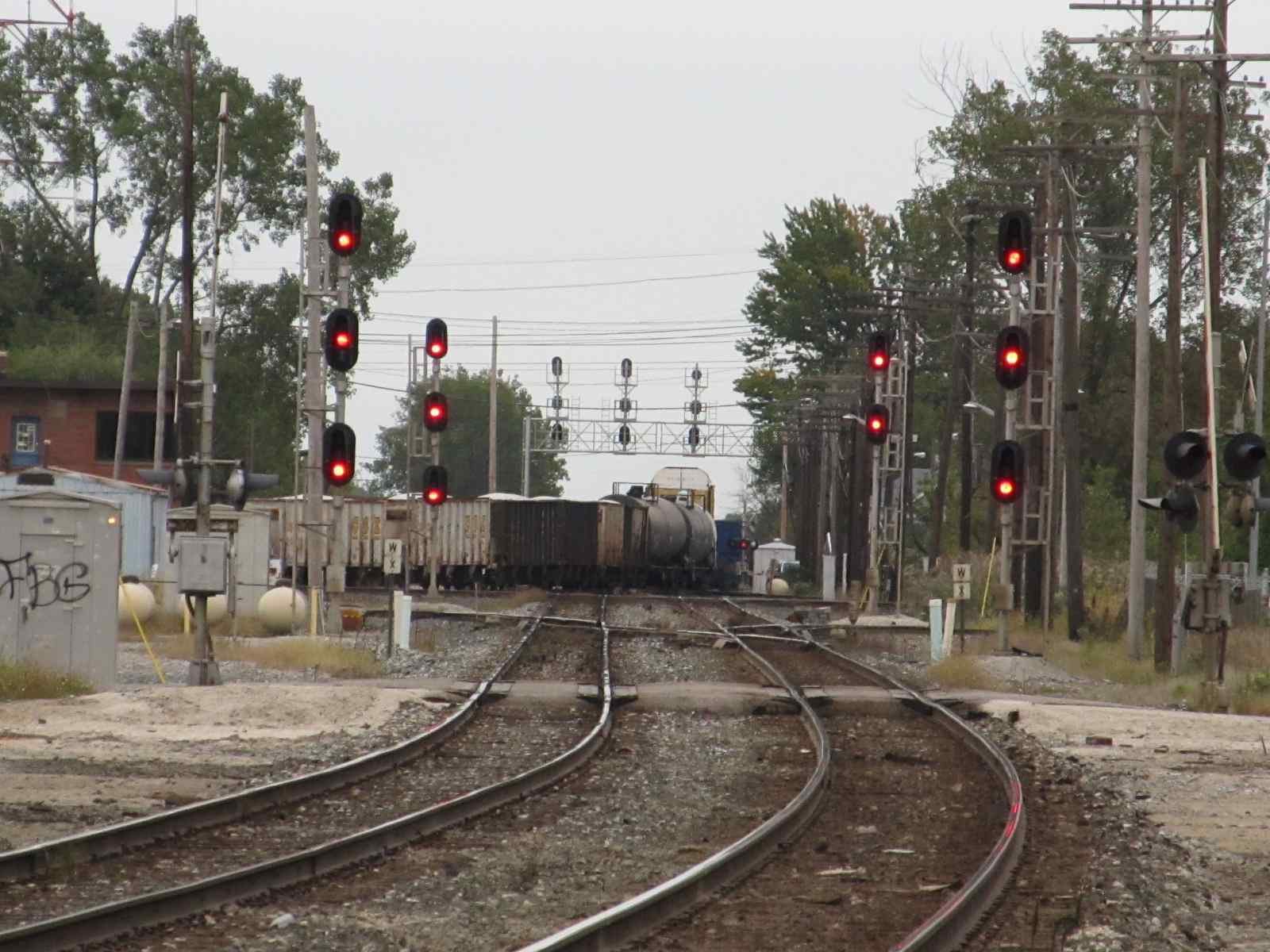
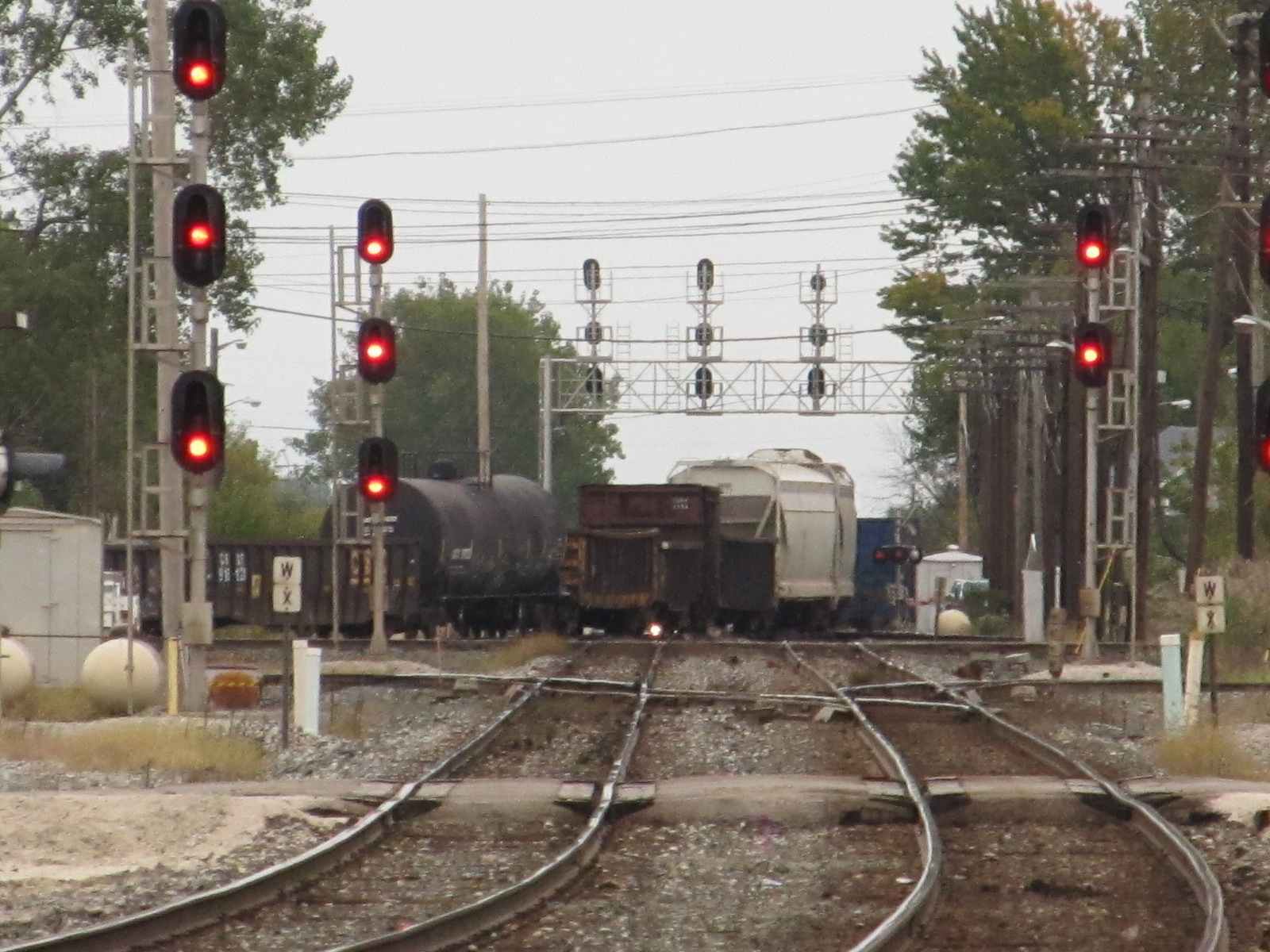
 F Tower and a NB CSX freight crossing the E-W CSX Main
 CSX engines west of the tower
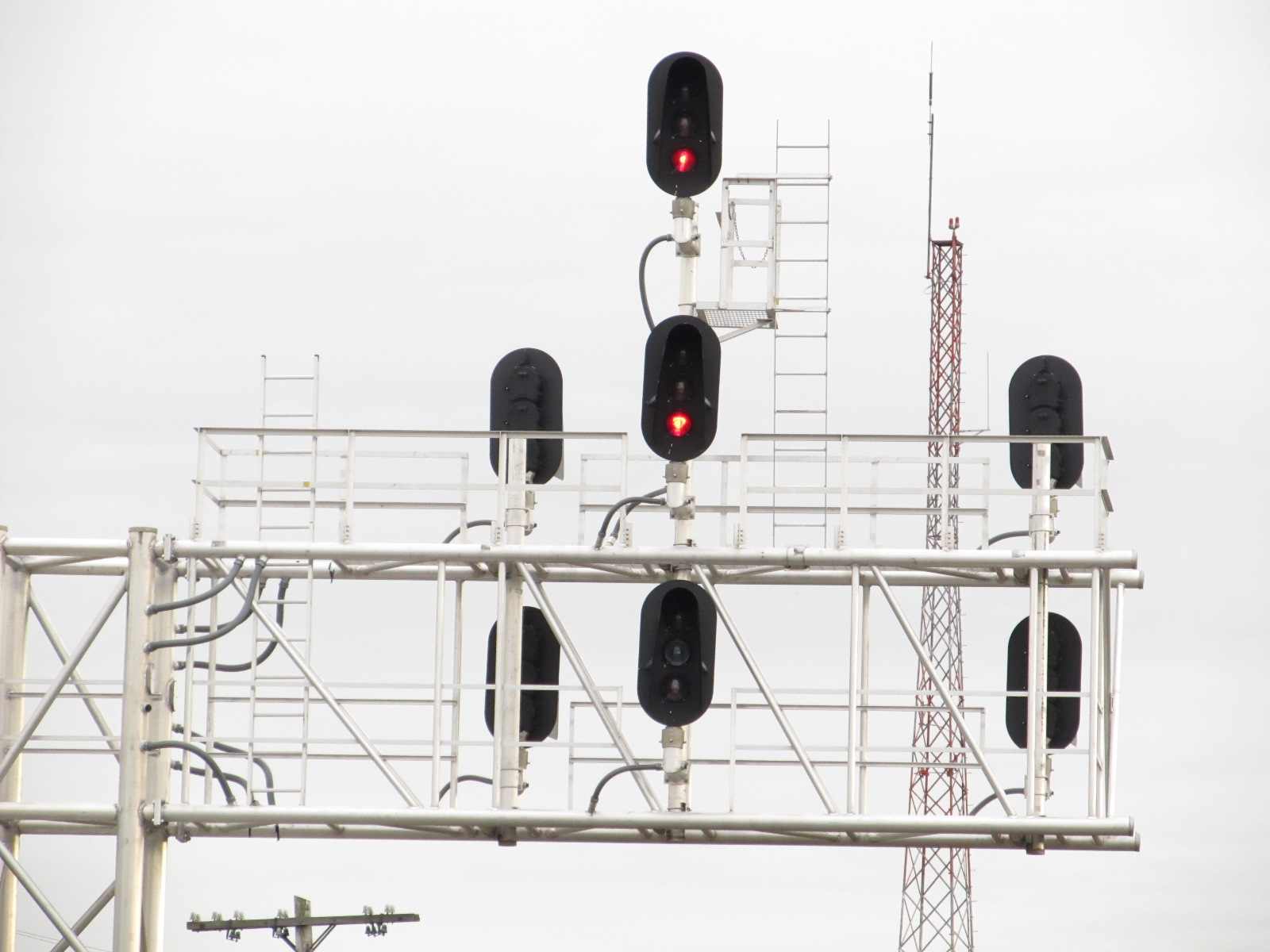
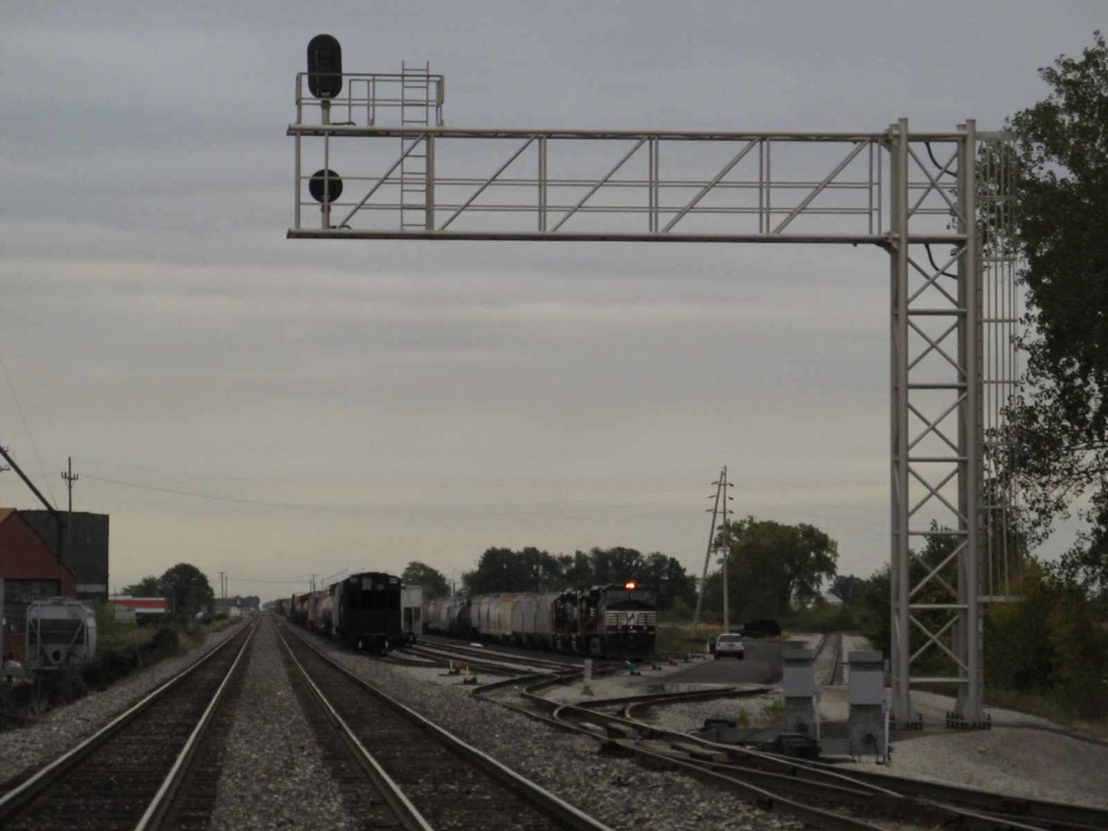
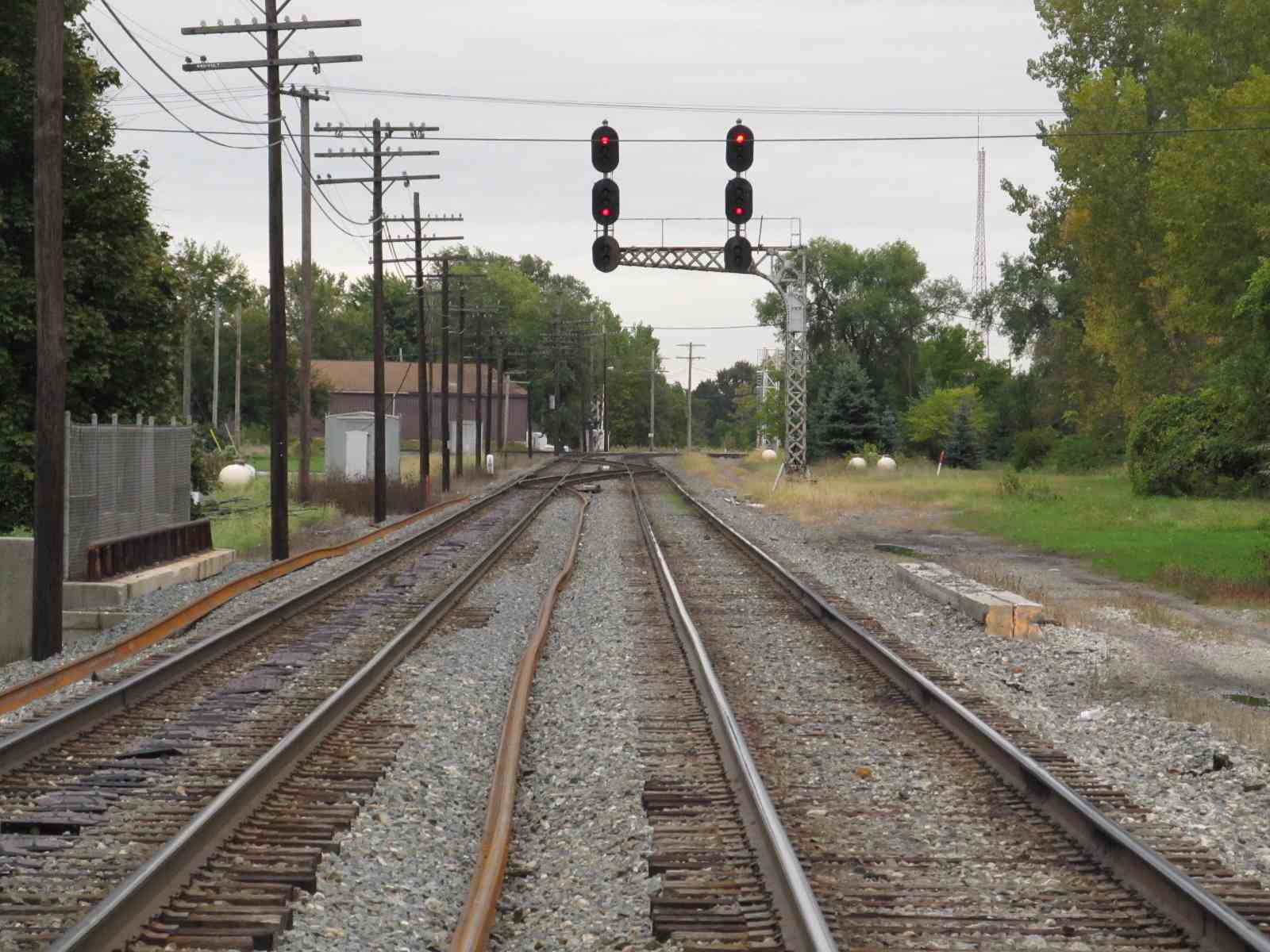
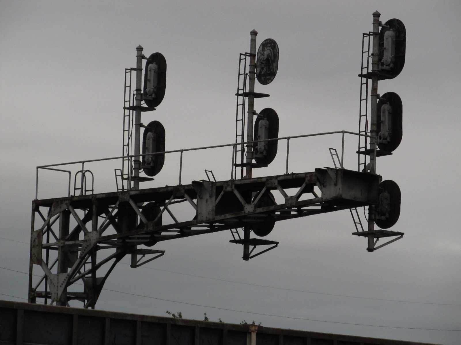
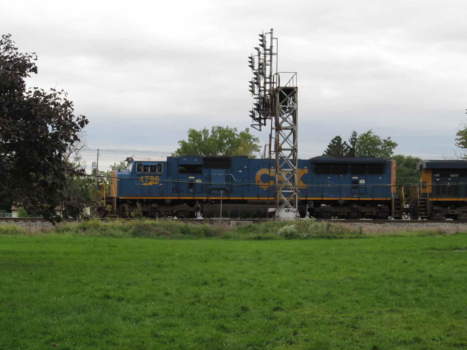
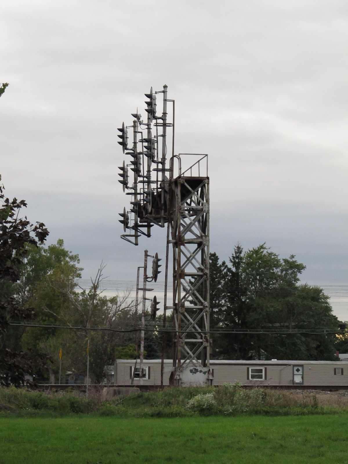
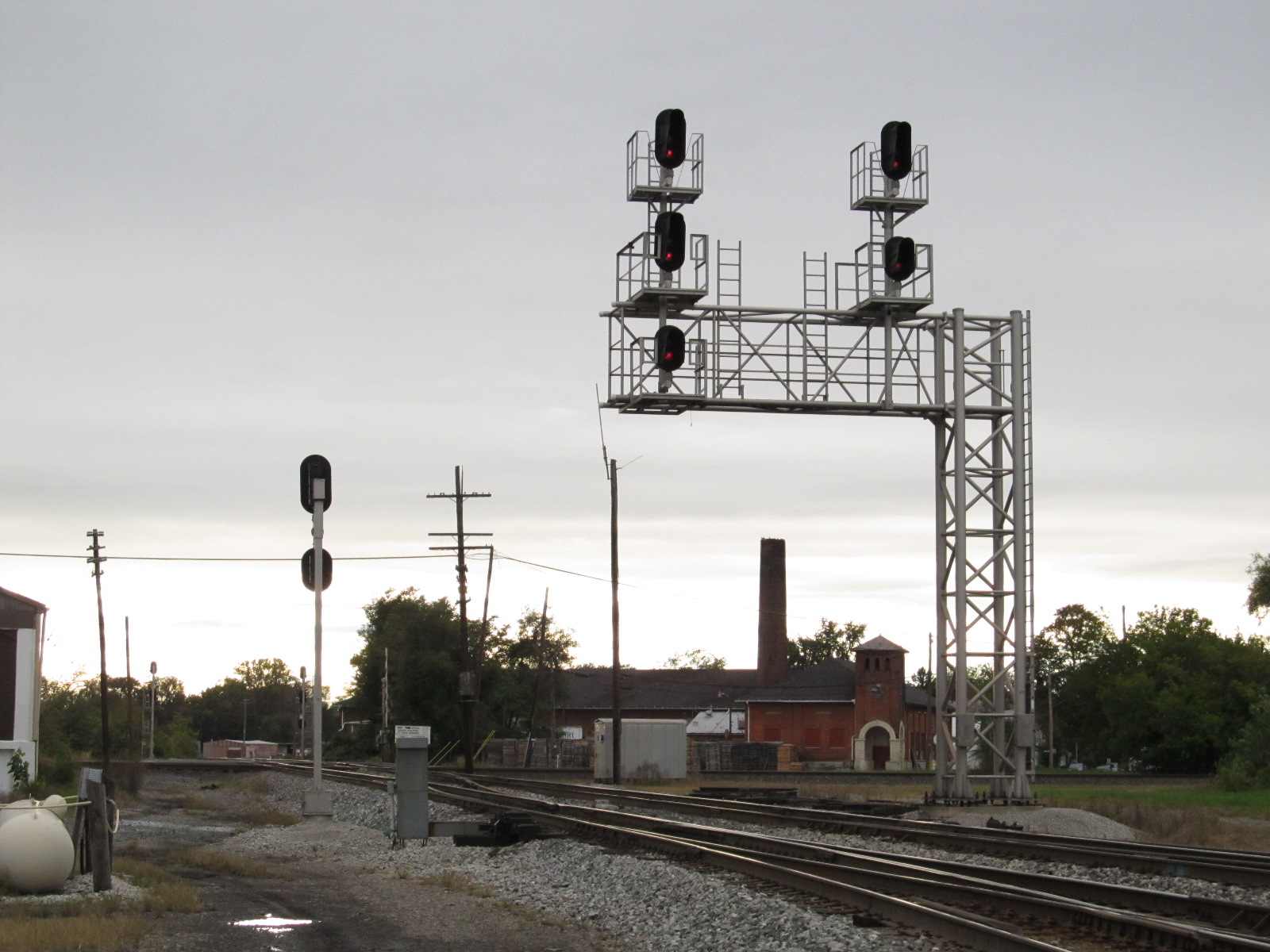
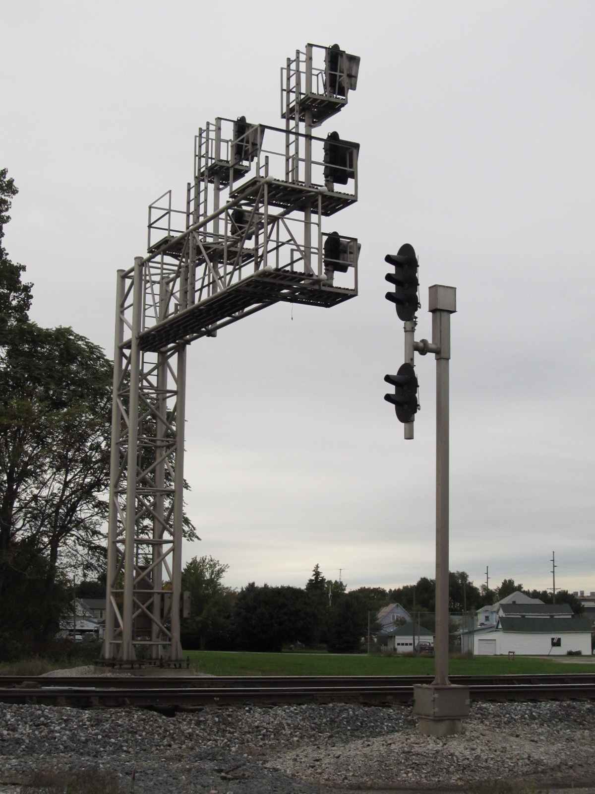
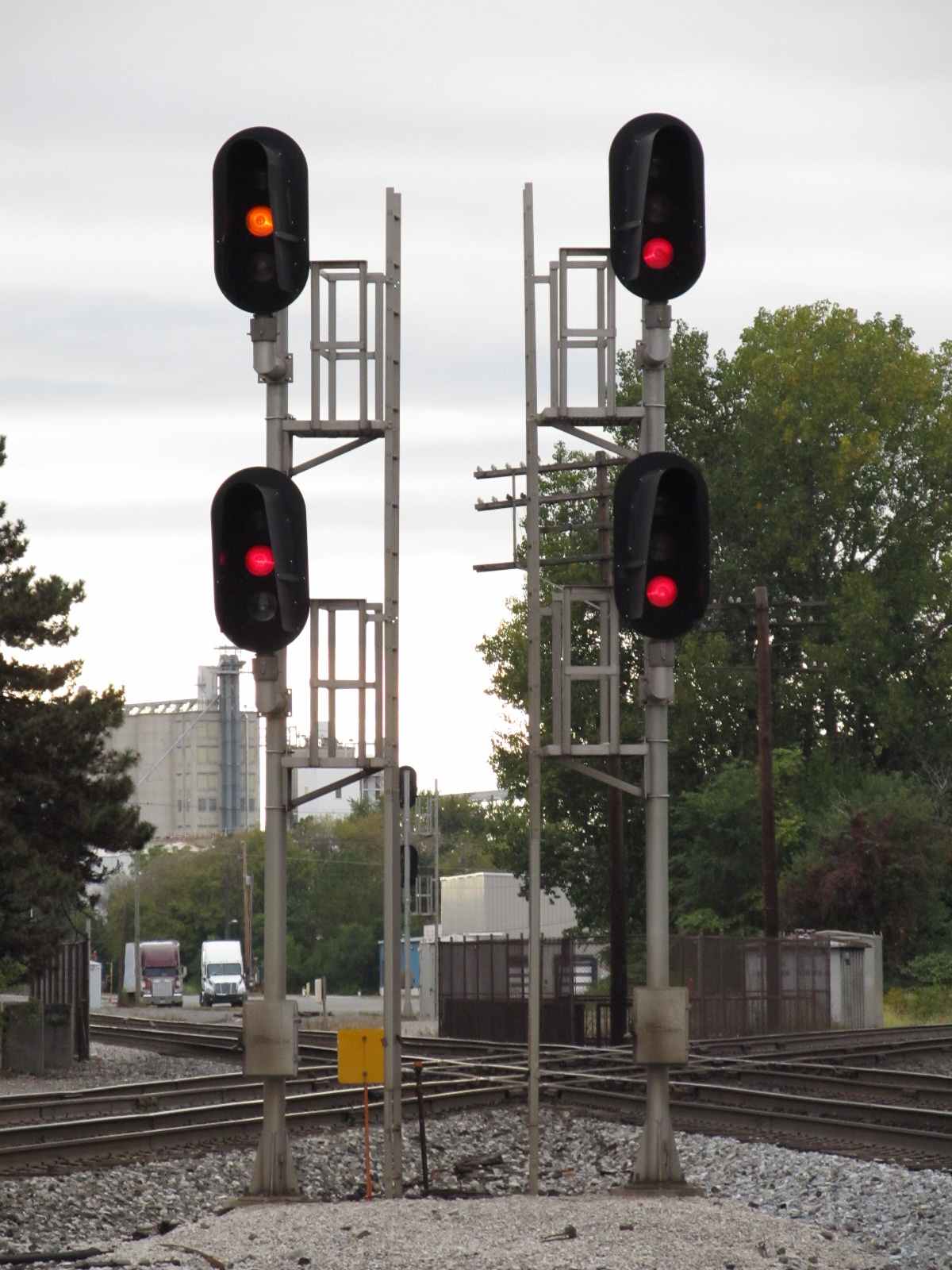
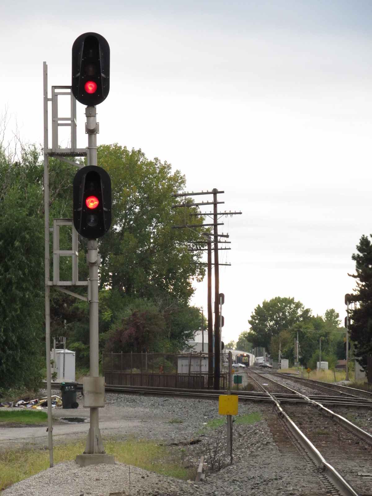
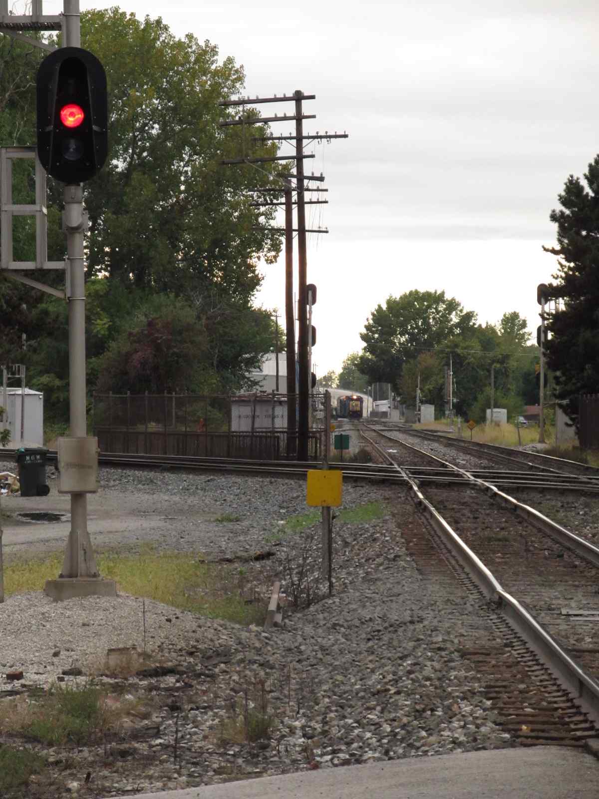
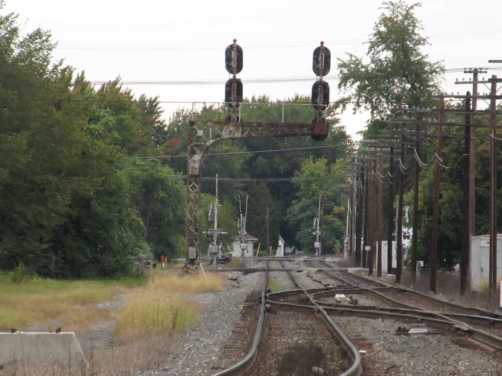 Looking north up the C&O line, can you tell from the cantilevered signals?
From Town St and the NS Crossing


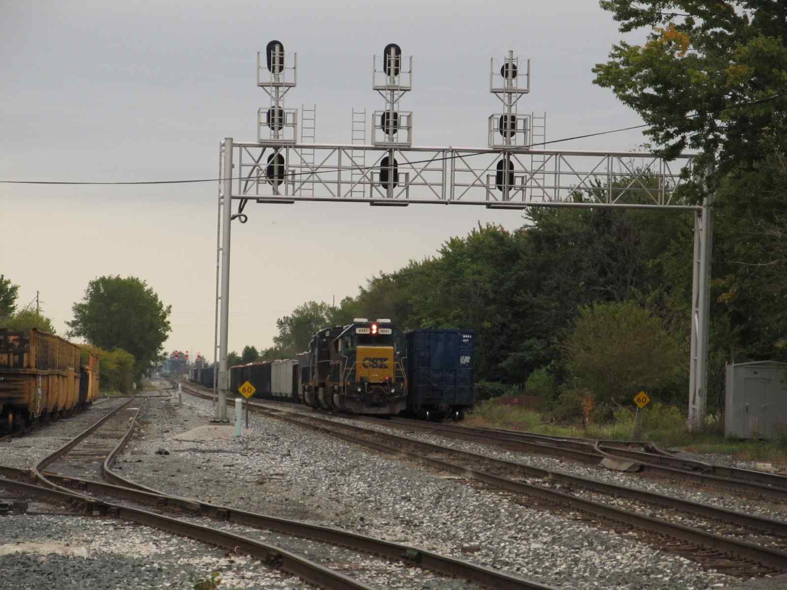
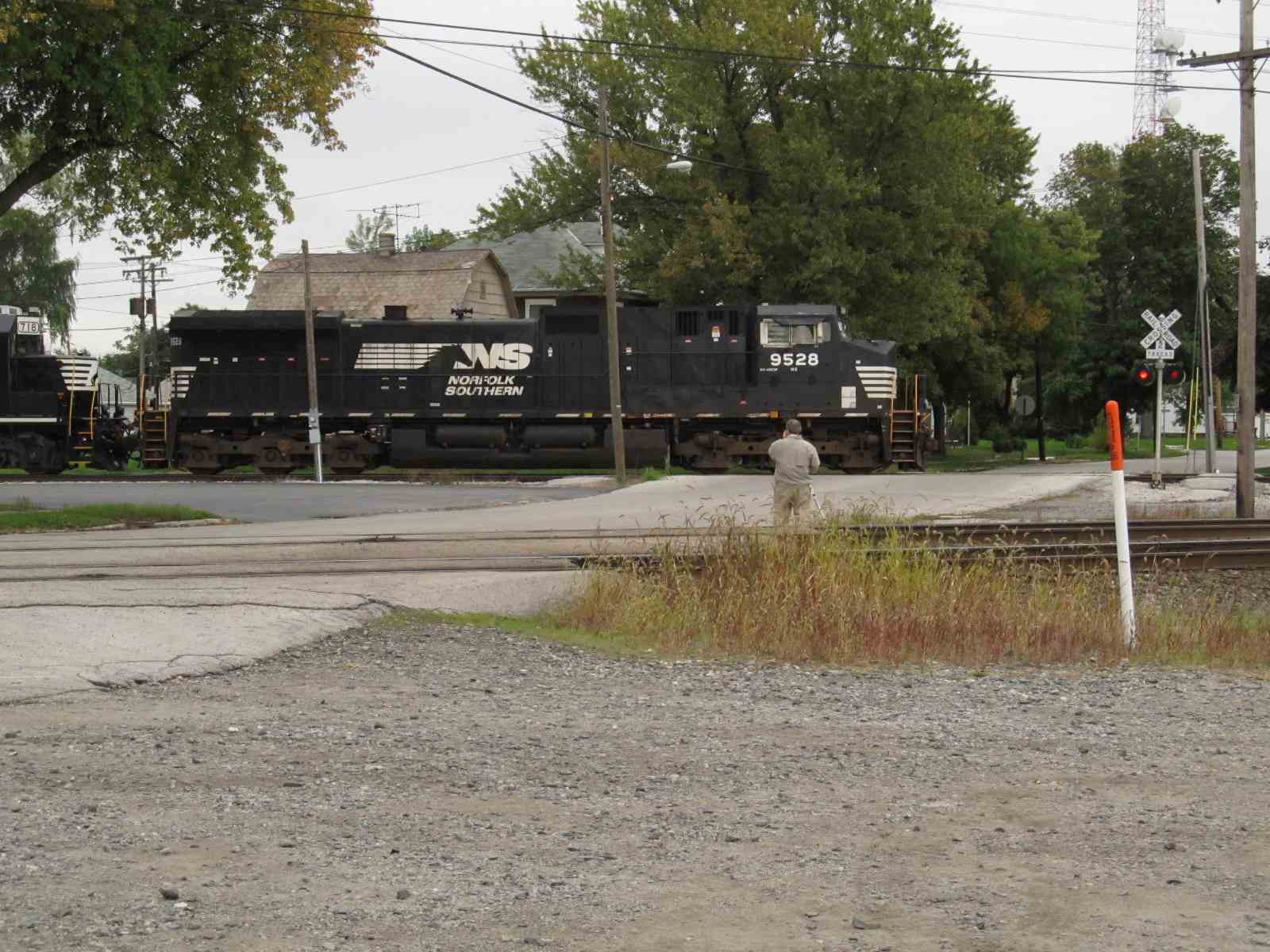
 Photos looking east from Town

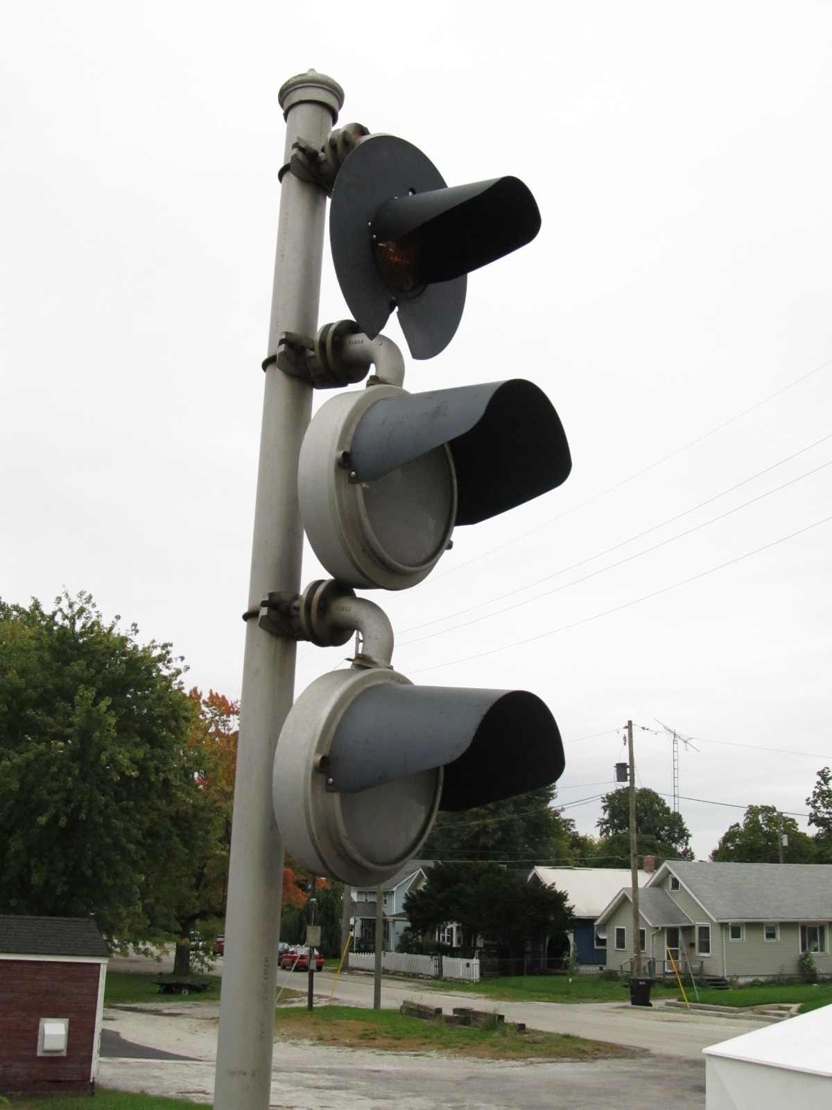

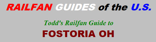
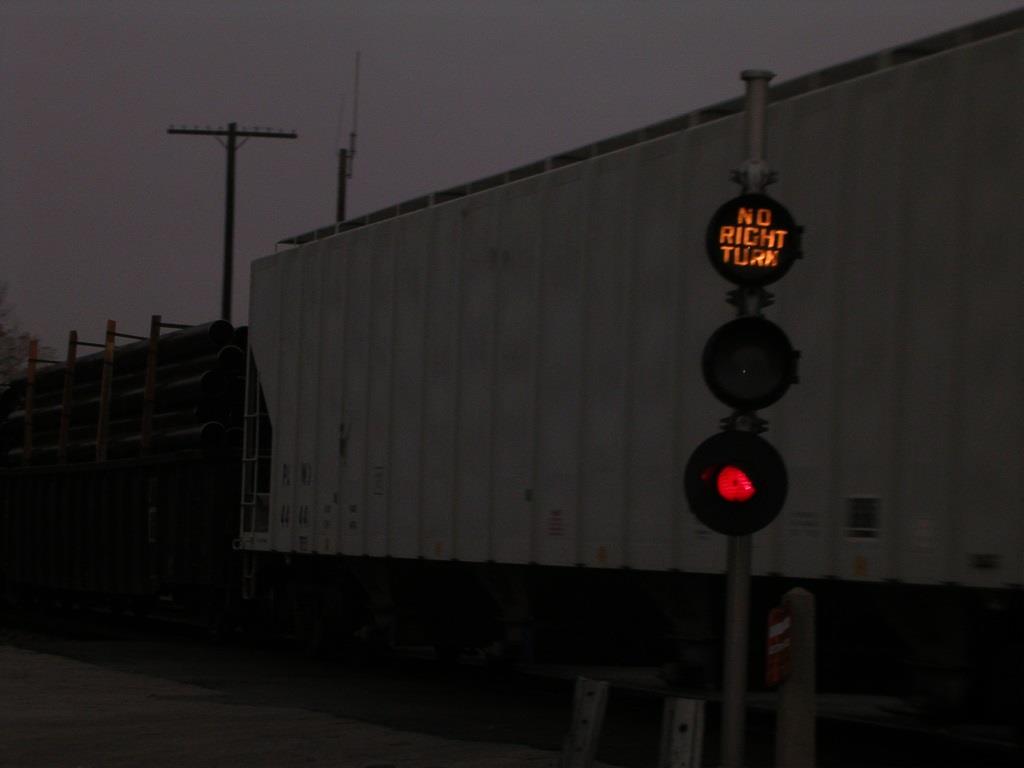
An NS freight in the NS-CSX interchange track and the no turn signal - you don't see a "no left turn" and a "no right turn" on
the same pole very often
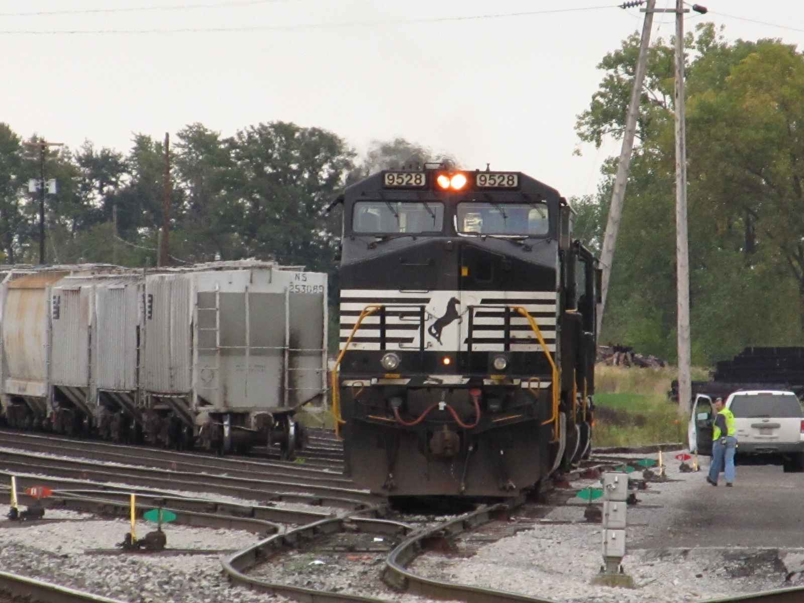


 More photos looking east from Town
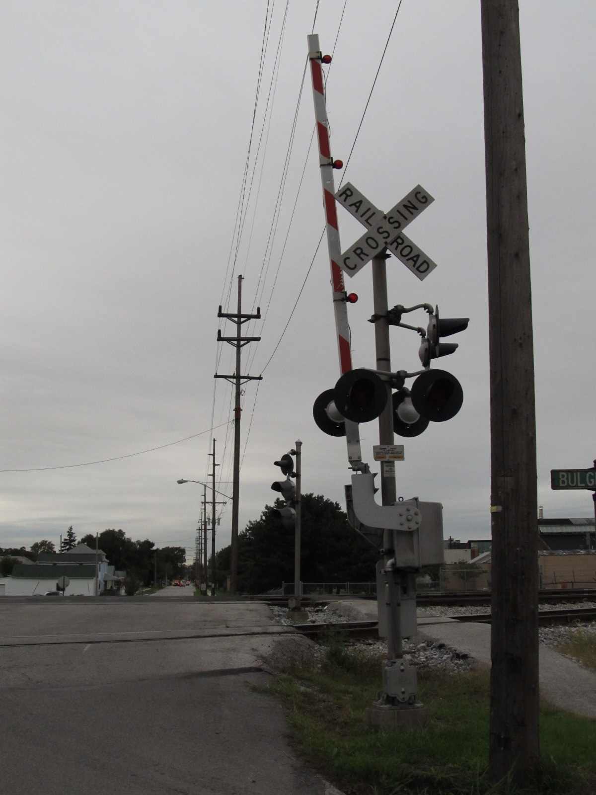

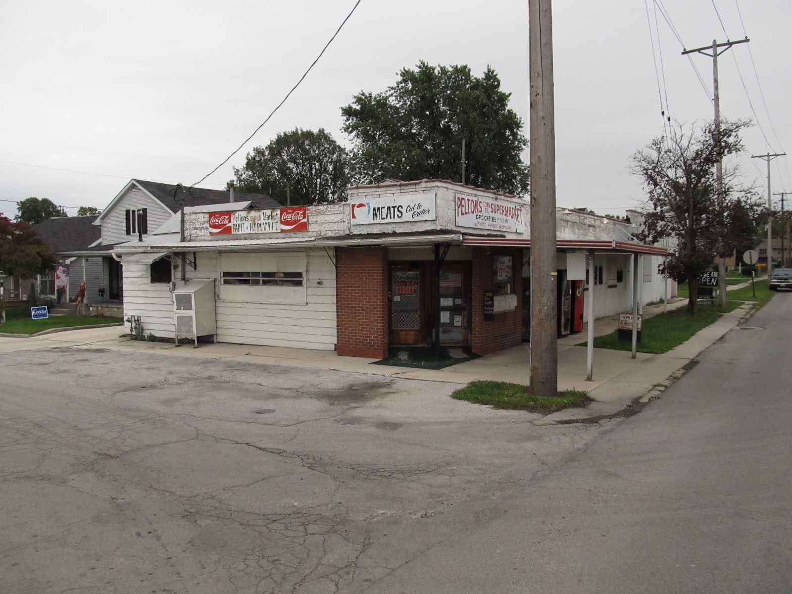 Grade Crossing at the NS tracks, Buckley, and Bulger, and a cute little store adjacent to it
From North St

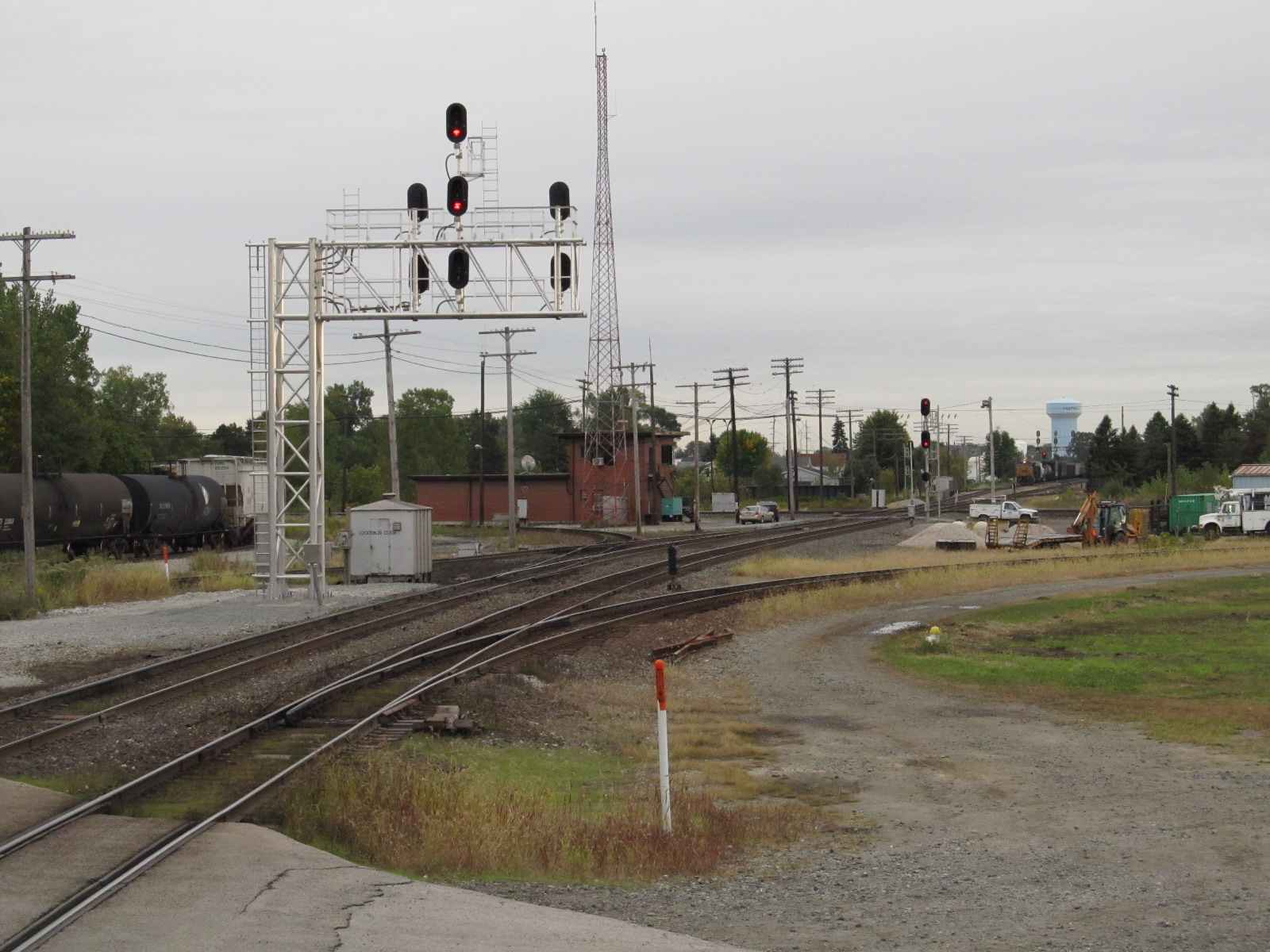
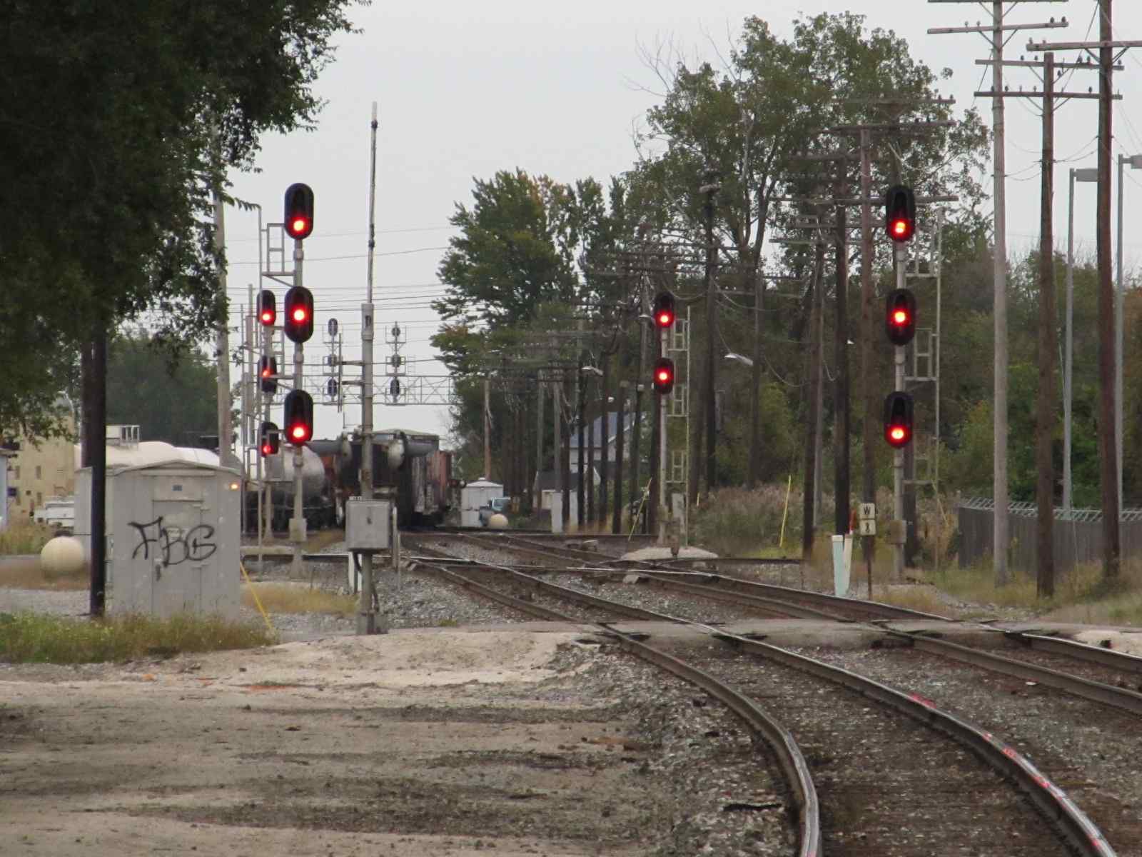
 Looking south towards the diamond, looking at the signals from Columbus is at the right
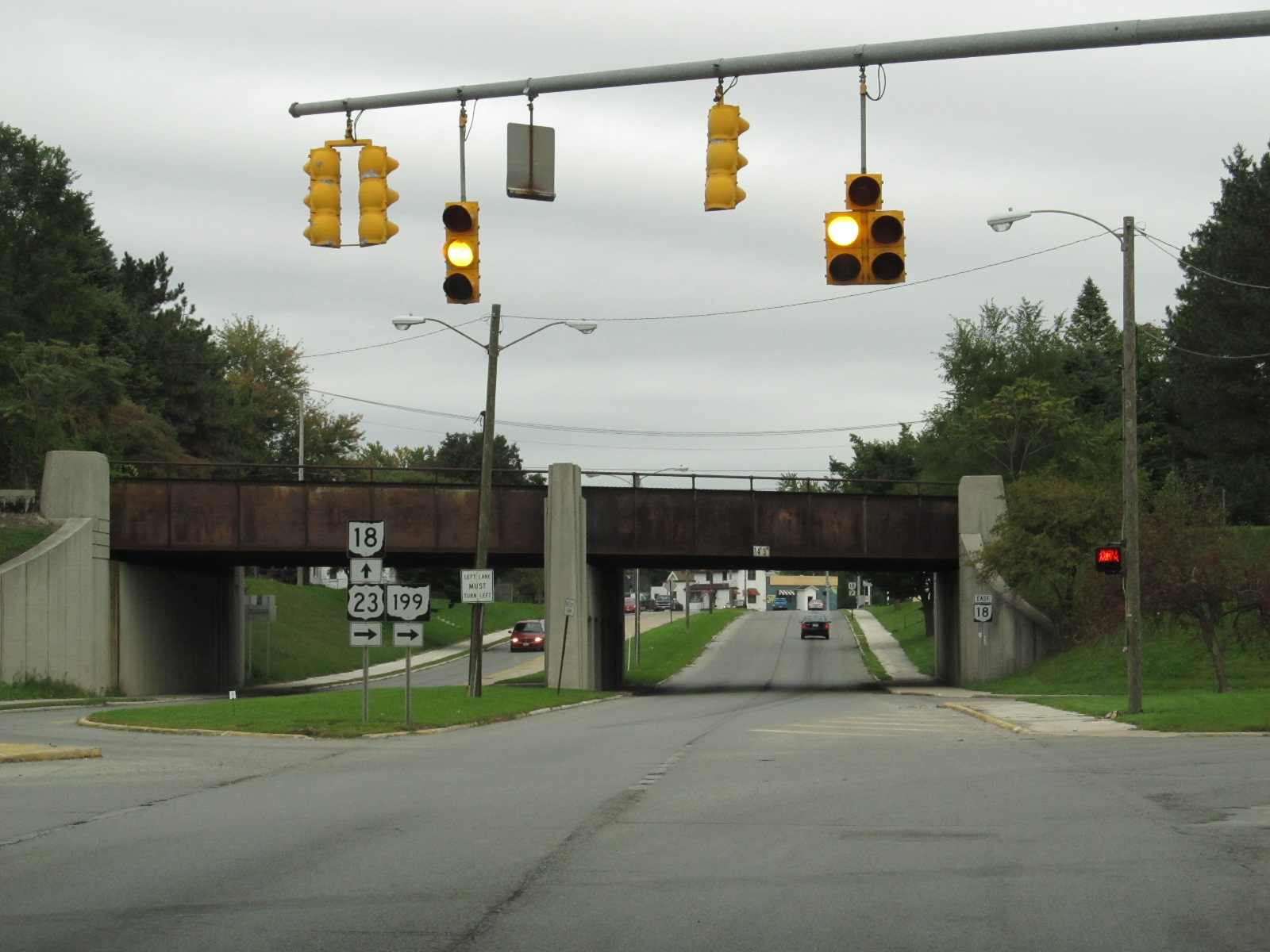
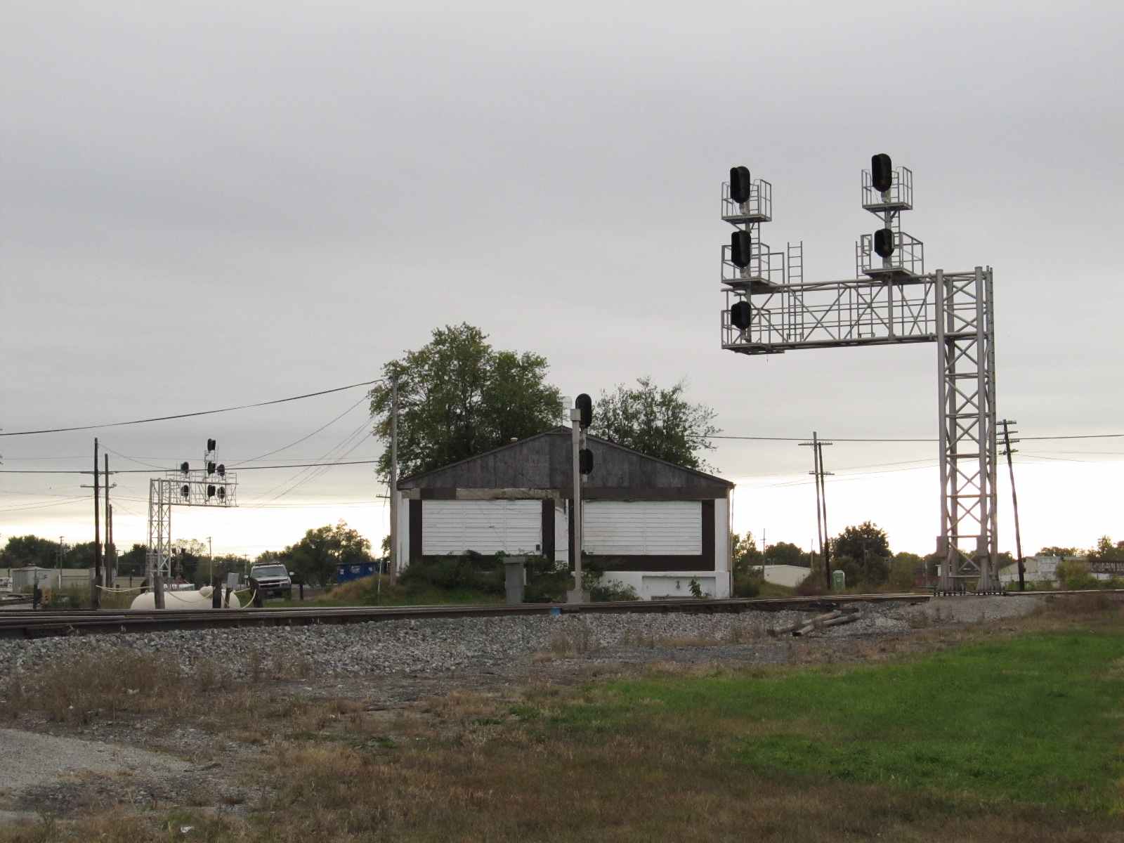
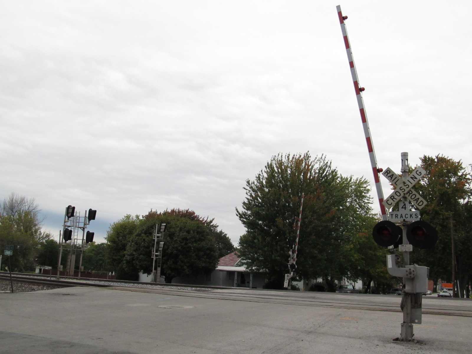
Findlay St Crossings
 Looking west on the NS from Findlay St
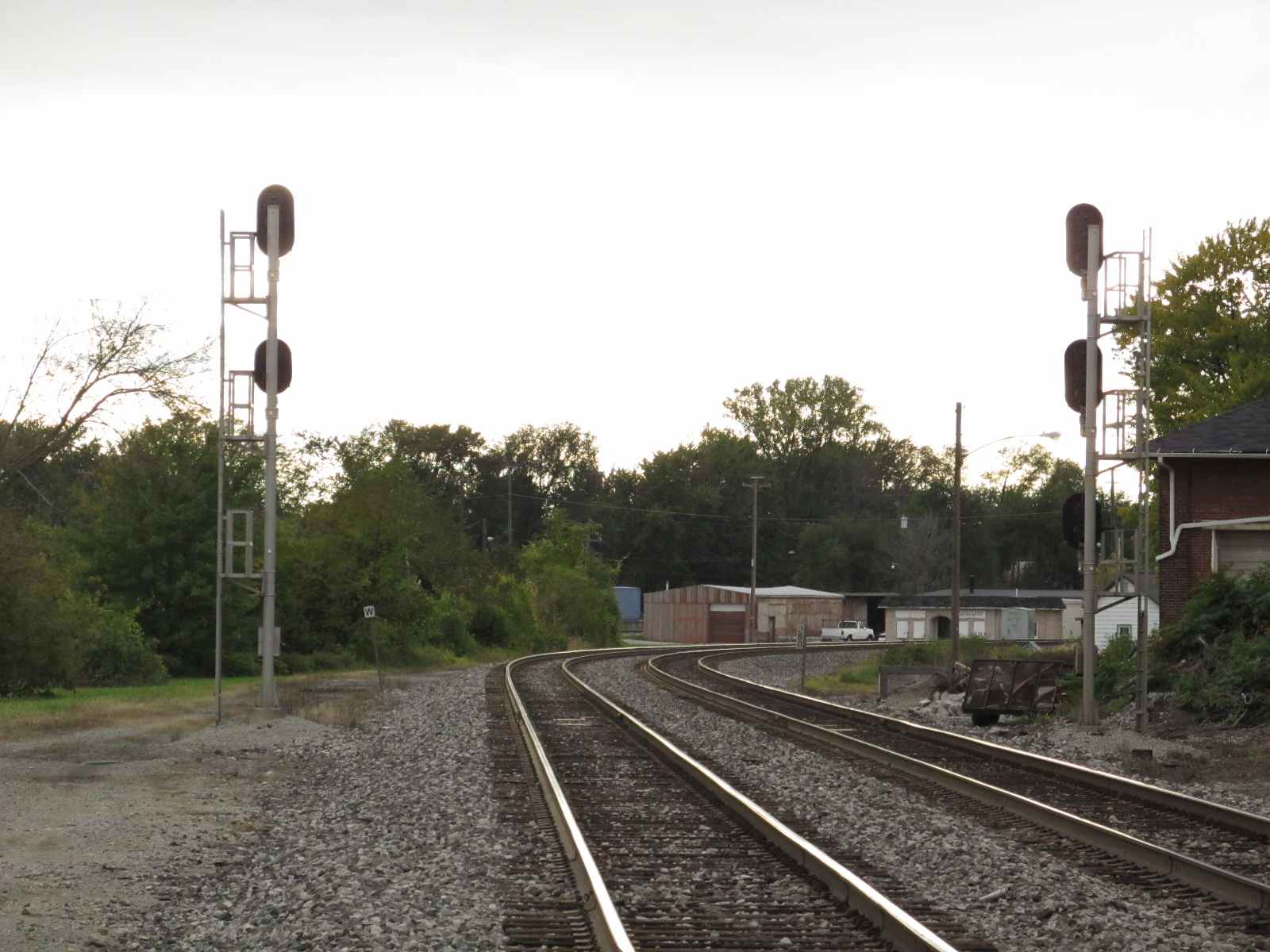
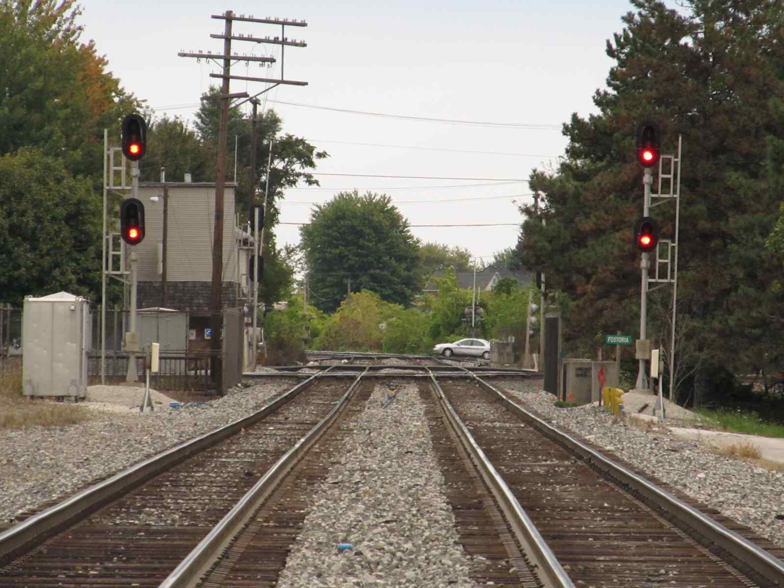
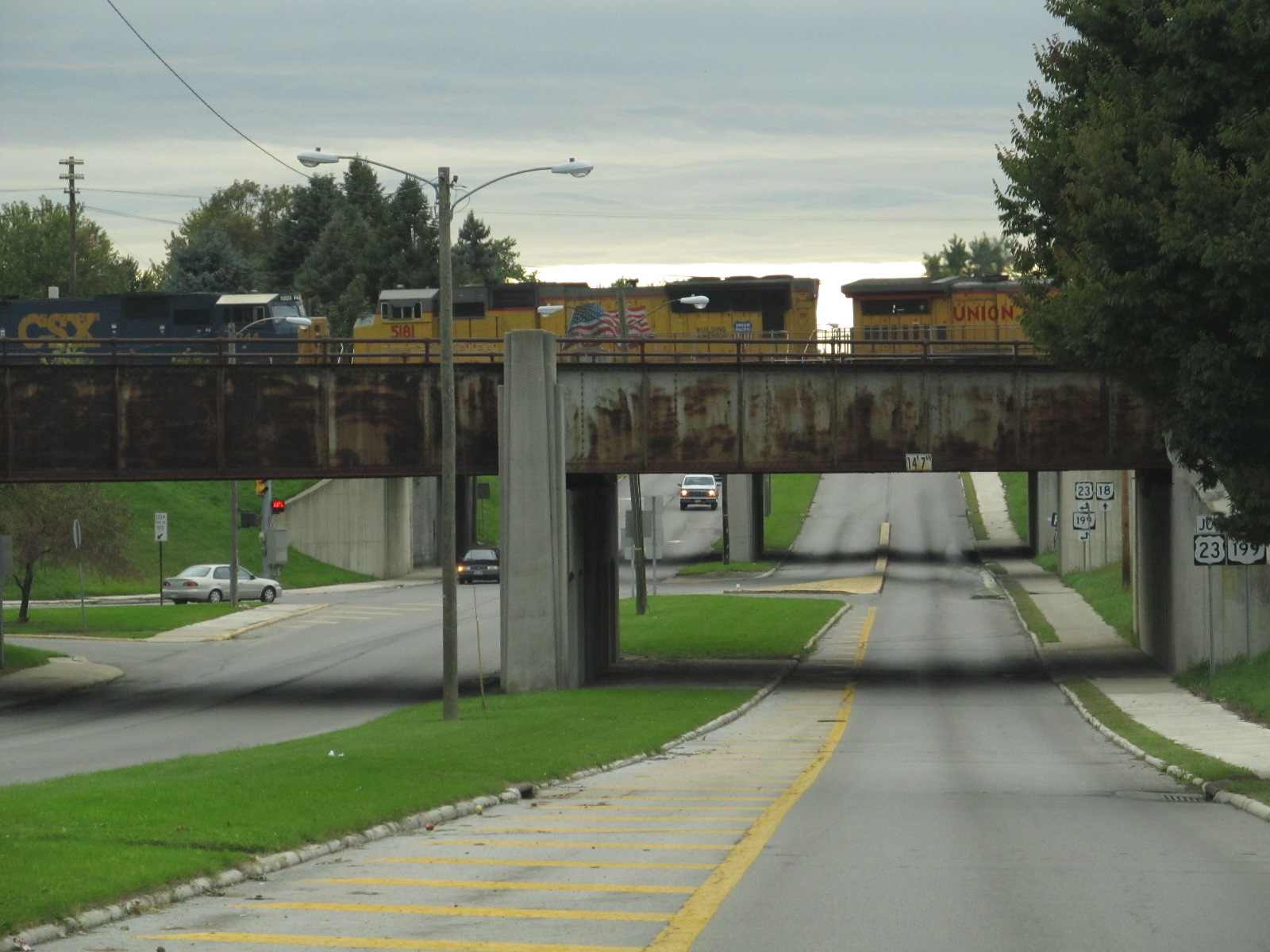
 Looking west on the CSX from the depot, Tiffin St in the background going over the tracks....


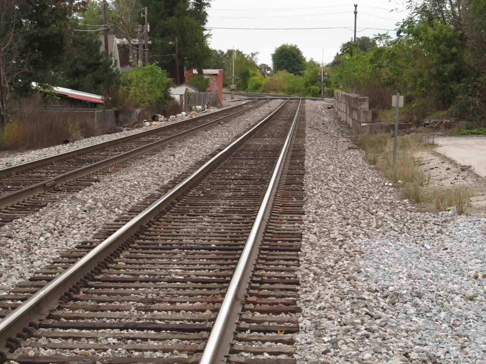
The "C&O" going over Lytle St

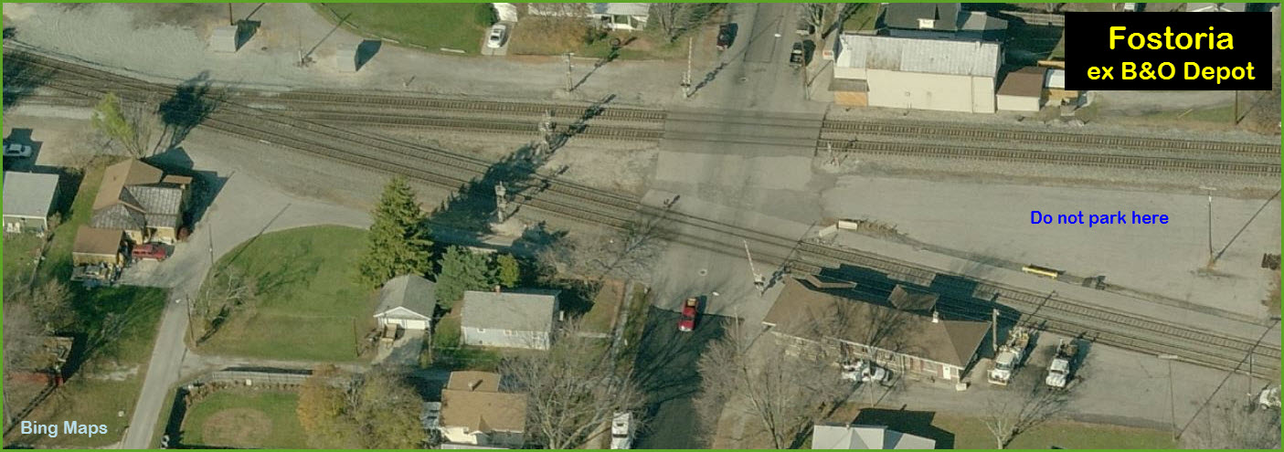
![]() ex B&O
(& Amtrak) Depot
ex B&O
(& Amtrak) Depot
![]() F Tower and CSX/CSX
Diamond
F Tower and CSX/CSX
Diamond
![]() ex NYC
Depot
ex NYC
Depot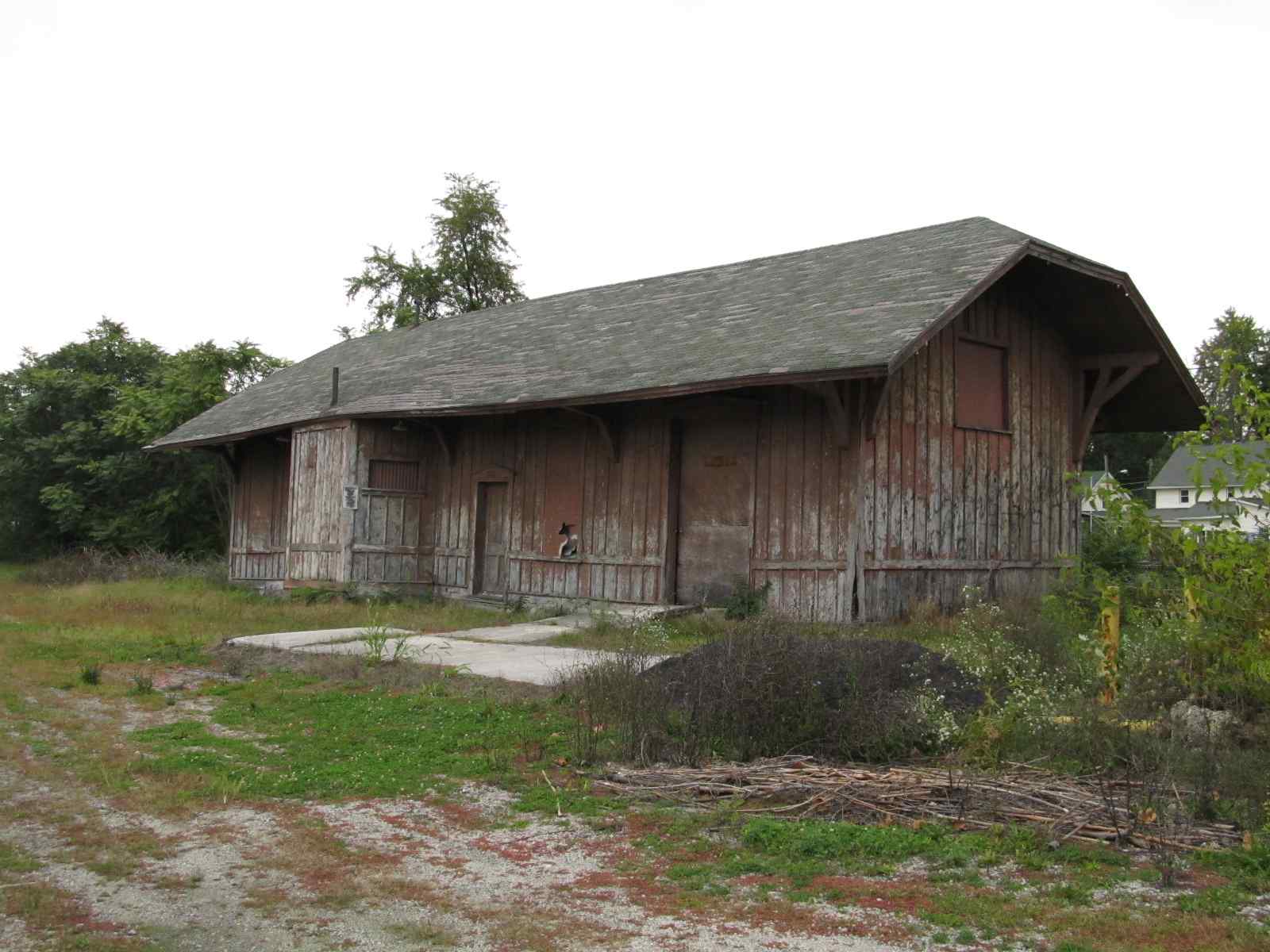
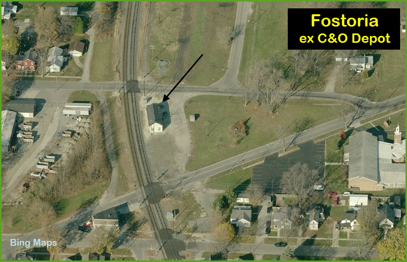
![]() ex C&O
Depot
ex C&O
Depot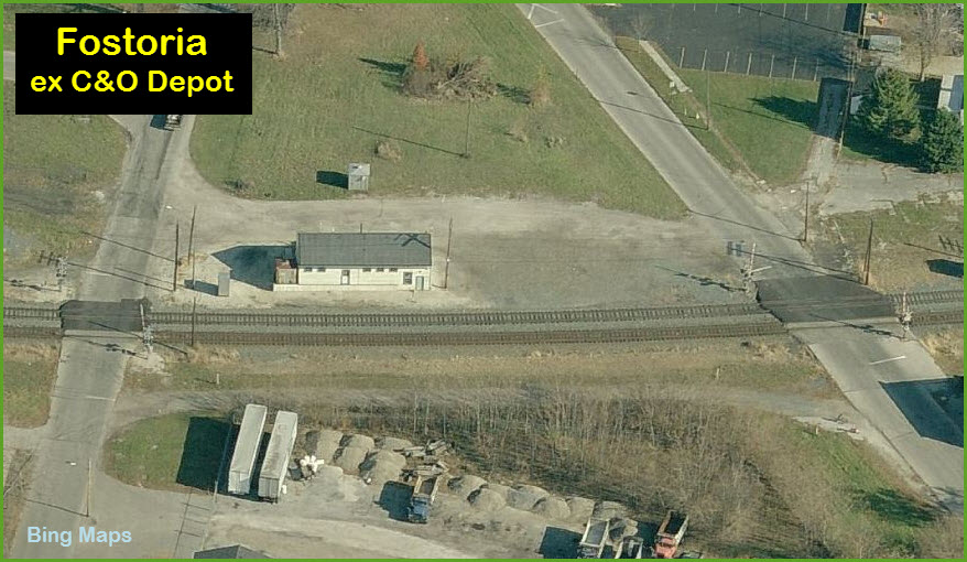
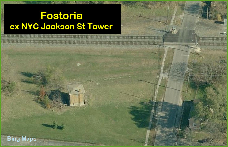
![]() ex NYC
Jackson St Tower
ex NYC
Jackson St Tower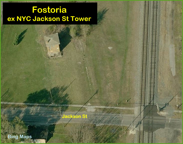
![]() NS Blair
Yard
NS Blair
Yard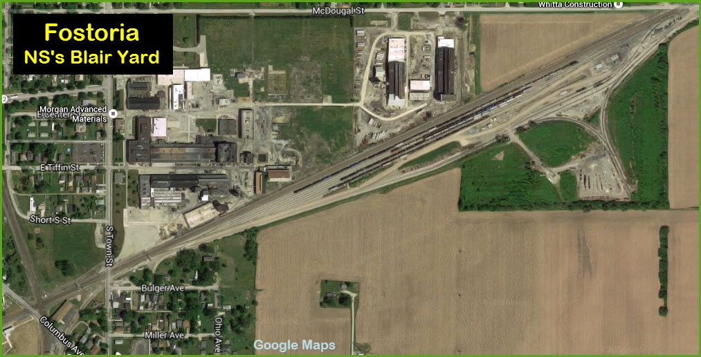
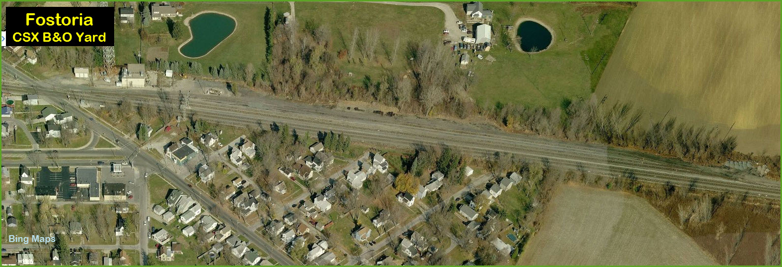
![]() CSX B&O
Yard
CSX B&O
Yard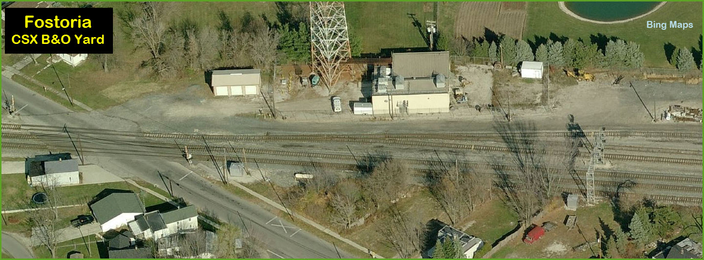
![]() CSX C&O
Yard
CSX C&O
Yard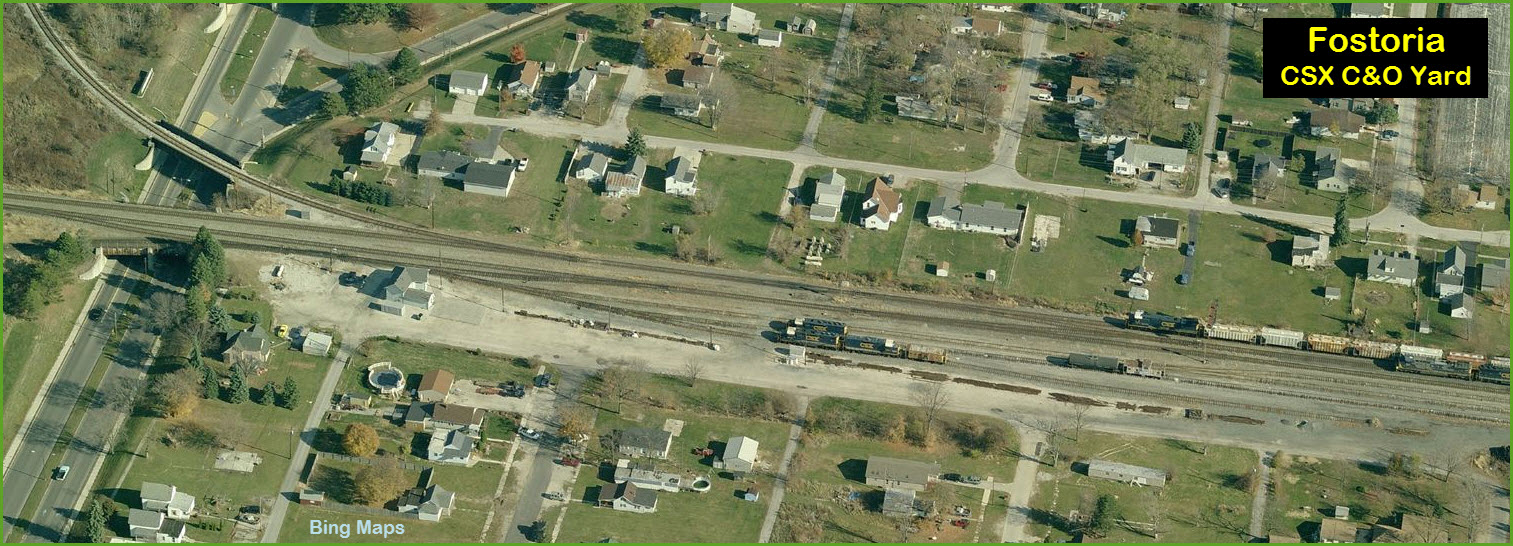
![]() CSX C&O
Yard Office
CSX C&O
Yard Office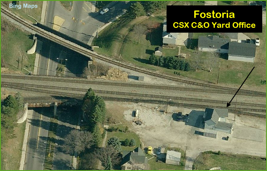
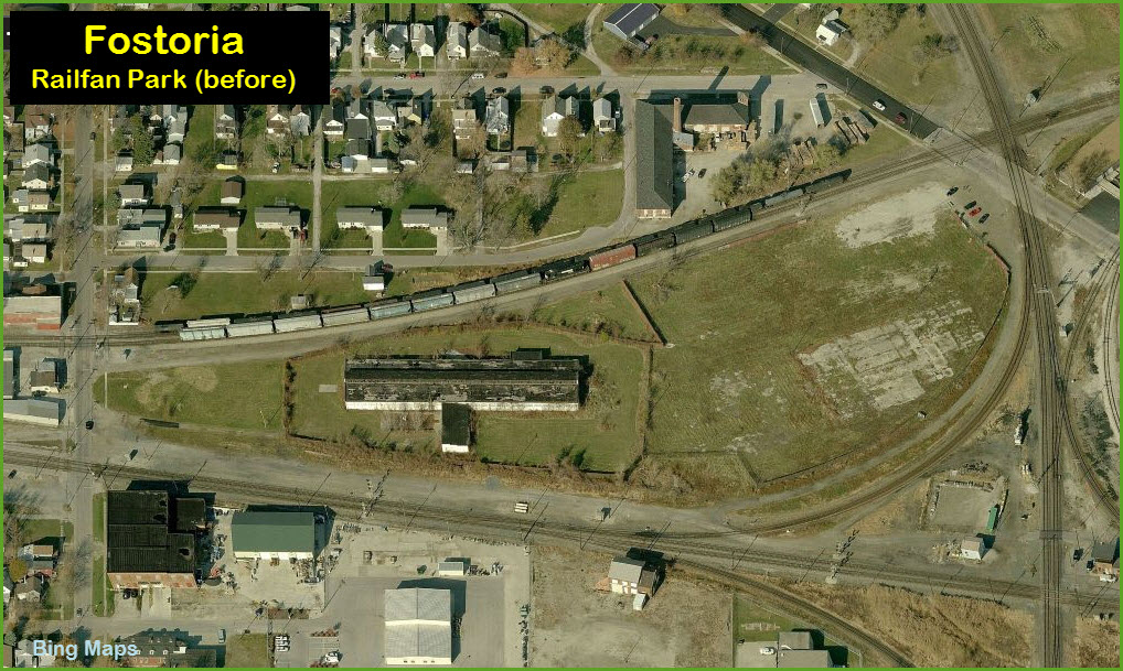
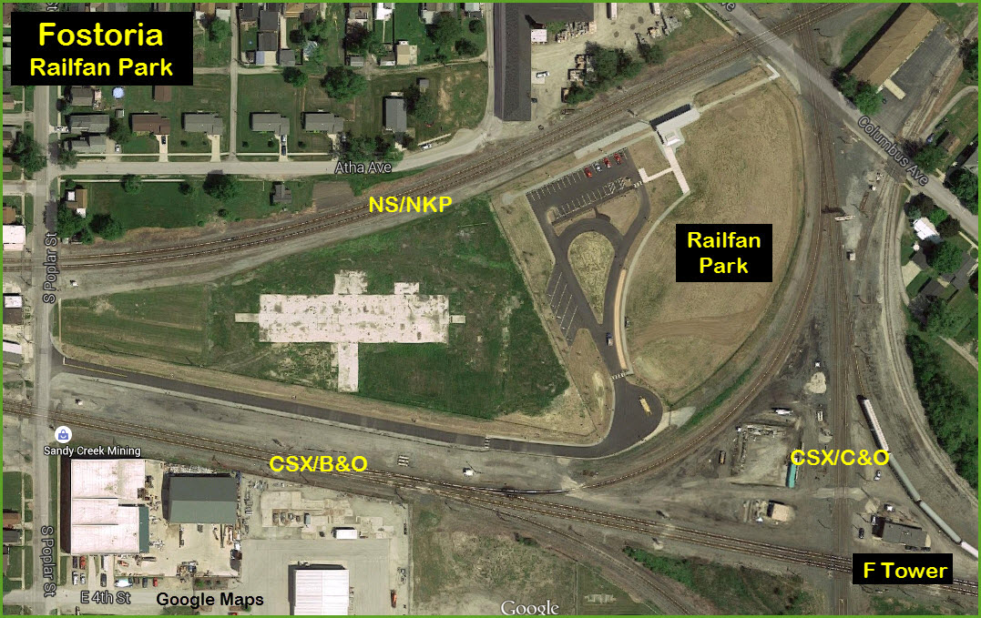
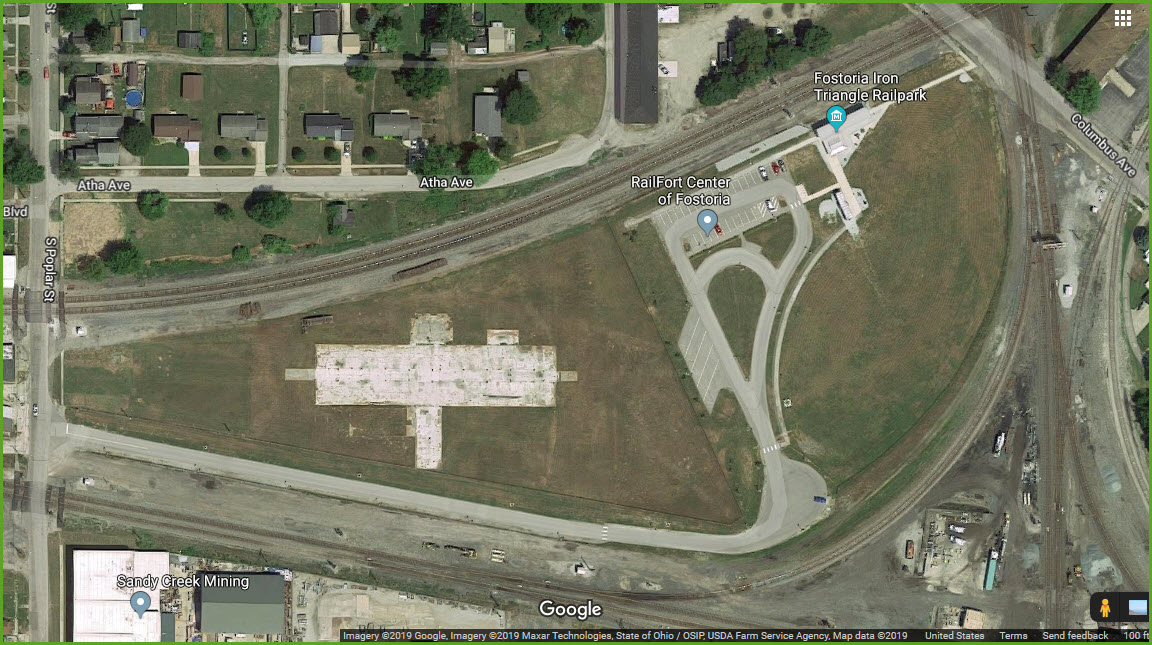
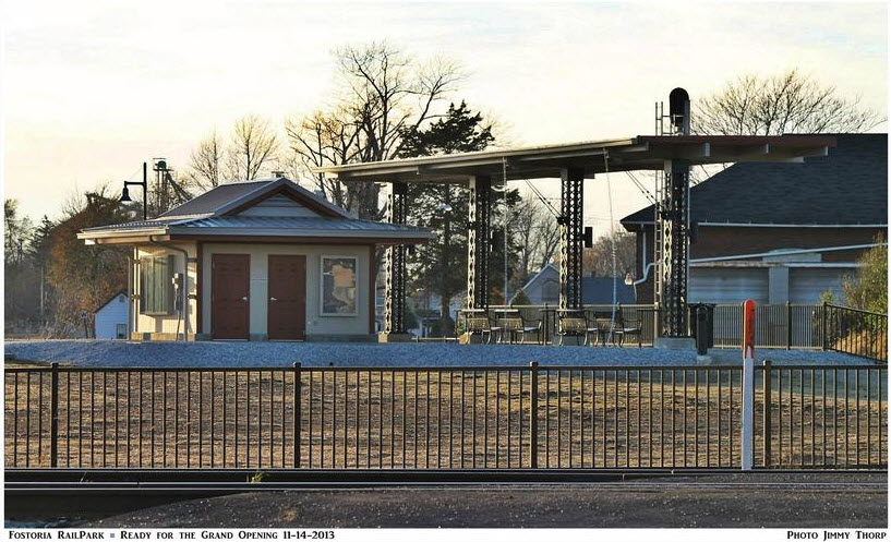
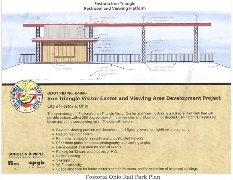
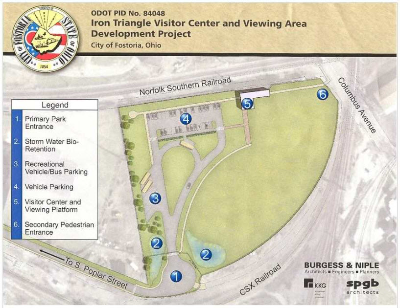
![]() Railfan Park
Railfan Park
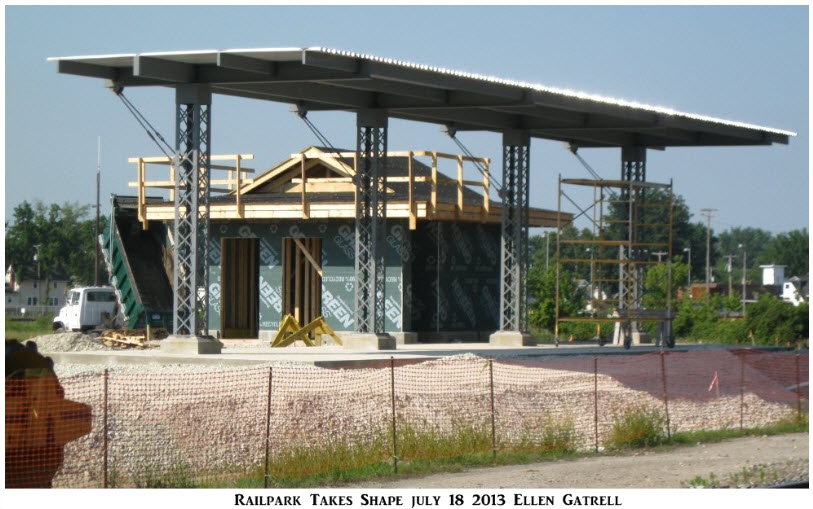
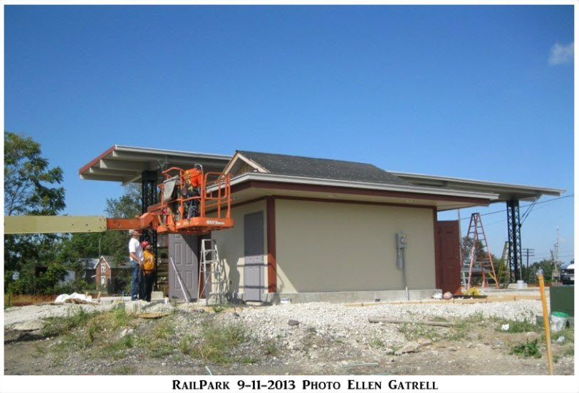
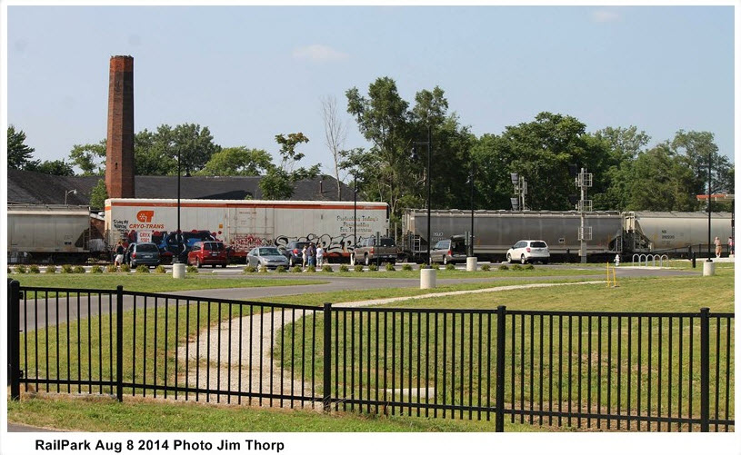
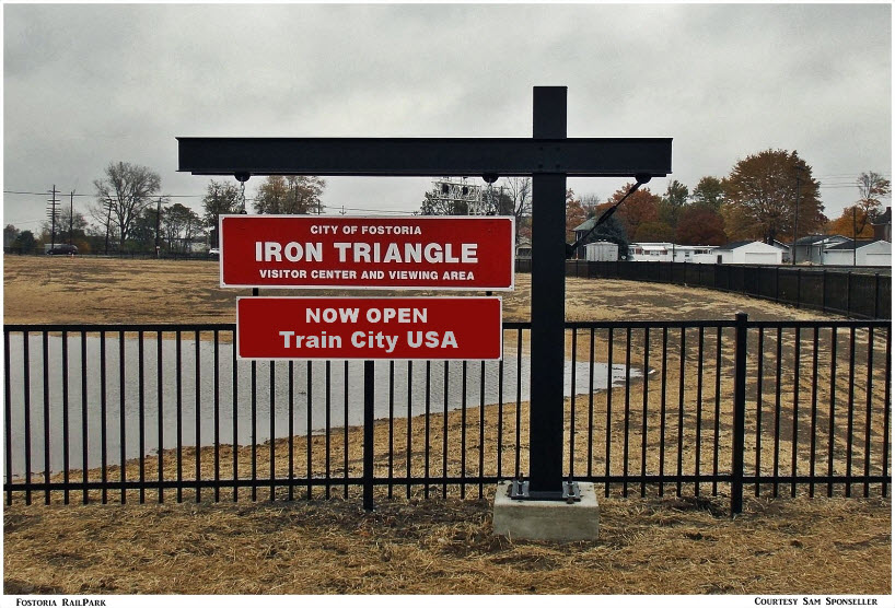
Fostoria RailPark: 499 S Poplar St, Fostoria Ohio
Fostoria's long awaited Railfan Park opened on November 15th, 2013. It is billed as the biggest and best railfan park for watching trains in the United States.
For more info and pictures, visit: http://fostoriairontriangle.com/railpark.htm
 Photographer credit on pictures.... unknown
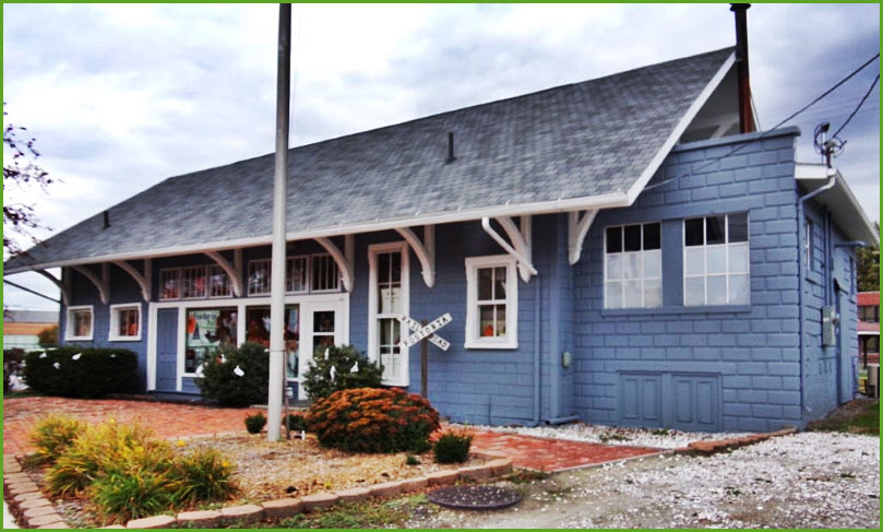
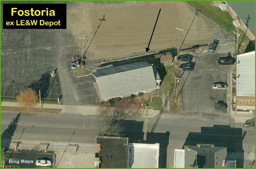
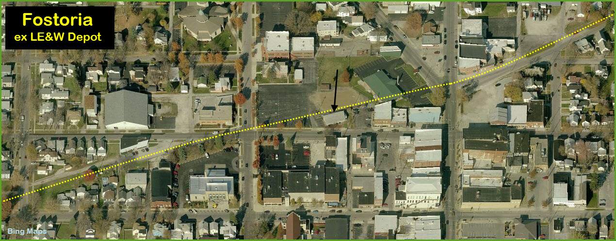
![]() ex LE&W Depot
ex LE&W Depot
GPS Coordinates: 41.158536, -83.415282
128 W. North St, Box 421, Fostoria OH 44830
Located on W North St near N Wood St, this old depot is now the HQ for the Fostoria Rail Preservation Society.
Their website is: http://fostoriairontriangle.com/
In the bottom picture, you can see how the LE&W line influenced the layout and buildings of Fosotria.
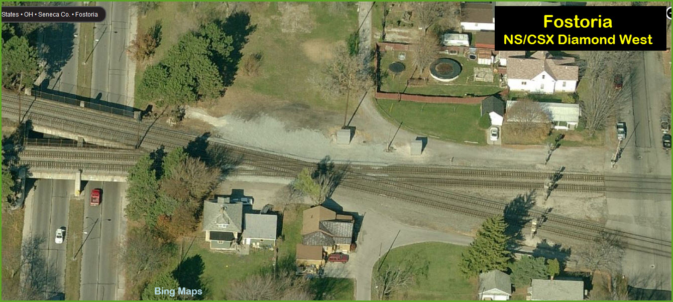
CSX/NS Diamond - East
GPS Coordinates: 41.154152, -83.406907


Two railroads, two different styles of dwarf signals on the NS-CSX interchange track by the commercial building at the diamond (the D&N Building).
It is owned by the FRPS and they may use it at some point in the future for a museum.....
For now, it is a good place to park.
CSX/NS Diamond - West
GPS Coordinates: 41.153070, -83.415090
 The parking lot in the middle of the two sets of tracks gets another no left and no right turn signal, the one on the right by Denver Todd

 Looking east from the depot on the NS
 Looking west on the NS from Main St, looking across the diamond
Disclaimers:
I love trains, and I love signals. I am not an expert. My webpages reflect what I find on the topic of the page. This is something I have fun with
while trying to help others. My webpages are an attempt at putting everything I can find of the subject in one convenient place. There are plenty of
other good websites to help me in this effort, and they are listed in the links section on my indexa page, or as needed on individual pages.
Please Note: Since the main focus of my two websites is railroad signals, the railfan guides are oriented towards the signal fan being able to locate
them. For those of you into the modeling aspect of our hobby, my indexa page has a list of almost
everything railroad oriented I can think of to provide you with at least a few pictures to help you detail your pike.
If this is a railfan page, every effort has been made to make sure that the information contained on this map and in this railfan guide is correct. Once in a
while, an error may creep in :-)
My philosophy: Pictures and maps are worth a thousand words, especially for railfanning. Text descriptions only get you so far, especially if you get lost or
disoriented. Take along good maps.... a GPS is OK to get somewhere, but maps are still better if you get lost! I belong to AAA, which allows you to get
local maps for free when you visit the local branches. ADC puts out a nice series of county maps for the Washington DC area, but their state maps do not have
the railroads on them. If you can find em, I like the National Geographic map book of the U.S..... good, clear, and concise graphics, and they do a really good
job of showing you where tourist type attractions are, although they too lack the railroads. Other notes about specific areas will show up on that page if known.
By the way, floobydust is a term I picked up 30-40 years ago from a National Semiconductor data book, and means
miscellaneous and/or other stuff.
Pictures and additional information is always needed if anyone feels inclined to take 'em, send 'em, and share 'em, or if you have something to add or correct....
credit is always given! BE NICE!!! Contact info is here
Beware: If used as a source, ANYTHING from Wikipedia must be treated as
being possibly being inaccurate, wrong, or not true.
RAILFAN GUIDES HOME
RAILROAD SIGNALS HOME
Last Modified
23-Oct-2019