The title is actually a misnomer today, for the MTA now
calls it SIR, or, the Staten Island Railway.
More down in the history section.
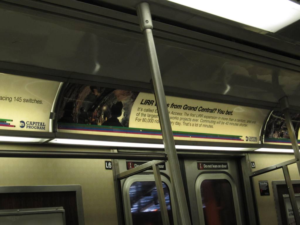
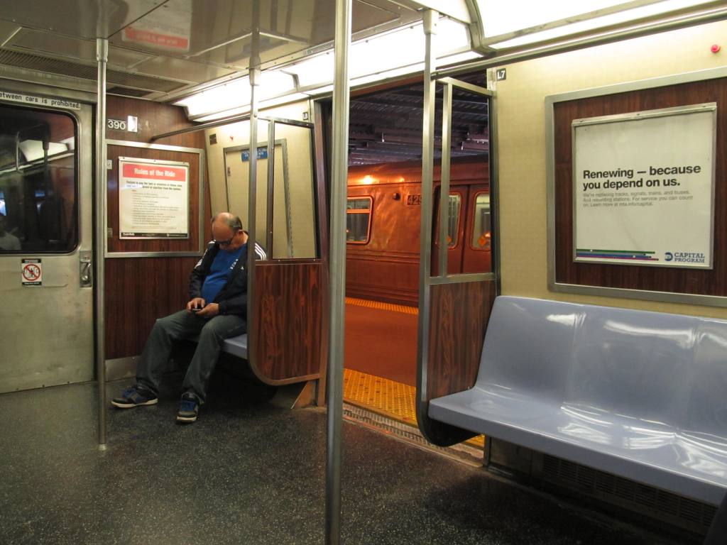
For those of you that remember the "good ole days"
where the operator was confined to a small cabin on the right side of the
car, and you could watch and take pictures out the front of the cars, those
days are long gone. Even in the newer cars which feature a full width
cab, and a glass window so you could see forward, they have been covered
over. On one of the trips I took, there was an ever so slight hole in
the paper they had the window covered up with, and I was taking pictures
thru it..... and somehow, this woman who was riding shotgun in the cab
noticed (I guess) the hole getting dark, she opened the door to the cab and
told me to stop taking pictures :-(
The following comes from
Wikipedia, so not all of it may be entirely true or accurate:
The Staten Island Rapid Transit Operating Authority (SIRTOA),
publicly known as MTA Staten Island Railway or SIR, is the operator
of the only rapid transit line in the borough of Staten Island, one
of five in New York City, NY. Service on the line is provided
24 hours a day, every day of the year. It is considered a
standard railroad line, but only freight service which runs along
the western portion of the North Shore Branch is connected to the
national railway system.
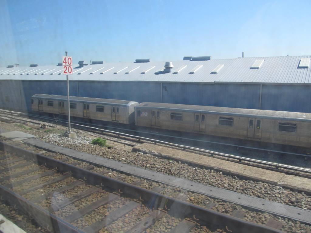
SIR operates
with modified R44 New York City Subway cars, and is run by the New
York City Transit Authority, an agency of the Metropolitan
Transportation Authority and operator of the New York City Subway.
However, there is no direct rail link between the SIR and the subway
system proper. SIR riders do get a free transfer to New York
subway lines, and the line is included on official New York City
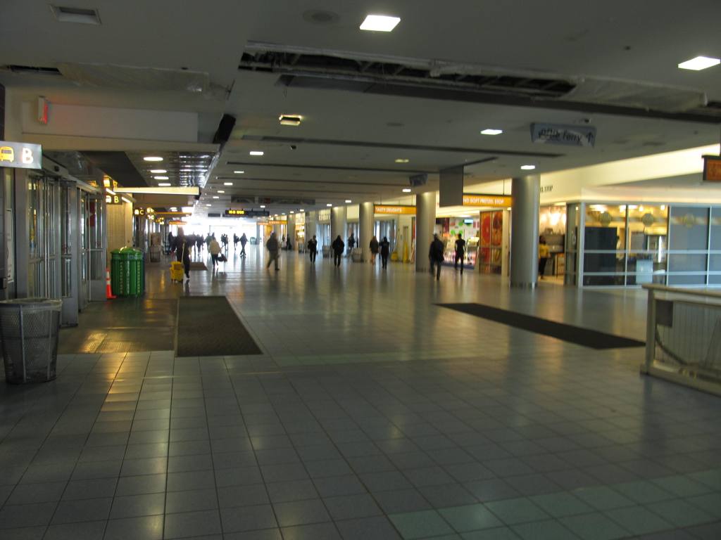
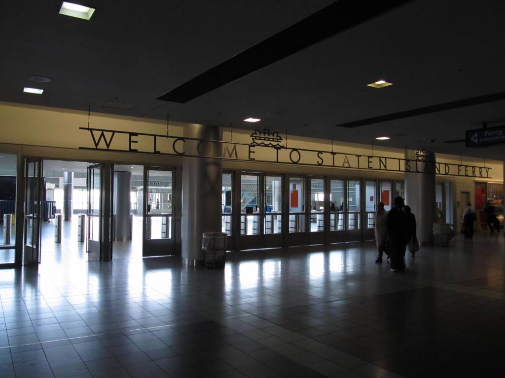
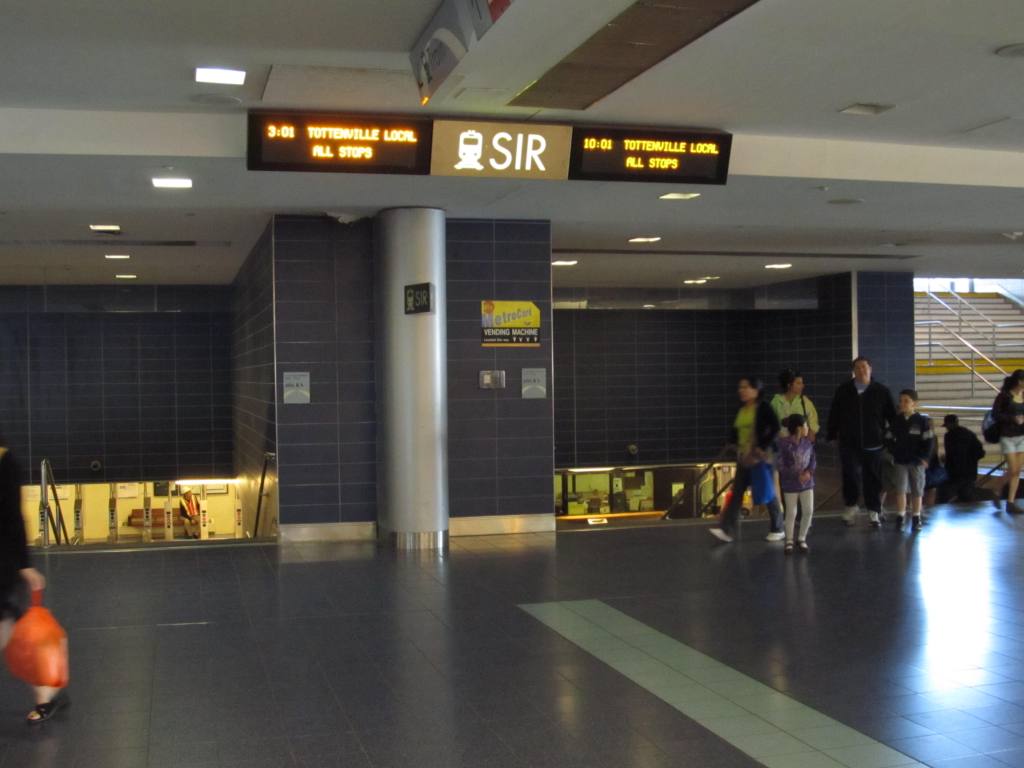
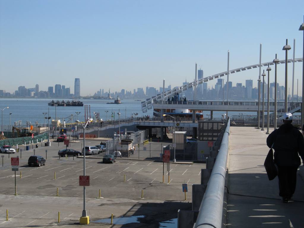
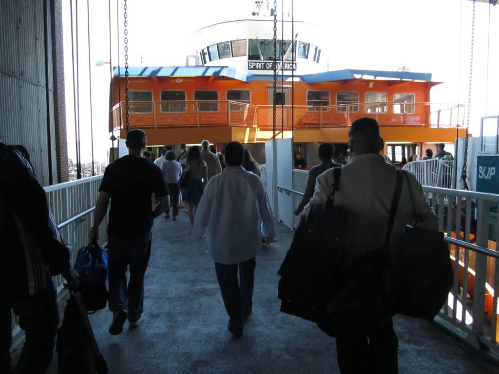
Subway maps. Commuters who use the railway typically use the
Staten Island Ferry to reach Manhattan; the line is accessible from
within the Ferry Terminal.
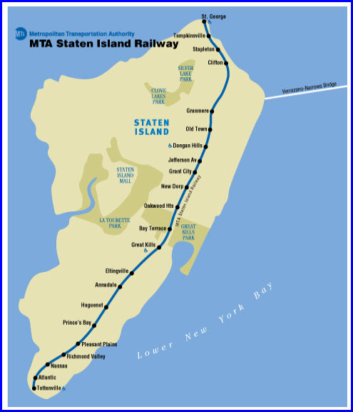
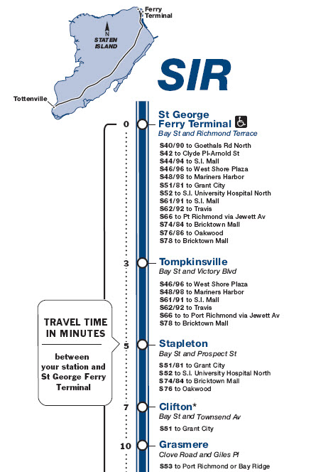
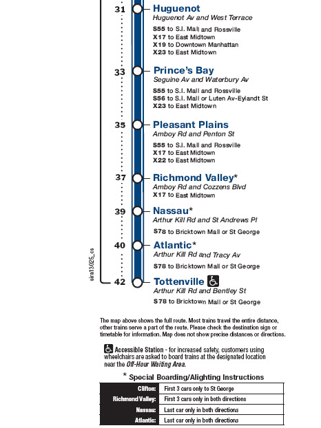
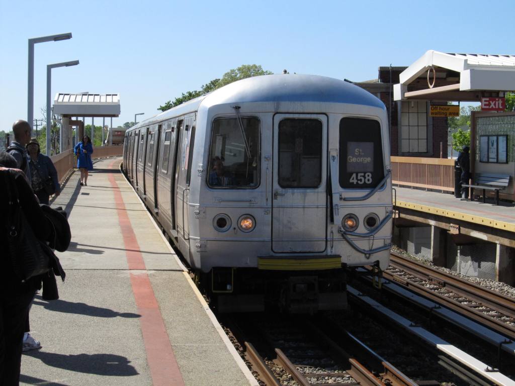
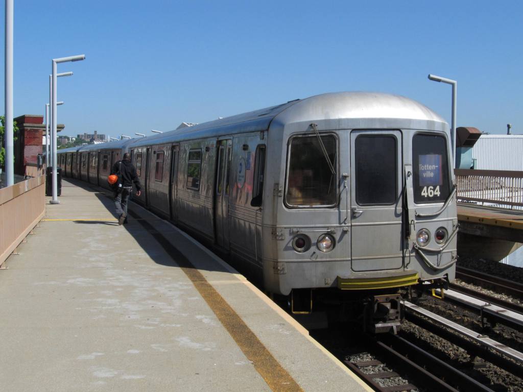
The Staten Island Railway provides full-time
local service between Saint George and Tottenville along the east
side of the borough. The line has a route bullet similar to
other subway routes: the letters SIR in a blue circle. It is
used only on timetables and on the MTA's site, not on trains.
The line runs 24 hours a day and is one of only five mass-transit
rail lines in the United States to do so (the others being the PATCO
Speedline, the Red and Blue Lines of the Chicago 'L', the PATH
lines, and the New York City Subway).
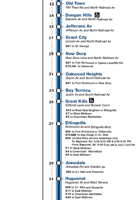
On weekdays, express service to St. George is
provided between 6:17 AM and 8:17 AM and to Tottenville from 7:06 AM
to 8:06 AM and 4:31 PM to 7:51 PM. Morning express trains run
non-stop between St. George and New Dorp; afternoon express trains
run non-stop from St. George to Great Kills southbound only.
Express service is noted on trains by the presence of a red marker
with the terminal and 'express' directly underneath it.
Pictures and additional information is always needed if anyone feels
inclined to take 'em, send 'em, and share 'em, or if you have
something to add or correct.... credit is always given! Contact info
is here
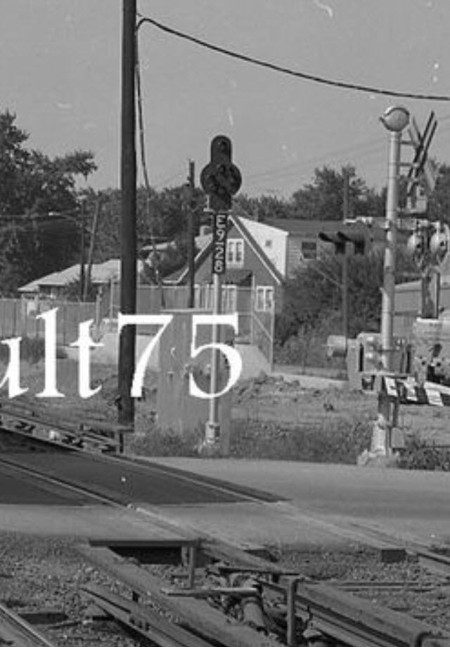
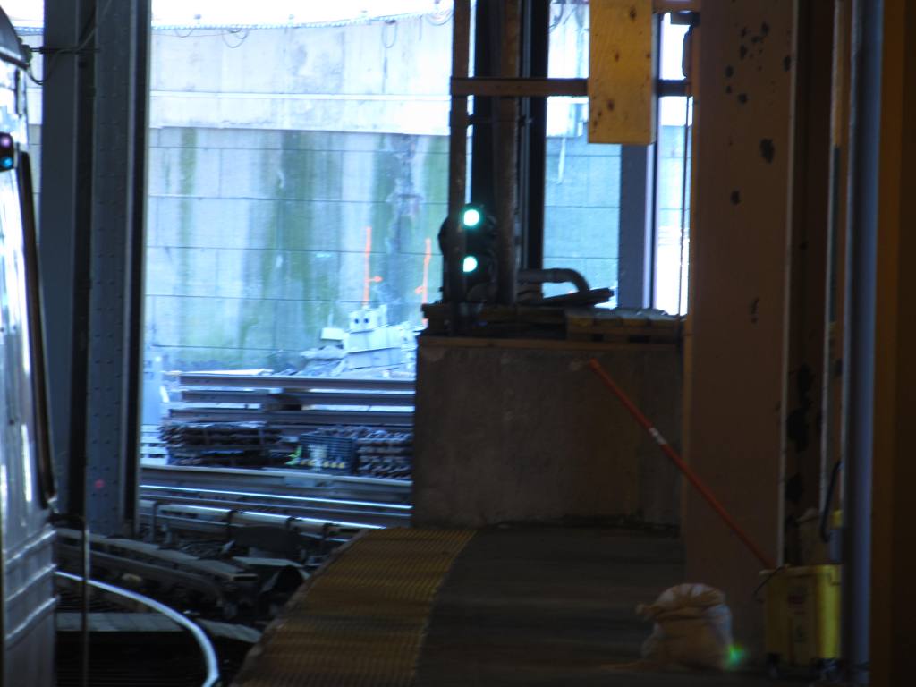
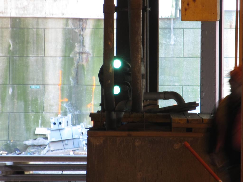
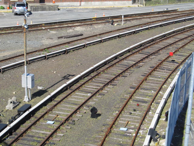
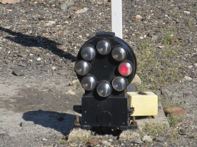
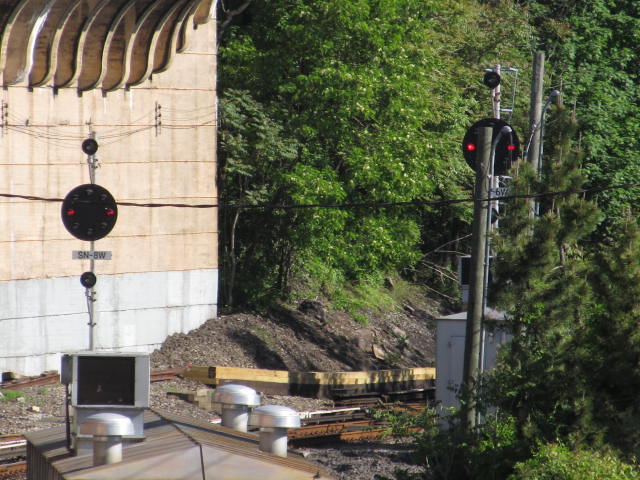
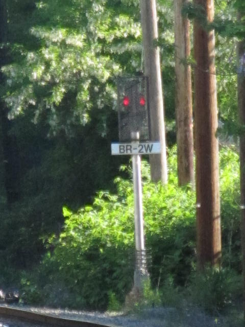
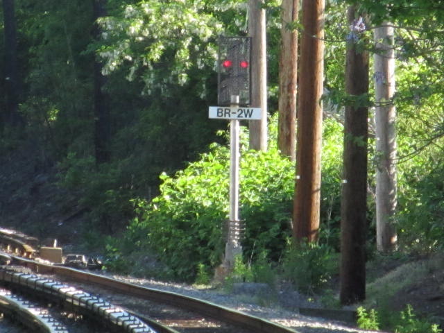
The Staten Island Rapid
Transit uses B&O style CPL (color position light) signals.
Why? At one time, the SIRT was owned by the B&O RR. Their use in
the transit industry is unique, for no-one else in the transit business uses
CPL's as their signals.
There was talk years ago, of replacing the signals, but
so far, they have not. Enjoy them while you can, because this may be
the only place you can go to see them, once CSX wipes them out of existence
on their tracks! :-)
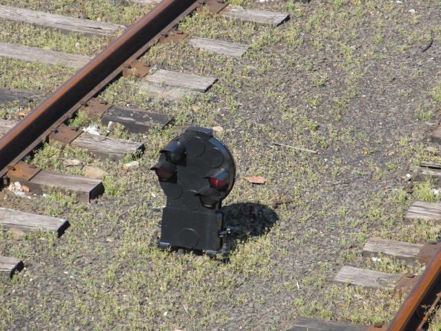
Most, if not all intermediate CPL signals have been
removed, the need for them having been replaced by Automatic Train Control.
Pictures of the signals will be featured where they were
taken.
The two photos below were found on EBay, for slides
that were being sold, sent in by a fellow railfan. These are probably
dated at least to the 50's, before they made the right-of-way grade
separated. The Long Island RR used to have exposed third rails too!
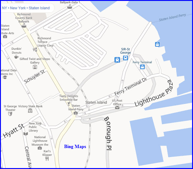
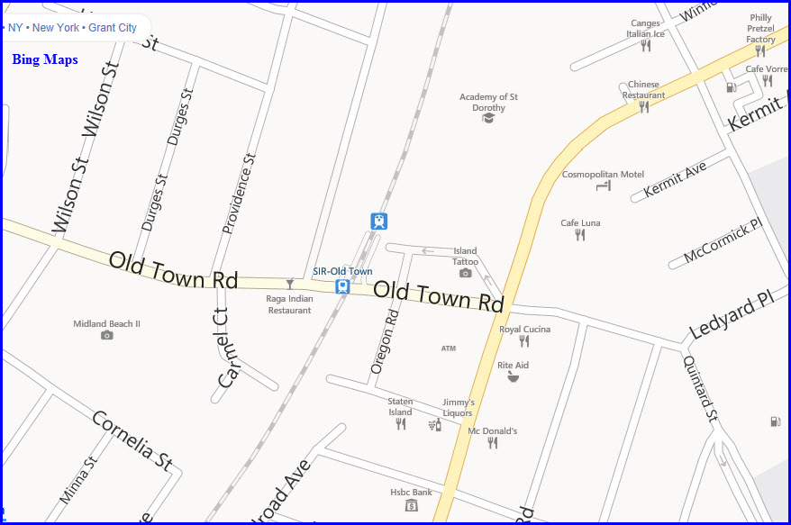
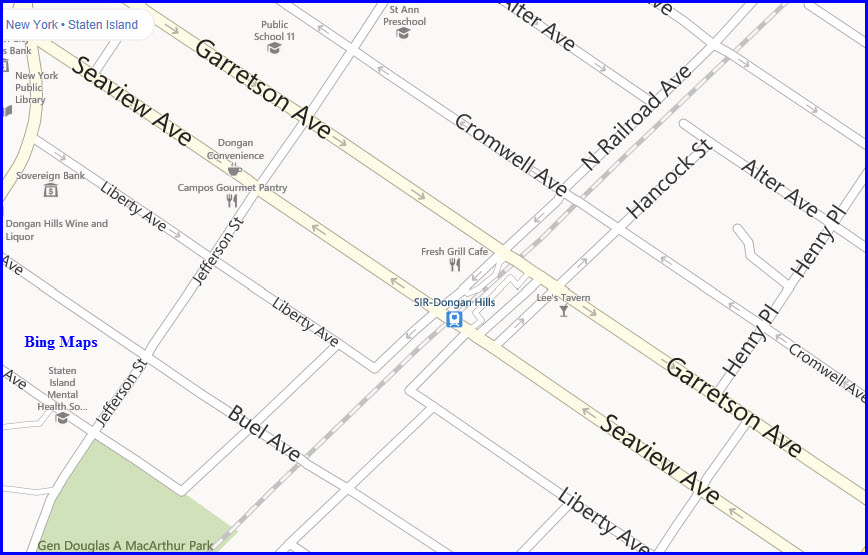
GPS coordinates:
40.642351, -74.075126 The coordinates are for the entrance to the driveway
into the terminal.
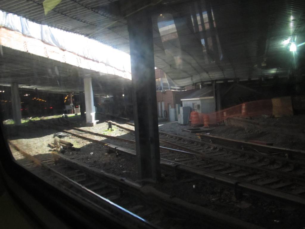
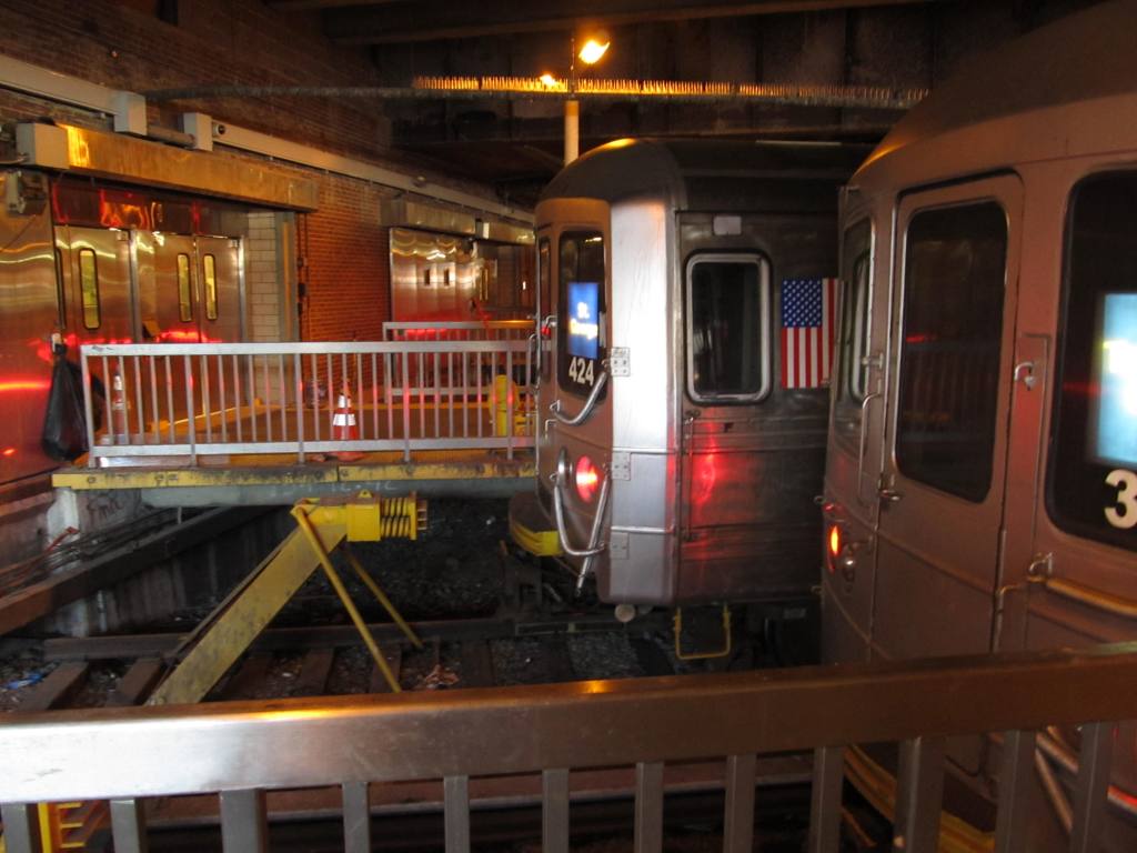
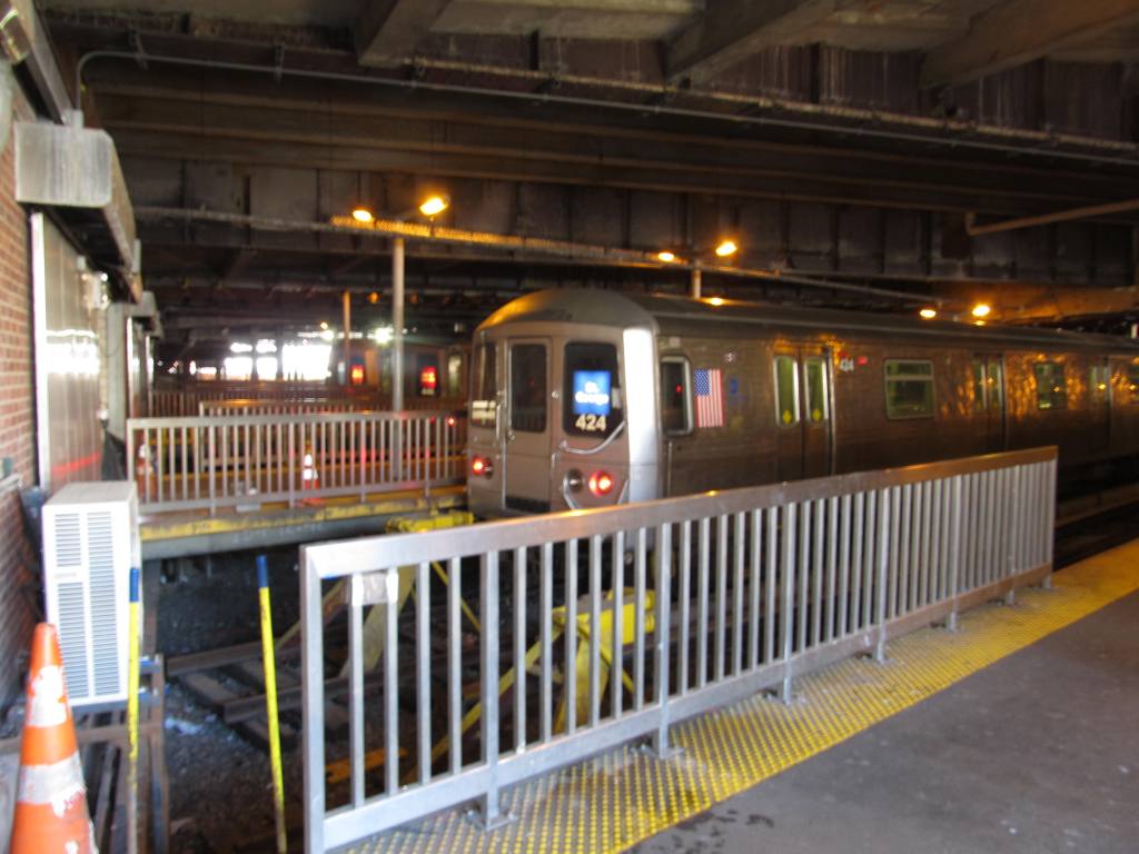
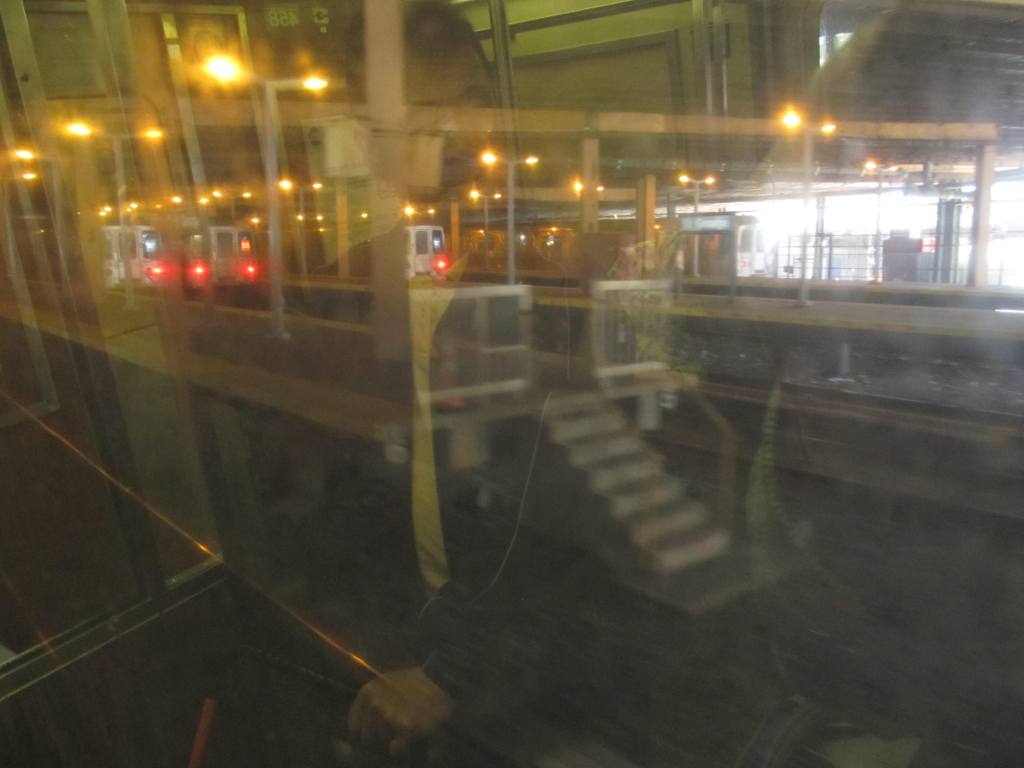
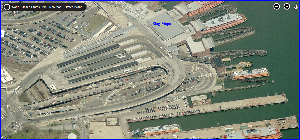
"Underground" at St George
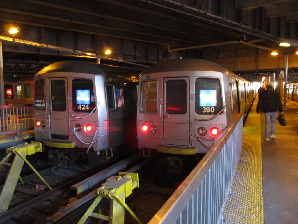
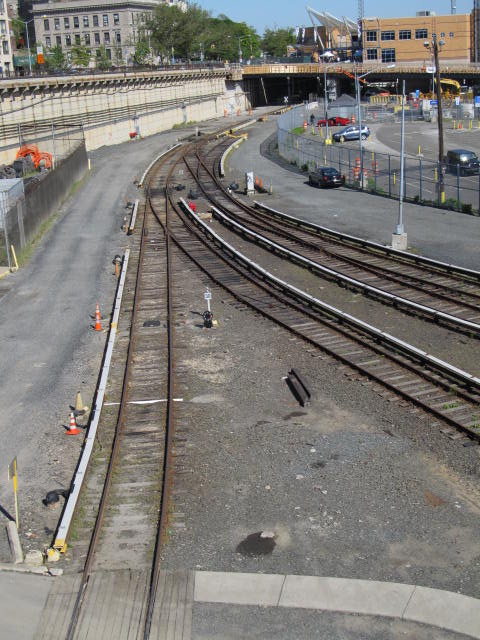
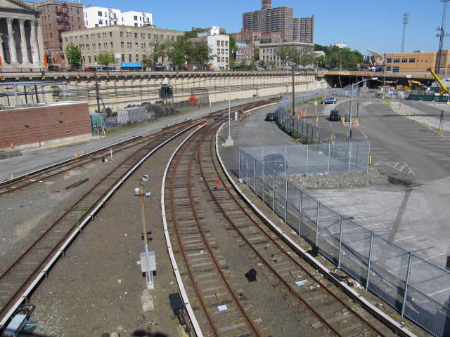
In the yard at St George
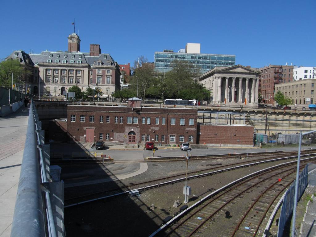
The Terminal
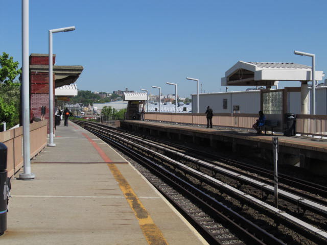
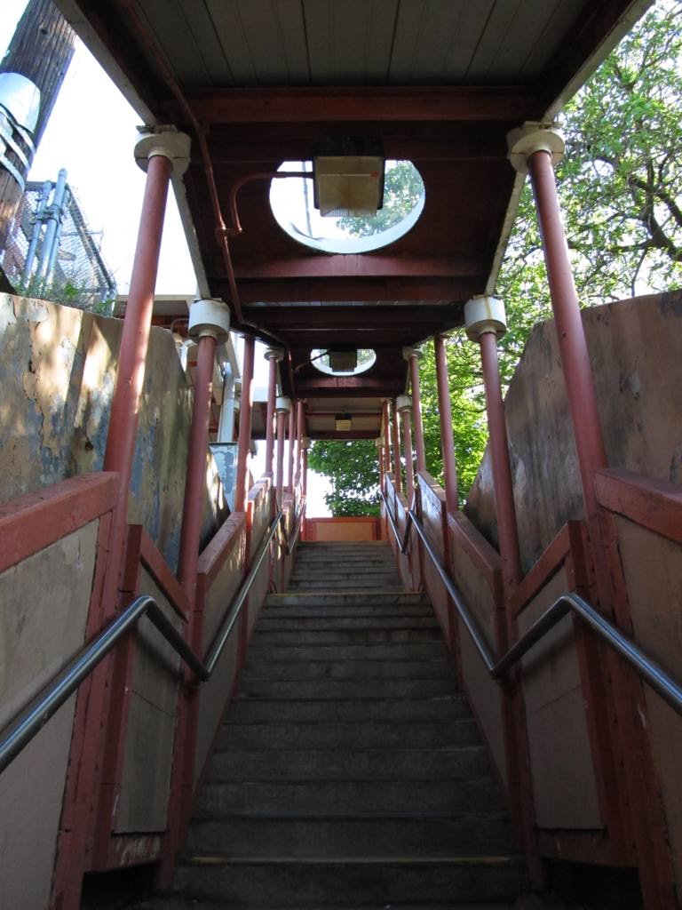
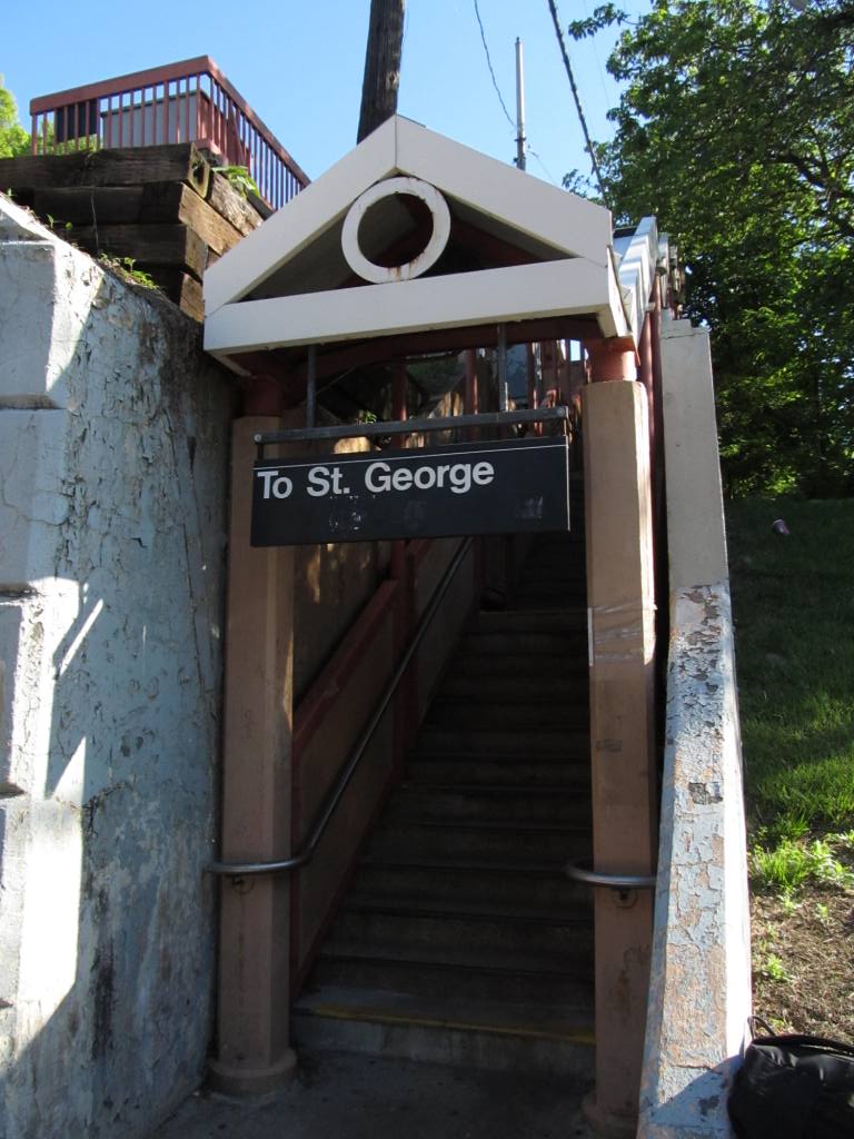
"Topside" at St George
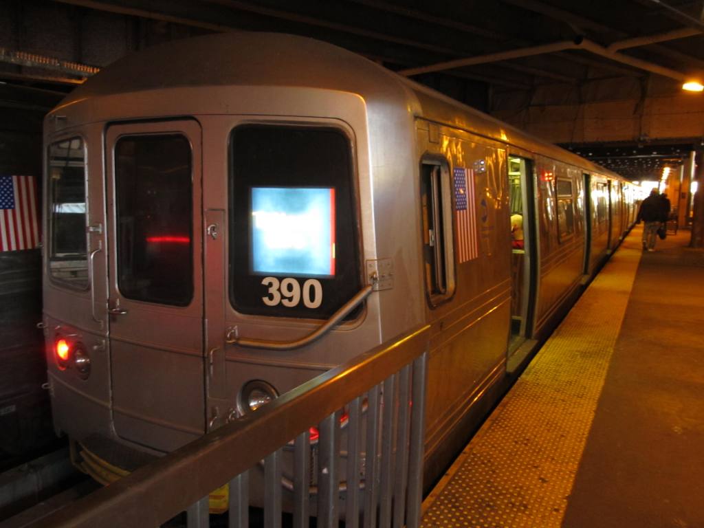
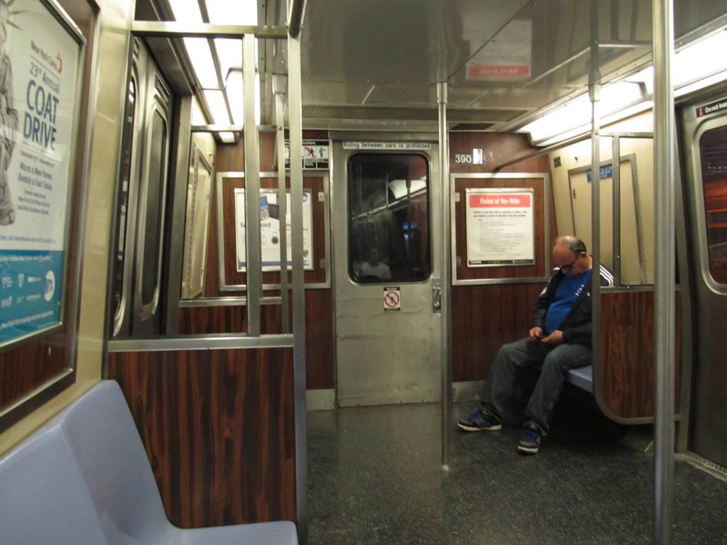
Inside the cars
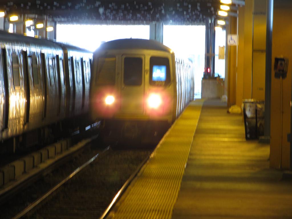
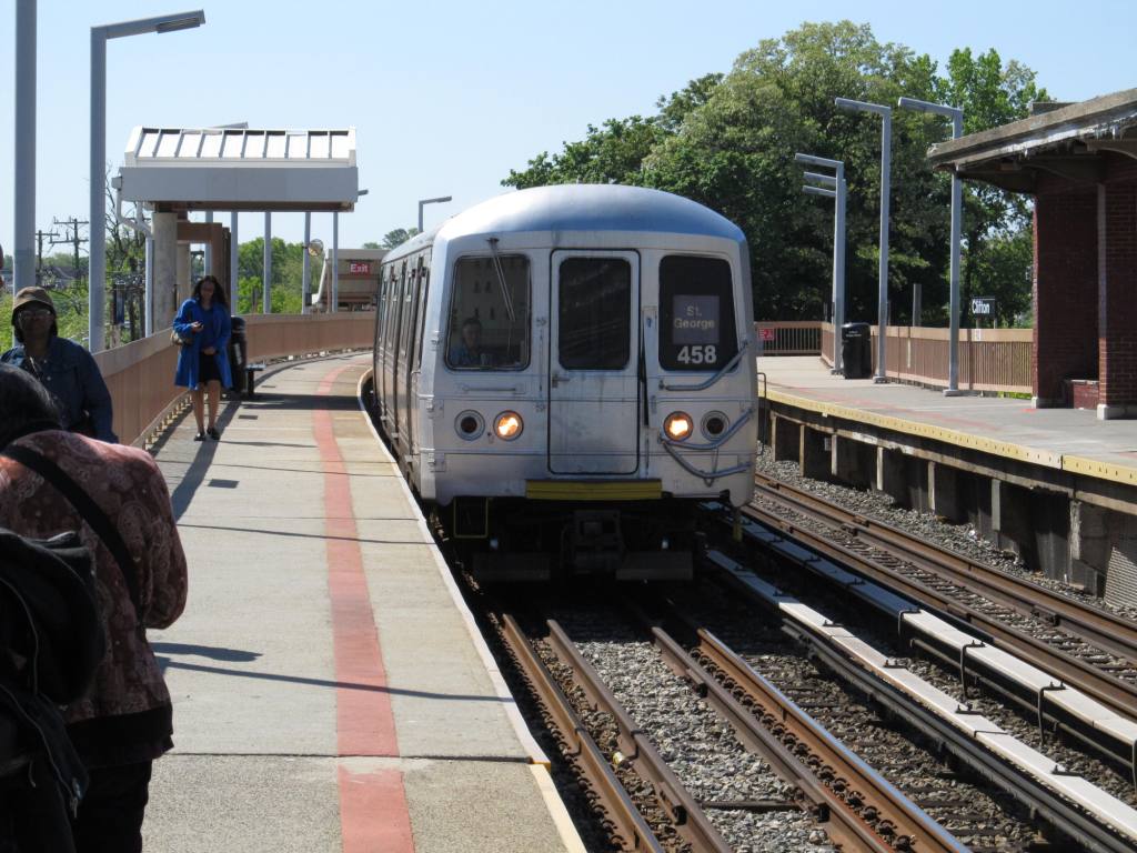
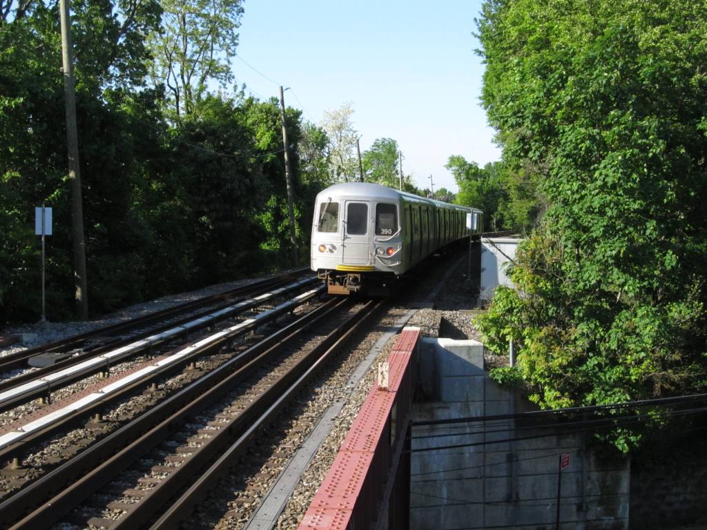
Comin, n
Goin
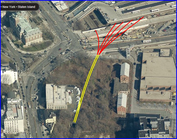
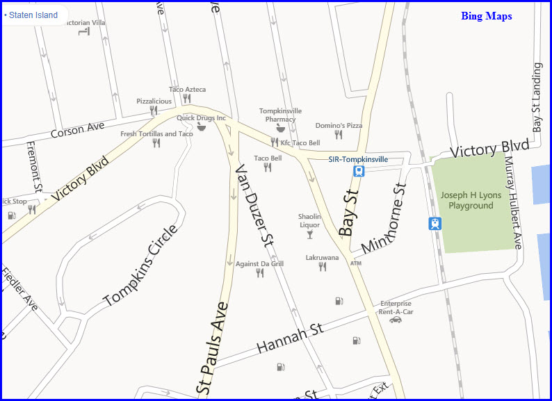
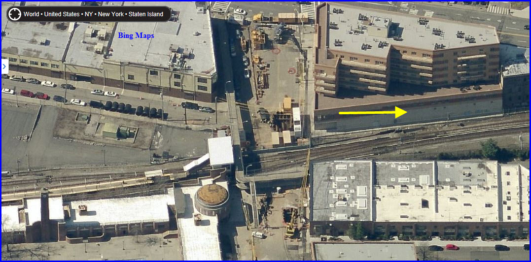
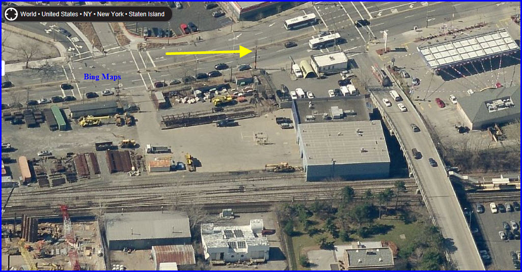
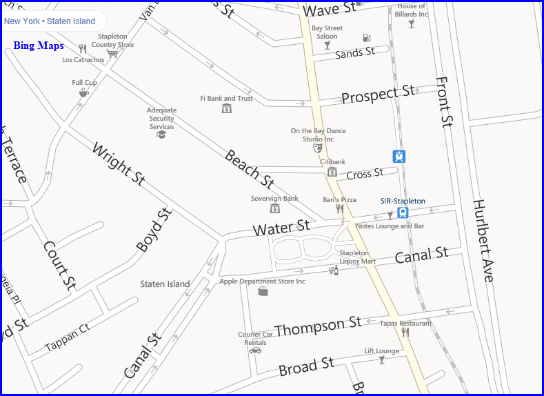
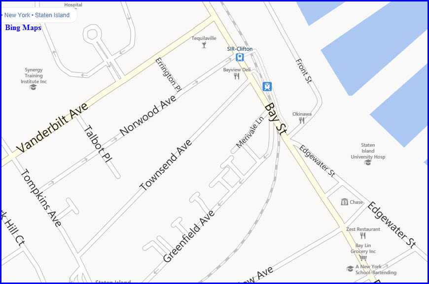
Tunnel
Leading into and out of St George is a short tunnel.
From the north end, you cannot get any shots of the portal. You can get
pictures of the southern portal from the sidewalk along Bay St. Taking a
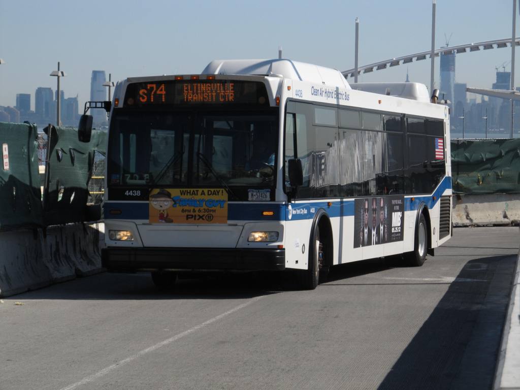
walk from Tompkinsville to St George is a short fun trip, especially if you are
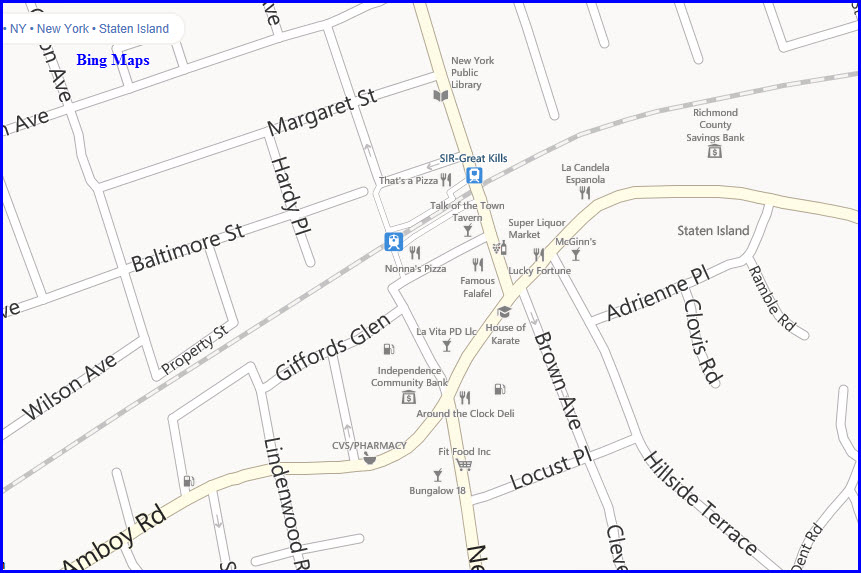
into busses.The actual tunnel is in yellow, the rest of the track that is
covered up by man made stuff is in red.
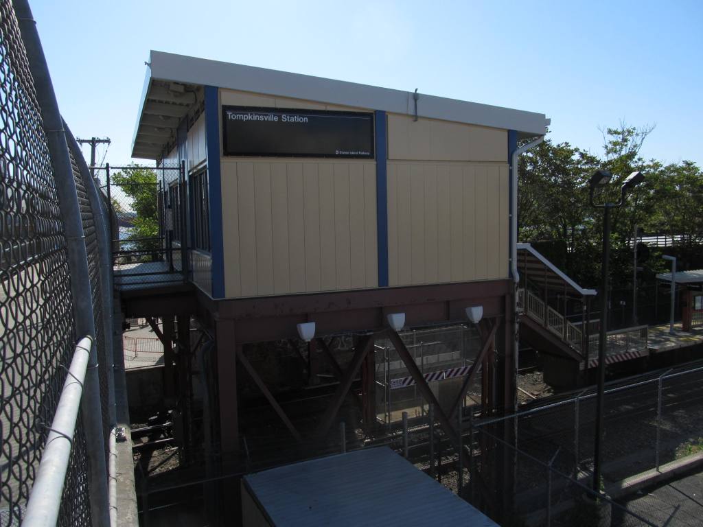
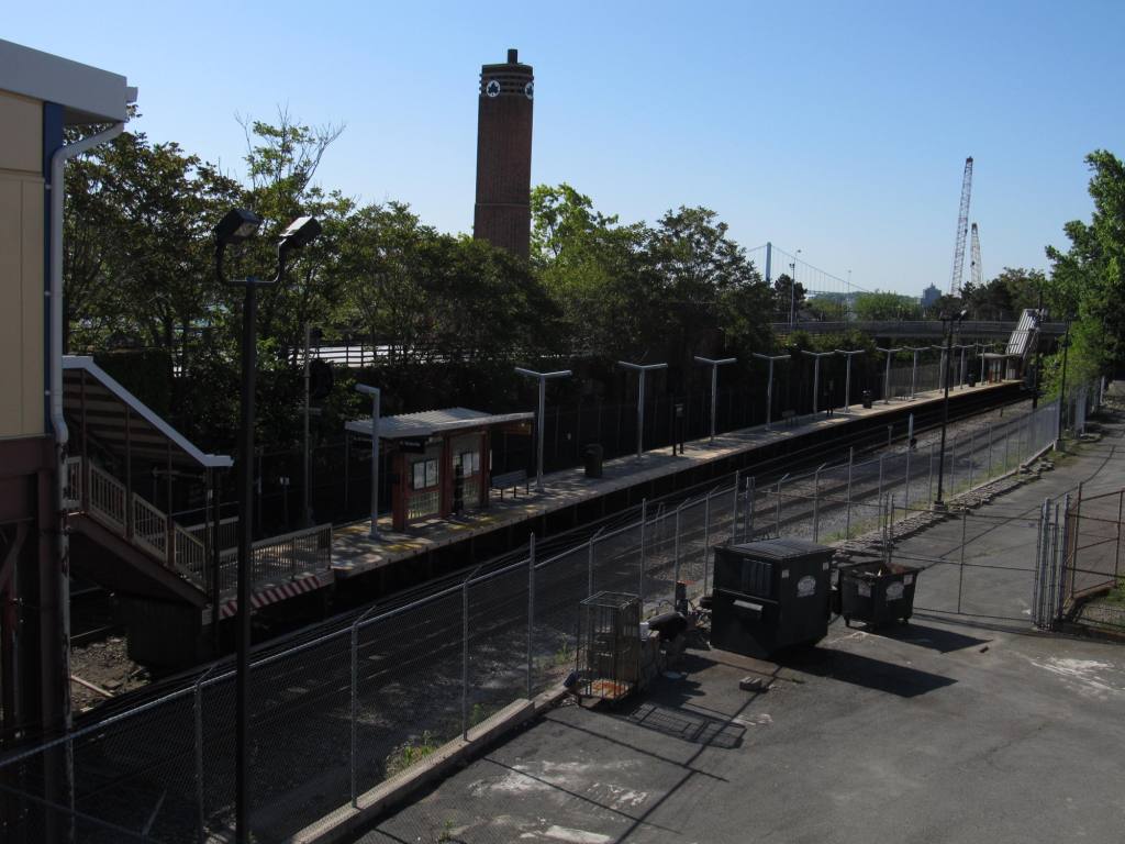
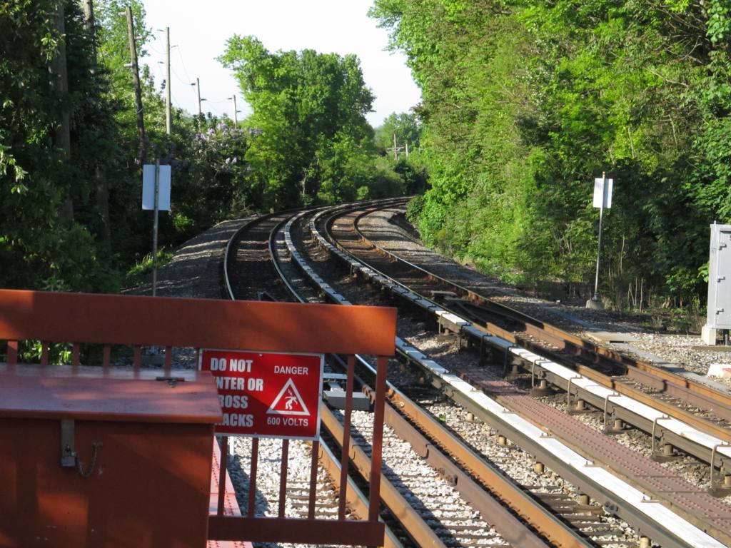
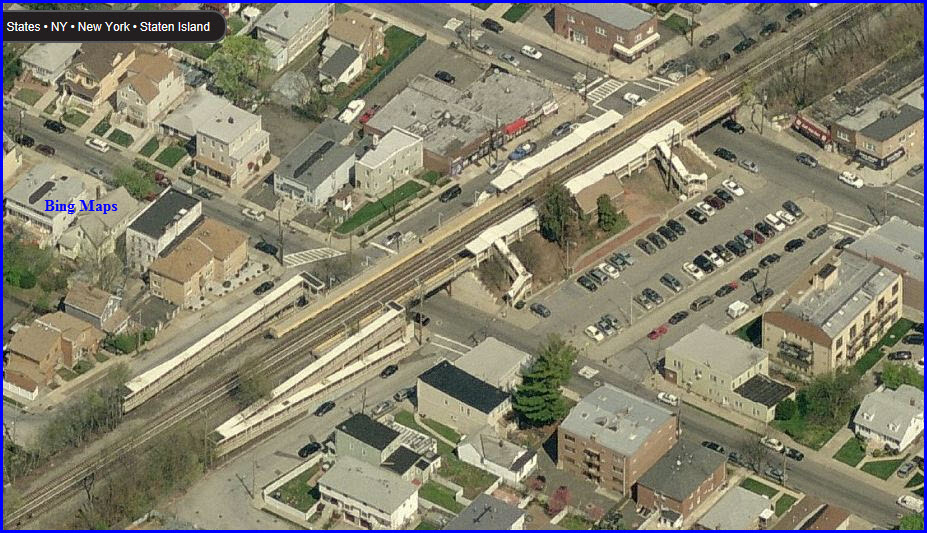
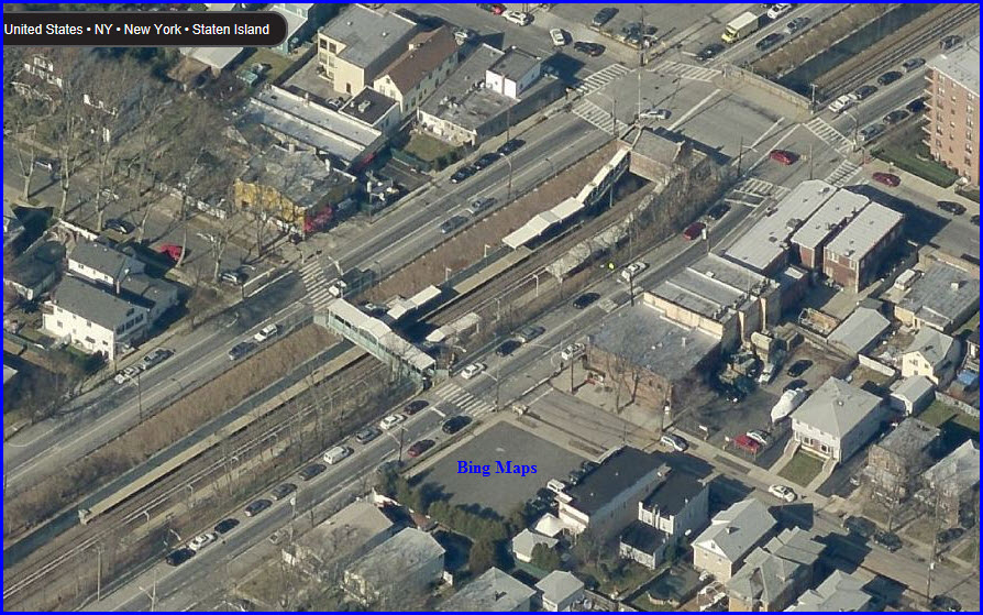
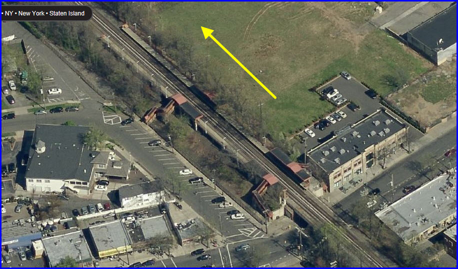
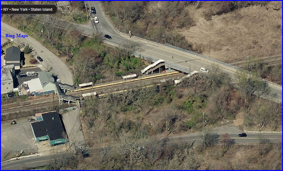
You can
get good shots from the overpasses at either end of the station.
At Tompkinsville, looking north.
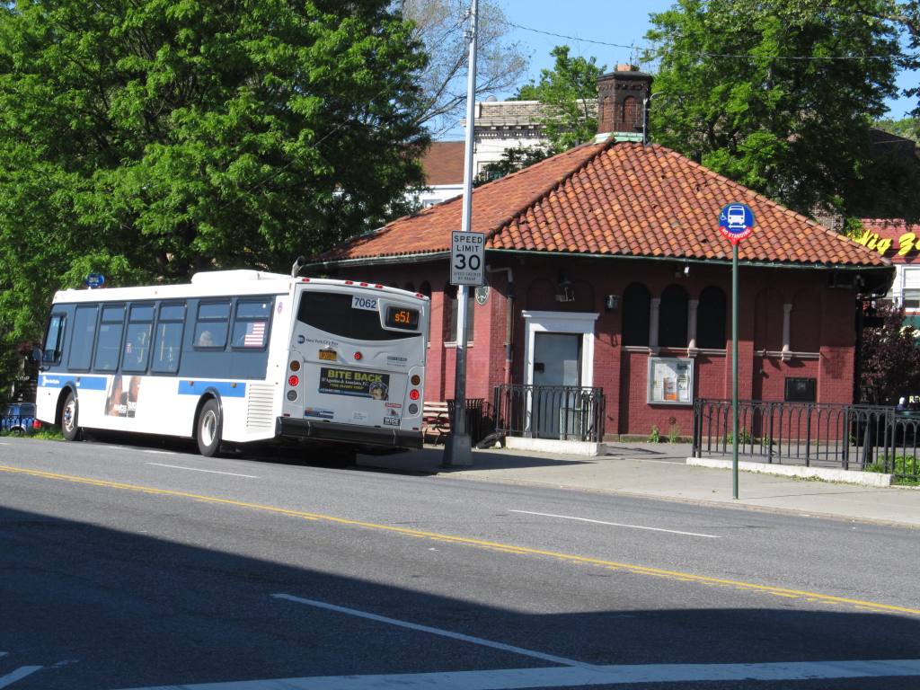
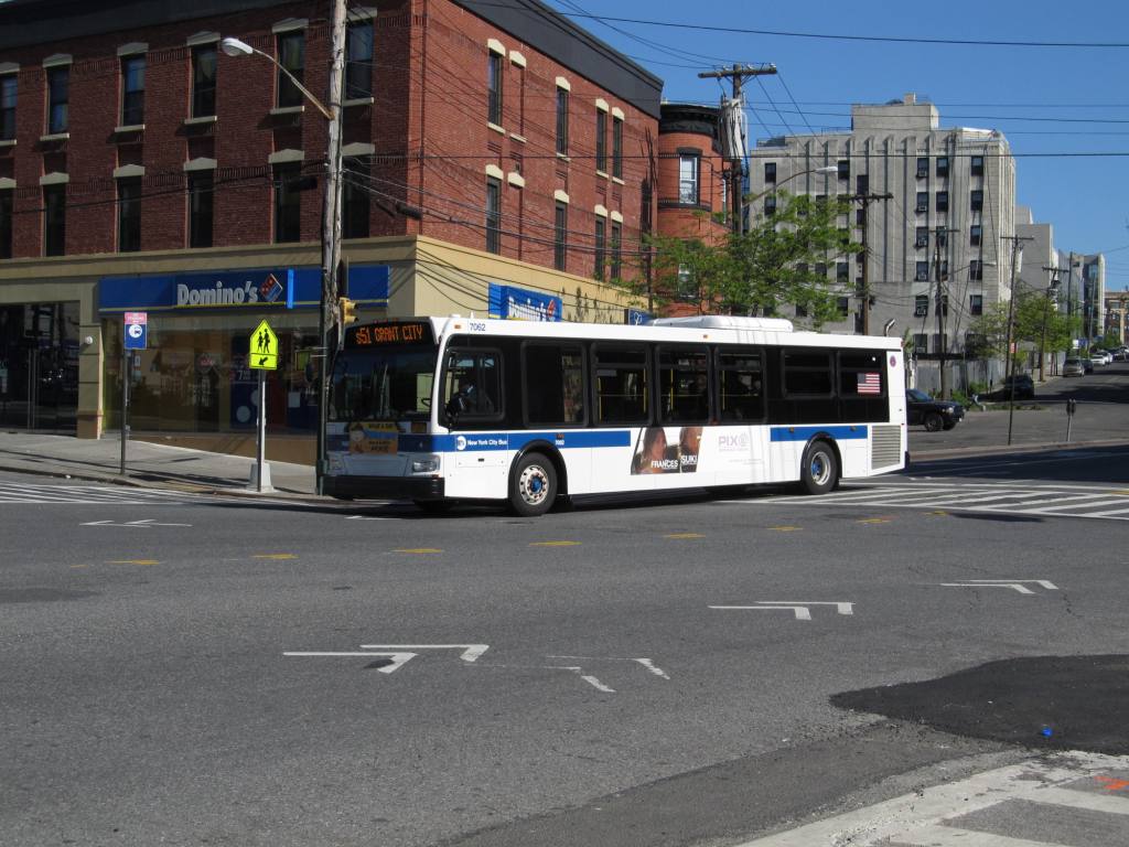
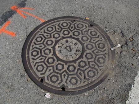
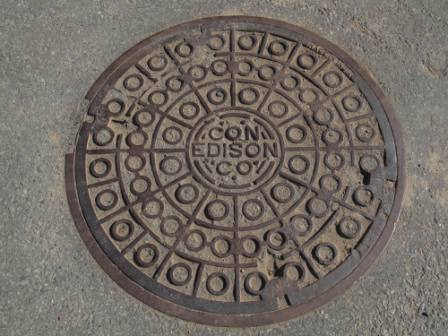
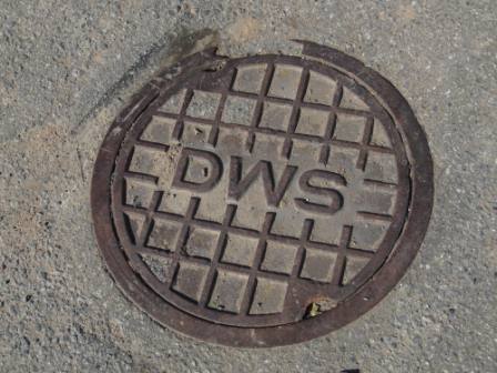
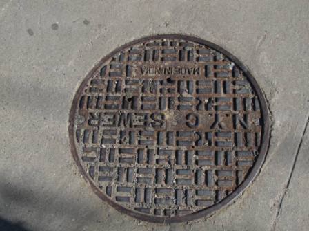
Out on the street, near the station:
And, in case you're wondering? The Bell System is what preceded
Verizon by about 30 years, also called "TPC" (the phone company :-).
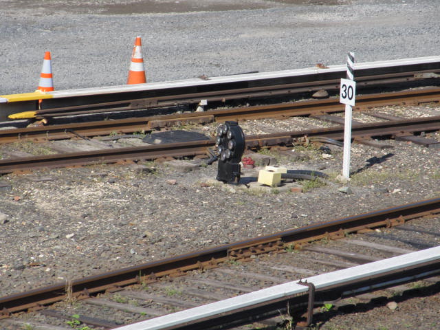
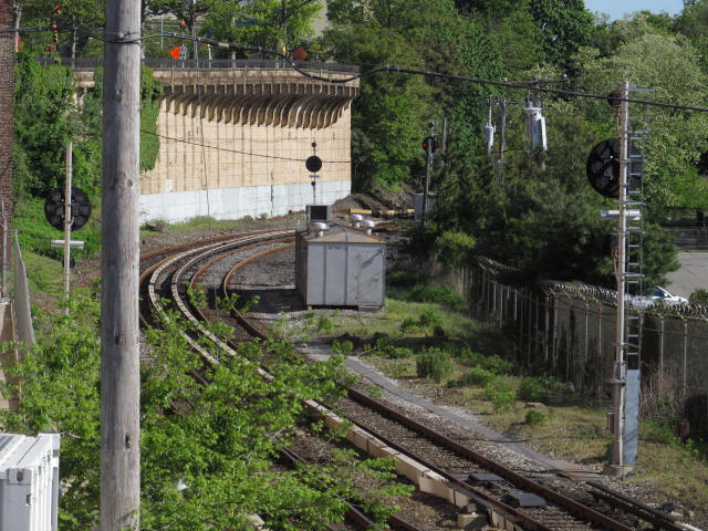
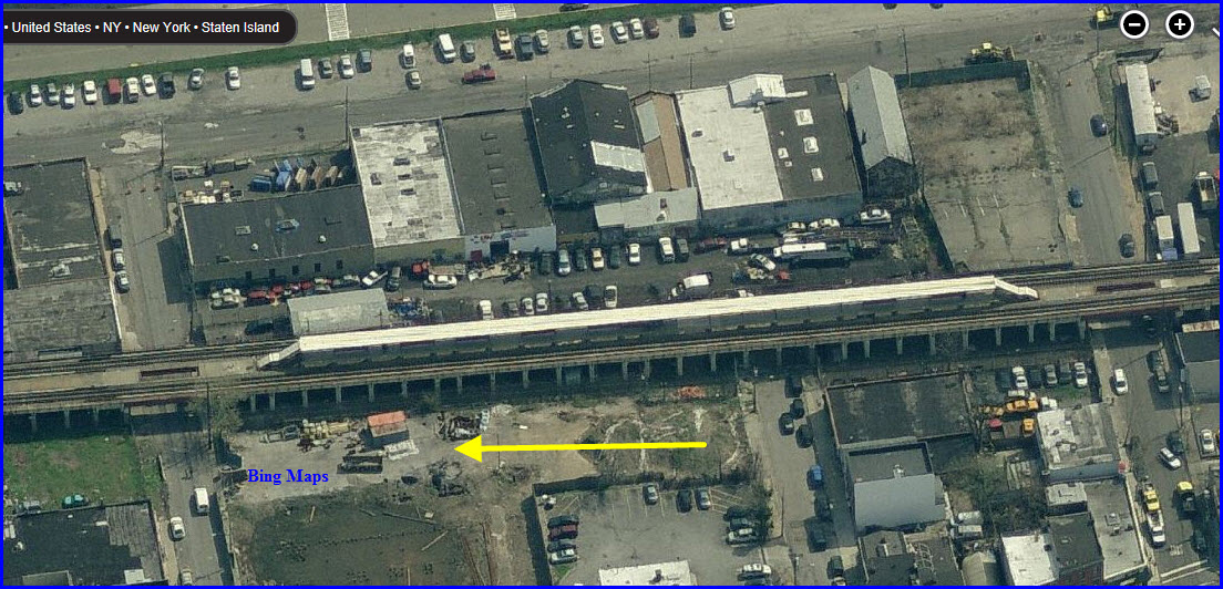
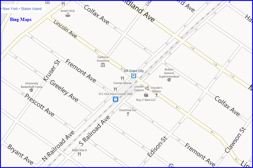
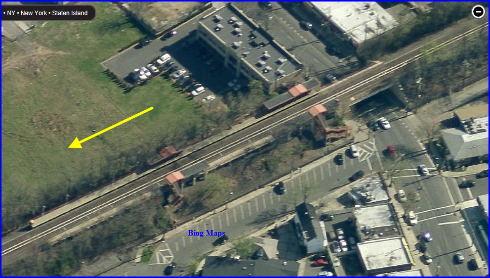
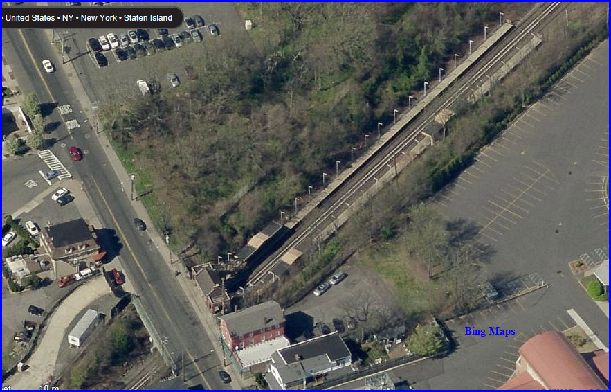
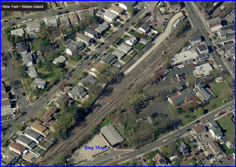
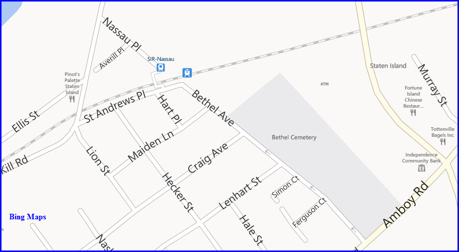
Crossover
In preparation for the MOW lead, there is a crossover
on the north, and south sides of the Tompkinsville station, the first Snag
is the north crossover.
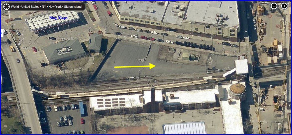
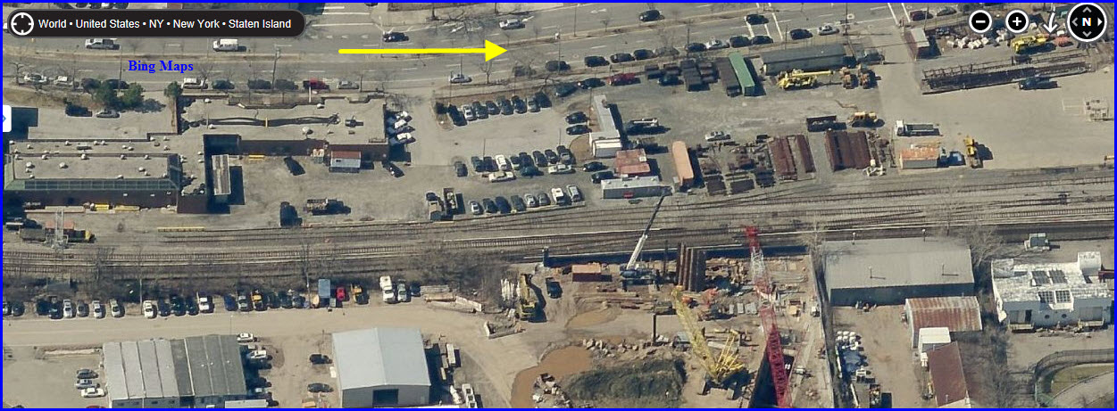
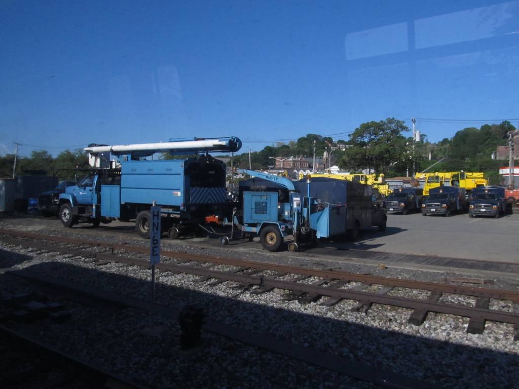
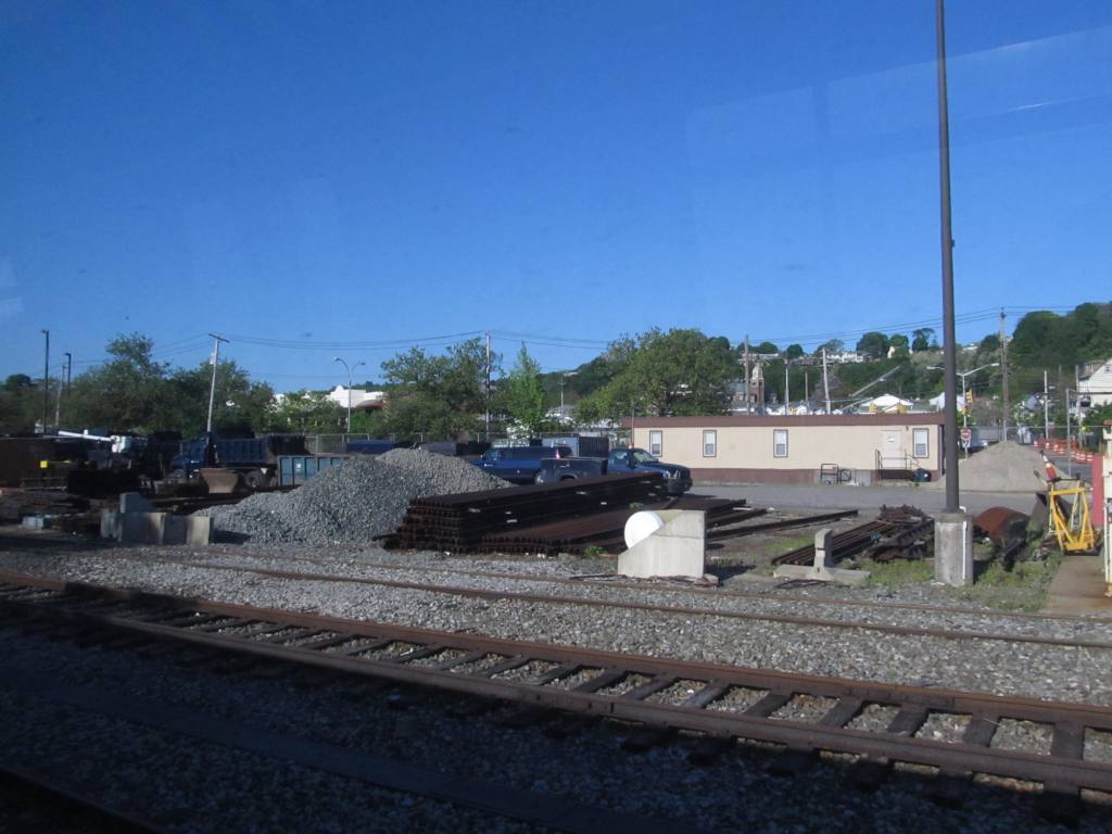
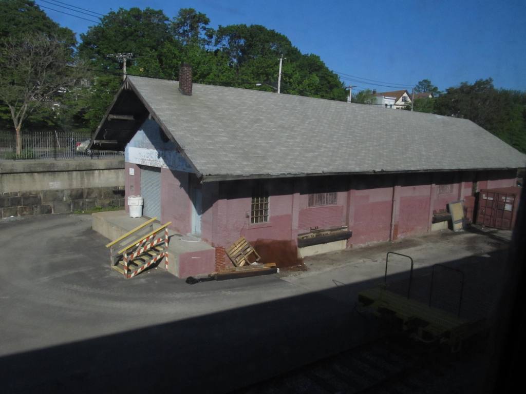
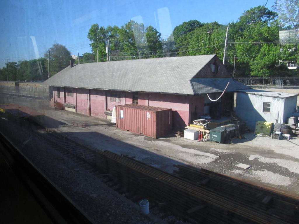
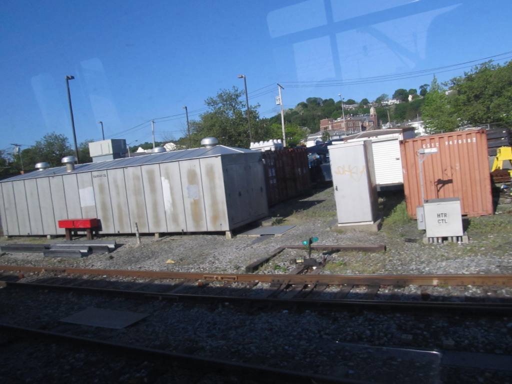
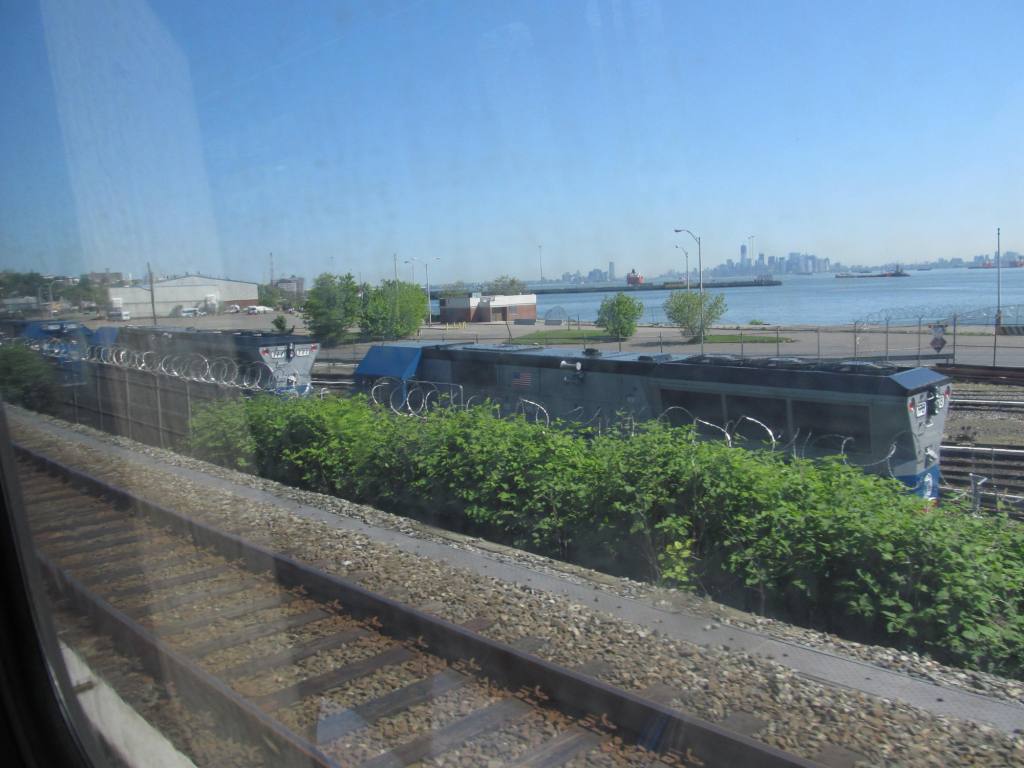
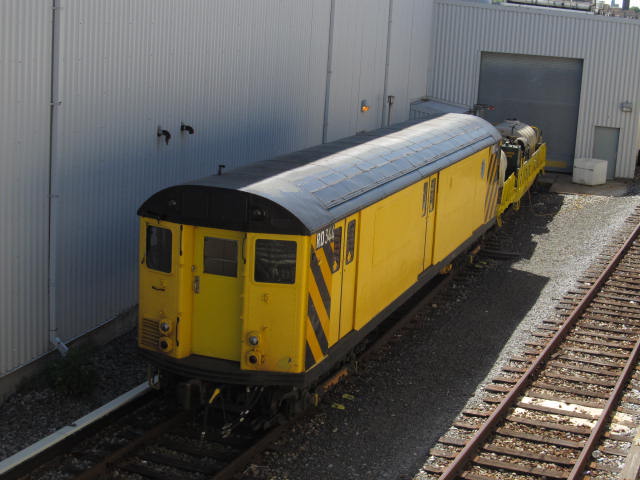
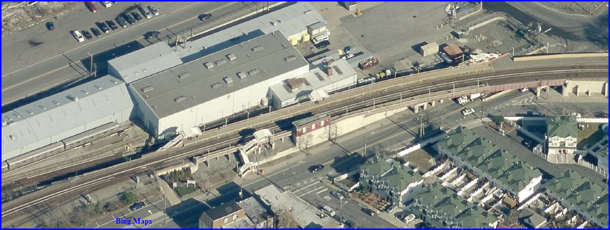
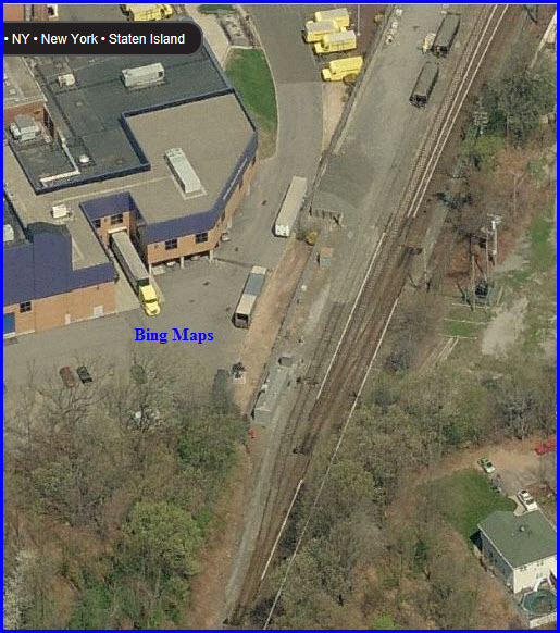
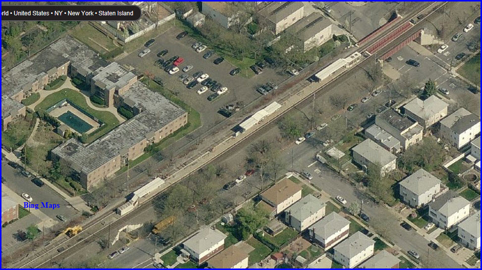
MOW
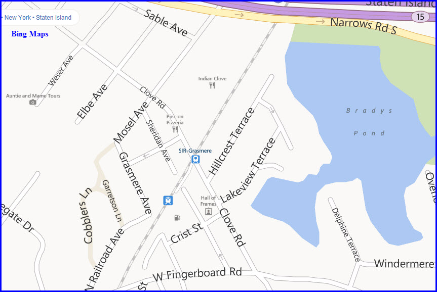
GPS coordinates:
40.635685, -74.075612
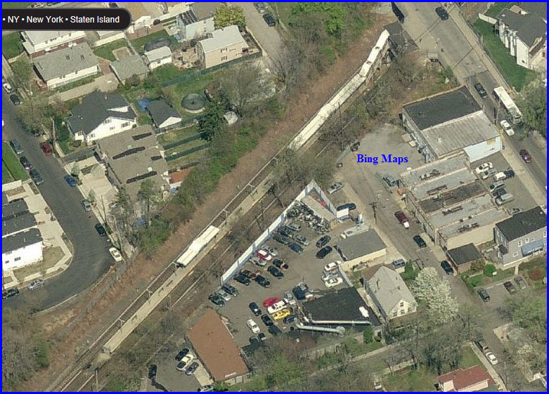
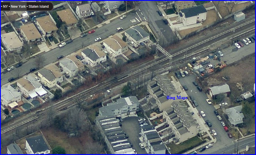
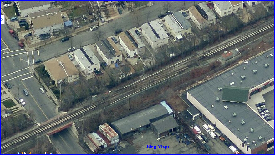
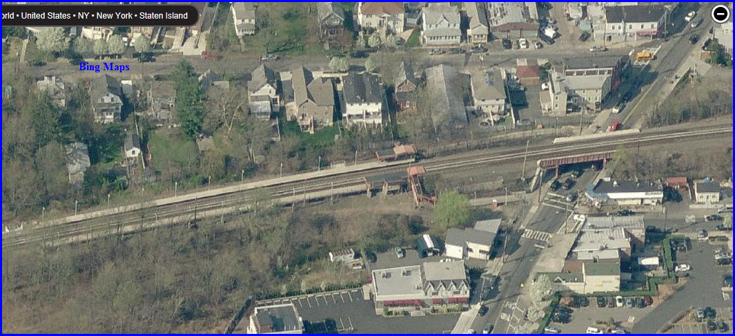
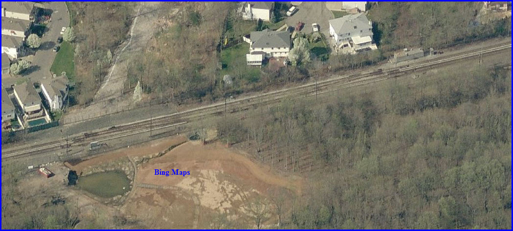
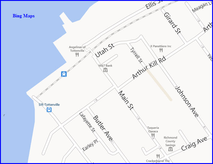
The SIR MOW (Maintenance-of-Way) facility is just south
of the Tompkinsville station.
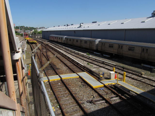
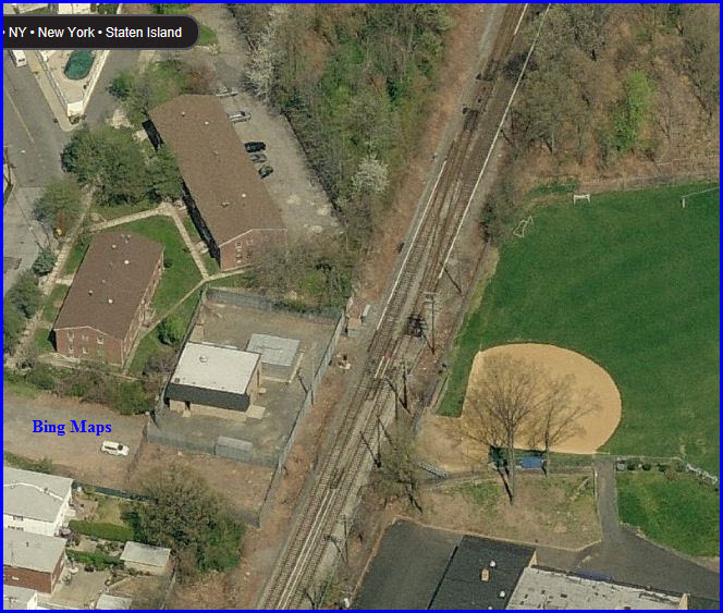
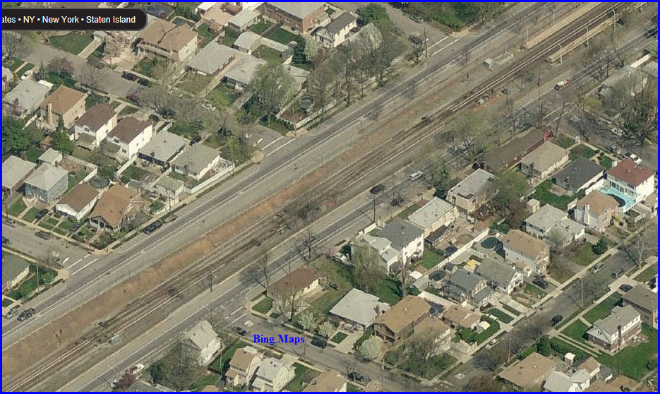
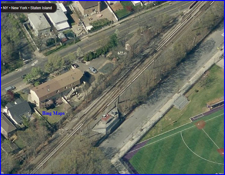
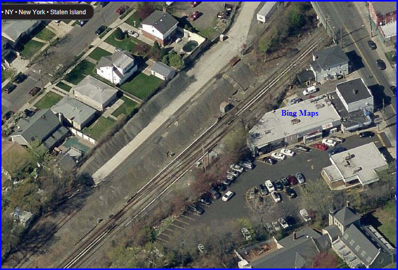
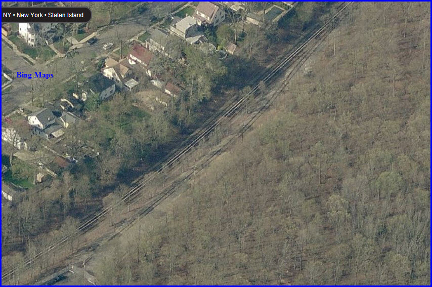
This set of crossovers is separated by several hundred
feet, not their usual style since nothing prevented them from placing them next
to each other. The above siding is also placed here, along with (probably)
the newest signal structure on the system.
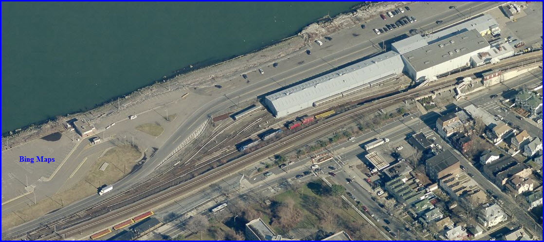
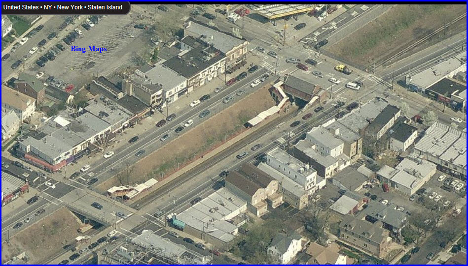
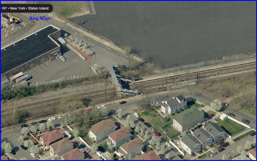
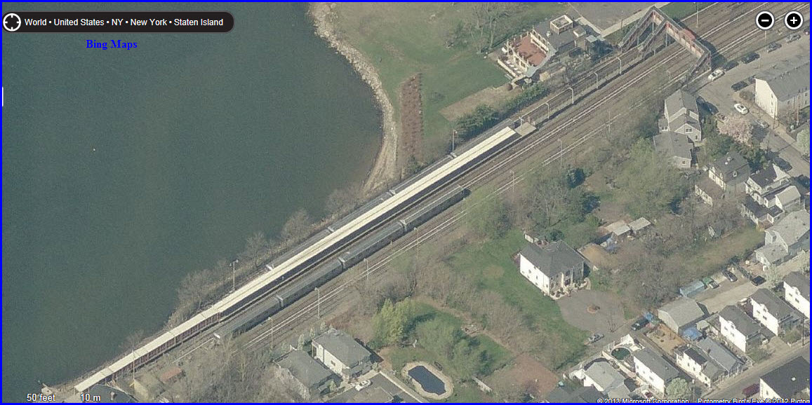
The Bing imagery here suffers a little in detail
compared to the rest of their aerials from Staten Island, and because of
this, the best view was from the other side, so St George is to the left.
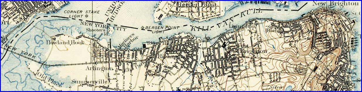
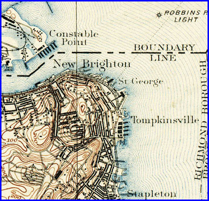
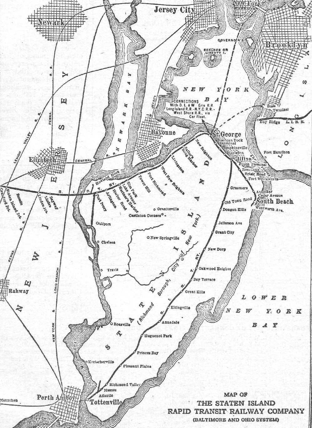
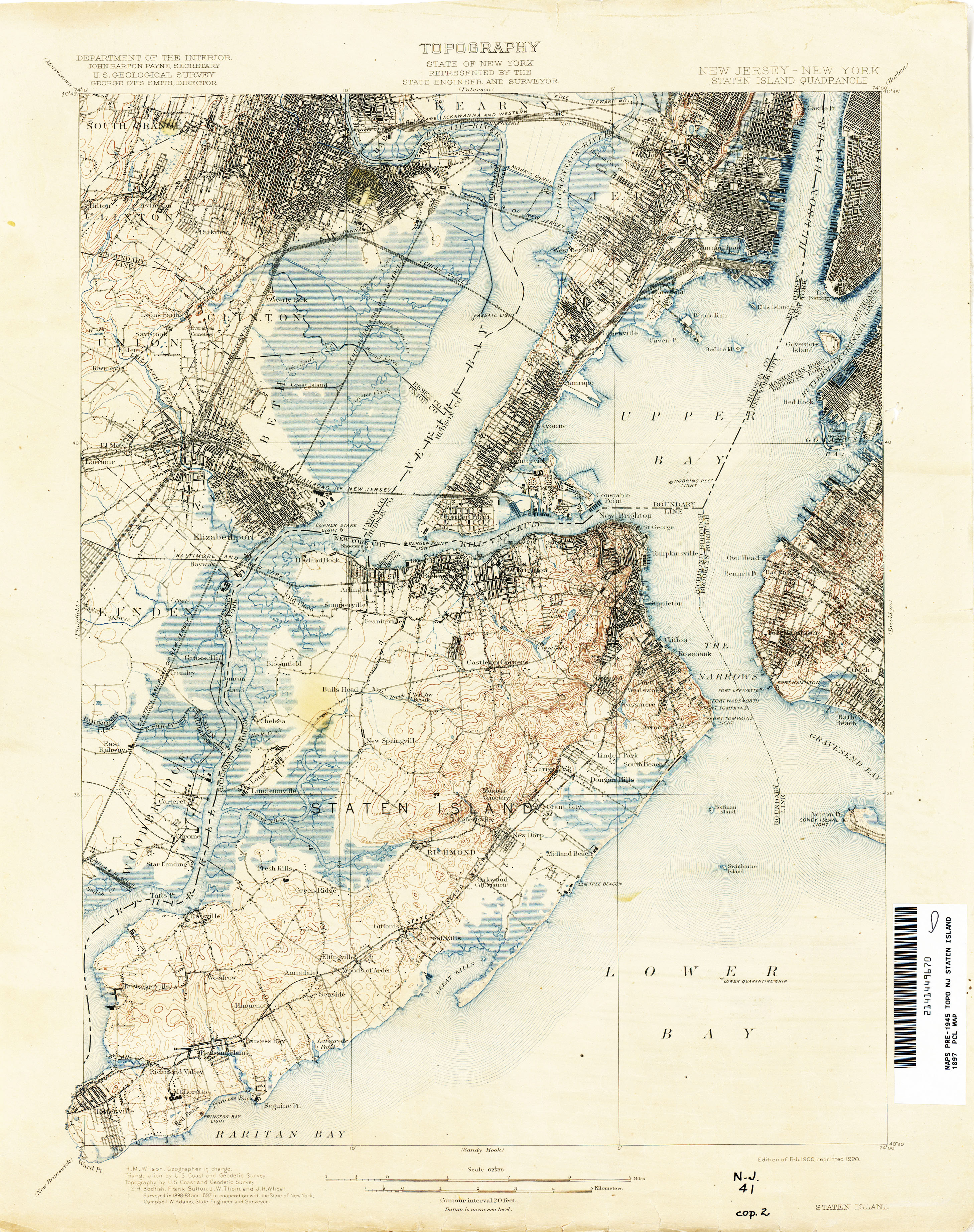
I always like to start off the history section with the
USGS maps, they tell you in pictures what you can't in 1000 words.
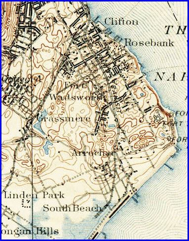
These particular Snags come from the 1897 Staten Island quadrangle.
These maps and more can be found at the
University of Texas website
here
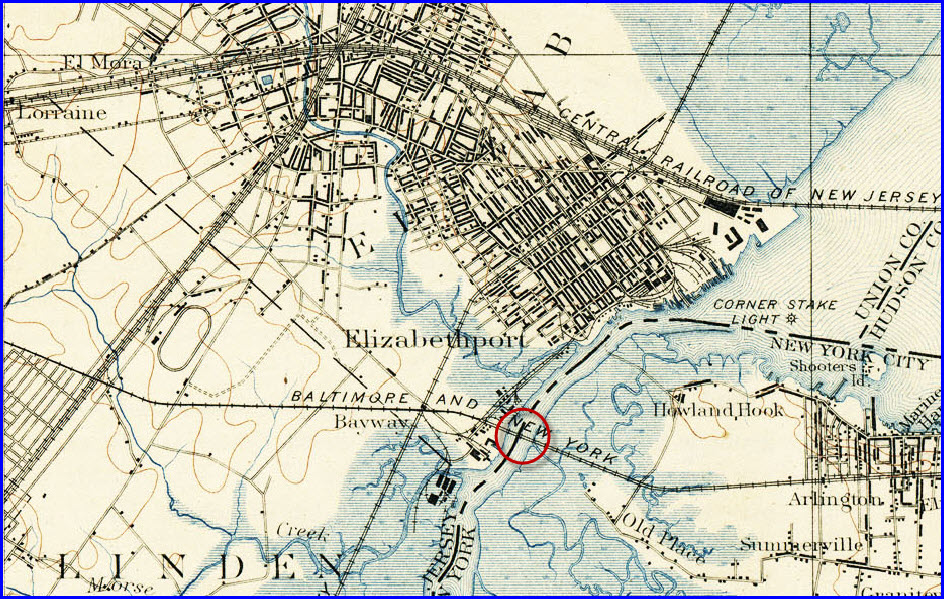
The northern section of the Staten Island Railway.
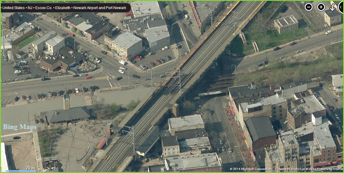
Coming in from New Jersey over the Arthur Kill. How
bout that 4x4 crossover over in Elizabeth!
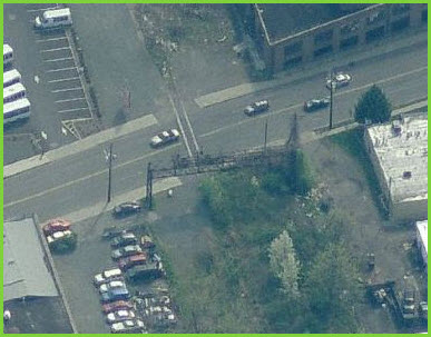
Below, that 4x4 crossover today, from Bing Maps birds eye view... at least
they kept the station :-)
To the west, there is still a signal bridge standing that crossed all four
tracks, can't tell from the aerial view if the signals are still on it.
Detail of the St George terminal area.
The branch going down to South Beach.
Map from 1952
In General
The following history comes from Wikipedia, and as
such, must contain my standard disclaimer: being Wikipedia is what it is,
there may be some information which could be incorrect, not true, wrong, or
other wise misleading. Reader beware. Source:
http://en.wikipedia.org/wiki/Staten_Island_Railway
The least-known borough of
New York City is Staten Island. Geographically, Staten Island is
much closer to New Jersey than to New York, and until the completion
of the Verrazano-Narrows Bridge in 1964 its only direct connection
to the rest of New York — city and state — was ferries from St.
George, at the north end of the island.
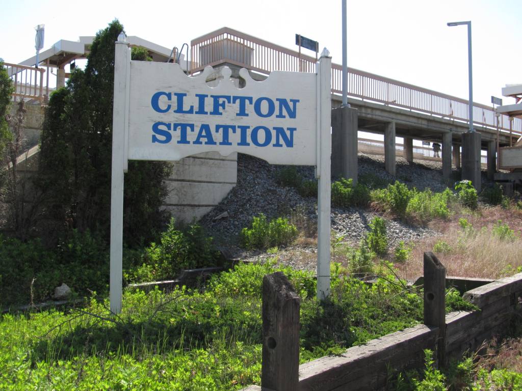
In 1885 the Baltimore & Ohio Railroad (B&O) purchased
the Staten Island Rapid Transit Railway (SIRT), which had a short
line of its own between Tompkinsville and Clifton on the northeast
shore of Staten Island and leased the Staten Island Railway, a line
from Clifton to Tottenville, at its southern tip. (The railway had
been completed in 1860 and was one of Cornelius Vanderbilt's early
properties.) B&O's intention was to build freight and passenger
terminals on Staten Island; purchase of SIRT gave B&O waterfront
property on New York Bay. SIRT built a line west to the Arthur
Kill Bridge in 1889 at the same time the Baltimore & New York
Railroad (B&NY), another B&O subsidiary, constructed a connecting
line from Cranford Junction on the Central Railroad of New Jersey.
SIRT built a short line from Clifton to South Beach in 1892.
In anticipation of a tunnel under the Narrows
to Brooklyn and a connection there with the New York subway system,
SIRT electrified its lines in 1925 using third rail power
distribution and cars similar to those of the Brooklyn–Manhattan
Transit Corporation (BMT). The electrification brought no big
increase in traffic, and the tunnel was never built.
The timetable for 15 October 1940 shows 248
trains leaving St George each weekday (Mon-Fri): 80 to Tottenville,
4 to Great Kills, 82 to South Beach, 79 to Arlington and 3 to Port
Ivory.
In 1944 SIRT purchased property of the B&NY and
merged the Staten Railway. In 1963 the railroad discontinued
its ferry service between Tottenville and Perth Amboy, New Jersey.
The terminal at St. George was destroyed by fire in 1946; a modern
replacement opened in 1951.
On 1 July 1948 bus fare on Staten Island
dropped from 5 cents per zone (20 cents Tottenville to the ferry) to
7 cents for the whole island, or 12 cents including a Manhattan
subway ride. In 1947 SIRT carried 12.3 million passengers; in 1948,
8.7 million; in 1949, 4.4 million.
SIRT discontinued passenger service on the
lines to Arlington and South Beach on March 31, 1953 because of
city-operated bus competition; the South Beach branch was abandoned
shortly thereafter while the Arlington branch continued to carry
freight.
In October 1957, four years after North Shore
Branch passenger trains ended, a train from Washington crossed the
Arthur Kill Vertical Lift Bridge carrying Queen Elizabeth II and
Prince Philip to the Staten Island Ferry for a state visit.
The last railroad crossings were eliminated by
1966, but SIRT continued to lose money. On January 1, 1970,
New York City's lease of the St. George-Tottenville line was
terminated; after that date the city reimbursed the railroad for its
passenger deficits. On July 1, 1971 operation of the
Tottenville line was turned over to the Staten Island Rapid Transit
Operating Authority, a division of the state's Metropolitan
Transportation Authority, and the line itself was purchased by the
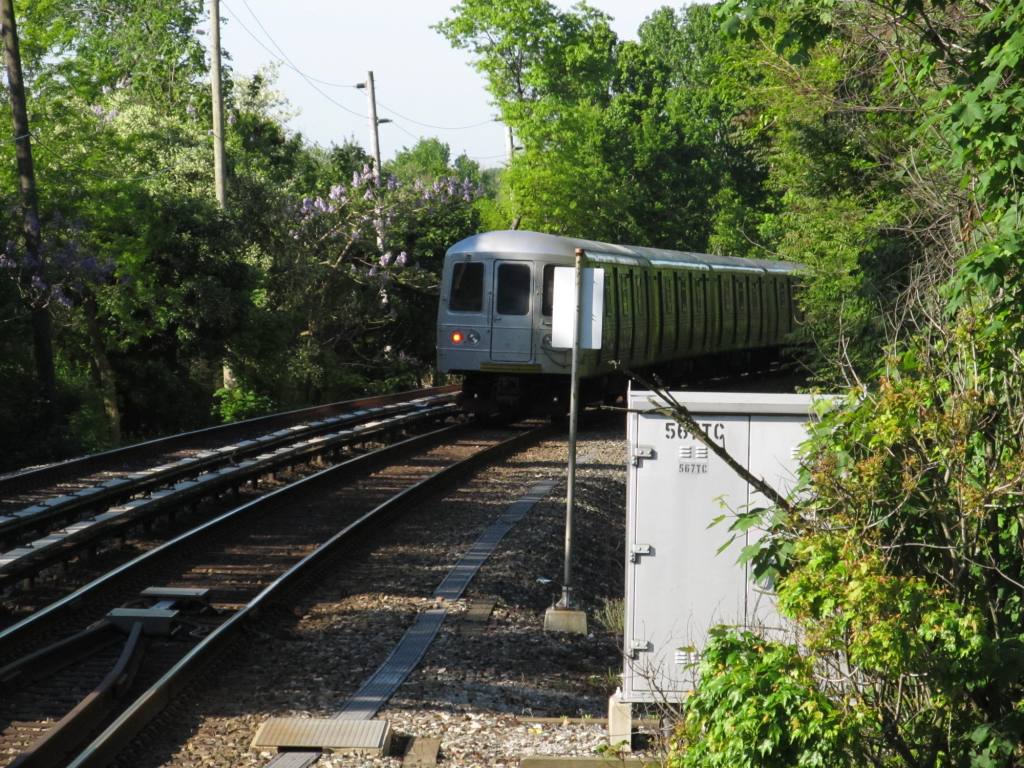
city of New York. In March 1973 new R44 cars -- the same as the
newest cars then in use on the subway lines in the other boroughs --
were pressed into service on the Staten Island line, replacing the
PS Standard rolling stock that had been inherited from the B&O and
had remained in continuous service since 1925.
Passenger Service
Today, only the north-south Main Line is in
passenger service. The terminal station at St. George provides
a direct connection to the Staten Island Ferry. At St. George
there are twelve tracks, only ten of which are presently used for
service. At Tottenville there is a three track yard, with two
tracks on either side of a concrete station platform.
Schedules are made by NYCT's Operations
Planning unit.
The last passenger trains on both the North
Shore and South Beach Branches ran on March 31, 1953. The
right-of-way of the South Beach Branch was eventually de-mapped and
the tracks have been removed.
The North Shore and Travis Branches saw freight
service temporarily suspended beginning in 1991. Freight
service along the Travis Branch and the westernmost portion of the
North Shore Branch was restored by 2007. Along the remainder
of the North Shore Branch, tracks and rail overpasses still exist in
some places. In 2001, a small section of the easternmost
portion of the North Shore Branch (a few hundred feet) was reopened
to provide passenger service to the new Richmond County Bank
Ballpark, home of the Staten Island Yankees minor-league baseball
team; however, this service was discontinued in 2009.
Plans to reopen the remainder of the North
Shore Branch, to both freight and passenger service, are being
studied, with one plan calling for the line to resume full
operations between St. George and Arlington or Port Ivory, with even
the possibility of through service between Arlington/Port Ivory and
Tottenville, which the aforementioned Ballpark wye makes feasible
(this did not exist prior to the 1953 discontinuance of passenger
service on the North Shore Branch).
Freight
Service
The railroad was changed to Staten Island
Railroad Corporation in 1971. In 1985 Staten Island Railroad
was purchased by the Delaware Otsego Corporation.
Freight traffic dropped off considerably, and the operation ceased
in 1991. The freight line connection from New Jersey to the
Staten Island Railway was restored in late 2006, and is operated in
part by the Morristown and Erie Railway under contract with the
State of New Jersey and other companies. The Arthur Kill
Vertical Lift Bridge which transports trains from Staten Island to
New Jersey over the Arthur Kill waterway was renovated in 2006 and
began regular service on April 2, 2007, 16 years after the bridge
closed. A portion of the North Shore of the Staten Island
Railway was rehabilitated, the Arlington Yard was expanded, and
6,500 feet (1,981 m) of new track was laid along the Travis Branch
to Fresh Kills. Soon after service restarted on the line Mayor
of New York City Michael Bloomberg officially commemorated the
reactivation on April 17, 2007. On behalf of the City of New
York, the New York City Economic Development Corporation formed an
agreement with CSX Transportation, Norfolk Southern Railway, and
Conrail to provide service over the reactivated line to haul waste
from the Staten Island Transfer Station and ship container freight
from the Howland Hook Marine Terminal and other industrial
businesses.
FRA Oversight
Unlike PATH, SIR is not under FRA oversight,
except for the separate restored freight service.
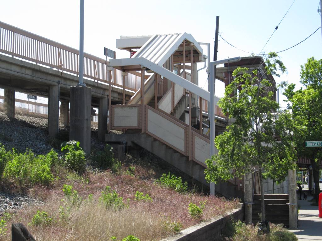
Physical Plant
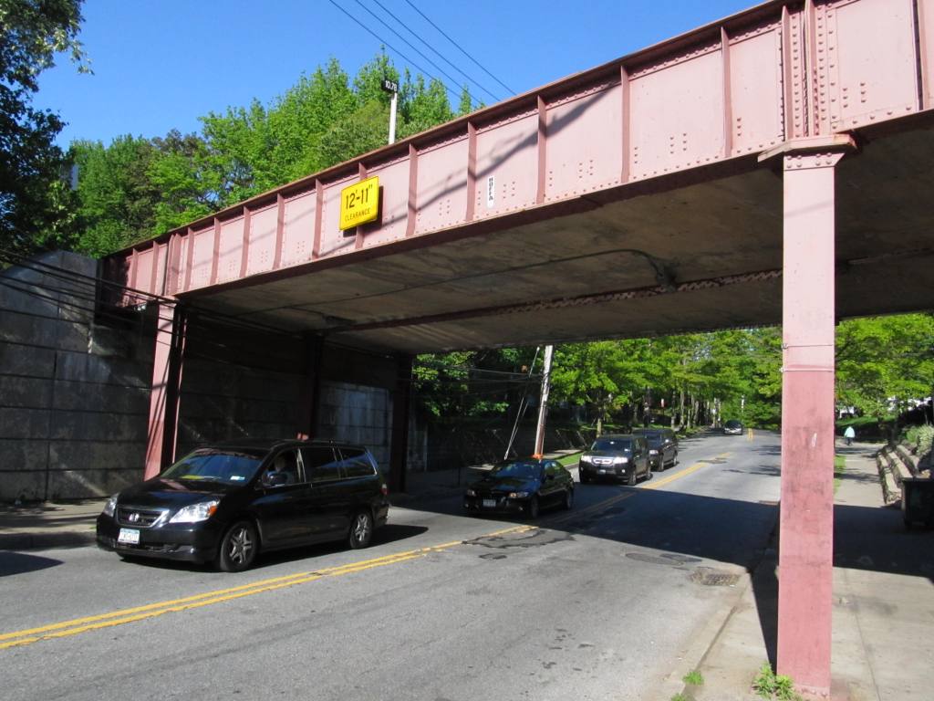
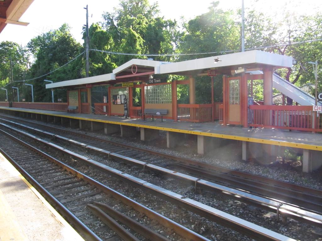
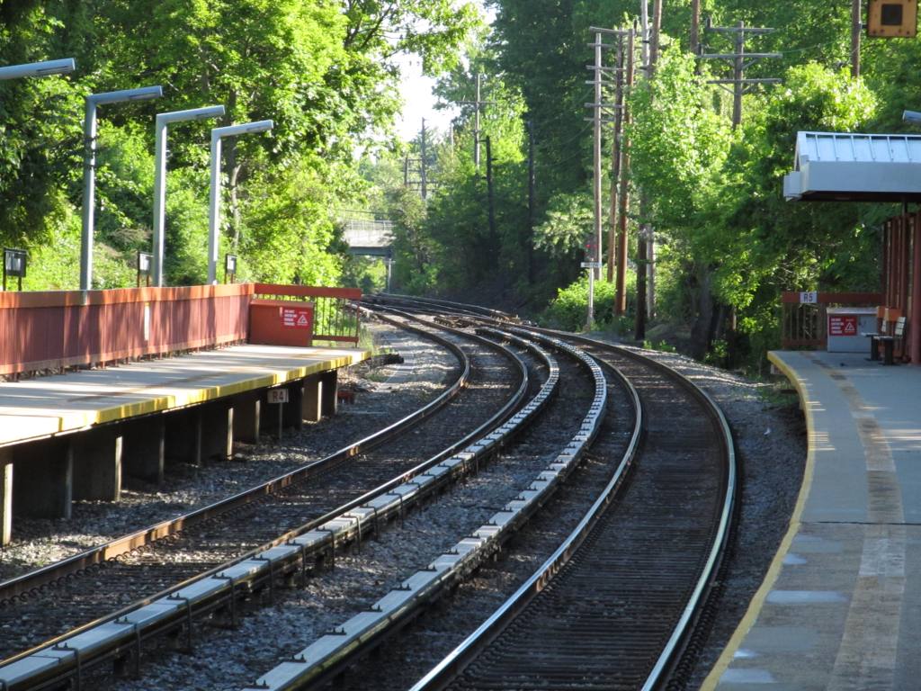
In general appearance, the current operating
line of SIR looks somewhat like an outdoor line of the New York City
Subway. Since the 1960s it has been grade separated from all
roads, but it runs more or less at street level for a brief stretch
north of Clifton, between the Grasmere and Old Town stations, and
from south of the Pleasant Plains station to Tottenville, the end of
the line. It uses NYC Transit-standard 600 V DC third rail
power. Its equipment is specially modified subway vehicles,
purchased at the same time as nearly identical cars for NYCT.
Heavy maintenance of the equipment is performed at the NYCT's
Clifton Shops. Any work that cannot be performed at Clifton
requires the cars to be trucked over the Verrazano-Narrows Bridge to
the subway's Coney Island Complex shops in Brooklyn.
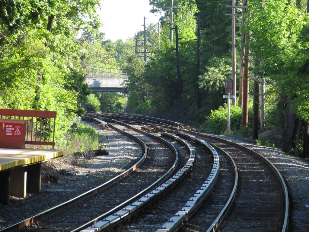
The right-of-way also includes elevated,
embankment and open-cut portions, and a tunnel near St. George.
Over the years there have been several
proposals for connecting the SIR with the subway system (including
the incomplete Staten Island Tunnel and a possible line along the
Verrazano-Narrows Bridge), as it uses B Division-sized cars and
loading gauge, but various economic, political, and engineering
difficulties have prevented this from happening.
Disclaimers:
I love trains, and I love signals. I am not an
expert. My webpages reflect what I find on the topic of the page.
This is something I have fun with while trying to help others. My
webpages are an attempt at putting everything I can find of the subject in
one convenient place. There are plenty of other good websites to help
me in this effort, and they are listed in the links section on my indexa
page, or as needed on individual pages. Please do not write to me
about something that may be incorrect, and then hound the heck out of me if
I do not respond to you in the manner you would like. I operate on the
"Golden Rule Principle", and if you are not familiar with it, please
acquaint yourself with how to treat people by reading Mathew 7:12 (among
others, the principle exists in almost every religion). If you contact
me (like some do, hi Paul) and try to make it a "non-fun" thing and start
with the name calling, your name will go into my spambox list! :-)
Please Note:
Since the main focus of my two websites is railroad signals, the railfan guides
are oriented towards the signal fan being able to locate them. For those
of you into the modeling aspect of our hobby, my
indexa page has a list of
almost everything railroad oriented I can think of to provide you with at least a few pictures to
help you detail your pike.
If this is a railfan page, every effort has
been made to make sure that the information contained on this map and in this
railfan guide is correct. Once in a while, an error may creep in,
especially if restaurants or gas stations open, close, or change names.
Most of my maps are a result of personal observation after visiting these
locations. I have always felt that a picture is worth a thousand words",
and I feel annotated maps such as the ones I work up do the same justice for the
railfan over a simple text description of the area. Since the main focus
of my website is railroad signals, the railfan guides are oriented towards the
signal fan being able to locate them. Since most of us railheads don't have just
trains as a hobby, I have also tried to point out where other interesting sites
of the area are.... things like fire stations, neat bridges, or other
significant historical or geographical feature. While some may feel they
shouldn't be included, these other things tend to make MY trips a lot more
interesting.... stuff like where the C&O Canal has a bridge going over a river (the Monocacy Aqueduct) between Point of Rocks and Gaithersburg MD, it's way cool to
realize this bridge to support a water "road" over a river was built in the
1830's!!!
My philosophy: Pictures and maps are worth a
thousand words, especially for railfanning. Text descriptions only
get you so far, especially if you get lost or disoriented. Take
along good maps.... a GPS is OK to get somewhere, but maps are still
better if you get lost! I belong to AAA, which allows you to get
local maps for free when you visit the local branches. ADC puts
out a nice series of county maps for the Washington DC area, but their
state maps do not have the railroads on them. If you can find em,
I like the National Geographic map book of the U.S..... good, clear, and
concise graphics, and they do a really good job of showing you where
tourist type attractions are, although they too lack the railroads.
Other notes about specific areas will show up on that page if known.
Pictures and additional information is always needed if anyone feels
inclined to take 'em, send 'em, and share 'em, or if you have
something to add or correct.... credit is always given! BE NICE!!! Contact info
is here
Beware: If used as a source, ANYTHING from Wikipedia must be treated as
being possibly being inaccurate, wrong, or not true.


