In General
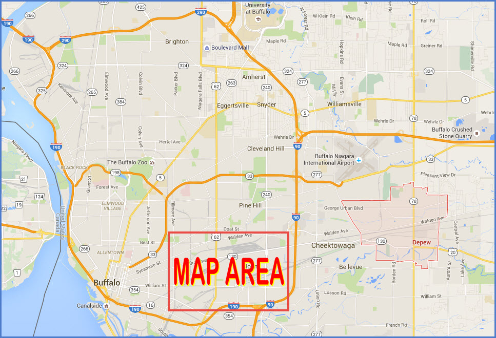
Getting Here
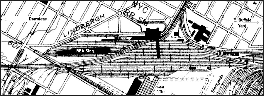
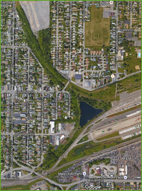
Map
Sites
Detail Areas
Pictures
Signals
Bridges
Floobydust
BUFFALO RAILFAN GUIDE HOME
RAILFAN GUIDES HOME
RAILROAD SIGNALS HOME
Buffalo Railfan Guide Homepage
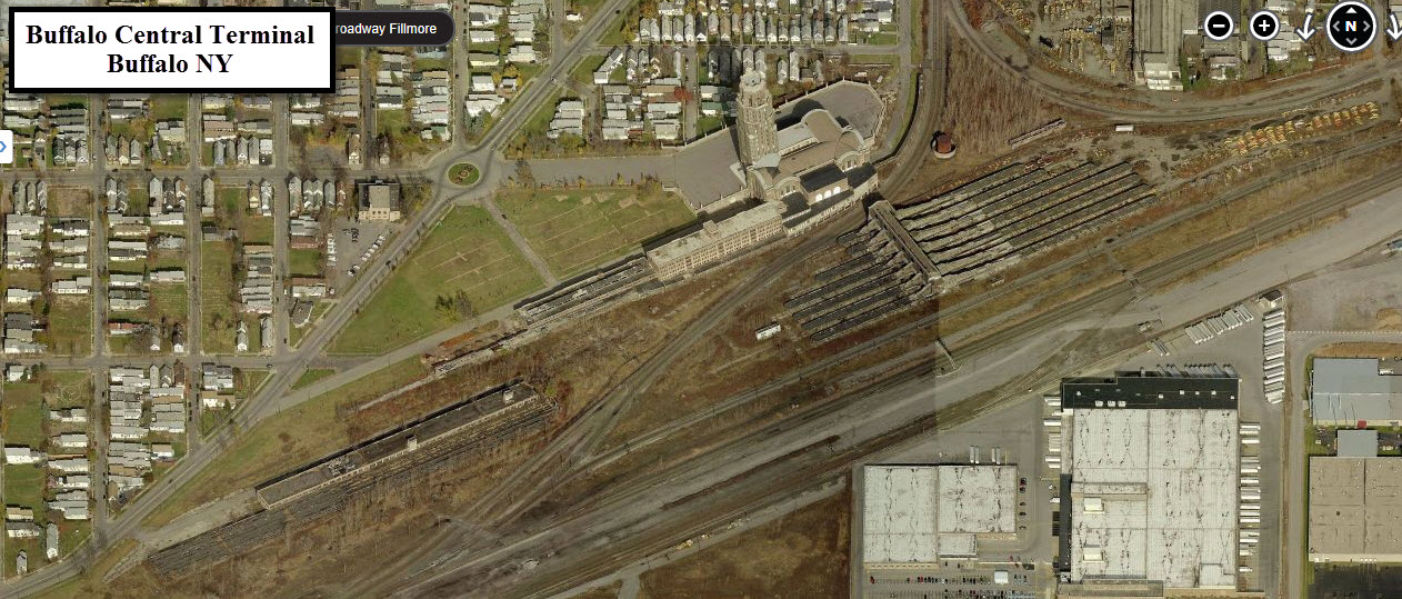
Map 1 - Downtown
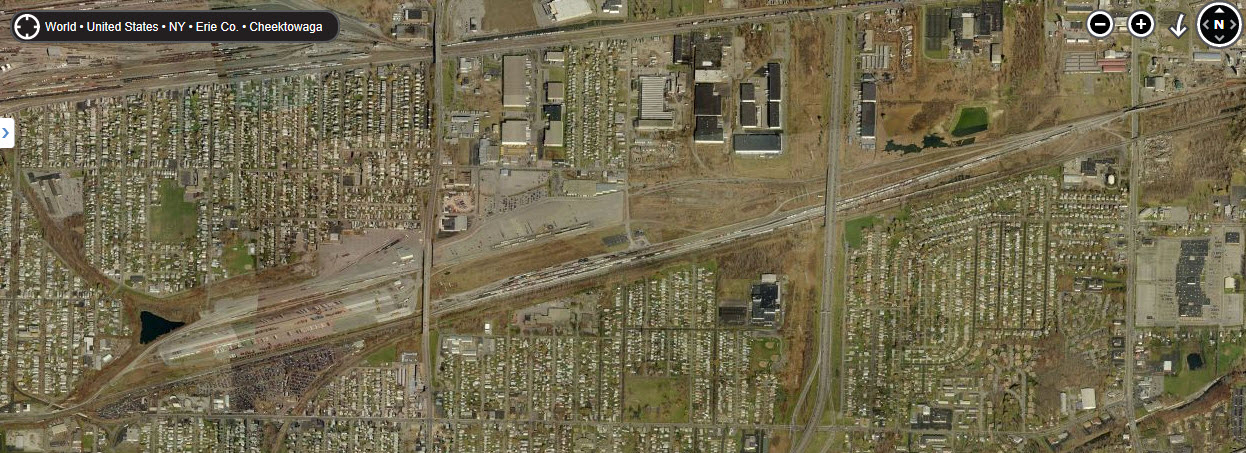
Map 2 - East - CSX's Frontier Yard and NS's Bison Yard - You're on it
Map 3 - Seneca
Map 4 - South
Map 5 - North
Light Rail guide
Depew Railfan Guide
Location / Name:
Buffalo NY, Erie County
What's Here:
CSX's Frontier Yard (Ex NYC)
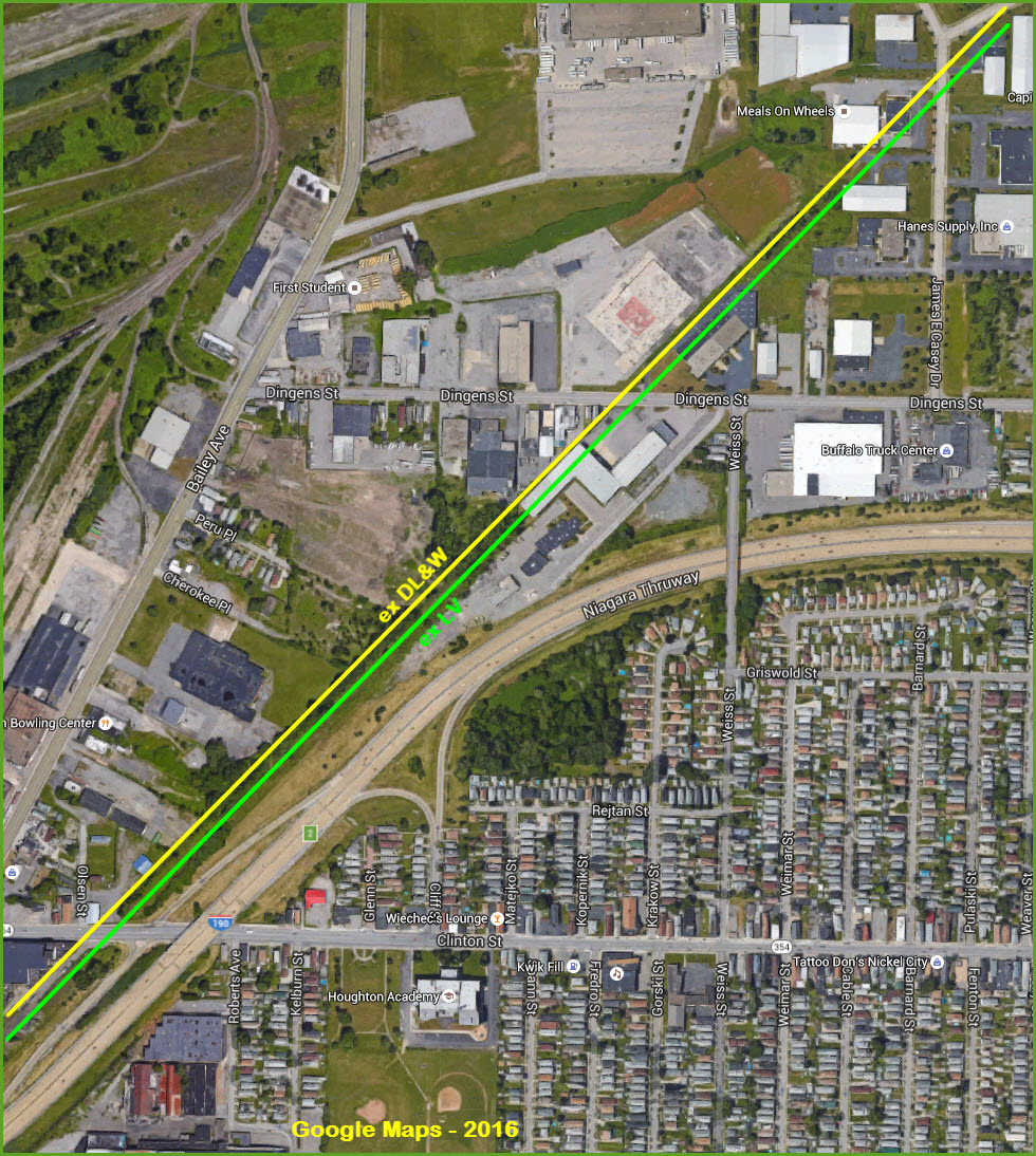
NS's Bison Yard (Ex DL&W)
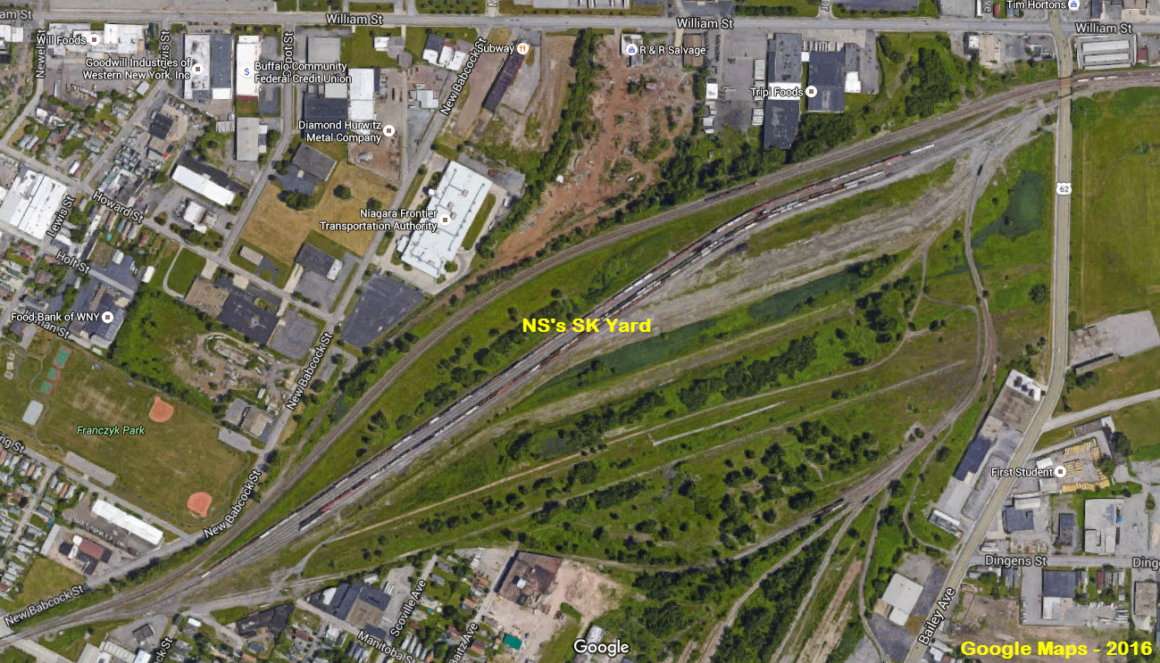
NS/CP's SK Yard (Ex Erie)
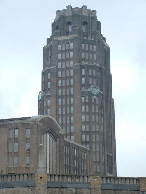
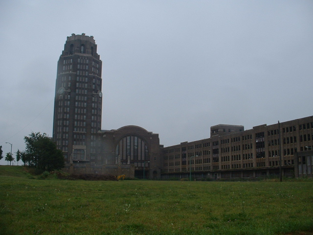
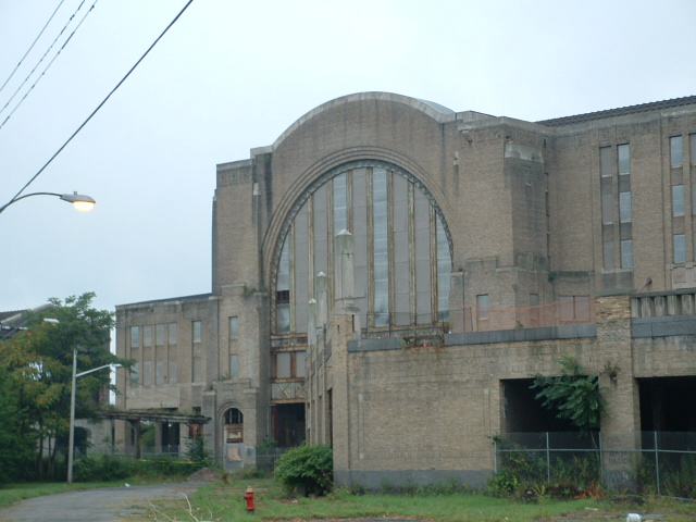
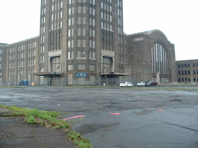
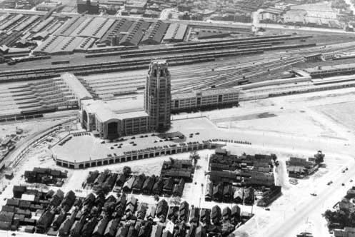
Buffalo Central Terminal
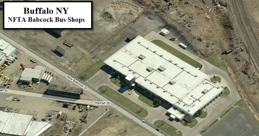
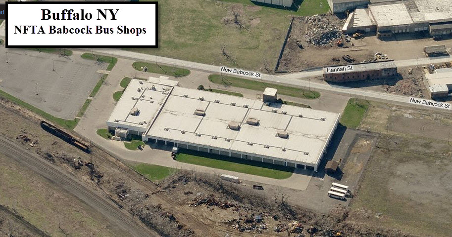
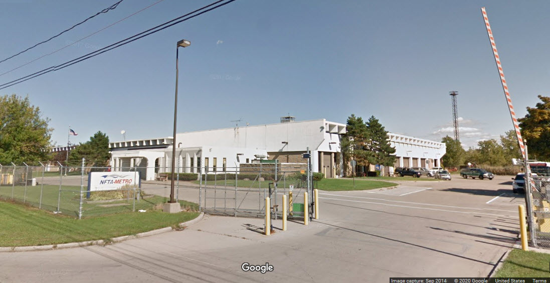
NFTA Bus Shops and Yard
Data:
GPS Coordinates: as needed
Phone A/C: 716
ZIP: 14212
Access by train/transit:
Amtrak in Depew ~ 3.5mi to the east
Amtrak Downtown ~ 4.2mi to the west
The Scoop:
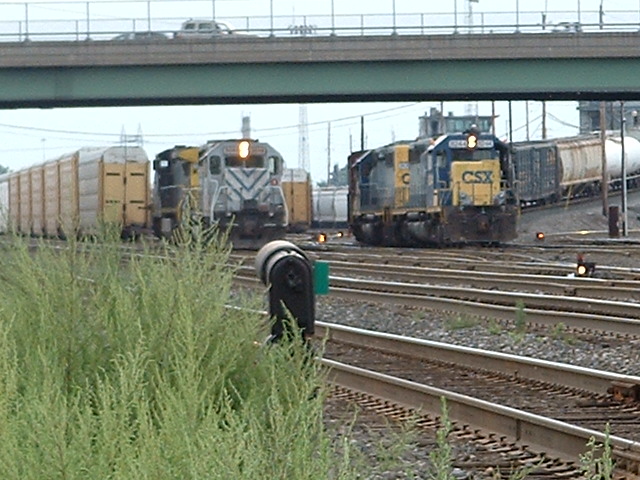
Amtrak, CSX, NS, and CP all have a presence on the east side of Buffalo.
Amtrak has two stations in the Buffalo area, three if you include Niagara Falls - one in Depew and one in downtown Buffalo. Amtrak shares the road with CSX.
CSX rides on the former New York Central mainline to New York City, most of which used to be a four track line.
At one time, the Erie, Lehigh Valley, and the Delaware, Lackawanna & Western all had parallel tracks with the NYC heading east. NS and CP uses the old Erie tracks to get to Binghamton NY via Hornell, Corning, and Elmira on what is known as the Southern Tier Line. The LV which was the southern most of the four, crossed the Erie and DL&W to run parallel to the NYC..... this line is all gone, and the DL&W tracks only go a few miles east of Depew before coming to an end.
The old New York Central Depot, Buffalo Terminal, is on the left side of the map.
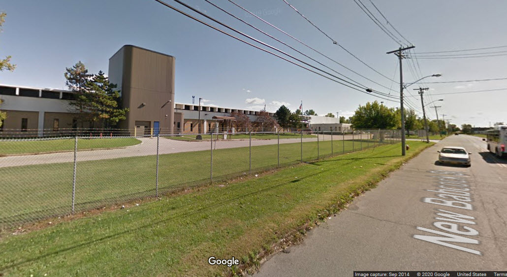
Down towards the bottom of the map, you have one of NFTA's bus yards. It is next to what remains of SK yard.
Acknowledgements:
Scott H
Adam Lloyd
Denver Todd
Websites and other additional information sources of interest for the area:
None for now.....
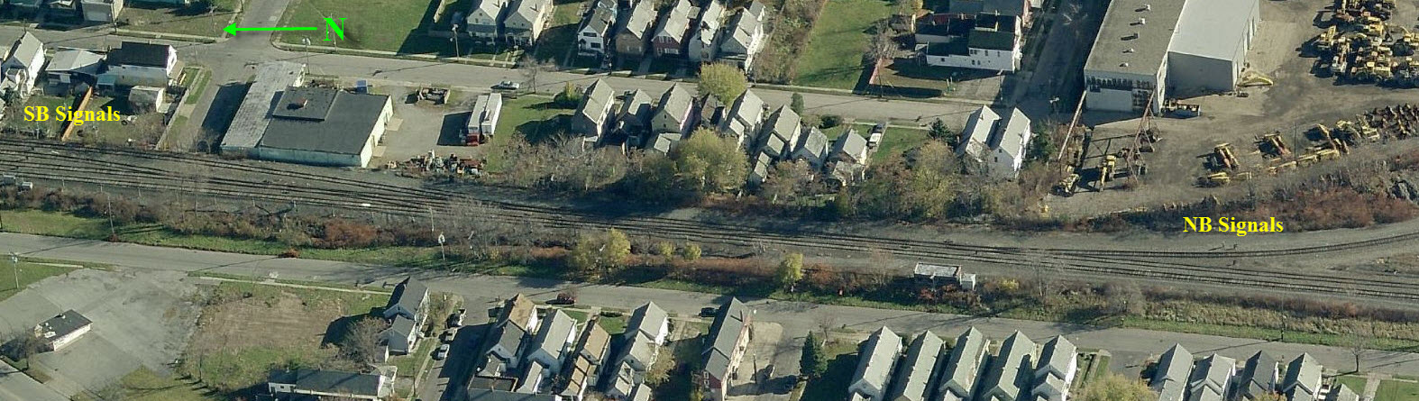
Signals
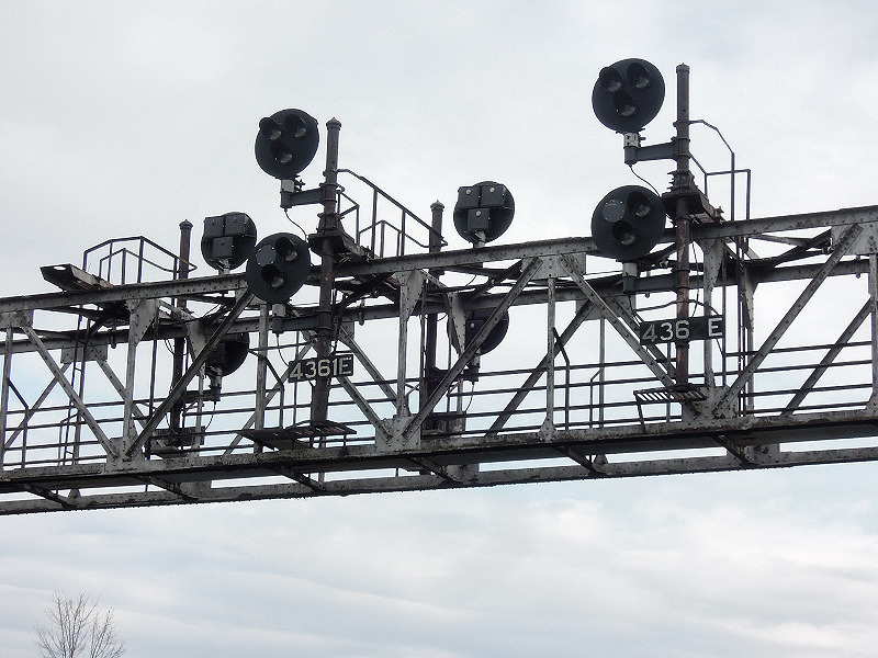
The great majority of signals around here are ex New York Central searchlight signals. Most are on signal bridges that span all of the tracks, sometimes as many as 5 tracks - the last one being off the right side of the map adjacent to Union Ave. CSX plans on replacing the searchlights with colorlight signal over the summer of 2016.
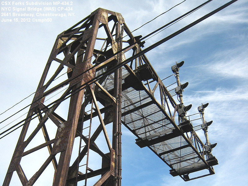
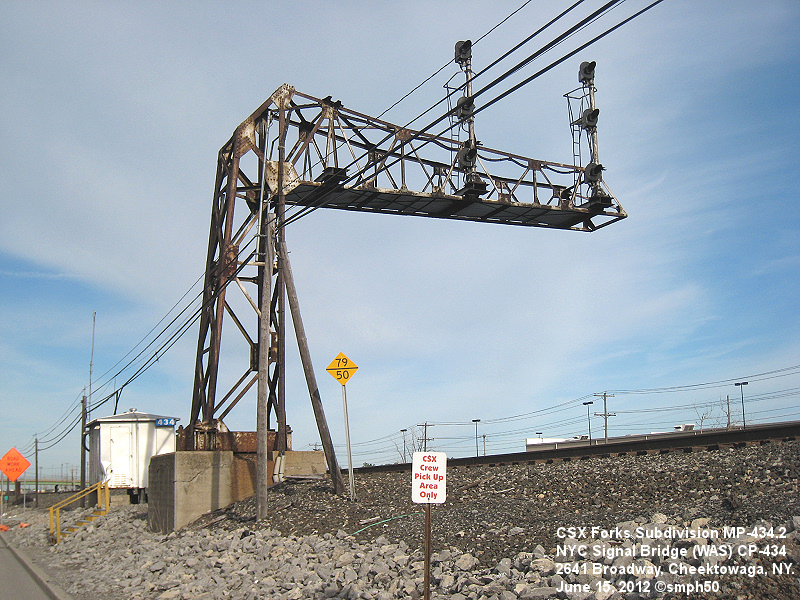
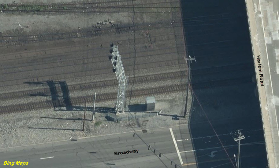
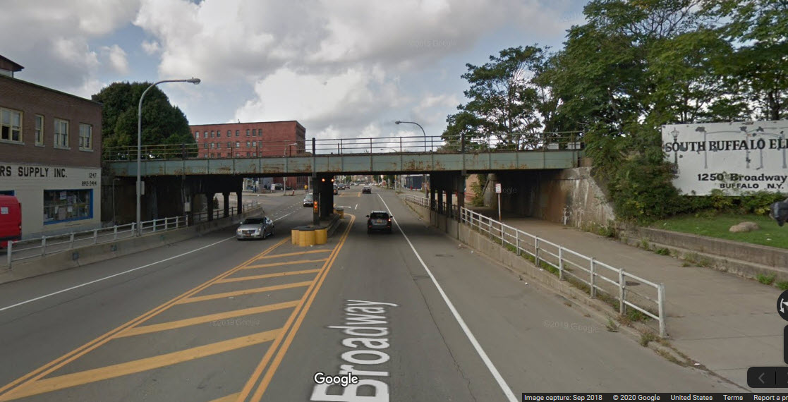
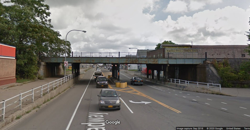
Across from Lemoine Ave on Broadway WAS a great old cantilever with two sets of WB signals on it.
From downtown, Broadway might take longer, but it's more interesting.
From anywhere else, use I-90 and get off at exit 52E or 52A, or get on I-190 and take exit 1.
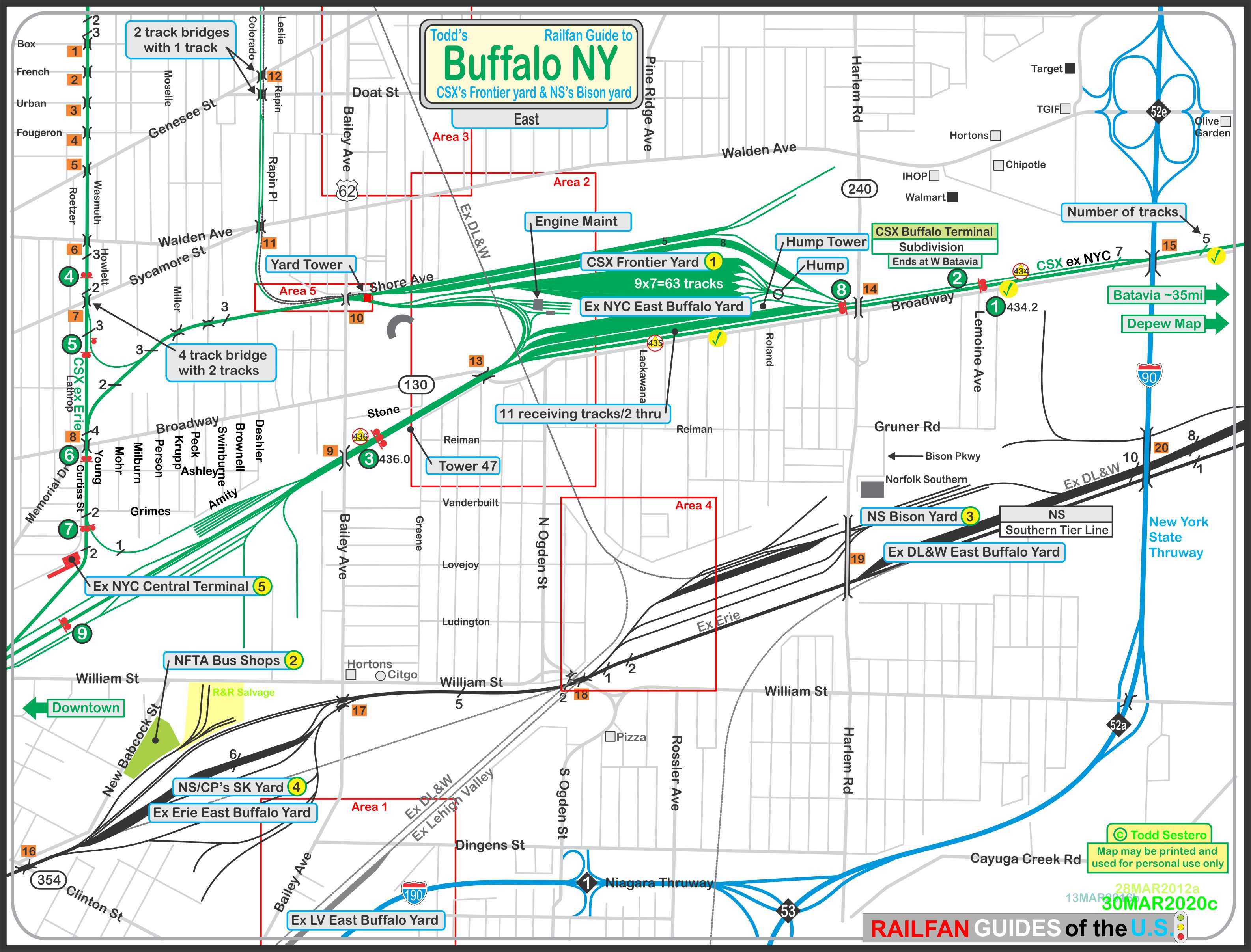
The above map in PDF form is here
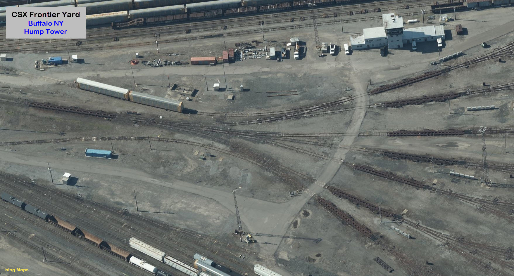
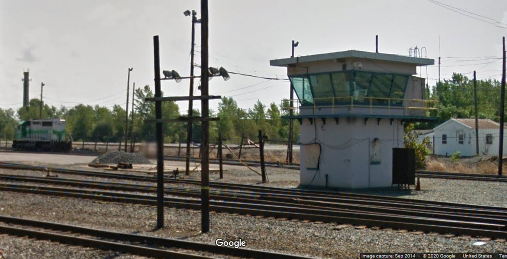
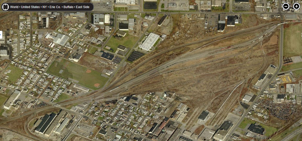
This was the New York Central's main yard in the Buffalo area.
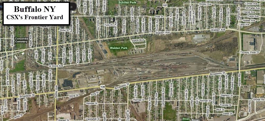
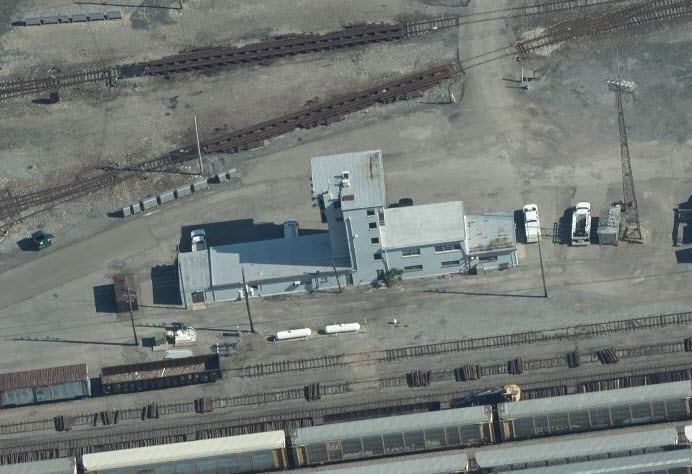
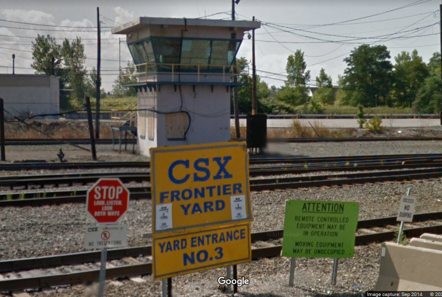
Nestled in the middle of the yard on the east end is the Hump Tower.
At the other end of the yard......
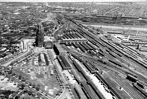
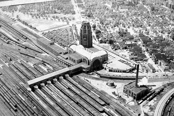
This station was in use between June 22nd, 1929 through 1979. It was built by the New York Central starting in 1927. It is in pretty bad condition, and ownership has been taken over by the Central Terminal Restoration Company. The station opened just prior to the start of the Great Depression.
Come 1968 and the formation of the Penn Central, they operated the station until Amtrak started in 1971. Penn Central and then Conrail maintained offices in the building until 1980.
The last train to leave the station was on October 28th, 1979, when Amtrak opened the current Depew station.
The station also served the Pennsylvania RR, the Canadian National Rwy, and the Toronto, Hamilton & Buffalo.
Here is an accounting from KJP found at http://www.urbanohio.com/forum2/index.php?topic=21124.0:
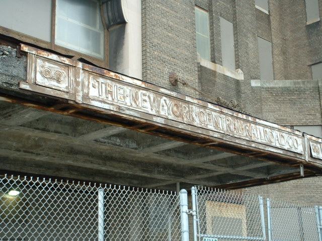
Once upon a time there was an active, magnificent train station called Buffalo Central Terminal which served tens of thousands of people per day and more than 200 daily trains at its peak. It housed hundreds of employees for the New York Central Railroad Co., one of America's largest companies, in a landmark 17-story tower above the terminal, as well as in adjoining buildings.
But there was a problem -- several, actually. The station was built where the railroad needed it, not where the public wanted it. It was built at the junction of railroad lines that allowed easy access for trains. But it was two miles east of downtown Buffalo in a working-class Polish neighborhood. And since local mobsters controlled taxi cab companies, they kept a proposed streetcar line from being built into the station making it less accessible. And, worst of all, the station opened on June 22, 1929, four months before the stock market crash and the start of the Great Depression. The massive, ornate and very expensive Buffalo Central Terminal would never reach its full potential.
Just 30 years later, as governments built airports and highway and rail passenger traffic went into a severe decline, New York Central began closing sections of the terminal to save money. NYC merged with its rival Pennsylvania Railroad in 1968. Amtrak took over passenger operations in 1971 and relocated its eight daily trains to/from Buffalo in 1979 to the old but cozy Exchange Street station downtown and the new and suburban station in Depew. By the early 1980s, there was nothing left at Buffalo Central Terminal but vagrants, vandals and memories.... Read more: here
More info at: http://en.wikipedia.org/wiki/Buffalo_Central_Terminal


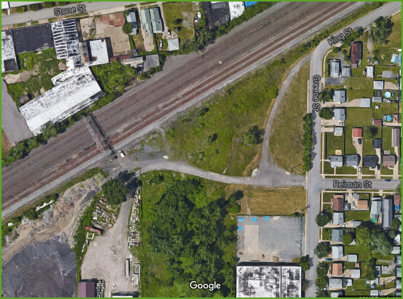
Detail Areas
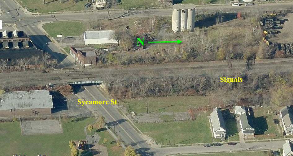
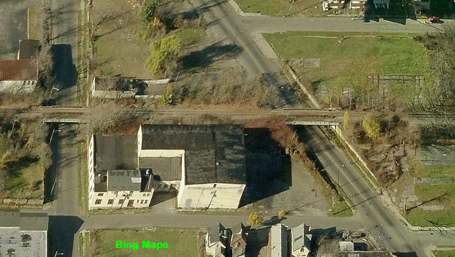
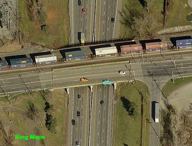
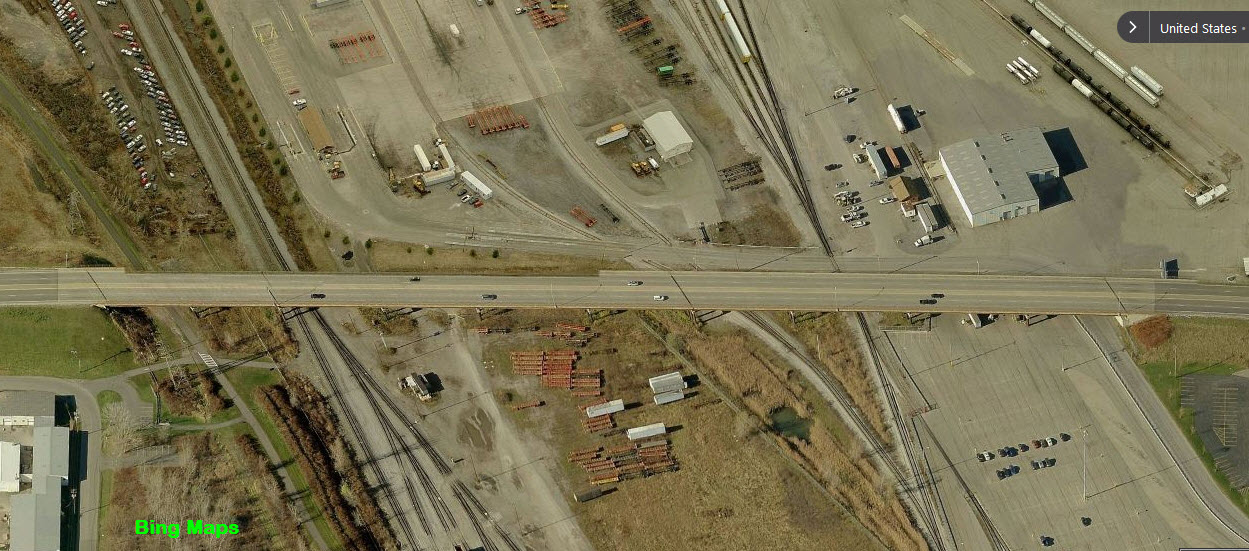
Area 1 of the map
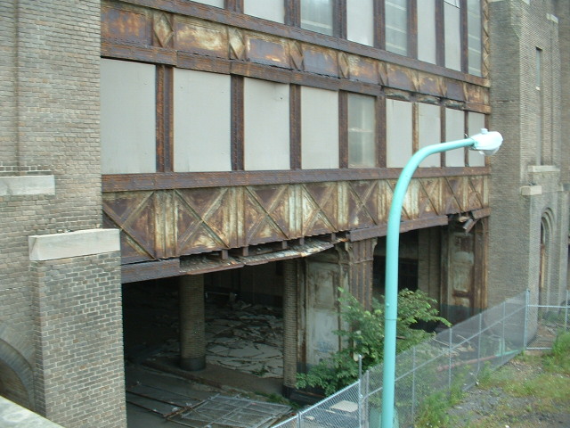
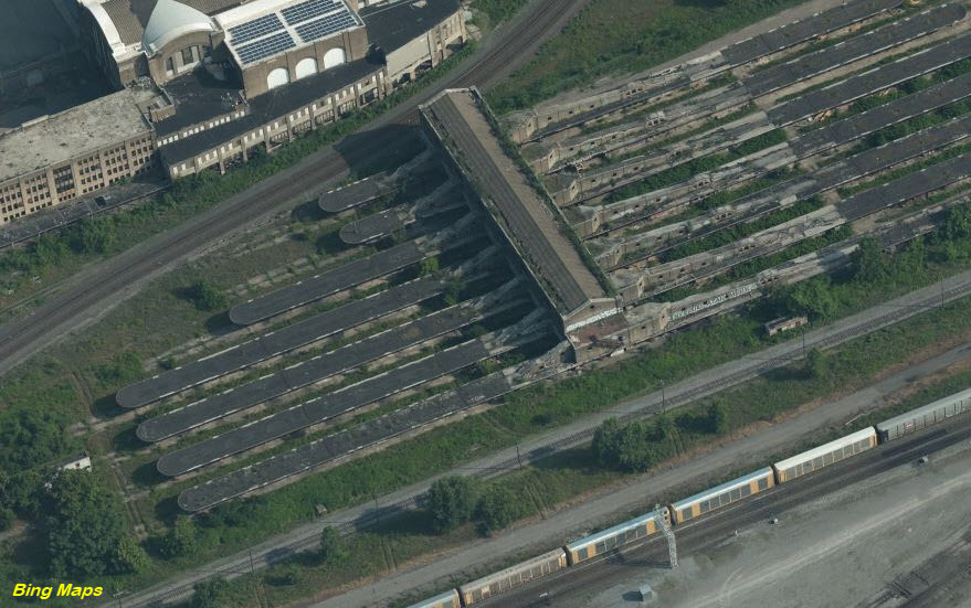
Here we can see how the layout of certain buildings was influenced by the right-of-ways of days gone by.
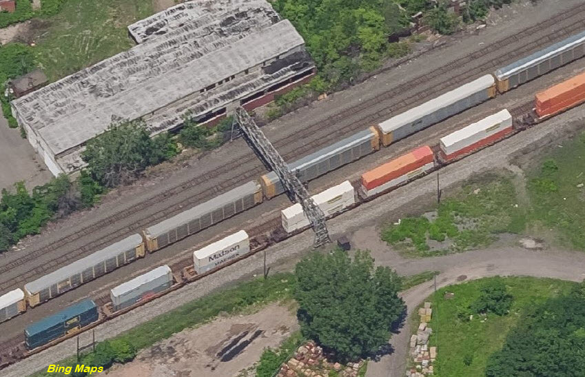
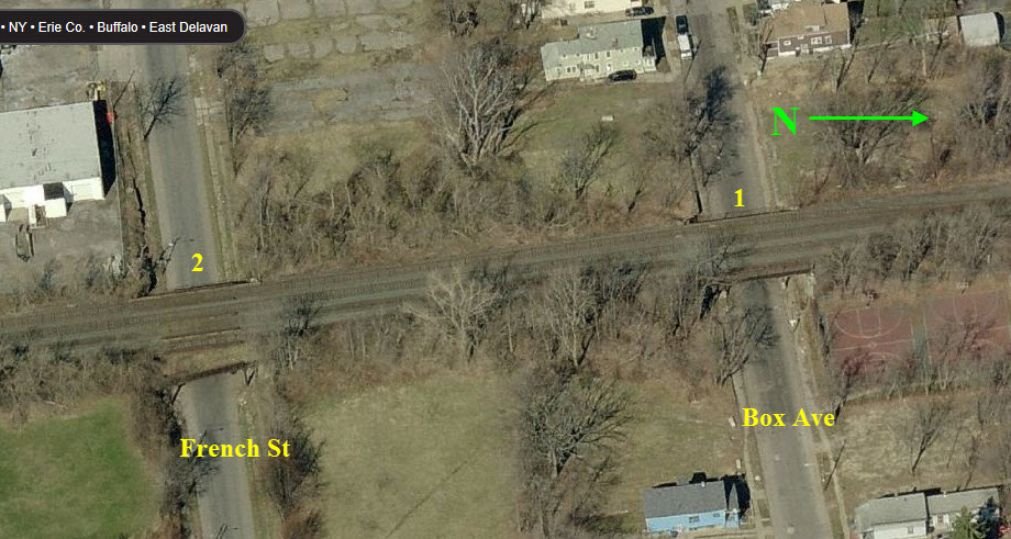
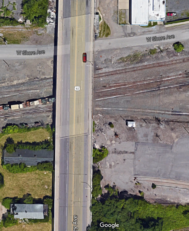
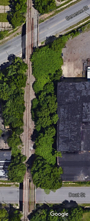
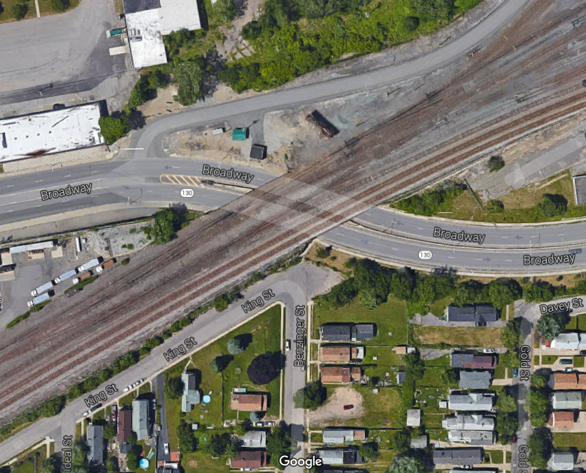
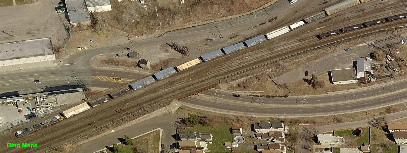
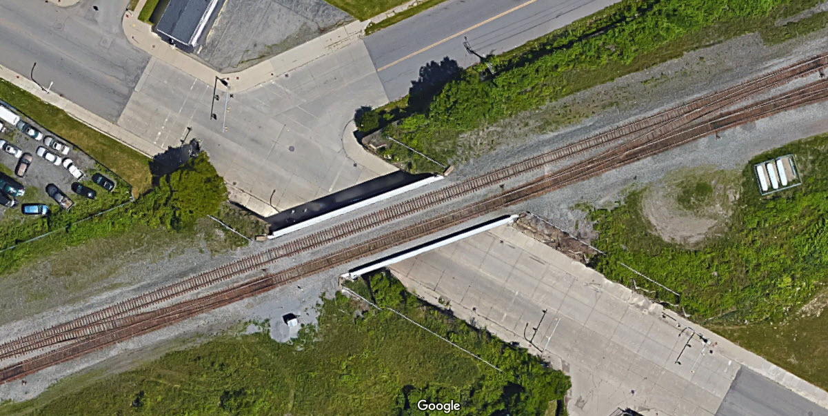
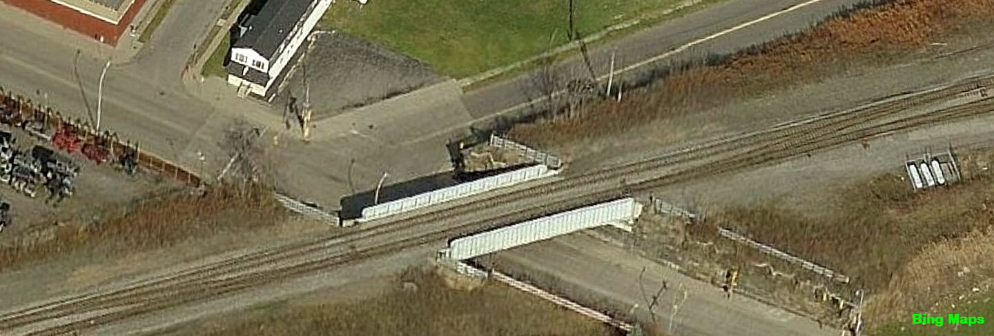
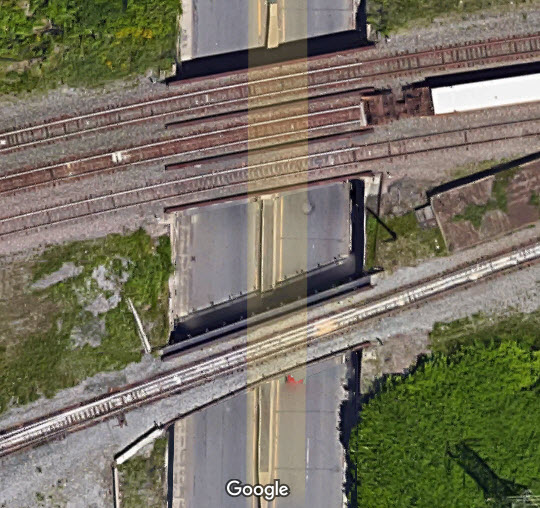
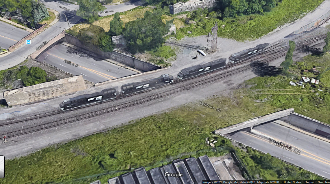
Area 2 of the map
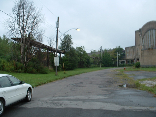
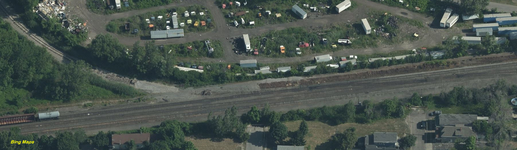
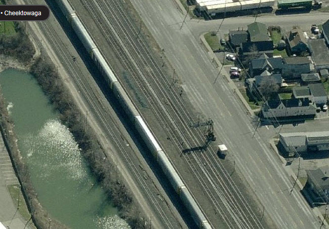
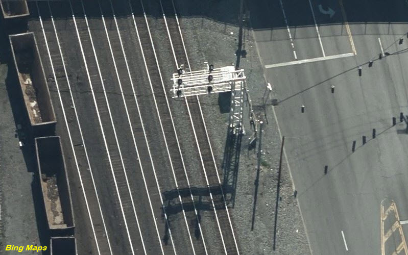
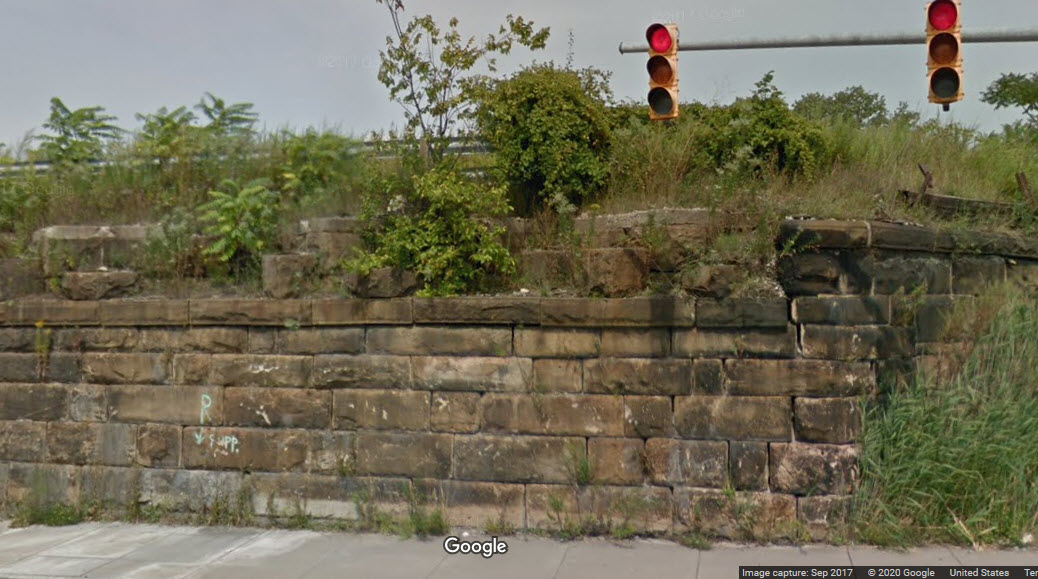
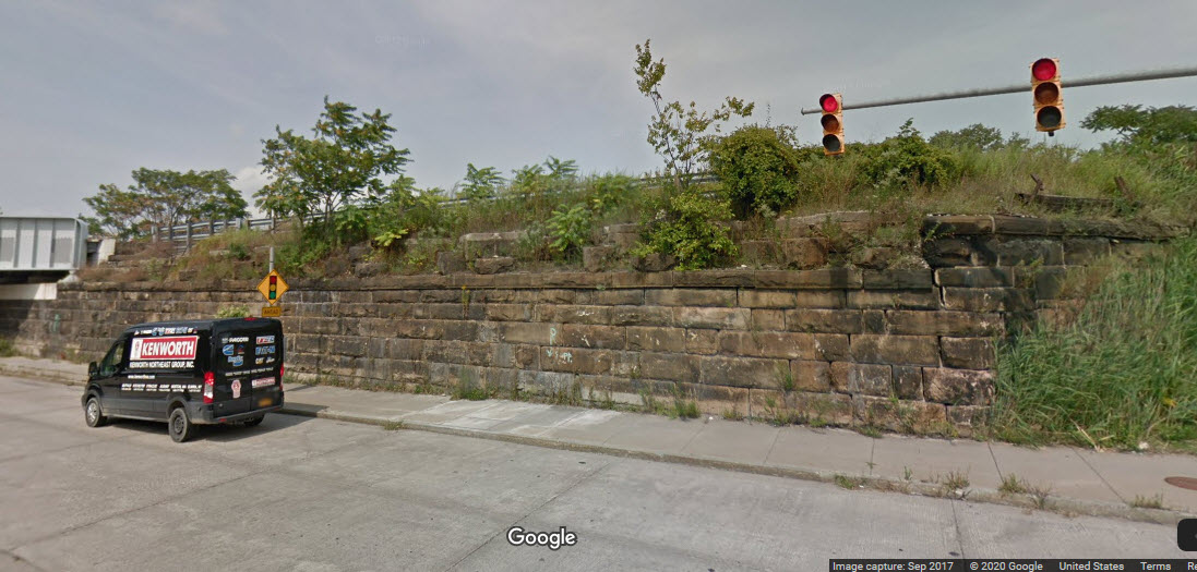
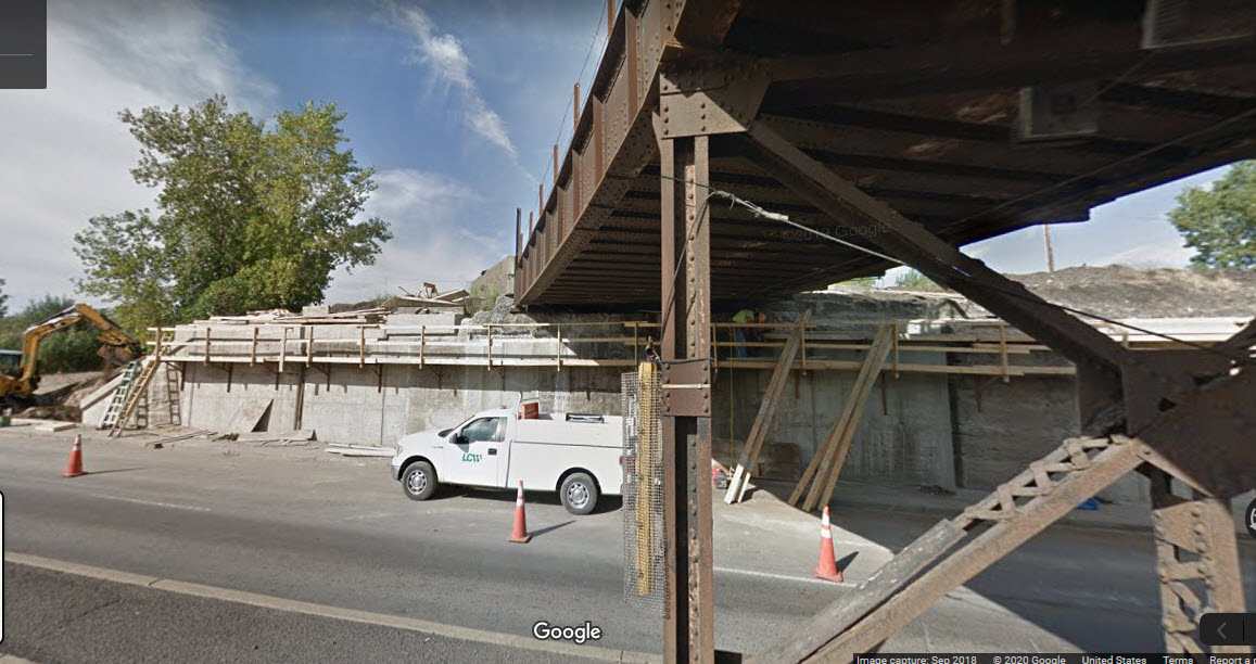
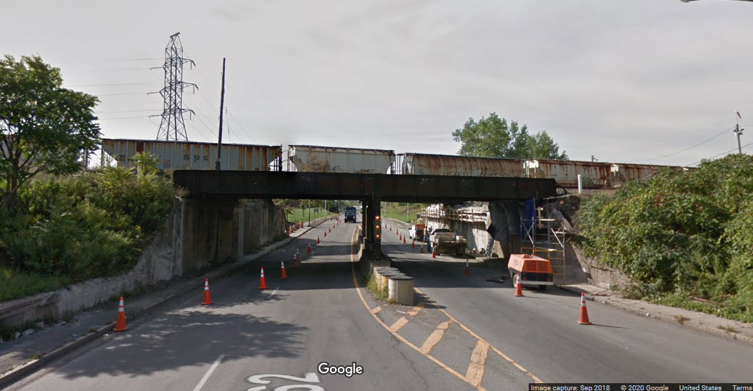
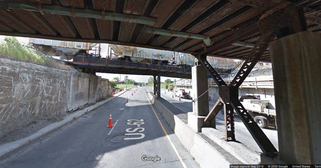
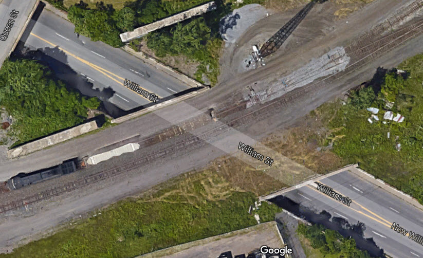
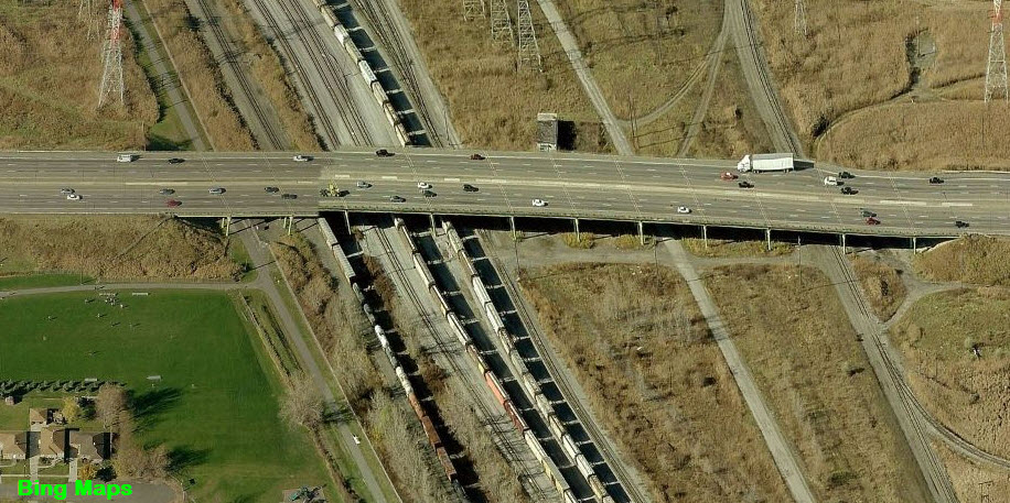
Here we can see how the DL&W crossed the old New York Central yard, with a number of the old pylons for the bridge still in place.

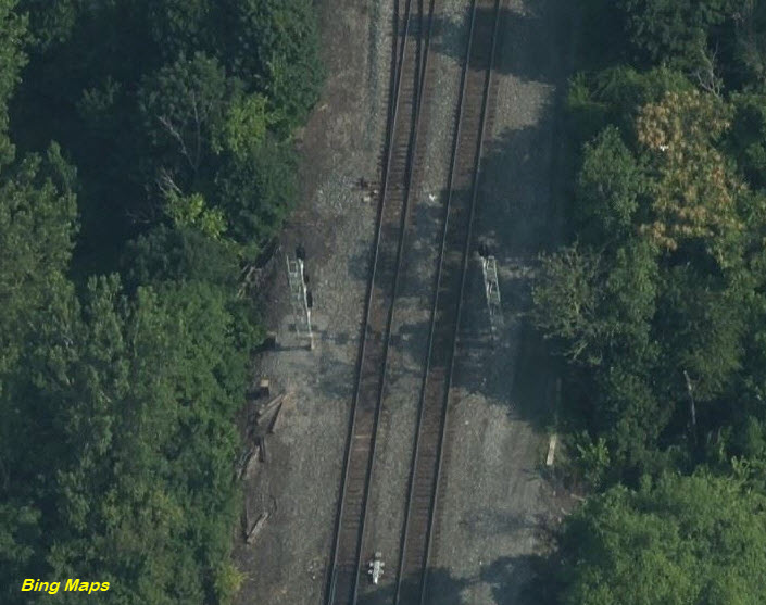
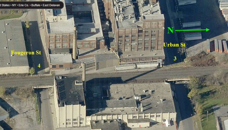
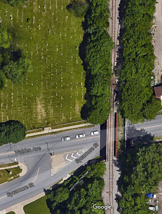
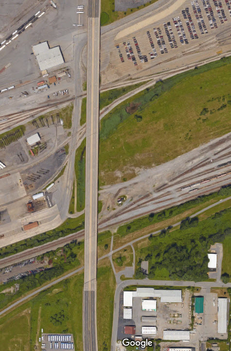
Area 3 of the map
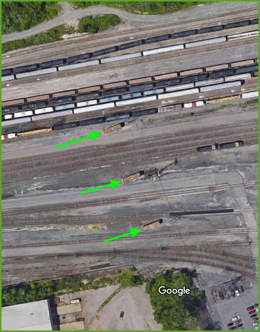
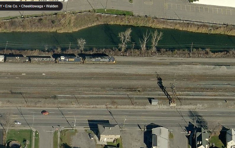
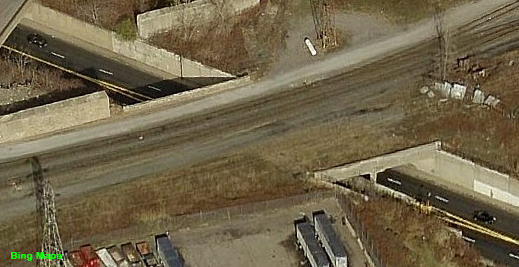
As the DL&W headed NW, we can still see ample evidence of the former tracks R-O-W. This continues way up north.

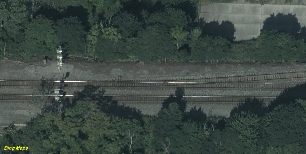
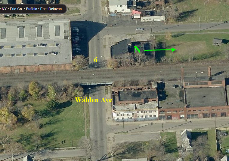
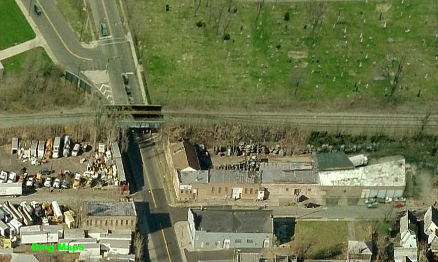
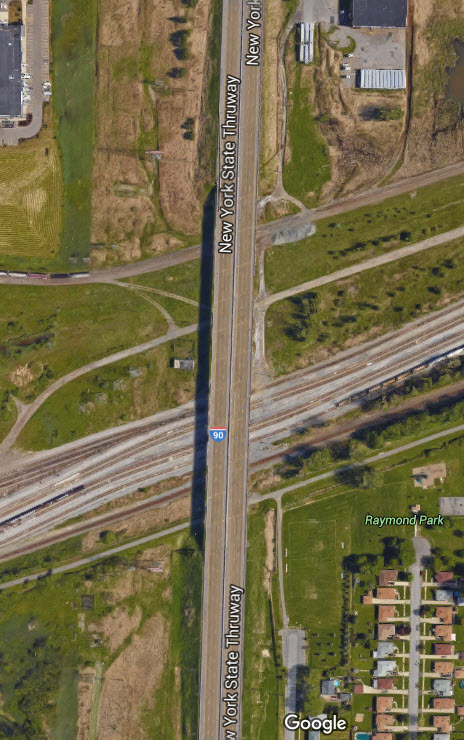
Area 4 of the map
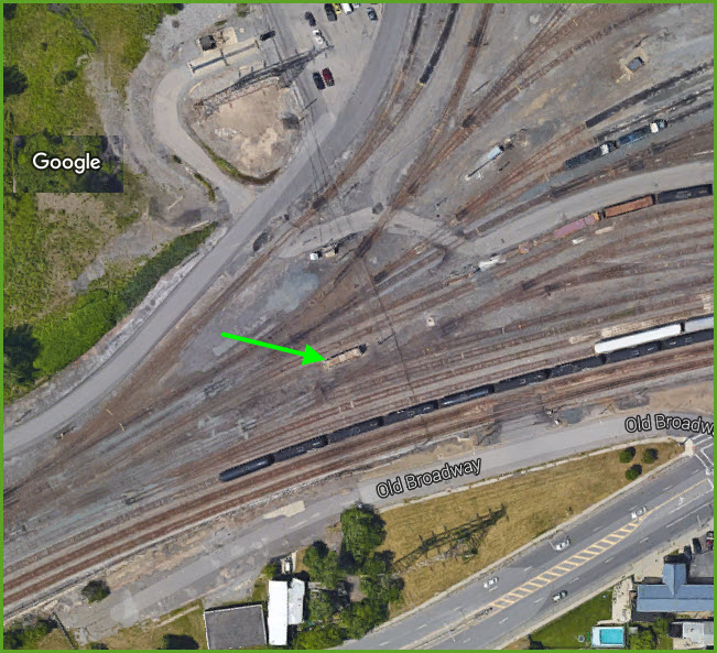
Here is the south end of the abandoned DL&W R-O-W where it joined in with the current trackage.
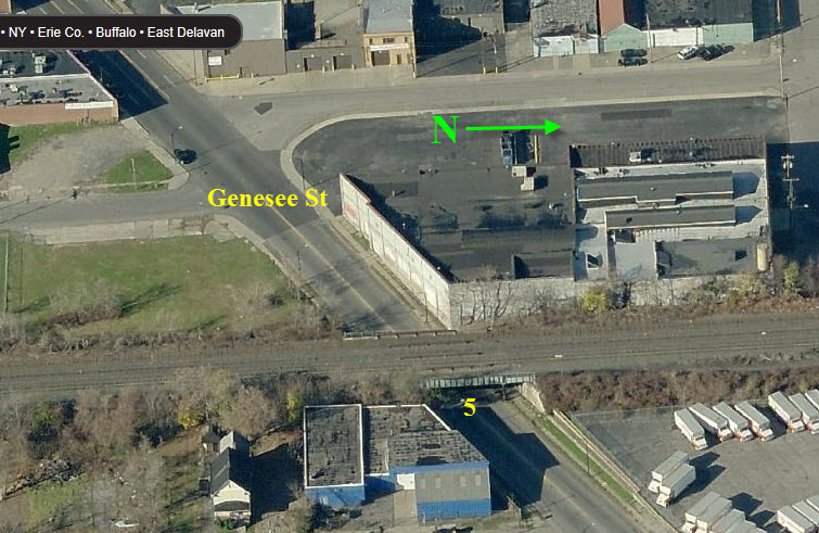
Area 5 of the map
Branch line trackage has been taken up where it joined the yard tracks, cutting off the branch.
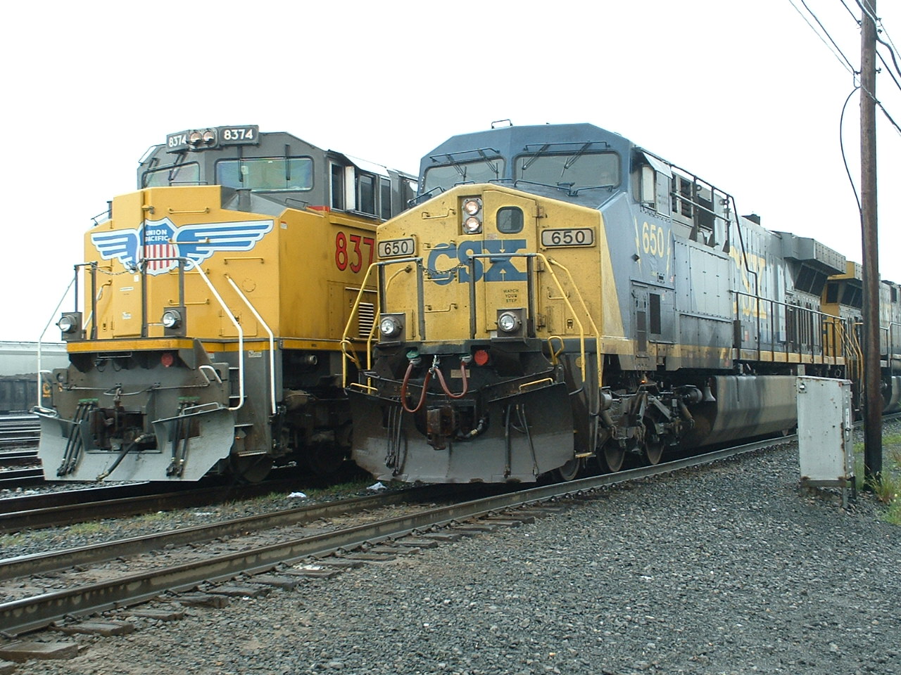
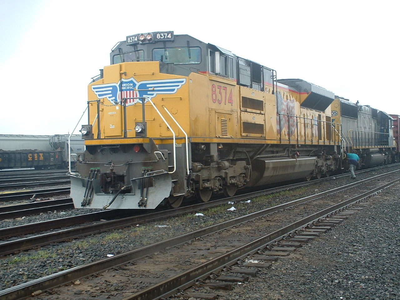
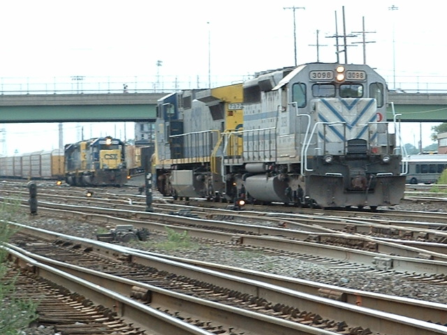
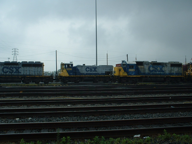
These pictures from around Frontier Yard are all from 2006, if anyone has new ones, please send em on in....


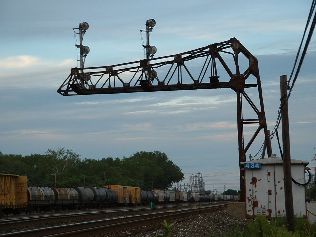
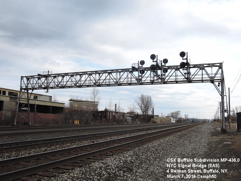
Along Broadway St, directly across from Lemoine Ave, was this very cool cantilever signal bridge.
It was taken down and replaced by colorlight signals on March 27th, 2017.
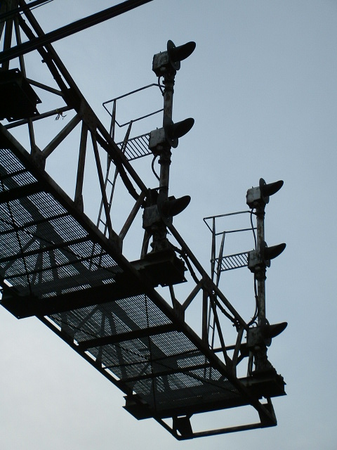
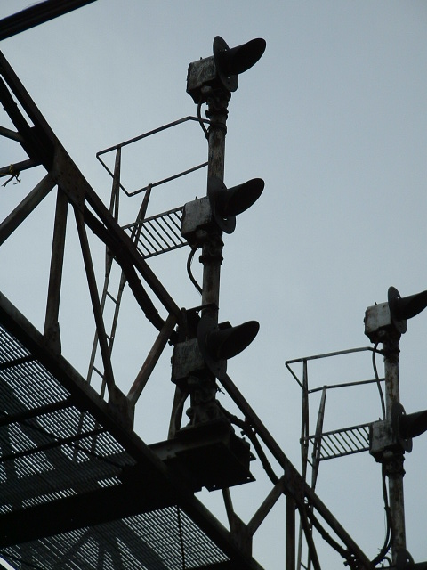
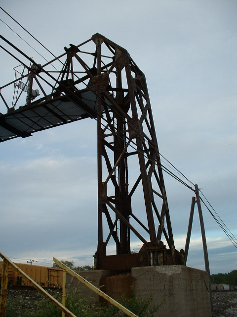


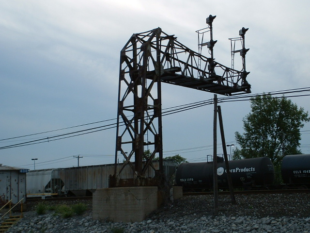
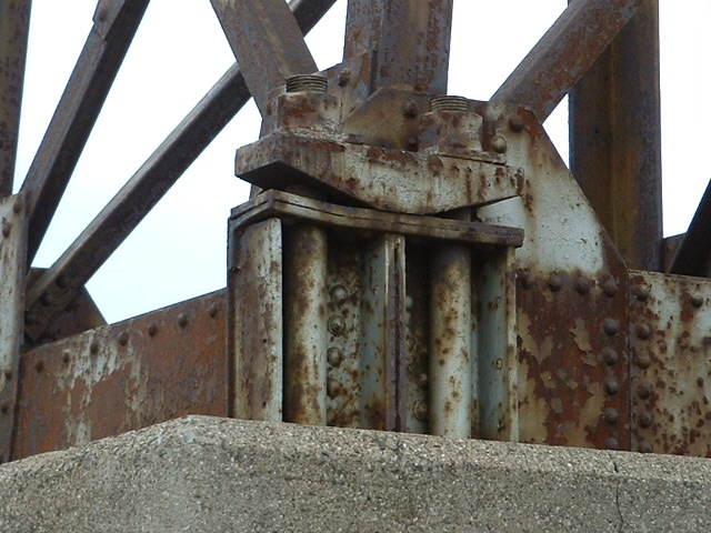
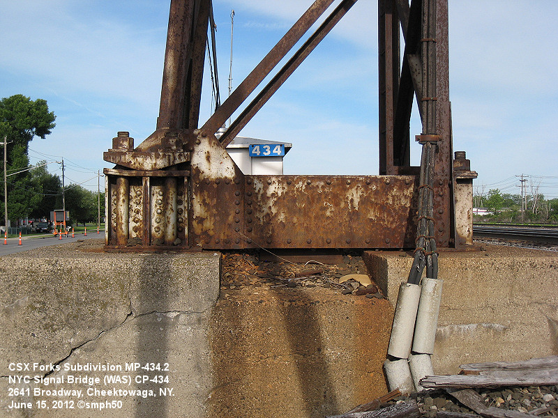 These four pictures are courtesy Scott H.
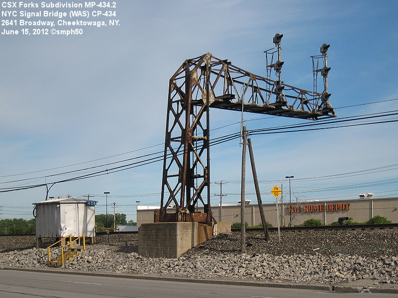
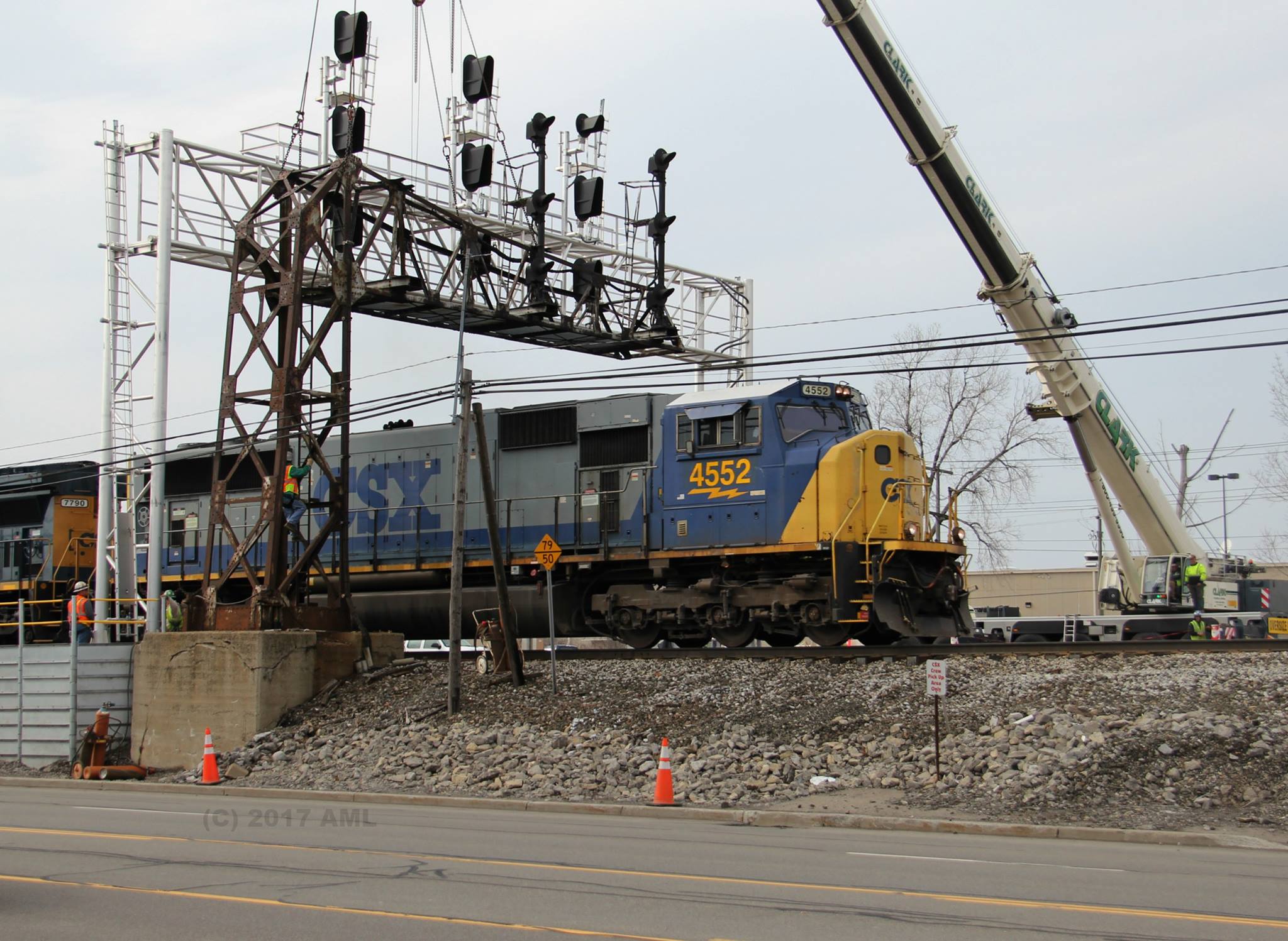
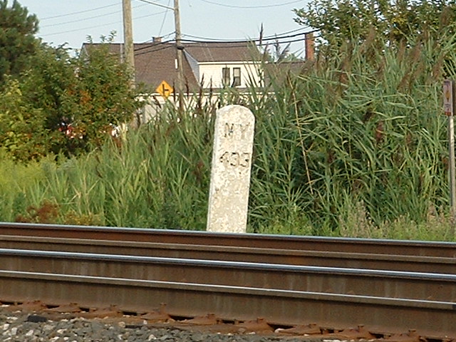
Last train to go under the signals at 434, March 26th, 2017 -- Photo by Adam Lloyd
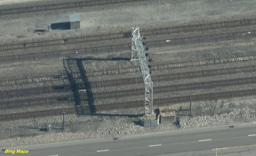
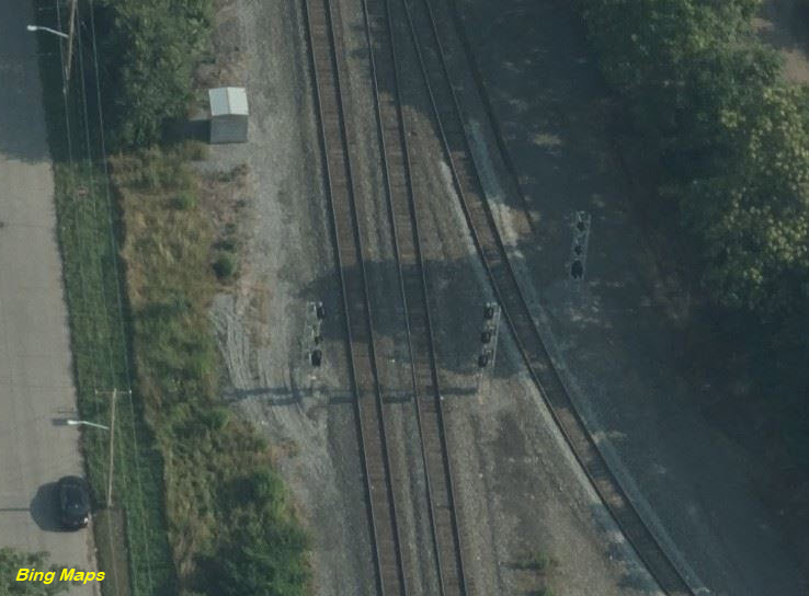
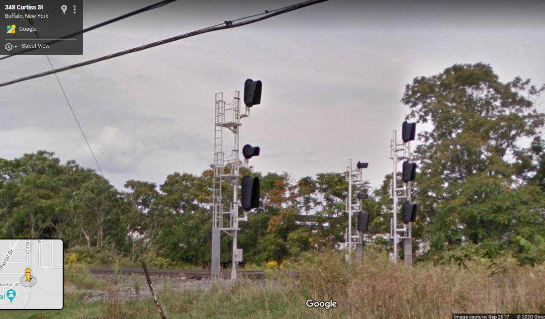
Various signals at the east end of Frontier Yard
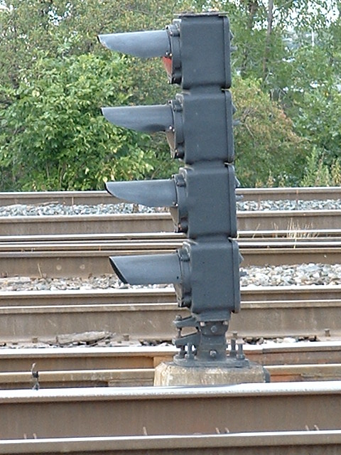
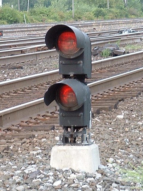
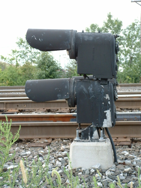

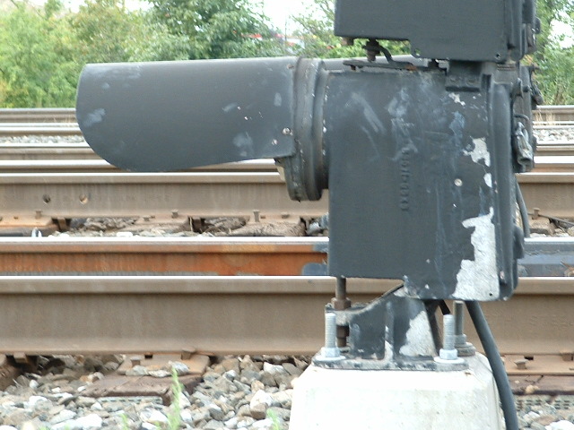

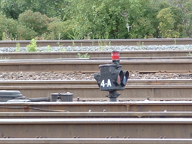
 These are GRS Type-P switch position indicator two light units
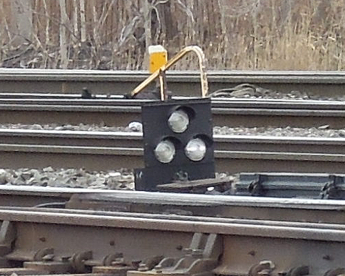
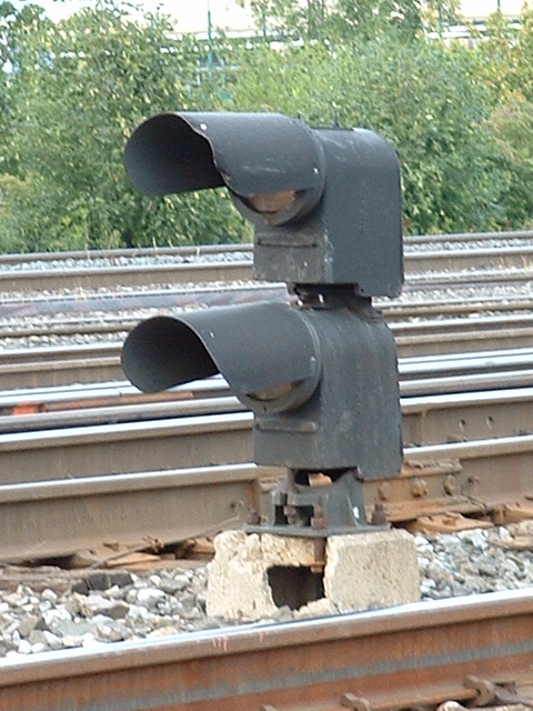
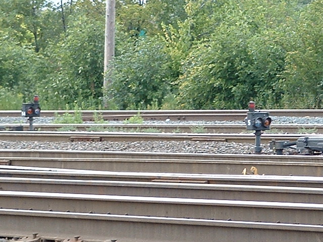
These 3-aspect dwarf type signals have replaced the GRS units above, maybe homemade? - Thanks to Scott H for the pictures!
 Thanks to Scott H for the pictures!
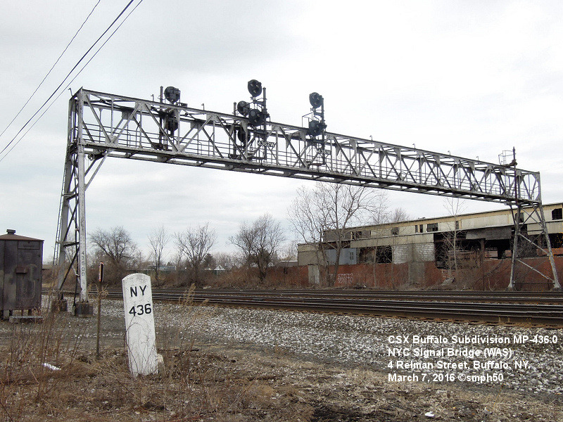
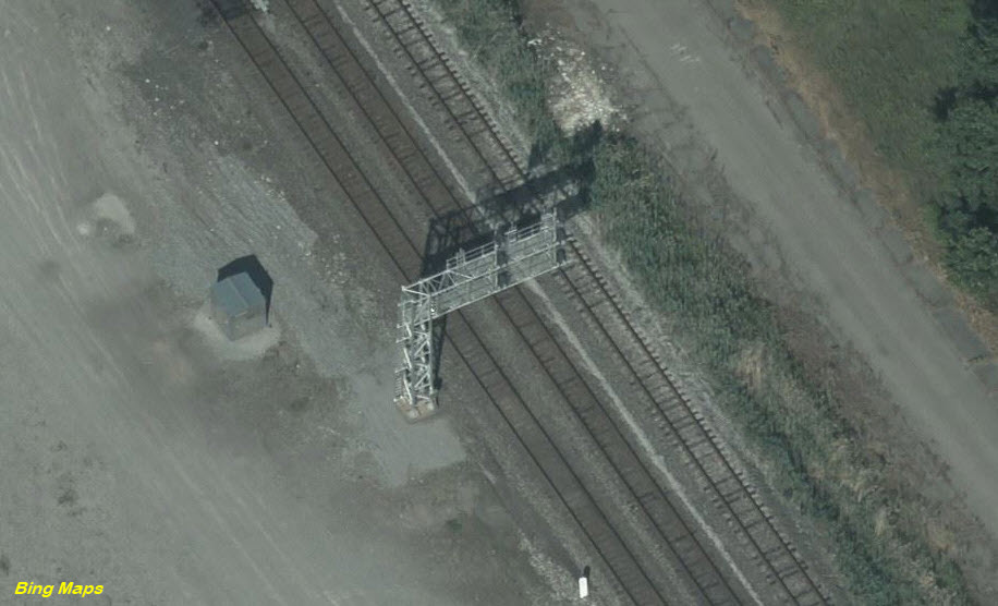
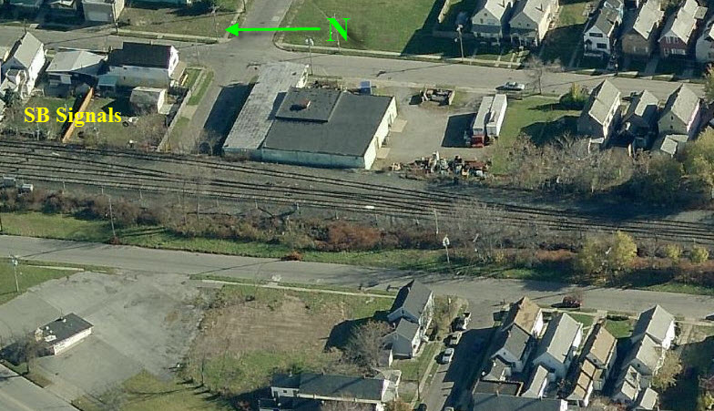
Since the pictures are above taken, it looks like a few more signals have been added.
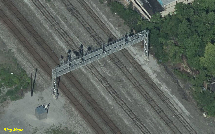
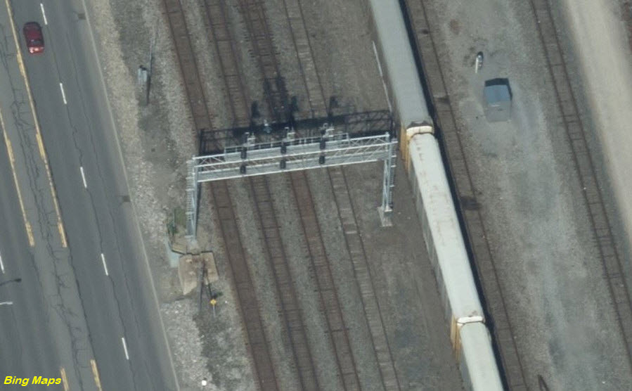
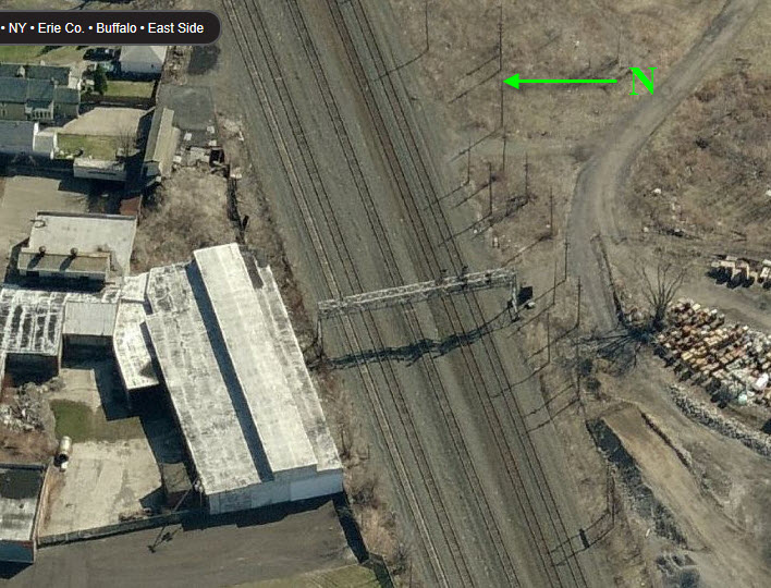
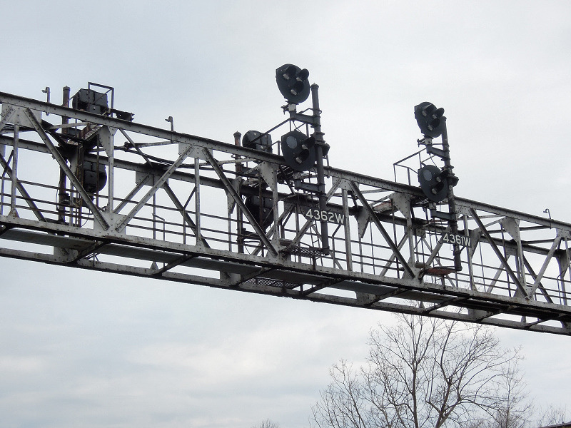
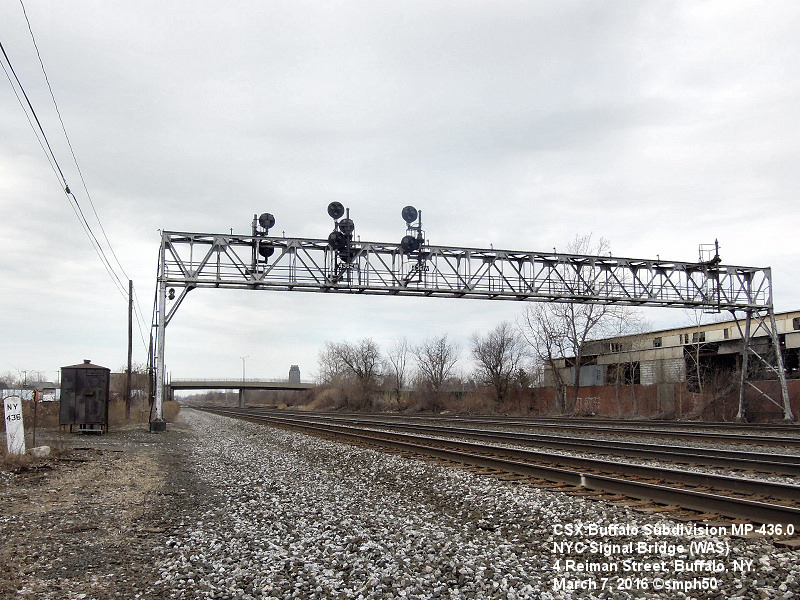
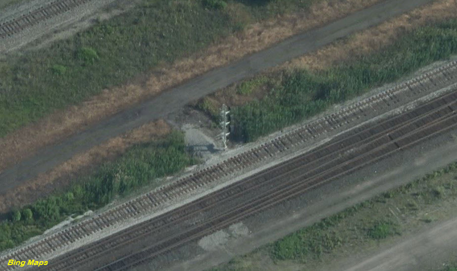
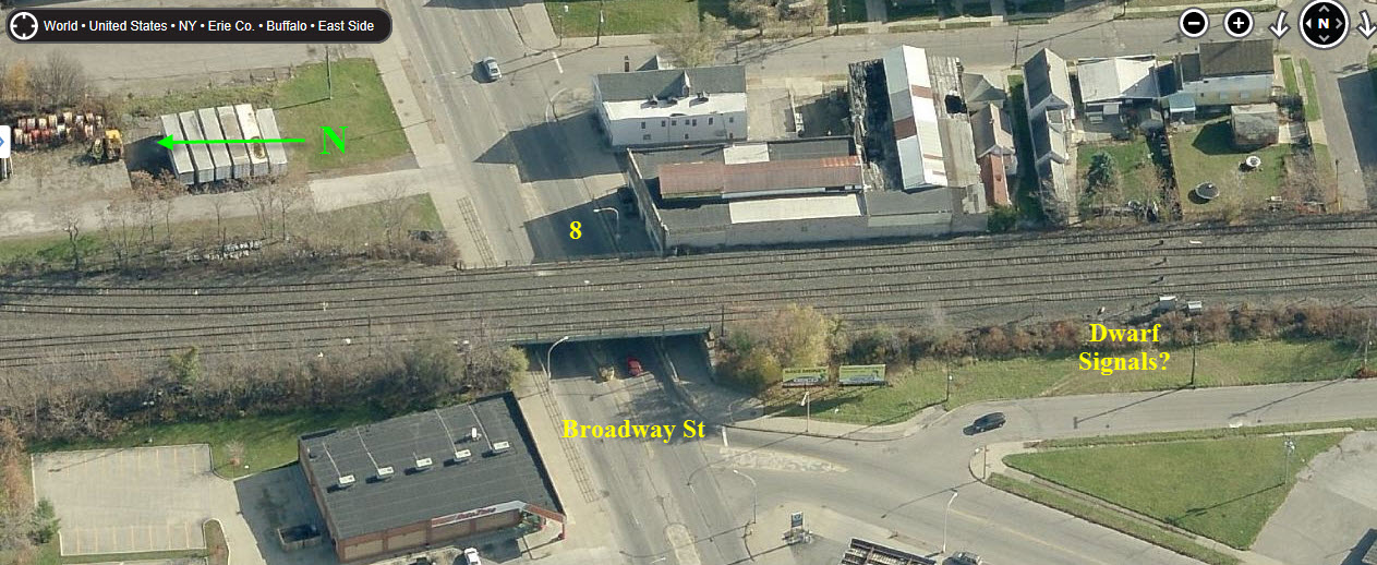
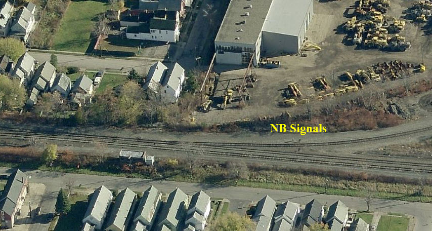
This signal bridge, shown in the upper aerial photo, has been replaced with standard color light signals on separate masts.
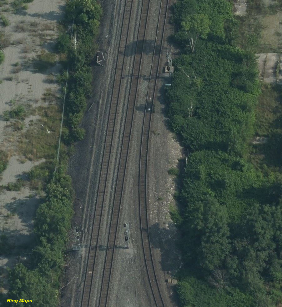
The top aerial photo is from around 2012, and the signals used at this interlocking appear to have been dwarfs.
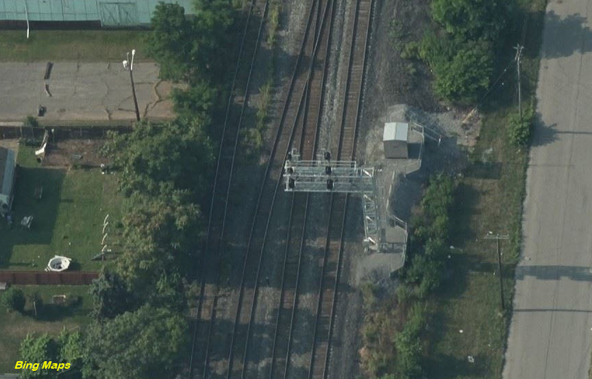
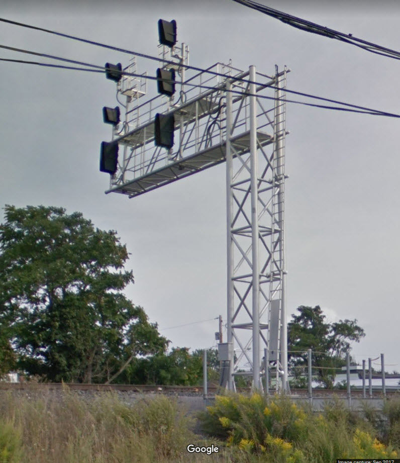
These signals are ~2040 feet from the signals at my location number 1, where the cantilever signal bridge used to be.
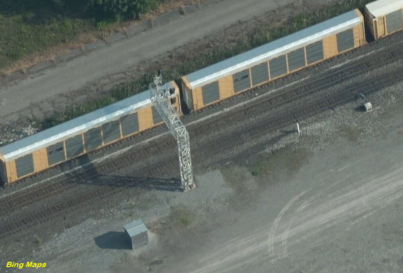
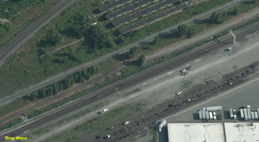
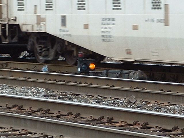
The signal below is on one of the yards leads, where it comes out onto the normally WB track of the mainline.
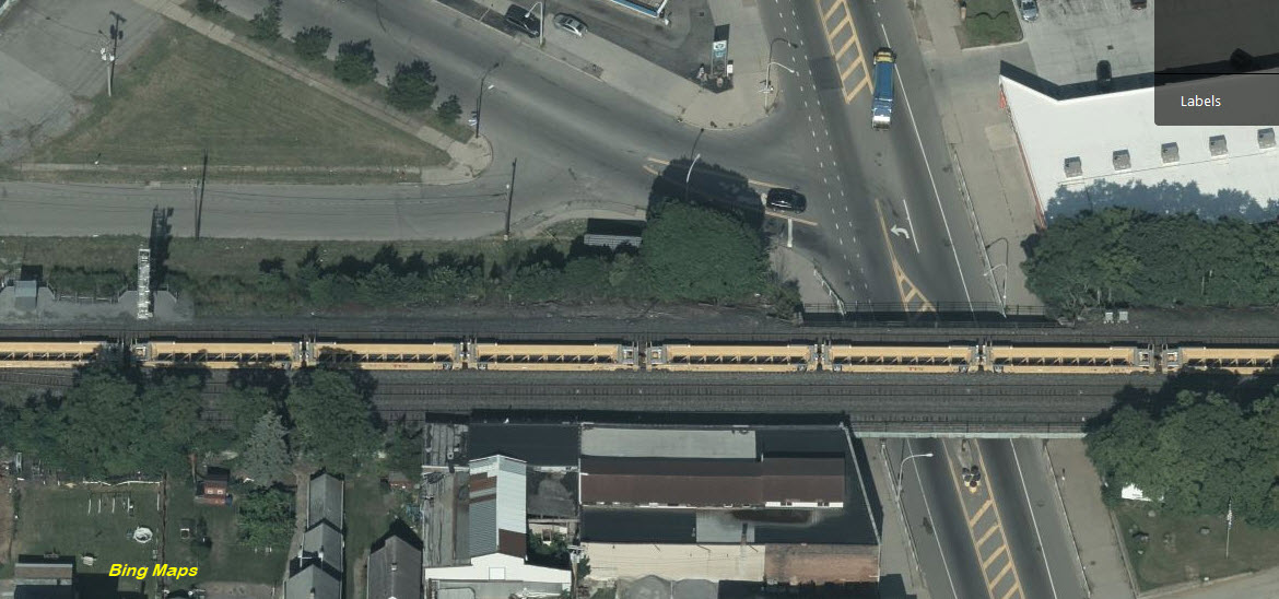
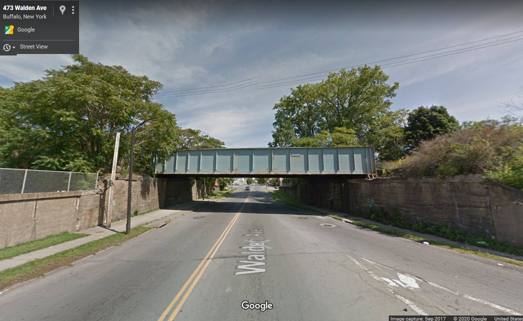
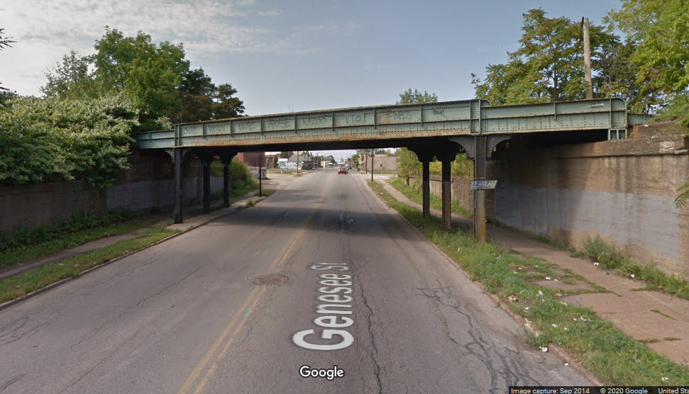
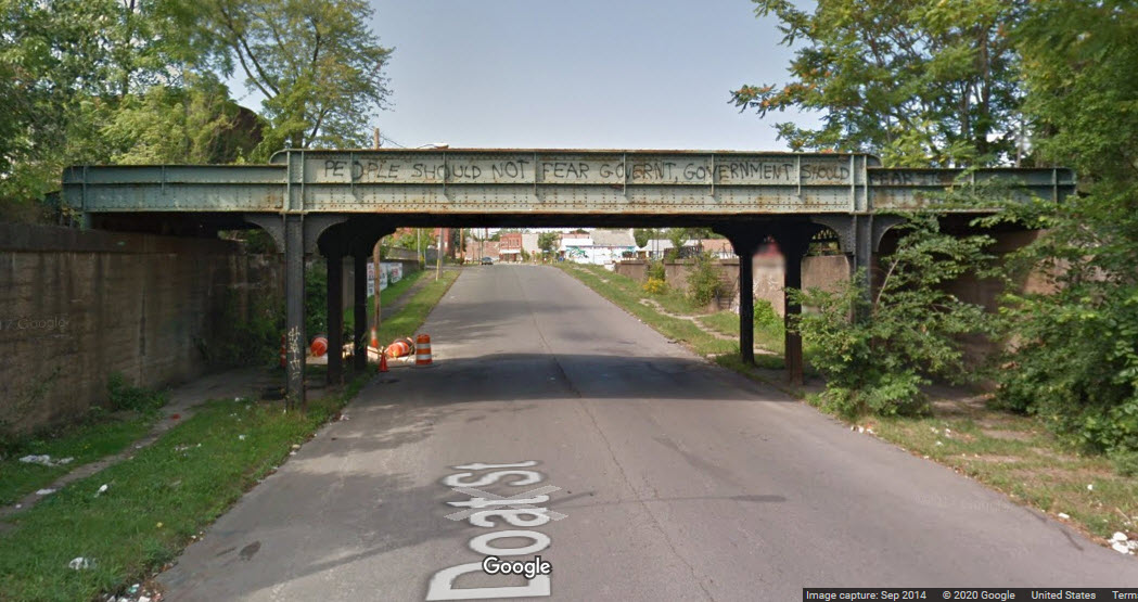
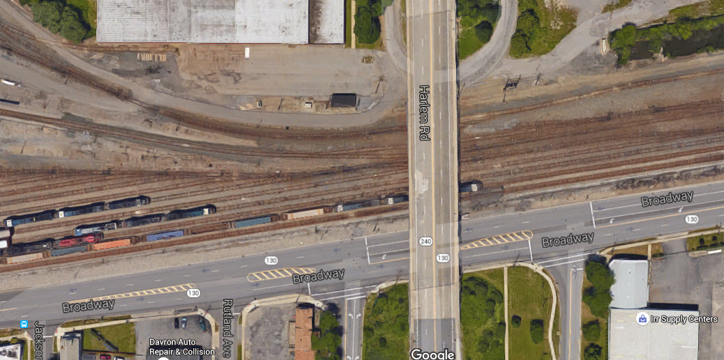
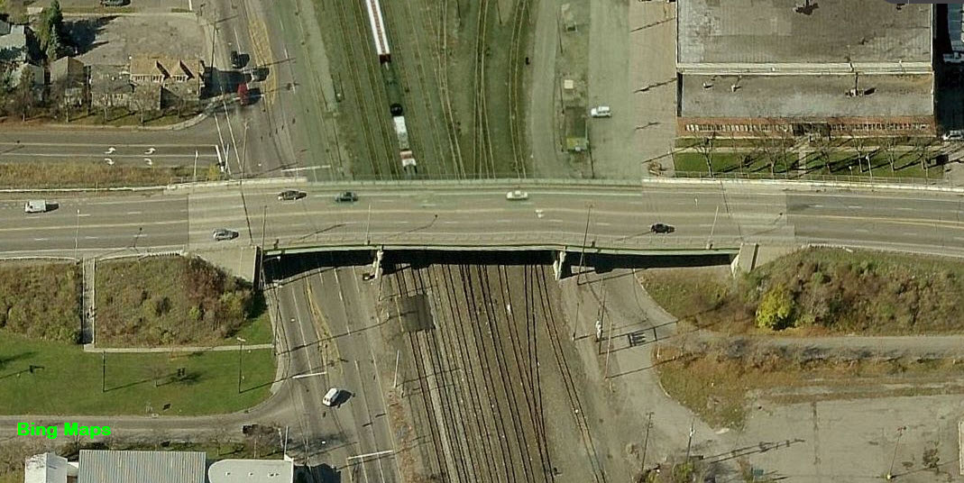
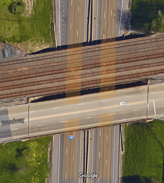
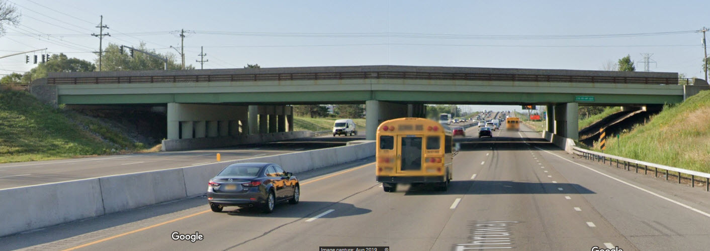
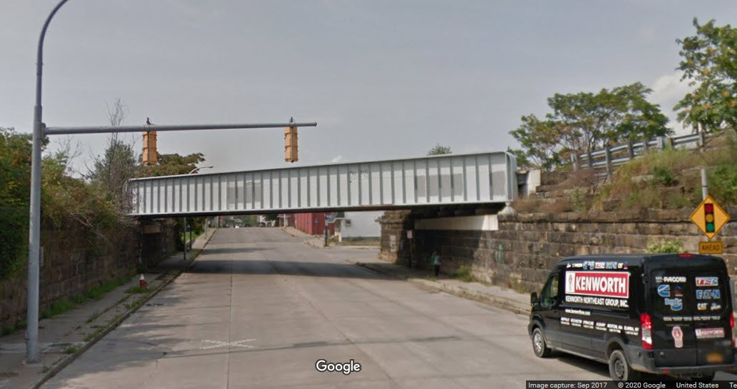
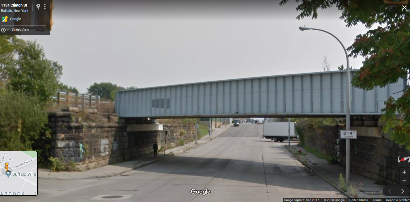
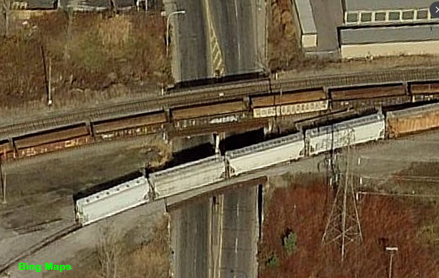
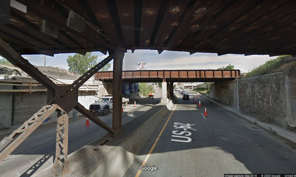
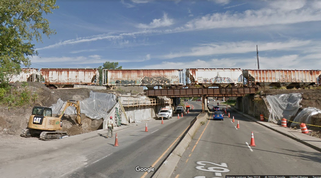
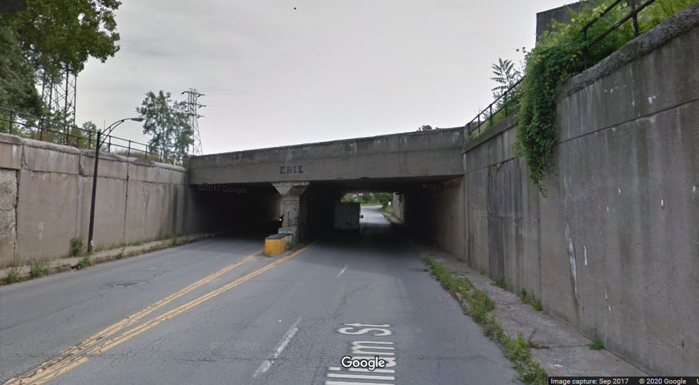
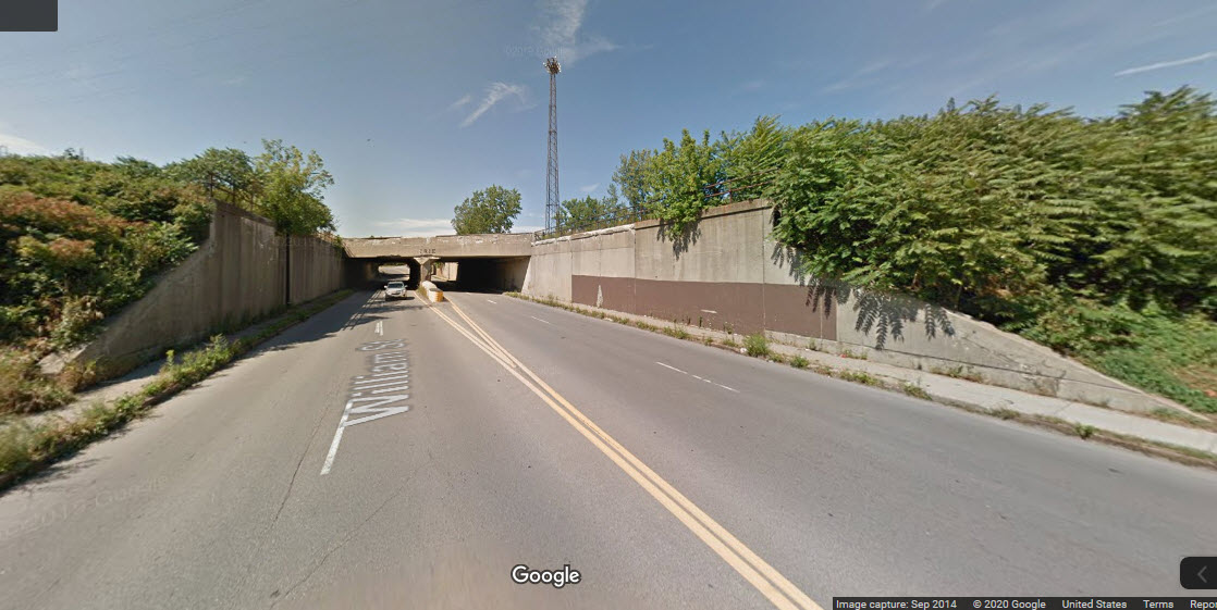
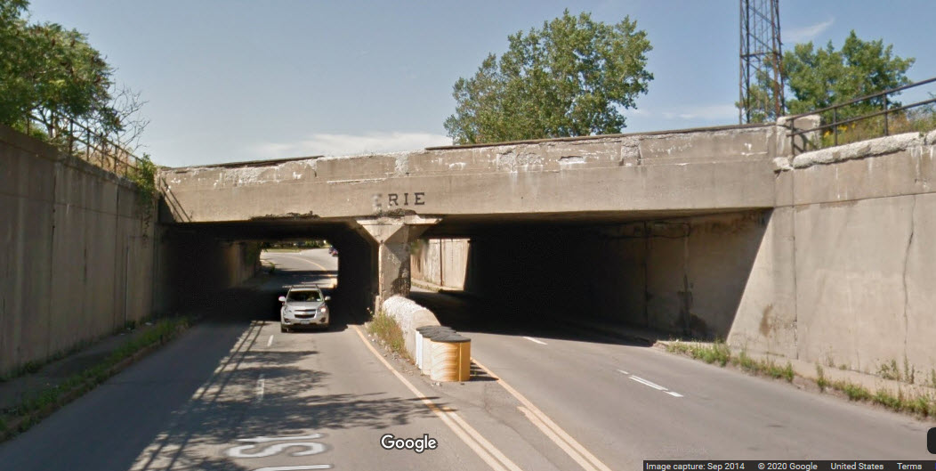
Very early on, because of the number of trains navigating through Buffalo, it was decided to do a grade separation between train traffic from vehicular traffic, and in some instances such as the DL&W, trains from trains. Although most of the bridges are nothing more than overpasses and therefore not very significant, there are plenty to enhance photo opportunities (as long as trees don't get in the way :-), and a lot to model!!!

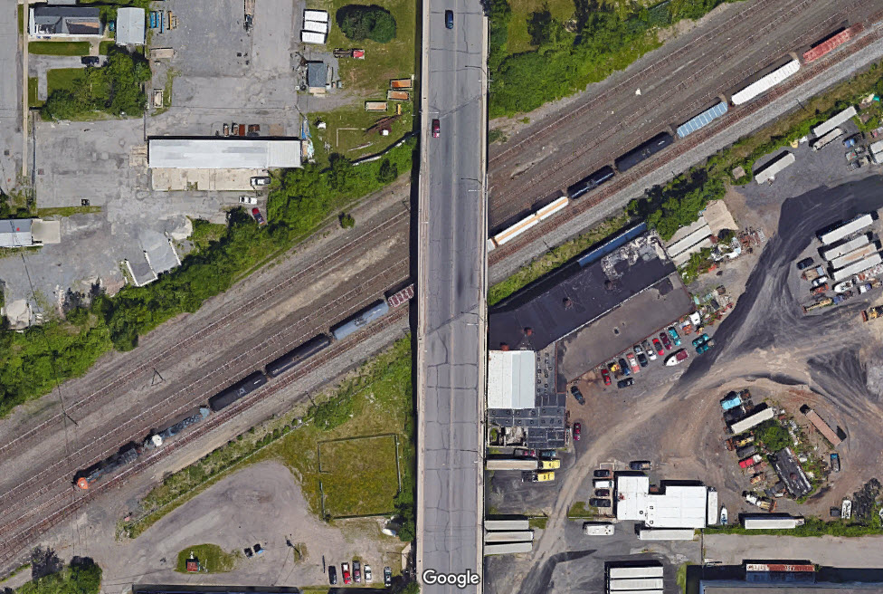
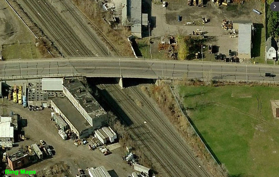
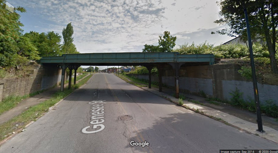

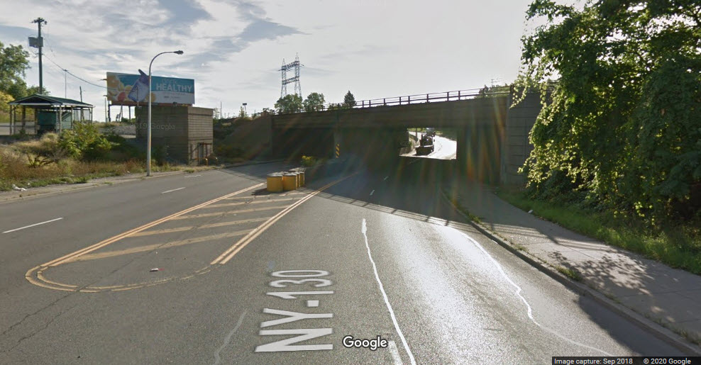
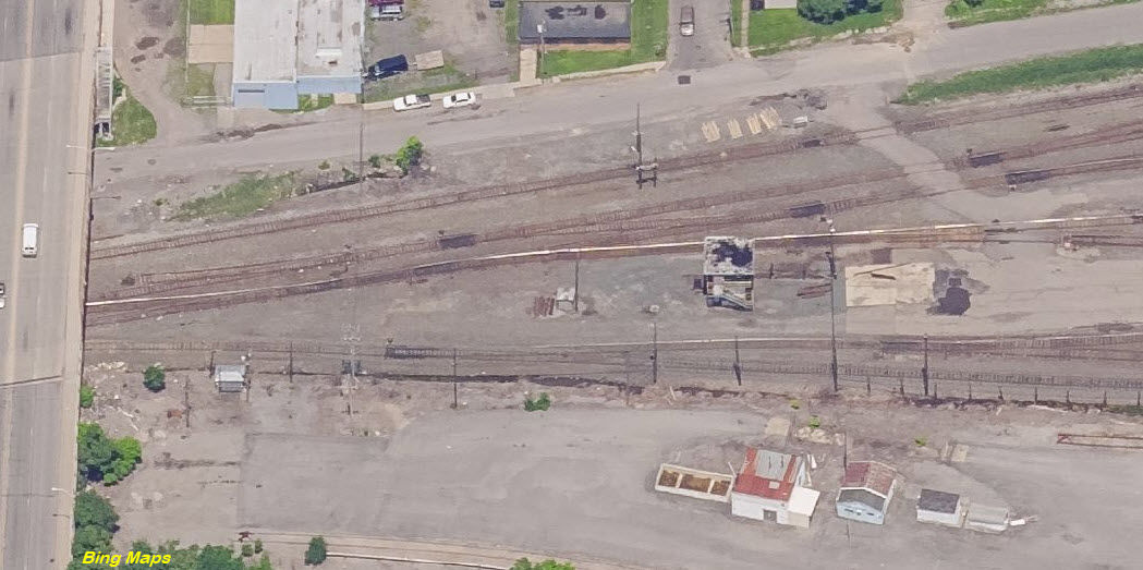
You can clearly see how at one time, this yard was much bigger, and had many more tracks crossing Clinton St
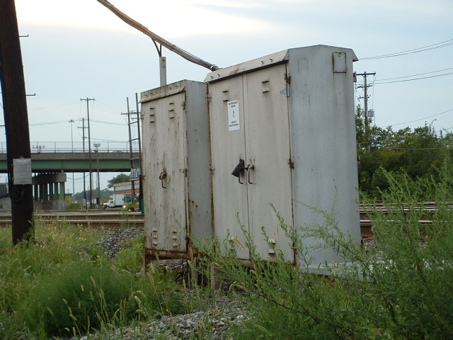

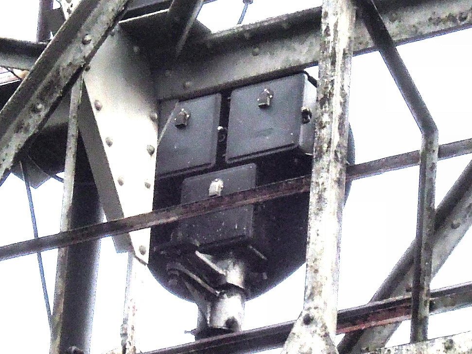
 Equipment cabinet adjacent to the cantilever signal bridge
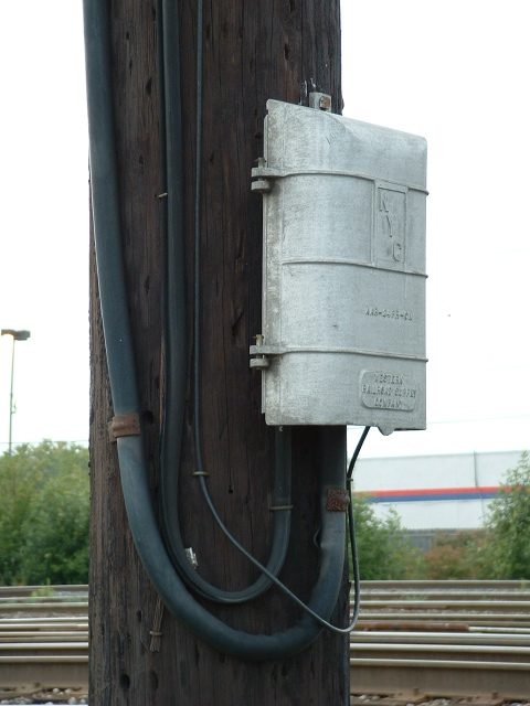

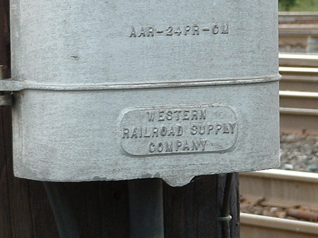
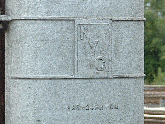
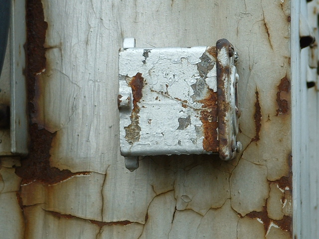
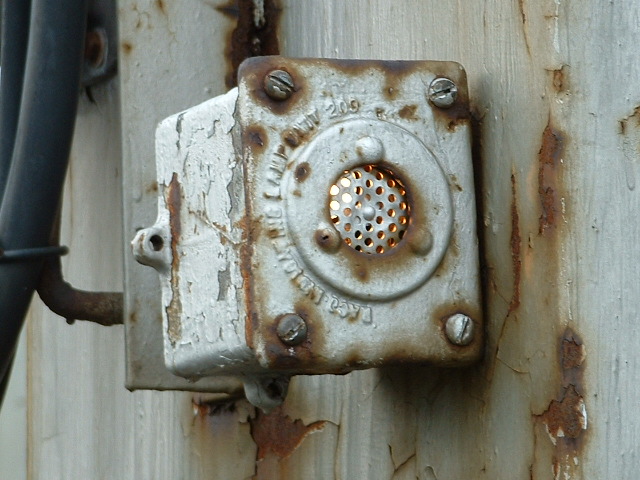
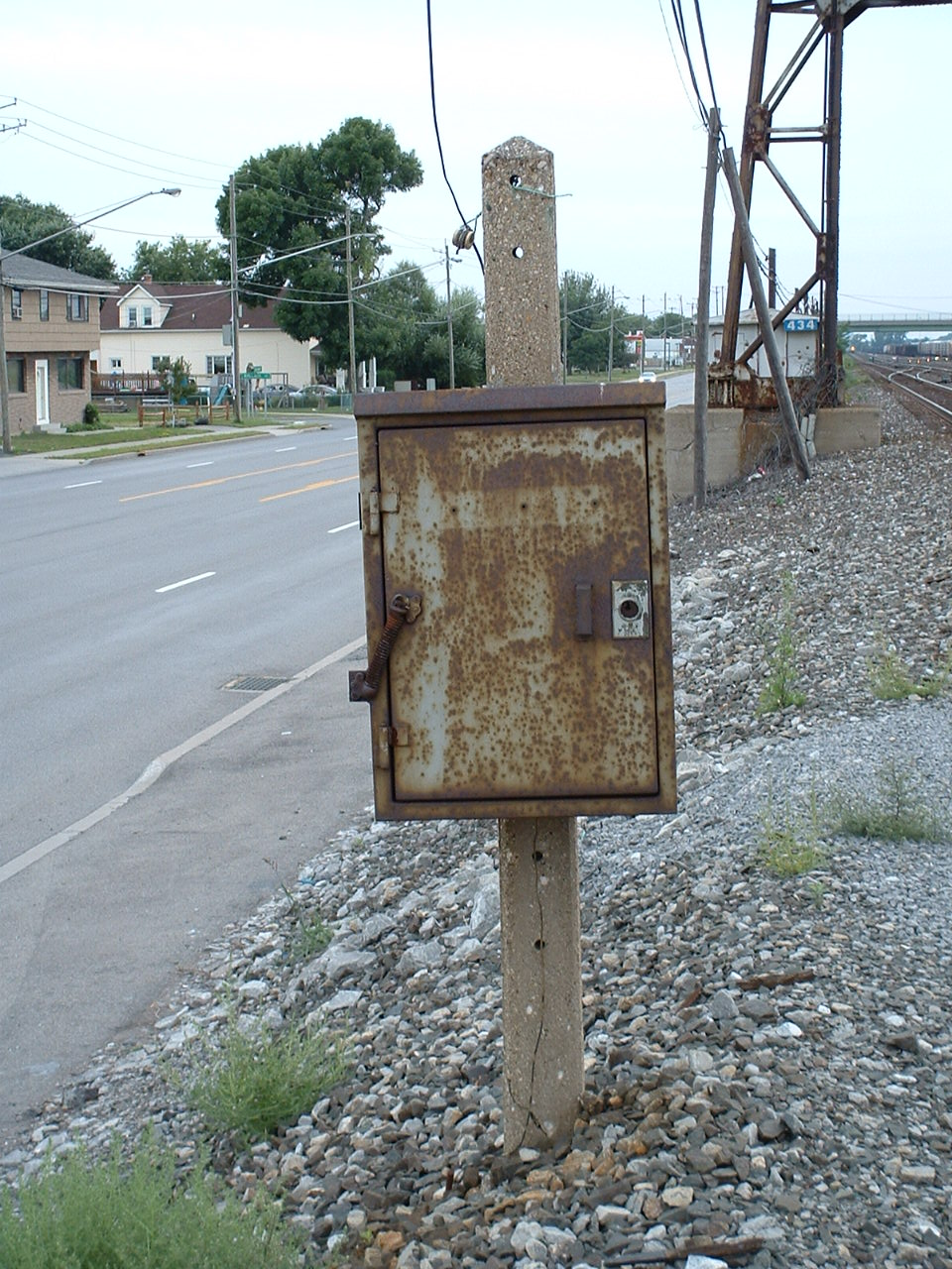
 Old NYC telephone box
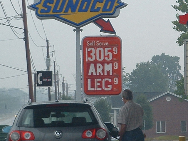 This was in 2006, I wonder what he would put on there today???
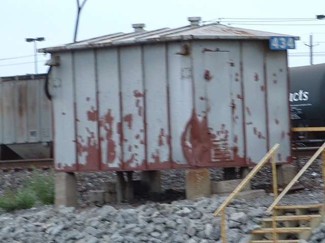
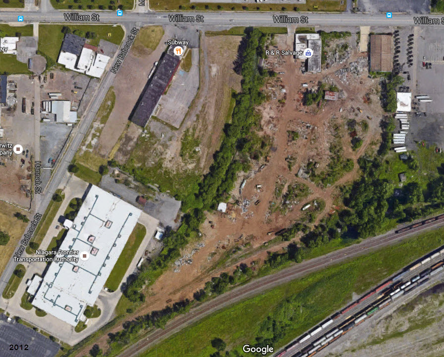 R&R Salvage
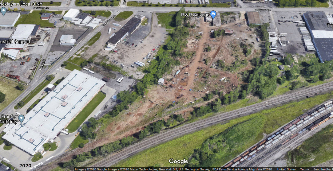
Disclaimers:
I love trains, and I love signals. I am not an expert. My webpages reflect what I find on the topic of the page. This is something I have fun with while trying to help others.
Please Note: Since the main focus of my two websites is railroad signals, the railfan guides are oriented towards the signal fan being able to locate them. For those of you into the modeling aspect of our hobby, my indexa page has a list of almost everything railroad oriented I can think of to provide you with at least a few pictures to help you detail your pike.
If this is a railfan page, every effort has been made to make sure that the information contained on this map and in this railfan guide is correct. Once in a while, an error may creep in :-)
My philosophy: Pictures and maps are worth a thousand words, especially for railfanning. Text descriptions only get you so far, especially if you get lost or disoriented. Take along good maps.... a GPS is OK to get somewhere, but maps are still better if you get lost! I belong to AAA, which allows you to get local maps for free when you visit the local branches. ADC puts out a nice series of county maps for the Washington DC area, but their state maps do not have the railroads on them. If you can find em, I like the National Geographic map book of the U.S..... good, clear, and concise graphics, and they do a really good job of showing you where tourist type attractions are, although they too lack the railroads. Other notes about specific areas will show up on that page if known.
Aerial shots were taken from either Google or Bing Maps as noted. Screen captures are made with Snagit, a Techsmith product... a great tool if you have never used it!
By the way, floobydust is a term I picked up 30-40 years ago from a National Semiconductor data book, and means miscellaneous and/or other stuff.
Pictures and additional information is always needed if anyone feels inclined to take 'em, send 'em, and share 'em, or if you have something to add or correct.... credit is always given! Please be NICE!!! Contact info is here
Beware: If used as a source, ANYTHING from Wikipedia must be treated as being possibly being inaccurate, wrong, or not true.
BUFFALO RAILFAN GUIDE HOME
RAILFAN GUIDES HOME
RAILROAD SIGNALS HOME
NEW MAR27/2012, MAR15/2016, MAR30/2020
Last Modified
31-Mar-2020