In General
Getting Here
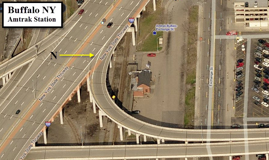
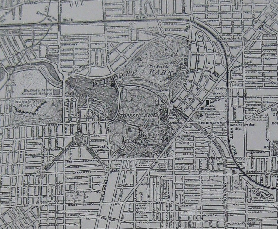
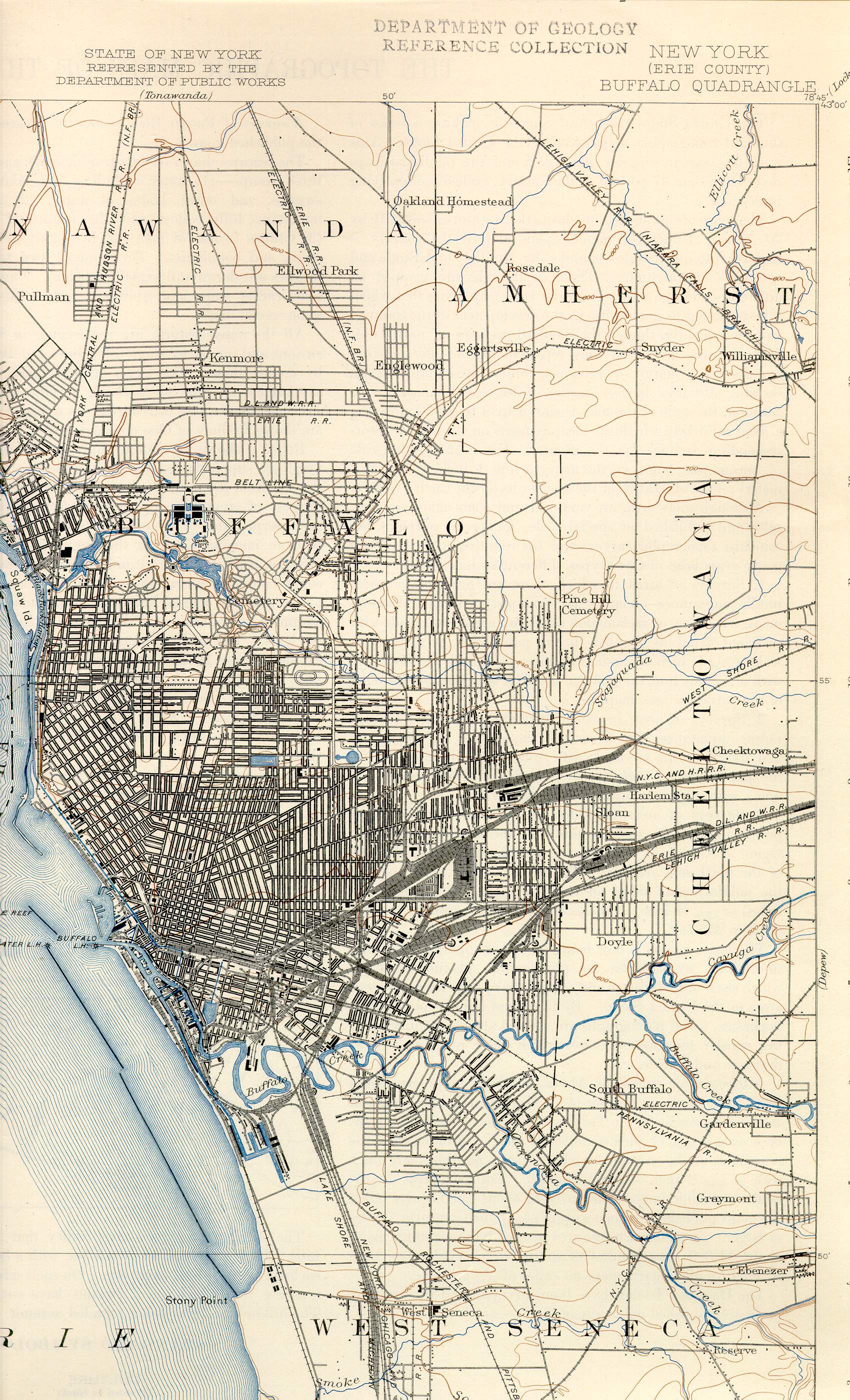
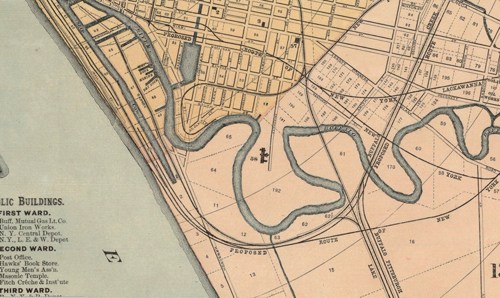
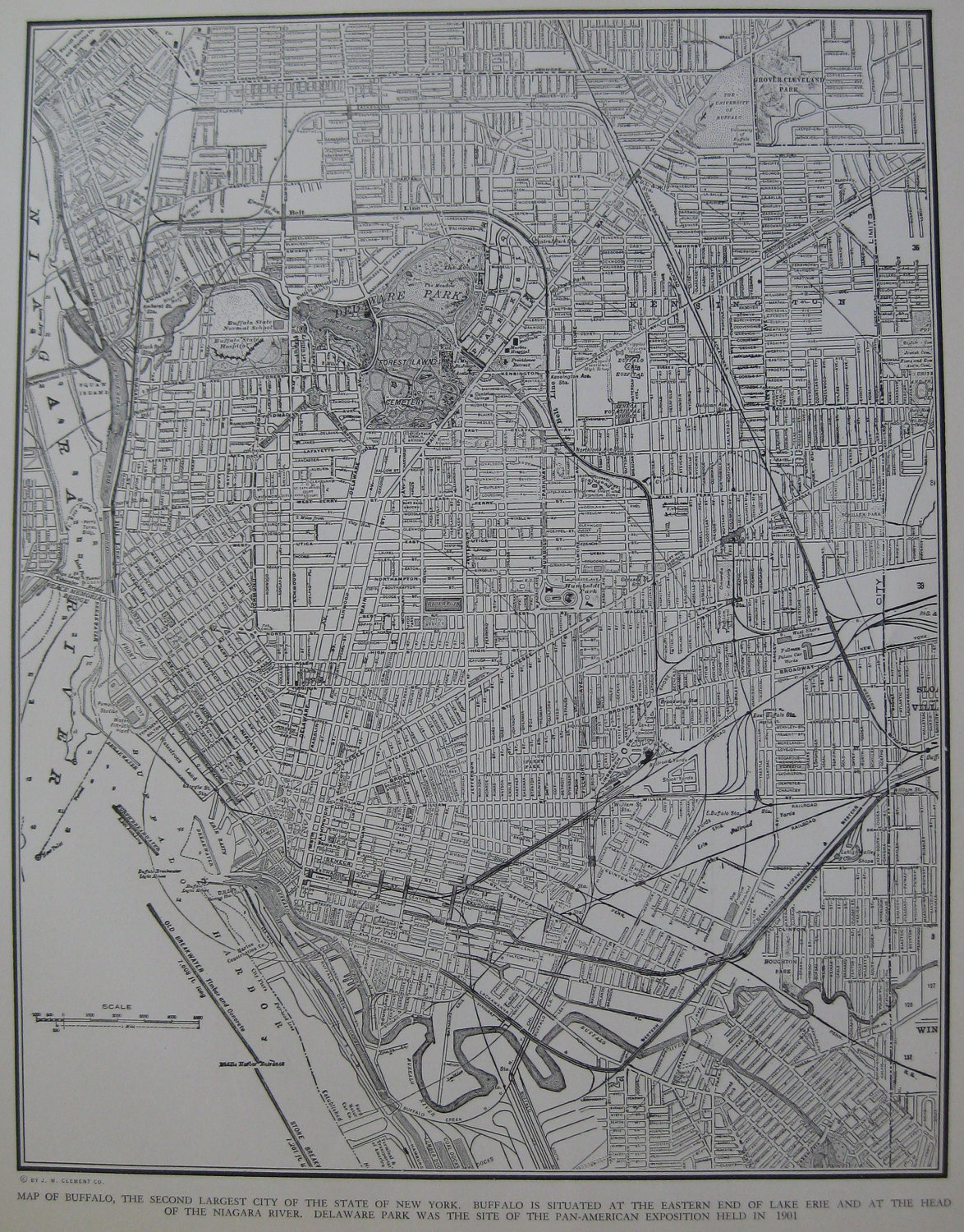
Map
Sights
Railroad Bridges and Overpass
Other Stuff
Historic Stuff
RAILFAN GUIDES HOME
RAILROAD SIGNALS HOME
Buffalo Railfan Guide Homepage
Map 1 - Downtown -You're on it
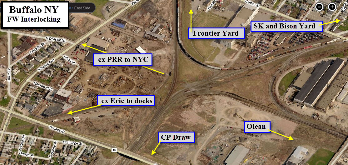
Map 2 - East - CSX's Frontier Yard and NS's Bison Yard
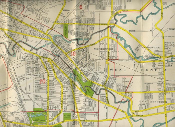
Map 3 - Seneca
Map 4 - South
Map 5 - North
Light Rail guide
Depew Railfan Guide
Location / Name:
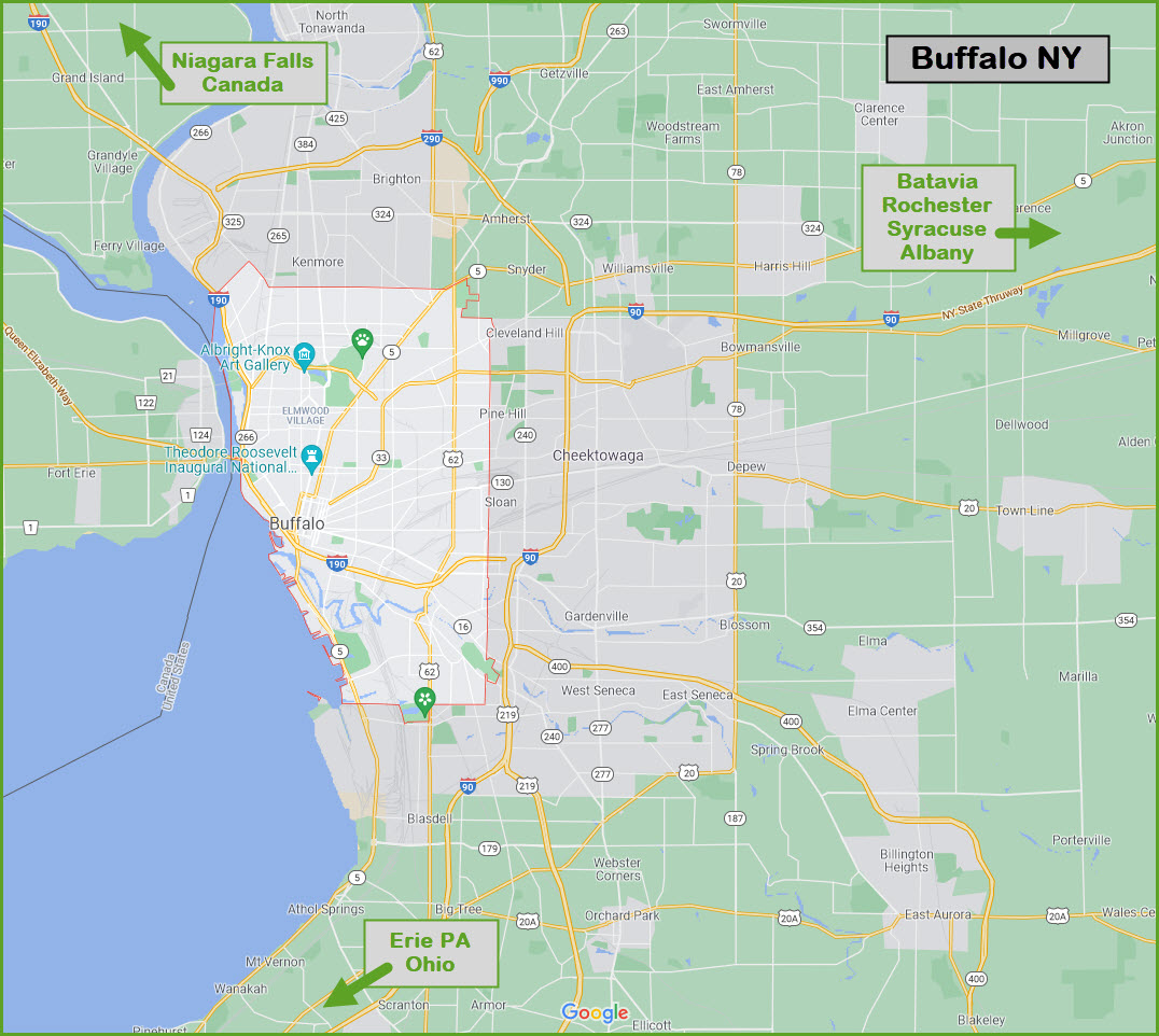
Buffalo NY, Erie County Seat
What's Here:
Buffalo Light Rail System
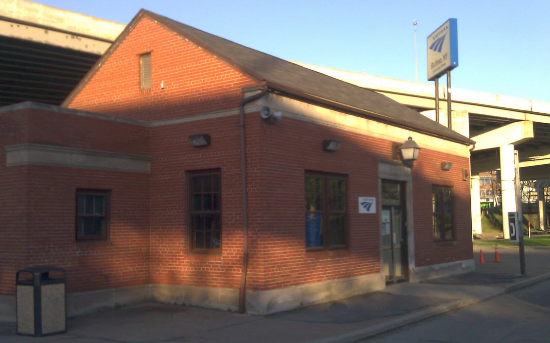
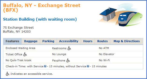
Amtrak Station
Oodles of Yards
Ex NYC Central Terminal (on the map 2 page)
Data:
GPS Coordinates: as needed and 42.88643, -78.87815 (Center of Niagara Square in front of City Hall)
Phone A/C: 716
ZIP: 14202 (City Hall)
Access by train/transit:
Amtrak Downtown
Buffalo Light Rail System
Depew Amtrak Station
The Scoop:
The downtown area offers a lot of activity though out most of the day.
Plenty of local switching takes place, working out of the numerous yards that surround Buffalo.
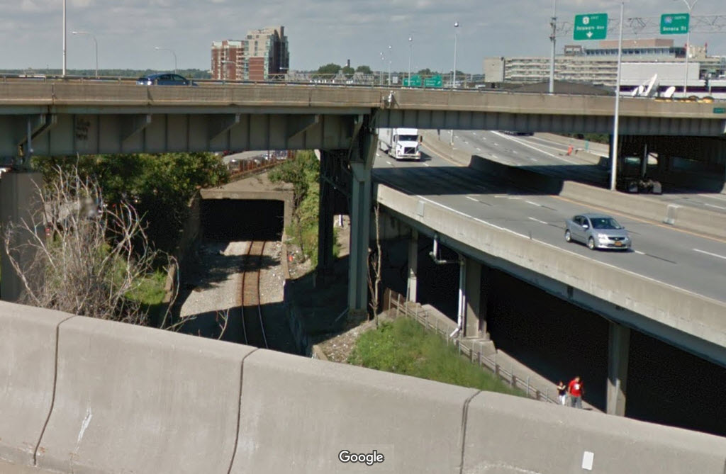
Amtrak comes through, and has a fair number of trains coming through to keep you entertained. Schedules are on the homepage. Tracks heading north from the Amtrak station to Niagara Falls follow I-190 on the west side till just south of the Peace Bridge, and then goes under the interstate to the east side.
If you're into transit, Buffalo has a light rail system for you to explore.
Acknowledgements:
Denver Todd
Websites and other additional information sources of interest for the area:
https://metro.nfta.com/
I-90 comes in from the east: Batavia, Rochester, Syracuse, and Albany. I-90 also heads south and then west to Erie PA and beyond, like OH, IN, and IL.
If you're coming in via I-90, take I-190 (exit 53) to get to the downtown sights.
Coming in from Niagara Falls and Canada: I-190 brings you down and connects with I-90 on the SE side of Buffalo.
I-190 exits 4, 5, 6, 7, and 8 drop you off in the downtown area.
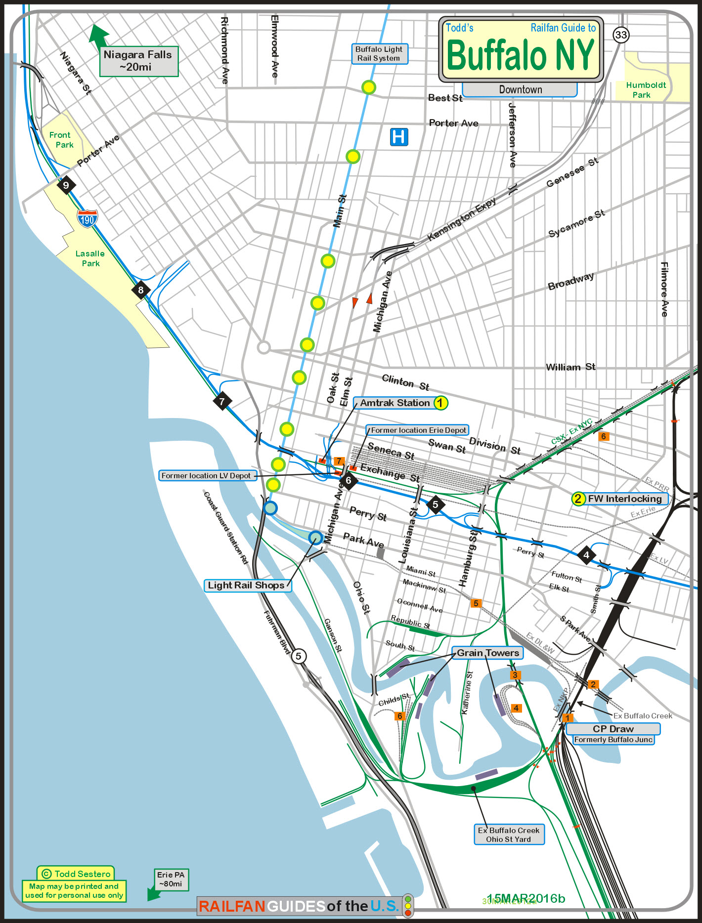
For the above map in PDF form, click here
GPS Coordinates: 42.877742, -78.872723
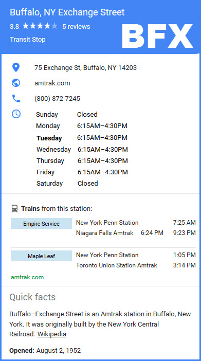 Amtrak schedules are on the Buffalo homepage.
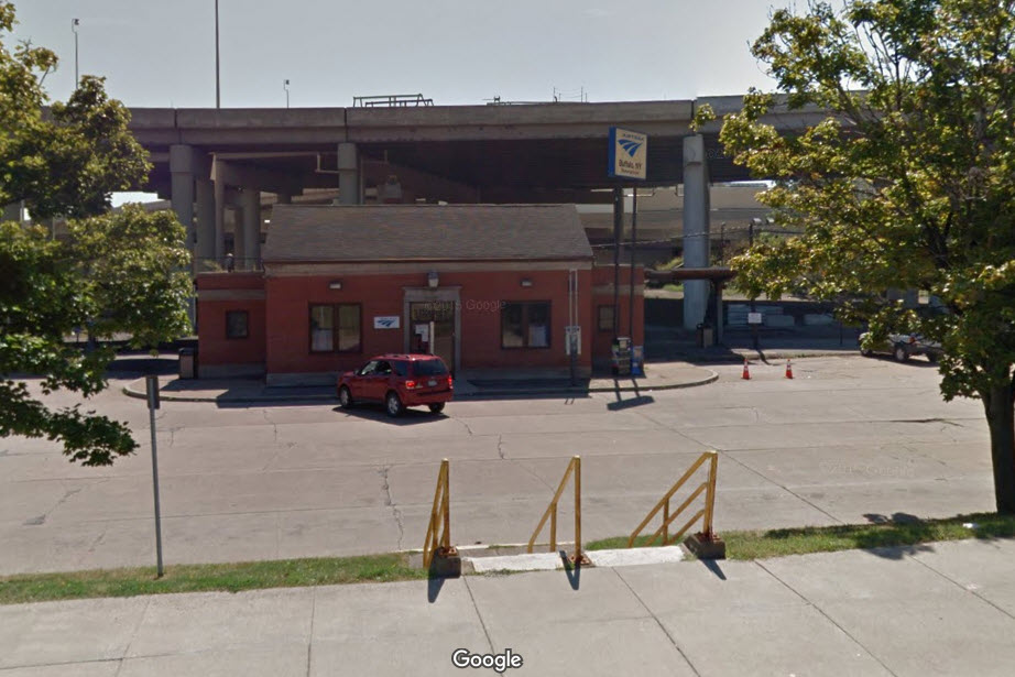
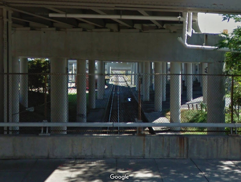
From Washington St looking (south) towards the Amtrak station, under I-190.
Below, the tracks head northward, and go thru another tunnel to get to the other side of the highway - picture from Google streetview from one of the exit ramps.
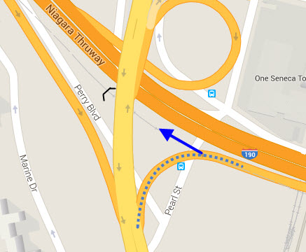
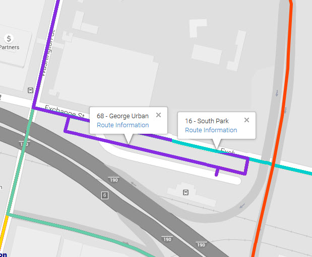
The #68 serves the station, goes NB on Washington and SB on Pearl, the #16 goes by the station but does not pull into the Amtrak lot.
A 68 bus at the station with a #16 going by.
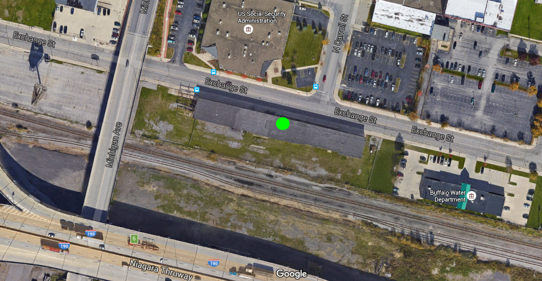
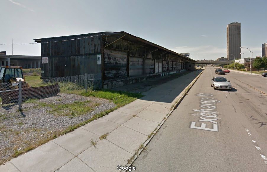
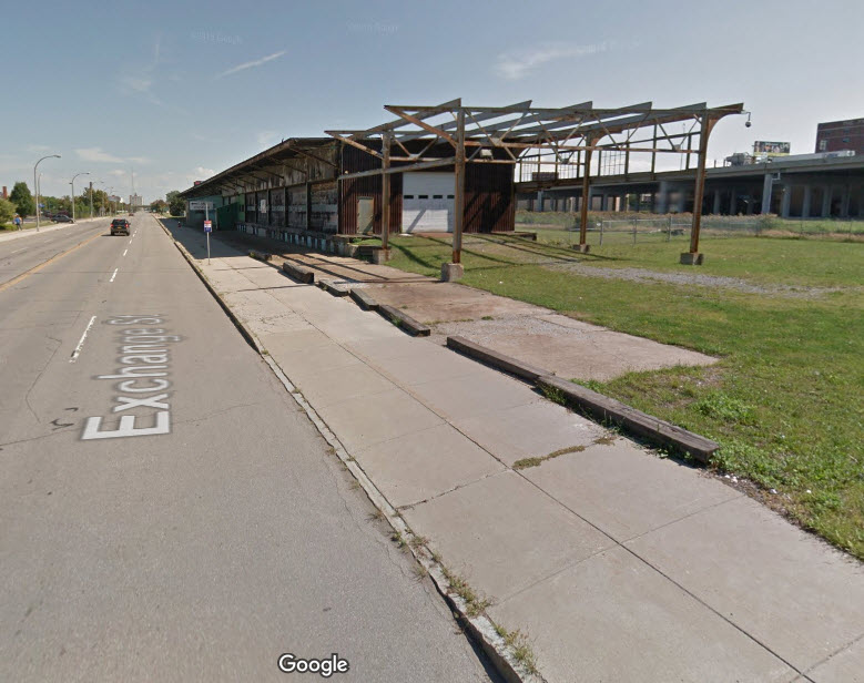
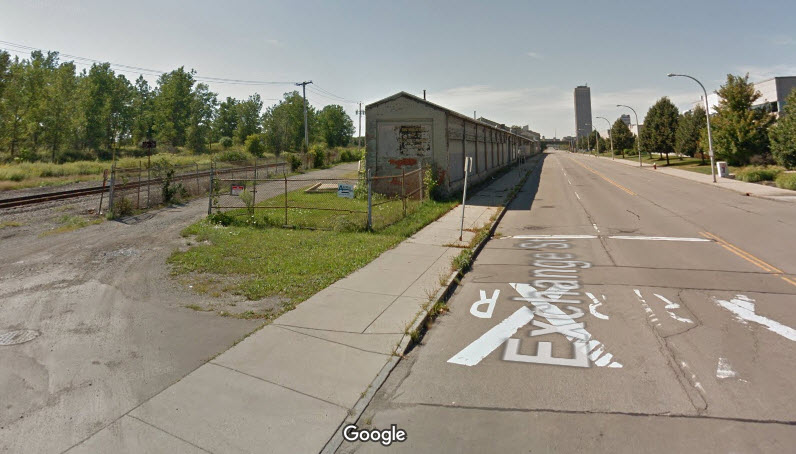
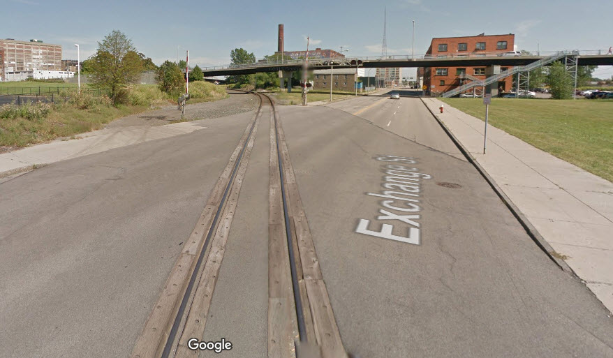
A little further east on Exchange St is another old RR building.
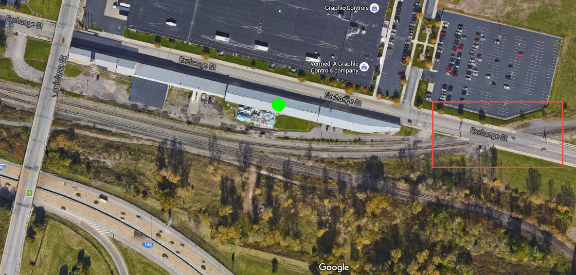
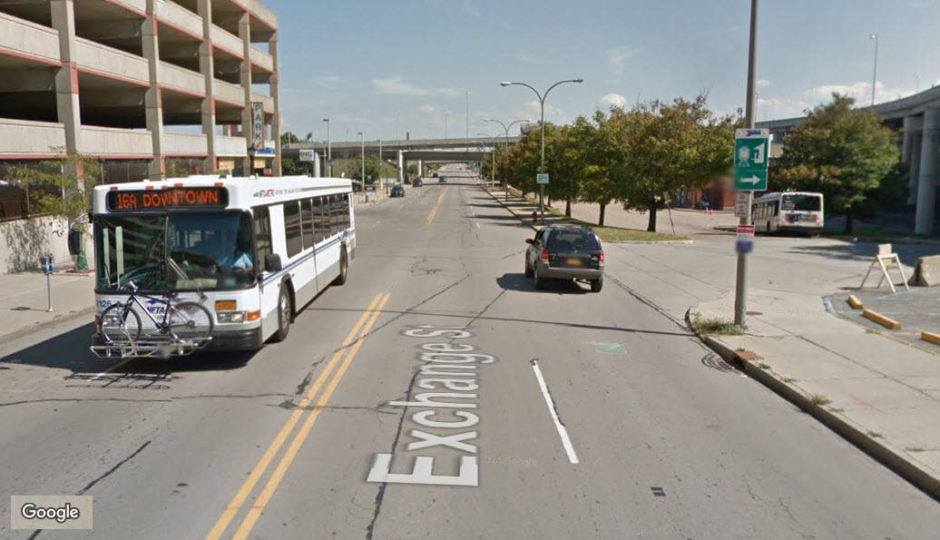
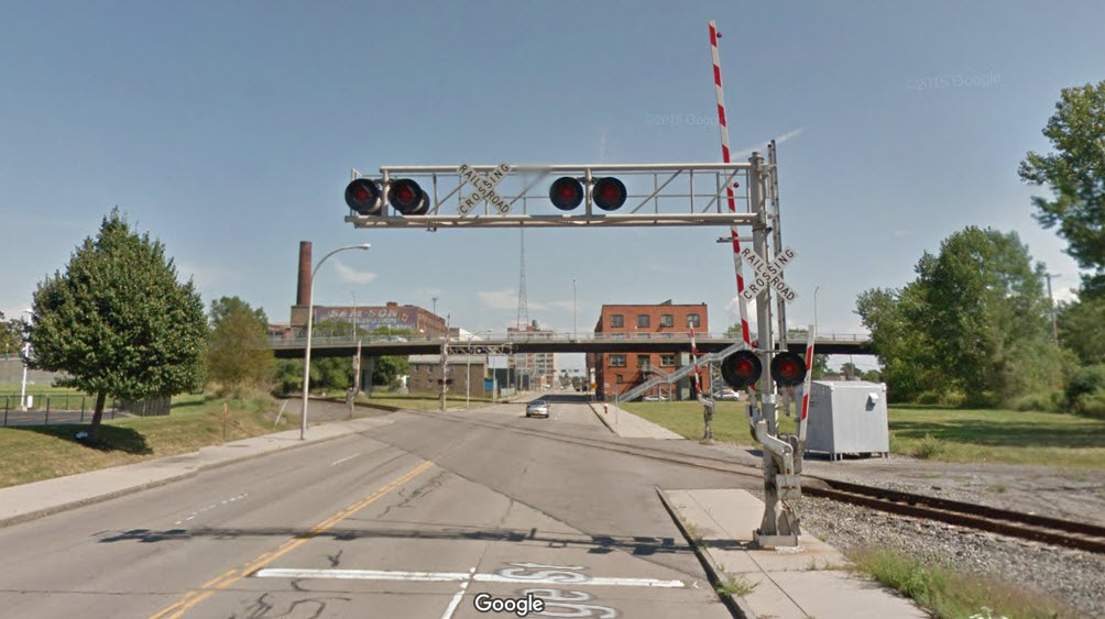
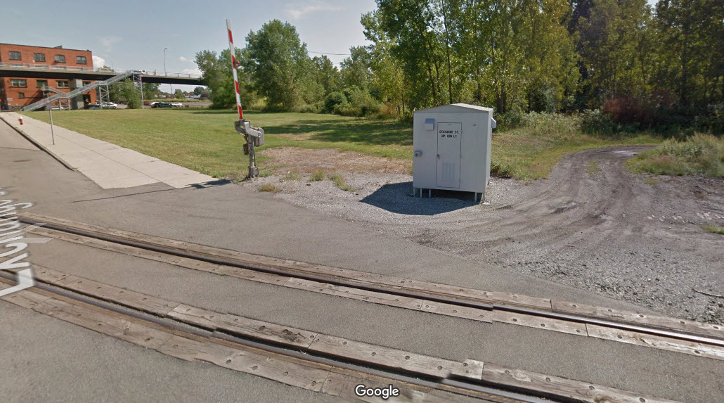
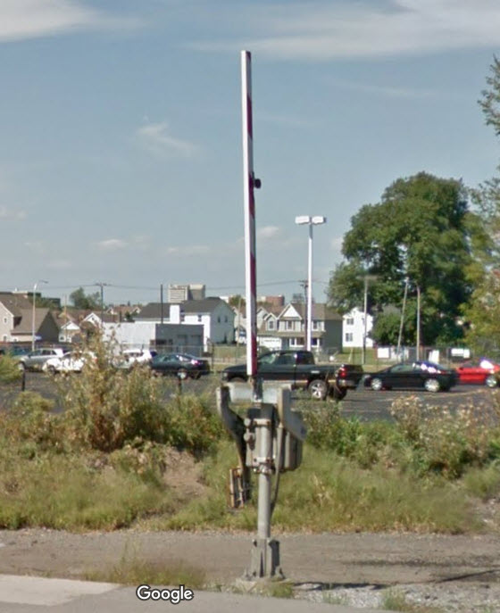
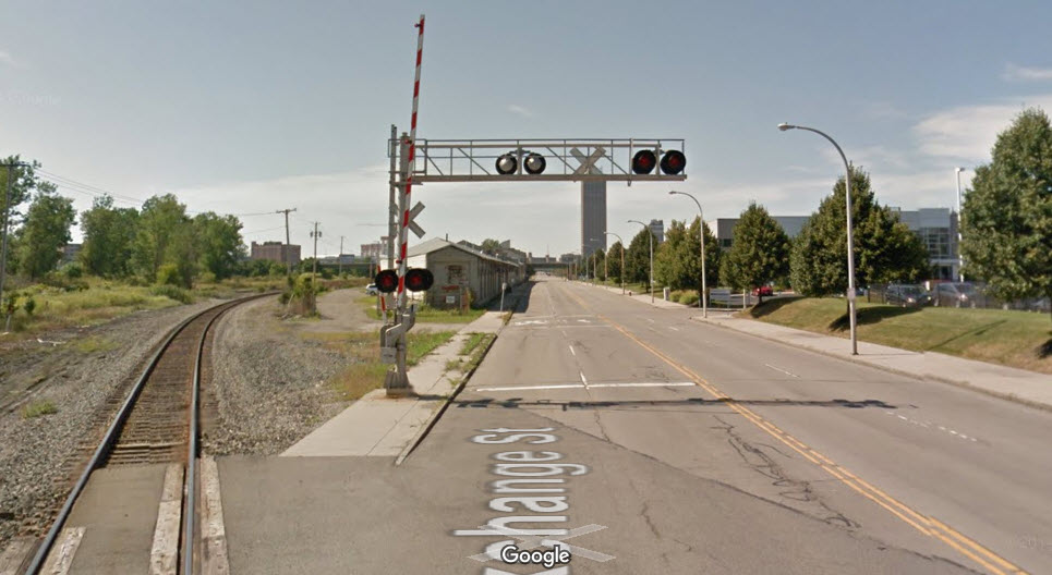
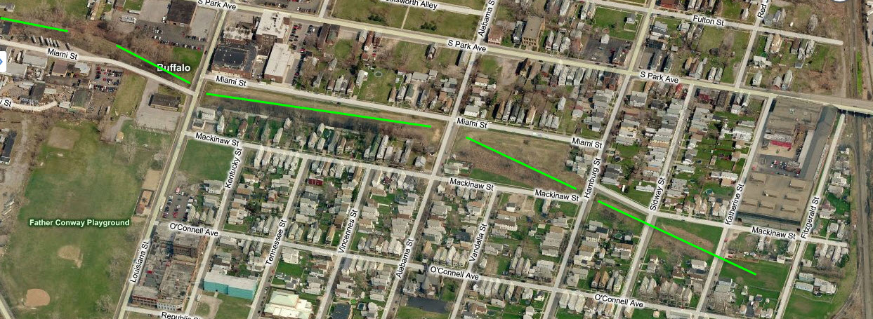
Nice clear crossing for taking pictures of the Amtrak trains coming thru. Even has a couple of pedestrian crossing gates which are fairly uncommon. Outlined in red above.
Railroad Bridges and Overpasses
This page was done before I started using my blue & white icons for bridges, at least at this point, I'm going to leave things pretty much alone..... :-) However, in SEP21, I started to break out the railroad bridges and overpasses from what used to be the RR Bridge and Other Stuff section, which is now the "Other Stuff" section below.
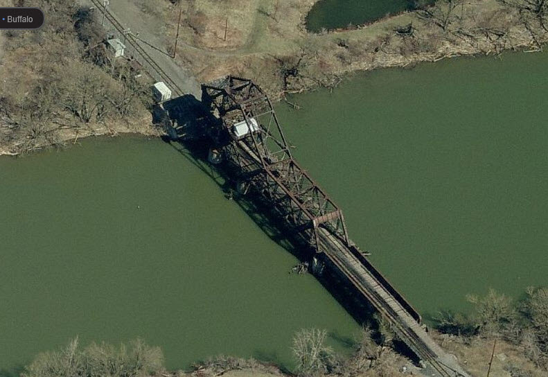
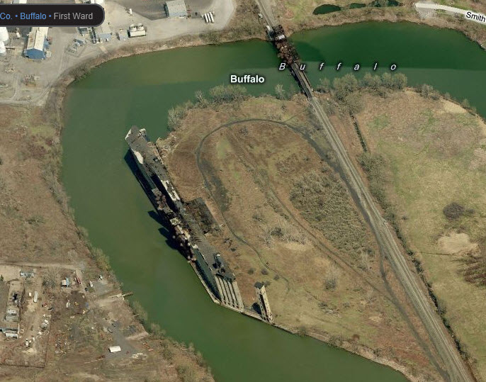
The bridge on the right is a former Buffalo Creek bridge which is still in use by CSX and NS. The bridge on the left is a former NKP bridge.
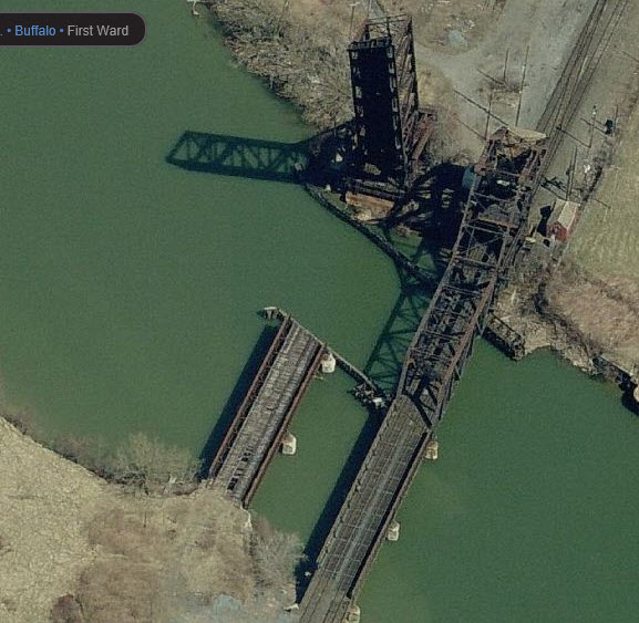
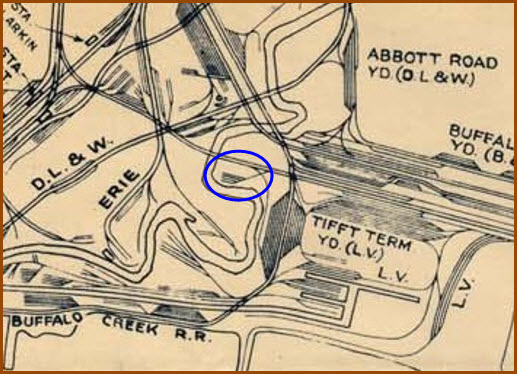
Evidence of the DL&W's entry into Buffalo (off to the left) can still be seen. The pilings on the half removed bridge look relatively new.
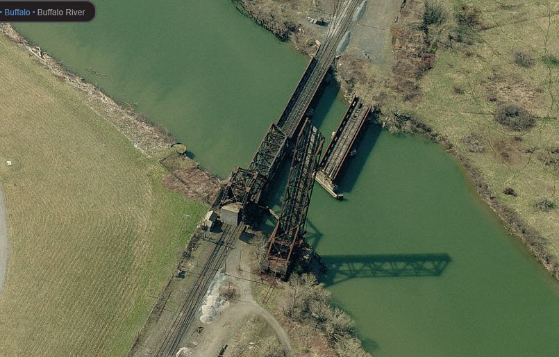
An ex New York Central bridge, once a part of their mainline to Chicago.
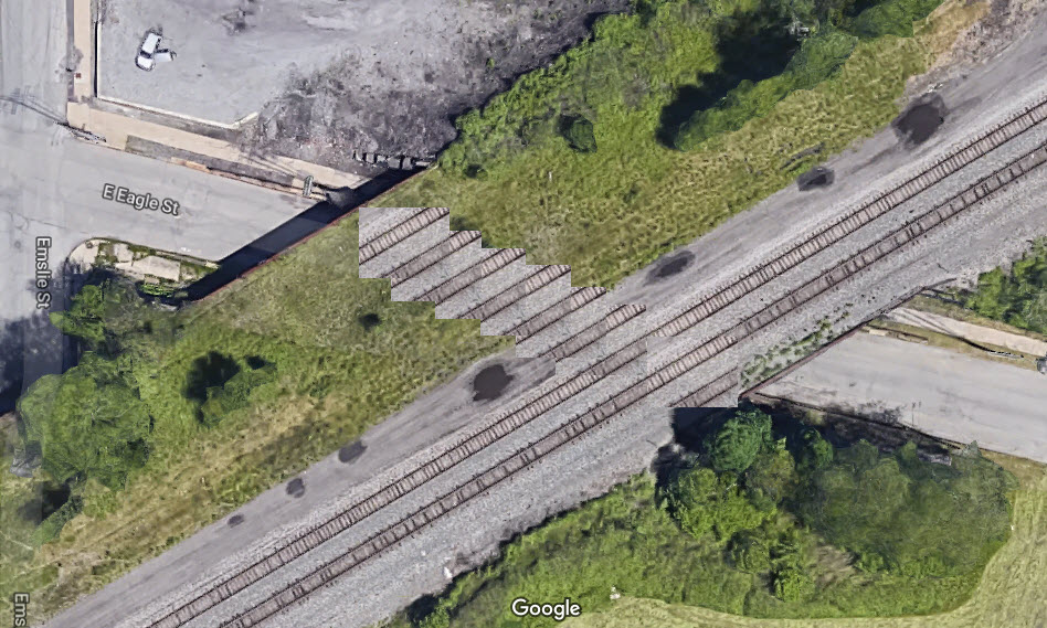
Wide overpasses - as can be seen in the doctored photo, the overpass can accommodate up to 9 tracks! Anyone have or know of a picture that shows all of the tracks in place???
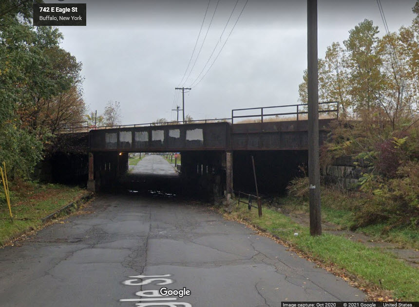 Eagle St looking west
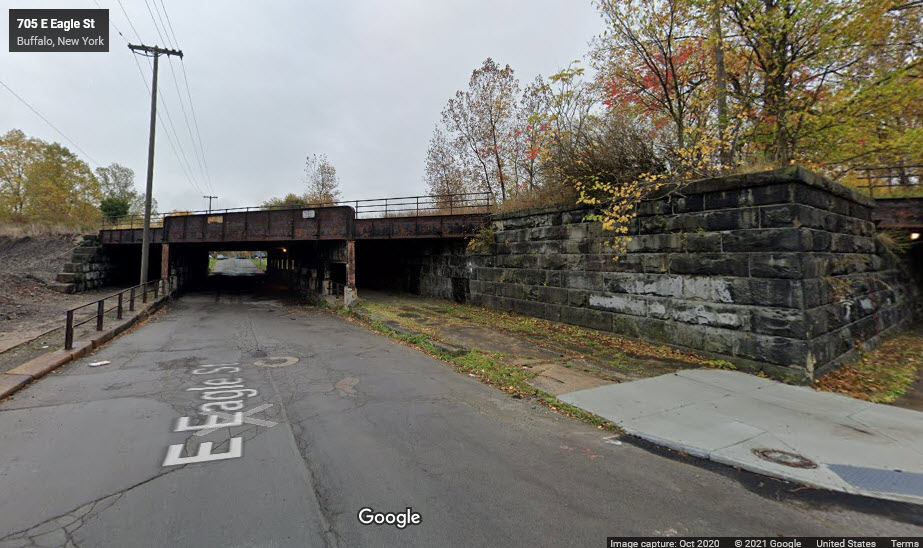 Eagle St looking east
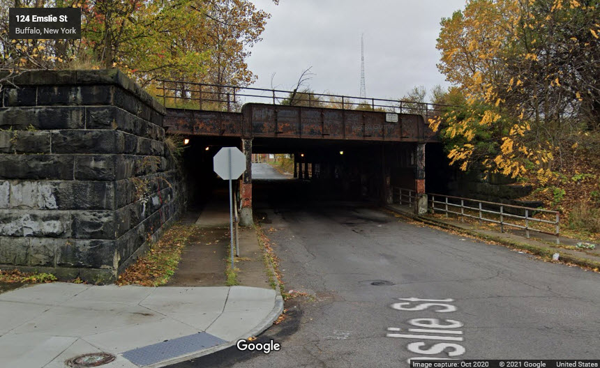 Emslie St looking south
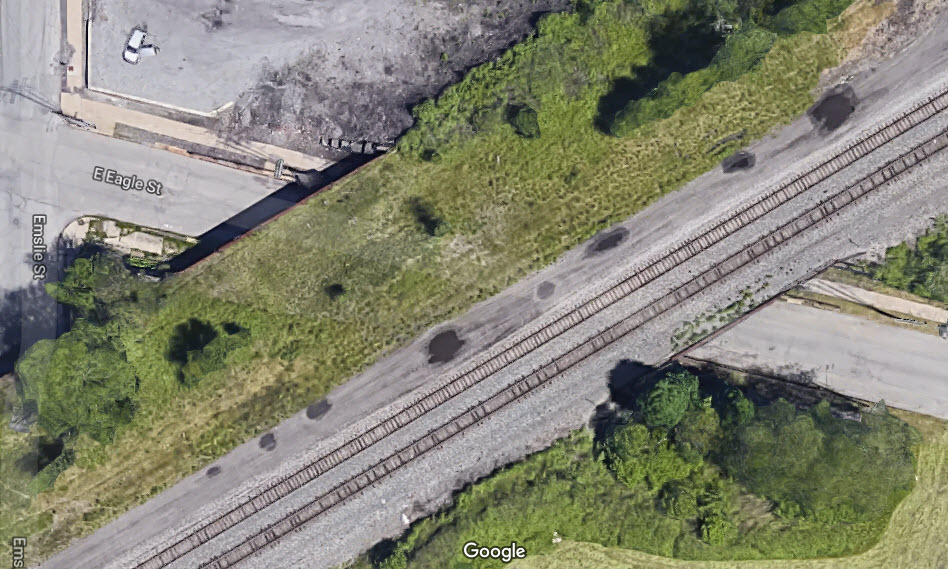
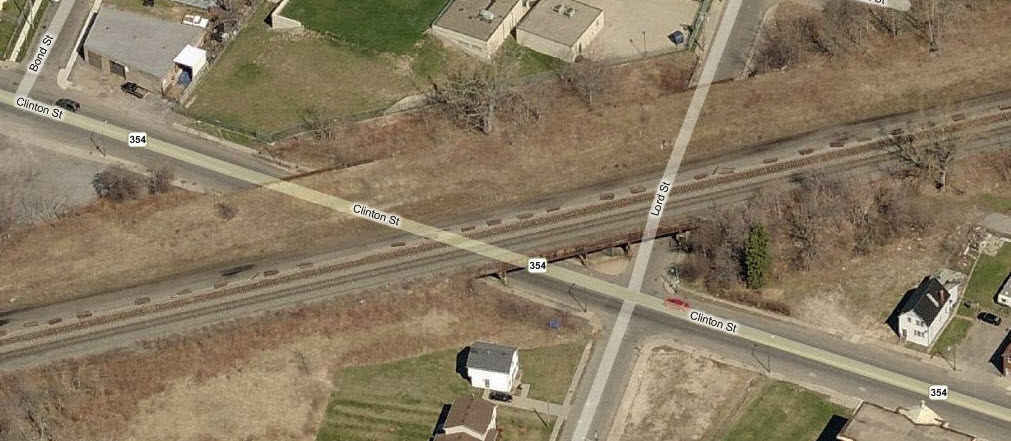
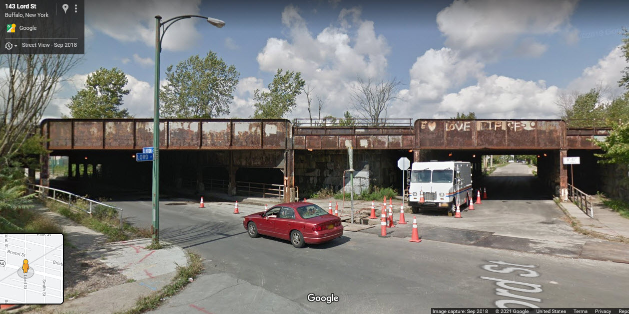
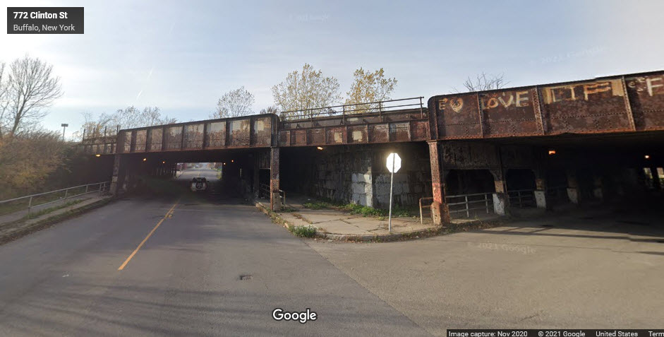
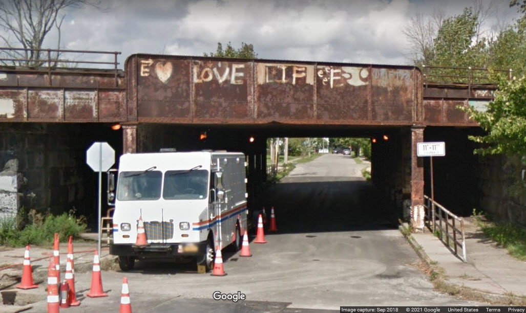
These underpasses are typical of the many that sprinkle the old New York Central right-of-way from Frontier yard into the downtown area. All the maps I can find of the area show there being four tracks coming through here, although it looks like it could handle quite a few more.... anyone know for sure? This one is at Clinton and Lord Streets.
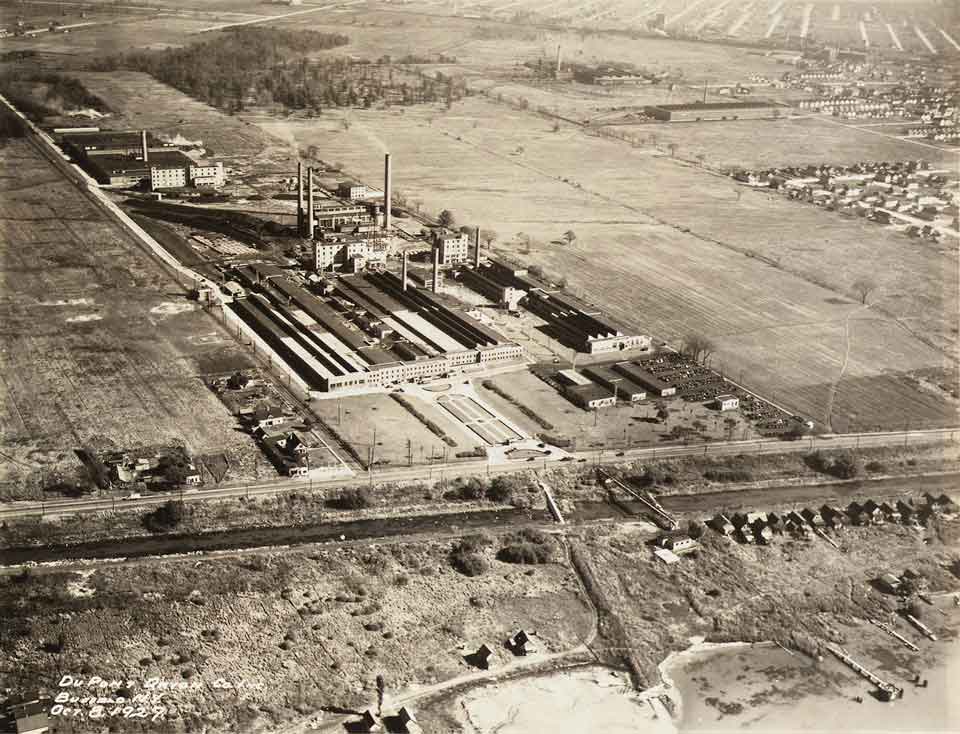
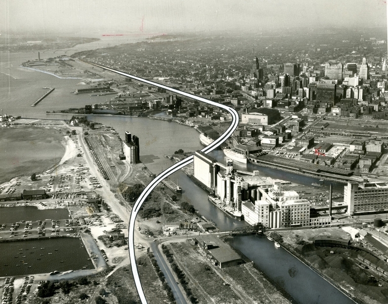
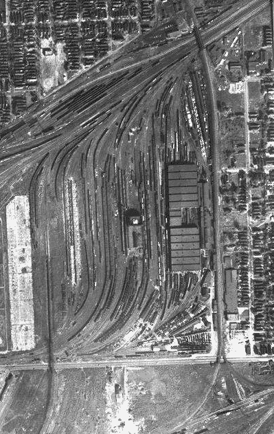
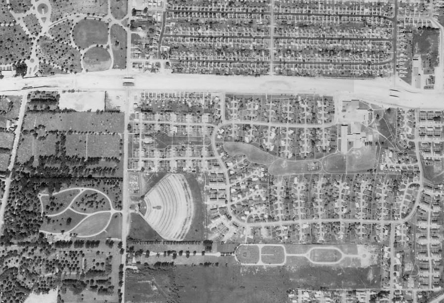
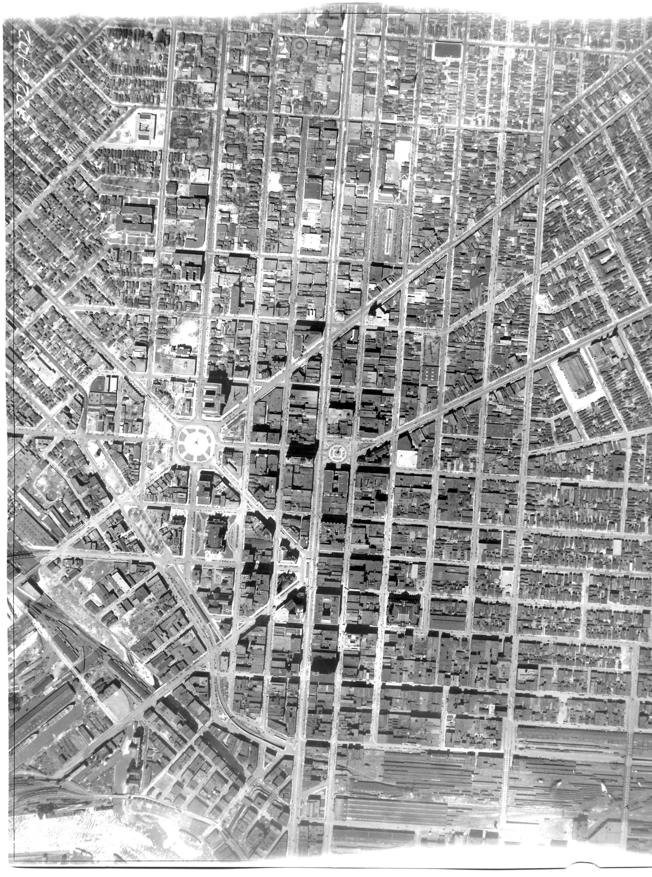
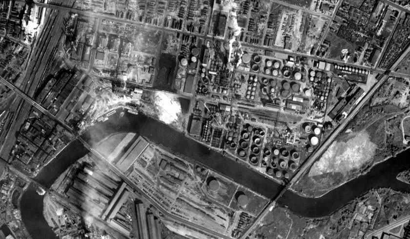
If you look at aerial shots of Buffalo today, you will see evidence of the old railroad infrastructure left over from Buffalo's heyday.
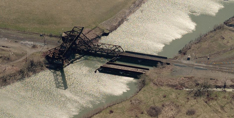
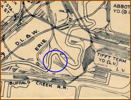
An unused grain tower, where there once was a substantial NYC yard with 5 tracks looping around to service the tower. The bridge at the top of the picture is the one featured above.
Although not depicted in "the map" as a loop, this is where it was located:
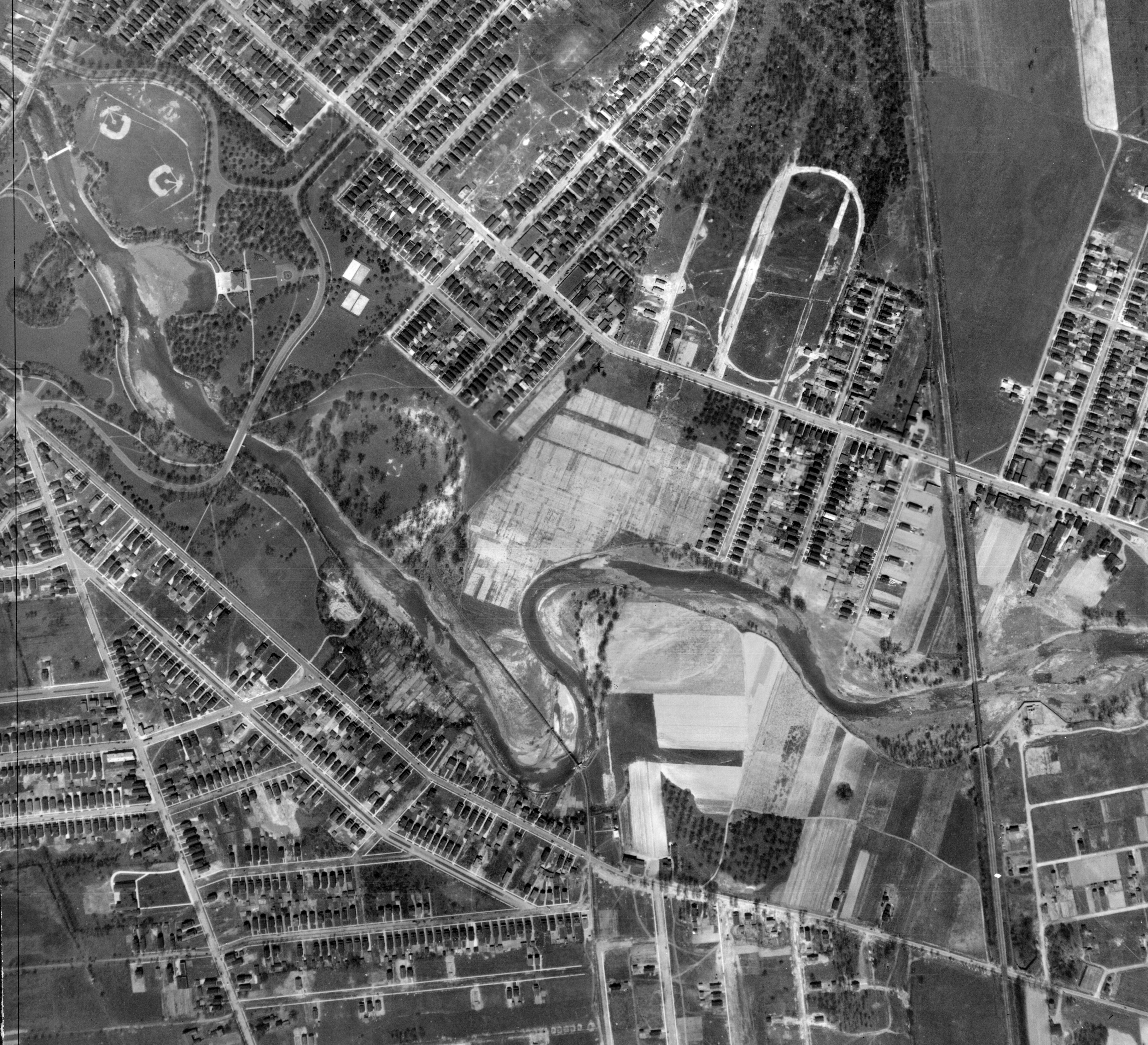
Looking from the air, we can easily see why some streets are the way they are. This is a continuation of the DL&W entrance into downtown Buffalo.
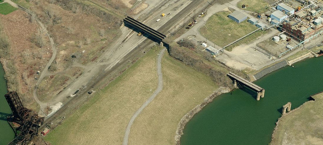
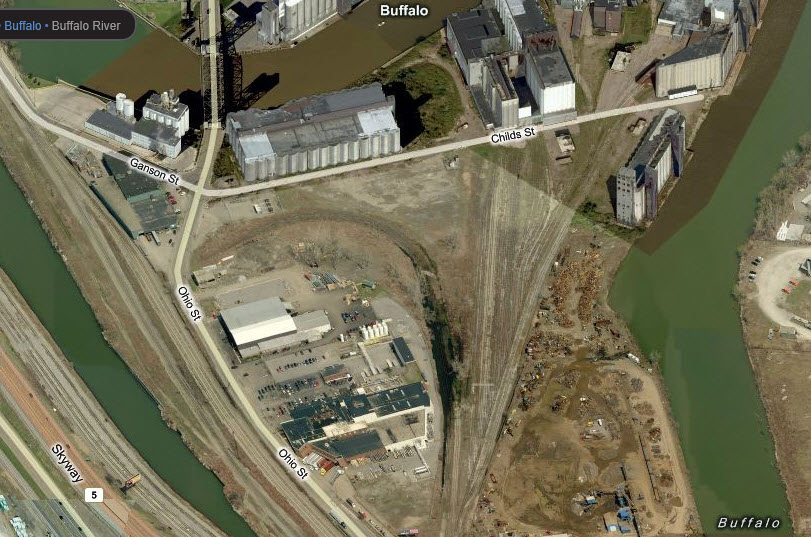
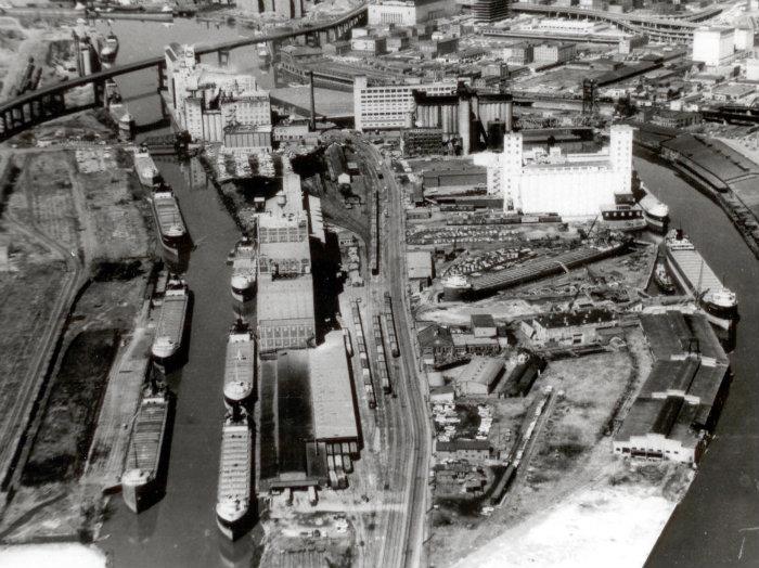
Plenty of unused track in this shot, the track that hooks on the left goes through a patch of water, so I don't believe it gets used much anymore.
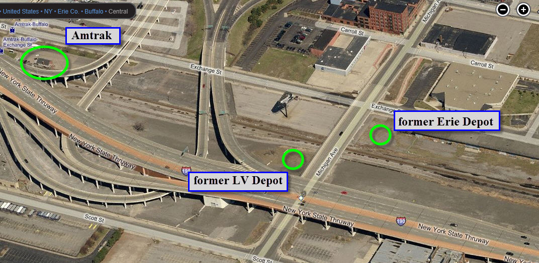
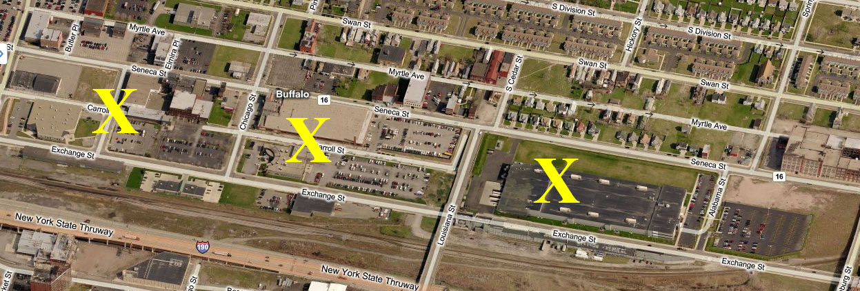
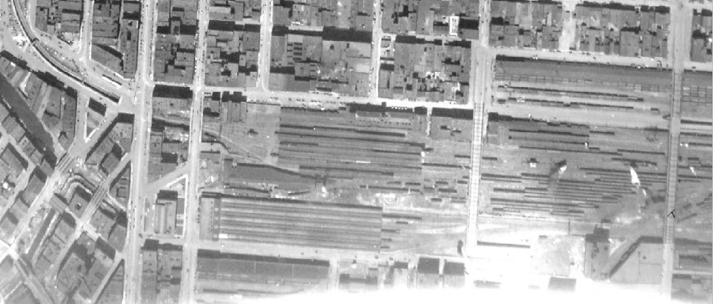
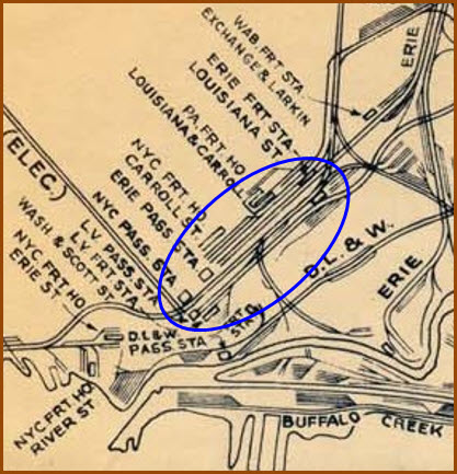
The top screen capture shows you where the former LV and DL&W Depots used to be located. Below that, the other picture shows the area on the north side of Exchange Street, where it used to be nothing but yard trackage where the "X's" are. I won't swear to it, but I believe the B&W picture at the bottom, a partial of a larger picture way below, might be of this area back in the 50's.
These underpasses are typical of the many that sprinkle the old New York Central right-of-way from Frontier yard into the downtown area. All the maps I can find of the area show there being four tracks coming through here, although it looks like it could handle quite a few more.... anyone know for sure? This one is at Clinton and Lord Streets.
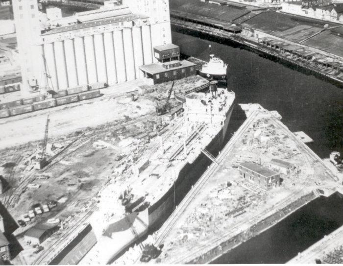
Vintage Photos & Maps

The two pictures below are from the same area, but the one on the right has Route 5 in it. Even as "recent" as these pictures are, it looks like a bunch of stuff has disappeared!
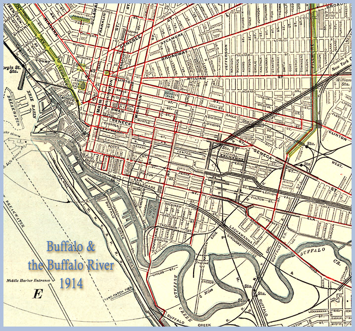
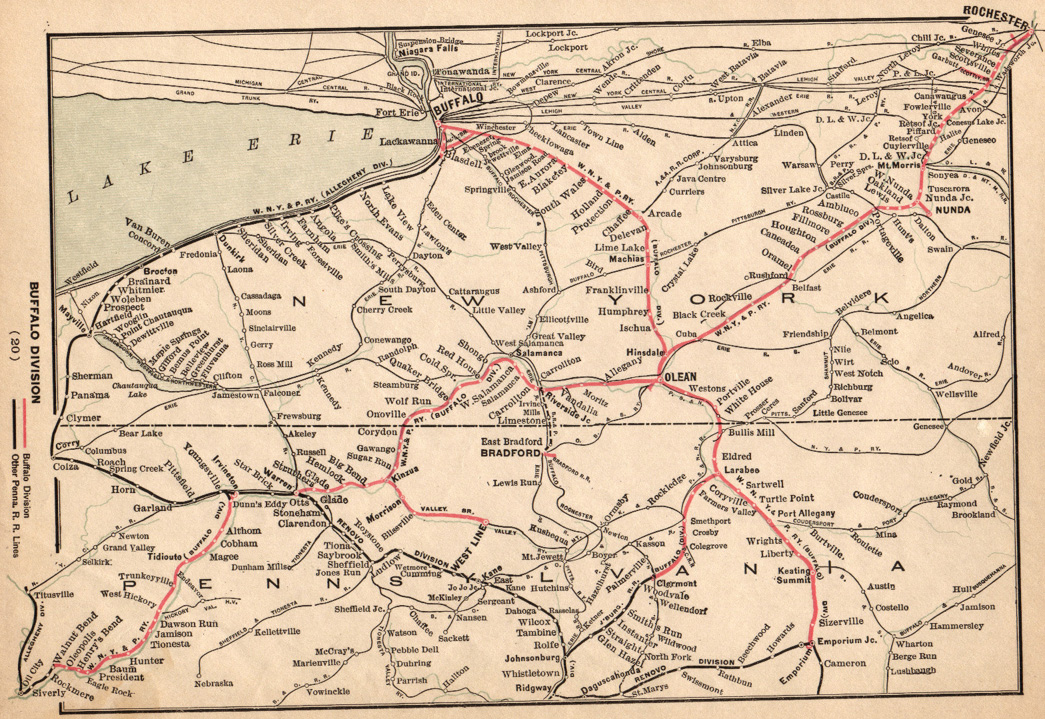
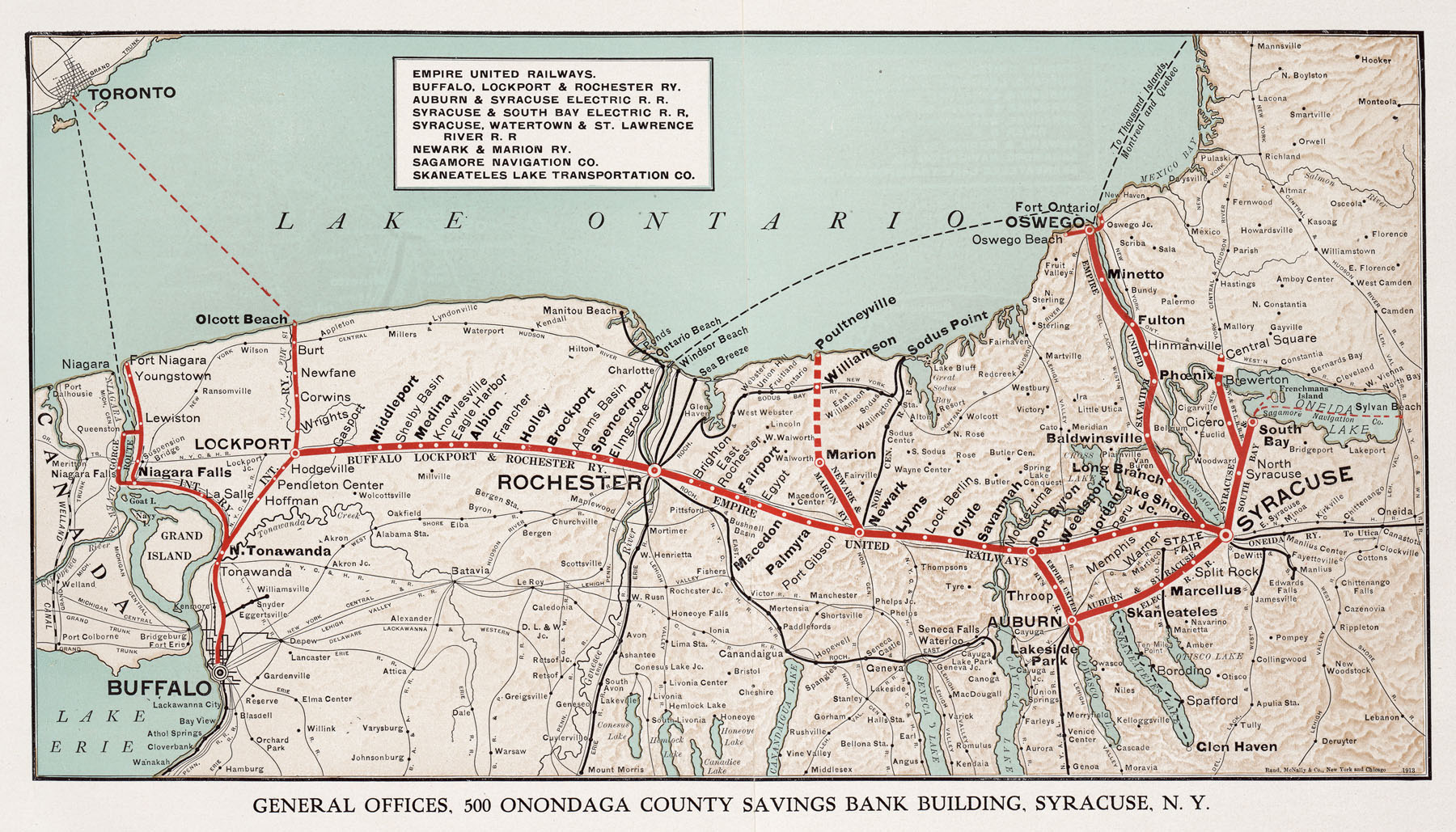
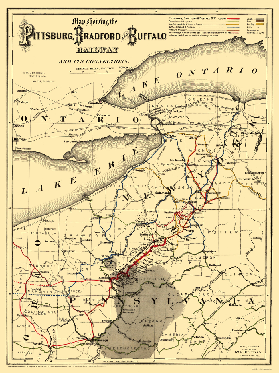
Railroad System Maps
Disclaimers:
I love trains, and I love signals. I am not an expert. My webpages reflect what I find on the topic of the page. This is something I have fun with while trying to help others.
Please Note: Since the main focus of my two websites is railroad signals, the railfan guides are oriented towards the signal fan being able to locate them. For those of you into the modeling aspect of our hobby, my indexa page has a list of almost everything railroad oriented I can think of to provide you with at least a few pictures to help you detail your pike.
If this is a railfan page, every effort has been made to make sure that the information contained on this map and in this railfan guide is correct. Once in a while, an error may creep in :-)
My philosophy: Pictures and maps are worth a thousand words, especially for railfanning. Text descriptions only get you so far, especially if you get lost or disoriented. Take along good maps.... a GPS is OK to get somewhere, but maps are still better if you get lost! I belong to AAA, which allows you to get local maps for free when you visit the local branches. ADC puts out a nice series of county maps for the Washington DC area, but their state maps do not have the railroads on them. If you can find em, I like the National Geographic map book of the U.S..... good, clear, and concise graphics, and they do a really good job of showing you where tourist type attractions are, although they too lack the railroads. Other notes about specific areas will show up on that page if known.
Aerial shots were taken from either Google or Bing Maps as noted. Screen captures are made with Snagit, a Techsmith product... a great tool if you have never used it!
By the way, floobydust is a term I picked up 30-40 years ago from a National Semiconductor data book, and means miscellaneous and/or other stuff.
Pictures and additional information is always needed if anyone feels inclined to take 'em, send 'em, and share 'em, or if you have something to add or correct.... credit is always given! Please be NICE!!! Contact info is here
Beware: If used as a source, ANYTHING from Wikipedia must be treated as being possibly inaccurate, wrong, or not true.
RAILFAN GUIDES HOME
RAILROAD SIGNALS HOME
NEW 03/21/2012, SEP11/2021
Last Modified
14-Sep-2021