RAILFAN GUIDES of the U.S.
Todd's Railfan
Guide to
BINGHAMTON
NY
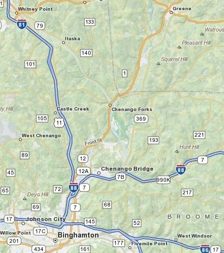
Map 4 - North of Binghamton
Greene, Chenango Forks
RAILFAN GUIDES HOME
RAILROAD SIGNALS HOME
The Binghamton guide is divided as follows:
Index Page - Introduction and General Information
Map
1 - Binghamton Proper
Map 2 -
Southeast of Binghamton
Map 3 -
West of Binghamton
Map 4 - North of Binghamton
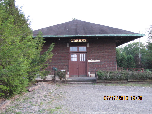
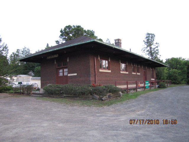
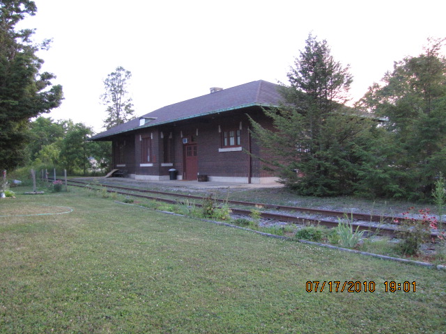
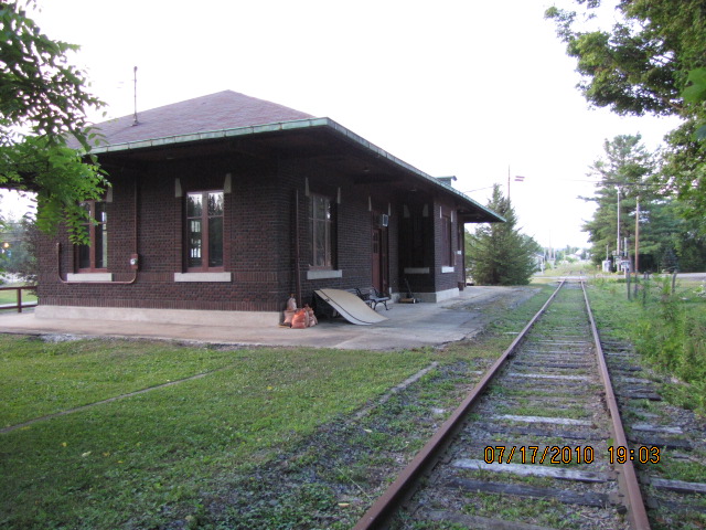
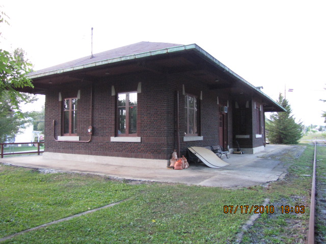
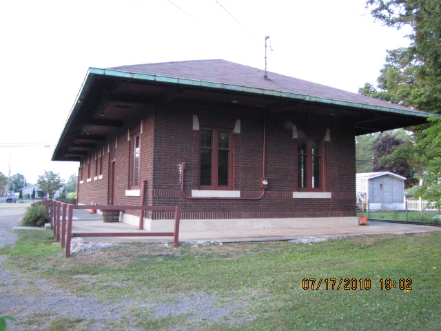
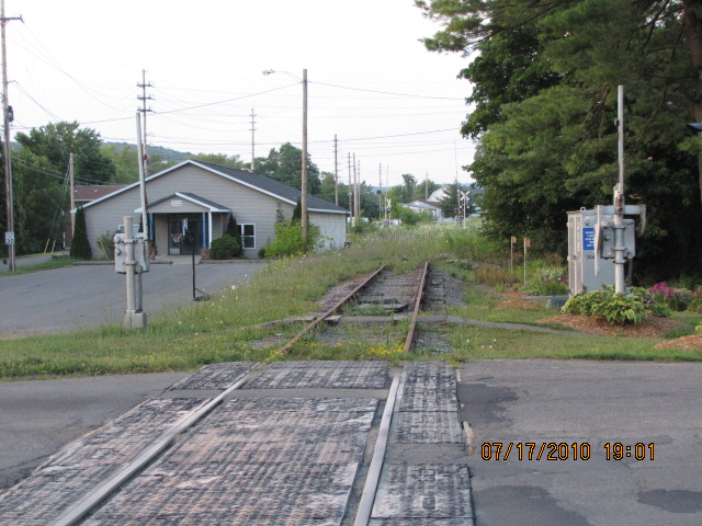
Greene NY
About 15 miles north of Binghamton
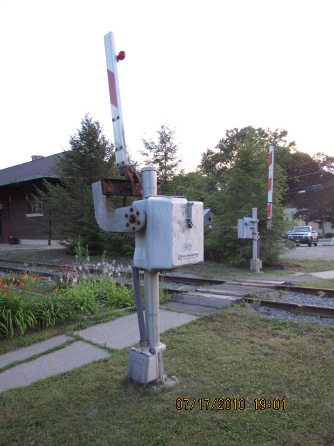
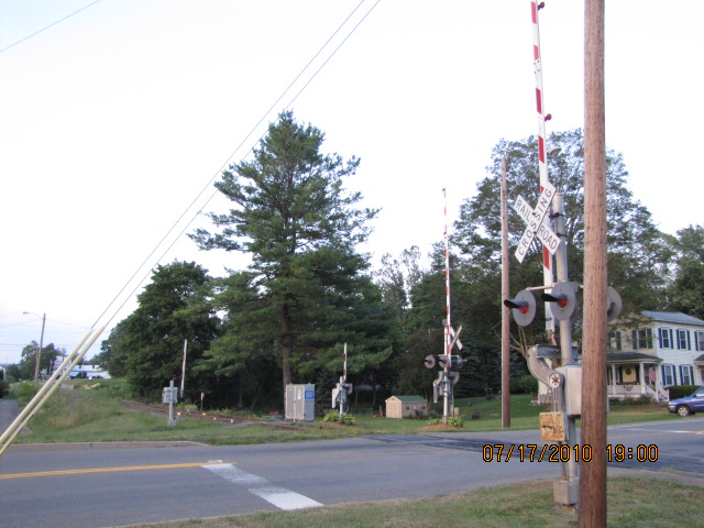
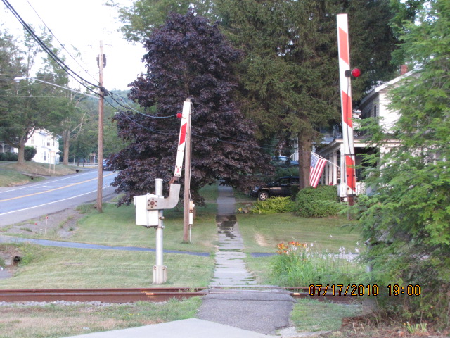
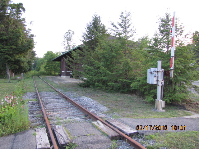
North of Binghamton sits this cute little depot on the Utica Branch of the NYS&W (an ex Erie line), and is now used by the highway department as a local office. If I can read my notes, a storm came through in July of 2006, and wiped out a good portion of the track, so thru freights haven't been above Chenango Forks since then.
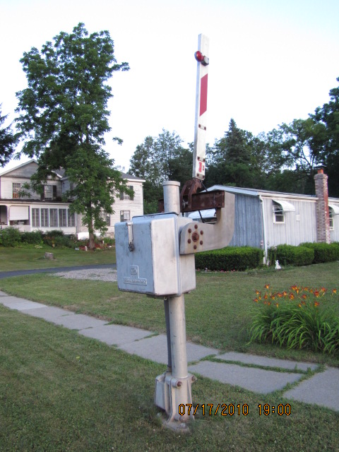
In addition to the depot and the normal compliment of crossing gates, you'll be pleasantly surprised by the four pedestrian crossing gates here. These are becoming rarer and rarer, and the only other ones I've seen are in Pennsylvania in Camp Hill, around Reading and Bethlehem, a set near Berea OH, and one crossing in Hagerstown MD. If you know of more and have pictures of them, please send them to me.
Chenango Forks
About 8 miles north of Binghamton
The Syracuse Branch takes off from the Utica Branch in Chenango Forks, and heads northwest thru Cortland on it's way to Syracuse. NY79 follows the tracks up to I81, about 6 miles from Chenango Forks. There, the track meets up with and follows I81 and US11 (or is it the other way around?). The tracks follow US11 and I81 up to Tully, where the tracks lose those two roads and head eastward (and then northward) to get into Syracuse following NY80 and Apulia Rd..... anyways.....
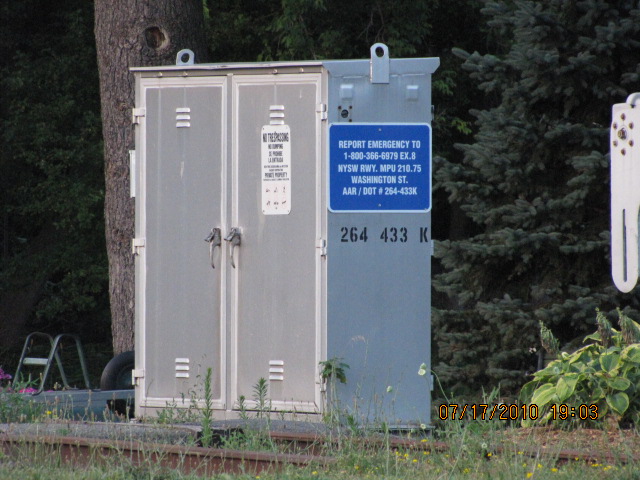
There's at least two sets of searchlight signals at the split, but I didn't have time to go out and get pictures on this trip.
Disclaimers:
I love trains, and I love signals. I am not an expert. My webpages reflect what I find on the topic of the page. This is something I have fun with while trying to help others. My webpages are an attempt at putting everything I can find of the subject in one convenient place. There are plenty of other good websites to help me in this effort, and they are listed in the links section on my indexa page, or as needed on individual pages. Please do not write to me about something that may be incorrect, and then hound the heck out of me if I do not respond to you in the manner you would like. I operate on the "Golden Rule Principle", and if you are not familiar with it, please acquaint yourself with how to treat people by reading Mathew 7:12 (among others, the principle exists in almost every religion). If you contact me (like some do, hi Paul) and try to make it a "non-fun" thing and start with the name calling, your name will go into my spambox list! :-)
Please Note: Since the main focus of my two websites is railroad signals, the railfan guides are oriented towards the signal fan being able to locate them. For those of you into the modeling aspect of our hobby, my indexa page has a list of almost everything railroad oriented I can think of to provide you with at least a few pictures to help you detail your pike.
If this is a railfan page, every effort has been made to make sure that the information contained on this map and in this railfan guide is correct. Once in a while, an error may creep in, especially if restaurants or gas stations open, close, or change names. Most of my maps are a result of personal observation after visiting these locations. I have always felt that a picture is worth a thousand words", and I feel annotated maps such as the ones I work up do the same justice for the railfan over a simple text description of the area. Since the main focus of my website is railroad signals, the railfan guides are oriented towards the signal fan being able to locate them. Since most of us railheads don't have just trains as a hobby, I have also tried to point out where other interesting sites of the area are.... things like fire stations, neat bridges, or other significant historical or geographical feature. While some may feel they shouldn't be included, these other things tend to make MY trips a lot more interesting.... stuff like where the C&O Canal has a bridge going over a river (the Monocacy Aqueduct) between Point of Rocks and Gaithersburg MD, it's way cool to realize this bridge to support a water "road" over a river was built in the 1830's!!!
My philosophy: Pictures and maps are worth a
thousand words, especially for railfanning. Text descriptions only
get you so far, especially if you get lost or disoriented. Take
along good maps.... a GPS is OK to get somewhere, but maps are still
better if you get lost! I belong to AAA, which allows you to get
local maps for free when you visit the local branches. ADC puts
out a nice series of county maps for the Washington DC area, but their
state maps do not have the railroads on them. If you can find em,
I like the National Geographic map book of the U.S..... good, clear, and
concise graphics, and they do a really good job of showing you where
tourist type attractions are, although they too lack the railroads.
Other notes about specific areas will show up on that page if known.
Pictures and additional information is always needed if anyone feels
inclined to take 'em, send 'em, and share 'em, or if you have
something to add or correct.... credit is always given! BE NICE!!! Contact info
is here
Beware: If used as a source, ANYTHING from Wikipedia must be treated as being possibly being inaccurate, wrong, or not true.
RAILFAN GUIDES HOME
RAILROAD SIGNALS HOME
NEW 8/14/2011
Last Modified 11-May-2014