RAILFAN GUIDES of the U.S.
Todd's Railfan
Guide to
BINGHAMTON
NY
Map 3 - West of Binghamton
the Southern Tier - Johnson City, Endicott, Endwell, and Vestal
Photos
Grade Crossings and Signal
Locations
RAILFAN GUIDES HOME
RAILROAD SIGNALS HOME
The Binghamton guide is divided as follows:
Index Page - Introduction and General Information
Map
1 - Binghamton Proper
Map
2 - East and South of Binghamton
Map 3 - West of Binghamton
Map
4 -
North of Binghamton
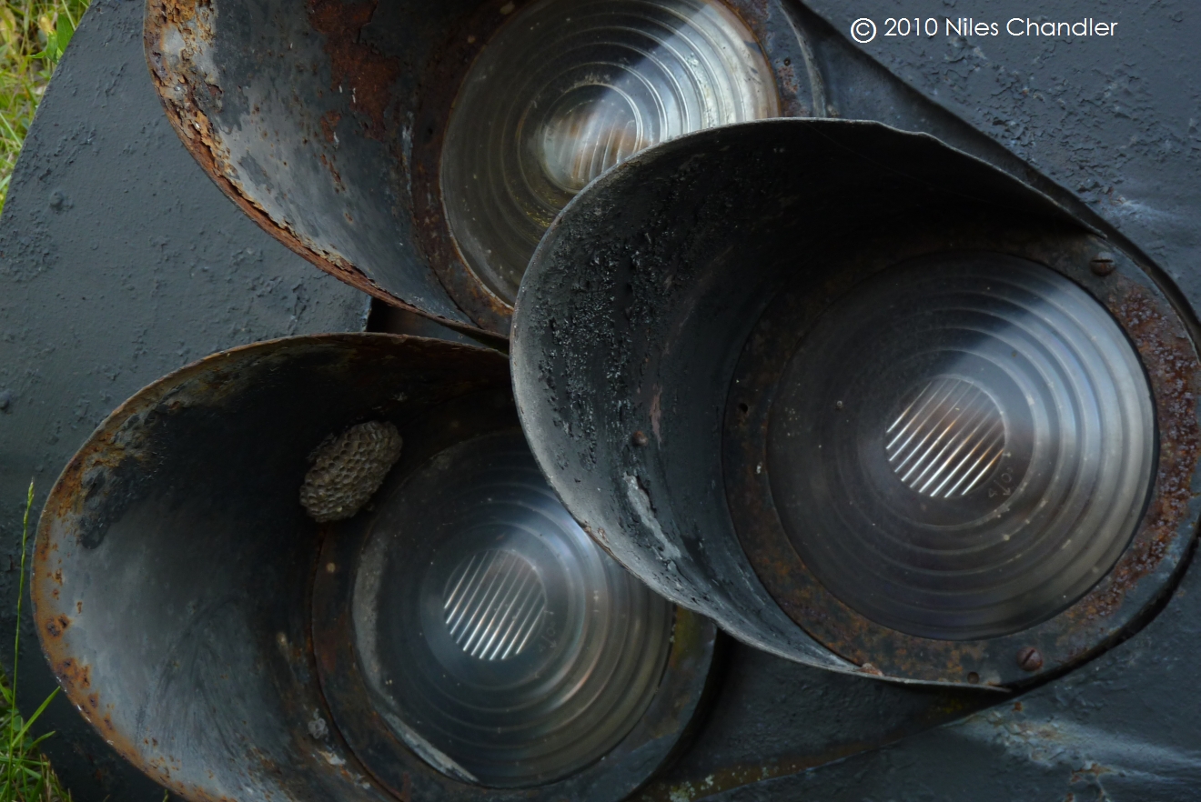
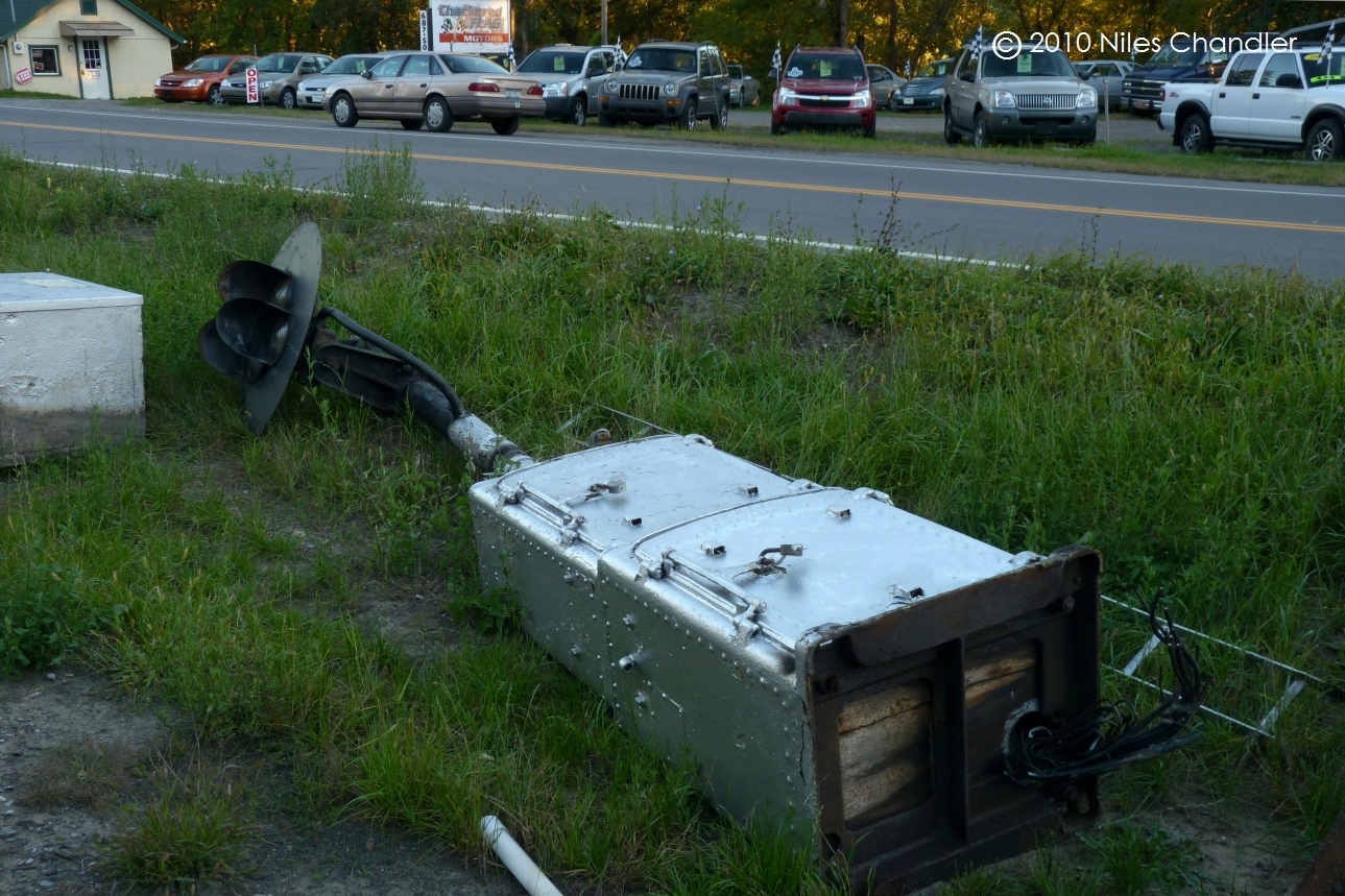
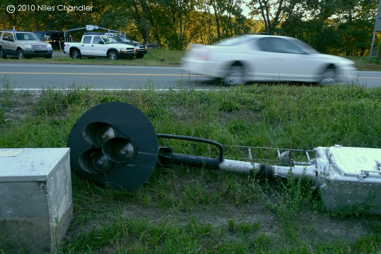
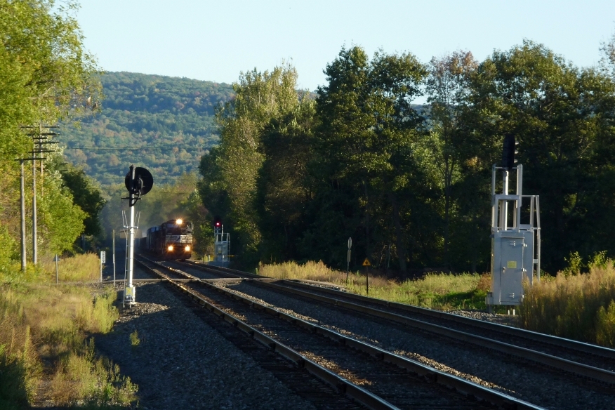
In the meantime, please enjoy these pictures by Niles Chandler, who has been going out and documenting the signal upgrades on the Southern Tier line.

Grade Crossings and Signal Locations
These are arranged from east to west. Other than warnings, I did not include road crossings that went over or under the right of way if the photo sight lines were impossible, difficult, or just plain bad.
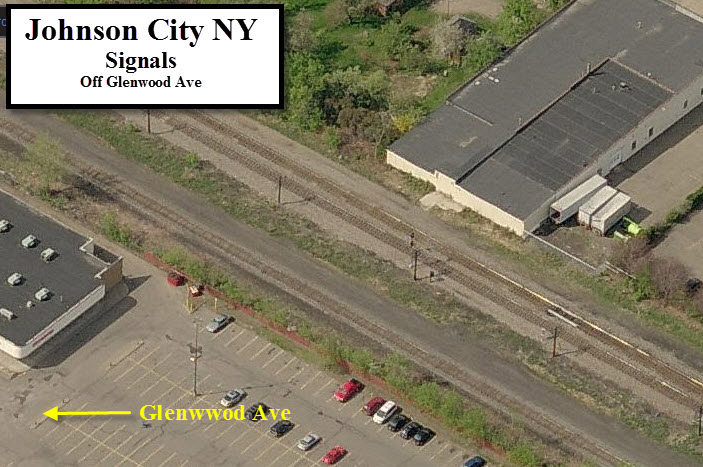
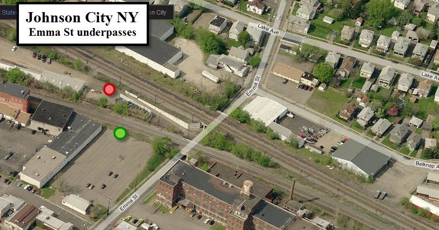
Photo ops might be OK at these two spots, the red spot is the mainline, the green spot would be for the short branch
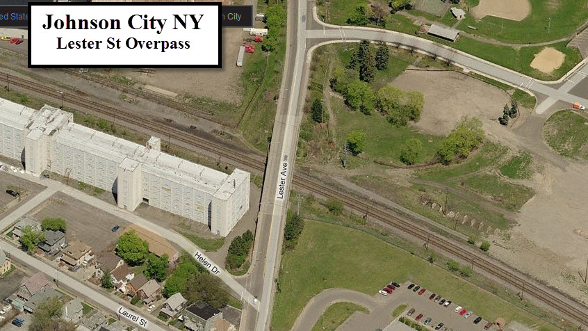
The huge lot off to the right (east) of Lester also looks like a great spot for pictures, and as long as they don't put anything on it, no hassles either.
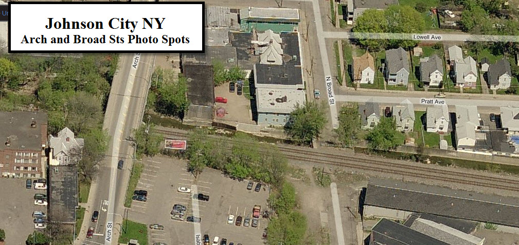
Looks like parking and sight lines are good from either spot. Sidewalks on both sides of the Arch St overpass.
Don't know if it easy to get a shot here or not. Parking looks easy enough tho.
NY201 and Oakdale Ave
Oakdale goes under the tracks, and does not offer you any good shots. NY201 goes over, and although pictures might be good from here, there are no sidewalks to take pictures from....
If you like shots with an overpass framing the train, you might want to check this spot out for EB freights in the morning.
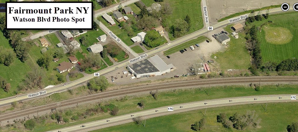
Located on a curve in Fairmount Park (between Johnson City and Endicott/Endwell), is this pretty nice spot behind a store where parking shouldn't be a problem.
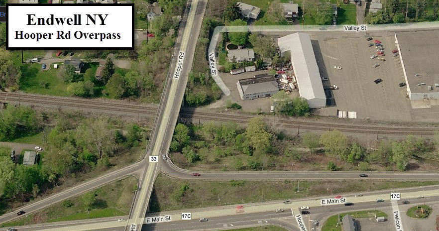
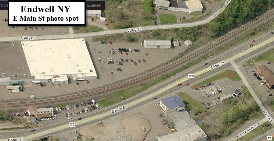
Looks like a pretty good vantage point for either WB's or EB's depending on the sun, The best parking looks to be off to the right of the picture on the south side of Main St. Just east of here along Main St looks like another good spot, especially for EB's coming off the curve.
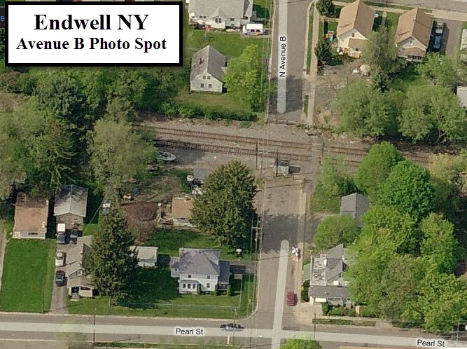
Between Avenue B and Hayes Ave
Nothing between these two streets looks particularly inviting
for the railfan to risk stopping here for photo ops.
N McKinley Ave and Oak Hill Avenue
Neither of these streets are good places for picture taking. Your shots from the overpass on McKinley are obstructed in both directions by stuff going over the tracks from the plant located on both sides of the tracks. Oak Hill is entrenched in a high walled underpass... forget it here!
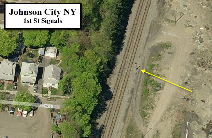
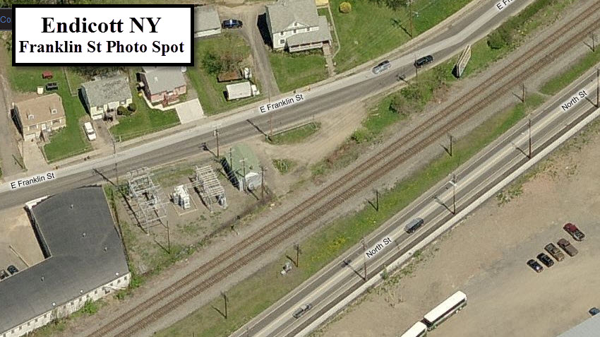
Located at a pull off for a small power substation is a set of signals. Looks like a good spot for WB trains.
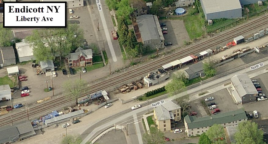
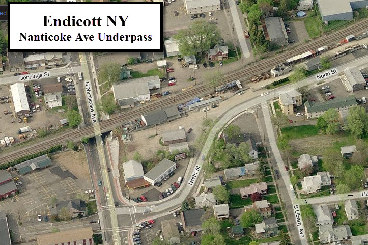
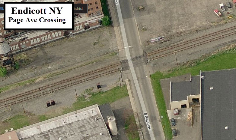
Liberty Avenue is just off of Nanticoke Ave, which goes under the right of way. The north side of the tracks off Liberty looks like a pretty good spot for photographs, and the south side from the parking lot next to Nanticoke may be OK if no-one bothers you while you park there. Have not tried either spot.
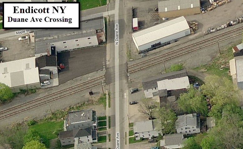
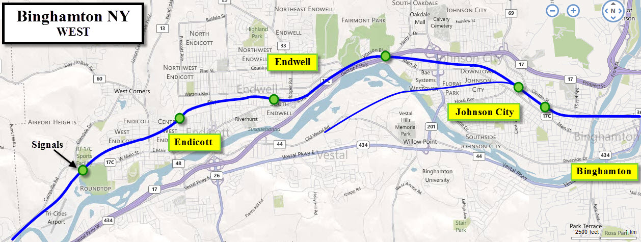
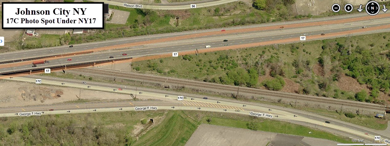
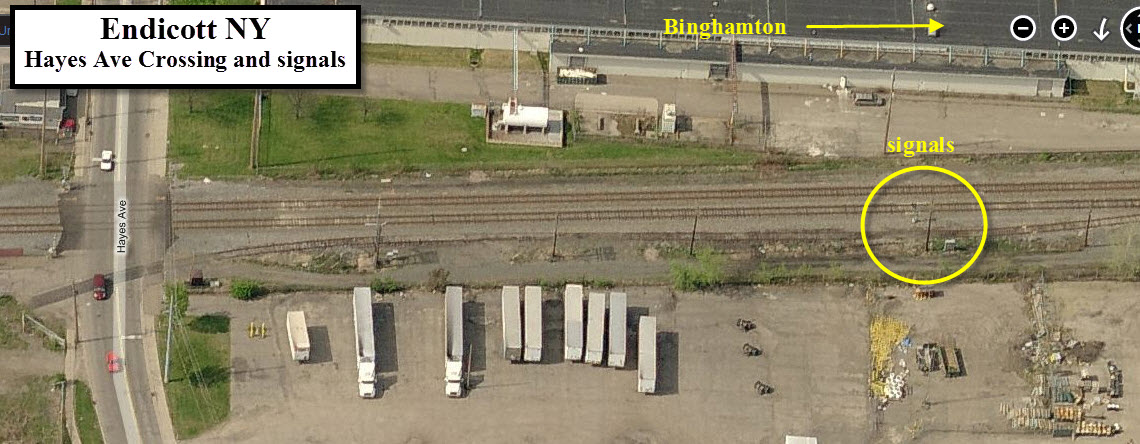
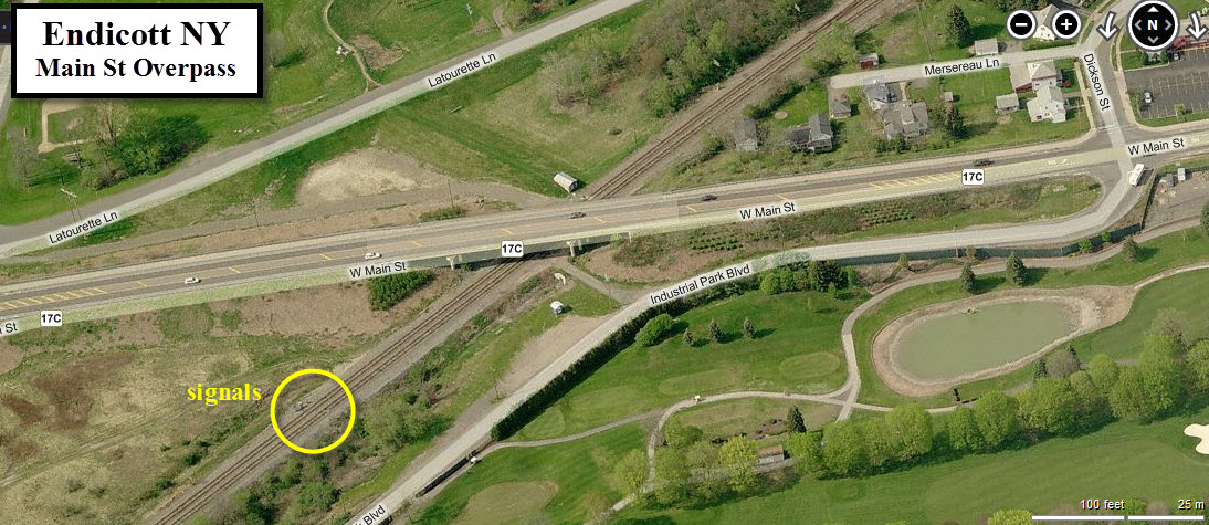
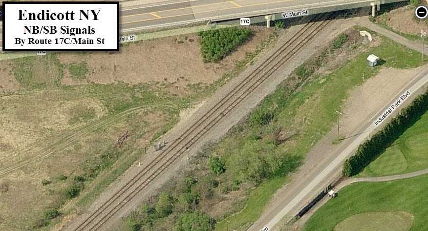
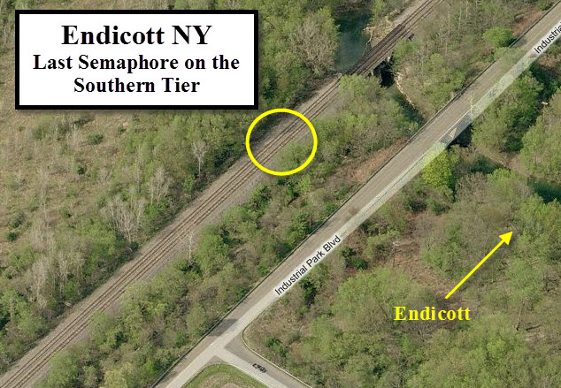
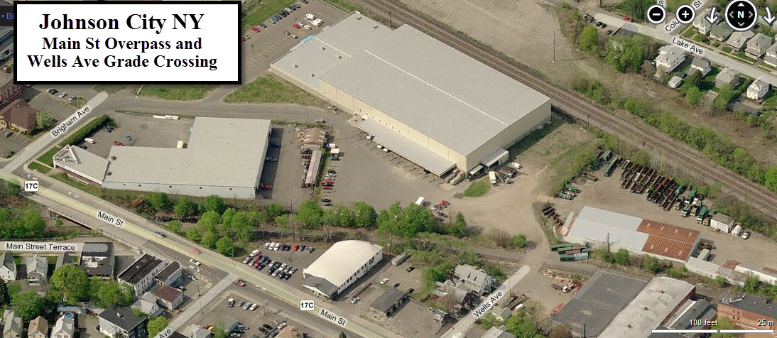
The "new" location for signals just off 17C, in a place that is fairly convenient for photographs. The location is a couple of hundred feet east of where the last semaphore on the Southern Tier was located.
The Branch to Vestal
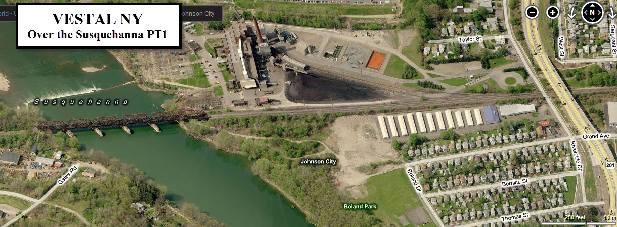
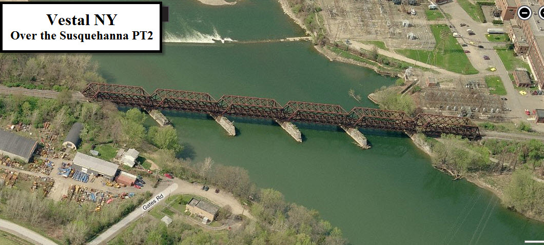
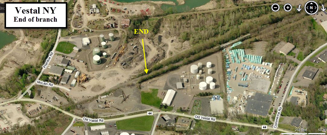
This series of photos covers the crossings from the split with the mainline down to the current end of operations in Vestal, about 3 miles worth of track. As I mention later, it's too bad the operations over this section are reduced to branch line operations with the bridge going over the Susquehanna River.
It's too bad this bridge sees precious little traffic anymore! Doesn't look like much of anyone will bother you from the east side of the bridge. Access is off of Riverside Dr, which parallels NY201
Disclaimers:
I love trains, and I love signals. I am not an expert. My webpages reflect what I find on the topic of the page. This is something I have fun with while trying to help others. My webpages are an attempt at putting everything I can find of the subject in one convenient place. There are plenty of other good websites to help me in this effort, and they are listed in the links section on my indexa page, or as needed on individual pages. Please do not write to me about something that may be incorrect, and then hound the heck out of me if I do not respond to you in the manner you would like. I operate on the "Golden Rule Principle", and if you are not familiar with it, please acquaint yourself with how to treat people by reading Mathew 7:12 (among others, the principle exists in almost every religion). If you contact me (like some do, hi Paul) and try to make it a "non-fun" thing and start with the name calling, your name will go into my spambox list! :-)
Please Note: Since the main focus of my two websites is railroad signals, the railfan guides are oriented towards the signal fan being able to locate them. For those of you into the modeling aspect of our hobby, my indexa page has a list of almost everything railroad oriented I can think of to provide you with at least a few pictures to help you detail your pike.
If this is a railfan page, every effort has been made to make sure that the information contained on this map and in this railfan guide is correct. Once in a while, an error may creep in, especially if restaurants or gas stations open, close, or change names. Most of my maps are a result of personal observation after visiting these locations. I have always felt that a picture is worth a thousand words", and I feel annotated maps such as the ones I work up do the same justice for the railfan over a simple text description of the area. Since the main focus of my website is railroad signals, the railfan guides are oriented towards the signal fan being able to locate them. Since most of us railheads don't have just trains as a hobby, I have also tried to point out where other interesting sites of the area are.... things like fire stations, neat bridges, or other significant historical or geographical feature. While some may feel they shouldn't be included, these other things tend to make MY trips a lot more interesting.... stuff like where the C&O Canal has a bridge going over a river (the Monocacy Aqueduct) between Point of Rocks and Gaithersburg MD, it's way cool to realize this bridge to support a water "road" over a river was built in the 1830's!!!
My philosophy: Pictures and maps are worth a
thousand words, especially for railfanning. Text descriptions only
get you so far, especially if you get lost or disoriented. Take
along good maps.... a GPS is OK to get somewhere, but maps are still
better if you get lost! I belong to AAA, which allows you to get
local maps for free when you visit the local branches. ADC puts
out a nice series of county maps for the Washington DC area, but their
state maps do not have the railroads on them. If you can find em,
I like the National Geographic map book of the U.S..... good, clear, and
concise graphics, and they do a really good job of showing you where
tourist type attractions are, although they too lack the railroads.
Other notes about specific areas will show up on that page if known.
Pictures and additional information is always needed if anyone feels
inclined to take 'em, send 'em, and share 'em, or if you have
something to add or correct.... credit is always given! BE NICE!!! Contact info
is here
Beware: If used as a source, ANYTHING from Wikipedia must be treated as being possibly being inaccurate, wrong, or not true.
RAILFAN GUIDES HOME
RAILROAD SIGNALS HOME
NEW 8/14/2011
Last Modified 11-May-2014