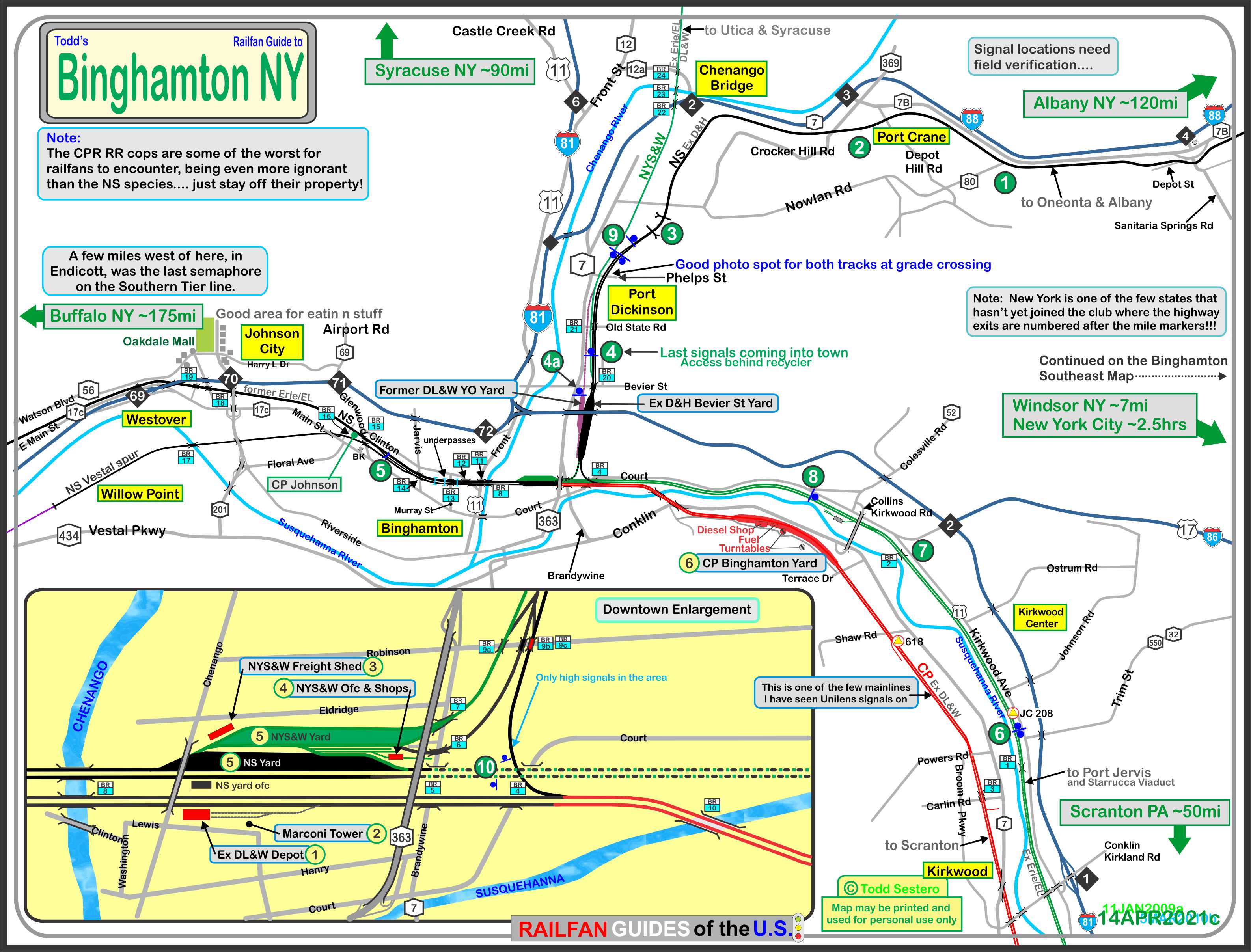
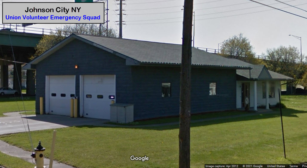
What's Here:
Norfolk Southern
Canadian Pacific
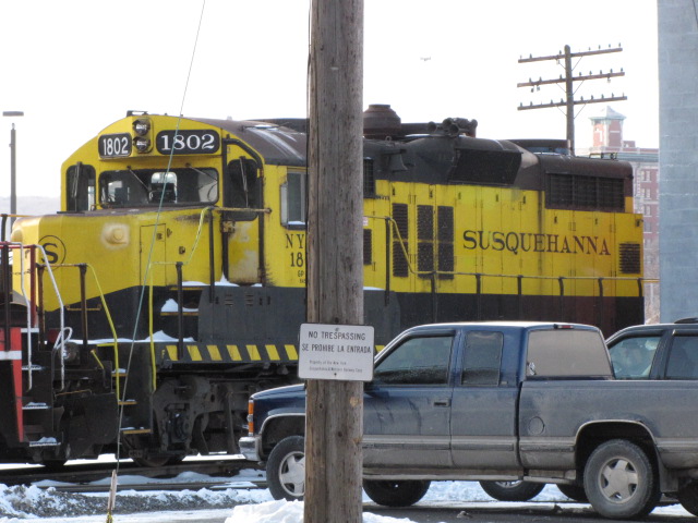
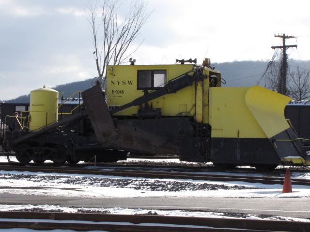
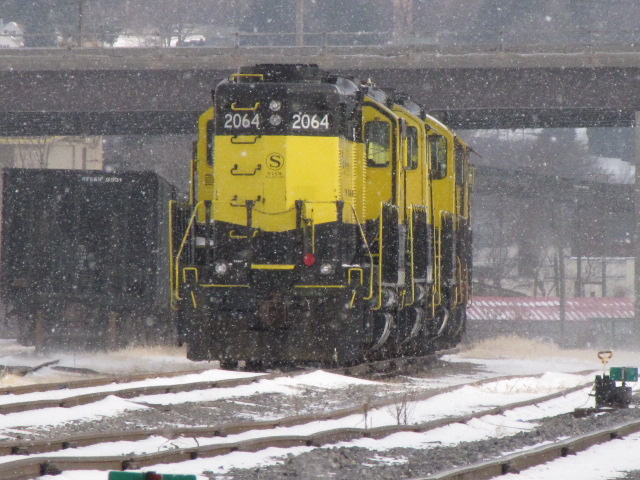
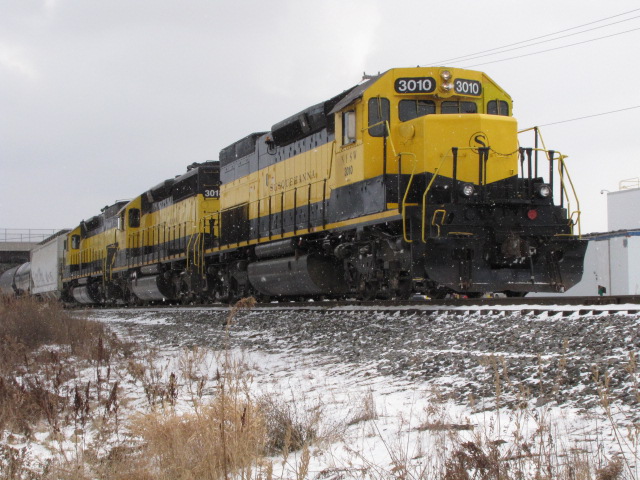
New York Susquehanna & Western
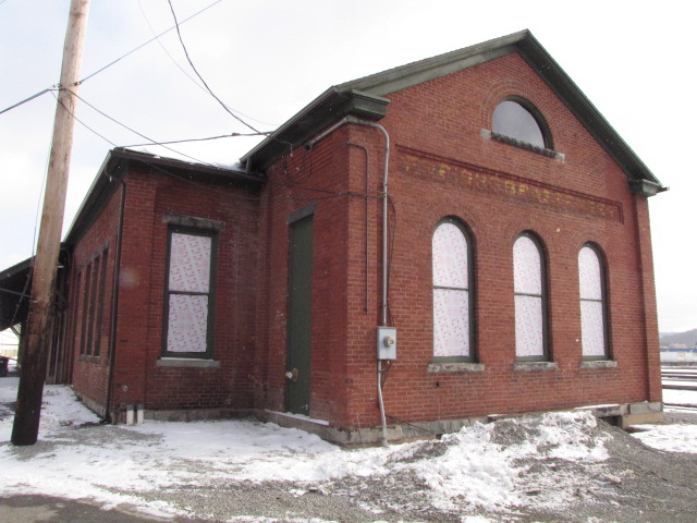
former DL&W Depot
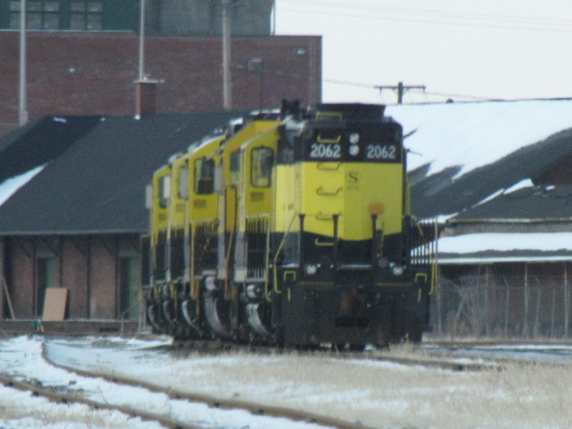
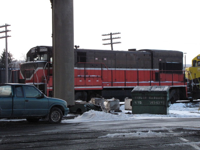
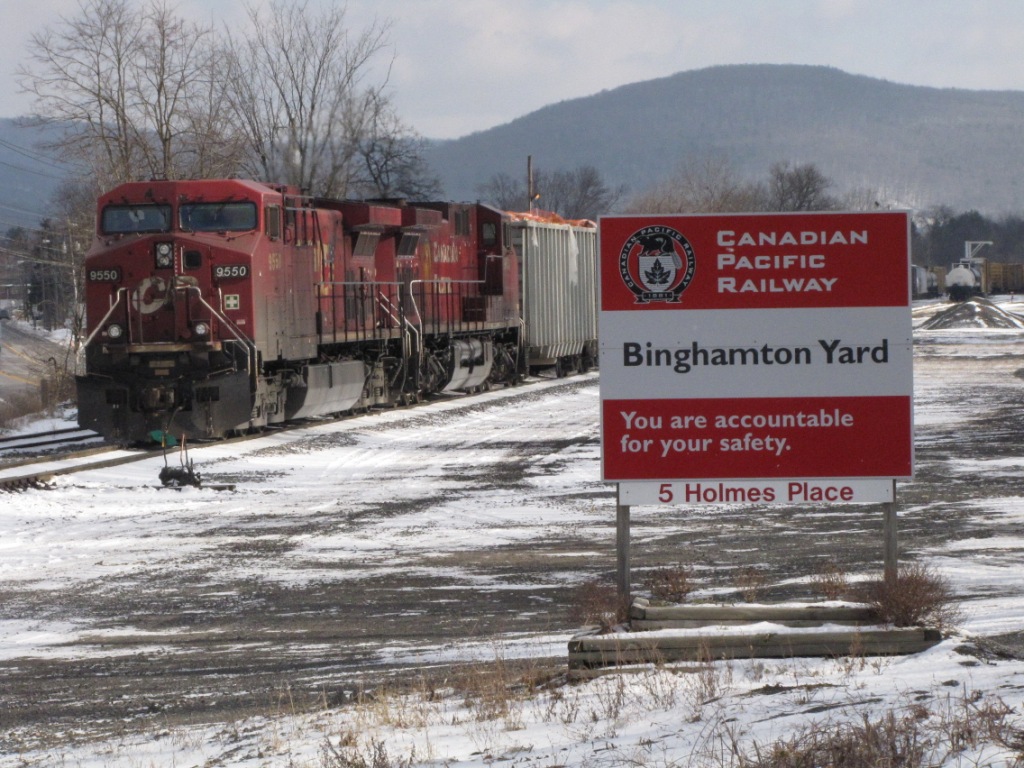
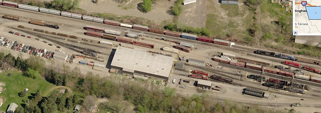
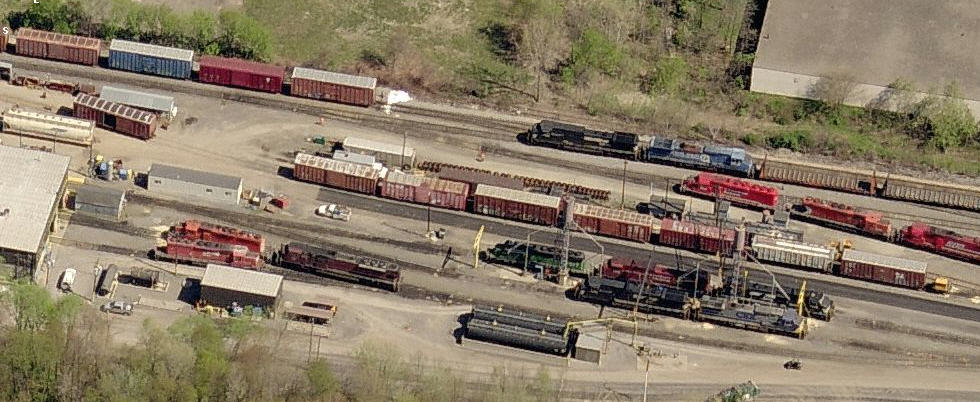
CP Binghamton Yard
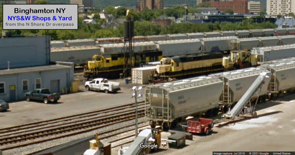
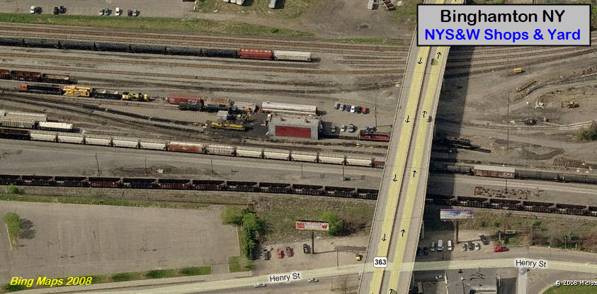
NYS&W Yard
NS Binghamton Yard
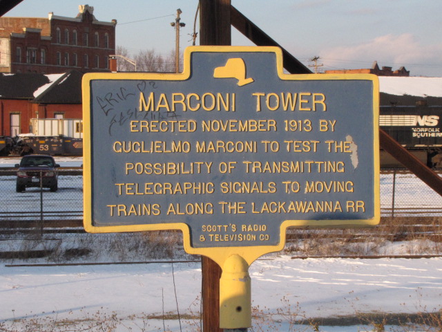
Marconi Tower
The railroad names of the 60's may have disappeared, but there is still plenty
to see in Binghamton, and the surrounding areas, even more if you feel like
traveling 20 miles out or so to see things like the Starrucca Viaduct.
The Norfolk Southern, Canadian Pacific, and the Delaware, Lackawanna & Western
all have a good sized presence in town, and all three have a yard here, altho
the CP yard is by far, the largest.
DO NOT take a chance with trespassing on either NS or CP property, especially
CP, because their cops are like no other, and won't blink an eye to arrest you -
and we all thought no-one could get worse than the NS jerks. Way back
when, you could take a leisurely stroll thru the CP yard from Holmes Place
down to Terrace Drive, but not anymore - it's a shame, because there used
to be a lot of old infrastructure along the access road in the yard.
Back in 2001, I pulled off Holmes Place, just barley onto their access road to
get a picture of a 60's generation diesel working under the Conklin overpass,
and the CP cop came up on me like stink on you-know-what, and he said he had
been following me ALL thru town... what a waste of time for him!
Binghamton does not have any Amtrak service, but here are the three closest towns where you can find Amtrak:
In this latest revision of the page (April 2021), I have added bridges and fire
stations to the mix, and I am still looking for decent pictures of the signals
in town. If you know of anything else interesting that should be
included, railroad oriented or not, please consider forwarding it to me, TNX.
Adding the bridges and USGS maps has made this a huge page, so you will need to
be patient when it is loading.
Other towns you may pas thru to get here, with interesting "stuff":
Corning NY: Corning Glass Works, former DL&W depot, Amtrak station, NS comes thru at speed.
Olean NY: The Western NY & Pennsylvania RR, NS's Southern Tier comes thru. http://www.wnyprr.com/
From the south, I-81 brings you up from Harrisburg and Scranton PA, and if
you're coming from further south, 81 comes all the way from eastern Tennessee.
I-83 from Baltimore joins up with I-81 in Harrisburg.
From the north, such as Syracuse NY, it's I-81 again.
From Rochester NY, you have two ways to get here: Option 1 (about 155 miles) -
Take I-90 east to Syracuse and then 81 south, or, Option 2 (about 170 miles) -
take I-390 south about 72 miles till it hits I-86 just north of Bath NY, then
take 86 into Binghamton about another 98 miles. This route will take you
through Corning and Elmira NY.
From Albany and Schenectady NY, use I-88 going west, it's about 120 miles to/from Albany.
From Boston and Springfield MA, take I-90 west to Albany, then jump onto I-88.
From the west, like Erie PA, it's I-86. Long ride of about 240+ miles, but
it takes you thru such towns as Olean, Salamanca, and Hornell NY - all of
which have something railroad oriented of interest, such as the depot turned
into museum in Salamanca.
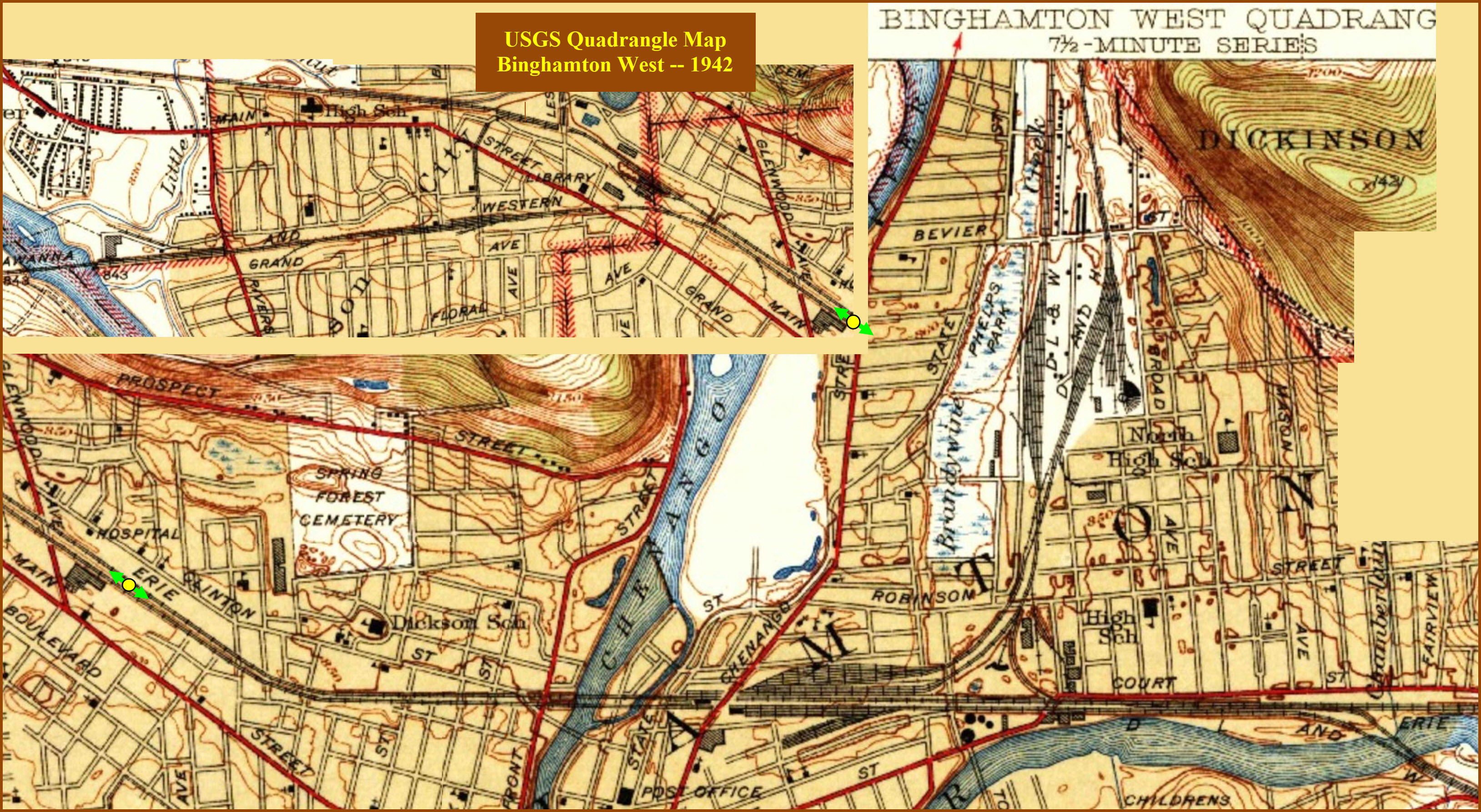
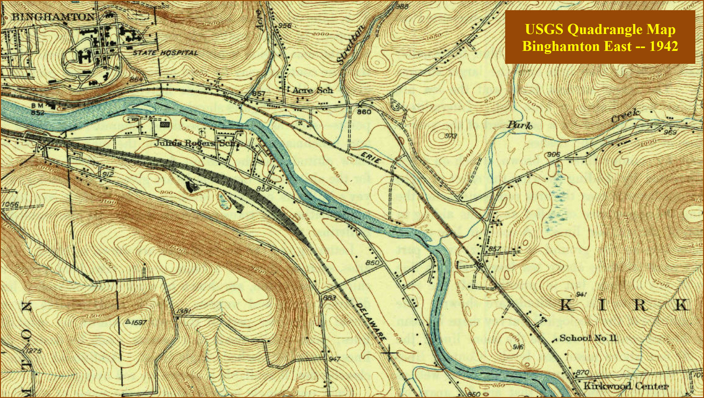
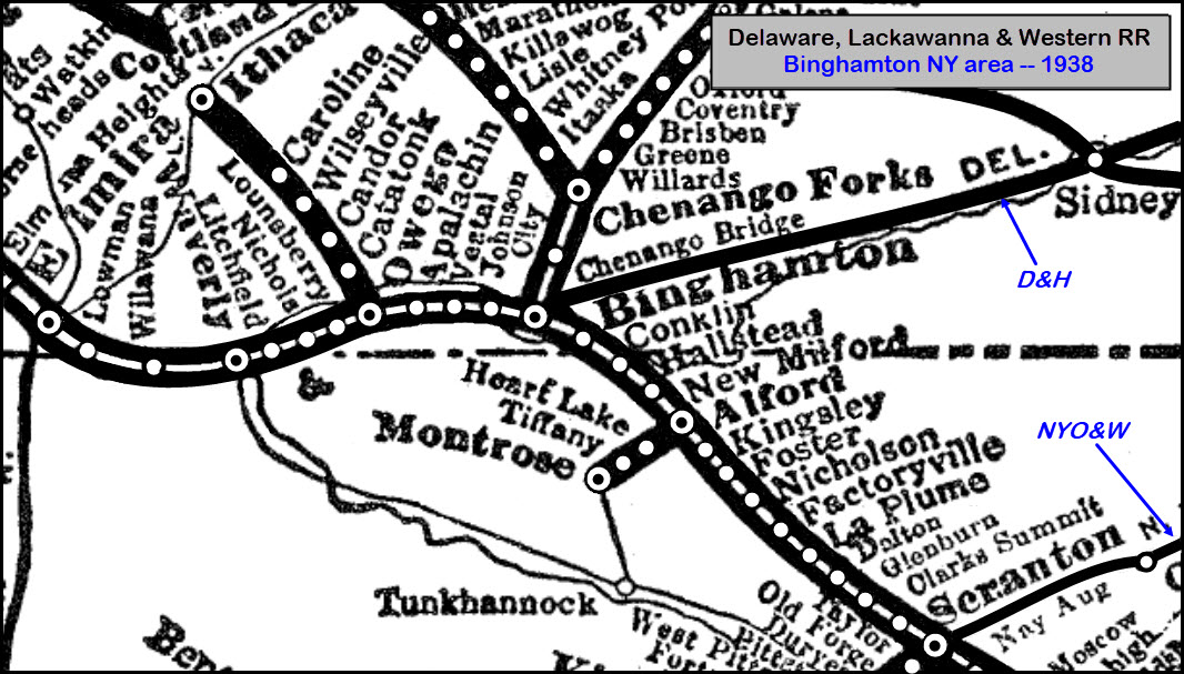
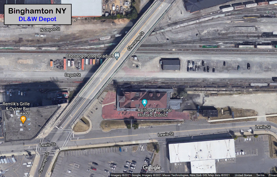
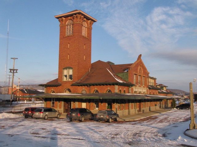
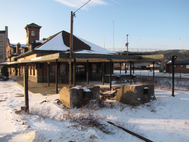
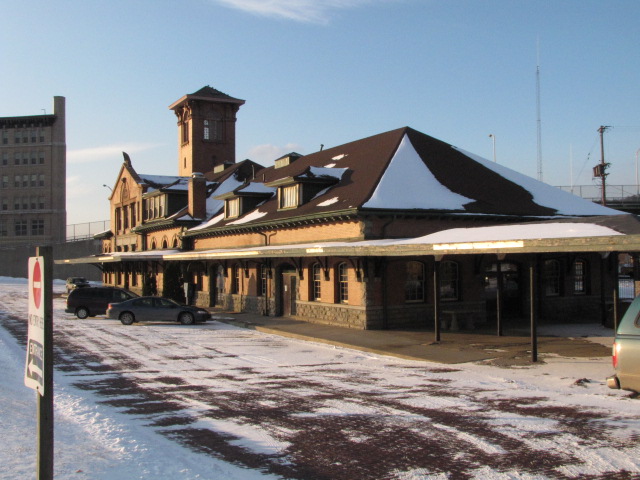
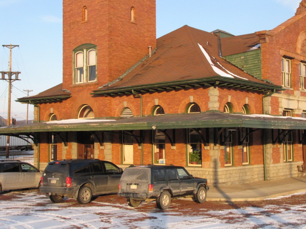
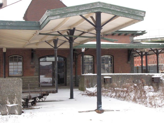
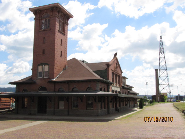
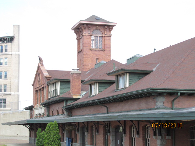
This depot was built by the Delaware, Lackawanna and Western
RR in 1901, and is done in the Italian Renaissance style. Passenger trains
from the Erie joined the DL&W trains at the station in 1958. Erie trains such as the
Lake Cities, the Erie Limited and the Atlantic Express/Pacific Express served Chicago
to the west and Hoboken to the east. BTW, Erie trains stopped using Pavonia Terminal
in Jersey City in the same year, 1958. The last long distance train was on January
6, 1970 when the Lake Cities stopped running.
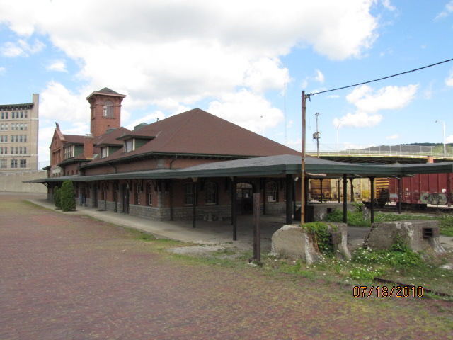
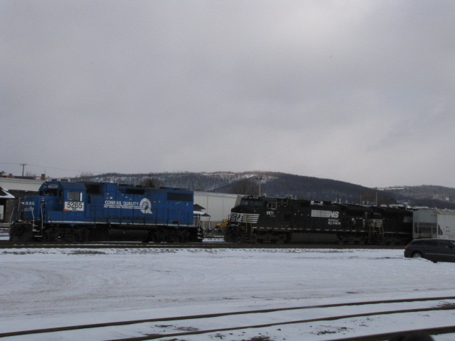
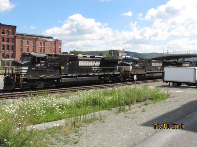
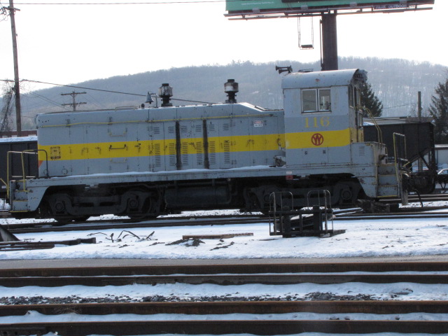
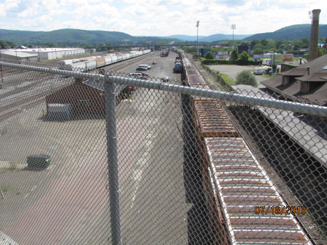
The winter shots are from early January 2009, and the non-snow pictures were taken July 2010.
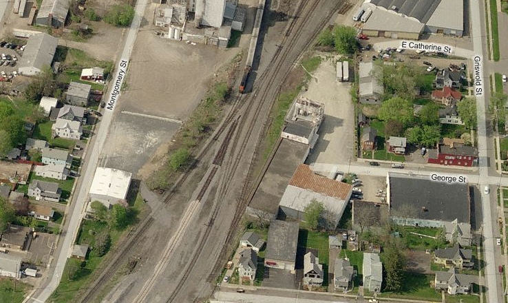
You can usually see some NS stuff across from the depot (L), and on the other side of Chenango (R).
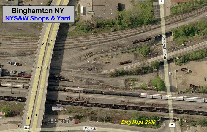
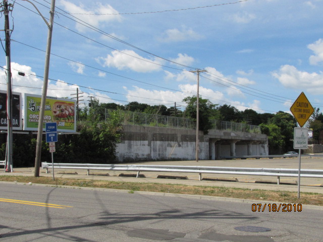
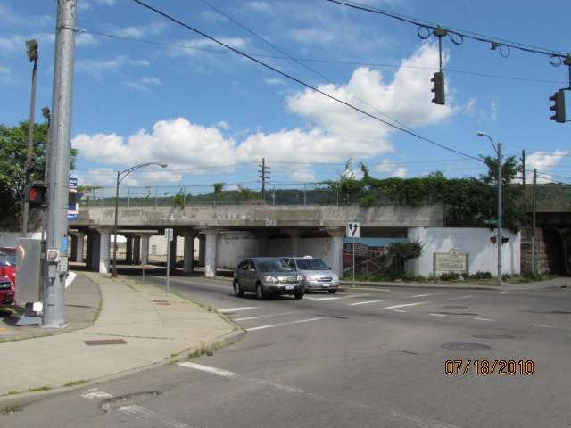
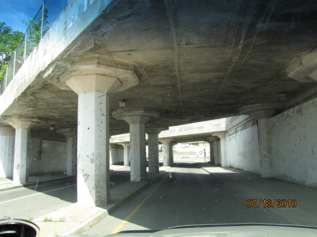
The shops and yard are located off Brandywine. The entrance is between
two sets of railroad overpasses. I don't know if things have changed any,
but things were pretty laid back the last time I visited around 2010, and no-one
bothered me - however, I must stress that I never got out of the car to take pictures.
One vantage point for checking the yard out is the Chenago
St overpass. The only thing wrong with it is the really high, and closely
knit fence as seen. On the north side of the yard runs Eldridge, but there
is no place to snap off any pictures from there, and on the south side, once you
leave the area of the station, nothing allows for easy access if at all.
GPS Coordinates, north end: 42.10022, 75.87022
GPS Coordinates, south end, Terrace Dr: 42.08866, -75.83845
642 Conklin Rd Binghamton, NY 13903
(607) 771-3443
The yard is about 1.73 miles long, according to Google Maps measuring.
As mentioned above, for your own sake, I wouldn't go into the yard, or even off
the road onto their access road to take pictures, to do so you risk getting
arrested.
GPS Coordinates: 42.06155, -75.80150
As with almost all of the old Erie bridges along Kirkwood Ave, they were built for a double track mainline.
Does anyone have a better shot of this bridge?
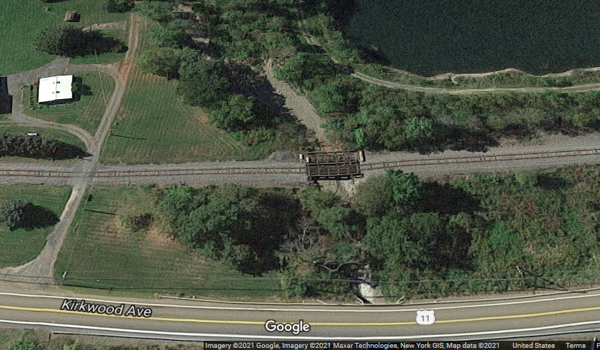
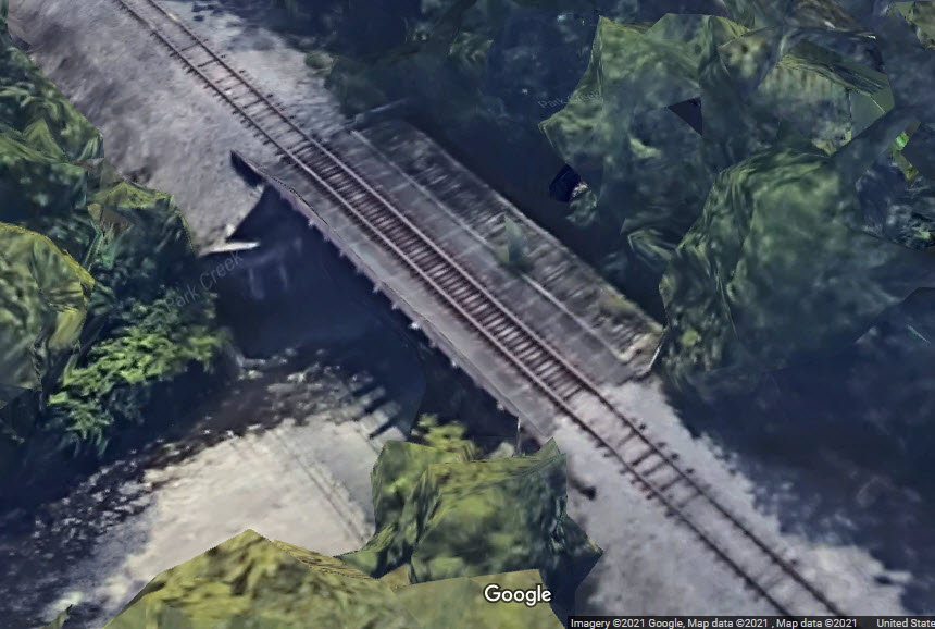
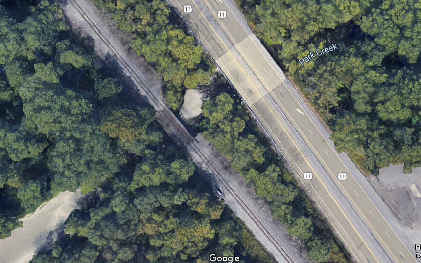
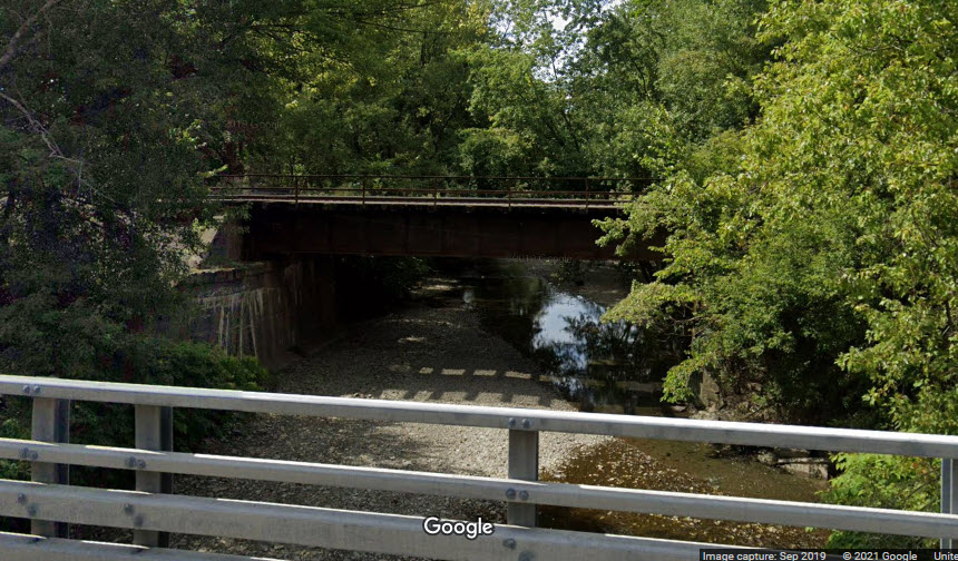
Over Park Creek
GPS Coordinates: 42.09280, -75.82643
Over Carlin Creek
GPS Coordinates: 42.05577, -75.81130
You can't get much simpler than this.....
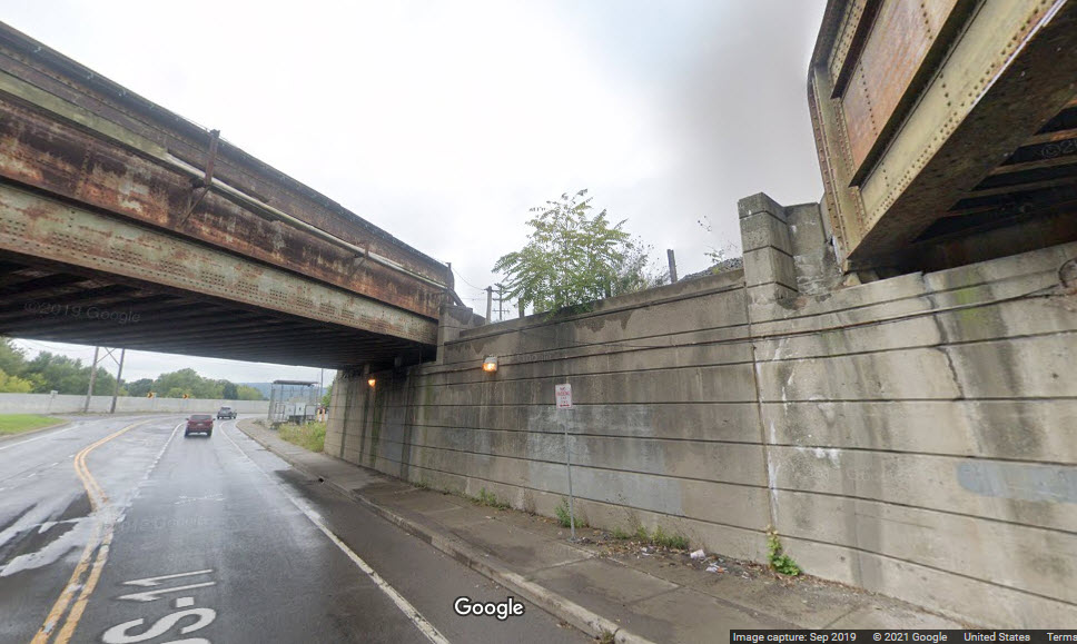
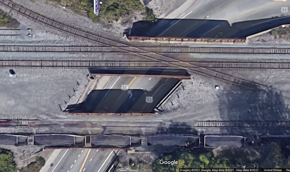
Over Court St
GPS Coordinates: 42.10385, -75.89356
from above
for the next three overpasses.....
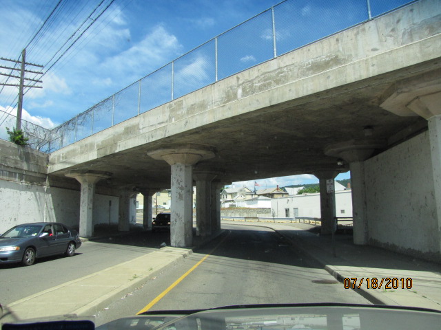
NS,
CP, and NYS&W Over Brandywine Ave
GPS Coordinates: 42.10390, -75.89808
looking north
looking south
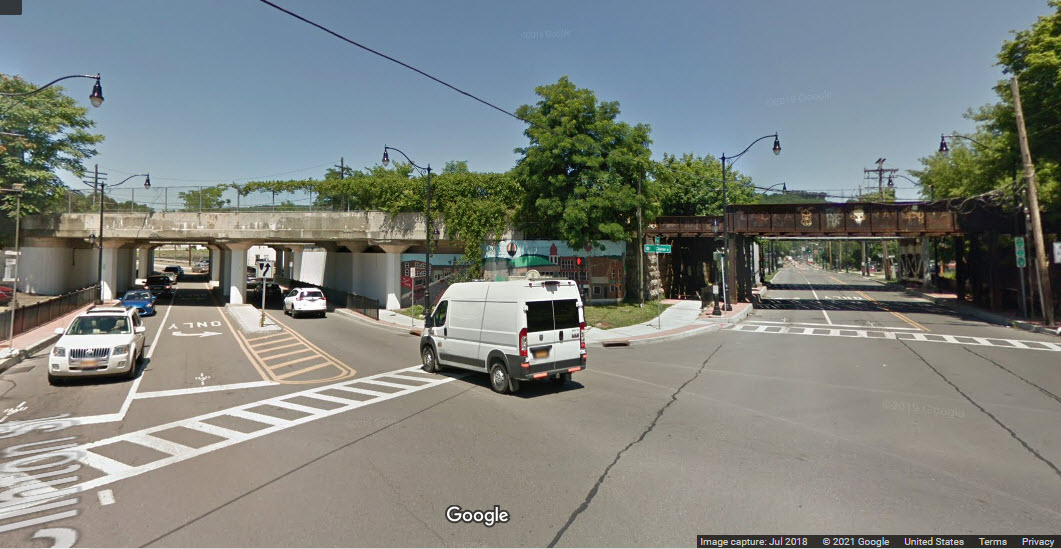
NS Over Brandywine Ave
GPS Coordinates: 42.10475, -75.89817
looking south
looking north
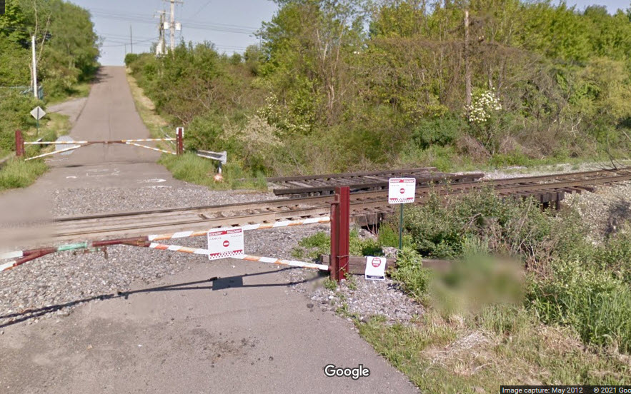
6 detail & NYS&W yard entrance
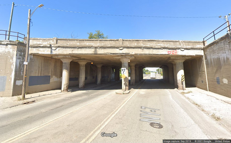
NYS&W Over Brandywine Ave
GPS Coordinates: 42.10514, -75.89819
looking north
concrete detail
looking south
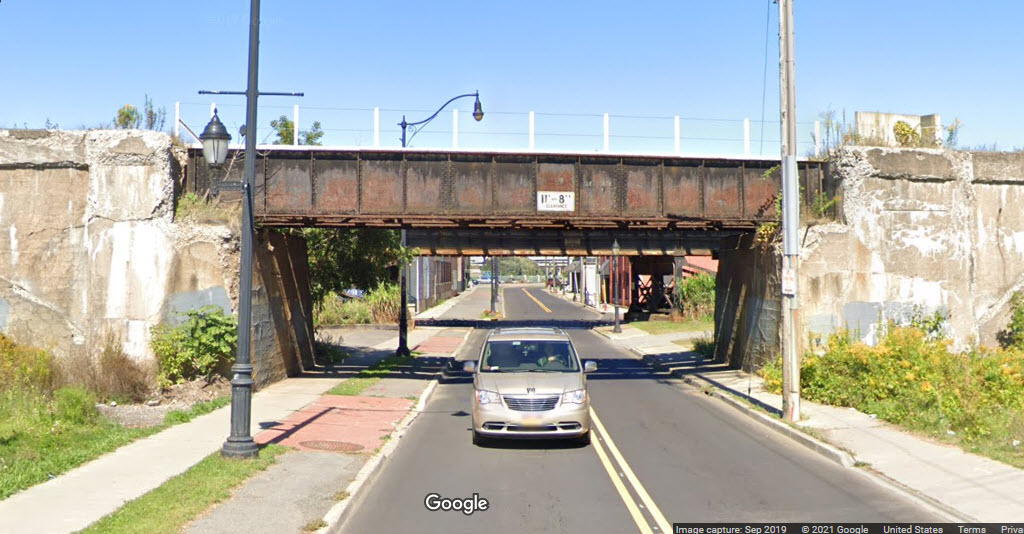
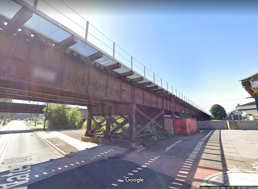
NS Over the Chanango
(and then Water St)
GPS Coordinates: ~42.10393, -75.91279
The northern bridge is former Erie, the southern bridge is former Delaware,
Lackawanna & Western.
NS Over Water St
GPS Coordinates: 42.10397, -75.91277
Tracks coming in from the west cross the Chenango here, adjacent to Clinton and Water Sts.
looking north
looking north
looking north
looking south
looking east
looking west
The set of pictures below come from the original making of this page....
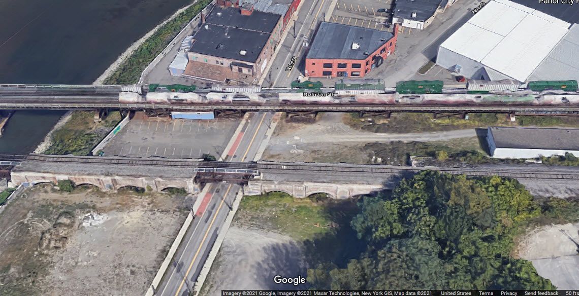
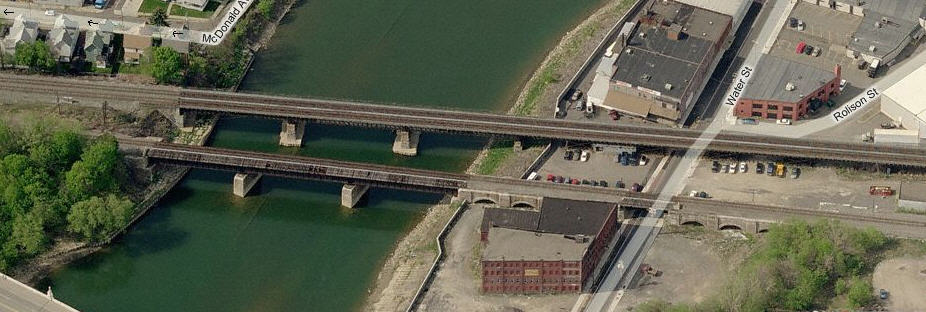
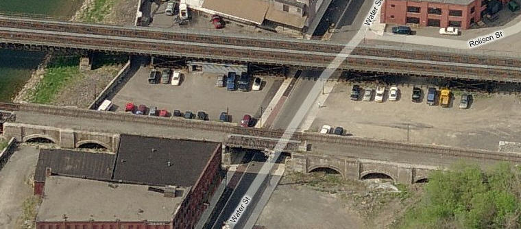
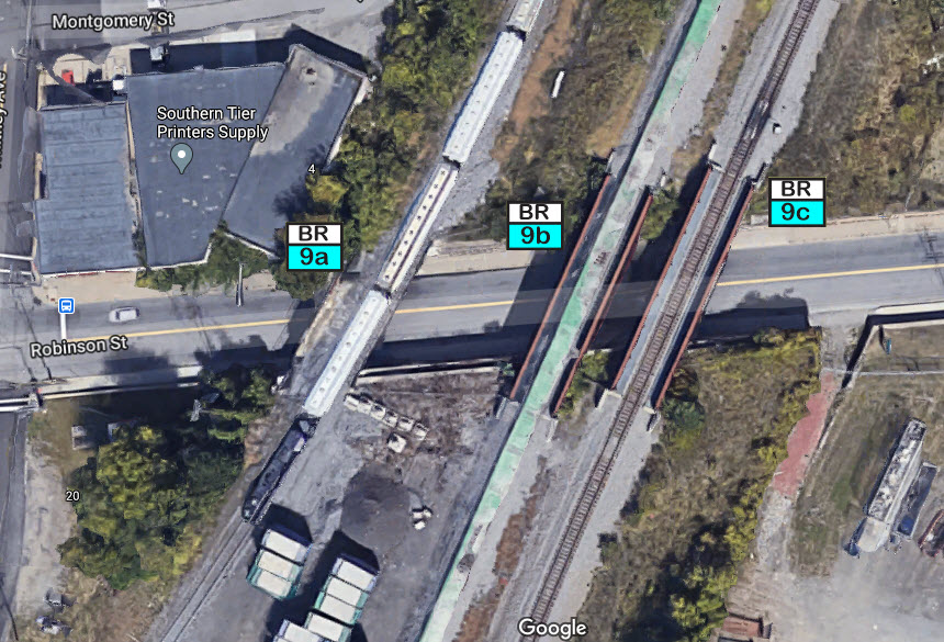
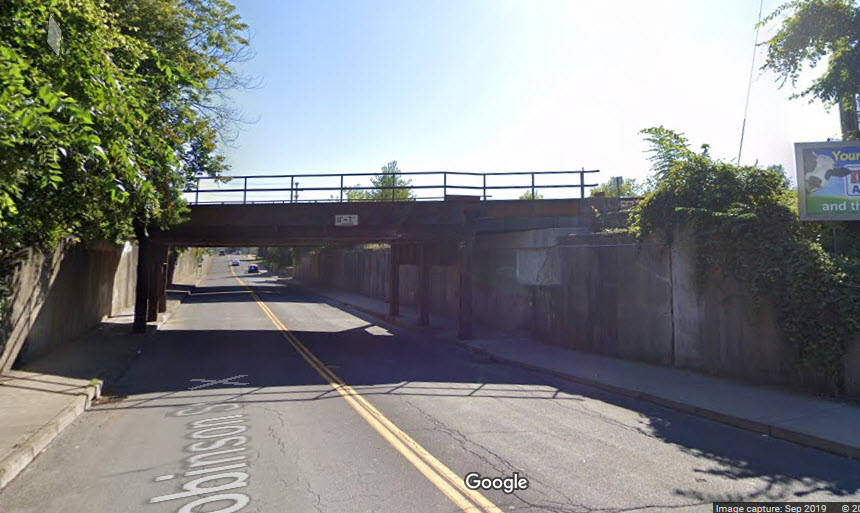
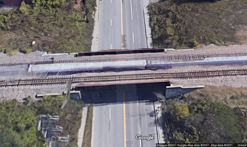
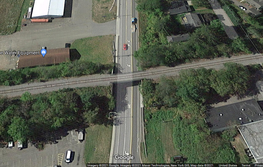
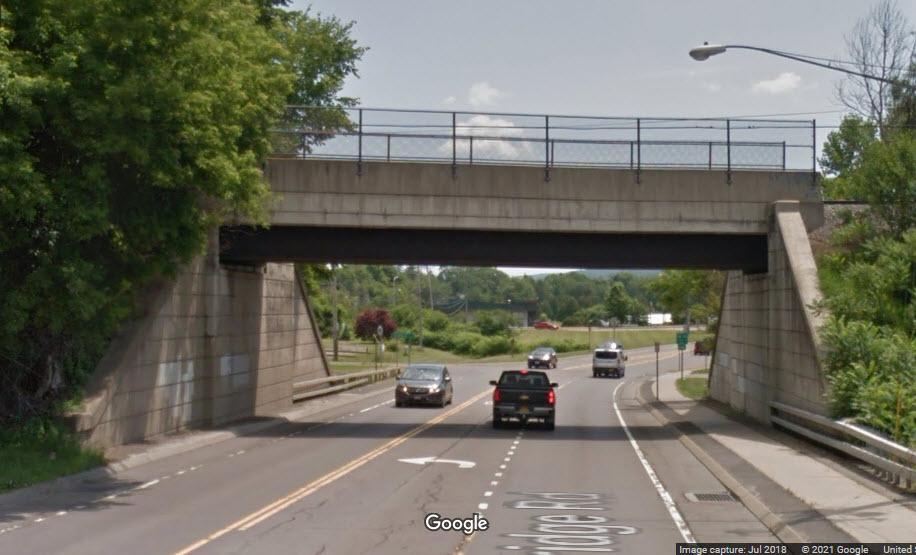
Over Robinson St
GPS Coordinates: 42.10714, -75.89525
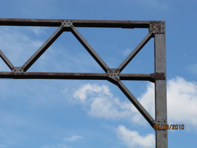
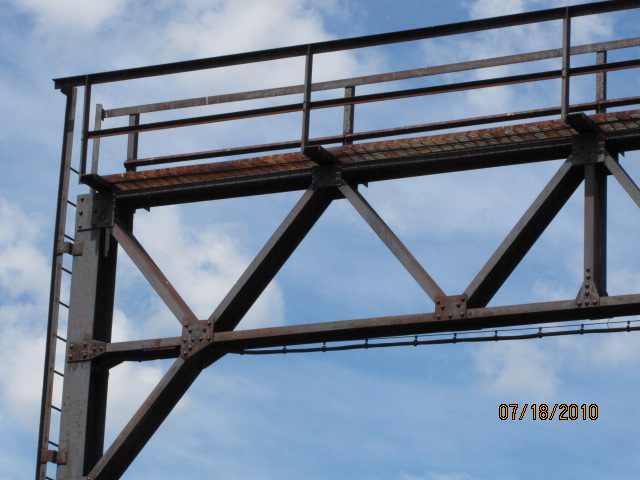
Three bridges built by three railroads to gain access to Binghamton from the north.
9a
9a
9b
9c
CP Over the Susquehanna
GPS Coordinates: 42.10248, -75.87891
This is how the Canadian Pacific gets from downtown to the other side of the
Susquehanna River. It is a double-tracked four section steel through truss
structure, roughly 685 feet long (measured with Google Maps). You may
be able to get access to the south end of the bridge by going thru Sandy Beach
Park, haven't tried, so I can't say for certain.
http://www.structsource.com/railroadbridge/types/steelthroughtruss.html
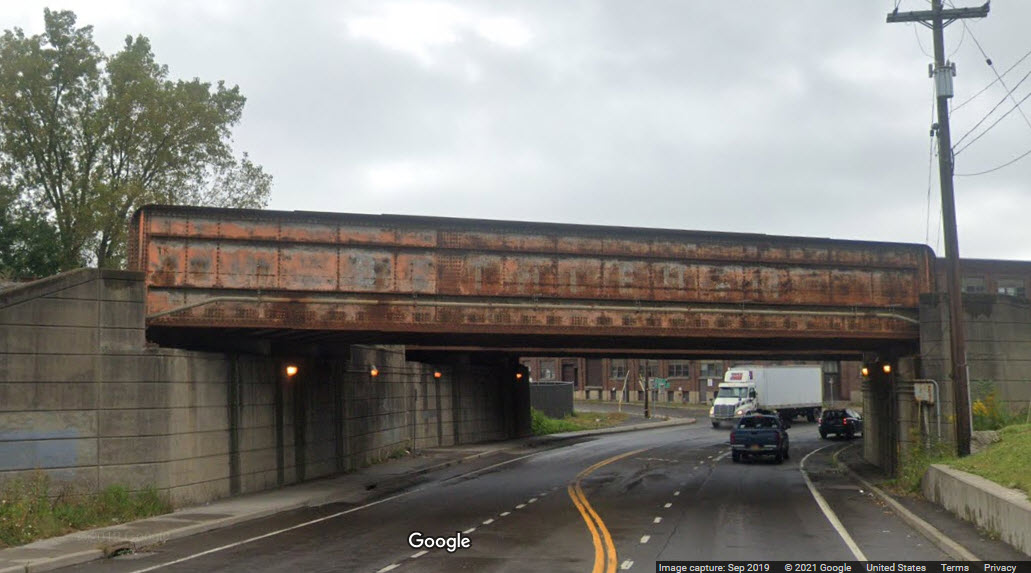
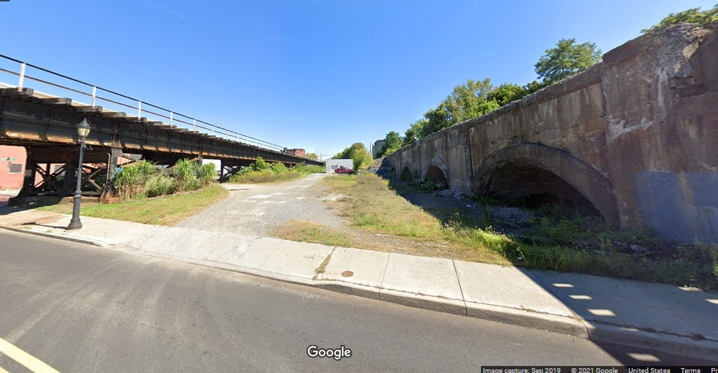
NS Over Front St
GPS Coordinates: 42.10404, -75.91595
The northern set of tracks going over Front and Clinton Streets was the Erie,
the southern tracks were the Lackawanna. The railroad crossing Front St on the west
side of the Chenango, you can still see the "Lackawana" on the one bridge.
between the two bridges
looking south on Front St
The railroad crossing Front St on the west side of the Chenango, you can still
see the "Lackawana" on the one bridge.
NS Over Clinton St
GPS Coordinates: 42.10406, -75.91670
The northern set of tracks going over Front and Clinton Streets was the Erie, the southern tracks were the Lackawanna.
In the Google Streetview below, Clinton St is on the left, Front St is on the right.
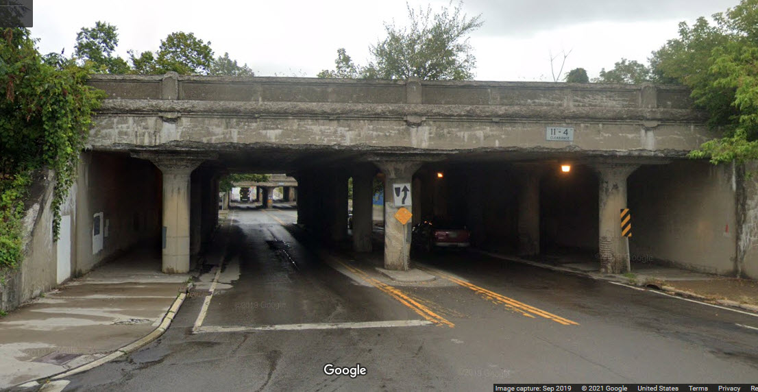
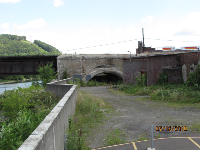
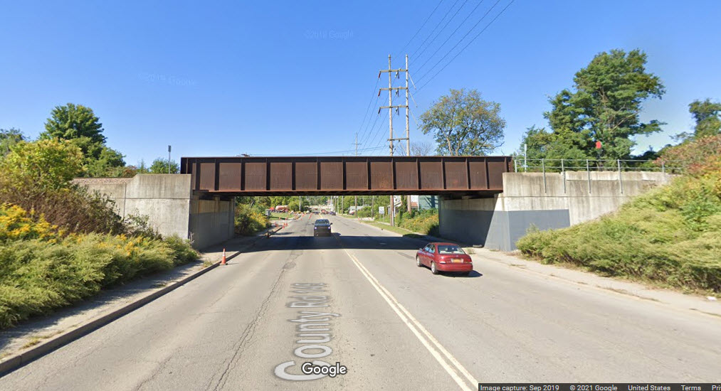
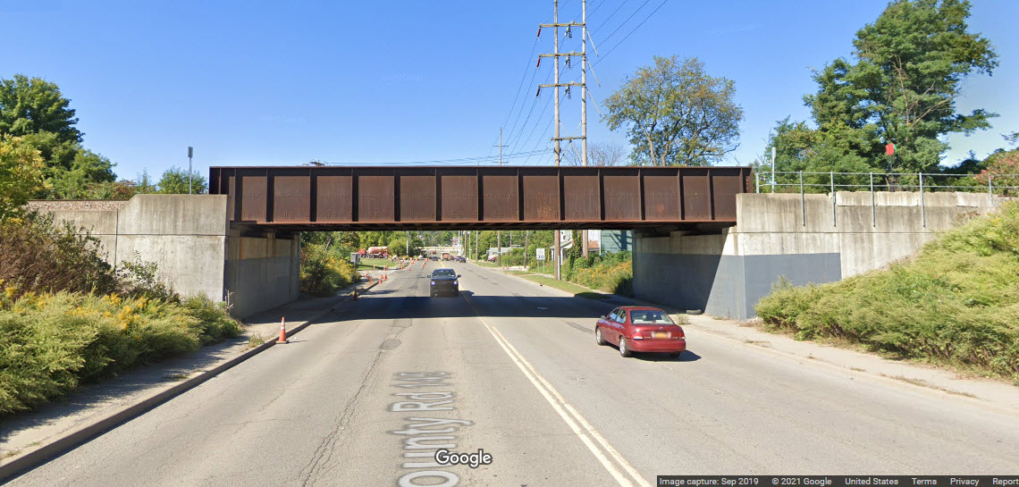
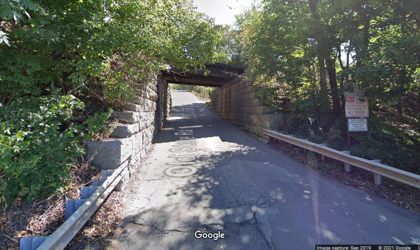
Over Oak St
GPS Coordinates: 42.10385, -75.92211
You don't see many of these anymore -- an underpass to get to the other side
of a set of railroad tracks -- and most of them you do find, have been closed,
probably out of concern of the safety for people that would like to use them....
south side
north side
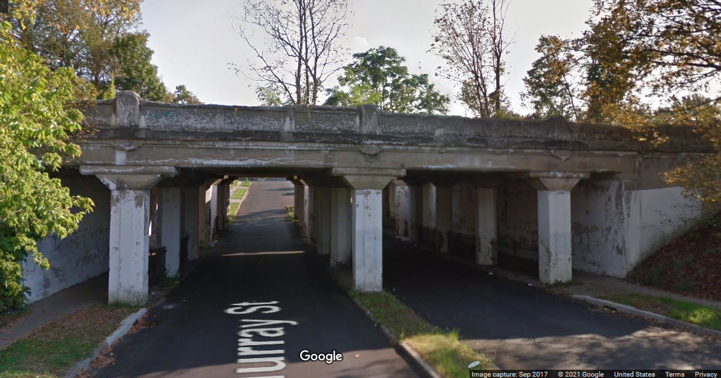
NS Over Murray St
GPS Coordinates: 42.10409, -75.91965
looking south
looking north
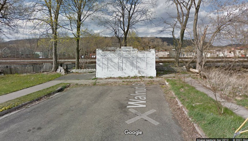
Over Walnut St
GPS Coordinates: 42.10407, -75.92201
This underpass is on Walnut on the south side of the tracks, and Titchener St on the north side.
south side on Walnut
north side on Titchener
north side again
Over Crandall St
GPS Coordinates: 42.10431, -75.92643
This underpass is at Crandall St. Is anyone beside me surprised that the light bulb is lit on the south side?!
south side
north side
NS Over Jarvis St
GPS Coordinates: 42.10540, -75.92946
looking north
looking south
NS Over Glenwood Ave
GPS Coordinates: 42.10965, -75.93797
looking north
looking south
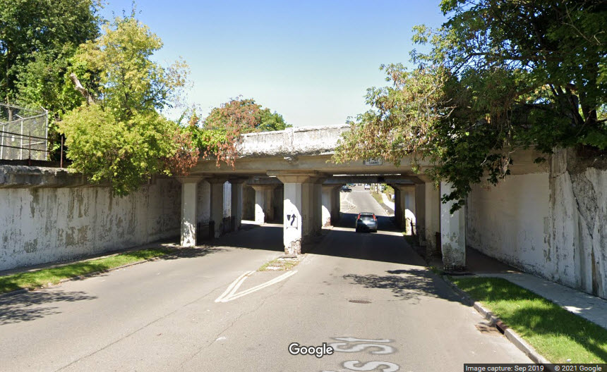
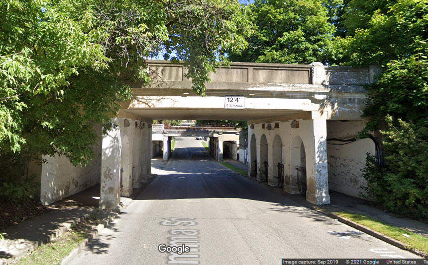
NS and the Vestal Spur Over Emma St
GPS Coordinates: 42.11198, -75.94257
looking north
looking north
looking south
looking south
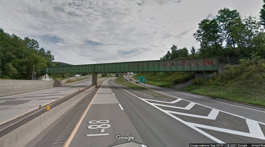
NS Vestal Spur Over the Susquehanna River
GPS Coordinates: 42.11014, -75.97681
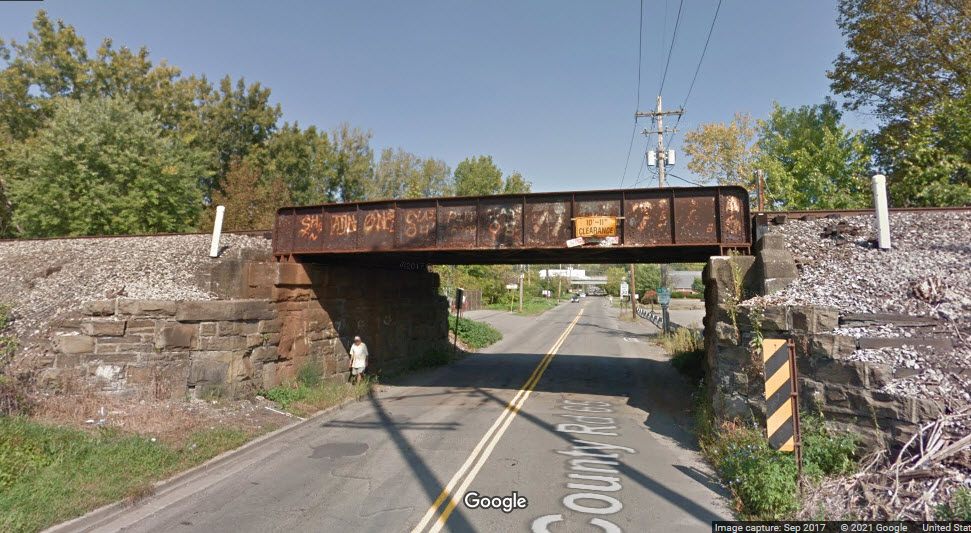
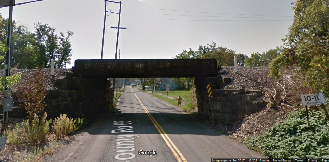
NS Over Oakdale Rd
GPS Coordinates: 42.11815, -75.97702
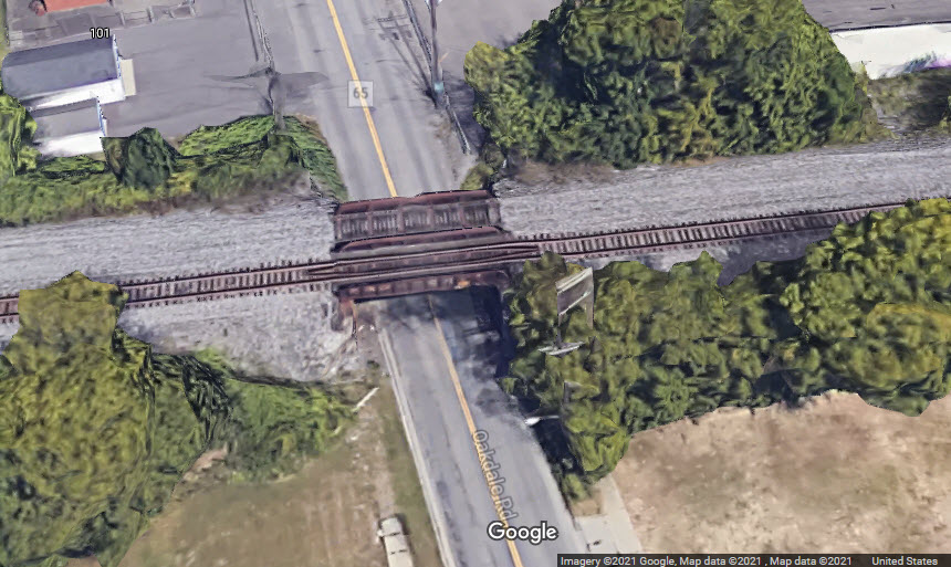
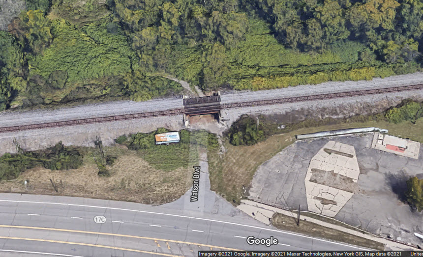
NS Over Watson Blvd
GPS Coordinates: 42.11839, -75.98038
The road and "bridge" is no longer used......
GPS Coordinates: 42.14662, -75.87684
There are two cantilever bridges south of Lower Nowlan Rd, at least the
first one from Nowlan Rd looks unused.
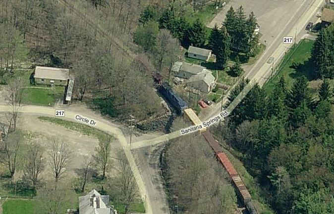
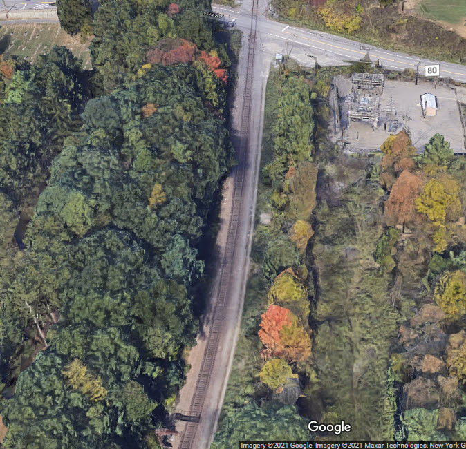
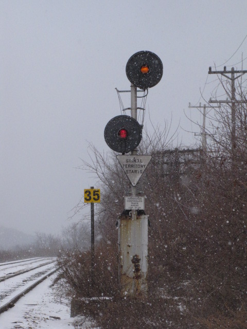
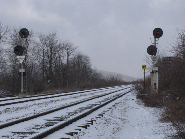
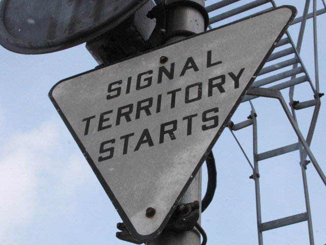
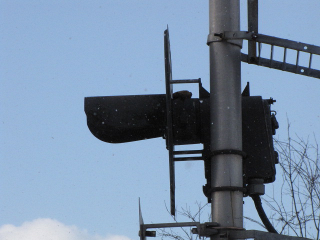
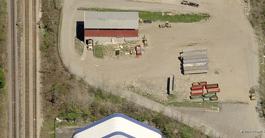
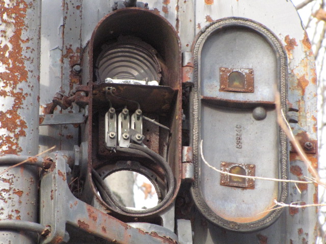
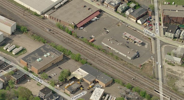
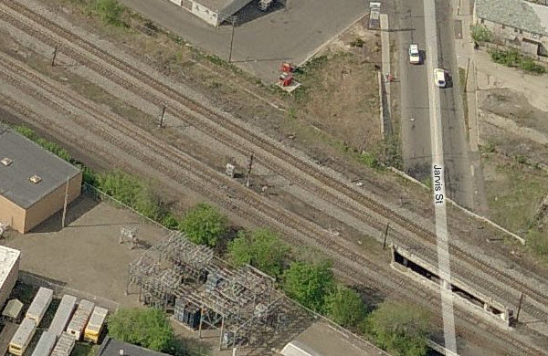
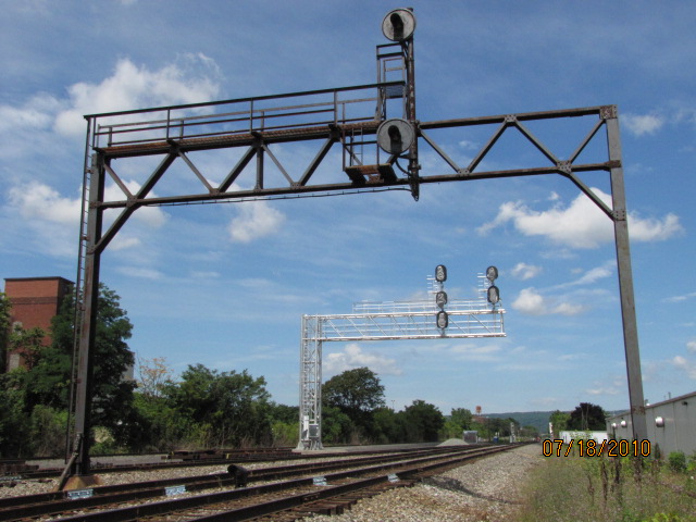
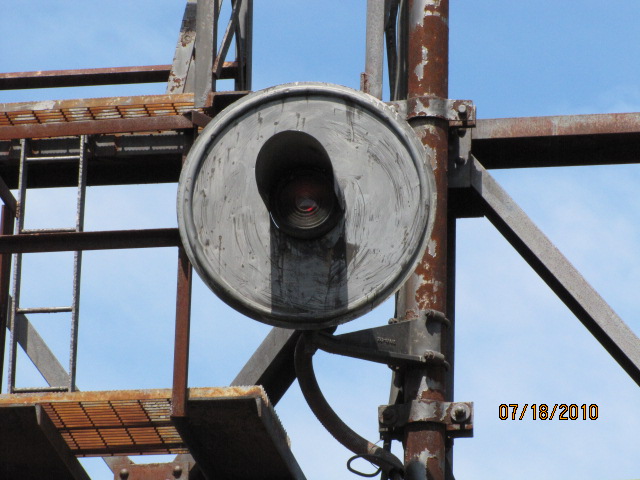
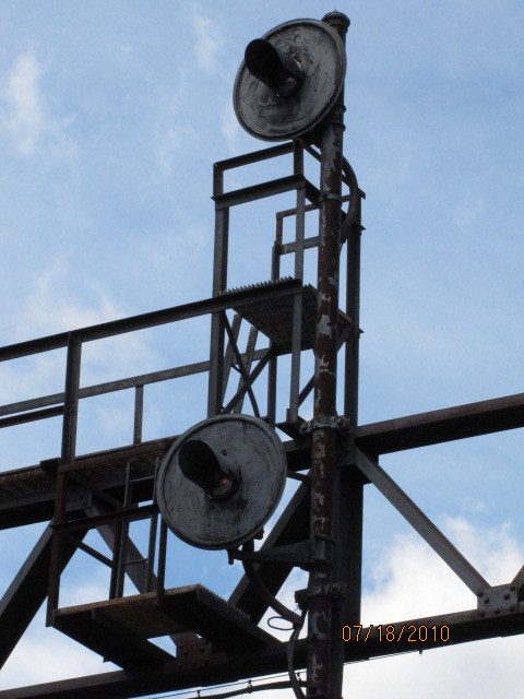
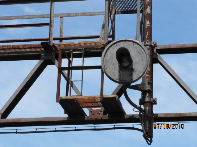
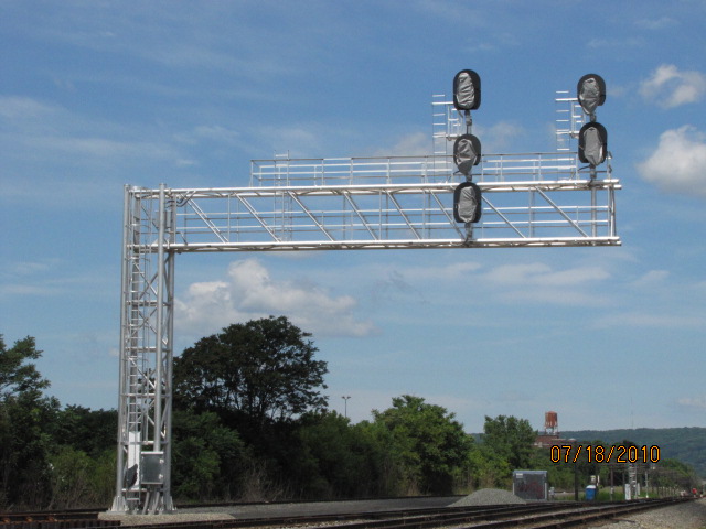
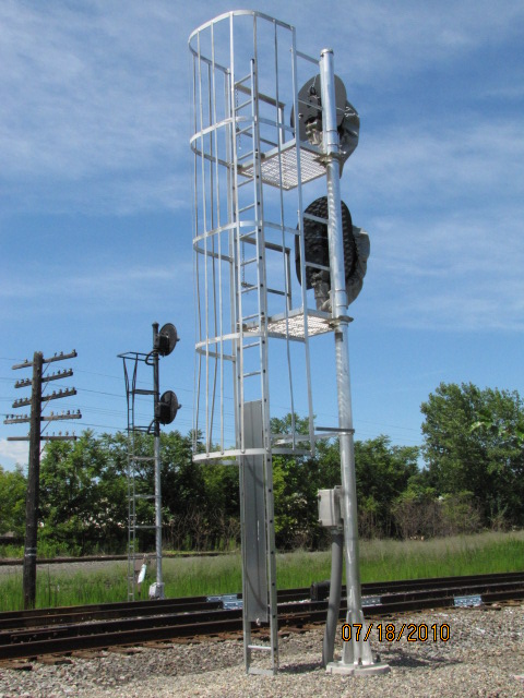
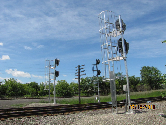
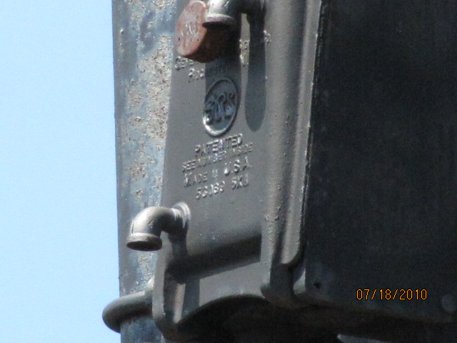
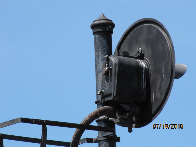
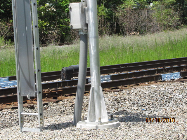
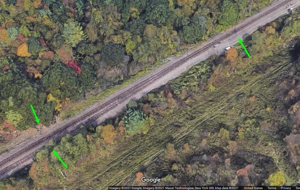
NB NS/CP Searchlight Signals
The signals at this location are very difficult to access, especially
in winter with a foot of snow and no boots! They use GRS Searchlights.
Without a site inspection, it is hard to tell from the Bing aerial view whether
or not both sets of signals are still here.... does anyone know? BTW,
for the most part, Bings aerial pictures have gotten worse in the past 10 years.
aerial view from 2008
aerial view from 2021
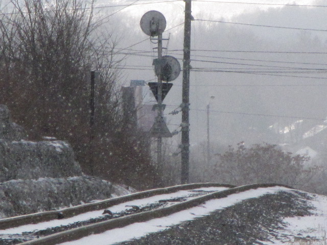
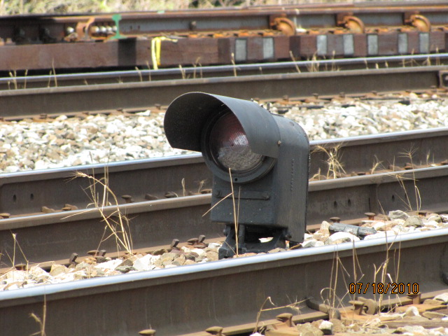
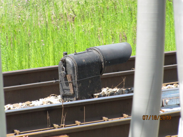
Old Erie Colorlight Signal
Old Erie signal that hasn't seen a train in what, 40+ years? South
of Bevier St and signal location #4.
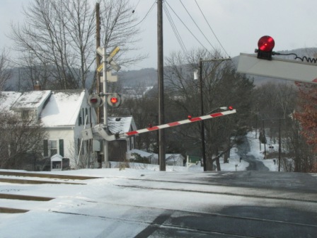
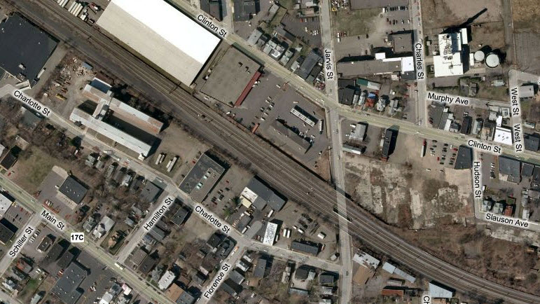
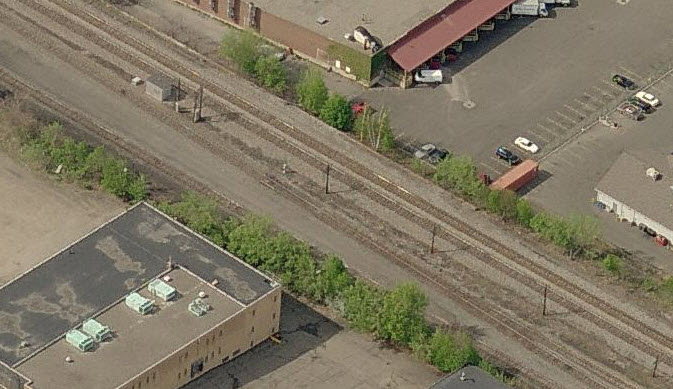
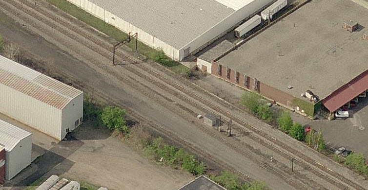
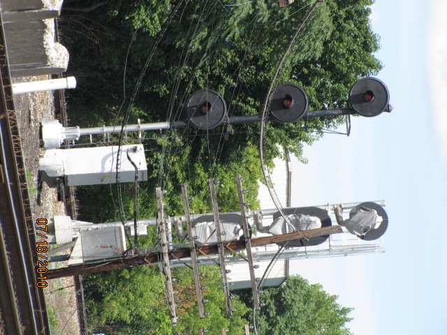
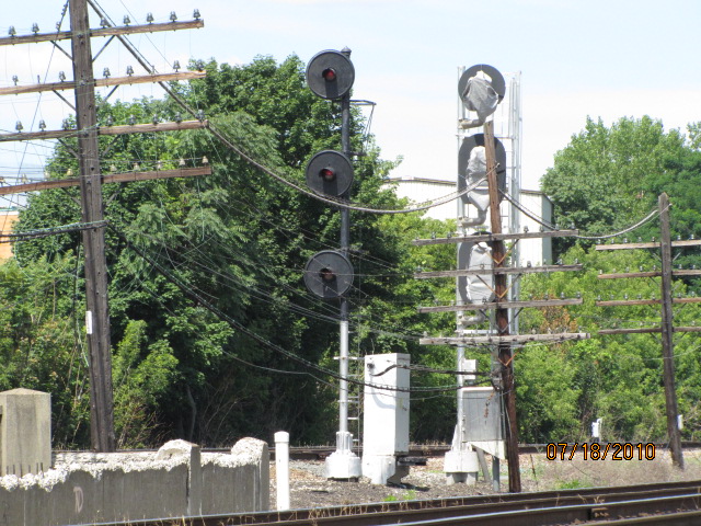
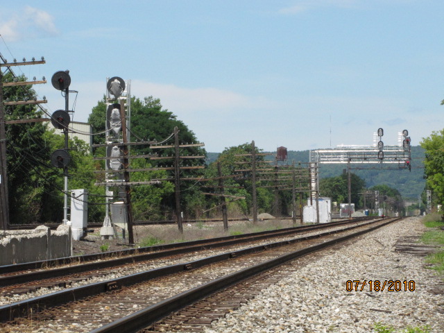
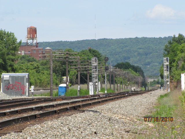
"Jarvis" Interlocking
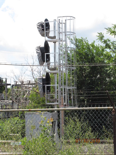
The old signals were replaced in July 2010... the new signals
are already in place when I came thru, just waiting to be cut over.
Bing Maps aerial shots.
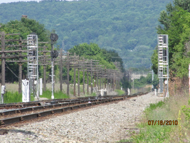
The WB high and dwarf signals, notice the top head appears to
be a single aspect light, judging from the housing.
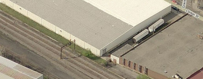
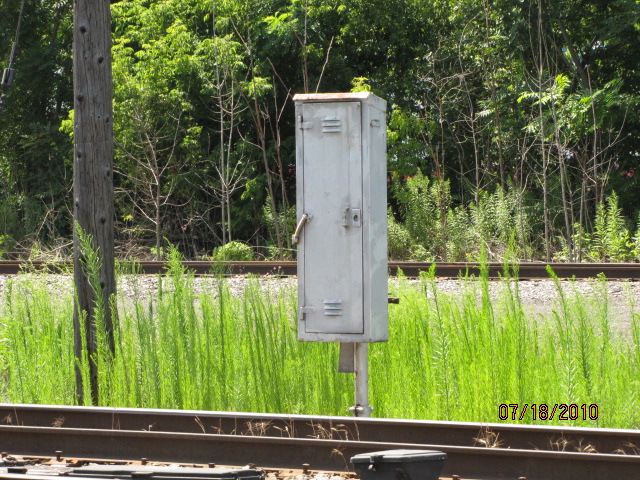
Misc stuff, and a view down an alley (across from Grace) to get to the old signal bridge.
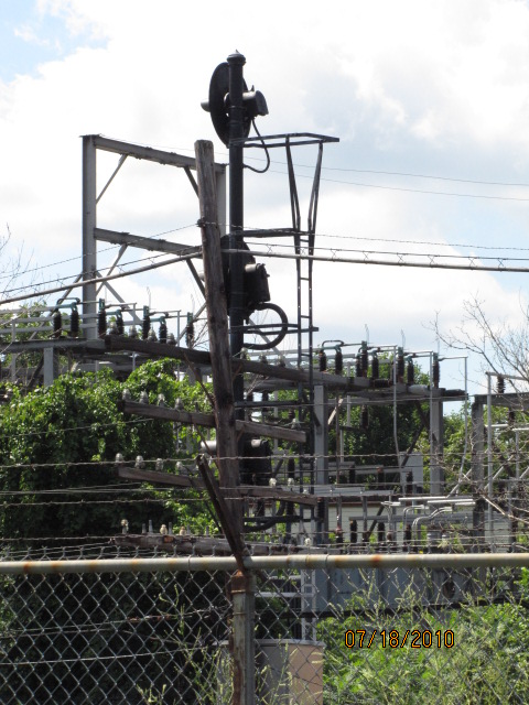
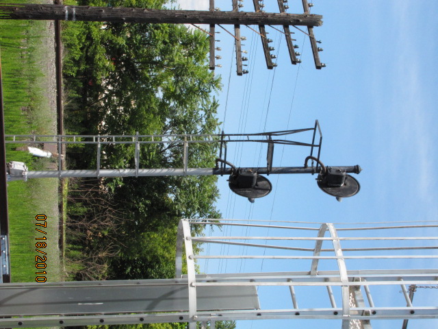
A great signal bridge holding up a single searchlight
installation... shame it's going bye-bye. A dwarf sits below it. The
searchlights are by GRS.
The new WB signals on a cantilever, and the dwarf searchlight
under the old bridge.
The eastbound signals.
Mile marker a little east of the signals, taken from about a quarter of a mile away, hence the blurry edges from the heat.
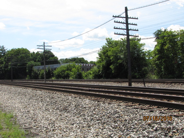
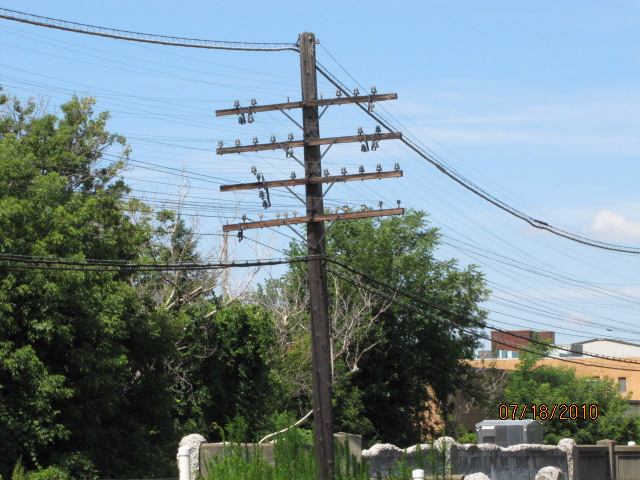
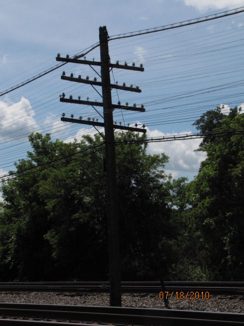
The pole line, but judging from the condition of several poles nearby, not used anymore.
NB/SB "Tri-Lights"
GPS Coordinates: 42.06721, -75.80400
Located about 150 feet north of Trim St on Kirkwood Ave (US11), south of Binghamton.
Need pictures.
Inbound Susquehanna freights
(to Binghamton) used to stop here a lot, at my signal location 8 along US11.... but why didn't
I get a picture of the signal??? When Google Maps came thru in 2019, it appears that
the signal was no more, as the searchlight signal heads were removed from the mast.
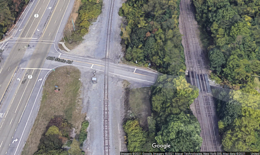
Interlocking
Inbound trains hit two tracks on their way into Binghamton at this point -
about 2.800 feet south of Nowlan Road, County Road 80.
CP Interlocking
GPS Coordinates: 42.06478, -75.81541
South of the Binghamton Yard, and just north of Powers Rd, is where the
single track mainline coming up from Scranton turns into two tracks. There
are no signals here, but there are some equipment detectors.
NYSW Interlocking
GPS Coordinates: 42.09785, -75.83369
Just south of the Collins Kirkwood overpass, the NYS&W tracks go from one
track to two. Like the Canadian Pacific interlocking above, there are no
signals here. In fact, it looks like the second (western) track is used as
a siding, and there is a derail before trains from the siding can hit the mainline.
Courtesy of the University of Texas Library, click here for their index page.
Disclaimers:
I love trains, and I love signals. I am not an expert. My webpages reflect what I find on the topic of the page. This is something I have fun with while
trying to help others.
Please Note: Since the main focus of my two websites is railroad signals, the railfan guides are oriented towards the signal fan being able to locate them.
For those of you into the modeling aspect of our hobby, my
indexa page has a list of almost everything railroad oriented
I can think of to provide you with at least a few pictures to help you detail your pike.
If this is a railfan page, every effort has been made to make sure that the information contained on this map and in this railfan guide is correct. Once in a while,
an error may creep in :-)
My philosophy: Pictures and maps are worth a thousand words, especially for railfanning. Text descriptions only get you so far, especially if you get lost or
disoriented. Take along good maps.... a GPS is OK to get somewhere, but maps are still better if you get lost! I belong to AAA, which allows you to get
local maps for free when you visit the local branches. ADC puts out a nice series of county maps for the Washington DC area, but their state maps do not have the
railroads on them. If you can find em, I like the National Geographic map book of the U.S..... good, clear, and concise graphics, and they do a really good job
of showing you where tourist type attractions are, although they too lack the railroads. Other notes about specific areas will show up on that page if known.
Aerial shots were taken from either Google or Bing Maps as noted. Screen captures are made
with Snagit, a Techsmith product... a great tool if you have never used it!
By the way, floobydust is a term I picked up 30-40 years ago from a National Semiconductor data book, and means miscellaneous
and/or other stuff.
Pictures and additional information is always needed if anyone feels inclined to take 'em, send 'em, and share 'em, or if you have something to add or correct.... credit
is always given! Please be NICE!!! Contact info is here
Beware: If used as a source, ANYTHING from Wikipedia must be treated as being possibly inaccurate, wrong, or not true.


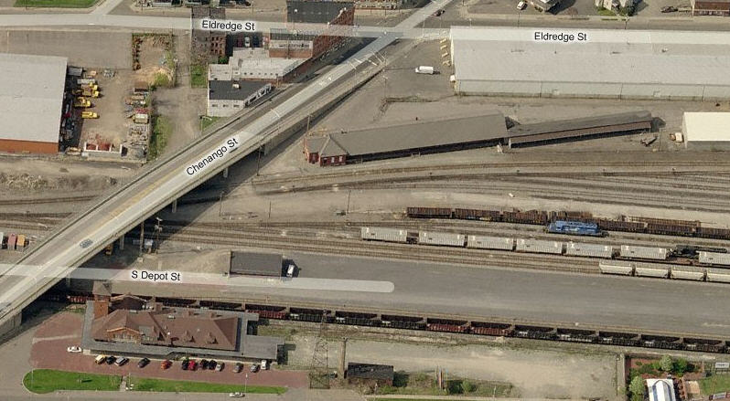
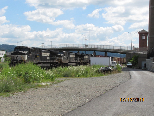 You can usually see some NS stuff across from the depot (L), and on the other side of Chenango (R).
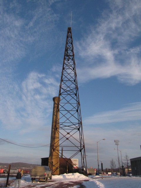

 at the north end of the yard
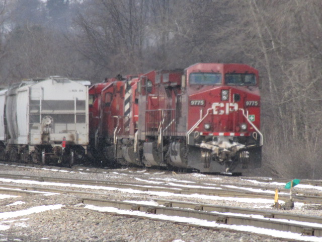 from Terrace Rd.
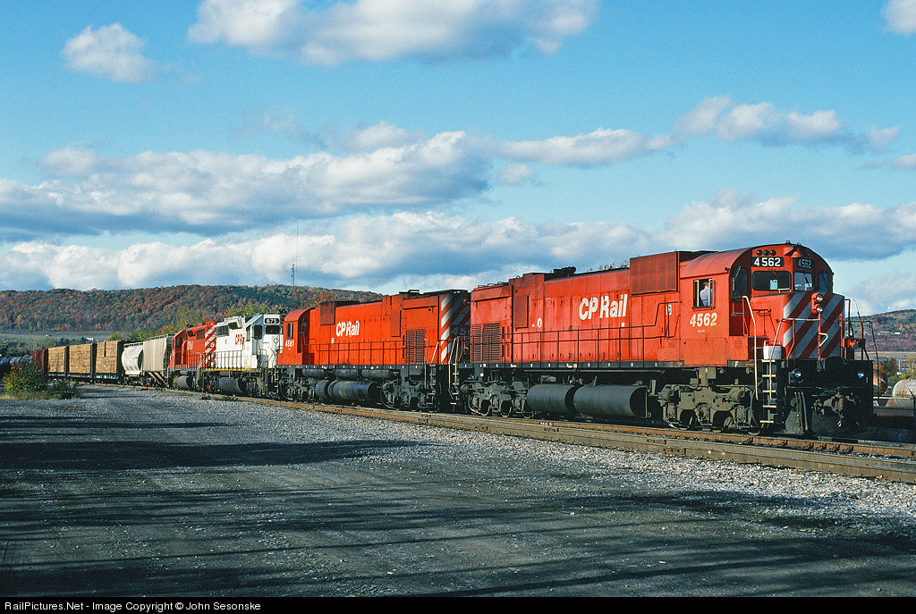 1993, photo by John Sesonske
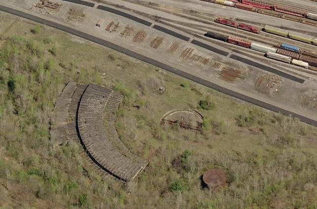
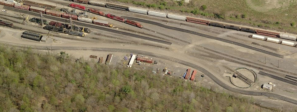


 from above
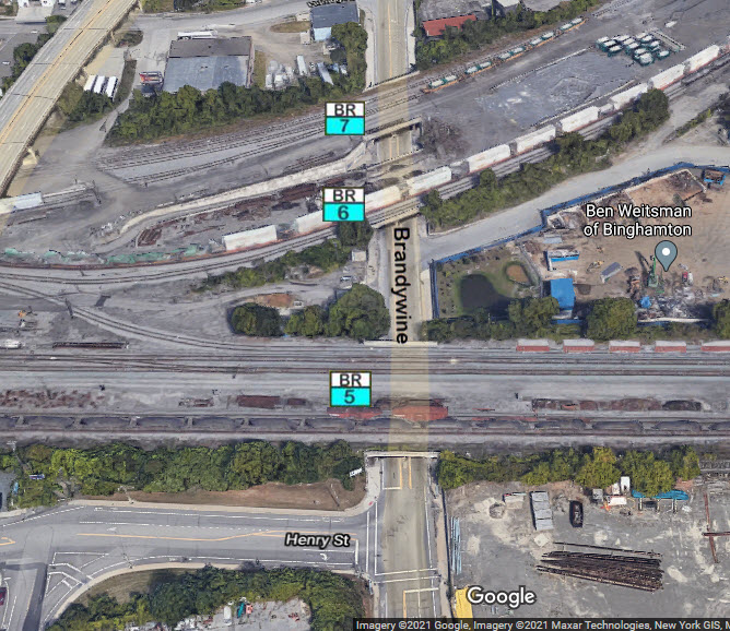
 looking north
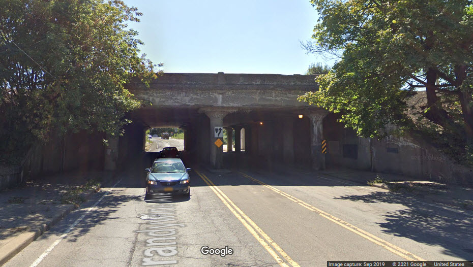 looking south
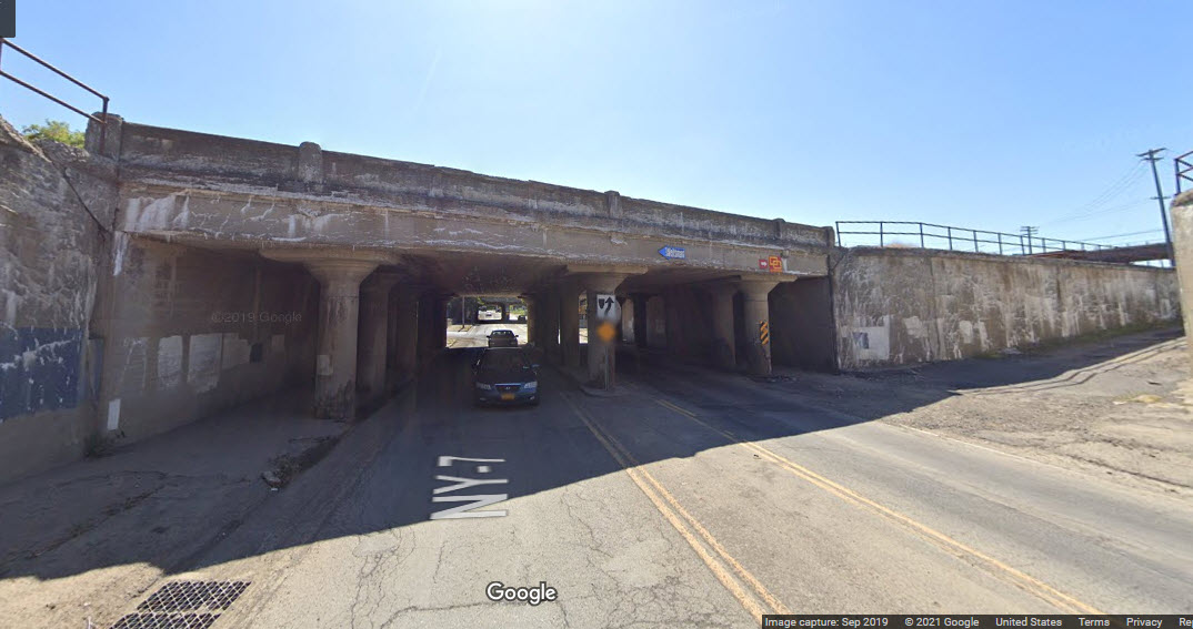 looking south
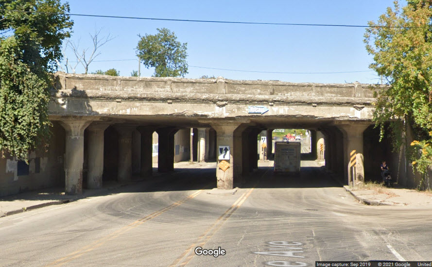 looking north
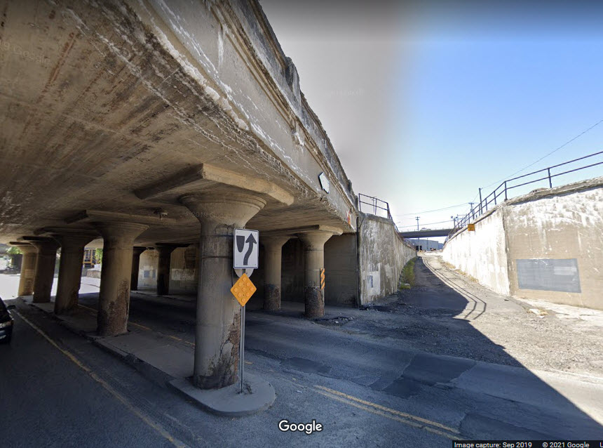 6 detail & NYS&W yard entrance
 looking north
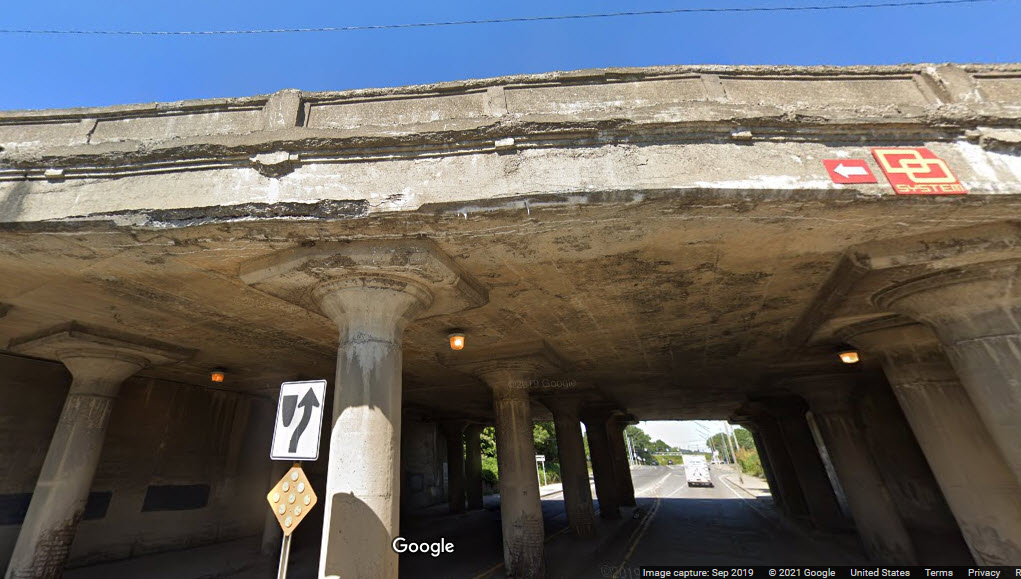 concrete detail
 looking south
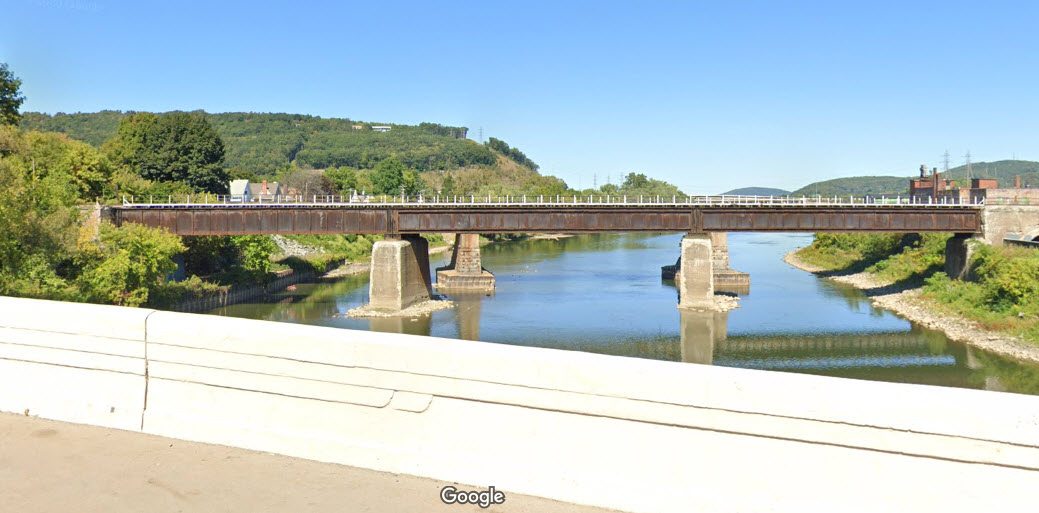

 looking north
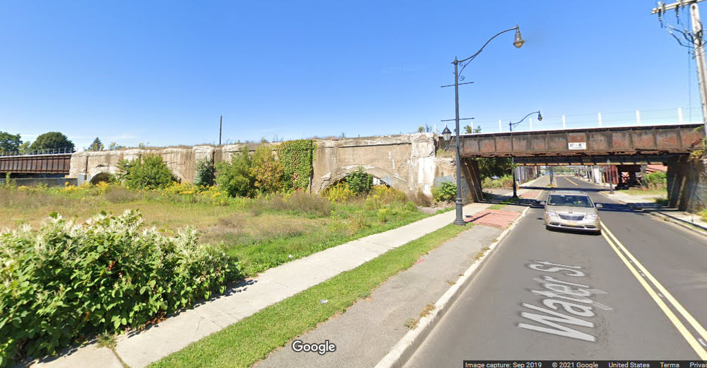 looking north
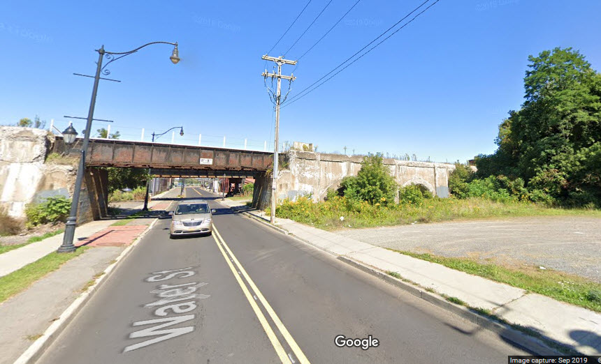 looking north
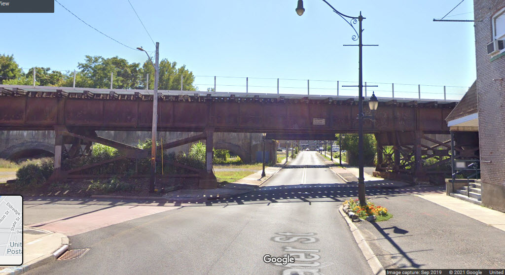 looking south
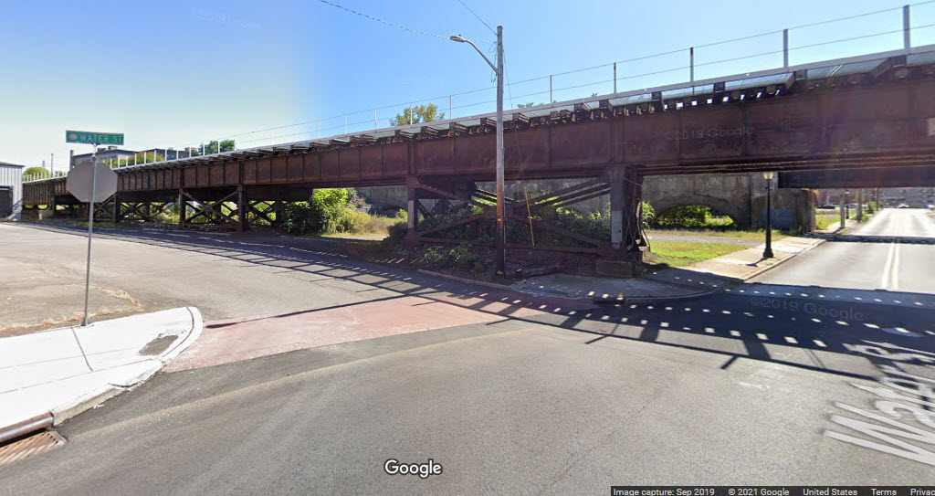
 looking east
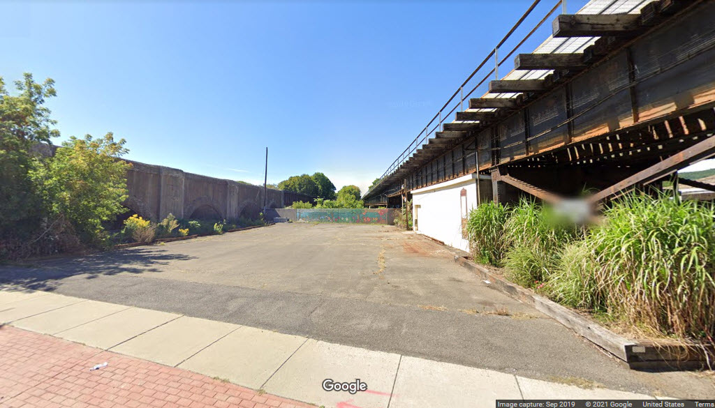 looking west
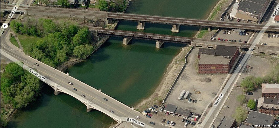

 9a
9a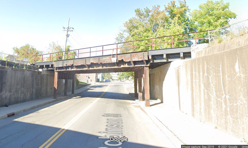 9a
9a 9b
9b 9c
9c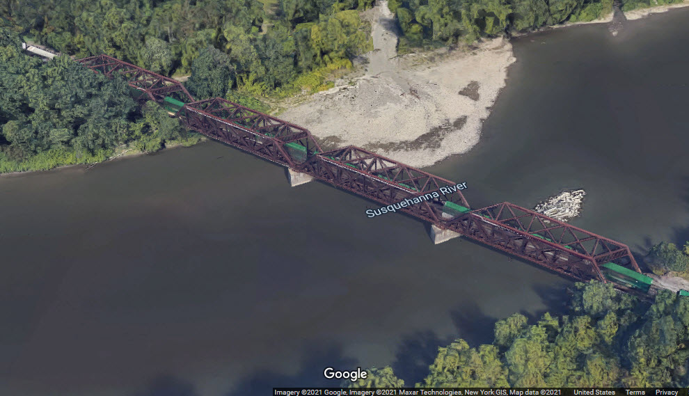

 between the two bridges
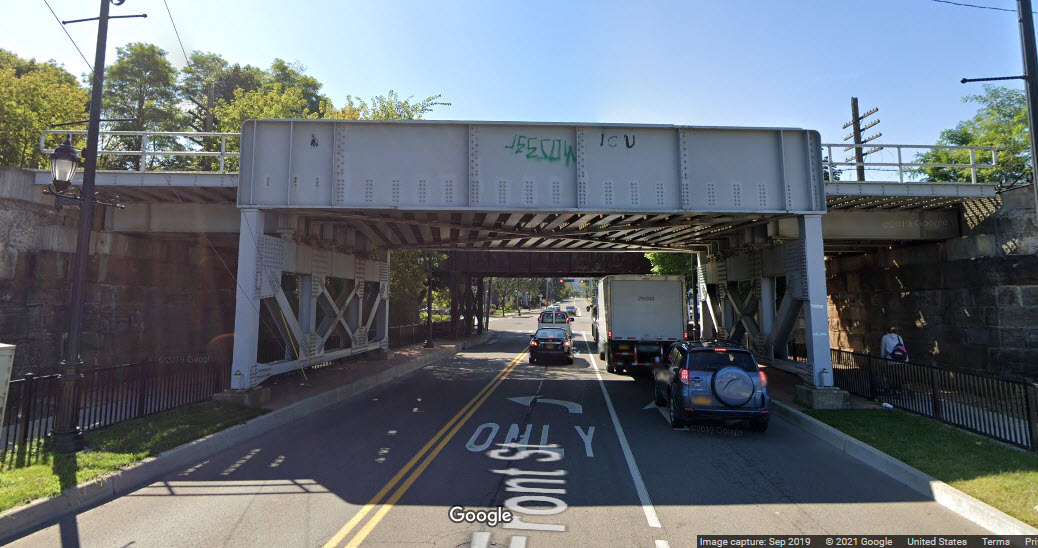 looking south on Front St

 south side
 north side
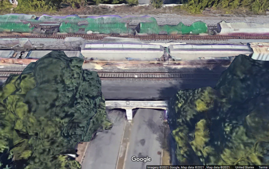
 looking south
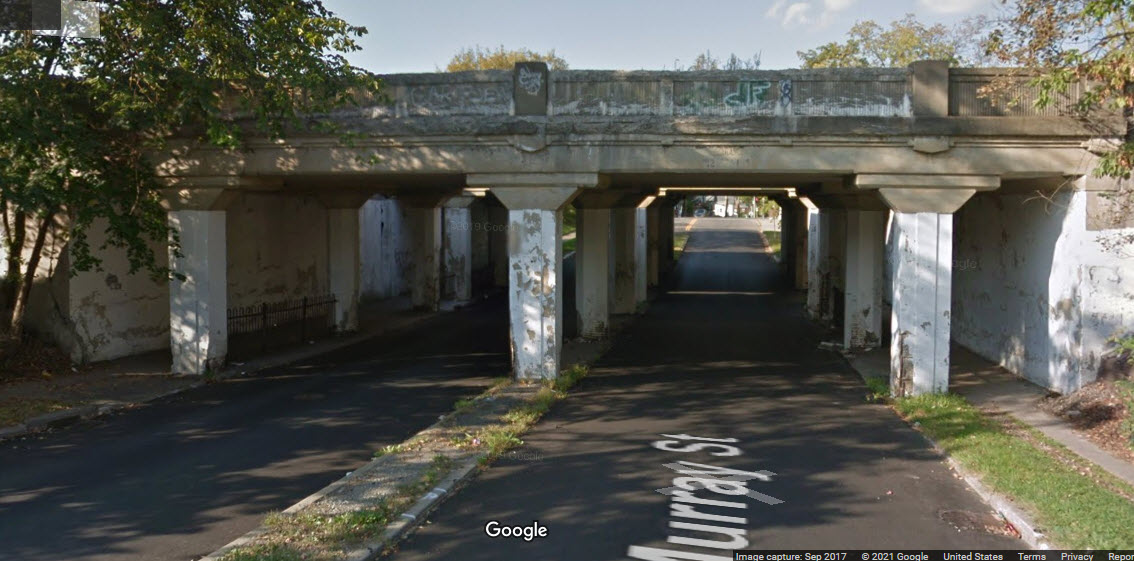 looking north
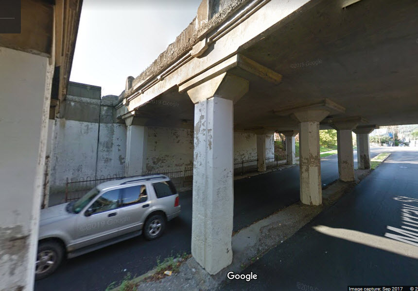

 south side on Walnut
 north side on Titchener
 north side again
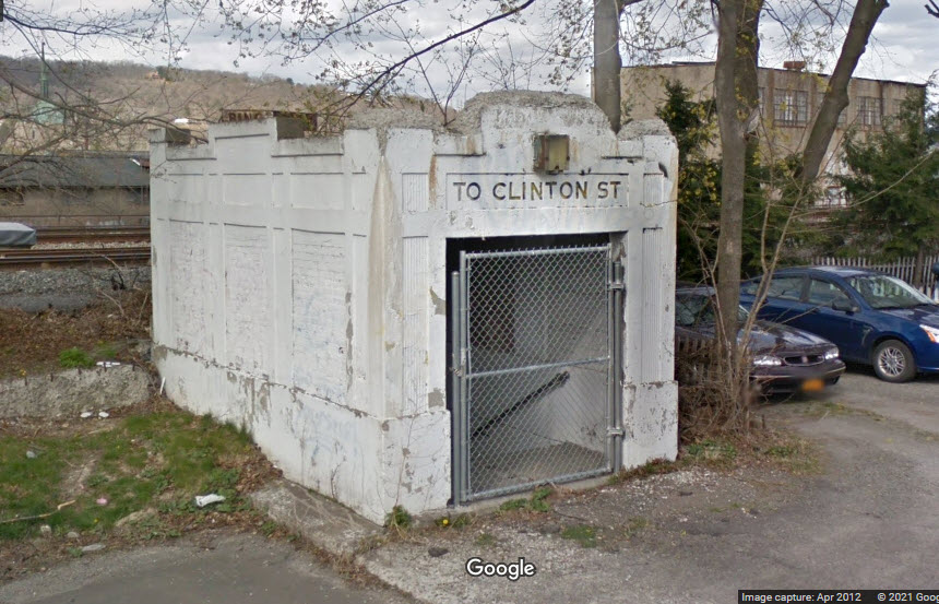 south side
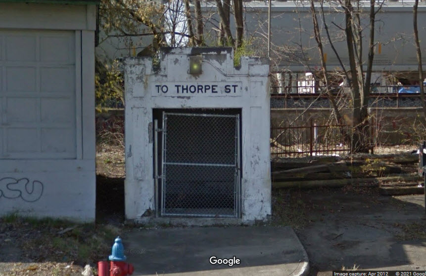 north side
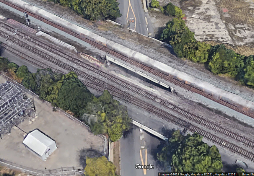
 looking north
 looking south
 looking north
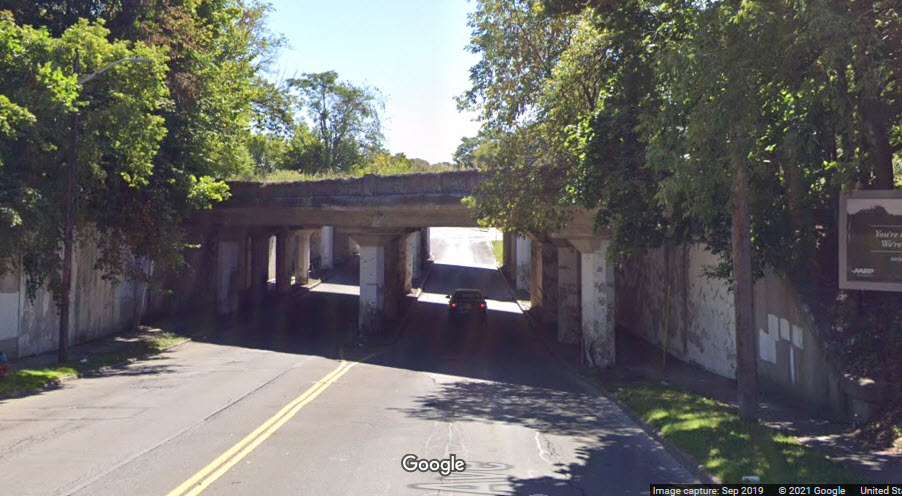 looking south
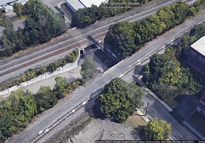
 looking north
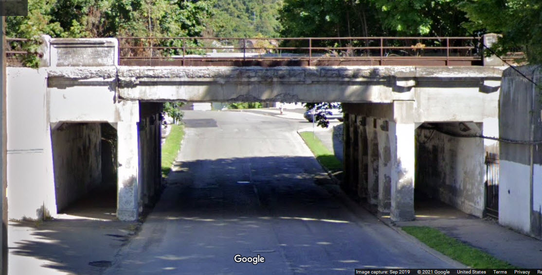 looking north
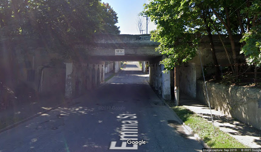 looking south
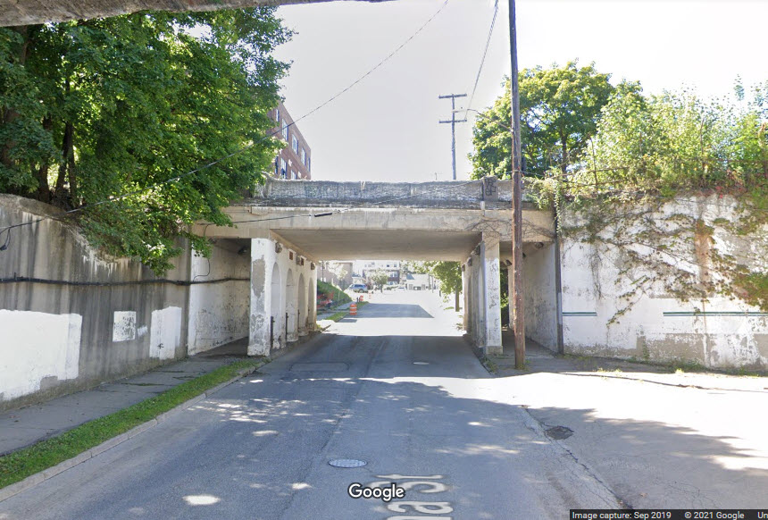 looking south
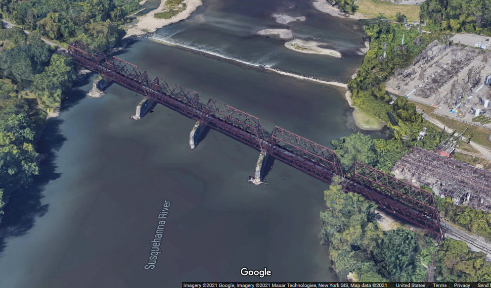

 looking east
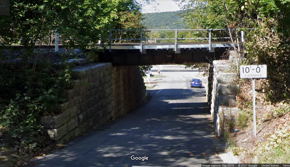 looking west
 looking east
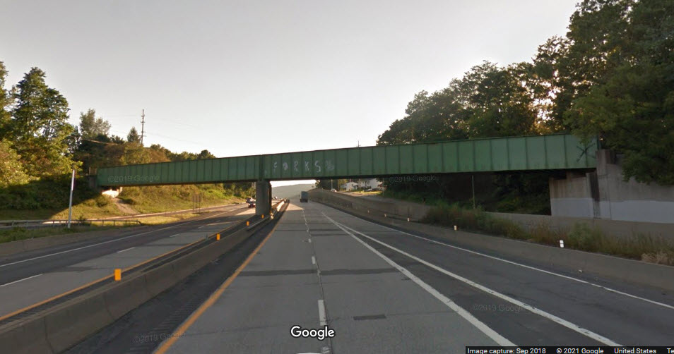 looking west
 looking east
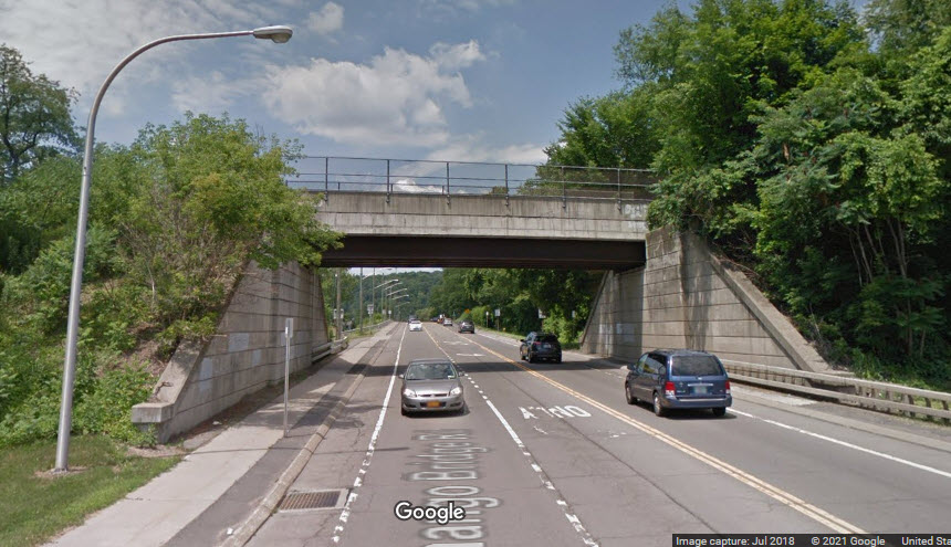 looking west
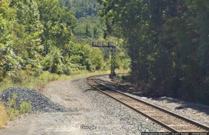


 aerial view from 2008
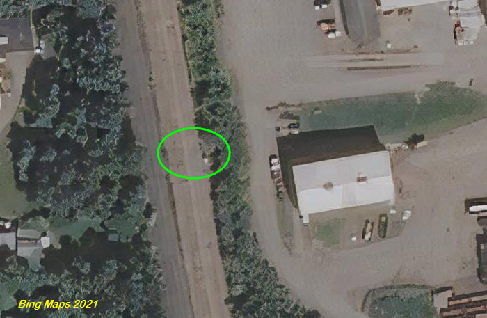 aerial view from 2021
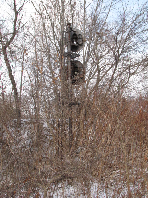
 Bing Maps aerial shots.
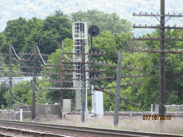


 Interchange tracks, just above the shot below.
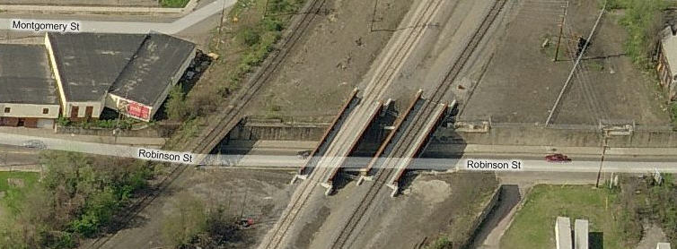 Here where the tracks come down from the north, and cross
Robinson, one can see signs of old trackwork.
Here where the tracks come down from the north, and cross
Robinson, one can see signs of old trackwork.