In General
Getting Here
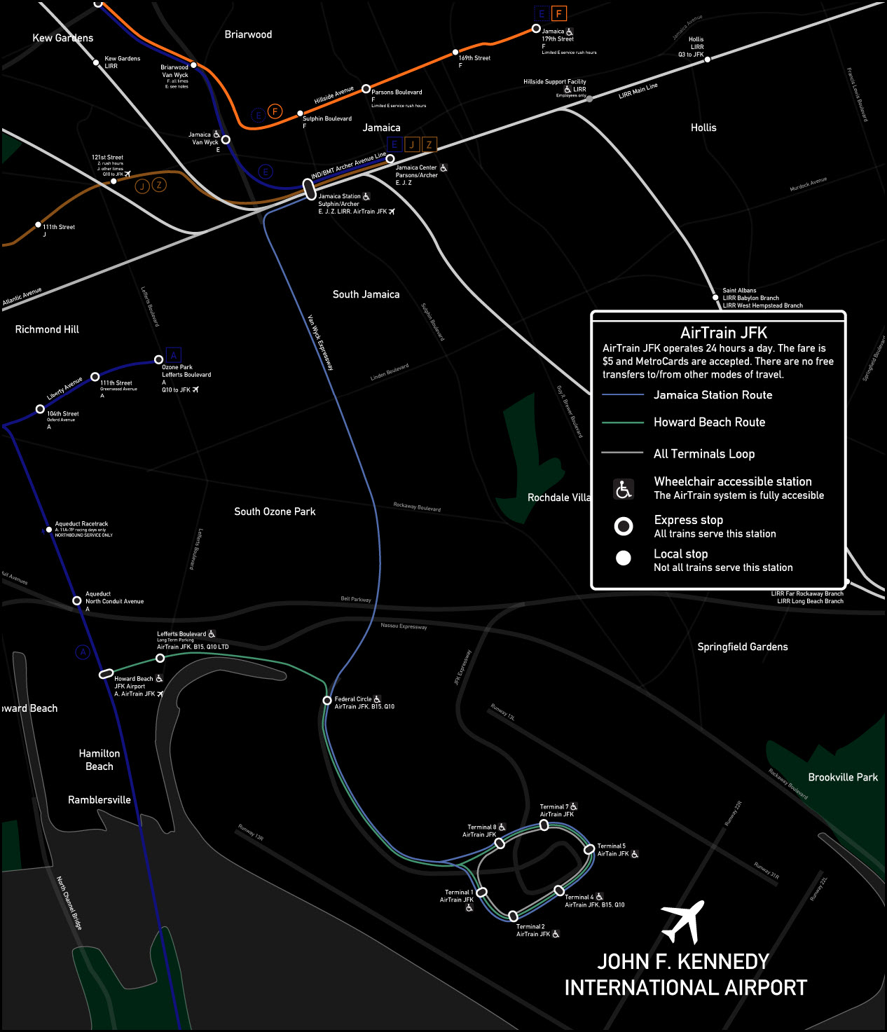
Map
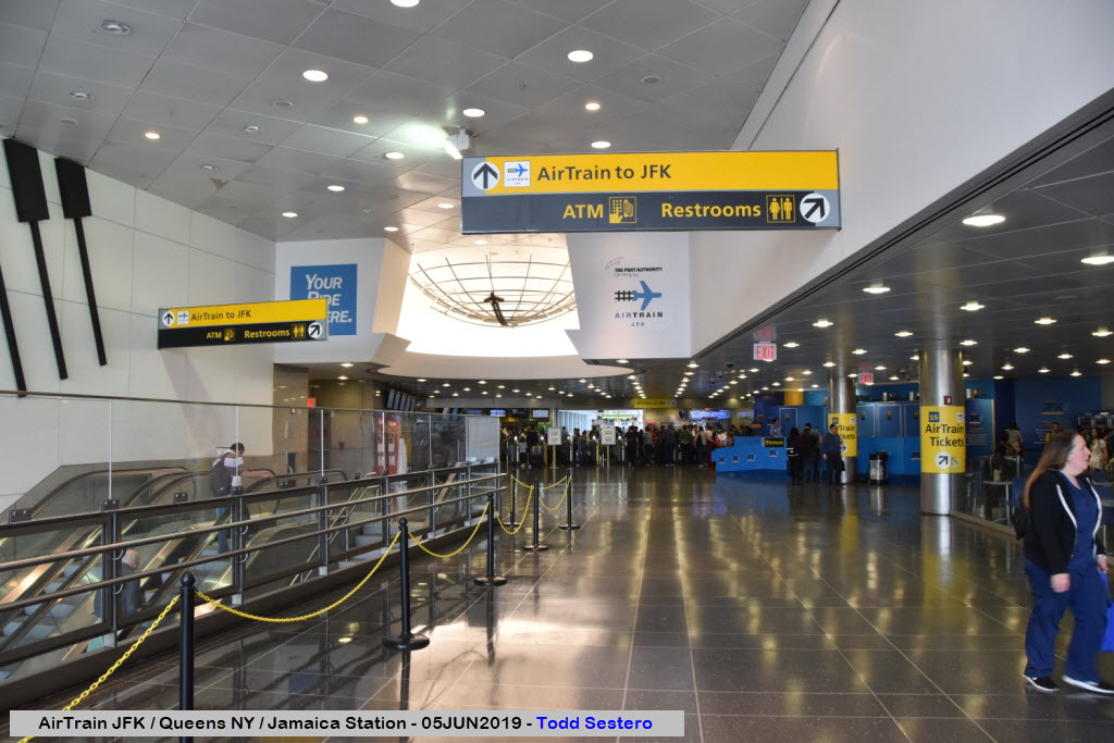
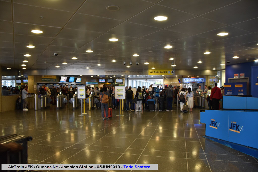
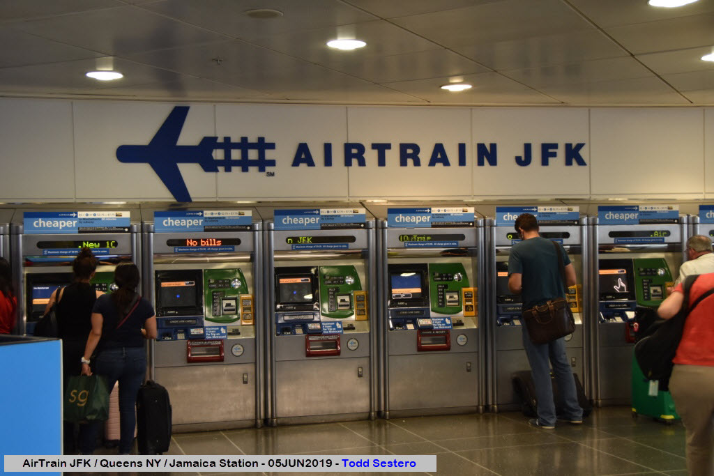
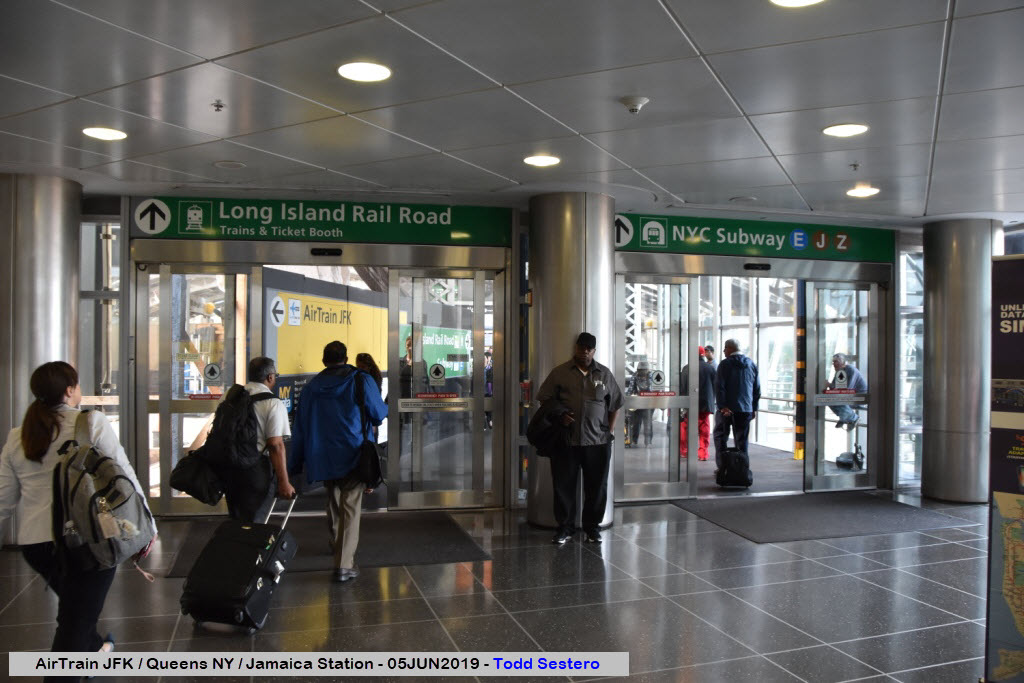
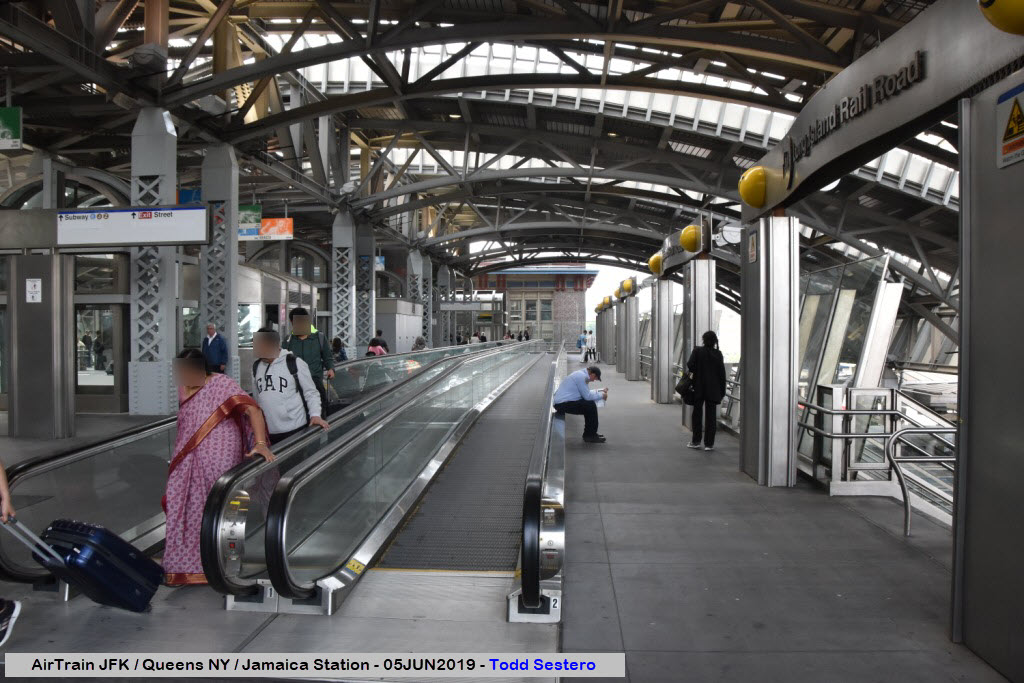
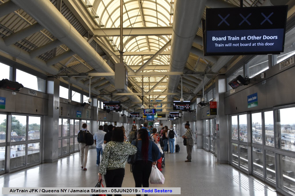
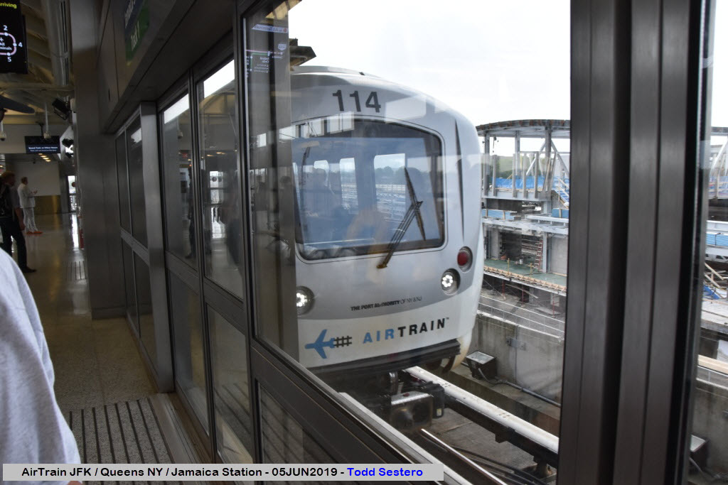
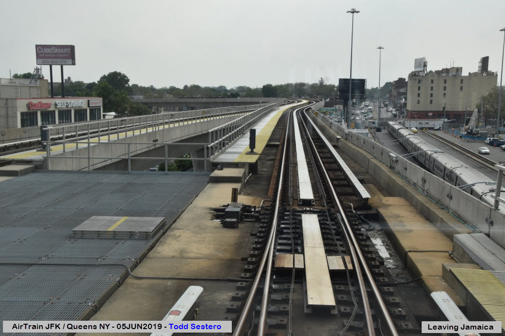
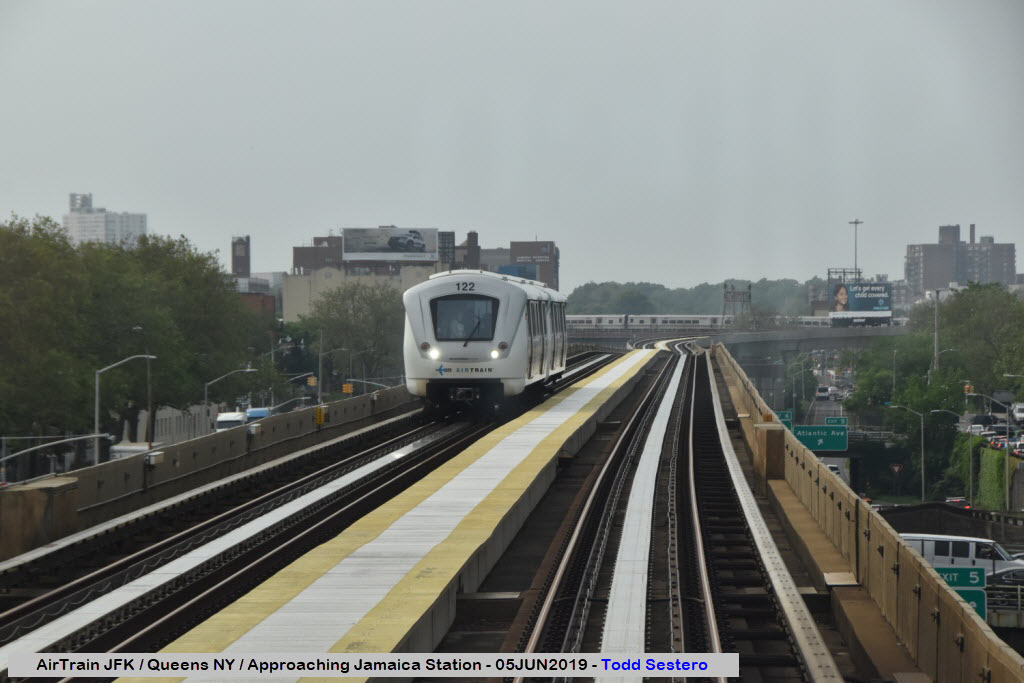
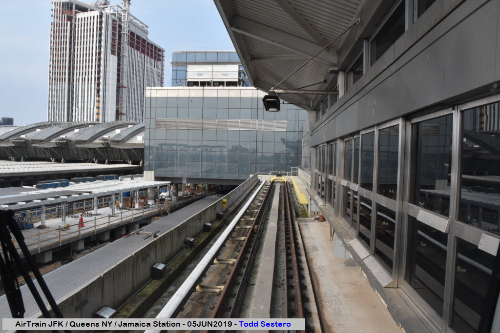
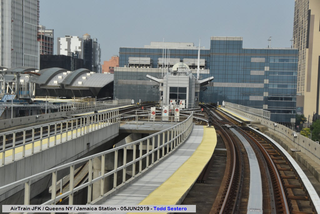
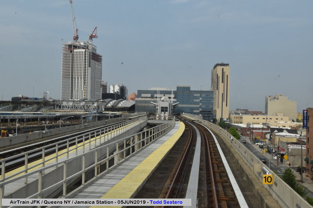
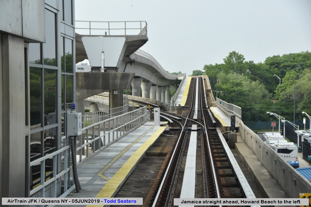
At Jamaica Station
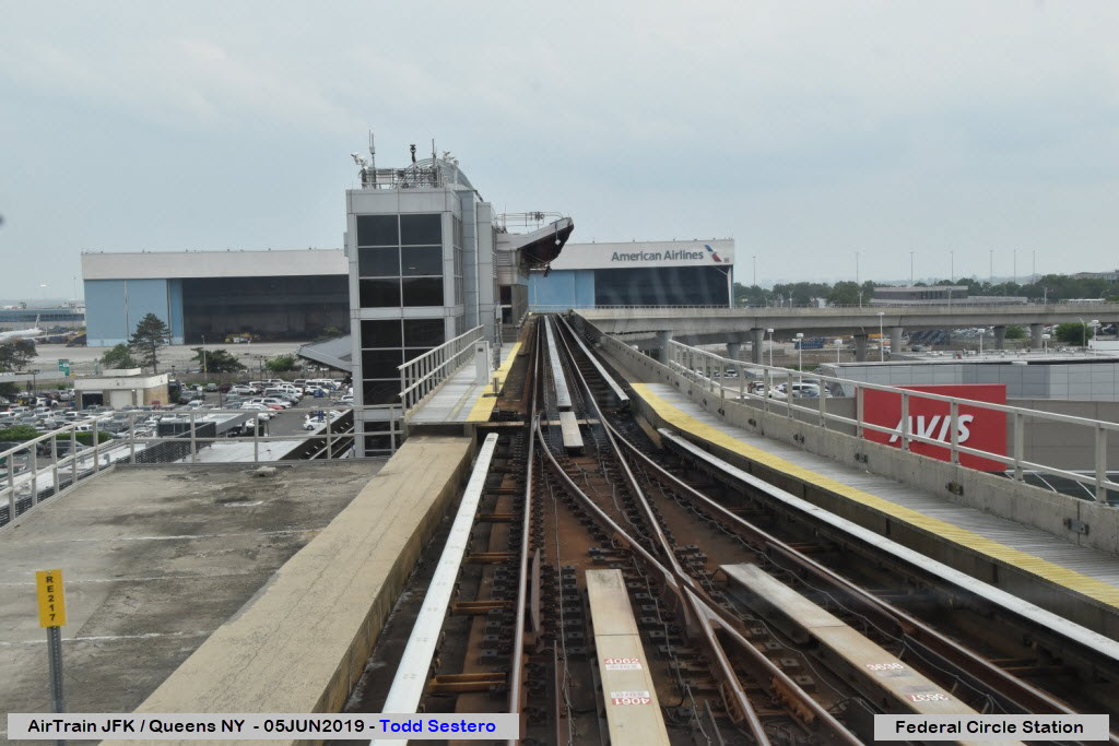
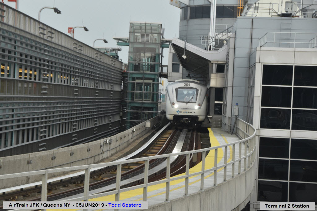
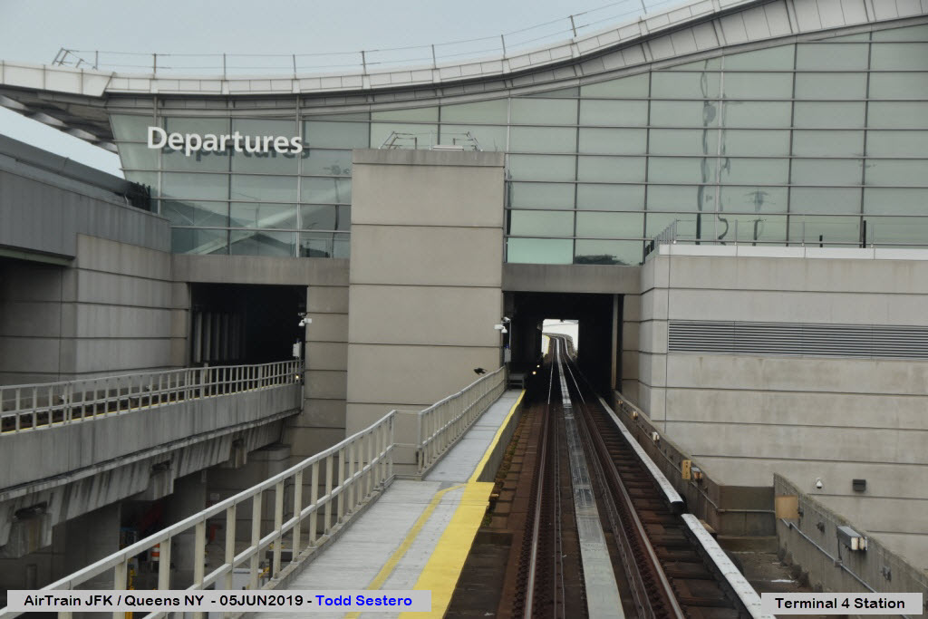
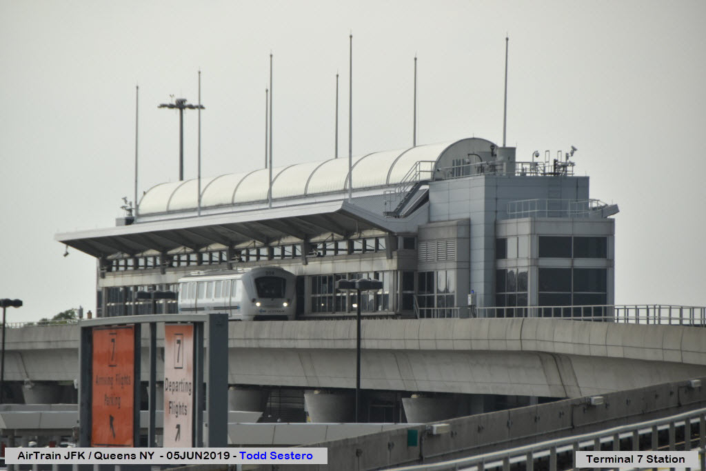
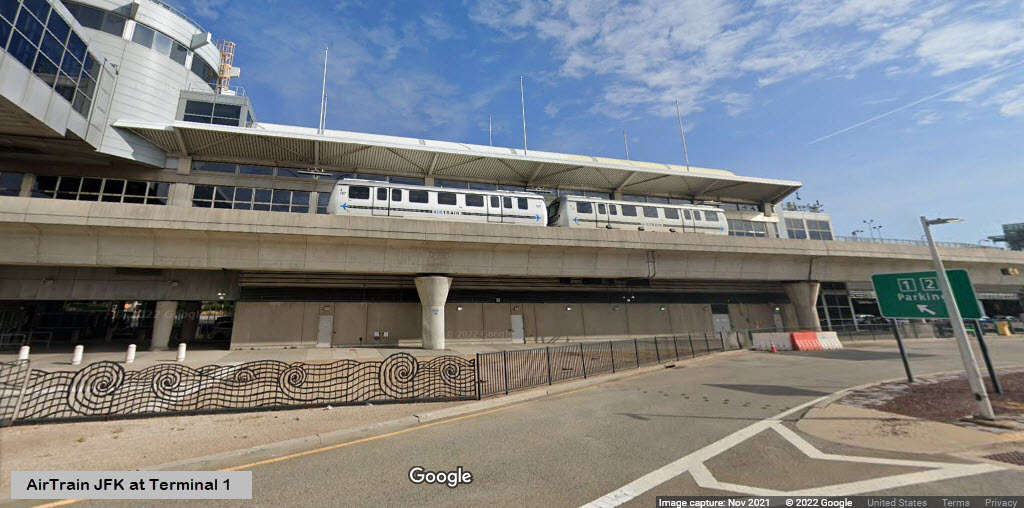
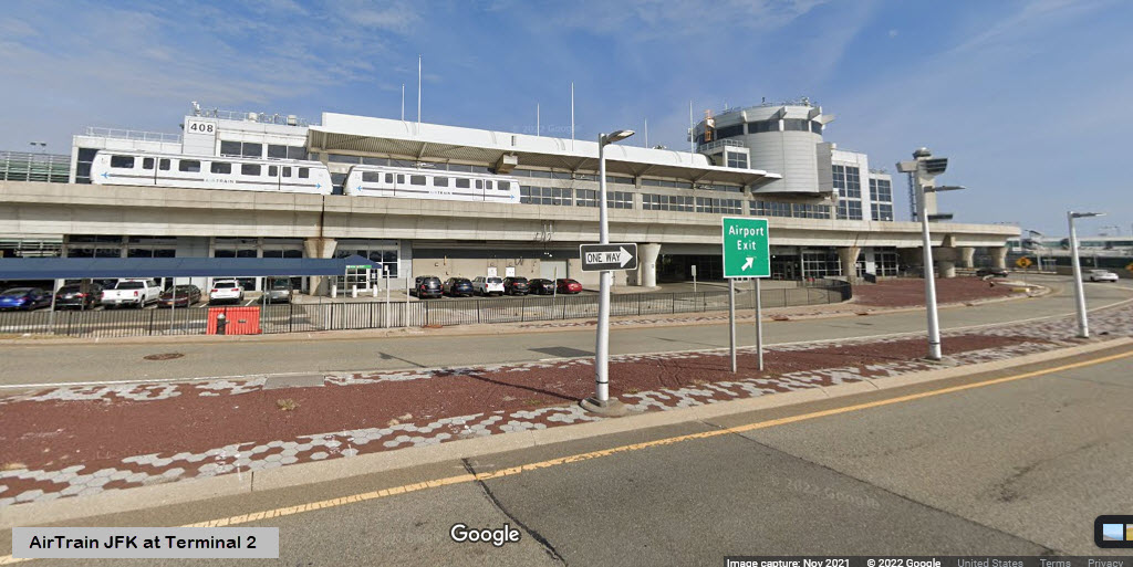
Stations
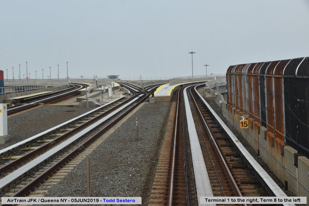
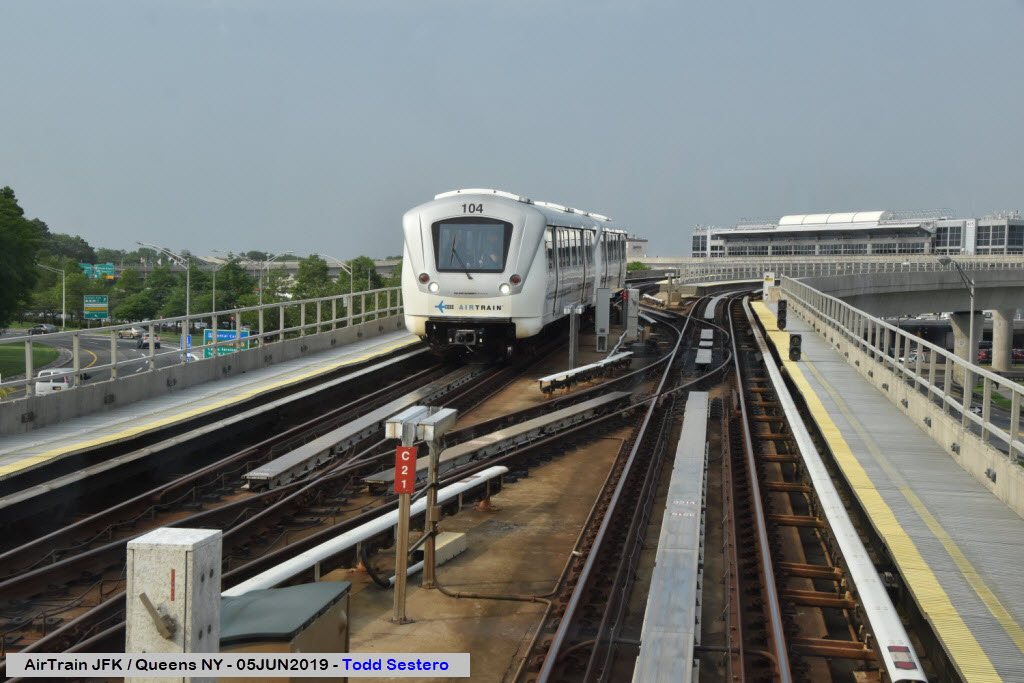
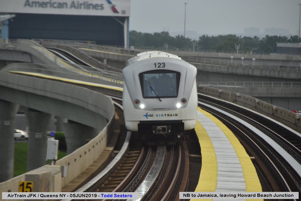
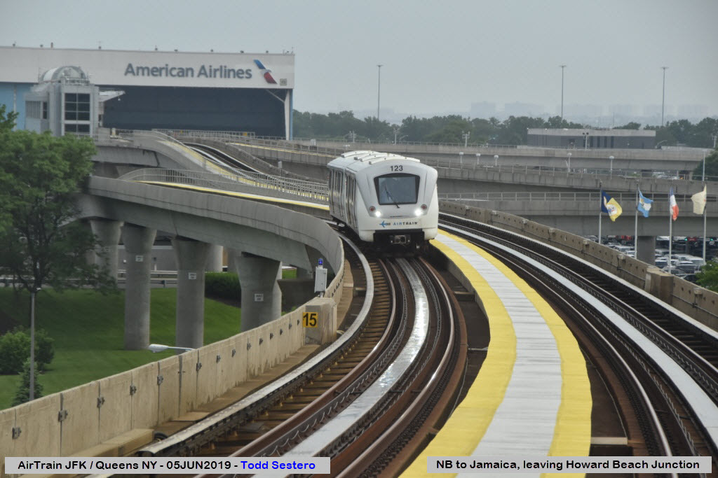
Enroute and Around the System
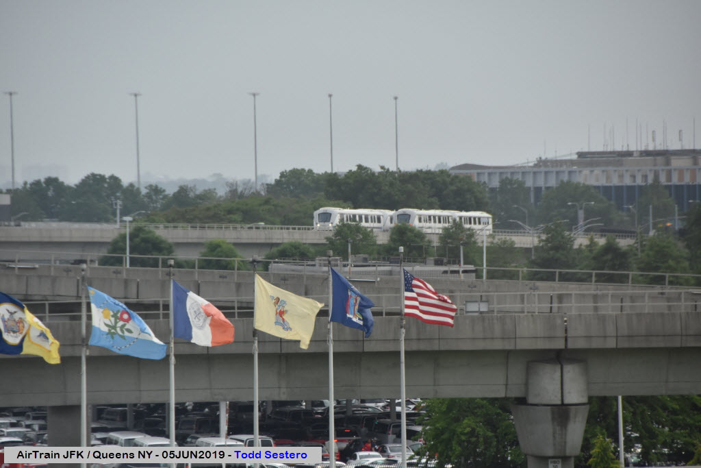
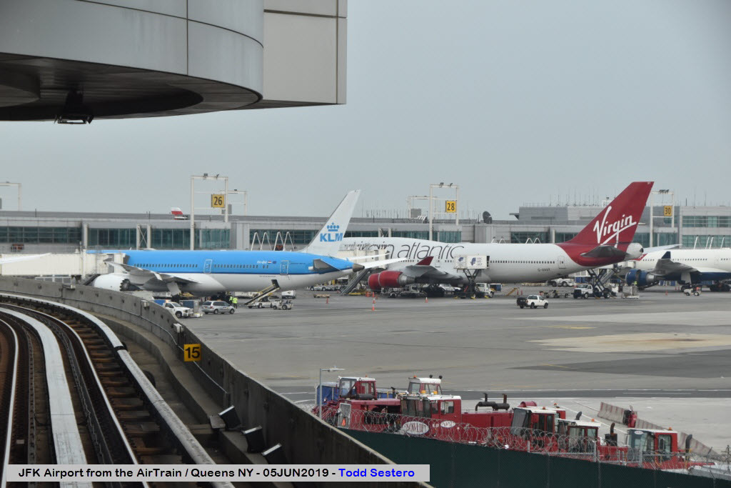
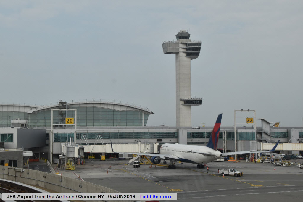
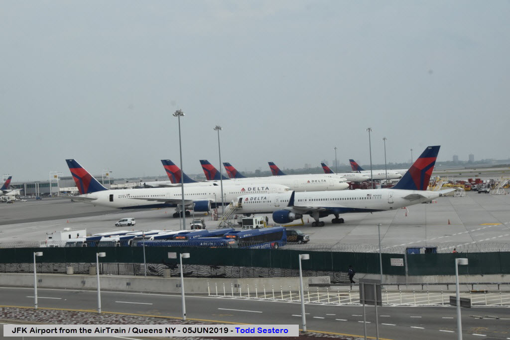
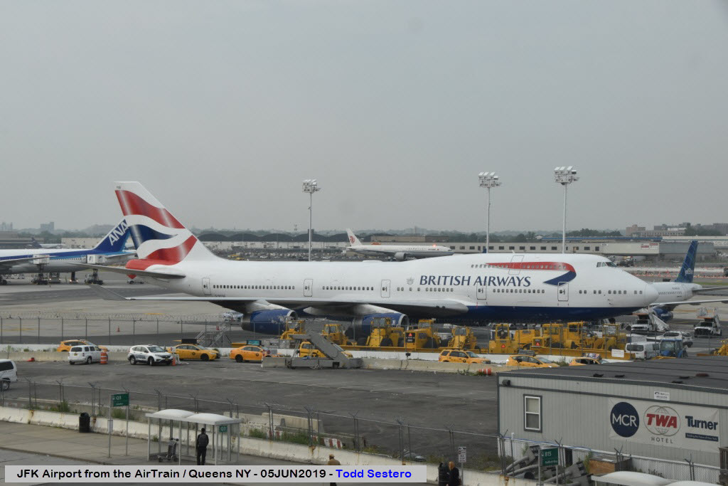
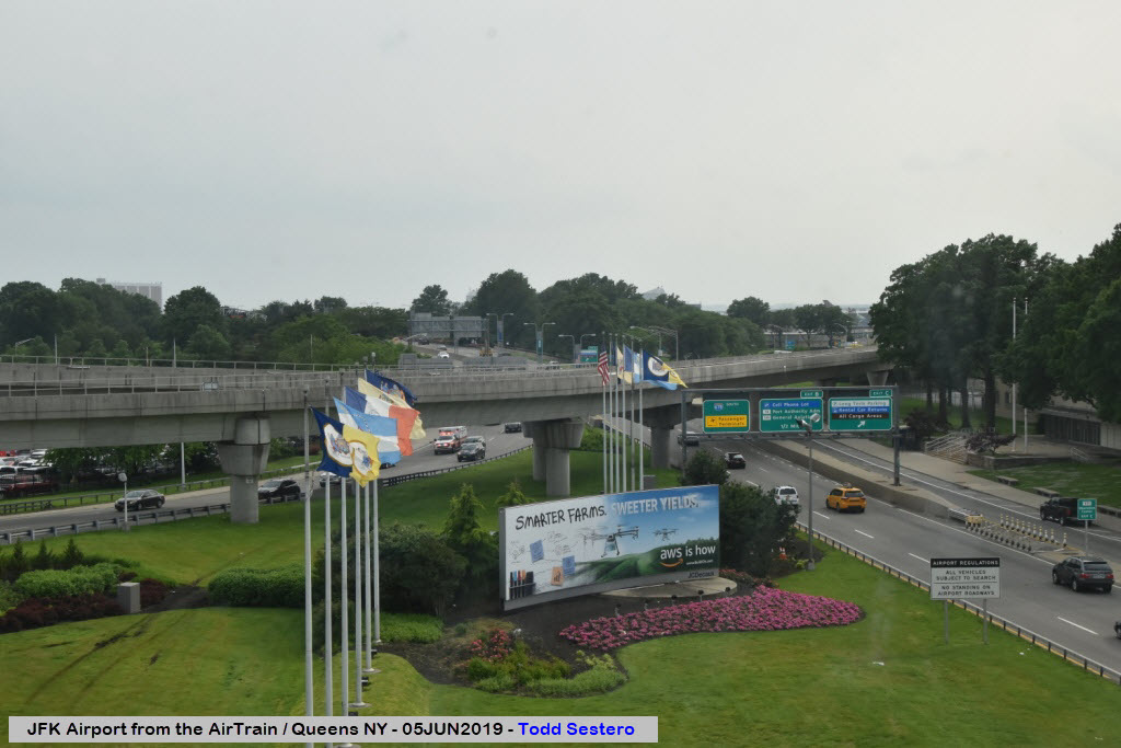
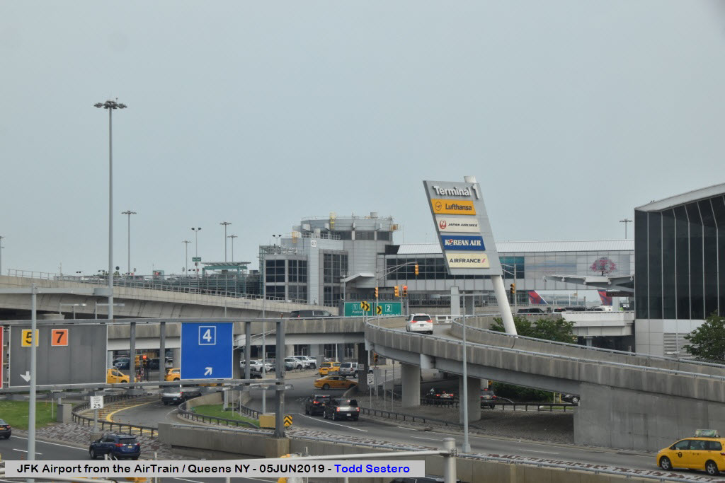
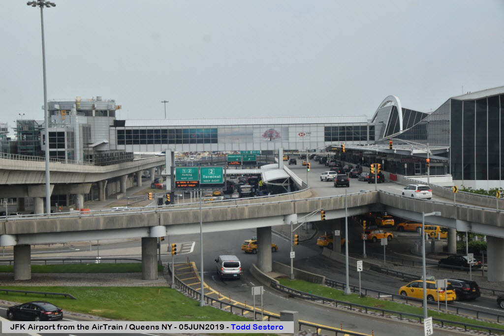
Seen Around JFK
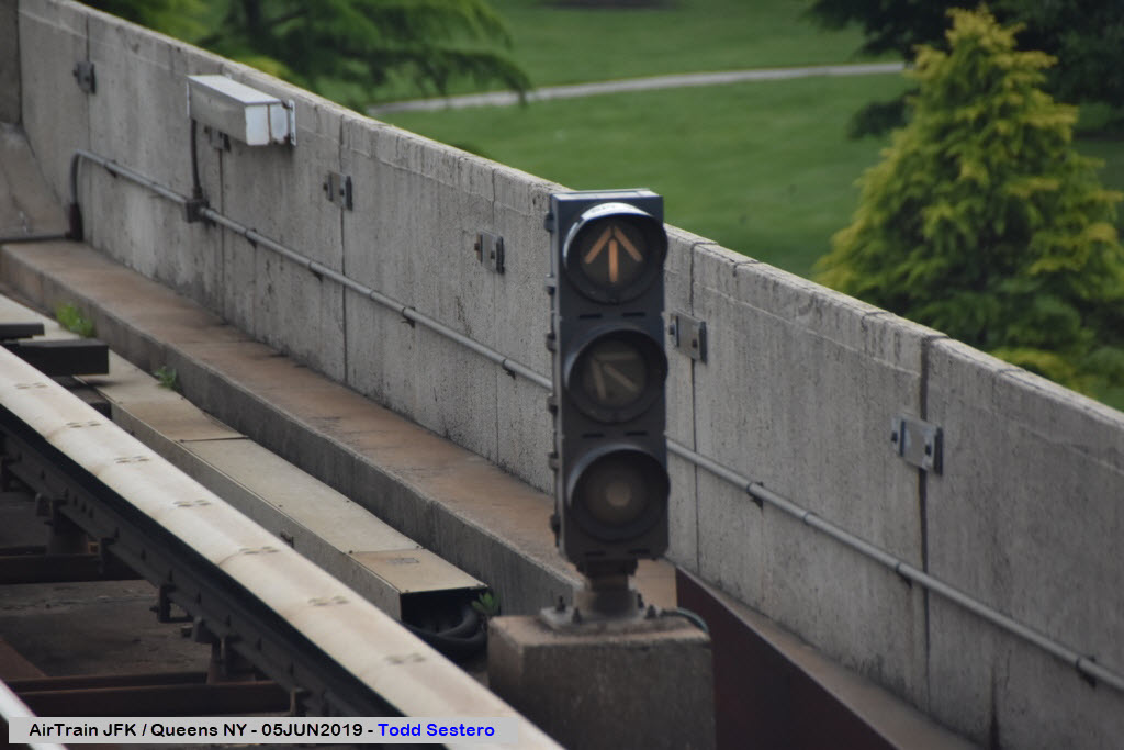
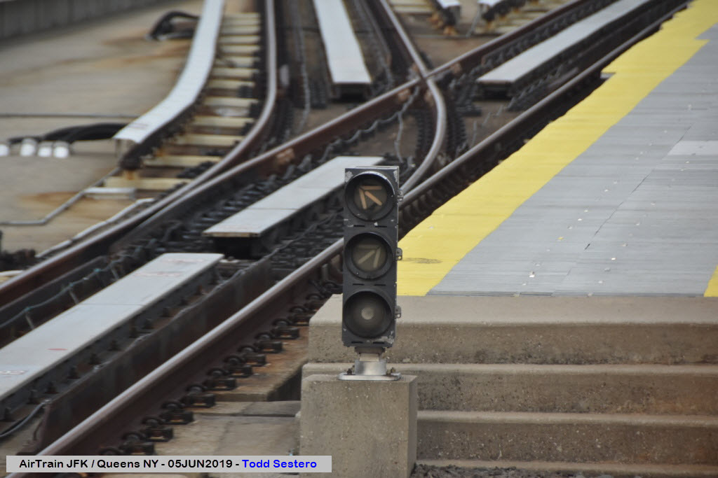
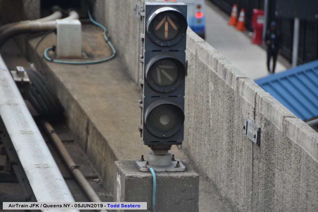
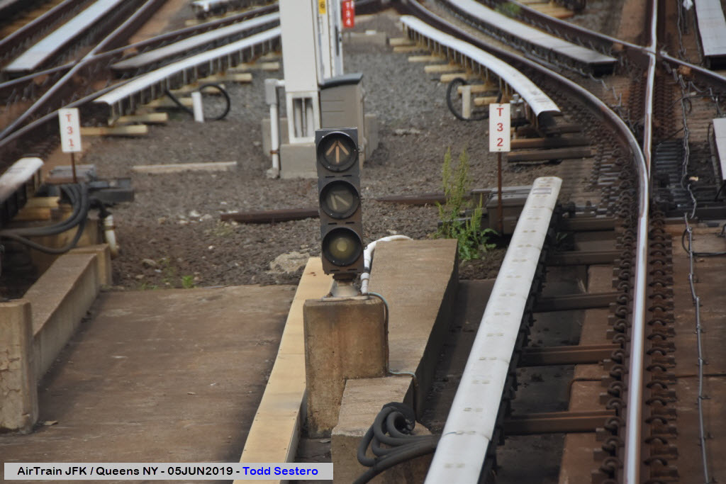
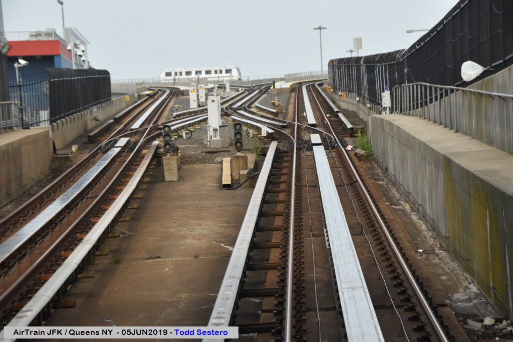
Signals
RAILROAD SIGNALS HOME
Location / Name:
Jamaica NY to JFK Airport, Queens, New York City
What's Here:
the AirTrain JFK People Mover System
Data:
GPS Coordinates: as needed
Phone A/C: 718
ZIP: 11435 (Jamaica by the station)
Access by train/transit:
LIRR at Jamaica
Subway:
-- the E, J, and Z trains at Jamaica
-- the A train at Howard Beach
The Scoop:
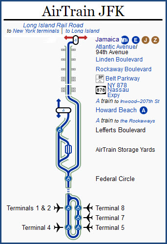
From Wikipedia: AirTrain JFK is an 8.1-mile-long (13 km) elevated people mover system and airport rail link serving John F. Kennedy International Airport (JFK Airport) in New York City. The driverless system operates 24/7 and consists of three lines and nine stations within the New York City borough of Queens. It connects the airport's terminals with the New York City Subway in Howard Beach, Queens, and with the Long Island Rail Road and the subway in Jamaica, Queens. Bombardier Transportation operates AirTrain JFK under contract to the airport's operator, the Port Authority of New York and New Jersey.
Construction of the current people-mover system began in 1998. The system opened on December 17, 2003, after many delays. Since then, several improvements have been proposed, including an extension to Manhattan. AirTrain JFK originally had ten stations, but one stop, Terminal 2, was closed in July 2022.
Tech Talk:
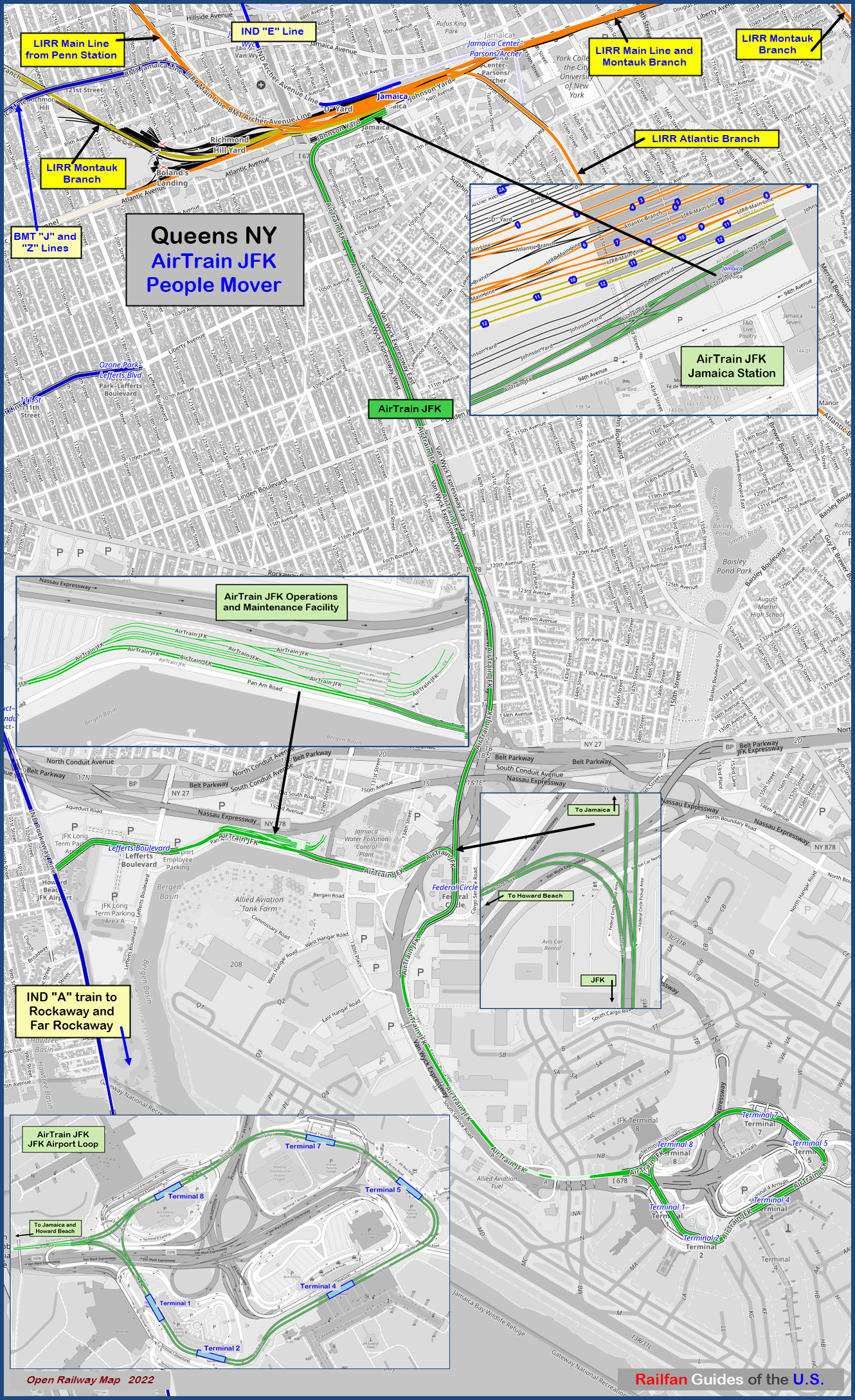
The AirTrain has a total route length of 8.1 miles (13.0 km). The system consists of 6.3 miles (10.1 km) of single-track guideway viaducts and 3.2 miles (5.1 km) of double-track guideway viaducts. AirTrain JFK is mostly elevated, though there are short segments that run underground or at ground level. The elevated sections were built with precast single and dual guideway spans, the underground sections used cut-and-cover, and the ground-level sections used concrete ties and ballast trackbeds. The single guideway viaducts carry one track each and are 19 feet 3 inches (5.87 m) wide, while the double guideway viaducts carry two tracks each and are 31 feet 0 inches (9.45 m) wide. Columns support the precast concrete elevated sections at intervals of up to 40 feet (12 m). The elevated structures use seismic isolation bearings and soundproof barriers to protect from small earthquakes as well as prevent noise pollution. AirTrain JFK's tunnels, all within the airport, pass beneath two taxiways and several highway ramps.
The AirTrain runs on steel rails that are continuously welded across all joints except at the terminals; the guideway viaducts are also continuously joined. Trains use double crossovers at the Jamaica and Howard Beach terminals in order to switch to the track going in the opposite direction. There are also crossover switches north and south of Federal Circle, counterclockwise from Terminal 8, and clockwise from Terminal 1.
The tracks are set at a gauge of 4 ft 8+1⁄2 in (1,435 mm). This enables possible future conversion to LIRR or subway use, or a possible connection to LIRR or subway tracks for a one-trip ride into Manhattan, since these systems use the same track gauge. AirTrain's current rolling stock, or train cars, are not able to use either LIRR or subway tracks due to the cars' inadequate structural strength and the different methods of propulsion used on each system. In particular, the linear induction motor system that propels the AirTrain vehicles is incompatible with the traction motor manual-propulsion system used by LIRR and subway rolling stock. If a one-seat ride is ever implemented, a hybrid-use vehicle would be needed to operate on both subway/LIRR and AirTrain tracks.
There are seven electrical substations. The redundancy allows trains to operate even if there are power outages at one substation. Since there are no emergency exits between stations, a control tower can automatically guide the train to its next stop in case of an emergency.
Equipment:
AirTrain JFK uses Bombardier Transportation's Innovia ART 200 rolling stock and technology. Similar systems are used on the SkyTrain in Vancouver, the Everline in Yongin, and the Kelana Jaya Line in Kuala Lumpur. The computerized trains are fully automated and use a communications-based train control system with moving block signals to dynamically determine the locations of the trains. AirTrain JFK is a wholly driverless system, and it uses SelTrac train-signaling technology manufactured by Thales Group. Trains are operated from and maintained at a 10-acre (4 ha) train yard between Lefferts Boulevard and Federal Circle, atop a former employee parking lot.
The 32 individual, non-articulated Mark II vehicles operating on the line draw power from a 750 V DC top-running third rail. A linear induction motor pushes magnetically against an aluminum strip in the center of the track. The vehicles also have steerable trucks that can navigate sharp curves and steep grades, as well as align precisely with the platform doors at the stations. The cars can run at up to 60 miles per hour (97 km/h), and they can operate on trackage with a minimum railway curve radius of 230 feet (70 m).
Each car is 57 feet 9 inches (17.60 m) long and 10 feet 2 inches (3.10 m) wide, which is similar to the dimensions of rolling stock used on the New York City Subway's B Division. Trains can run in either direction and can consist of between one and four cars. The cars contain two pairs of doors on each side, with each door opening being 10 feet 5 inches (3.18 m) wide. An individual car has 26 seats and can carry up to 97 passengers with luggage, or 205 without luggage. Because most passengers carry luggage, the actual operating capacity is between 75 and 78 passengers per car. end Wiki
Although I did not see any operator controls, I'm pretty sure there is an access panel somewhere that they can open and control the cars from within, otherwise, there would be no need for signals and speed limit signs on the system. I'm sure they also use manual control in the yards too..... but it's just a guess.
Acknowledgements:
Denver Todd
Google Maps
Bing Maps
Open Railway Map
Wikipedia
Websites and other additional information sources of interest for the area:
https://en.wikipedia.org/wiki/Jamaica_station
https://en.wikipedia.org/wiki/AirTrain_JFK
http://www.trainsarefun.com/lirr/licity/licity.htm More than you will ever want to know about Long Island City and Sunnyside :-)
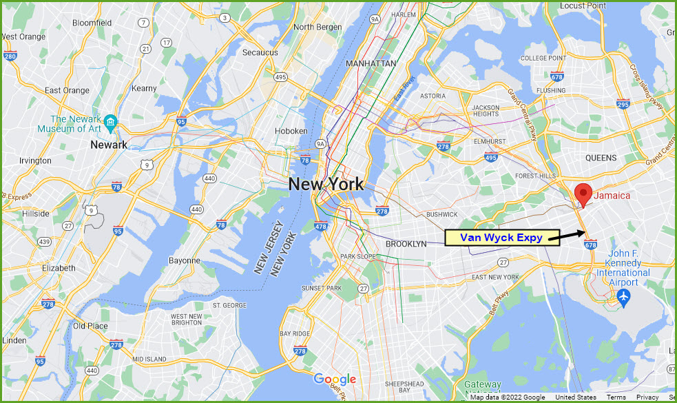
To Jamaica:
Exit 5 from NB I-678, the Van Wyck, take a right onto Atlantic Ave, you will be under the AirTrain line. Follow that around to 95th St, where you need to take a left, and go 6 blocks to Sutphin Blvd - and take a left, this will take you to the station. BUT don't look for a whole lot of places to park, cause I could only find one place about 5 blocks away, and lord knows how much they charge (and how safe it would be!). I would probably park somewhere else and take the subway to get here.
From the SB Van Wyck, take the exit for Atlantic Ave, and take a left onto it. Go 7 blocks, and take a right onto Sutphin. You're 7 blocks from Jamaica station.
The Van Wyck is also the highway that runs into the belly of the beast - JFK Airport.
I would use GPS to navigate the highways, coupled with something that gives you highway conditions and alternative routes, not that that will help very often.
Please Note: The highway system in New York City is complex and was built a long time ago. Exits and entrance ramps were usually placed wherever, as the area I grew up in Jackson Heights can attest to - they have made some "improvements" where they can, but with the congestion, it is really difficult. With that said, you need to be on your toes and really pay attention if you are not familiar with the roads and highway names, exit numbers are not used in most places, so you need to know the name of the road/exit you are looking for.... beware. :-)
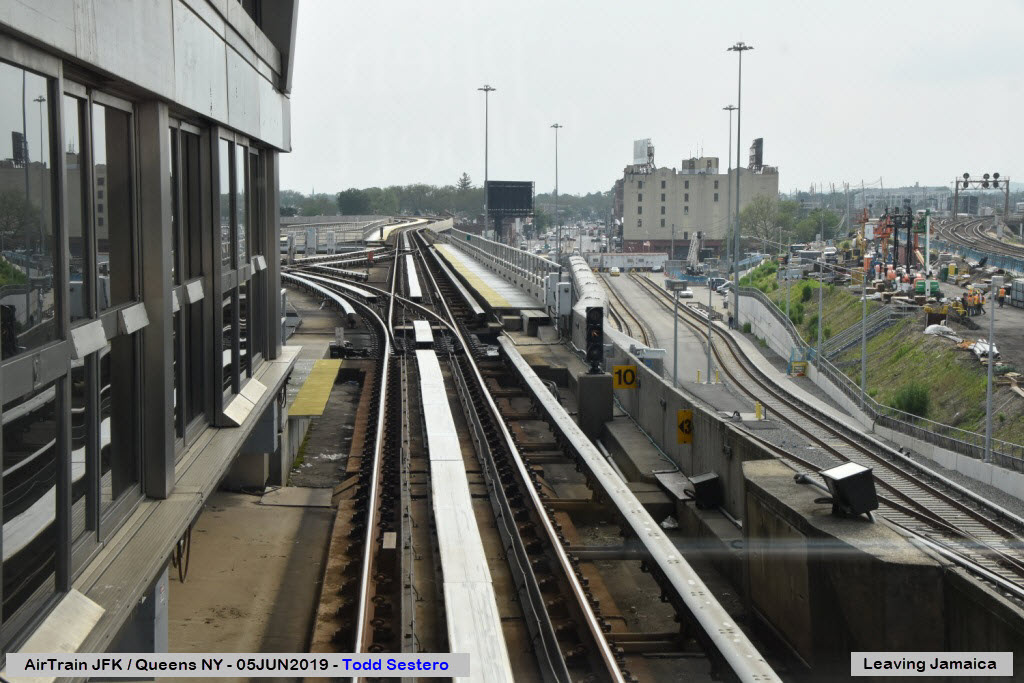
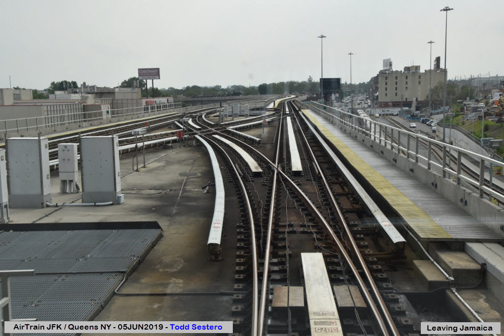
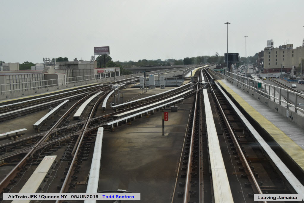


Enroute and Around the System
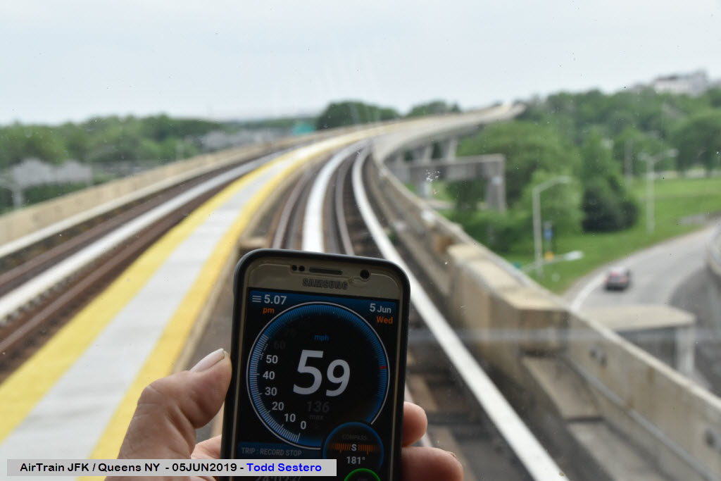
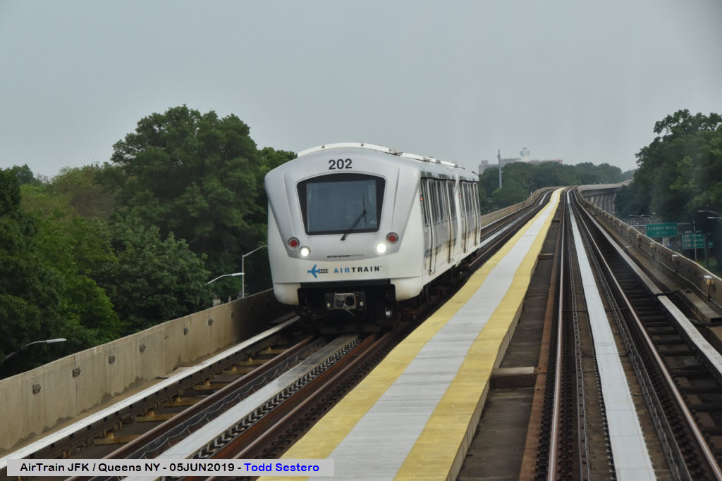
This is the fastest I clocked us at, on the open stretch heading down to the airport!

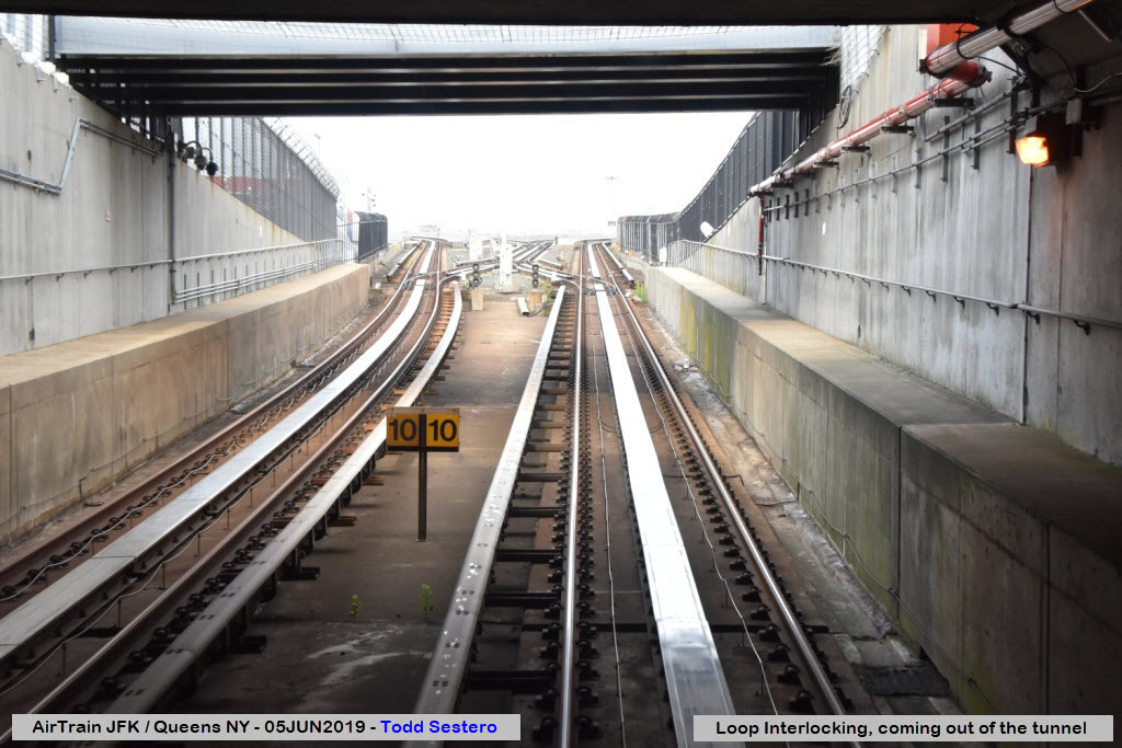
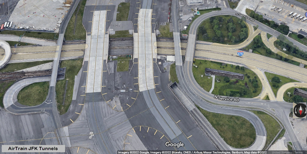
Entering (above) and coming out of (below) the only tunnels on the system. A shorter tunnel goes under access roads, and a longer tunnel goes under the two looping taxi-ways "A" and "B" that circle the entire airport to serve the 4 runways: 13R/31L, 13L/31R, 4L/22R, and 4R/22L.
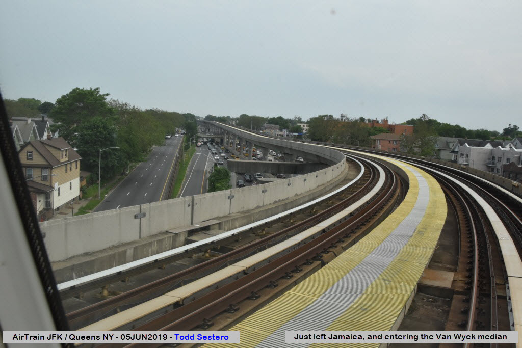
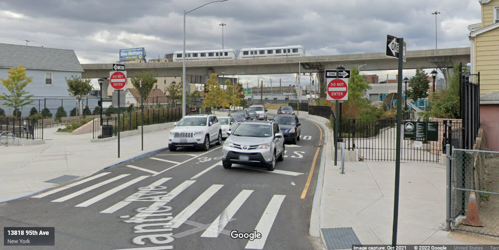
What you can see after getting off the NB Van Wyck and taking Atlantic Ave around to 95th Street.
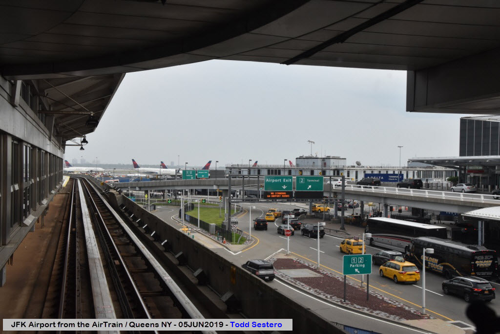
BTW, according to my buddy Sunil over at www.lockonaviation.net, most 747's have been put into cargo service since I was here in 2019.
Without having any insight into the signaling system, it looks like the signals display the route selected and probably stop. I'm also going to take a guess that the top indication is the primary route.
Disclaimers:
I love trains, and I love signals. I am not an expert. My webpages reflect what I find on the topic of the page. This is something I have fun with while trying to help others.
Please Note: Since the main focus of my two websites is railroad signals, the railfan guides are oriented towards the signal fan being able to locate them. For those of you into the modeling aspect of our hobby, my indexa page has a list of almost everything railroad oriented I can think of to provide you with at least a few pictures to help you detail your pike.
If this is a railfan page, every effort has been made to make sure that the information contained on this map and in this railfan guide is correct. Once in a while, an error may creep in :-)
My philosophy: Pictures and maps are worth a thousand words, especially for railfanning. Text descriptions only get you so far, especially if you get lost or disoriented. Take along good maps.... a GPS is OK to get somewhere, but maps are still better if you get lost! I belong to AAA, which allows you to get local maps for free when you visit the local branches. ADC puts out a nice series of county maps for the Washington DC area, but their state maps do not have the railroads on them. If you can find em, I like the National Geographic map book of the U.S..... good, clear, and concise graphics, and they do a really good job of showing you where tourist type attractions are, although they too lack the railroads. Other notes about specific areas will show up on that page if known.
Aerial shots were taken from either Google or Bing Maps as noted. Screen captures are made with Snagit, a Techsmith product... a great tool if you have never used it!
By the way, floobydust is a term I picked up 30-40 years ago from a National Semiconductor data book, and means miscellaneous and/or other stuff.
Pictures and additional information is always needed if anyone feels inclined to take 'em, send 'em, and share 'em, or if you have something to add or correct.... credit is always given! Please be NICE!!! Contact info is here
Beware: If used as a source, ANYTHING from Wikipedia must be treated as being possibly inaccurate, wrong, or not true.
RAILFAN GUIDES HOME
RAILROAD SIGNALS HOME
NEW 08/15/2022, AUG16/17/2022
Last Modified 17-Aug-2022