RAILFAN GUIDES of the U.S.
Todd's Railfan Guide to
LORDSBURG NM
In General
Getting Here
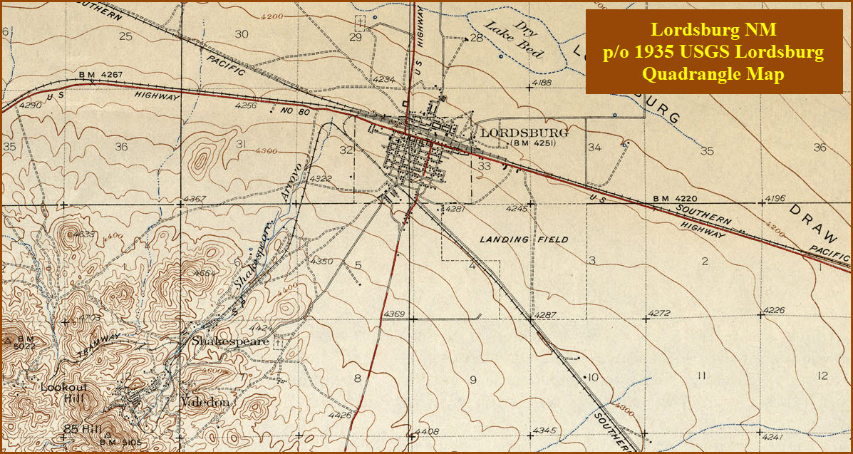
Map
Sights
Pictures
Bridges
Signals
Fire & Police
Floobydust
USGS Maps
RAILROAD SIGNALS HOME
Location / Name:
Lordsburg NM, Hidalgo County
What's Here:
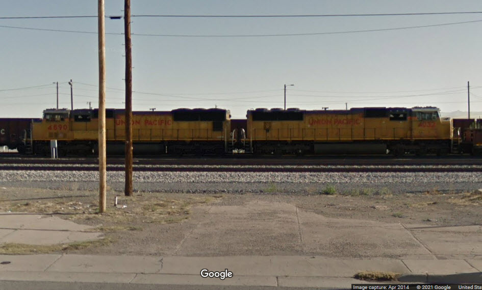
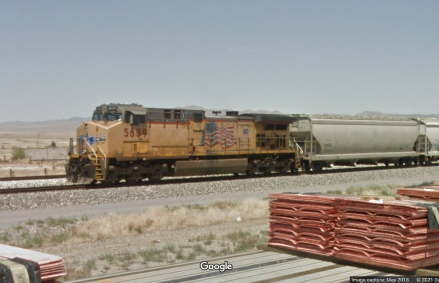
Union Pacific Yard
Amtrak Station
Two Wye's
the Arizona Eastern RR
Data:
GPS Coordinates: as needed
Phone A/C: 575
ZIP: 88045
Access by train/transit:
Amtrak
The Scoop:
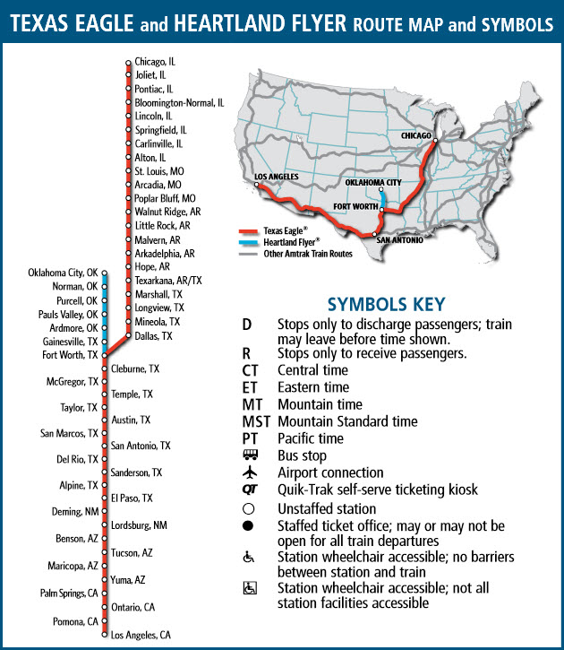
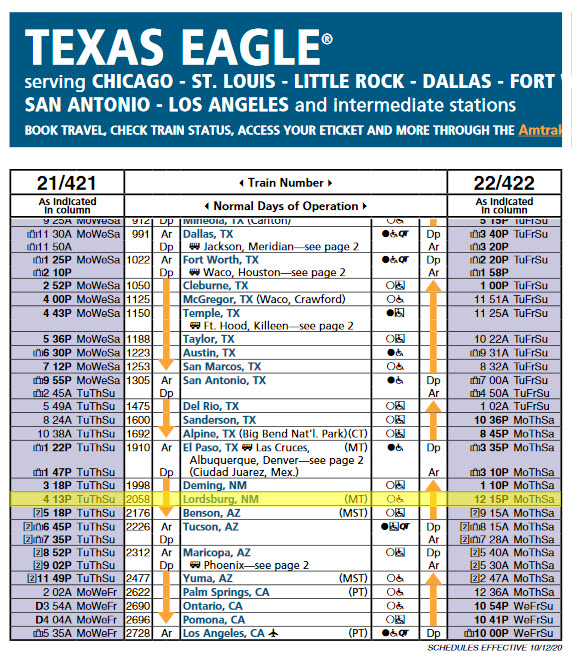
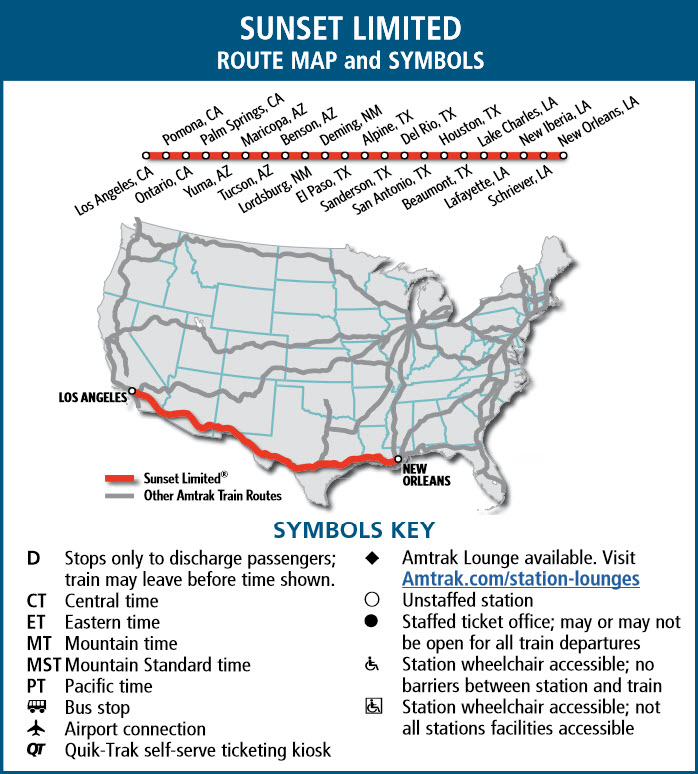
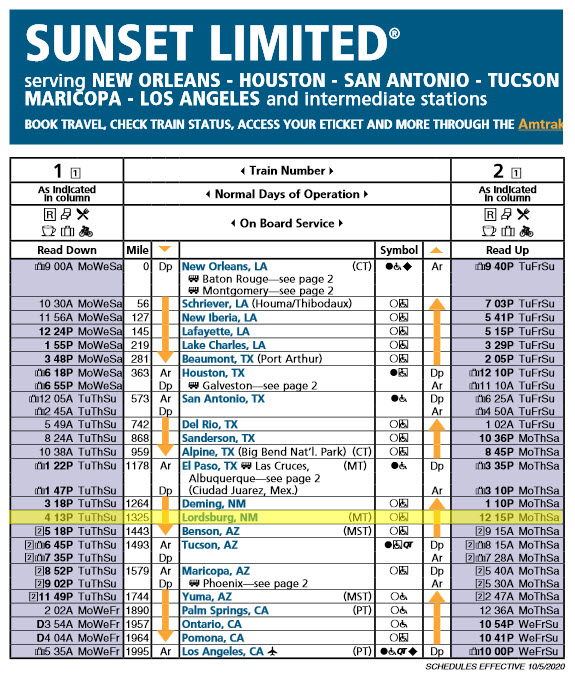
Two Amtrak trains stop here, the Sunset Limited, and the Texas Eagle.
Lordsburg is known for its proximity to some of the great natural landscapes of the Southwest, including Gila National Forest and numerous mountain ranges.
Another one of these is located about 70 miles to the west, and south of Wilcox AZ, are the Chiricahua Mountains and National Monument. If your looking for something to do, and have the time for a hike, I recommend it, as sunsets are beautiful "up there". Take water, and set aside at least 3 or 4 hours. Go southeast out of town on AZ 186. Along the way is also the Fort Bowie National Historic Site.
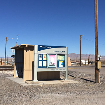
From the Amtrak page for Lordsburg: Railroad crossing, south side of tracks, Center Street and East Motel Drive, Lordsburg, NM 88045 The parking lot and Track are owned by Union Pacific.
Passengers at Lordsburg use the street at the grade crossing for boarding, and there is also a shelter with benches.
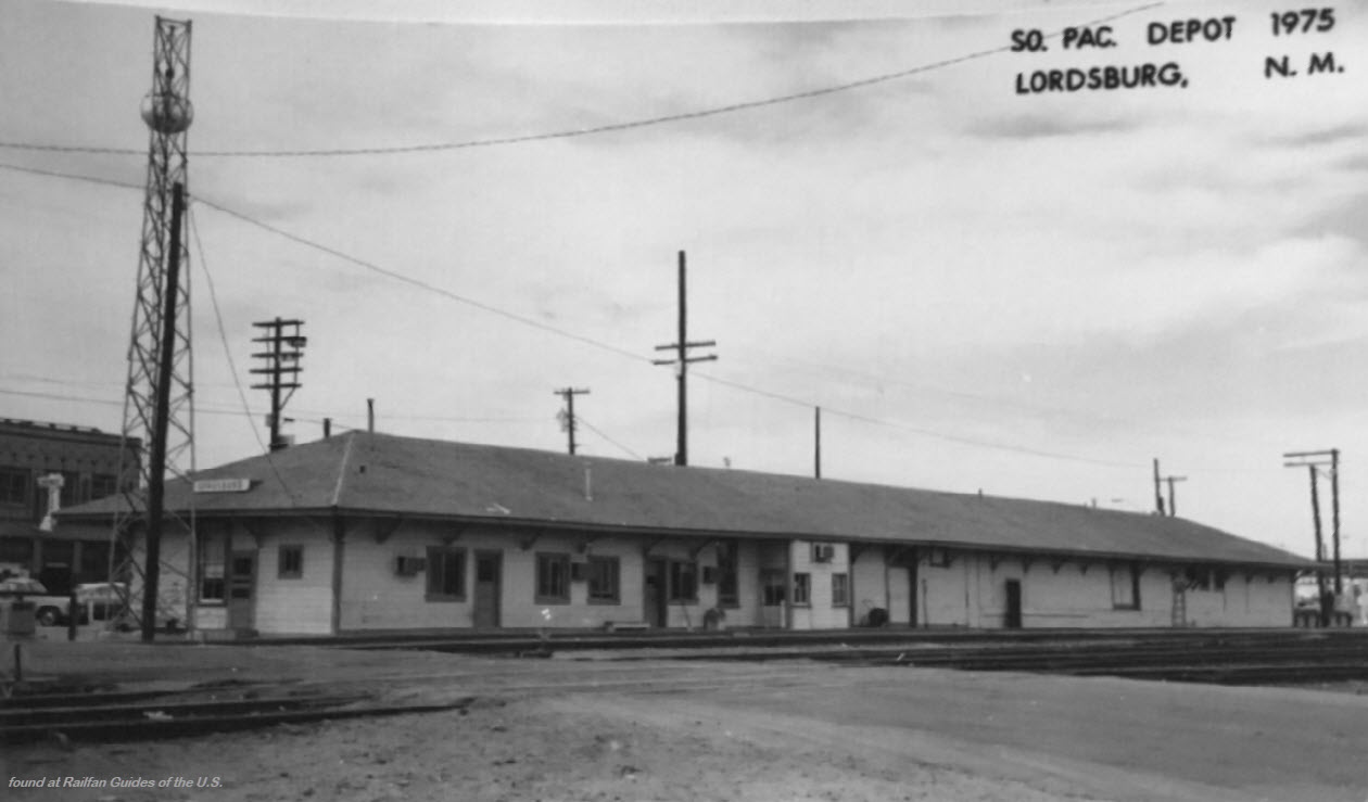
In 1988, the Southern Pacific razed the original 1880s wooden clapboard station that once stood by the tracks. Low slung, it featured a hipped roof and wide eaves supported by numerous simple wooden brackets; the eaves provided much needed shade for passengers and railroad employees, as a warm summer day in town can reach almost 100 degrees.
Lordsburg was founded in 1880 when the Southern Pacific reached the area on its way east in a quest to complete the second transcontinental railroad. Theories abound as to the town’s namesake, but the most reasonable seems to be that it was named in honor of Delbert Lord, chief engineer for the railroad’s mainline, and who located the town site halfway between Tucson and El Paso.
In addition to rail, road transport has also been important to the area. Across from the rail station one could find the Hotel Hidalgo, designed in 1928 by the El Paso architecture and engineering firm of Trost and Trost. Constructed in the Pueblo Revival style so popular in New Mexico, it featured a lobby with an impressive beamed ceiling and plush red leather chairs. The hotel was a well known landmark and stop on the Old Spanish Trail, a transcontinental highway inaugurated in 1915 that eventually connected St. Augustine, FL to San Diego, CA. In the 1960s, new interstate highways bypassed the old roads, and the highway fell into obscurity, hurting establishments such as the Hotel Hidalgo.
Although a small town, Lordsburg has seen its fair share of important historic events. In the late 19th century, the town served as a shipping point for numerous mine communities such as Shakespeare and Steins, which are today ghost-towns. In 1927, Charles Lindbergh stopped in Lordsburg during his cross-country trip; Amelia Earhart would also visit the town’s airport, the first in New Mexico. During World War II, Lordsburg became known as the site of an internment camp for Japanese-Americans operated by the U.S. Army.
Today Lordsburg is known for its proximity to some of the great natural landscapes of the Southwest, including Gila National Forest, as well as numerous mountain ranges that provide opportunities for hiking, hunting, and bird watching. Appropriately, New Mexico’s state song, which praises “Rugged and high sierras, With deep canyons below, Dotted with fertile valleys…” was written by Elizabeth Garrett while she resided in Lordsburg in the early 20th century. -end Amtrak-
Acknowledgements:
CSX THS Society
Drew Jacksich
Amtrak
Google Maps
Websites and other additional information sources of interest for the area:
https://www.greatamericanstations.com/stations/lordsburg-nm-ldb/
https://www.gwrr.com/railroads/north_america/AZER#m_tab-one-panel
http://csxthsociety.org/railfanning/upnewmexico20190430.html Thanks to Charles B and the CSXTHS Collection!
http://railfan.com/arizona-eastern-railway/
https://dpdproductions.com/pages/railroad-frequencies-by-area no freqs for this area, but looks like a good source
https://www.genordell.com/travel/NMtrains.htm
https://en.wikipedia.org/wiki/Lordsburg_station
http://sphts.org/pmcclosky/spwebresources.html great resource, but a lot of links are no longer good
https://www.roguecolumnist.com/rogue_columnist/2018/08/ghost-railroads-of-arizona.html
https://www.trainorders.com/discussion/read.php?1,4050262
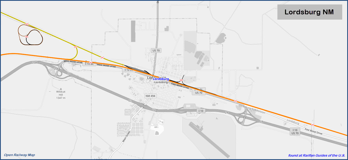
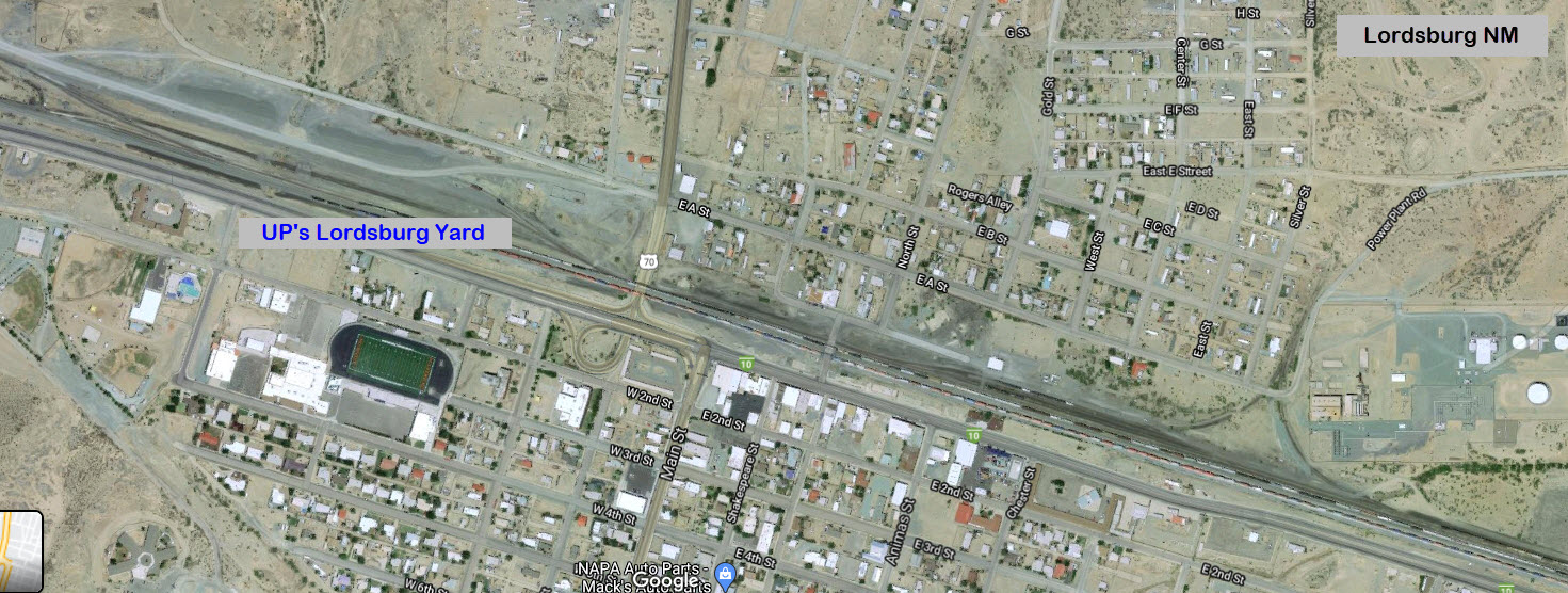
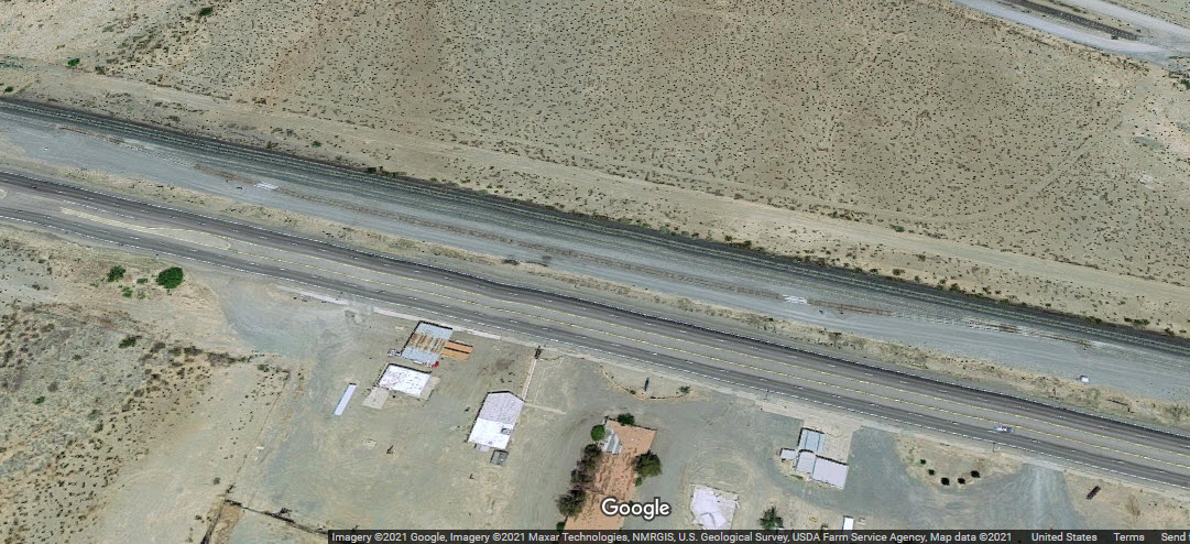
Getting here is convenient as all get out, as the center of town is directly on exit 22 of I-10. The tracks are to the north. Exit 22 dumps you off right on Main St. Take that up to West Motel Drive, and take a right. The yard will be on your left, and with any luck, you might catch some UP engines milling around. This also puts you adjacent to the where the Amtrak "station" is. I say this because there is no physical station, and the SP building from 1975 (pictured below) is long gone. At exit 22, we also have a Hampton Inn, Econolodge, Motel 6 and Comfort Inn, and a McDs.
There are two other exits for Lordsburg, 24 on the east side, and 20 on the west, both are convenient to the tracks.
There are Pilot and Flying J service centers at exit 24.
At exit 20 is a Love's service center, and a Days Inn & Suites. Also at exit 20 is a rest stop, but there is only one, so west-bounders have to take the exit to get to it.
There are way-stations in between exits 22 and 24, and the EB one is a port of entry station.
Lordsburg is 22 miles from the Arizona border, and 48 miles from the Mexican border at its closest.
GPS Coordinates: 32.35007, -108.70703
Station code: ADB
This is the kind of thing you're ashamed to call a station, but it is what it is.
https://amtrakguide.com/routes/sunset-limited/
https://amtrakguide.com/routes/texas-eagle/
The Espee depot was taken down sometime in the 80's.
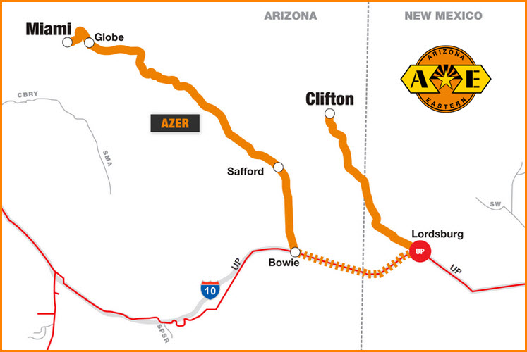
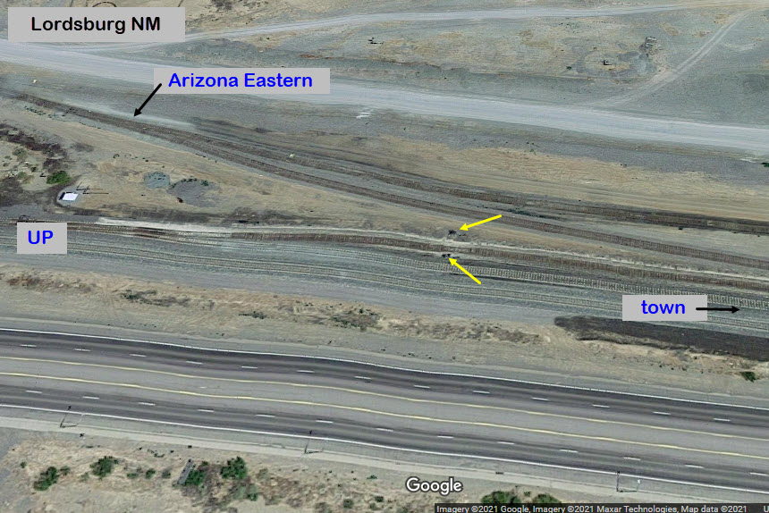
The AZER was originally chartered in 1895 as the Gila Valley, Globe & Northern, with 133 route-miles between Bowie and Miami AZ. Today, AZER also includes a 70-mile line between Clifton AZ, and Lordsburg NM, that connects to the original Bowie line via trackage rights on the UP.
The Arizona & Eastern was acquired by G&W in 2011.
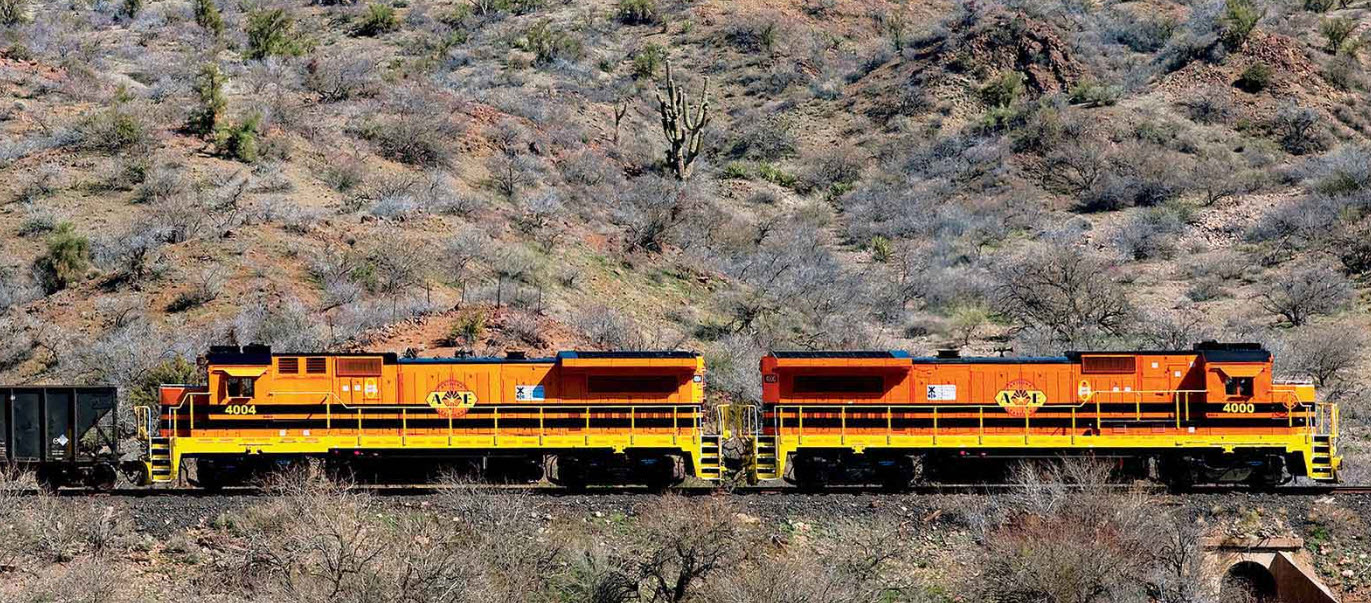
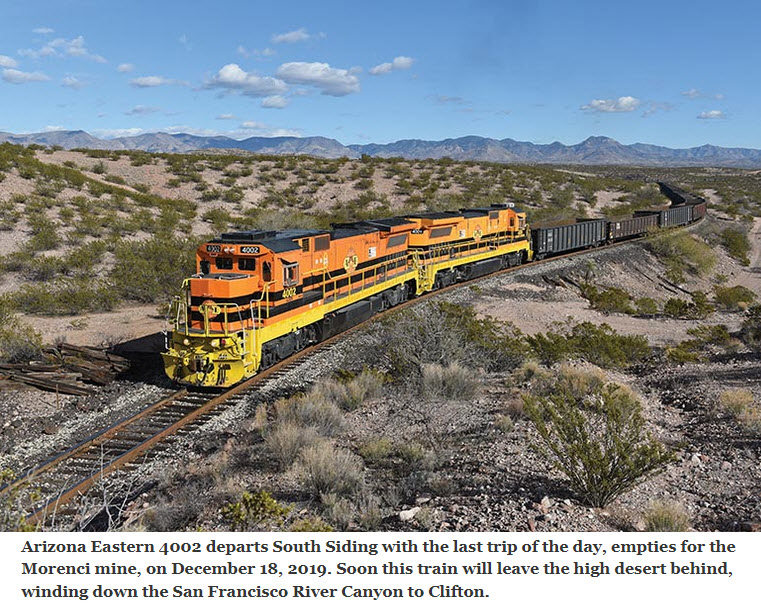 from the Railfan & Railroad article
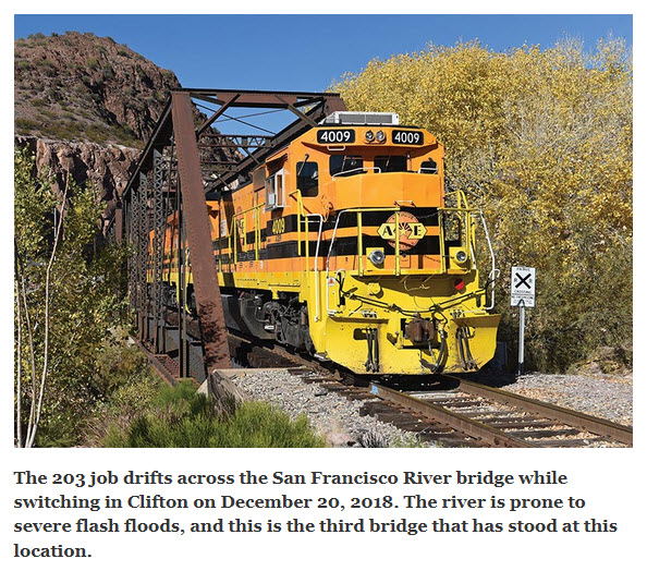 from the Railfan & Railroad article
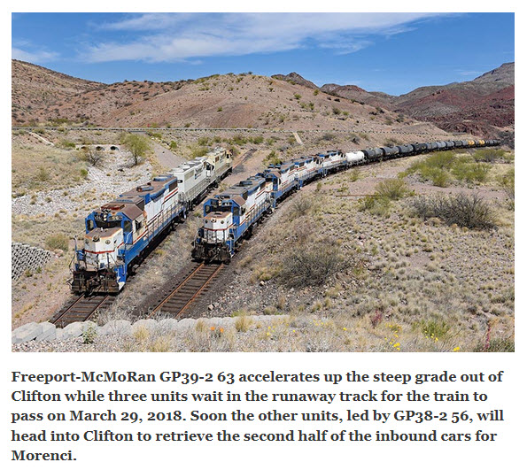 from the Railfan & Railroad article
E Railroad Ave, Lordsburg, NM 88045
(575) 542-9202
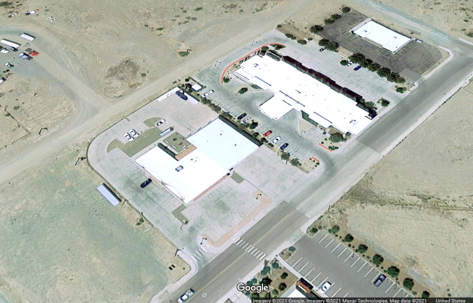
This aerial screenshot is the majority of the yard, four tracks continue SE a little bit more to a point across from Noce St.
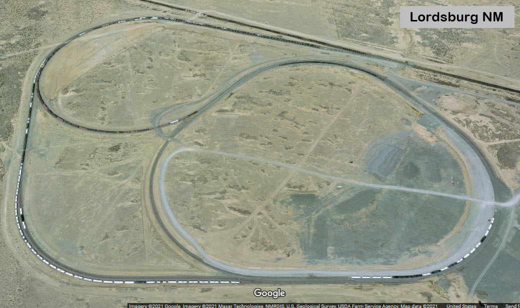
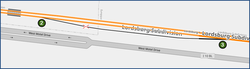
There is much speculation as to the purpose of this loop. If anyone has a definitive answer, please email me and let me know. Thanks, Todd
Otherwise, this is a page of guesses: https://www.trainorders.com/discussion/read.php?1,4050262
What I can tell you from the general layout: 1) It is only accessible from the yard or from the EB UP main via the "wye" interchange track, 2) Trains exiting the loop can only go EB into the yard and then EB on the UP, or west on the UP via the "wye" interchange track, 3) Access is via the Arizona Eastern trackage.
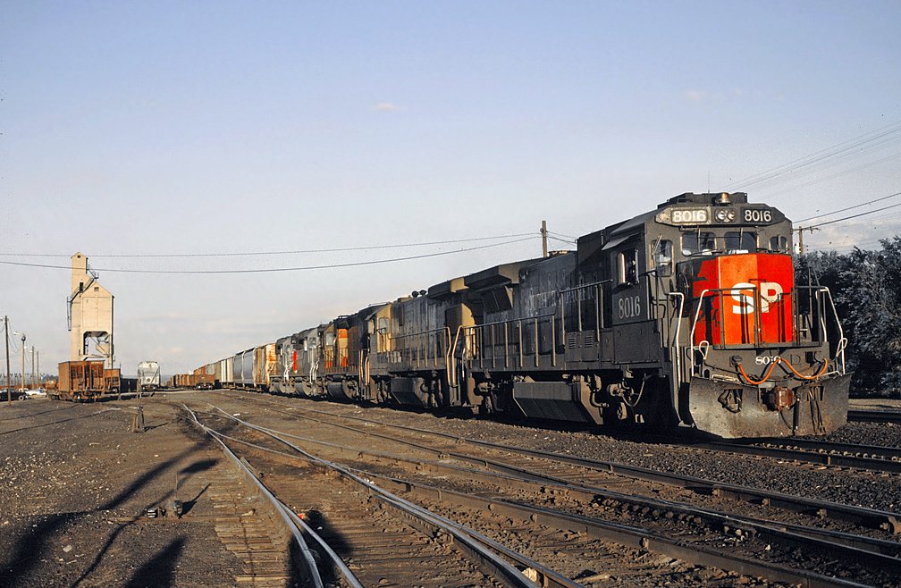 1993 photo by Drew Jacksich via Wikipedia
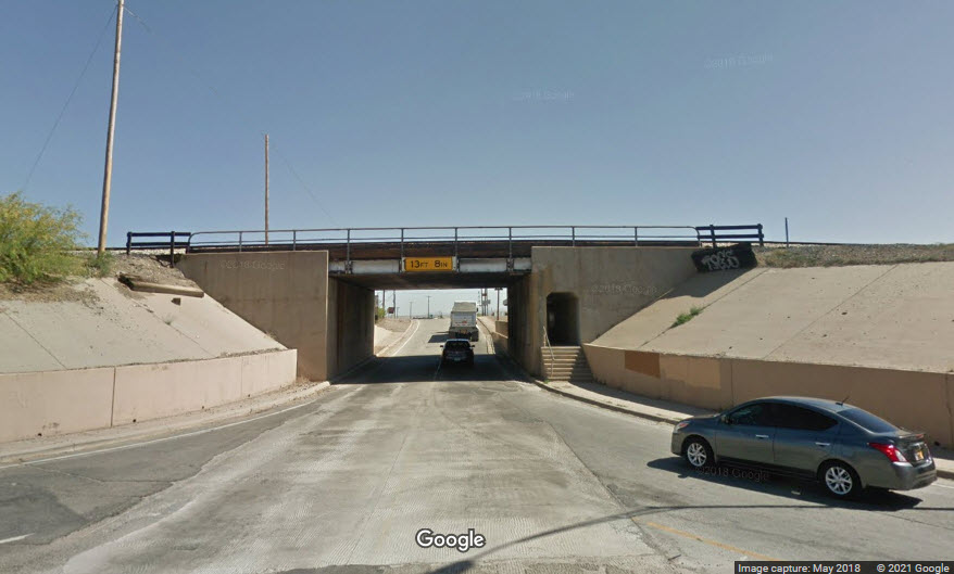
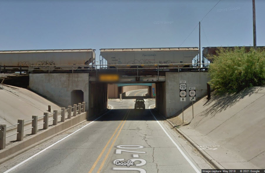
This is the only place in town where the railroad goes over a road.
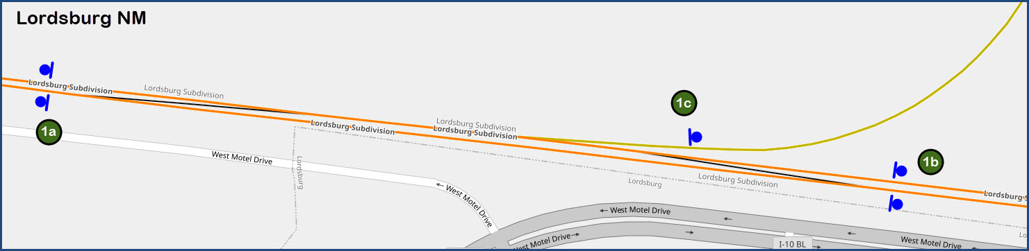
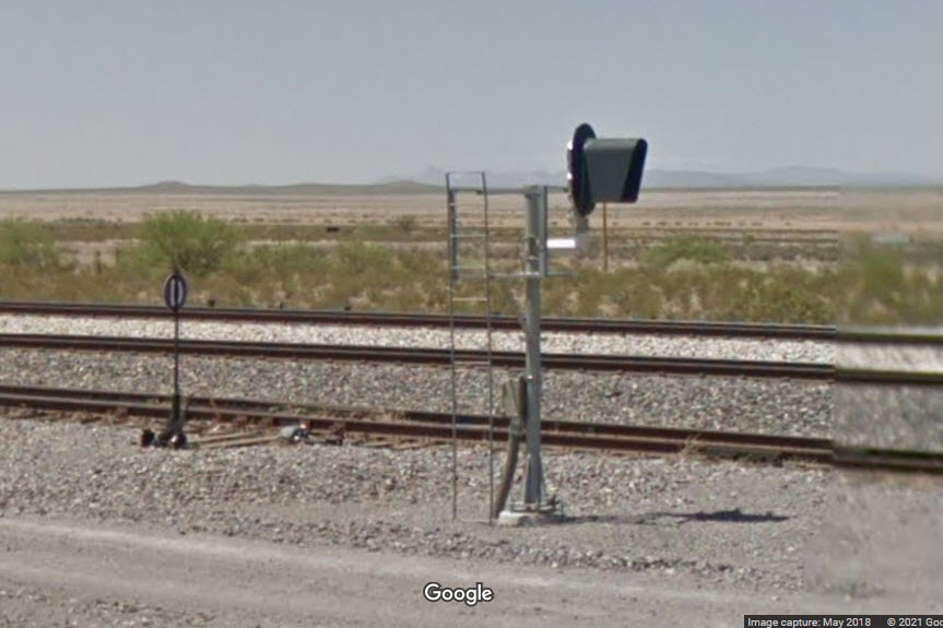
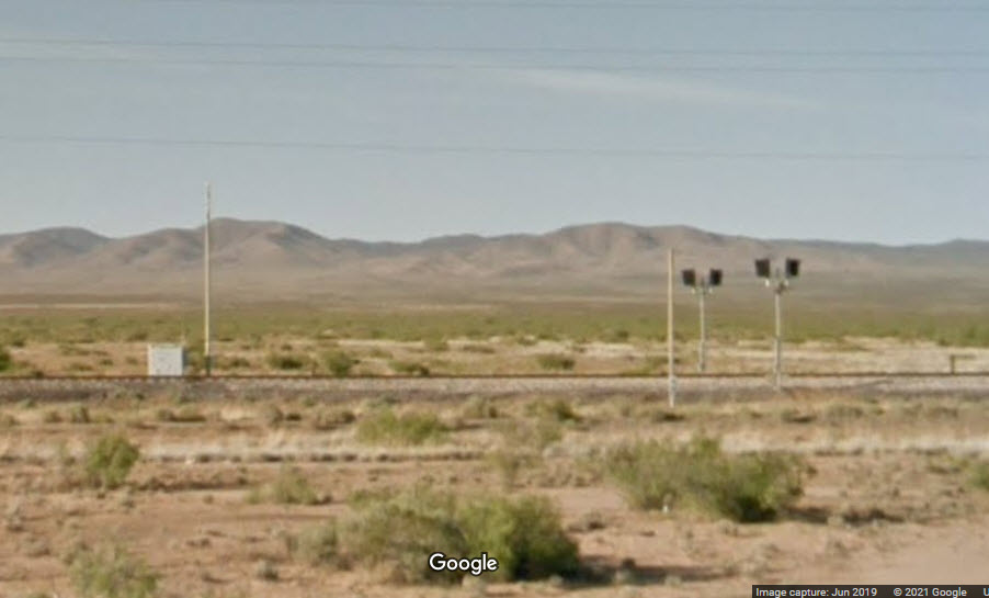
Signals
West to East
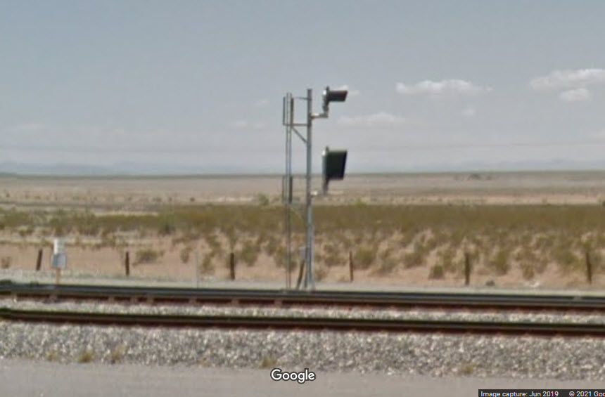
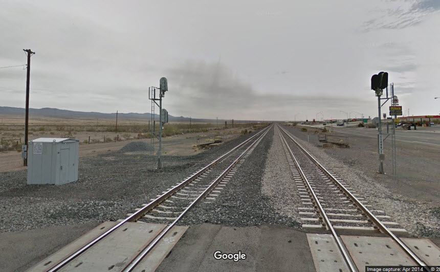
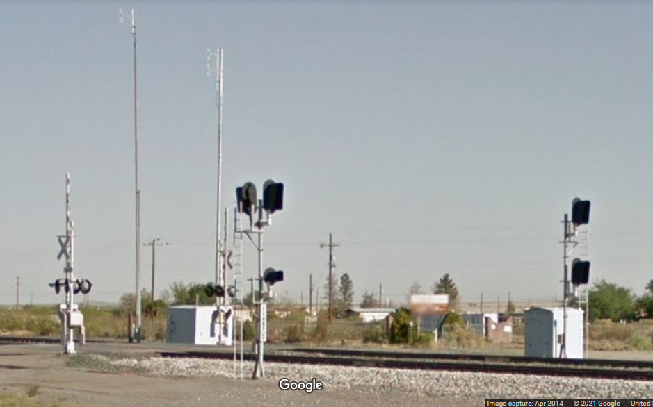
1B - The first set of signals are 1.62 miles west of Main St on the UP Mainline for WB traffic.
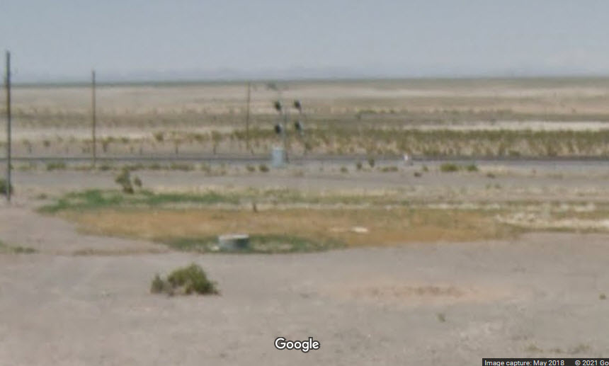
1C - This signal controls trains coming off the Arizona Eastern via the "wye" track.
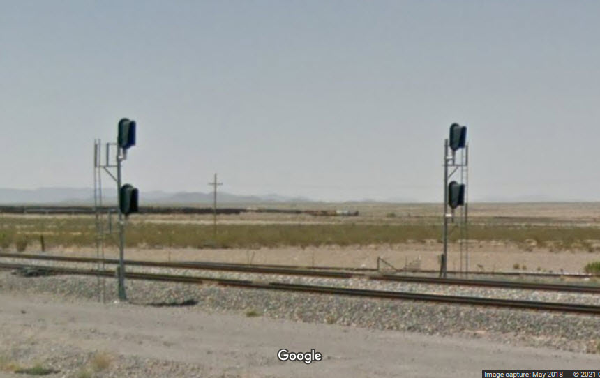
1A - These are the EB signals for the interlocking.
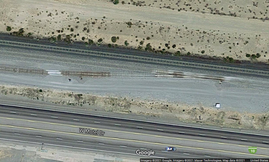
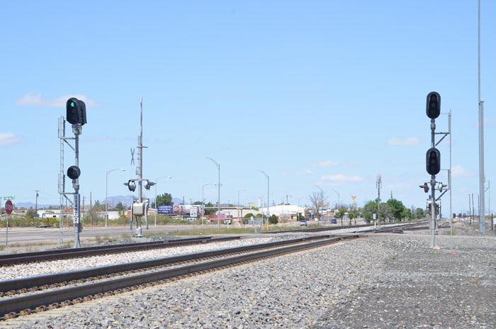
Signal at the west end of the 760 foot long siding, 1.3 miles west of Main St.
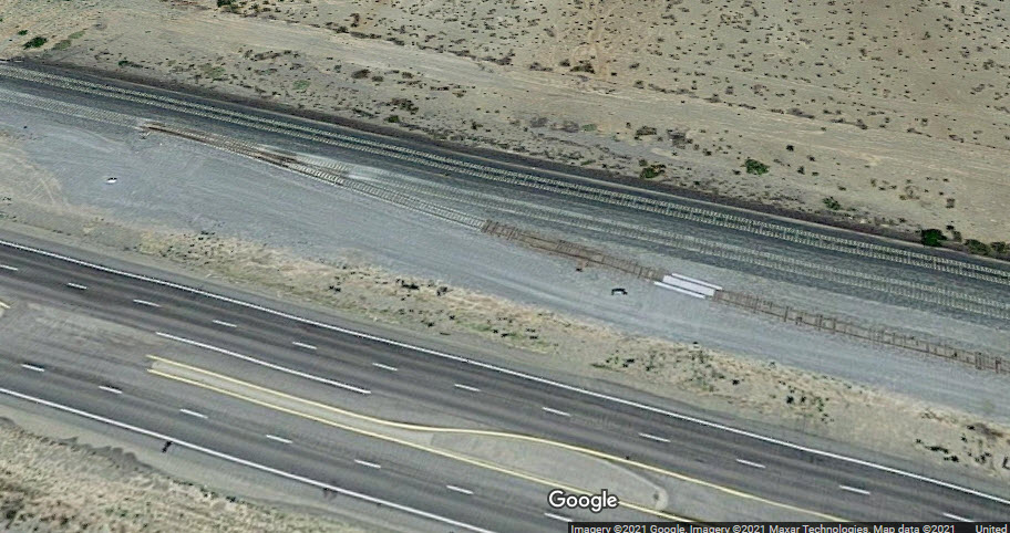
Signal at the east end of a 760 foot long siding, 1.1 miles west of Main St.
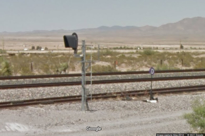
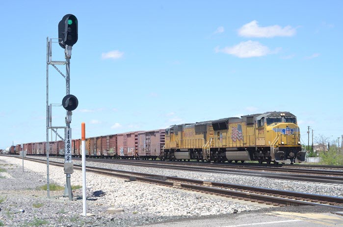
Located at the west end of the yard, where the yard track enters the mainline, one for the mainline, one for the yard track.
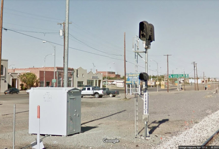
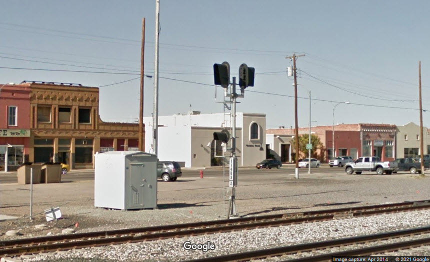
Conveniently located at a grade crossing with "SP Crossing Street" two blocks east of Main St.
 courtesy the CSXTHS Collection
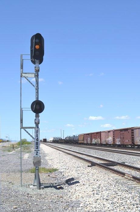 courtesy the CSXTHS Collection
Conveniently located at the Gold Hill Rd grade crossing, 1.5 miles east of Main St.
 courtesy the CSXTHS Collection
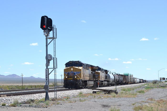 courtesy the CSXTHS Collection
Intermediate signals about 3.5 miles east of Main St.
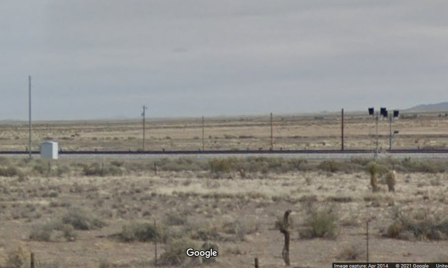
Intermediate signals 7.0 miles east of Main St.
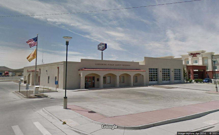
1000 S Main St, Lordsburg NM 88045
575-542-9261
Looks like Lordsburg may have built a new fire station since Google came thru in 2014, for there is nothing at this address.
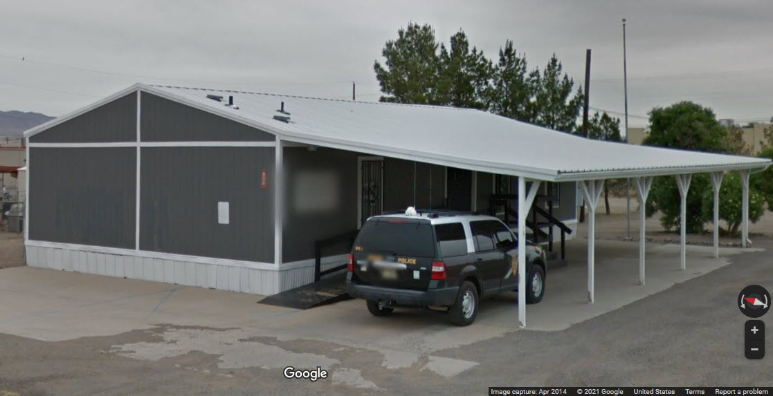
404 W Wabash St, Lordsburg NM 88045
575-542-3505
808 High St, Lordsburg, NM 88045
575-542-9563
Early scene in Lordsburg to illustrate that we all think parking problems are a modern inconvenience, but it appears that even 100 years ago, they were beginning to have "problems" :-)
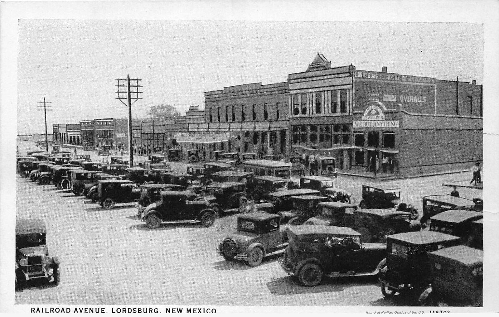
Here is a modern view of the same area, we have lost the nice wooden "sidewalk":

Courtesy of the University of Texas Library, click here for their index page.
Disclaimers:
I love trains, and I love signals. I am not an expert. My webpages reflect what I find on the topic of the page. This is something I have fun with while trying to help others.
Please Note: Since the main focus of my two websites is railroad signals, the railfan guides are oriented towards the signal fan being able to locate them. For those of you into the modeling aspect of our hobby, my indexa page has a list of almost everything railroad oriented I can think of to provide you with at least a few pictures to help you detail your pike.
If this is a railfan page, every effort has been made to make sure that the information contained on this map and in this railfan guide is correct. Once in a while, an error may creep in :-)
My philosophy: Pictures and maps are worth a thousand words, especially for railfanning. Text descriptions only get you so far, especially if you get lost or disoriented. Take along good maps.... a GPS is OK to get somewhere, but maps are still better if you get lost! I belong to AAA, which allows you to get local maps for free when you visit the local branches. ADC puts out a nice series of county maps for the Washington DC area, but their state maps do not have the railroads on them. If you can find em, I like the National Geographic map book of the U.S..... good, clear, and concise graphics, and they do a really good job of showing you where tourist type attractions are, although they too lack the railroads. Other notes about specific areas will show up on that page if known.
Aerial shots were taken from either Google or Bing Maps as noted. Screen captures are made with Snagit, a Techsmith product... a great tool if you have never used it!
By the way, floobydust is a term I picked up 30-40 years ago from a National Semiconductor data book, and means miscellaneous and/or other stuff.
Pictures and additional information is always needed if anyone feels inclined to take 'em, send 'em, and share 'em, or if you have something to add or correct.... credit is always given! Please be NICE!!! Contact info is here
Beware: If used as a source, ANYTHING from Wikipedia must be treated as being possibly inaccurate, wrong, or not true.
RAILFAN GUIDES HOME
RAILROAD SIGNALS HOME
NEW FEB03/2021
Last Modified 04-Feb-2021