
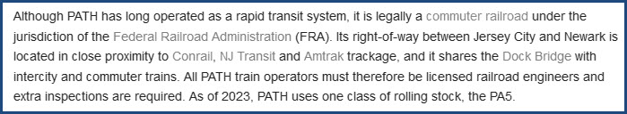
In General
Getting Here
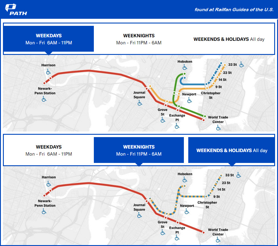
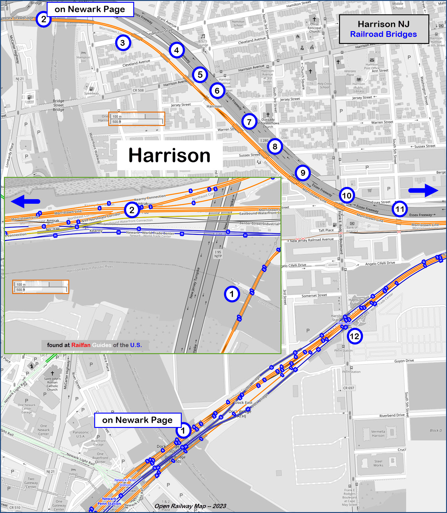
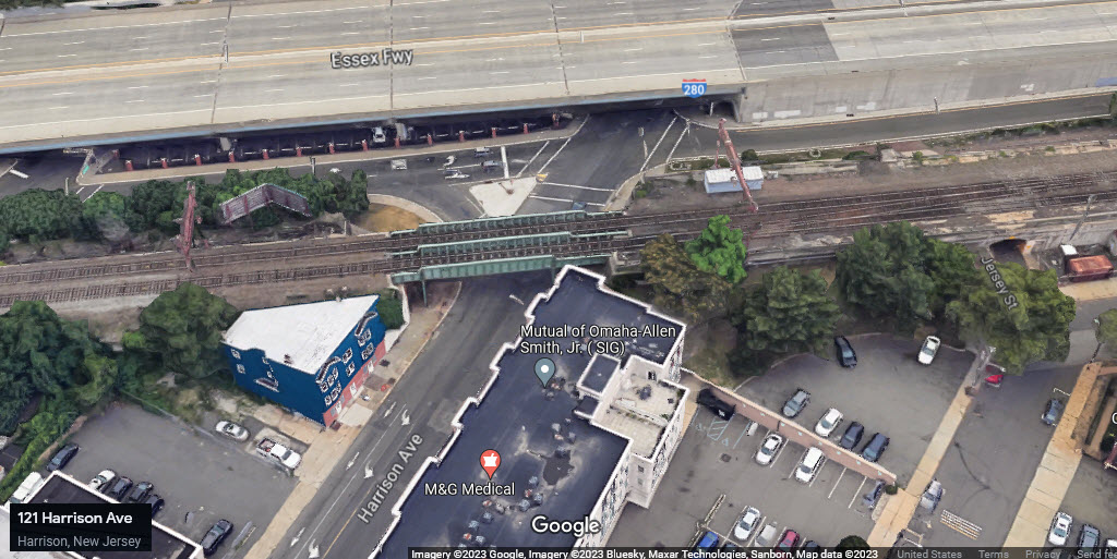
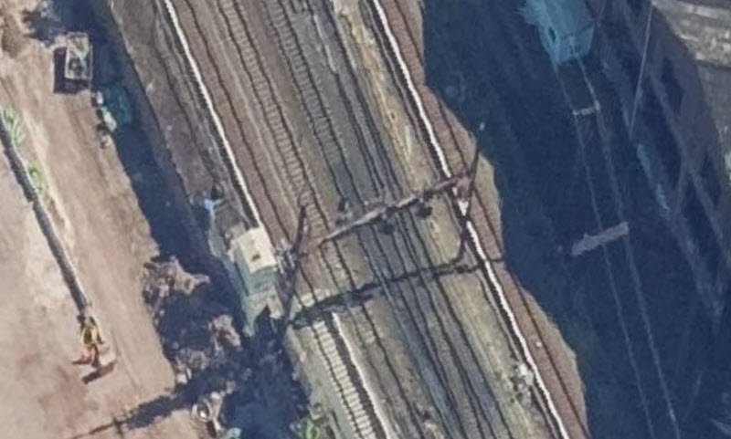
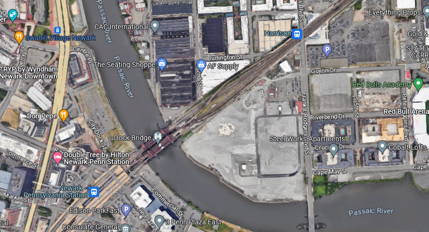
Map
Pictures
Bridges
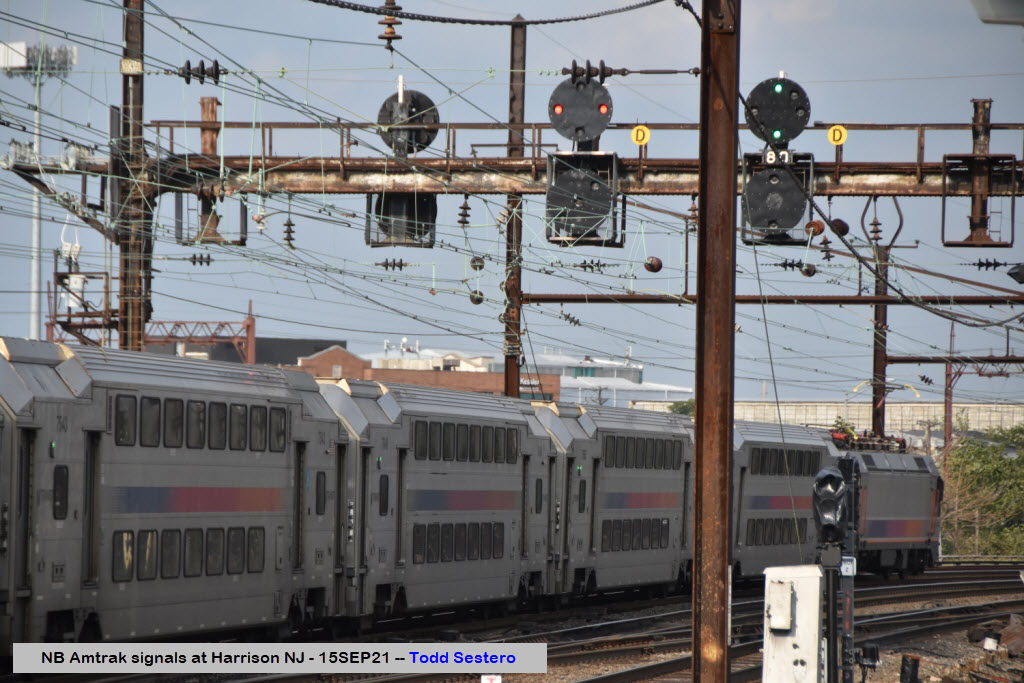
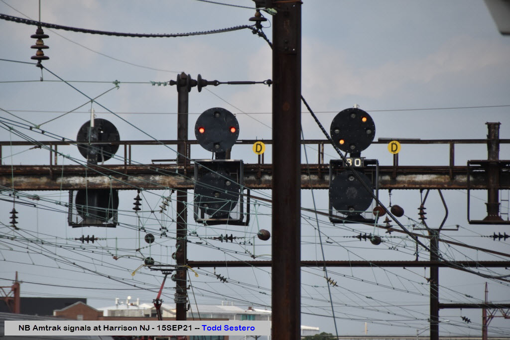
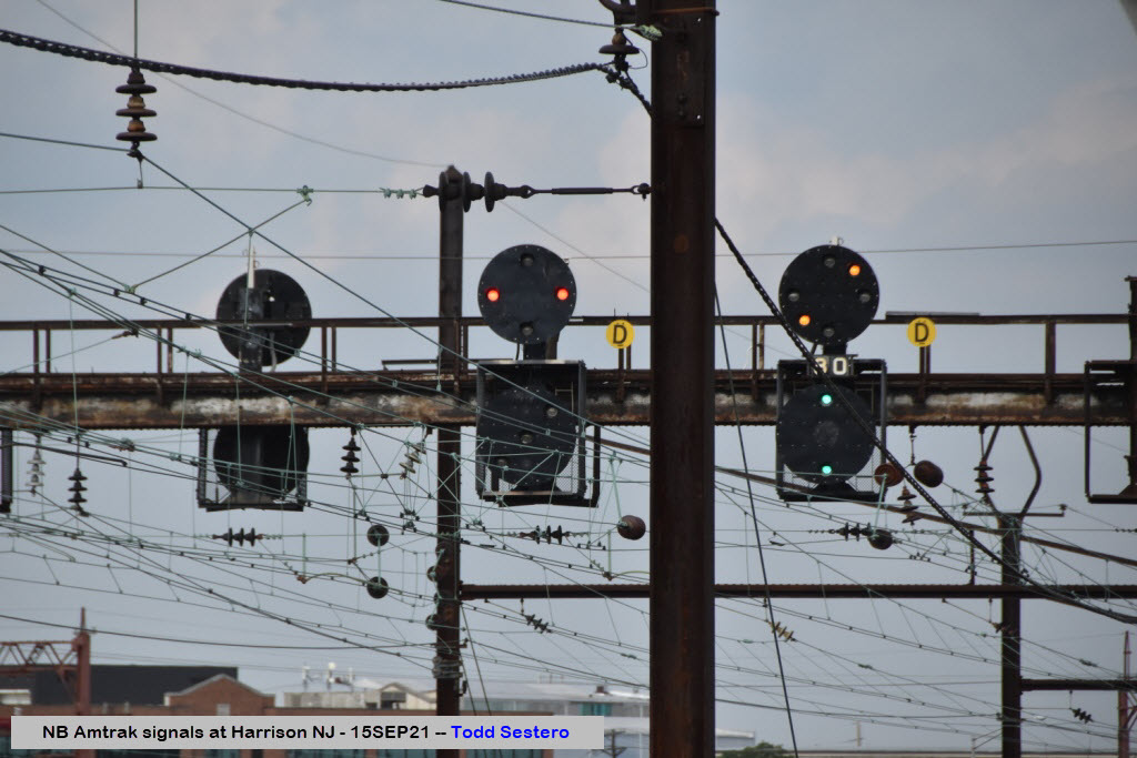
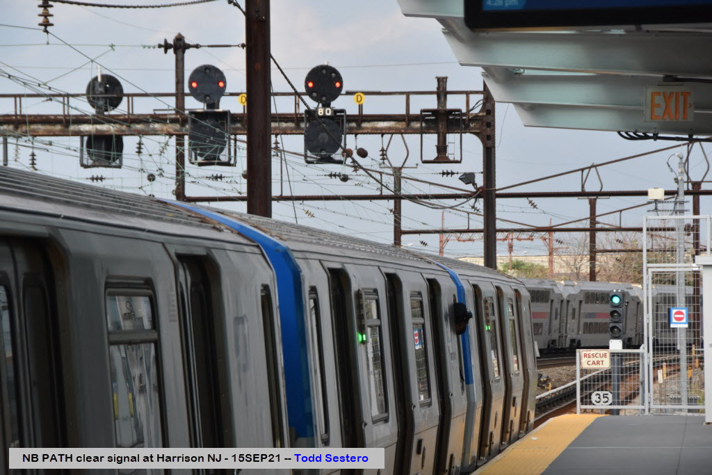
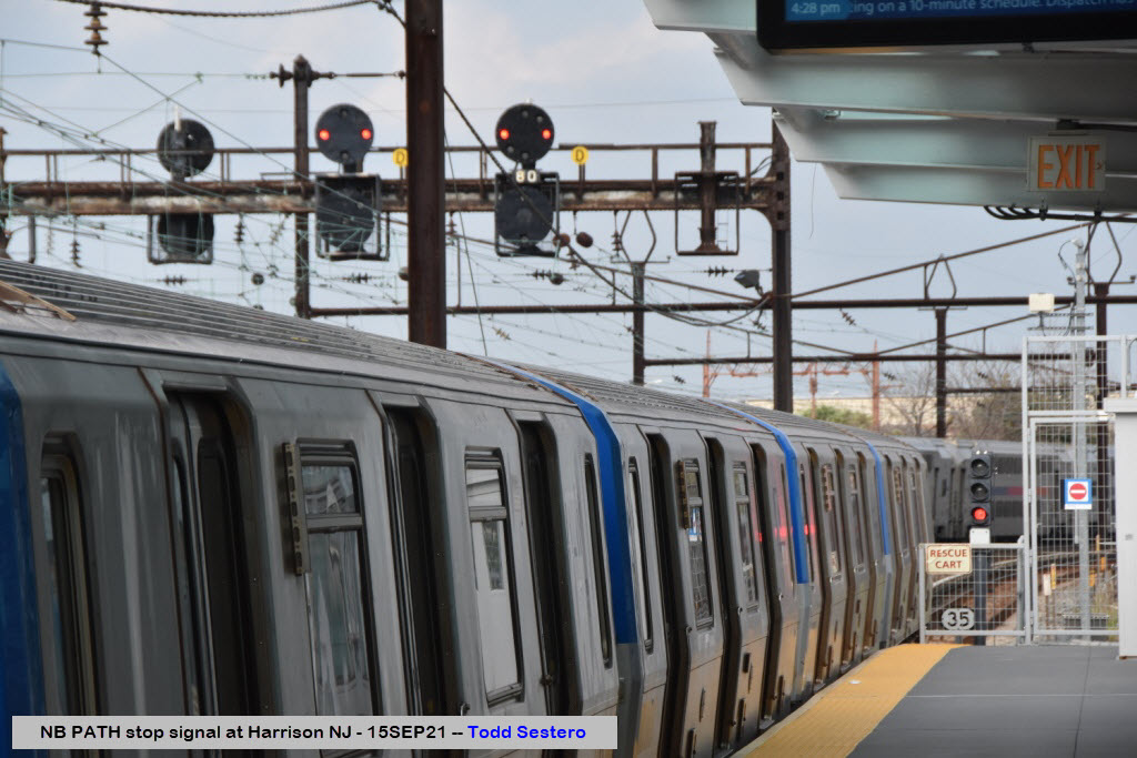
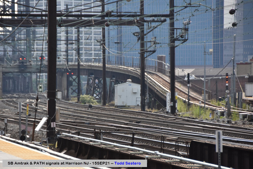
Signals
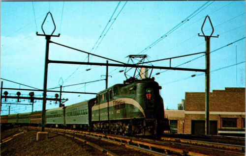
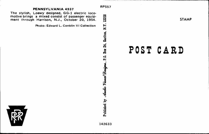
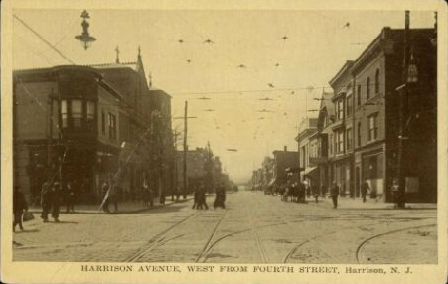
Postcards
Floobydust
RAILFAN GUIDES HOME
RAILROAD SIGNALS HOME
Location / Name:
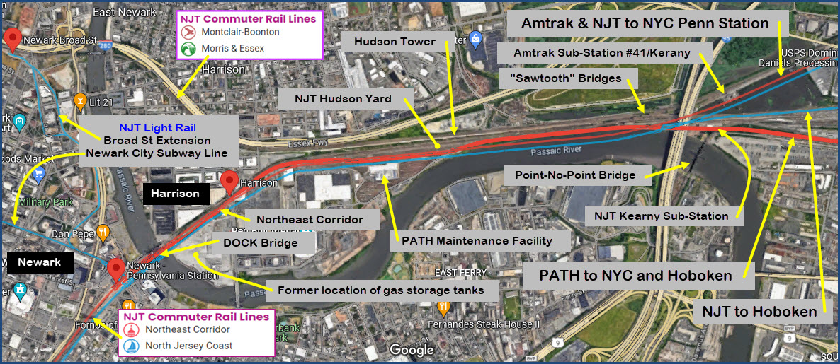
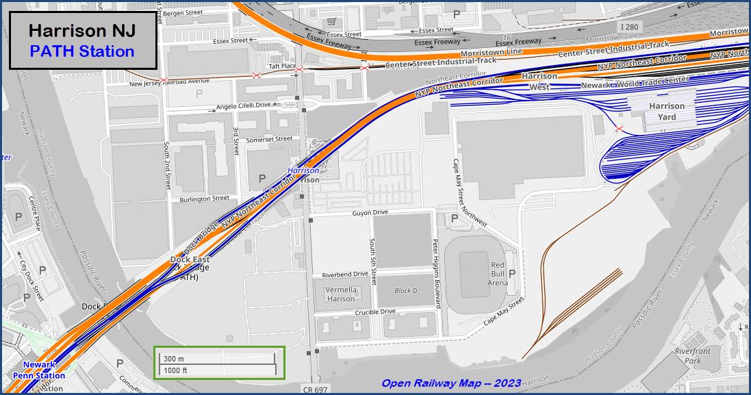
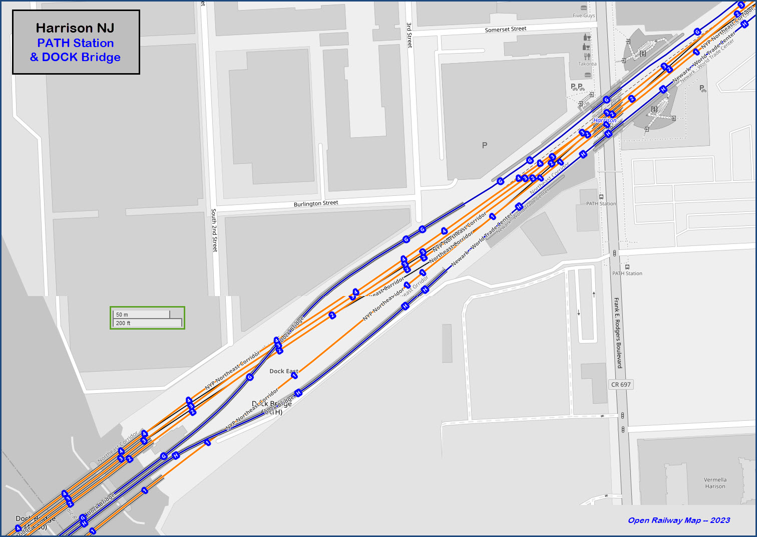
Harrison NJ, Hudson County
What's Here:
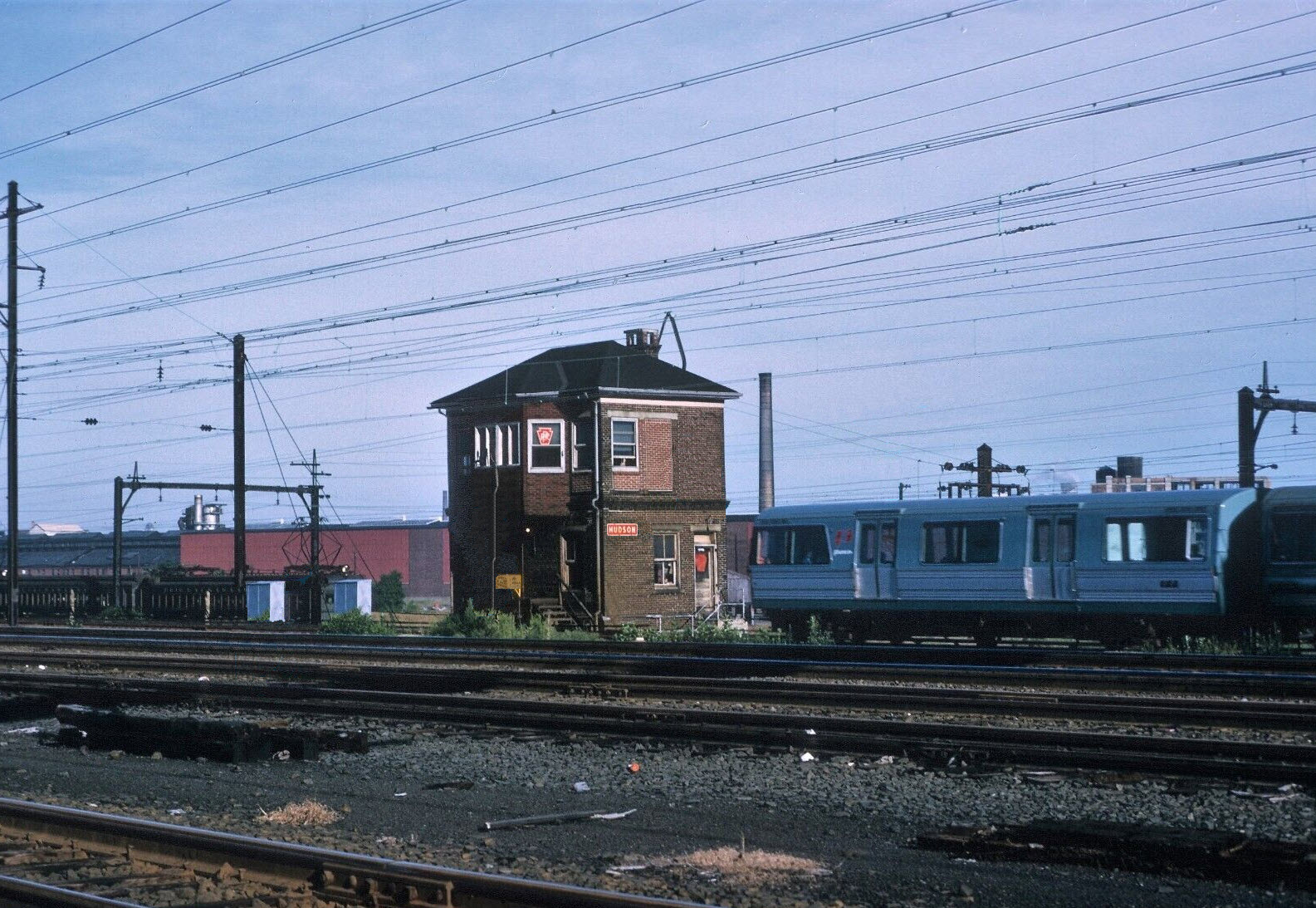
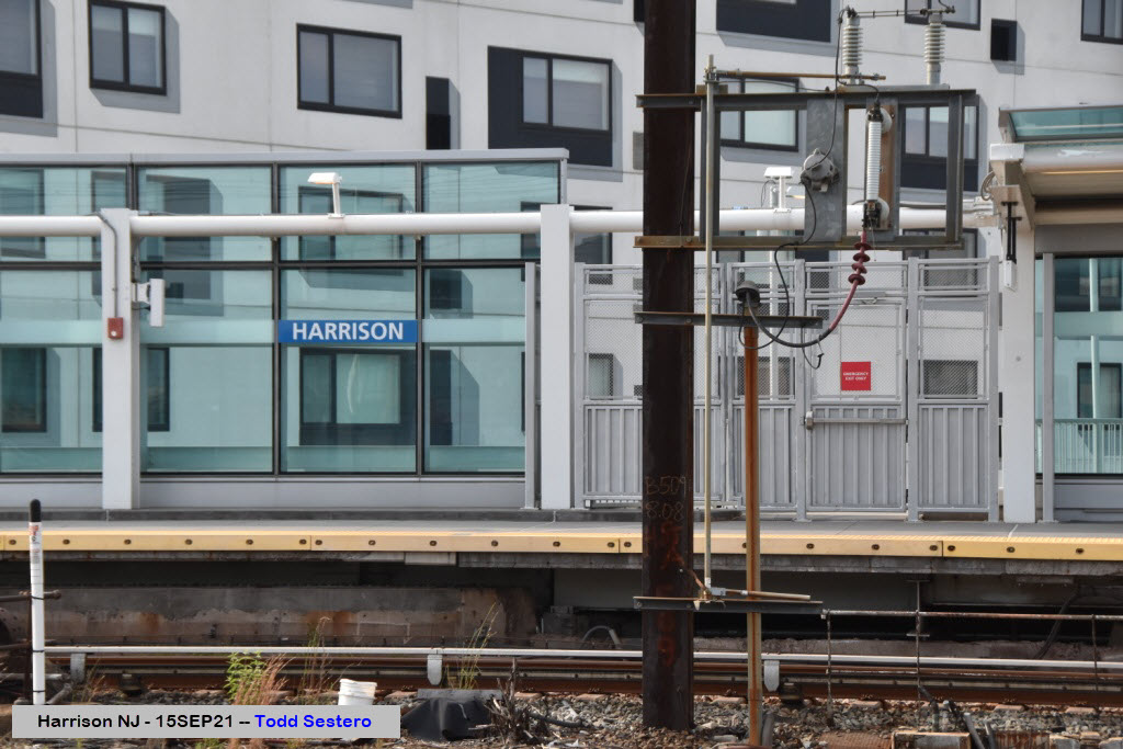
Harrison PATH Station
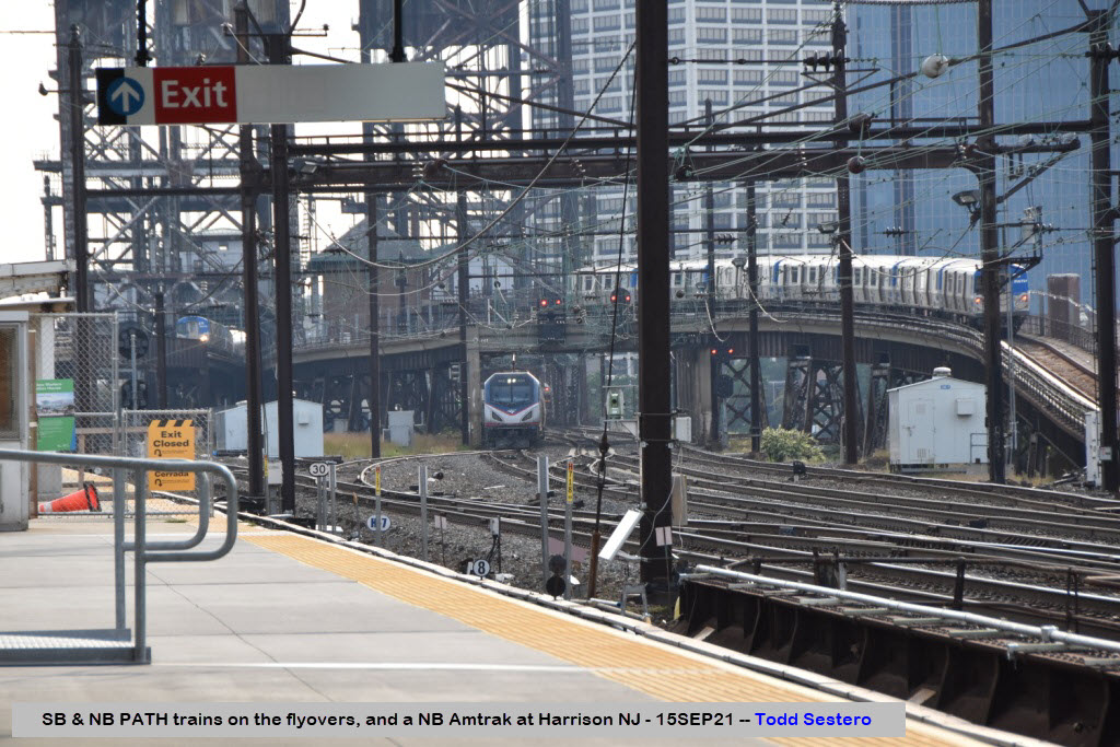
Amtrak and NJT comes rolling through on the NEC
PATH Maintenance Facility and Yard
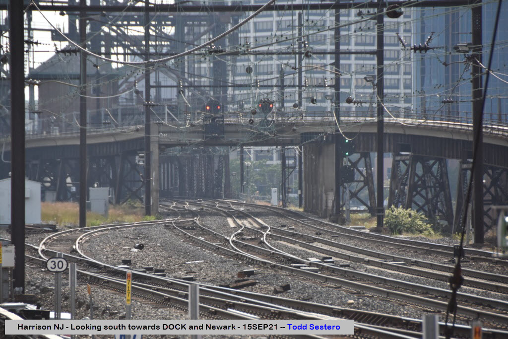
North side of DOCK Bridge
Data:
GPS Coordinates: 40.73909, -74.15616 (at station)
Phone A/C: 201/862/973
ZIP: 07029
Access by train/transit:
PATH Subway
Geography:
Harrison is about 9 miles from mid-Manhattan, and about 7 miles from Hoboken NJ. Newark is just on the other side of the Passaic River, about a half mile away. And the Broad Street station is exactly a mile away by air. All of the trains lines through Harrison are elevated above street level. I-280 follows the Morristown Line for about 2.4 miles, on both sides of the Broad Street station, the eastbound direction gives you the best shots.
The overall terrain here is flat. Harrison is bordered on the west and south by the Passaic River, which dumps out into the Newark Bay.

The Scoop:
Didn't want to overload the Newark page, so we created the Harrison page just to highlight the PATH station here and the diverging NJT Morristown Branch route.
Even a short visit here will give you a camera full of pictures :-)
Approximate train volume per 24 hours are ~110 on Amtrak, ~260 on NJT, and ~290 on PATH.
Acknowledgements:
Rich W.
Google Maps
Bing Maps
Open Railway Map
Wikipedia
Websites and other additional information sources of interest for the area:
https://www.njtransit.com/ NJT Homepage
https://www.panynj.gov/path/en/index.html PATH Homepage
https://en.wikipedia.org/wiki/PATH_(rail_system)
https://en.wikipedia.org/wiki/Point-No-Point_Bridge
https://en.wikipedia.org/wiki/Morristown_Line
Getting to G
GPS Coordinates:
913 Frank E Rodgers Blvd S, Harrison NJ 07029
The
GPS Coordinates:
The
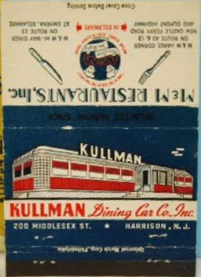
 found on Ebay, cleaned up
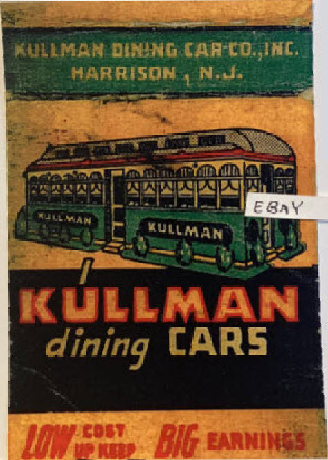
Pictures
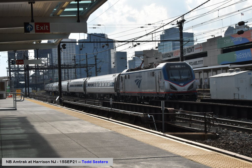
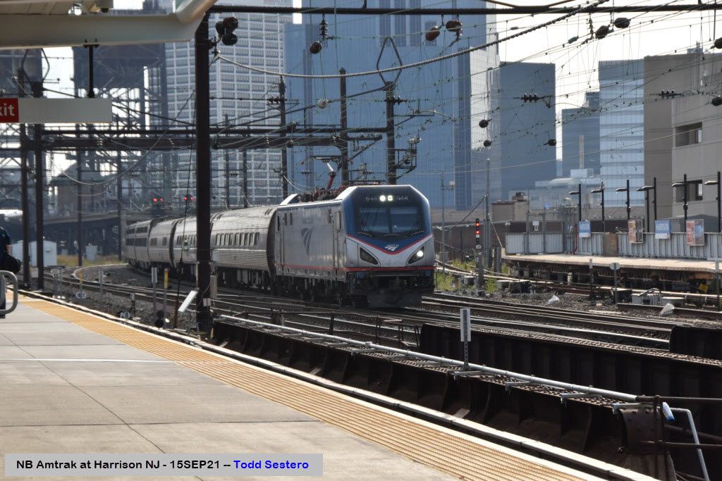
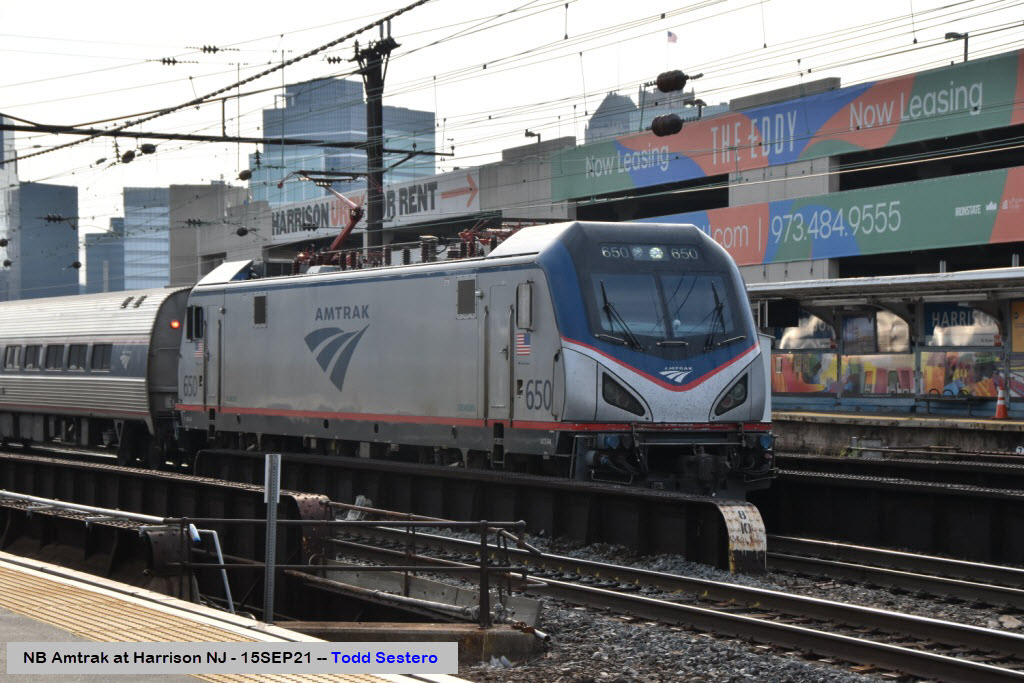
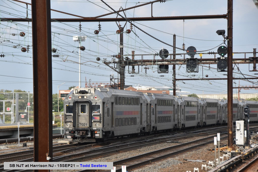
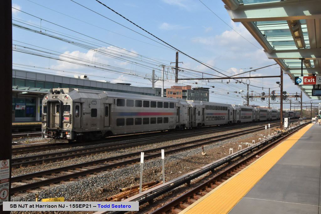
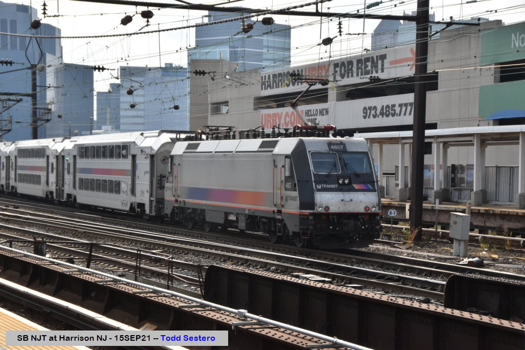
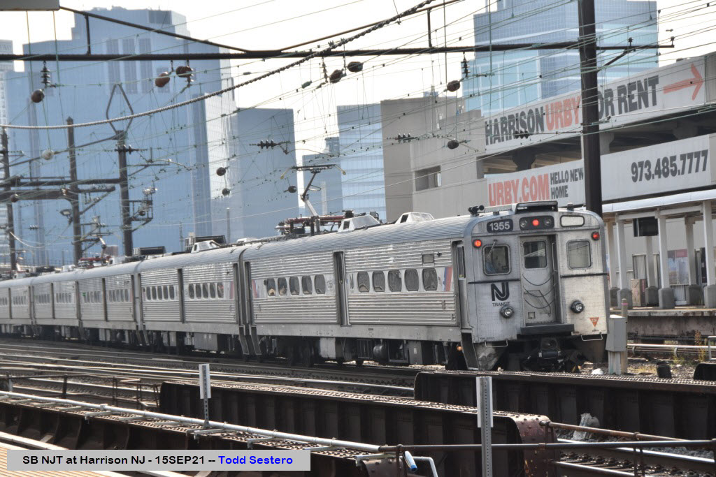
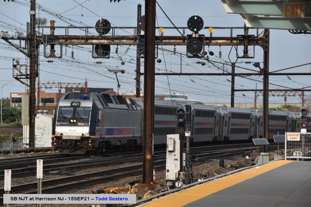
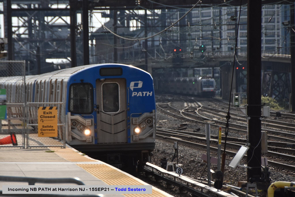
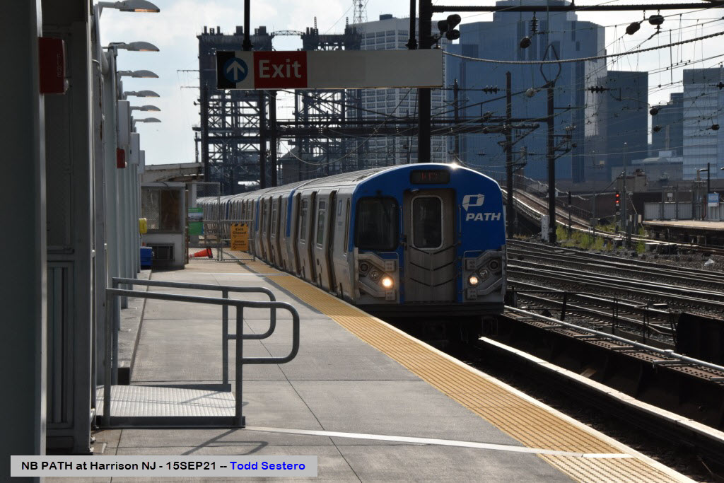
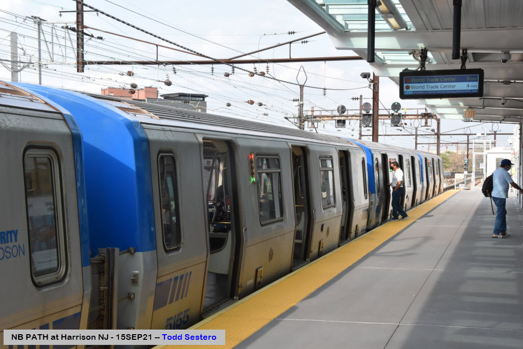
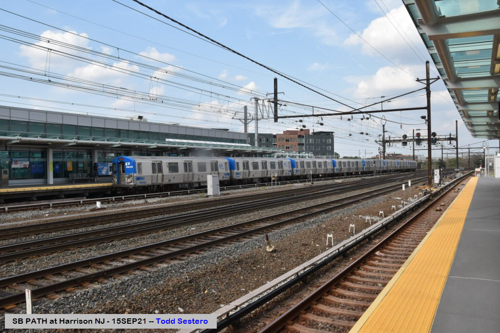
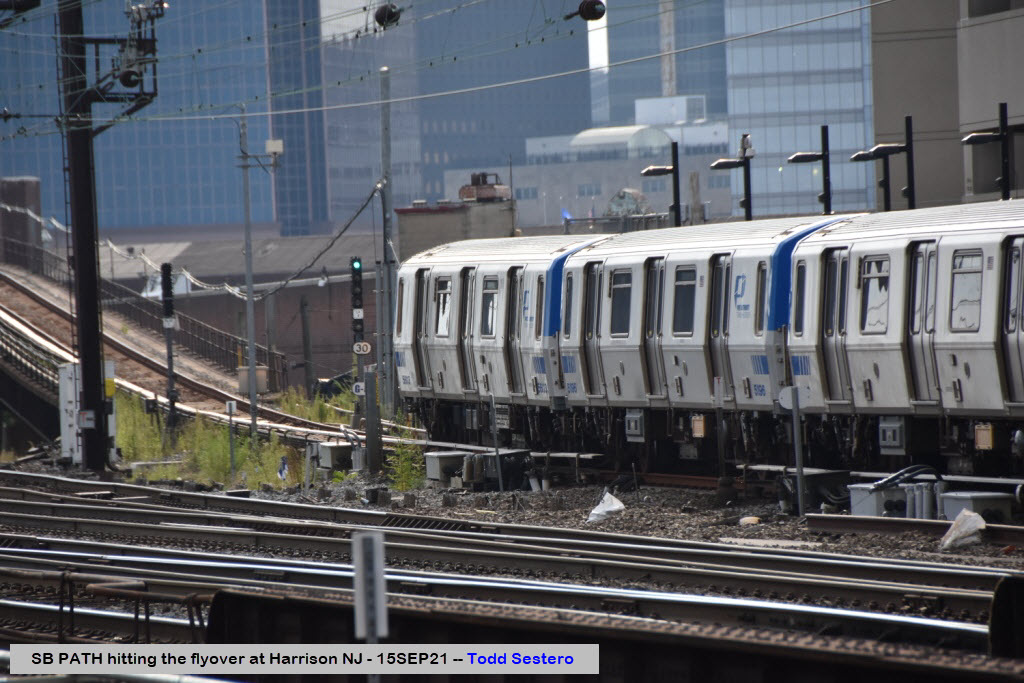
Unless otherwise noted, my pictures were taken from the NB PATH platform.
Amtrak
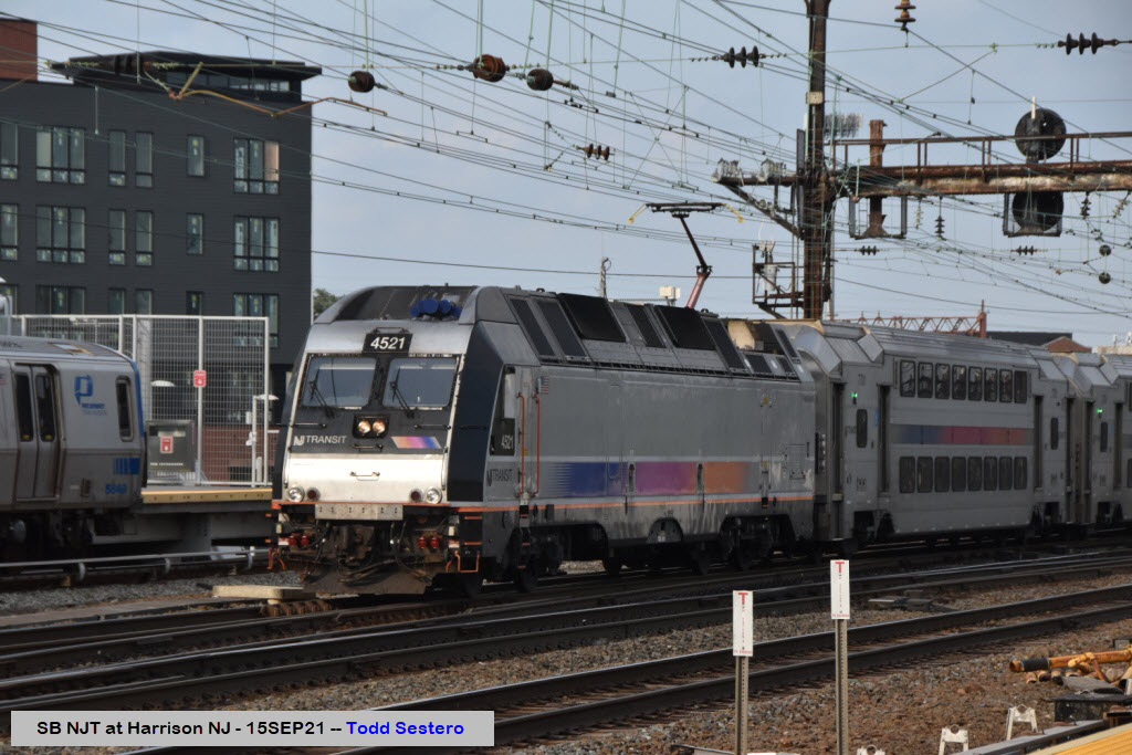
New Jersey Transit
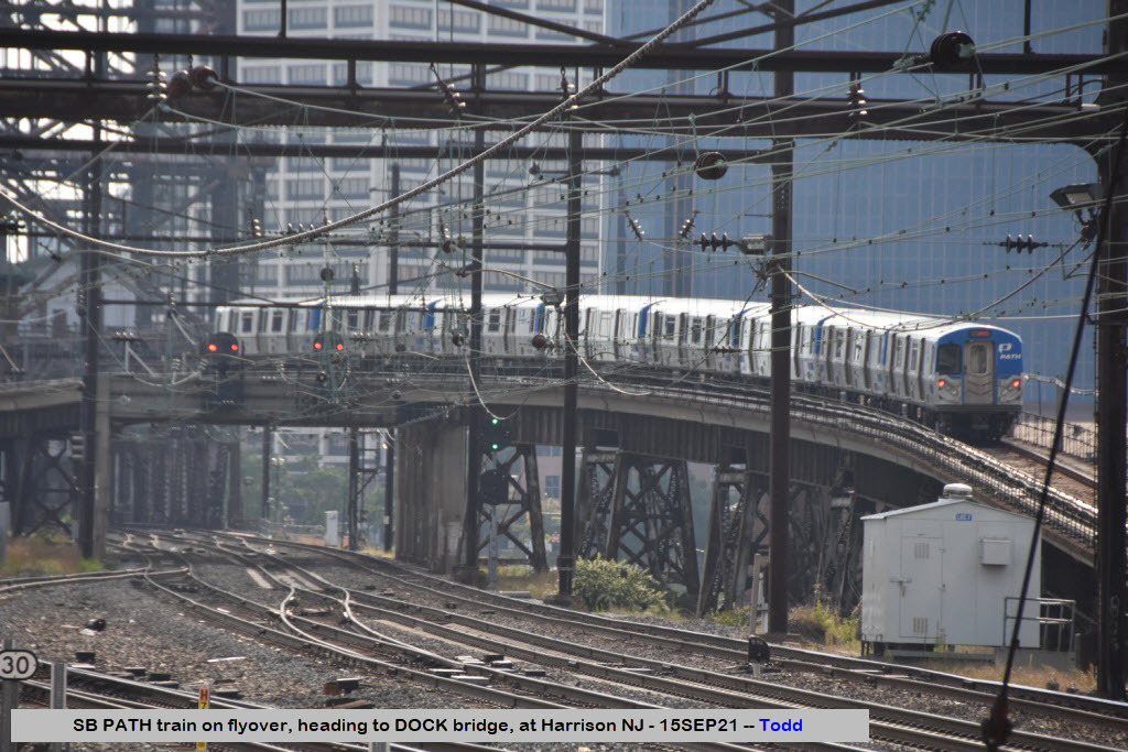
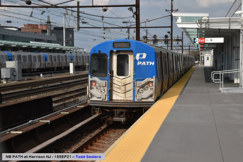
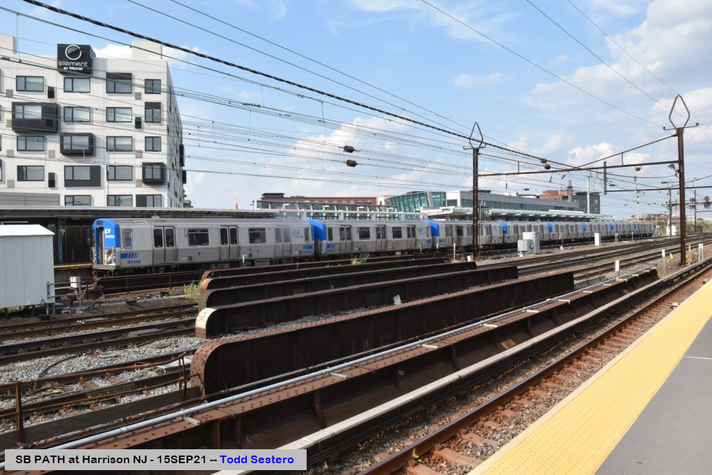
PATH

GPS Coordinates: 40.74168, -74.12100
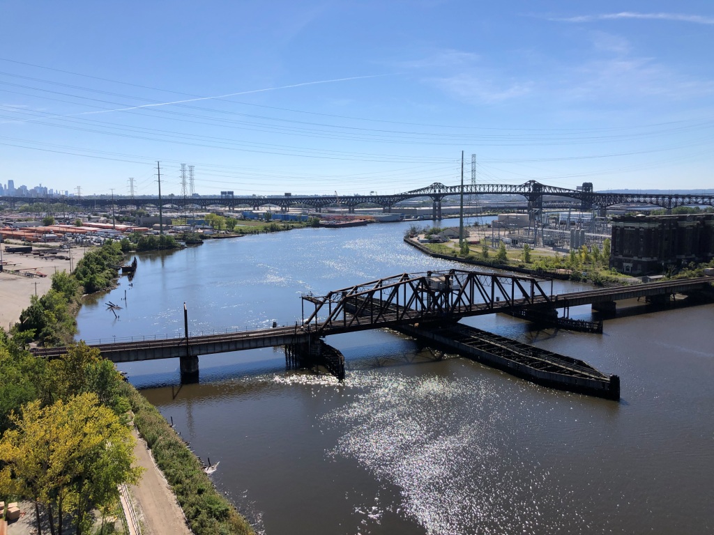
This is a swing bridge crossing the Passaic River, and carries the Passaic and Harsimus Line. From Wikipedia: Point-No-Point Bridge is a railroad bridge crossing the Passaic River between Newark and Kearny NJ, in the New Jersey Meadowlands. The swing bridge is the fourth from the river's mouth at Newark Bay and is 2.6 miles (4.2 km) upstream from it. A camelback through truss bridge, it is owned by Conrail as part of its North Jersey Shared Assets and carries the Passaic and Harsimus Line used by CSX and NS. CSX's River subdivision accesses the line via Marion Junction. Conrail is considering replacing the bridge, which was opened in 1901.
A crossing of the Passaic at Point-No-Point was originally built by the Pennsylvania Railroad (PRR) in the early 1890s to bypass its mainline and thus shorten the distance to its rail yard at Harsimus Cove. At the time the railroad crossed the Passaic at the Centre Street Bridge (no longer in existence) near its Newark station, at the site of today's New Jersey Performing Arts Center. The new Pennsylvania Cut-off diverged from the line (now today's Northeast Corridor) at Waverly Yard, crossed the Newark Ironbound and the Passaic to the Kearny Meadows and then crossed the Hackensack River on the Harsimus Branch Lift Bridge. It rejoined the main line at the Bergen Hill Cut, but diverged again using the Harsimus Stem Embankment to reach its freight yards on the Hudson River waterfront north of its passenger terminal at Exchange Place. The PRR also used the Lehigh Valley Railroad Bridge to reach its car float operations at Greenville Yard on the Upper New York Bay.
 Pix by Famartin, from Wikipedia
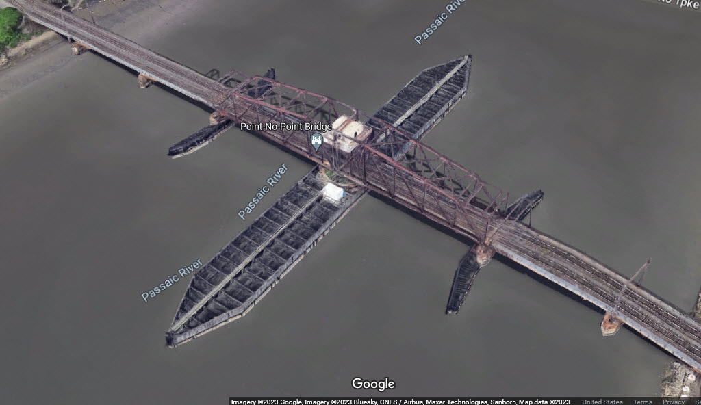
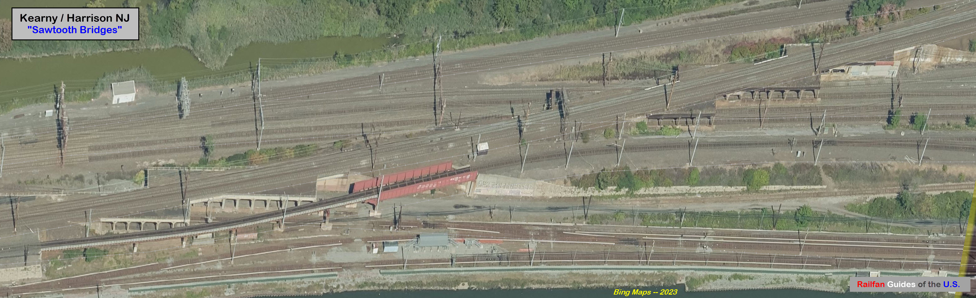
GPS Coordinates: 40.74367, -74.12636
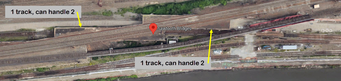
Technically in Kearny, and not Harrison, this set of "tunnel" type bridges carry the Amtrak NEC over the NJT lines running in and out of the Kearny Yard. Over in Sunnyside yard, this same type of "bridge" is nicknamed a "duckunder". The bridges carry the NEC over six other tracks: [1(2)x1(2)]x[2x2x0] - (1x(2) means there is one track in the tunnel, but it can handle two).

GPS Coordinates: 40.74699, -74.16298
Steel girder bridge spanning 3 lanes of traffic/2 sidewalks and carrying 2 tracks.
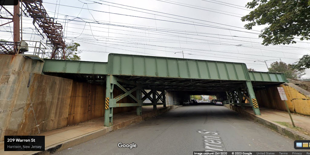
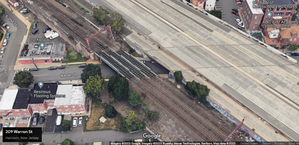
GPS Coordinates: 40.74642, -74.16200
Steel girder bridge spanning 4 lanes of traffic/2 sidewalks and carrying 2 tracks.
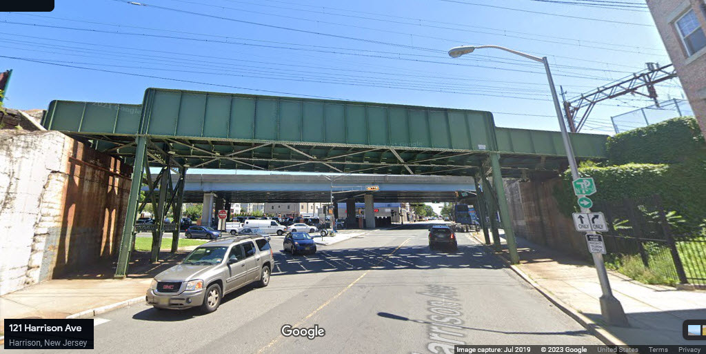
GPS Coordinates: 40.74582, -74.16117
Steel girder bridge spanning 4 lanes of traffic/2 sidewalks and carrying 2 tracks.
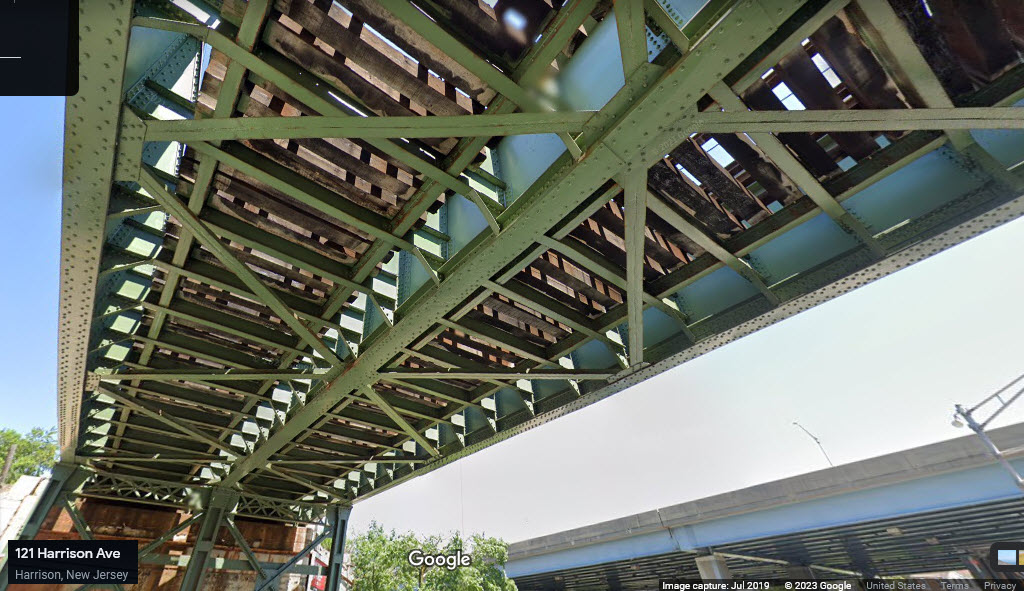
GPS Coordinates: 40.74533, -74.16056
Concrete Arch bridge over (basically) one lane of traffic, carrying 2 tracks and crossover.
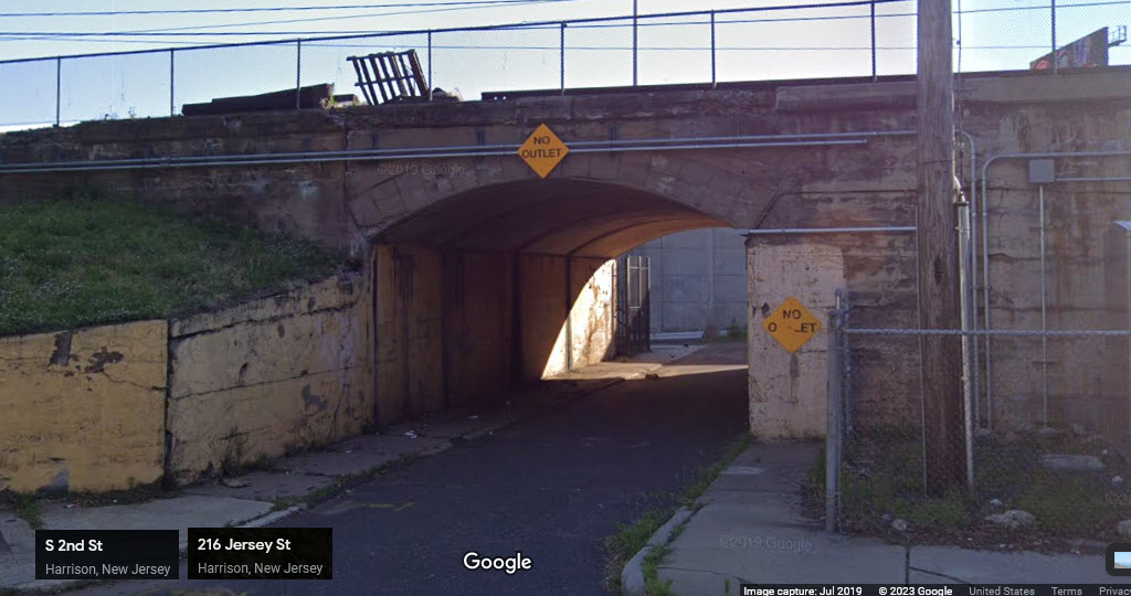
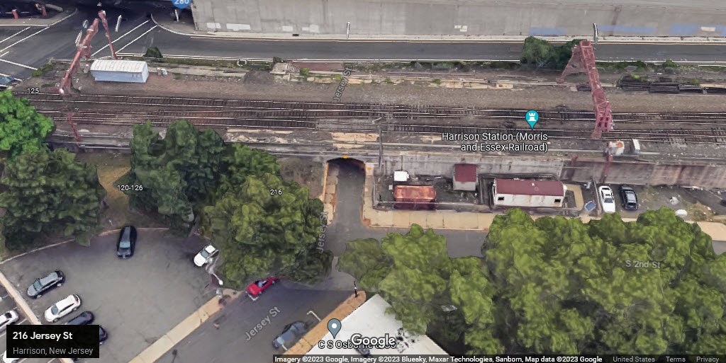
GPS Coordinates: 40.744541, -74.15944
Steel girder bridge spanning 4 lanes of traffic/2 sidewalks and carrying 3 tracks.
GPS Coordinates: 40.74387, -74.15855
Steel girder bridge spanning 4 lanes of traffic/2 sidewalks and carrying 3 tracks.
GPS Coordinates: 40.74318, -74.15752
Steel girder bridge spanning 4 lanes of traffic/2 sidewalks and carrying 3 tracks.
GPS Coordinates: 40.74245, -74.15583
Steel girder bridge spanning 4 lanes of traffic/2 sidewalks and carrying 3 tracks.
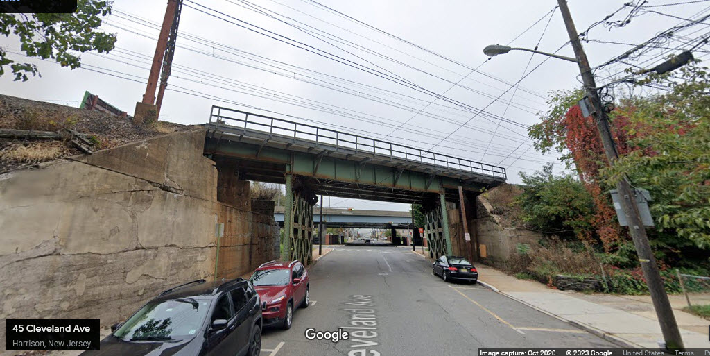
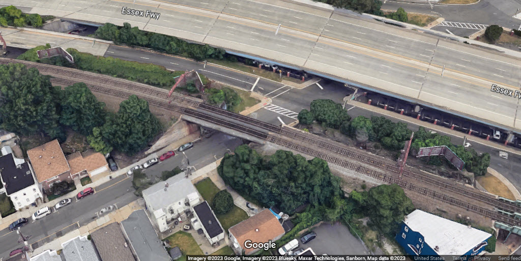
GPS Coordinates: 40.74204, -74.15375
Steel girder bridge spanning 2 lanes of traffic/2 sidewalks and carrying 3 tracks.
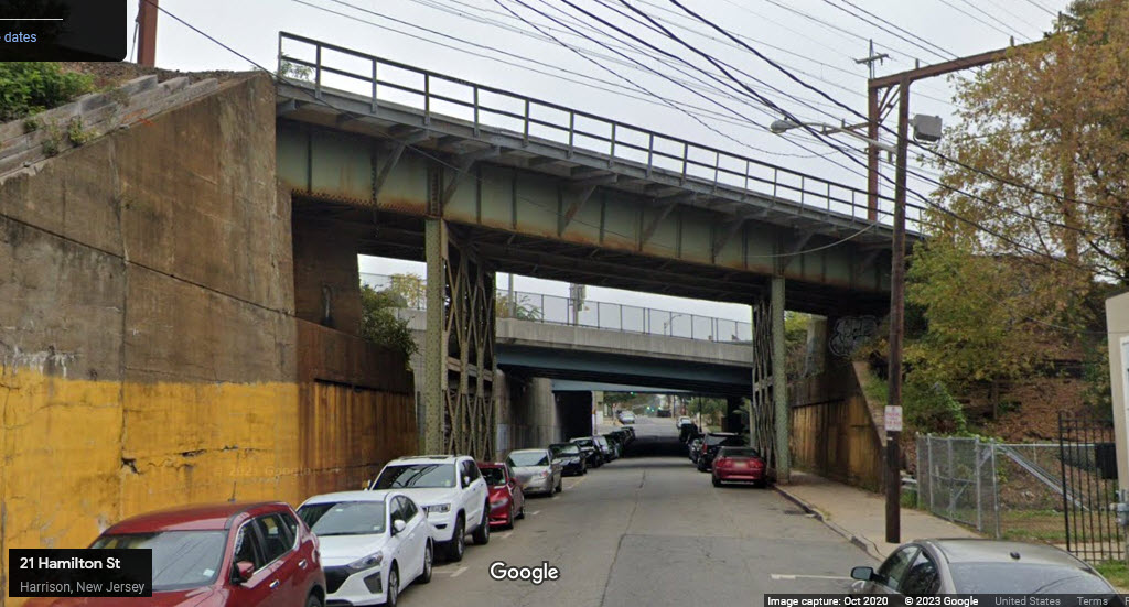
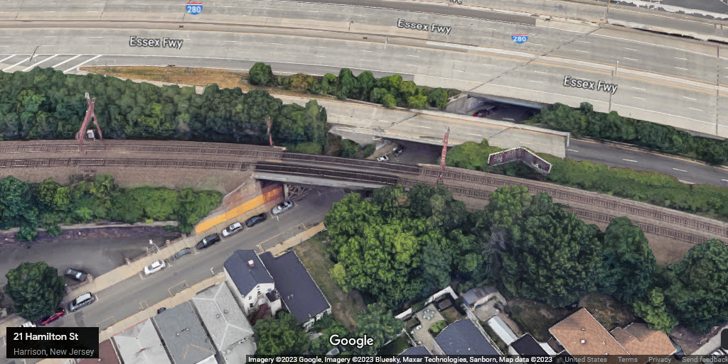
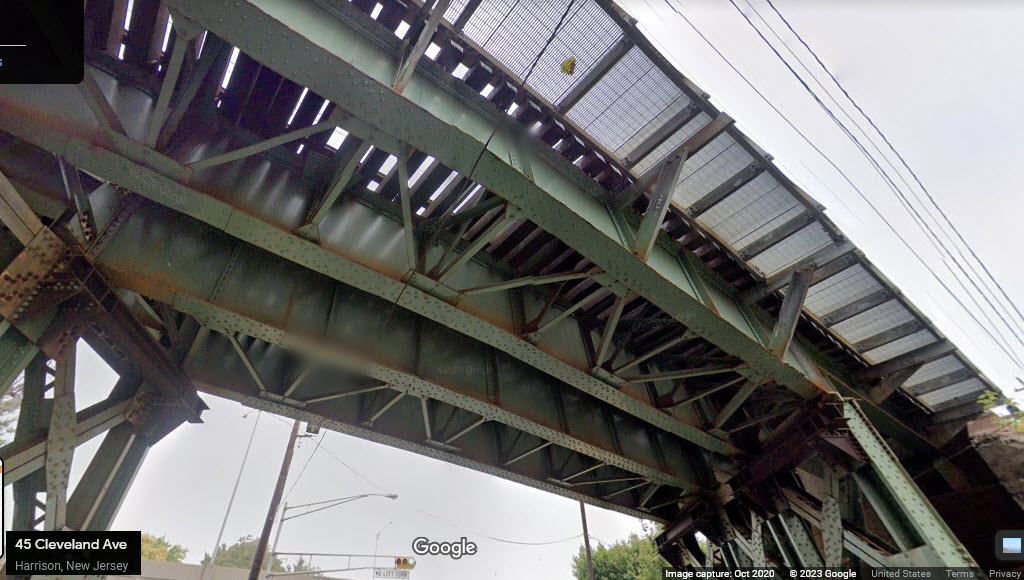
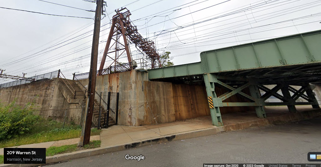
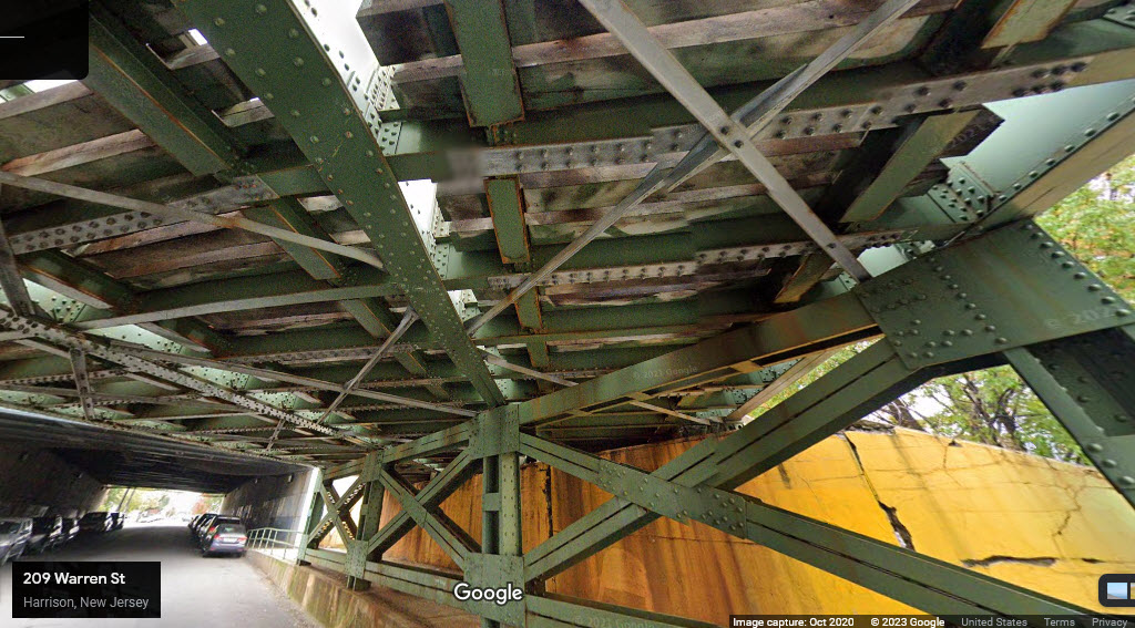
GPS Coordinates: 40.73938, -74.15565
A series of three steel girder bridge spanning 4 lanes of traffic/2 sidewalks and carrying 1+3+1 tracks and part of the Harrison NJ PATH station platforms..
GPS Coordinates: 40.74024, -74.15422, From the NB PATH Harrison Station
GPS Coordinates: 40.73986, -74.15458
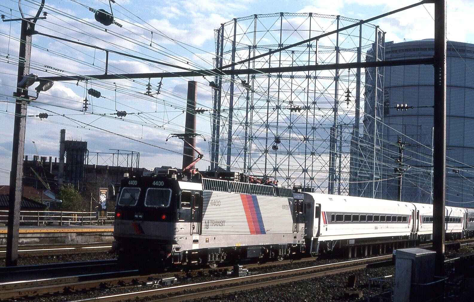
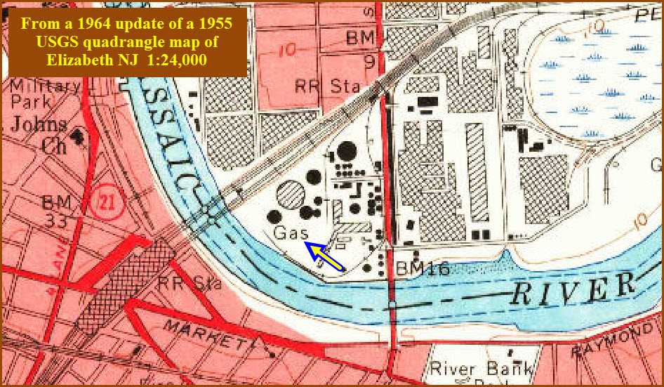
NB NJT with ALP44 #4400. The gas storage tanks in the picture below are no longer around.... from 1994, from EBay seller ty12jk, photo by him.
None for now......
Disclaimers:
I love trains, and I love signals. I am not an expert. My webpages reflect what I find on the topic of the page. This is something I have fun with while trying to help others.
Please Note: Since the main focus of my two websites is railroad signals, the railfan guides are oriented towards the signal fan being able to locate them. For those of you into the modeling aspect of our hobby, my indexa page has a list of almost everything railroad oriented I can think of to provide you with at least a few pictures to help you detail your pike.
If this is a railfan page, every effort has been made to make sure that the information contained on this map and in this railfan guide is correct. Once in a while, an error may creep in :-)
My philosophy: Pictures and maps are worth a thousand words, especially for railfanning. Text descriptions only get you so far, especially if you get lost or disoriented. Take along good maps.... a GPS is OK to get somewhere, but maps are still better if you get lost! I belong to AAA, which allows you to get local maps for free when you visit the local branches. ADC puts out a nice series of county maps for the Washington DC area, but their state maps do not have the railroads on them. If you can find em, I like the National Geographic map book of the U.S..... good, clear, and concise graphics, and they do a really good job of showing you where tourist type attractions are, although they too lack the railroads. Other notes about specific areas will show up on that page if known.
Aerial shots were taken from either Google or Bing Maps as noted. Screen captures are made with Snagit, a Techsmith product... a great tool if you have never used it!
By the way, floobydust is a term I picked up 30-40 years ago from a National Semiconductor data book, and means miscellaneous and/or other stuff.
Pictures and additional information is always needed if anyone feels inclined to take 'em, send 'em, and share 'em, or if you have something to add or correct.... credit is always given! Please be NICE!!! Contact info is here
Beware: If used as a source, ANYTHING from Wikipedia must be treated as being possibly inaccurate, wrong, or not true.
NJT HOMEPAGE
RAILFAN GUIDES HOME
RAILROAD SIGNALS HOME
NEW APR21/2023, APR22/23/29/2023
Last Modified 29-Apr-2023