RAILFAN GUIDES of the U.S.
Todd's Railfan Guide to
the MINNESOTA STREETCAR MUSEUM
the Como-Harriet Line
In General
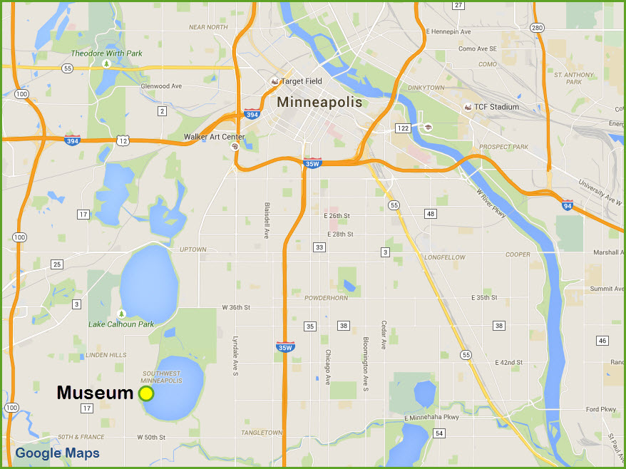
Getting Here
Map
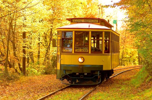
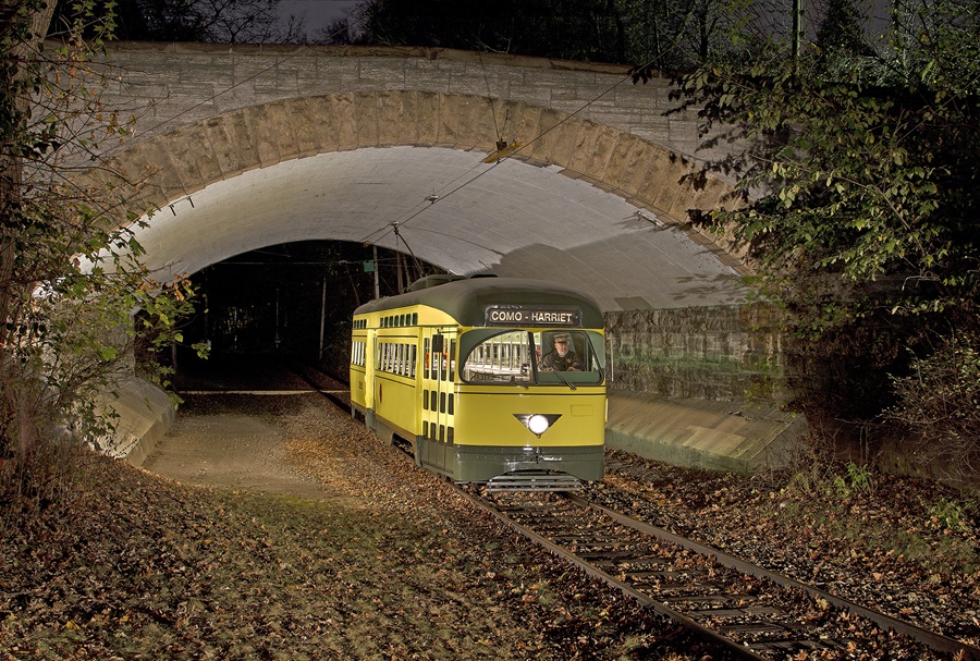
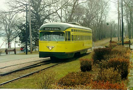
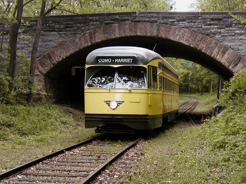
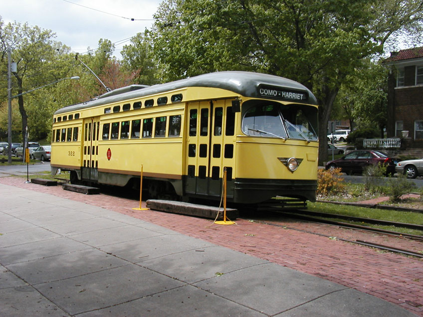
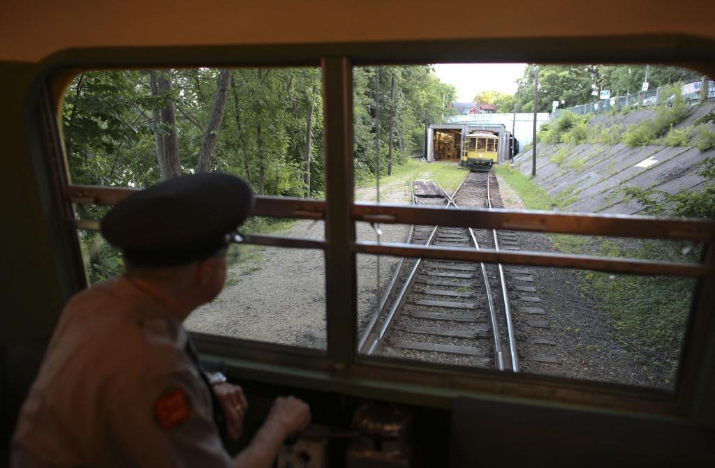
the Cars of Como-Harriet
Pictures
Floobydust
USGS Maps
RAILFAN GUIDES HOME
RAILROAD SIGNALS HOME
Location / Name:
Southwest Minneapolis
What's Here:
Minnesota Streetcar Museum - the Como-Harriet Line
Data:
GPS Coordinates: 44.927438, -93.309598
Scanner Frequencies:
None
Access by train/transit:
Bus route #6 and others - see below
The Scoop:
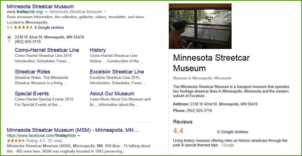
The Minnesota Streetcar Museum has two facilities. One is in southwest Minneapolis, the Como-Harriet line, and one in Excelsior. This page will cover the Como-Harriet line.
From the MTM's fact sheet page comes this:
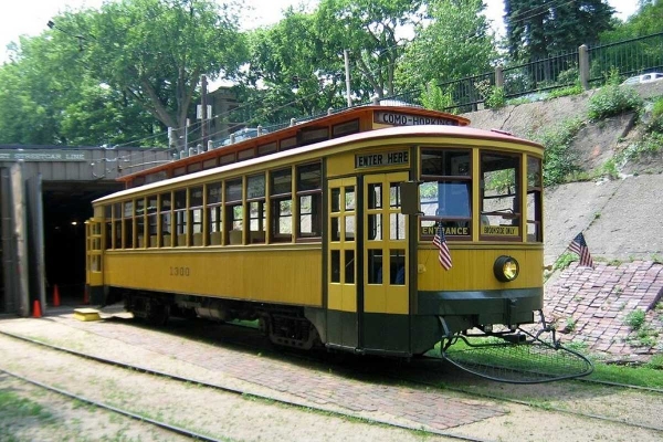
The Minnesota Streetcar Museum was created in December, 2004, as part of the restructuring of the Minnesota Transportation Museum which "spun off" its streetcar and steamboat operations to MSM and the Museum of Lake Minnetonka respectively during the winter of 2004-2005. MTM, which now focuses on railroading, was founded in 1962 to preserve Twin City Lines streetcar No. 1300 and, over the years, expanded into a multi-modal transportation museum preserving buses, a steamboat, streetcars, trains, and several railroad-related buildings.
The Minnesota Streetcar Museum focuses on the preservation of Minnesota's electric railway history by acquiring, restoring, maintaining, and operating a fleet of eight historic Minnesota streetcars at the Como-Harriet Streetcar Line in Minneapolis and the Excelsior Streetcar Line in Excelsior. MSM also preserves artifacts, papers, and photographs that it uses to interpret Minnesota's electric railway history.
Acknowledgements:
Thanks to Mike Miller of the MTM for some of the info and Denver Todd for his help with my railfan guides and suggesting welcome changes to help all ya'll.
Websites and other additional information sources of interest for the area:
https://www.metrotransit.org/Data/Sites/1/media/pdfs/central/report/metrotransit.org_sysmap_map_system.pdf
Aerial shots were taken from either Google Maps or www.bing.com/maps as noted, once in a great while maybe MapQuest.
The screen captures are made with Snagit, a Techsmith product... a great tool if you have never used it!
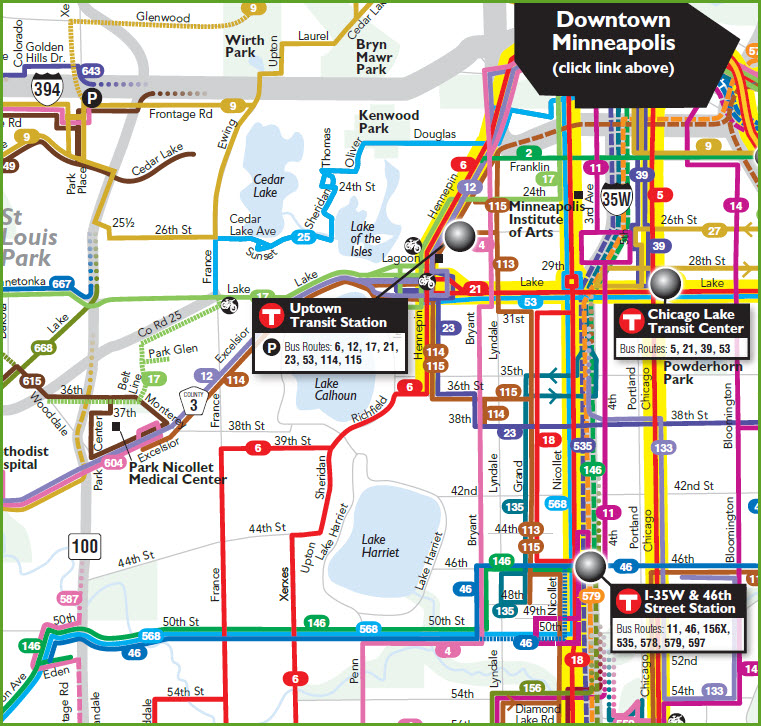
There are a number of ways to get here. One is by bus,
and the #6 route is your best bet. There are others that bring you
close, but not as close as the number 6 line. See the Metro Transit
map below.
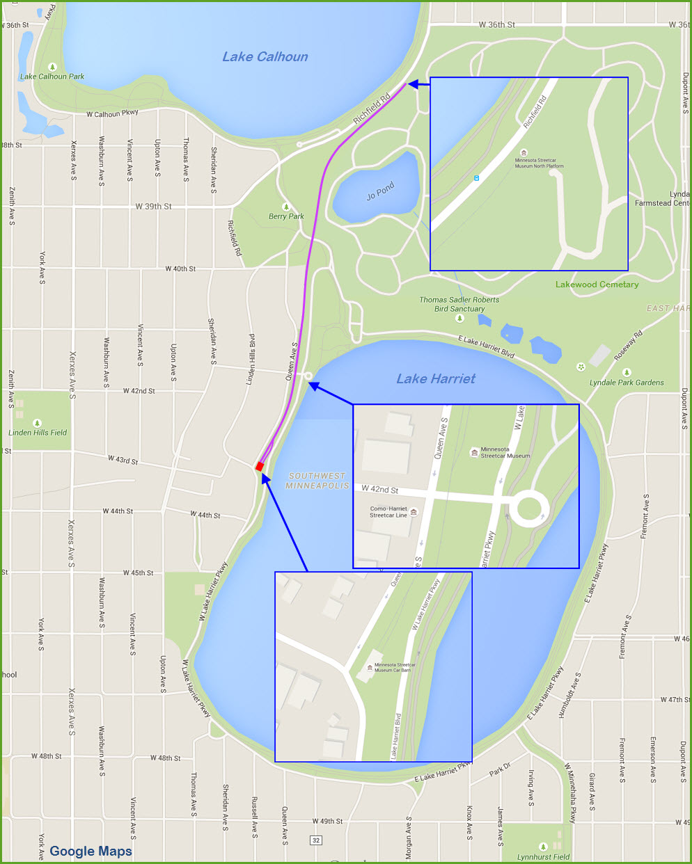
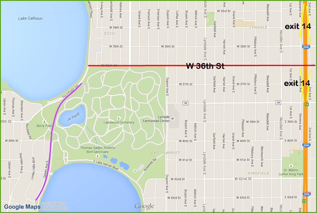
You can do I-35W by getting off at exit 14, and go west on
36th Street, and then follow the maps below.
You can also take 100
from either I-394 (exit 5/5B in Cedarhurst), 62 in Edina, or I-49 on
the south side, and get off at Excelsior Blvd.
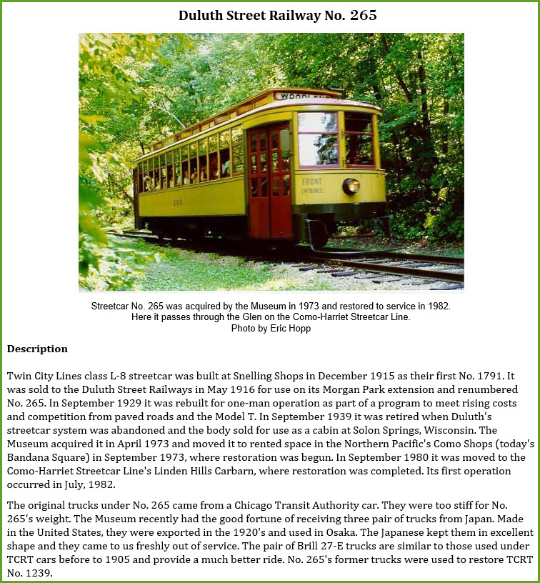
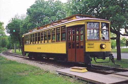
265
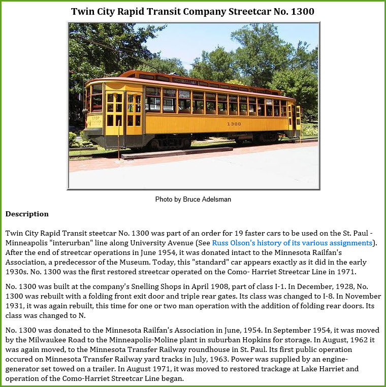
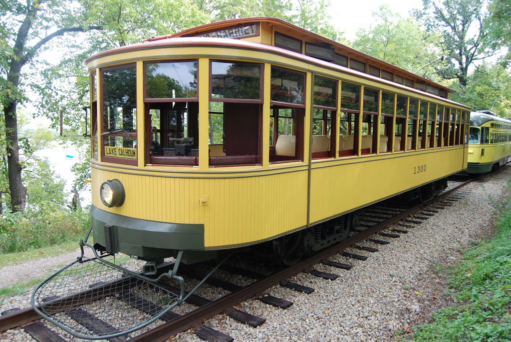
1300
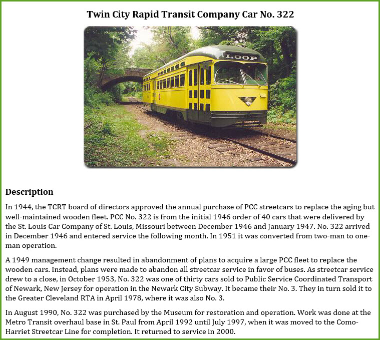
322
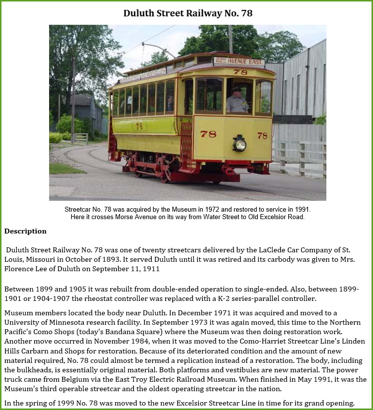
78
the Lake Harriet Bandshell Courtesy of the University of Texas Library, click
here for
their index page. Disclaimers: I love trains, and I love signals. I am not an
expert. My webpages reflect what I find on the topic of the page.
This is something I have fun with while trying to help others. My
webpages are an attempt at putting everything I can find of the subject in
one convenient place. There are plenty of other good websites to help
me in this effort, and they are listed in the links section on my indexa
page, or as needed on individual pages. Please do not write to me
about something that may be incorrect, and then hound the heck out of me if
I do not respond to you in the manner you would like. I operate on the
"Golden Rule Principle", and if you are not familiar with it, please
acquaint yourself with how to treat people by reading Mathew 7:12 (among
others, the principle exists in almost every religion). If you contact
me (like some do, hi Paul) and try to make it a "non-fun" thing and start
with the name calling, your name will go into my spambox list! :-) Please Note:
Since the main focus of my two websites is railroad signals, the railfan guides
are oriented towards the signal fan being able to locate them. For those
of you into the modeling aspect of our hobby, my
indexa page has a list of
almost everything railroad oriented I can think of to provide you with at least a few pictures to
help you detail your pike. If this is a railfan page, every effort has
been made to make sure that the information contained on this map and in this
railfan guide is correct. Once in a while, an error may creep in,
especially if restaurants or gas stations open, close, or change names.
Most of my maps are a result of personal observation after visiting these
locations. I have always felt that a picture is worth a thousand words",
and I feel annotated maps such as the ones I work up do the same justice for the
railfan over a simple text description of the area. Since the main focus
of my website is railroad signals, the railfan guides are oriented towards the
signal fan being able to locate them. Since most of us railheads don't have just
trains as a hobby, I have also tried to point out where other interesting sites
of the area are.... things like fire stations, neat bridges, or other
significant historical or geographical feature. While some may feel they
shouldn't be included, these other things tend to make MY trips a lot more
interesting.... stuff like where the C&O Canal has a bridge going over a river (the Monocacy Aqueduct) between Point of Rocks and Gaithersburg MD, it's way cool to
realize this bridge to support a water "road" over a river was built in the
1830's!!!
My philosophy: Pictures and maps are worth a
thousand words, especially for railfanning. Text descriptions only
get you so far, especially if you get lost or disoriented. Take
along good maps.... a GPS is OK to get somewhere, but maps are still
better if you get lost! I belong to AAA, which allows you to get
local maps for free when you visit the local branches. ADC puts
out a nice series of county maps for the Washington DC area, but their
state maps do not have the railroads on them. If you can find em,
I like the National Geographic map book of the U.S..... good, clear, and
concise graphics, and they do a really good job of showing you where
tourist type attractions are, although they too lack the railroads.
Other notes about specific areas will show up on that page if known. Beware: If used as a source, ANYTHING from Wikipedia must be treated as
being possibly being inaccurate, wrong, or not true.
RAILFAN GUIDES HOME
NEW 01/01/2014
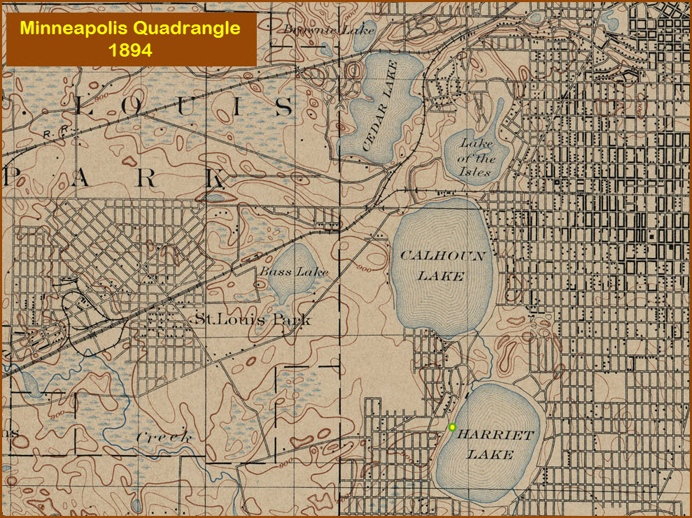
From Wikipedia: Lake Harriet is a lake in the southwest part of Minneapolis, just
south of Lake Calhoun and north of Minnehaha Creek. The lake is
surrounded by parkland as part of the Minneapolis Chain of Lakes. The
lake has an area of 335 acres (1.36 km2)
and a maximum depth of 85 feet (26 m).
Lake Harriet is very popular for recreation. It offers sailing, two
beaches, and a system of bike and pedestrian trails (about 3.05 miles
(4.91 km) for the bike trail and 2.95 miles (4.75 km) for the pedestrian
trail). The trail and parkway system, part of the Grand Rounds Scenic Byway,
connects with Lake Calhoun on the north end via William Berry Parkway and
with the Minnehaha Creek trail system on the southeast corner. The
north end of the lake also offers a bandshell, which is used in the summer
months for concerts, and a refreshment stand. A preserved section of
the
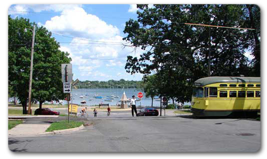
Como-Harriet Streetcar Line runs between Lake Calhoun and the west side
of Lake Harriet. It is a popular spot for Ingress Players and
Geocachers.
The Bandshell: Every summer, Lake Harriet is host to many concerts in its castle-shaped
Bandshell. Music has been a part of the lake since the first pavilion
was built on the property of
Thomas Lowry in 1888. The bandshell stood on the edge of Lake Harriet
until 1891 when it was destroyed by fire. After the fire, Minneapolis hired
Architect Harry Jones to design the next bandshell. The ‘Pagoda Pavilion’
overlooked the lake until 1903 when it was destroyed by fire. Another Bandshell, again designed by Harry Jones was built in 1904 but was destroyed
on July 8, 1925 in a windstorm. A new bandshell was erected in 1927 and
remained until 1985 when the modern bandshell was built.
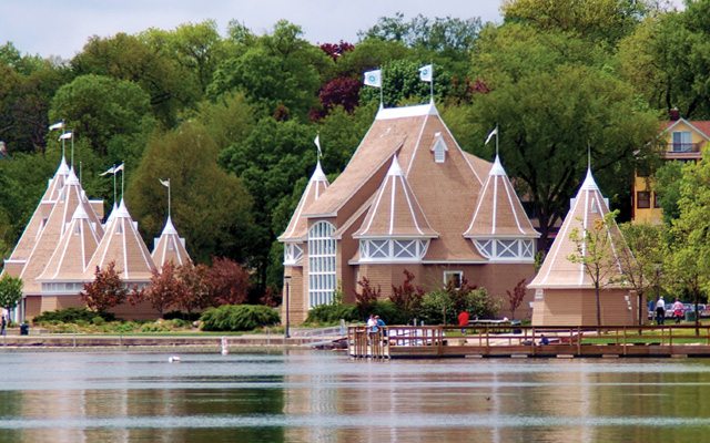
The picture above at left shows the current bandshell in blue, but in
2004 developer Mark McGowan organized an all-volunteer completely free
restoration of the buildings. To complete the free restoration, McGowan
obtained $650,000 in donated labor and materials from local and national
companies. Through these efforts, the bandshell, refectory and sailing club
have been repaired and repainted to a light brown color, shown above right. To celebrate the free restoration, an all-day music festival, called "Lake
Harriet Live!, was held September 19, 2004.
During the fall of 2006, construction of a new patio and picnic shelter
built to match the design of the original buildings was begun next to the
concessions. Construction of the new building and picnic area have been
completed.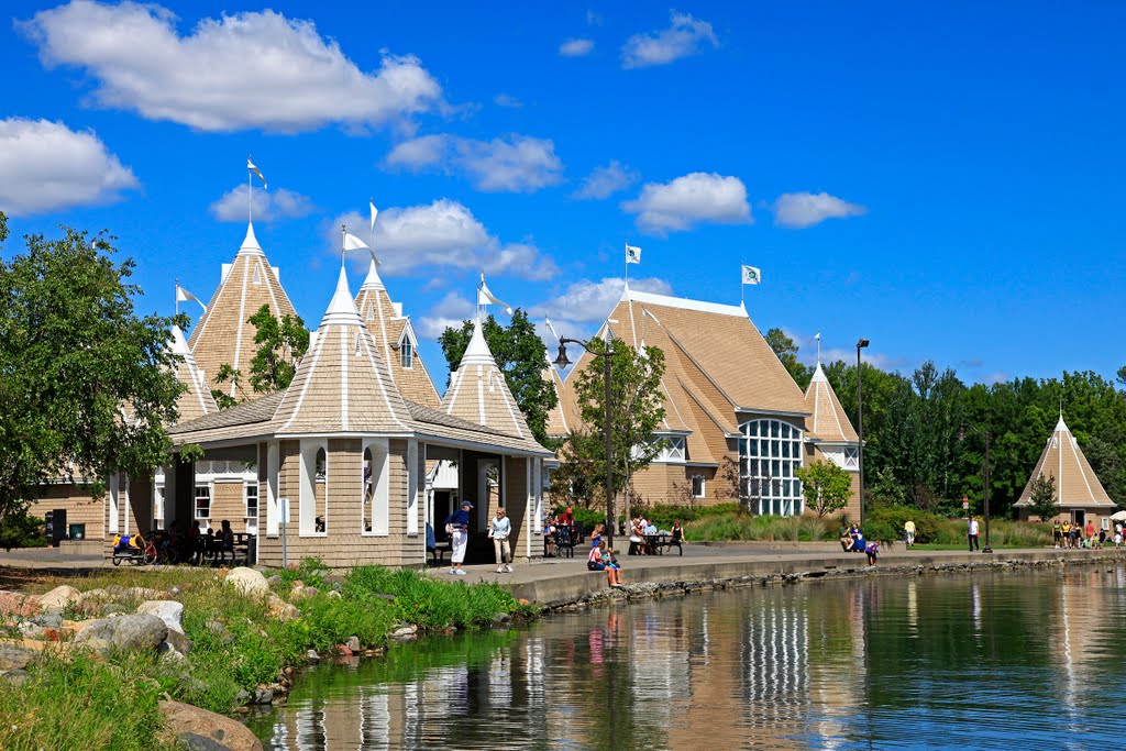
By the way, floobydust is
a term I picked up 30-40 years ago from a National Semiconductor data
book, and means miscellaneous and/or other stuff.
Pictures and additional information is always needed if anyone feels
inclined to take 'em, send 'em, and share 'em, or if you have
something to add or correct.... credit is always given! BE NICE!!! Contact info
is here
RAILROAD SIGNALS HOME
Last Modified
19-Jul-2015