In General
the Signals
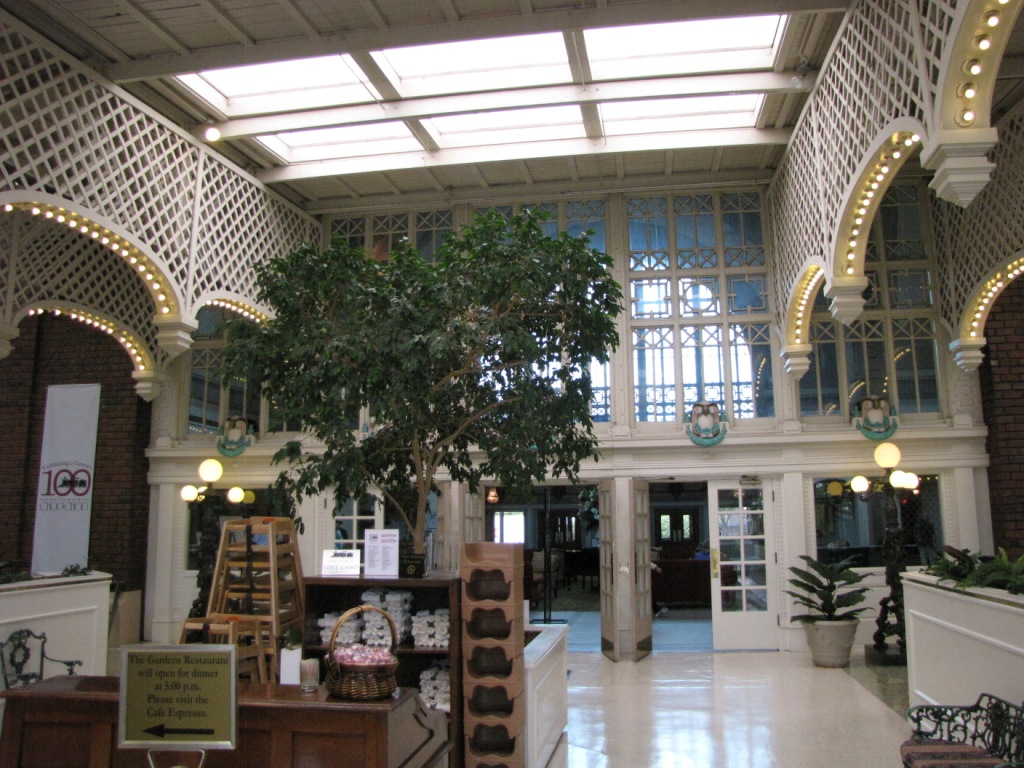
the Hotel
the Train
the Trolley
Floobydust
In General
the Signals
the Hotel
the Train
the Trolley
Floobydust
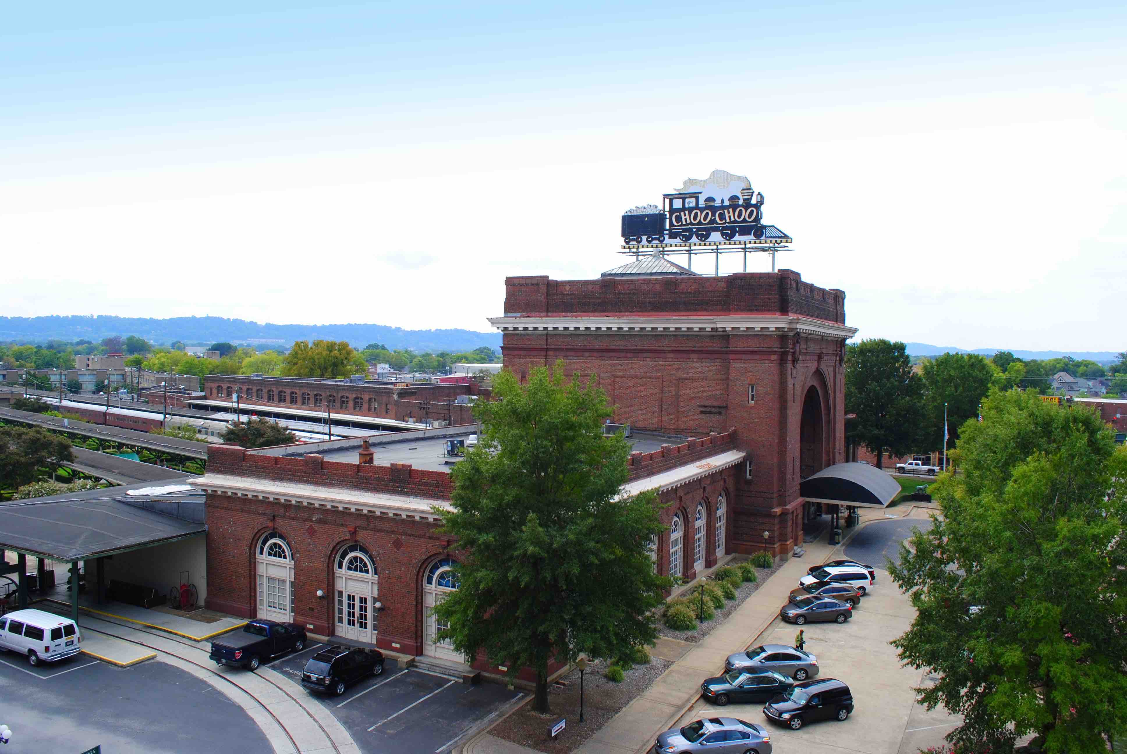
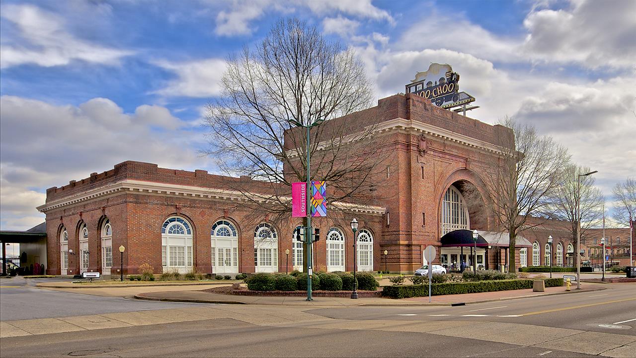
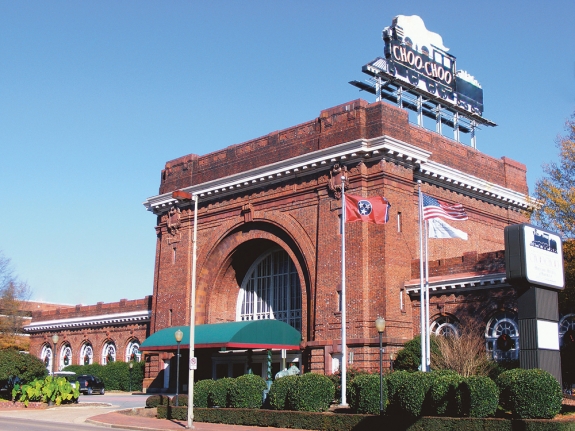
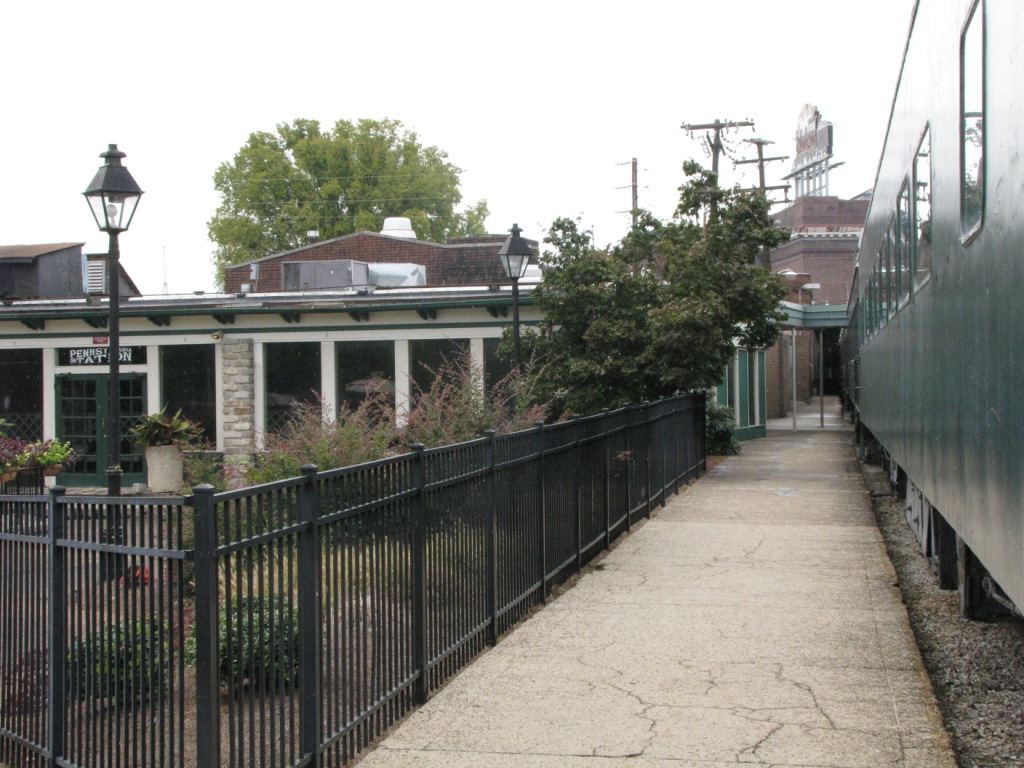
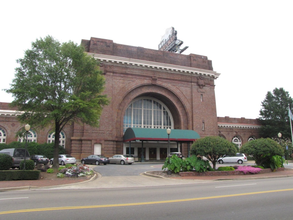
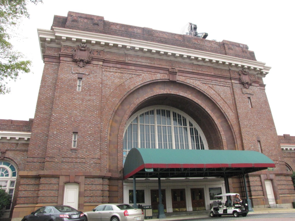
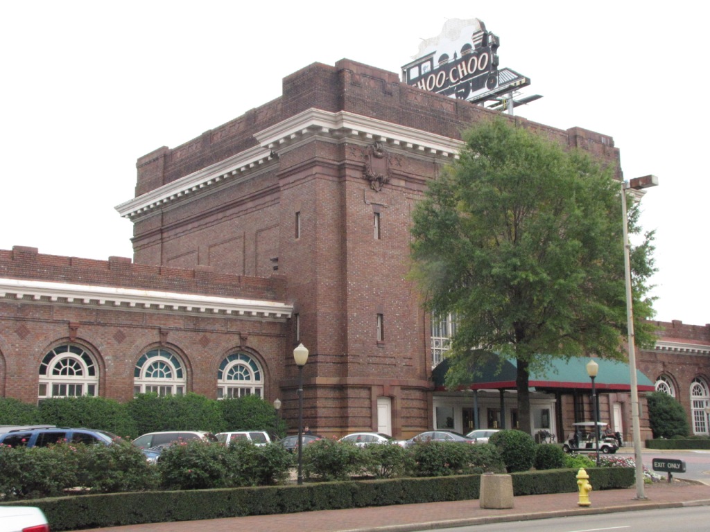
While the Chattanooga Choo-Choo is technically not a museum, it is still very worthwhile stopping here for the things it does has and the depot which is now a hotel.
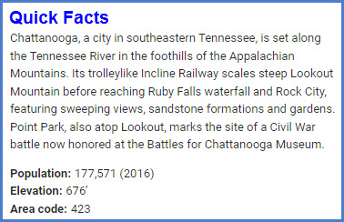
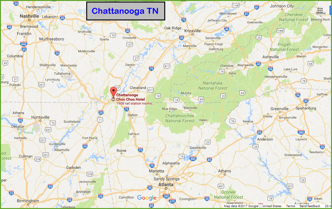
Chattanooga is nestled away in the very southern part of Tennessee, and easy to get to from just about anywhere, but especially from Atlanta, Nashville, and Knoxville.
Chattanooga is also the home of the NMRA, National Model Railroad Association.
I'd like to thank my wife Dianne for
putting up with a visit to the Choo Choo on the way home from Georgia.
Heading north out of Chattanooga is a Norfolk Southern line, and it is nicknamed
"the Rathole".... mostly inaccessible railfanning in a very mountainous area in
Tennessee and Kentucky, on its way to Cincinnati. Denver Todd has put
together a great guide to the Rathole at the link below.
Since my website is signal oriented,
we'll start off with them.
Acknowledgements: Getting Here Floobydust
Denver Todd
Websites and other additional information sources of interest for the area:
http://www.choochoo.com/
http://en.wikipedia.org/wiki/Chattanooga_Choo_Choo
http://www.gregariousrailfan.com/RatHole.html
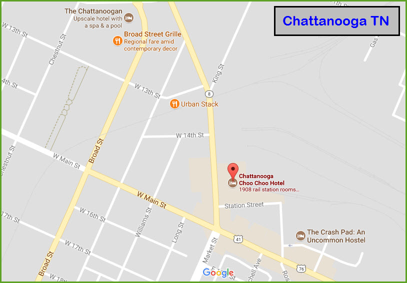
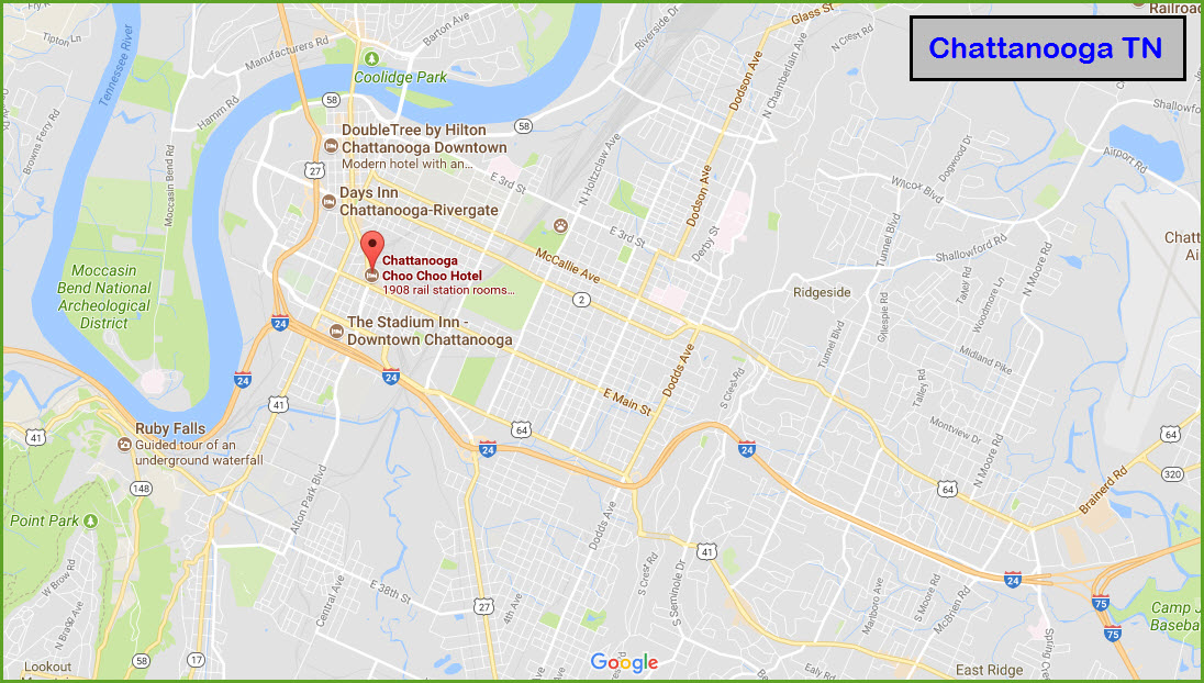
From the south and Atlanta via I75: Heading north on i75, a few miles into Tennessee, you come to the junction of I75 and I24, follow the signs for westbound I24, and
in 4 or 5 miles, you'll come to the Market St exit, exit 178. Head north on Market to the Hotel on your right in about a mile or so.
From the west: come into town via I24 from Nashville, and take exit 178 north, which will put you on Broad St. Take any of the streets over to Market, like 20th,
17th, or Main St (a right turn). From Nashville, you have I65 running north into Kentucky (Louisville), and south into Alabama (Birmingham and Hunstsville - altho
from Huntsville, I would be tempted to get here via US72 east out of town).
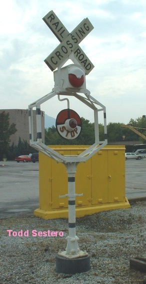
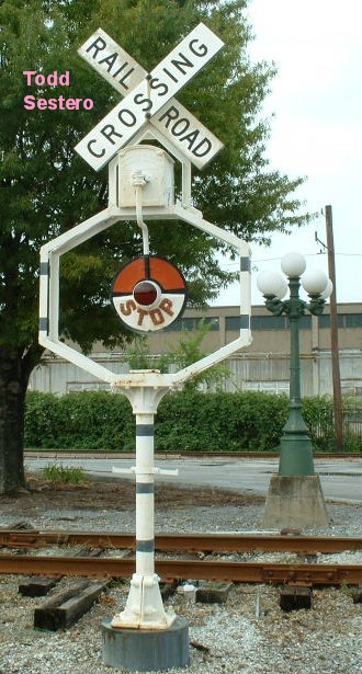
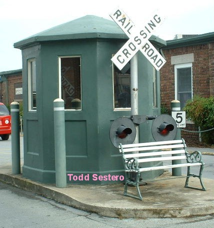
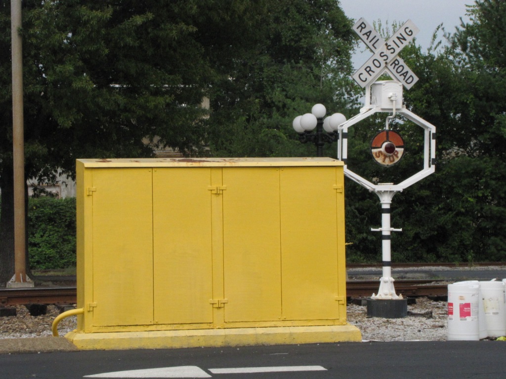
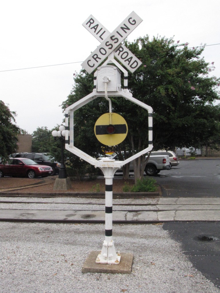
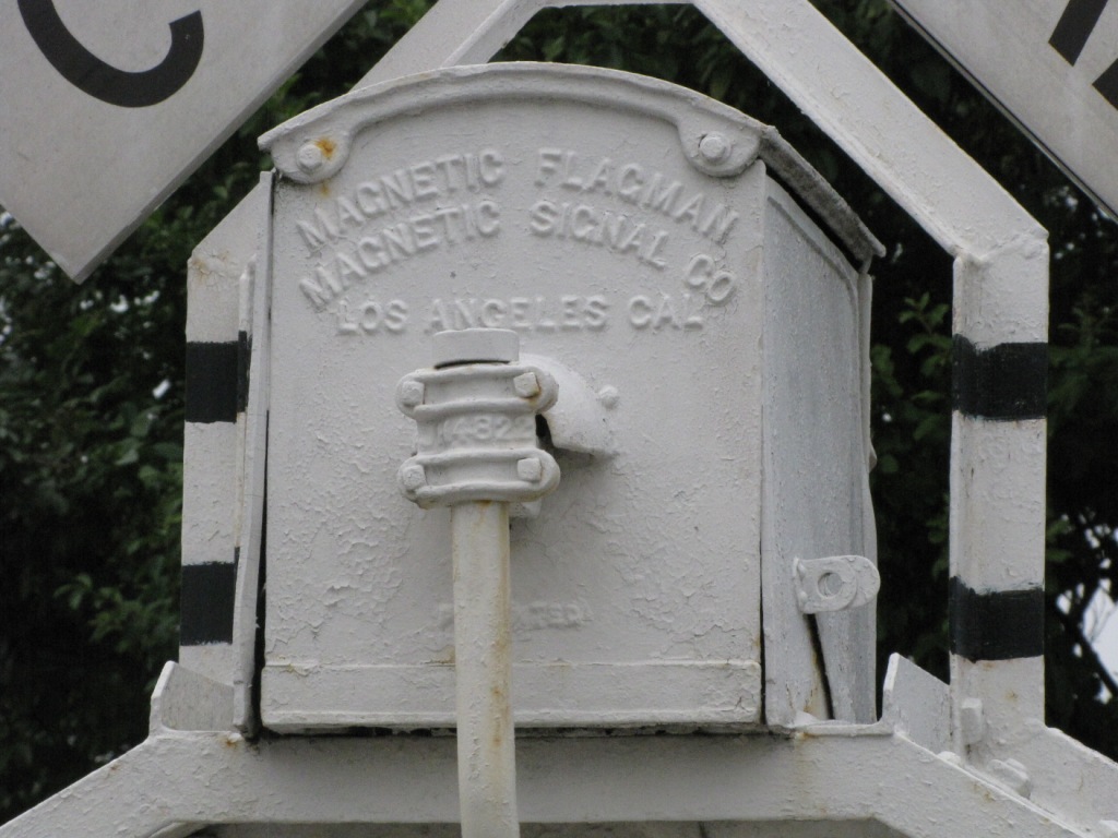
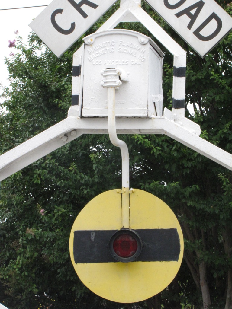
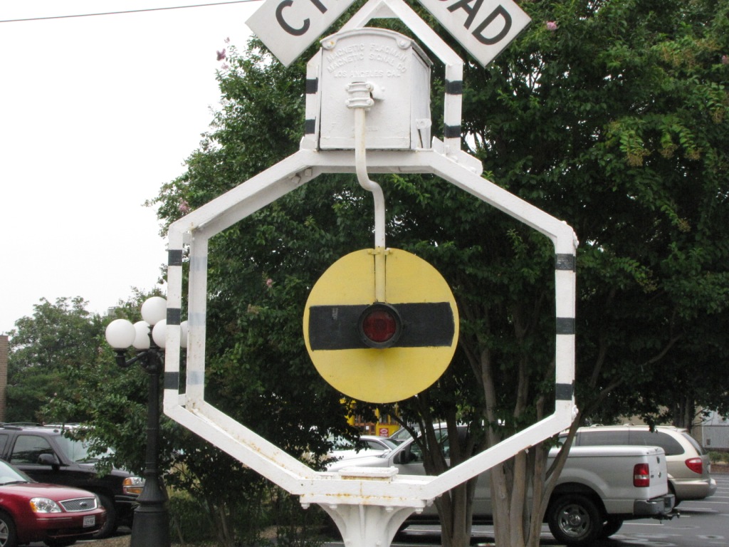
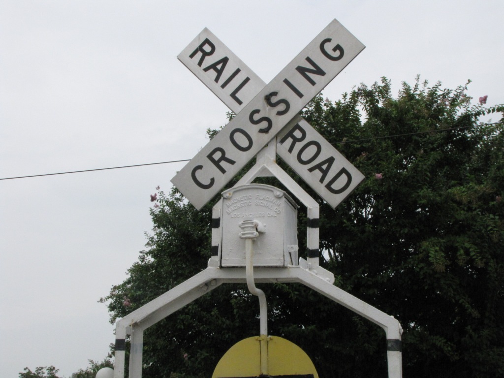
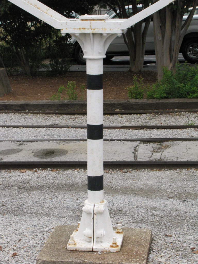
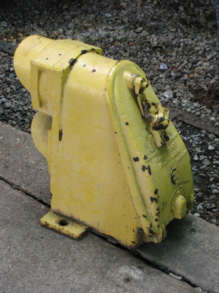
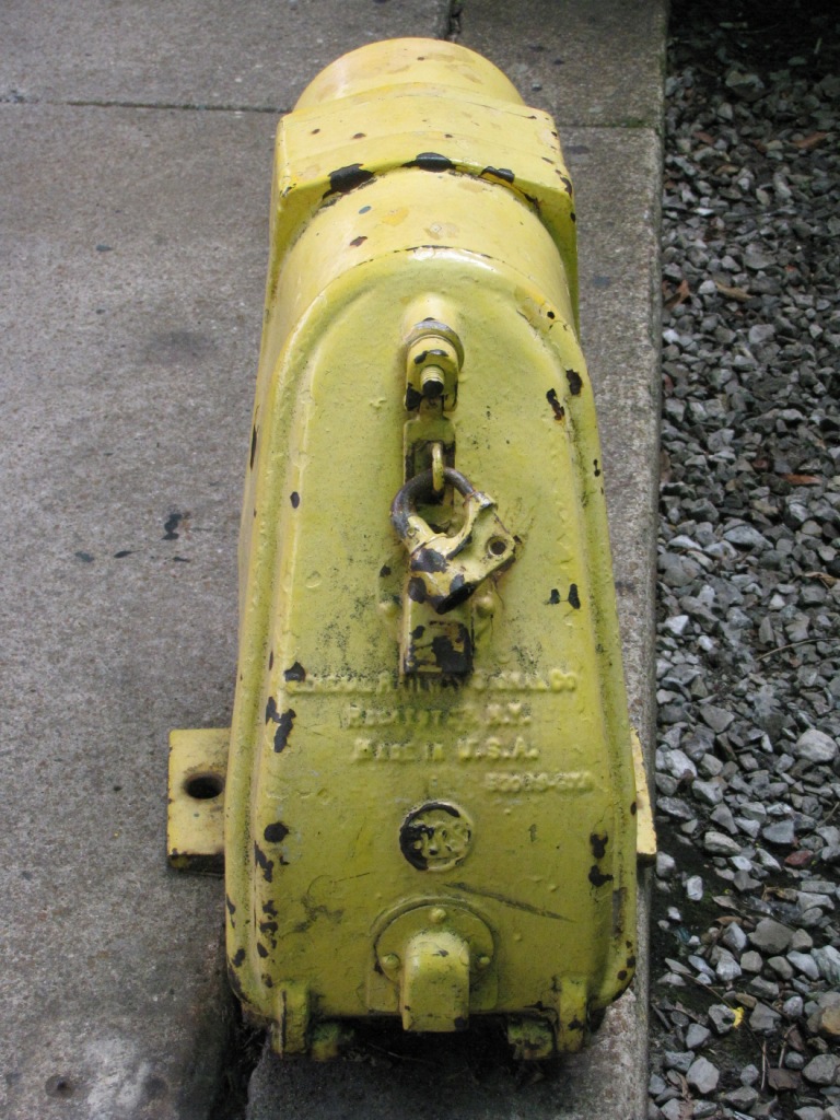
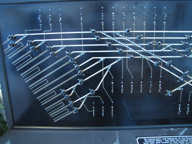
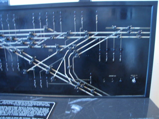
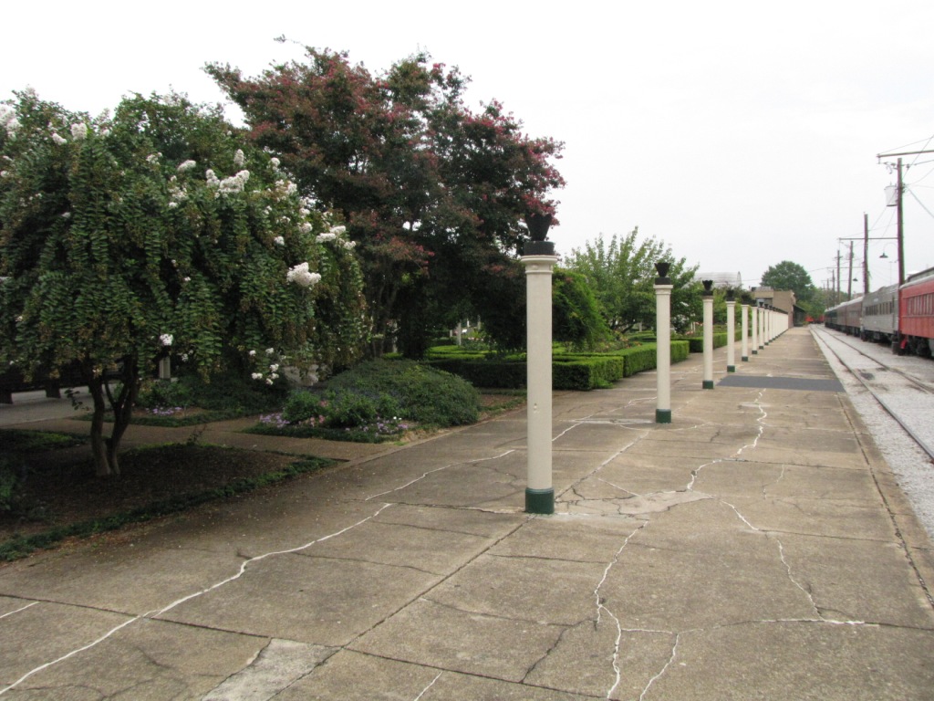
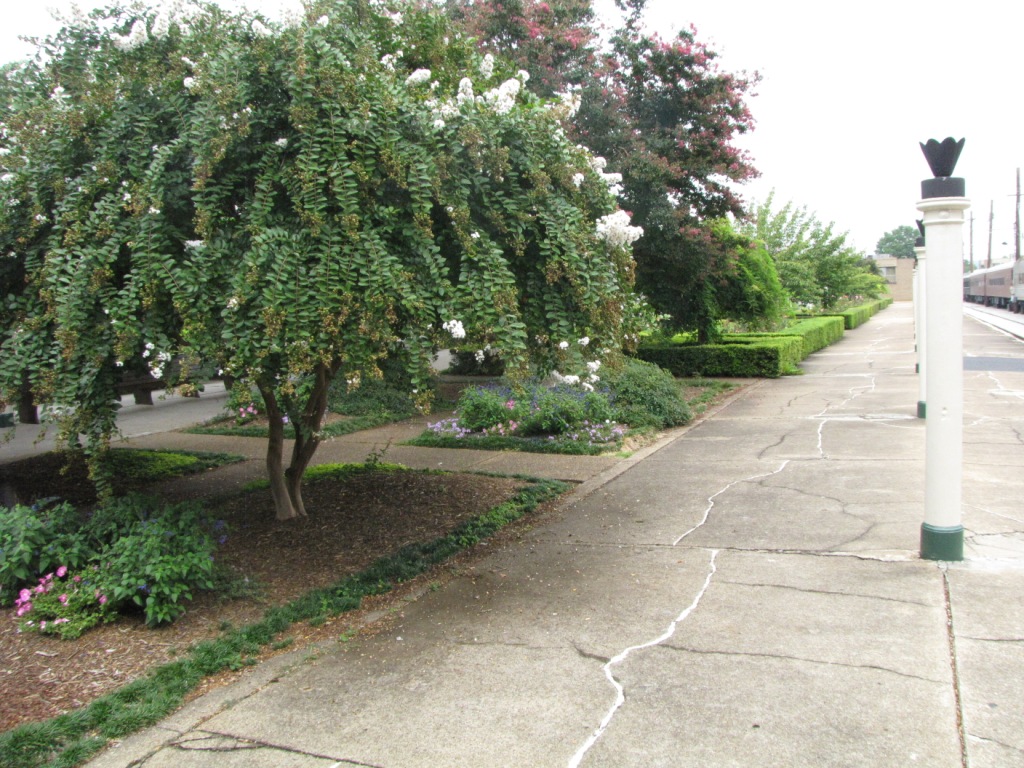
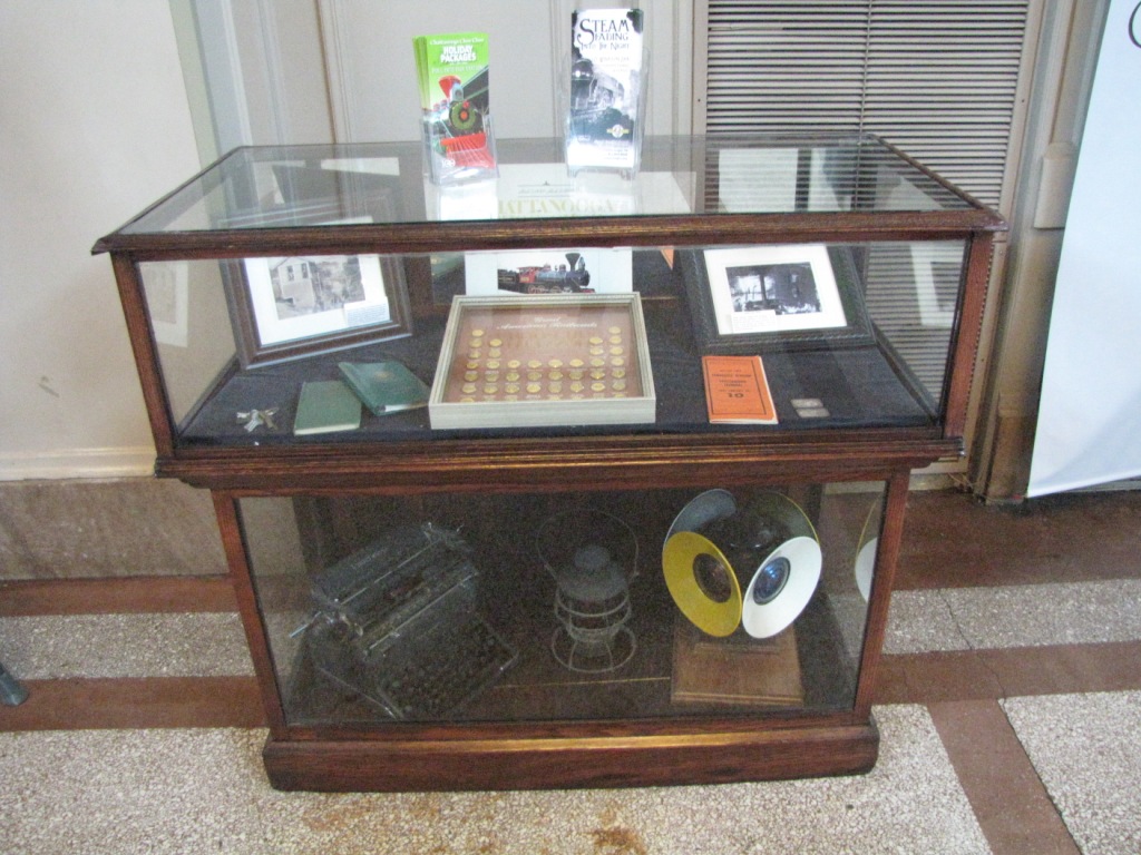
I can't tell you much about the signals here at the Choo-Choo Hotel, other than who made them. There was no-one around that knew anything about them, and there is
no information anywhere on the grounds that I could find that might tell me something. Darn.
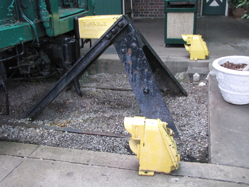
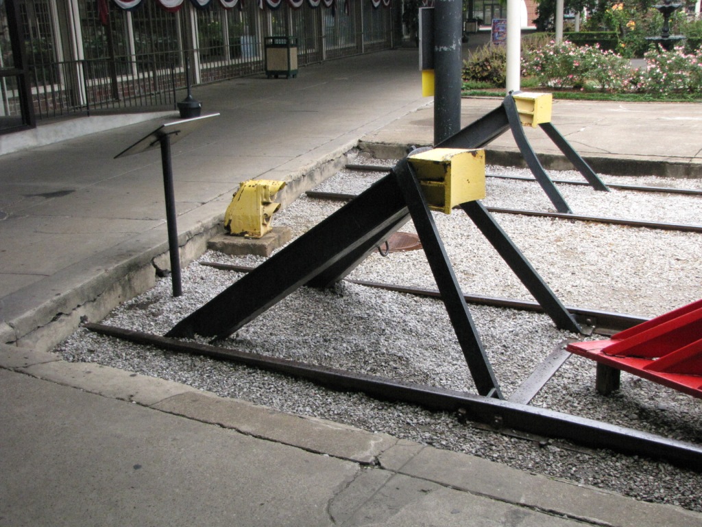
The platform signals are probably the originals from when trains backed into the station, and are made by GRS.
The wig-wags are made by Magnetic Flagman of Los Angles CA.
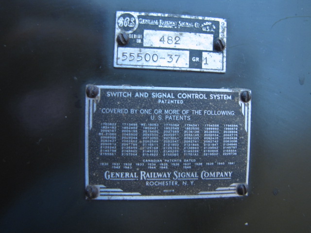
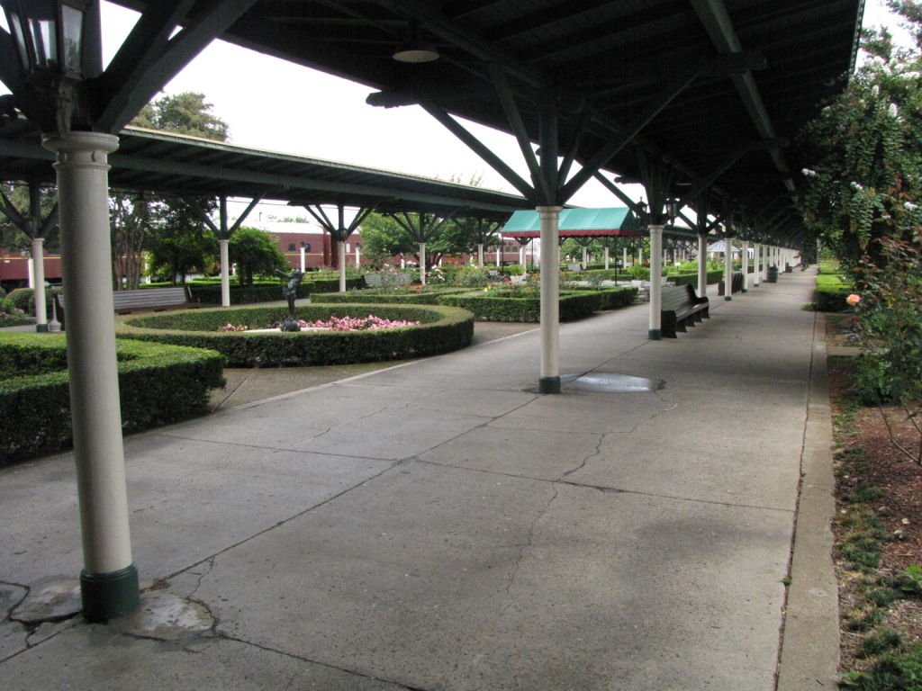
The interlocking machine is manufactured by GRS, and is on display in the lobby.


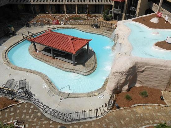
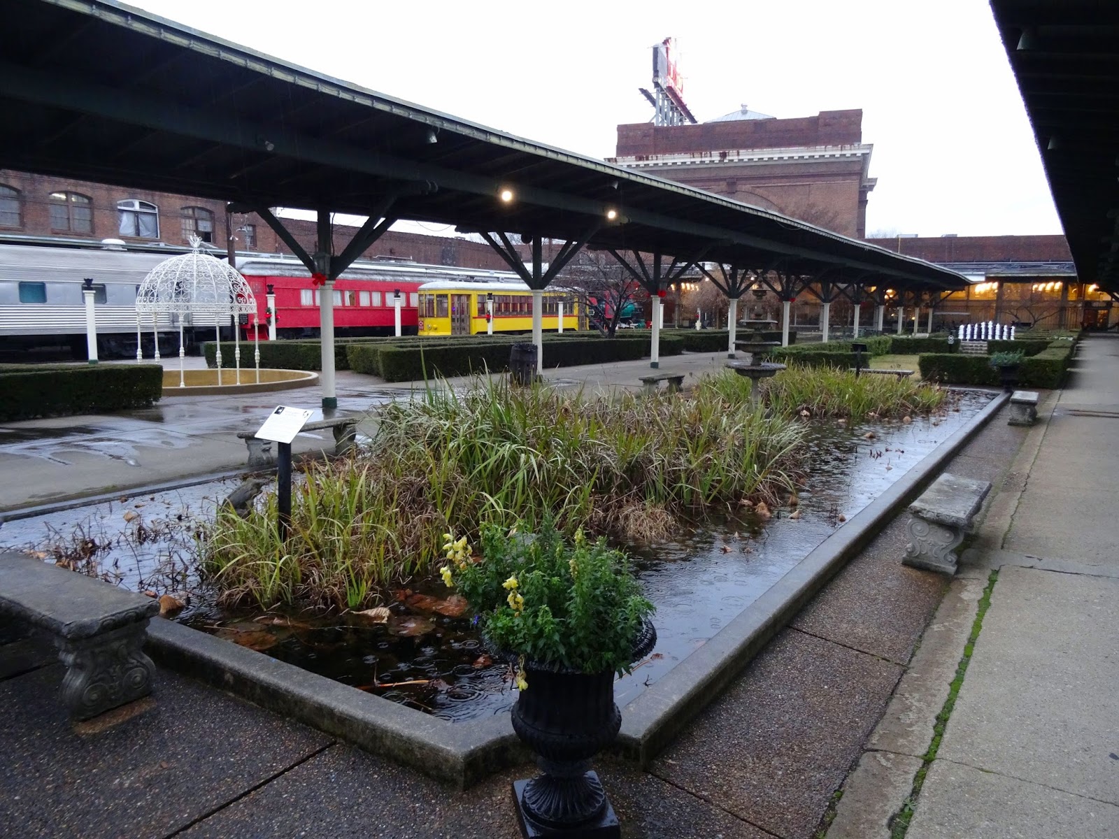
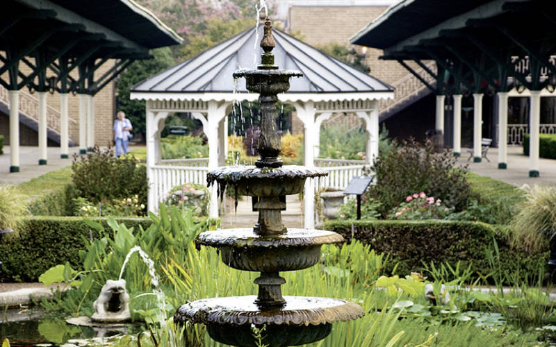
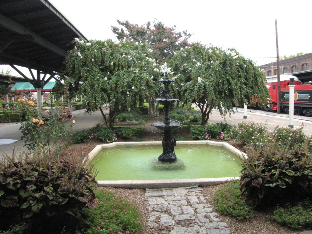
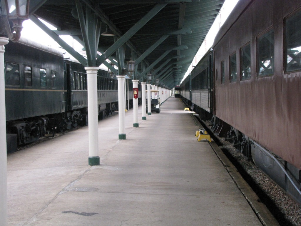
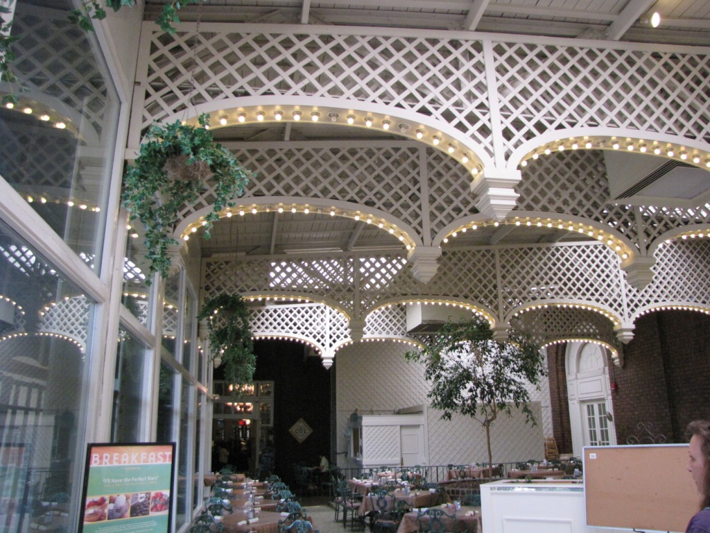
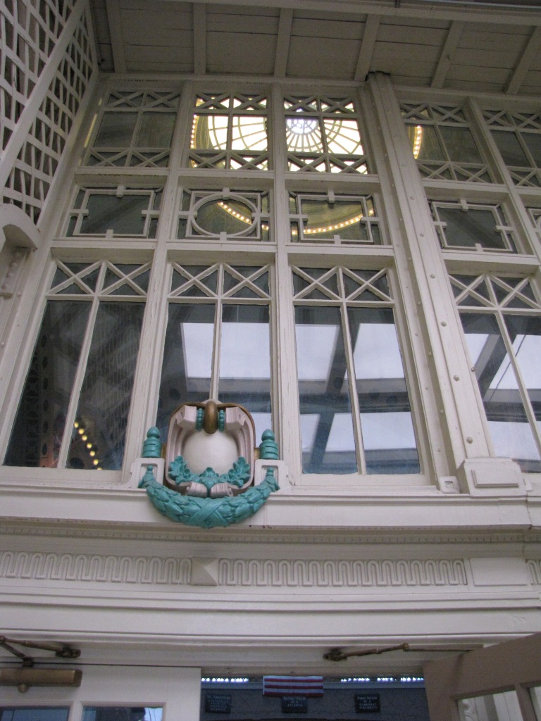
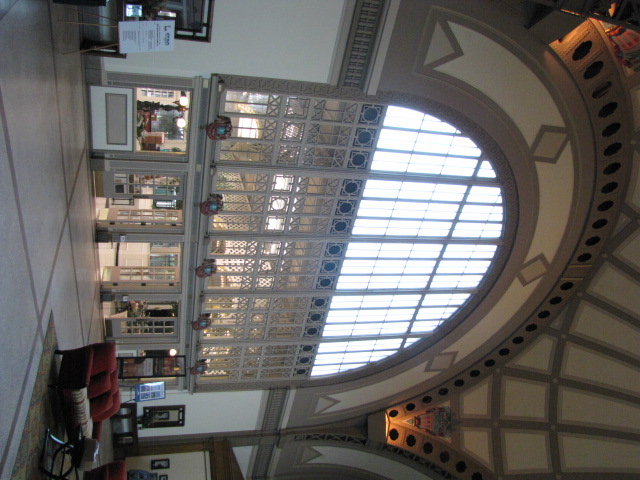
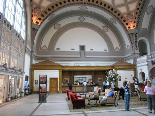
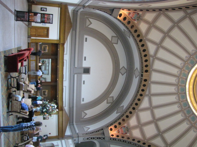
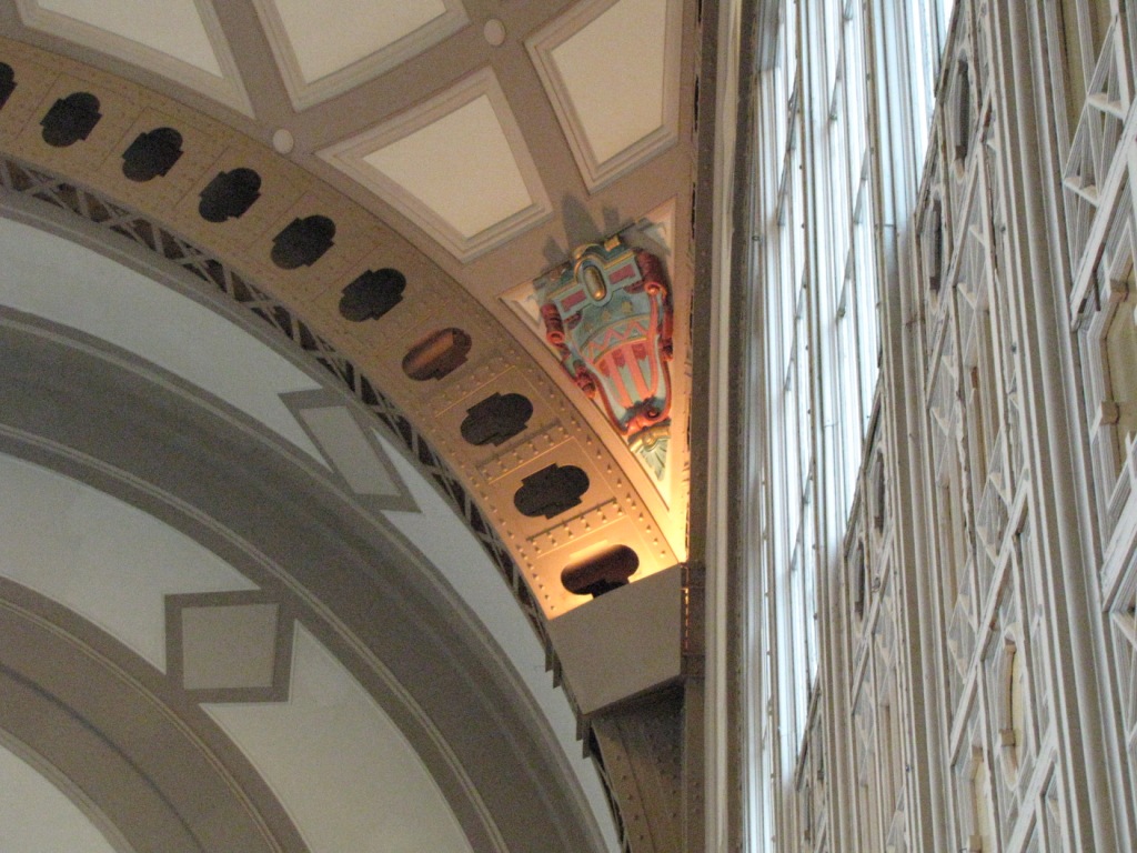
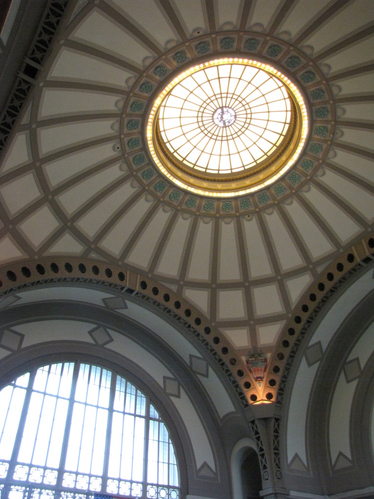
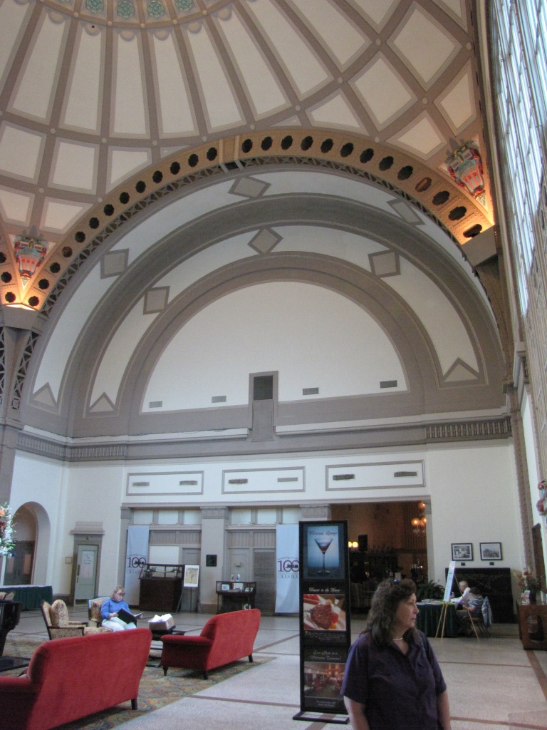
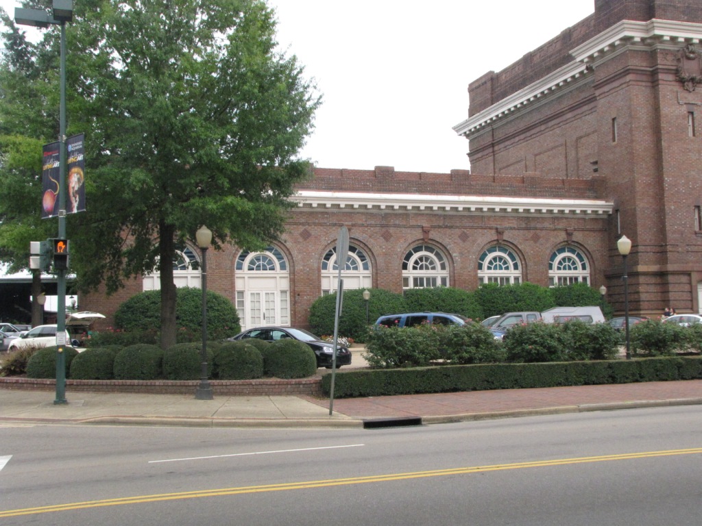
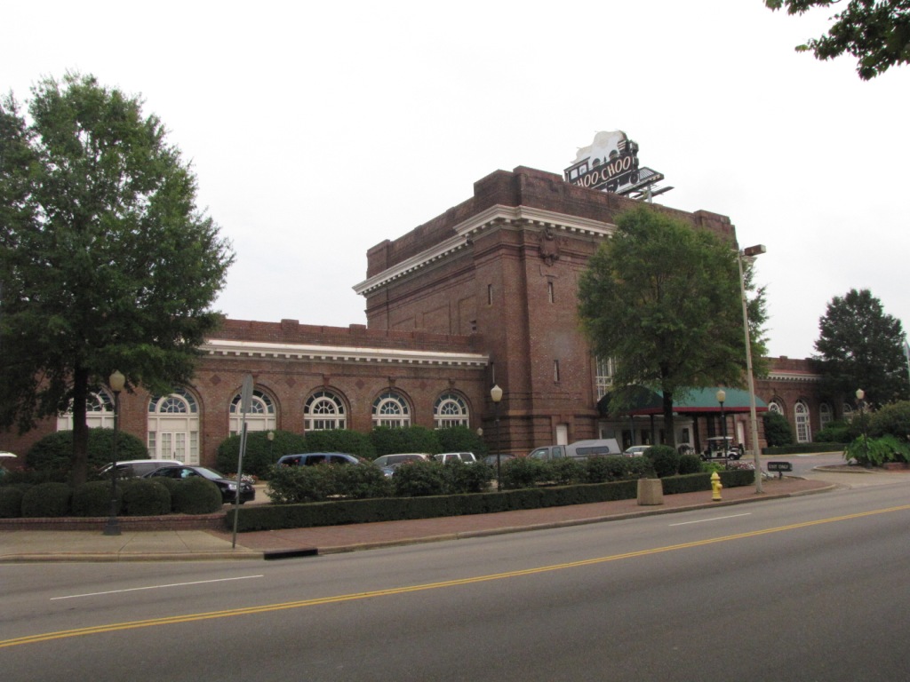
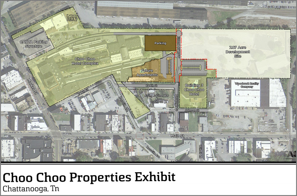
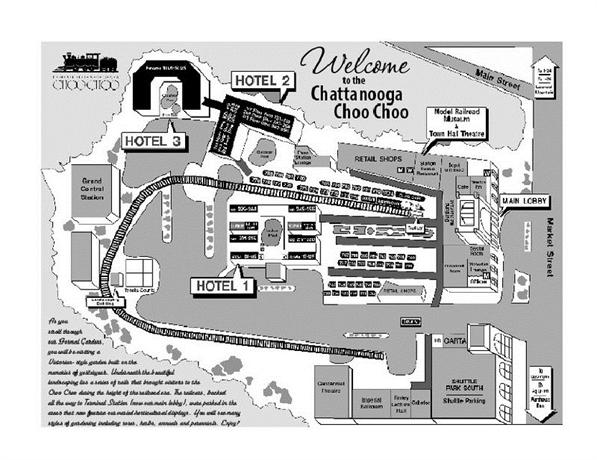
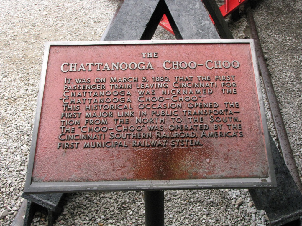
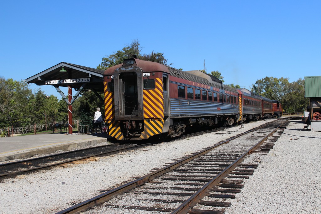
The hotel is in what used to be the former Terminal Station under the Southern Railway, and saw it's last train in 1970. The depot was built in 1908, and saw
it's first train in 1909. It opened as a hotel in 1973.
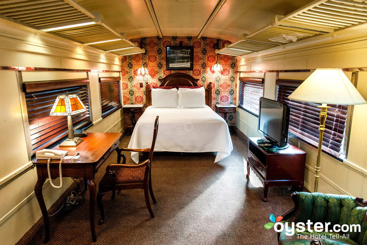
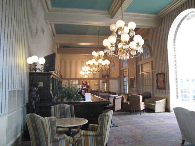
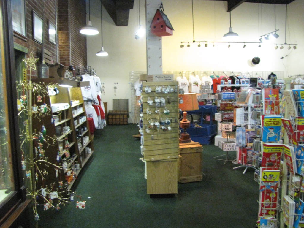
In addition to staying at the hotel, you can stay in half of a restored passenger car (of which there are several).
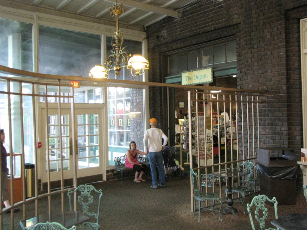
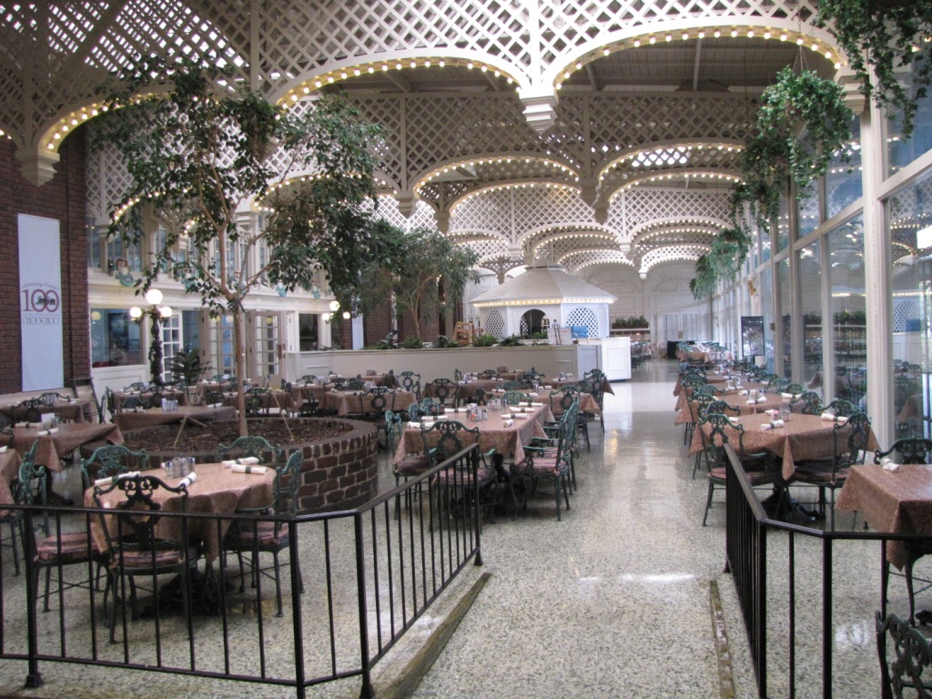
There are several places to eat at the complex, including a top rated diner in a restored dining car, the main restaurant, or a sandwich shop which is open when
everything else is closed.
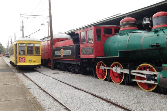

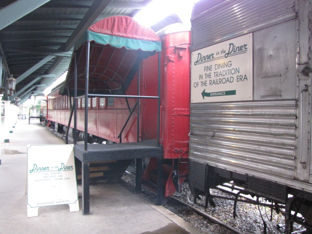


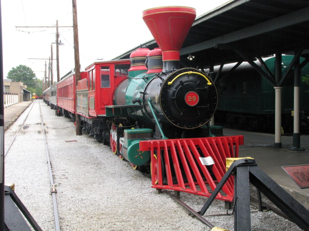
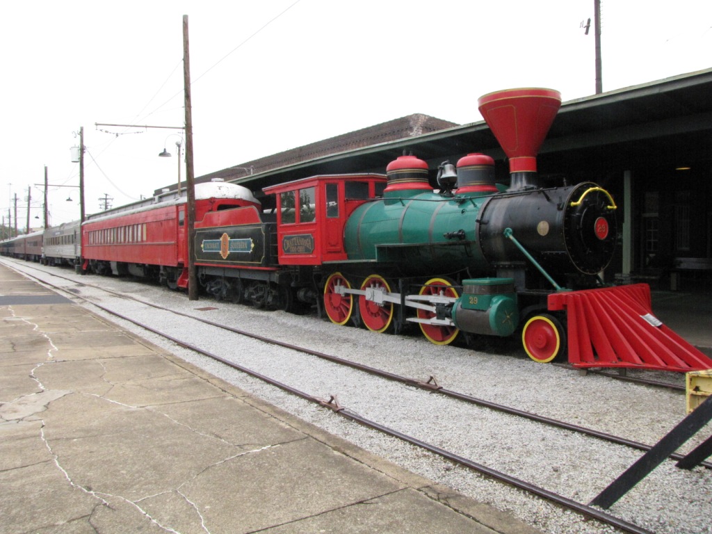
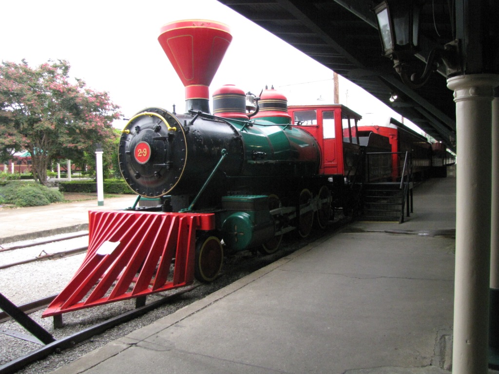
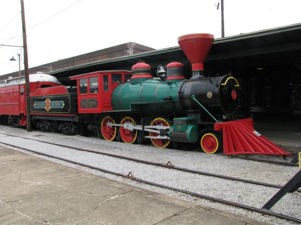
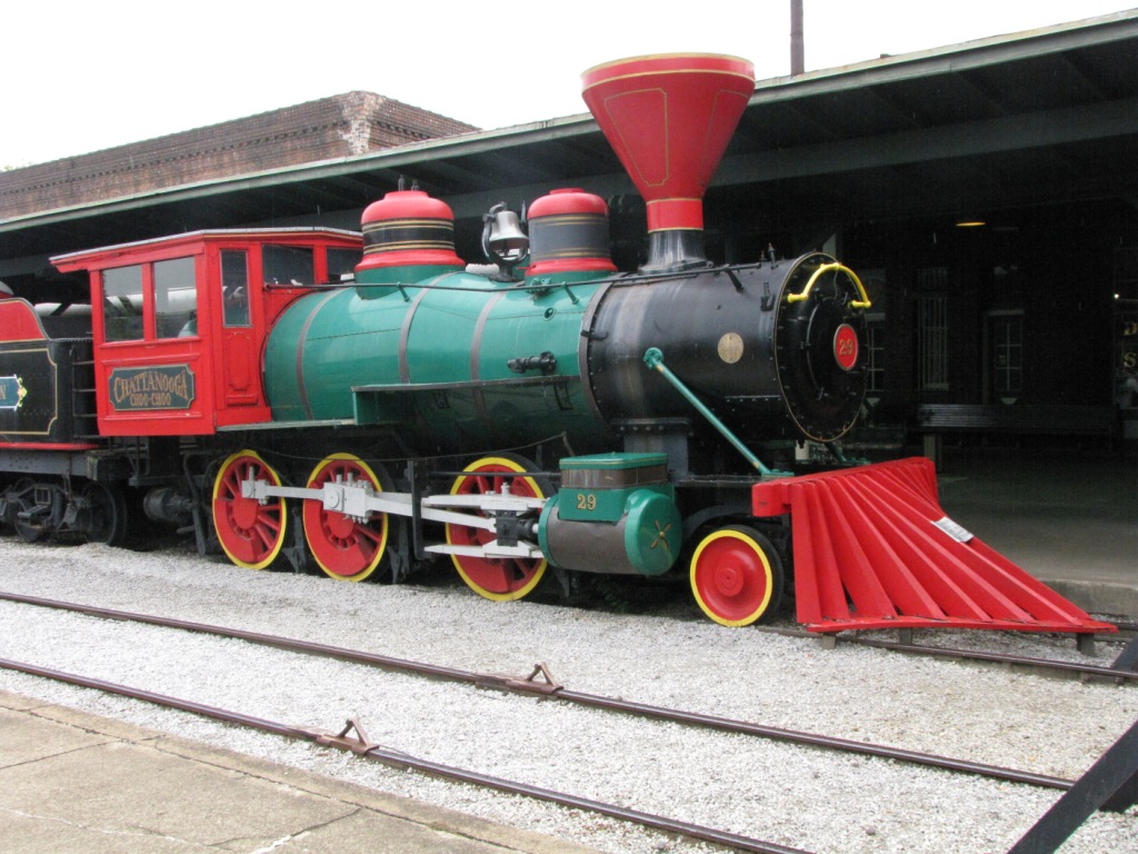
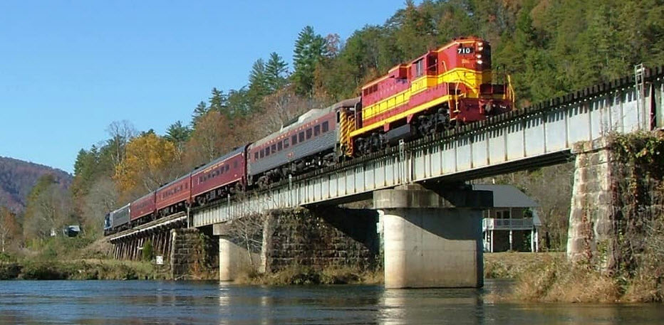
The Hotel's website doesn't give too much info on the train, except that it was built by Baldwin in 1880, and is the same as
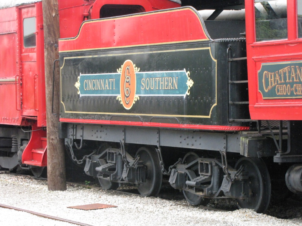
the trains that used to run between Cincinnati and Chattanooga. The railroad, as noted in the plaque, was the Cincinnati Southern Railroad.
It was last used by the Smokey Mountain RR in the 1940's, between Knoxville and the Smokey Mountains, refurbished, and then brought to the hotel.
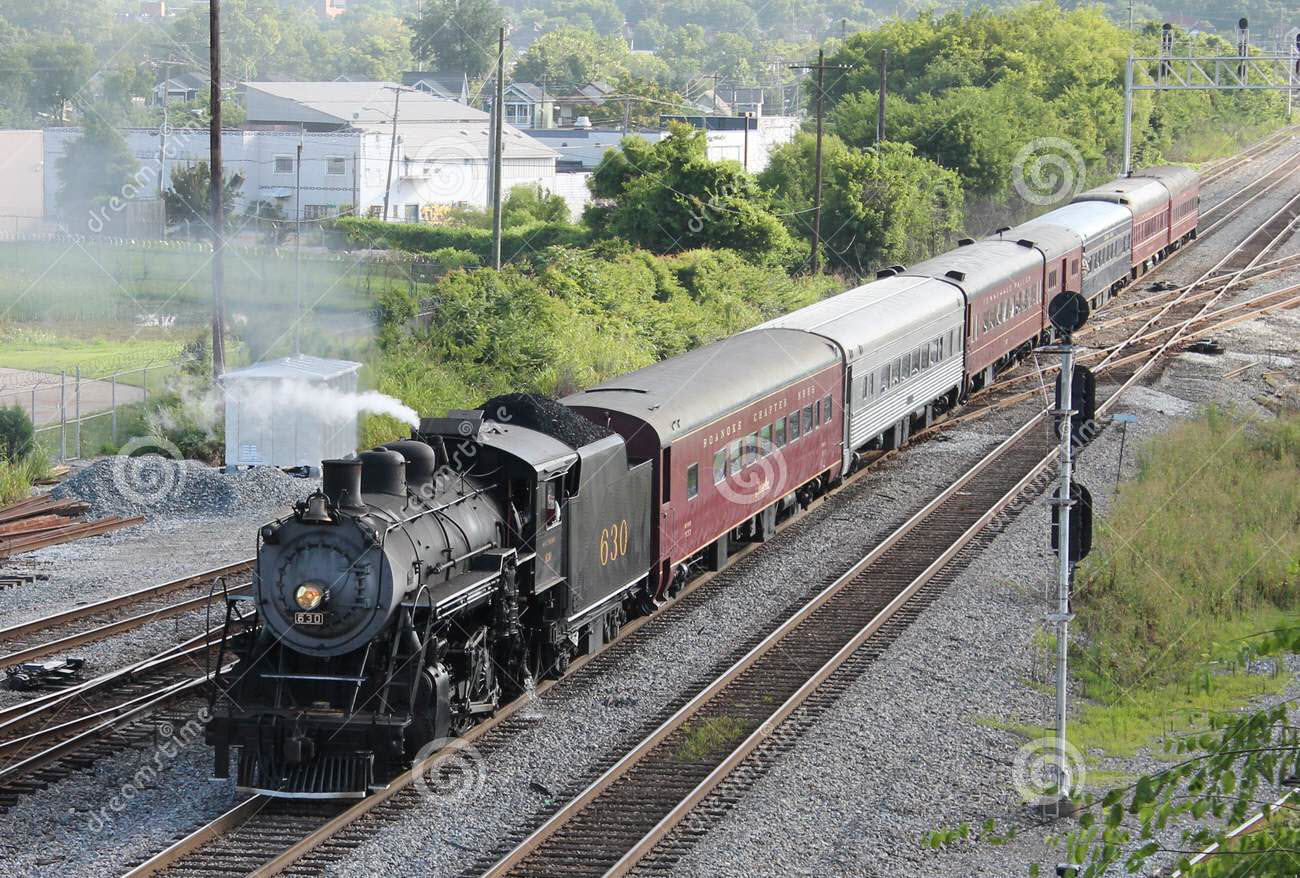
The song "Chattanooga Choo Choo" did not refer to any particular train, although it is often connected to the L&N's Dixie Limited or the
Southern's Crescent Limited. The song was done by Glenn Miller and first appeared in the 1941 movie "Sun Valley Serenade
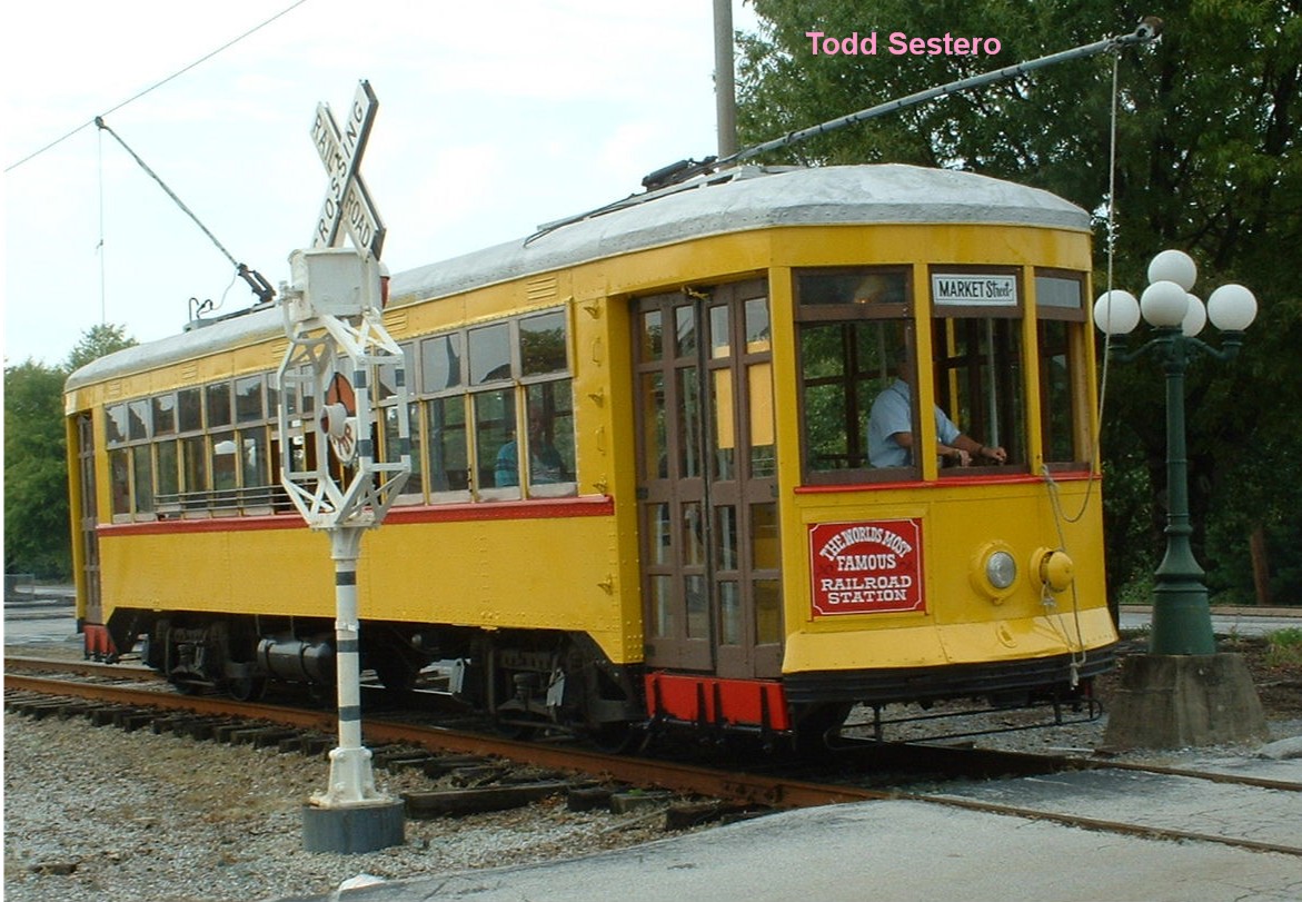
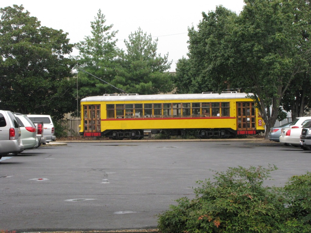
An excerpt from the Choo-Choo's webpage about their trolley:
Pearly Thomas Car Works of High Point NC, built the Choo Choo’s trolley in 1924. The reversible seats were constructed in
Philadelphia, PA. The Trolley operated on the Canal Street Line in New Orleans from 1924 to 1960. The Tennessee Valley Railroad
Museum obtained the Trolley in 1964 and brought it to Chattanooga. After being restored in Georgia, the Trolley began operating on opening day at
the Chattanooga Choo Choo in 1973.
The hours are as follows:
Sunday - Thursday at 11:00am, 1:00pm, 3:00pm
Friday & Saturday at 11:00am, 1:00pm, 3:00pm, 4:00pm
Other Local Attractions
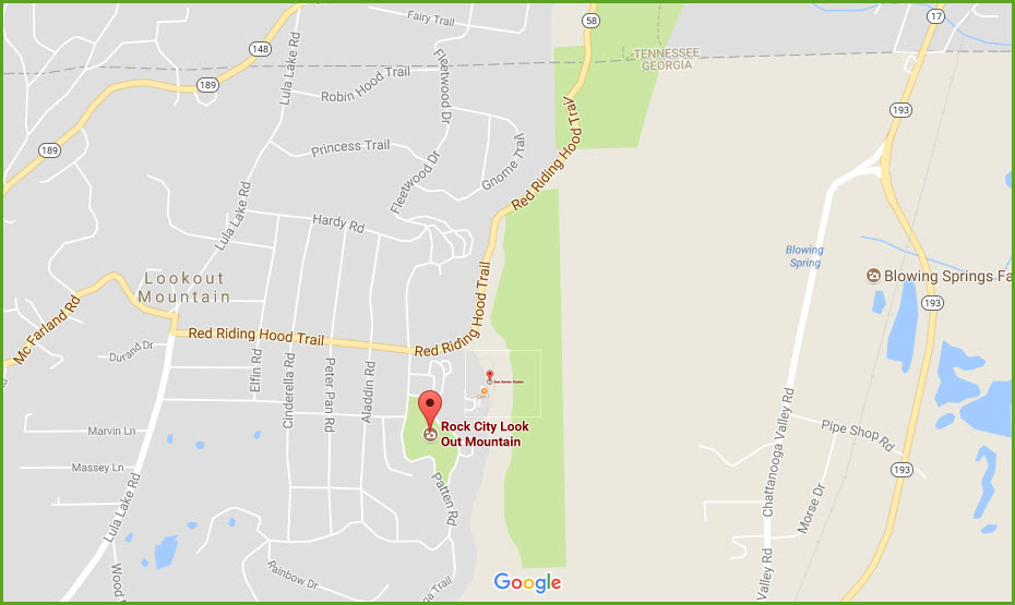
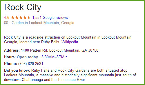
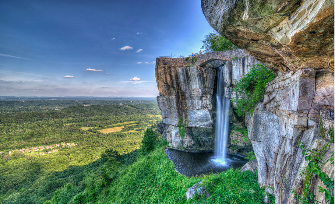
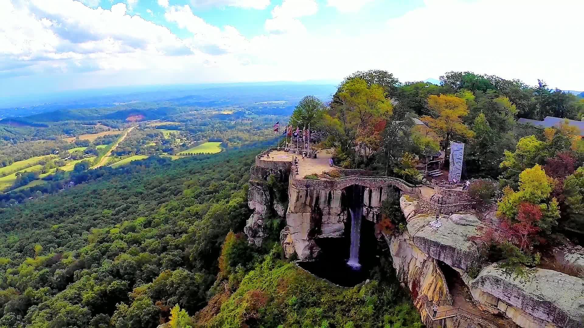
Rock City GA
GPS Coordinates: 34.973602, -85.349582
1400 Patten Rd, Lookout Mountain, GA 30750
A particularly beautiful waterfall in a beautiful setting.
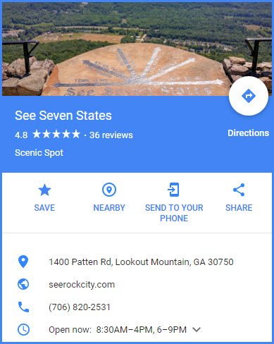
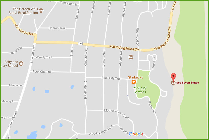
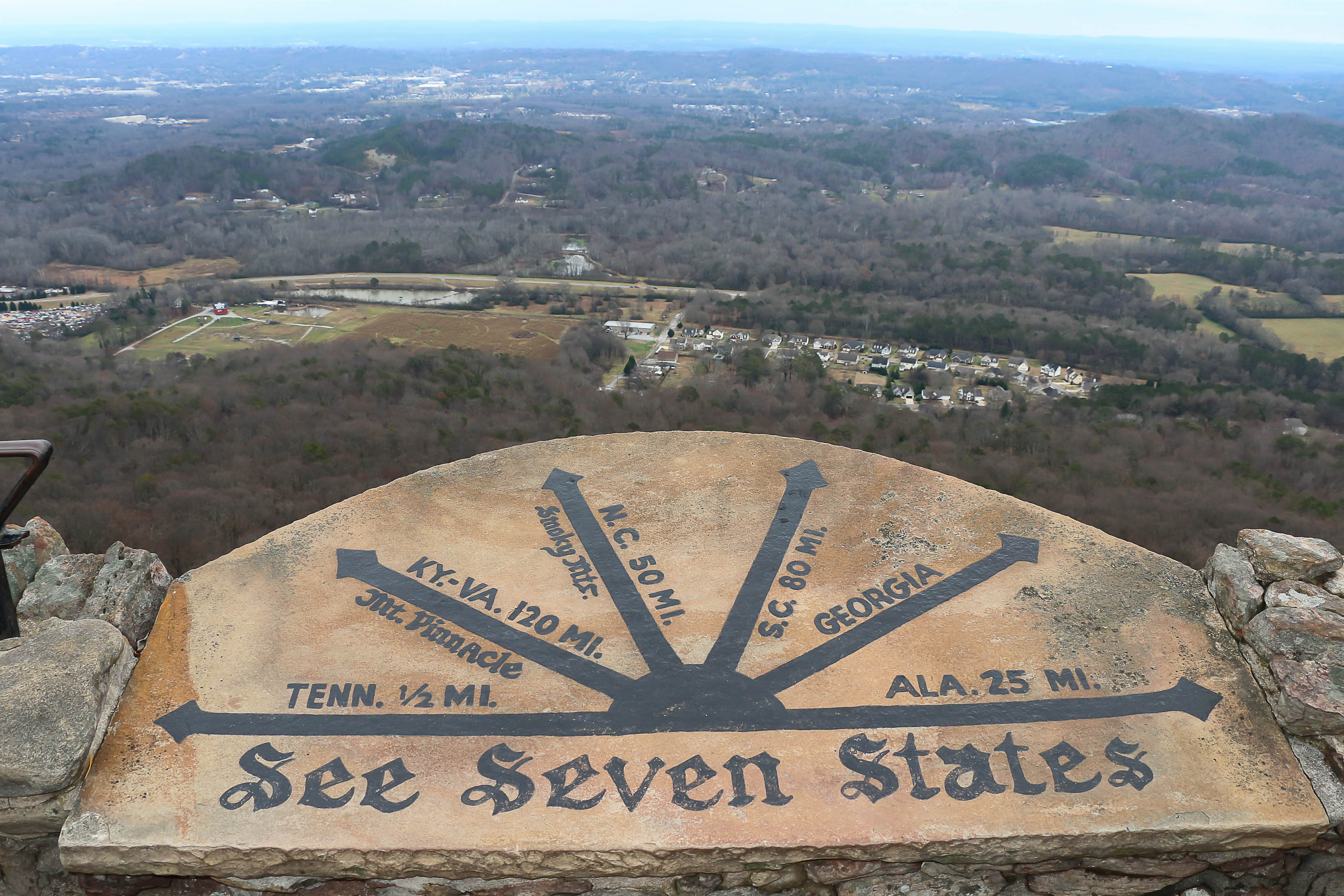
See Seven States GA
GPS Coordinates: 34.973850, -85.347644
1400 Patten Rd, Lookout Mountain, GA 30750
This is part of the Rock City attraction.
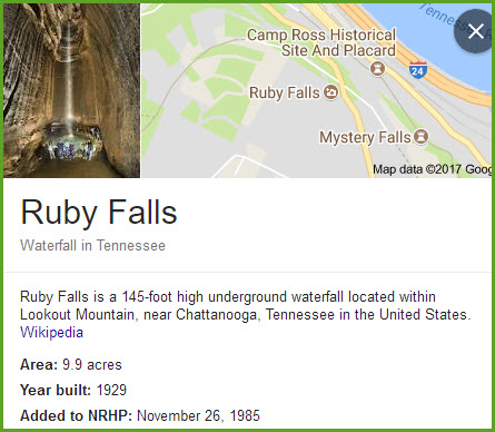
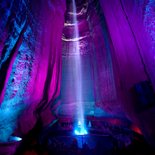
Ruby Falls TN
GPS Coordinates: 35.019080, -85.339372
1720 Scenic Hwy, Chattanooga, TN 37409
http://www.rubyfalls.com/
A beautiful underground waterfall. In 1928, Leo Lambert and a team of excavators found a breathtaking waterfall located over 1,120 feet below the surface of Lookout
Mountain in Chattanooga, TN. Lambert named the falls after his wife, Ruby, and opened the area as a public attraction in 1930. Today, Ruby Falls welcomes thousands
of visitors each year. Come tour the falls for yourself and see why it has been one of the best Chattanooga attractions for over 85 years.
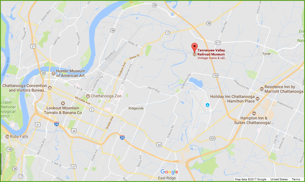
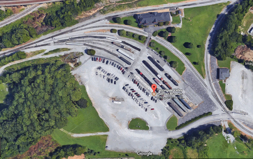
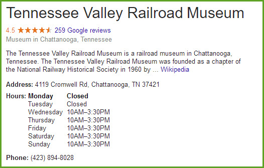
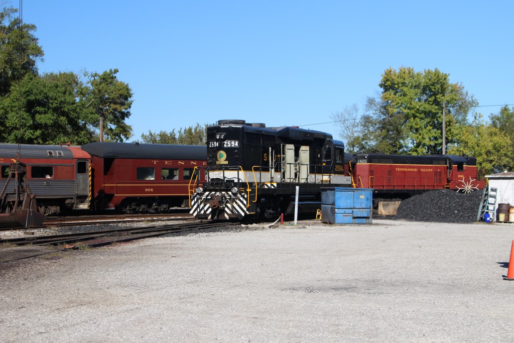
Tennessee Valley Railroad Museum
GPS Coordinates: 35.066980, -85.206117
4119 Cromwell Rd, Chattanooga, TN 37421
Phone: 423-894-8028
http://www.tvrail.com/
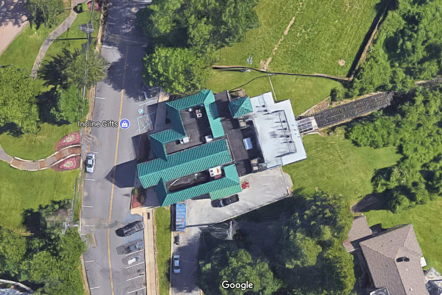
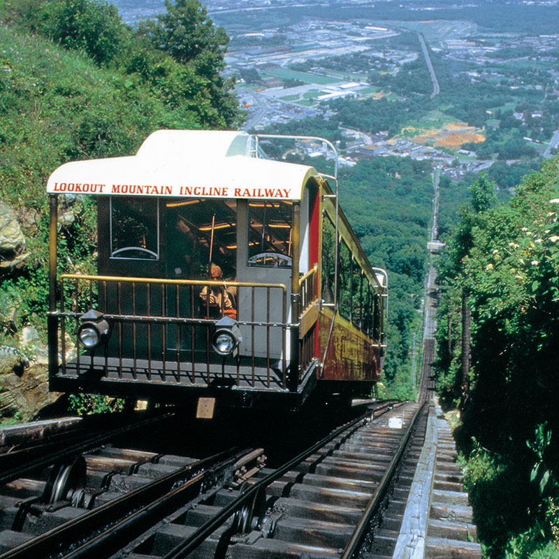
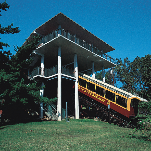
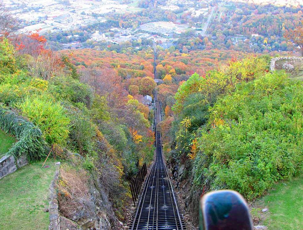
Lookout Mountain Incline Railway
GPS Coordinates, top: 35.005969, -85.343297
GPS Coordinates, bottom: 35.009650, -85.328492
Phone: 423-821-4224
http://www.ridetheincline.com/
One of the "cooler" attractions around, but that's coming from a railfan! :-)
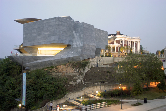
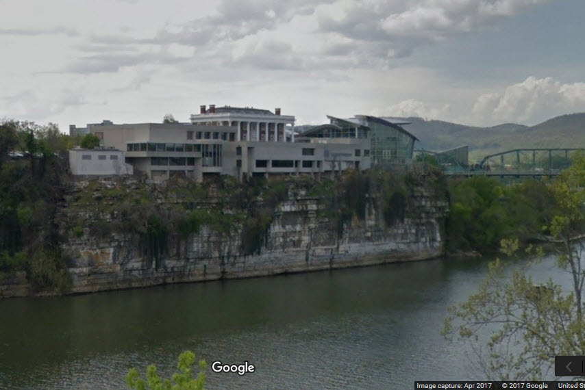
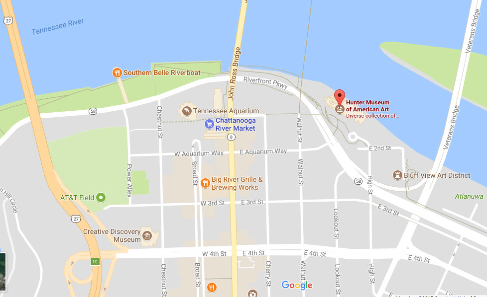
Chattanooga Hunter Museum of American Art
GPS Coordinates: 35.055862, -85.306411
10 Bluff View, Chattanooga, TN 37403
Phone: (423) 267-0968
http://www.huntermuseum.org/
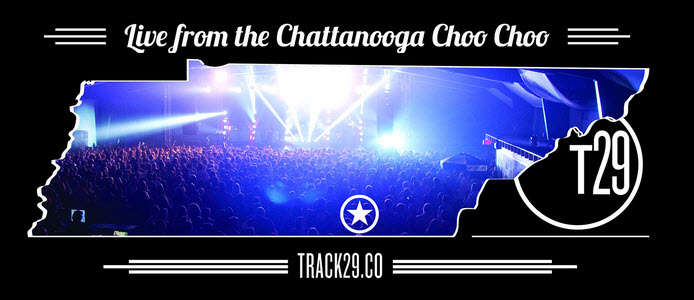
Chattanooga Track 29
Interesting graphic. That's why it's here. Track 29 is Chattanooga's
premier concert venue.
Disclaimers:
I love trains, and I love signals. I am not an expert. My webpages reflect what I find on the topic of the page. This is something I have fun with while
trying to help others.
Please Note: Since the main focus of my two websites is railroad signals, the railfan guides are oriented towards the signal fan being able to locate them.
For those of you into the modeling aspect of our hobby, myindexa page has a list of almost everything railroad oriented
I can think of to provide you with at least a few pictures to help you detail your pike.
If this is a railfan page, every effort has been made to make sure that the information contained on this map and in this railfan guide is correct. Once in a while,
an error may creep in :-)
My philosophy: Pictures and maps are worth a thousand words, especially for railfanning. Text descriptions only get you so far, especially if you get lost or
disoriented. Take along good maps.... a GPS is OK to get somewhere, but maps are still better if you get lost! I belong to AAA, which allows you to get
local maps for free when you visit the local branches. ADC puts out a nice series of county maps for the Washington DC area, but their state maps do not have the
railroads on them. If you can find em, I like the National Geographic map book of the U.S..... good, clear, and concise graphics, and they do a really good job
of showing you where tourist type attractions are, although they too lack the railroads. Other notes about specific areas will show up on that page if known.
Aerial shots were taken from either Google Maps or www.bing.com/maps as noted. Screen captures are made
with Snagit, a Techsmith product... a great tool if you have never used it!
By the way, floobydust is a term I picked up 30-40 years ago from a National Semiconductor data book, and means miscellaneous
and/or other stuff.
Pictures and additional information is always needed if anyone feels inclined to take 'em, send 'em, and share 'em, or if you have something to add or correct.... credit
is always given! Please be NICE!!! Contact info is here
Beware: If used as a source, ANYTHING from Wikipedia must be treated as being possibly being inaccurate, wrong, or not true.
RAILFAN GUIDES HOME
RAILROAD SIGNALS HOME
New 10/6/06
Last Updated: 08/22/2017