RAILFAN GUIDES of the U.S.
Todd's Railfan Guide to
MAGNOLIA MS
In General
Getting Here
Map
Sights
Pictures
Bridges
Signals
Fire & Police
Floobydust
USGS Maps
RAILROAD SIGNALS HOME
Location / Name:
Magnolia MS, Pike County
What's Here:
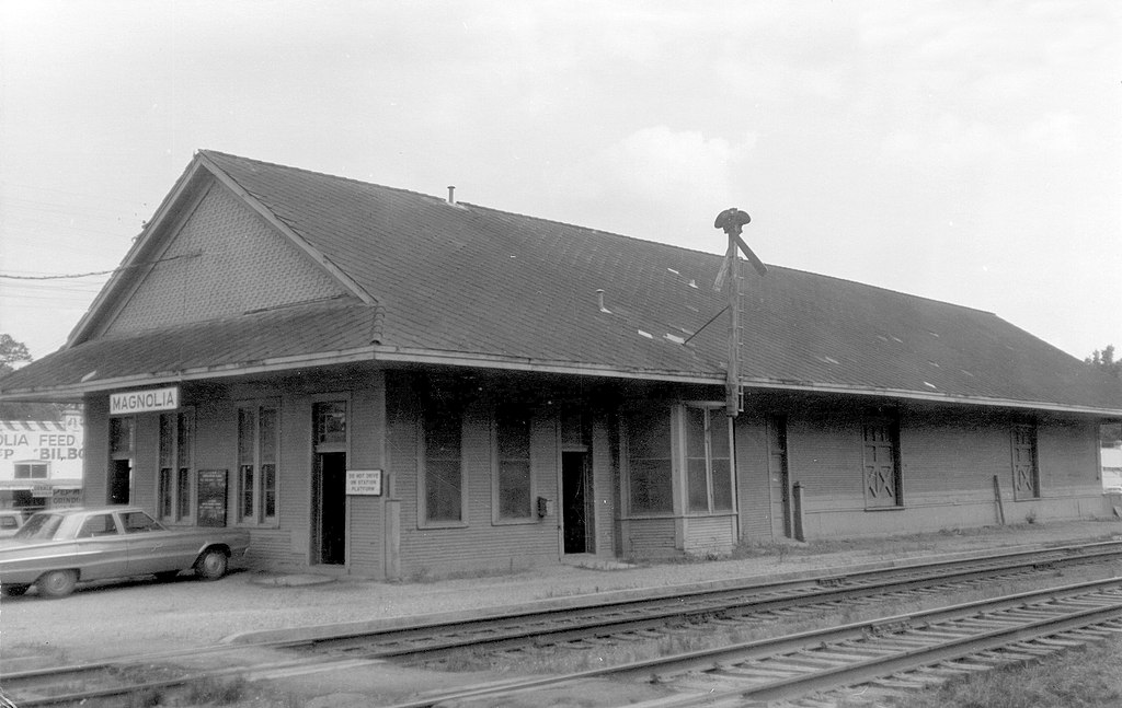
Magnolia Station
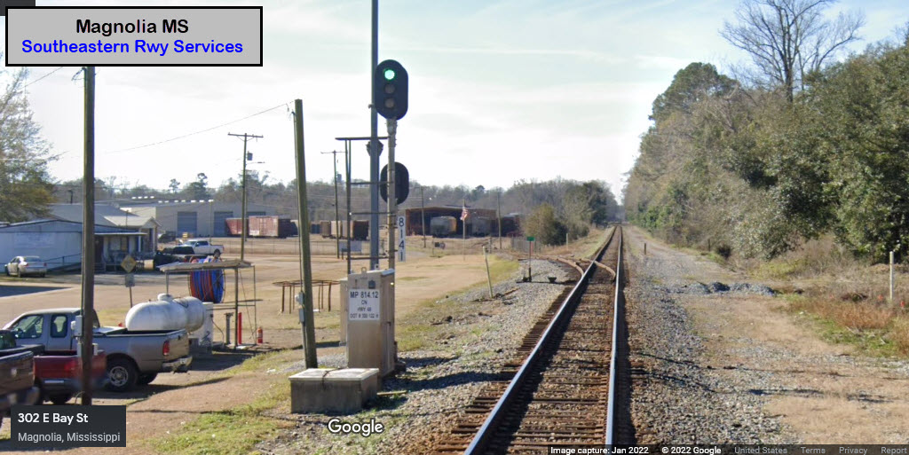
Southeastern Railway Services
Data:
GPS Coordinates: as needed
Phone A/C: 601
ZIP: 39562
Access by train/transit:
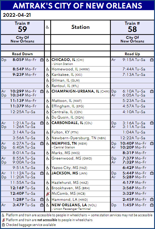
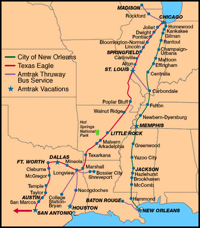
None, but Amtrak's City of New Orleans comes thru.
The Scoop:
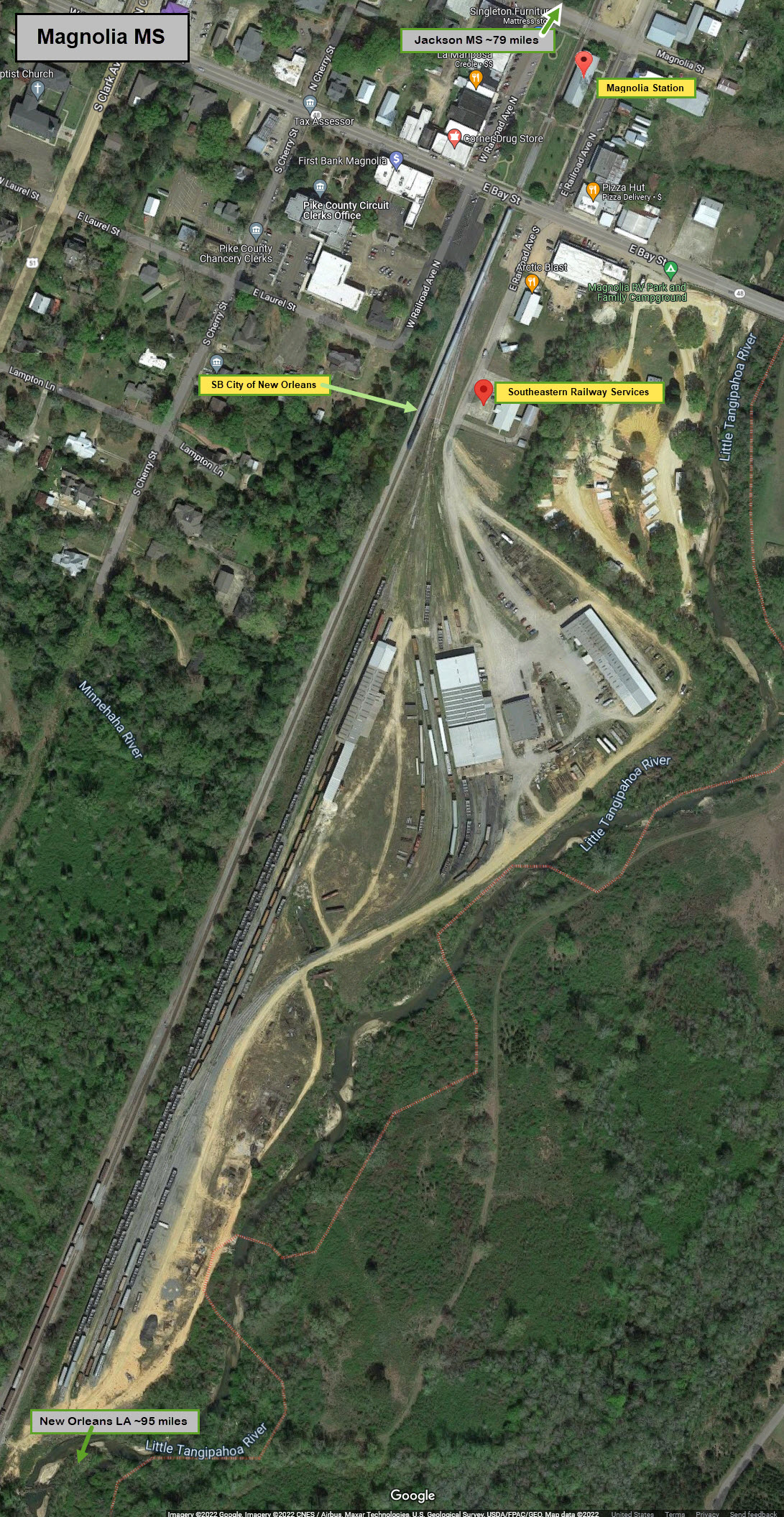
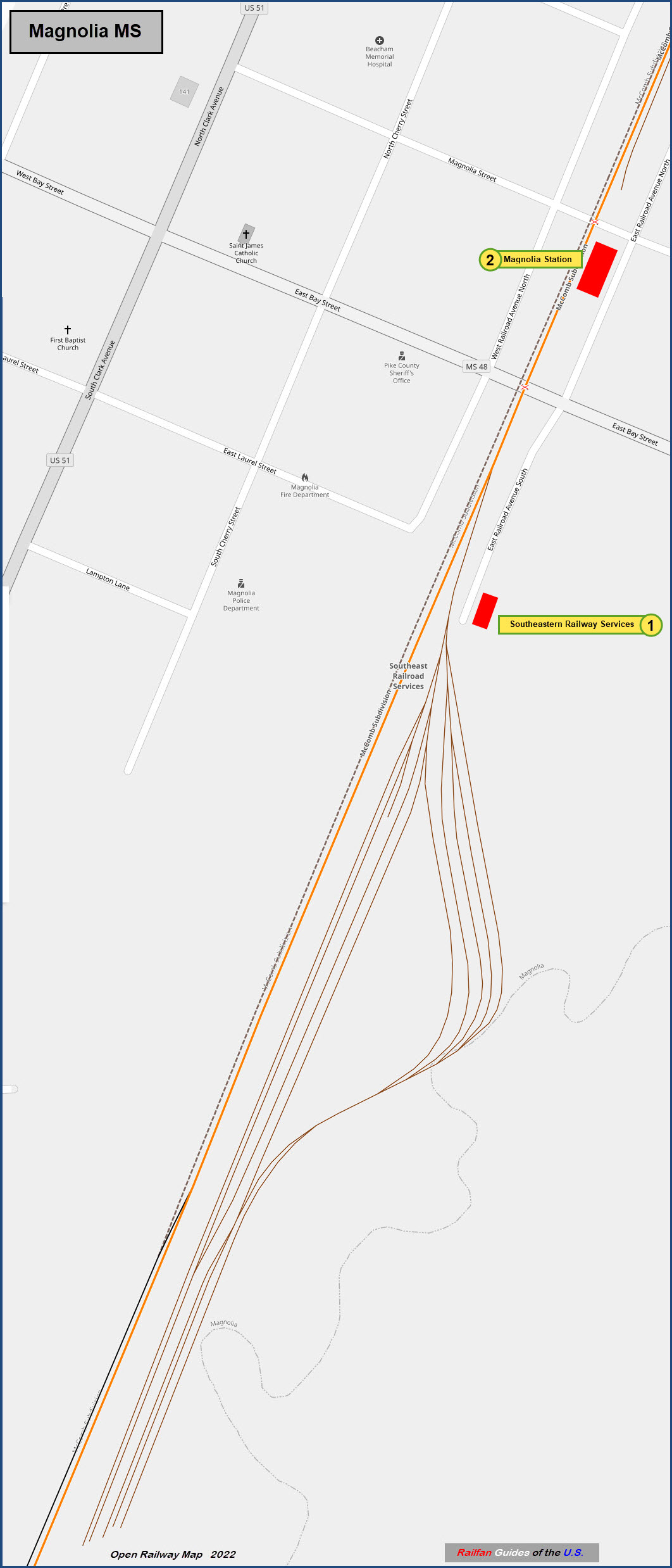
Magnolia has two items of interest to the railfan, three if you count the City of New Orleans that comes thru.
One is the former Illinois Central depot, the second is Southeastern Railway Services, which performs any number of things to support railroads of the area.
Acknowledgements:
Denver Todd
Google Maps
Open Railway Map
Wikipedia
Websites and other additional information sources of interest for the area:
http://www.srsx.com/
https://www.commtrex.com/rail-service/location/1361.html
https://www.progressiverailroading.com/railproducts/manufacturer/Southeastern-Railway-Services-Inc--2574
https://www.flickr.com/photos/mississippi-dept-of-archives-and-history/28184688971/
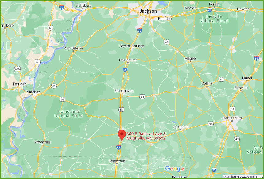
Magnolia is about 10 miles north of the MS/LA border,
about 95 miles north of New Orleans (as the train rides),
and about 79 miles south of Jackson MS, the capitol of Mississippi.
Exit 10 from north-south running I-55 drops you off into the middle of town via West Bay St.
Bay Street also takes you to the Southeastern Railway Services and Magnolia station.
GPS Coordinates:
Physical Address: 300 E Railroad Ave S, Magnolia MS 39652
Mailing Address: PO Box 72, Magnolia MS 39652-0072
601-783-2006
The
GPS Coordinates: 31.14417, -90.45789
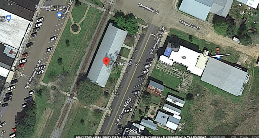
175 E Railroad Ave N, Magnolia MS 39652
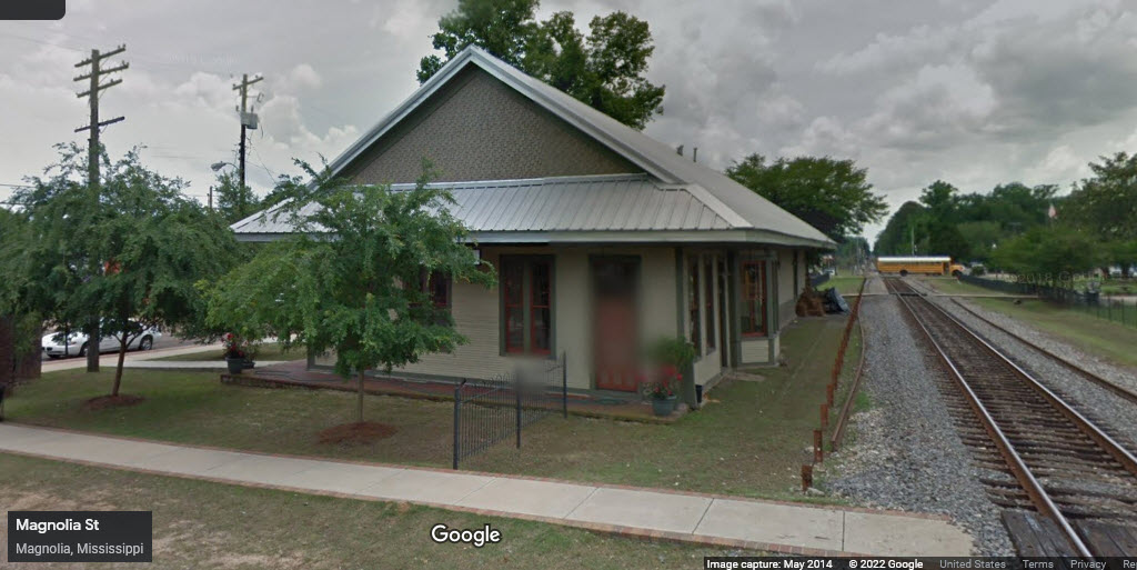
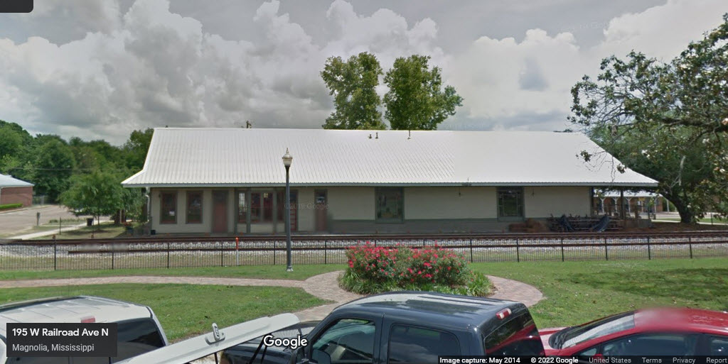
From Wikipedia: In 1851, Abraham Lincoln and Stephen Douglas both supported the funding for the New Orleans, Jackson, and Great Northern Railroad thatwas to connect Canton MS to New Orleans LA. This plan would ultimately include a stop and depot at Magnolia, Mississippi. The first depot in Magnolia - built in 1856, was one of only three depots on the New Orleans, Jackson, and Great Northern to survive the Civil War. In 1893 a fire destroyed this Magnolia railway depot that was completed during the President Franklin Pierce administration in 1856. Between 1893 and 1895, the present structure was built a little north of the original site, next to the Illinois Central Railroad. The second depot featured a front gable and the name of the town (Magnolia) painted on the roof. In the 1920s, the Illinois Central Railroad paid for additions and renovations. The front gable was taken in by the roof and the north waiting rooms expanded and enlarged, with other significant alterations to the structure occurring on the south part as well.
The depot is a one-story, wood-frame building with a rectangular floor plan. It was designed to accommodate both freight and passengers at the turn of the 20th century, when Magnolia served as a resort destination. The depot has a gable roof design with wide eaves. The track side of the building was designed with irregular placement of sash windows, a bay window, single entrance doors, and freight doors. The opposite side of the building had single entrance doors and sash windows.
The station is now home to the Magnolia Mayor's office.
The
None in the area.
GPS Coordinates:
The
GPS Coordinates:
The
![]() Xxx
Xxx
The
![]() Xxx
Xxx
The
![]() Xxx
Xxx
The
Courtesy USGS, click here for their index page.
Disclaimers:
I love trains, and I love signals. I am not an expert. My webpages reflect what I find on the topic of the page. This is something I have fun with while trying to help others.
Please Note: Since the main focus of my two websites is railroad signals, the railfan guides are oriented towards the signal fan being able to locate them. For those of you into the modeling aspect of our hobby, my indexa page has a list of almost everything railroad oriented I can think of to provide you with at least a few pictures to help you detail your pike.
If this is a railfan page, every effort has been made to make sure that the information contained on this map and in this railfan guide is correct. Once in a while, an error may creep in :-)
My philosophy: Pictures and maps are worth a thousand words, especially for railfanning. Text descriptions only get you so far, especially if you get lost or disoriented. Take along good maps.... a GPS is OK to get somewhere, but maps are still better if you get lost! I belong to AAA, which allows you to get local maps for free when you visit the local branches. ADC puts out a nice series of county maps for the Washington DC area, but their state maps do not have the railroads on them. If you can find em, I like the National Geographic map book of the U.S..... good, clear, and concise graphics, and they do a really good job of showing you where tourist type attractions are, although they too lack the railroads. Other notes about specific areas will show up on that page if known.
Aerial shots were taken from either Google or Bing Maps as noted. Screen captures are made with Snagit, a Techsmith product... a great tool if you have never used it!
By the way, floobydust is a term I picked up 30-40 years ago from a National Semiconductor data book, and means miscellaneous and/or other stuff.
Pictures and additional information is always needed if anyone feels inclined to take 'em, send 'em, and share 'em, or if you have something to add or correct.... credit is always given! Please be NICE!!! Contact info is here
Beware: If used as a source, ANYTHING from Wikipedia must be treated as being possibly inaccurate, wrong, or not true.
RAILFAN GUIDES HOME
RAILROAD SIGNALS HOME
NEW 10/18/2022
Last Modified 18-Nov-2022
