
In General
Getting Here
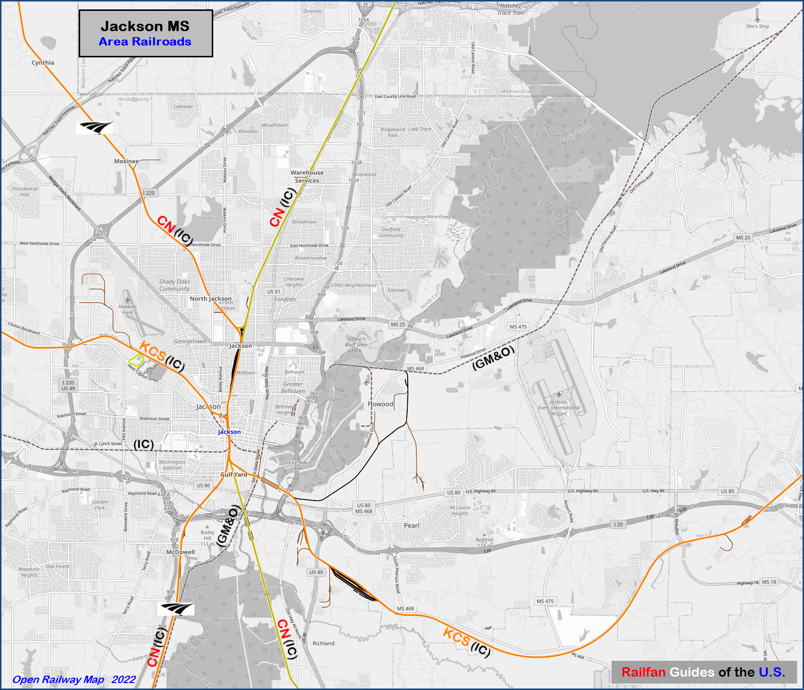
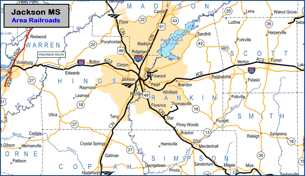
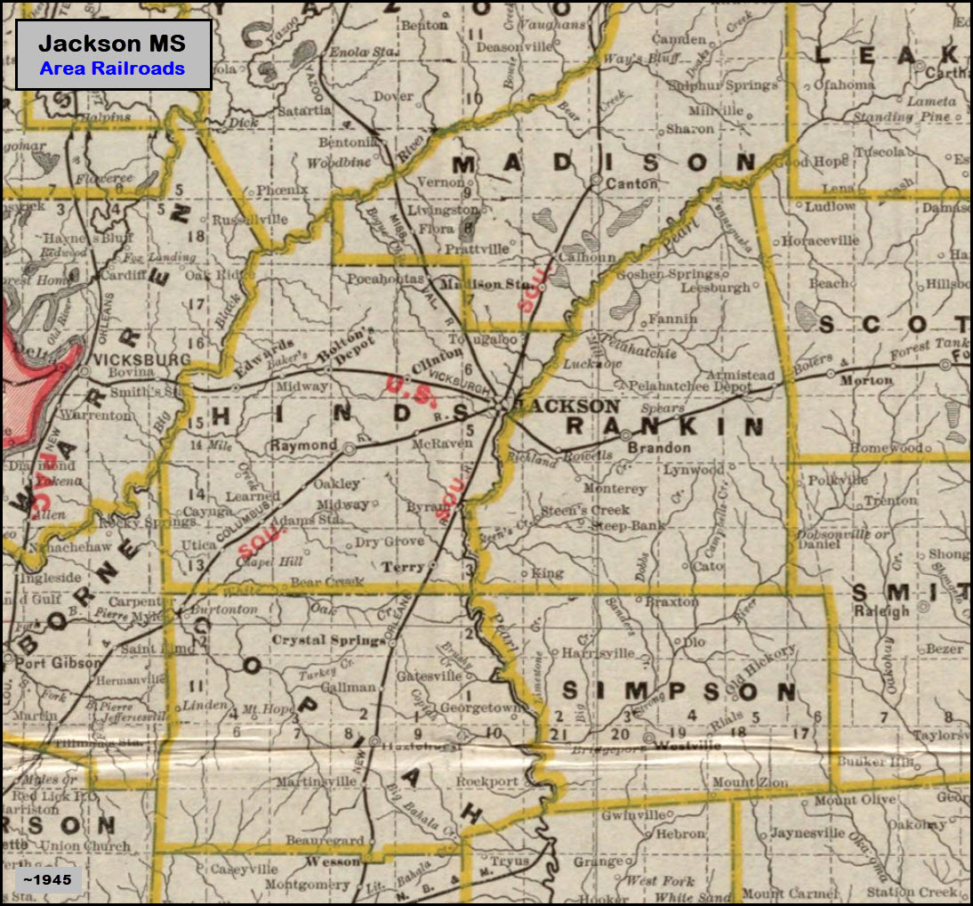
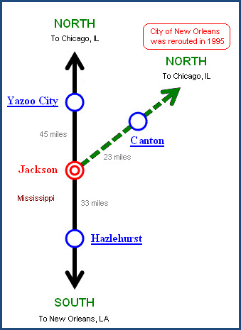
Map
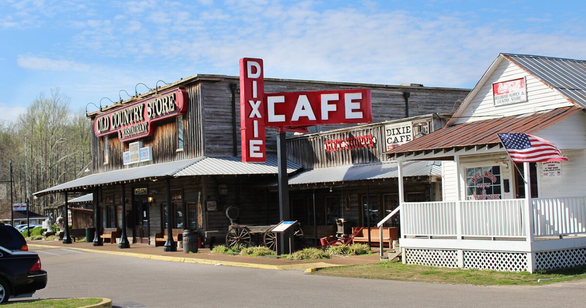
Sights
Pictures
Bridges
Signals
Fire & Police
Postcards
Floobydust
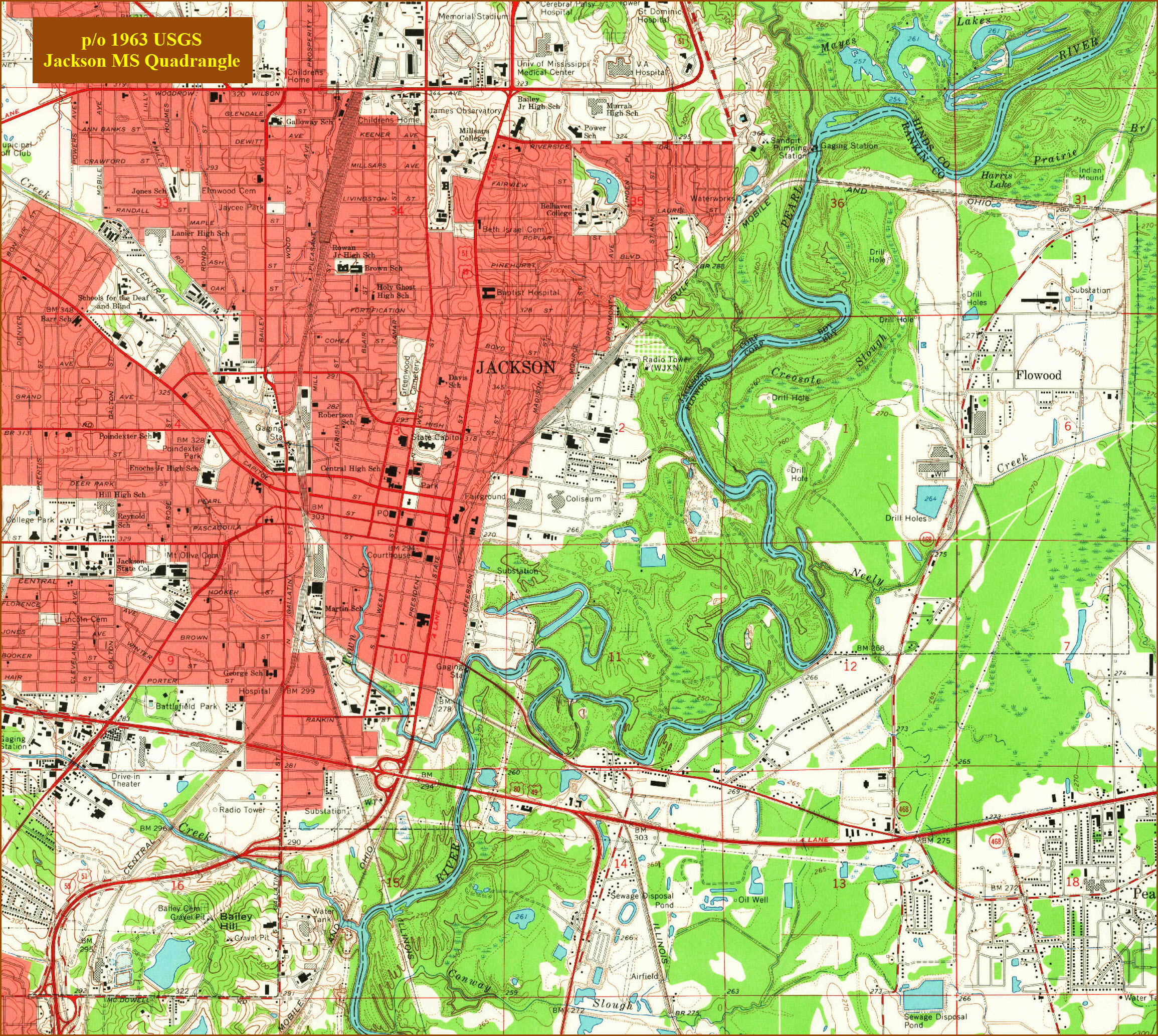
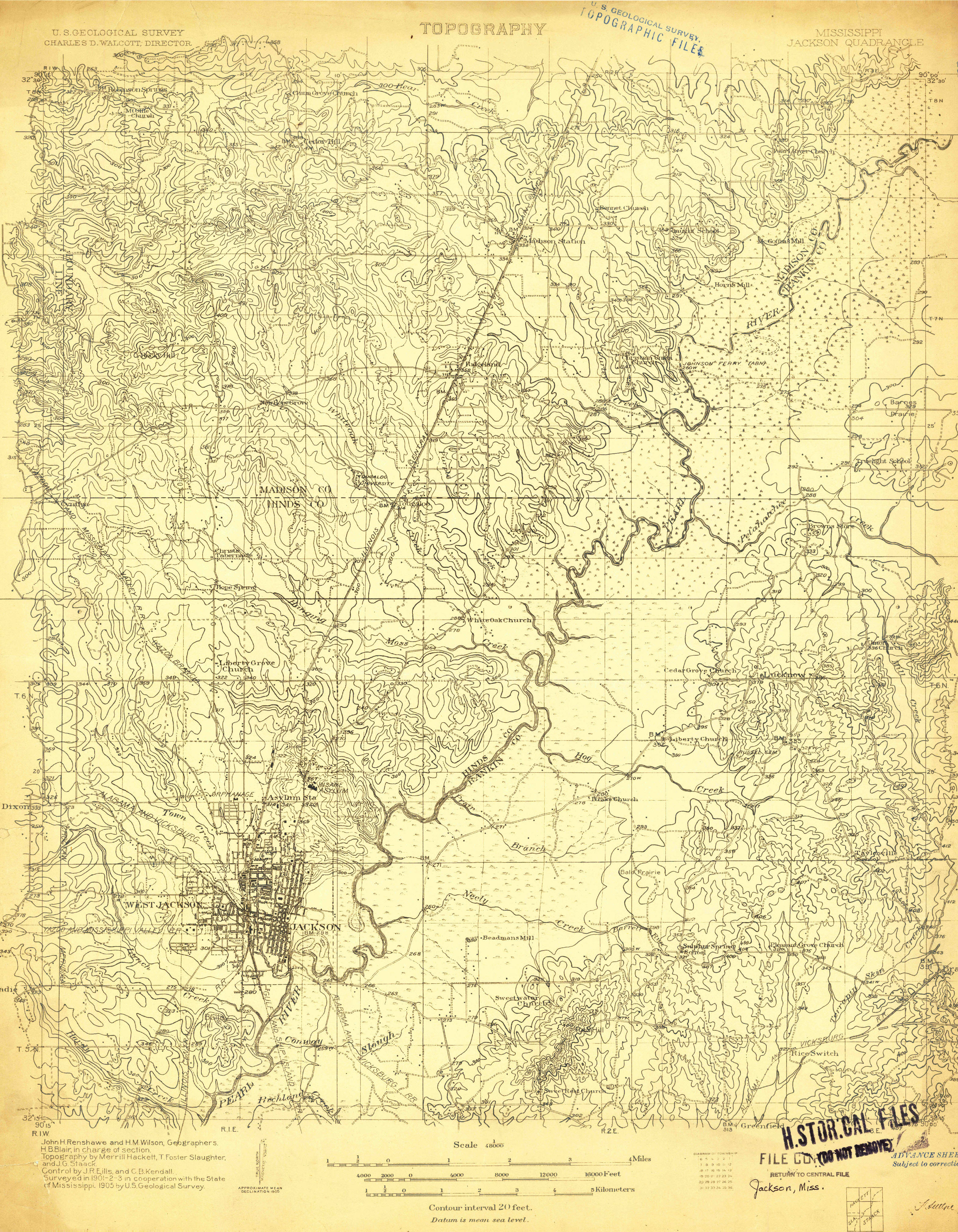
USGS Maps
RAILROAD SIGNALS HOME
Location / Name:
Jackson MS, Hinds County, capital of and the most populous city in the State of Mississippi
What's Here:
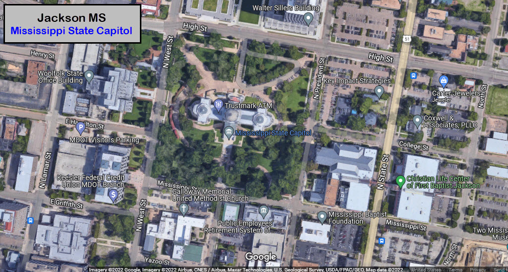
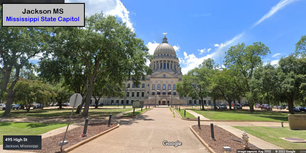
Mississippi State Capitol
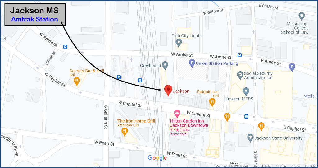
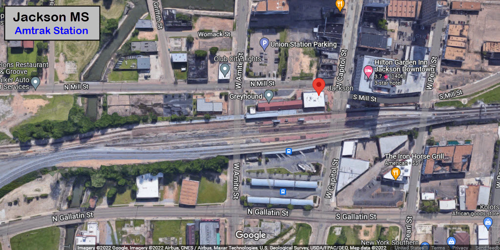
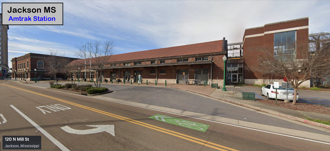
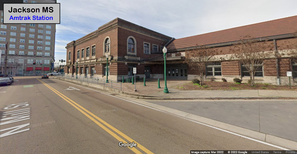
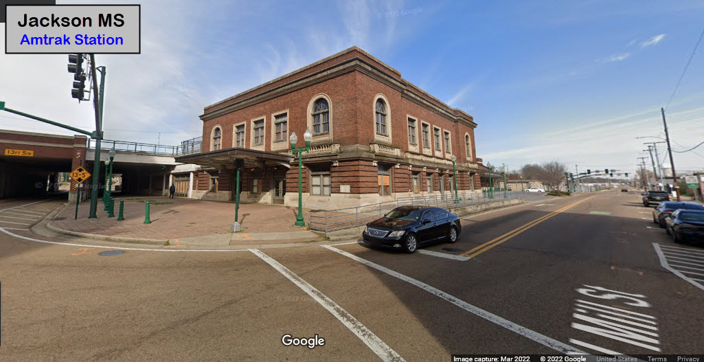
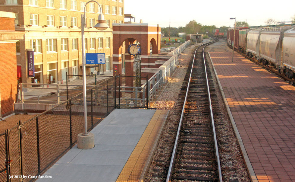
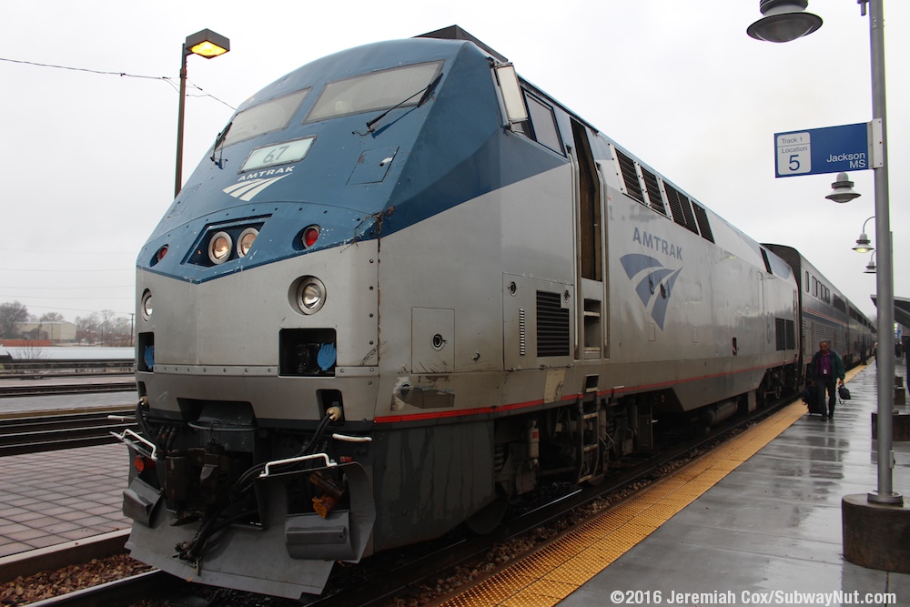
Amtrak Station
Casey Jones RR Museum
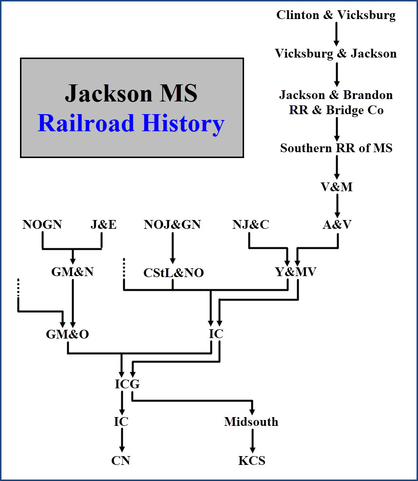
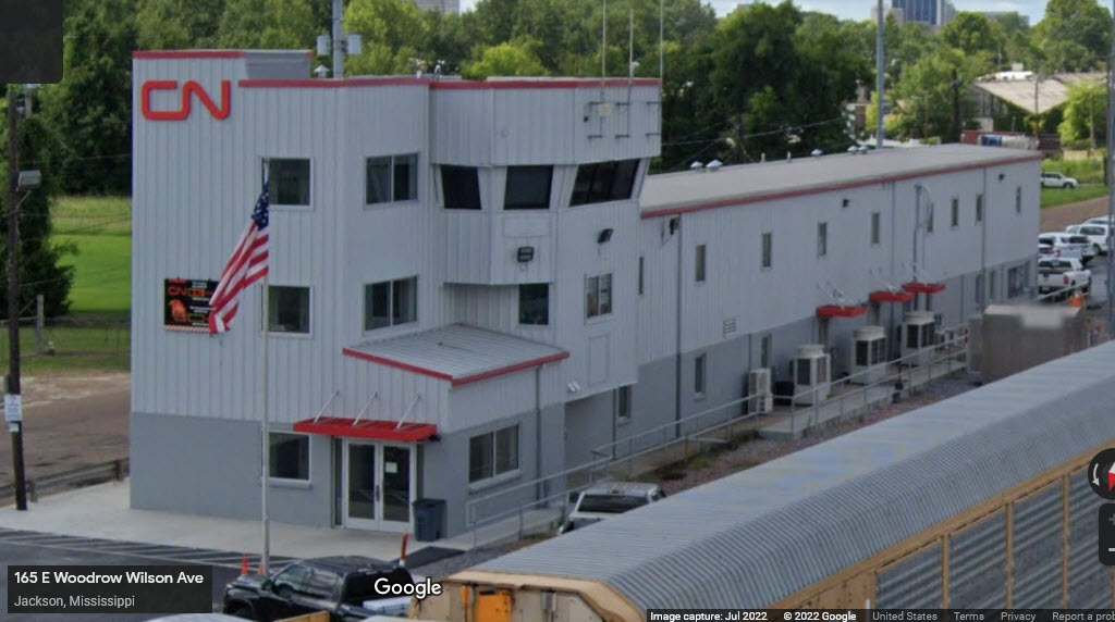
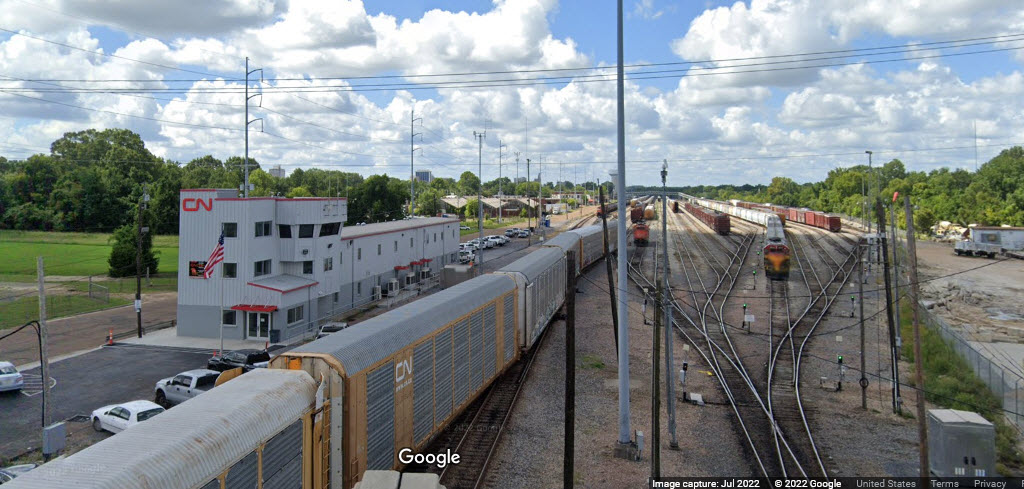
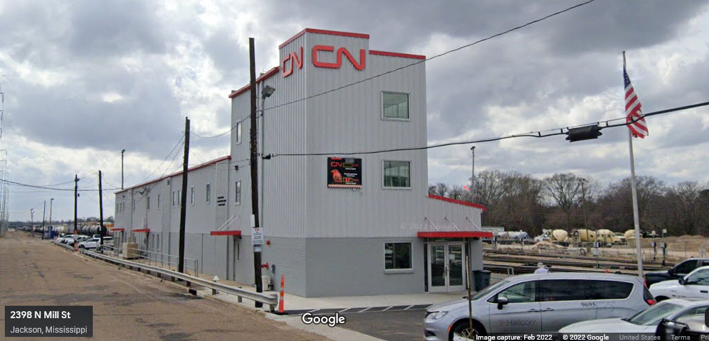
Canadian National RR
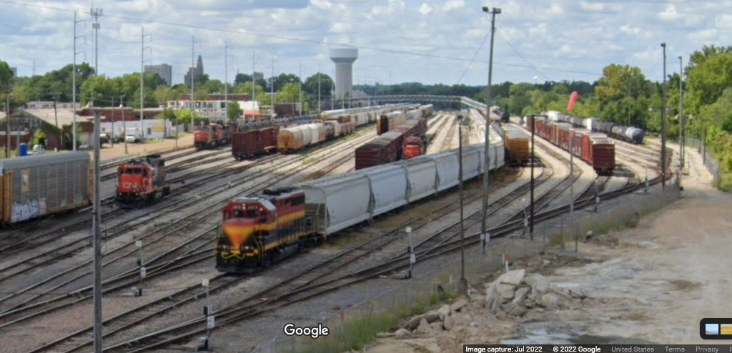
Kansas City Southern RR
CN's North Yard
KCS's High Oak Yard
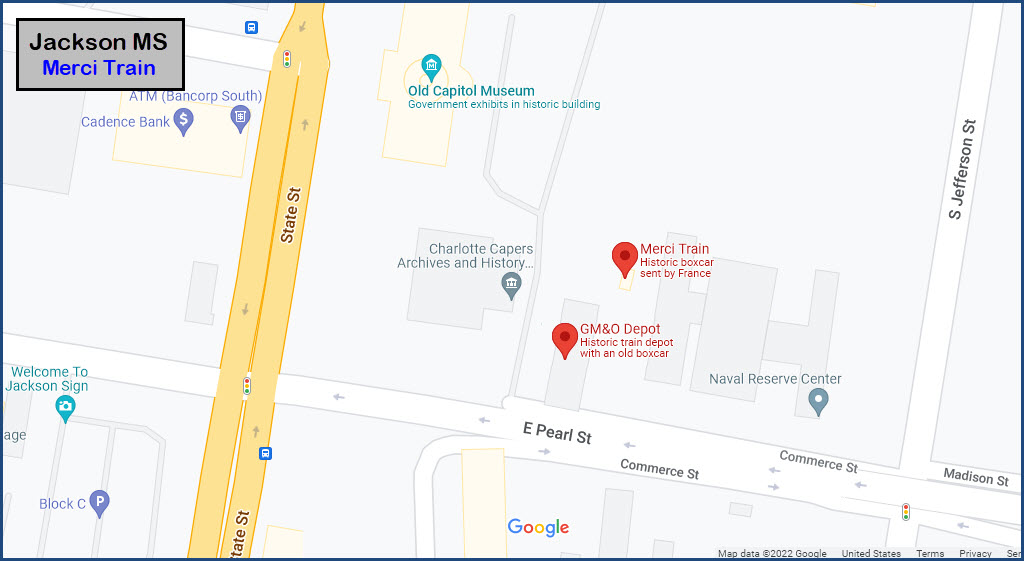
Merci Train
Former GM&O Depot
Data:
GPS Coordinates: as needed
Phone A/C: 601
ZIP: 39201 (Amtrak station area)
Access by train/transit:
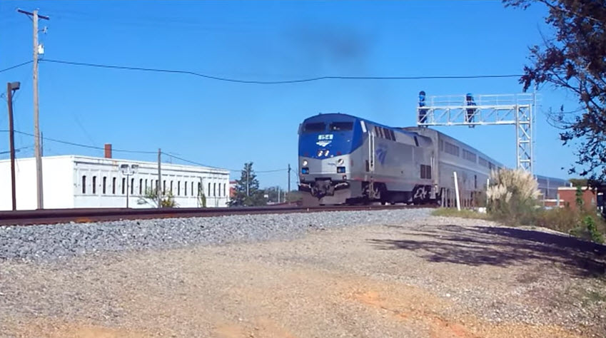
Amtrak, City of New Orleans
The Scoop:
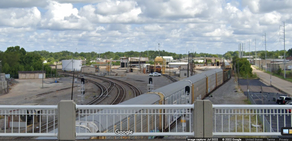
Jackson sports two freight roads plus Amtrak - Canadian National and the Kansas City Southern.
According to the 'Railfan Motels' website, the area around the Amtrak station, known as "the Switch Tender", is Mississippi's most active train watching spot, with about 30 trains a day.
Unfortunately for "us", most of the railroad activity in the downtown area is above street level, with almost all of the action above us on overpasses, making photography very difficult, if it all possible.
Casey Jones' accident in 1900 happened about 37 miles to the north in Vaughan MS.
Please note that CN cops are NOT railfan friendly! Reports of their KGB tactics remind me of the CP cops in Binghamton NY, where one followed me around for 3 hours as I went around town taking pictures, and then finally pulled me over..... Here is a comment from the Railfan Motel page:
Radio Freqs:
161.190 / 160.920
Convenient Hotel for Railfanning:
Hilton Garden Inn Jackson Downtown
235 West Capitol Street
601-353-5464
12 Story, 186 Room, 3 star Hotel located adjacent to the tracks in downtown Jackson within walking distance of Amtrak.
Book a room on the west side - the higher, the better. Rooms well sound-proofed.
Acknowledgements:
Denver Todd
Craig Sanders
Pilotguy251
Jeremiah Cox
Google Maps
Tennessee State Library
Open Railway Map
Wikipedia
Websites and other additional information sources of interest for the area:
https://www.caseyjones.com/museum/
https://sharetngov.tnsosfiles.com/tsla/exhibits/myth/caseyjones.htm
https://caseyjonesmuseum.weebly.com/casey-jones.html
https://en.wikipedia.org/wiki/Casey_Jones
http://mdot.ms.gov/documents/planning/Maps/Rails%20Map/Rails%20Map%202015%20Front%20Side.pdf
https://www.msrailroads.com/Towns/Jackson.htm
https://www.railfanmotels.com/msjackson.htm
https://www.frograil.com/railroad/ms.php 5 sites listed for Jackson, but no updates since 1998
https://www.chicagorailfan.com/aatms1.html
https://www.visitjackson.com/directory/merci-train/
https://www.onlyinyourstate.com/mississippi/10-ms-trains/
http://www.trainweb.org/usarail/jacksonms.htm
https://www.youtube.com/watch?v=xUpaBoqSzYw
Jackson is conveniently located along east-west running I-20, and north-south running US 49 and 51.
GPS Coordinates:
300 West Capitol Street, Jackson MS 39201
Station Code: JAN
https://en.wikipedia.org/wiki/Union_Station_(Jackson,_Mississippi)
https://www.greatamericanstations.com/stations/jackson-ms-jan/
https://www.hmdb.org/m.asp?m=115146
From GAS: The Jackson station and connecting freight house was built by the Illinois Central Railroad in 1927 after the railroad was elevated through downtown. In 1976, the station waiting room was renovated in conjunction with the nation’s bicentennial for the American Freedom Train tour. In 2003 the city of Jackson acquired the building from Canadian National (the successor to Illinois Central) and began a $20 million renovation of the 60,000 square foot multi-floor brick building, reopening it as the Union Station Multimodal Transportation Facility. Amtrak was relocated to the former freight house section of the building, joining Greyhound and Jatran, the city’s bus network. The former passenger waiting room and ticket counter were converted into commercial office space. end GAS
 Pilotguy251/youtube
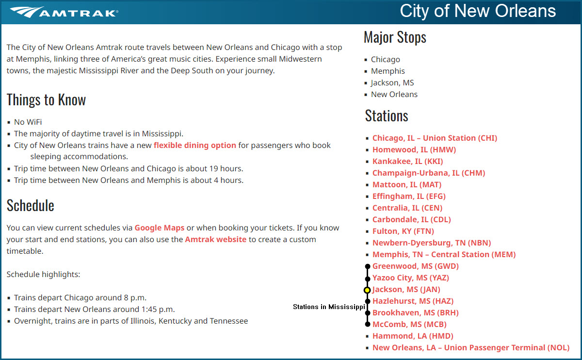
GPS Coordinates: 32.32594, -90.18715 (tower)
GPS Coordinates:
The
GPS Coordinates:
The
GPS Coordinates:
The
GPS Coordinates: 32.29851, -90.17914
618 East Pearl St, Jackson MS 39201
601-576-6940
Hours: Sunday–Saturday dawn until dusk
http://mercitrain.org/
From the "visit Jackson" website: In 1947, Washington Post columnist Drew Pearson launched a grassroots effort to help war recovery in France and Italy. Over $40 million worth of supplies was collected from across the United States, eventually filling more than 700 railroad cars. The train became known as the American Friendship Train, and the boxcars arrived in Europe in December 1947.
In response to America’s generosity, the French reciprocated with their own train of gifts. Known as the French Merci Train, the cars were decorated with placards of the coats of arms of all of the provinces of France and loaded with personal donations from across the country. Each of the forty-eight states would receive a car, plus one to be shared between Washington, D.C., and Hawaii.
After first stopping in Meridian, Mississippi’s boxcar arrived in Jackson on February 12, 1949. The items in the car were displayed at the farmer’s market and then divided among various organizations. The Department of Archives and History received forty objects from the Merci train that are still in the permanent collection.
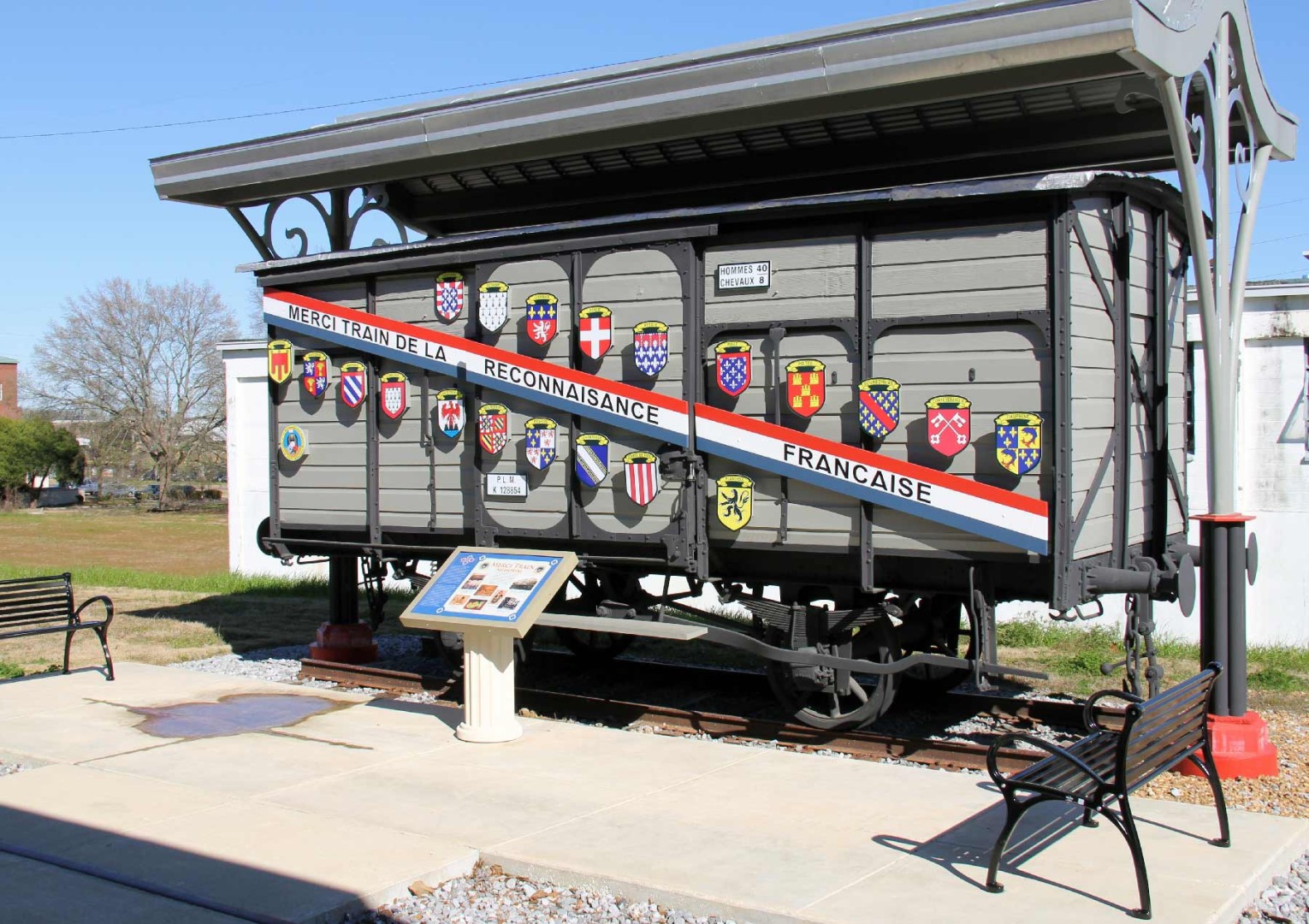
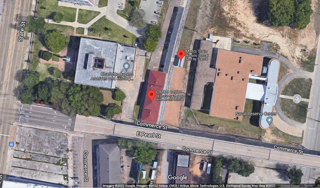
GPS Coordinates: 32.29824, -90.17934
618 E Pearl St, Jackson MS 39201
On the far

GPS Coordinates: 32.30561, -90.19316
618 E Pearl St, Jackson MS 39201
On the far side of the tracks from the Amtrak station.
GPS Coordinates: 32.30383, -90.18210
400 High St, Jackson MS 39201
601-359-3114
The
GPS Coordinates: 32.30561, -90.19316
About 4 blocks (1,600 ft) North of the Amtrak station.
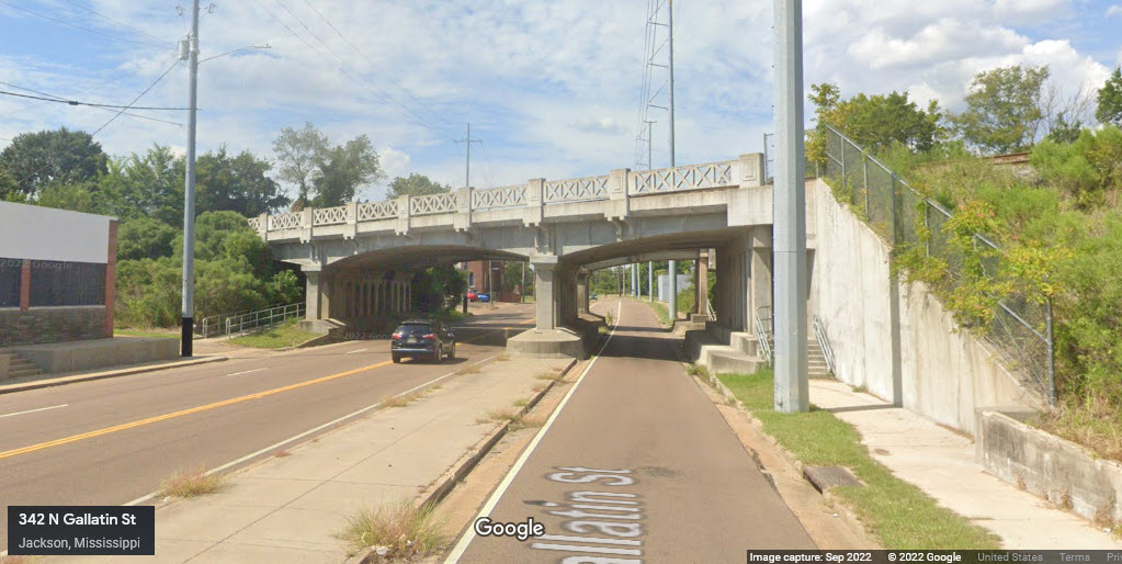
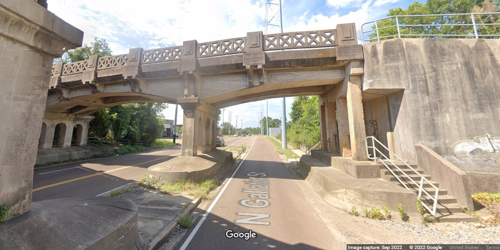
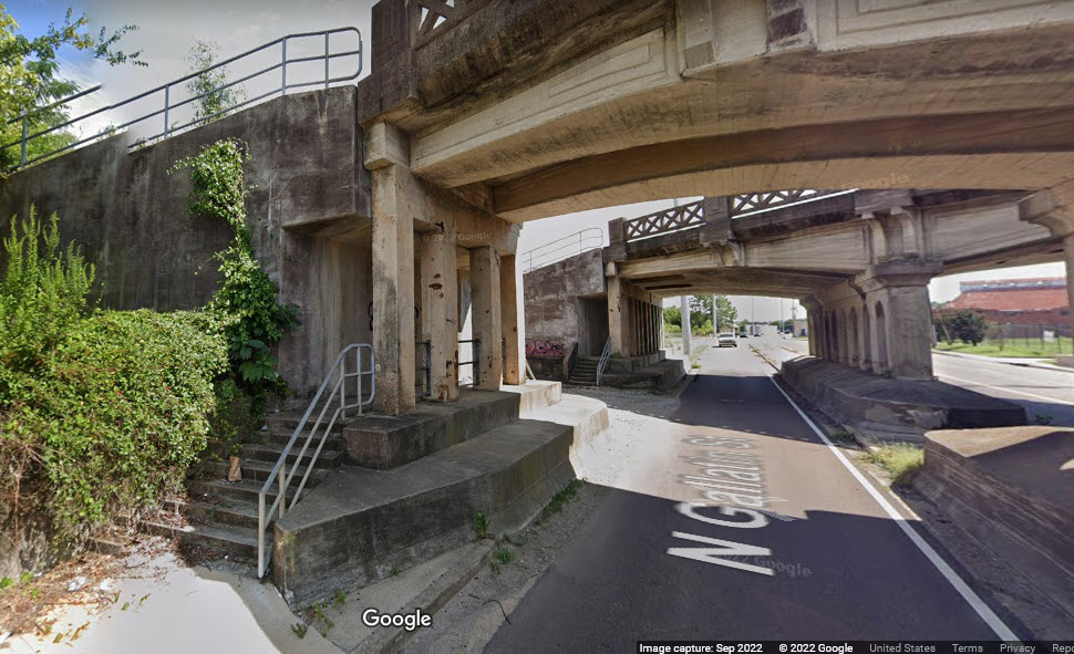
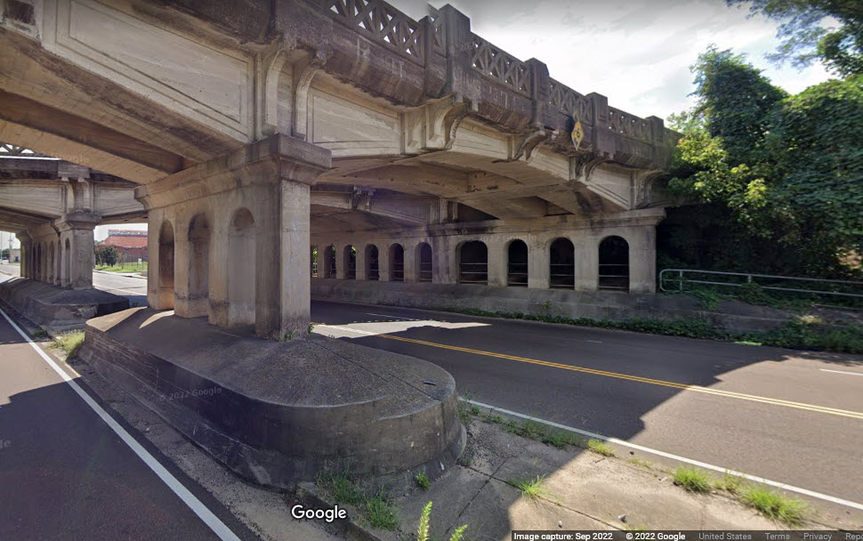
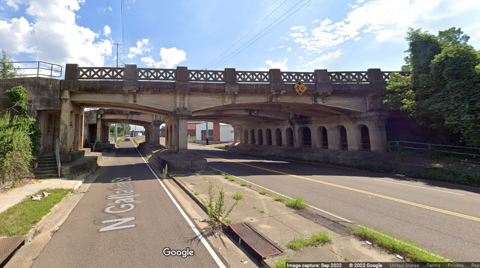
Ornate cast concrete bridges, with an interesting design of 1 + 3 lanes of traffic even though there are 2 lanes for each direction.
Beautiful cast concrete work you just don't see anymore.
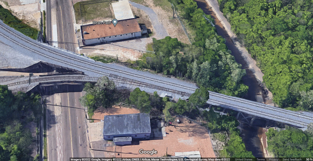
Who wants to be the first to send in pictures of the trestle going over Town Creek?
GPS Coordinates:
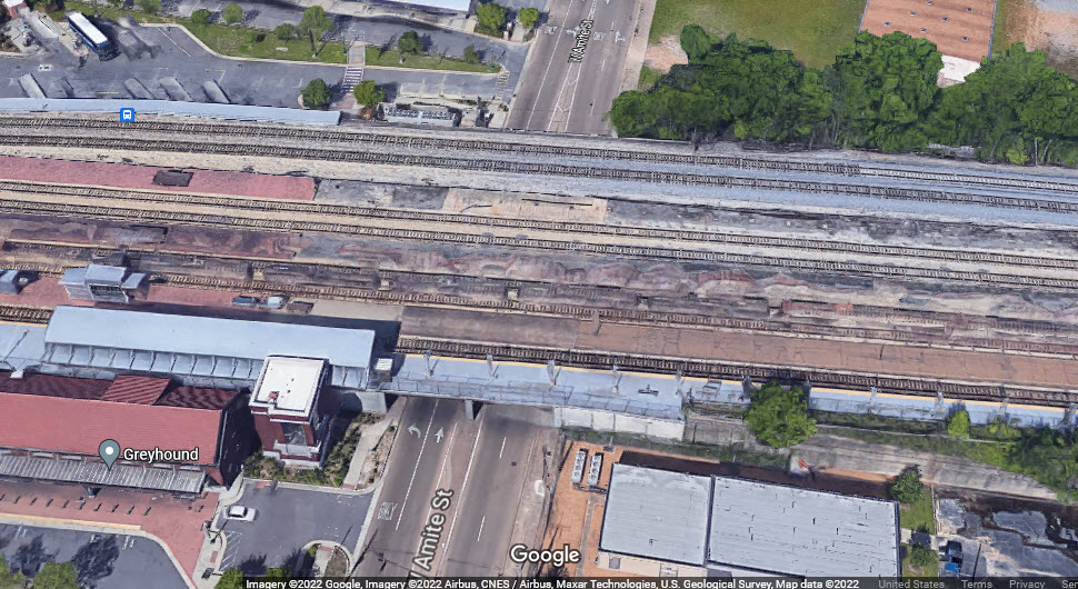
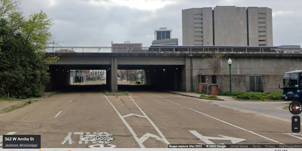
Concrete and I-beam construction, carrying 7 tracks, and the north end of the Amtrak station platform.

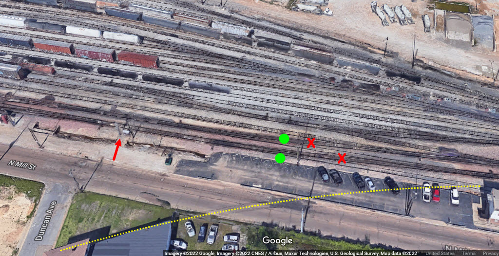
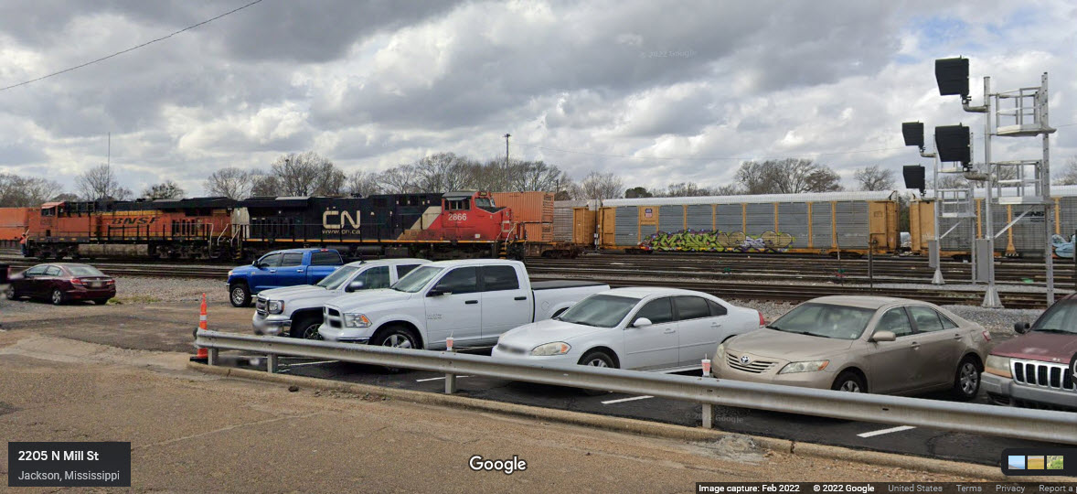
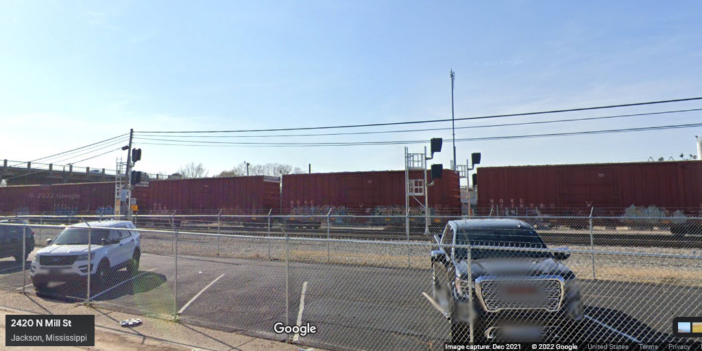
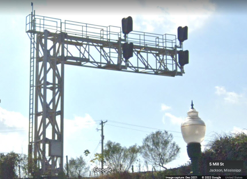
GPS Coordinates: 32.32515, -90.18749
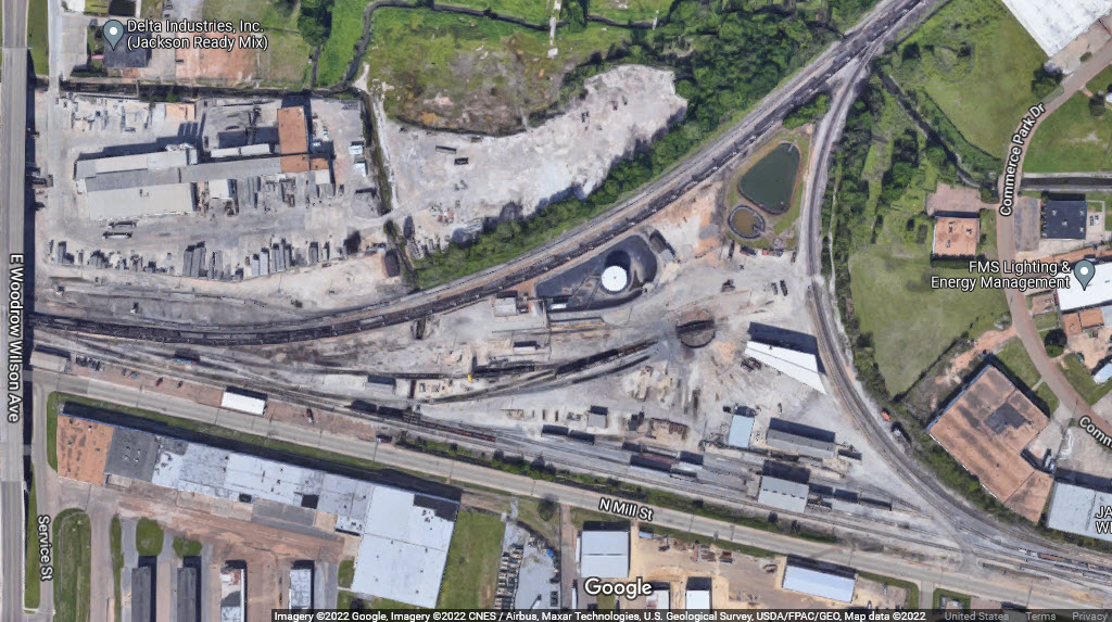
These signals are adjacent to the CN offices on North Mill St. It looks like, since the aerial view was taken, they have come through and done some track work and signal upgrades, because the two crossover tracks appear to be gone, and the signals shown in the streetview are not seen in the aerial photo. You can also see where a siding used to be in the aerial shot.
GPS Coordinates:
The
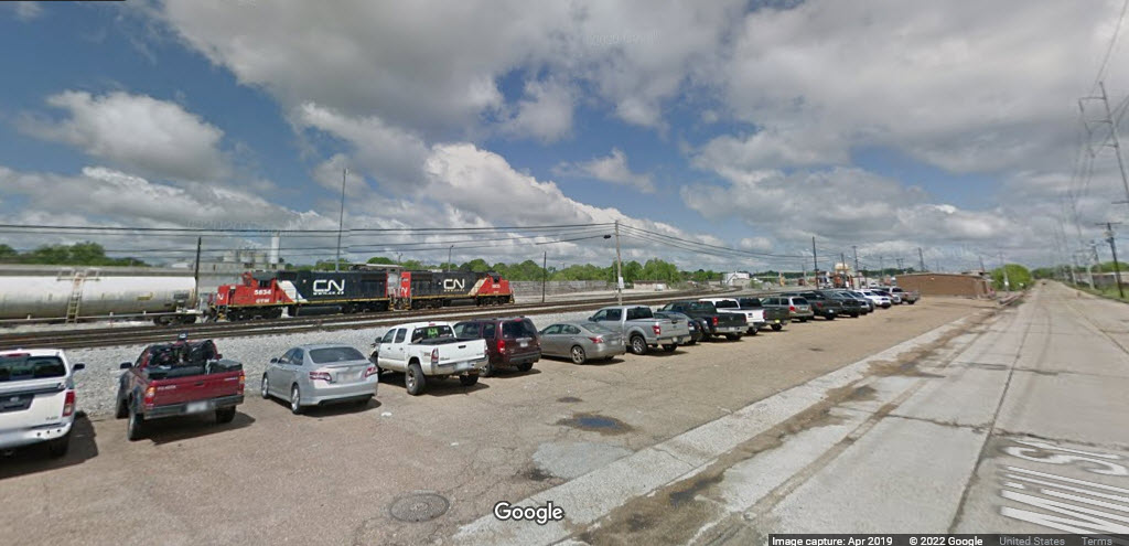
In this 2019 view, there are no signals, and the building along Mill St is still there, it was subsequently removed.
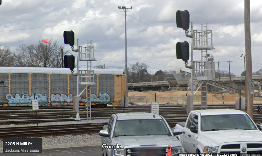
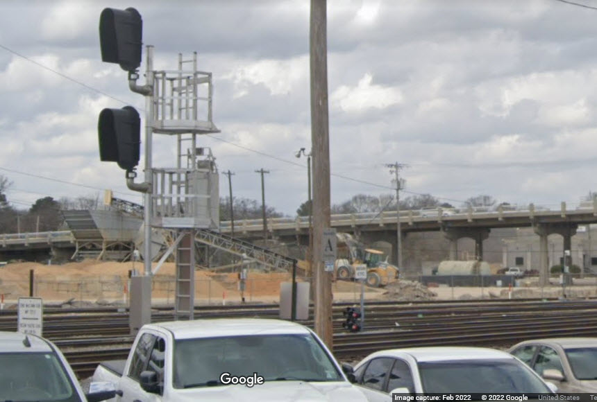
GPS Coordinates: 32.29892, -90.19110
Two signals on a cantilever, for SB traffic coming out of the Amtrak station area.
![]() Xxx
Xxx
The
![]() Xxx
Xxx
The
![]() Xxx
Xxx
The
Casey Jones Home and Railroad Museum
GPS Coordinates:
30 Casey Jones Ln, Jackson TN 38305
731-668-1222
https://www.facebook.com/caseyjonesmuseum/
The
Courtesy USGS, click here for their index page.
Disclaimers:
I love trains, and I love signals. I am not an expert. My webpages reflect what I find on the topic of the page. This is something I have fun with while trying to help others.
Please Note: Since the main focus of my two websites is railroad signals, the railfan guides are oriented towards the signal fan being able to locate them. For those of you into the modeling aspect of our hobby, my indexa page has a list of almost everything railroad oriented I can think of to provide you with at least a few pictures to help you detail your pike.
If this is a railfan page, every effort has been made to make sure that the information contained on this map and in this railfan guide is correct. Once in a while, an error may creep in :-)
My philosophy: Pictures and maps are worth a thousand words, especially for railfanning. Text descriptions only get you so far, especially if you get lost or disoriented. Take along good maps.... a GPS is OK to get somewhere, but maps are still better if you get lost! I belong to AAA, which allows you to get local maps for free when you visit the local branches. ADC puts out a nice series of county maps for the Washington DC area, but their state maps do not have the railroads on them. If you can find em, I like the National Geographic map book of the U.S..... good, clear, and concise graphics, and they do a really good job of showing you where tourist type attractions are, although they too lack the railroads. Other notes about specific areas will show up on that page if known.
Aerial shots were taken from either Google or Bing Maps as noted. Screen captures are made with Snagit, a Techsmith product... a great tool if you have never used it!
By the way, floobydust is a term I picked up 30-40 years ago from a National Semiconductor data book, and means miscellaneous and/or other stuff.
Pictures and additional information is always needed if anyone feels inclined to take 'em, send 'em, and share 'em, or if you have something to add or correct.... credit is always given! Please be NICE!!! Contact info is here
Beware: If used as a source, ANYTHING from Wikipedia must be treated as being possibly inaccurate, wrong, or not true.
RAILFAN GUIDES HOME
RAILROAD SIGNALS HOME
NEW NOV10/2022
Last Modified 17-Nov-2022