RAILFAN GUIDES of the U.S.
Todd's Transit Guide to
the Metrolink Light Rail System
St Louis
MO
In General
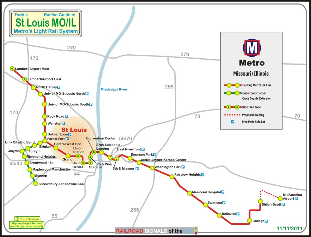
Map
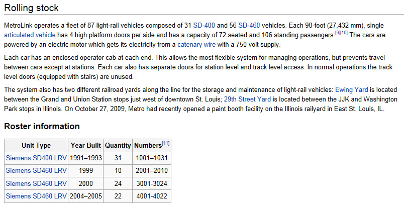
Equipment
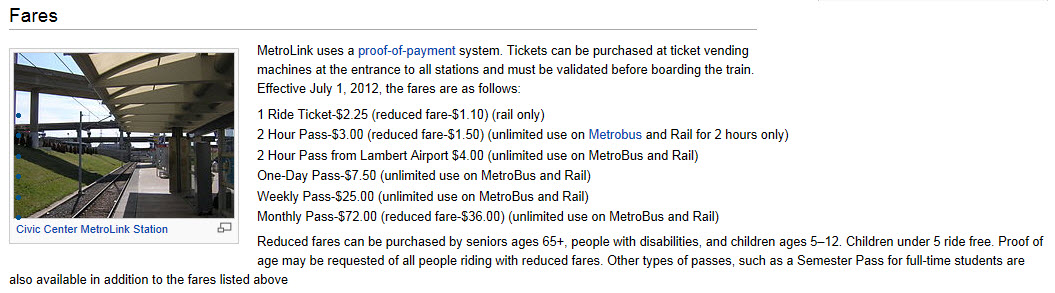
Fares
Pictures
RAILFAN GUIDES HOME
RAILROAD SIGNALS HOME
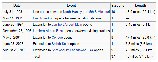
Construction of the Light Rail system in St Louis began in 1990.
The first section between the
North Hanley and
5th & Missouri stations was opened on July 31st, 1993.
The initial phase reportedly cost $465M, $348M of which came from the Feds.
In 1994, the system was extended and opened to the Lambert Airport Main station on the west side, and the East Riverfront on the east side, finally crossing the Mississippi River into Illinois.
If you railfan in the East St Louis area, PLEASE take along at least one big friend. There are a couple of yards over there to keep you happy for a while, but don't stop for too long in any one place waiting for train pictures. Just talking from personal experience :-)
The Lambert East station was opened in 1998.
The extension from
5th & Missouri to the College
station in Belleville was started in 1998 and opened in May of 2001.
This extension cost around $339M, of which the Feds kicked in $244M and the St
Clair County Transit District $95M.
The extension from College to the Shiloh-Scott station was opened on June 23rd, 2003. No federal money was use for this section, instead, $60M was funded by the FIRST (Fund for the Infrastructure, Roads, School & Transit), and $15M came from the St Clair County Transit District.
The extension to the Shrewsbury-Lansdowne station open in August 2006, with the station at Brentwood-I44 opening on June 12th, 2007.
On October 27th, 2008, Metrolink renamed the lines using color designations. The Red Line runs from Lambert Airport on the west end to Shiloh-Scott on the east end, and the Blue line runs from Shrewsbury to Fairview Heights on the Red Line, joining the Red Line at Forest Park.
Here is a chart outlining the sections:
Almost all of the above info comes from the Wikipedia page on the St Louis Light Rail system. Take the info with a grain of salt, for just above the chart it states a section on the Blue line didn't open until 2008, 5 years after the article says the entire Blue line was dedicated.
I'm working on splitting it into two maps for chasing purposes, one day I'll get er done.
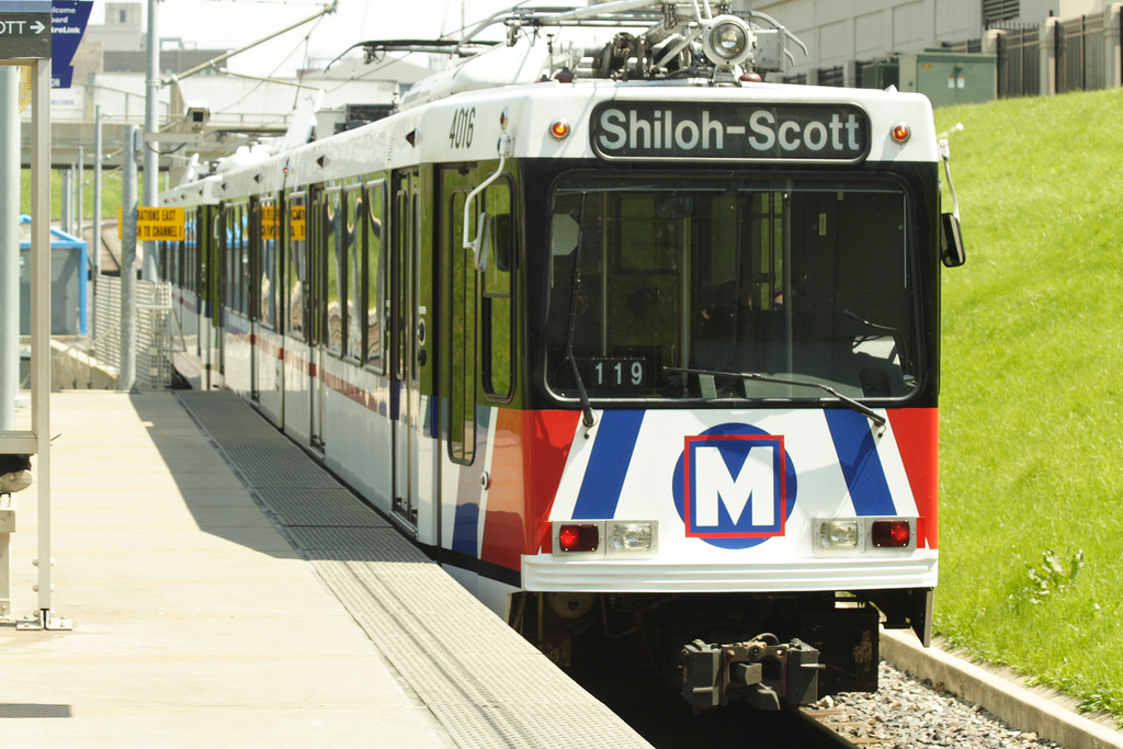
A train leaving the station. Picture by Matthew Black, from
Wikipedia
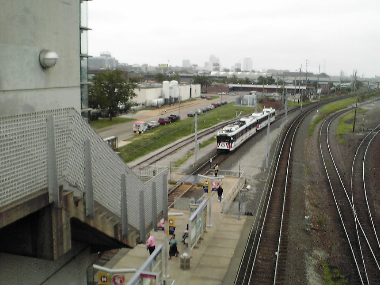
Train entering the Grand station, by Chris Lawrence, from from
Wikipedia
I have a bunch of pictures from the 2001 timeframe, but need to get the slides scanned someday.
New 12/1/2011
last Modified:
10 Jan 2014