
In General
Getting Here
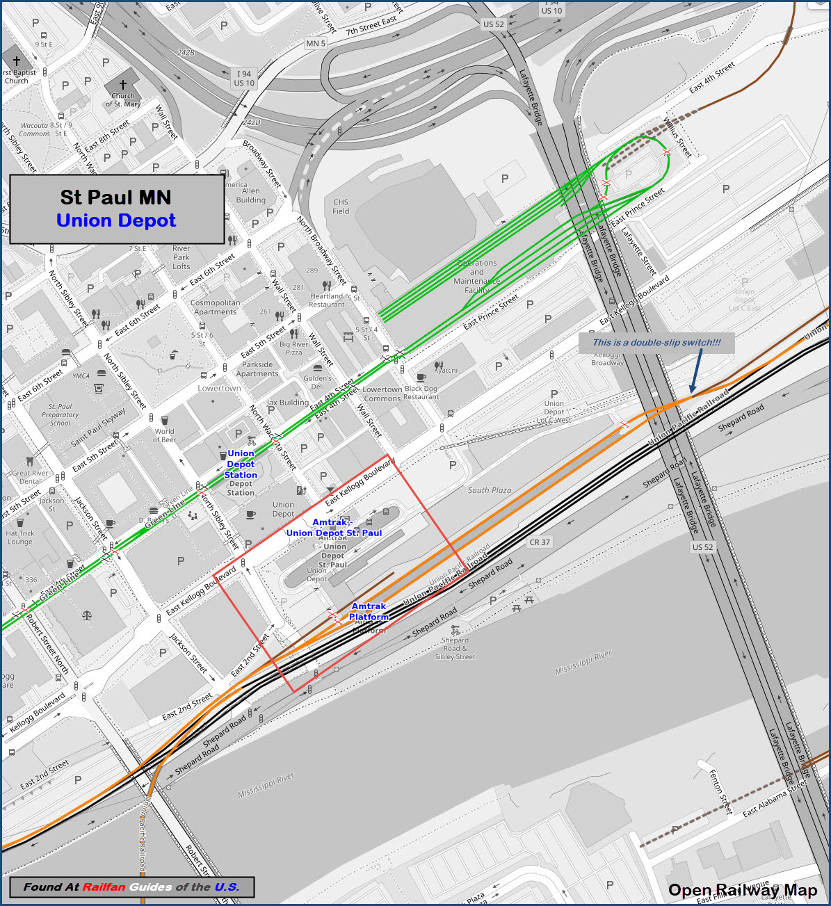
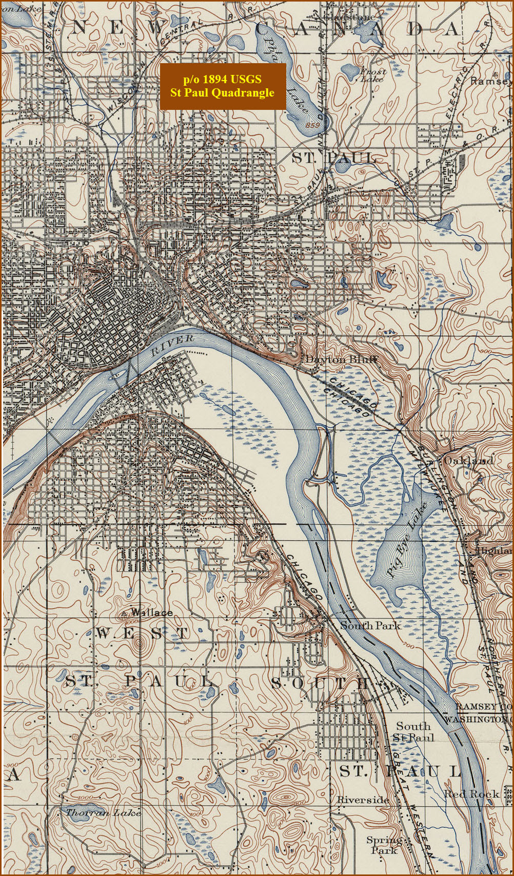
Map
Sights
Station by Station
Pictures
Signals
Bridges
Amtrak Info
Floobydust
USGS Maps
RAILROAD SIGNALS HOME
Location / Name:
St Paul MN, Ramsey County
What's Here:
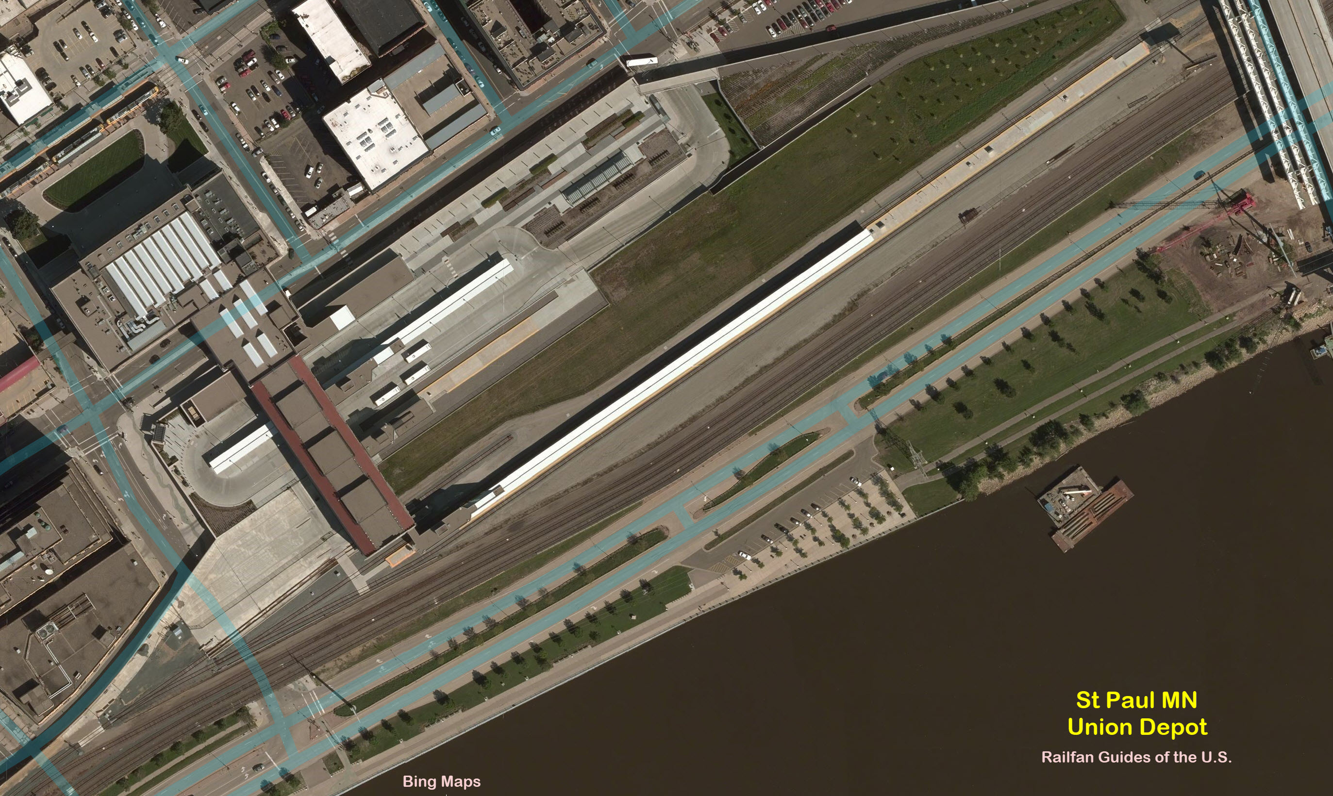
Union Depot
the Minnesota Railroad Museum (MTM)
2 Wye's
the West End of Dayton's Bluff
Metro Green Line End of Line & Shops
Data:
GPS Coordinates: As Needed
Phone A/C: 651
ZIP: 55101 (dntn St Paul)
Access by train/transit:
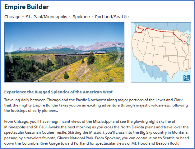
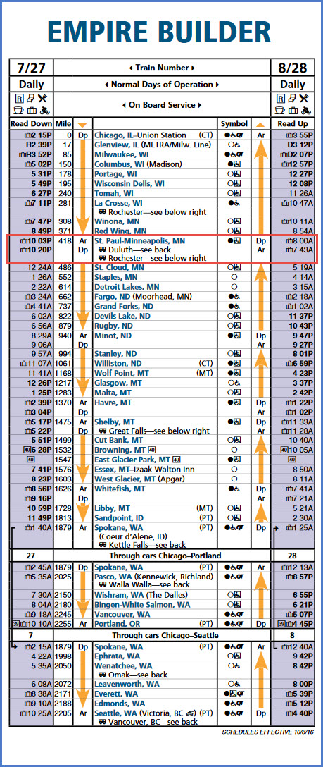
Amtrak's daily Empire Builder
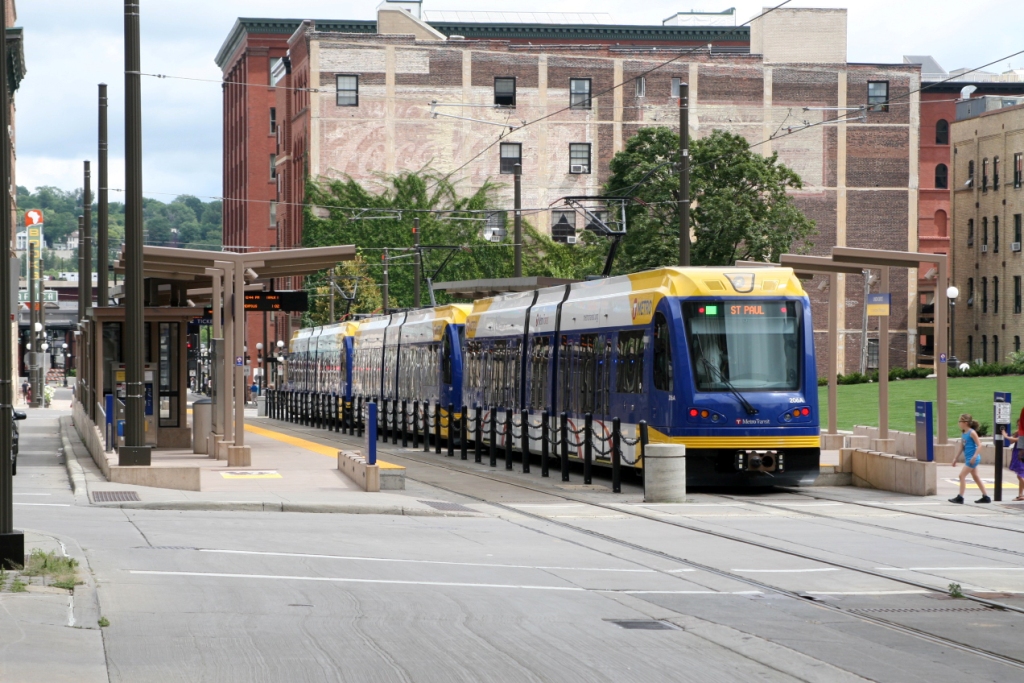
Metro T's Green Line Light Rail
The Scoop:
Within the confines of downtown St Paul, there is enough variety to keep you busy looking for that perfect Picture spot all day long. You have the same lines which run thru Dayton's Bluff, you have two wye's, St Paul Union Depot, tunnels, cool bridges, light rail, Amtrak, the Minnesota Railroad Museum, and you even have a portion of the old streetcar system from the 50's if you are into that kind of stuff.
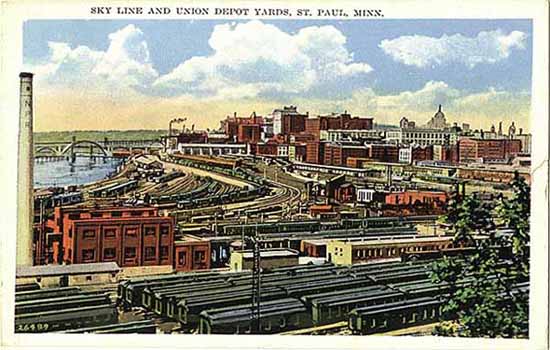
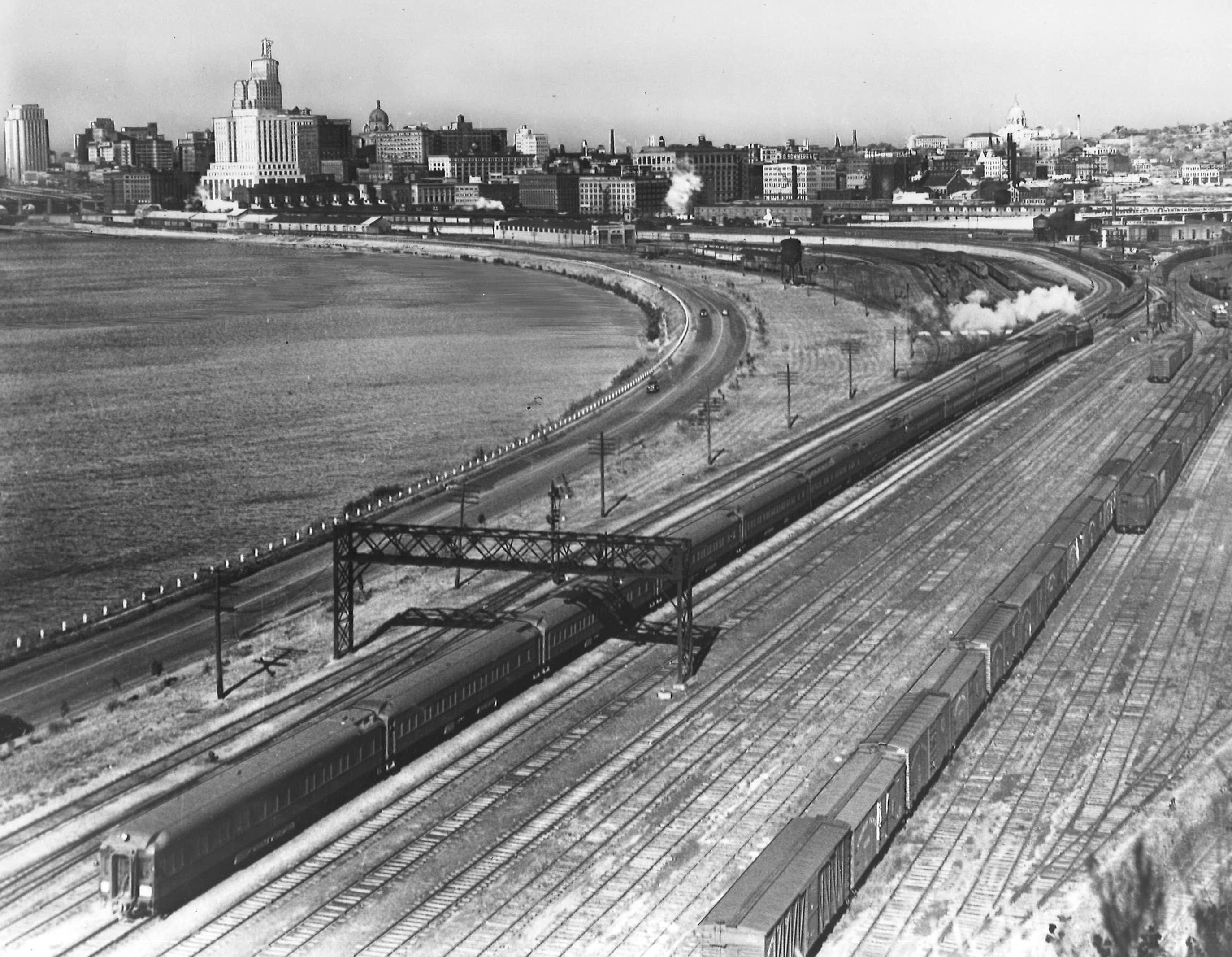
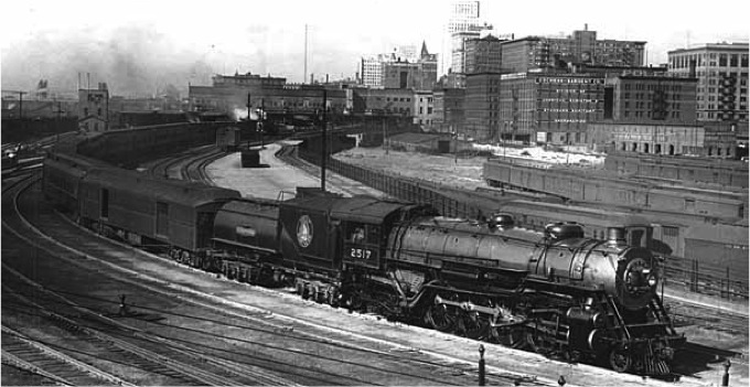
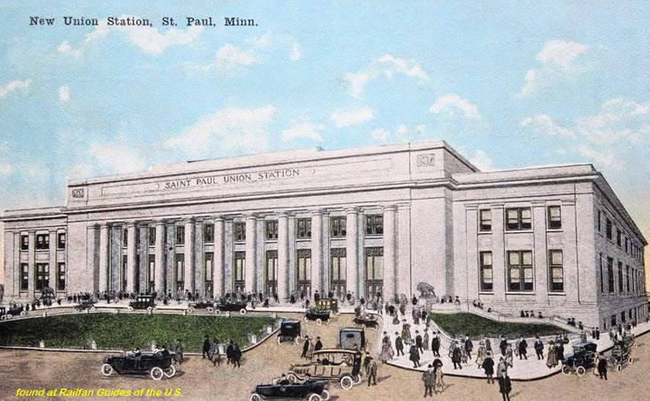
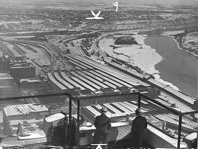
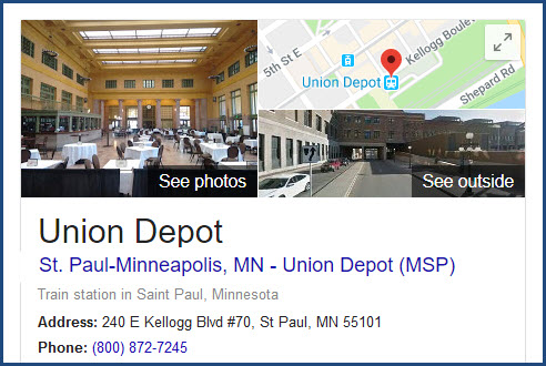
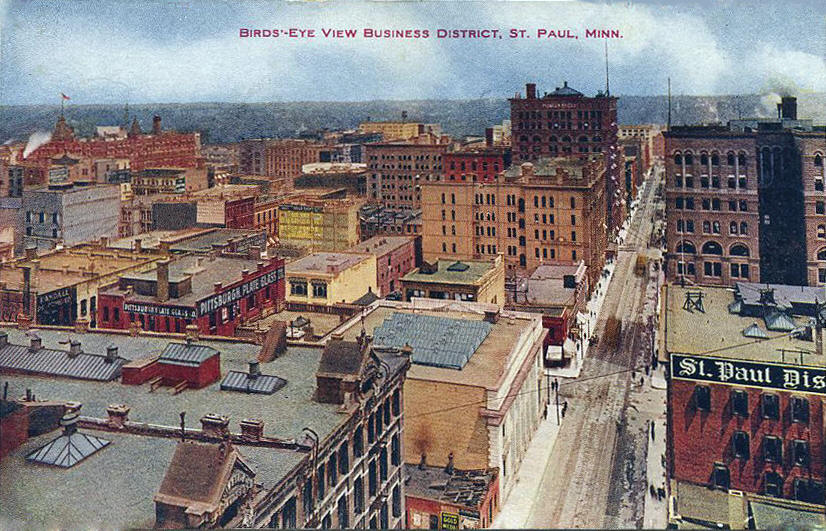
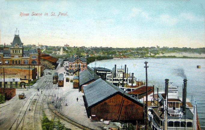
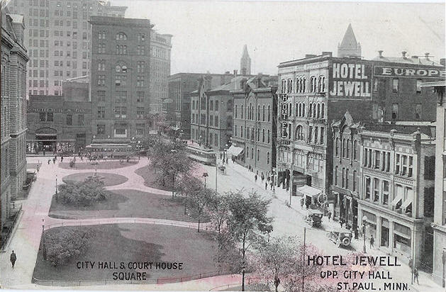
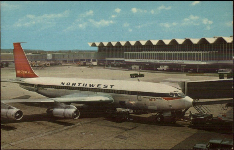
As for the train station in St Paul, it is affectionately called "SPUD", for St Paul Union Depot. Prior to the decline of passenger travel in the U.S. in the 60's, the area at the wye adjacent to SPUD was a huge complex, as can be seen below in some of the pictures. You had the Northern Pacific's Division Street Coach Yard, the Chicago, Burlington & Quincy's North Yard, and the Milwaukee's Old Yard. Too bad we didn't have digital cameras back then when you could take hundreds, no, thousands of pictures for literally nothing more than the cost of an SD card! More info on the depot is below in the first section, and a map of the 50's is directly below. Come the Amtrak era in 1971, SPUD was closed and the station was moved twice for the Empire Builder, first to Minneapolis, then to Midway station on the west side of St Paul near the (current) Minnesota Commercial operation. In 2012, Amtrak moved it's operation back to Union Depot after the station was renovated.
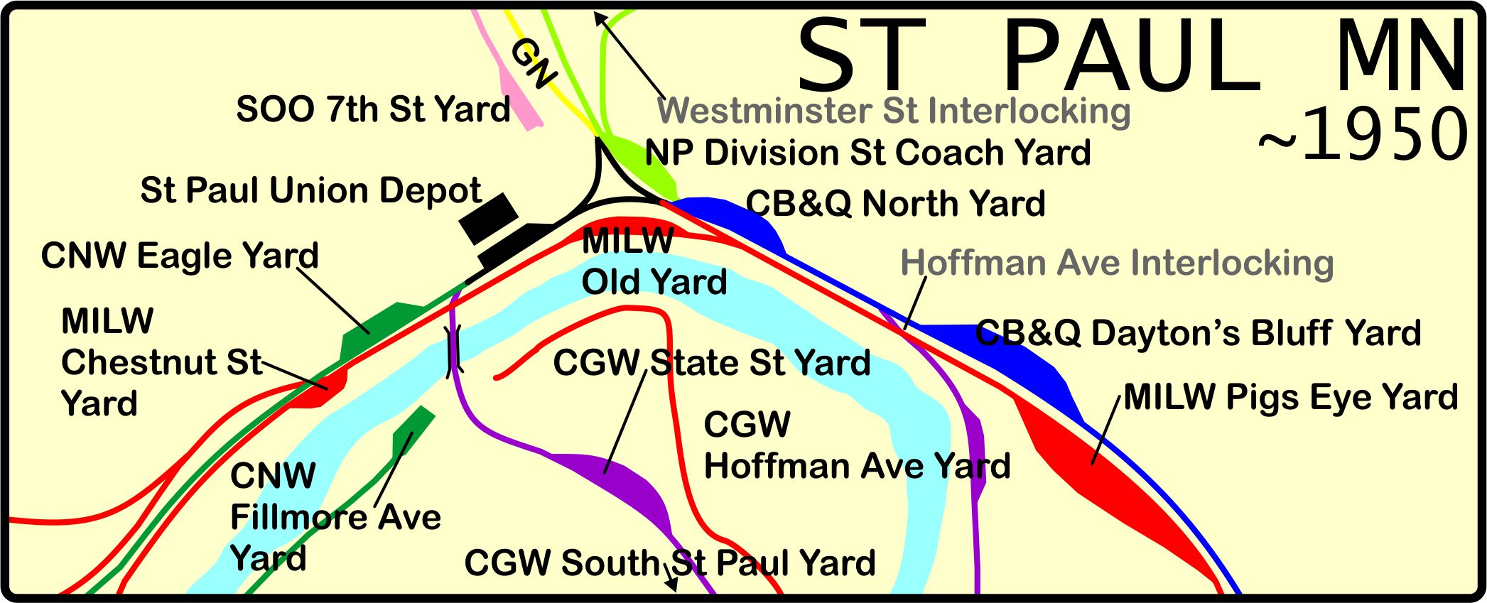
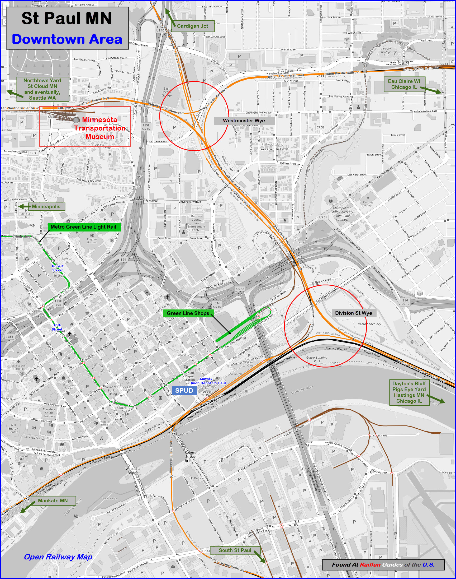
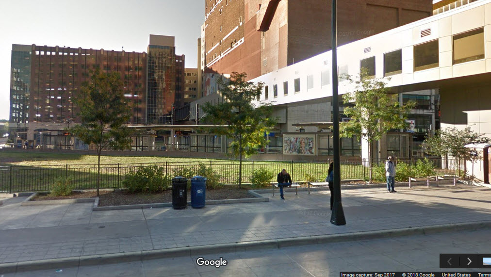
The two wye's, Westminster and Division Street, provide the railfan with a plethora of angles and backgrounds to make just about anyone happy. At Division Street, they have even installed a picnic area where you can watch the trains all day long without trespassing on railroad property, and just about everything that runs in the Twin City area passes by.
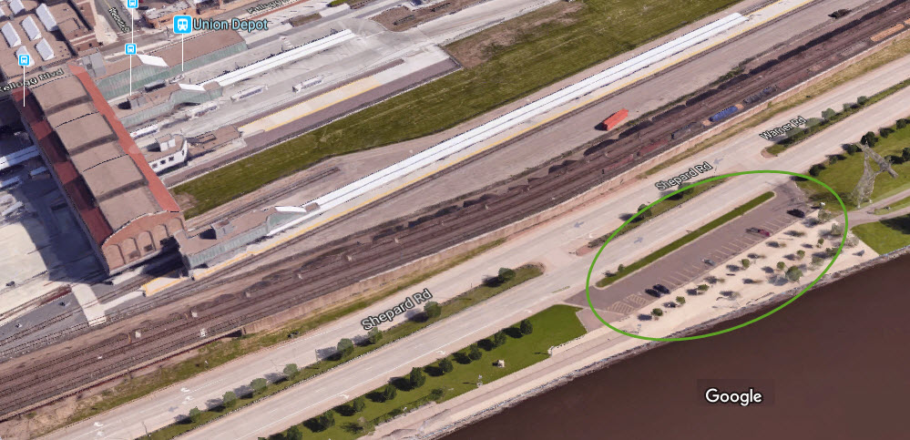
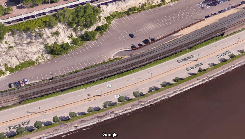
Across Shepard Road from from Union Depot is a parking lot if you want to park along the river and access the riverside walking path. From here, you can walk or bike along the entire riverfront and get pictures from an angle you would not otherwise have the opportunity. It may be a hike over to Dayton's Bluff, but now that the entire area is virtually "impenetrable" by railfans, this may be your best solution to getting pictures of the action along the Bluff. You can also get good pictures of UP trains crossing the river going over to, or coming from South St Paul.
Acknowledgements:
Jim Mihalek
Denver Todd
Google Maps
Open Railway Map
Bing Maps
Websites and other additional information sources of interest for the area:
http://railfan44.blogspot.com/2015/05/spud-not-potato-but-st-pauls-train-depot.html
http://www.lakesnwoods.com/StPaul/1910s.htm
https://www.american-rails.com/great-northern-railway.html#gallery[pageGallery]/1/
https://rrx.chadkluck.net/2009/04/skally-line/
Oy! Downtown St Paul is at the junction of I-94 (east/west) and I-35E (north/south), and they share a common road for about 5 blocks north of the train station. Exits are many. Then add US 52 coming in from South St Paul, and you have yourself some complicated interchanges. Pay attention to the signs, and familiarize yourself with the area on a map before coming here, you'll be glad you did! :-)
GPS Coordinates: 44.947710, -93.086309
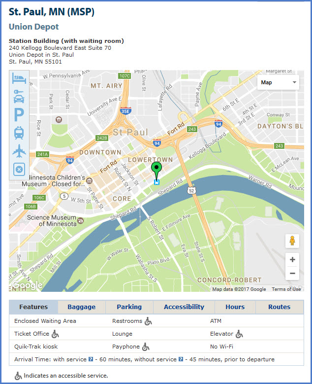
Address: 214 4th Street, East St Paul MN 55101
Phone: 651-202-2700
Tours: every other Tuesday @ 11am
Union Depot was re-opened in 2012 after a $238 million dollar remodeling project, funded in part by the American Recovery & Redevelopment Act of 2009. This project connected Amtrak and regional and local bus services, and will serve as a terminus of the Central Corridor Light Rail between St. Paul and Minneapolis, among other longer-term transitways for the region. The Depot offers guided tours every other Tuesday that provide access to the entire building and include discussions of the building's history and its role in St. Paul history. The depot also has five rooftop beehives that produce and sell Bee Line Honey.
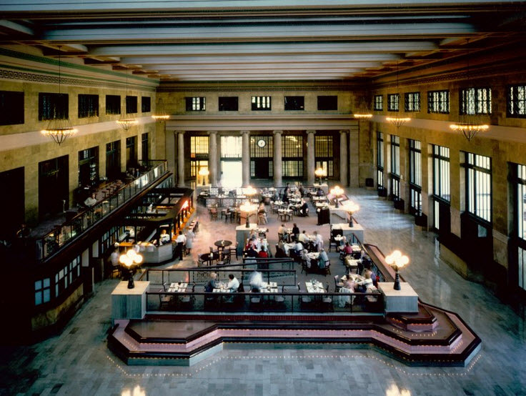
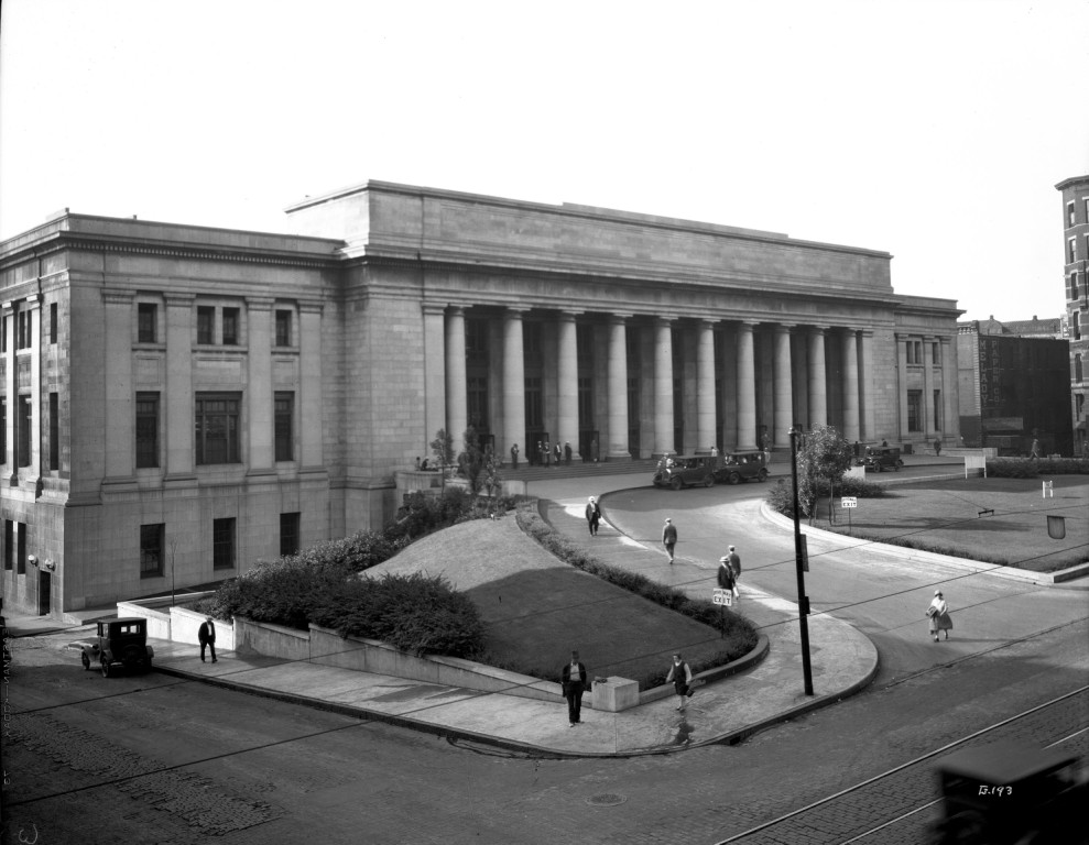
Union Depot was completed in 1926 by the major railroads serving the area and at its peak, the station served 20,000 passengers each day by connecting them to over three hundred routes. This station replaced a previous structure that was built in 1881 and destroyed by fire. Construction for the current station started in 1917 but was stalled owing to the outbreak of World War I. Union Depot was abandoned for twelve years from 1971 until its renovation in 1983. Being on the National Register of Historic Places, the primary task of this project was to restore the material conditions of this civic monument in Downtown St. Paul. The renovation also provided for new types of space to occur within the main concourse. Restaurants, retail tenants, and offices now occupy the Union Depot while it simultaneously remains in the spirit of its historic origins. The renovation adheres to all federal guidelines for historic places. The entire 150,000 square foot structure was restored and new windows were installed. Light fixtures were reproduced, the ticket counter was rebuilt, decorative plaster was replicated, and the upper mezzanine areas were opened up in order to overlook the great concourse below.
The Empire Builder, originally a Great Northern train, started using the station in 1929. In 1970, the GN merged with the CB&Q, and became the Burlington Northern. When Amtrak nationalized passenger train service in 1971, they moved the Empire Builder over to the former Great Northern Station in Minneapolis until 1978. From there, Amtrak service moved to Midway station in St Paul, where it remained until Union Depot was re-opened in 2012.
In looking at the old photos, wouldn't it have been great to be a railfan at the height of passenger service in the U.S. in 1945??? Look at all that "stuff"! :-) :-)
 Photo by Paul Crosby
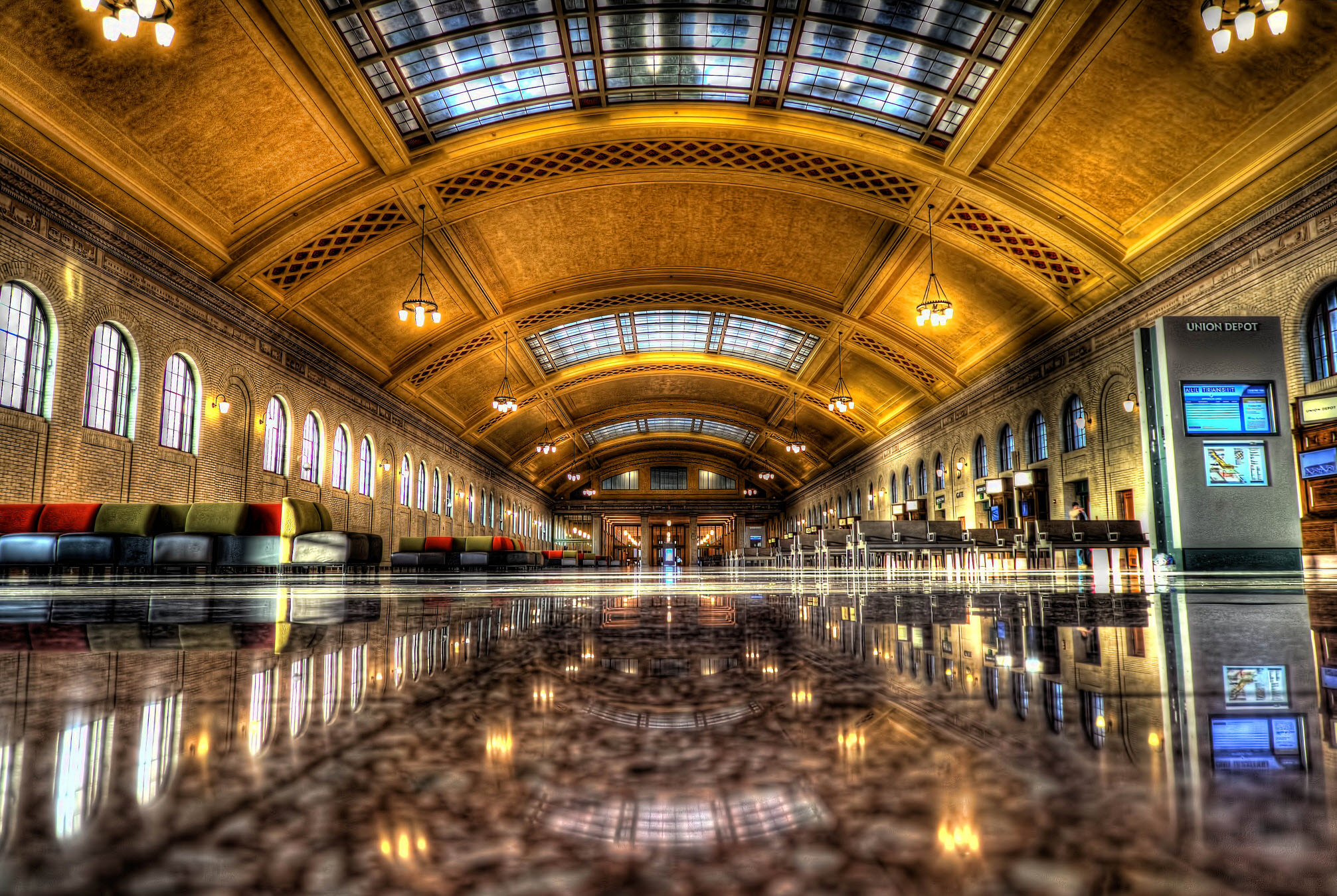
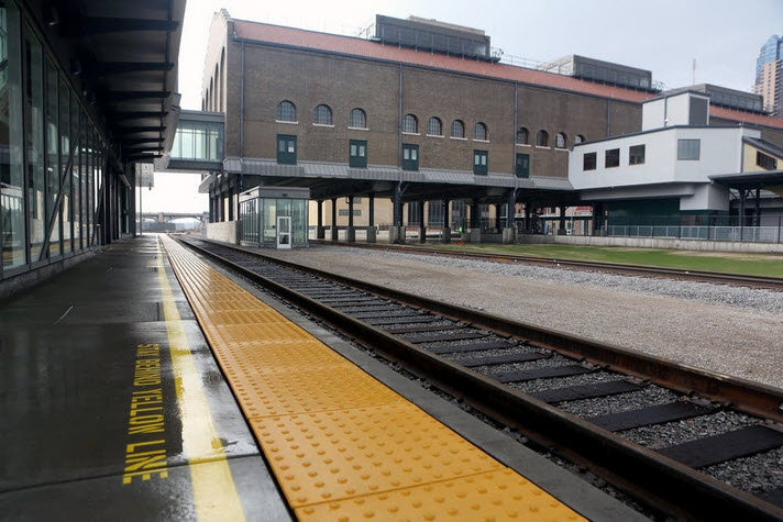 Photo by Jeffrey Thompson
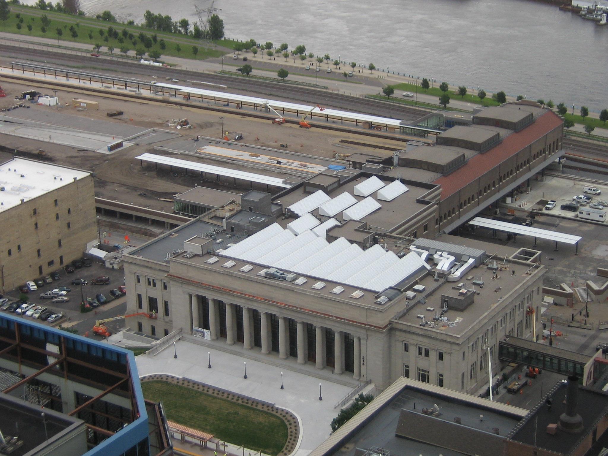
 in 1924


GPS Coordinates: 44.962516, -93.095974
193 Pennsylvania Ave E, St Paul, MN 55130
651-228-0263
Admission: $13.00, $35/family
http://transportationmuseum.org/
https://www.familyfuntwincities.com/directory/jackson-street-roundhouse/

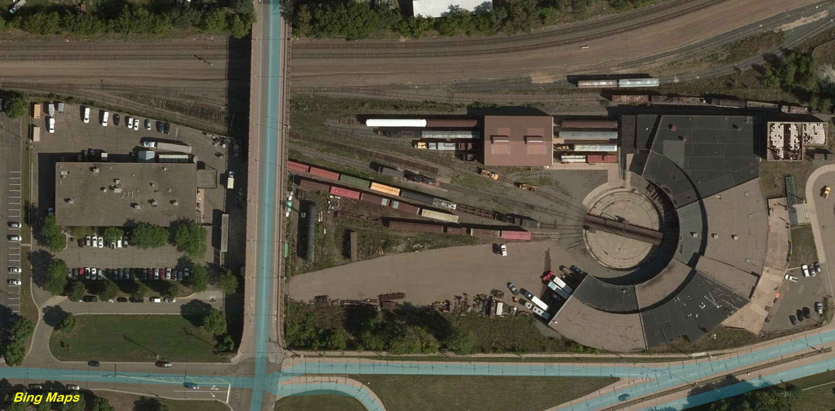
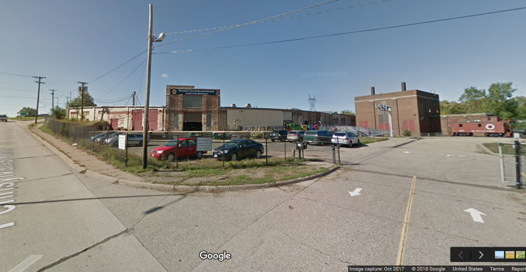
A downtown railroad museum located right next to the tracks they used to support, what could be better?
From the MTM website: Minnesota Transportation Museum (MTM) is located at the historic Jackson Street Roundhouse. This building was originally a steam engine maintenance facility for The Great Northern Railroad.
The Roundhouse was built in 1907 and was one of the last roundhouses built by the "Empire Builder", James J. Hill. It replaced a smaller wooden engine-house of the Saint Paul & Pacific. The Roundhouse was part of a large shop complex built in the 1880s.
Located near downtown Saint Paul just north and east of the State Capitol, the complex had been sold by Great Northern in 1960. The Roundhouse was then remodeled as a warehouse/industrial building. All the tracks were removed and an addition was built where the turntable used to be.
MTM took possession of the Roundhouse in 1986, acquiring a substantial mortgage. Jackson Street was restored as an operating roundhouse, but with several changes. It is MTM's backshop, but it also houses exhibitions, archives, an audio-visual theater, a meeting room, and offices. The turntable was re-installed in 2001 and the connection with the Burlington Northern (BN) has been reinstalled, along with five yard tracks. BN has cleaned up environmental pollution, mostly petroleum in the groundwater. The large mortgage was paid off through the generous financial support of longtime director Arthur E. Pew III and others.
The Museum at Jackson Street Roundhouse opened in 1999. In March of that year, MTM hired its first paid Executive Director and the administrative offices moved into a renovated space, shared with Great Northern and Northern Pacific Historical Societies. They and the MTM are creating an archive with climate-controlled space and a combined cataloging system.

 from Pennsylvania Ave
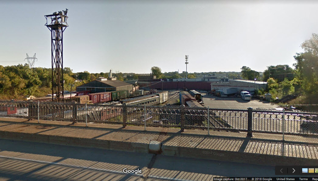 from Jackson St overpass
GPS Coordinates: 44.962486, -93.086155 (center of the wye)
https://www.trainorders.com/discussion/read.php?11,3509635
https://rrx.chadkluck.net/2008/07/westminster-junction/
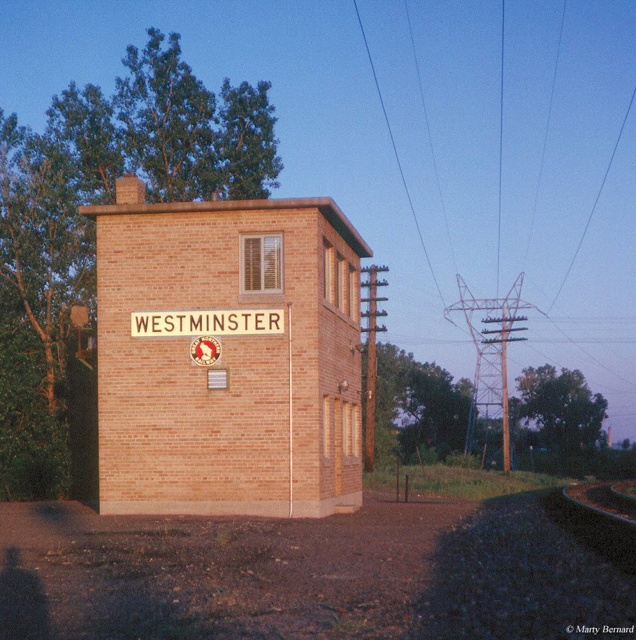
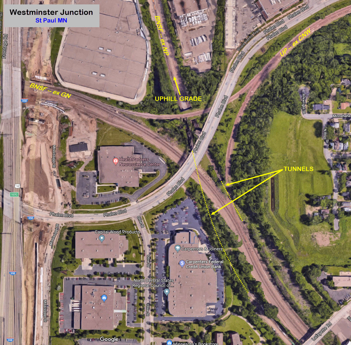
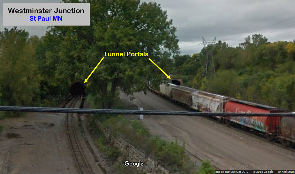
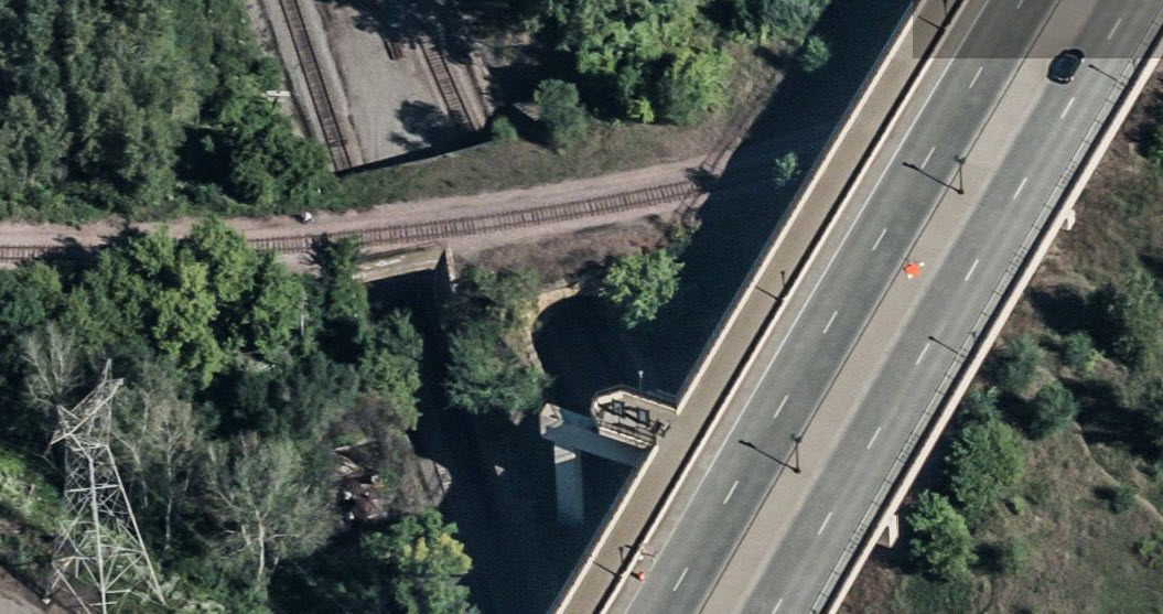
There are two wyes in downtown St Paul - there used to be a third, the SOO Line Junction, equal distance north of Westminster as is Division St is to the south. This one goes by the name of Westminster, and was a junction between the Great Northern and the Chicago North Western, with the Northern Pacific running north/south under the wye in two really, really short tunnels (to go under the north leg of the wye), and two short tunnels. All of the lines are still there and still used. Apparently, the two longer tunnels are two of the few, if not all of the tunnels in Minnesota (info needed to collaborate this).
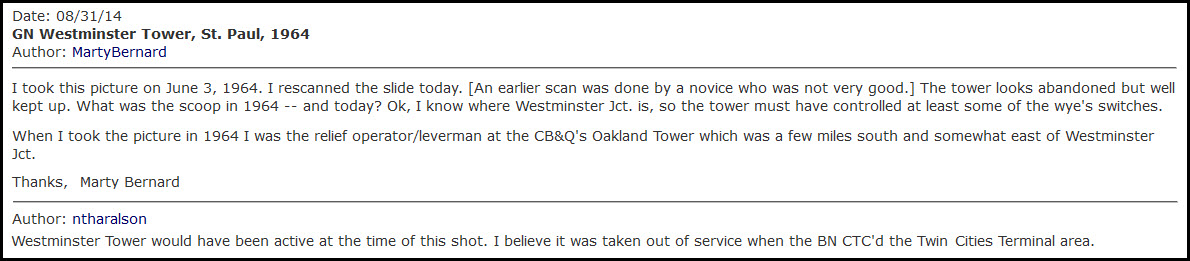
Can't tell you anything about the Westminster tower.... info on it is almost non-existent, does anyone know the scoop on it?
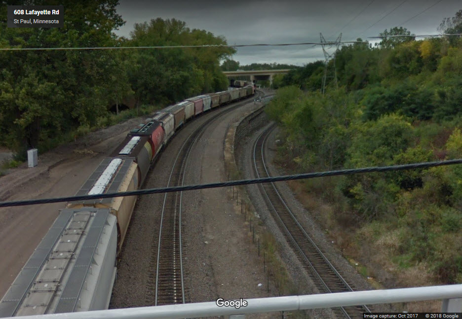
With a good telephoto lens, you could easily pull in a SB freight coming out of either of the tunnels from the Lafayette Rd overpass.....
Railfan here with at least one other railfan, two would be better! :-)
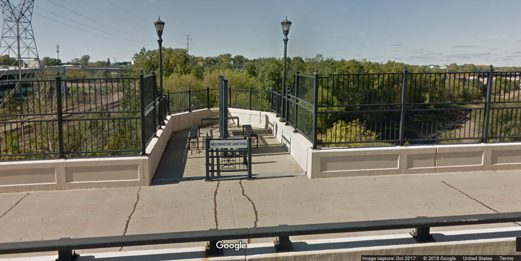
There are two good locations to view the junction and the tunnels from, and they are the Phalen Blvd and Lafayette St bridges. The Phalen bridge actually has a viewing platform over the two really short tunnels, along with a marker describing the history of the junction.

GPS Coordinates: 44.950601, -93.076097
Notice they kindly put a picnic area right next to the tracks! :-)
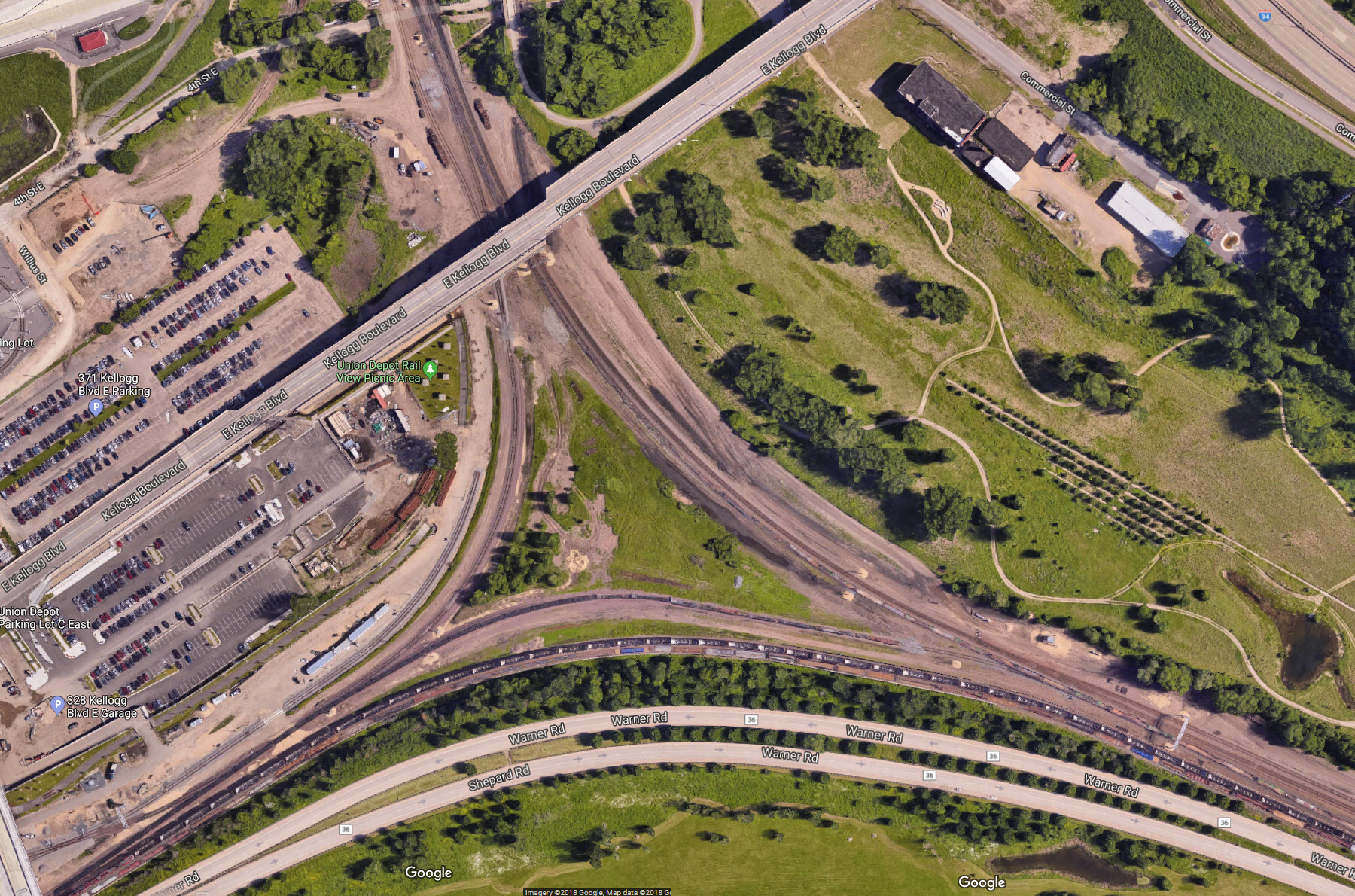
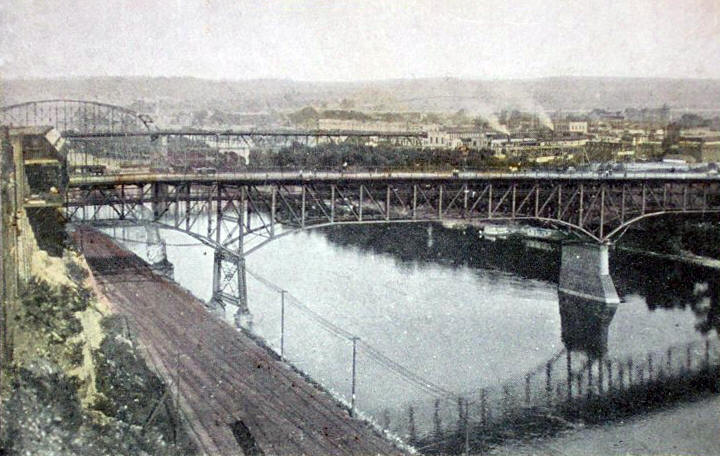
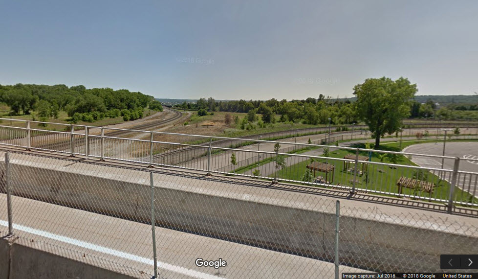 From the Kellog Blvd bridge
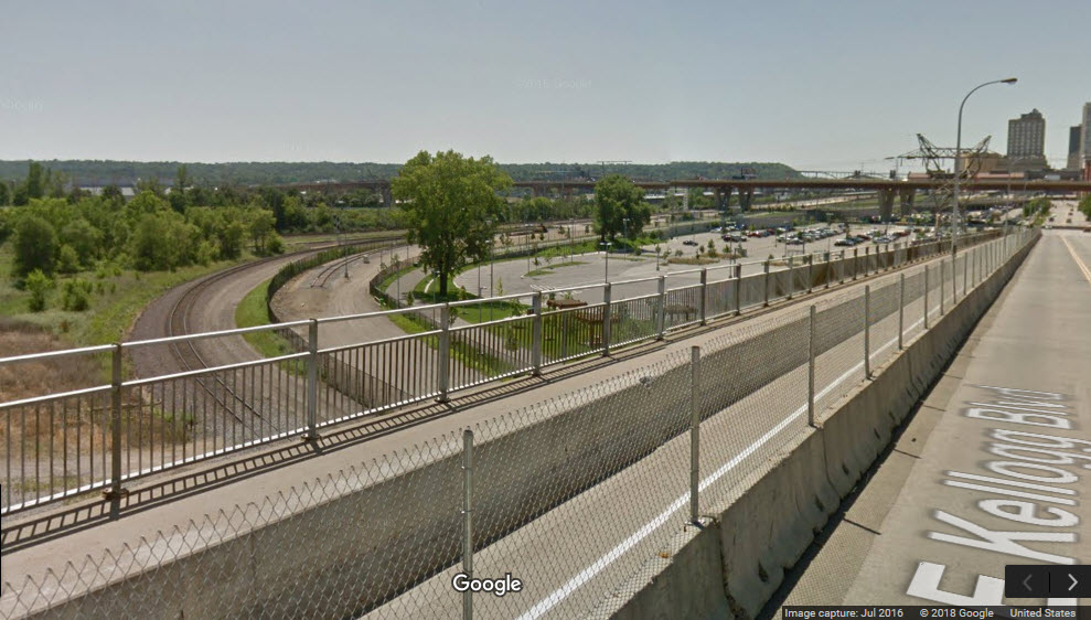
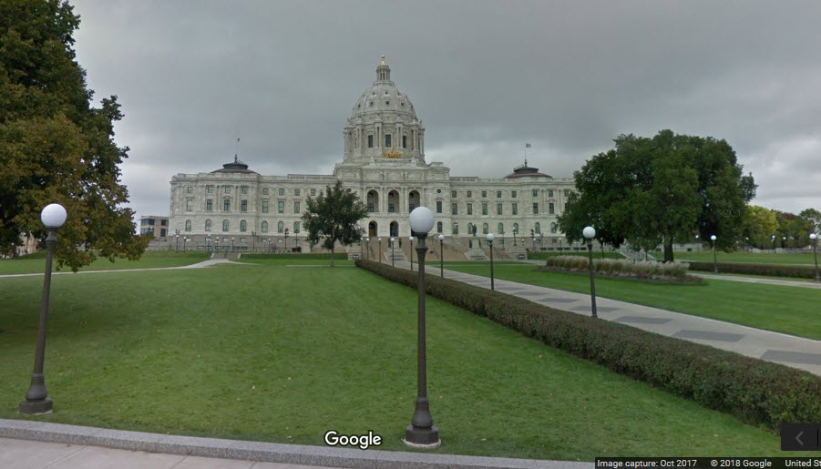
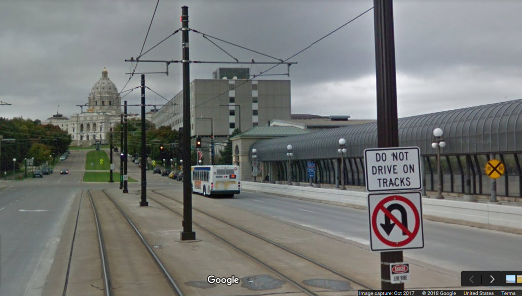
GPS Coordinates: 44.955187, -93.102215
75 Rev Dr Martin Luther King Jr Boulevard., St Paul, MN 55155
https://mn.gov/admin/government/buildings-grounds/building-management/buildings/statecapitol.jsp
http://www.mnhs.org/capitol
https://en.wikipedia.org/wiki/Minnesota_State_Capitol
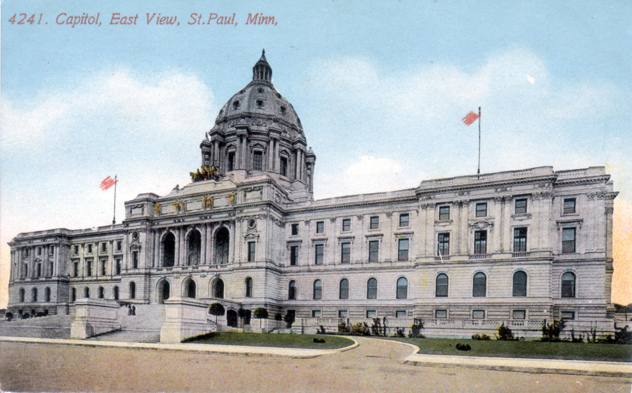
From Wikipedia: The building was built by Butler-Ryan Construction and designed by Cass Gilbert and modeled after Saint Peter's Basilica in Rome—the unsupported marble dome is the second largest in the world, after Saint Peter's. However, like all capitols with domes in the US it is also inspired by the idea of domed capitols originating with the United States Capitol dome. Work began on the capitol in 1896, its corner-stone laid July 27, 1898, and construction was completed in 1905. It is the third building to serve this purpose: the first capitol was destroyed by fire in 1881, and the second was completed in 1883, but was considered to be too small almost immediately.
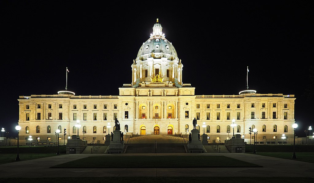 picture by McGhiever/Wikipedia
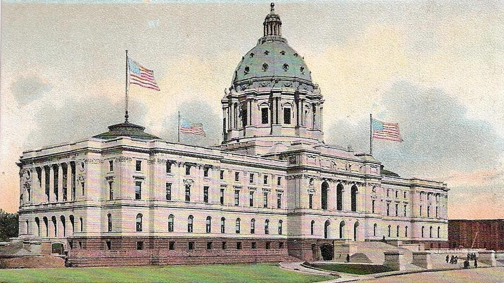
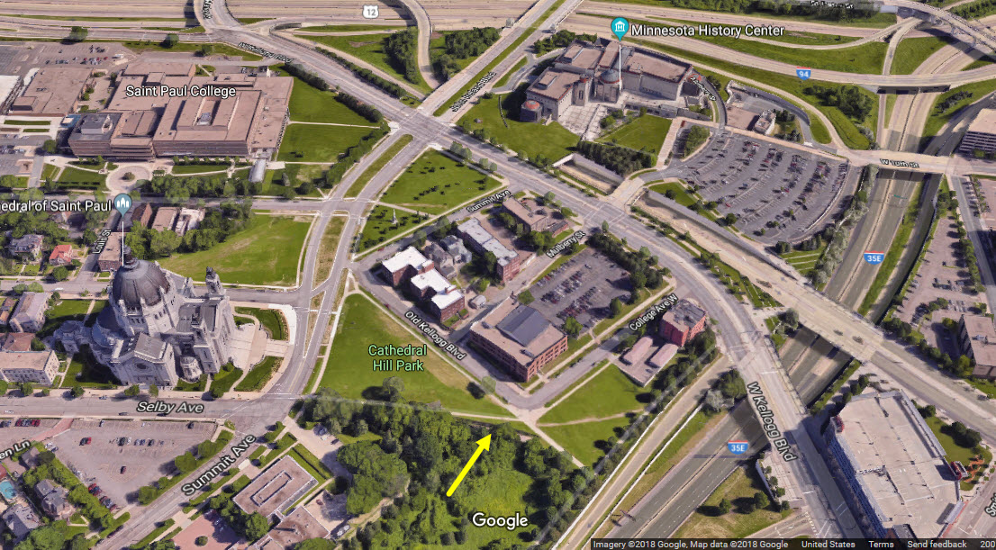
GPS Coordinates: 44.946539, -93.106827
https://streets.mn/2018/07/31/the-story-of-saint-pauls-selby-avenue-tunnel/
https://substreet.org/selby-streetcar-tunnel/
http://forgottenminnesota.com/2011/08/the-rise-of-the-selby-avenue-streetcar-line/ its a right click disabled page
https://en.wikipedia.org/wiki/Selby_Avenue
http://www.placeography.org/index.php/Selby_Tunnel%2C_Saint_Paul%2C_Minnesota
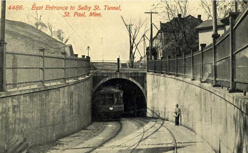
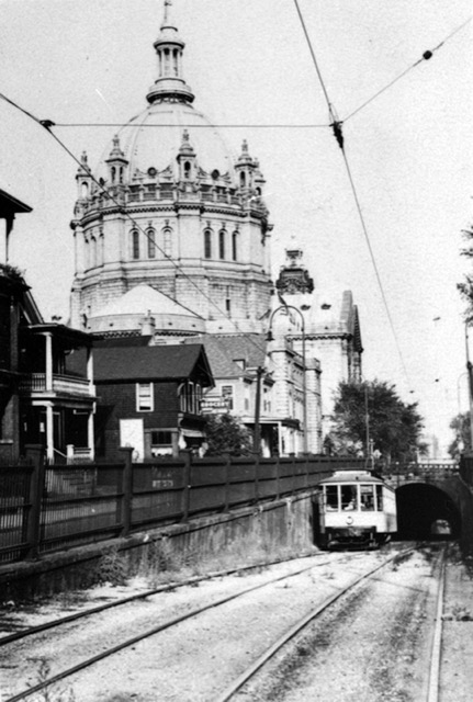
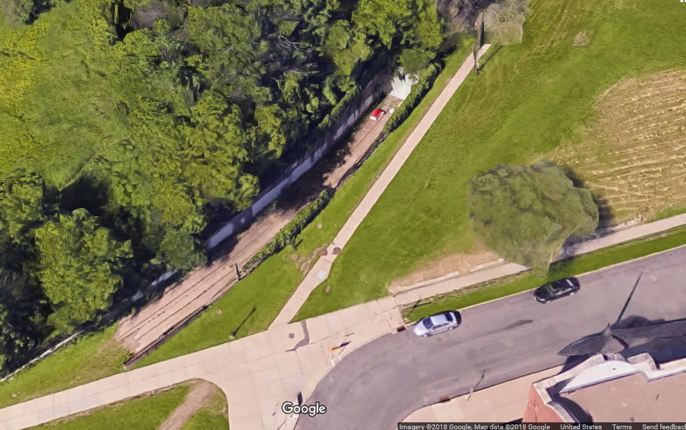
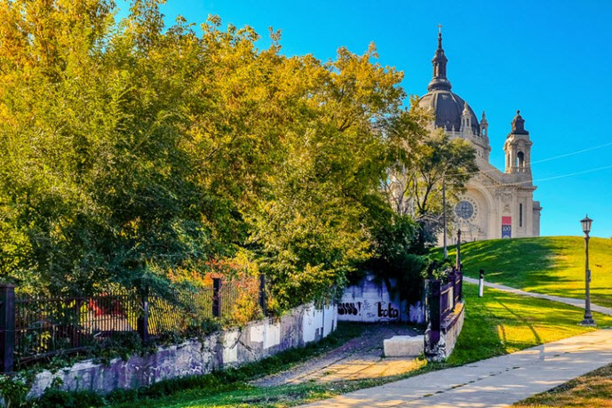
Here is the "south" end of the Selby Ave Tunnel, that used to be for the streetcars coming off of Selby Ave.
From the streets of St Paul page: As Saint Paul’s population grew in the late 19th Century, people began moving out of the city’s core and into residential areas adjacent to downtown. The Selby Avenue streetcar line was built in 1888 to provide people with transportation from their homes on top of the hill to the offices, factories, and shops downtown, and to the transportation hub – Union Depot. With the newly christened Selby-Lake line up and running, the streetcars made runs between Minneapolis and St. Paul at all times of the day. The Selby-Lake line was the most popular route in the entire streetcar system.
Most of the line traversed a flat Twin Cites landscape. Near the Cathedral of Saint Paul the electric engines of the streetcars struggled to climb the steep 14 percent grade. The system used counterweighted cable cars but a more permanent solution had to be found as service up and down the hill was slow and dangerous. The cable cars could not travel more than 10 miles per hour. In 1906 the Twin Cities Rapid Transit (TCRT) cut a tunnel under Selby Avenue lowering the grade to 7 percent, which was manageable for the electric streetcars to handle without counterweights. After a year of digging, the two-track tunnel opened in 1907. Streetcars bound for downtown St. Paul traveled below this section of Selby Avenue near Nina Street and descended quickly through the 1,472 foot long passage to emerge at the base of the hill.
The last streetcar passed through the tunnel in 1954, three years after General Motors promised to finance 525 city busses, with the understanding that all streetcars would be taken off the streets and the rails would be sold or destroyed. Today, the lower entrance to the tunnel can still be seen below the Cathedral of St. Paul, complete with tracks appearing from a thick concrete wall that blocks anyone from going inside.
The tunnel was officially closed in 1959. The upper entrance was completely sealed and paved over. The lower entrance was superficially closed until the mid 80's, when they put in the concrete wall you can see today, until that happened, the homeless used the tunnel as an escape from the harsh Minnesota winters.. The tracks that remain visible are indeed a rare sight in the Twin Cities, as very little of the any streetcar trackage remains today. The trolley museum in Minneapolis has some of the only other streetcar trackage remaining.

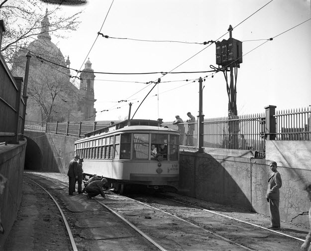
 A postcard of the upper level street entrance
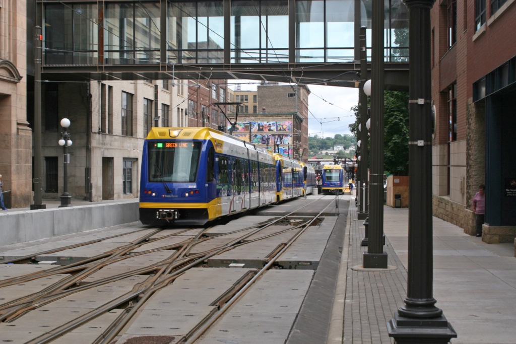
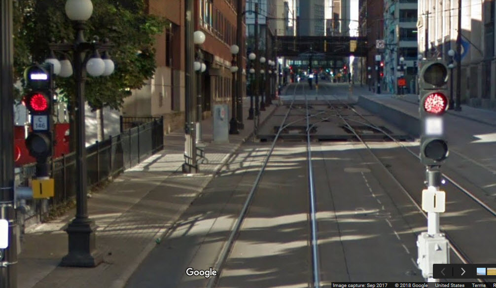
Light Rail - Station by Station
Depending on what you consider downtown, there are three/four/or five light rail stations in the downtown area of St Paul: Capitol, Robert St, 10th St, Central, and Union Depot, and the Green Line shops.
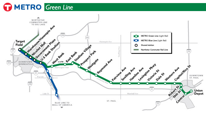
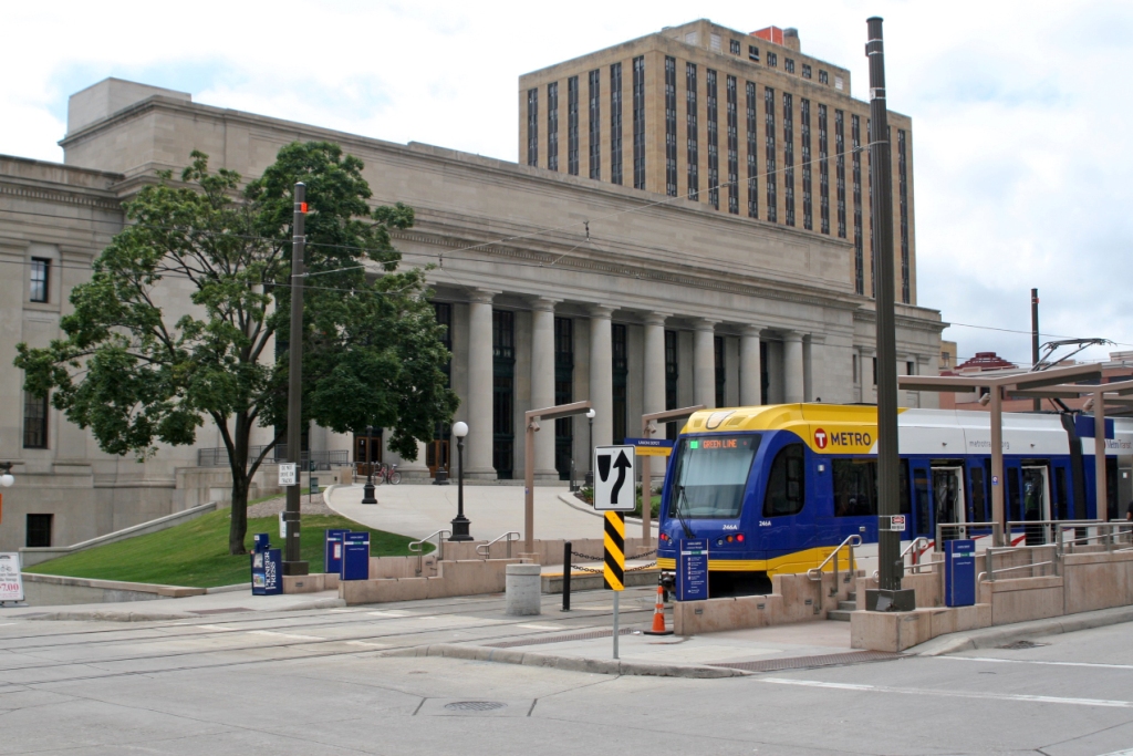
Capitol / Rice St
GPS Coordinates: 44.955683, -93.105131

Robert St
GPS Coordinates: 44.953694, -93.097137
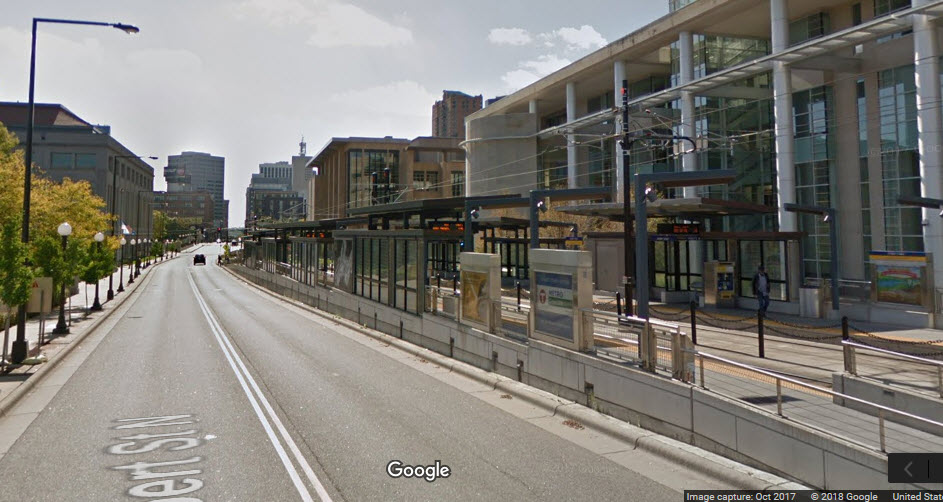
 Pedestrian Grade Crossing! :-)
10th St
GPS Coordinates: 44.950618, -93.097522


Central
GPS Coordinates: 44.946158, -93.092142

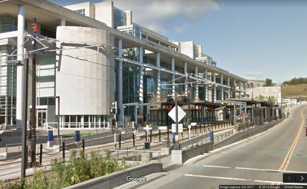
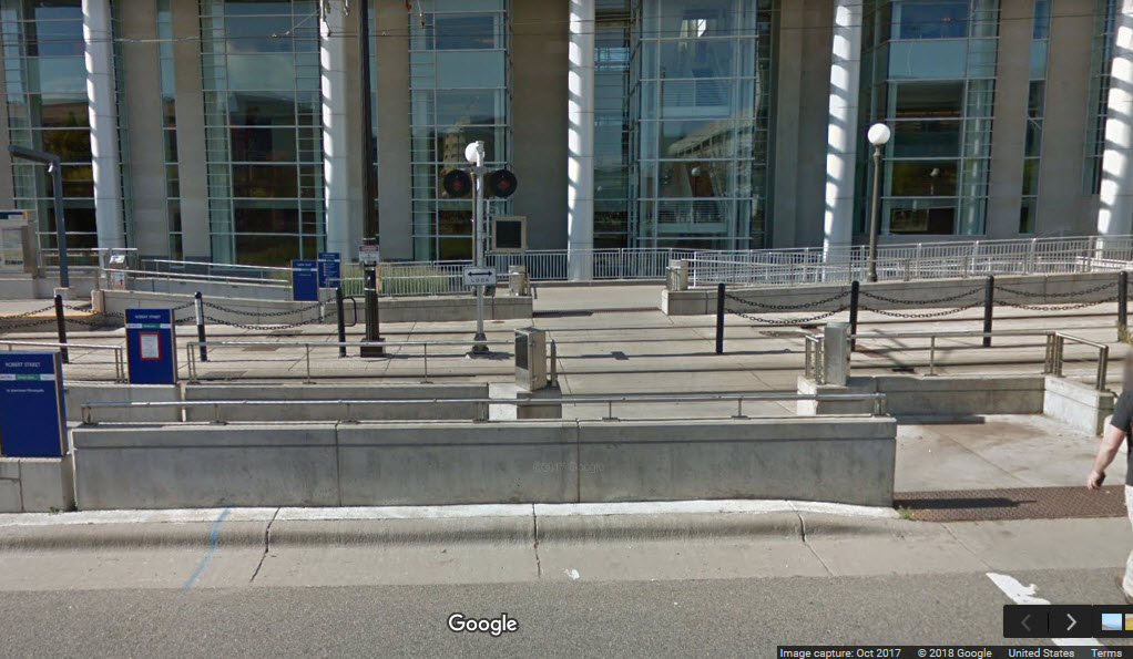
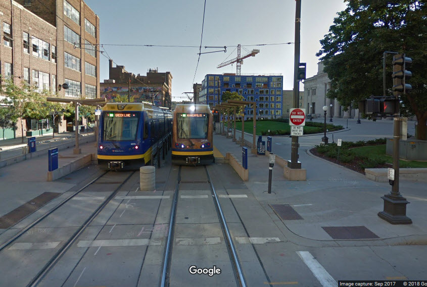
Union Depot
GPS Coordinates: 44.948211, -93.086779
This station is the current end of the Green Line. The other end of this line is in Minneapolis at Target Field, for now, until the SW Line is built.
All photos are by Jim Mihalek except as noted.
You don't often see many double crossovers on light rail systems such as the one here, the trackwork is too complicated and more expensive to install.

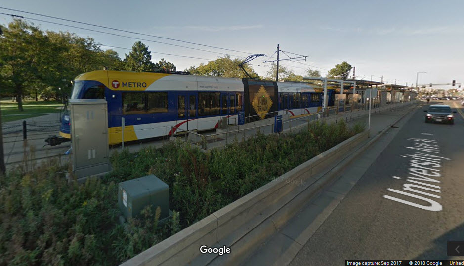
the Green Line Light Rail Shops
The
The
The
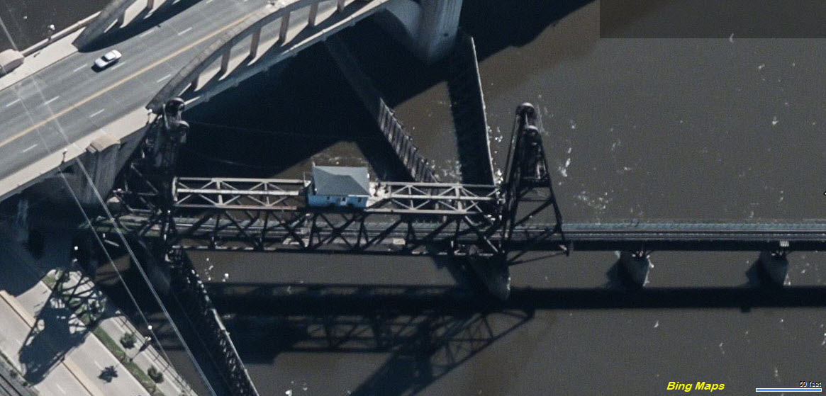
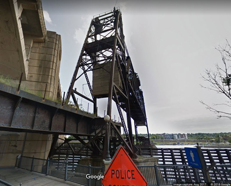
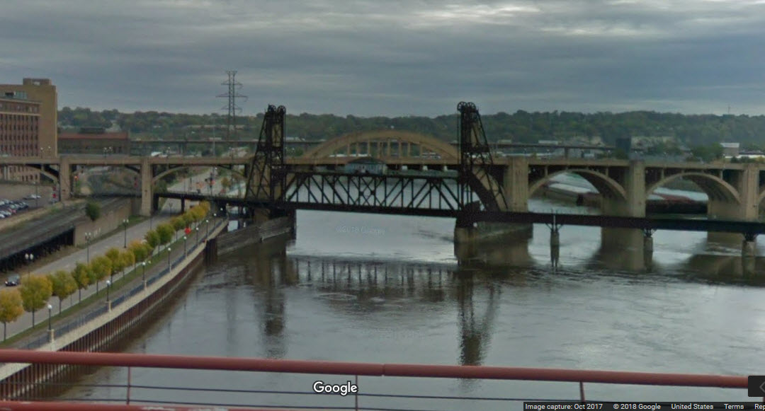
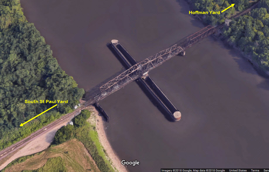
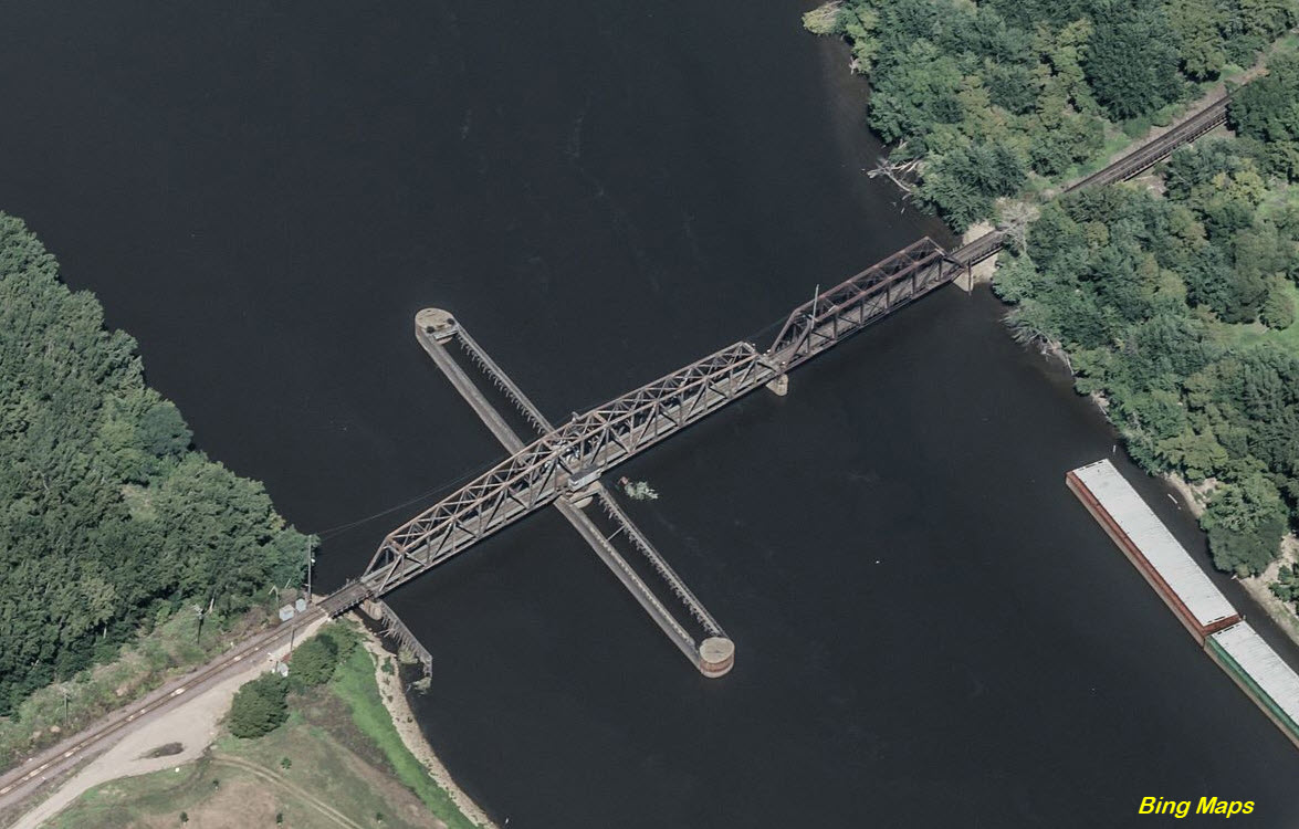
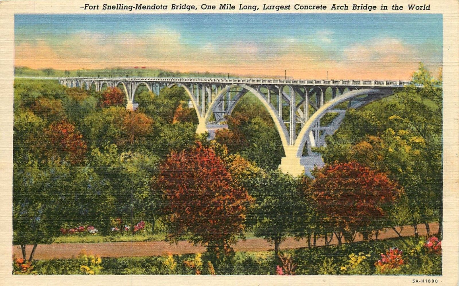
A vertical lift bridge, it usually remains in the UP position.

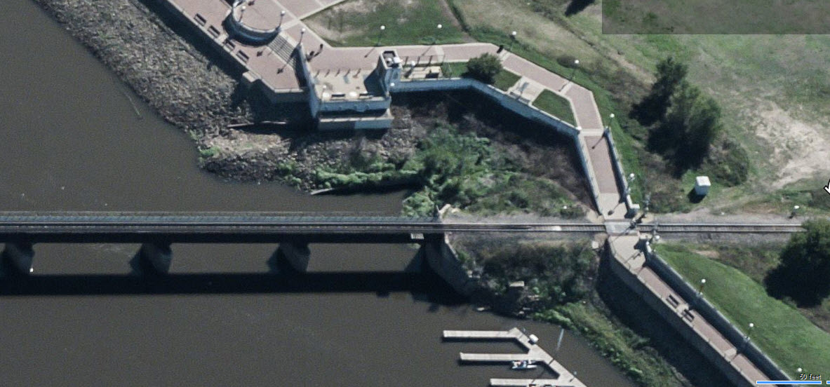
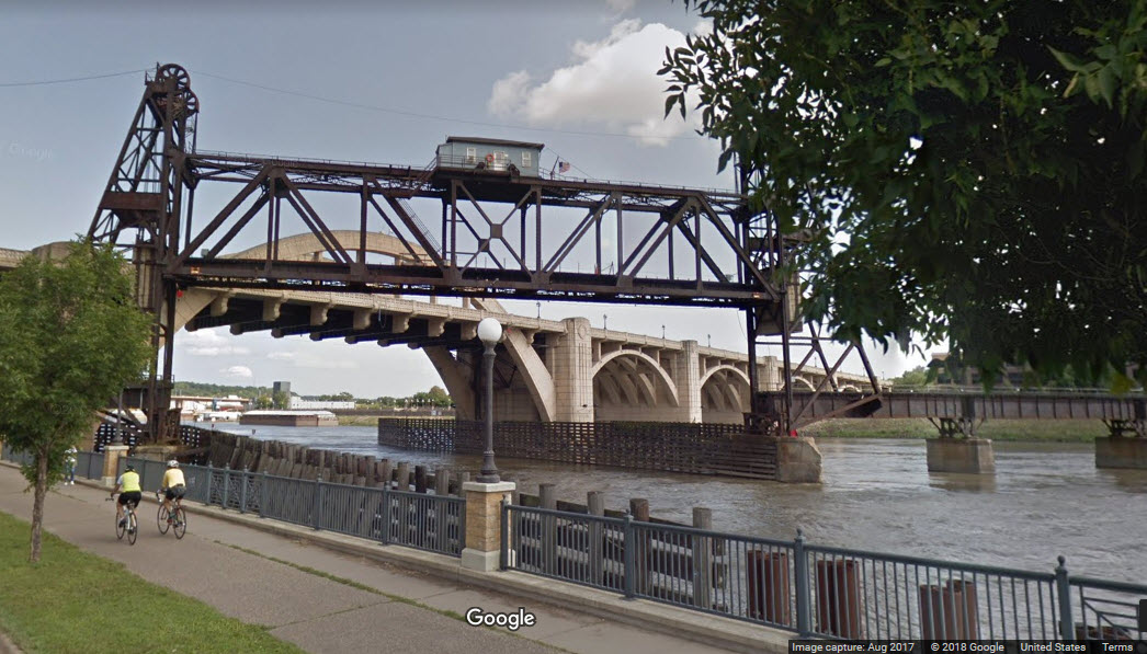
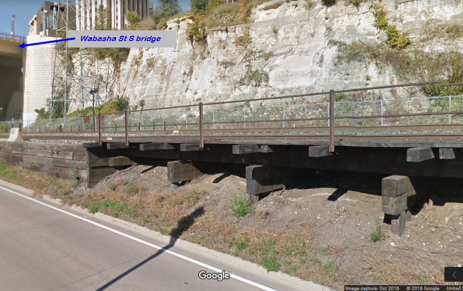
 from Wabasha St bridge
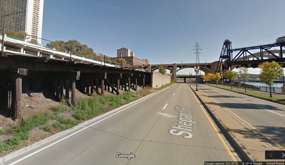
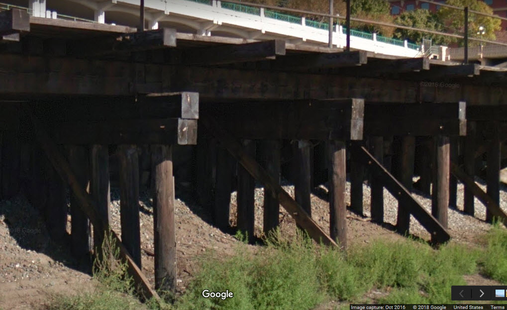
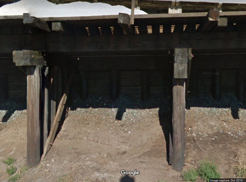
I don't know if this qualifies as a bridge, but this is where I am putting it.... Not sure why the tracks were built on this instead of being built up on a fill (with a concrete retaining wall) like the rest of the line along Shepard St, but it adds an interesting contrast for photo ops.

Anyone have a boat and wanna go out and get a good shot of this bridge? :-)

Postcards N Such.....


Courtesy of the University of Texas Library, click here for their index page.
Disclaimers:
I love trains, and I love signals. I am not an expert. My webpages reflect what I find on the topic of the page. This is something I have fun with while trying to help others.
Please Note: Since the main focus of my two websites is railroad signals, the railfan guides are oriented towards the signal fan being able to locate them. For those of you into the modeling aspect of our hobby, my indexa page has a list of almost everything railroad oriented I can think of to provide you with at least a few pictures to help you detail your pike.
If this is a railfan page, every effort has been made to make sure that the information contained on this map and in this railfan guide is correct. Once in a while, an error may creep in :-)
My philosophy: Pictures and maps are worth a thousand words, especially for railfanning. Text descriptions only get you so far, especially if you get lost or disoriented. Take along good maps.... a GPS is OK to get somewhere, but maps are still better if you get lost! I belong to AAA, which allows you to get local maps for free when you visit the local branches. ADC puts out a nice series of county maps for the Washington DC area, but their state maps do not have the railroads on them. If you can find em, I like the National Geographic map book of the U.S..... good, clear, and concise graphics, and they do a really good job of showing you where tourist type attractions are, although they too lack the railroads. Other notes about specific areas will show up on that page if known.
Aerial shots were taken from either Google or Bing Maps as noted. Screen captures are made with Snagit, a Techsmith product... a great tool if you have never used it!
By the way, floobydust is a term I picked up 30-40 years ago from a National Semiconductor data book, and means miscellaneous and/or other stuff.
Pictures and additional information is always needed if anyone feels inclined to take 'em, send 'em, and share 'em, or if you have something to add or correct.... credit is always given! Please be NICE!!! Contact info is here
Beware: If used as a source, ANYTHING from Wikipedia must be treated as being possibly being inaccurate, wrong, or not true.
RAILFAN GUIDES HOME
RAILROAD SIGNALS HOME
NEW 08/30/2018,
OCT16/2021, DEC14/22/2022
Last Modified
22-Dec-2022