
In General
Map
Pictures
Signals
RAILROAD SIGNALS HOME
Location / Name:
North West of St Cloud and Minneapolis MN
What's Here:
BNSF Mainline action between Minneapolis and the west.
Scanner Frequencies:
?
Access by train/transit:
None
The Scoop:
This page covers a day of chasing between Staples and Rice MN, generally going from north to south.
Please note, the map below is an 11x17 picture. The map is not finished - it is being replaced by two standard 8-1/2x11 maps.
If you are chasing the BNSF thru here, you will find that US 10 follows it for the most part, paralleling it for almost the entire run between Rice and Cushing.
Acknowledgements:
a BIG thanks to Jim Mihalek for taking the pictures and providing the descriptions.
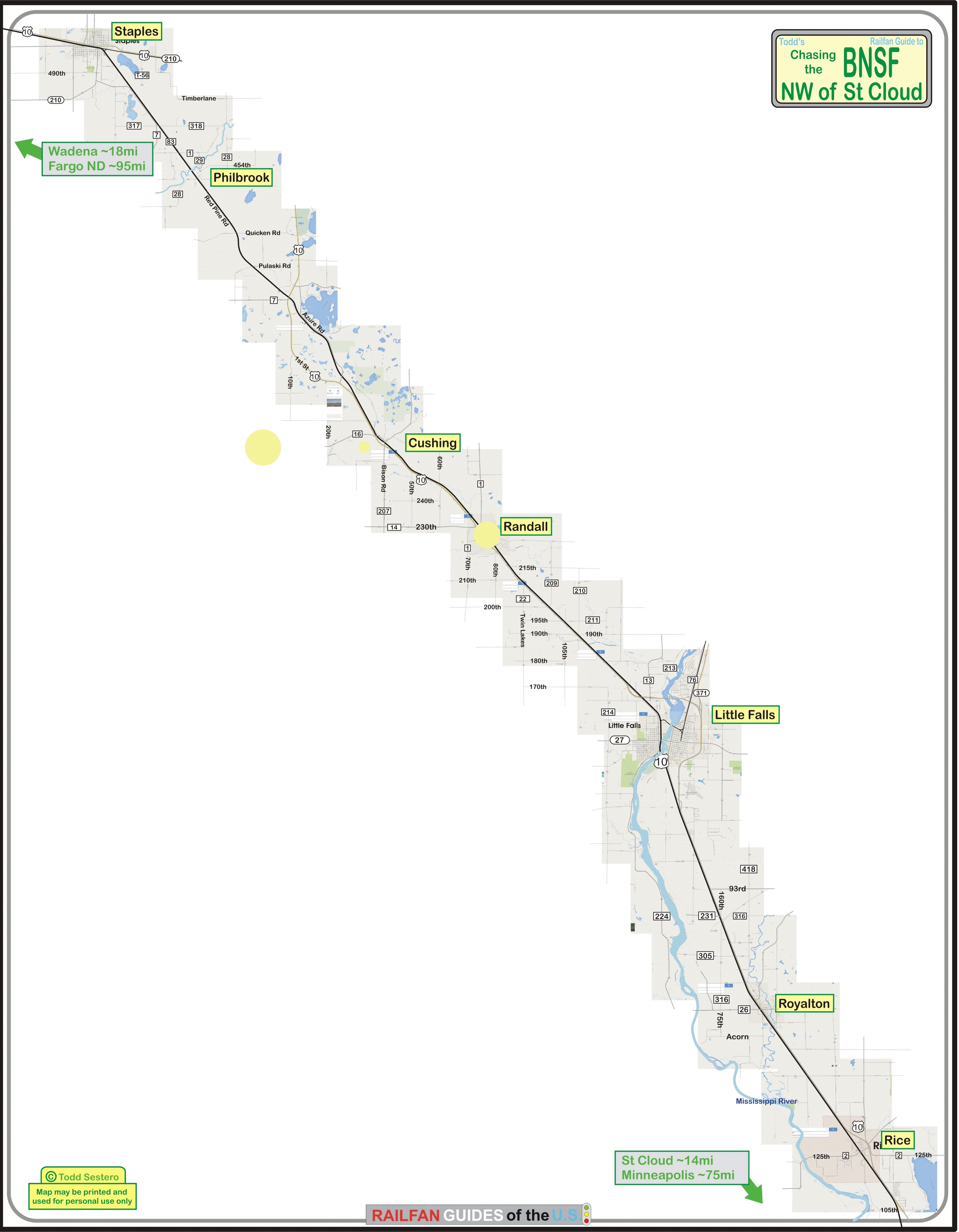
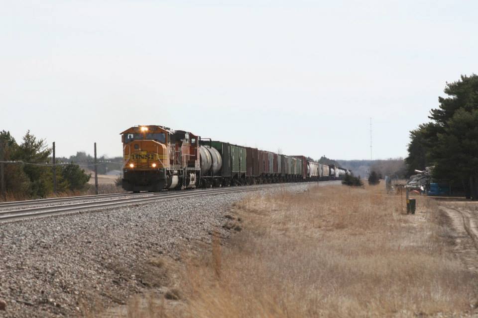
Staples
Arriving in Staples I am greeted by a train without much time to do anything about it except park and shoot.
This one is headed for the coal dock in Superior WI.
No sooner am I back in the car another headlight appears in the west. I have the time to turn around and catch them as they head out of town.
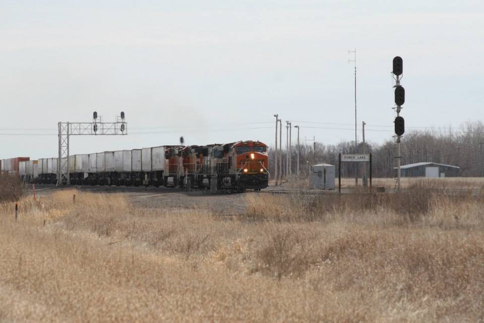
After making the loop to the west end of the yard, the final westbound of the fleet comes through and accelerates past Dower Lake.
The BNSF is planning to double track most, if not all of this line to better handle the increasing volume of traffic. It looks as if they have started clearing trees and staking the route for that. It would have helped to have it now as this short stack train has one engine down and is only making 30mph coming into Cushing.
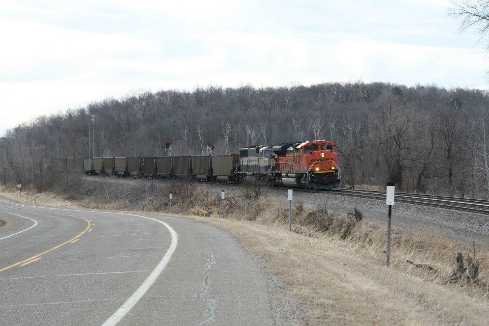
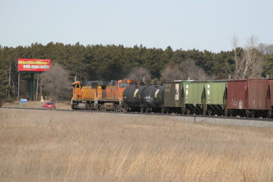
Philbrook
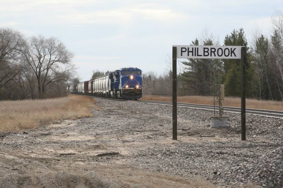
I knew this one was coming but it still managed to sneak up on me as I approached the crossing. No doubt as to where we are.
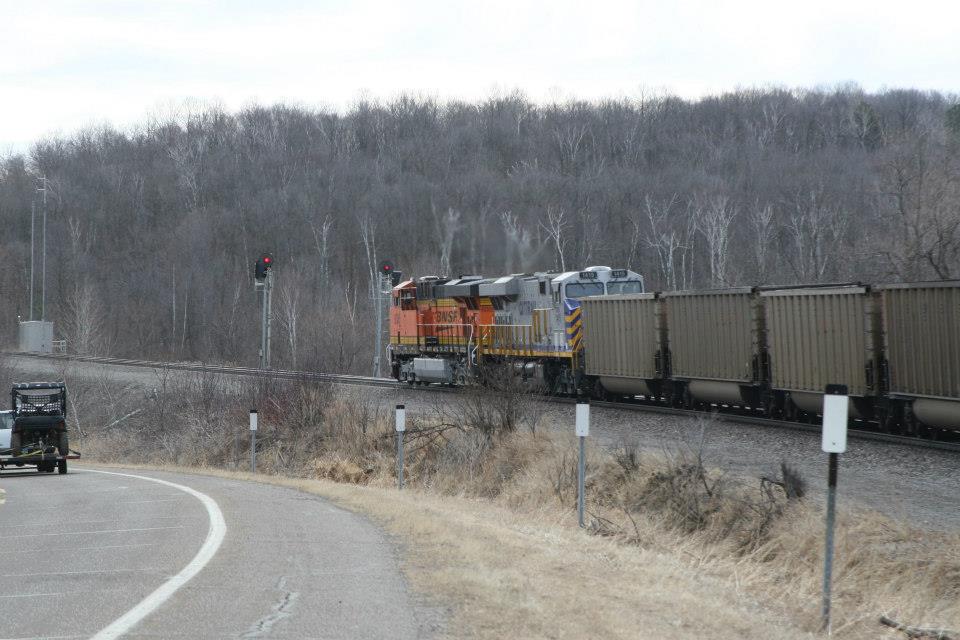
Another one that was closer than I expected, Becker loads ease down to Philbrook to wait on one westbound.
This one, the WB, also features double DPU.
Cushing
The BNSF is planning to double track most, if not all of this line to better handle the increasing volume of traffic. It looks as if they have started clearing trees and staking the route for that. It would have helped to have it now as this short stack train has one engine down and is only making 30mph coming into Cushing.
Hot on his block is a westbound grain empty at Cushing.
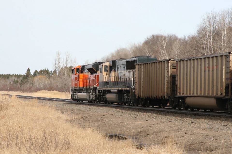
Lincoln
Because close behind is an oil empty at Lincoln (a continuation from the picture below).
East Lincoln
This Becker empty was able to get out on the main, and is making a good run at East Lincoln.
Double DPUs are doing their part keeping the speed up.
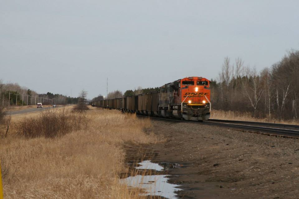
Along The Way, Heading Home
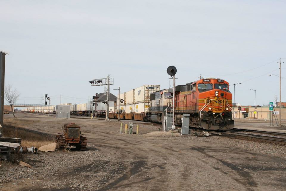
Heading back home I pass on several westbounds, but this one was "right there" so I stopped and grabbed the shot.
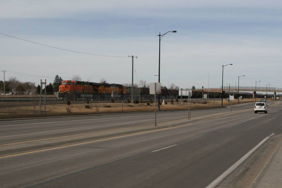
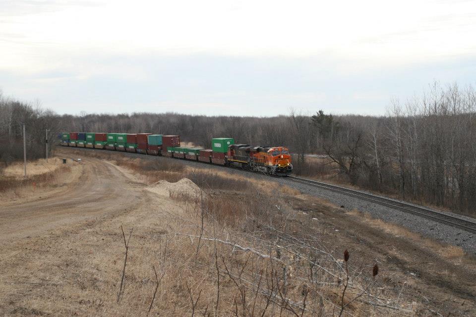
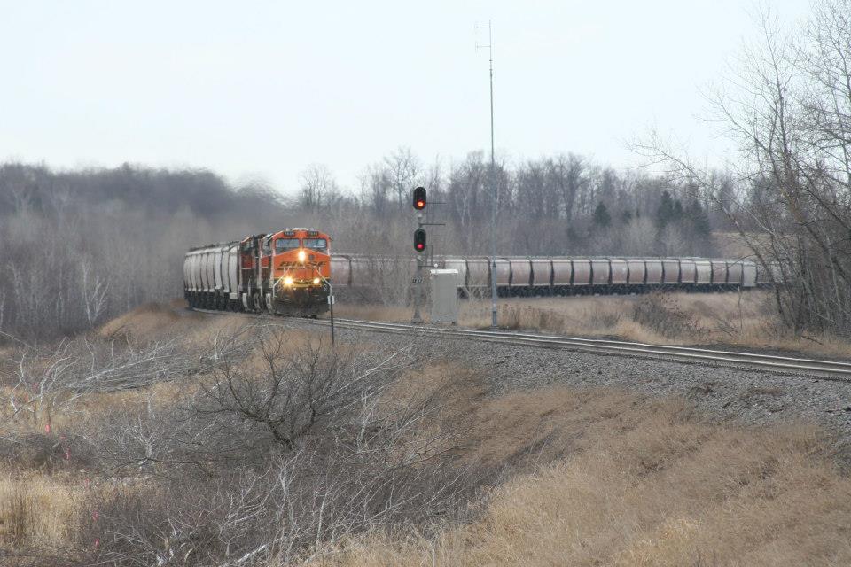
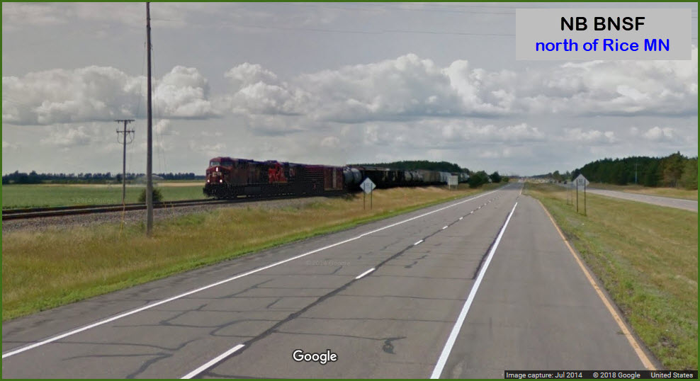
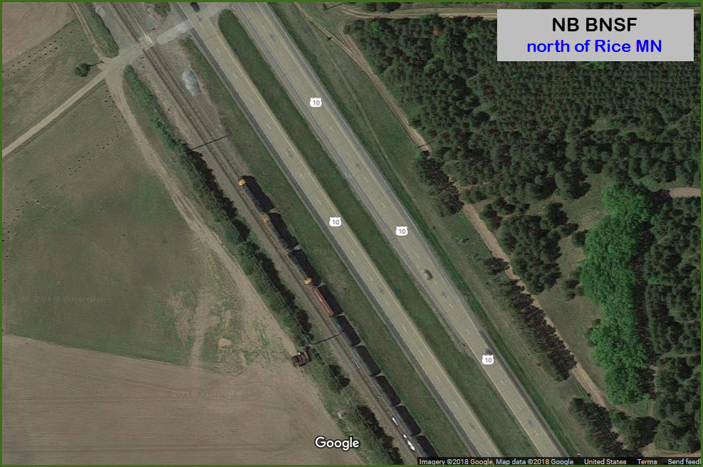
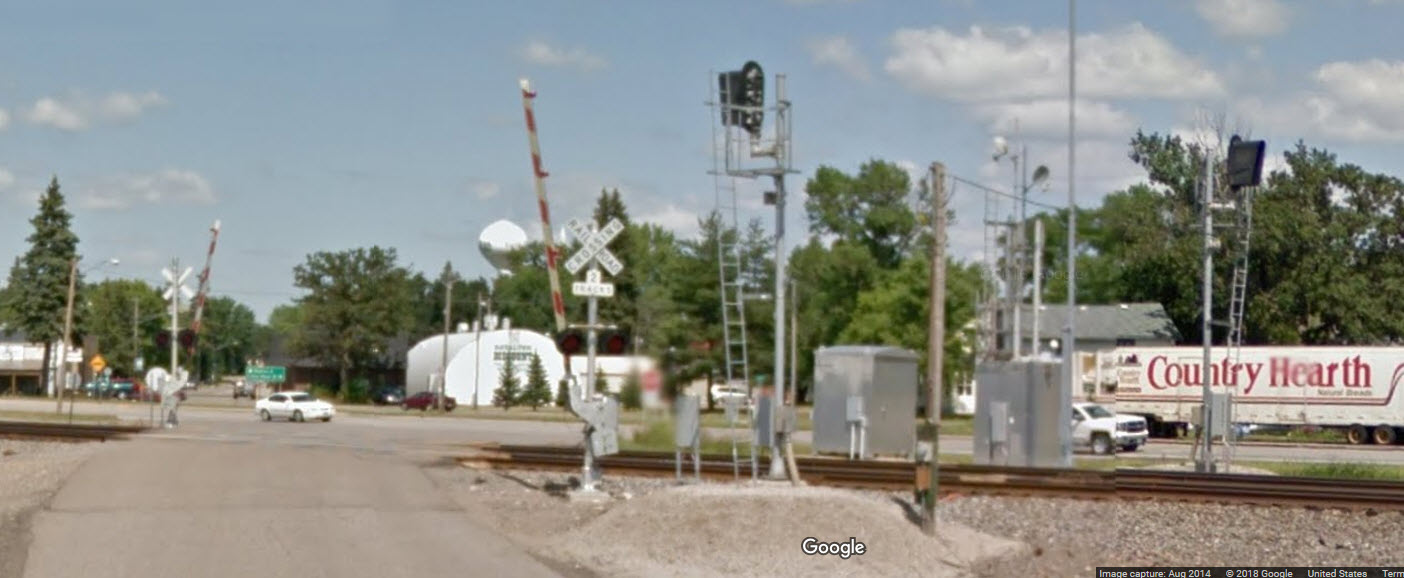
Rice
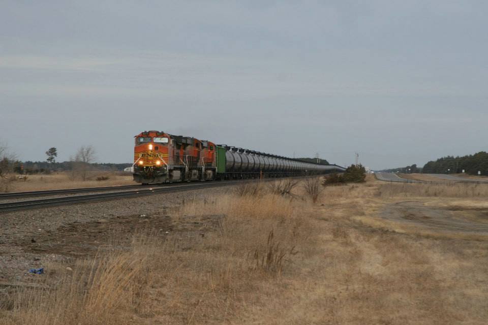
With a forecasted 67 degrees today, I felt compelled to finally make a run up to Staples. The first train encountered was an eastbound oil train at Rice.
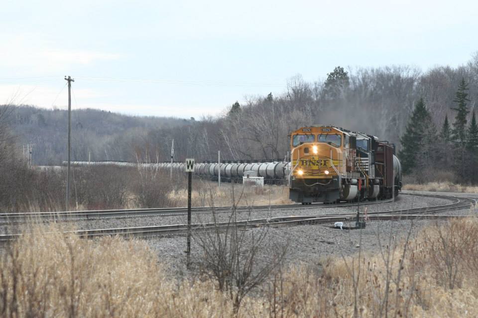
And this one as the sun catches it rounding the curve into Rice, on the way home.
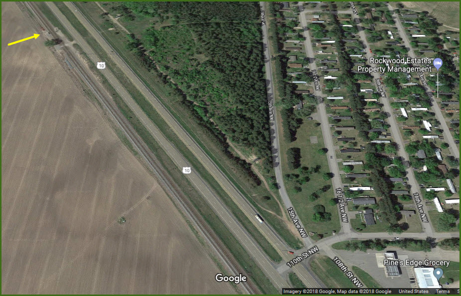
These are about 1/3 mile north of 110th St NW, and Pine's Edge Grocery, on the south side of Rice.
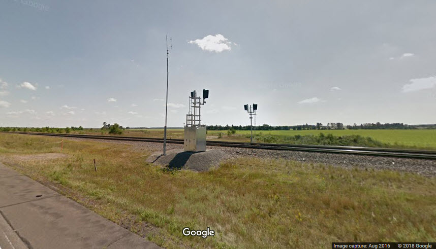
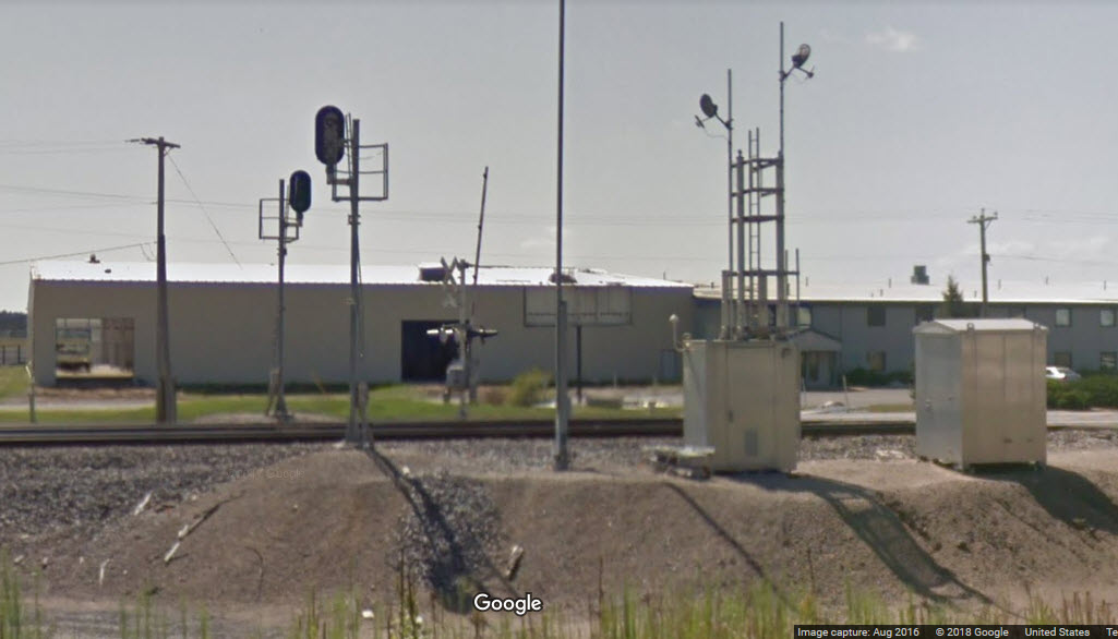
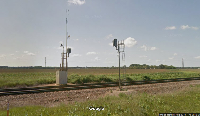
In the Google views, it looks like we caught BNSF in the middle of replacing the old searchlight signals....
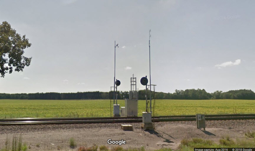
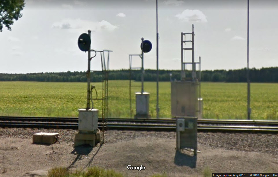
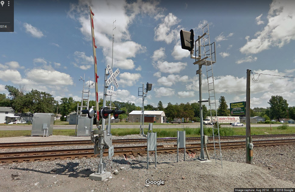
A set of intermediate signals, one for each direction, in the "downtown" area of Rice.
Good viewing from County road 31.
GPS Coordinates: 45.770998, -94.238234
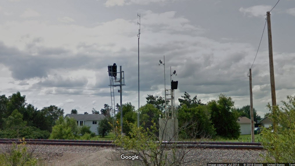
This set is 1.12 miles from the intermediates in downtown Rice.
As seen below, there were no signals here in mid 2014, looks like they went in between JUL14 and NOV15.....
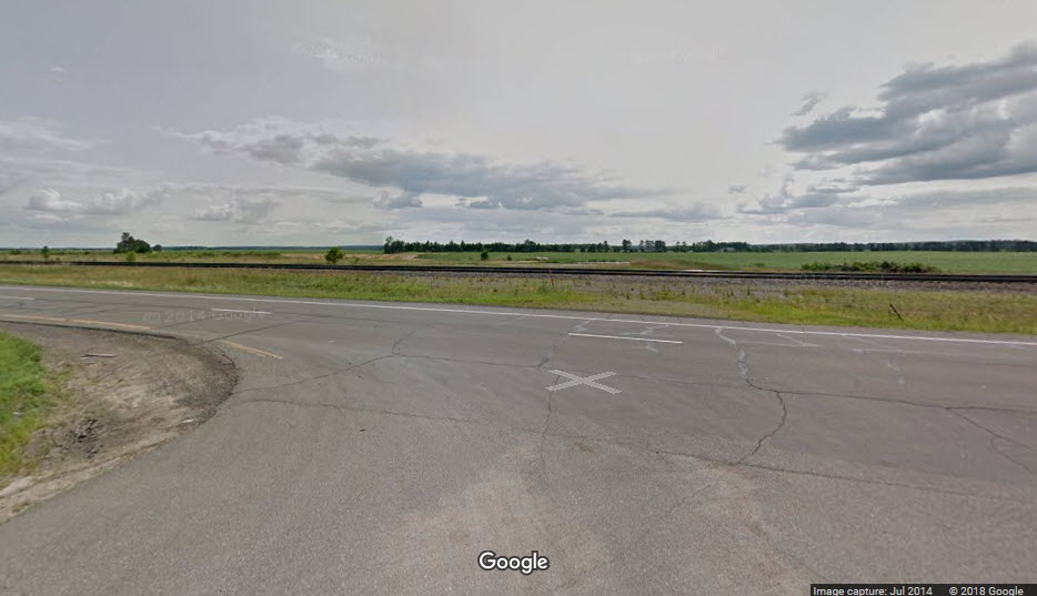
Here, and just north of here, Google catches a couple northbound BNSF freights:
GPS Coordinates: 45.780989, -94.247805
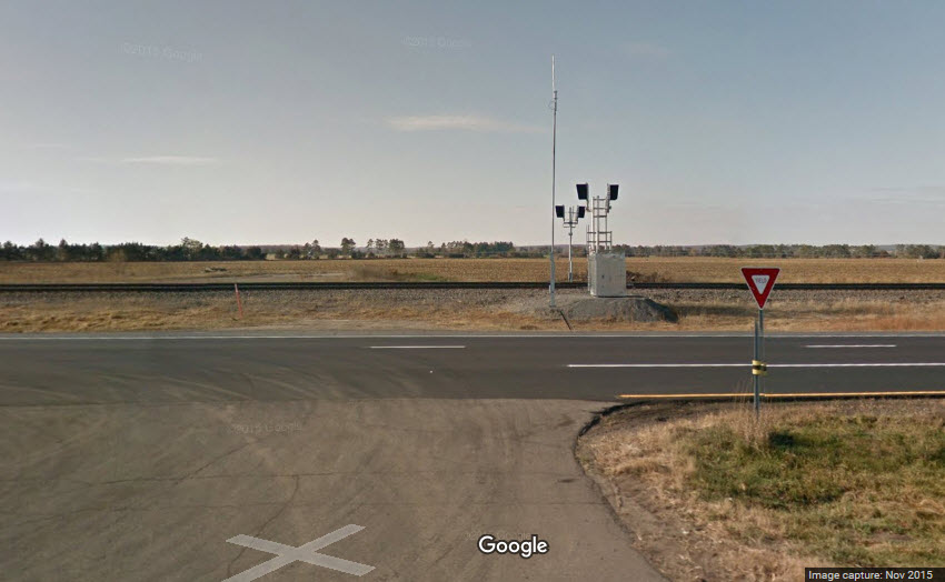
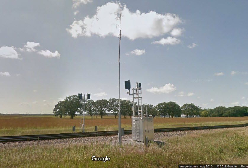
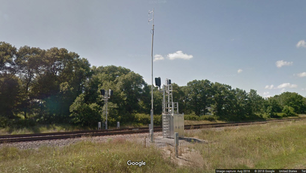
As we progress NW on us 10, we come across another set of intermediate signals, not yet in service in AUG2016.
1.94 miles from the set in downtown Rice.
GPS Coordinates: 45.797384, -94.263616
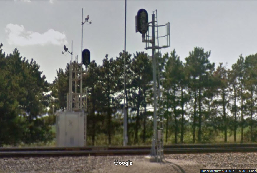
A set of interlocking signals, 1874/1875?.
3.30 miles from the set in downtown Rice.
GPS Coordinates: 45.804028, -94.269984
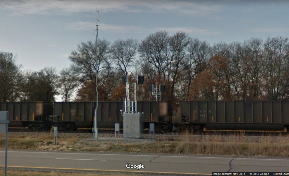
Another set of intermediate signals, not yet in service in AUG2016.
3.86 miles from the set in downtown Rice.
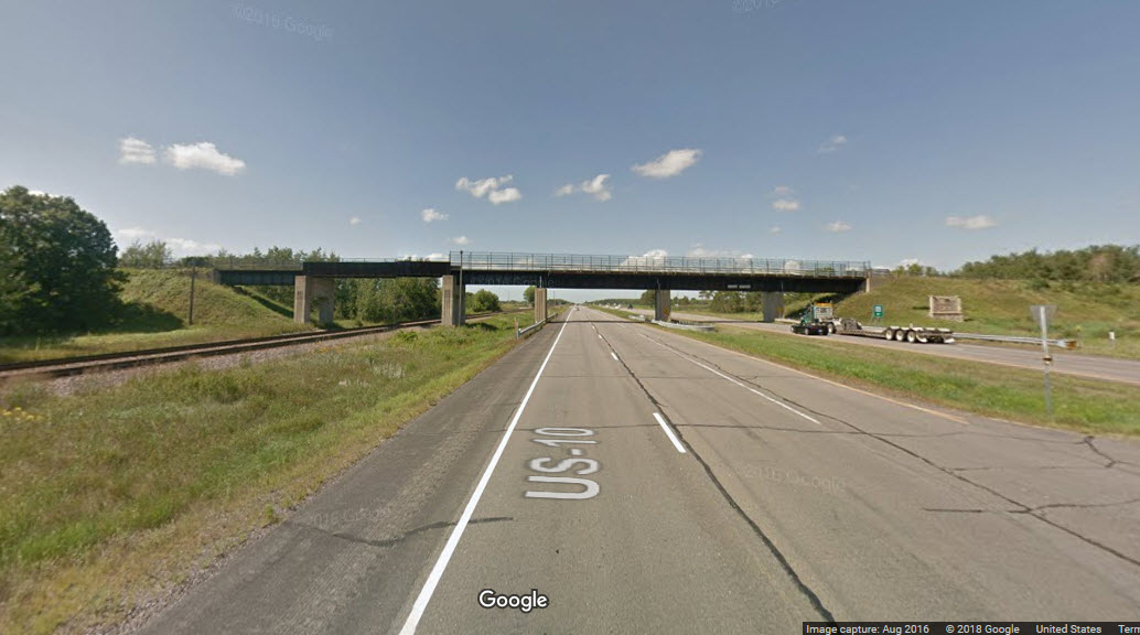
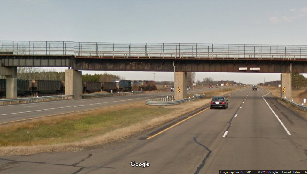
Bridge - near 55th Ave/S Hawthorne St over the Platte River
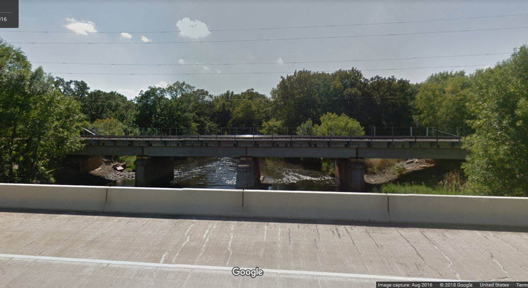

GPS Coordinates: 45.821743, -94.287075
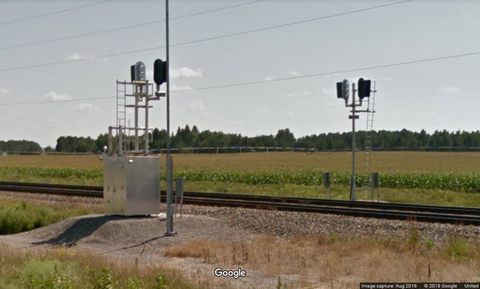
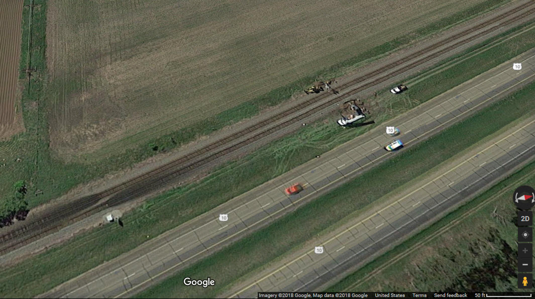
A set of interlocking signals, 1945/1946, just north of the Platte River bridge.
In the aerial shot, it looks as if they were working on the signals - maybe installing them?
5.33 miles from the set in downtown Rice.
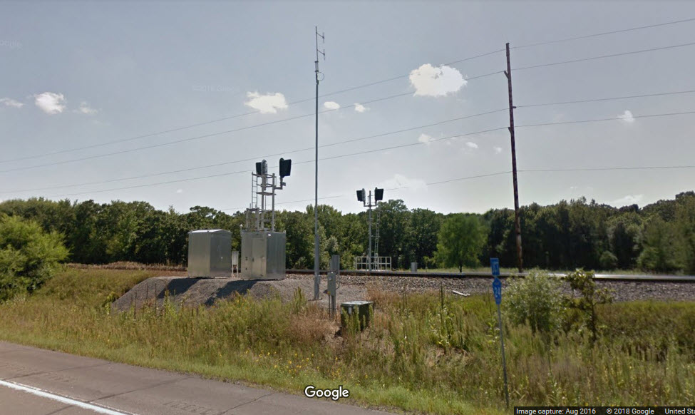
GPS Coordinates: 45.821743, -94.287075
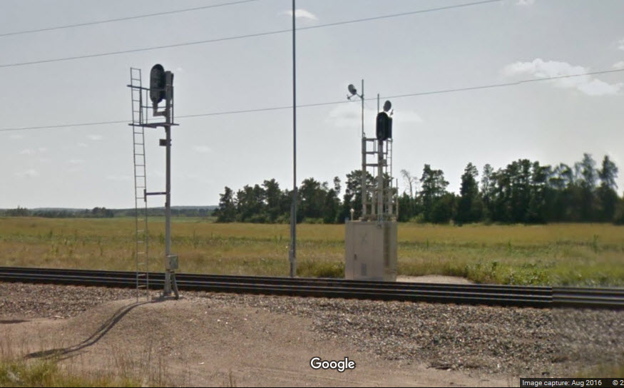
A set of intermediate signals.
In the later streetview shot from 2016, they are turned sideways, indicating they are not in service, but the 2014 show them in service, so what gives???
It looks like they might be using microwaves for some of the comm, but can't be sure without a close and personal inspection....
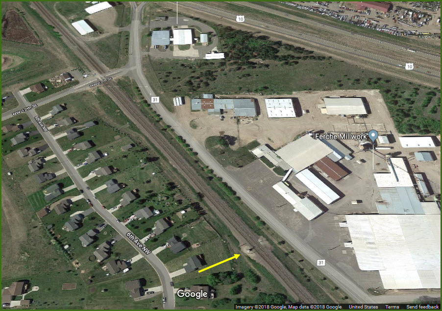
Royalton has a bank, ATM, gas, and food.
Royalton also has a 1,185 foot long siding in front of the junkyard, north of Centre St.
5.85 miles from the set in downtown Rice.
GPS Coordinates: 45.848929, -94.308721
South of 63rd Street.
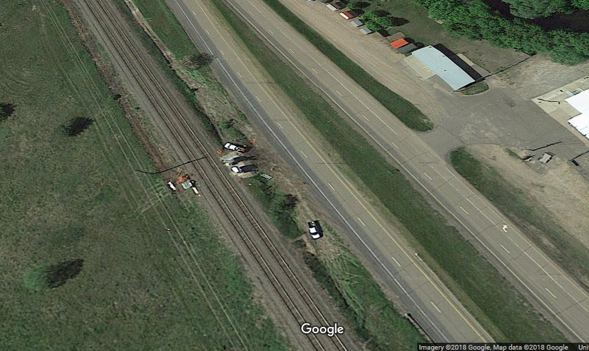
Interlocking signals, 1966/1967, again, we see the BNSF crews working on the signal in the aerial shot, along with flange lubricators.
7.48 miles from the set in downtown Rice, 1.63 miles from the set in Royalton.
GPS Coordinates: 45.856794, -94.312967
Intermediate signals, just south of 68th Street/305.
8.05 miles from the set in downtown Rice, 2.20 miles north of Royalton.
GPS Coordinates: 45.876865, -94.323657
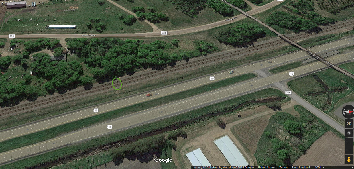
Interlocking signals and equipment detectors, just south of the Soo Line ATV Trail.
9.55 miles from the set in downtown Rice, and 3.70 miles from Royalton.
In the aerial picture below for the SOO Line Trail, the green oval shows you where these signals are.
the SOO Line ATV Trail
GPS Coordinates: 45.878675, -94.324602
East Lincoln
If you look close, you can see there is a new set of signals waiting to replace the old searchlight signals.
Cushing
New colorlights have already replaced the old NP searchlights at this location.
Philbrook
Philbrook is the east end of the double track out of Staples (heading south, or east).
As of 2015, the old NP style signal mast still stands even though replacements are waiting to take over.
The old NP signal is now gone......
Staples
Colorlight signals ready to replace the searchlight signals here too.
Disclaimers:
I love trains, and I love signals. I am not an expert. My webpages reflect what I find on the topic of the page. This is something I have fun with while trying to help others.
Please Note: Since the main focus of my two websites is railroad signals, the railfan guides are oriented towards the signal fan being able to locate them. For those of you into the modeling aspect of our hobby, my indexa page has a list of almost everything railroad oriented I can think of to provide you with at least a few pictures to help you detail your pike.
If this is a railfan page, every effort has been made to make sure that the information contained on this map and in this railfan guide is correct. Once in a while, an error may creep in :-)
My philosophy: Pictures and maps are worth a thousand words, especially for railfanning. Text descriptions only get you so far, especially if you get lost or disoriented. Take along good maps.... a GPS is OK to get somewhere, but maps are still better if you get lost! I belong to AAA, which allows you to get local maps for free when you visit the local branches. ADC puts out a nice series of county maps for the Washington DC area, but their state maps do not have the railroads on them. If you can find em, I like the National Geographic map book of the U.S..... good, clear, and concise graphics, and they do a really good job of showing you where tourist type attractions are, although they too lack the railroads. Other notes about specific areas will show up on that page if known.
Pictures and additional information is always needed if anyone feels inclined to take 'em, send 'em, and share 'em, or if you have something to add or correct.... credit is always given! BE NICE!!! Contact info is here
Beware: If used as a source, ANYTHING from Wikipedia must be treated as being possibly being inaccurate, wrong, or not true.
RAILFAN GUIDES HOME
RAILROAD SIGNALS HOME
NEW 01/01/2014, 02/12/2017
Last Modified
11-Jun-2018