

General Info
System Map
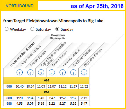
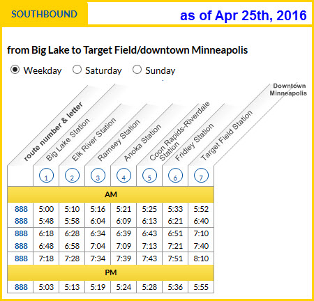
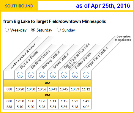
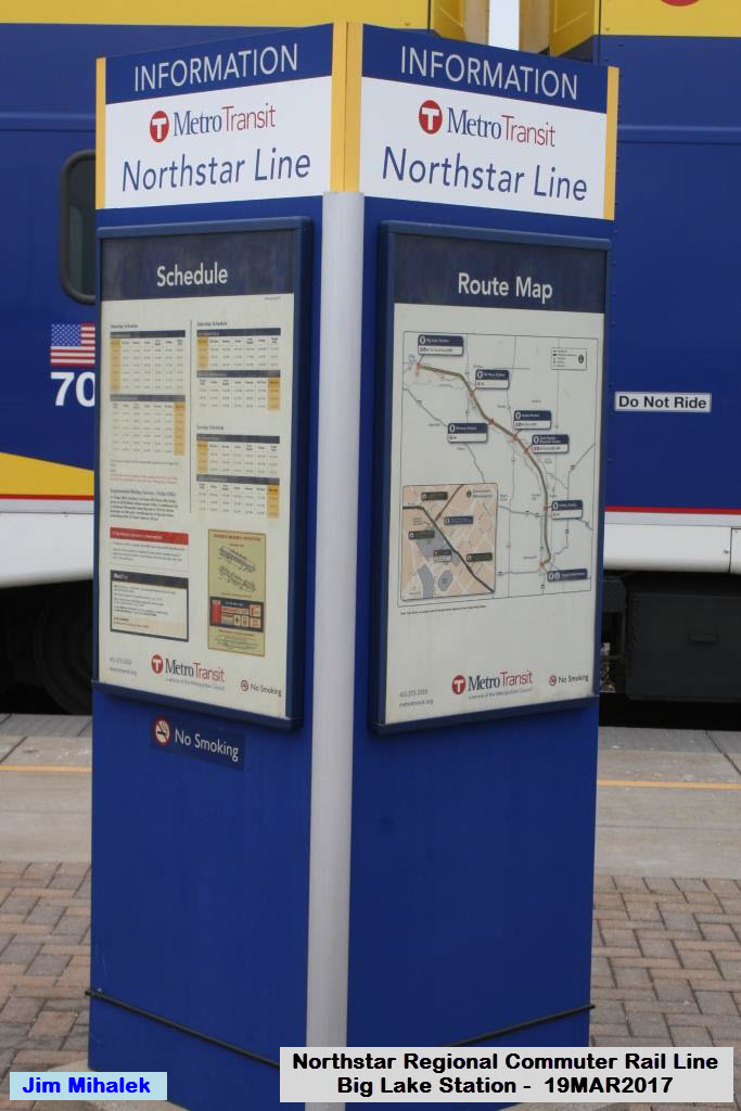
Schedules
Station by Station
RAILFAN GUIDES HOME
RAILROAD SIGNALS HOME
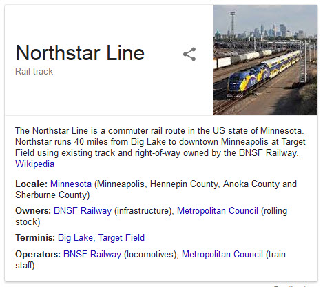
Minneapolis got it's name on the Commuter Rail grid in 2009
with the opening of it's Northstar Corridor,
a regional commuter rail line.
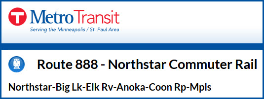
It is part of the area's Metro Transit
operations along with the two light rail lines and bus service, and carries the
designation Route 888.
The line originates in downtown Minneapolis adjacent to the new Target Field
Stadium, and heads north to just above the Fridley station, where it then heads
northwest to Big Lake, which is the current end of operations.
Service was inaugurated on November 16th, 2009.
Banner from their homepage
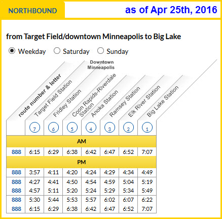
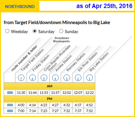
Northstar has added a few more
trains since they started service, the schedules are below.
If you're in Minneapolis, which I
consider one of the better railfan towns around, you have an enormous amount of
things to keep you busy easily for a week, if you so choose.
You have the Union Pacific, BNSF, CP Rail, the Twin Cities and Western, Amtrak, and last, but not least, the Minnesota Commercial. The MC is railfan friendly, and will let you wander the yard, as long as you promise to stay off stuff and sign a release (at least they were that way the last time I was there in 2006). Formerly an all Alco railroad, they have started buying stuff other than Alco equipment.
Within a three hour (or so) drive
from the Twin Cities area, you also have the Iowa Traction in Mason City, and
the Missabe up to the north in Duluth, among others. Guides for
Mason City
and Albert Lea
are available. Other towns of interest include Mankato (southwest),
Cloquet (northwest, on the way to Duluth, home of the
Cloquet
Terminal Railroad ), Two Harbors (north of Duluth), Proctor (home to the
Missabe), Hastings (southeast, nice river crossing), Glencoe (southwest, home to
the TC&W), and Waseca (southwest, office for
the DM&E).
Acknowledgements:
Jim Mihalek, I can't thank him enough for the pictures he takes and
forwards to me!!!
Websites and other additional information sources of interest for the area:
https://www.metrotransit.org/northstar
http://metrotransit.org/light-rail.aspx
https://en.wikipedia.org/wiki/Northstar_Line
http://www.nprha.org/NP%20Track%20Segments%20of%20BNSF/BNSF%20Track%20Segments%20Version%2010.pdf
an extremely detailed listing of BNSF tracks, with historical lineage!
Aerial shots were taken from either Google Maps or www.bing.com/maps as noted. Screen captures are made with Snagit, a
Techsmith product... a great tool if you have never used it!
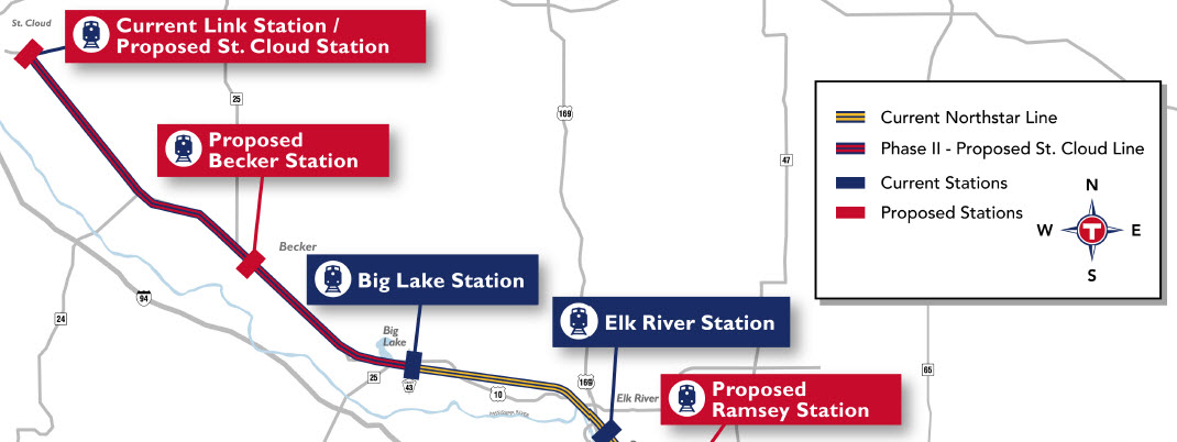
System Map
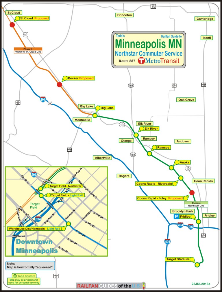
The above map in a PDF, below is the "T's" version of the system map.
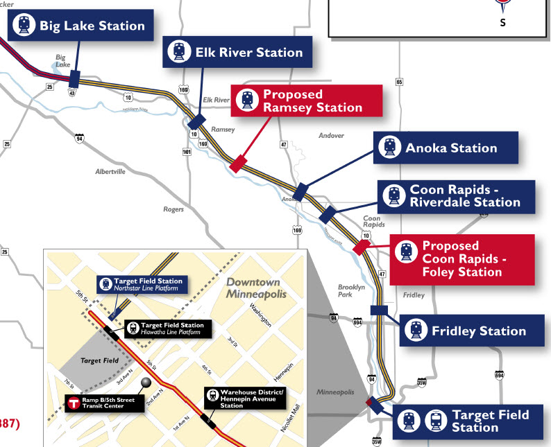
Above, current system map....
Below, the planned extensions part of the map.

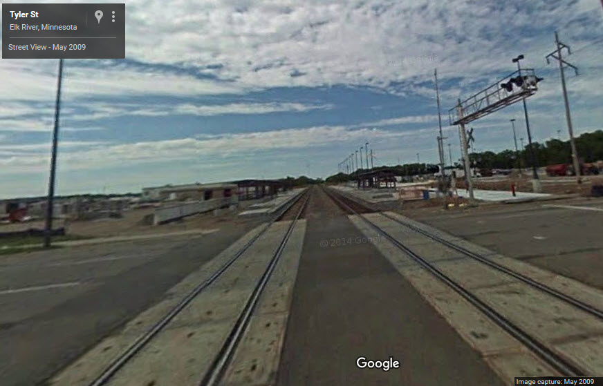
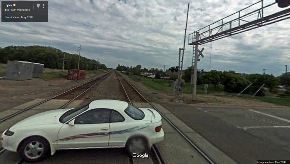
Station by Station Below: two Google Streetviews from Tyler St circa May 2009, adjacent to Elk River station before the new signals were installed. I love it when they don't have updated views! :-)
NEW 07/26/2013
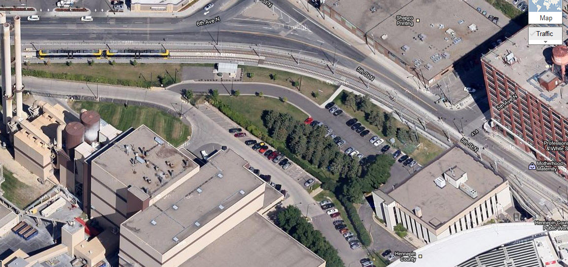
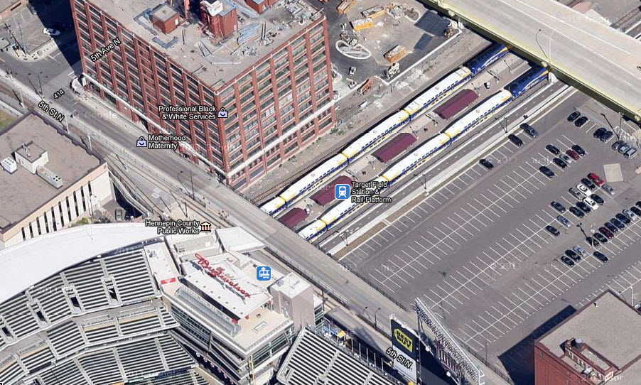
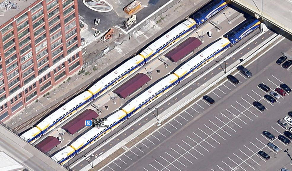
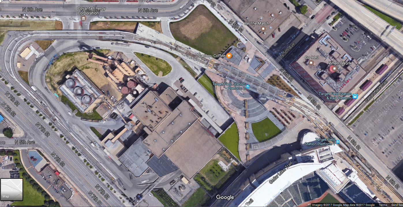
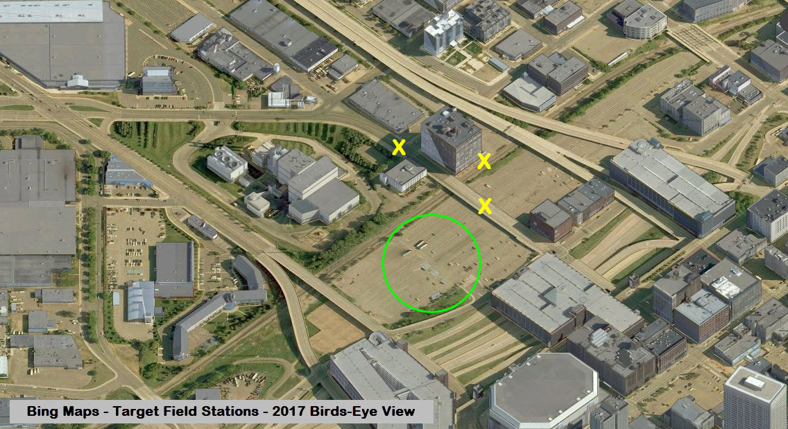
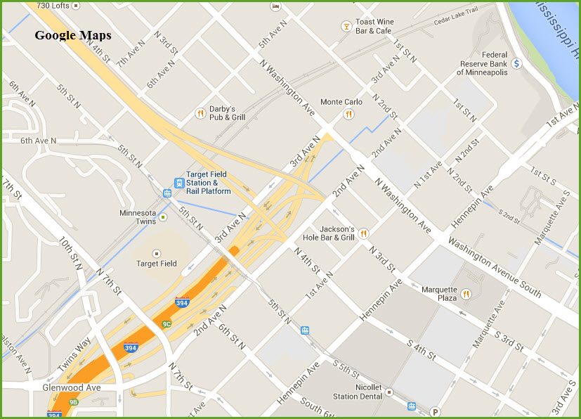
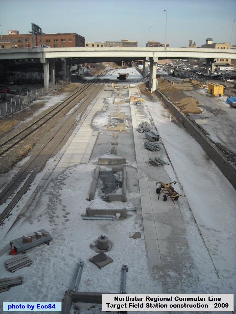
Target Field Station
GPS Coordinates: 44.983256,-93.276962
The Target Field Station opened in 2009 to allow commuters easy access to the Northstar Commuter Rail Line. As of this date (the end of 2011,
and the end of 2013! AND Mar2017!!!), Google wins in the aerial photo category, as Bing has not updated their fly-over pictures yet. The light rail station is right at the commuter rail station, and goes into a short
single track section before going into a double track stub... my guess is that it was easier and cheaper to do this than build a double crossover.
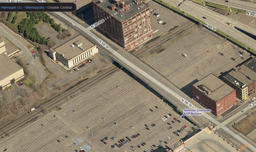 Before the new stadium
Before and after shots from the same day off of Bing and Google..... Bing is still missing the 3 stations at the X's and the stadium (in green).
 Found on Wikipedia
 Found on Wikipedia
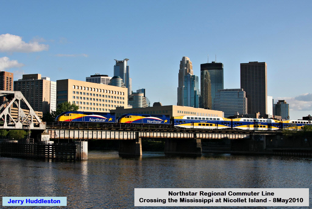
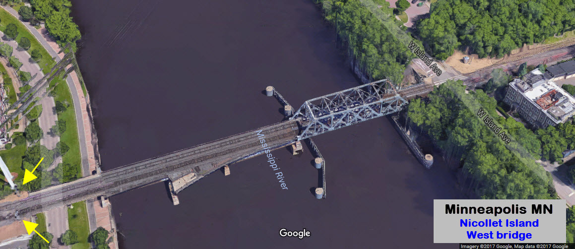
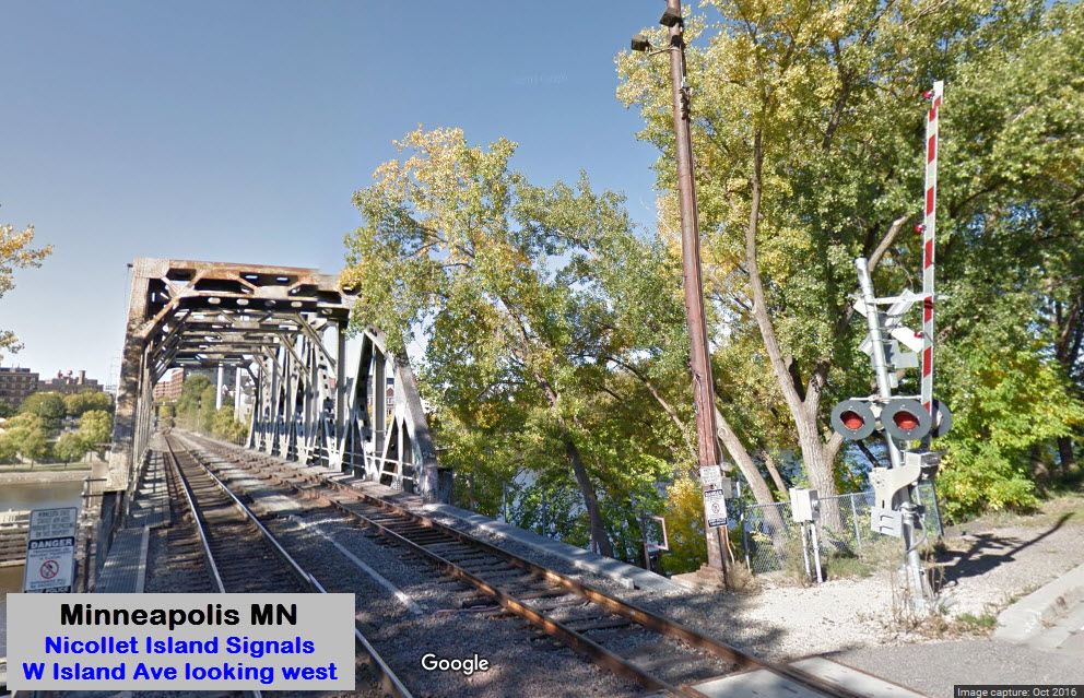
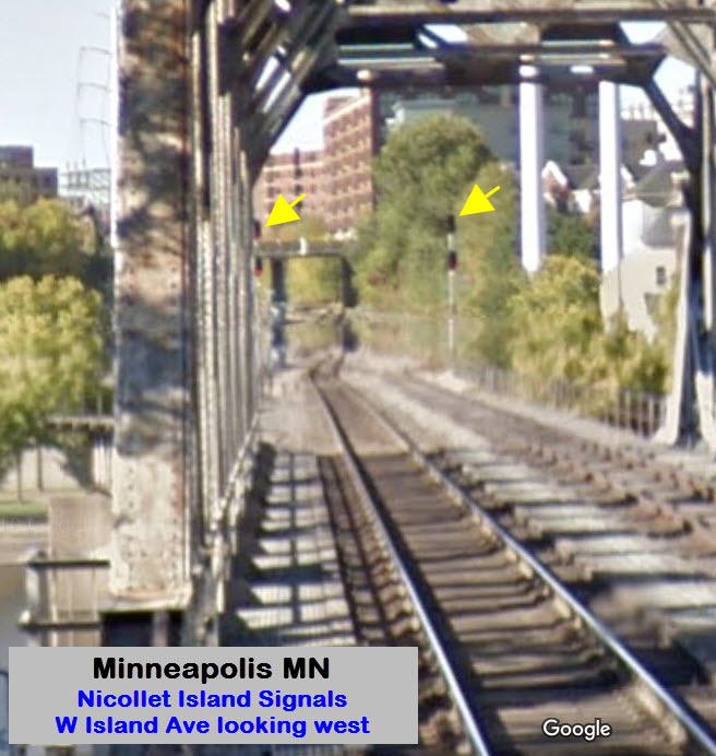
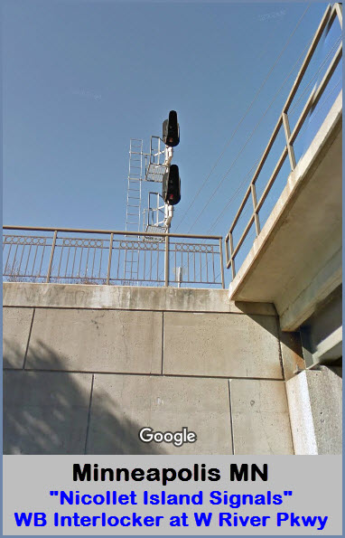
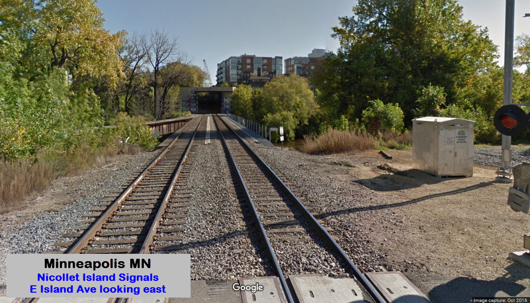
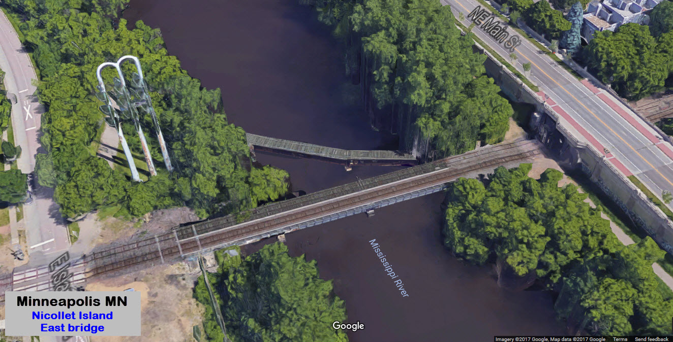
Crossing Nicollet Island
GPS Coordinates: 44.988329,-93.263711 - center of track on the island
There are two bridges going to Nicollet Island, for it sits in the middle of the Mississippi River. On the north side of the tracks is a small housing community, on the south side is DeLaSalle
High School, the Nicollet Island Inn, and the Nicollet Island Park. Access is via Hennepin Ave and Merriam St to the east. Island Ave goes around the perimeter of the island, and good
pictures can be had from either West OR East Island Ave. There is a
set of signals on the west bank of the river where the tracks go down into one
track for a short section, before going back to two tracks - I guess it was
easier and cheaper to do this than put in a double crossover - same number of
signals but only two switches.
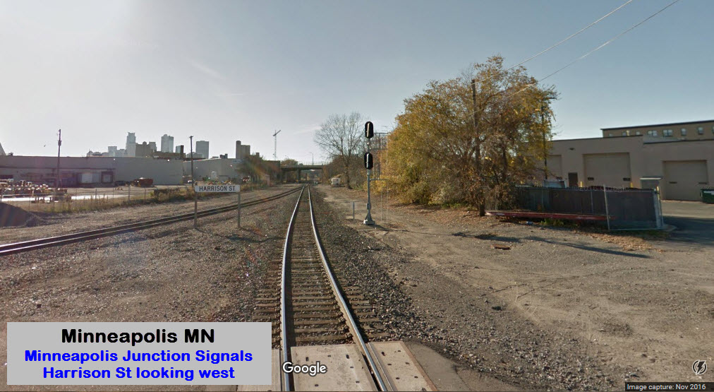
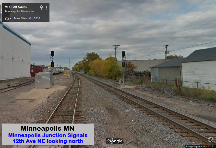
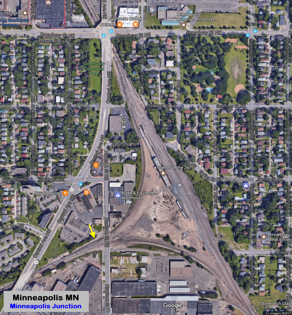
Minneapolis Junction
GPS Coordinates: 44.994361, -93.245354 (center of the wye)
After crossing Nicollet Island, the Northstar trains pass thru Minneapolis Junction, where much history took place. Many years ago, there was a roundhouse and turntable here, you can still still
evidence of this from the aerial view. The Harrison St signal is for WB trains coming off the main from Northtown and heading towards the river.
Milwaukie steam engine #261 is kept in the middle of the wye.
Harrison St Signal
12th Ave NE Signals
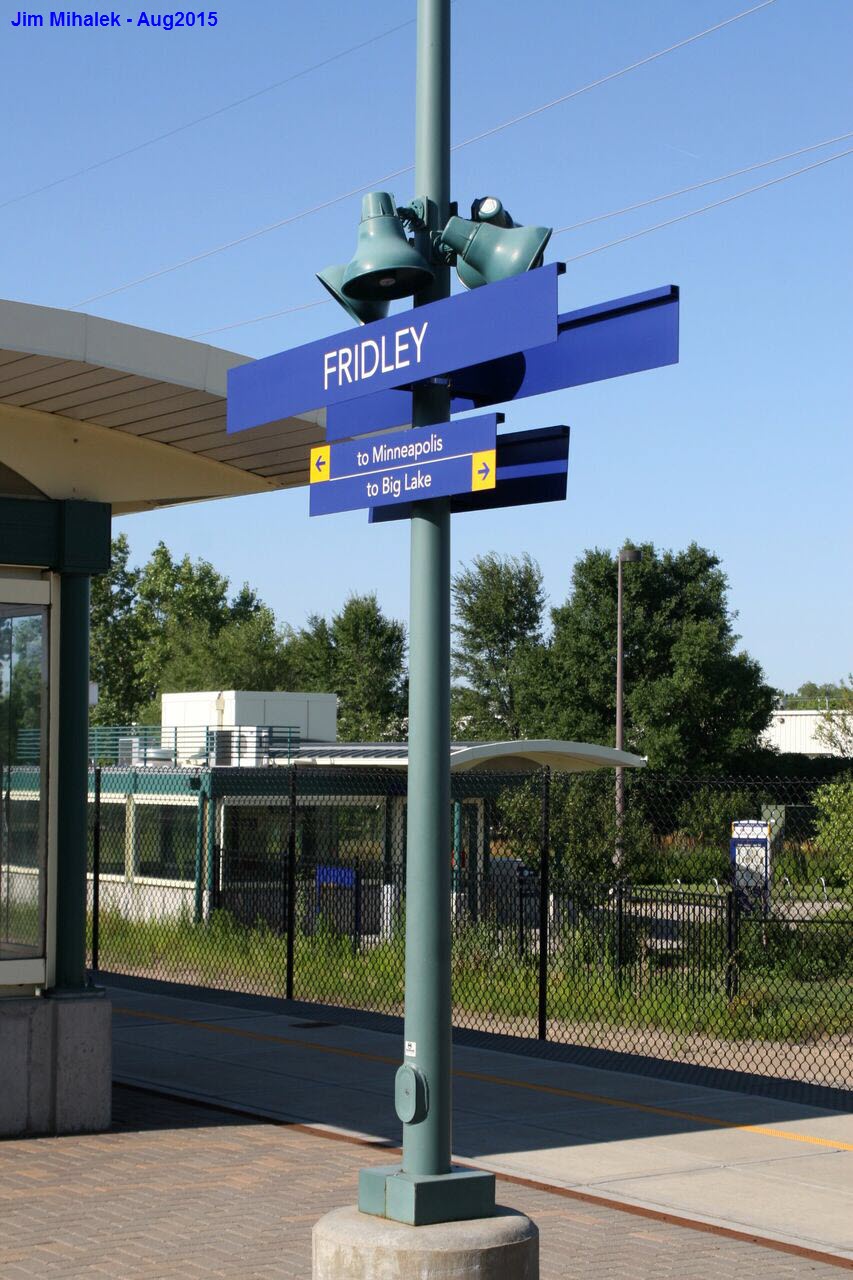
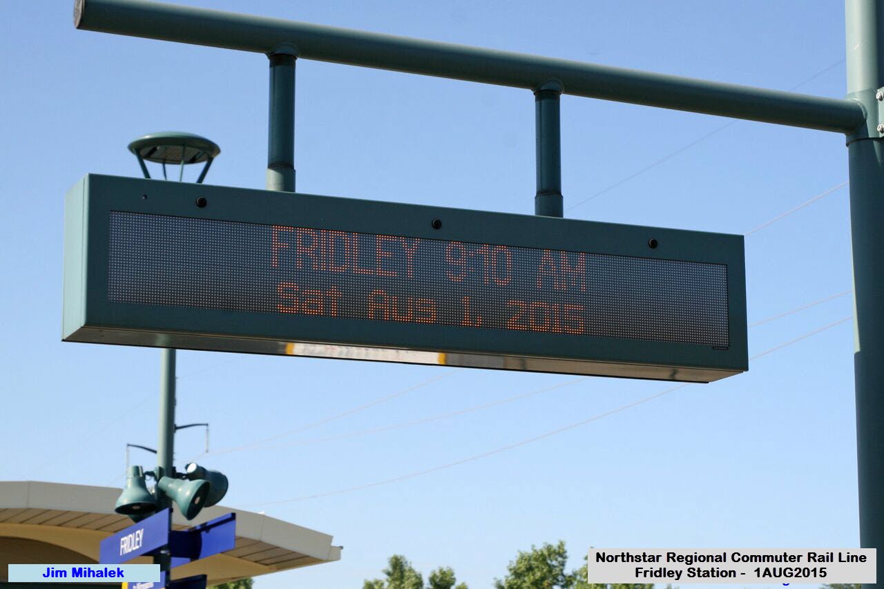
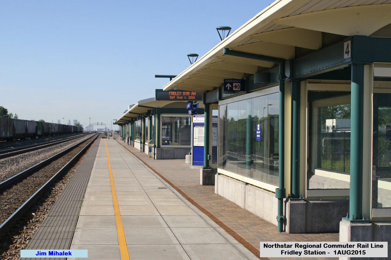
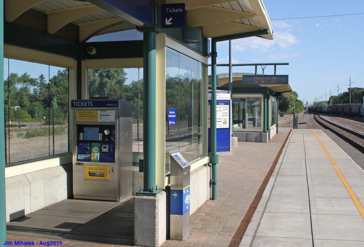
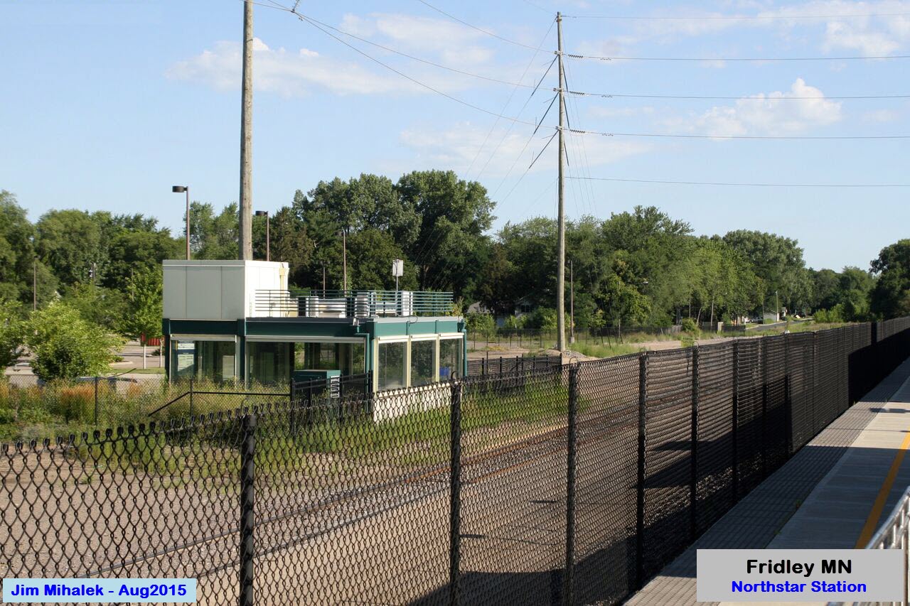
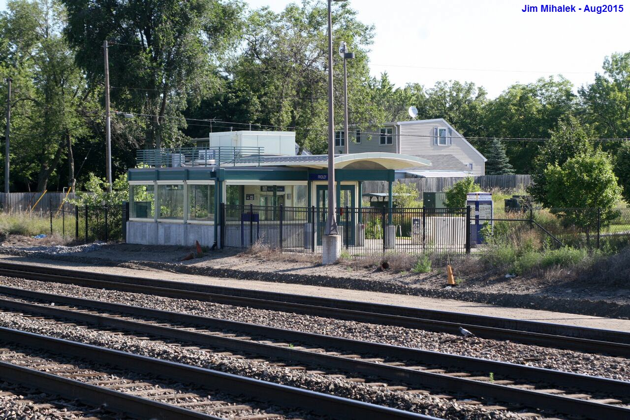
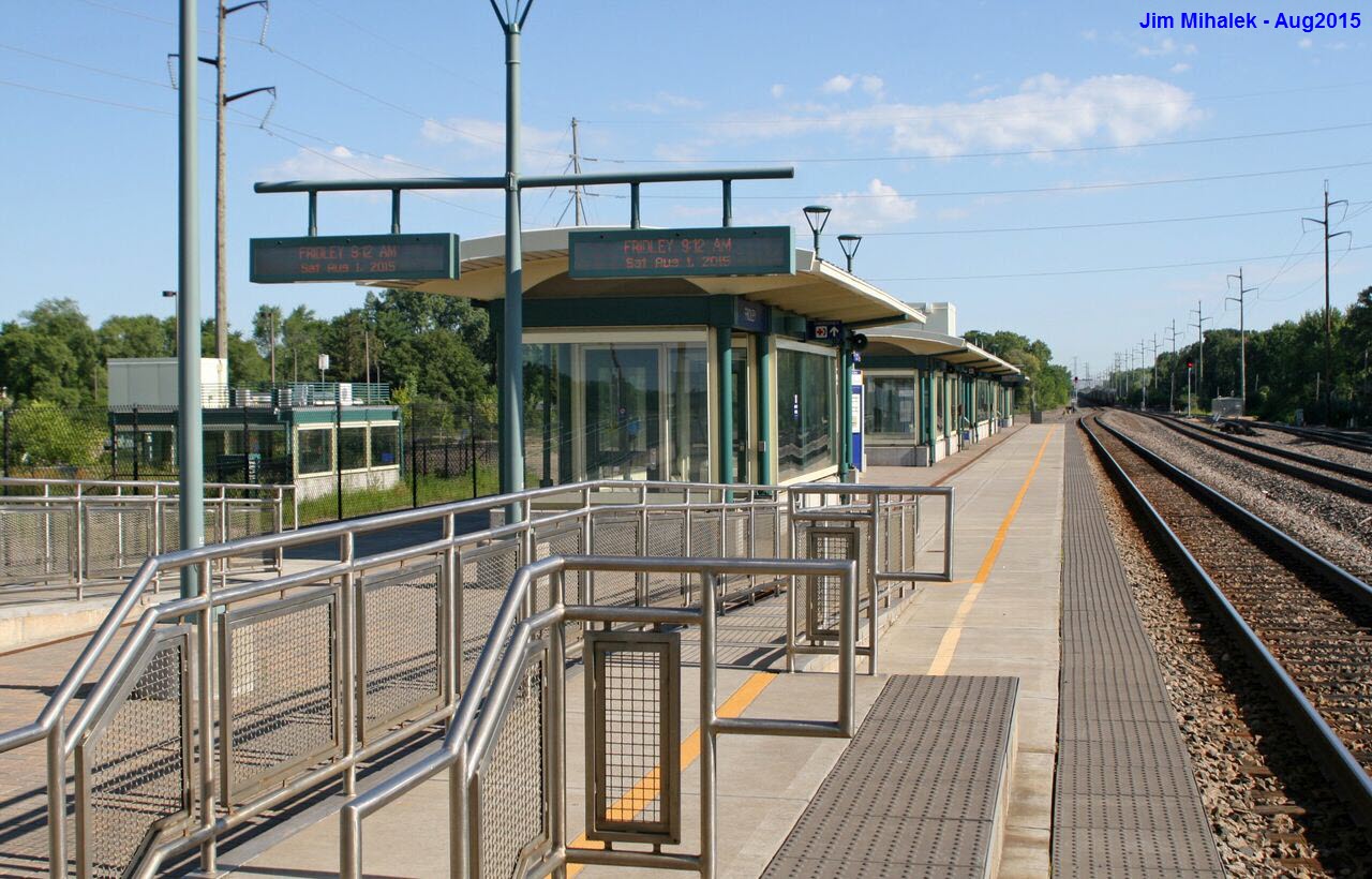
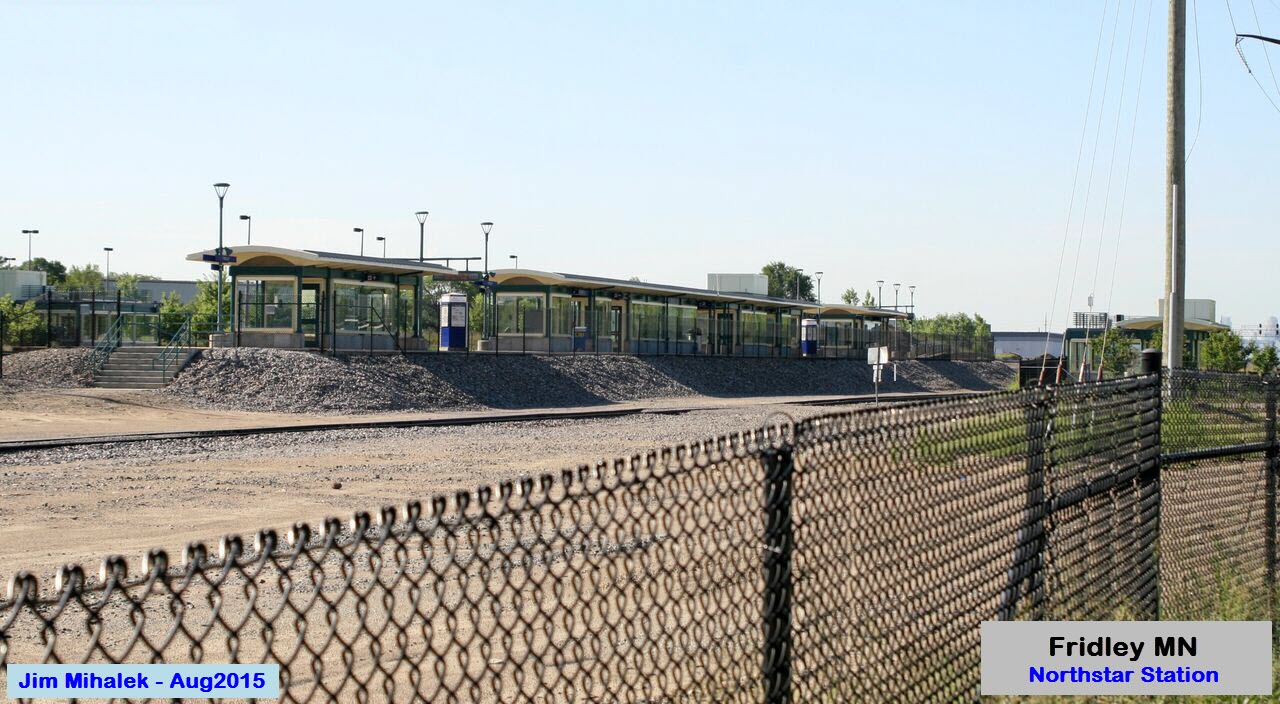
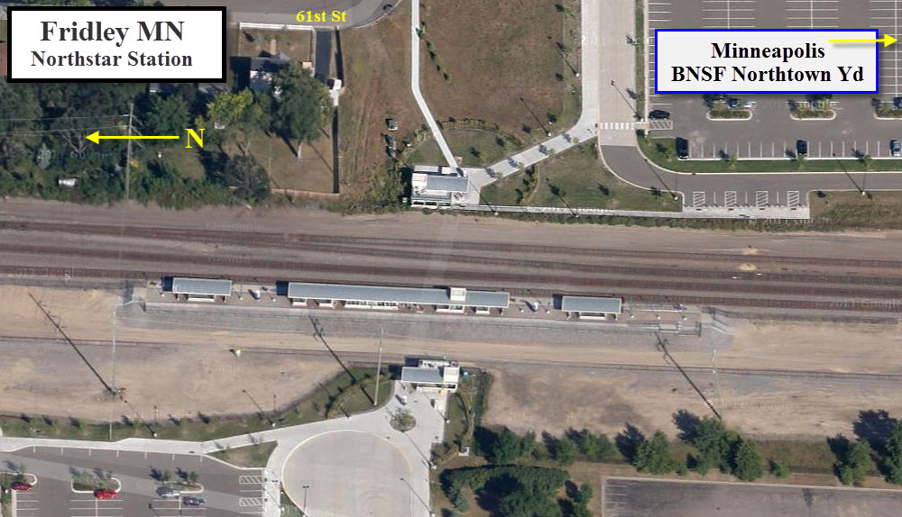
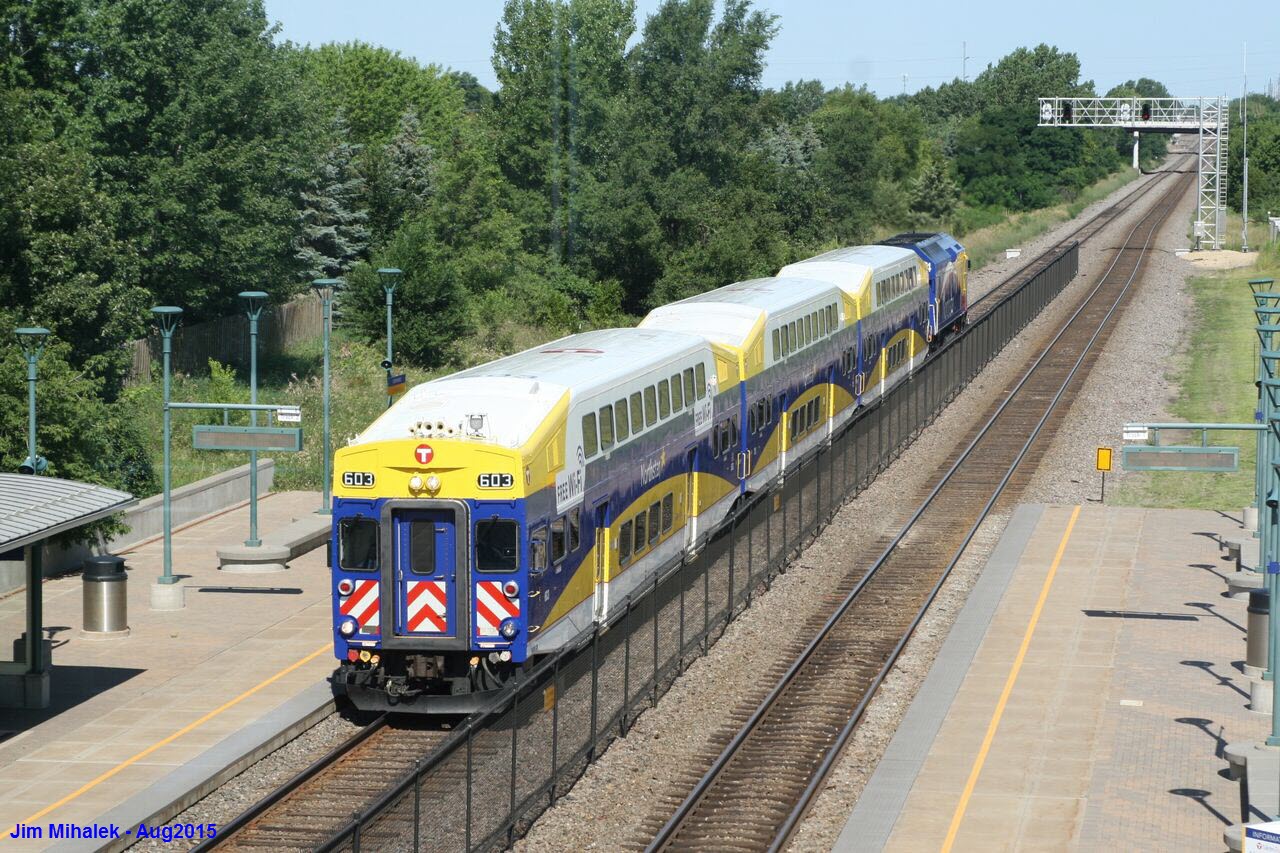
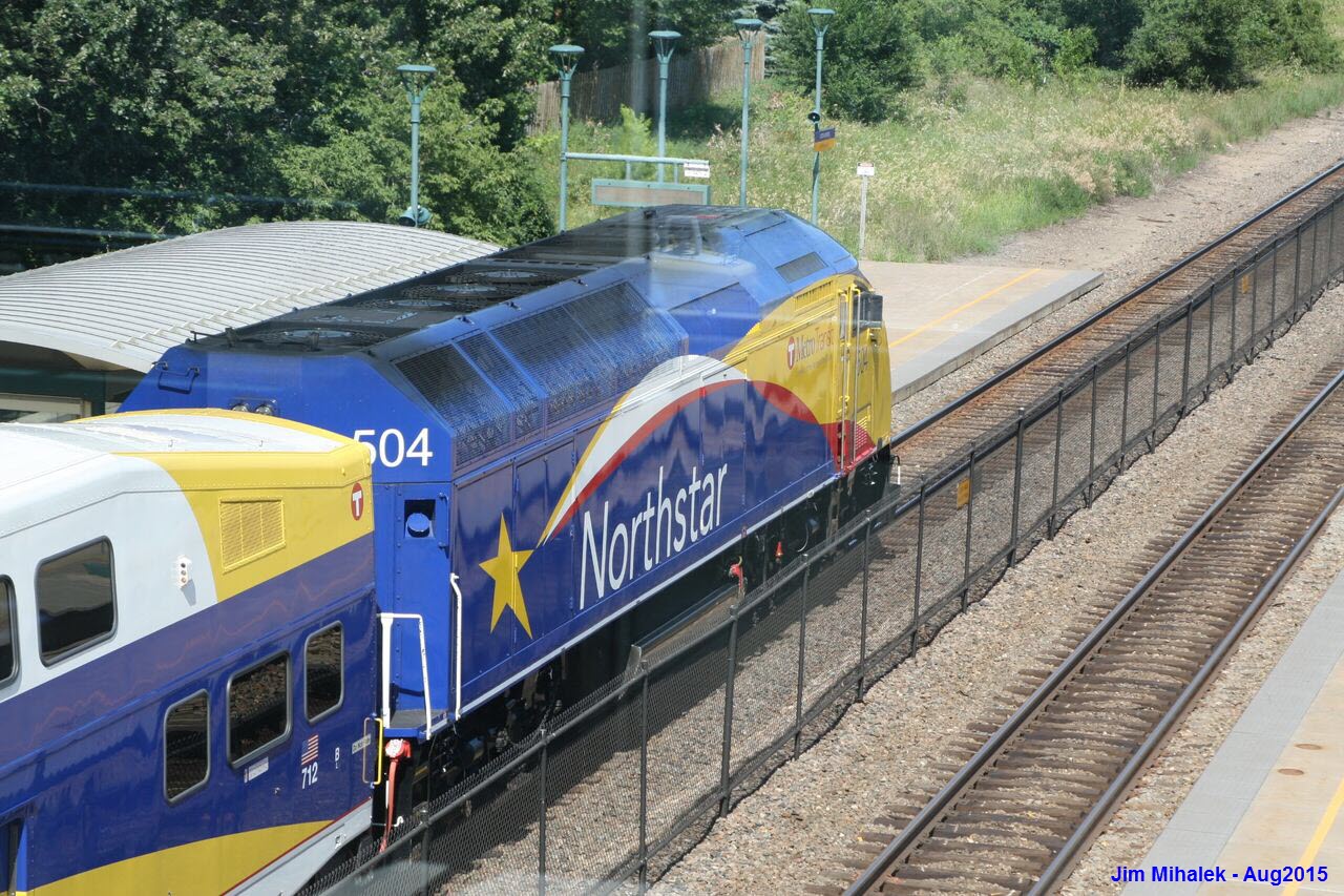
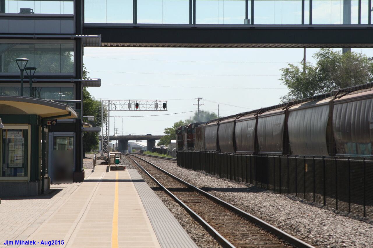
Fridley Station
GPS Coordinates: 45.078369,-93.270342
The Fridley station has parking available on both sides of the BNSF railroad right-of-way, although the station is on the west side. Access from the east side is via an underpass.
Getting here is pretty easy, as you have two choices from I-694. For the western lot, take exit 36, which is East River Rd, and head north about 3/4 of a mile to the lot on your right.
For the eastern lot, take exit 37, NE University and go north about 3/4 to 61st Street, and take a left... go about 5 blocks into the parking lot.
There is a good railfan spot off of 57th St behind the Home Depot. This is also an access point for railroad vehicles, so don't park in the way!
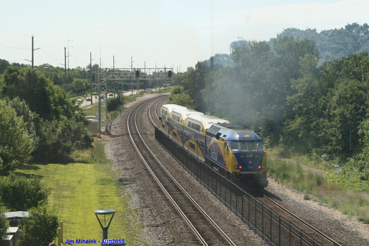
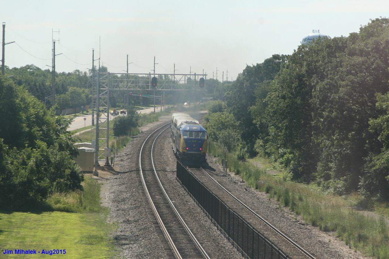
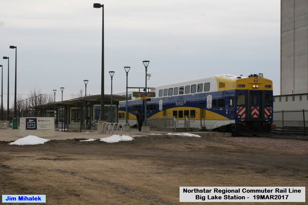
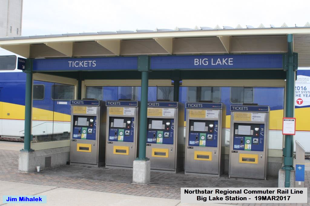
Pictures by Jim Mihalek: Thank you for sharing!
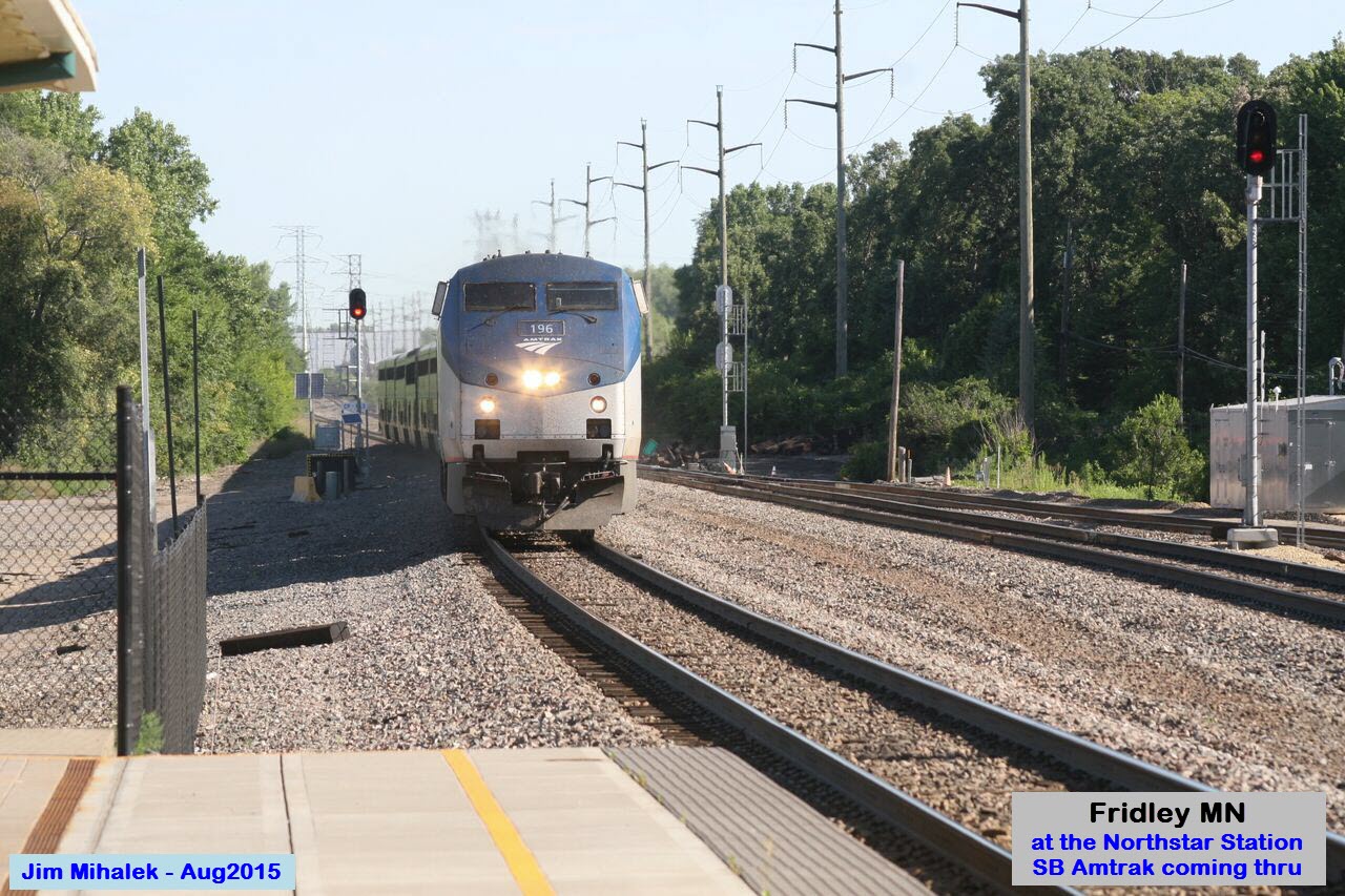


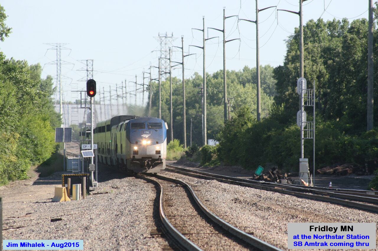

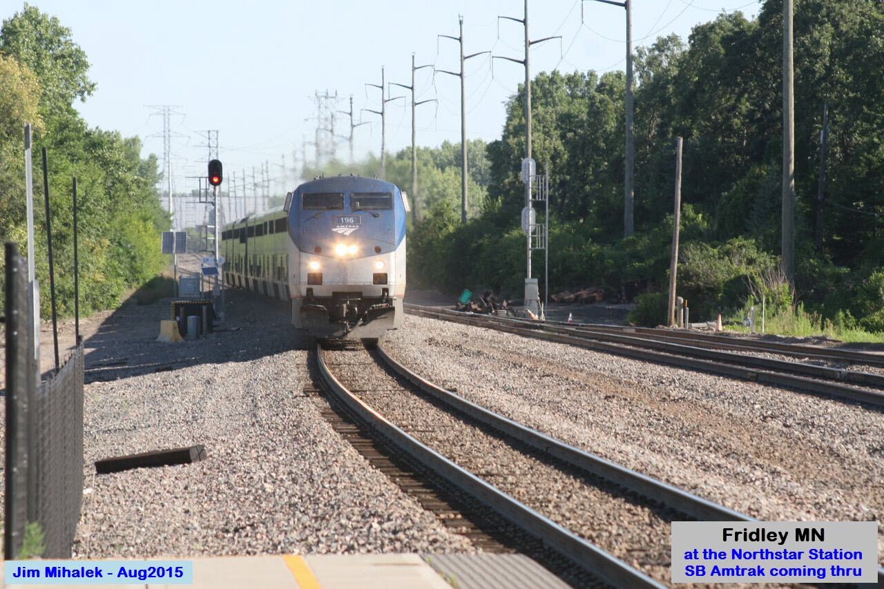


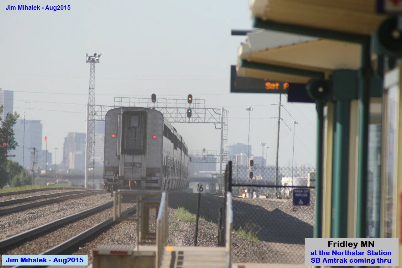 I hope a passing Amtrak train is OK instead of a Northstar train.
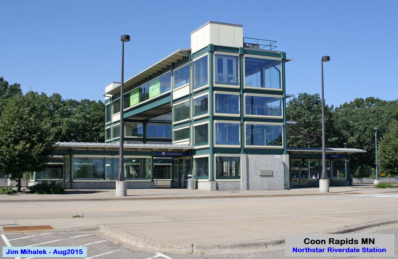
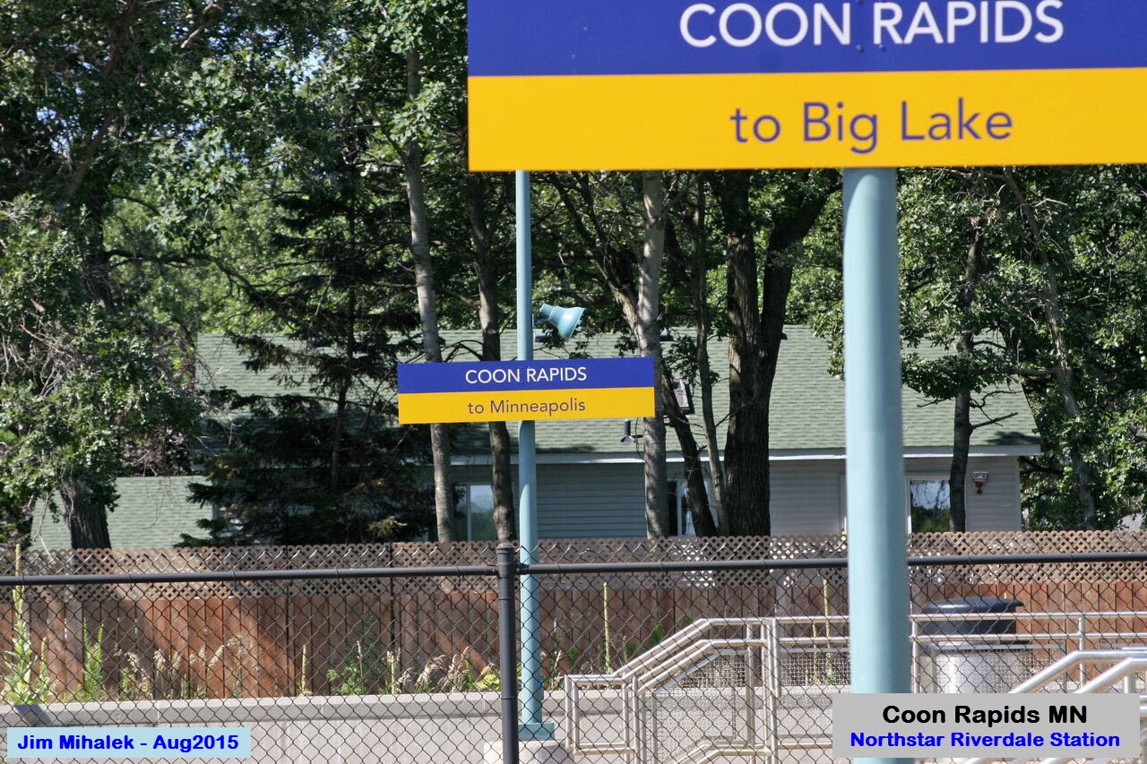
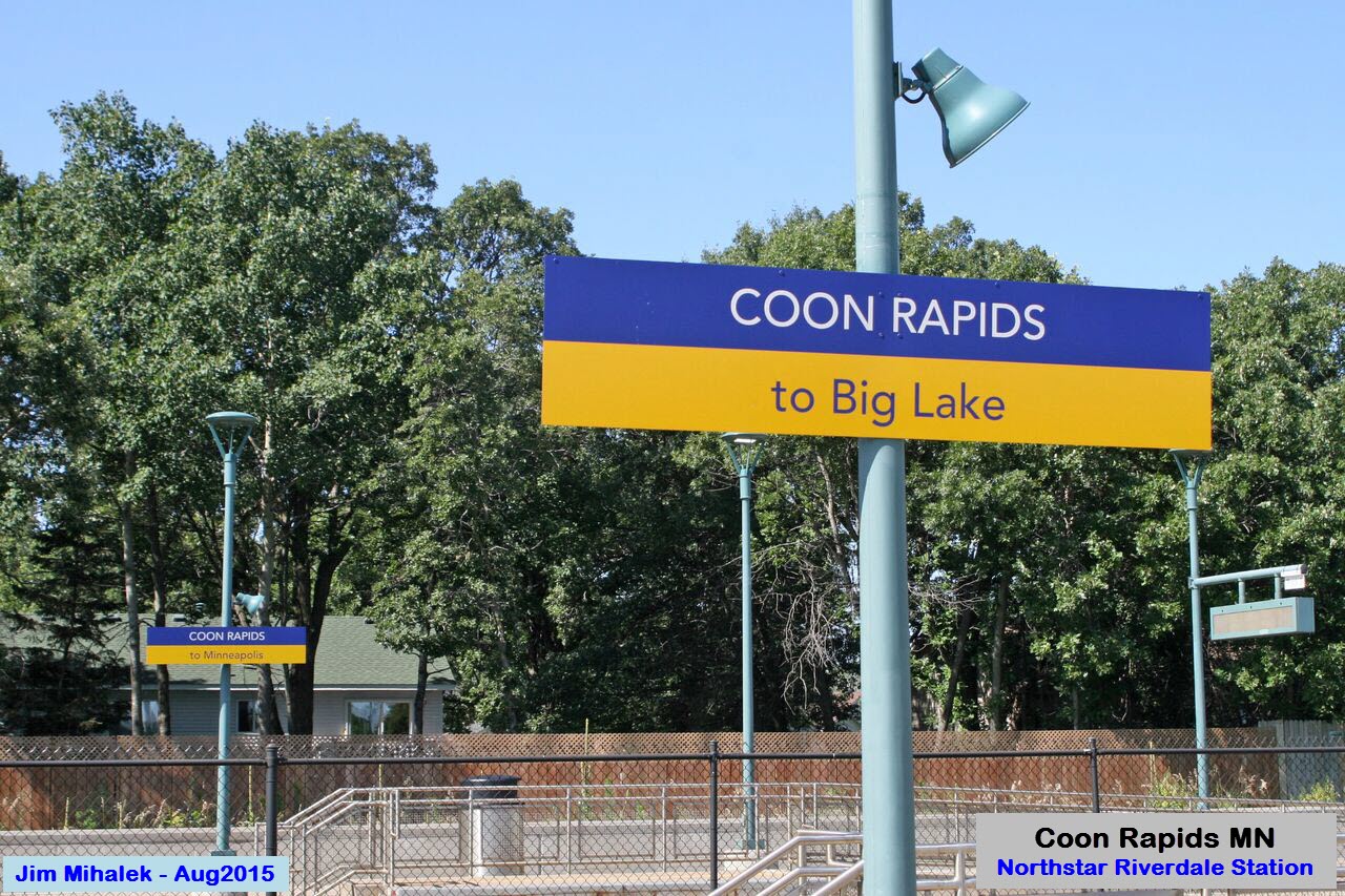
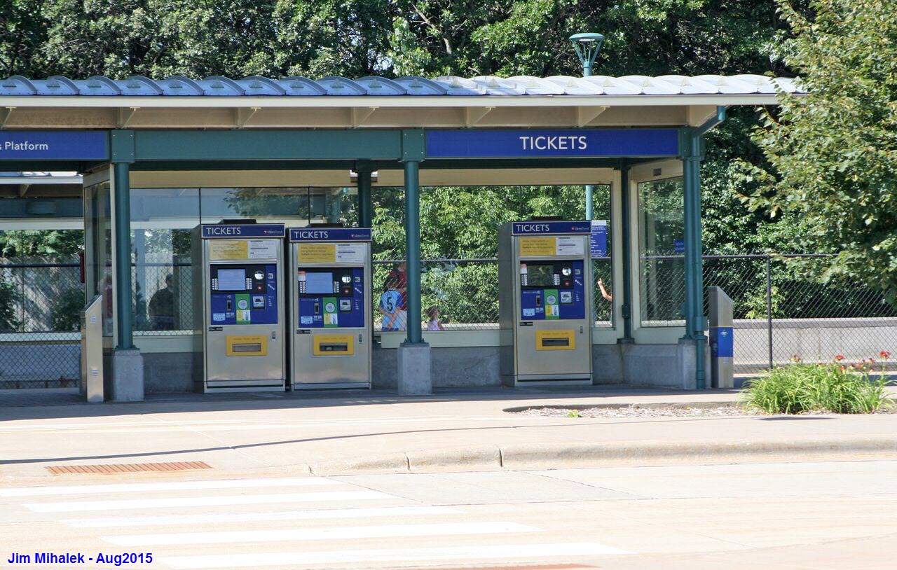
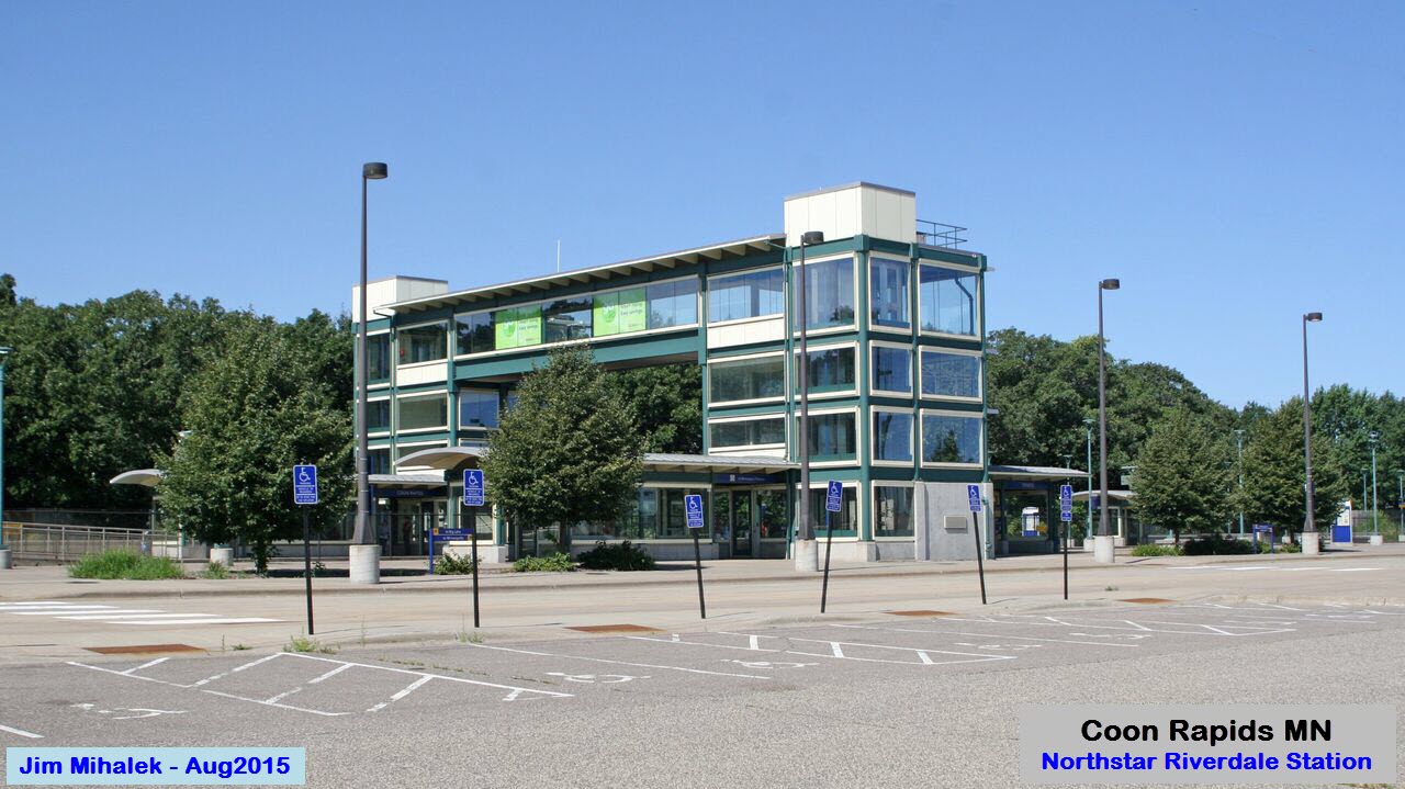
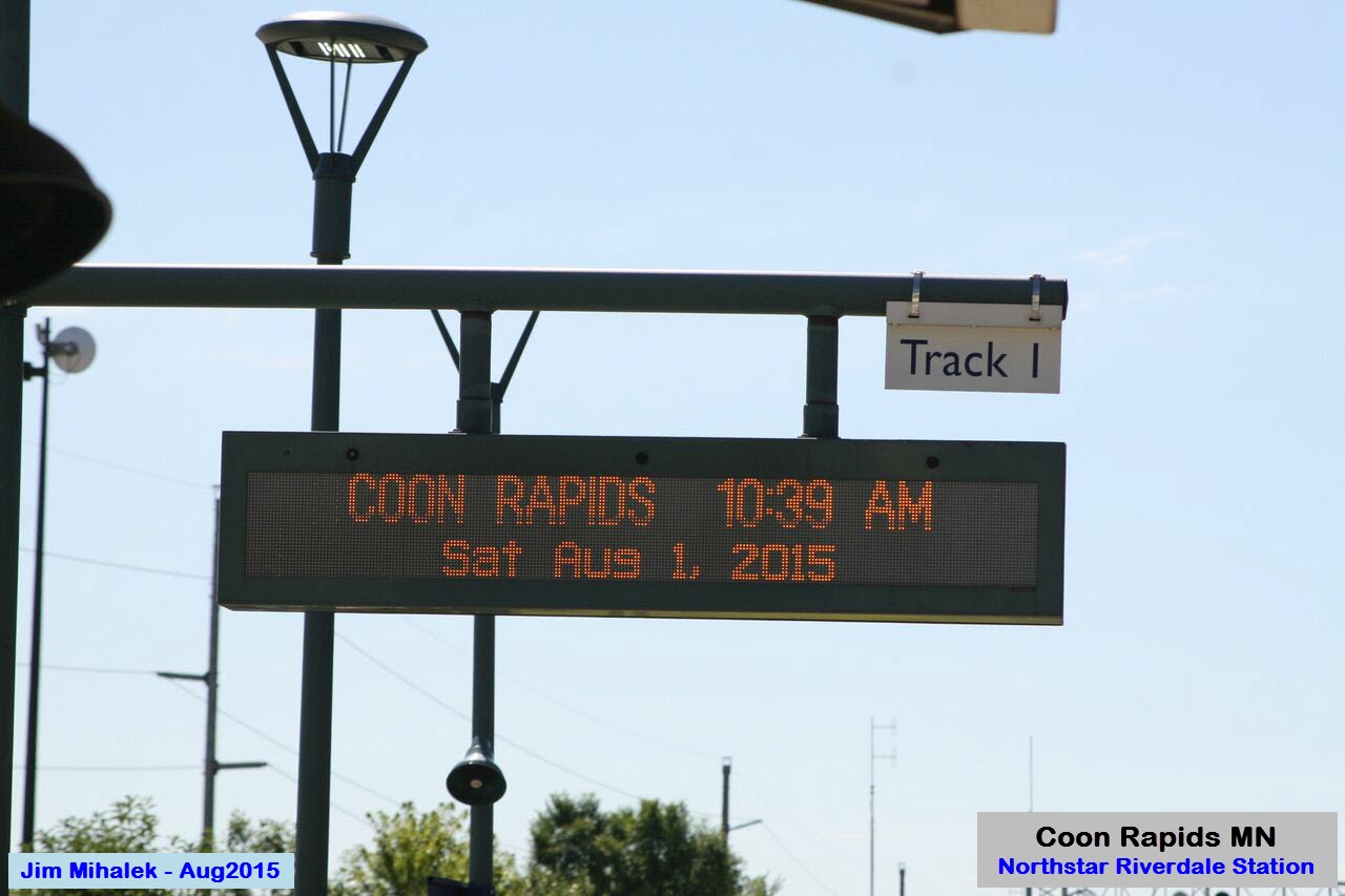
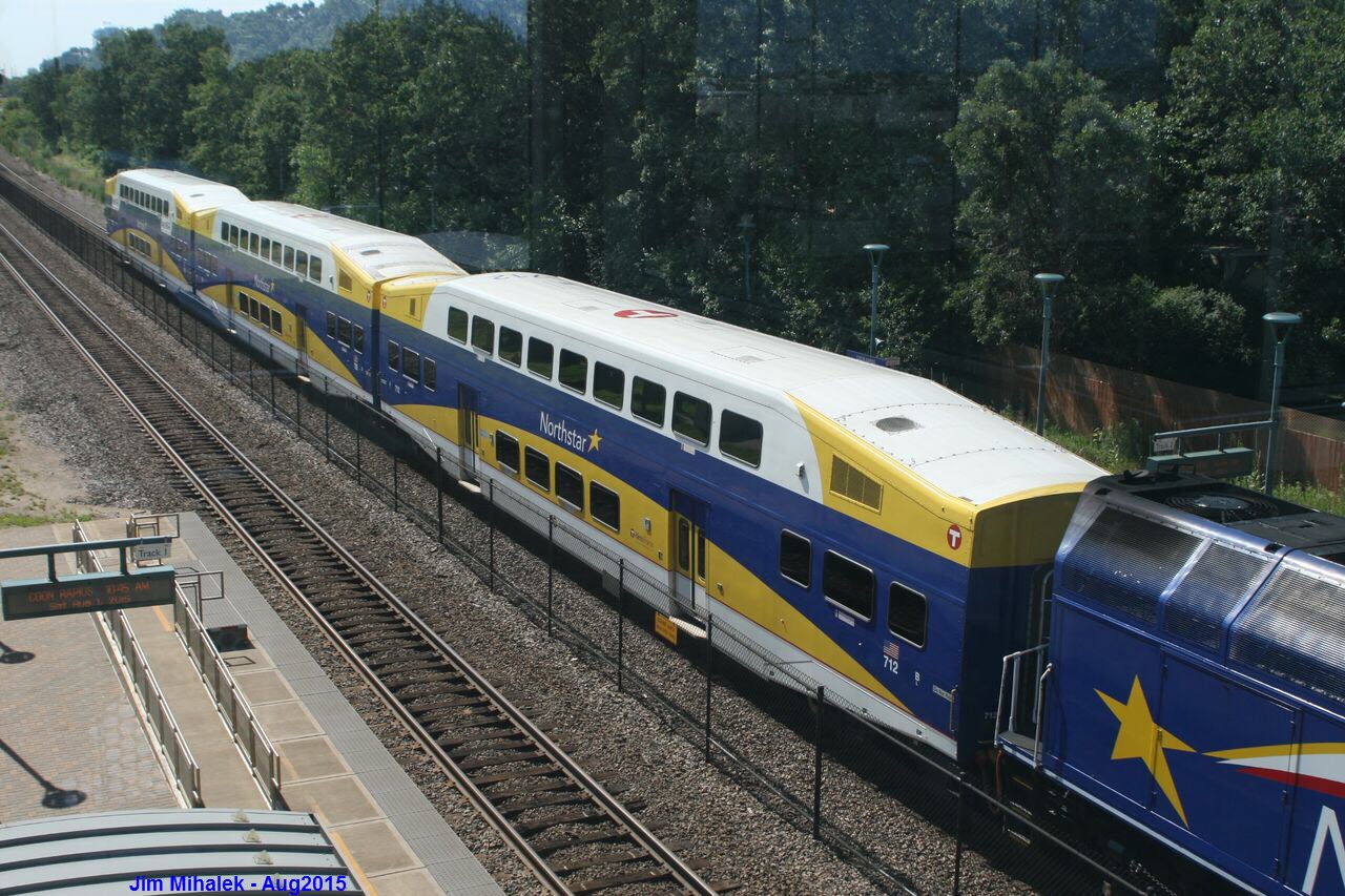
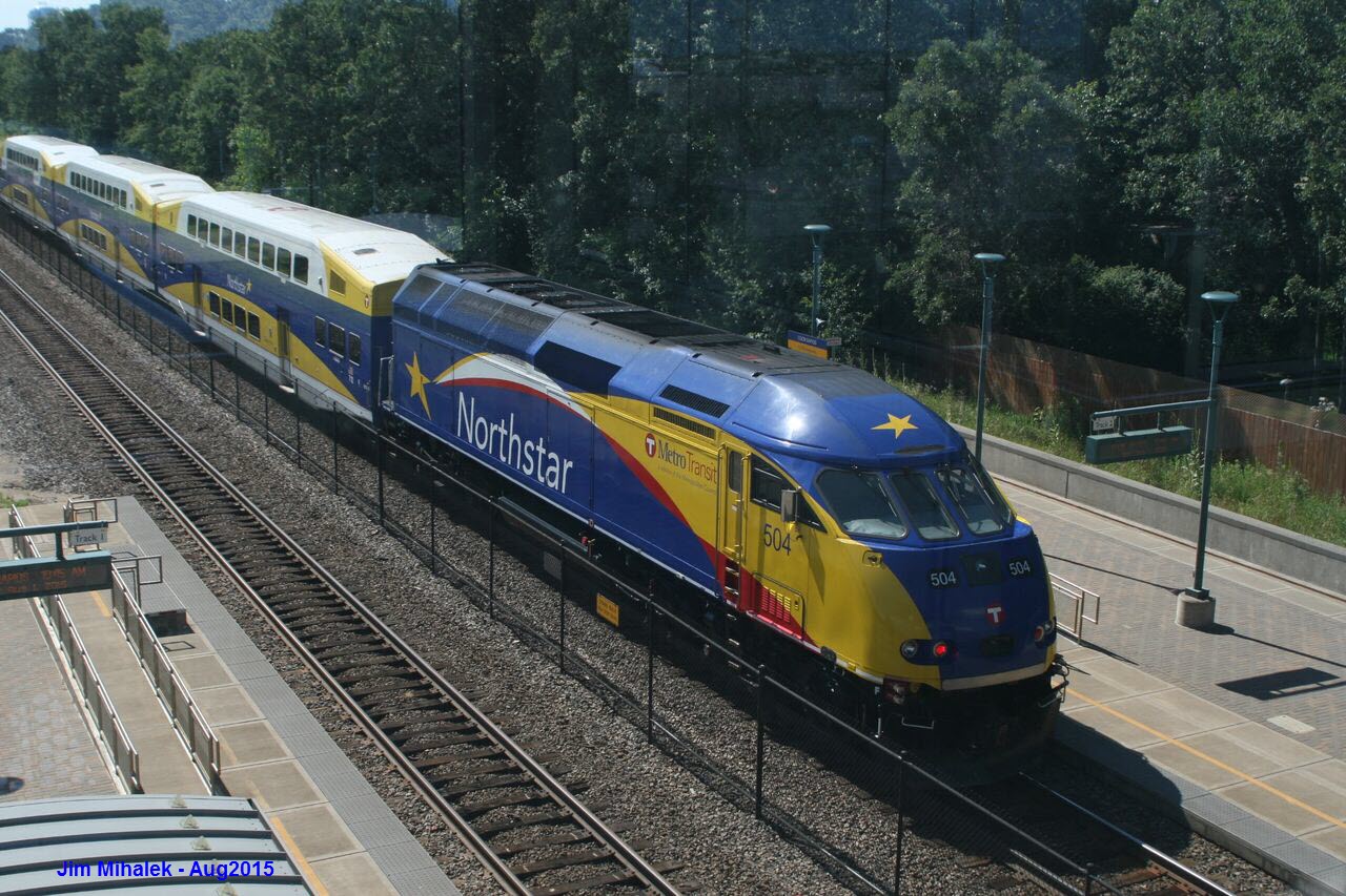
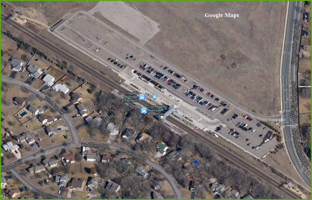
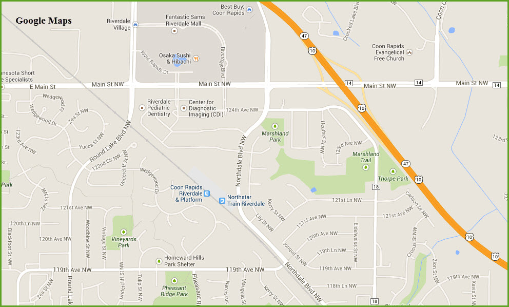
Coon Rapids - Riverdale Station
GPS Coordinates: 45.191239,-93.351367
Signals off the end of the platforms in both directions.
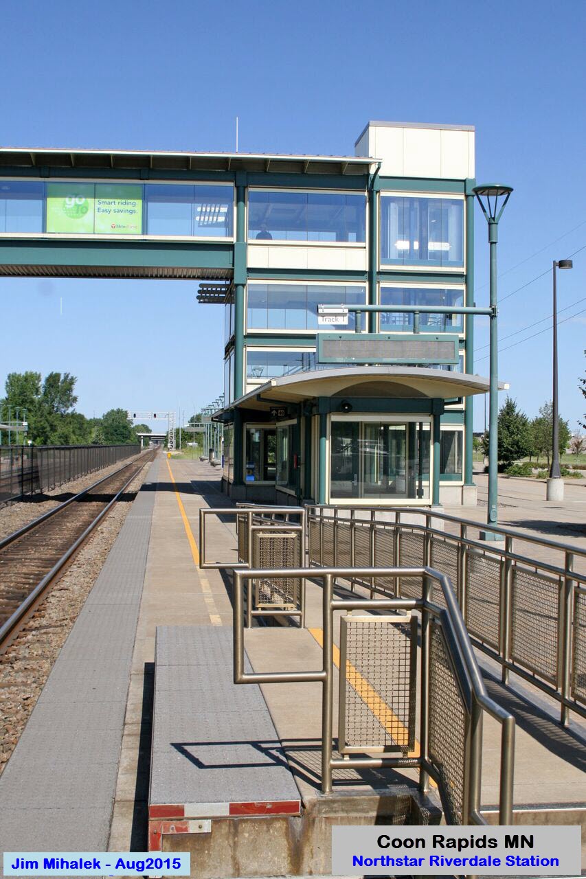
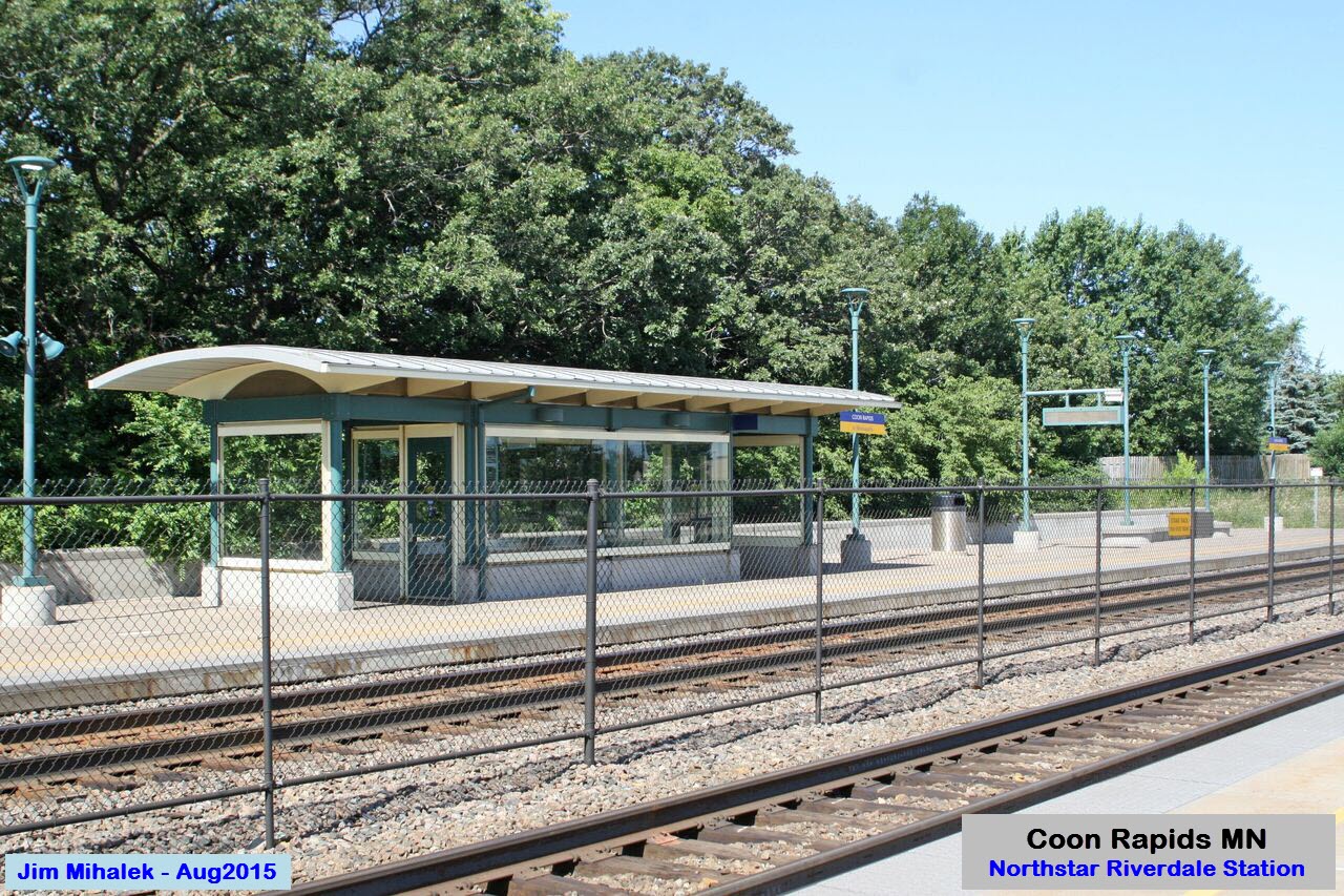
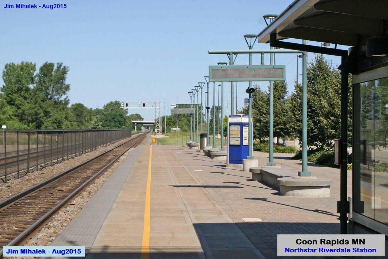
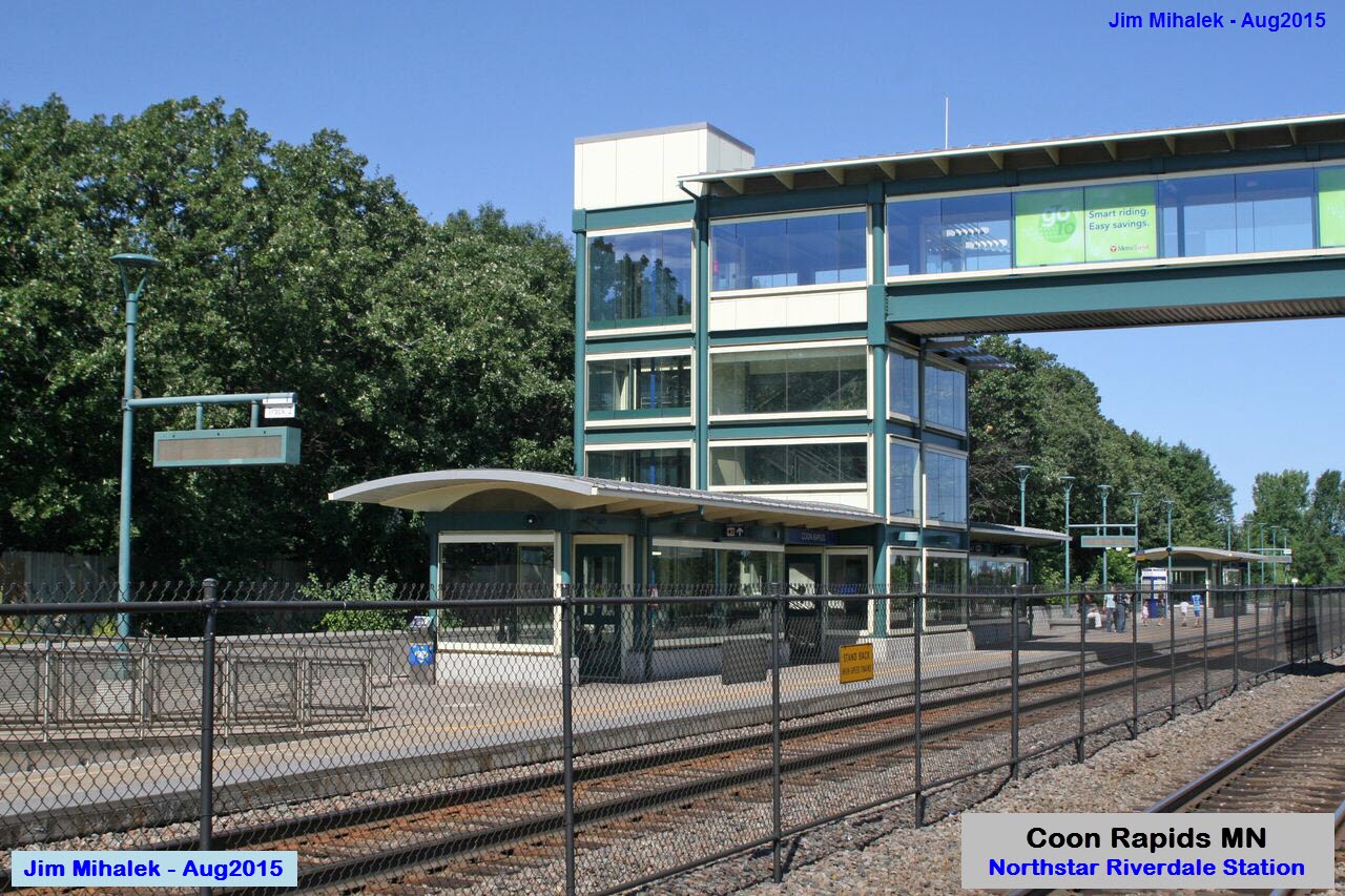
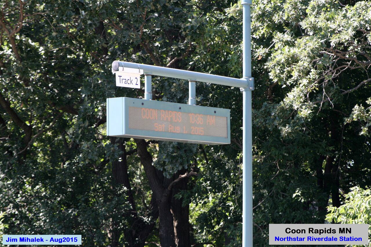


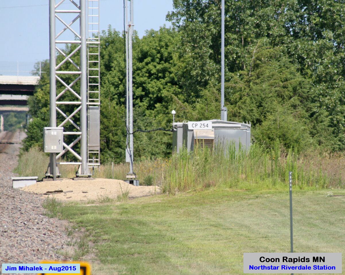
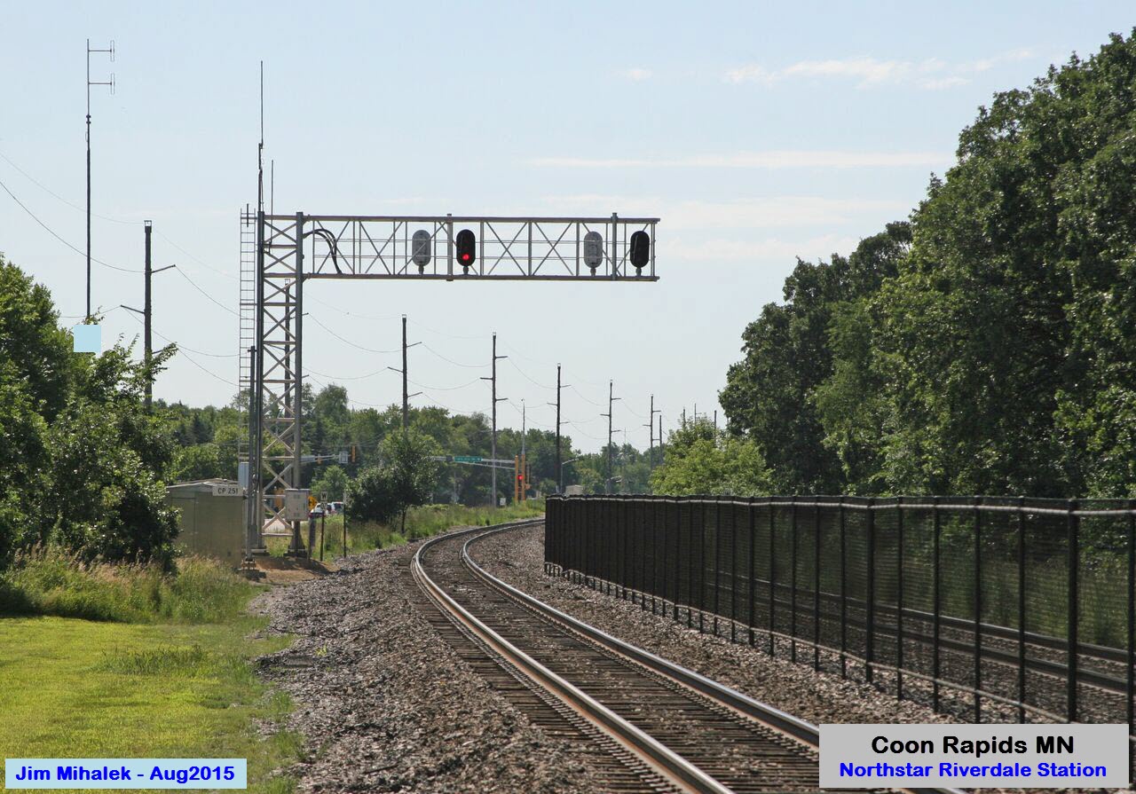

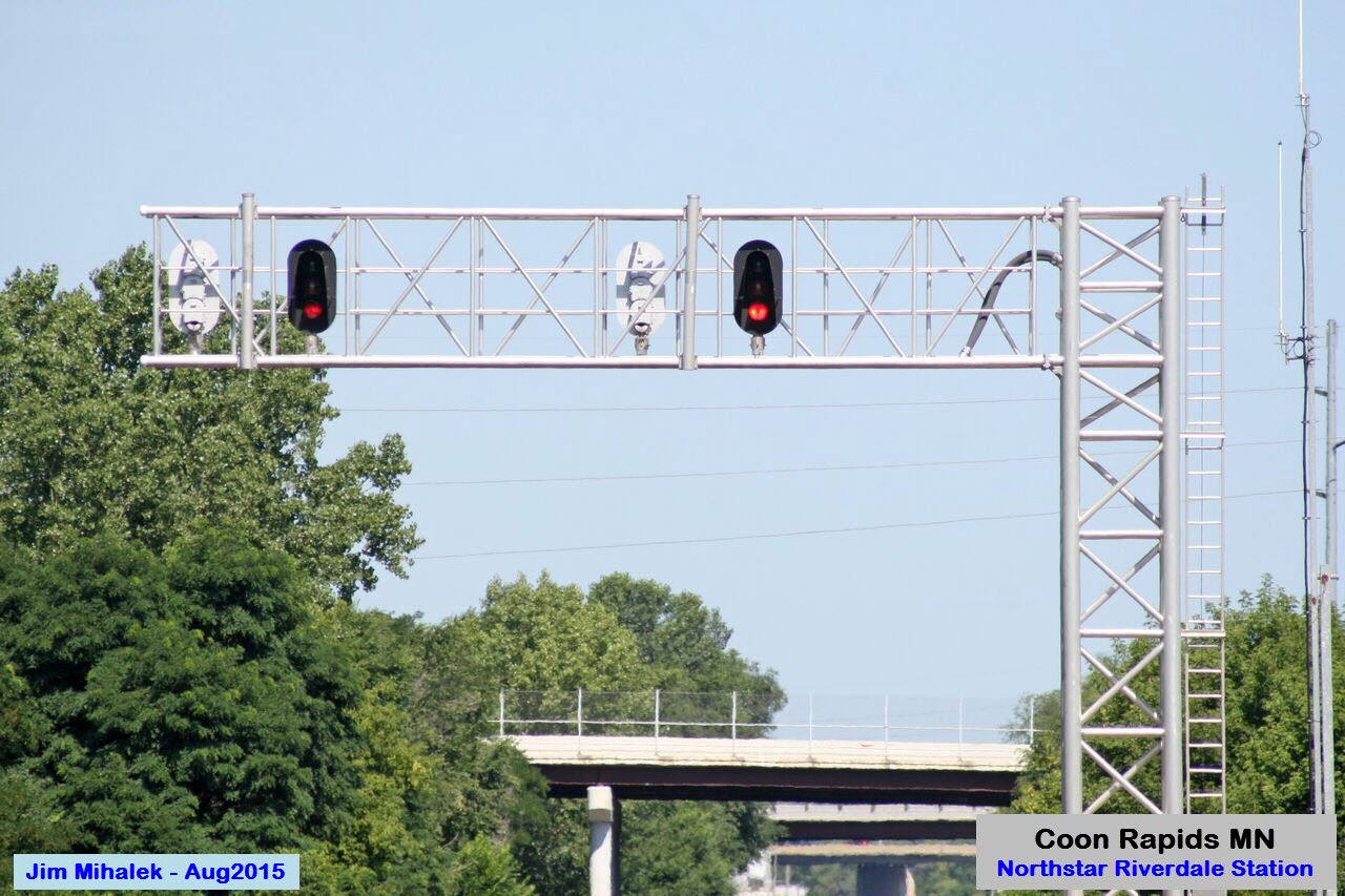
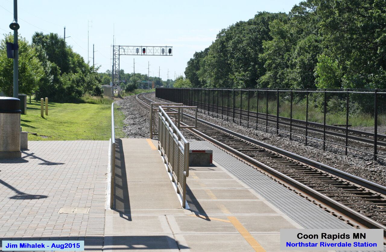
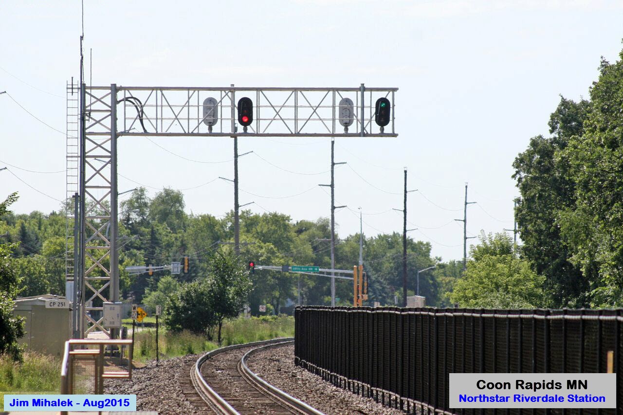
 The signals

 A passing Northstar train


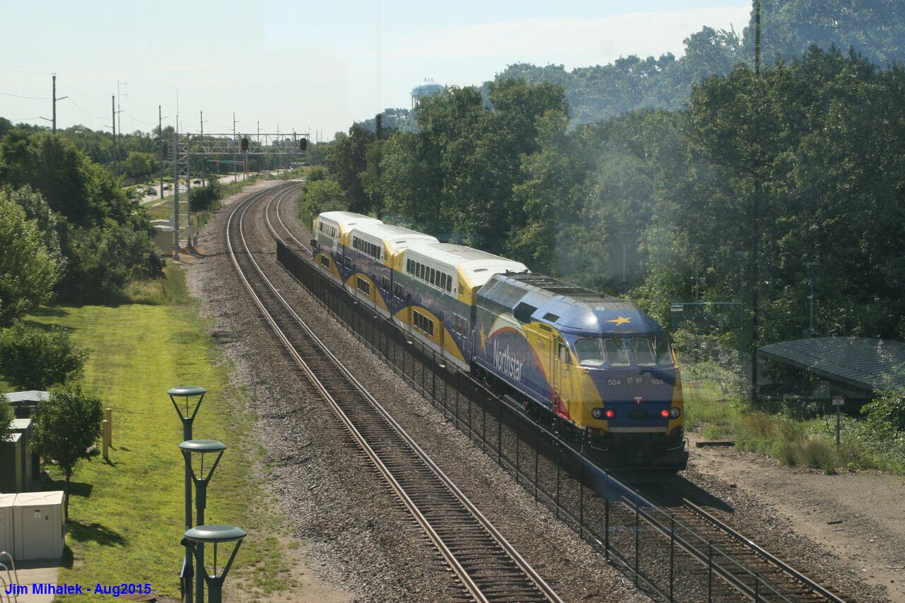

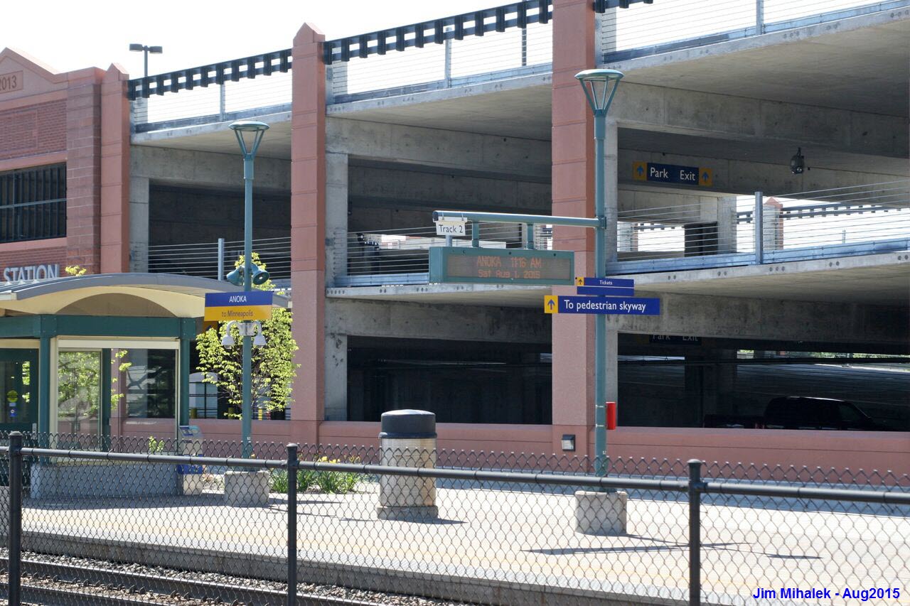
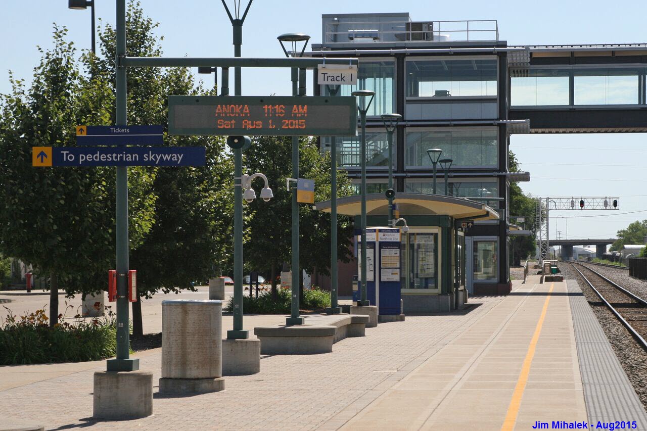
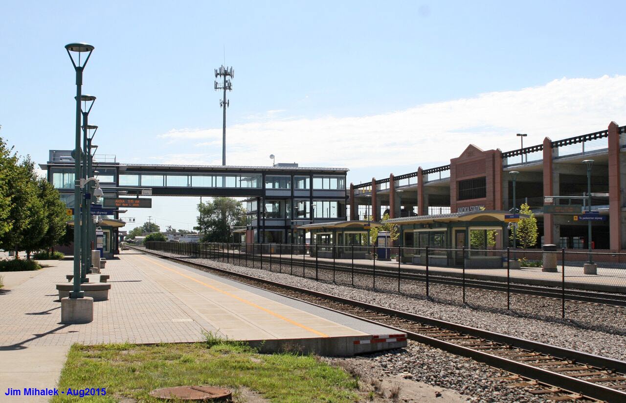
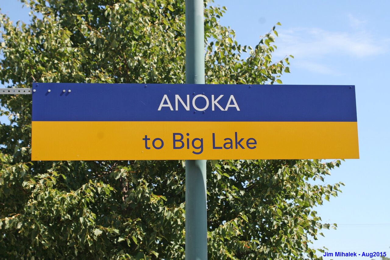
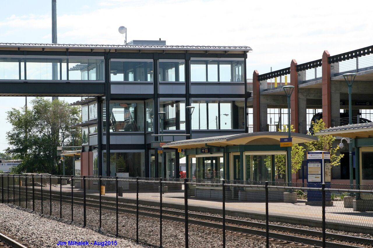
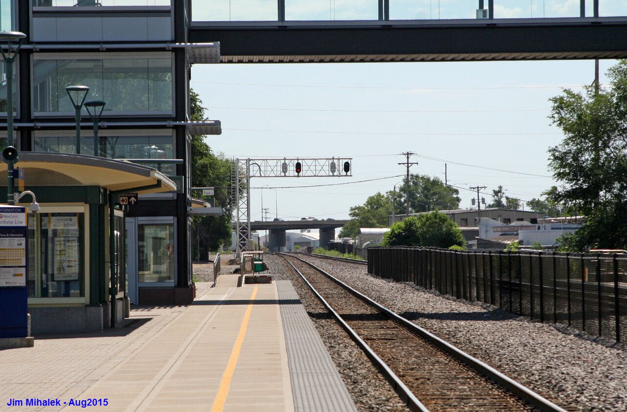
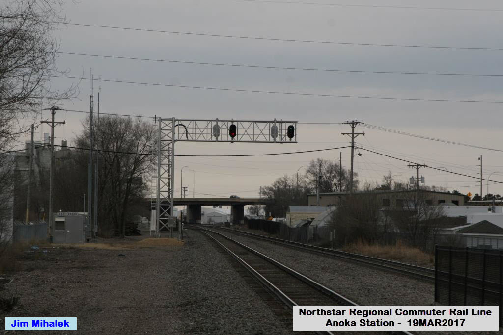
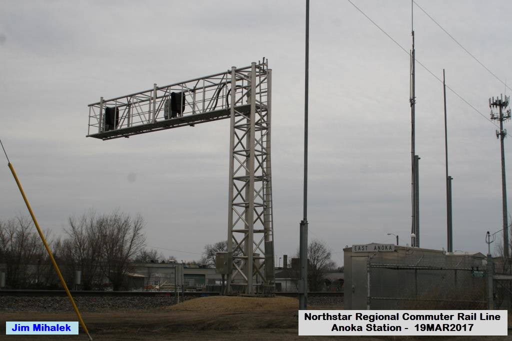
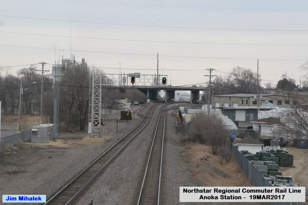
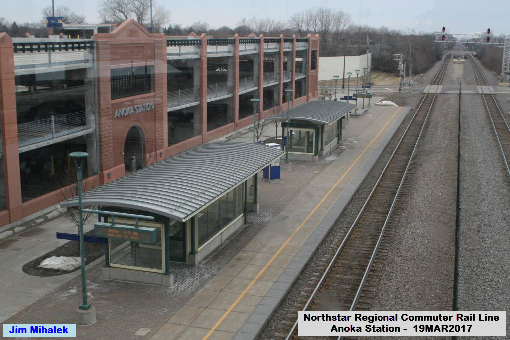
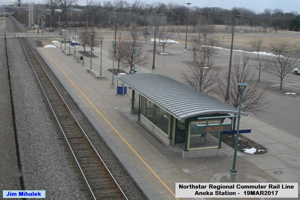
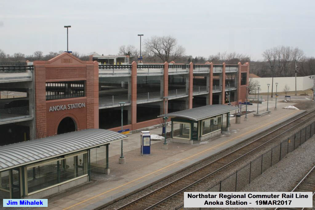
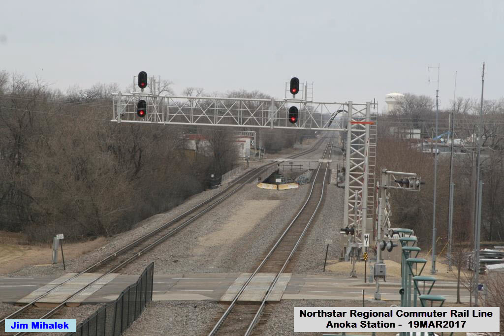
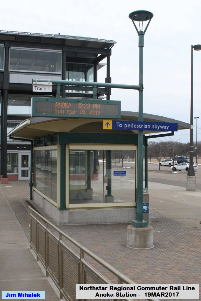
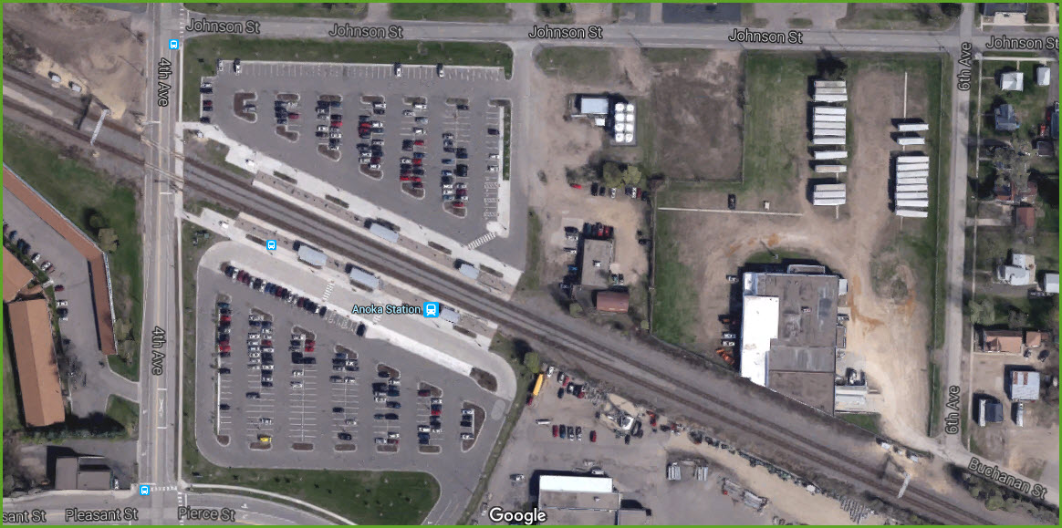
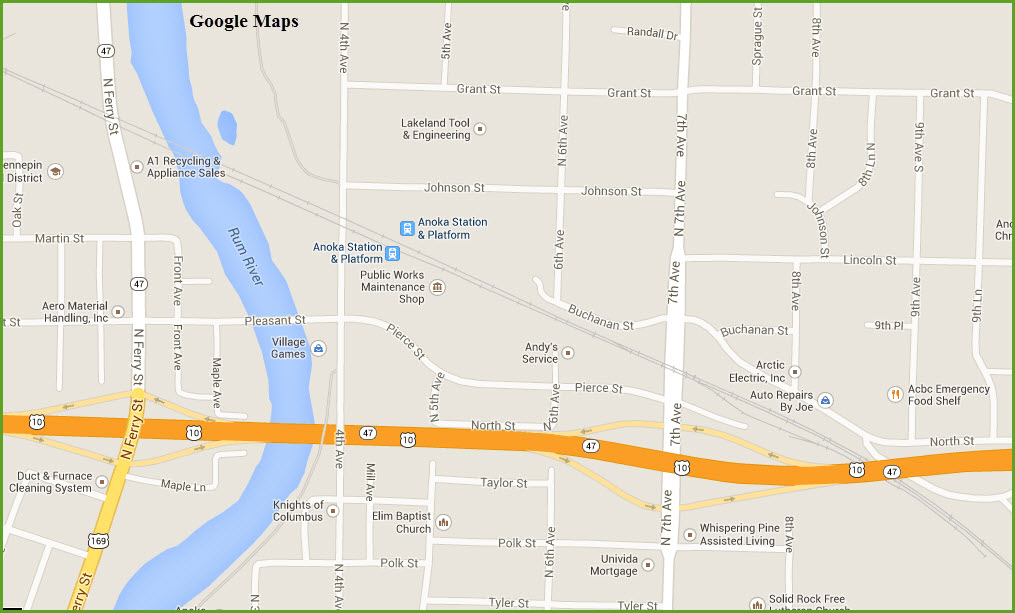
Anoka Station
GPS Coordinates: 45.207657,-93.384583
Again, there are signals off the end of the platforms in both directions.


 The signals.
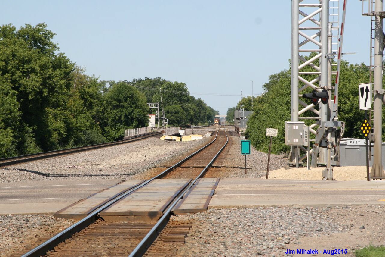
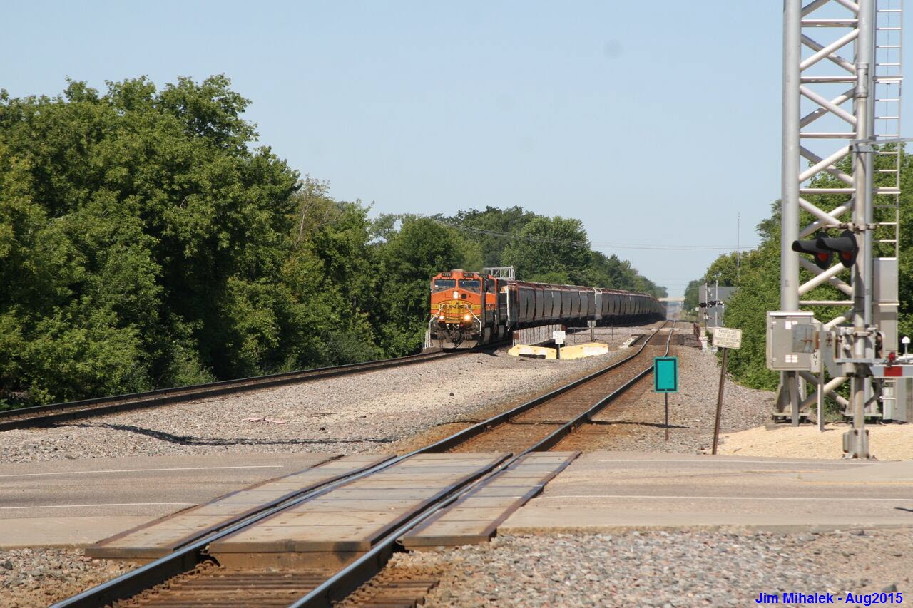
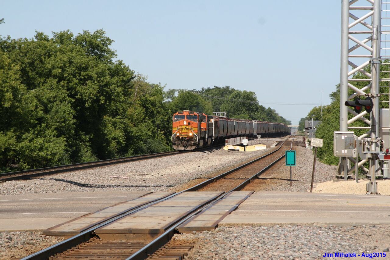
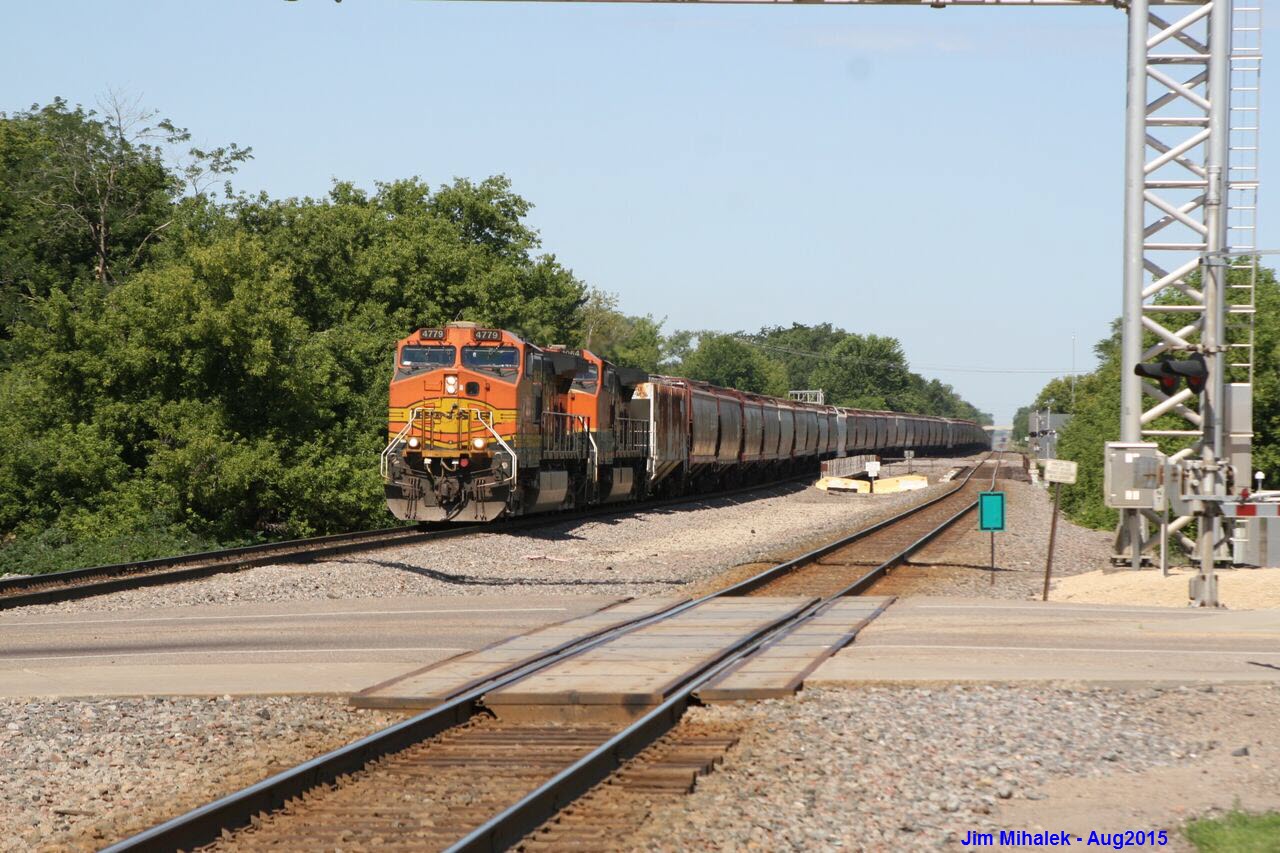
 A passing SB BNSF freight.

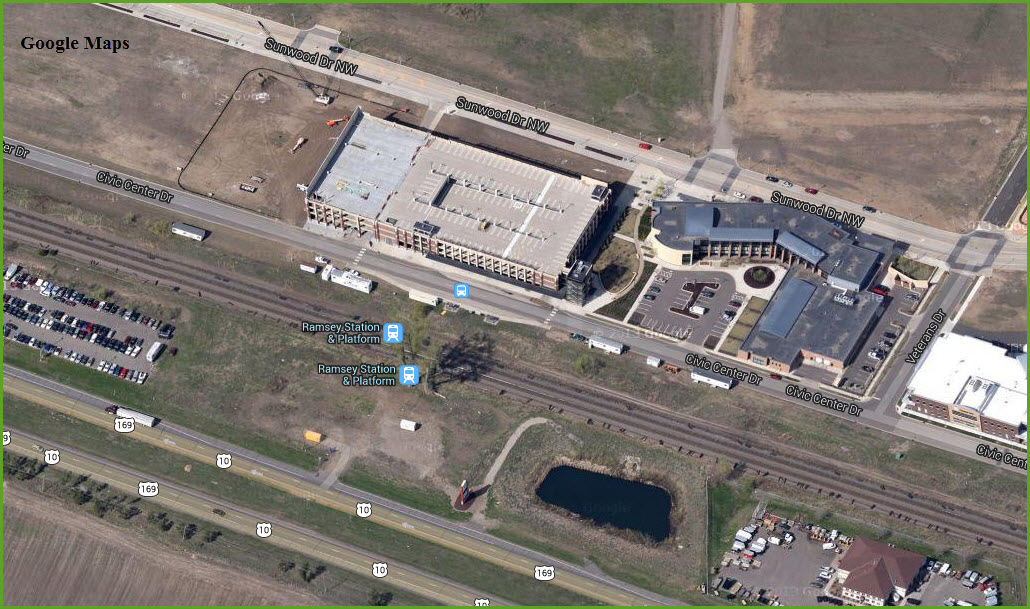
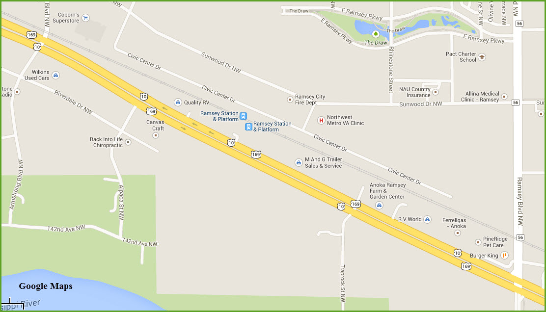
Ramsey Station
GPS Coordinates: 45.231866,-93.461723
Elk River Station
GPS Coordinates: 45.282427,-93.541964
Nice big parking lot.
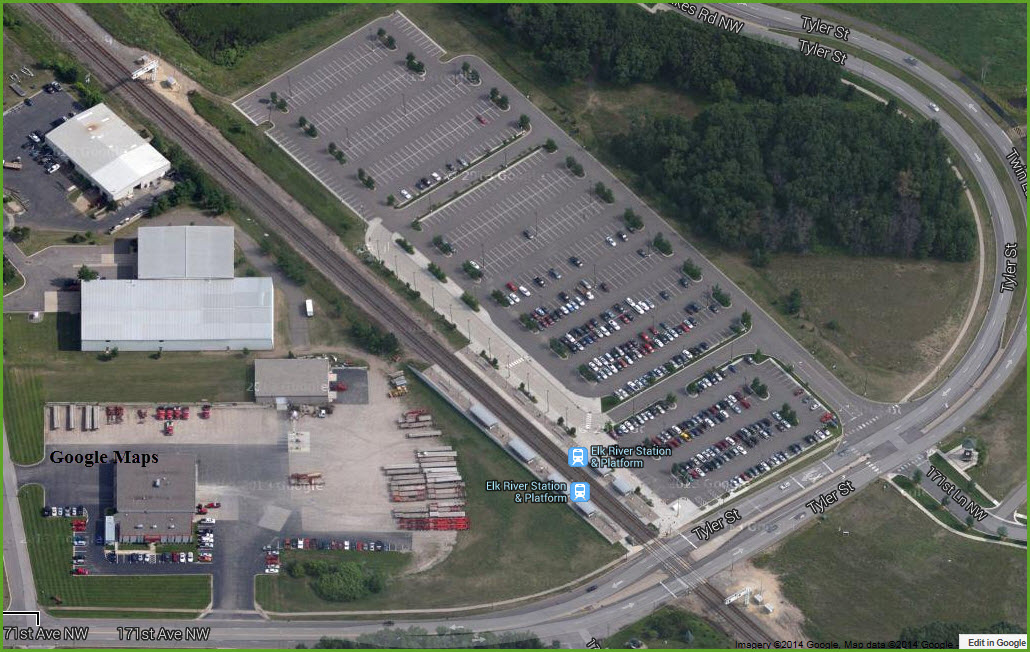
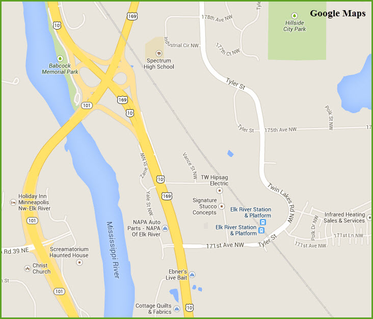
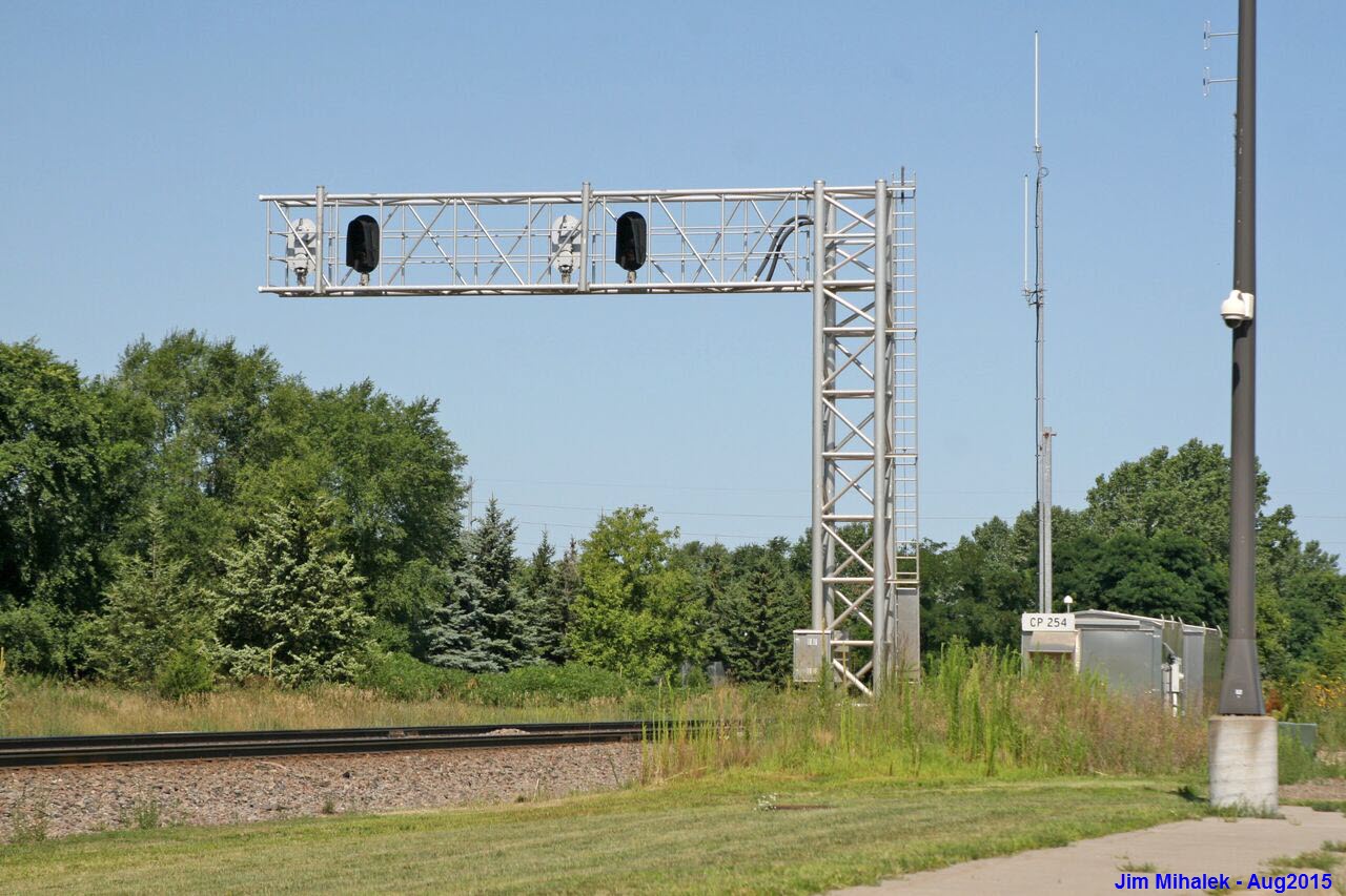
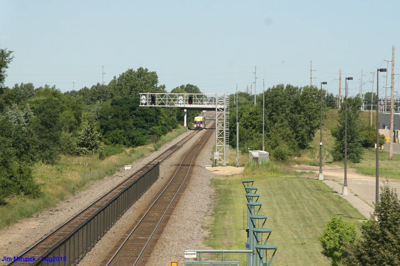
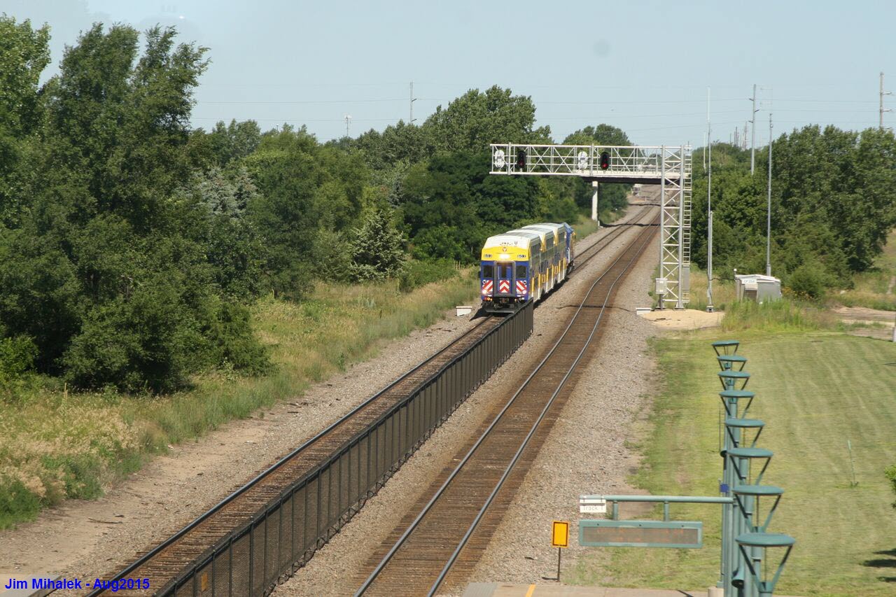
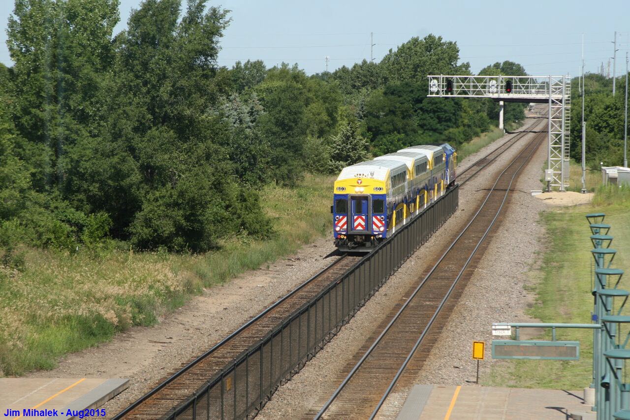
Signals - Elk River Station
GPS Coordinates: 45.282427,-93.541964
There are ("new") signals off the end of the platforms in both directions.
Signals - Main St/Elk River
GPS Coordinates: 45.302644, -93.563012
NB and SB signals on a cantilever bridge at Main St adjacent to the grade crossing
Next set south: at the Elk River Station; 1.53mi for SB signals, 1.82mi for NB signals
Next set north: at Meadowvale Rd NW; 1.94mi

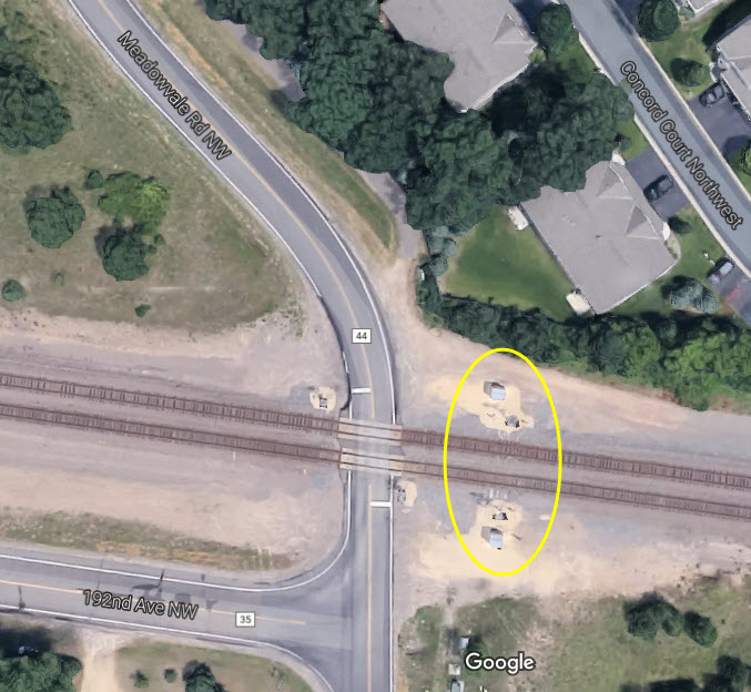
Signals - Meadowvale Rd/Elk River
GPS Coordinates: 43.317057, -93.596759
Bi-directional pairs of NB and SB signals on wayside masts adjacent to the grade crossing
Next set south: at the Main St grade crossing in Elk River; 1.94mi
Next set north: at Zebulon Rd NW; 1.56mi NB signals, 1.81mi for SB signals
Good pictures needed! :-)
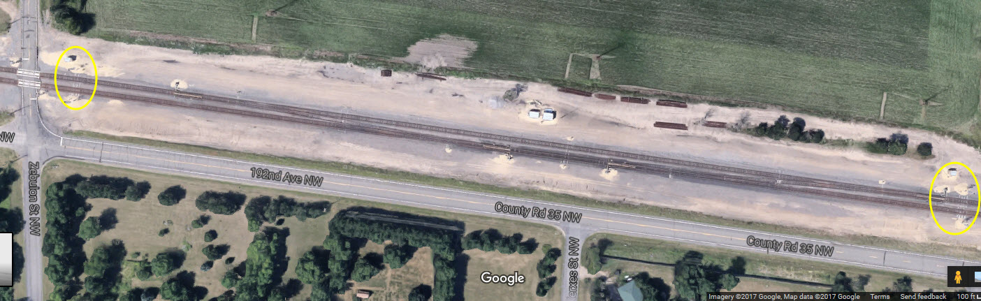
Signals & Crossovers - Zebulon Rd NW/Elk River
GPS Coordinates: 45.320382, -93.631176
Bi-directional pairs of NB and SB signals on wayside masts adjacent to the grade crossing
Next set south: at the Meadowvale Rd grade crossing in Elk River; 1.94mi
Next set north: at Road 15; 1.54mi
Good pictures needed! :-)
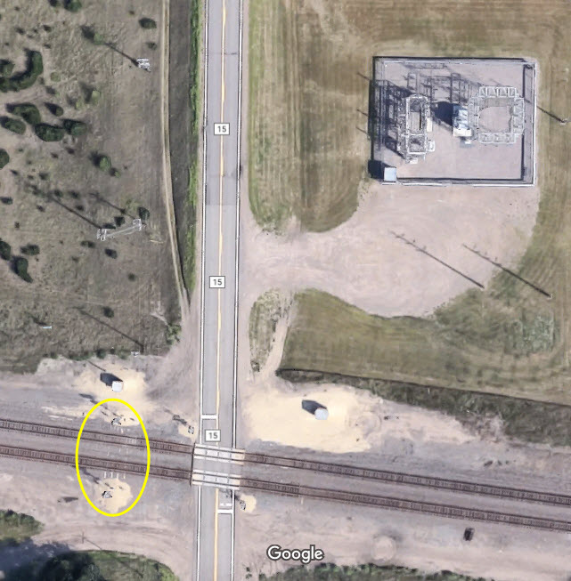
Signals - County Road 15/Big Lake
GPS Coordinates: 45.323683, -93.665108
Bi-directional pairs of NB and SB signals on wayside masts adjacent to the grade crossing
Next set south: at the Zebulon Rd grade crossing in Elk River; 1.54mi
Next set north: at private grade crossing; 1.30mi
Good pictures needed! :-)
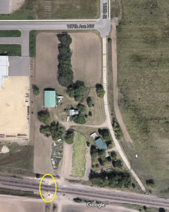
Signals - Private grade crossing off 197th Ave NW & 166th St/Big Lake
GPS Coordinates: 45.326239, -93.691629
Bi-directional pairs of NB and SB signals on wayside masts adjacent to the grade crossing
Next set south: at the County Road 15 grade crossing in Big Lake; 1.30mi
Next set north: at the Big Lake station; 1.53mi for the NB set, 1.74mi or the SB set
Good pictures needed! :-)
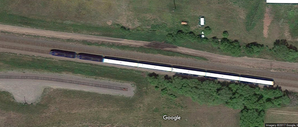
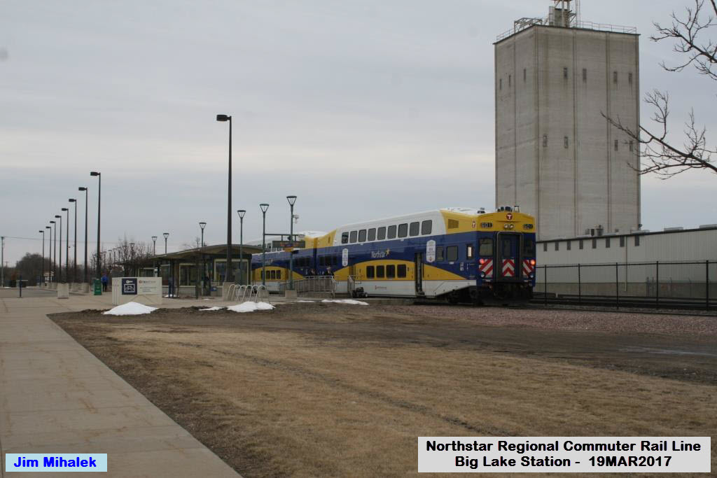
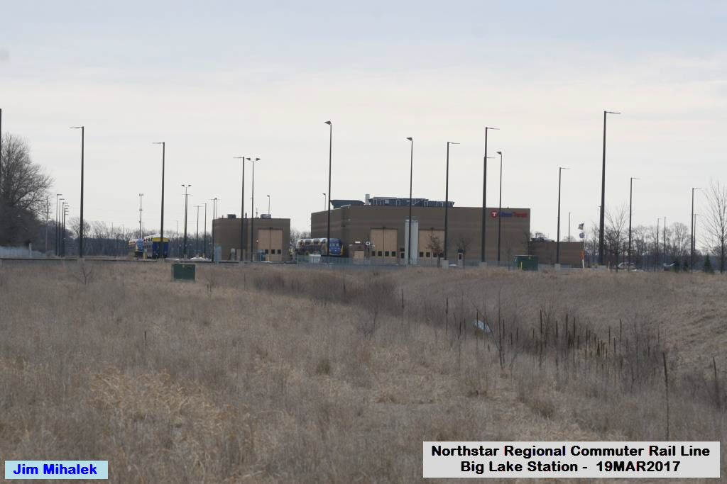
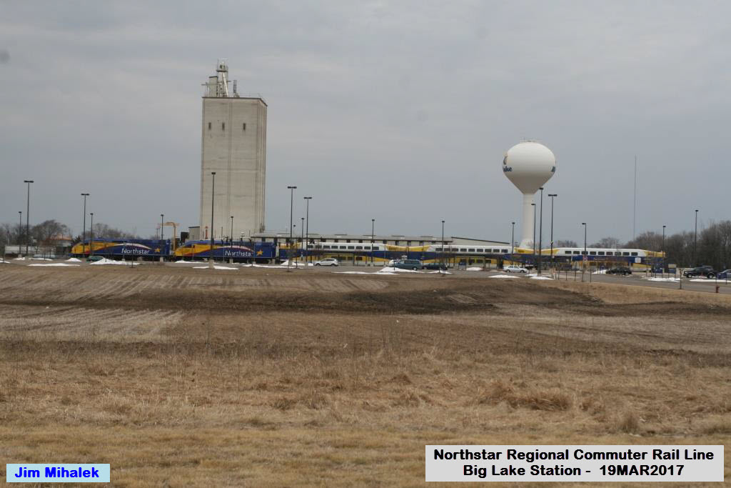
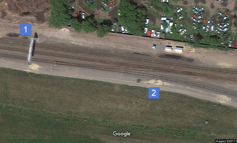
Storage Yard and Maintenance Facility
GPS Coordinates: 45.327606,-93.719934
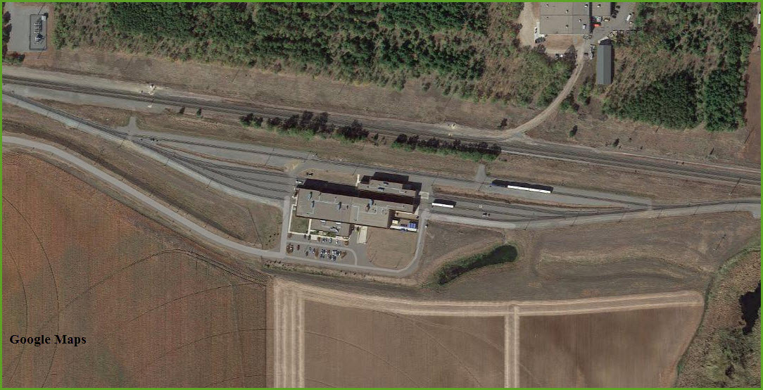
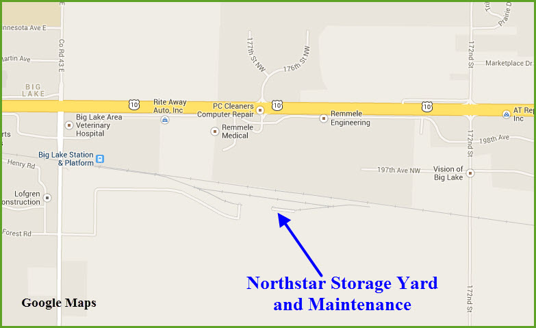
A train that just left the Big Lake station, the tail track of the yard is seen below the train.
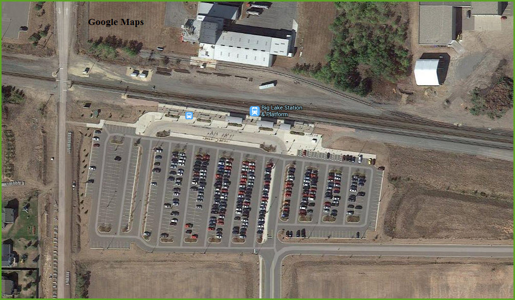
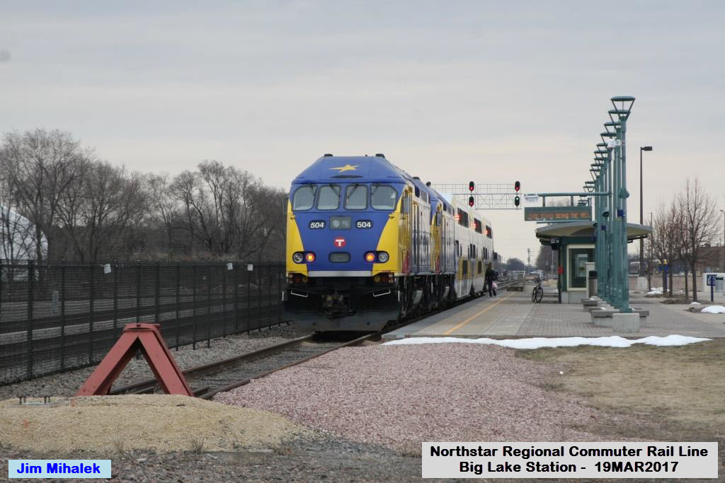
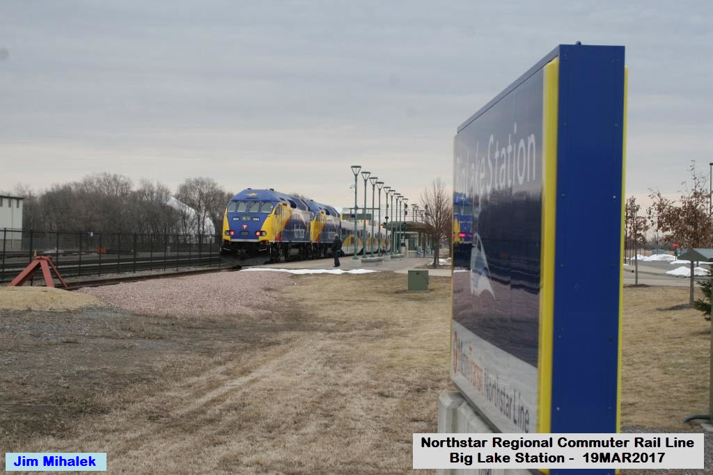
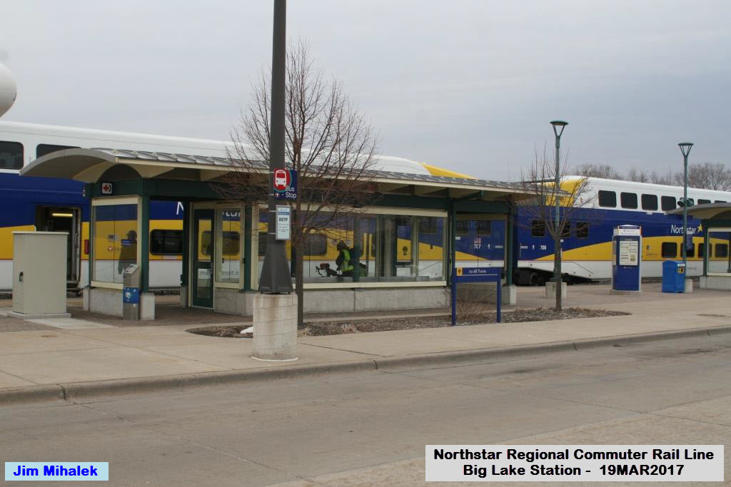
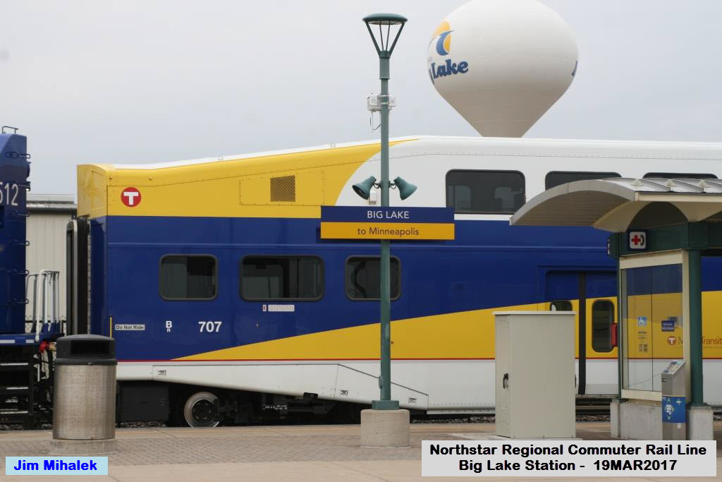
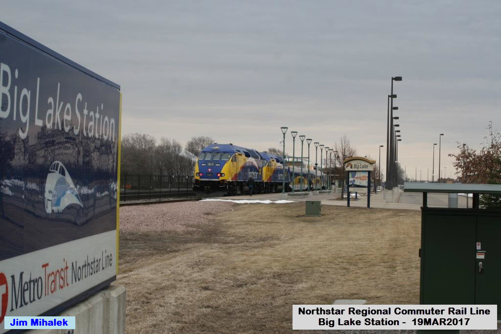
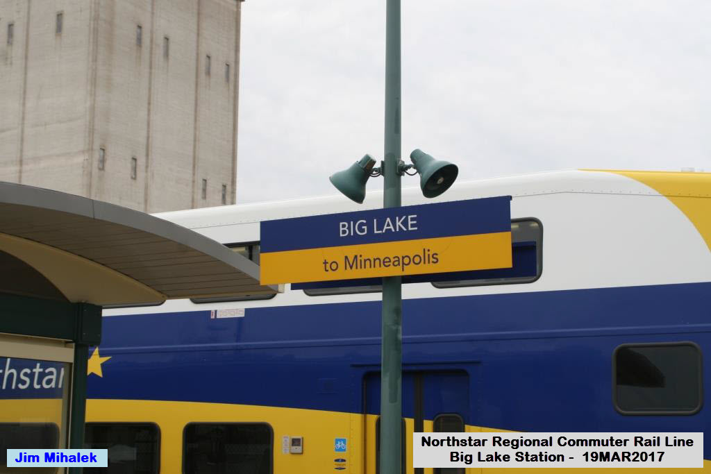
Big Lake Station
GPS Coordinates: 45.32965,-93.730159
Here at Big Lake, the station is configured a little differently from the rest of the stations on the line. The station is on a siding, one because it is the current end of the line and it gets
trains off the main line for layovers, and secondly, the siding is part of the yard lead into the maintenance facility.
For the last 4.87 miles into the Big Lake station, all trains, NB and SB,
run on the southern track, because Zebulon is where the last crossover from
mainline 1 (WB) track to mainline 2 (EB) track appears.
Notice in the four years since I first did this guide, BNSF has double tracked the R-O-W west of the station.
 2013
2013
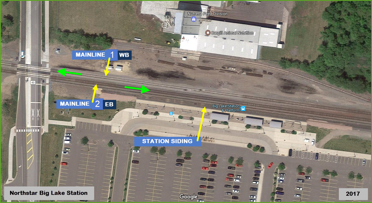
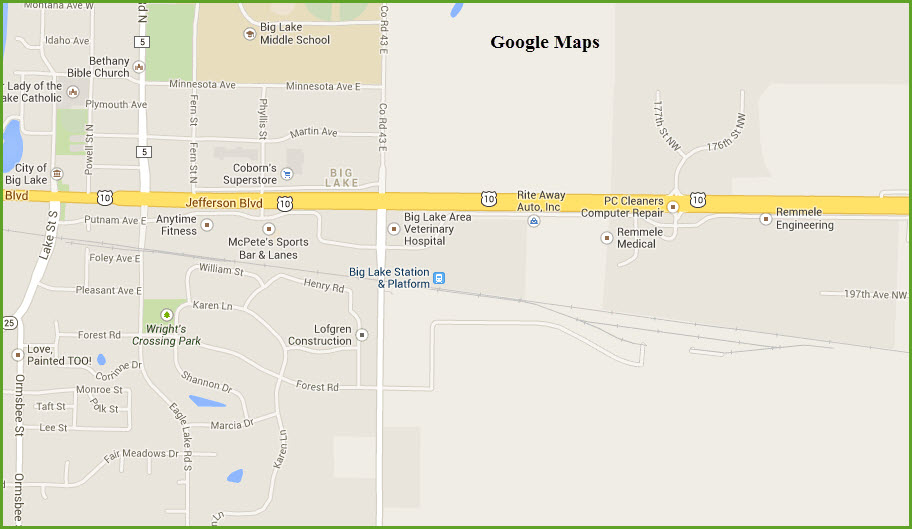


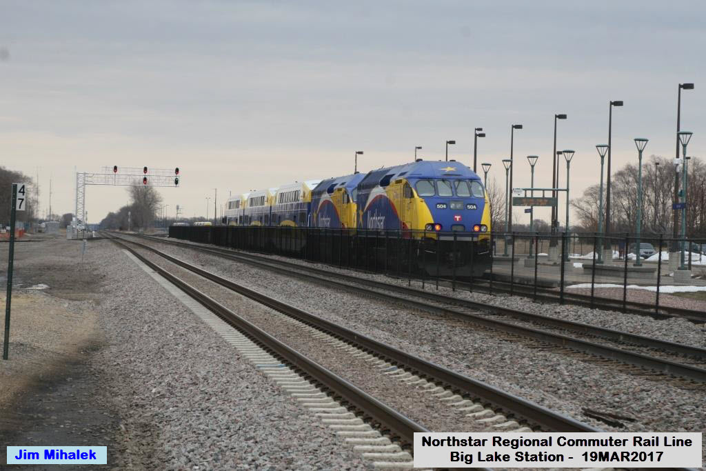

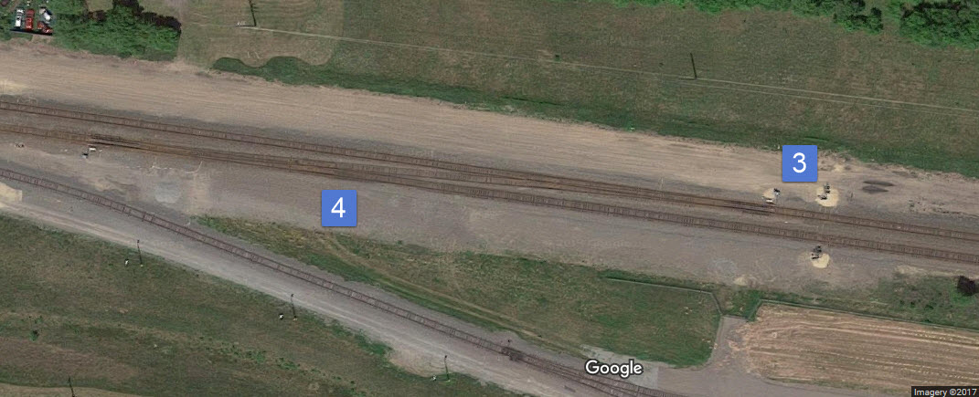
Below, the signals south of the station platform (1) for SB trains on a three track cantilever bridge, and a signal for trains coming out of the yard (2).
3 is the NB set, and 4 is the crossover to the station siding and yard lead.
In the picture above with the train at the station, it has a medium clear to proceed. My guess is that is the best he will see due to the fact he has to come out onto the mainline?
Disclaimers:
I love trains, and I love signals. I am not an expert. I do these pages because I love spending my time doing them - although I do a reasonable amount of research to make sure the information
presented is accurate! :-) :-)
Please Note: Since the main focus of my two websites is railroad signals, the railfan guides are oriented towards the signal fan being able to locate them. For those
of you into the modeling aspect of our hobby, my indexa page has a list of almost everything railroad oriented I can think of to provide you with at least a few pictures to
help you detail your pike.
If this is a railfan page, every effort has been made to make sure that the information contained on this map and in this railfan guide is correct. Once in a while, an error may creep in,
oooooooops, oh well! :-)
My philosophy: Pictures and maps are worth a thousand words, especially for railfanning. Text descriptions only get you so far, especially if you get lost or disoriented. Take
along good maps.... a GPS is OK to get somewhere, but maps are still better if you get lost! I belong to AAA, which allows you to get local maps for free when you visit the local branches.
ADC puts out a nice series of county maps for the Washington DC area, but their state maps do not have the railroads on them. If you can find em, I like the National Geographic map book of the
U.S..... good, clear, and concise graphics, and they do a really good job of showing you where tourist type attractions are, although they too lack the railroads. Other notes about specific areas
will show up on that page if known.
BTW, floobydust is a term I picked up 30-40 years ago from a National Semiconductor data book, and means miscellaneous and/or other stuff.
Pictures and additional information is always needed if anyone feels inclined to take 'em, send 'em, and share 'em, or if you have something to add or correct.... credit is always given! BE NICE!!! Contact info
is here. Beware: If used as a source, ANYTHING from Wikipedia must be treated as being possibly being inaccurate, wrong, or not true.
RAILFAN GUIDES HOME
RAILROAD SIGNALS HOME
Last Updated: 28 Mar 2017