
In General
Getting Here
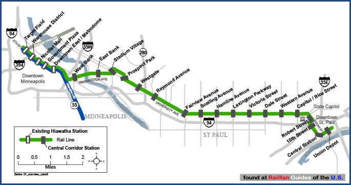
Map
Station by Station
Pictures
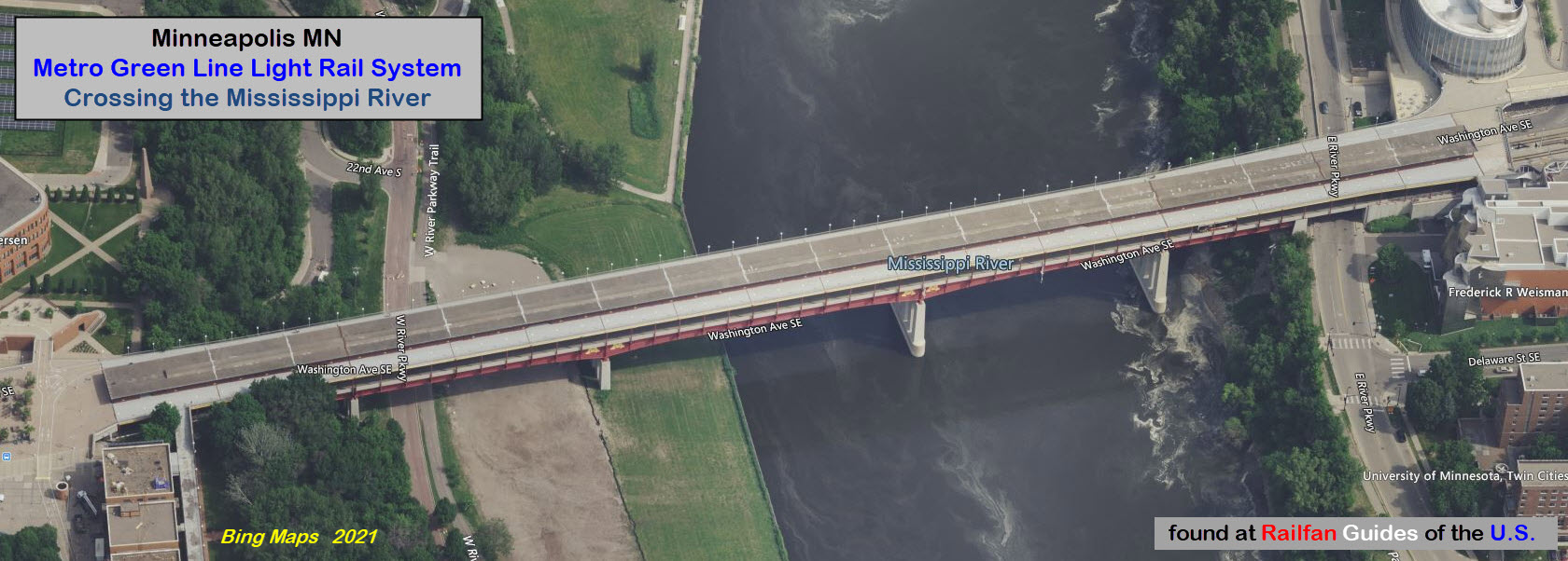
Bridges
Signals
Floobydust
RAILROAD SIGNALS HOME
Location / Name:
Minneapolis MN, Hennepin County TO
St Paul MN, Ramsey County
What's Here:
Metro Green Line Light Rail System
Data:
GPS Coordinates: as needed
Phone A/C: 612
ZIP: 55415 (downtown Minneapolis)
ZIP: 55101 (downtown St Paul)
Access by train/transit:
Blue Line Light Rail System (in Minneapolis)
Northstar Regional Commuter Rail (in Minneapolis)
Amtrak (in St Paul)
The Scoop:
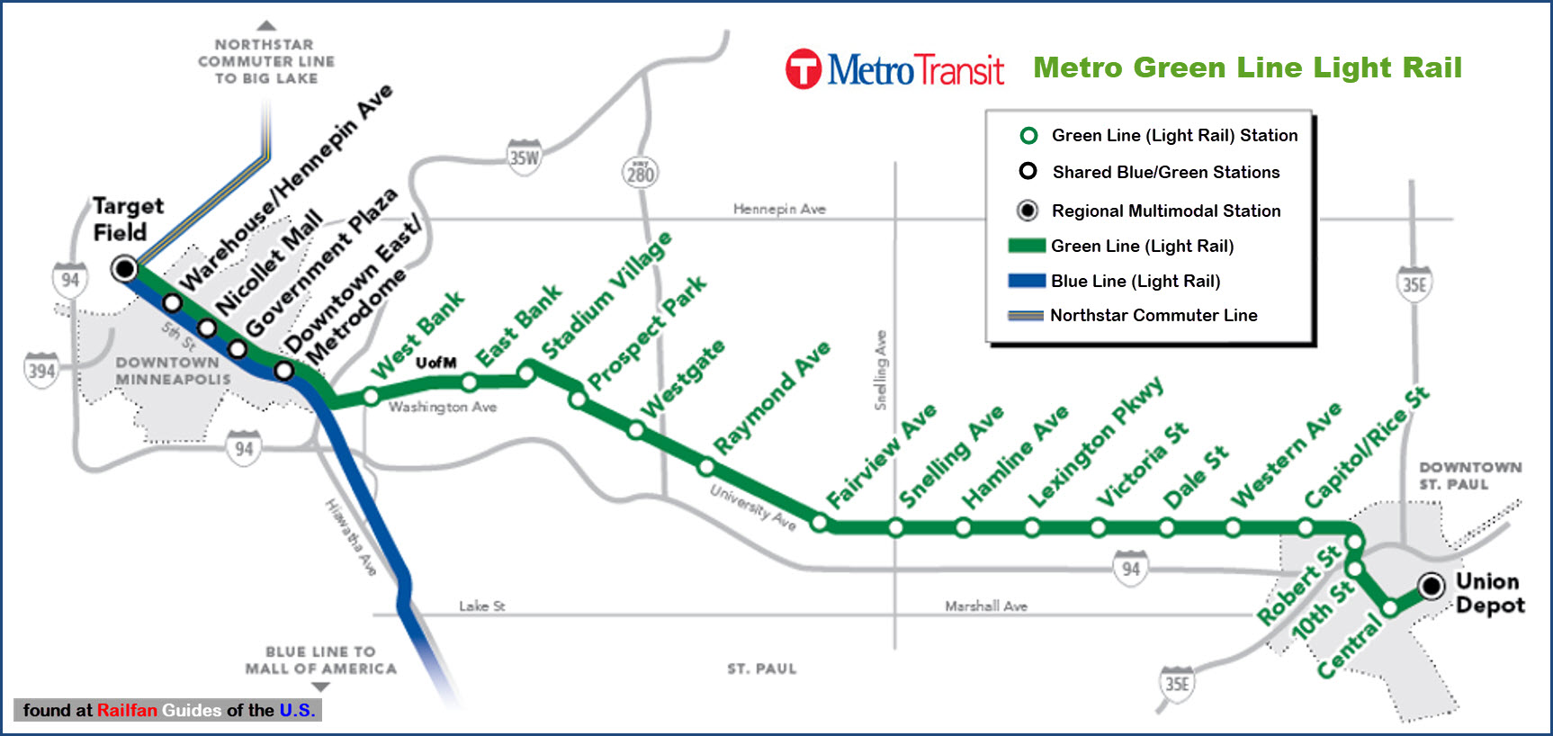
The Green Line (formerly called the Central Corridor) opened on June 14th, 2014.
The line has a total of 23 stations, five of which it shares with the Blue Line when in downtown Minneapolis.
The last station on the Green Line is Union Station in St Paul. Service to Union Station had come to an end when Amtrak took over in 1971, but the city purchased the building in 2009, and the renovated station re-opened to the public on December 8, 2012
If you want to go south in Minneapolis, let's say to the Mall of America, you will have to transfer to a Blue Line train at one of the five stations in downtown Minneapolis.
Acknowledgements:
Jim Mihalek
Caroline Yang/MPR News
Websites and other additional information sources of interest for the area:
Time-lapse tour of the Green Line
Almost any exit on I-94 between St Paul and Minneapolis will be close to the line at some point, this includes exits:
From WB I-95, there is no way to get on I-35W NB
-- 234C - 5 blocks north via Cedar Ave
-- 234C - 2 blocks south via Cedar Ave for the Blue Line Shops and Franklin Ave station
-- 235B - 7 blocks north via Huron Blvd
-- 236 - 2 blocks north once you take the University exit off 280
-- 237 - 4 blocks north via Vandalia St (also Minnesota Commercial here)
-- 238 - 5 blocks north via Snelling Ave, MN 51
-- 239A - 5 blocks north via Hamline Ave
-- 239 - 4 blocks north via Lexington Pkwy
-- 240 - 7 blocks north via Dale St
-- 241 - 7 blocks north via Marion St
Station by Station
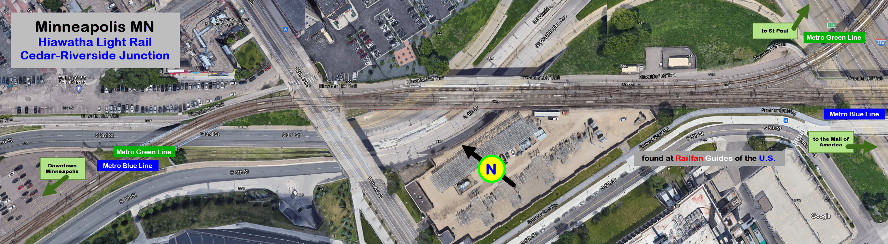
Green Line/Blue Line Junction
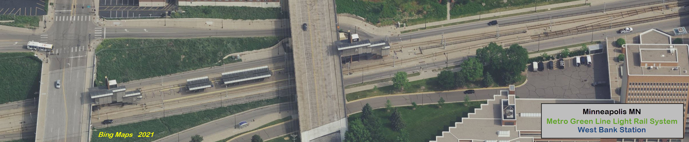
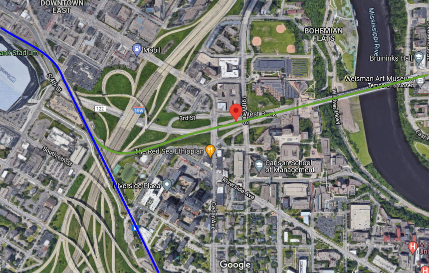
West Bank
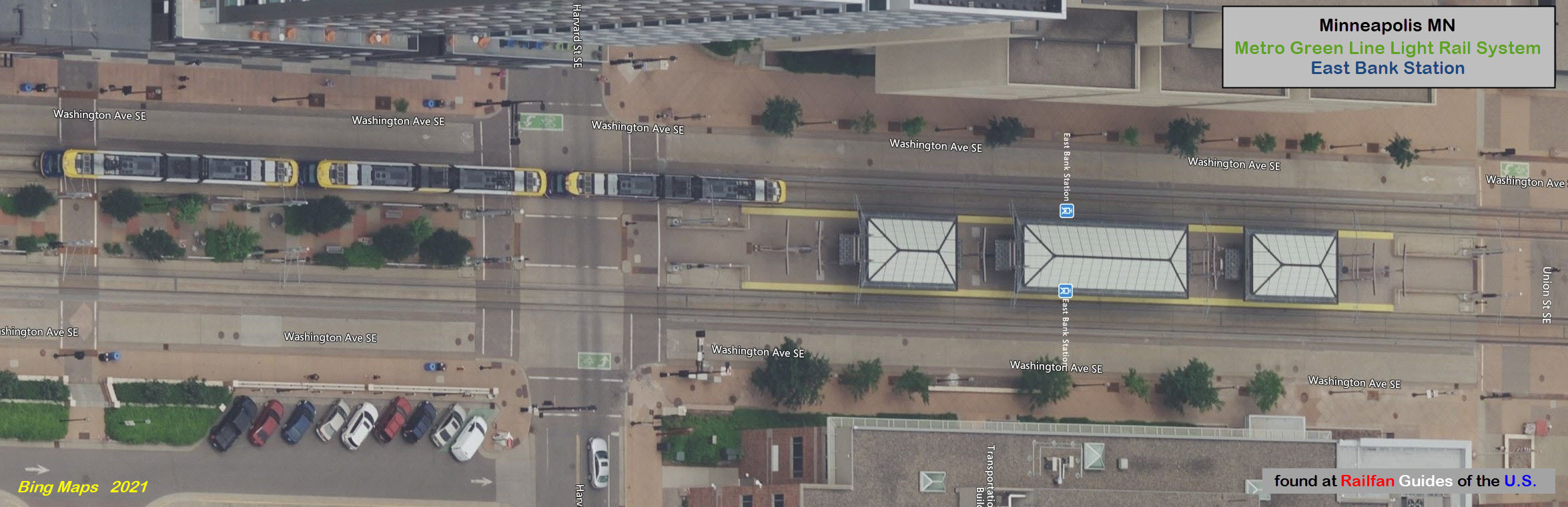
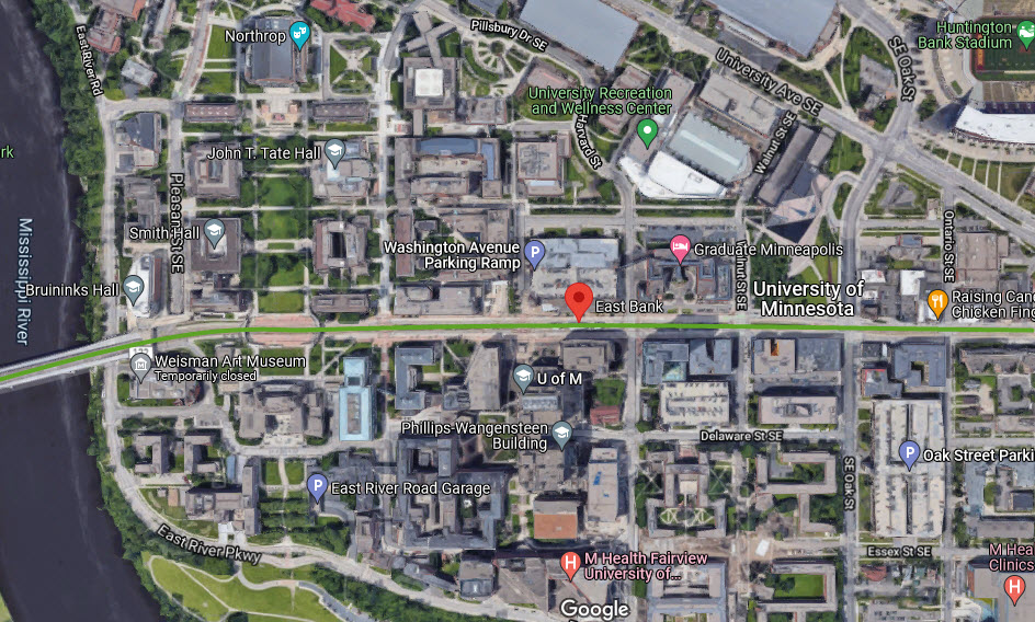
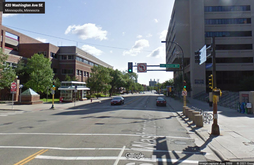
East Bank
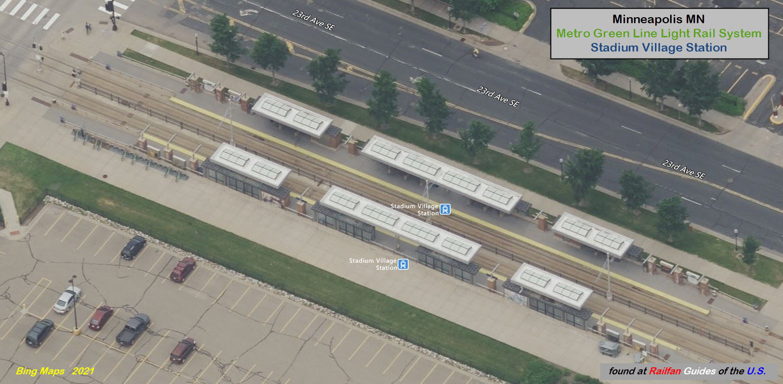
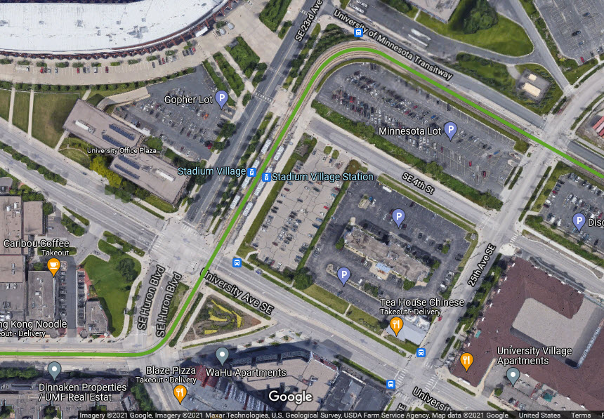
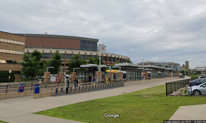
Stadium Village
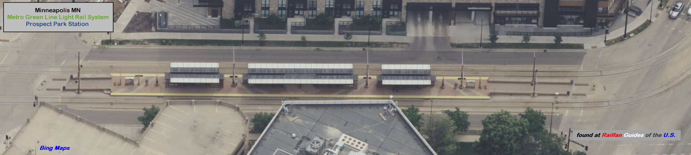
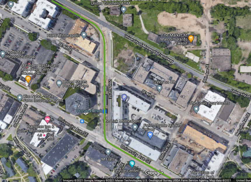
Prospect Park
Westgate
Raymond Ave
Fairview Ave
Snelling Ave
Hamline Ave
Lexington Pkwy
Victoria St
Dale St
Western Ave
Capitol/Rice St
Robert St
10th St
Central
Union Station
Blue Line / Green Line Junction
This is the junction between the Blue and Green lines:
West Bank Station
GPS Coordinates: 44.97195, -93.24630, station in the middle of SE Washington Ave
East Bank Station
GPS Coordinates: 44.97368, -93.23108, station in the middle of SE Washington Ave
 before
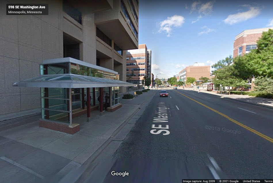 before
Stadium Village Station
GPS Coordinates: 44.97480, -93.22282
 before
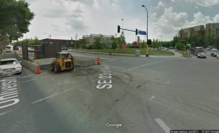 before
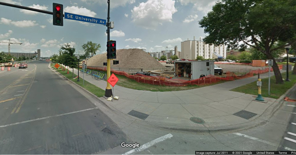
Prospect Park Station
GPS Coordinates: 44.97175, -9321526
Westgate Station
GPS Coordinates:
Raymond Ave Station
GPS Coordinates:
Fairview Ave Station
GPS Coordinates:
Snelling Ave Station
GPS Coordinates:
Hamline Ave Station
Lexington Pkwy Station
GPS Coordinates:
Victoria St Station
GPS Coordinates:
Dale St Station
GPS Coordinates:
Western Ave Station
GPS Coordinates:
Capitol/Rice St Station
GPS Coordinates:
Robert St Station
GPS Coordinates:
10th St Station
GPS Coordinates:
Central Station
GPS Coordinates:
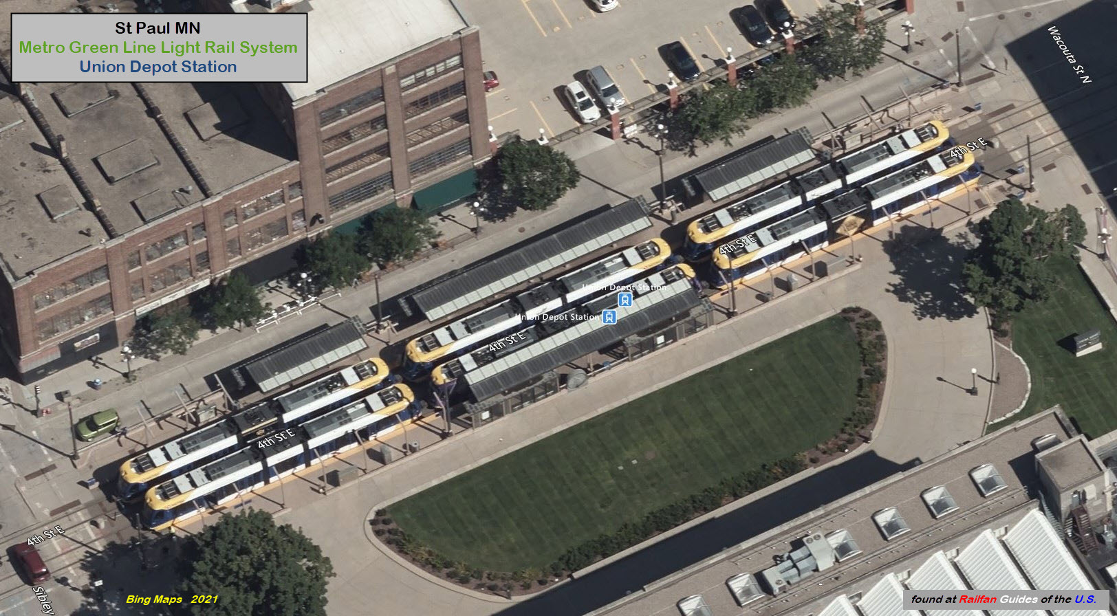
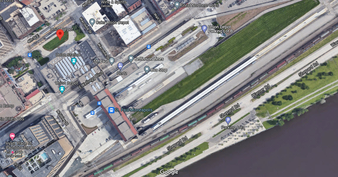
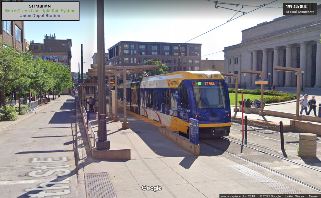
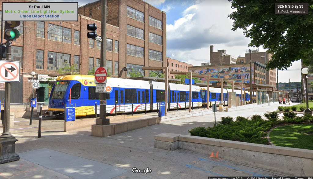
Union Depot Station
GPS Coordinates: 44.94818, -93.08685
https://en.wikipedia.org/wiki/Saint_Paul_Union_Depot
https://www.uniondepot.org/
https://www.amtrak.com/stations/msp
the Green Line Shops
GPS Coordinates: 44.94947, -93.08413 (LRV entrance on 4th St
340 Broadway St, St Paul MN 55101
https://finance-commerce.com/2014/04/metro-transit-officials-tout-new-operation-centers-green-features/
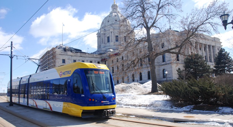
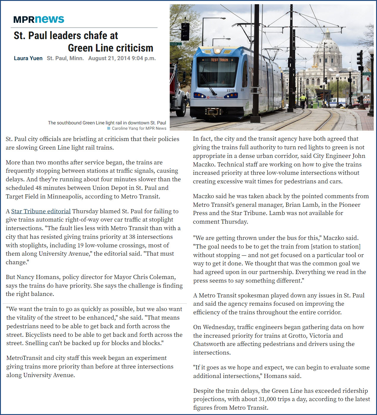
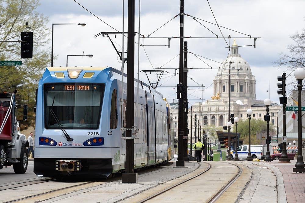 photo by Caroline Yang via MPR News
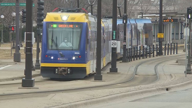 near the Capitol Building
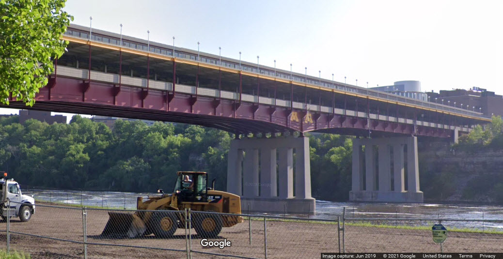
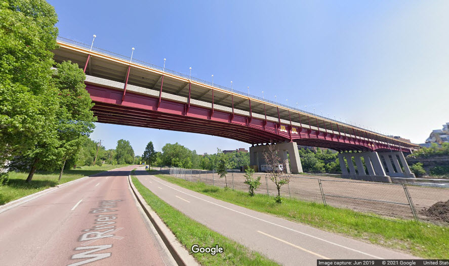
The bridge, being in the middle of the University of Minnesota, has an upper deck that is just for students to walk from one side to the other, and is covered.
The
Signals for the Metro Green Line are the same as for the Blue Line, and are covered here: https://railfanguides.us/mn/hiawatha/blue/index.htm#Signals_
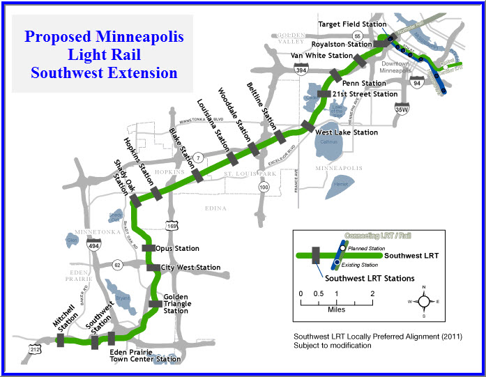
The Proposed Southwest Extension
The Southwest Extension (of the Green Line) is currently a hotly debated project. Much of the proposed right-of-way would encroach upon hikey-bikey trails carved from long abandoned rail lines, and the health nuts don't want to see one inch of their precious trail going to the project.... stay tuned! The current government council will be replaced in the next upcoming election, and if the project is not approved before then, the fate of it hangs in the air.
Disclaimers:
I love trains, and I love signals. I am not an expert. My webpages reflect what I find on the topic of the page. This is something I have fun with while trying to help others.
Please Note: Since the main focus of my two websites is railroad signals, the railfan guides are oriented towards the signal fan being able to locate them. For those of you into the modeling aspect of our hobby, my indexa page has a list of almost everything railroad oriented I can think of to provide you with at least a few pictures to help you detail your pike.
If this is a railfan page, every effort has been made to make sure that the information contained on this map and in this railfan guide is correct. Once in a while, an error may creep in :-)
My philosophy: Pictures and maps are worth a thousand words, especially for railfanning. Text descriptions only get you so far, especially if you get lost or disoriented. Take along good maps.... a GPS is OK to get somewhere, but maps are still better if you get lost! I belong to AAA, which allows you to get local maps for free when you visit the local branches. ADC puts out a nice series of county maps for the Washington DC area, but their state maps do not have the railroads on them. If you can find em, I like the National Geographic map book of the U.S..... good, clear, and concise graphics, and they do a really good job of showing you where tourist type attractions are, although they too lack the railroads. Other notes about specific areas will show up on that page if known.
Aerial shots were taken from either Google or Bing Maps as noted. Screen captures are made with Snagit, a Techsmith product... a great tool if you have never used it!
By the way, floobydust is a term I picked up 30-40 years ago from a National Semiconductor data book, and means miscellaneous and/or other stuff.
Pictures and additional information is always needed if anyone feels inclined to take 'em, send 'em, and share 'em, or if you have something to add or correct.... credit is always given! Please be NICE!!! Contact info is here
Beware: If used as a source, ANYTHING from Wikipedia must be treated as being possibly inaccurate, wrong, or not true.
RAILFAN GUIDES HOME
RAILROAD SIGNALS HOME
NEW 10/07/2021
Last Modified 20-Oct-2021