RAILFAN GUIDES HOME
RAILROAD SIGNALS HOME
In General
Location / Name:
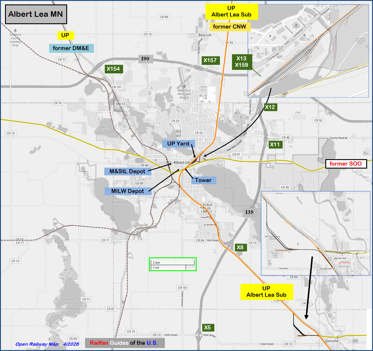
Albert Lea MN,
What's Here:
Small UP yard
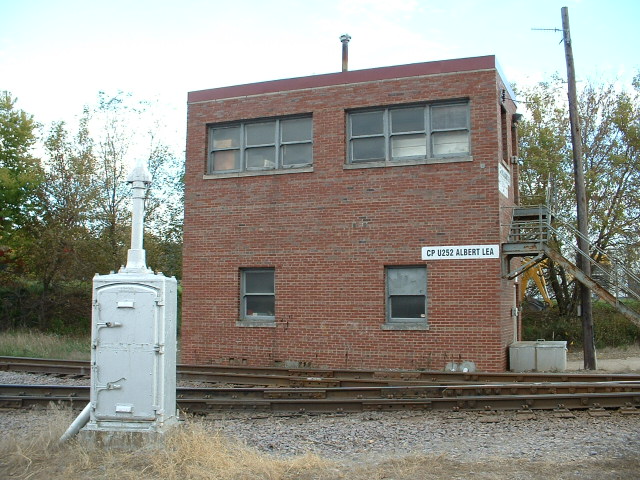
Diamond crossing with tower (tower closed)
Two vintage depots
Another small UP yard about 9mi north in Clark's Grove for grain transfer
Two bio-processing facilities 6mi SE of town
Windmill farm NW of town
Data:
GPS Coordinates: as needed
Phone A/C: 507
ZIP: 56007
Access by train/transit:
None
Geography:
Flat with small hills
The Scoop:
Years ago, Albert Lea had a lot of railroading for it's size. Now, it's
pretty quiet, with a small UP yard on the northeast side of town. The
tower in the pictures below is closed, and the signals there are typical of
how railroads now protect crossings with other railroads.
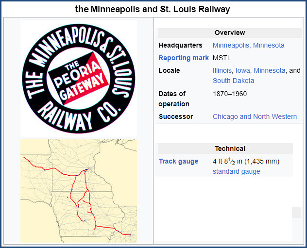
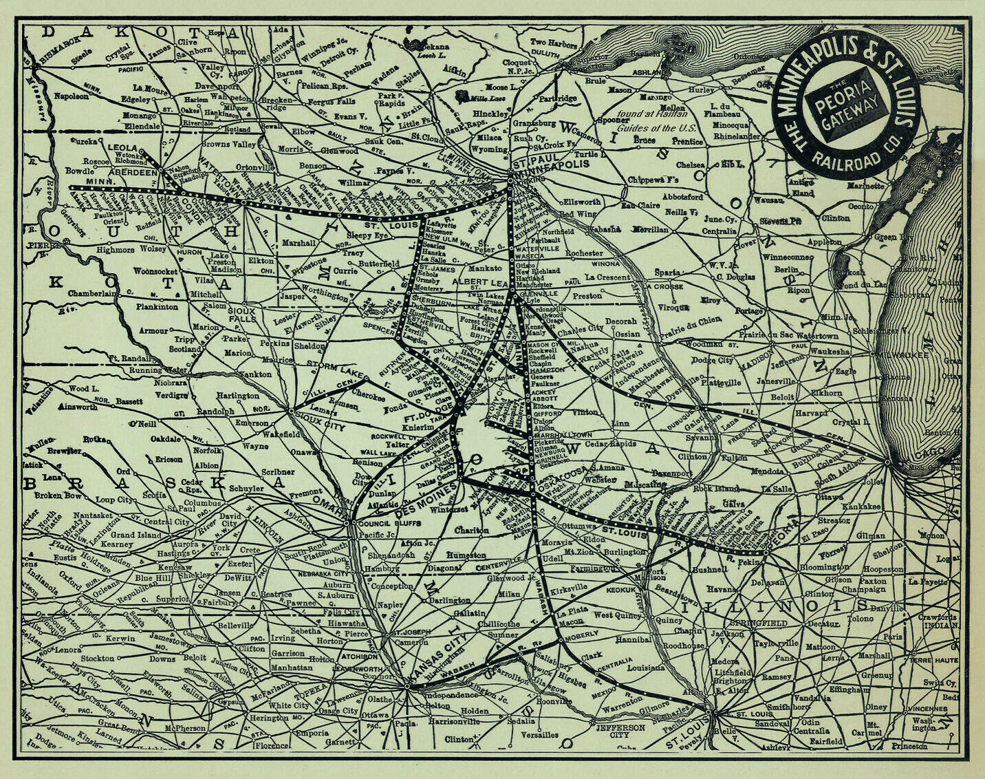
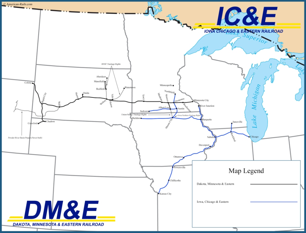
The Union Pacific trackage used to belong to the CNW, and the IC&E was
formerly the Milwaukee (and then SOO). I need to do further research
into the lineage for the DM&E/UP's track heading NW out of town, after
it was the M&StL. If anyone knows and wants to share, please email me.
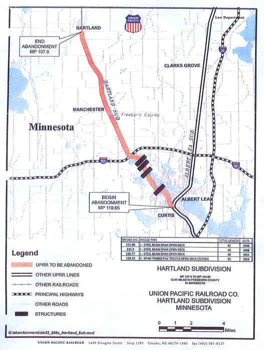
Update Feb 2014 - The M&StL / UP north/south line was vacated several years
ago (in 2011) and all trackage has been removed. It was vacated as far
as the grain elevator (pictured at the bottom of the
page) which is now served from the North only through Waseca.
This eliminated the western diamond on Front St and the junction on the south
side as well. Jim Mihalek provided a link to an article on the change:
http://www.albertleatribune.com/2011/11/a-future-trail/
My pictures were taken in October of 2006 on a field trip with Jim M and Mike
Miller. Jim's pictures are a -little- more recent from 2009.
This page originally just covered the eastern diamond, but has since grown
into a guide for the whole town. If you're scooting by on the
interstates 35 or 90, it's well worth a stop since it's so close.
Mason City Iowa isn't too far away either, and is a favorite railfan spot
because of Iowa Traction.
If you look around on Google or Bing Maps, you will notice that you can't go
much more than 10 miles and not find a grain tower, and many of these are
conveniently located on a rail line!
The Lakeside Cafe comes highly recommended.
Update February 2014 - The Lakeside Cafe is closed, and there is no substitute
for their menu of fresh baked goods and sandwiches. :-( :-( Michael
suggest either the B&B Cafe or The Elbow Room if you are
looking for non-chain meals.
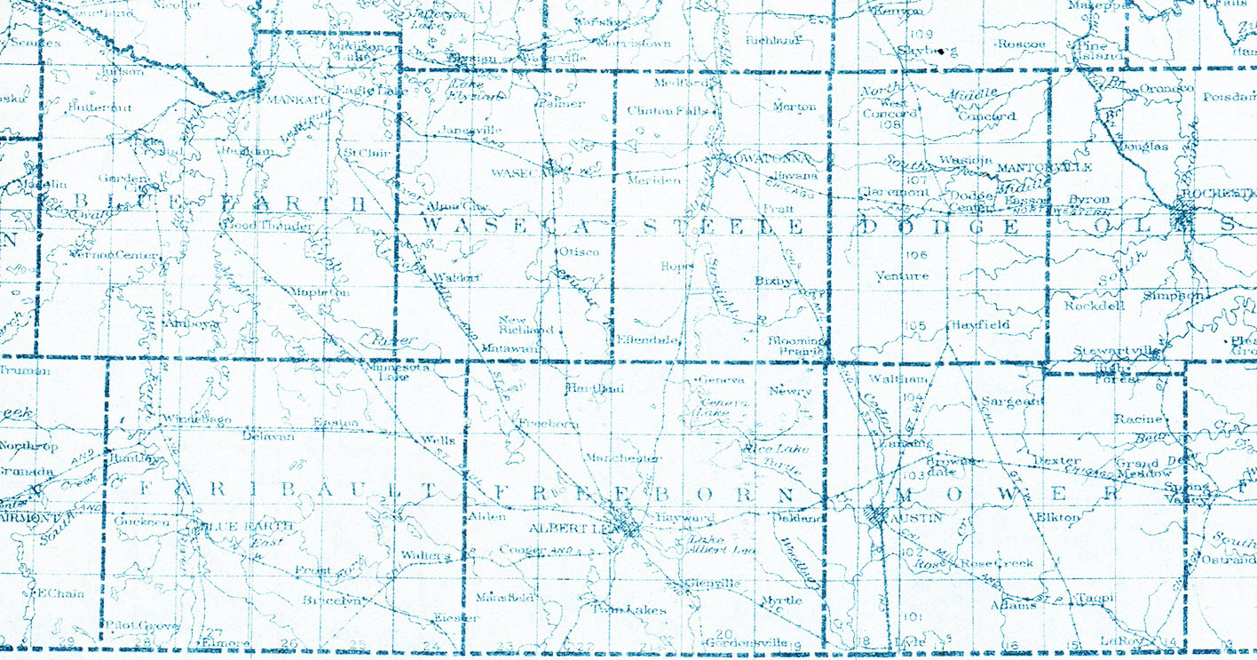
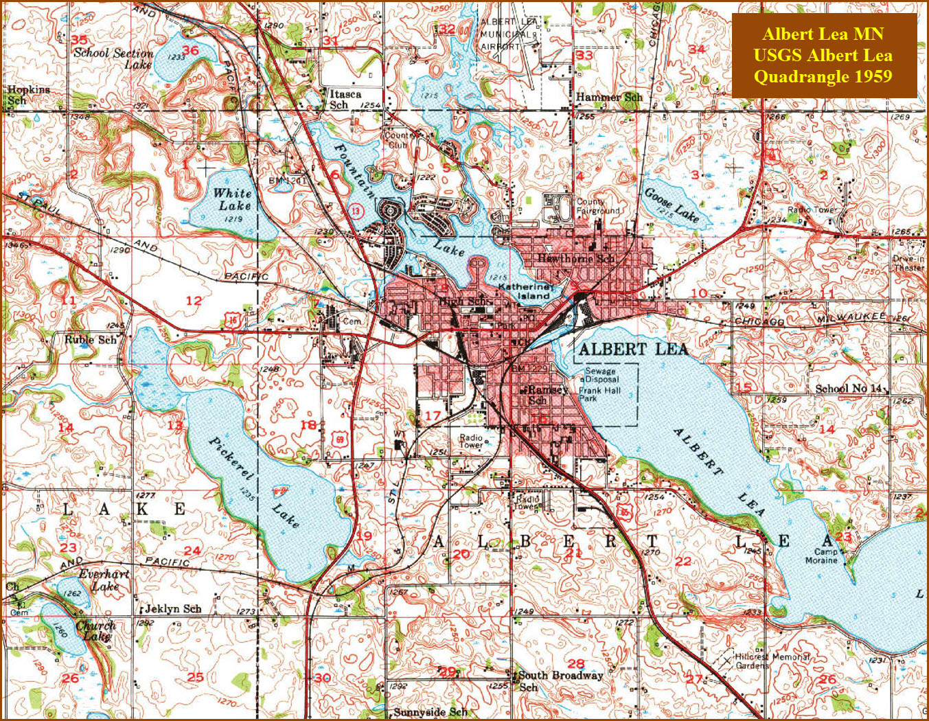
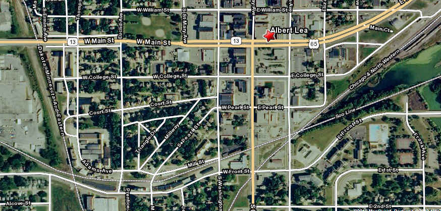
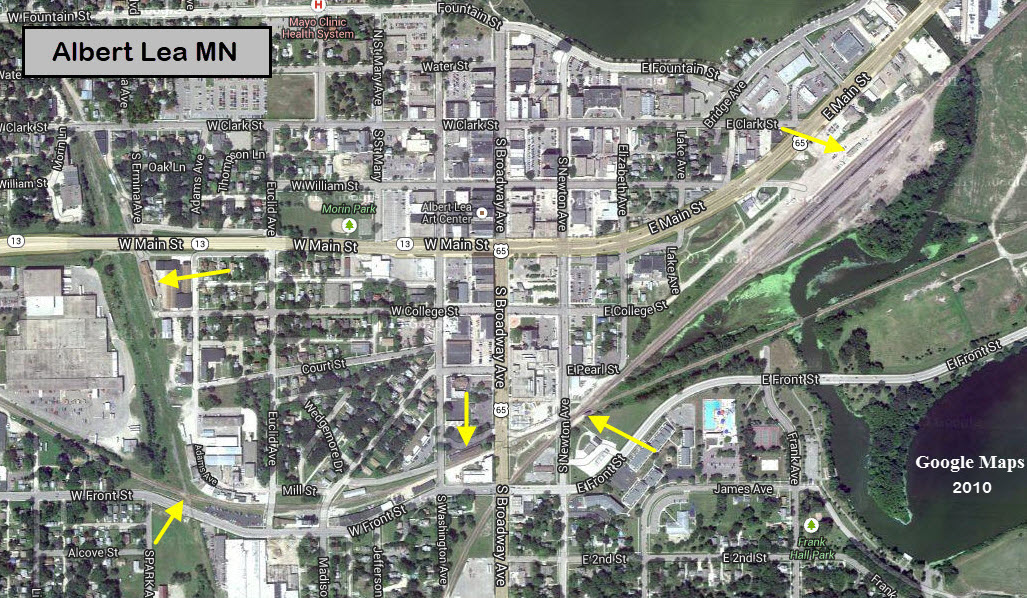
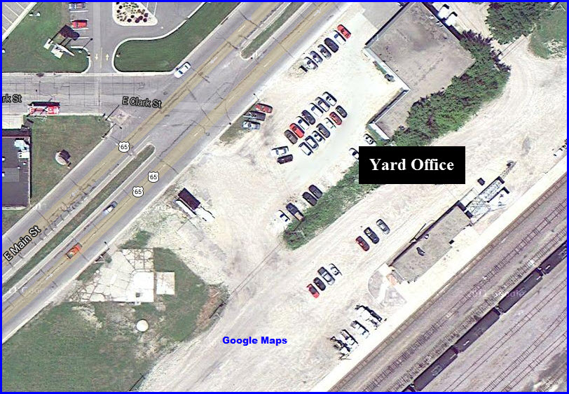
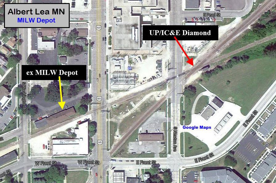
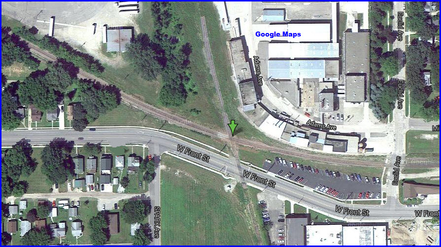
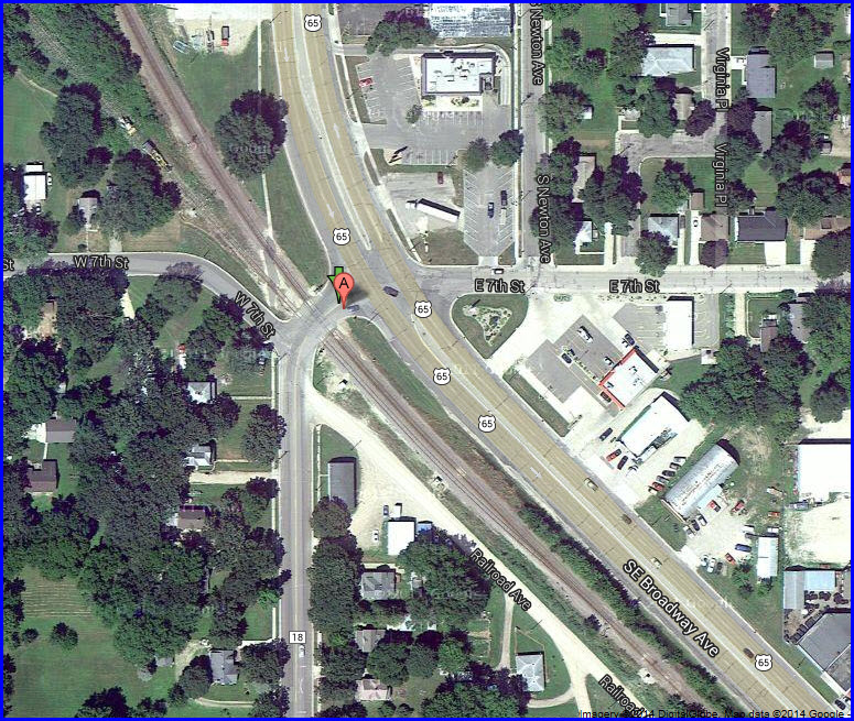
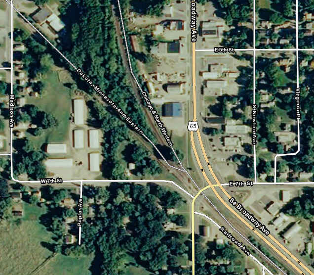
Out of the map services from Google, Bing, and Mapquest, Mapquest -had-
the best satellite photos of Albert Lea when I originally did this page, but
in 2013, Google has some terrific satellite photos of Albert Lea, as
seen below. I left the Mapquest map here, because it labels the
railroads!
Acknowledgments:
Jim Mihalek - Information and pictures
Mike Miller - Information.
Michael Johannsen - 2014 Update
Mark Simonson
John Harker
CG Wallenmeyer
Dan Sabin
Websites and other additional information sources of interest for the area:
The first two links provided by Jim:
Cool stuff on Albert Lea: http://www.cashgroth.com/depots/depalbertlea.html
Info from the CNW Historical Society: http://www.cnwhs.org/archives_maps.htm
https://www.american-rails.com/dme.html
https://www.facebook.com/groups/1404731103844357 The Manly Junction (IA) RR Museum
https://towns-and-nature.blogspot.com/2021/08/albert-lea-mn-milwaukee-depot-and.html
Maps
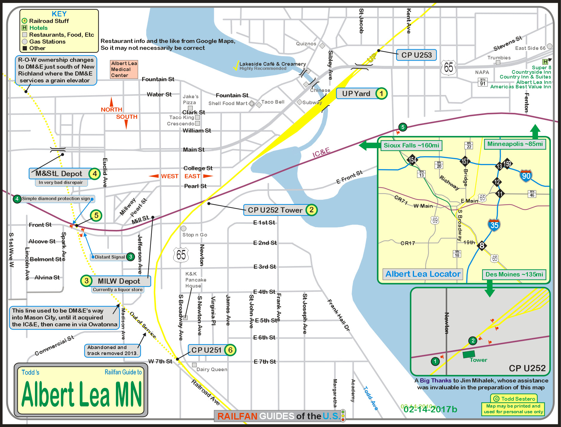
Map is available HERE as a PDF.
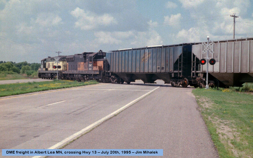
Pictures
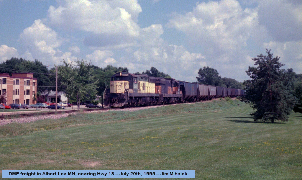
A couple of pictures from 1995 of a DME fright coming thru Albert Lea on trackage that is no longer around. Thanks to Jim Mihalek for the pix!
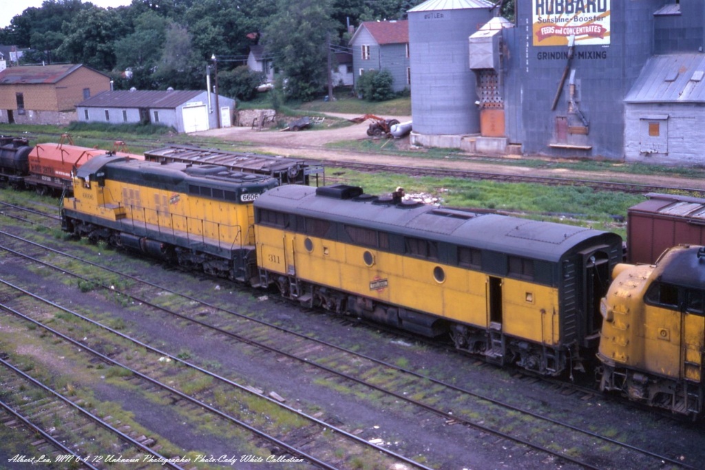
Here's a nice shot of a CNW freight running through Albert Lea, MN June 4, 1972. Leading the train
is SD9 6606 followed by F3B 311 and another A Unit F. The 6606 was built in May 1954 as CNW 1706
and was renumbered to 6606 in 1971. The short hood was cut down in the 60s. The 6606 was sold to
the DME in 1986. The 311 was built as CGW 109B in March 1948 and renumbered to CNW 311 in September
1971, finally retired in February 1975. Unknown Photographer, Kodachrome, from my Collection. (from FB)

A C&NW south bound freight with SD40-2 6890 leading was just about to cross the diamond with the Milw
in Albert Lea, MN on January 24th, 1984. The diamond was just east of South Newton Ave, This scene with
the interlocking tower looks to the northeast. The C&NW freight was traveling on the Spine Line or the
ex Rock Island Short Line. Mark Simonson captured this scene. John Harker editing and collection.
Bob Johnson: Unless something has changed, that Tower is still there, but it is a Signal Maintainer Office. (from FB)
Sights
the UP Yard
the Eastern Diamond
the former MILW Depot
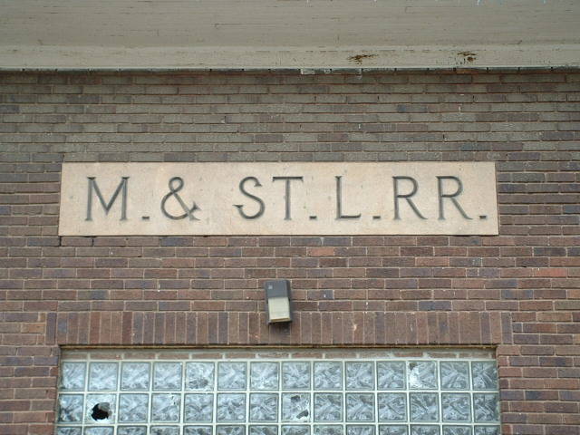
the former M&StL Depot
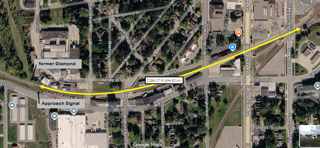
the Western Diamond
the South Side UP Junction
Grain Towers in the area
Bio-Fuel Processors
UP's Clarks Grover Yard
Wind Farm
the "old" M&StL Depot
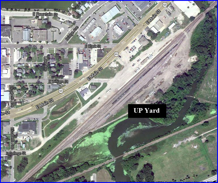
 The Union Pacific Yard
GPS Coordinates: 43.64939, -93.36197 (Gets you near the yard office)

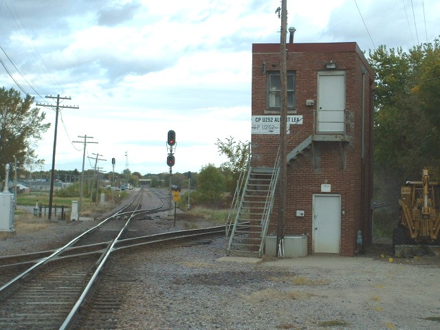
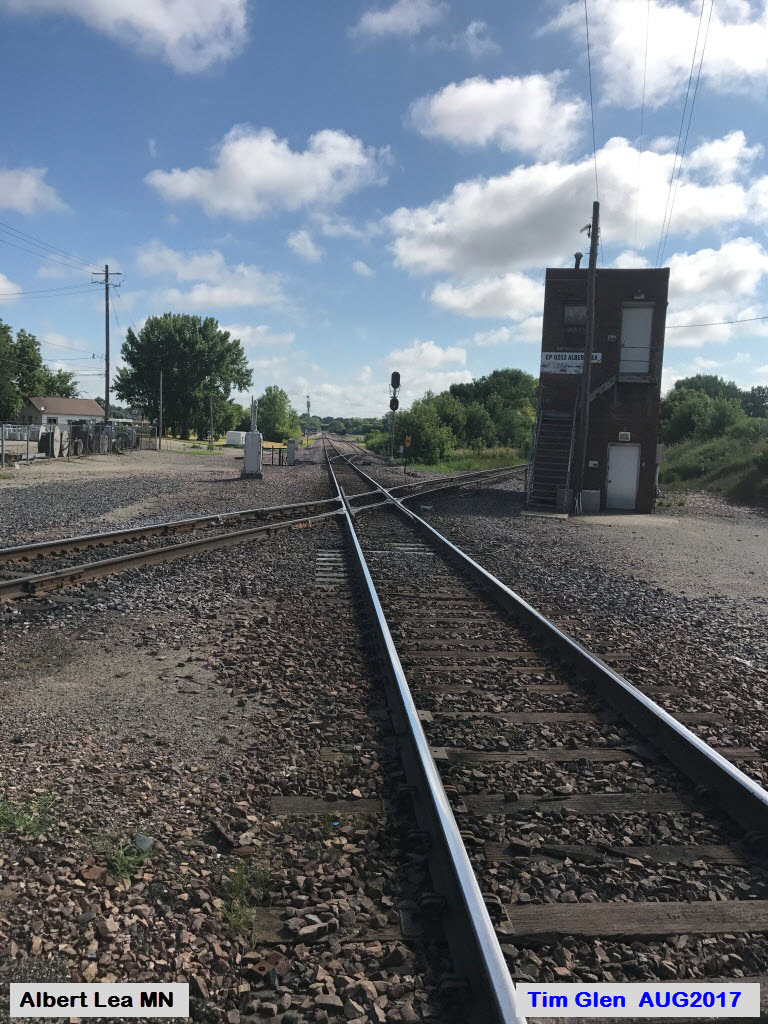
 The eastern Diamond between the IC&E and the UP
GPS Coordinates: 43.64521, -93.36733
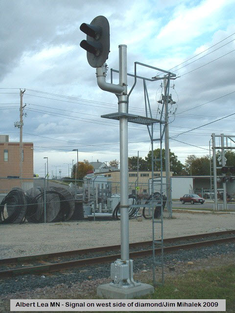
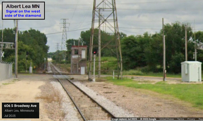
Signals on the east side of the diamond are HERE,
and on the west side, HERE.
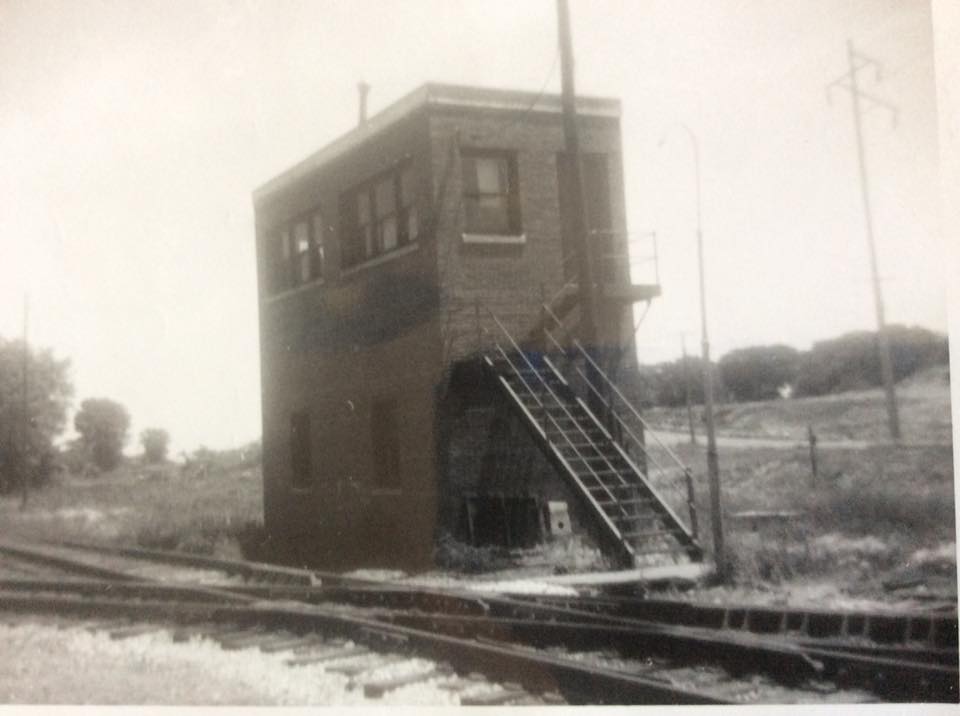
Above: Picture of the CRI&P tower by Frank G, Fink of Lake Crystal MN, dated 17JUN1973, courtesy Jim Mihalek


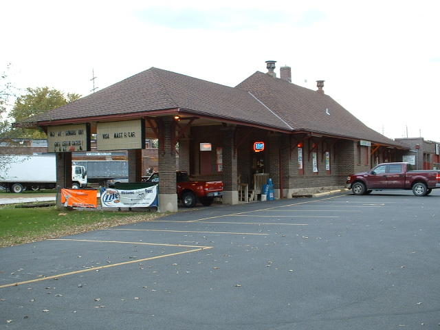
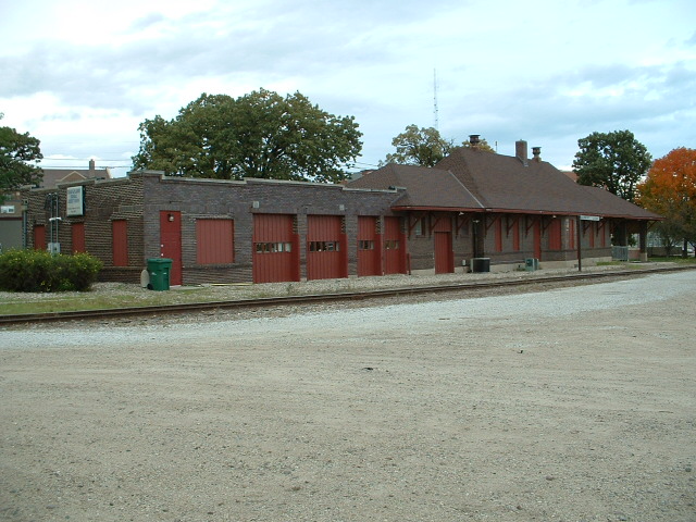
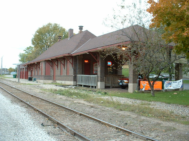
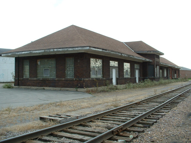
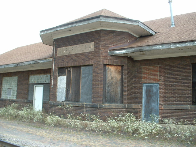
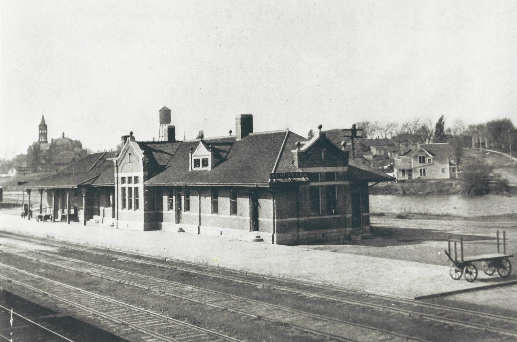
 The ex Milwaukee Depot
GPS Coordinates: 43.64474,-93.36949
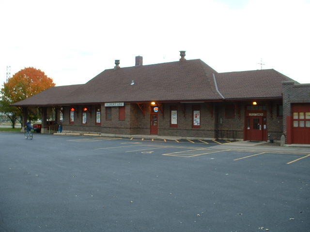
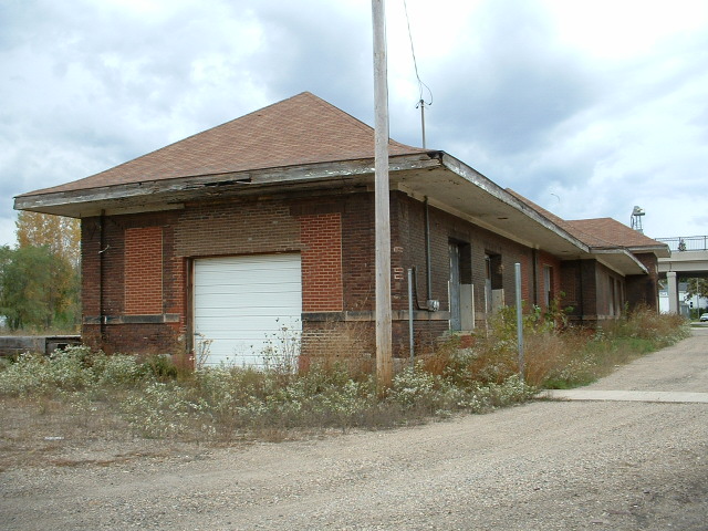
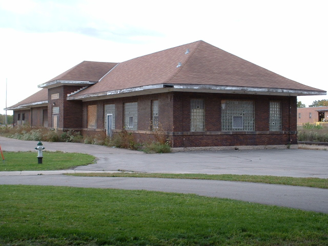
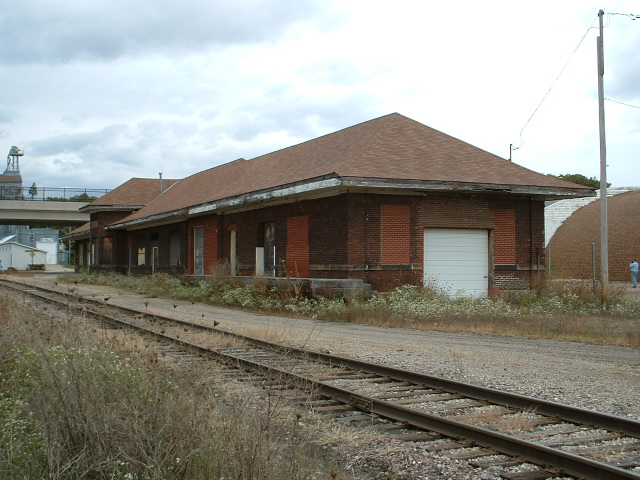
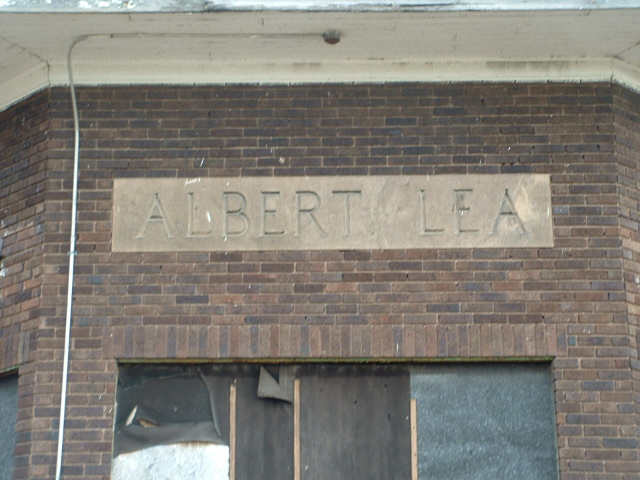
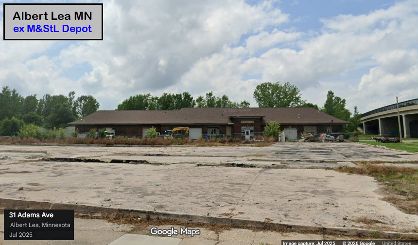
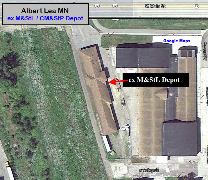
 The ex M&StL Depot
GPS Coordinates: 43.64735,-93.37614
The depot is now owned by Big Toe Little Toe Excavating, and is completely fenced in
-- you can't get decent pictures of it anymore :-(
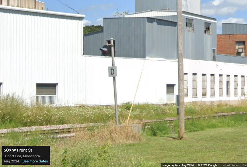
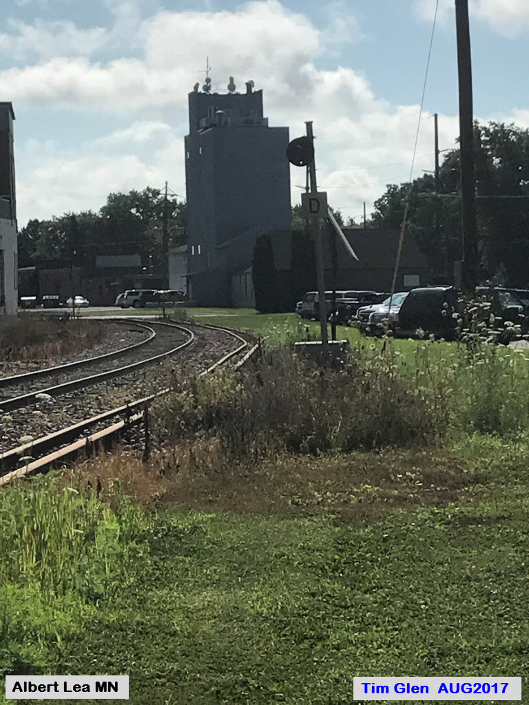
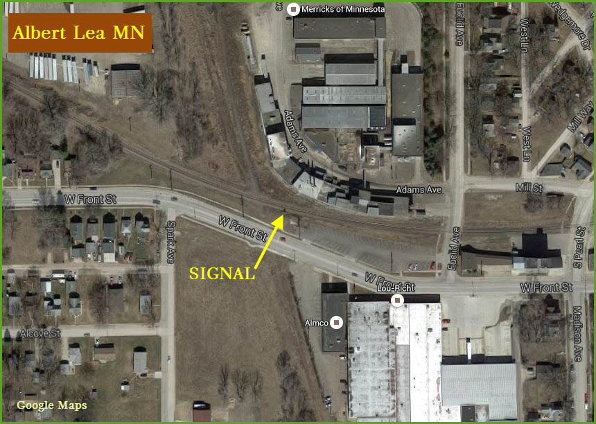
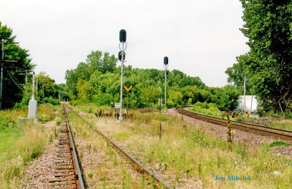
 The western Diamond between the IC&E and the UP
GPS Coordinates: 43.644018, -93.375426
The diamond was easily accessible from Front St. NOTE: Around ~2012, this diamond was removed. :-(
Left - looking south...... right - looking north across the diamond with the M&StL depot in the distance.
Photos - a big thanks to Jim Mihalek
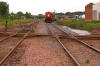 Photo by Kevin Klitzke
Above - we're looking in the same direction as the right picture above, circa 2003, picture via Jim from the FB Minnesota RR group.
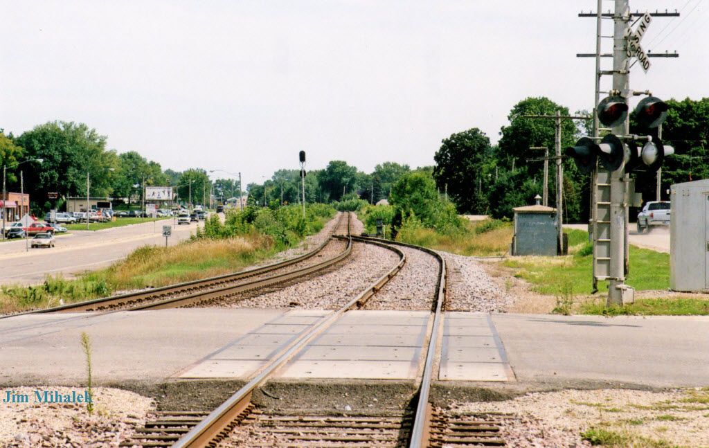
 Looking east with the simple diamond
crossing protection signal, there is also one for the N-S UP track.
Looking east with the simple diamond
crossing protection signal, there is also one for the N-S UP track.
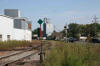 photo courtesy Jim Mihalek
 As of January 2016
 As of January 2016
 As of January 2016
 UP junction on the south side
GPS Coordinates: 43.636809, -93.368452
This is where the Rock Island and the M&StL joined up.
Thanks to Jim Mihalek for the pictures of the junction from 2004.
NOTE: As of (around) 2012, this switch was removed and nothing remains.
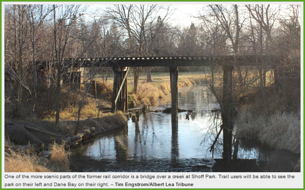
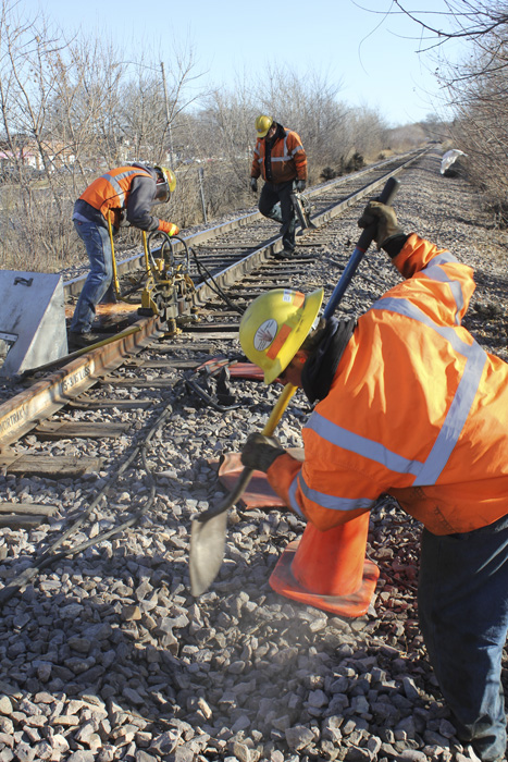
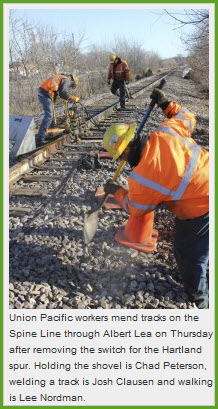
The pictures below come from the Albert Lea Tribune article linked above.
I'm guessing the trestle pictured is the last bridge on the UP list.....
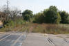
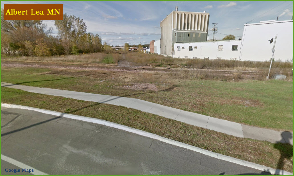
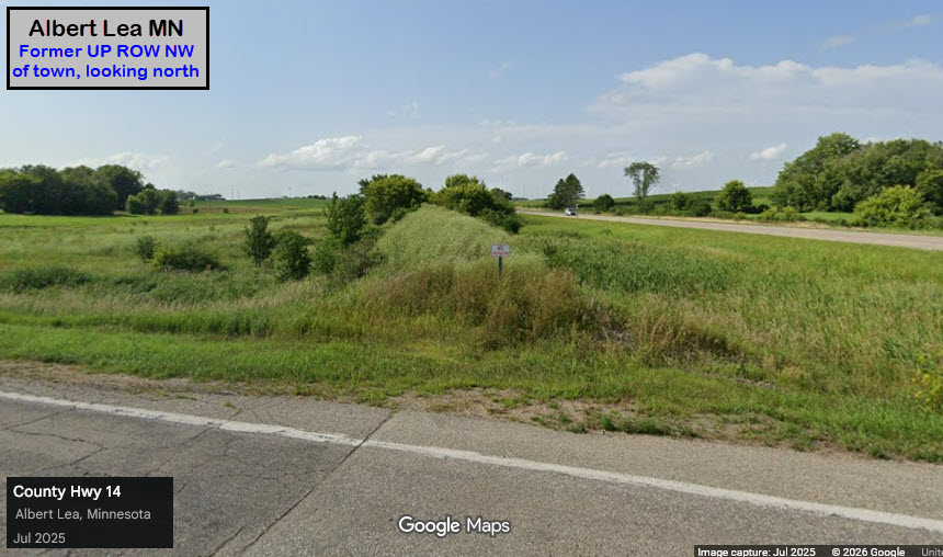
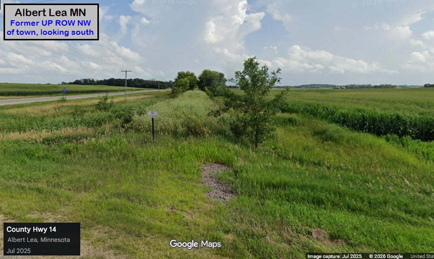
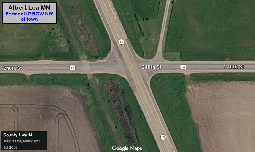
14 years later (2026), hardly anything remains to tell you that a railroad used to come thru here, but if you know the telltale signs, you know.
These screenshots come from where 240th Street crosses the former ROW, a few feet off of 13.
This location is about 5 miles (7.3km) north of the western diamond in Albert Lea.
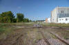
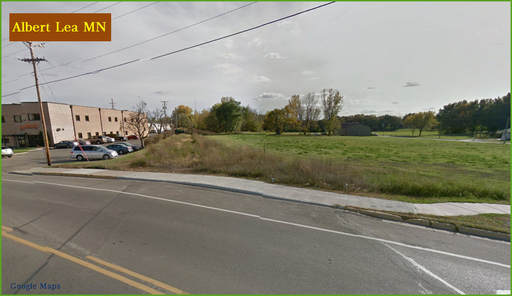
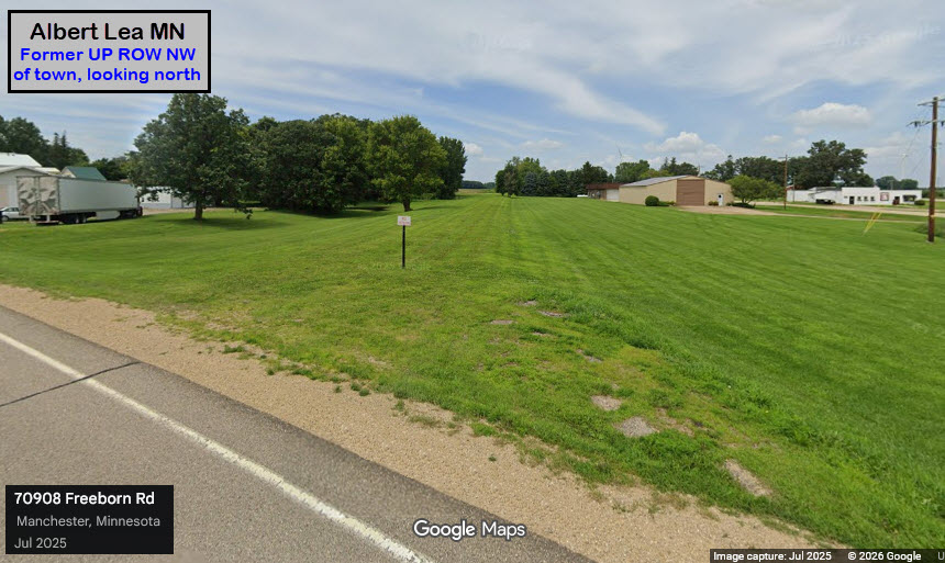
There are spots along the ROW that have recovered quite nicely, this is 1.6mi 2.6km) north of the location above.
 Area Grain Towers
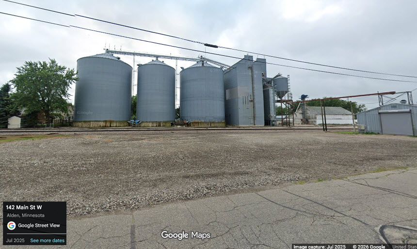
Alden MN
GPS Coordinates: 43.67037, -93.57796
Off Broadway and Main, exit 146 from I-90. About 10.7 miles / 17.2km west of the diamond.
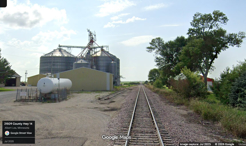
Armstrong MN
GPS Coordinates: 43.66557, -93.47102
Off 700th Ave and 210th St (46). About 5.4 miles / 8.6km west of the diamond.
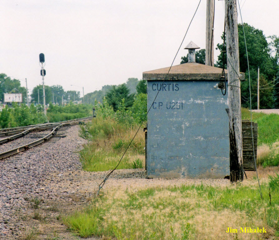
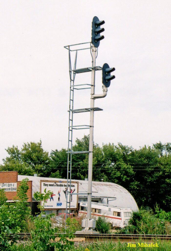
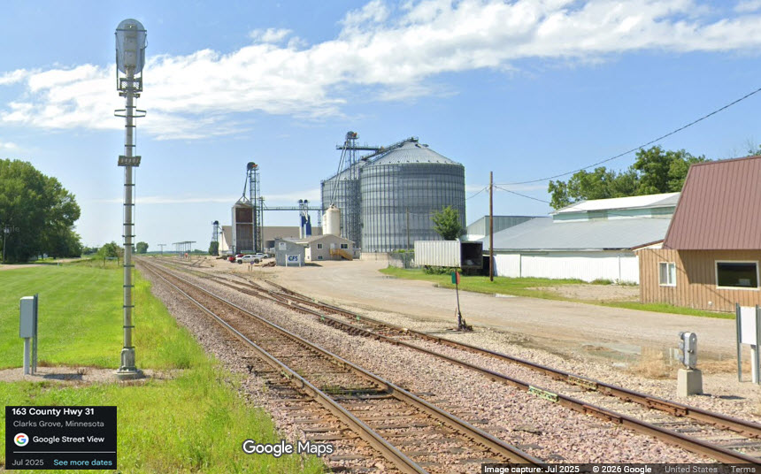
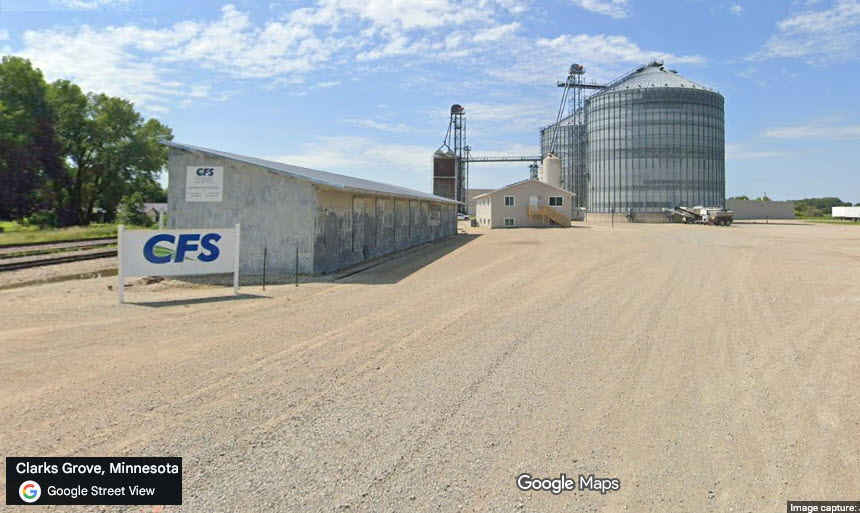
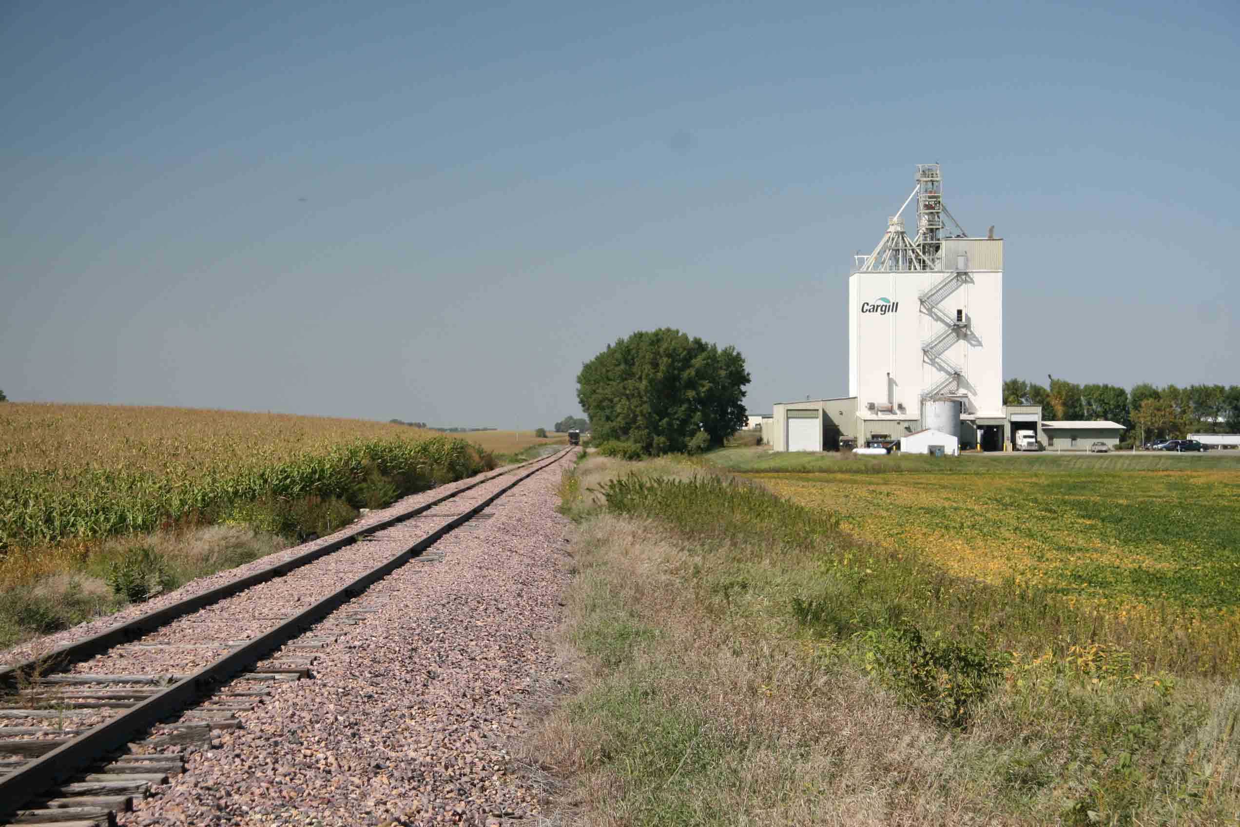
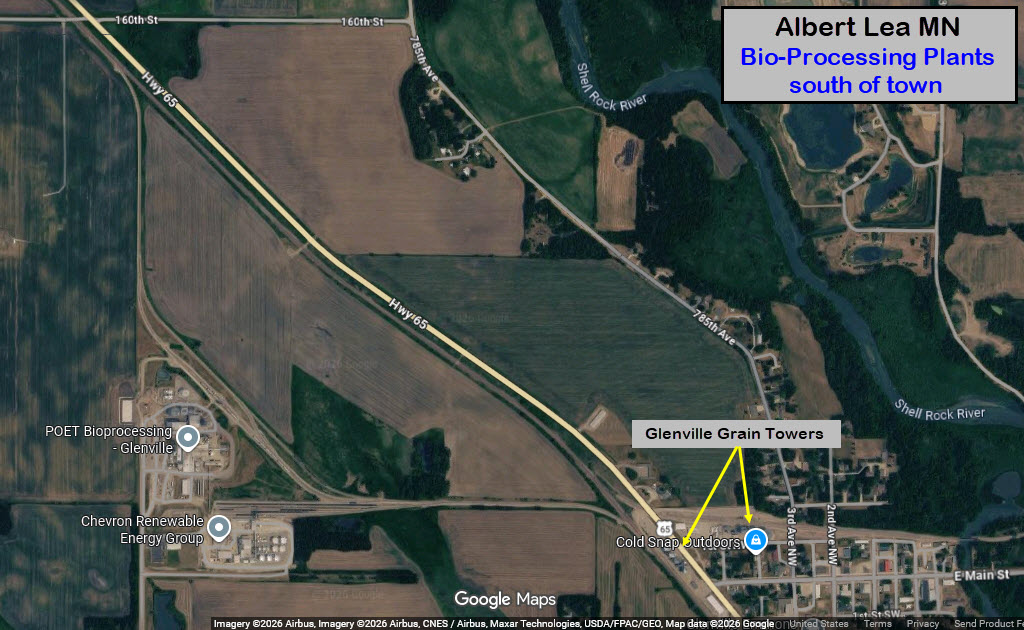
Clarks Grove MN
GPS Coordinates: 43.76180, -93.33216
Off Main Street West by Independence Ave. About 8 miles NNE of Albert
Lea. Nice set of signals here with a dwarf for the grain siding. MP 261.
One of the few places where the camera car ventured onto private property! :-)

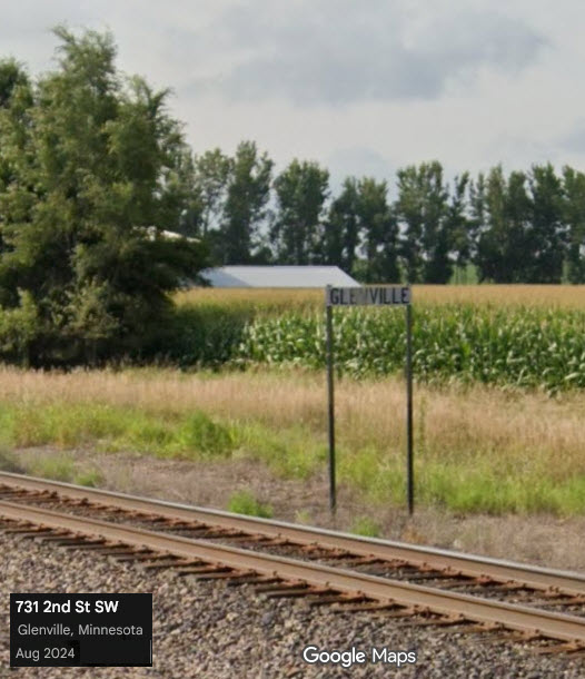
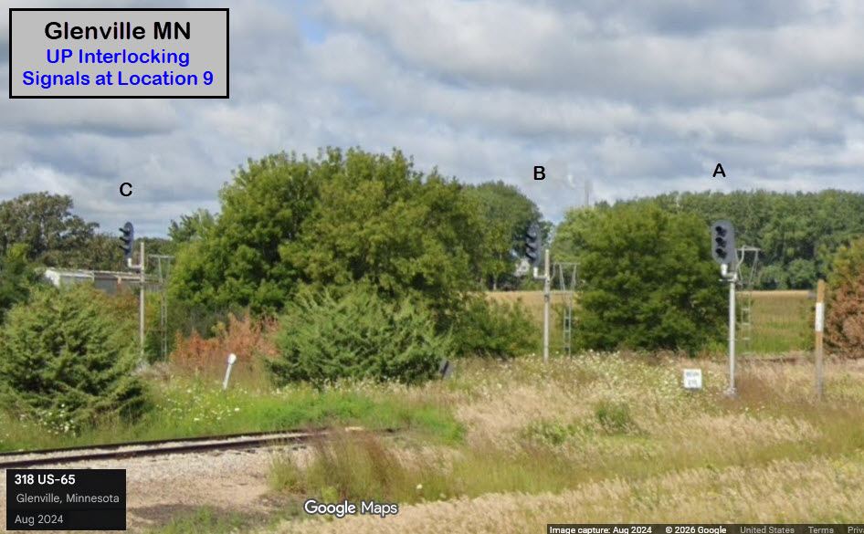
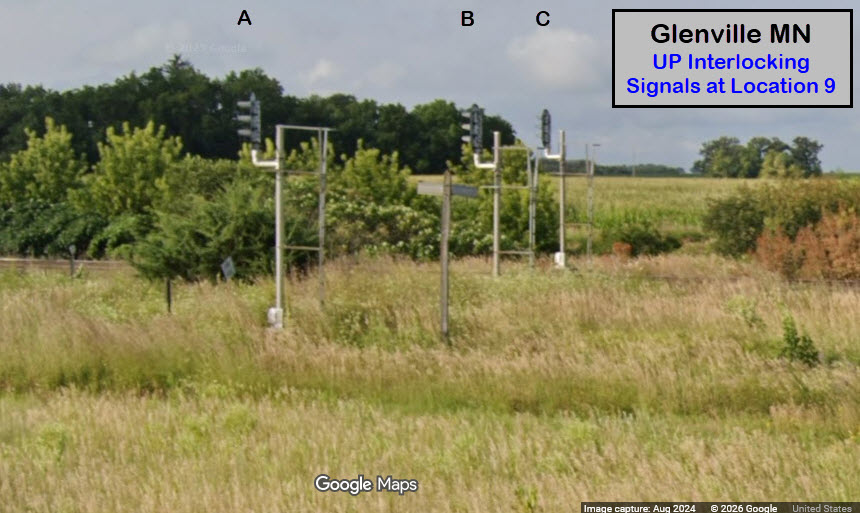
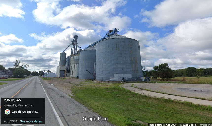
Glenville MN #1
GPS Coordinates: 43.57445, -93.28463
Off 1st St SW and HWY/US 65. About 6.4 miles / 10.3km south of Albert Lea on the UP.
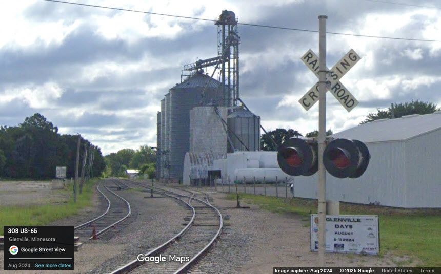
Glenville MN #2
GPS Coordinates: 43.57384, -93.28708
Right on HWY/US 65. About 6.4 miles / 10.3km south of Albert Lea on the UP.
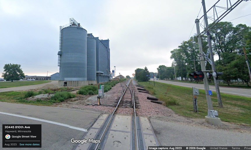
Hayward MN
GPS Coordinates: 43.65031, -93.24764
Off 810th Ave (26), off Main St East. About 6.3 miles / 10.2km east of Albert Lea.
New Richmond
GPS Coordinates: 43.86659, -93.487900
Serviced by the DM&E. Located
15.8mi NNW of Albert Lea in New Richmond, Hwy 13 and 210th St.
Note: As of 2012, this facility is now being serviced from
the north, and the tracks south of here have been torn up.
 Jim Mihalek photo
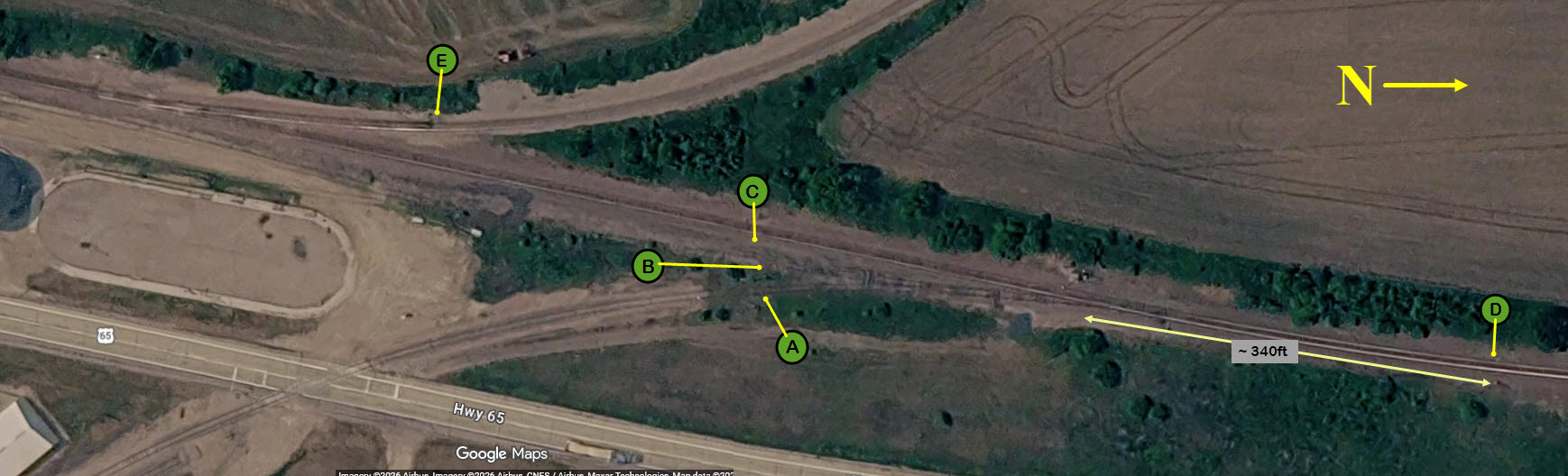
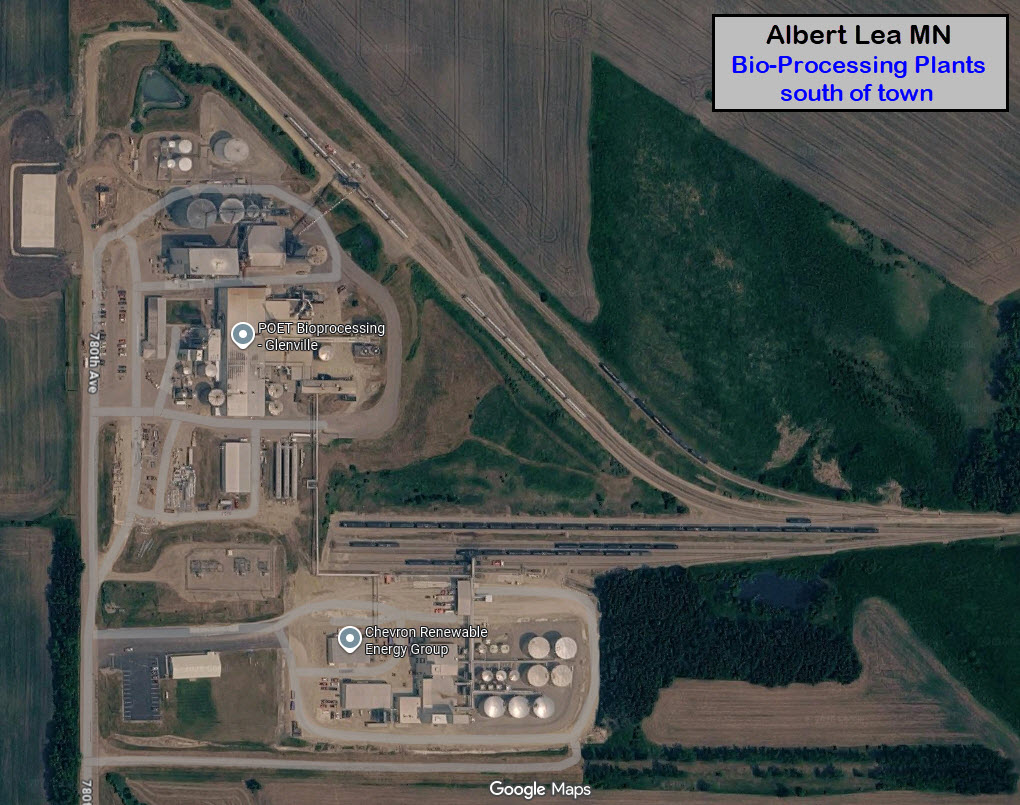
 Bio Processing Plants
GPS Coordinates: 43.57519, -93.30090
South of Albert Lea on the UP, the
tracks take a wide departure from the mainline to service two plants: POET
Bioprocessing Glenville, and Chevron Renewable Energy Group.
Conveniently off Hwy 65 (US 65)
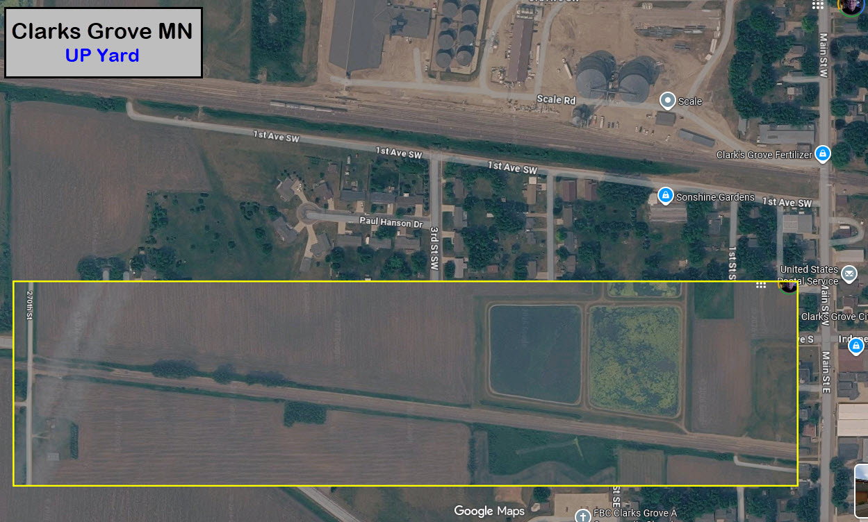
 UP's Clarks Grove Yard
GPS Coordinates: 43.76377, -93.33135
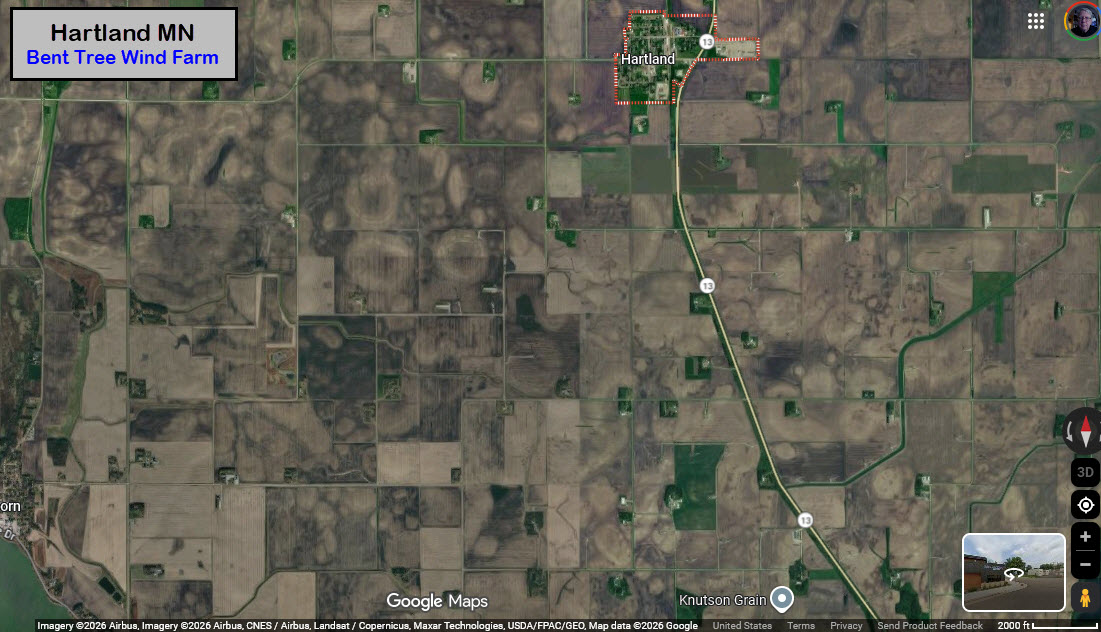
 Bent Tree Wind Farm
GPS Coordinates: 43.80397, -93.48502 (Hartland)
Spread out all over the place, not on just one piece of land. Seems a lot
of locals don't like the windmills! :-(
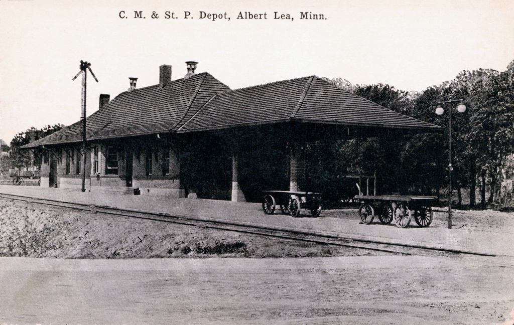
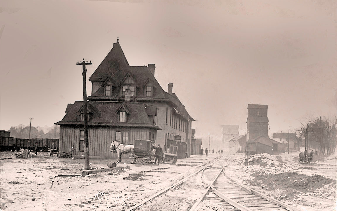
The "old" M&StL Depot
GPS Coordinates: same as the existing structure
https://www.facebook.com/photo/?fbid=122218635116323073&set=gm.1737946413856156&idorvanity=1404731103844357
https://minnesotahistoryshop.com/product/mstl-depot-albert-lea-minnesota-1908-postcard-reproduction/
The existing depot was maybe ? built in 1954, replacing this structure, shame.....
And, apparently, it replaced an even older structure, if we can believe the
photo that comes from the MN History page.
The depot kept getting smaller and smaller and smaller with each reincarnation :-)
Albert Lea Depot before new building in 1954, Dan Sabin Collection
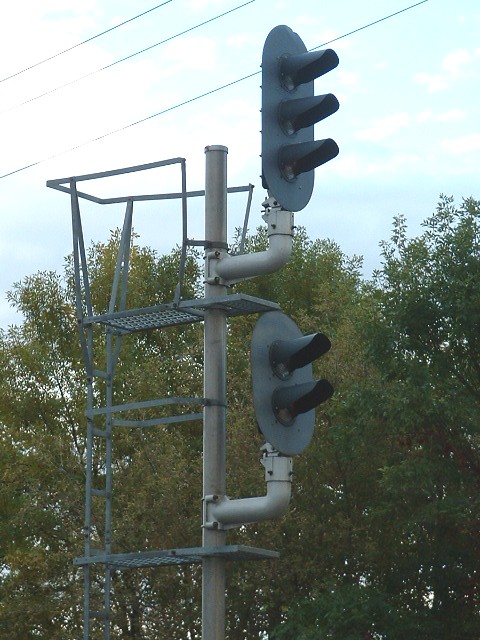
Signals
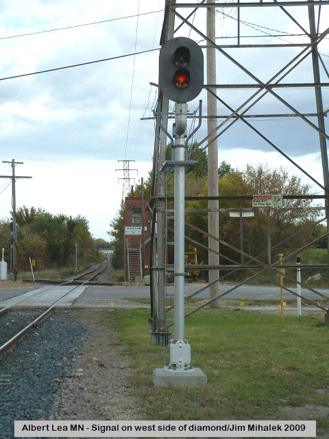
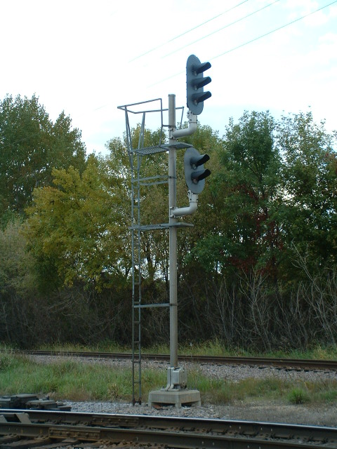
 Interlocking signal on the
west side of the diamond and Newton
Interlocking signal on the
west side of the diamond and Newton
GPS Coordinates: 43.64502, -93.36770
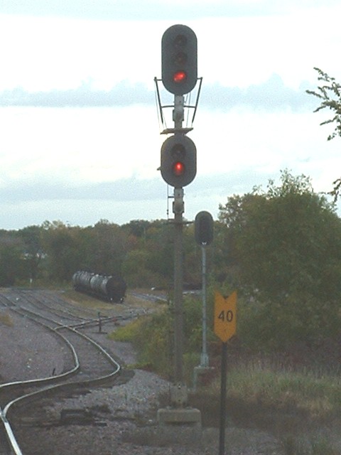
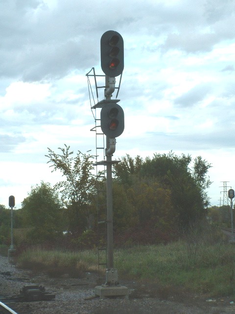
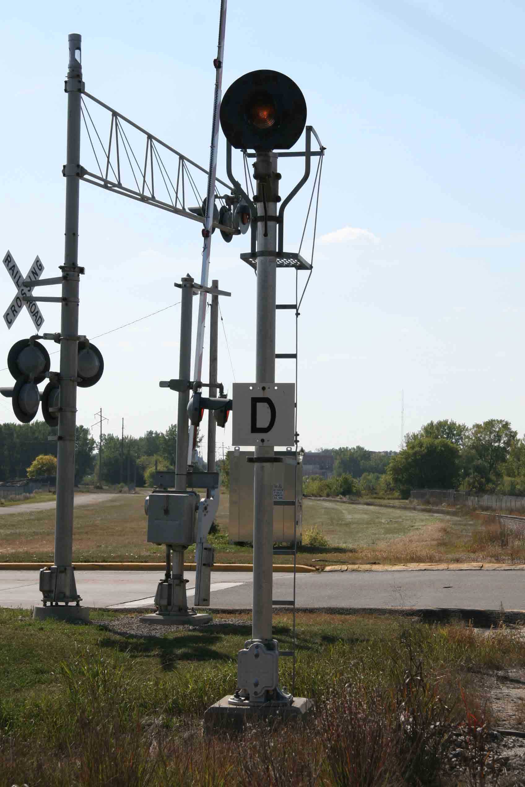
 Interlocking signals on the east side of the diamond and Newton
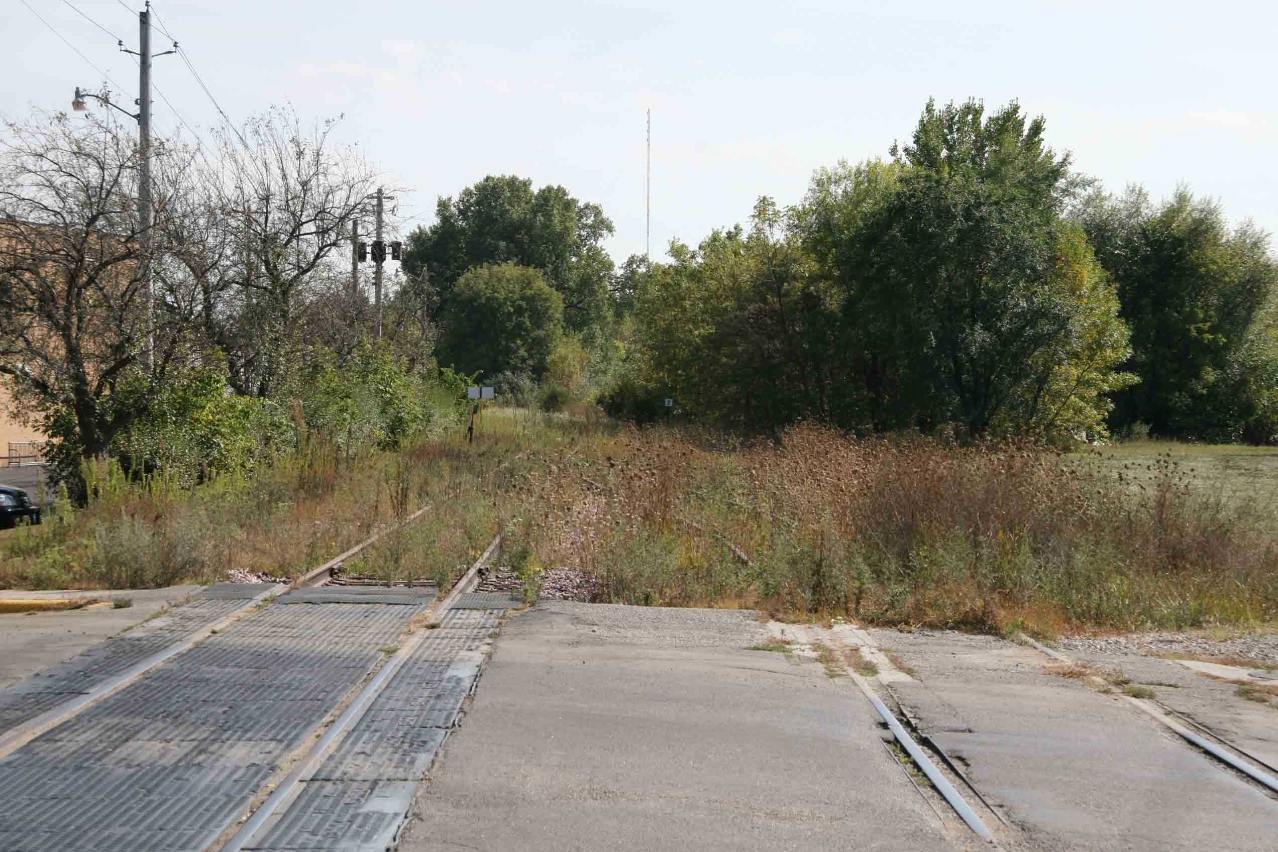

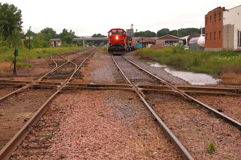 Photo by Kevin Klitzke
 photo courtesy Jim Mihalek
 Jim Mihalek photo