
In General
Map
Sights
Signals
Bridges
Floobydust
USGS Map
MICHIGAN RAILFAN GUIDE HOMEPAGE
RAILFAN GUIDES HOME
RAILROAD SIGNALS HOME
Location / Name:
Saginaw MI, Saginaw County
What's Here:
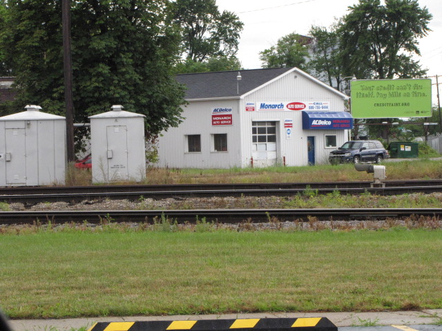
Ex Pere Marquette Depot
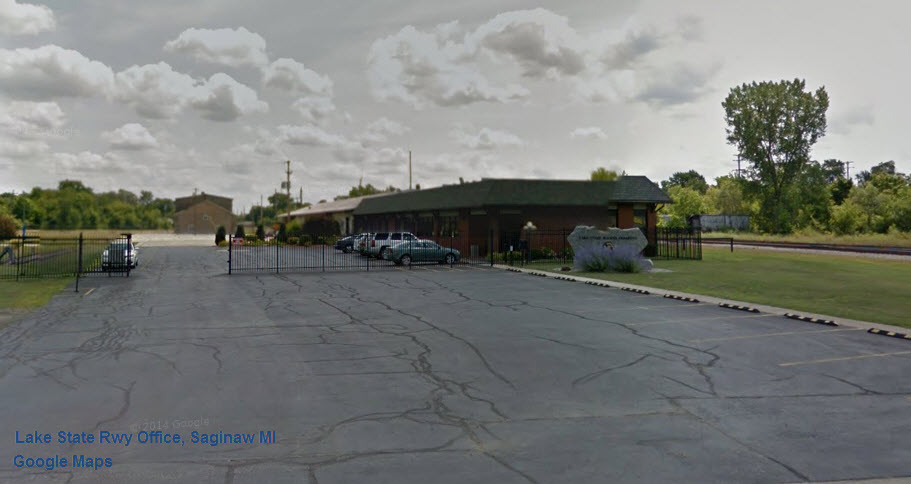
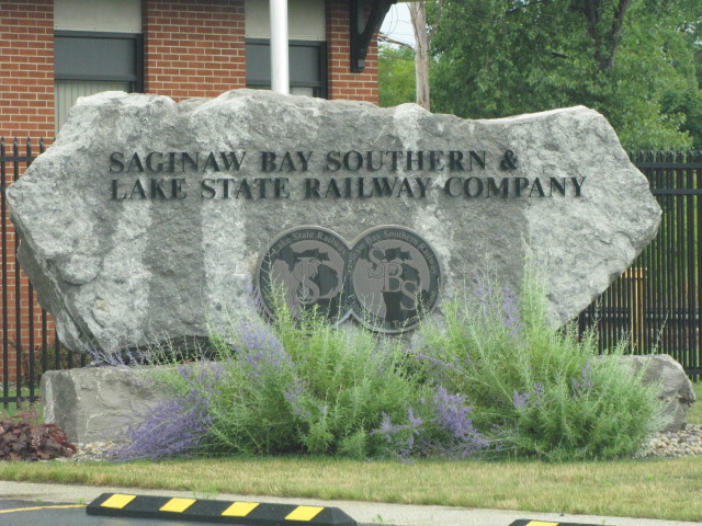
Lake State RR Office
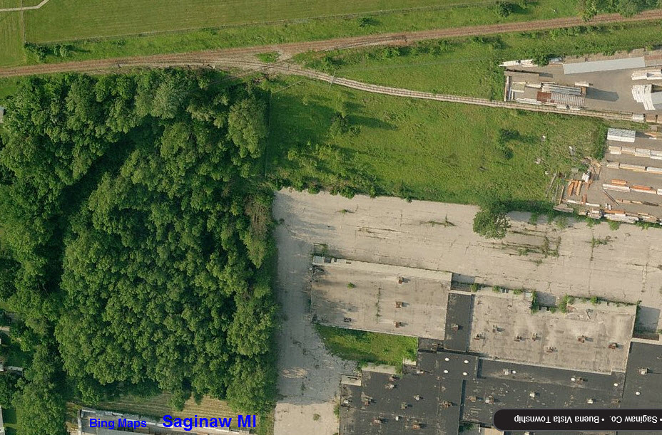
Saginaw Yard with a turntable buried in the middle of it
The Saginaw Railroad Museum
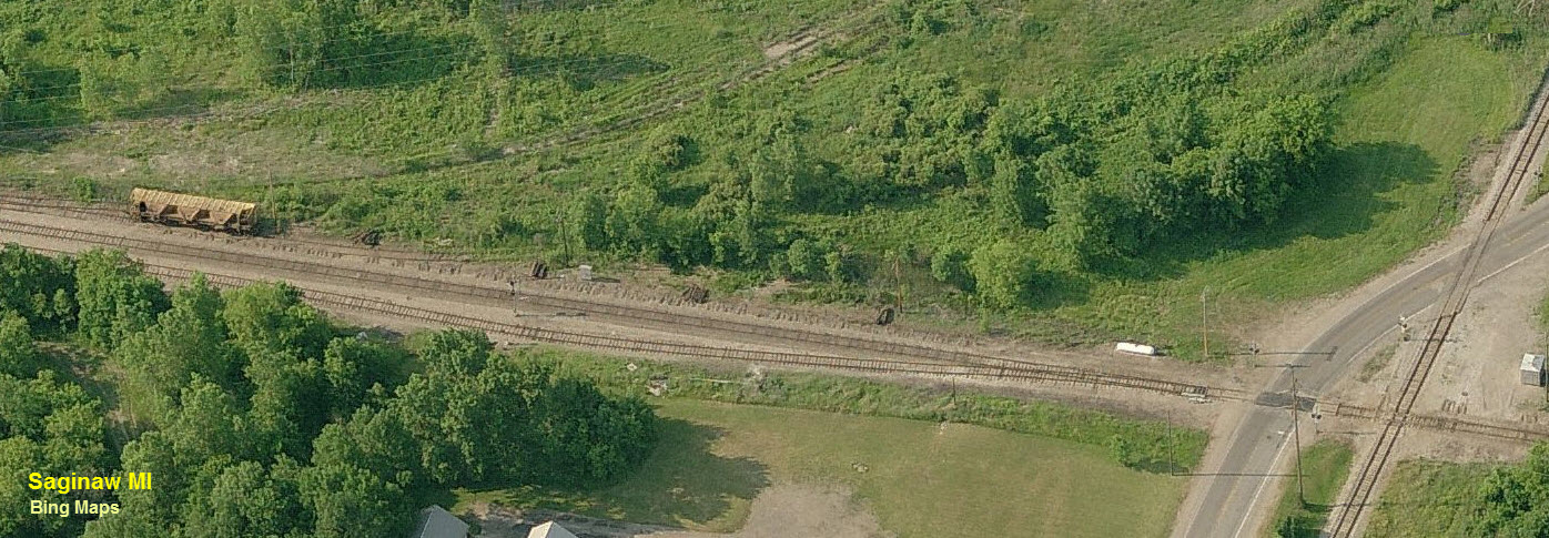
Small yard at Delphi Electronics
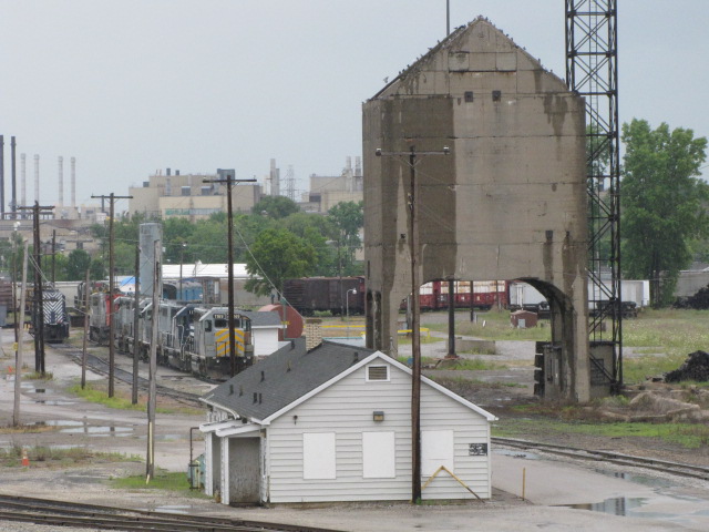
Misc old yards and a diamond
Data:
GPS Coordinates: as needed
Phone A/C: 989
ZIP: 48601
Access by train/transit:
None
The Scoop:
I'm going to make a guess that at one time, like many other American cities, Saginaw had a most interesting rail scene, especially with that "wye" configuration yard!! At one time, if you look at the USGS map below, there were four railroad bridges crossing the Saginaw River. Also as noted, much of the track on the east side of the river in the "downtown" area is no longer around :-(
Most of the rail/road crossings are at grade level, in comparison to many of the other towns in the Michigan section, which should make chasing freights much easier due to speed restrictions. I was only there for about an hour, so I can't tell you much about railfanning Saginaw per se.
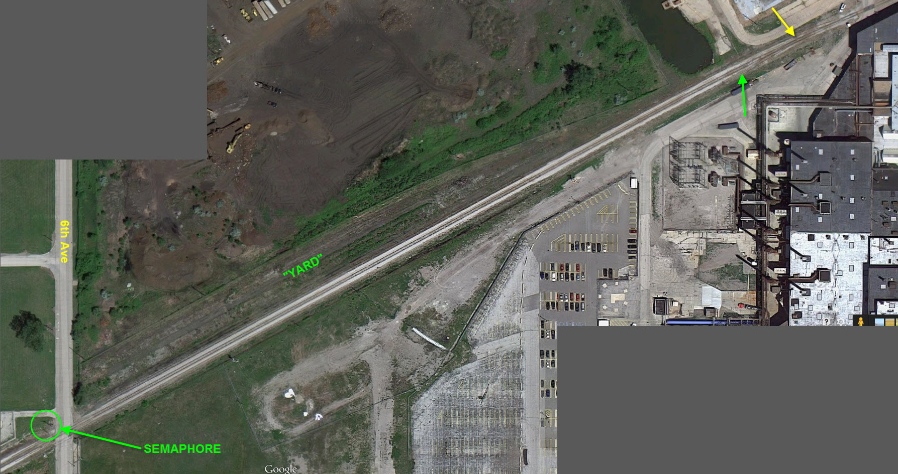
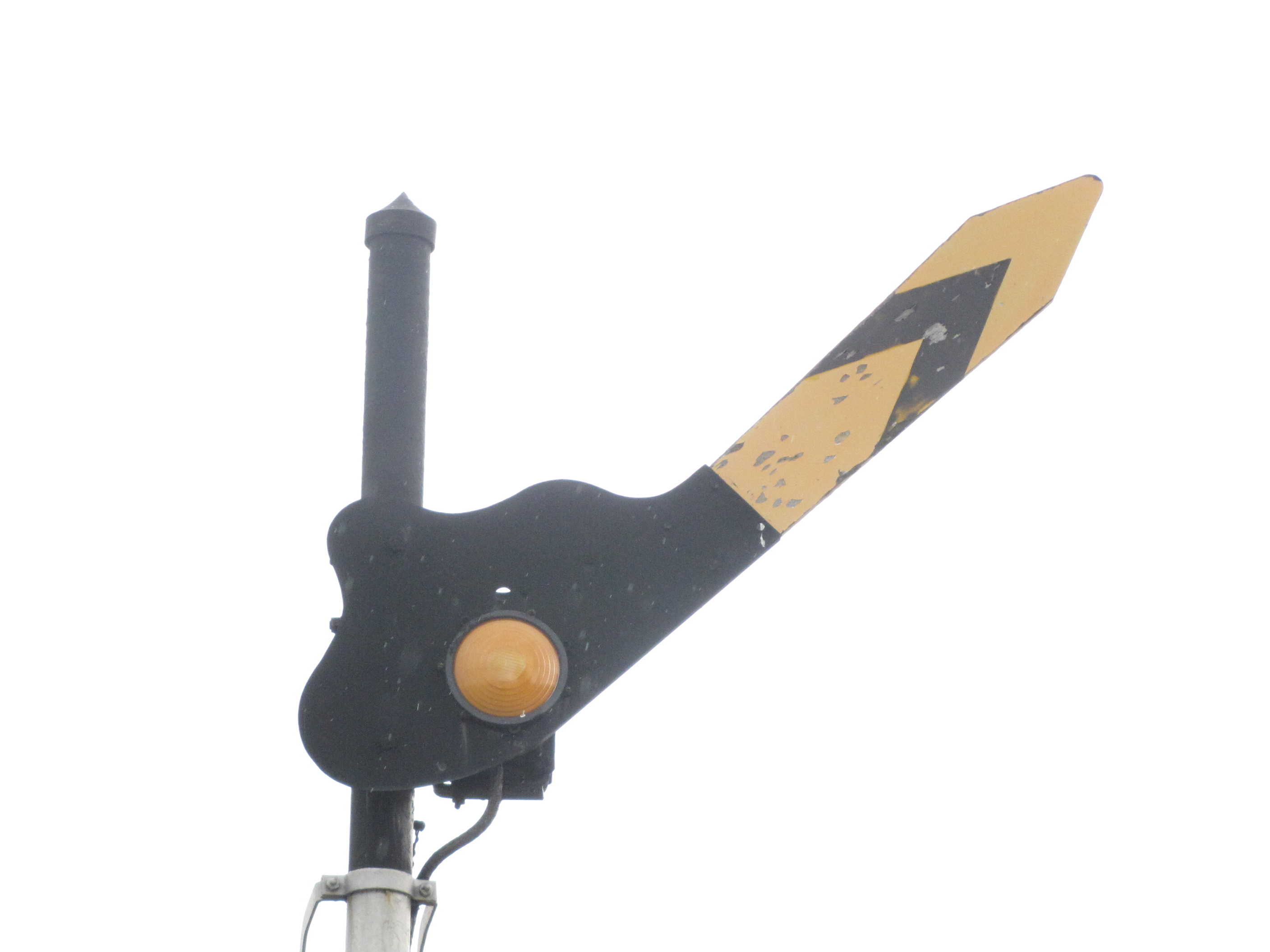
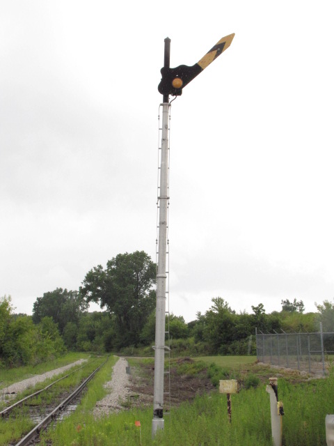
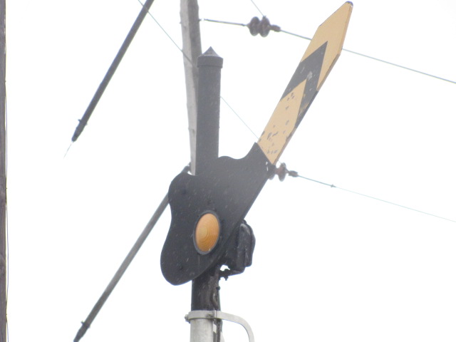
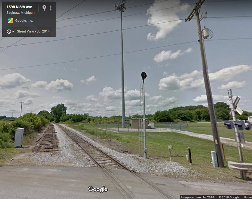
The last time I was through here, about 2009 or so, there was a fixed position semaphore on 6th Ave as noted on the map - it's a fixed signal. Never mind, as of 2014, Google Streetview shows it being gone..... darn!
Acknowledgements:
Denver Todd
Jack Prange
Websites and other additional information sources of interest for the area:
None Yet
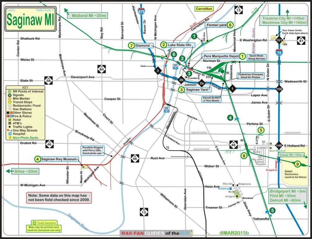
The above map can be found here as a PDF
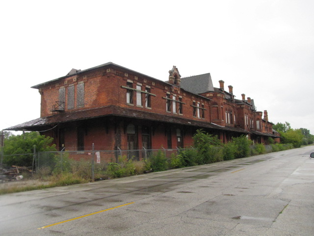
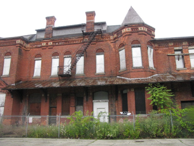
GPS Coordinates: 43.440773, -83.932968
Approximate Address: 501 Potter St, Saginaw, MI 48607
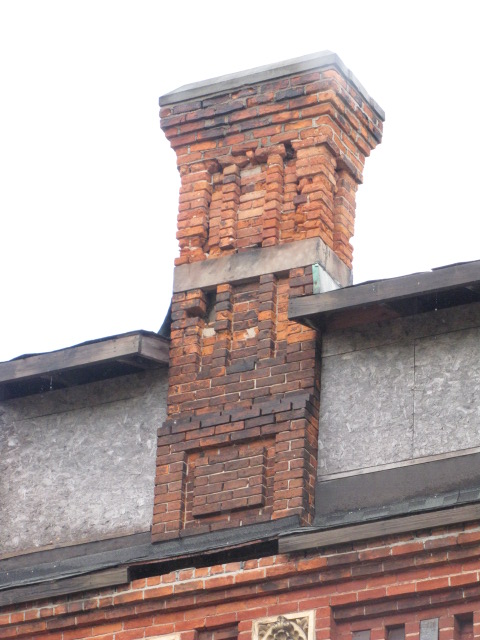
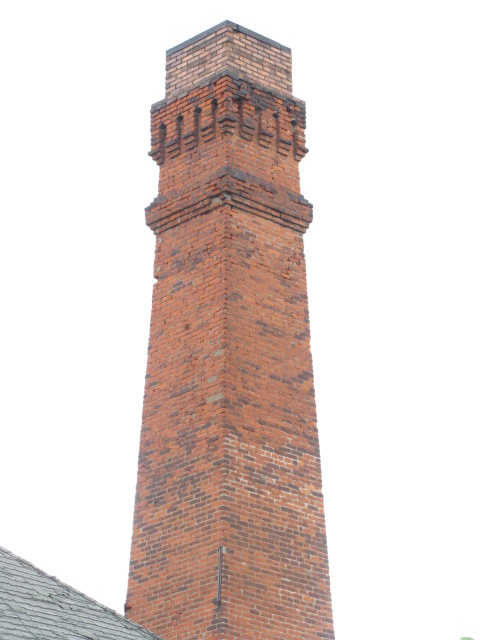
Built in 1881 by the Flint & Pere Marquette Rwy, it's a beautiful structure, and unfortunately, unused.
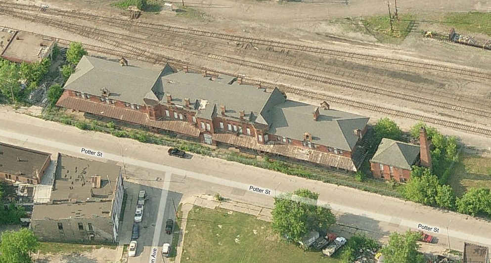
The Pere Marquette depot on Potter St, adjacent to the yards.


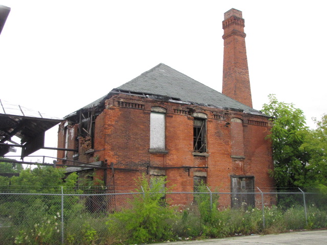
GPS Coordinates: 43.441647, -83.934329
GPS Coordinates: 43.441004, -83.918199 (Center of the turntable)
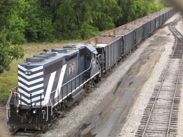
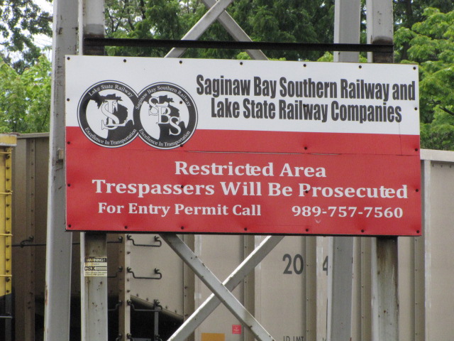
Lake State, since I was around taking pictures of them maybe 6-8 years ago, has posted signs all over the place, and has put fences up at most locations, even in Bay City which was not even posted the last time I was there. Michigan has a law where private property doesn't have to be posted, so you can be arrested for trespassing without any notice that you did something wrong... this was explained to us by a CSX cop in Toledo while taking pictures of another Lake State train.
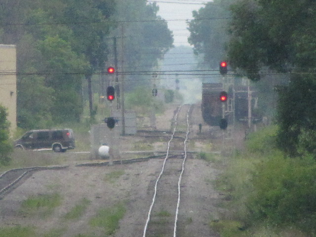
The thumbnails belowt are views looking south from the pedestrian overpass... the far set of signals is about a mile and a half down the track. With as little as the signals are used, you would think they would rewire them for approach lighting. All of my photos are taken with a Canon SX10IS camera, which has 20x optical zoom, and another 4x digital, which adds up to 80x... add to this image stabilization, and you can get pictures like this without a tripod! The camera can also do macro to zero inches in addition to video and audio as a "tape recorder". I used to shoot with a Canon SLR, and had to have a bag full of lenses to do the same thing. I hated loosing the SLR. Too many signals, not enough time.
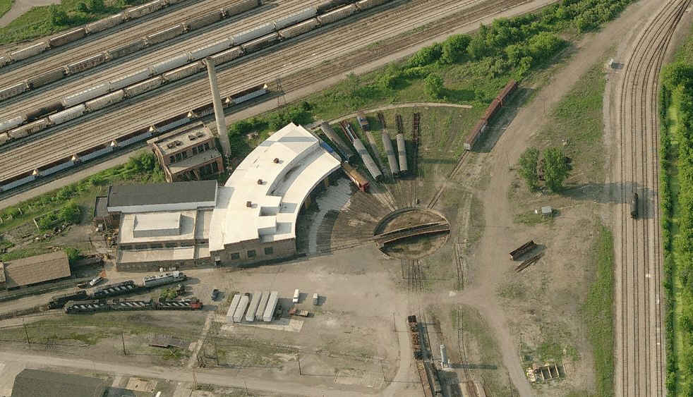
Above and below are a couple of shots inside the wye. It's too bad there isn't easy access to the turntable :-(
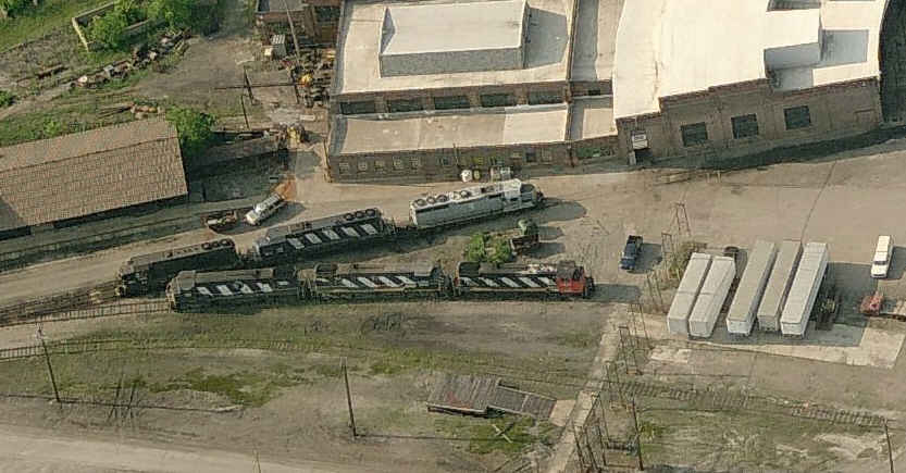
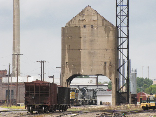
It's too bad all of the really good stuff is buried deep inside the yard :-(
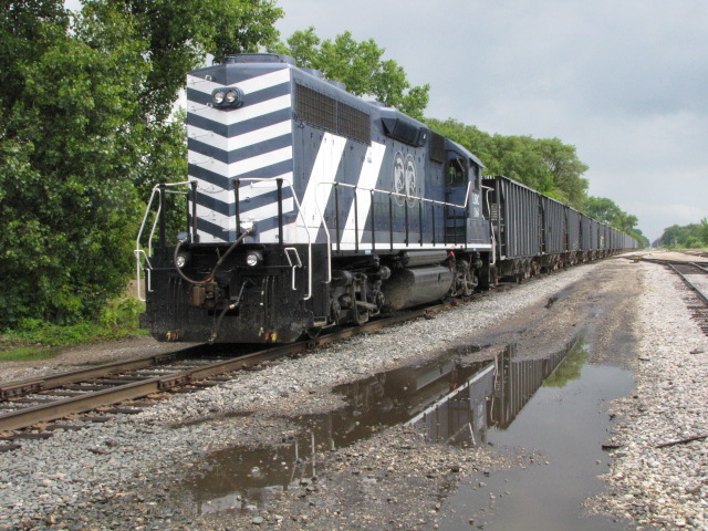
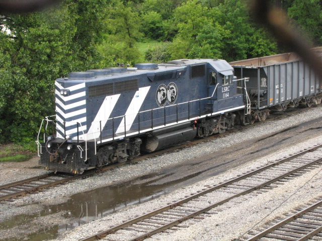
An empty Lake State freight sitting on the south leg of the wye, NB - pictures from "above" are taken from the pedestrian crosswalk that goes over the yard.
GPS Coordinates: 43.407513, -83.984588
This is the home of the Saginaw Railway Museum
900 Maple Street, Saginaw MI, 48602 989-790-7994
It's on the southwest side of town. For more info: http://www.trainweb.org/svhrs/

GPS Coordinates: 43.419404, -83.900706
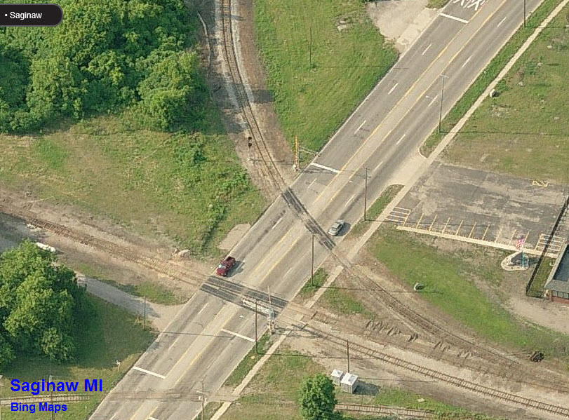
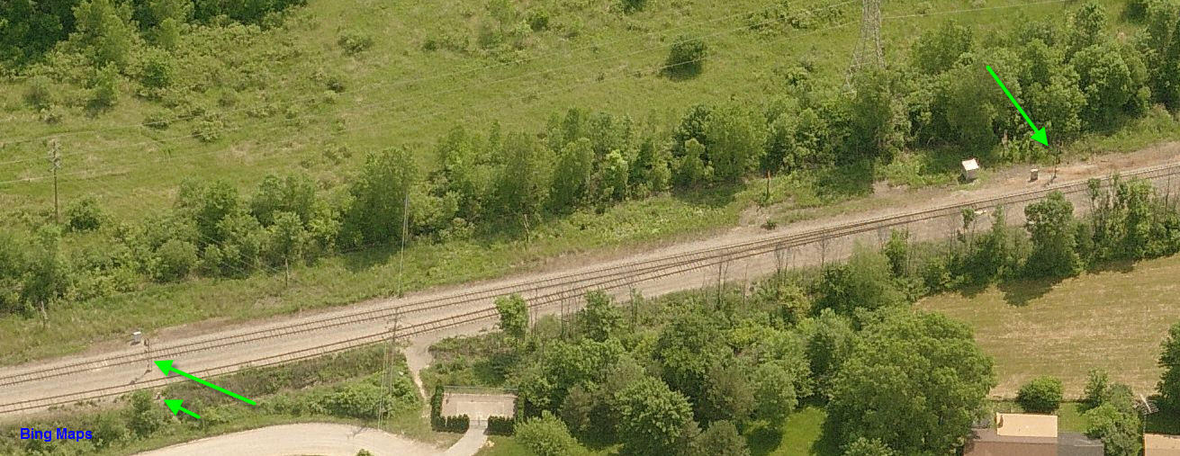
At one time this probably provided some interesting switching off these sidings. It's off 27th and Holland, I-75 exit 149. The picture is upside down, but oriented properly with the north at the top.... it shows the detail a little bit better.
GPS Coordinates: 43.450271, -83.925140 (Center of the yard)
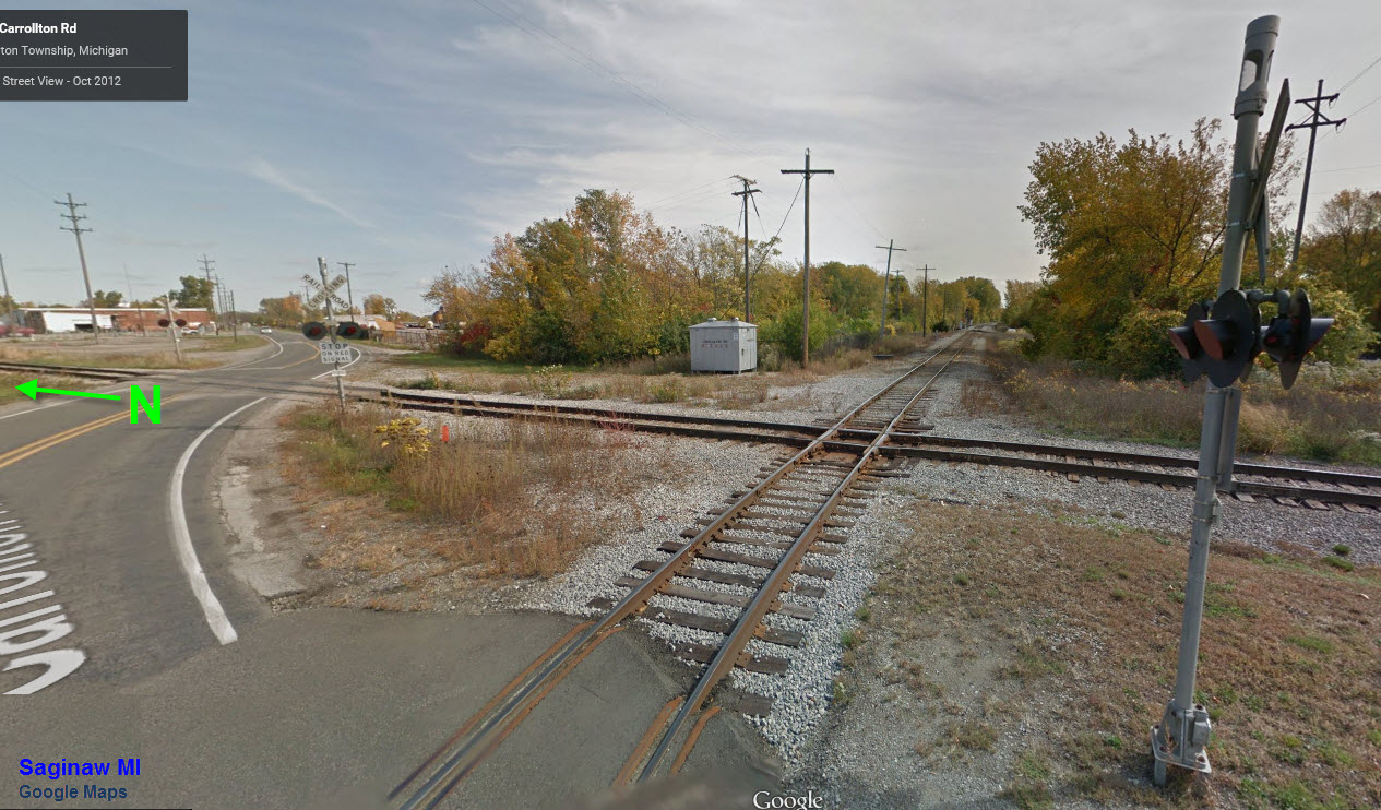
Looks like a 6-8 track stub-end yard was here at one time (yellow arrow), and a siding on the south side of the mainline track (green arrow). The fixed approach semaphore is at the bottom left corner of the picture.
GPS Coordinates: 43.444389, -83.944274
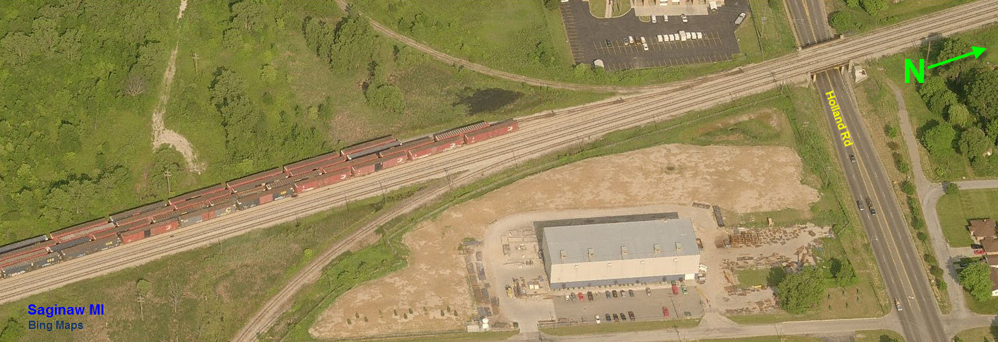
The diamond looks like it is at least protected by three signals, on the west, north, and south sides. I haven't been to the diamond, and can't tell from the Google Streetview pictures if the signal on the east side of the diamond is approach signal for the diamond or the bridge. Pictures of the signals are below in the signal section.

GPS Coordinates: 43.414739, -83.906838
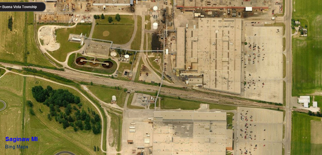
This is the north end of the small yard at Holland. There used to be a diamond here - the line going off to the right is now a short industrial spur.

GPS Coordinates: 43.408284, -83.882499
GPS Coordinates: 43.449523, -83.926953
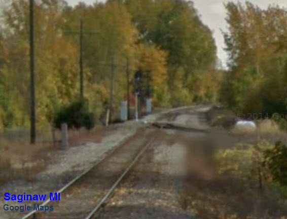
This semaphore no longer exists. It served as an approach to the signal below. It was replaced by a fixed yellow approach signal sometime between September 2012 when Jack P. came thru looking for it, and July 2014 when the Google Streetview picture was taken.

 The replacement signal
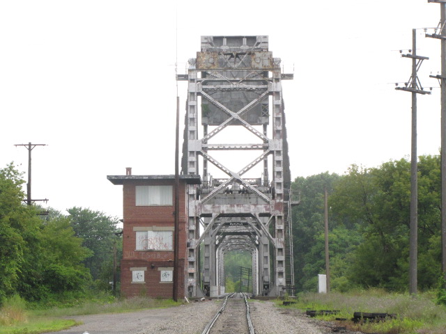
Looks like the control tower for the bridge is now gone, judging from the Google Maps Street view.
Just guessing, but it probably doesn't swing anymore.
This bridge is off the bottom of the map.... Other Shots from Around Town From the University of Texas Library collection here:
http://www.lib.utexas.edu/maps/topo/topo_us.html
Disclaimers:
I love trains, and I love signals. I am not an
expert. My webpages reflect what I find on the topic of the page.
This is something I have fun with while trying to help others. My
webpages are an attempt at putting everything I can find of the subject in
one convenient place. Please Note:
Since the main focus of my two websites is railroad signals,
the railfan guides are oriented towards the signal fan being able to locate
them. For those of you into the modeling aspect of our hobby, my
indexa page has a
list of almost everything railroad oriented I can think of to provide you
with at least a few pictures to help you detail your pike. If this is a railfan page, every effort has been made
to make sure that the information contained on this map and in this railfan
guide is correct. Once in a while, an error may creep in :-)
My philosophy: Pictures and maps are worth a thousand
words, especially for railfanning. Text descriptions only get you so
far, especially if you get lost or disoriented. Take along good
maps.... a GPS is OK to get somewhere, but maps are still better if you get
lost! I belong to AAA, which allows you to get local maps for free
when you visit the local branches. ADC puts out a nice series of
county maps for the Washington DC area, but their state maps do not have the
railroads on them. If you can find em, I like the National Geographic
map book of the U.S..... good, clear, and concise graphics, and they do a
really good job of showing you where tourist type attractions are, although
they too lack the railroads. Other notes about specific areas will
show up on that page if known. NEW 07/08/2009,
03/09/2015![]()
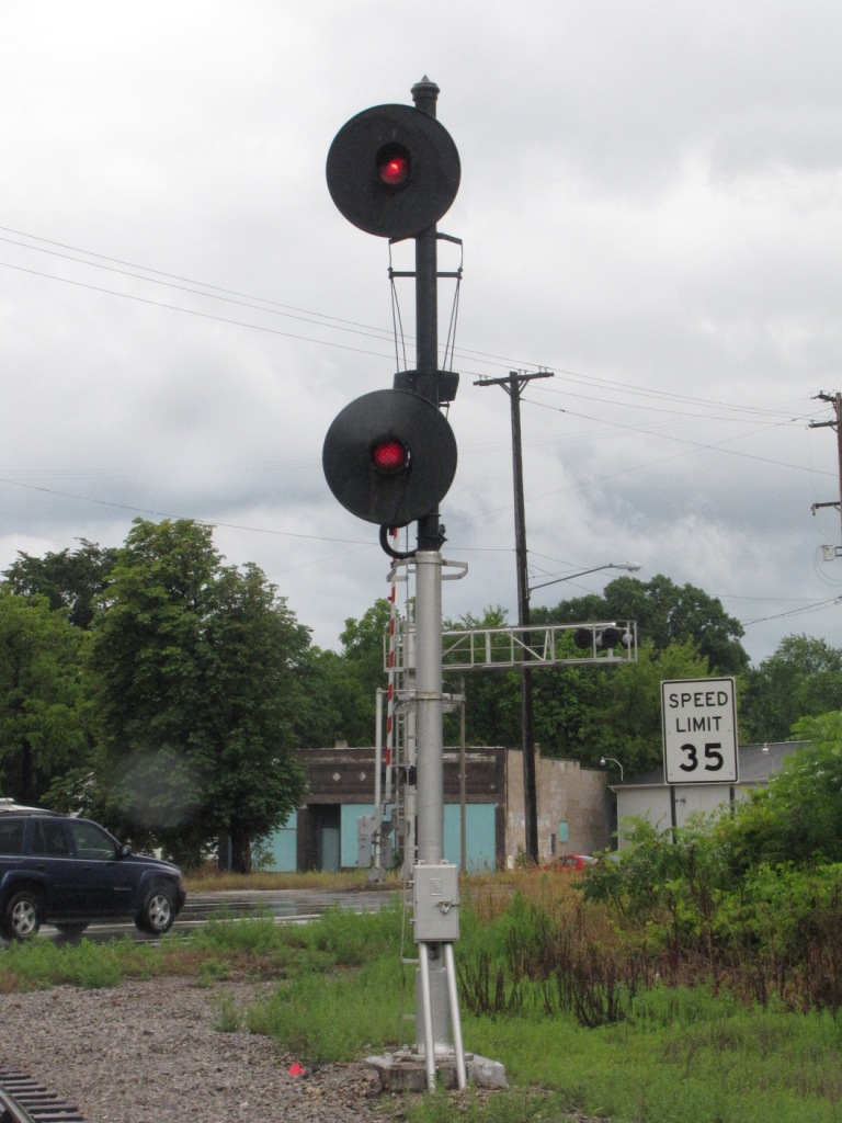
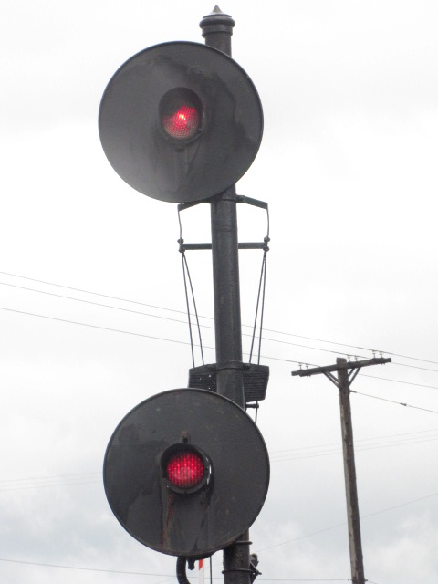
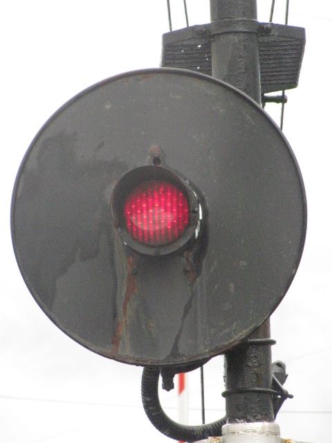
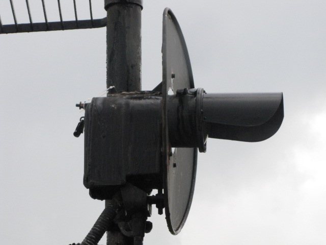
GPS Coordinates: 43.442076, -83.935514
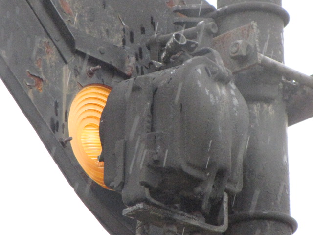
The above semaphore serves as the approach signal to this one: a signal with two heads, but only the lower signal is a searchlight... the upper signal is a fixed aspect
that always displays red. The first three pictures are the lower head, the two in the middle are of the upper head.
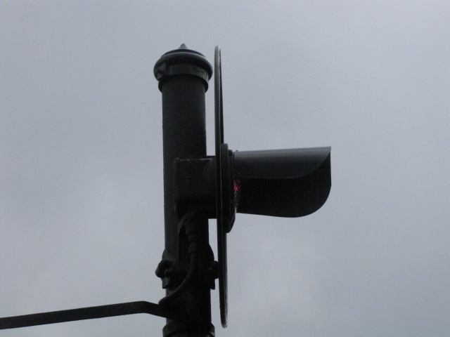

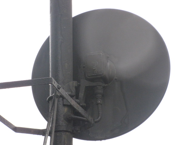
![]() Bridge Approach Dwarf
Bridge Approach Dwarf
GPS Coordinates: 43.441391, -83.934527
A single GRS searchlight dwarf protects the drawbridge from this side.

![]() Perkins Street
Perkins Street
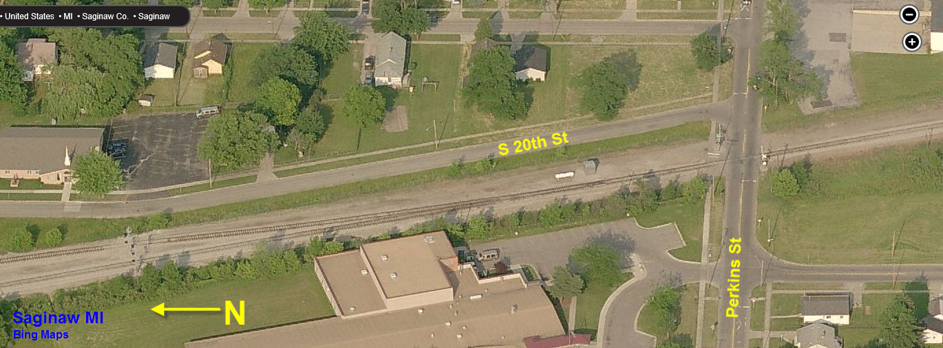
GPS Coordinates: 43.422201, -83.910188
Two tracks to one going southbound, there are only these two SB signals, none for NB trains.
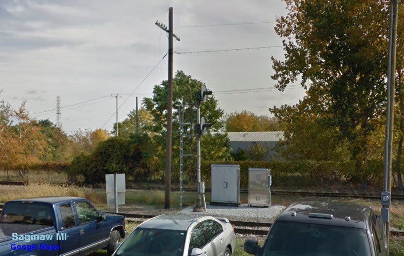
![]() 2-1 Interlocking
2-1 Interlocking
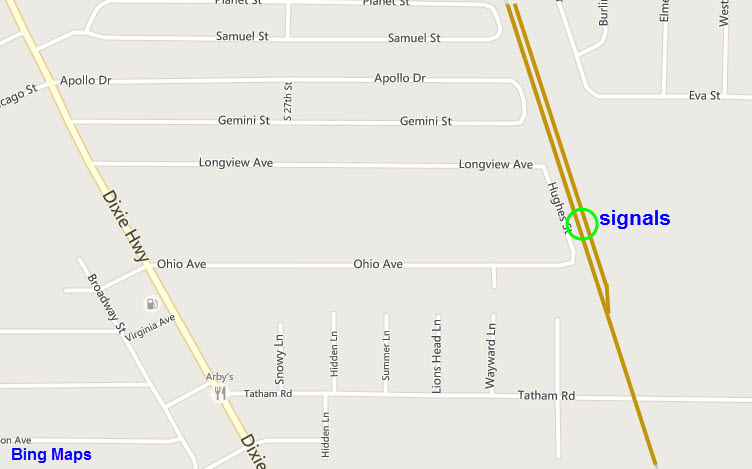
GPS Coordinates: 43.390587, -83.895984
Although the signals and switch are viewable from Tatham Rd, the signals are better accessed from Hughes St, off of Longview and Ohio Streets.

![]() Diamond Interlocking Signals
Diamond Interlocking Signals
Need good pictures
-- From the south
GPS Coordinates: 43.441595, -83.945559

-- From the west
GPS Coordinates: 43.444638, -83.945776
-- From the east
GPS Coordinates: 43.444088, -83.942612

-- From the north
GPS Coordinates: 43.447080, -83.942946
Need picture
![]() Bridge 1
Bridge 1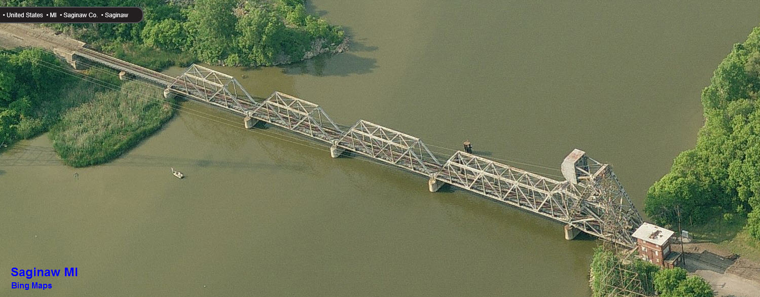
 After
After
 Before
![]() Bridge 2 -
Swingbridge
Bridge 2 -
Swingbridge
![]() Bridge 3
Bridge 3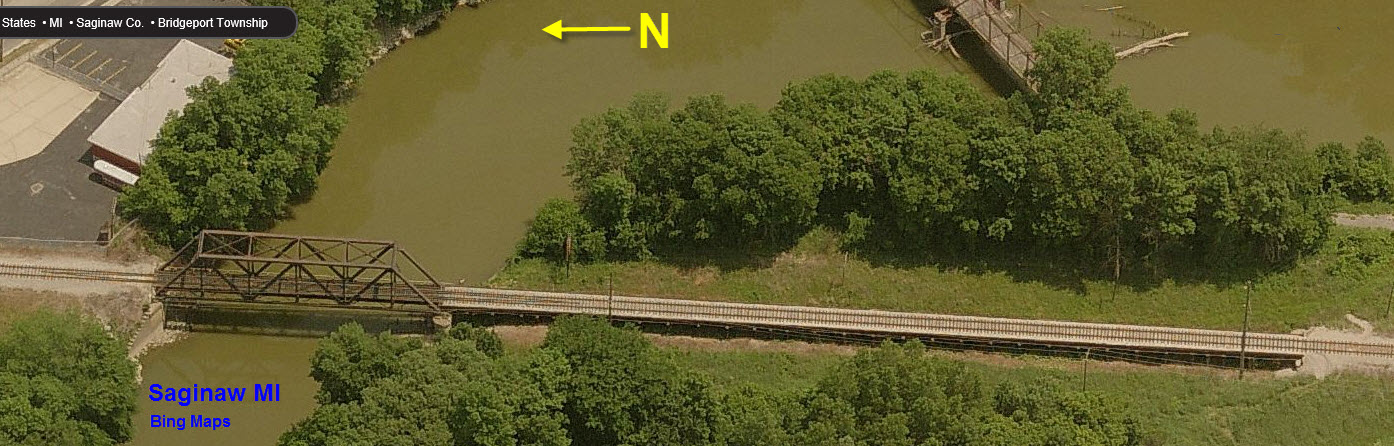

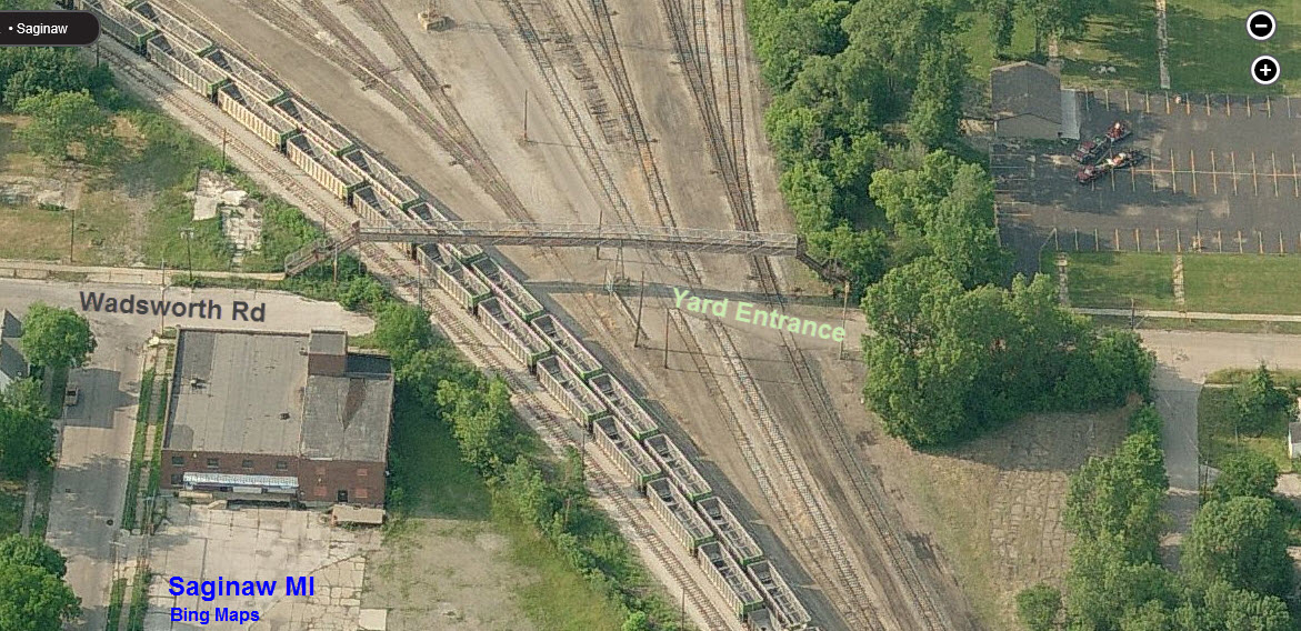
Pedestrian overpass on the southern side of the yard/wye.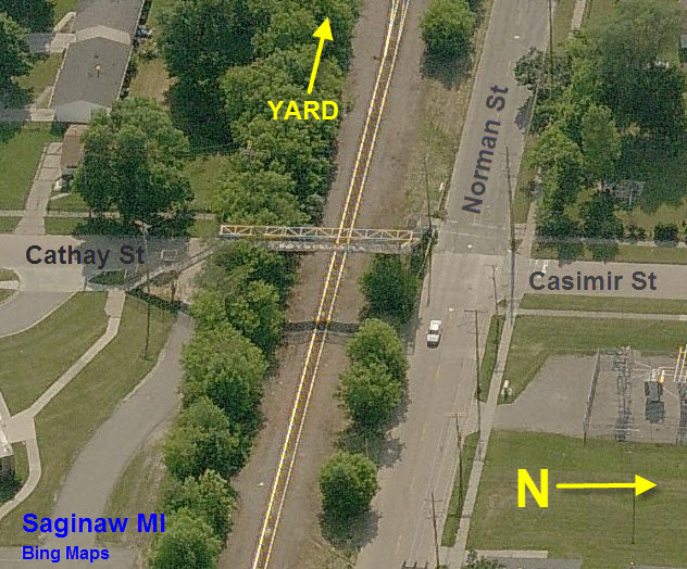
Pedestrian overpass on the eastern side of the yard/wye.

I wonder how many developers are jealous of the riverfront
property the CN has on it's way through town.
Anyone want a used hopper?

I don't normally include pictures of roads and/or
highways, but I think the Michigan DOT should get some sort of award for
this interchange :-) It's exit 151, Washington Rd.
This is a huge map, so I made it a thumbnail to keep the page from
loading really, really slowly :-)........ 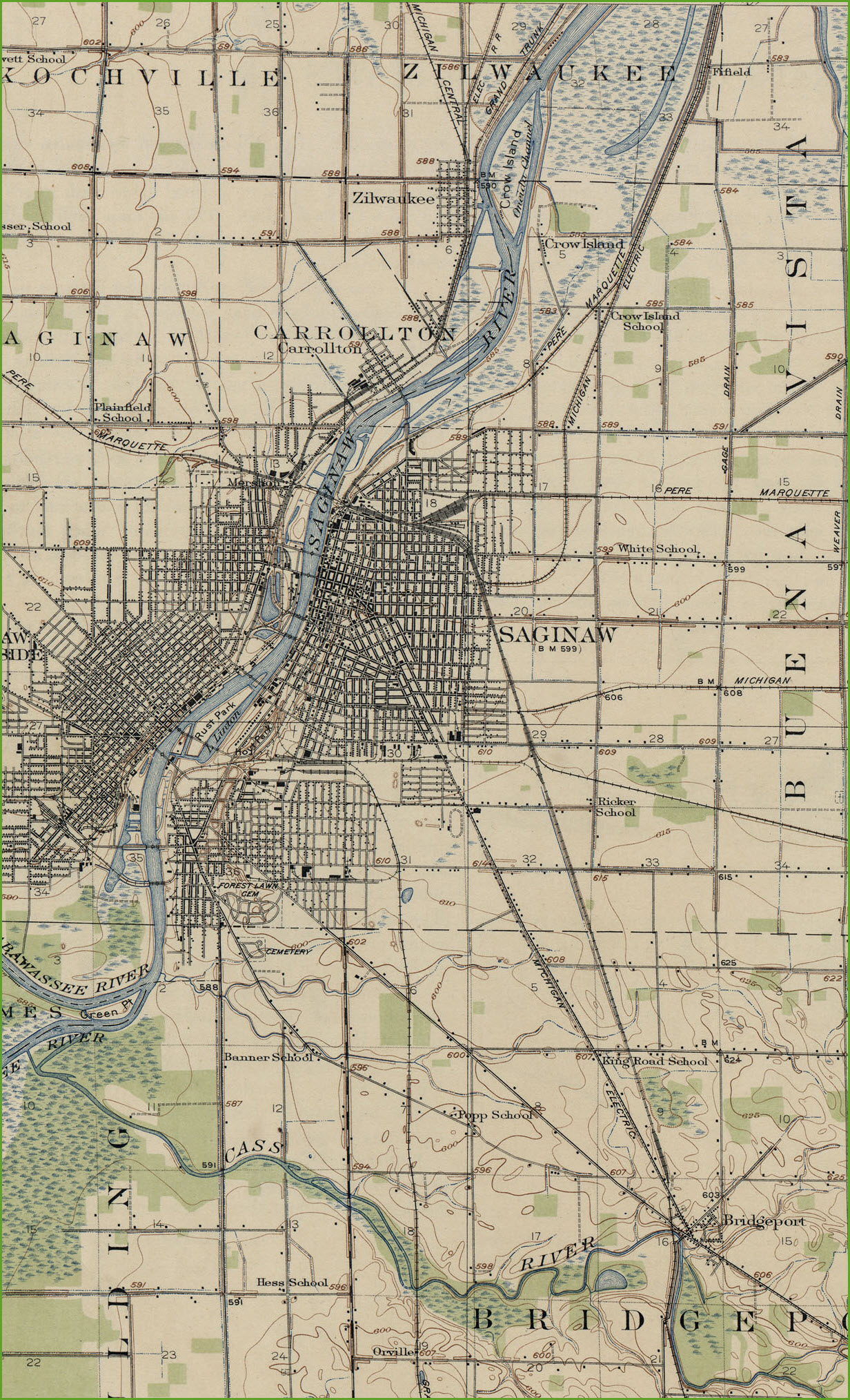
The aerial shots are from either Google Maps or Bing Maps as noted.... Google's Street View is a frickin great resources for railfanning! Bings Birds Eye View used
to be, but sometime around the end of 2017, they revised the software and now it is an utter waste of time to try to use because they have restricted its abilities.
Pictures and additional information is always needed if anyone feels inclined to take 'em, send 'em, and share 'em, or if you have something to add or correct....
credit is always given! BE NICE!!! Contact info is here
Beware: If used as a source, ANYTHING from Wikipedia must be treated as being possibly being inaccurate, wrong, or not true.
RAILFAN GUIDES HOME
RAILROAD SIGNALS HOME
Last Modified
20-Feb-2018