
In General
Getting Here
Map
Sights
Signals
Bridges
Floobydust
MICHIGAN GUIDE HOME
RAILFAN GUIDES HOME
RAILROAD SIGNALS HOME
Location / Name:
Lansing MI, Ingham County (mostly)
What's Here:
Grand Trunk Western depot
Michigan Central depot
Amtrak station
Diamond (near the Amtrak station)
Several yards
the R.E. Olds Transportation Museum
Data:
GPS Coordinates: as needed
Phone A/C: 517
ZIP: 48933 (at the Capitol Building)
Access by train/transit:
Amtrak
The Scoop:
Lansing is a good railfanning town. It is kinda in the center of the state, and is the capitol of Michigan.
Among all of the things Lansing has to offer, it is lucky to have two noteworthy structures still standing: two really nice depots. A Grand Trunk Western depot on Washington Ave, and the Michigan Central depot on East Michigan Ave.
In addition, Lansing has an Amtrak station, a pretty active diamond, and plenty of yards to keep one busy for a full day of railfanning!
I breezed thru Lansing in 2011, I was given a bang-up tour of the sites Lansing has to offer by two local railfans, but I can't locate my notes or the names of the guys from that tour, but I thank them immensely.
The CN and CSX yards are the busiest, and from looking at the birds eye view on Bing maps, it doesn't appear that NS uses the yard on the southside of town for much of anything - a couple of tracks have had their south leads taken out.
Acknowledgements:
Denver Todd
Google Maps
Bing Maps
Open Railway and Open Street Maps
Wikipedia
Websites and other additional information sources of interest for the area:
None for now.....
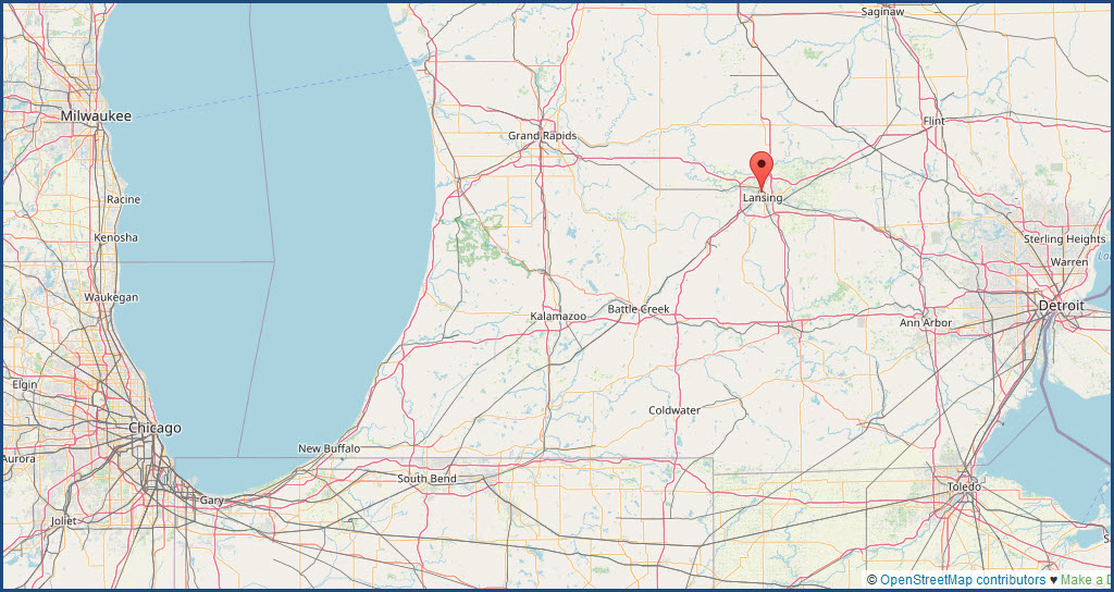
Lansing is at the crossroads of interstates I-96 and I-69.
I-69 runs heads SW out of Flint, and then kinda south once passing thru Lansing heading to Fort Wayne IN.
I-96 runs east and west from Detroit to Grand Rapids and the west coast of Michigan: Muskegon and Grand Haven.
You also have US127 which north-south, splitting off from I-75 just south of Grayling (where you would head west to go to Traverse City) in upper Michigan (not the U.P.), Hits I-94 at Jackson MI, and continues on south as a real back road.
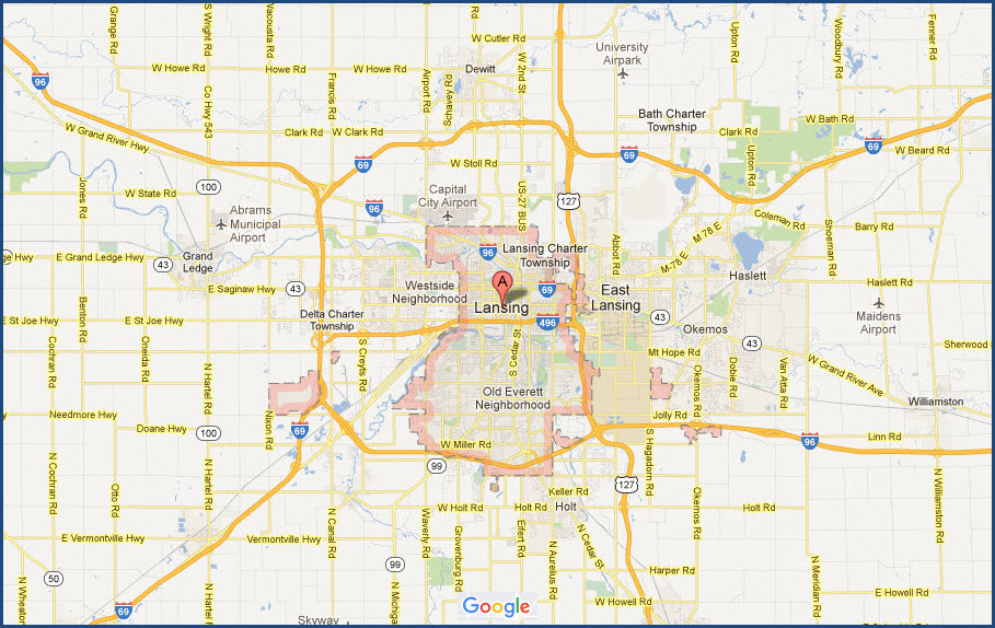
In looking at the above map, you will notice that there is a "beltway", or loop of sorts made up of the two interstates and US127. Getting around to the various places and sights in Lansing is an easy task, with nothing really too far away from anything else.
You also have I-496 which cuts through the center of town going east-west, and provides quick access to most of the downtown sights to check out other than the yards.
From downtown Lansing, Grand Rapids is approximately 70 miles away, Durand is about 35 miles, and Detroit is about 90 miles.
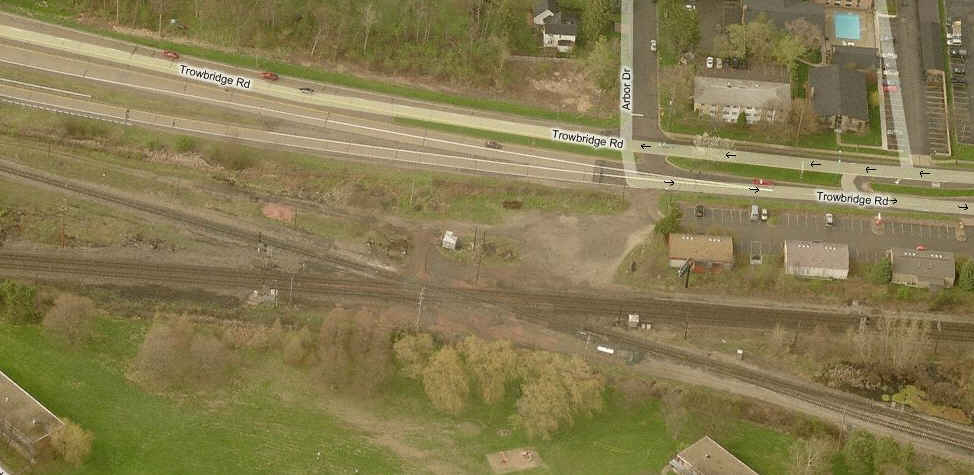
Map
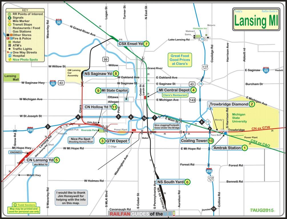
PDF version
Note: I took the easy way out on my map and used "4t" to denote the number
of tracks instead of showing them separately.... :-)
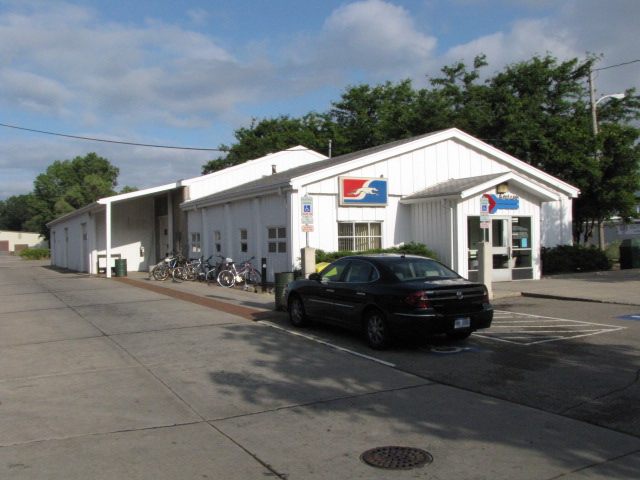
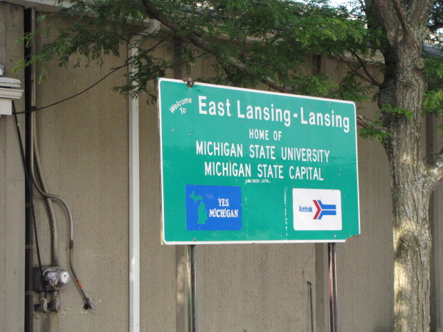
Amtrak's station for the area is in East Lansing.
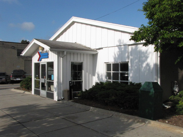
The station sign, and a billboard with an ad for the Blue Water train.

We missed the Amtrak train by 10 minutes, so this is the only thing we caught while at the station.
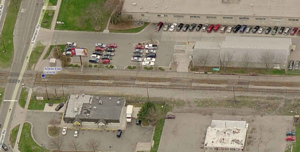
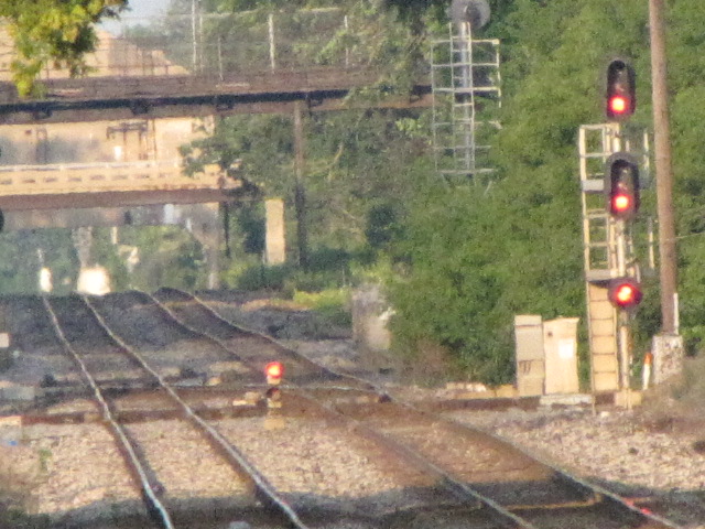
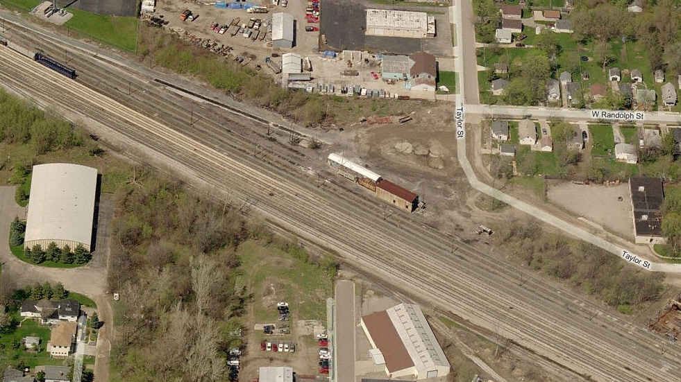
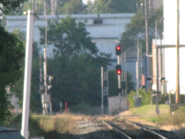
The diamond is just west of the Amtrak station.
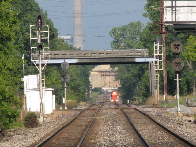
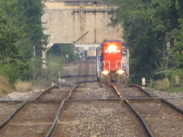
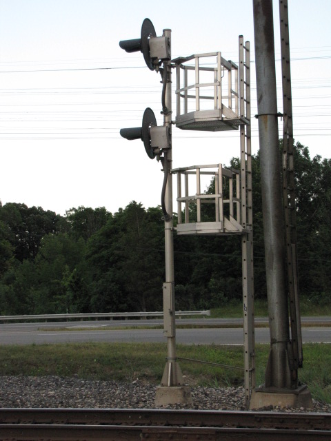
A couple of shots looking across the diamond from the Amtrak station. The one on the right is "all the way" on the camera at x80. This is a good study in the signaling here, as it looks like they replaced the most used signals, leaving the signals for the reverse traffic to do at a later time. I guess they run left hand traffic like the CNW and the RF&P. The left photo gives you a good view of the four GTW/CN signals, and in the photo on the right, you can make out a signal on the far side of the elevator.


(L) Looking west on the Grand Trunk, (R) Close-up of the color light signal.
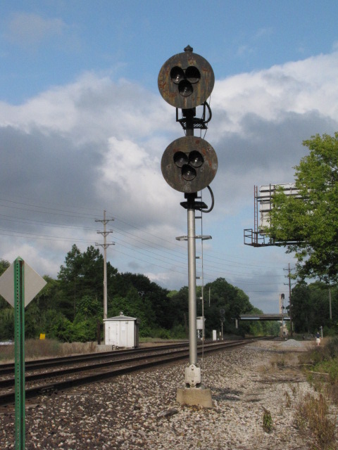
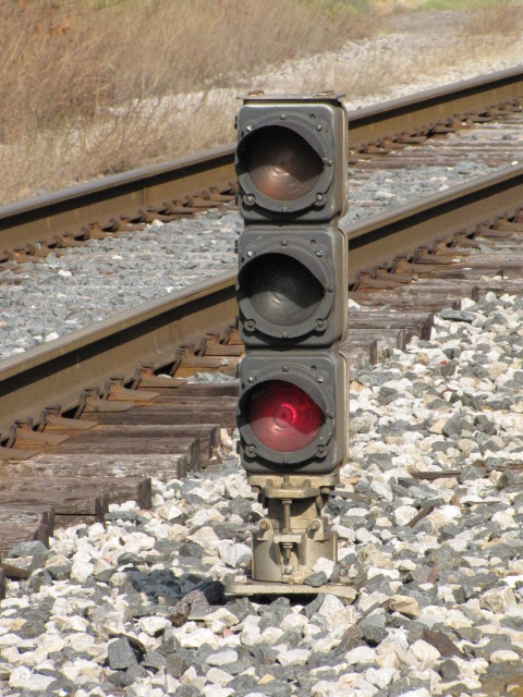
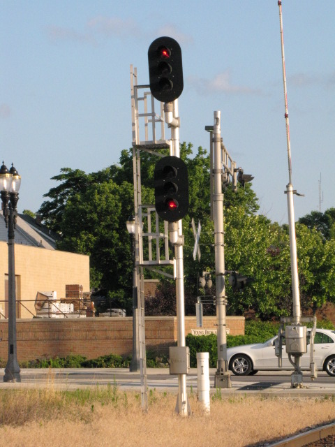
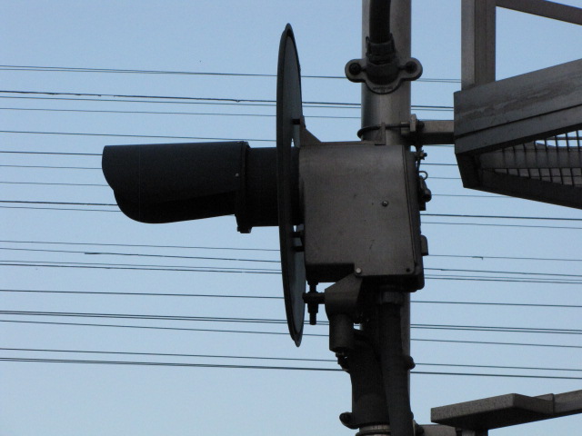
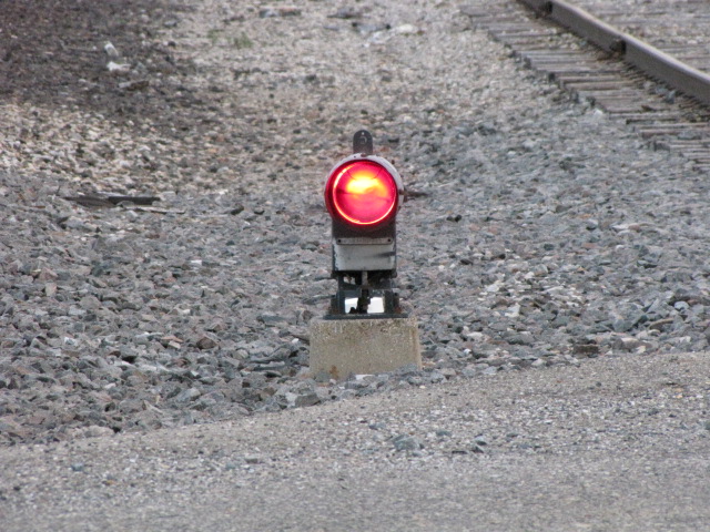
(L) The "tri-light" protecting the GT WB reverse traffic track, (R) 3 color color light dwarf on the SB CSX track - notice the green (or lunar) is in the middle...

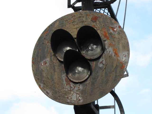
(L) A 2 head GRS searchlight signal on the SB CSX track, (R) a close-up of one of the tri-light heads.
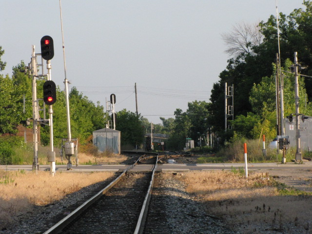
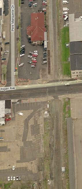
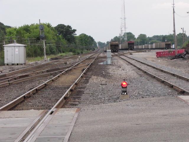
The CN-NS diamond. The track bearing off to the left does not interchange with the CN, instead, it curves back around as shown on the map to serve local business'..... Maybe at one time there was an interchange?
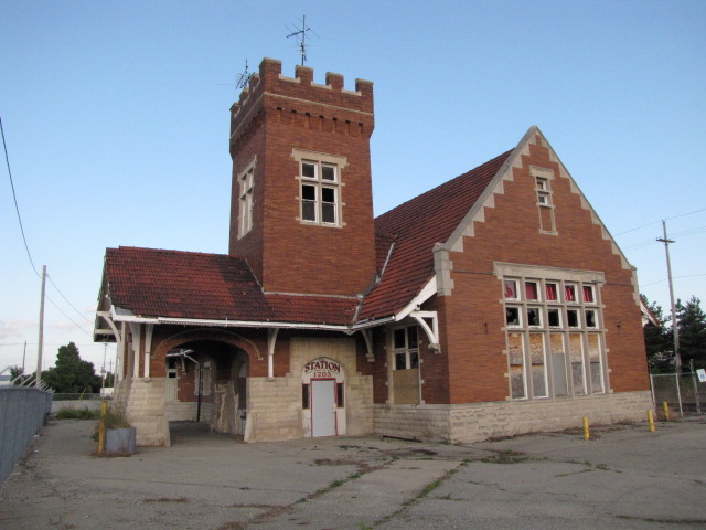
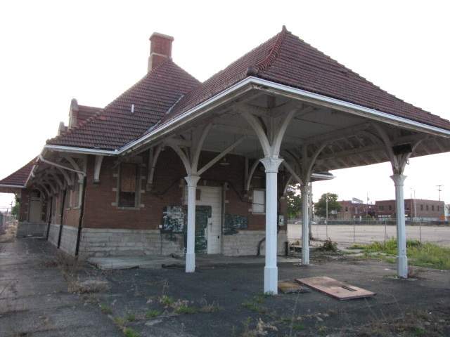
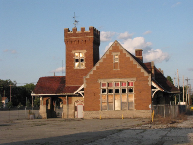
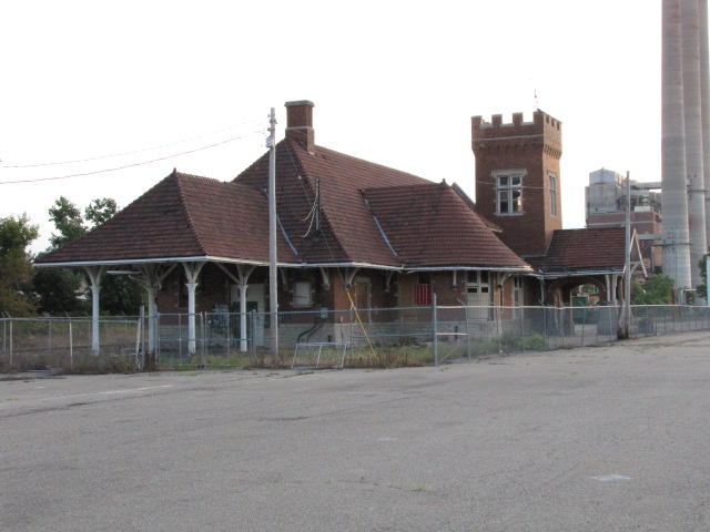
The Grand Trunk depot, and a nearby girder bridge.
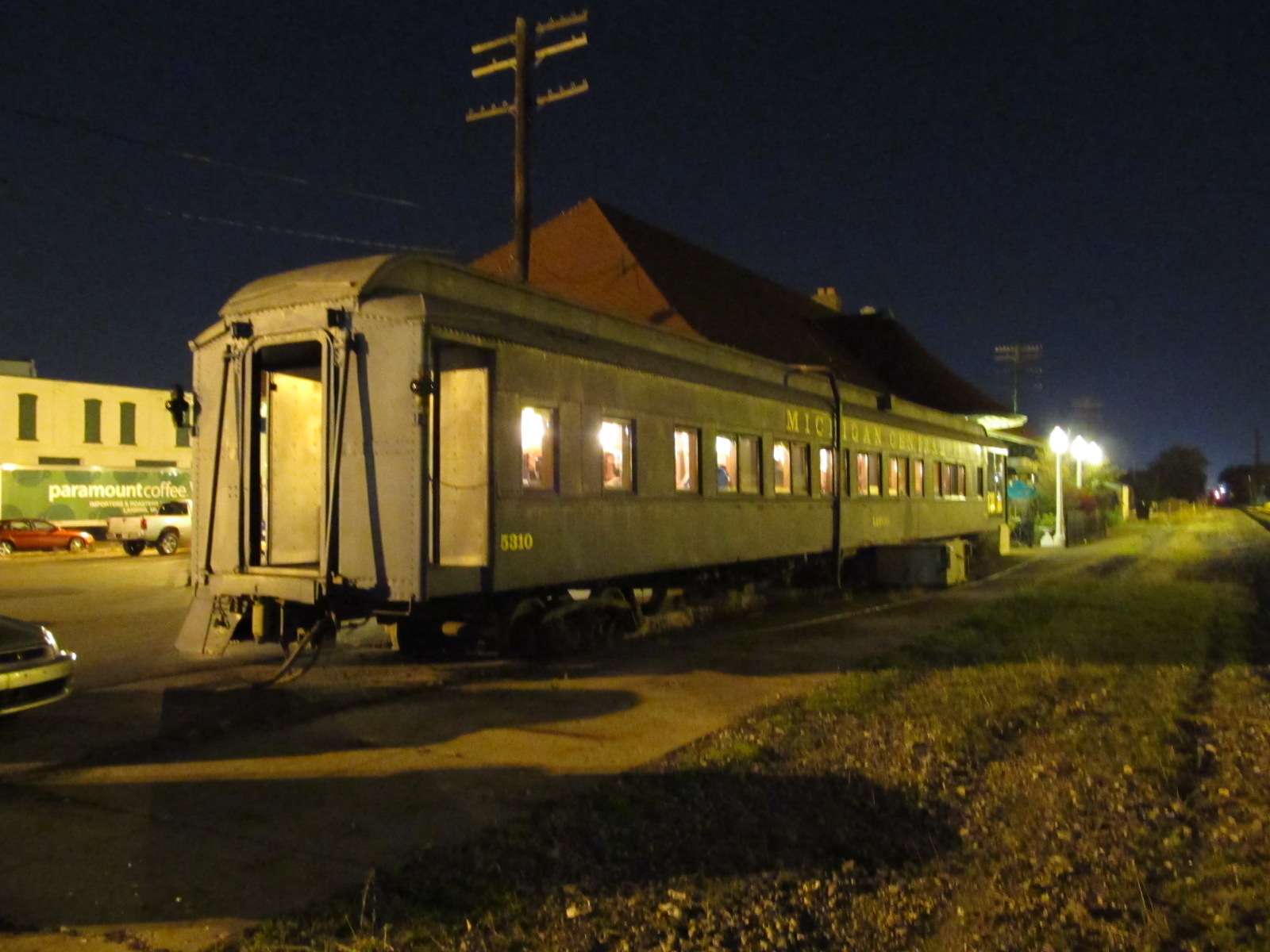
The other side of the GT depot, showing a caboose on the lot. The last time I was here, someone was going to turn it into a restaurant. They should look to the success of the restaurants in Northumberland PA, Berea OH, Oakland NY, Sykesville MD for examples on how to do it right! Well, I guess I have to take the Berea depot out of the mix, as they apparently closed up in 2009... darn...

The signals are looking east from the depot.

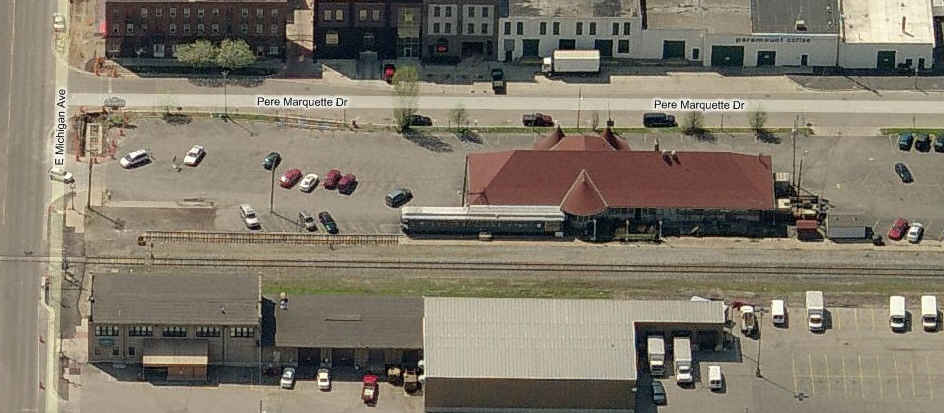
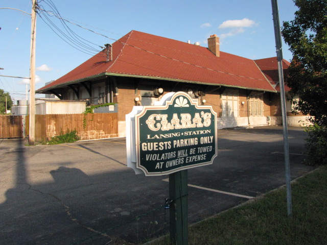
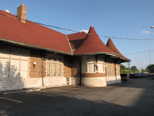
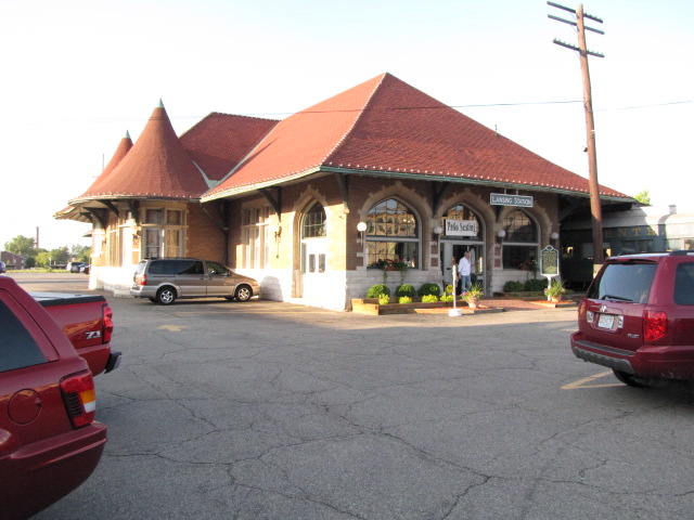
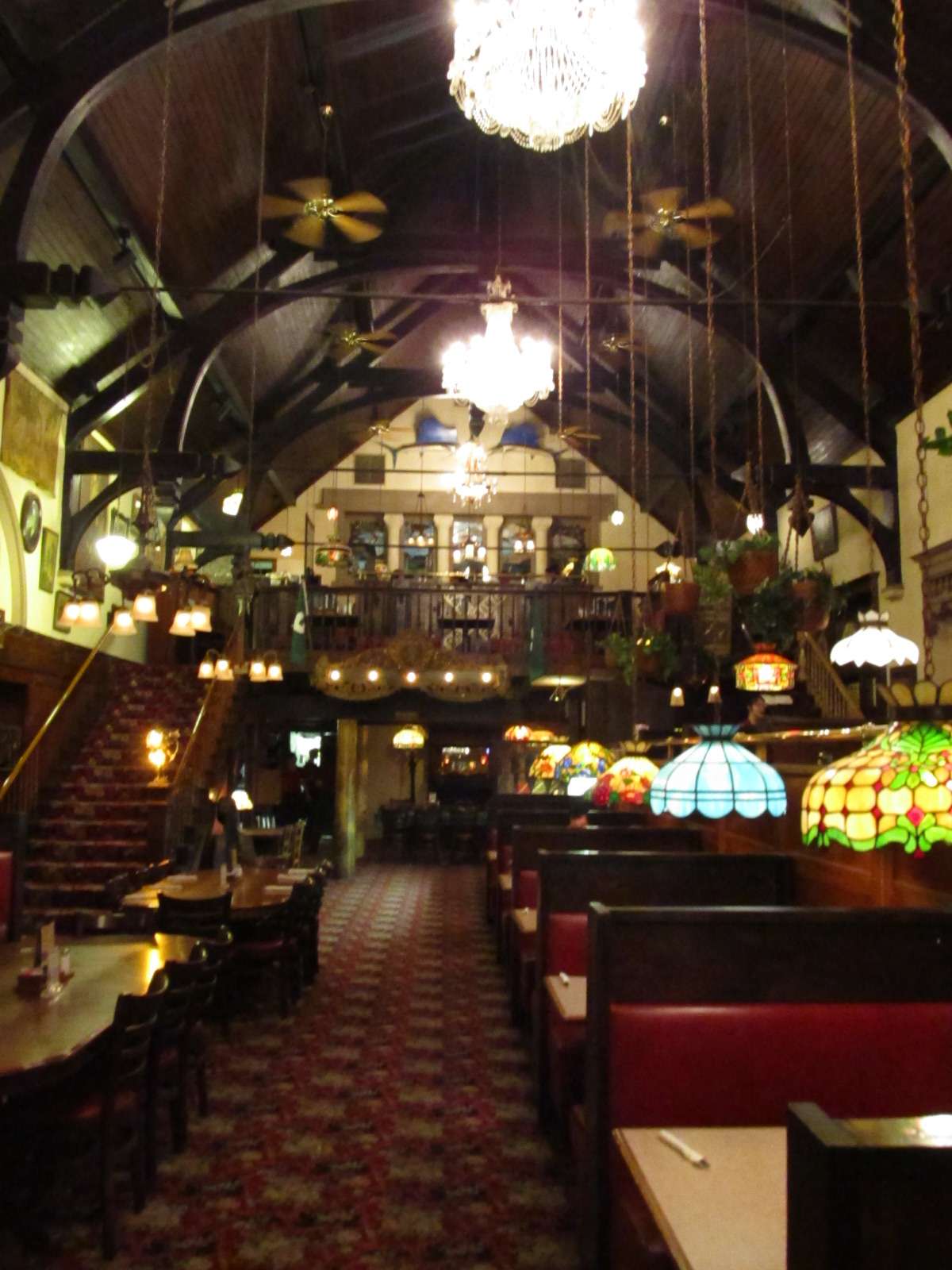
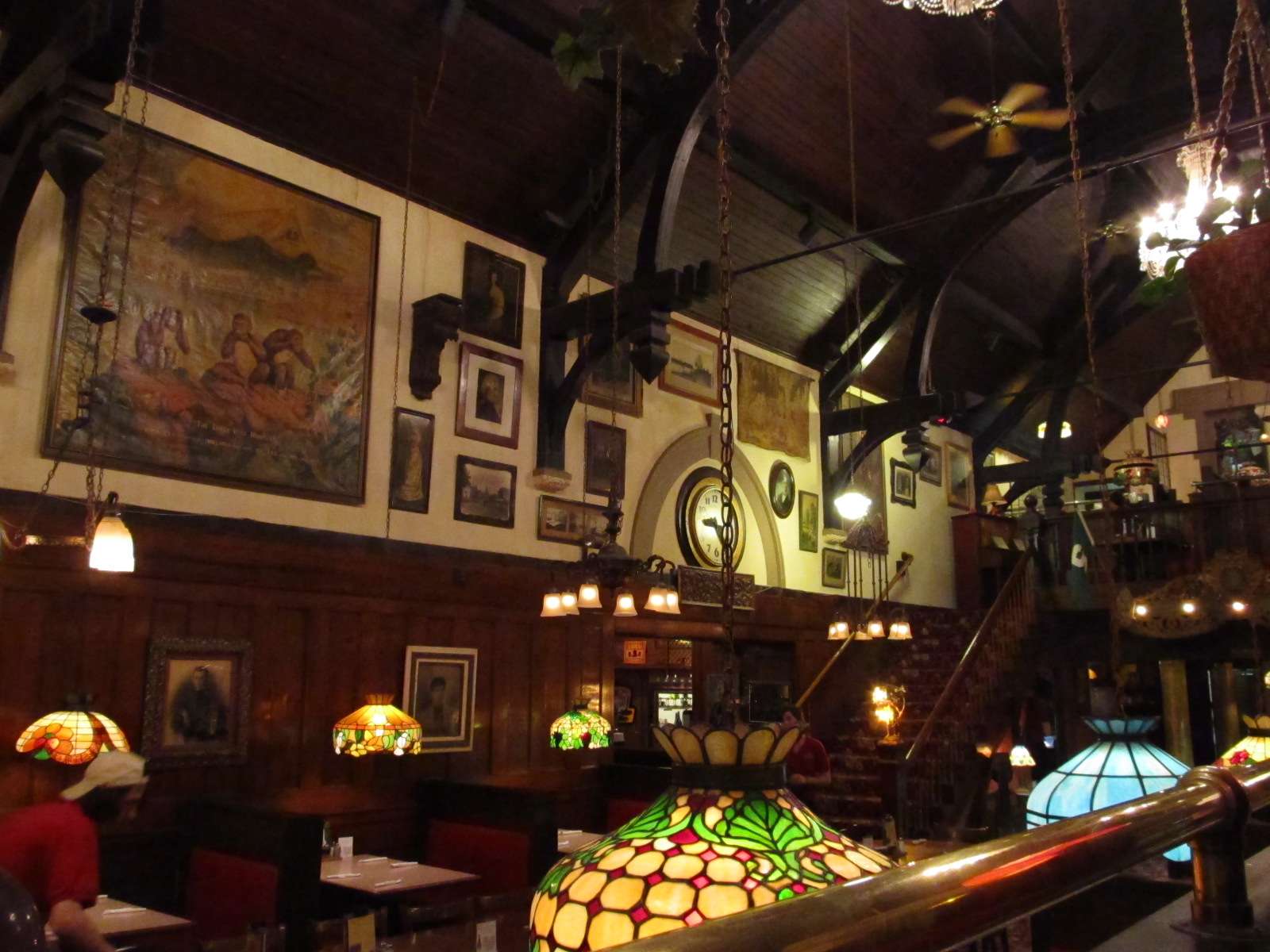
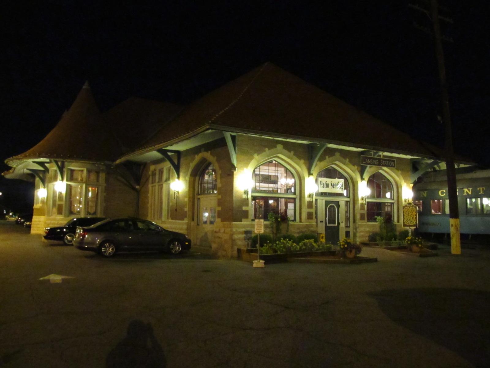
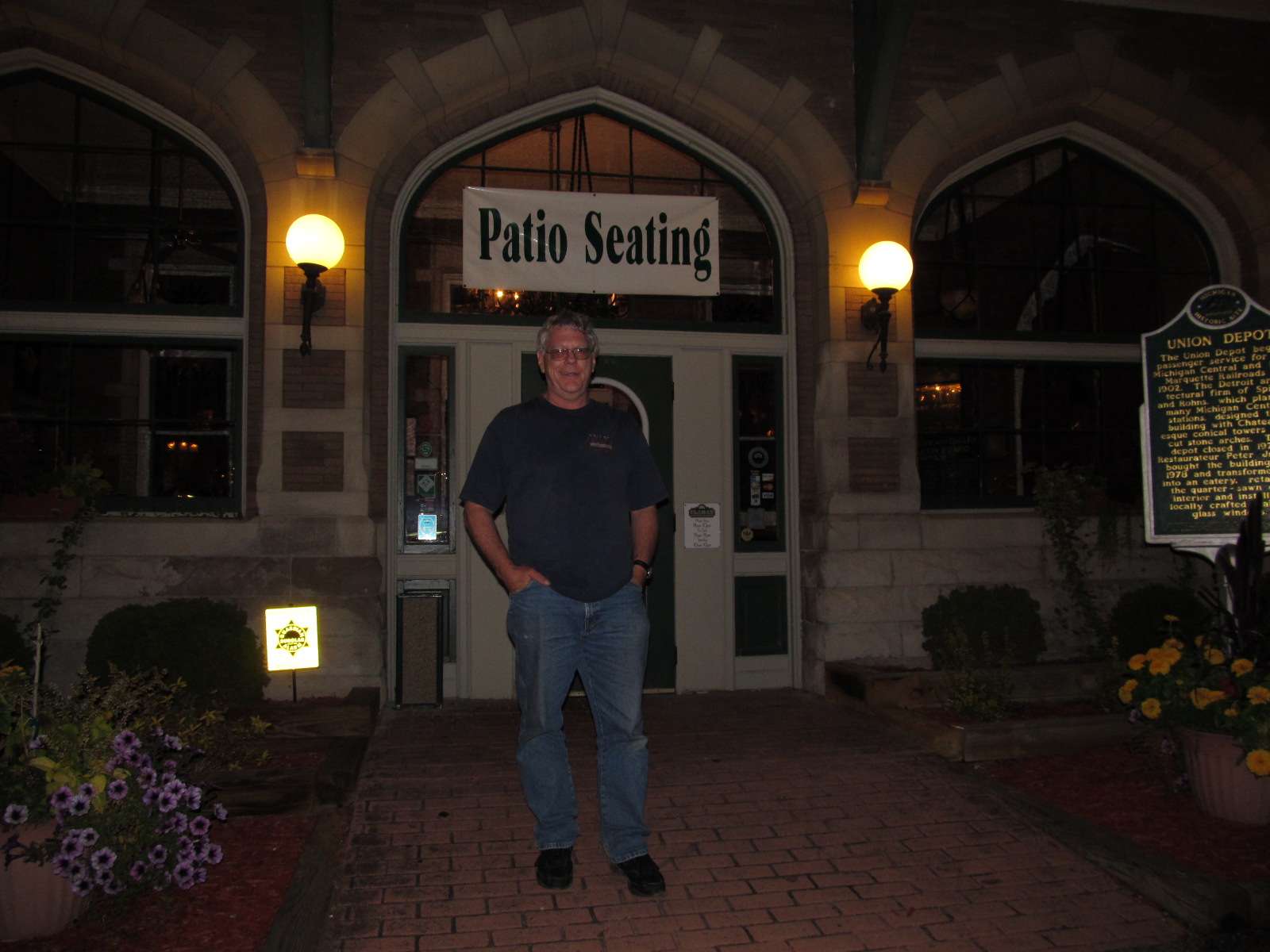
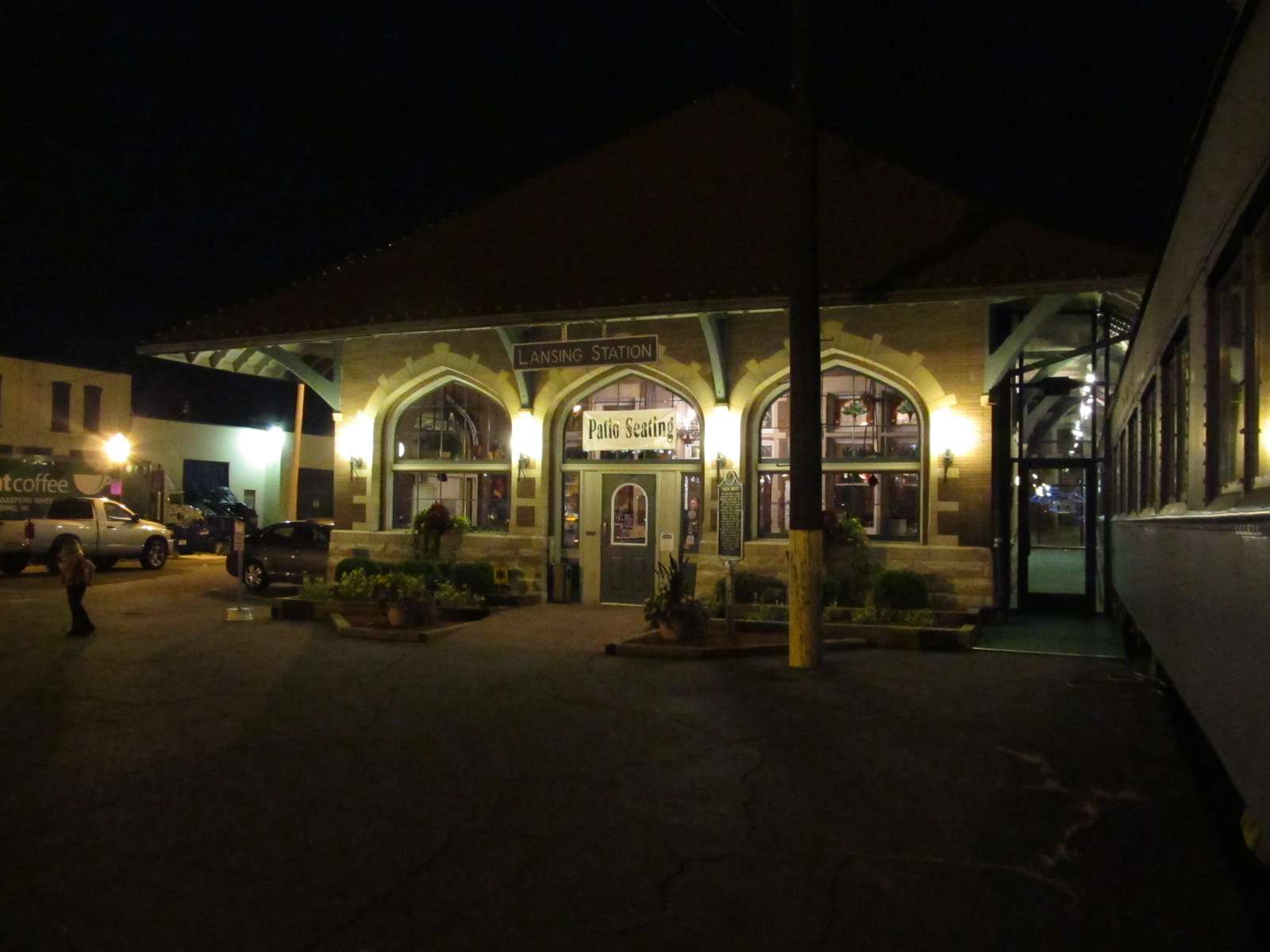
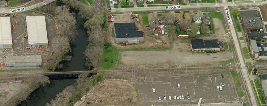
Above is an aerial view of the depot ex Michigan Central depot on Michigan Ave. This one houses Clara's restaurant. Plan your visit so you can have lunch or dinner here, the food is great, and the prices are very reasonable.
I've now had dinner here three times, and every time I have been more than happy with the food and service. On my most recent visit in 2011, I had the pleasure of meeting one of the owners, Cindy. She and her brother now own the restaurant, having taken over it's operation when their father passed on in 2005. She is a most wonderful host, so if you get a chance, please tell her how much you enjoyed the experience.
They also have another restaurant in Battle Creek... for more info: http://www.claras.com/index_html.html

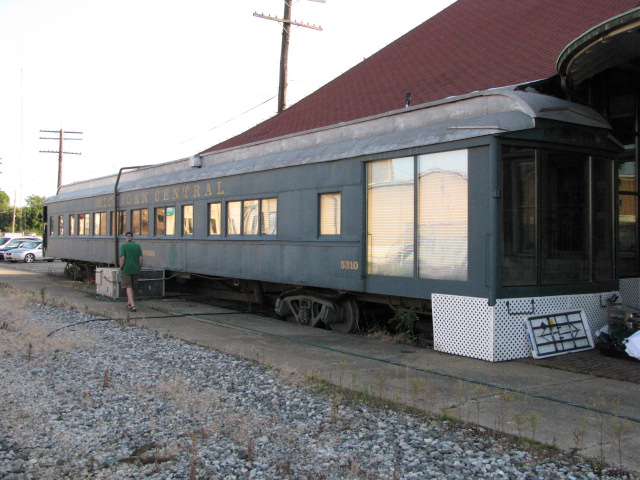
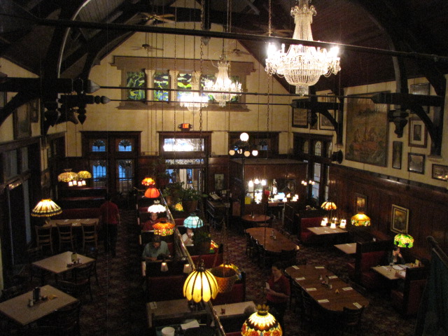
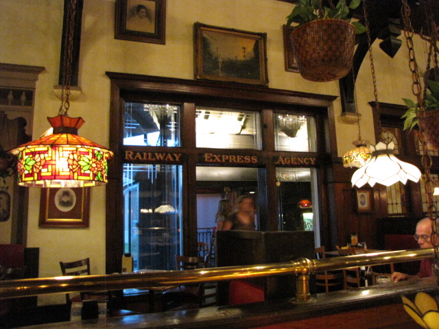
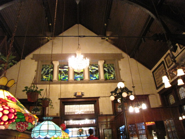
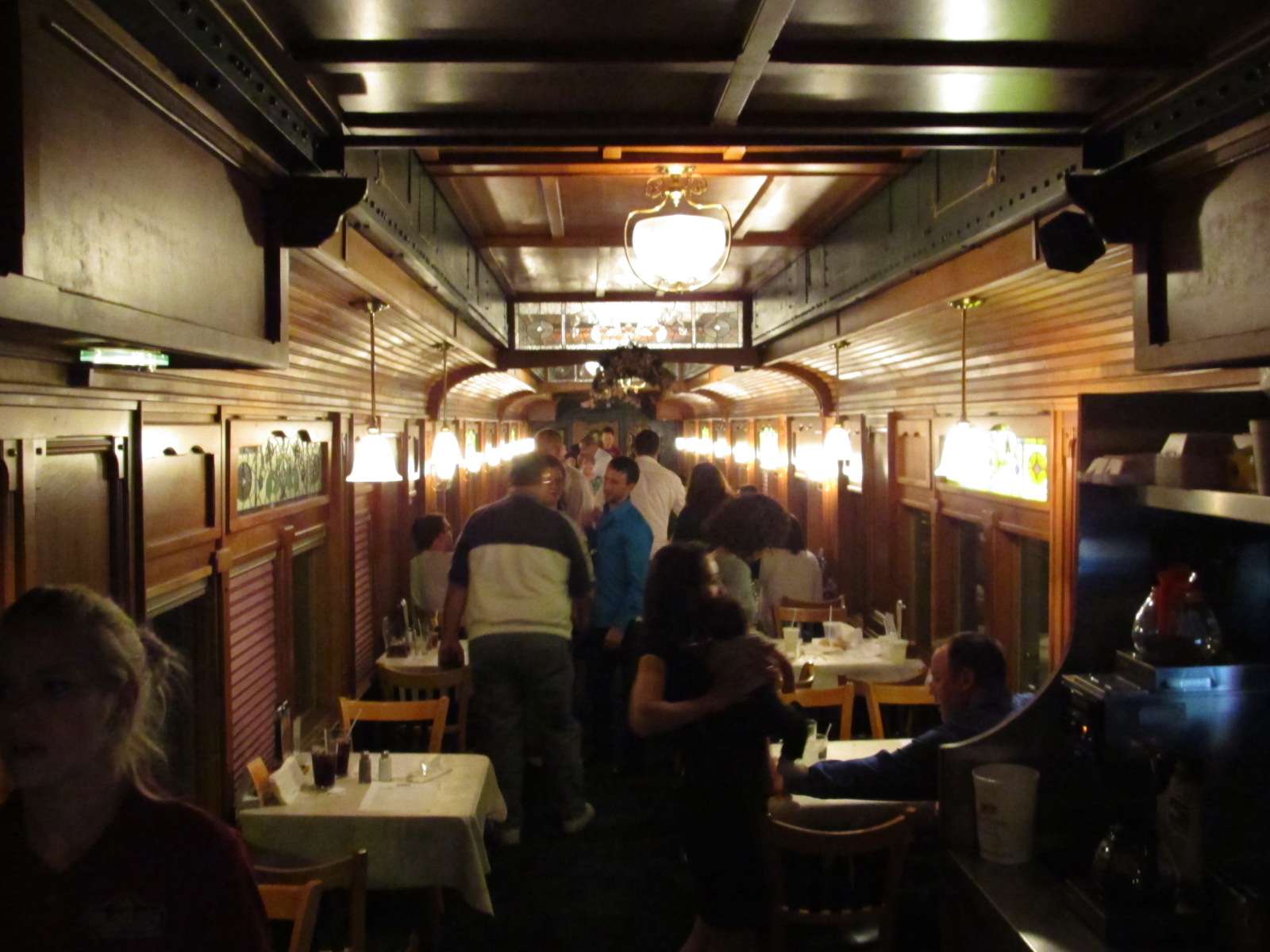
The set of pictures above is from JUL2009, and below, from OCT2011. Thanks to Cindy for taking my pix.
The picture next to the last on the right (bottom) is an interior shot of the diner car... very cool!

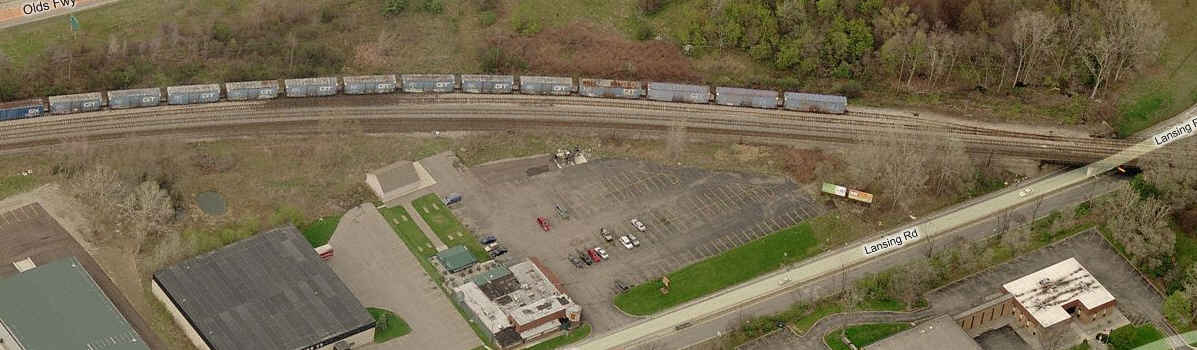
First row, two aerial shots of the CN yard, the southern end is the bottom
of the two. The 6 pictures above the aerial views are from the crossing at
the north end of the yard.... The 4 pix below are from the south end.


![]() NS's South Yard
NS's South Yard
The north and south end of the NS yard on the south side of town.
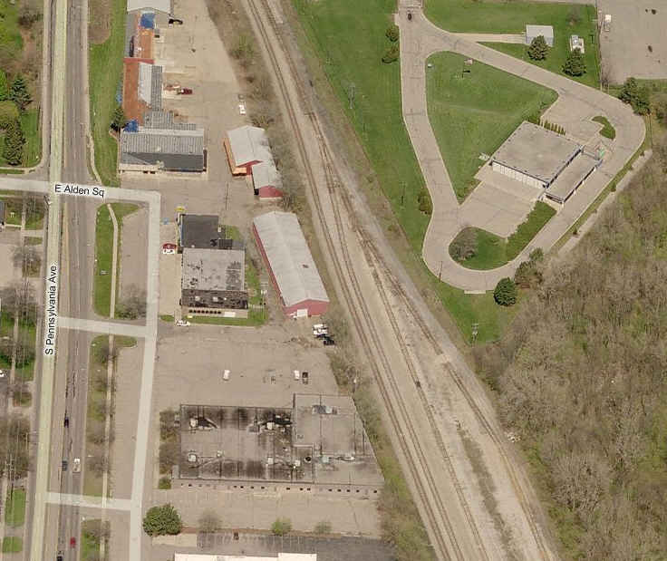
![]() CSX's Ensel Yard
CSX's Ensel Yard
Two shots of the west end of the CSX yard, mid view on the right.

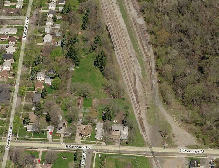
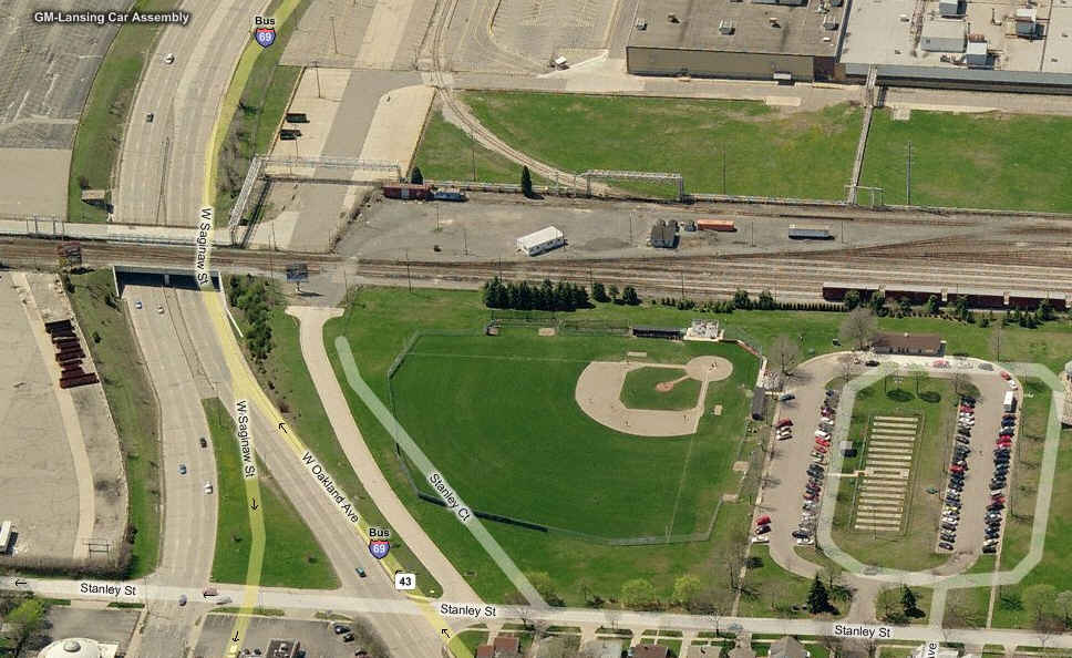
![]() NS's Saginaw Yard
NS's Saginaw Yard
Southern end of the NS yard by the GM assembly plant.
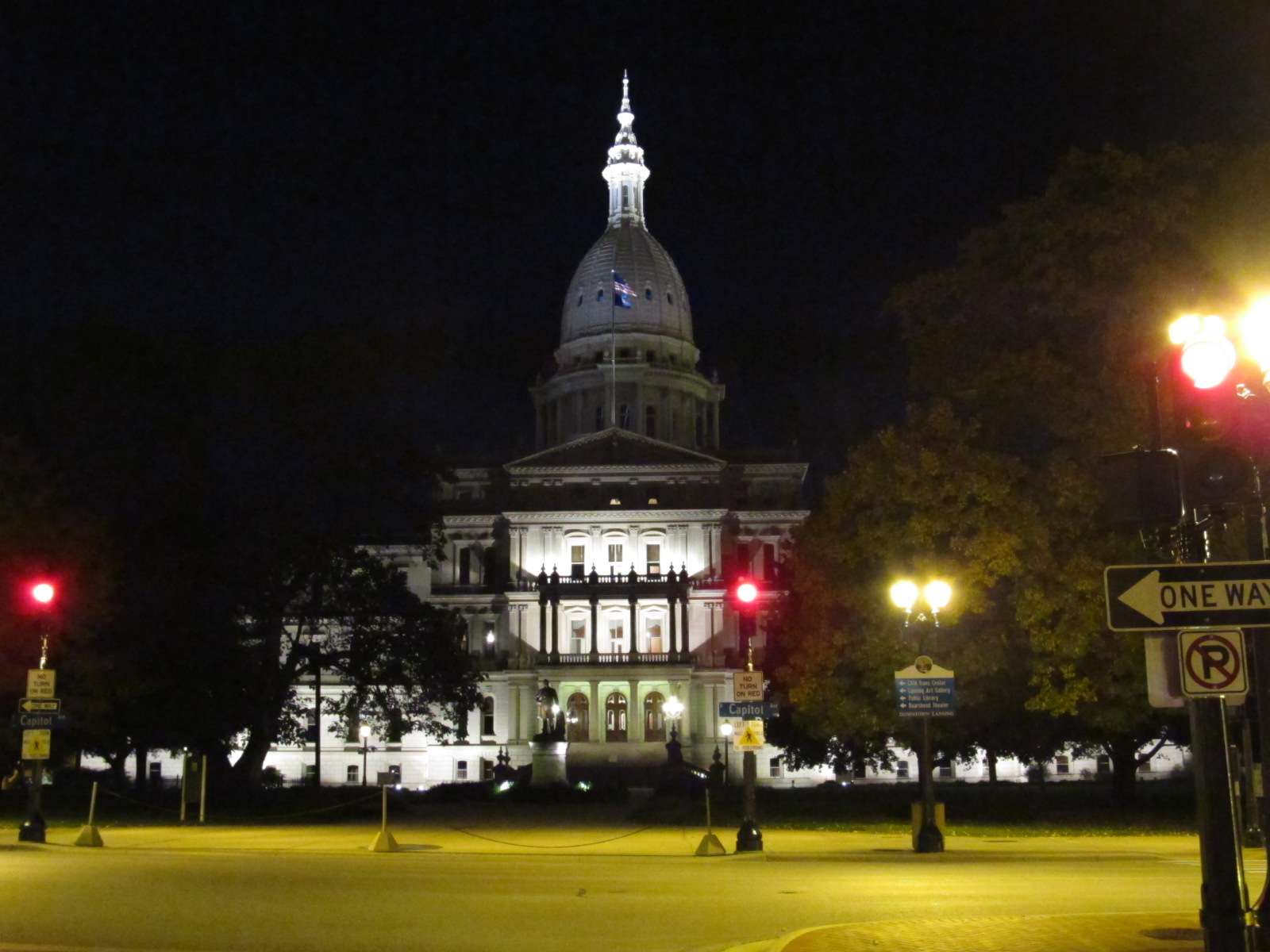
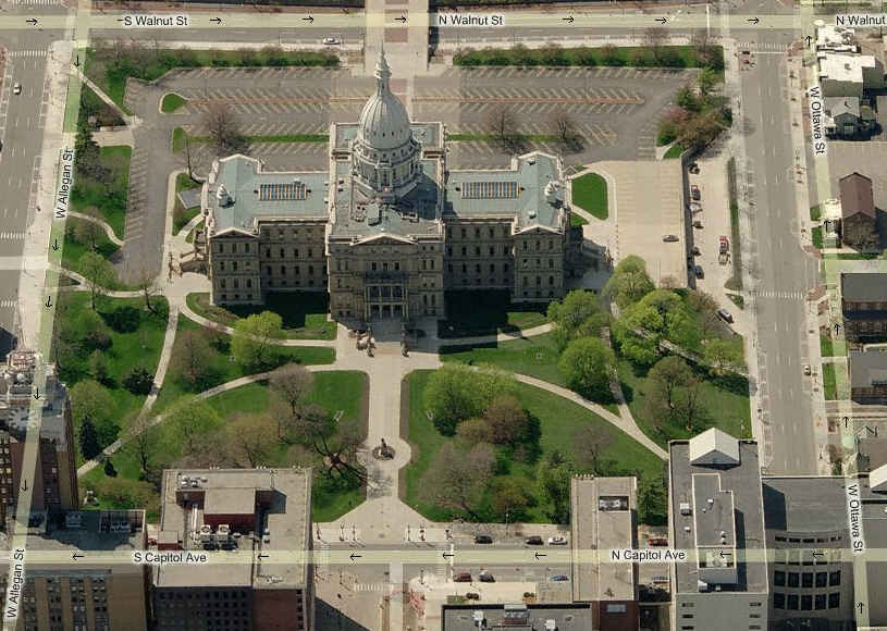
![]() State Capitol Building
State Capitol Building
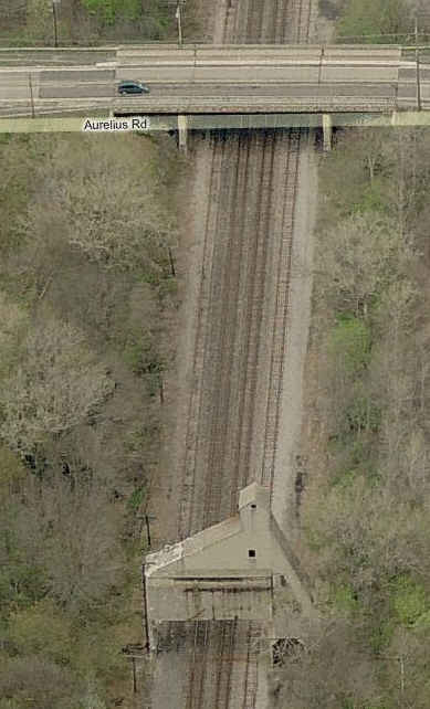
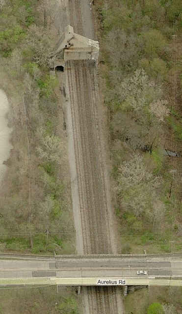
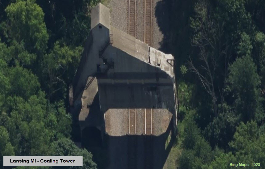
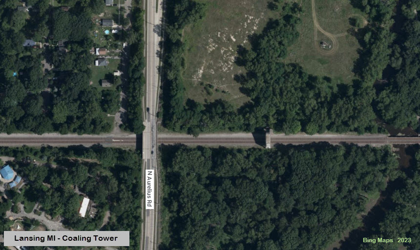
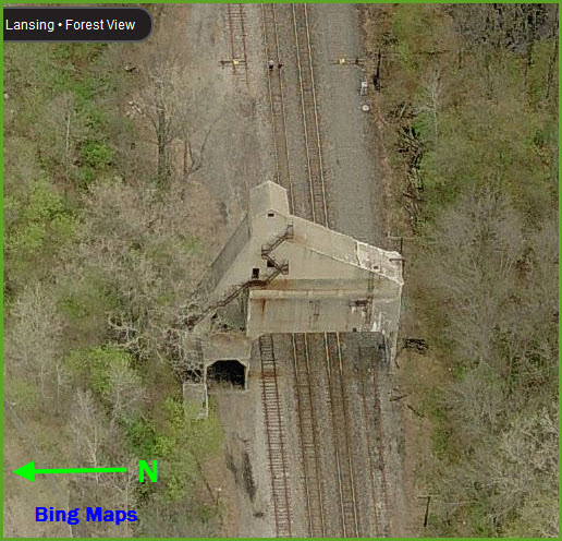
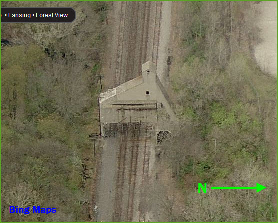
![]() Ex GTW Coaling Tower
Ex GTW Coaling Tower
A "larger than most structure", with at one time, four main
line tracks rolling underneath it. It's on the CN main, just east of Aurelius.
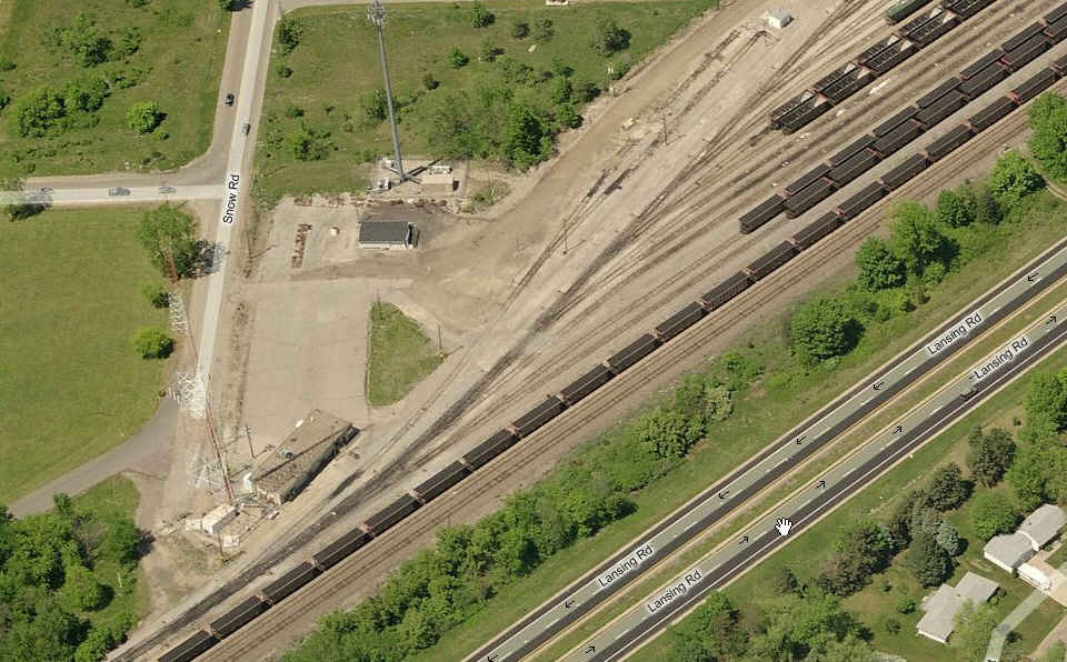
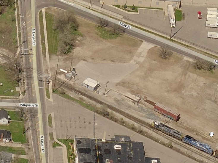
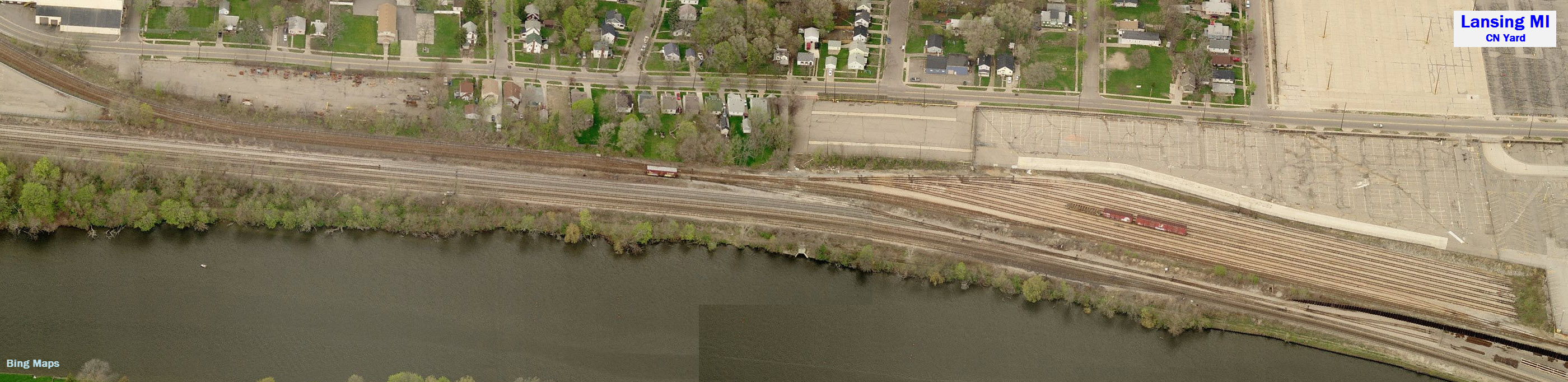
![]() CN Yard
CN Yard
Not sure of the name of this yard - I have seen the name
"Holland Yard" mentioned.... Can anyone help me out here? The picture
is a composite from Bing Maps.
I'm sure there are a whole lot more signals to be found in Lansing, I just didn't
have the time to hunt them down. If you have pictures of them, if you
could please, send them my way.
![]() Colorlight Signals adjacent to Clara's Restaurant
Colorlight Signals adjacent to Clara's Restaurant
A few signal shots from the depot.... first is one
looking south towards an approach signal, showing the split between the CSX
(to the left) and the NS line.... on the right is looking north... Just not
enough time to get pictures of everything.
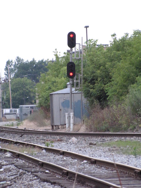
The SB signal and grade crossing gate next to the depot.

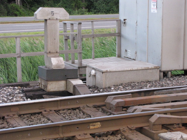
This picture shows a couple of the interlocking signals:
 Looking north from Clara's.
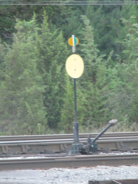
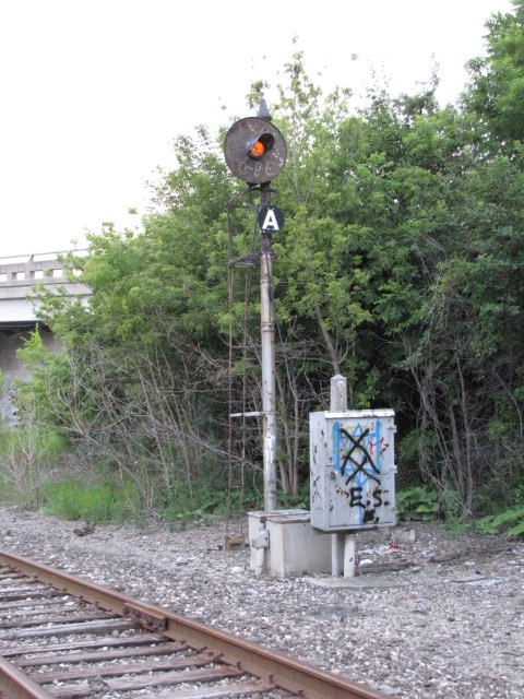
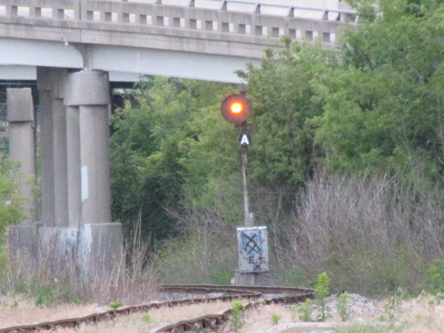
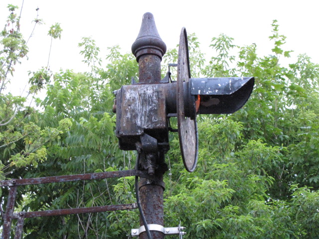
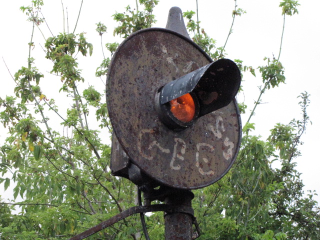
![]() Searchlight south of Clara's
Searchlight south of Clara's
About a half a mile south of Clara's is this lonely approach signal,
we didn't have time to see what the signal was an approach for. Although the
signal is a searchlight and capable of three aspects, my guess is that the
signal is fixed at approach. You can just barely make it out in the
first picture under the depot pix, it's the little spec of light over the
right rail! The right photo is looking back towards the depot from the approach signal,
you can easily see the mainline signal for CSX where the NS joins up with it.
![]() At CN's Lansing Yard
At CN's Lansing Yard
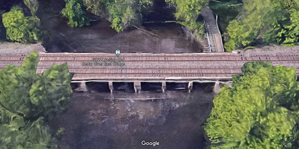
![]() CN over Red Cedar River
CN over Red Cedar River
GPS Coordinates: 42.7192, -84.5184
![]() 222
222
GPS Coordinates:
The
The CN-NS diamond. The track bearing off to the left does not
interchange with the CN, instead, it curves back around as shown on the map
to serve local business'..... Maybe at one time there was an interchange?
An eastbound CN freight slides along the waterfront getting ready to pass under the MLK.

They're not there any more, but at one time, the CN was
using this siding for the storage of older GTW rolling stock.
Bridge on the NS, just south of Hazel St.
The Footpath/trail going under the CN line.
![]()
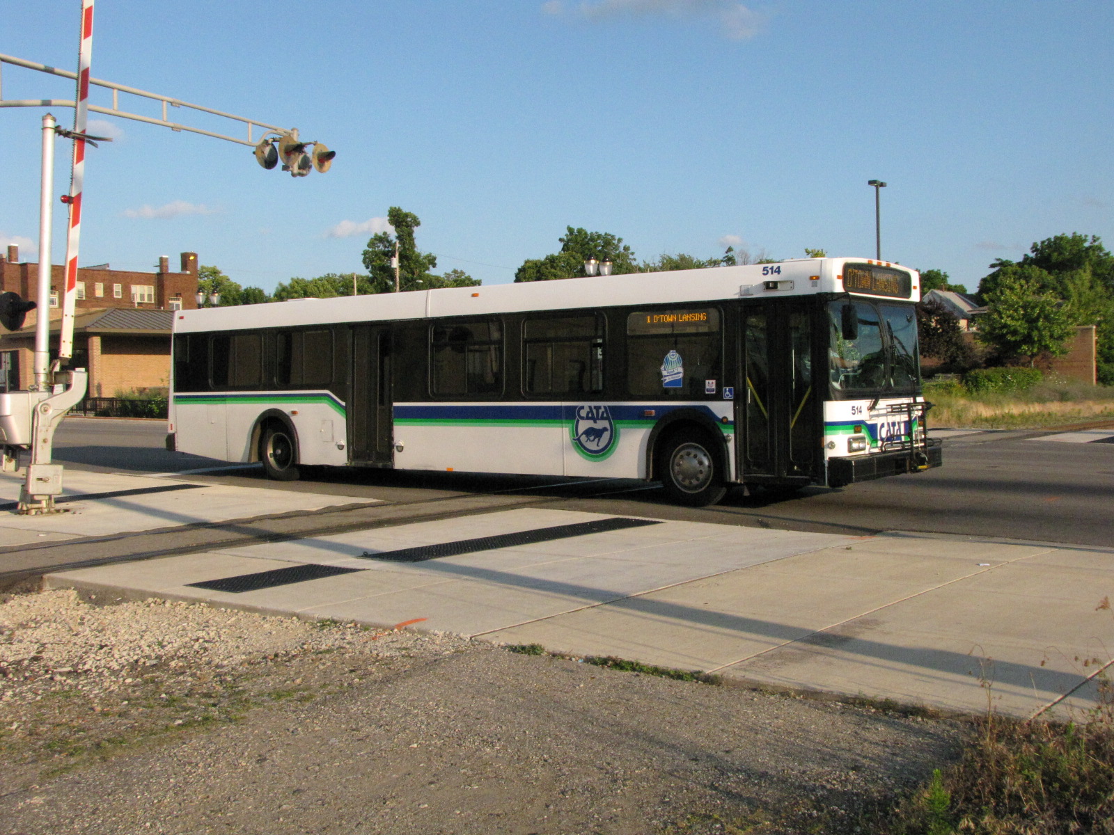
If you're into them, busses pass right in front of Clara's.
When I blew thru town in 2011, one of the electronic billboards was
running this series of "pictures". We have lost a
true genius that has changed the world for the better probably more
than anyone else of our time!! (I know, I'm not suppose to express
my personal opinions :-)


Courtesy USGS, click here for their index page.
Disclaimers:
I love trains, and I love signals. I am not an expert. My webpages reflect what I find on the topic of the page. This is something I have fun with while
trying to help others.
Please Note: Since the main focus of my two websites is railroad signals, the railfan guides are oriented towards the signal fan being able to locate them.
For those of you into the modeling aspect of our hobby, my indexa page has a list of almost everything railroad oriented
I can think of to provide you with at least a few pictures to help you detail your pike.
If this is a railfan page, every effort has been made to make sure that the information contained on this map and in this railfan guide is correct. Once in a while,
an error may creep in :-)
My philosophy: Pictures and maps are worth a thousand words, especially for railfanning. Text descriptions only get you so far, especially if you get lost or
disoriented. Take along good maps.... a GPS is OK to get somewhere, but maps are still better if you get lost! I belong to AAA, which allows you to get
local maps for free when you visit the local branches. ADC puts out a nice series of county maps for the Washington DC area, but their state maps do not have the
railroads on them. If you can find em, I like the National Geographic map book of the U.S..... good, clear, and concise graphics, and they do a really good job
of showing you where tourist type attractions are, although they too lack the railroads. Other notes about specific areas will show up on that page if known.
Aerial shots were taken from either Google or Bing Maps as noted. Screen captures are made
with Snagit, a Techsmith product... a great tool if you have never used it!
By the way, floobydust is a term I picked up 30-40 years ago from a National Semiconductor data book, and means miscellaneous
and/or other stuff.
Pictures and additional information is always needed if anyone feels inclined to take 'em, send 'em, and share 'em, or if you have something to add or correct.... credit
is always given! Please be NICE!!! Contact info is here
Beware: If used as a source, ANYTHING from Wikipedia must be treated as being possibly inaccurate, wrong, or not true.
MICHIGAN GUIDE HOME
RAILFAN GUIDES HOME
RAILROAD SIGNALS HOME
NEW JUL07/2009, AUG08/2015, FEB07/08/2023
Last Modified 08-Feb-2023