
In General
Getting Here
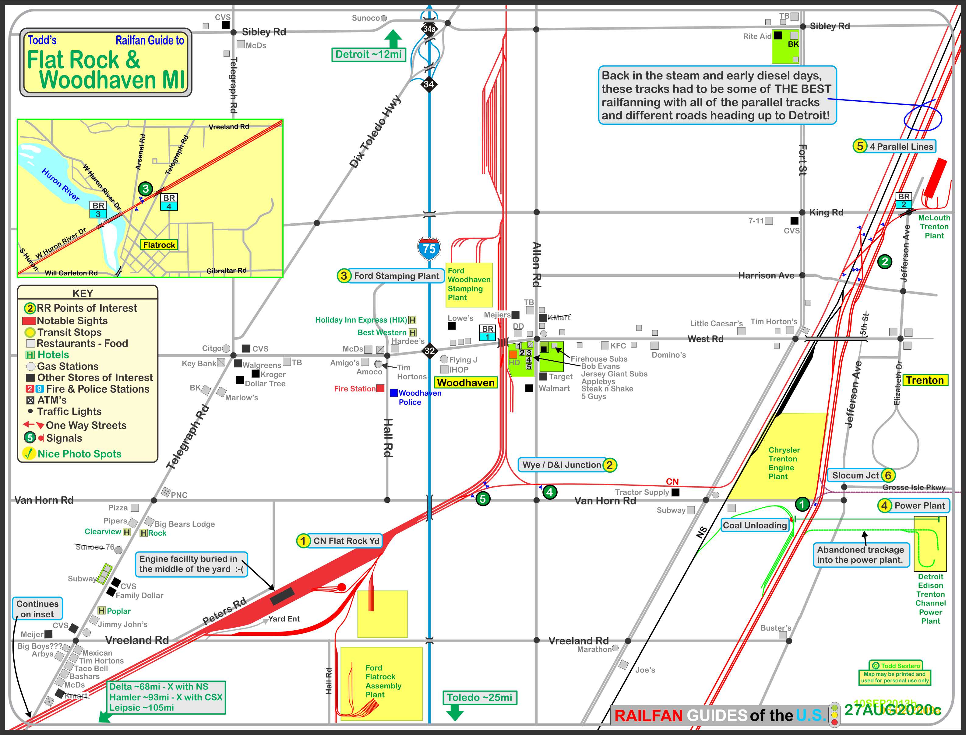
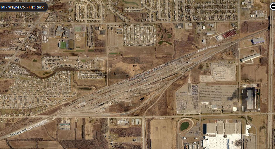
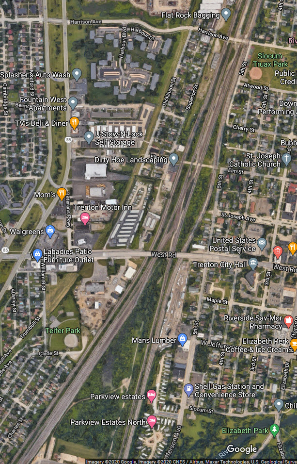
Map
Sights
Signals
Fire & Police
Floobydust
USGS Maps
RAILFAN GUIDES HOME
RAILROAD SIGNALS HOME
Location / Name:
Flatrock / Woodhaven MI, Wayne County
What's Here:
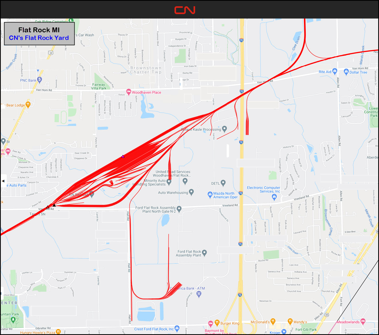
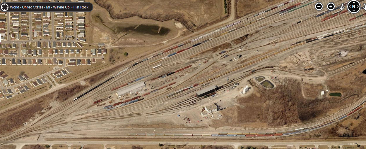
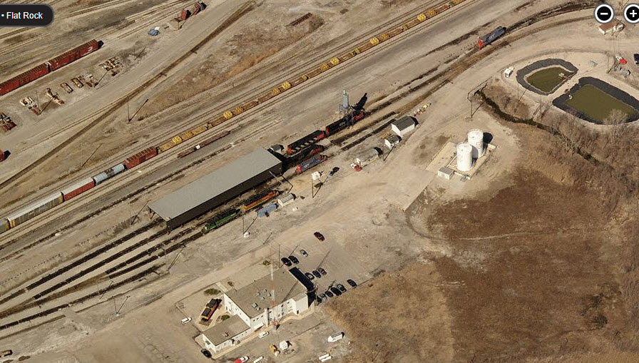
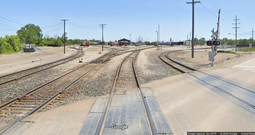
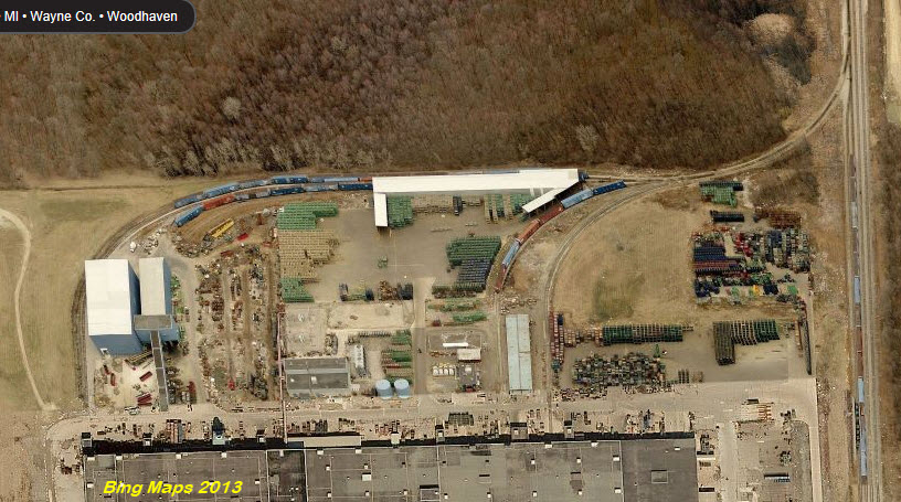
CN's Flatrock Yard
Lot's of switching at the auto plants
Switching at the Detroit Edison Power Plant Coal Yard
Data:
GPS Coordinates: as needed
Phone A/C: 734
ZIP: 48134
Access by train/transit:
None
The Scoop:
Well, when you think there isn't all that much to do or see in a certain area, like here in Flatrock where the main attraction is the CN yard, you start going around on the maps to see about signals, cool and different grade crossings, bridges, overpasses, abandoned tracks, etc; and you "discover" all sorts of neat things, if you are so inclined to railfan everything.
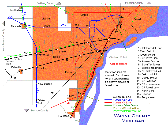
If you're into mainline railfanning, you have four sets of tracks that parallel each other coming up from the south and heading into Detroit by NS's River Rouge yard in addition to what goes in and out of the Flatrock yard.
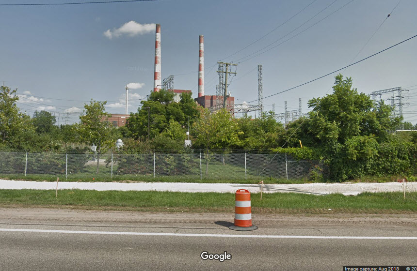
If you are railfanning the parallel tracks, you might be able to catch something working the various sidings, or the Trenton Power Plant coal yard.
Acknowledgements:
John Bjorklund
Denver Todd
Websites and other additional information sources of interest for the area:
https://www.trentonhistoricalsociety.org/farmerhistory.html
http://www.michiganrailroads.com/timetables-routes/333-michigan-central-railroad-timetables/5001-time-table-mcrr-bridge-division
https://www.crainsdetroit.com/transportation/39-million-secured-separate-allen-road-woodhaven-railroad-crossing
https://en.wikipedia.org/wiki/Flat_Rock_Dam_(Michigan)
One of the larger yards in the -Detroit area- is CN's Flat Rock Yard (it's way south, so it may not really count as being in the Detroit area, but if you're coming from 100 miles away, well....). There is plenty of action around, even though you do not have access to the inner workings of the yard.
Getting here is easy, via I-75.
Running parallel to Fort Ave are several lines running north-south between Toledo and Detroit, and back in the "old" days, I betcha there was almost non-stop railroading and railfanning along the stretch where these lines ran parallel!
The best exit to take for southbounders is exit 32, West Road. Head west to Hall Road and hang a left. Going this way will take you past the fire station. When you reach Van Horne, take a right, and go almost a mile to Peters Road on your left and take that. Peters Road will bring you along the side of the yard down to Vreeland Road.
If you're coming up from Toledo, take exit 29, Gibraltar Road west to (~ 1 mile) Hall Road and take a right. You will be facing the southern side of the yard when you hit Vreeland Road.
The above map in a PDF
Above map comes from: https://cnebusiness.geomapguide.ca/
The above map was found here
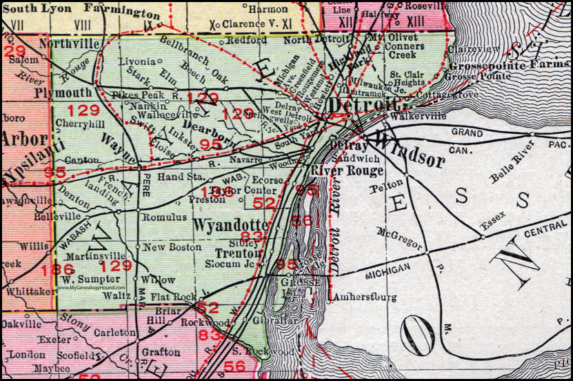
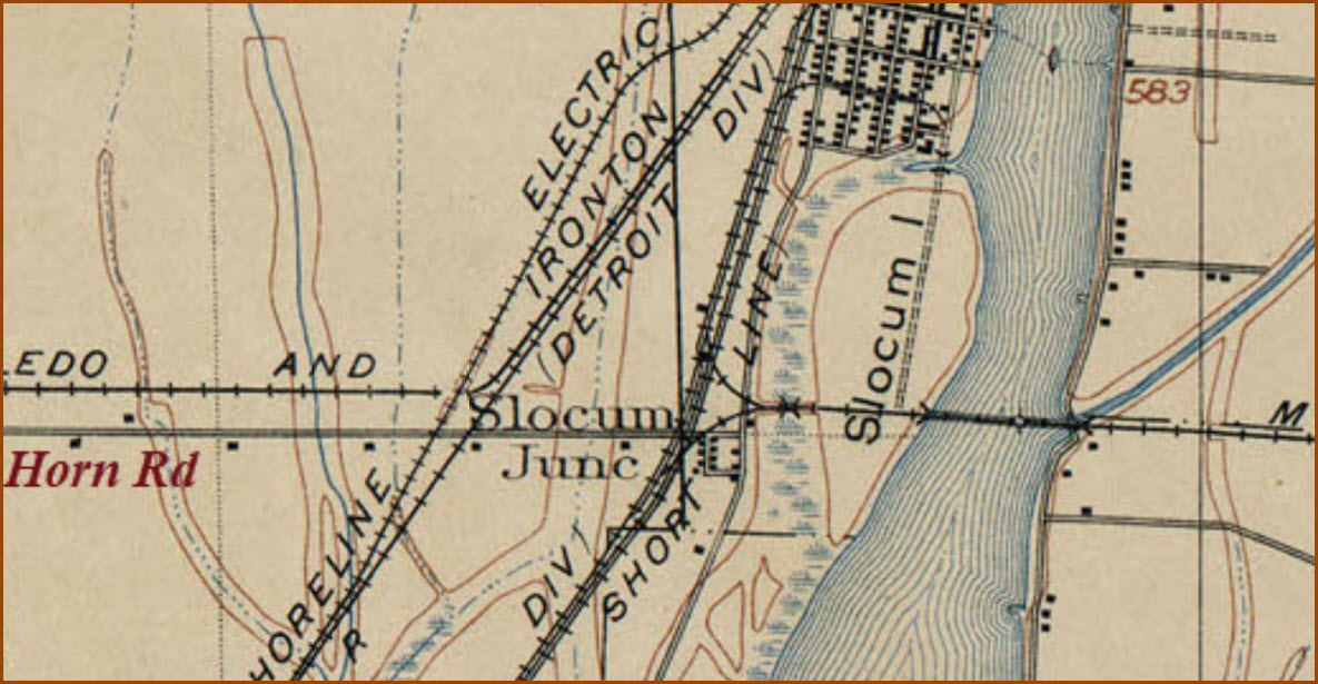
Part of a Rand McNally map from 1911:
Sights
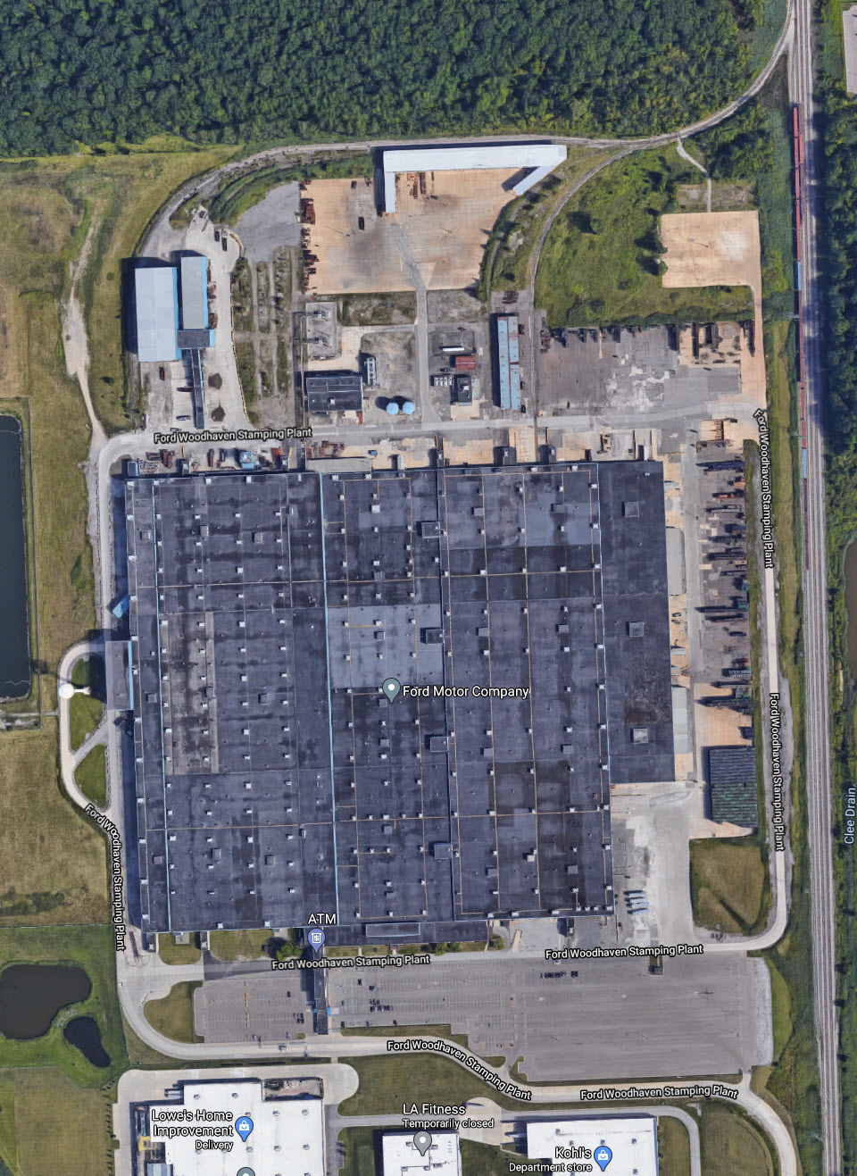
CN Flat Rock Yard
Wye / D&I Junction
Ford Stamping Plant
Detroit Edison Trenton Channel Power Plant
4 Parallel Tracks
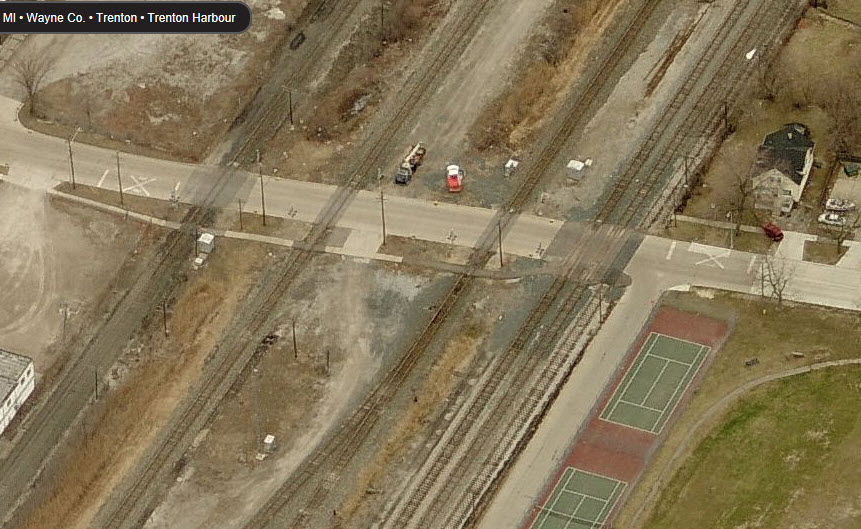
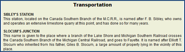
Slocum Junction

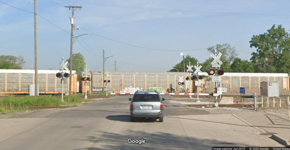
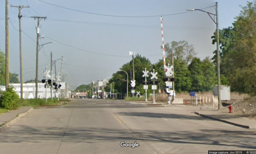
 Vreeland Rd looking north
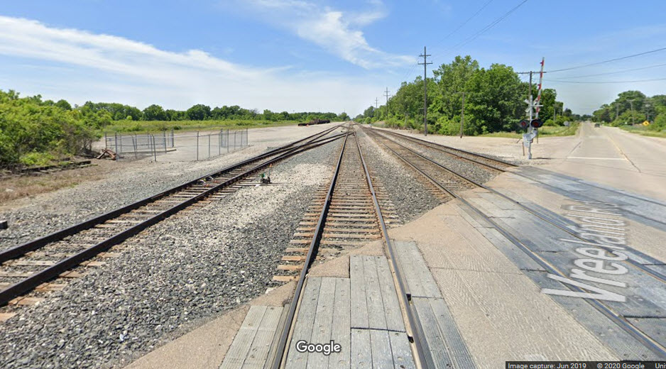 Vreeland Rd looking south
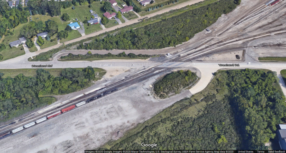 Vreeland Rd yard entrance
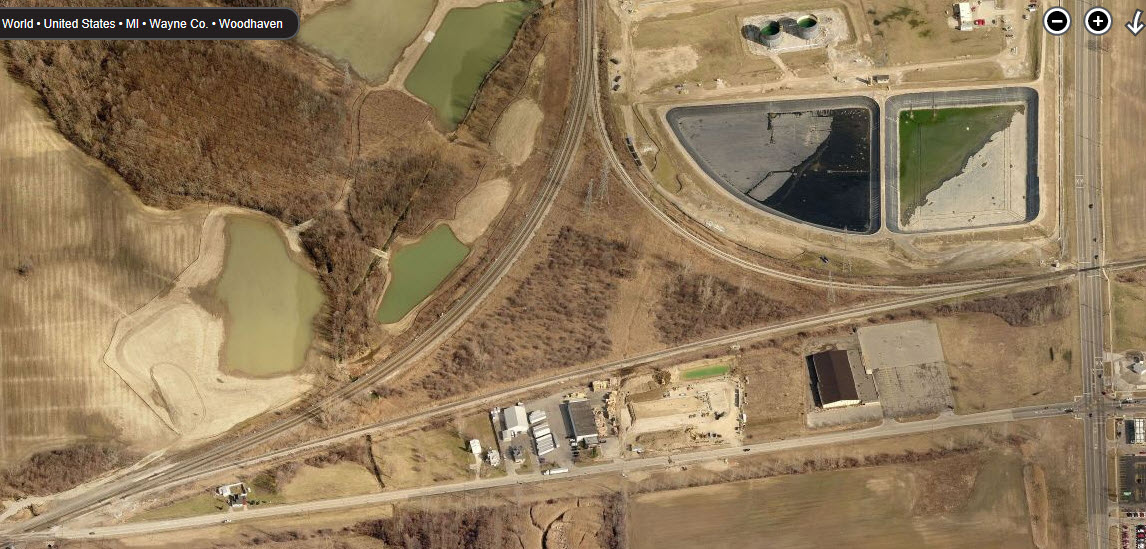

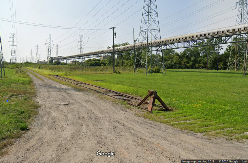
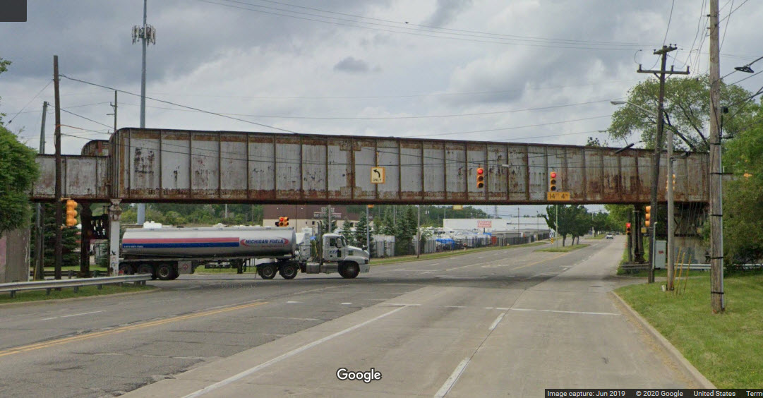
The tracks that used to lead into the power plant now come to end before crossing Jefferson Ave.
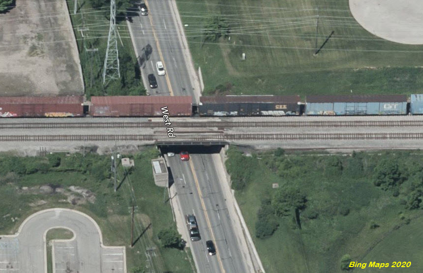
One of the more interesting facets of railroading in the Detroit area is in the Woodhaven area, where there are four sets of tracks coming into town, all parallel to each other, and within 200 feet of each other. During the vintage years of the 40's, 50's and 60's, this must have been an exciting time - Think of how many trains each railroad used to have, and the variety of colors you would see - wow! I imagine there were times when you couldn't get across the grade crossings for 10's of minutes, at least. I would love to find some pictures from this area, if anyone knows of any, maybe you could email me! :-) Thanks.
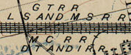
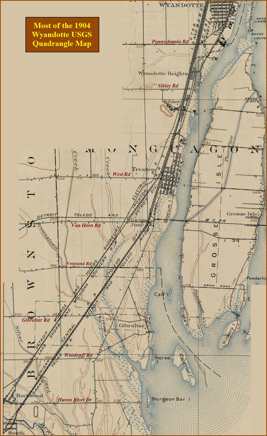
In 1904, the four railroads running thru here were the:
Detroit, Toledo & Ironton RR
Grand Trunk RR
Lake Shore & Michigan Southern RR
Michigan Central RR
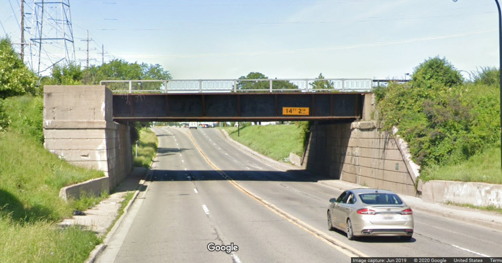
Below West Rd, the tracks spread out, into 2 sets of two.
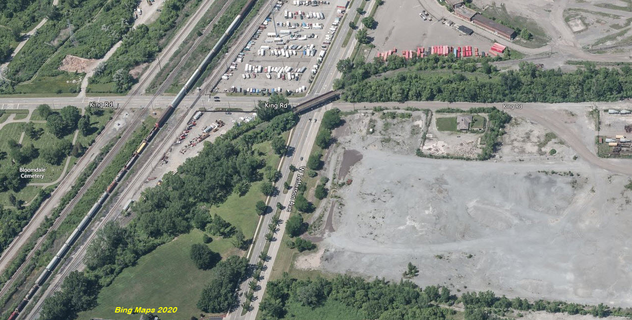
Between West and Visger Roads, it is a straight run of about 8.4 miles, except a small bend at King Rd.
Visger Road is the south end NS's River Rouge Yard.
There are plenty of photo ops, as you have grade crossings at (starting on the north end):
Visger Rd
Saliotte Rd
-West Outer Dr- no, they go over
One of the tracks splits off, we now have 3 tracks going north from here
-Southfield St- nope, the tracks go over Southfield
Mill St
Emmons Blvd
St John St
Goddard Rd
Antoine St
Northline Rd/Ford Ave
Vinewood St
Oak St
-Eureka Rd- no, the railroads go over Eureka
Pennsylvania Rd
Sibley Rd
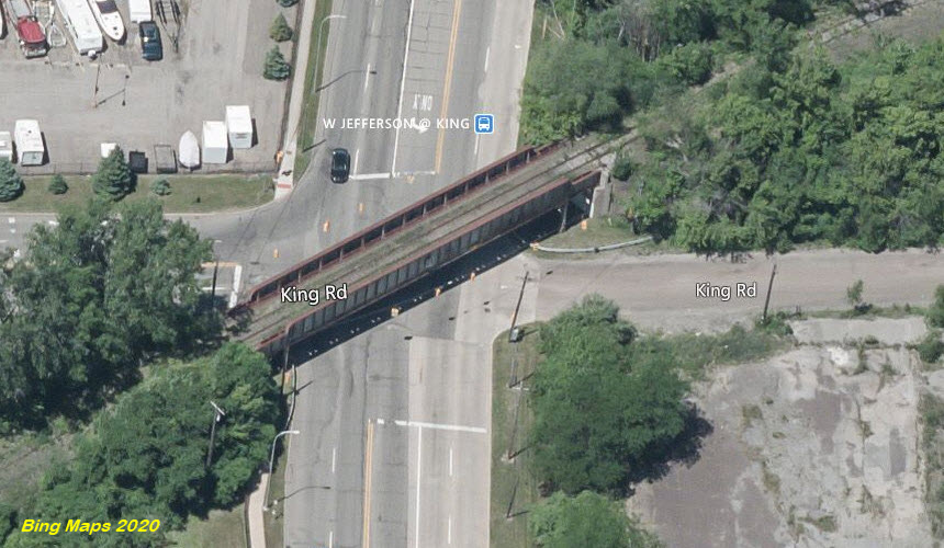
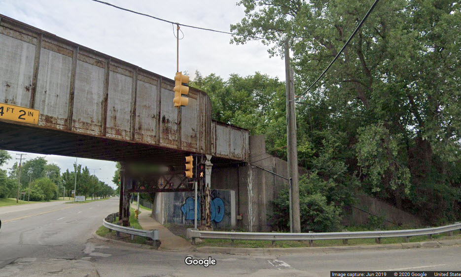
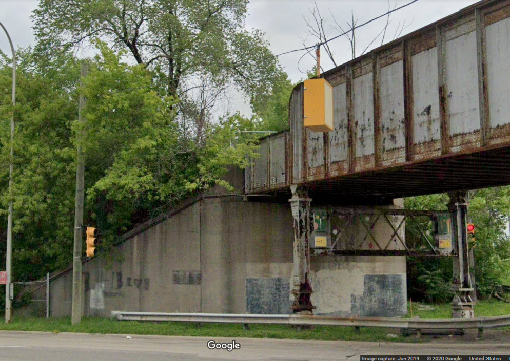
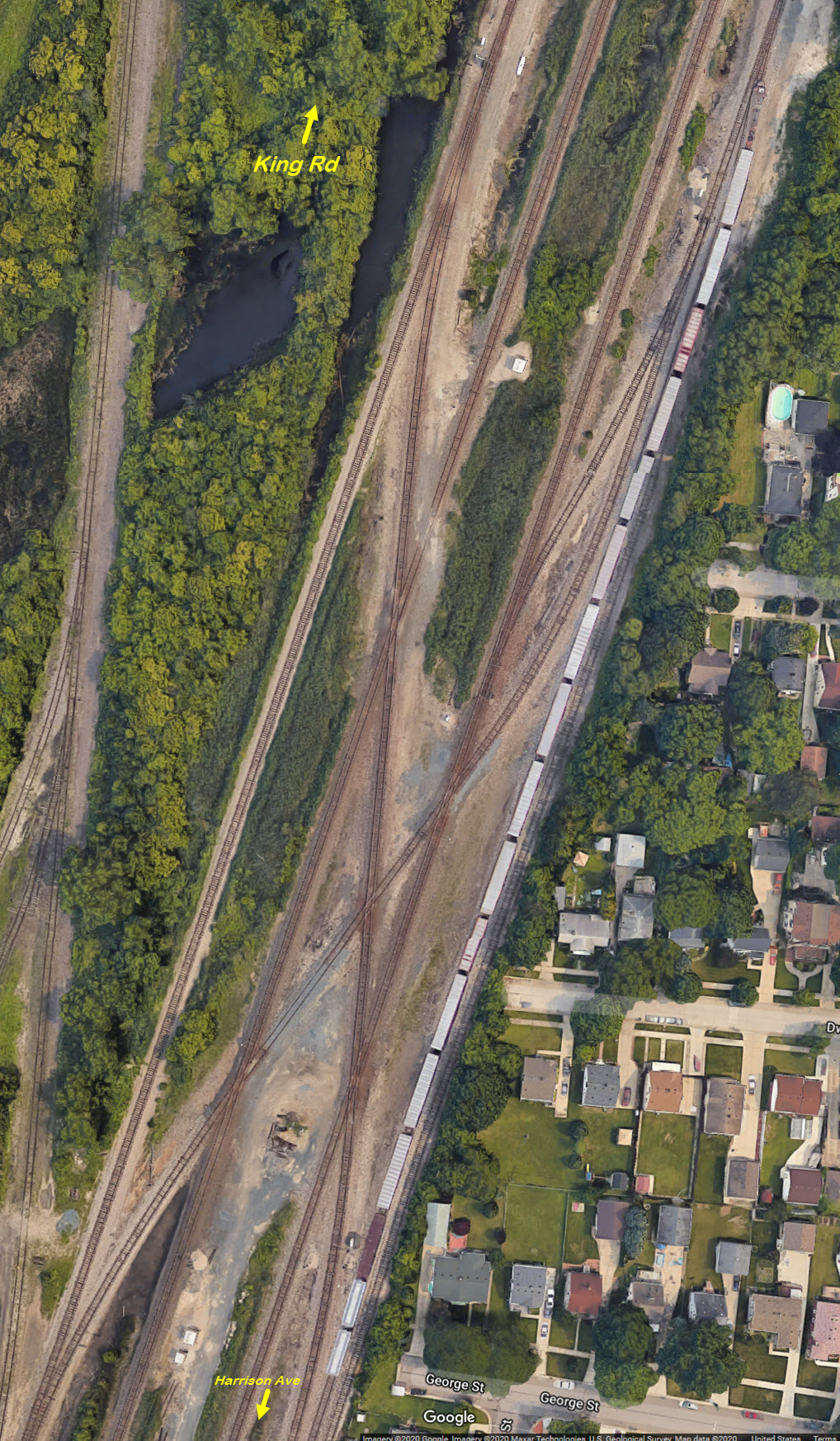
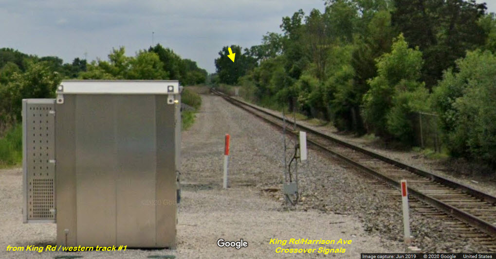
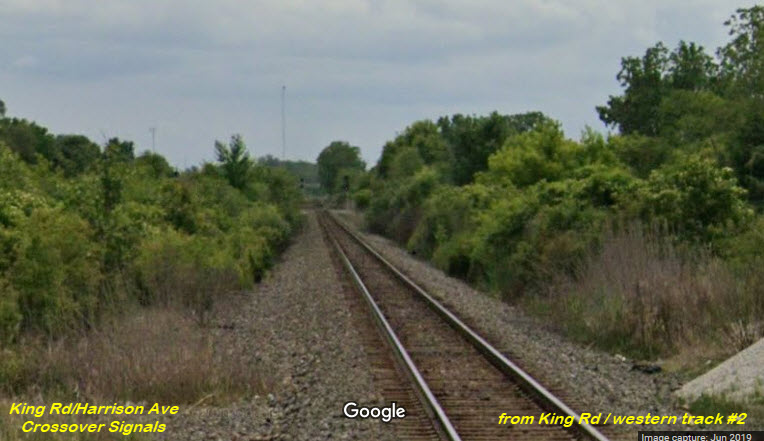
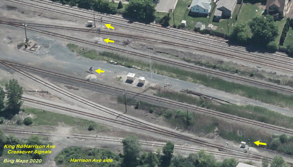
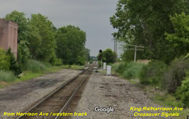
King Rd
Harrison Rd
This is at Visger Rd, where the parallel run "starts":
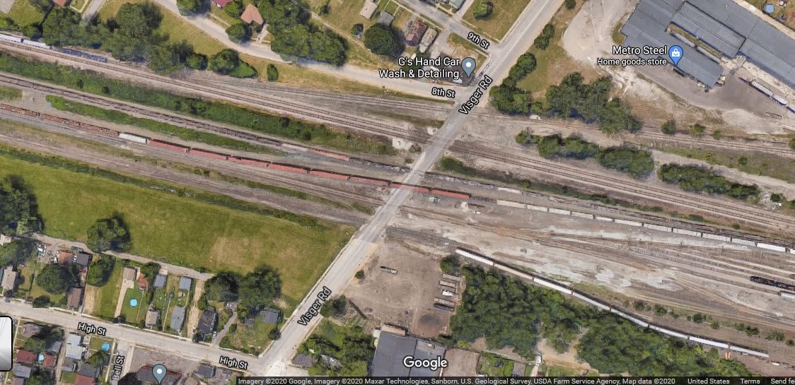
Between Harrison and King, there is a "huge" crossover between the two "outside" tracks.
Only know about this point because it shows up on the Wyandotte quadrangle map. Does anyone know when it was removed? It is so old, it doesn't even show up on the Open Railway map.
It was a Michigan Central branch, used to access a ferry going across the river to Canada prior to the tunnel being built.
In looking at the 1904 map, and aerial views, it's possible that they may have used the railroad right-of-way as the original bridge for auto use over to the island when trains stopped using it sometime after the 1910 opening of the Detroit-Windsor Tunnel. The swing span might even still be the original, but this is conjecture.


GPS Coordinates: 42.140054, -83.231410
 looking west
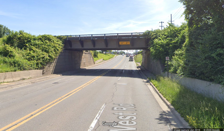 looking east
GPS Coordinates: 42.156043, -83.175117
This is an industrial siding into what looks like a small steel mill, the line comes off the eastern most CN line.

GPS Coordinates: 42.099786, -83.295772
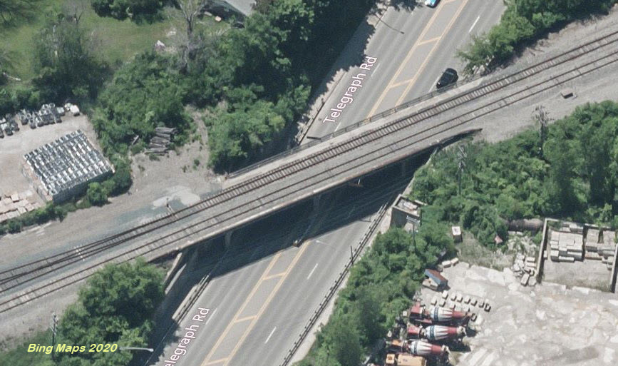
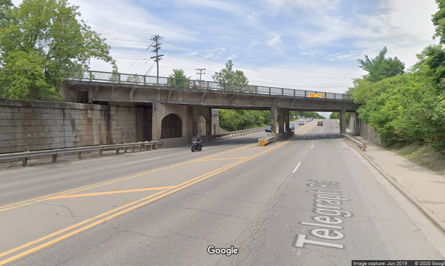
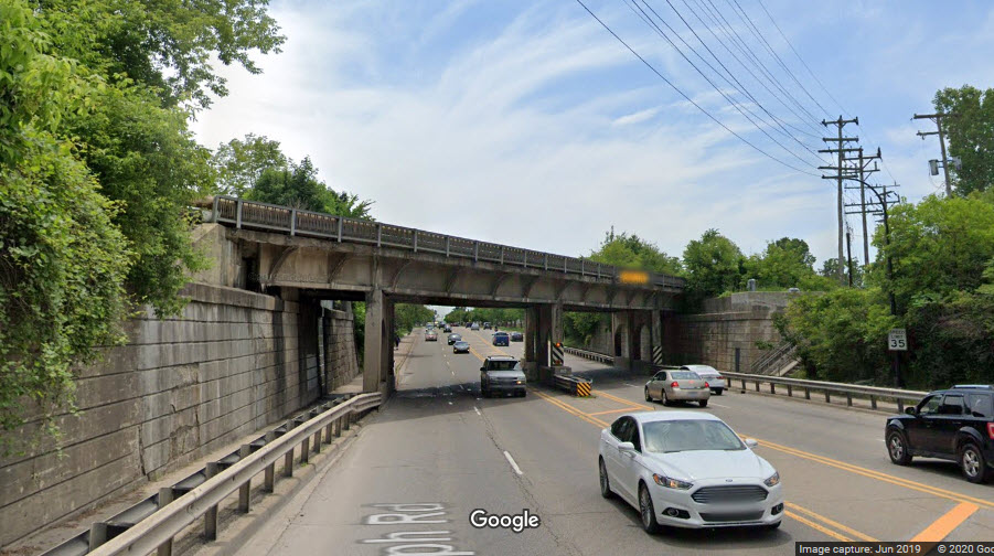
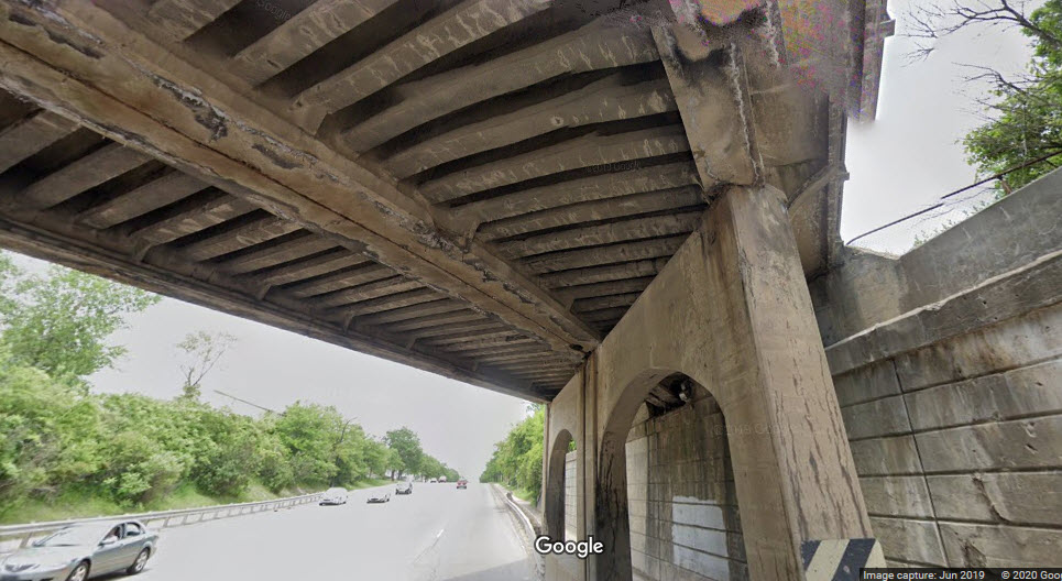
Interesting dual use bridge over the Huron River, it has a long section, and a short section. It seems that the bridge is also part of a dam for an old generating plant for Ford, supplying power to a light bulb plant that was in operation from the 1924 until 1950. I can't quite tell yet, from the sources I have come across, as to whether or not the railroad bridge is actually physically part of the dam, or attached to the dam structure. I wonder if the building is still set up as a generating plant, and if so, would make an interesting tour!
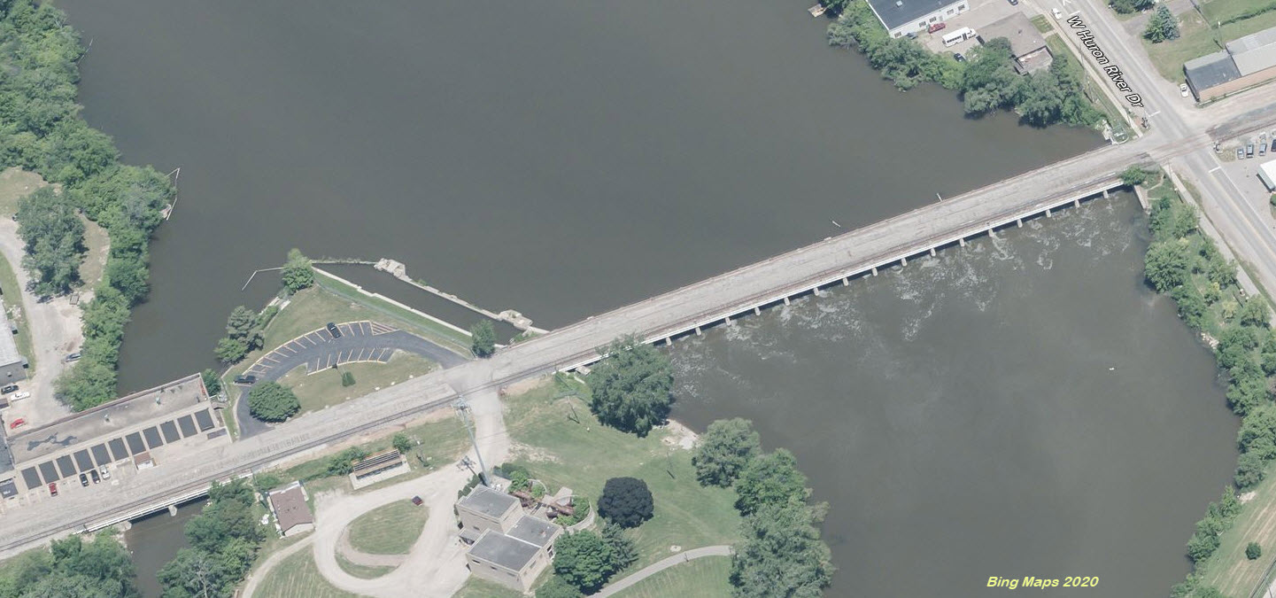
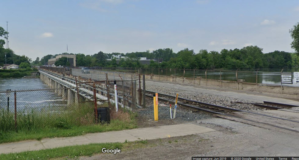
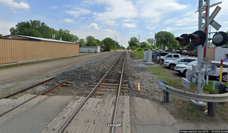
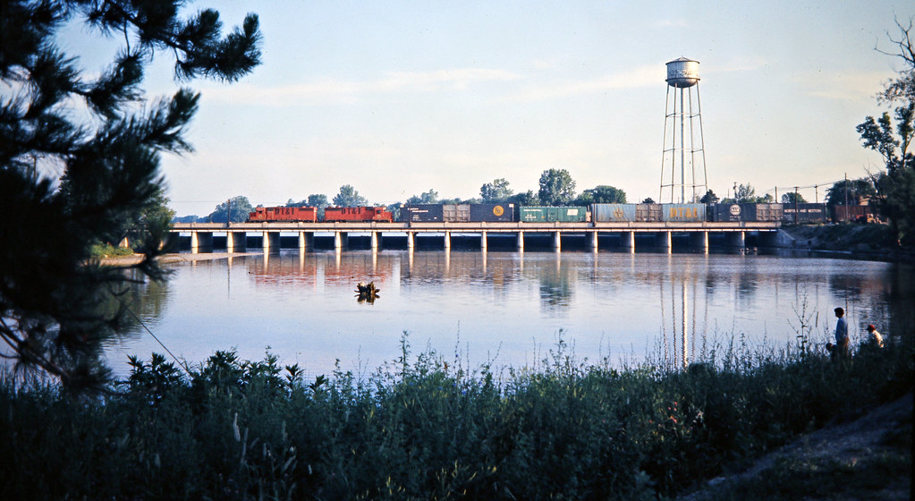 photo by John Bjorklund, 1973
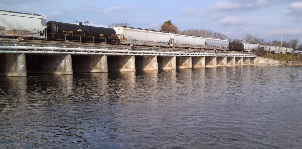
GPS Coordinates: 42.102366, -83.289784
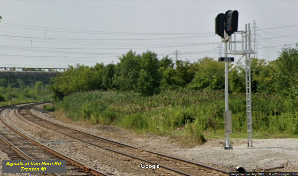
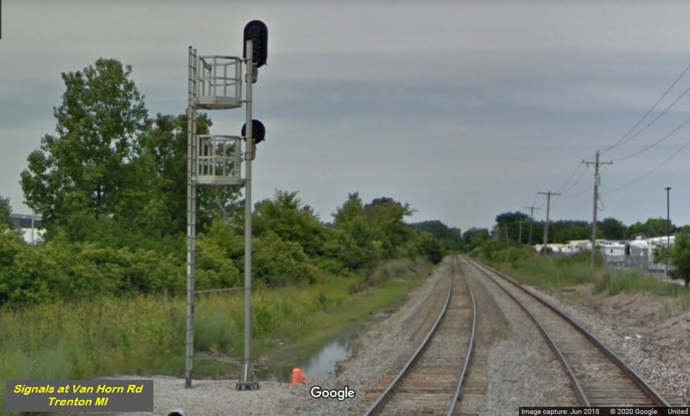
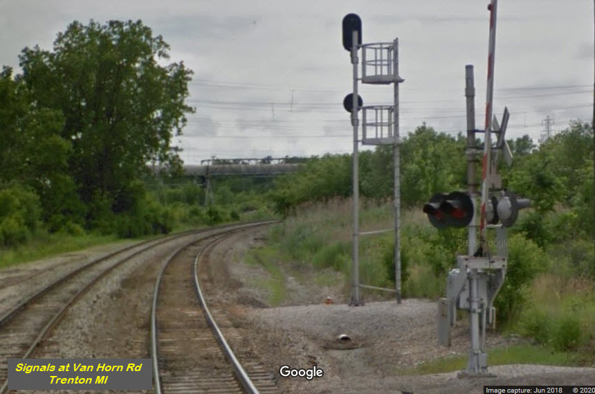
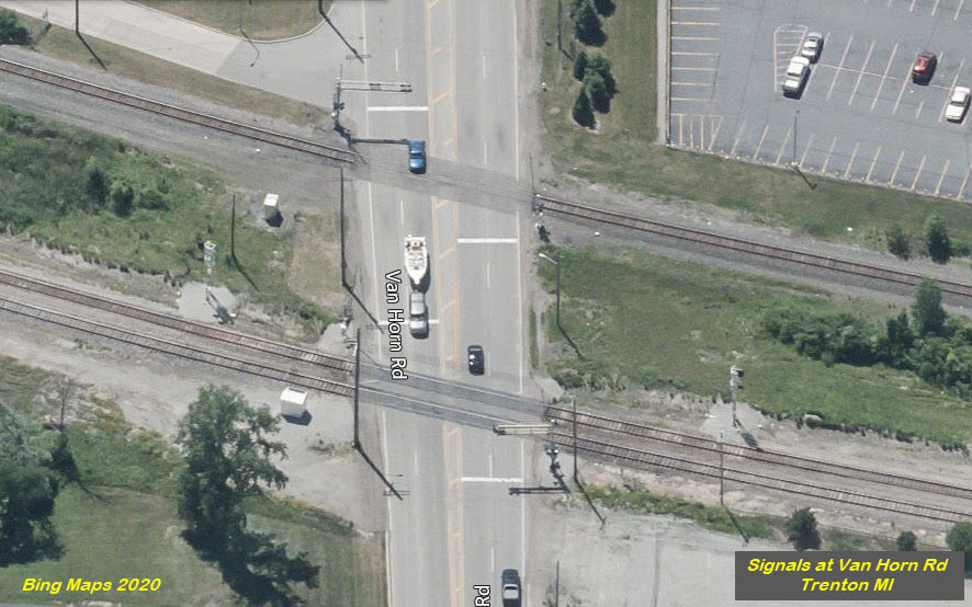
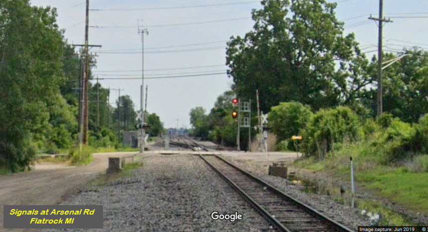
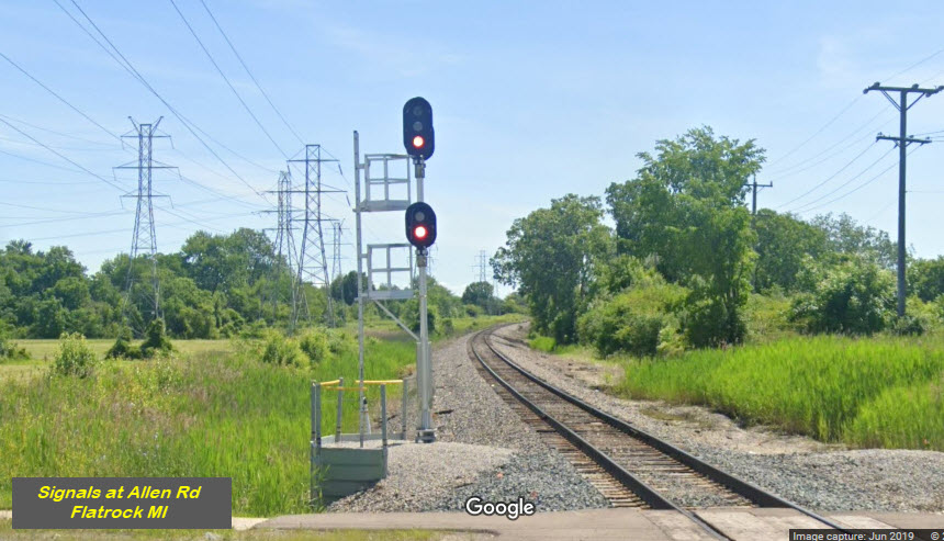
I didn't notice many signals in the area when I was here, but in sneaking around on Google Streetview I came across a few.
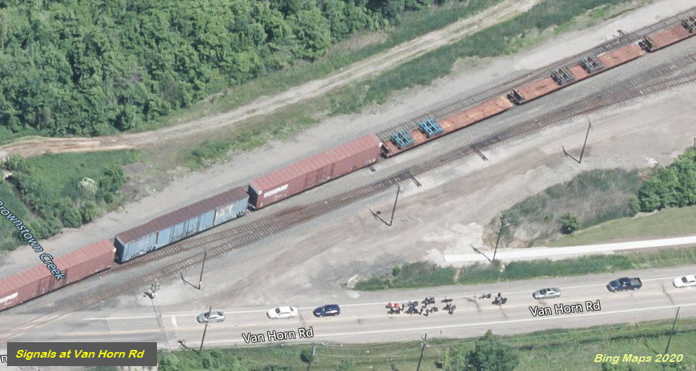
If we go by the date stamp on the Google Streetview (2018), the signal was upgraded from a separate signal location for the NB and SB signal, one on each side of Van Horn Rd, to a single location on the south side.

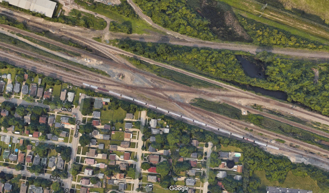
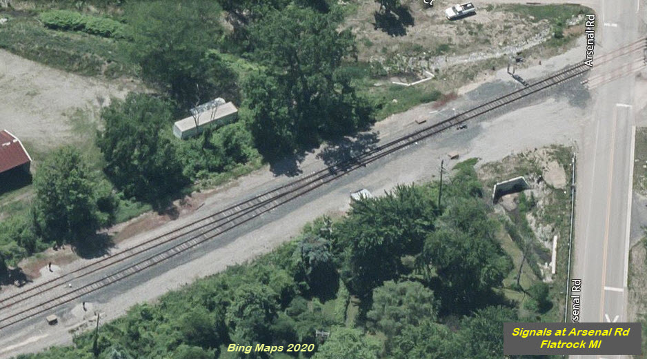
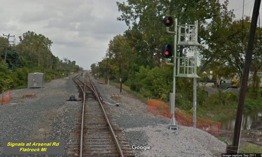
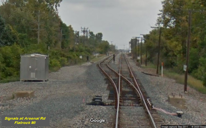
This "large" crossover is between the two outside sets of tracks, crossing over the inside two sets of tracks, creating a complex array of diamonds - five in total. All four tracks are signaled for the interlocking.
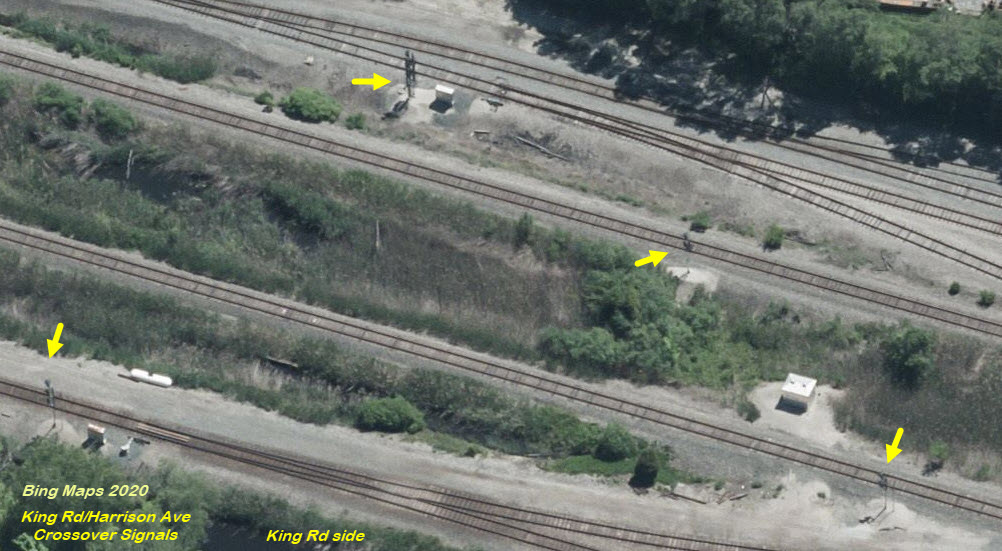
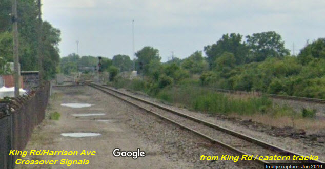
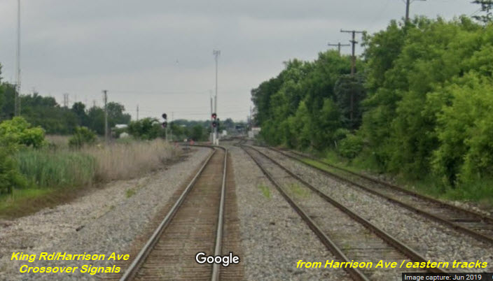
Here we have a high signal for trains going "north", and dwarf signals for trains coming out of the yard heading "south".
It appears that this signal is a relative newcomer, being that it nor the PTC equipment is not in the Bing aerial view. All three legs of the junction are signaled, however, the two WB signals are single head sgnals.

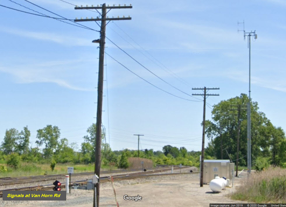
GPS Coordinates: 42.137382, -83.246896
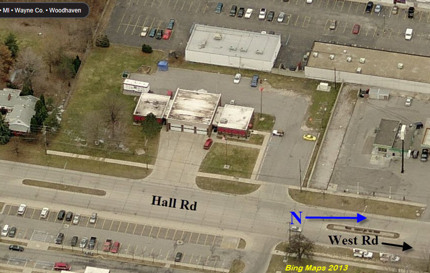
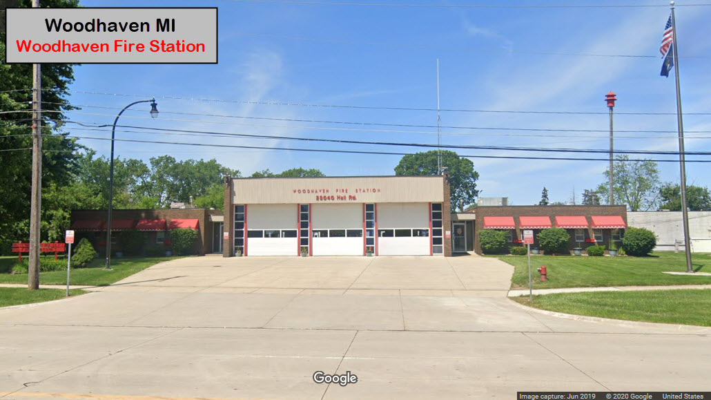
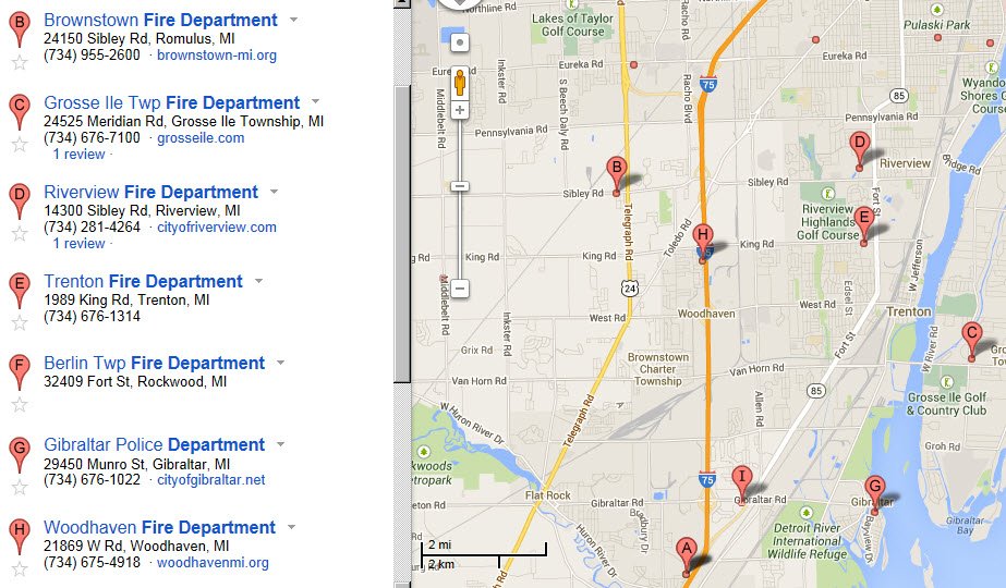
This Google map shows you where the fire stations are in the area, altho the one on Hall Road is not listed.
GPS Coordinates: 42.137210, -83.245649
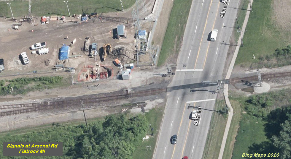
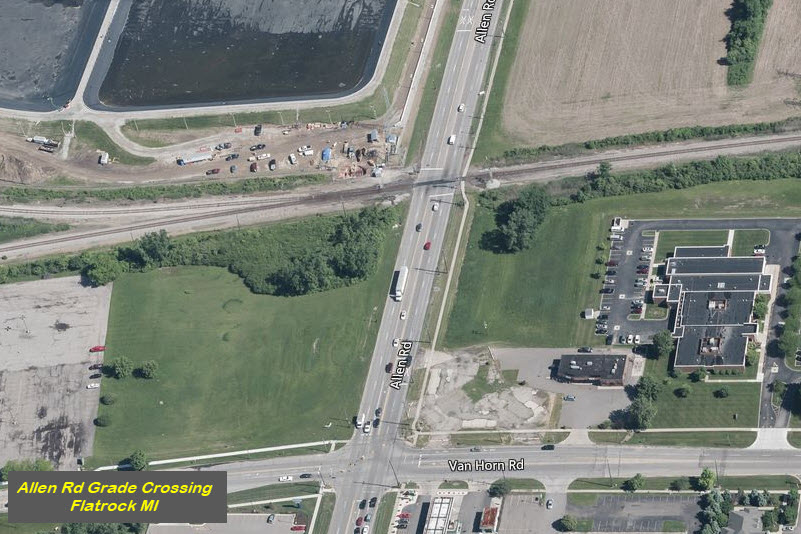
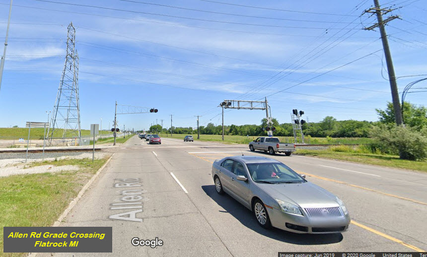
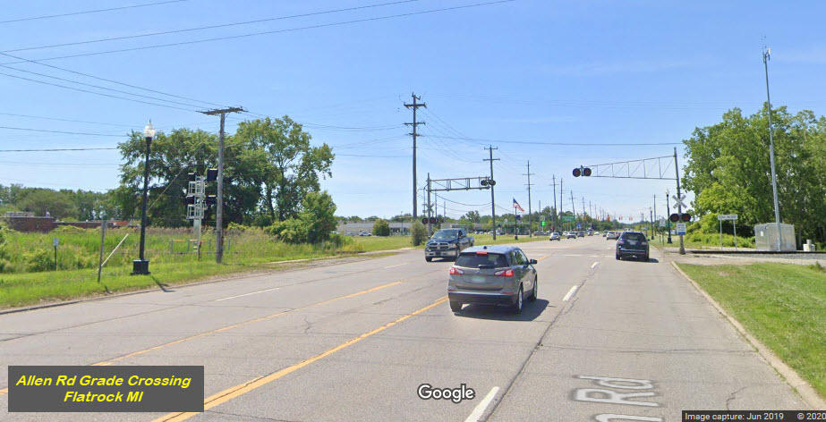
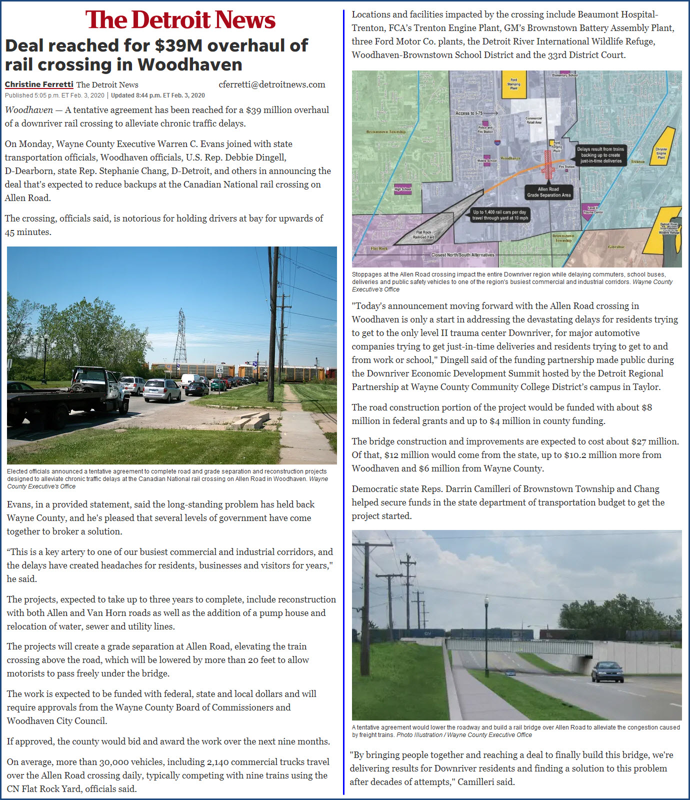
Allen Rd Grade Crossing
I included the Allen Rd grade crossing in here, because there is talk about wanting to do a grade separation project by lowering the road, and putting the railroad on a bridge over Allen Rd. Some work would also be done to Van Horn Road, but lowering it too, does not seem to be part of the project at this time.
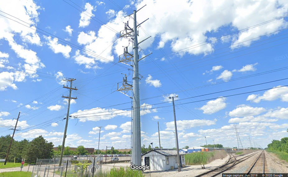
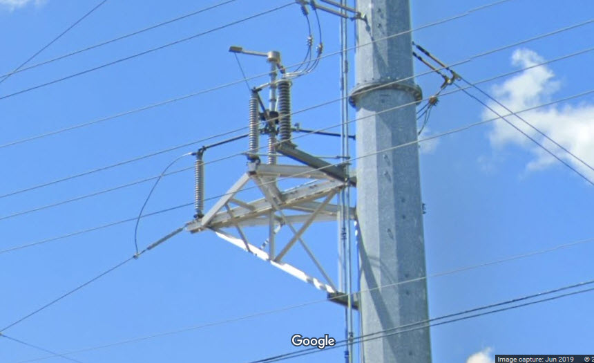
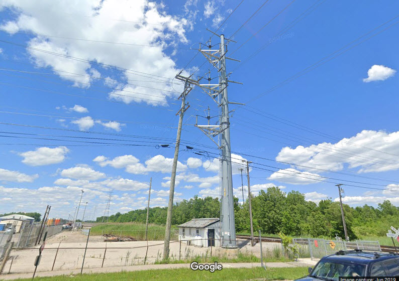
Interesting Hi-Tension Pole
As I was looking around for signals, I came across this pole and thought it was interesting because of the 90 degree takeoff to go into a small substation.
Courtesy of the University of Texas Library, click here for their index page.
Disclaimers:
I love trains, and I love signals. I am not an expert. My webpages reflect what I find on the topic of the page. This is something I have fun with while trying to help others.
Please Note: Since the main focus of my two websites is railroad signals, the railfan guides are oriented towards the signal fan being able to locate them. For those of you into the modeling aspect of our hobby, my indexa page has a list of almost everything railroad oriented I can think of to provide you with at least a few pictures to help you detail your pike.
If this is a railfan page, every effort has been made to make sure that the information contained on this map and in this railfan guide is correct. Once in a while, an error may creep in :-)
My philosophy: Pictures and maps are worth a thousand words, especially for railfanning. Text descriptions only get you so far, especially if you get lost or disoriented. Take along good maps.... a GPS is OK to get somewhere, but maps are still better if you get lost! I belong to AAA, which allows you to get local maps for free when you visit the local branches. ADC puts out a nice series of county maps for the Washington DC area, but their state maps do not have the railroads on them. If you can find em, I like the National Geographic map book of the U.S..... good, clear, and concise graphics, and they do a really good job of showing you where tourist type attractions are, although they too lack the railroads. Other notes about specific areas will show up on that page if known.
Aerial shots were taken from either Google or Bing Maps as noted. Screen captures are made with Snagit, a Techsmith product... a great tool if you have never used it!
By the way, floobydust is a term I picked up 30-40 years ago from a National Semiconductor data book, and means miscellaneous and/or other stuff.
Pictures and additional information is always needed if anyone feels inclined to take 'em, send 'em, and share 'em, or if you have something to add or correct.... credit is always given! Please be NICE!!! Contact info is here
Beware: If used as a source, ANYTHING from Wikipedia must be treated as being possibly inaccurate, wrong, or not true.
MICHIGAN RAILFAN GUIDE HOME
RAILFAN GUIDES HOME
RAILROAD SIGNALS HOME
NEW
SEP09/2013, AUG27-31/2020
Last Modified
02-Sep-2020