RAILFAN GUIDES of the U.S.
Todd's Railfan Guide to
DETROIT MI
The Train Stations of
In General
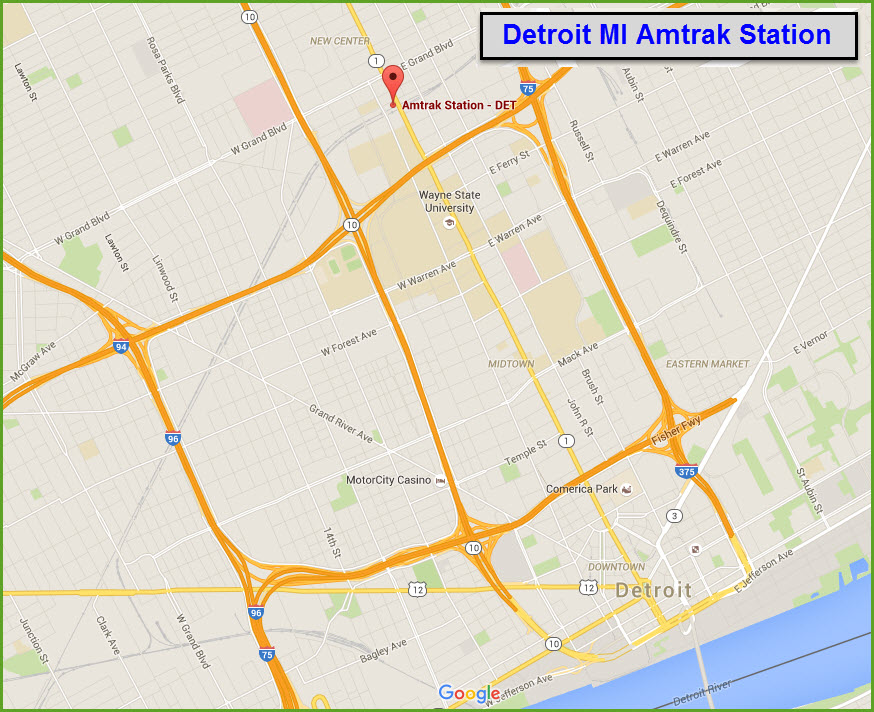
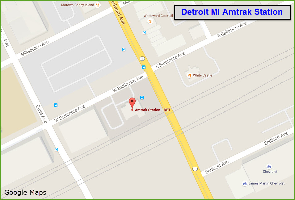
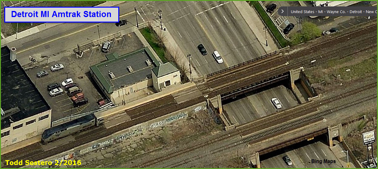
Detroit
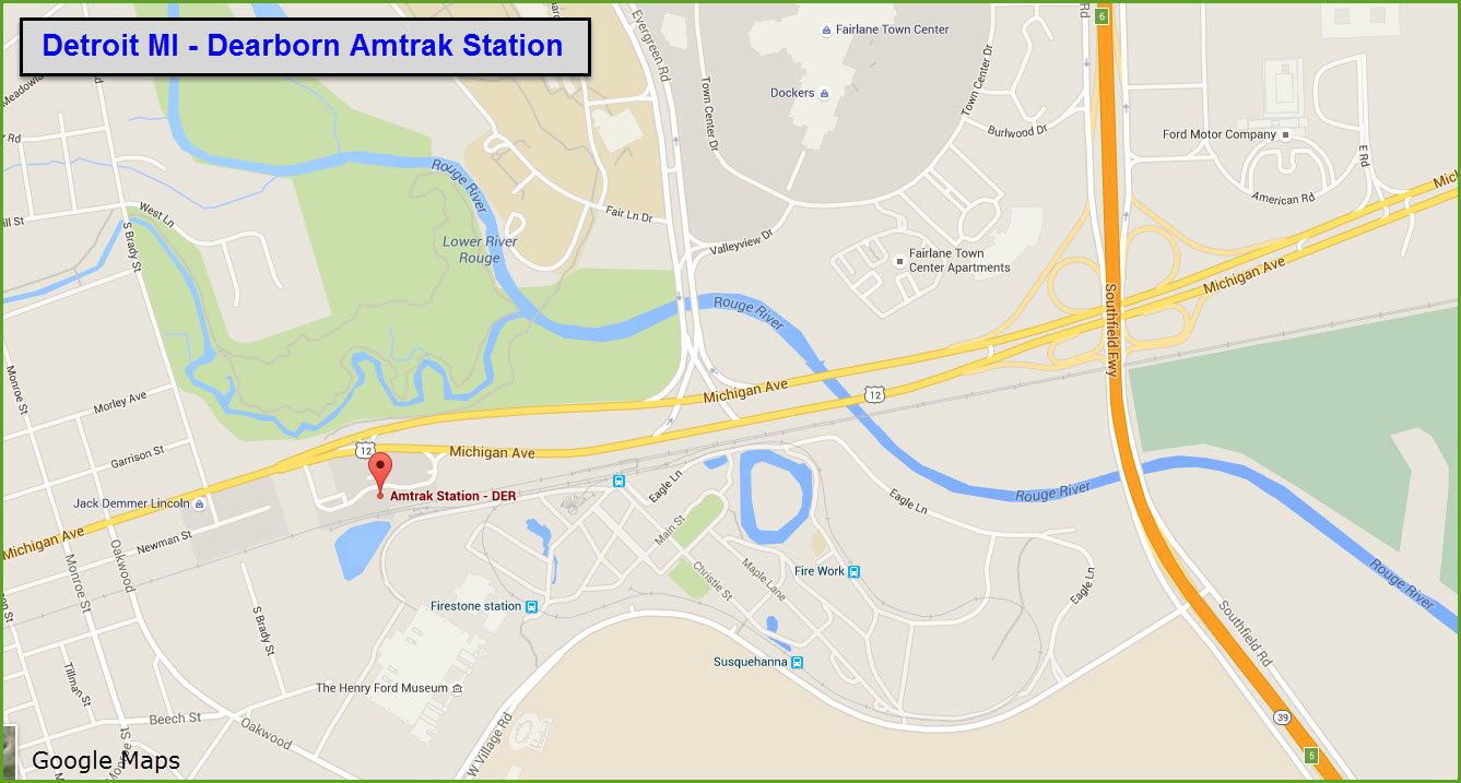
Dearborn
MC Depot
RAILFAN GUIDES HOME
RAILROAD SIGNALS HOME
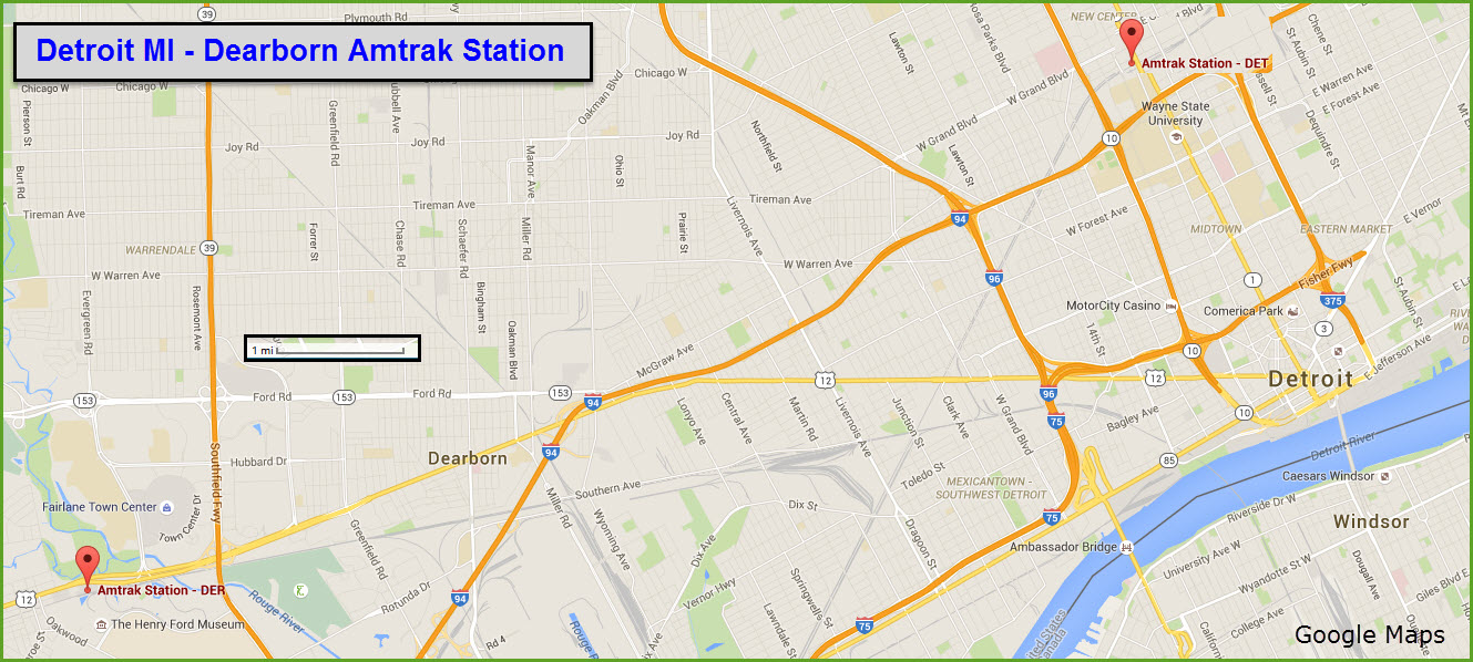
Detroit has two Amtrak stations. One is north of the downtown area off of Woodward Ave/Rt 1, and the other is in Dearborn off of Michigan Ave.
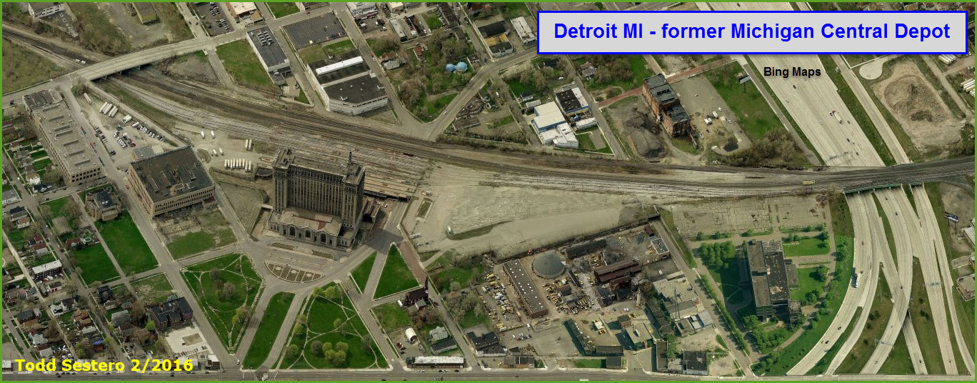
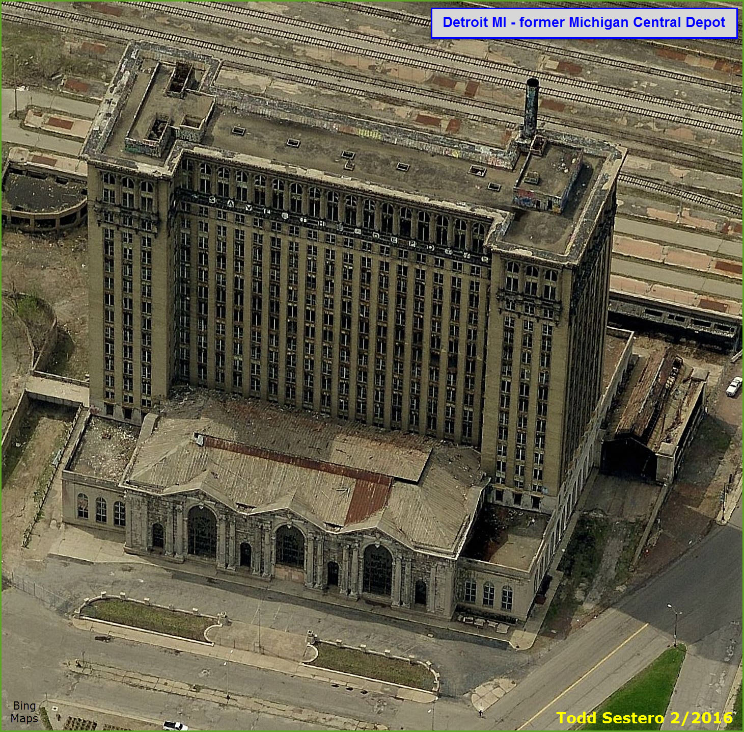
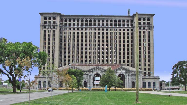
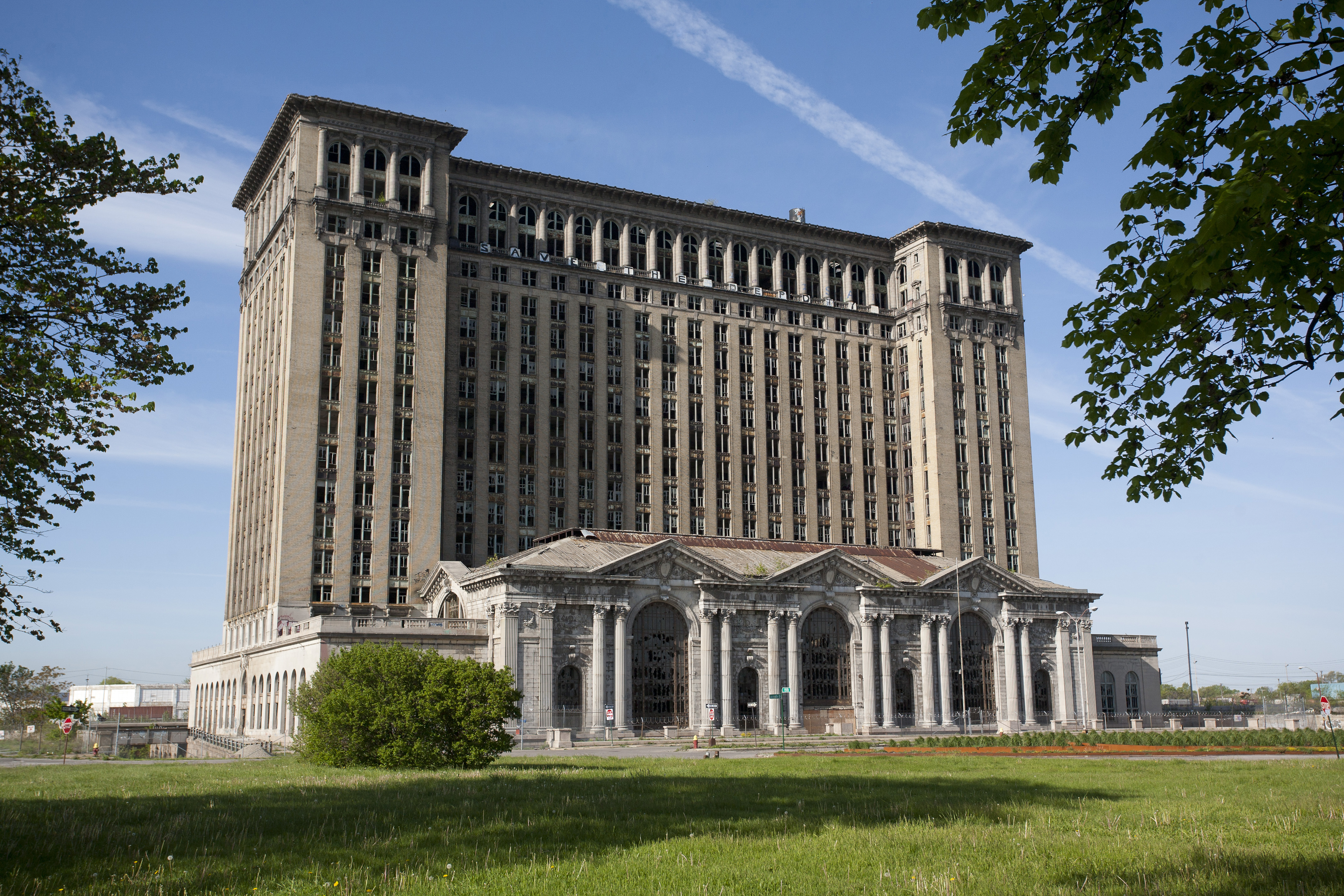
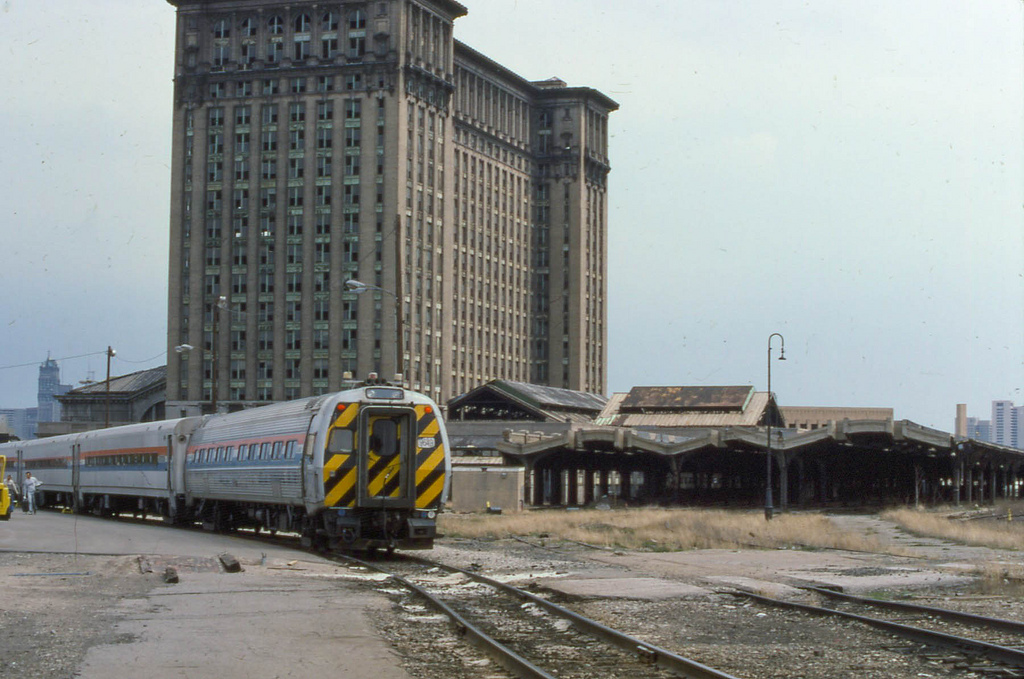
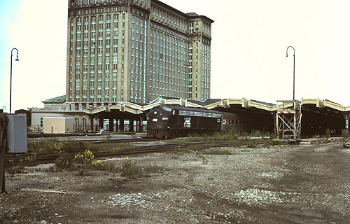
The grand old Michigan Central station is still around. Although in a very bad state of repair, some efforts in the past few years have been made to replace some of the windows, clean up broken glass, and remove water from the structure. It is close to downtown Detroit. At the time it was built, it was the tallest railroad station in existence.
Websites and other additional information sources of interest for the area:
Aerial shots were taken from either Google Maps or www.bing.com/maps as noted. Screen captures are made with Snagit, a Techsmith product... a great tool if you have never used it!
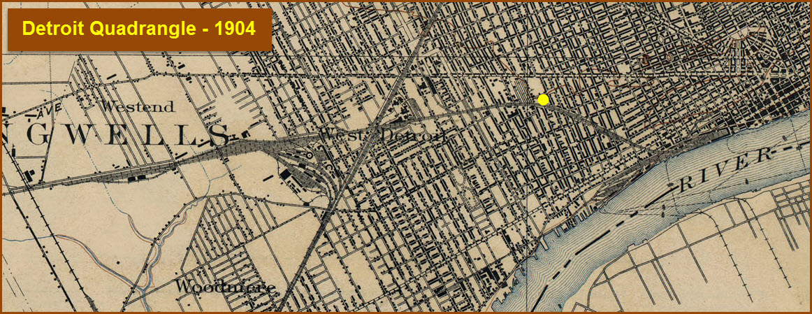
GPS Coordinates: 42.2204, -83.0421
Served by SMART bus route: 200, 255, 445, 450, 460, 475,
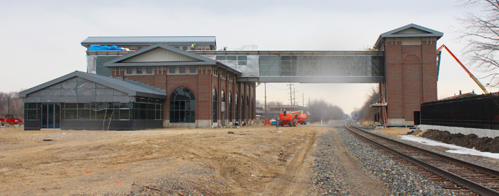
From Wikipedia: The Michigan Department of Transportation (MDOT) bought the 3.1 acre site of the station for $889,000, in 1994 from General Motors. The purchase also includes land directly across the tracks. The station was built in 1994 as a replacement for the former Michigan Central Station, which closed in 1988. From the closure of Michigan in 1988 until the new stations opening in 1994, services used a platform close to the old station.
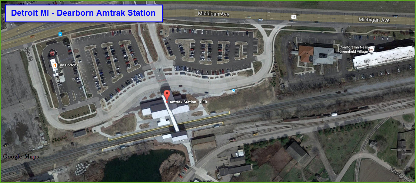
GPS Coordinates: 42.307088, -83.235295
Served by SMART bus route: 140, 200, 250
The Amtrak station in Dearborn is no longer called just the "Dearborn station", it is now referred to as the John D. Dingell Transit Center. It is served daily by Amtrak's Wolverine, which runs three times daily between Chicago IL and Pontiac MI, via Detroit. John Dingell was a member of the U.S. House of Representatives, serving 60 years from 1955 till 2015.
The "new" station also replaces a separate station that was used to access the Henry Ford Museum. The old station was several hundred feet east of the Dearborn station. Access to the Museum can now be made from the Transit Center.
From Wikipedia: The "old" station building opened on October 1, 1979, replacing a temporary structure which opened on July 30, 1978. The station was built on property deeded to the city by the Ford Motor Company. The station cost $348,000, which was split between Amtrak and the state of Michigan.
On 19 August 2011, it was announced that the Federal Railroad Administration had released $28.2 million in funds from the ARRA economic stimulus package for the construction of a new intermodal station to replace the current building. The new facility would serve both intercity and commuter rail and include a connection to the Henry Ford Museum.
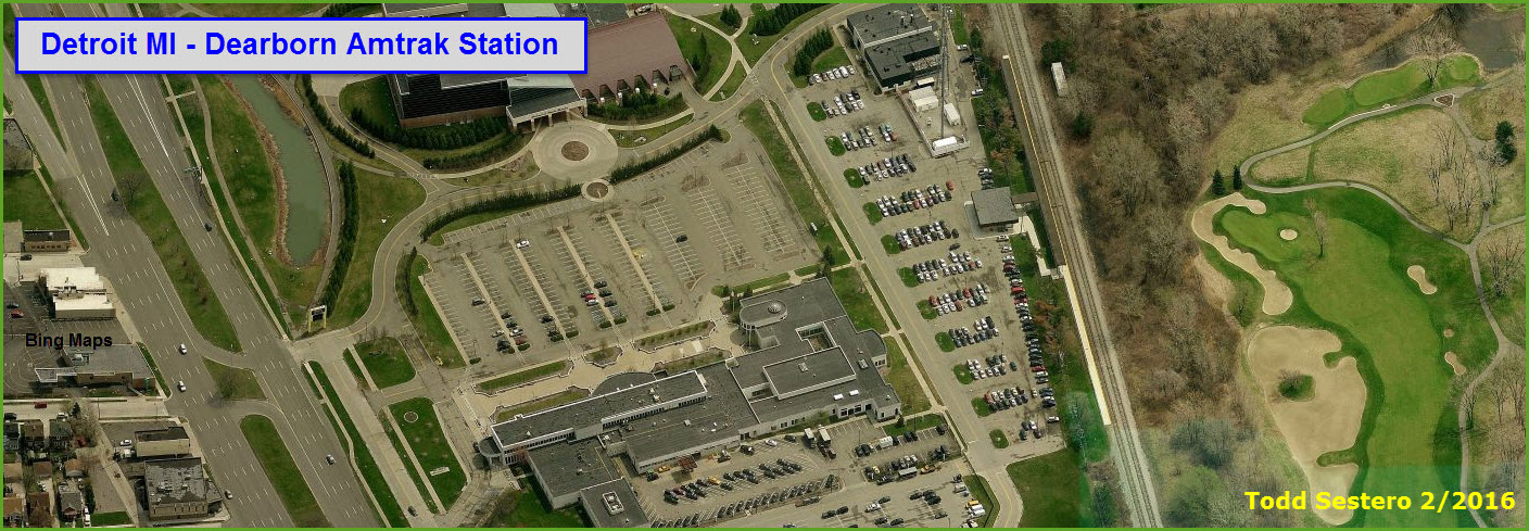
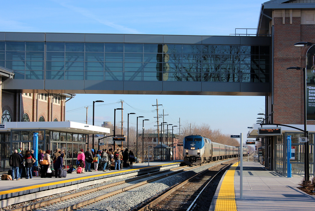
The new 16,000-square-foot station was officially opened for service on 10 December 2014, and consolidates the old station and the Greenfield Village station.
A group called Pockets of Perception, made up of ten students of Dearborn senior high schools created a 18-foot (5.5m) by 20 feet (6.1m) mosaic, titled "Transformations," on display in the station's lobby.
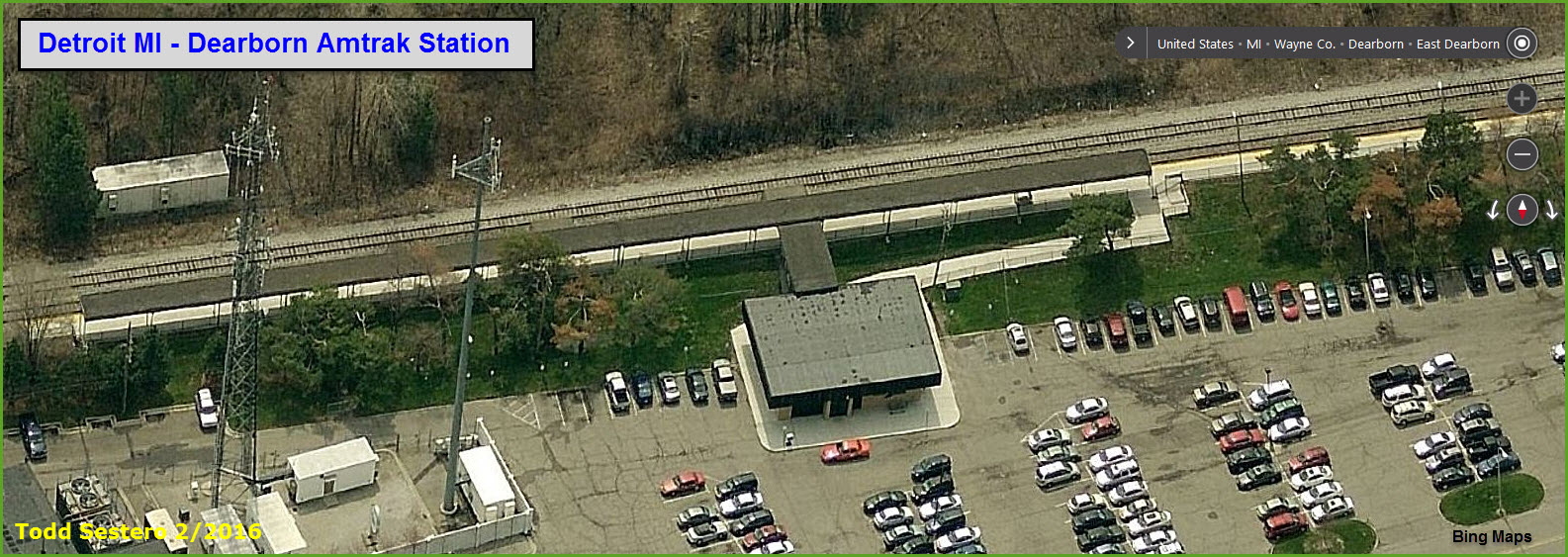
As of Feb2016, Bing still had the "old" station in their data base. ↓
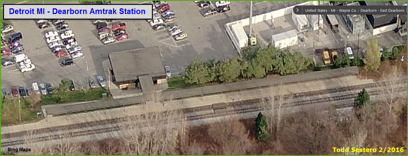
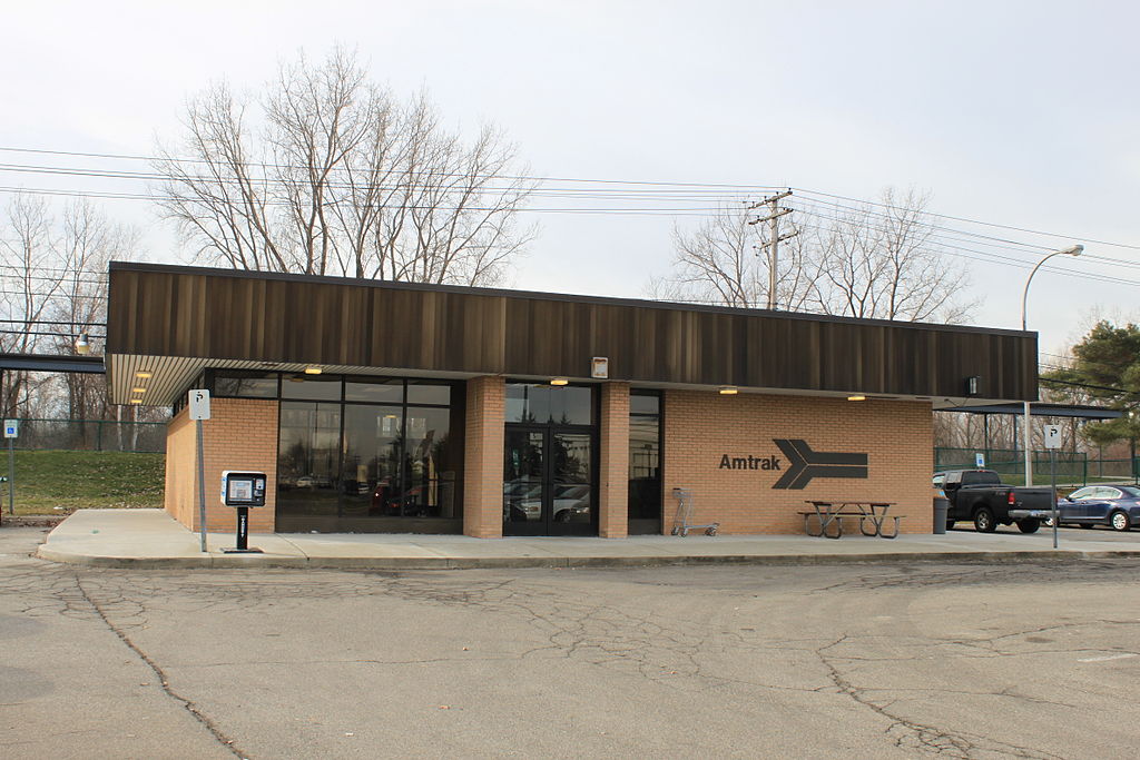 The "old" station.
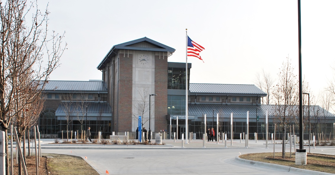 The new
station.
The new
station.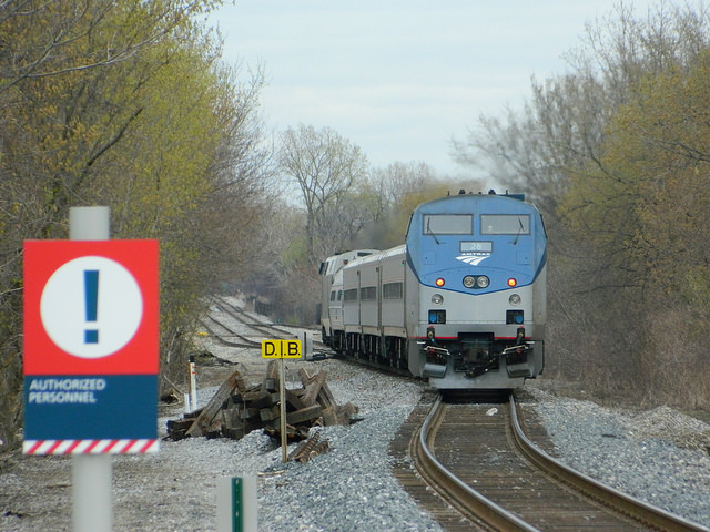
GPS Coordinates: 42.328774, -83.077277
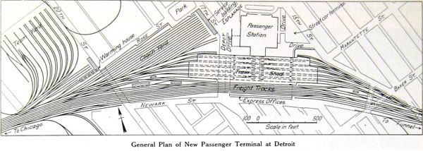
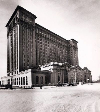
History, from Wikipedia: The building began operating as Detroit's main passenger depot in 1913 after the older Michigan Central Station burned on December 26, 1913. It was originally owned and operated by Michigan Central Railroad. It was planned as part of a large project that included the Michigan Central Railway Tunnel below the Detroit River for freight and passengers. The old station was located on a spur line, which was inconvenient for the high volume of passengers it served. The new Michigan Central placed passenger service on the main line.
The growing trend toward increased automobile use was not a large concern in 1912, as is evident in the design of the building. Most passengers would arrive at and leave from Michigan Central Station by interurban service or streetcar, due to the station's distance from downtown Detroit. The station was placed away from downtown in order to stimulate related development to come in its direction.
At the beginning of World War I, the peak of rail travel in the United States, more than 200 trains left the station each day and lines would stretch from the boarding gates to the main entrance. In the 1940s, more than 4,000 passengers a day used the station and more than 3,000 people worked in its office tower. Among notable passengers arriving at MCS were Presidents Herbert Hoover, Harry S. Truman and Franklin D. Roosevelt, actor Charlie Chaplin and inventor Thomas Edison.
In the 1920s, Henry Ford began to buy land near the station and made construction plans, but the Great Depression and other circumstances squelched this and many other development efforts. The original design included no large parking facility. When the interurban service was discontinued less than two decades after MCS opened, the station was effectively isolated from the large majority of the population who drove cars and needed parking to use the facility.
Passenger volume did not decrease immediately. During World War II, the station was used heavily by military troops. After the war, with a growth in automobile ownership, people used trains less frequently for vacation or other travel. Service was cut back and passenger traffic became so low that the owners of the station attempted to sell the facility in 1956 for US$5 million, one-third of its original 1913 building cost. Another attempted sale in 1963 failed for lack of buyers. In 1967, maintenance costs were seen as too high relative to the decreasing passenger volume. The restaurant, arcade shops, and main entrance were closed, along with much of the main waiting room. This left only two ticket windows to serve passengers and visitors, who used the same parking-lot entrance as railroad employees working in the building.
Amtrak took over the nation's passenger rail service in 1971, reopening the main waiting room and entrance in 1975. It started a $1.25 million renovation project in 1978. Six years later, the building was sold for a transportation center project that never materialized. On January 6, 1988, the last Amtrak train pulled away from the station after owners decided to close the facility. In July 1992, the Detroit Master Plan of Policies for the southwest sector's urban design identified the station as an attractive or interesting feature to be recognized, enhanced and promoted. Amtrak service continued at a platform near the building until a new station opened several miles away in New Center in 1994.
Controlled Terminals Inc. acquired the station in 1996. Its sister company, the Detroit International Bridge Co., owns the nearby Ambassador Bridge and both are part of a group of transportation-related companies owned by businessman Manuel Moroun, Chairman and CEO of CenTra Inc. The company demolished the train shed in 2000, and converted the remaining tracks and platforms into an intermodal freight facility, named "Expressway" and operated by Canadian Pacific Railway. This facility was closed in June 2004.
Although the City of Detroit considered the building a "Priority Cultural Site" in 2006, the City Council on April 7, 2009 passed a resolution to demolish the Depot. Seven days later, Detroit resident Stanley Christmas sued the city of Detroit to stop the demolition effort, citing the National Historic Preservation Act of 1966. Although the City of Detroit considered the building a "Priority Cultural Site" in 2006, the City Council on April 7, 2009 passed a resolution to demolish the Depot. Seven days later, Detroit resident Stanley Christmas sued the city of Detroit to stop the demolition effort, citing the National Historic Preservation Act of 1966. In June 2011 work began on partial asbestos abatement on the first floor; other work conducted included interior demolition work, removal of broken glass from first floor windows, and removal of water. As of June 2012, electricity has been restored to the interior. Lights have illuminated the main lobby nightly.
The website Talk To The Station has been launched by the Michigan Central Station Preservation Society to provide a sounding board for community questions and suggestions.
On June 10, 2014, it was reported that the owners of Michigan Central Station were moving forward with about $676,000 in rehab work, and had received permits to install a new 9,000-pound capacity freight elevator, which will allow for the smooth installation of new windows and roof work. In late 2014 work to install the elevator started, with an expected completion by February.
In February 2015 the owners announced that they would be replacing more than 1,000 windows above the first level. In late April the city announced a land swap deal with the Bridge Company to transfer a 3-acre strip of Riverside Park near the Ambassador Bridge for 4.8 acres of adjacent property owned by the Bridge Company. As part of that agreement, the city would receive up to $5 million for park improvements, and the Bridge Company agreed to replace the windows in the train station. In July the Detroit City Council approved the land transfer. As August 2015 about more than half the new windows have been installed. Despite this work, the future of the building is undetermined. In June 2011 work began on partial asbestos abatement on the first floor. Other work conducted included interior demolition work, removal of broken glass from first floor windows, and removal of water. As of June 2012, electricity has been restored to the interior. Lights have illuminated the main lobby nightly.
 < Before the station
was built.
< Before the station
was built.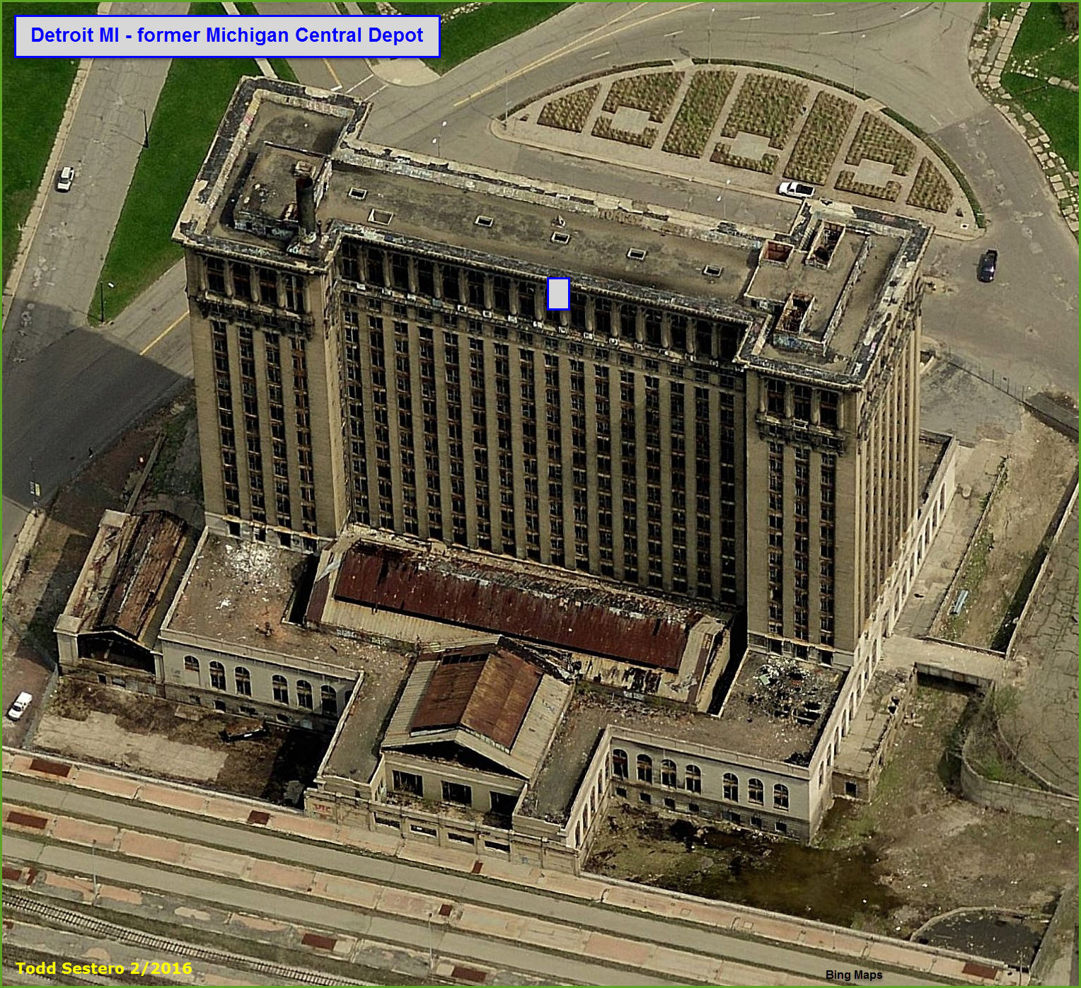
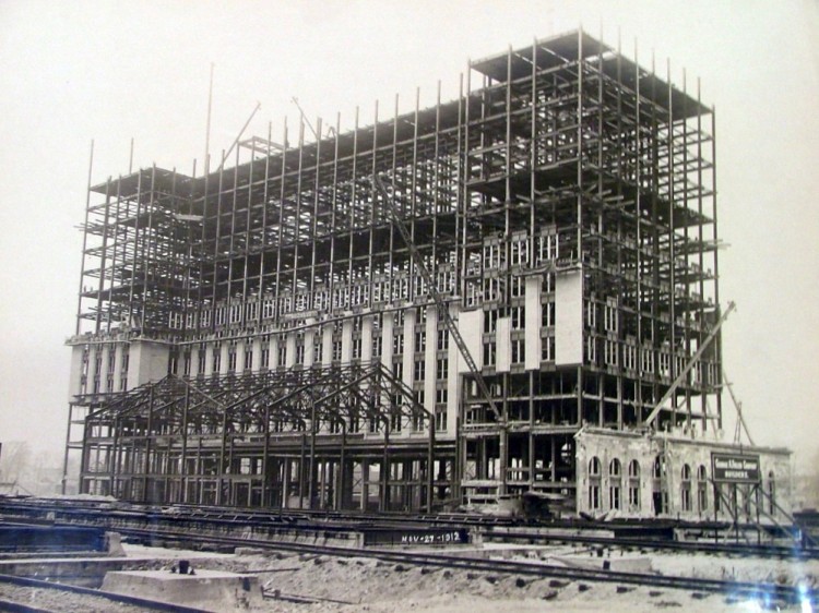 1913
1913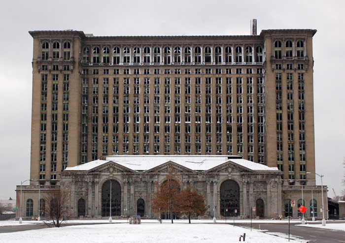
Disclaimers:
I love trains, and I love signals. I am not an expert. My webpages reflect what I find on the topic of the page. This is something I have fun with while trying to help others. My webpages are an attempt at putting everything I can find of the subject in one convenient place. There are plenty of other good websites to help me in this effort, and they are listed in the links section on my indexa page, or as needed on individual pages. Please do not write to me about something that may be incorrect, and then hound the heck out of me if I do not respond to you in the manner you would like. I operate on the "Golden Rule Principle", and if you are not familiar with it, please acquaint yourself with how to treat people by reading Mathew 7:12 (among others, the principle exists in almost every religion). If you contact me (like some do, hi Paul) and try to make it a "non-fun" thing and start with the name calling, your name will go into my spambox list! :-)
Please Note: Since the main focus of my two websites is railroad signals, the railfan guides are oriented towards the signal fan being able to locate them. For those of you into the modeling aspect of our hobby, my indexa page has a list of almost everything railroad oriented I can think of to provide you with at least a few pictures to help you detail your pike.
If this is a railfan page, every effort has been made to make sure that the information contained on this map and in this railfan guide is correct. Once in a while, an error may creep in, especially if restaurants or gas stations open, close, or change names. Most of my maps are a result of personal observation after visiting these locations. I have always felt that a picture is worth a thousand words", and I feel annotated maps such as the ones I work up do the same justice for the railfan over a simple text description of the area. Since the main focus of my website is railroad signals, the railfan guides are oriented towards the signal fan being able to locate them. Since most of us railheads don't have just trains as a hobby, I have also tried to point out where other interesting sites of the area are.... things like fire stations, neat bridges, or other significant historical or geographical feature. While some may feel they shouldn't be included, these other things tend to make MY trips a lot more interesting.... stuff like where the C&O Canal has a bridge going over a river (the Monocacy Aqueduct) between Point of Rocks and Gaithersburg MD, it's way cool to realize this bridge to support a water "road" over a river was built in the 1830's!!!
My philosophy: Pictures and maps are worth a
thousand words, especially for railfanning. Text descriptions only
get you so far, especially if you get lost or disoriented. Take
along good maps.... a GPS is OK to get somewhere, but maps are still
better if you get lost! I belong to AAA, which allows you to get
local maps for free when you visit the local branches. ADC puts
out a nice series of county maps for the Washington DC area, but their
state maps do not have the railroads on them. If you can find em,
I like the National Geographic map book of the U.S..... good, clear, and
concise graphics, and they do a really good job of showing you where
tourist type attractions are, although they too lack the railroads.
Other notes about specific areas will show up on that page if known.
By the way, floobydust is
a term I picked up 30-40 years ago from a National Semiconductor data
book, and means miscellaneous and/or other stuff.
Pictures and additional information is always needed if anyone feels
inclined to take 'em, send 'em, and share 'em, or if you have
something to add or correct.... credit is always given! BE NICE!!! Contact info
is here
Beware: If used as a source, ANYTHING from Wikipedia must be treated as being possibly being inaccurate, wrong, or not true.
RAILFAN GUIDES HOME
RAILROAD SIGNALS HOME
NEW 02/27/2016
Last Modified
29-Feb-2016