
In General
Getting Here
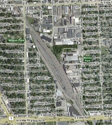
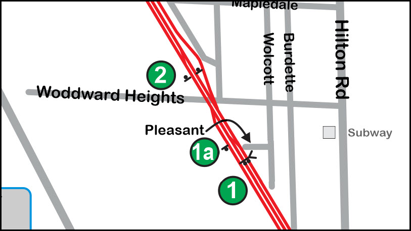
Map
Pictures
Signals
Bridges
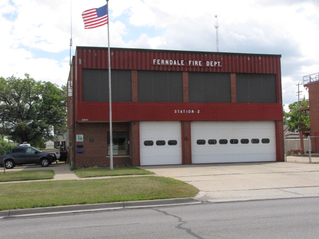
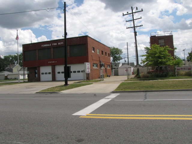
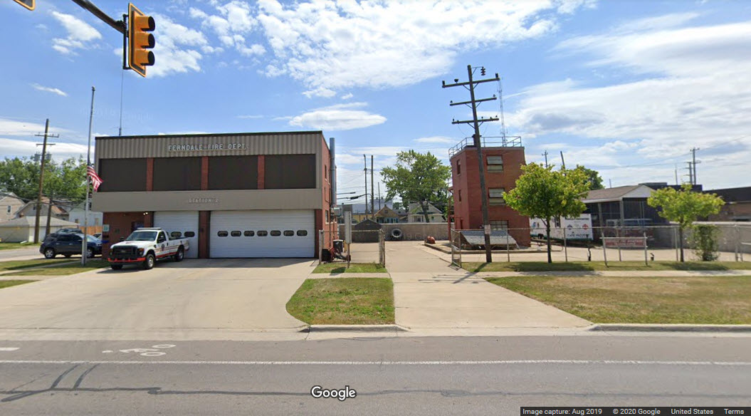
Fire & Police
Floobydust
RAILFAN GUIDES HOME
RAILROAD SIGNALS HOME
Location / Name:
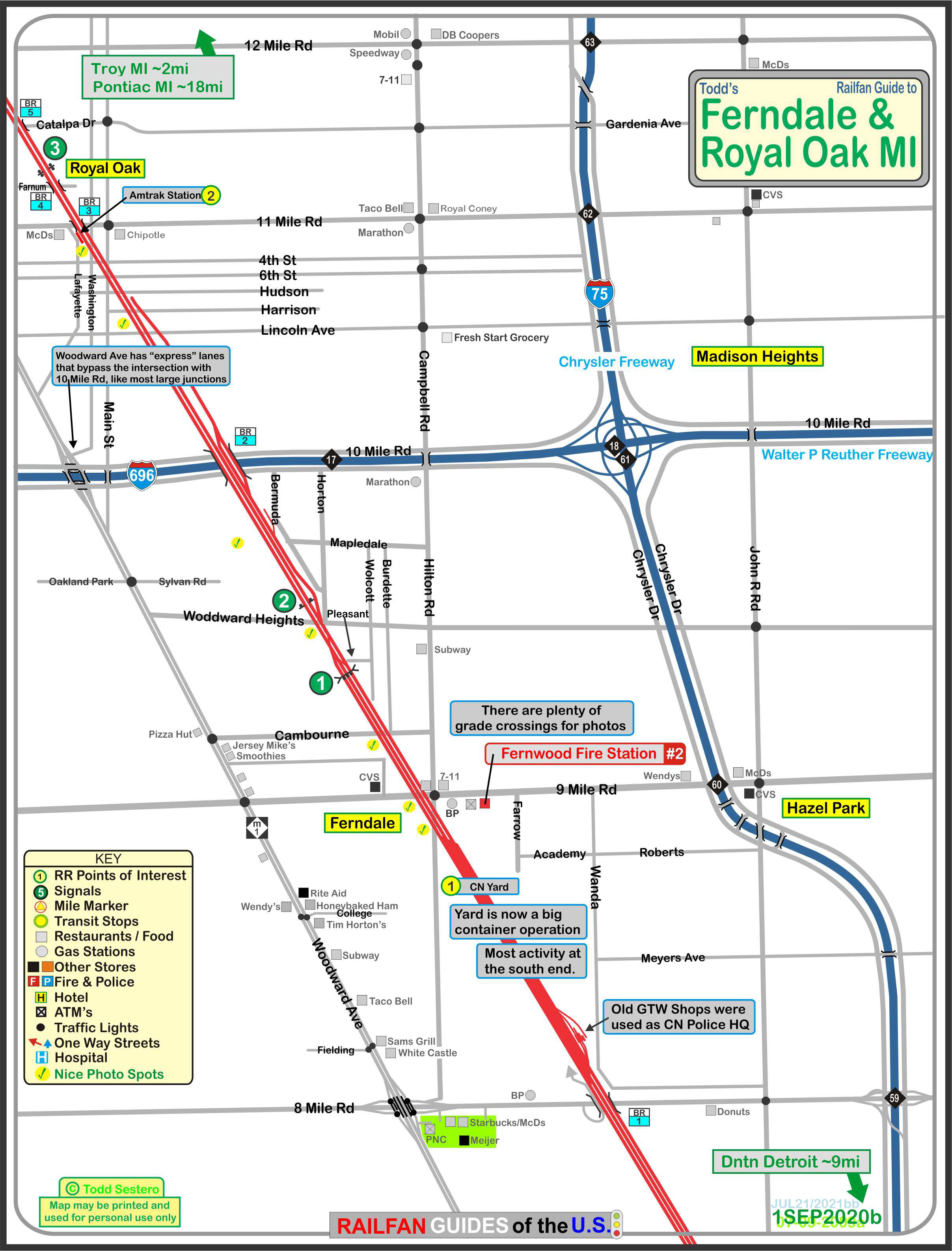
Ferndale & Royal Oak MI, Oakland County (NW suburbs of Detroit)
What's Here:
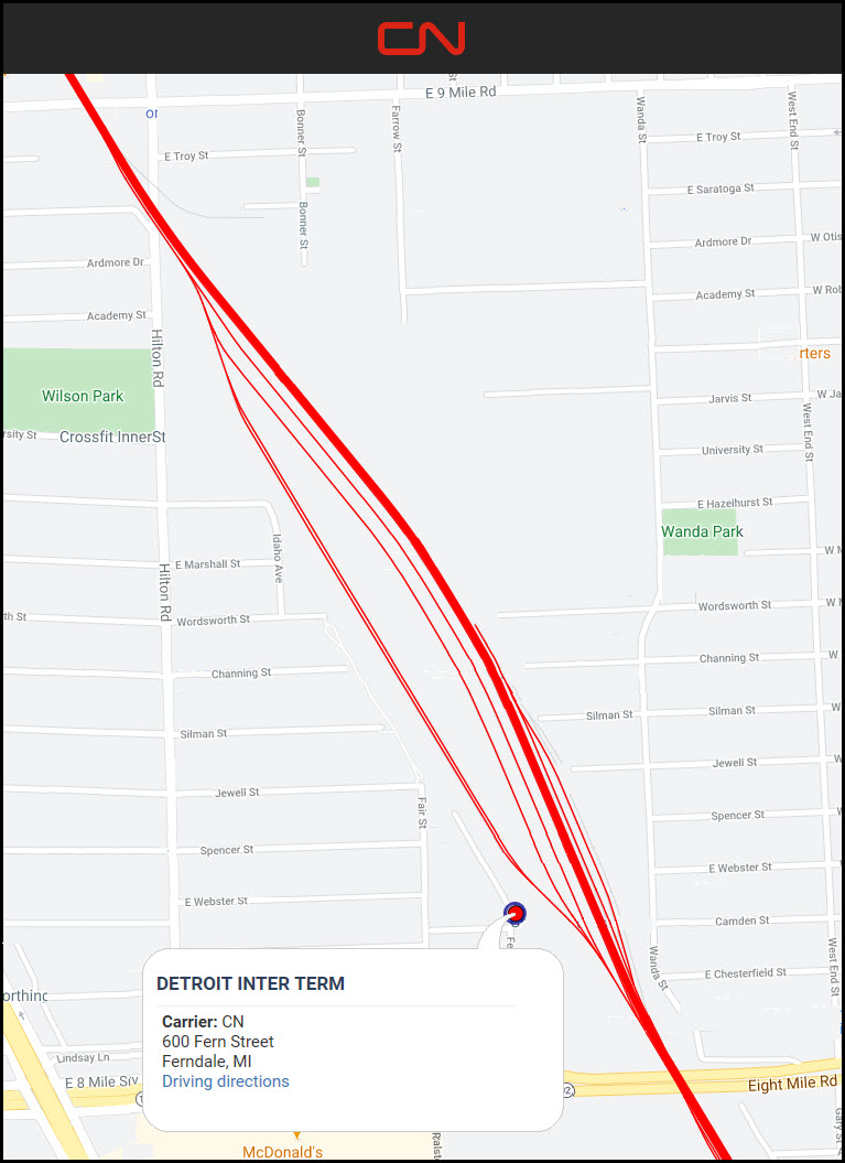
CN's Ferndale Yard
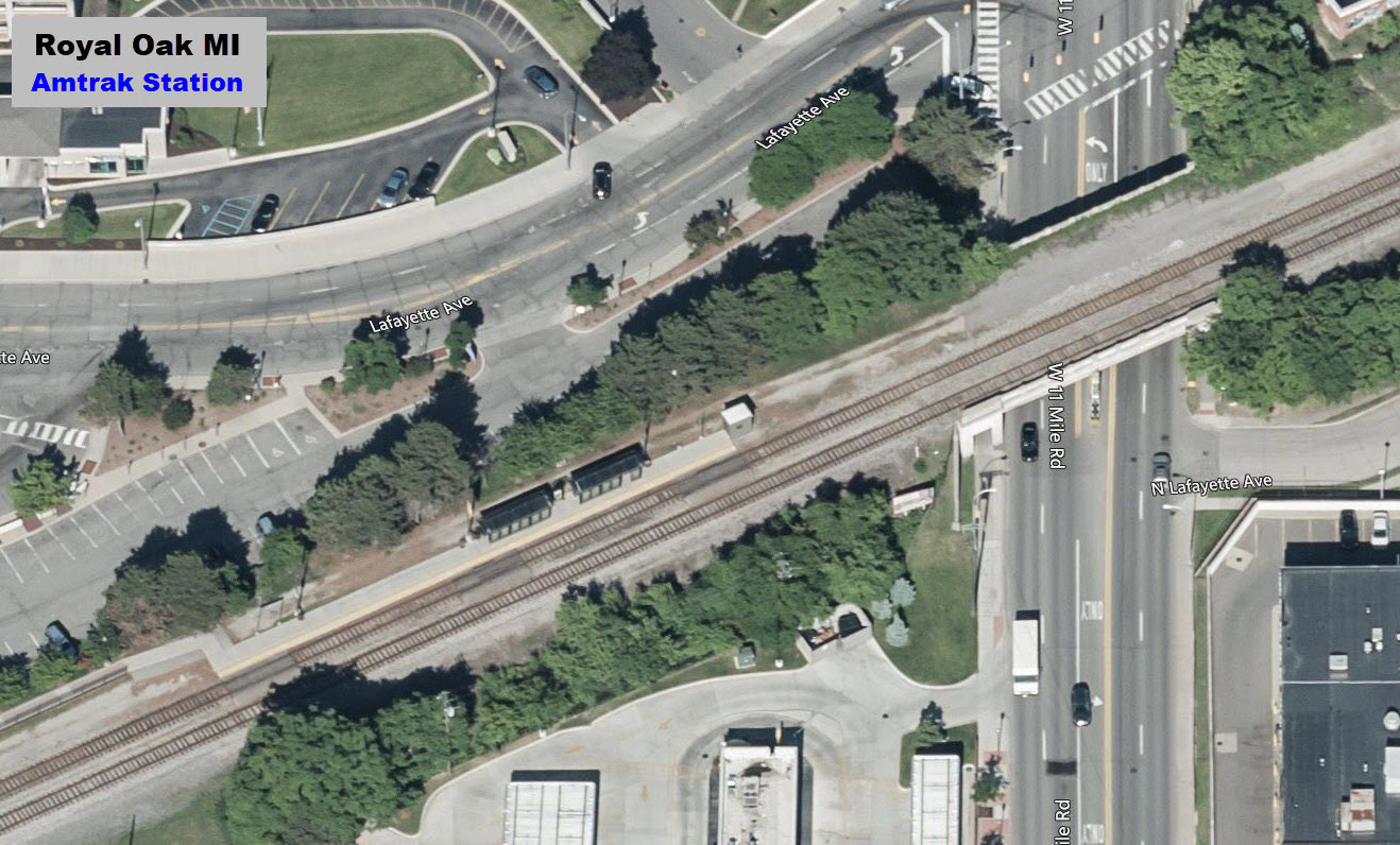
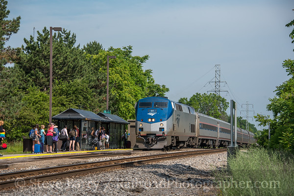
Amtrak Royal Oak Station
Data:
GPS Coordinates: as needed
Phone A/C: 313
ZIP: 48203
Access by train/transit:
Amtrak Wolverine
The Scoop:
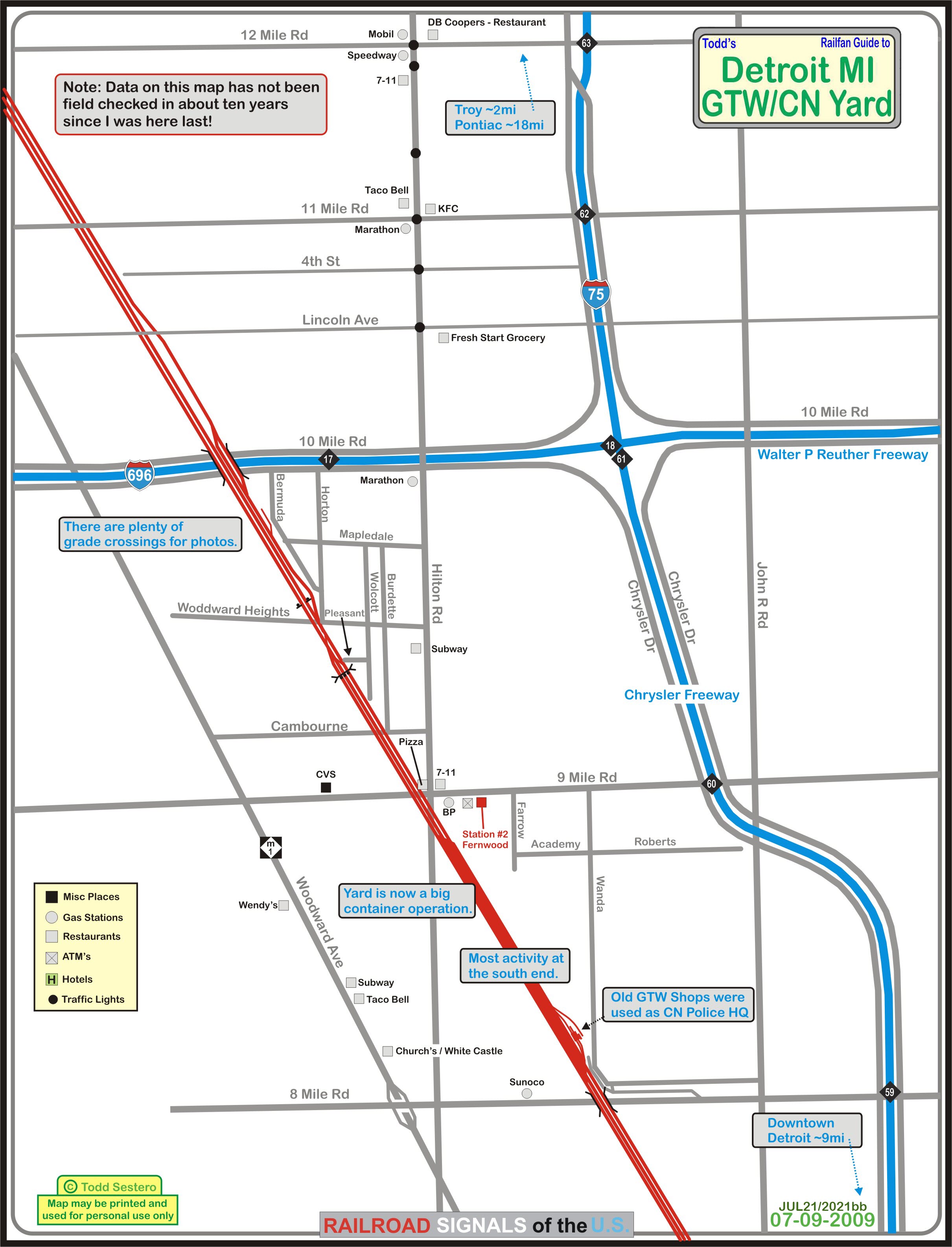
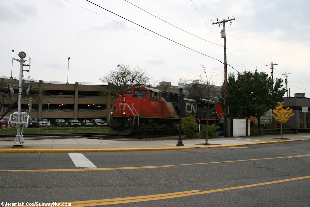
Tucked away on the northwest side of Detroit is this CN yard, which is a formaer Grand Trunk yard.
A little north of the yard in Royal Oak, is an Amtrak station, which sits near the site of the old GTW station.
The map is condensed between 696 and the top. I wasn't planning on a visit, but on the weekend preceding the Owosso Train Festival, they had a truck fire on 75 which closed it to traffic, and this yard was on the detour!
Acknowledgements:
Jeremiah Cox
Steve Barry
Fox 2 Detroit
Denver Todd
Websites and other additional information sources of interest for the area:
None for now.....
Via I-75 northbound: take exit 60 and follow the exit road to 9 Mile Rd, and take a left. Go to Hilton Rd, and take a left, this will put you at the north end of the yard, with signals to your north for good pix of SB trains.
Like wise for SB I-75, exit 60, but take a right at 9 Mile Rd.
For the south end of the yard, you can get off at 8 Mile Rd, however, access for photos is difficult if not impossible without crawling onto railroad property.
Click here for the map in PDF format
GPS Coordinates: 42.459208, -83.122949 (north end at Hilton Rd grade crossing).... 42.446955, -83.112966 (south end)
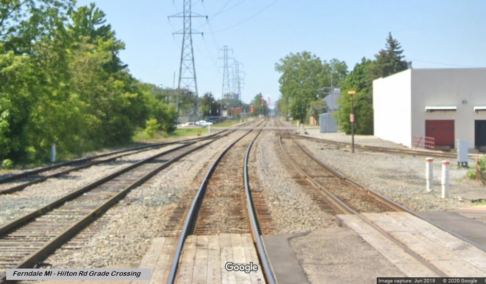
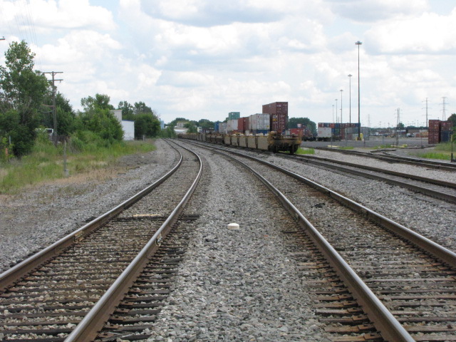 Looking south from Hilton
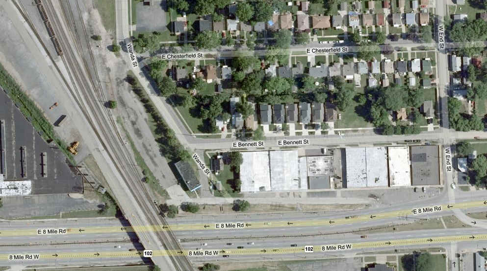
South end of the yard.
 Aerial shot of the yard, also from Bing.
GPS Coordinates: 42.489215, -83.147550
 NB CN freight at Washington
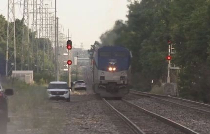
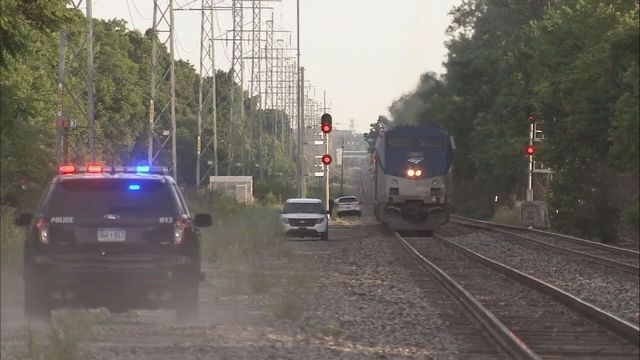 Accident in Royal Oak on 6/22/2016, Fox 2 Detroit
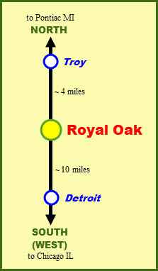
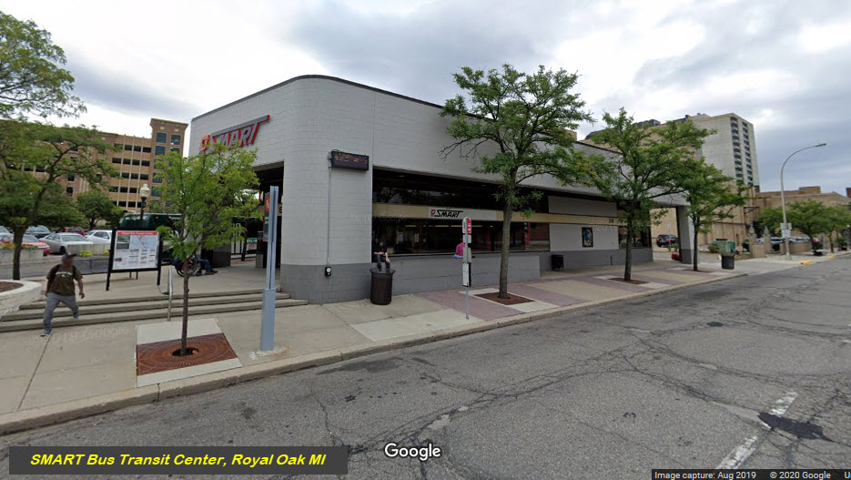
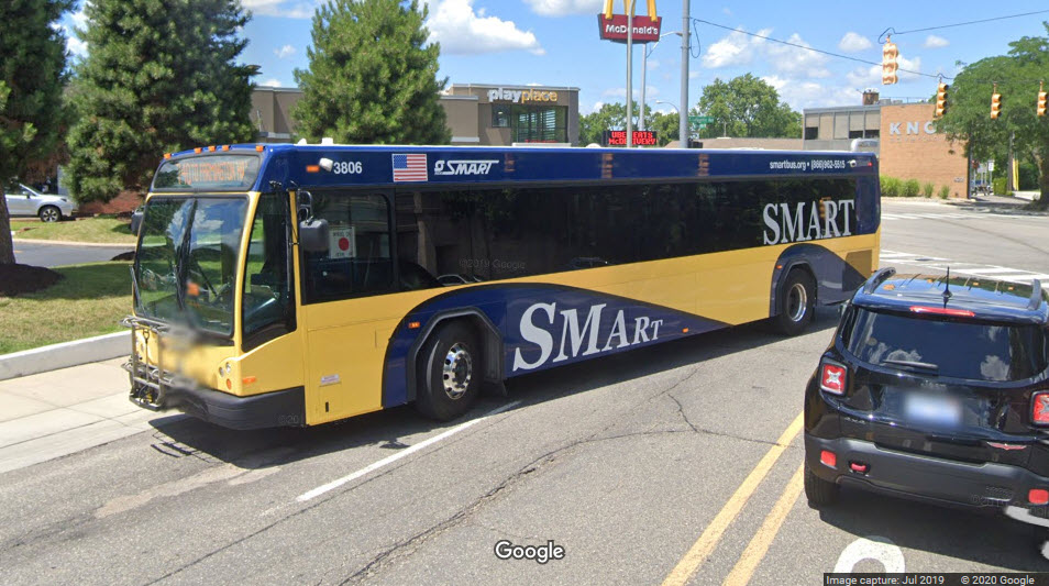
Next to the Amtrak platform, is a SMART Bus Transit Center.
A SMART bus running on Lafayette across from the Amtrak Station.
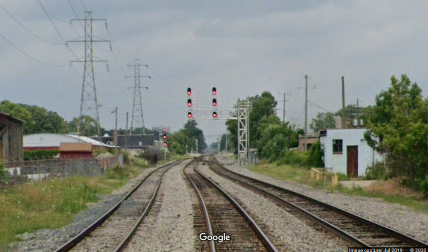
Looks like CN did a signal upgrade for the interlocking between Cambourne and Woodward Heights since I was here last....
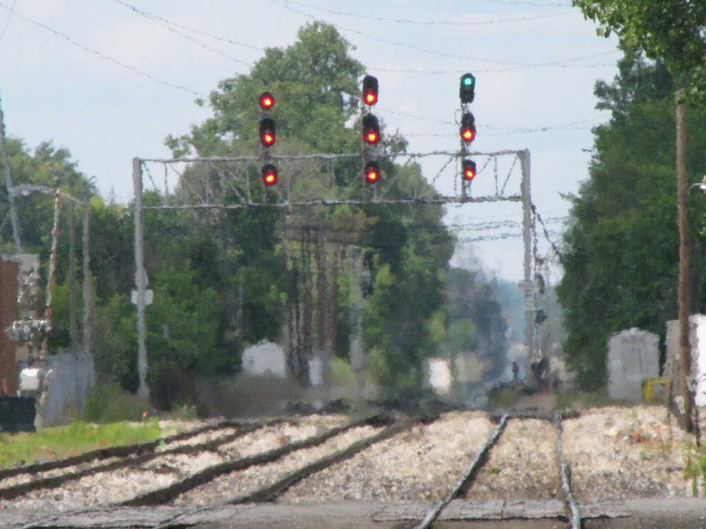
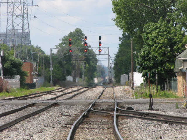
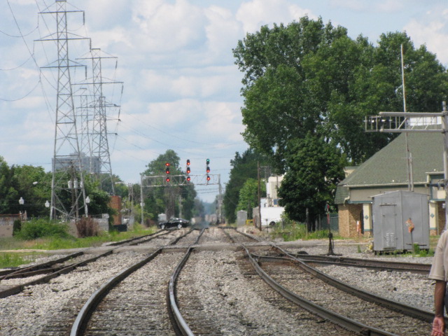
3 shots looking north from Hilton, and the signal bridge just north of Cambourne.
Added this one with my latest update.....
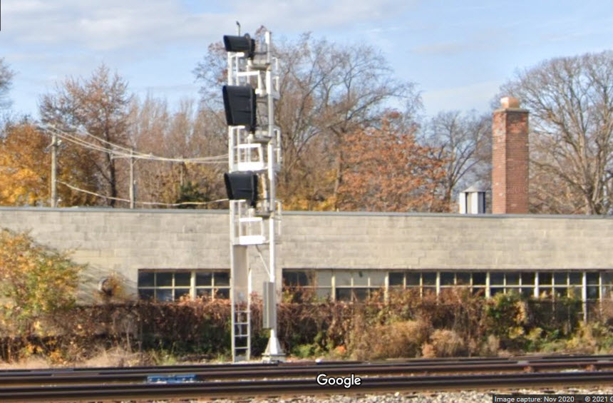
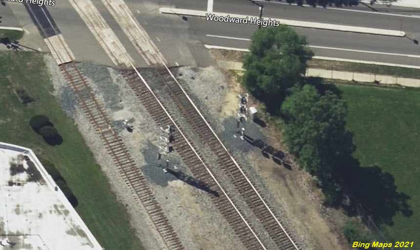
Since I was here in 2009 snapping off pictures, it looks like CN has upgraded the signals here too, deleting the NB signal to the left.
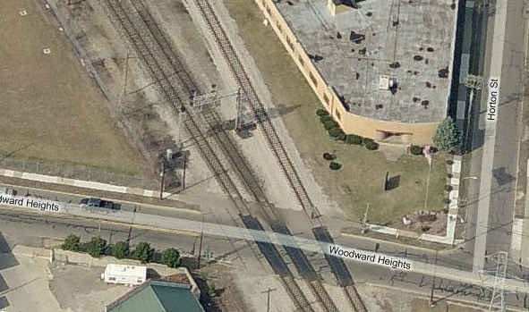 Birds eye
view of the SB signals at Woodward Heights/2009
Birds eye
view of the SB signals at Woodward Heights/2009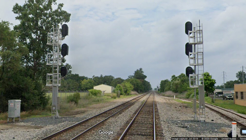
These signals are adjacent to a school baseball and track field. Probably no real good way to get pictures here.
This set of signals MAY be the ones at this location, it's part of the picture you saw above for the accident.....
If they are not, the signals are VERY similar.
GPS Coordinates: 42.446774, -83.112811
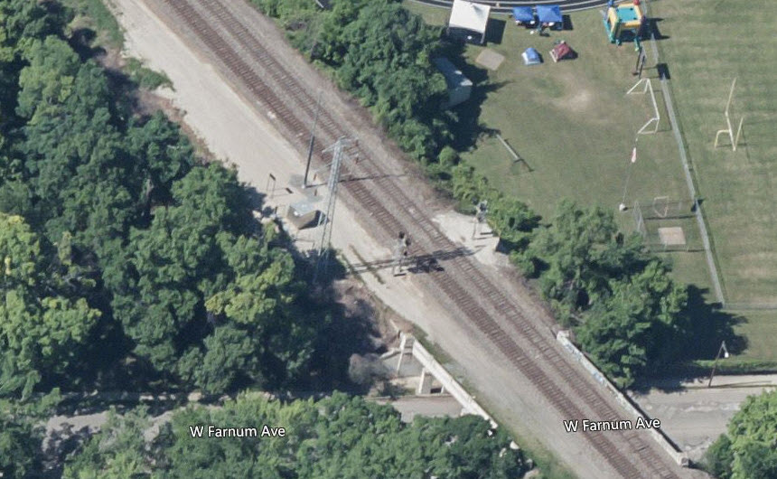
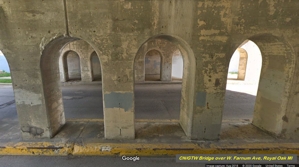
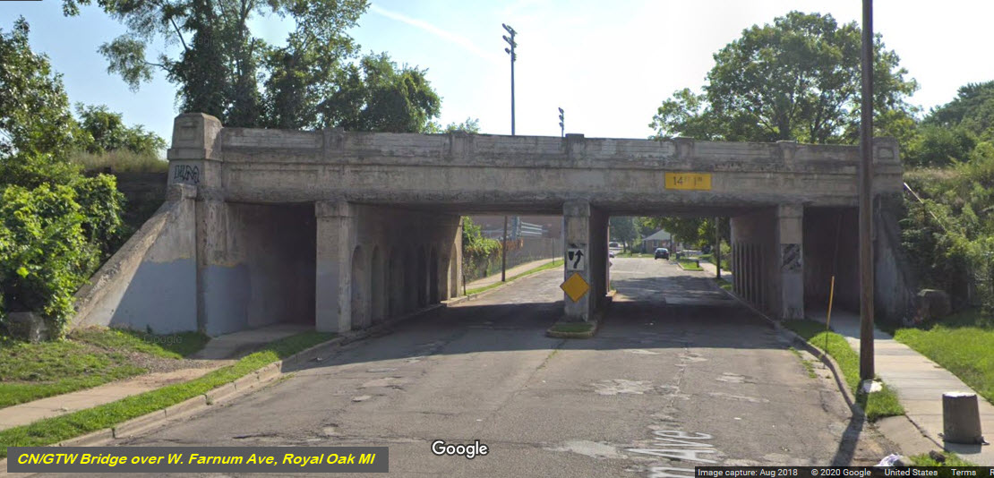
This bridge not only serves the tracks, but provides the southern entrance to the yard, coming off of 8 Mile Rd on the EB (eastbound) side.
There are three sets of tracks on the bridge, and there may have been another one.....
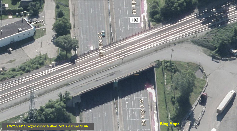
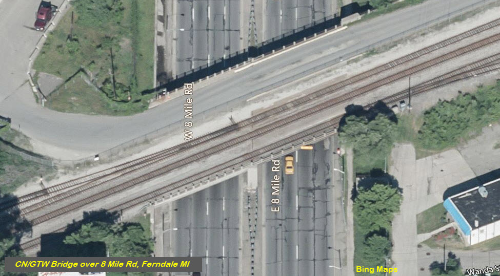
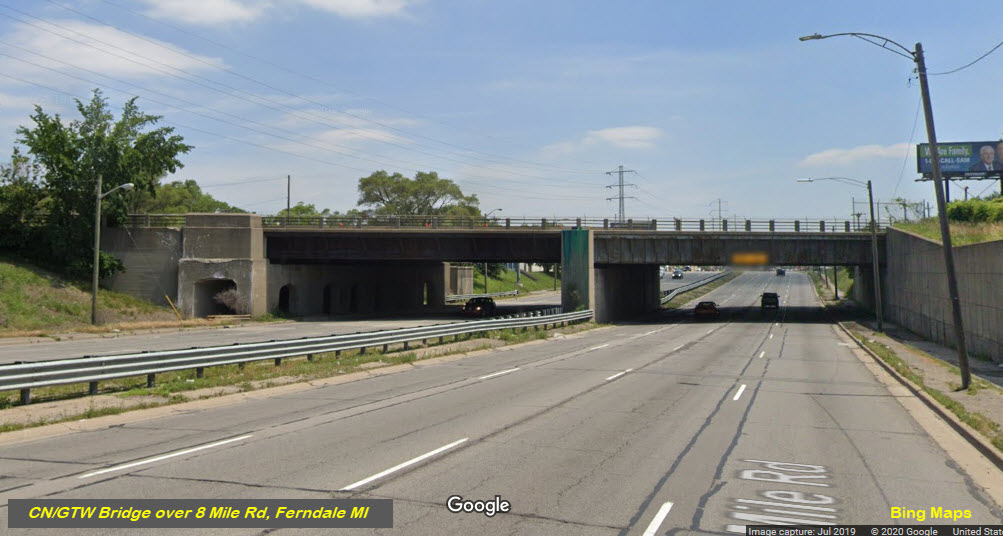
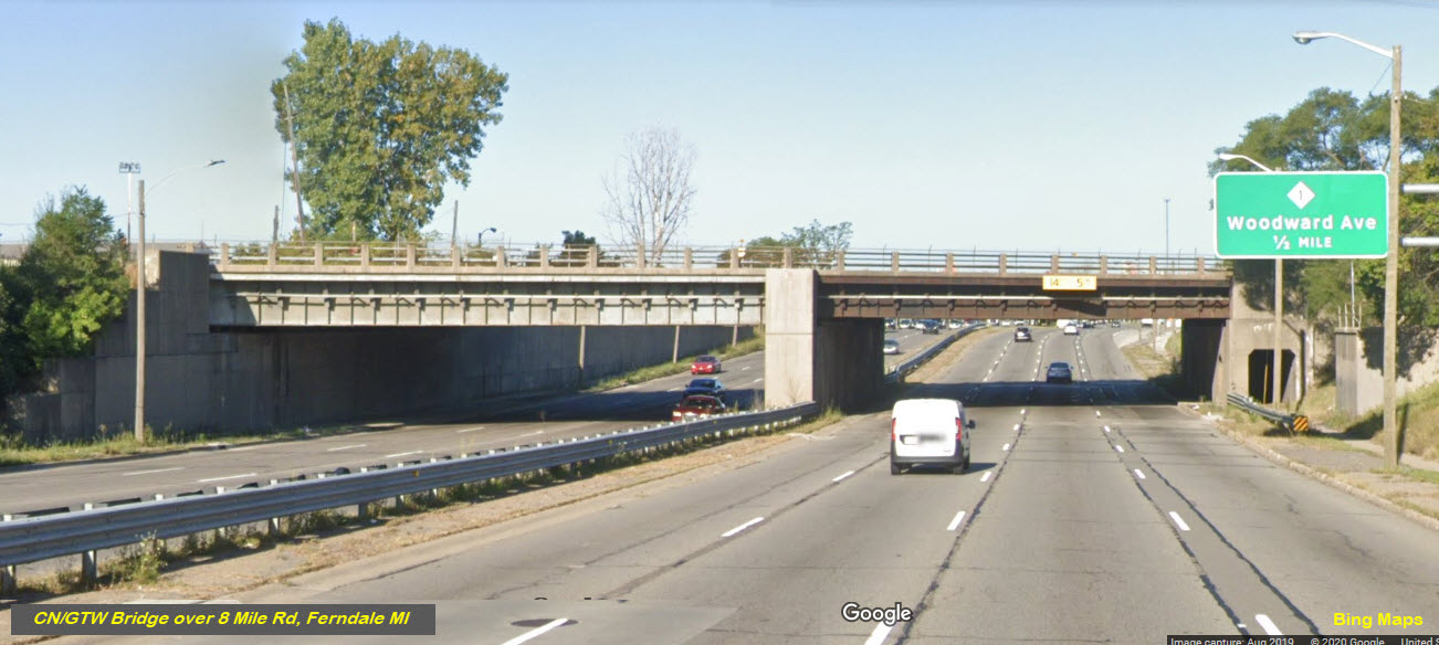
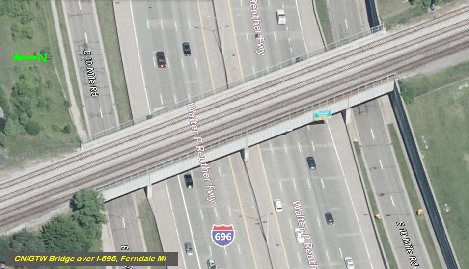
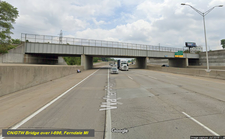
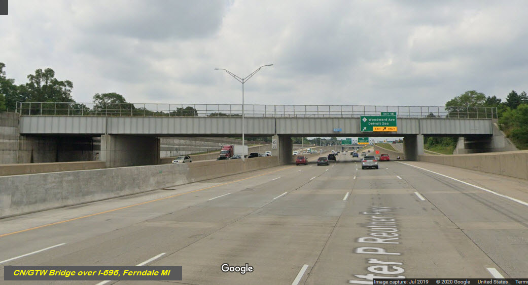
GPS Coordinates: 42.475753, -83.136436
Without doing further investigation, and not having grown up here, I do not know if the railroad bridge going over 10 Mile Rd is new enough that it never had the "missing two western tracks" or not, maybe someone that grew up here could email me and let me know, it would be interesting to find out the history!
GPS Coordinates: 42.489686, -83.147924
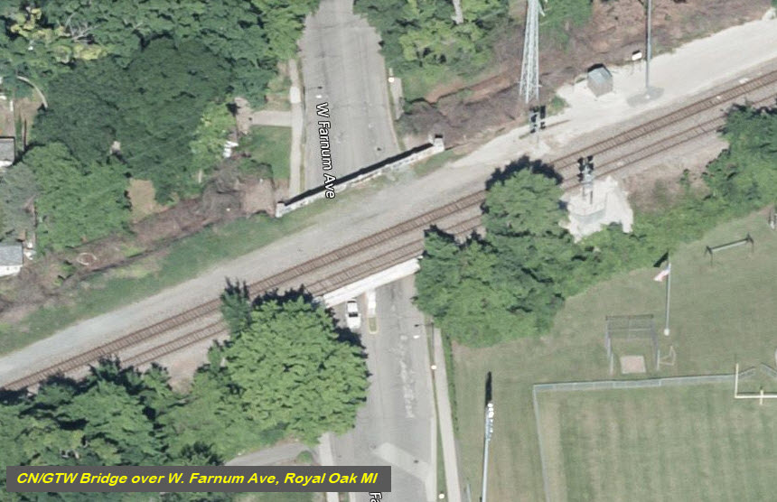
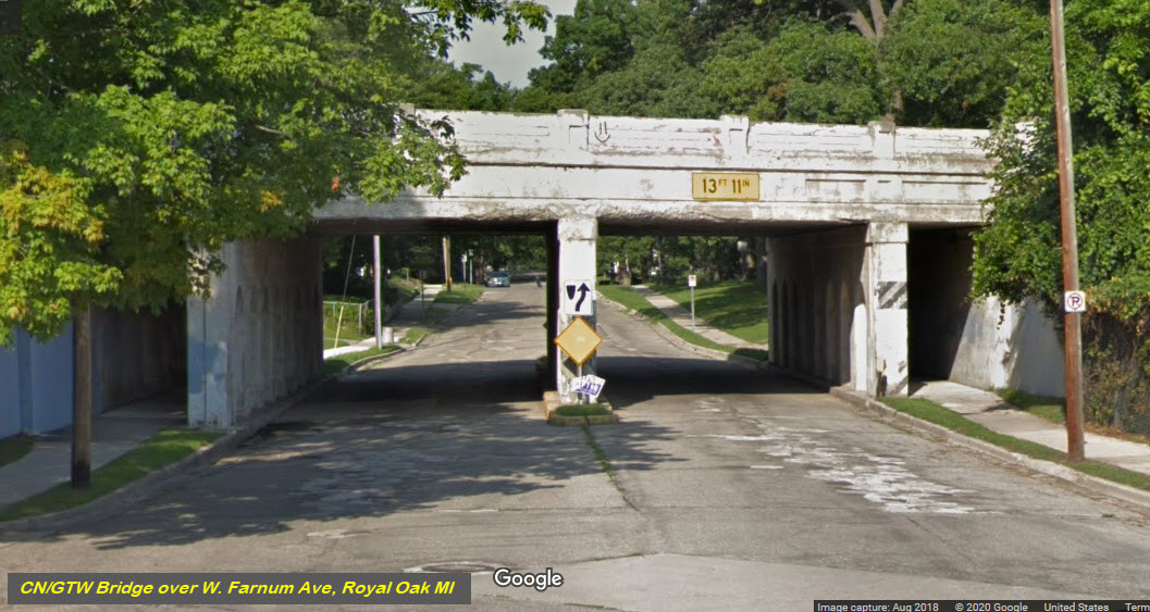
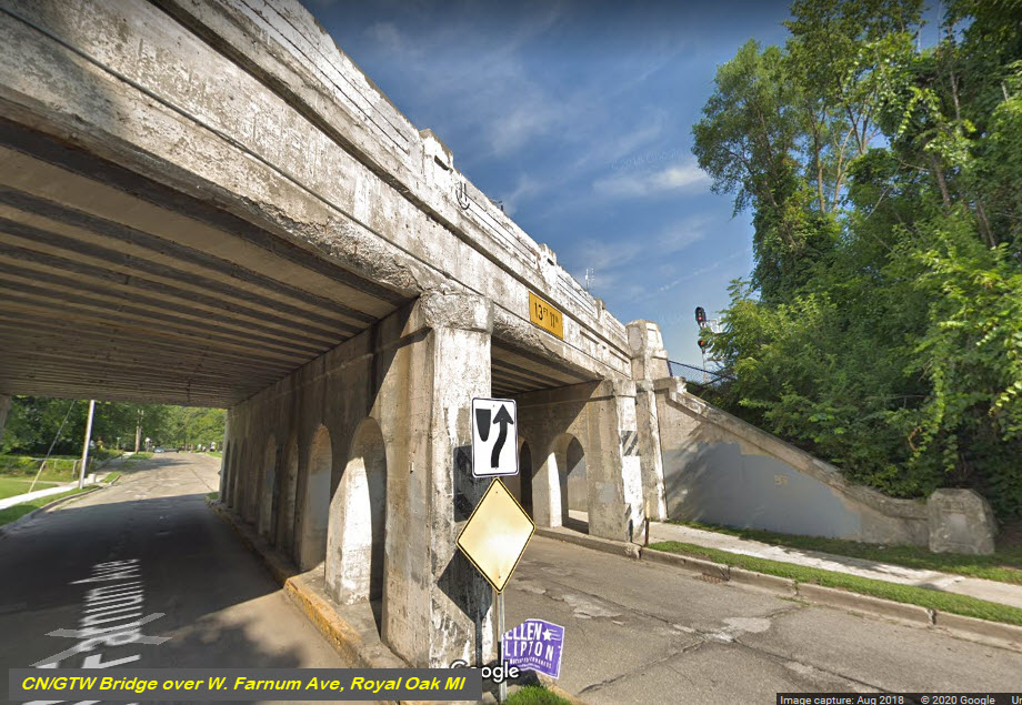
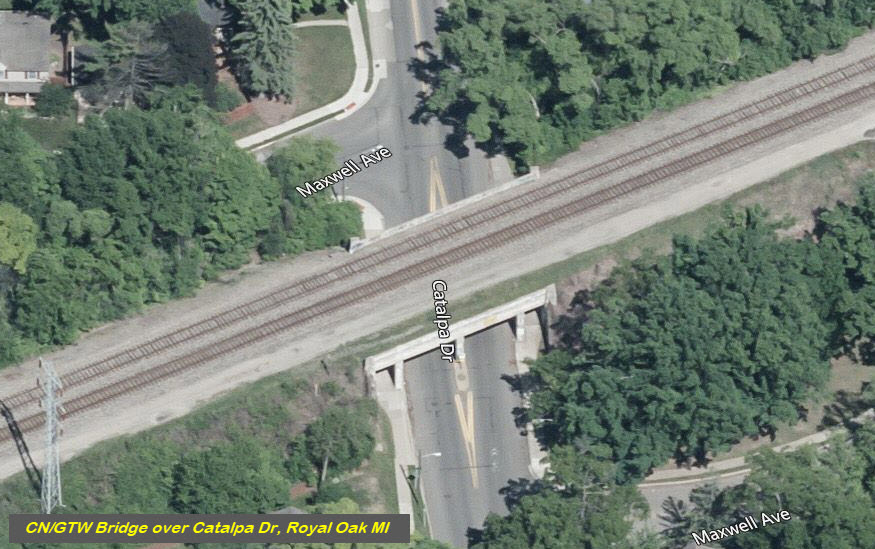
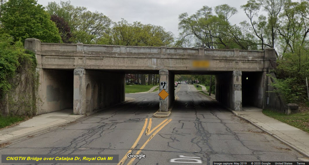
Most of the small bridges going over a 2/3 lane road are of the same design, and all look like one another.
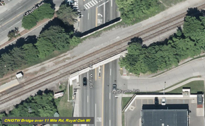
GPS Coordinates: 42.493668, -83.151173
GPS Coordinates: 42.497401, -83.154222
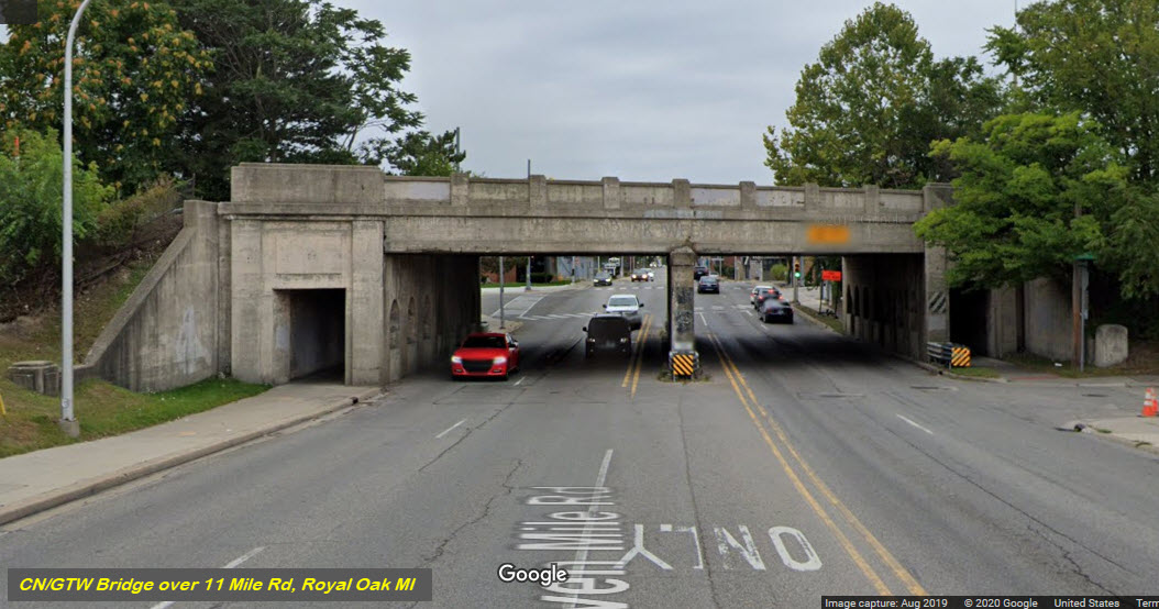
GPS Coordinates: 42.460702, -83.120421
1070 E 9 Mile Rd, Ferndale, MI 48220
Evidence of 4 Tracks
If we look around, along the right-of-way, we can see evidence of there being four tracks at one time.... here are a few examples:
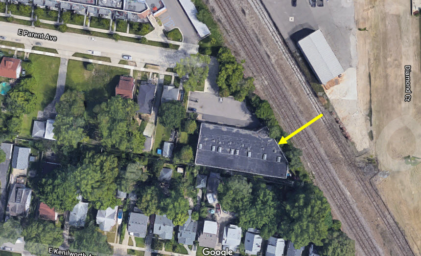
Grade Crossing at Hilton Rd
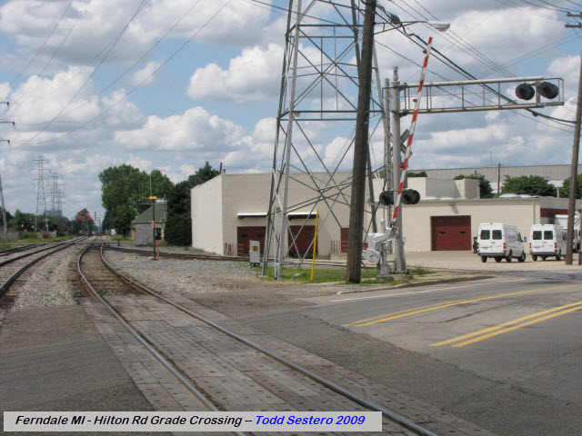
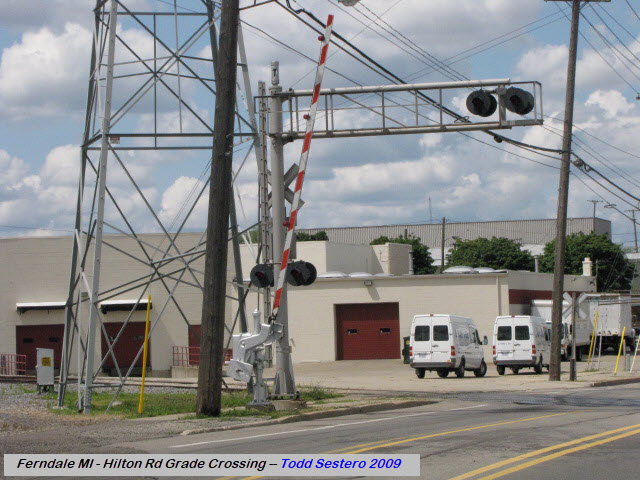
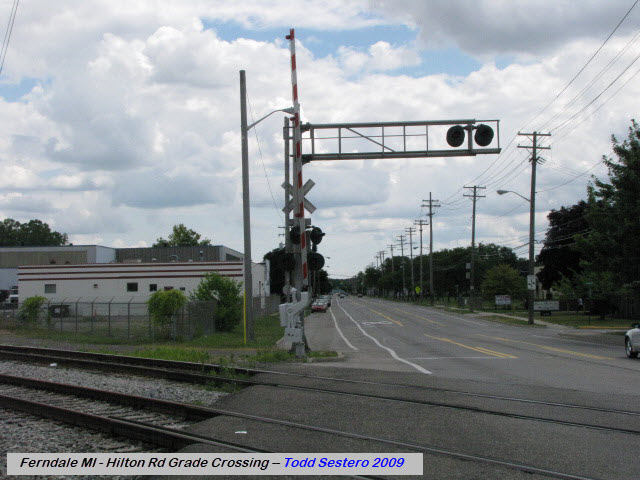
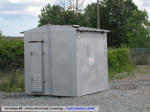
 Looking north
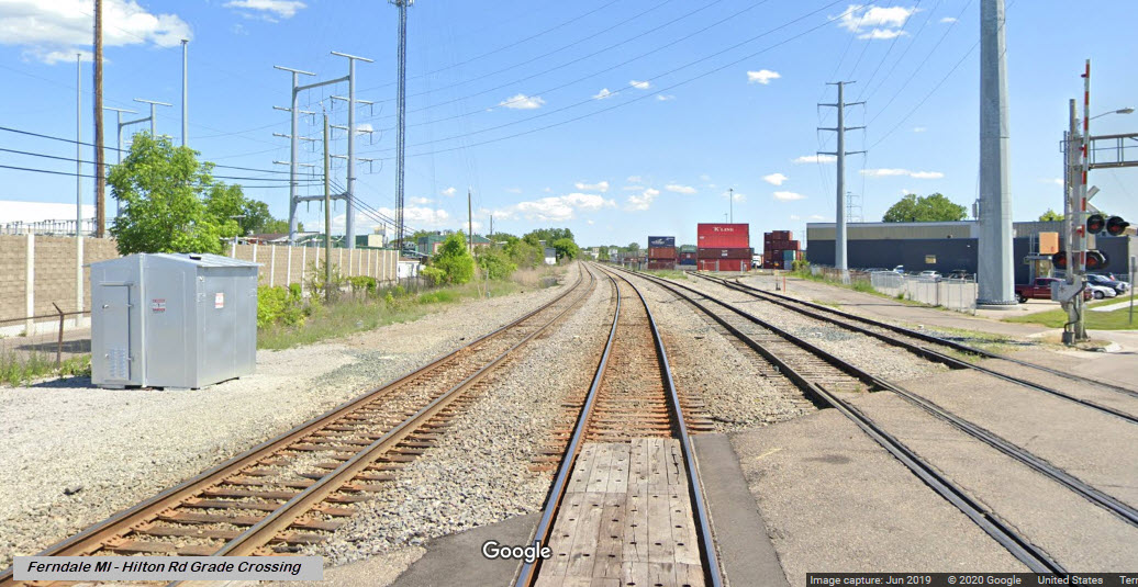 Looking south
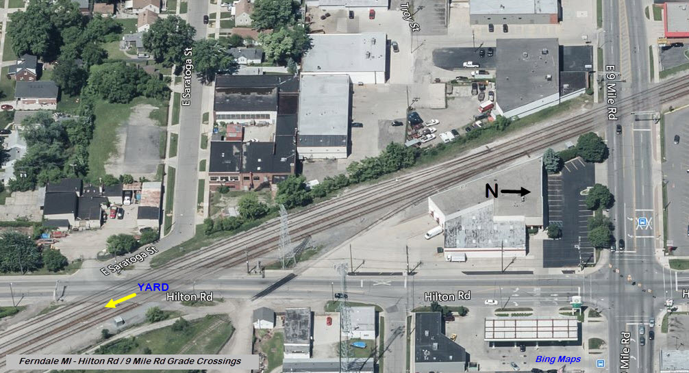
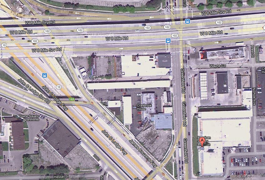
"Infamous" Pawn Shop
Oh yea, if you watch(ed) that TV show about the pawn shop in Detroit (American Jewelry and Loan), it is just to the left on the map off of 8 Mile Lane, where it crosses over 10, the John C Lodge Freeway.
Disclaimers:
I love trains, and I love signals. I am not an expert. My webpages reflect what I find on the topic of the page. This is something I have fun with while trying to help others.
Please Note: Since the main focus of my two websites is railroad signals, the railfan guides are oriented towards the signal fan being able to locate them. For those of you into the modeling aspect of our hobby, my indexa page has a list of almost everything railroad oriented I can think of to provide you with at least a few pictures to help you detail your pike.
If this is a railfan page, every effort has been made to make sure that the information contained on this map and in this railfan guide is correct. Once in a while, an error may creep in :-)
My philosophy: Pictures and maps are worth a thousand words, especially for railfanning. Text descriptions only get you so far, especially if you get lost or disoriented. Take along good maps.... a GPS is OK to get somewhere, but maps are still better if you get lost! I belong to AAA, which allows you to get local maps for free when you visit the local branches. ADC puts out a nice series of county maps for the Washington DC area, but their state maps do not have the railroads on them. If you can find em, I like the National Geographic map book of the U.S..... good, clear, and concise graphics, and they do a really good job of showing you where tourist type attractions are, although they too lack the railroads. Other notes about specific areas will show up on that page if known.
Aerial shots were taken from either Google or Bing Maps as noted. Screen captures are made with Snagit, a Techsmith product... a great tool if you have never used it!
By the way, floobydust is a term I picked up 30-40 years ago from a National Semiconductor data book, and means miscellaneous and/or other stuff.
Pictures and additional information is always needed if anyone feels inclined to take 'em, send 'em, and share 'em, or if you have something to add or correct.... credit is always given! Please be NICE!!! Contact info is here
Beware: If used as a source, ANYTHING from Wikipedia must be treated as being possibly inaccurate, wrong, or not true.
DETROIT RAILFAN GUIDE HOME
RAILFAN GUIDES HOME
RAILROAD SIGNALS HOME
NEW 08/22/2009, SEP02/2020, SEP03/2020, JUL21/2021
Last Modified 22-Jul-2021