RAILFAN GUIDES of the U.S.
Todd's Railfan Guide to
DETROIT MI
M-1 Rail / QLine Streetcar System
In General
Getting Here
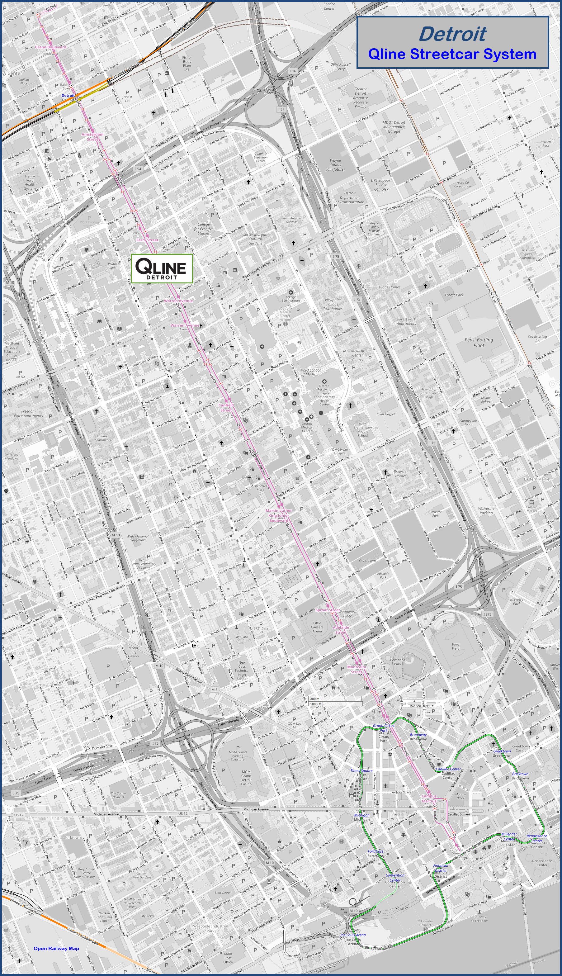
Map
Station by Station
Signals
Floobydust
RAILFAN GUIDES HOME
RAILROAD SIGNALS HOME
Location / Name:
Detroit MI, Wayne County
What's Here:
QLine Streetcar System
Data:
GPS Coordinates: as needed
Phone A/C: 313
ZIP: 48201
Access by train/transit:
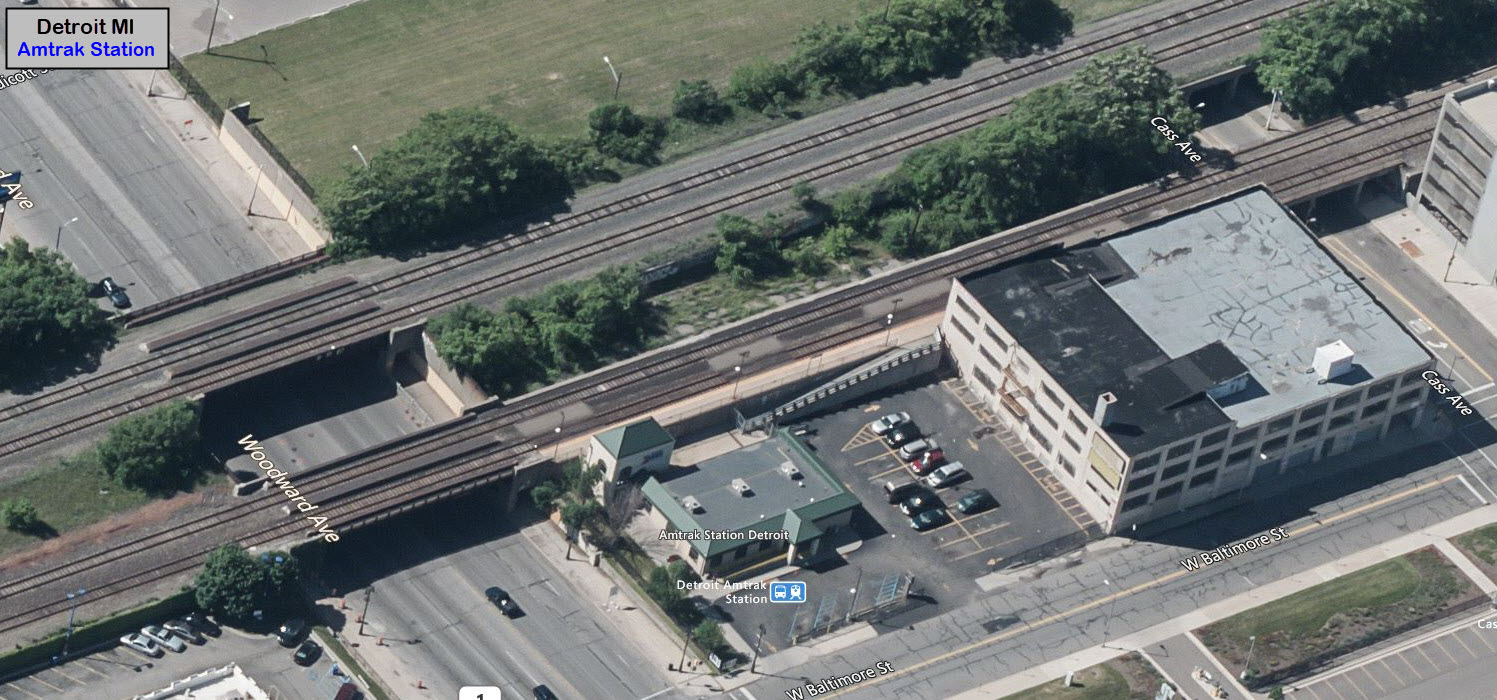
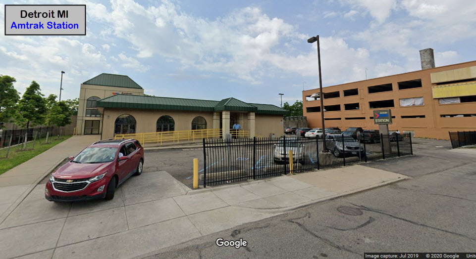
Detroit People Mover at the Grand Circus station
Amtrak at the Baltimore St station
The Scoop:
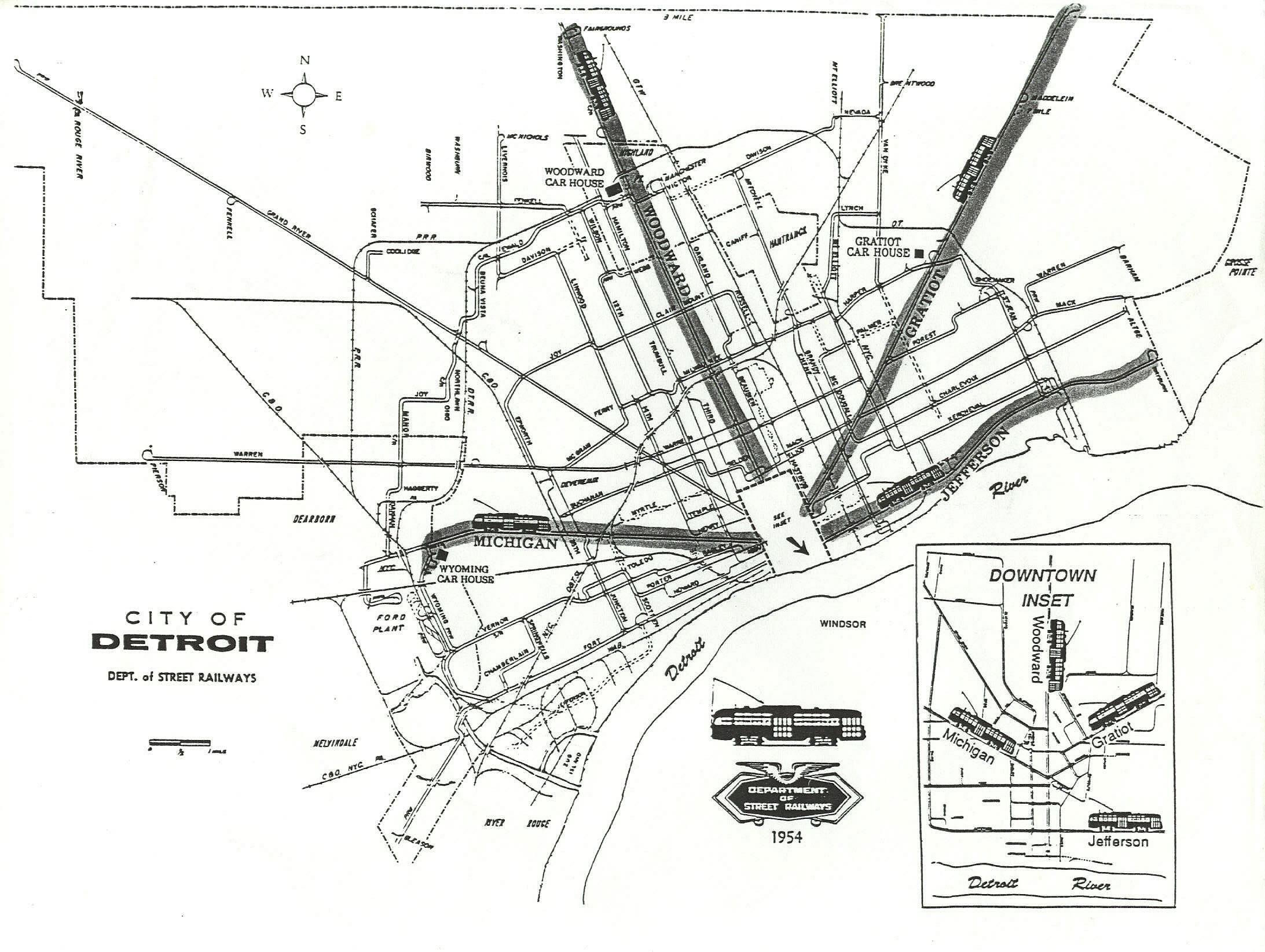
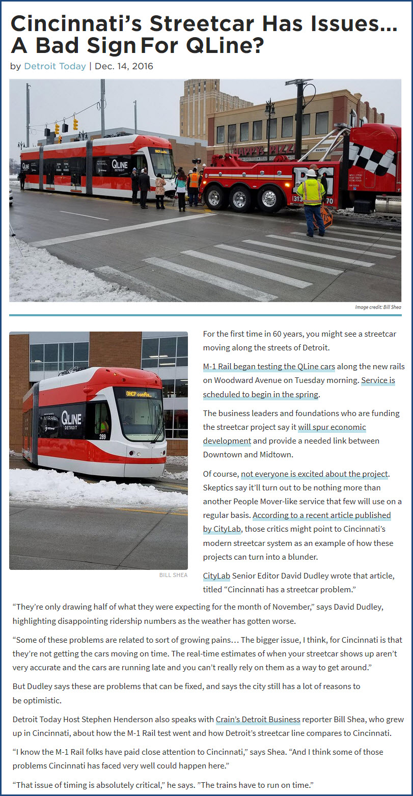
The M-1 Rail / QLine Streetcar System runs north/south on Woodward Avenue, on a path that saw old trolleys and PCC cars in "the old days". Service began in 2017, 61 years after the last streetcar was removed from Woodward Ave.
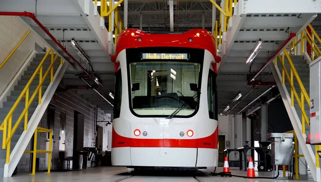
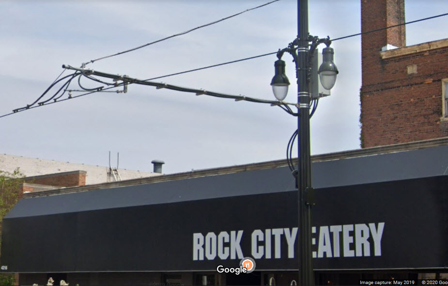
The system is the second line in the U.S. that is hybrid: It can run off either the overhead line, or from an onboard battery.
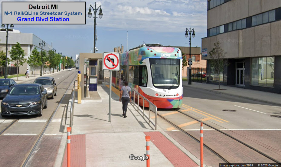
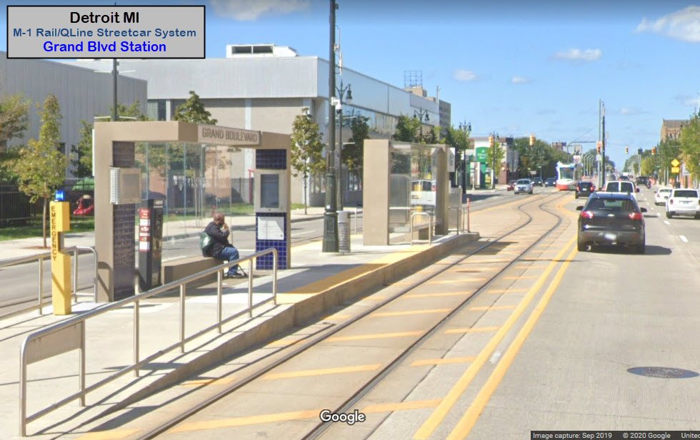
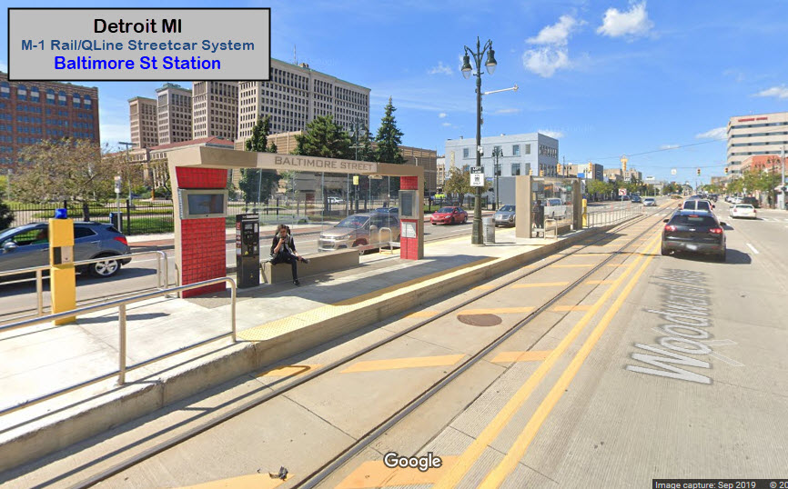
The system has two styles of platforms: Center Running, and Curb Running. The first three stations at the north end are center running like the old streetcar system: Grand Blvd, Baltimore St, and Amsterdam St.
 Curb station
 Center station
What came before: the venerable PCC car.....

Acknowledgements:
Steve Neavling
Denver Todd
Google Maps
Bing Maps
Websites and other additional information sources of interest for the area:
https://en.wikipedia.org/wiki/QLine
https://qlinedetroit.com/
https://usa.streetsblog.org/2018/03/14/how-detroits-streetcar-overlooked-real-transit-needs-to-satisfy-a-well-connected-few/
https://www.npr.org/sections/thetwo-way/2017/05/12/528190480/after-61-years-detroit-gets-a-streetcar-once-more
https://medium.com/@degiff/m-1-qline-a-detailed-guide-842839a1cf1e
I-75 northbound, exit 50 puts you in Greektown.
Exit 2C off of SB M10, take a left-puts you on Grand River Avenue, take it till it crosses the streetcar line at Woodward.
Greektown is in the middle of sooooo many highways, it is probably best to use your GPS!
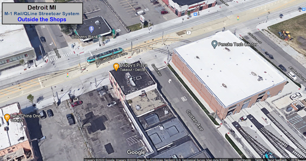
The Car Barn / Penske Tech Center
GPS Coordinates: 42.372234, -83.074110
The car barn, maintenance shops, whatever you want to call it, is at the very north end of the line beyond the last station on the line, Grand Blvd.


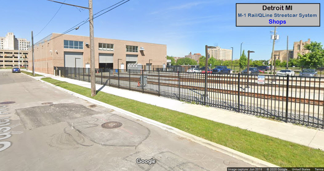
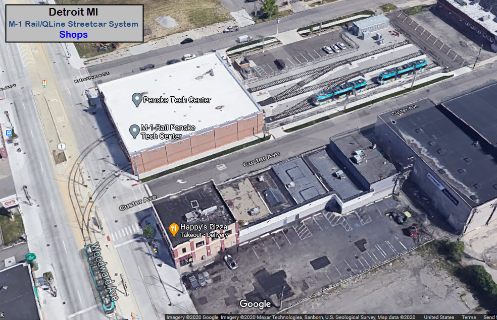
Tail Track
Right outside the shops on Woodward Ave is a short section of single track between there and the two tracks that run down Woodward. I'm guessing that this is where the trains turn around for the return trip south into downtown.


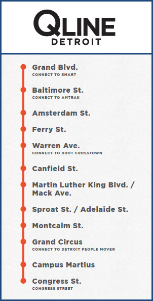
Grand Blvd
GPS Coordinates: 42.370642, -83.073552
Baltimore St
GPS Coordinates: 42.368743, -83.072328
This station is across the street from the Amtrak station.
Amtrak Station
GPS Coordinates: 42.368007, -83.072321
Here you can catch the three times daily Wolverine to Chicago to the west, or Pontiac to the north.

Amsterdam St
GPS Coordinates:
Ferry St
GPS Coordinates:
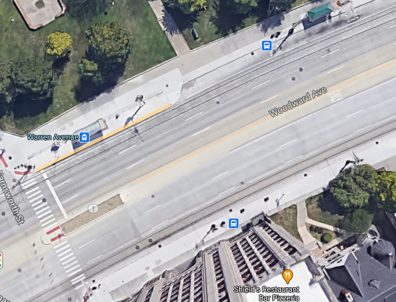
Warren Ave
GPS Coordinates:
Canfield St
GPS Coordinates:
MLK Blvd / Mack Ave
GPS Coordinates:
Sproat St / Adelaide St
GPS Coordinates:
Montcalm St
GPS Coordinates:
Grand Circus
GPS Coordinates:
Campus Martius
GPS Coordinates:
Congress St
GPS Coordinates:
The
The
Detroit Streetcar map from 1954:
Power feed between Willis and Canfield, across from and at McDonalds.


Disclaimers:
I love trains, and I love signals. I am not an expert. My webpages reflect what I find on the topic of the page. This is something I have fun with while trying to help others.
Please Note: Since the main focus of my two websites is railroad signals, the railfan guides are oriented towards the signal fan being able to locate them. For those of you into the modeling aspect of our hobby, my indexa page has a list of almost everything railroad oriented I can think of to provide you with at least a few pictures to help you detail your pike.
If this is a railfan page, every effort has been made to make sure that the information contained on this map and in this railfan guide is correct. Once in a while, an error may creep in :-)
My philosophy: Pictures and maps are worth a thousand words, especially for railfanning. Text descriptions only get you so far, especially if you get lost or disoriented. Take along good maps.... a GPS is OK to get somewhere, but maps are still better if you get lost! I belong to AAA, which allows you to get local maps for free when you visit the local branches. ADC puts out a nice series of county maps for the Washington DC area, but their state maps do not have the railroads on them. If you can find em, I like the National Geographic map book of the U.S..... good, clear, and concise graphics, and they do a really good job of showing you where tourist type attractions are, although they too lack the railroads. Other notes about specific areas will show up on that page if known.
Aerial shots were taken from either Google or Bing Maps as noted. Screen captures are made with Snagit, a Techsmith product... a great tool if you have never used it!
By the way, floobydust is a term I picked up 30-40 years ago from a National Semiconductor data book, and means miscellaneous and/or other stuff.
Pictures and additional information is always needed if anyone feels inclined to take 'em, send 'em, and share 'em, or if you have something to add or correct.... credit is always given! Please be NICE!!! Contact info is here
Beware: If used as a source, ANYTHING from Wikipedia must be treated as being possibly inaccurate, wrong, or not true.
DETROIT HOMEPAGE
RAILFAN GUIDES HOME
RAILROAD SIGNALS HOME
NEW SEP04/2020
Last Modified 06-Sep-2020