
In General
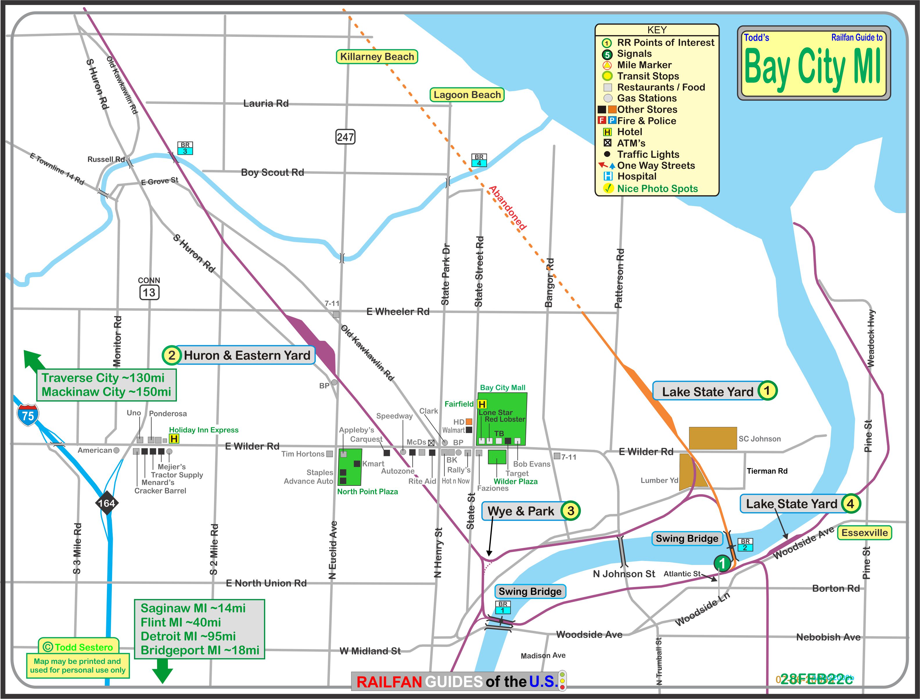
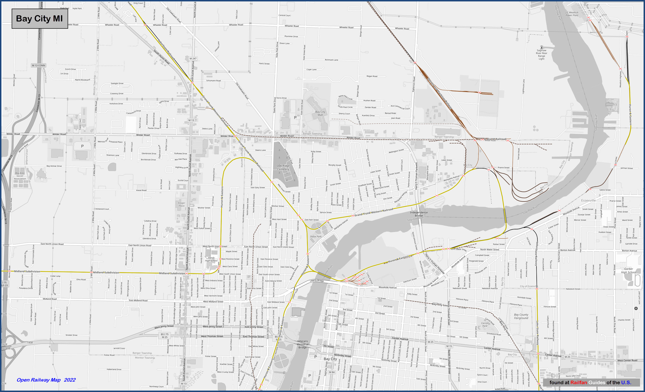
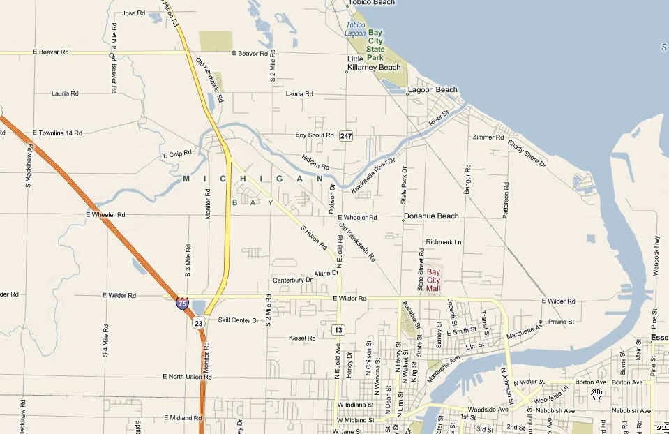
Map
Sights
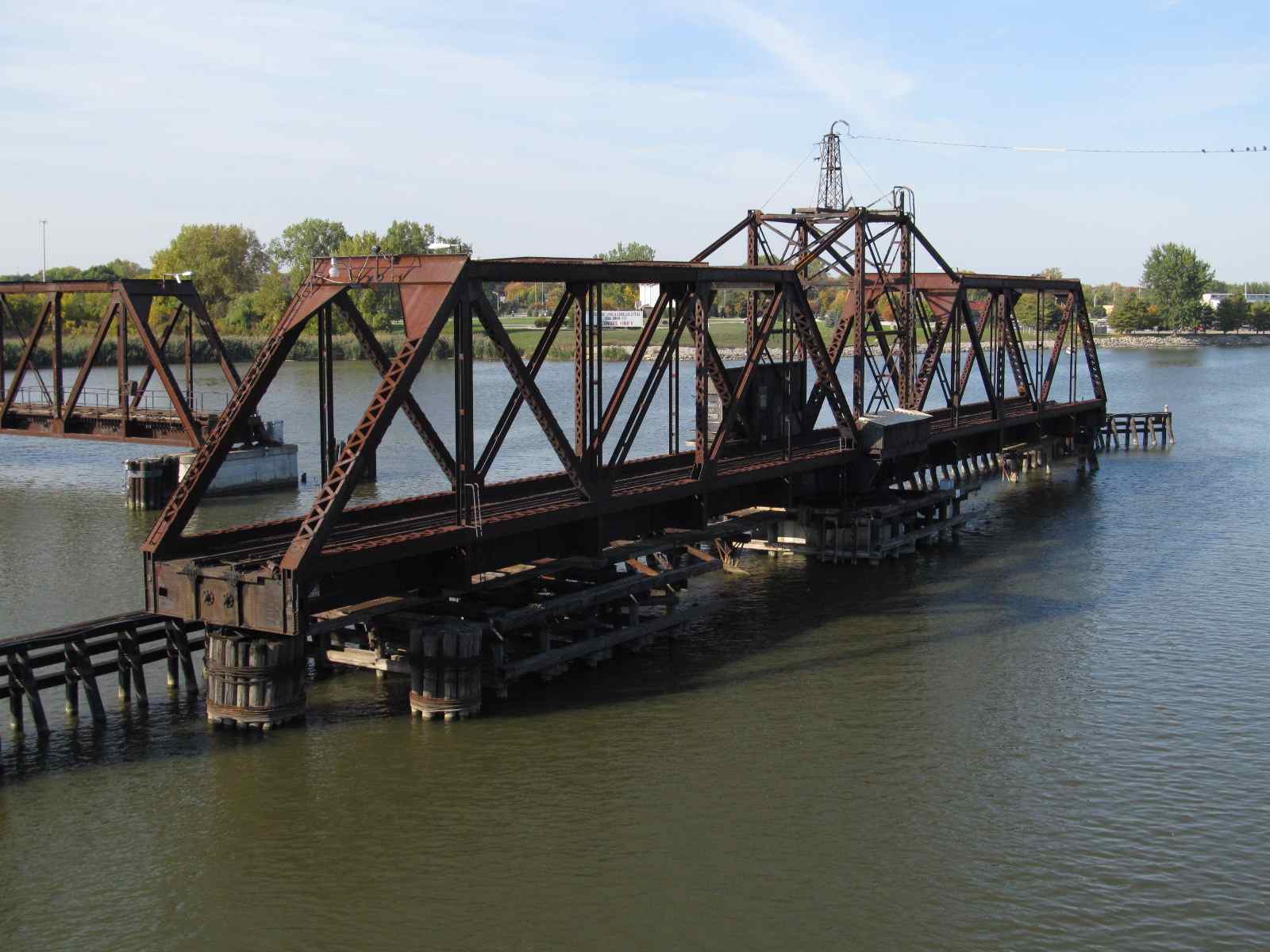
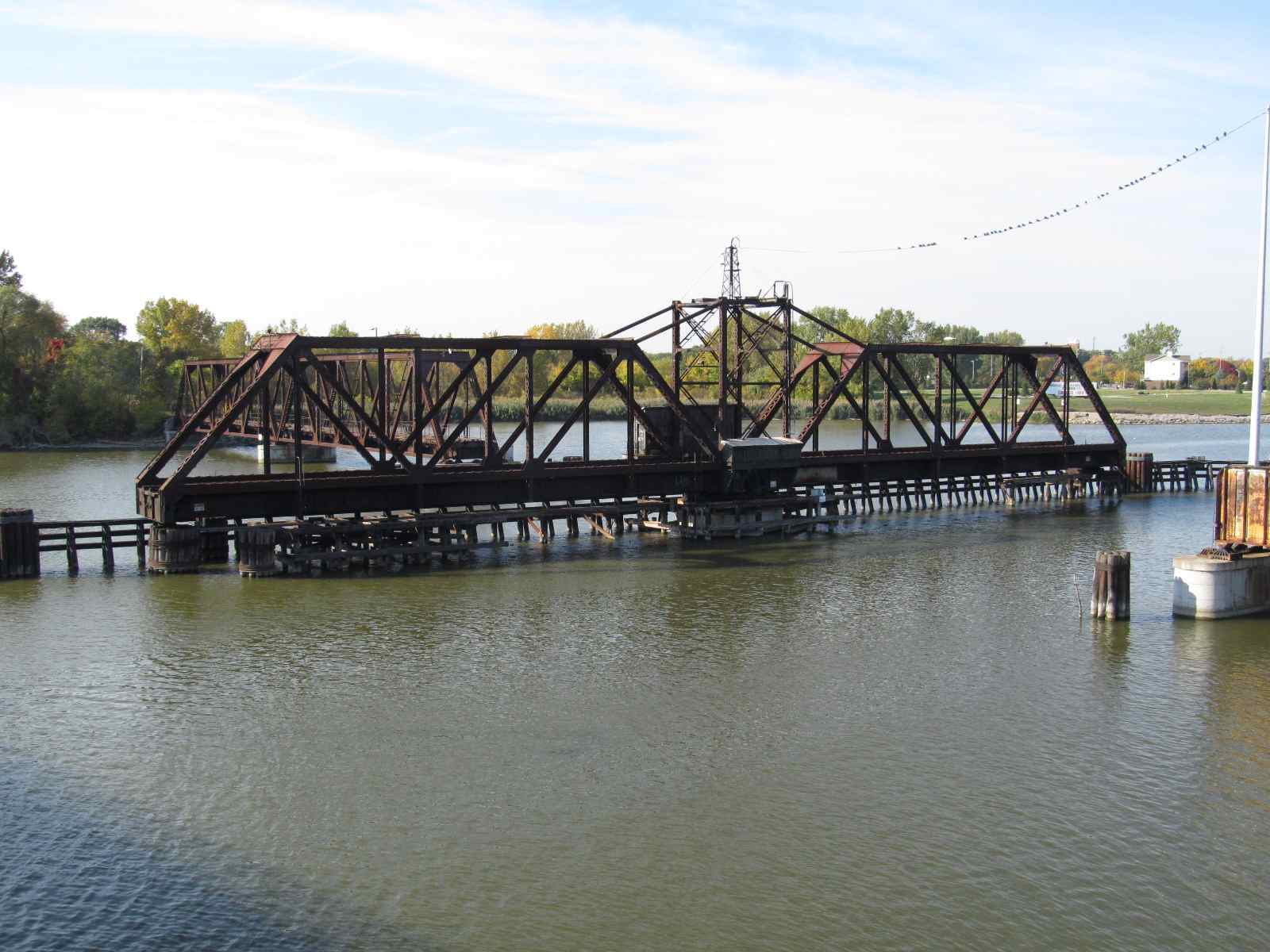
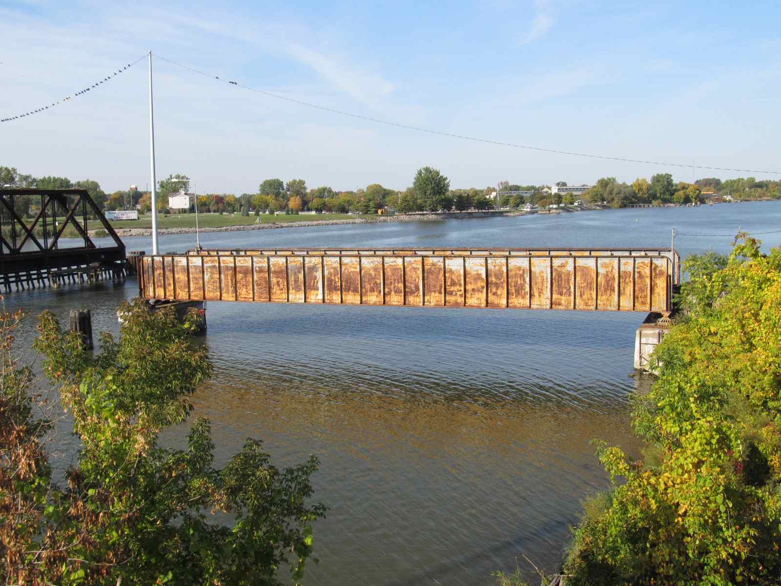
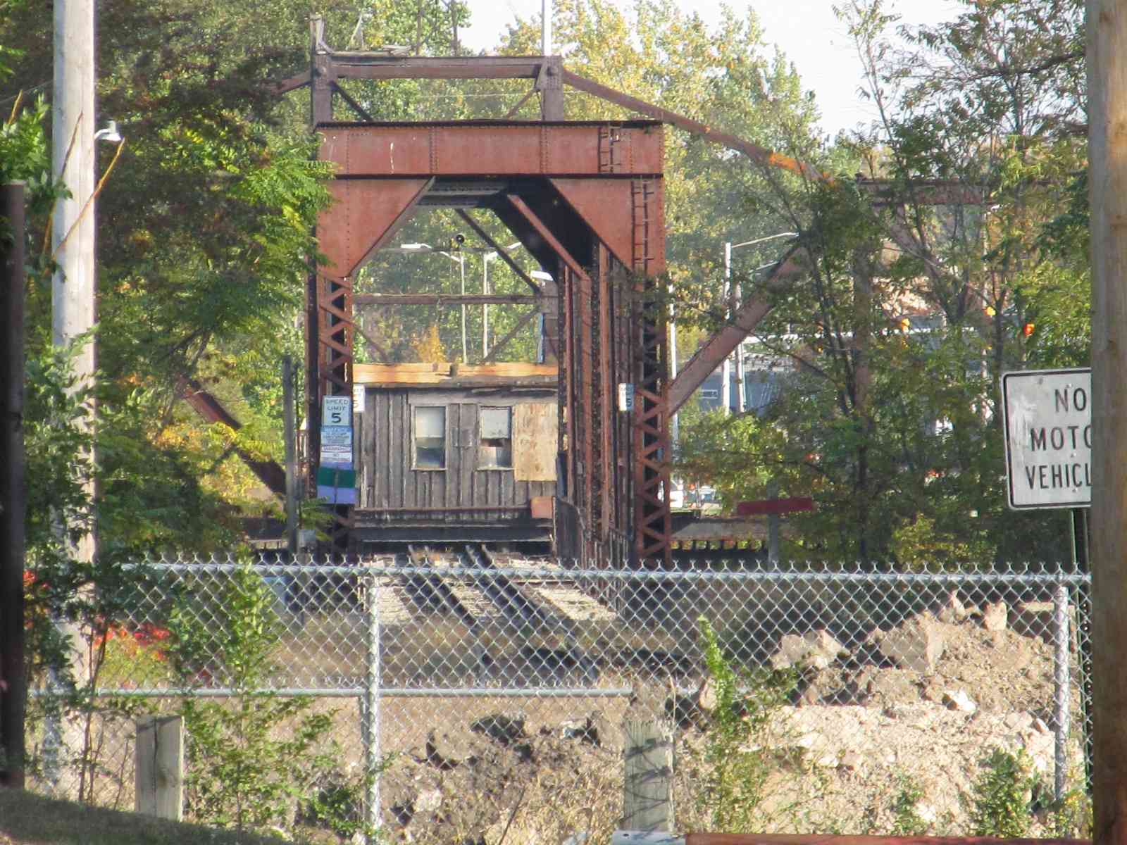
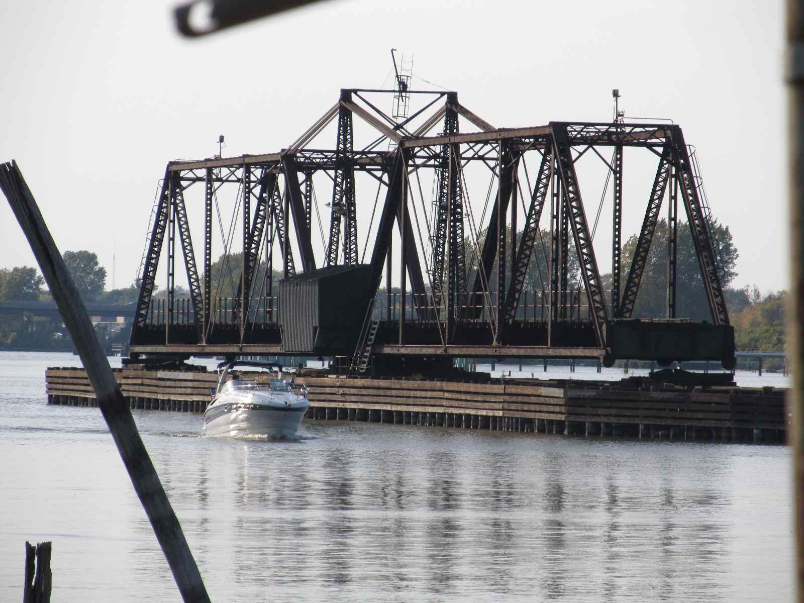
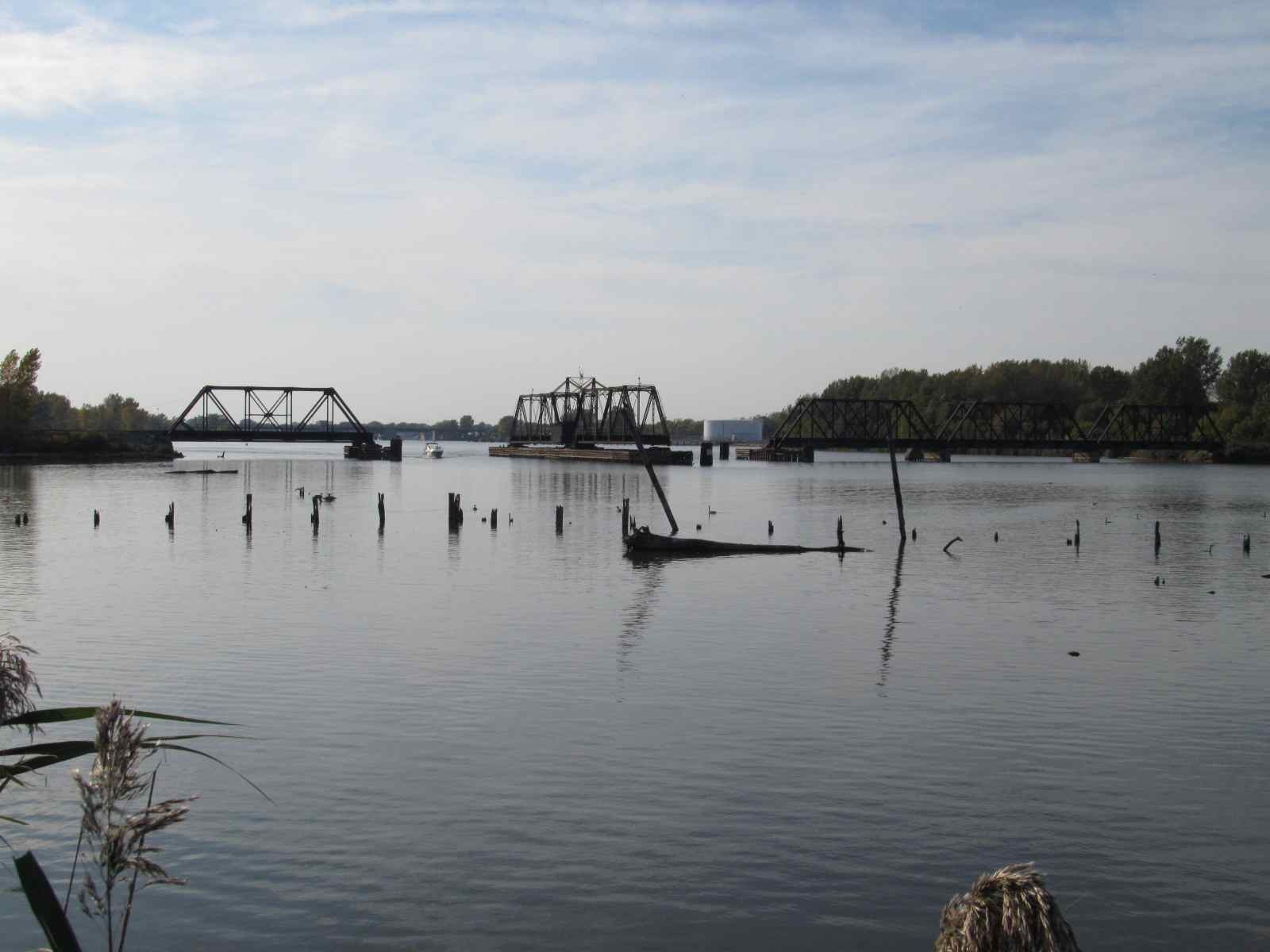
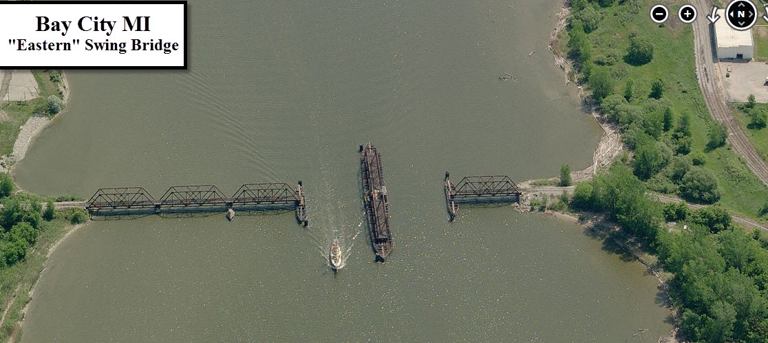
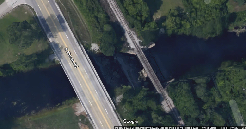
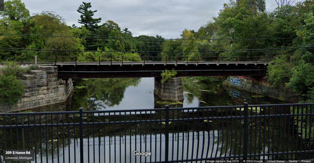
Bridges
Signals
Fire and Police
Floobydust
RAILFAN GUIDES HOME
RAILROAD SIGNALS HOME
Location / Name:
Bay City MI, Bay County
What's Here:
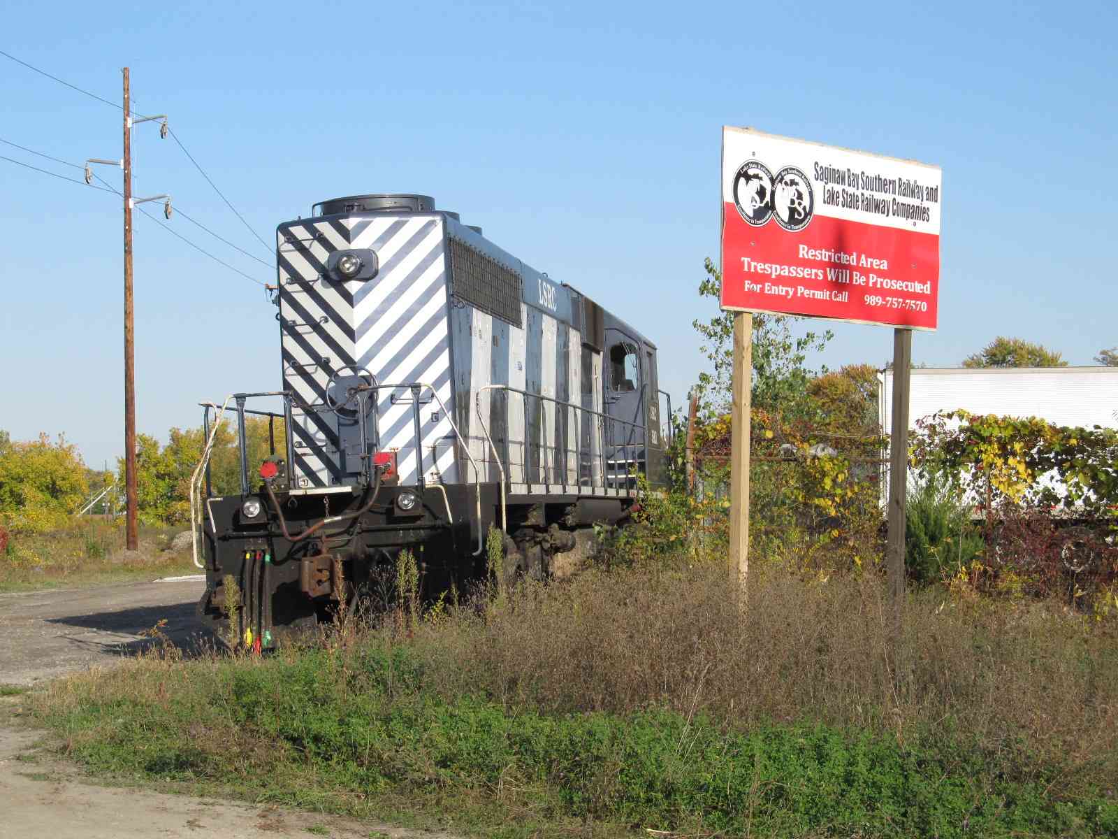
Lake State RR
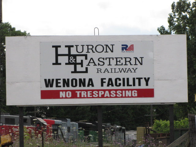
Huron and Eastern RR
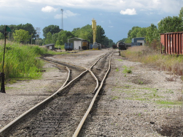
Three Yards
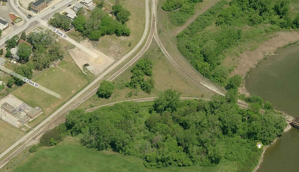
Two Wyes
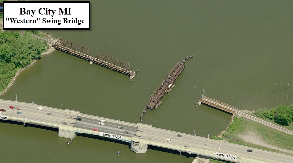
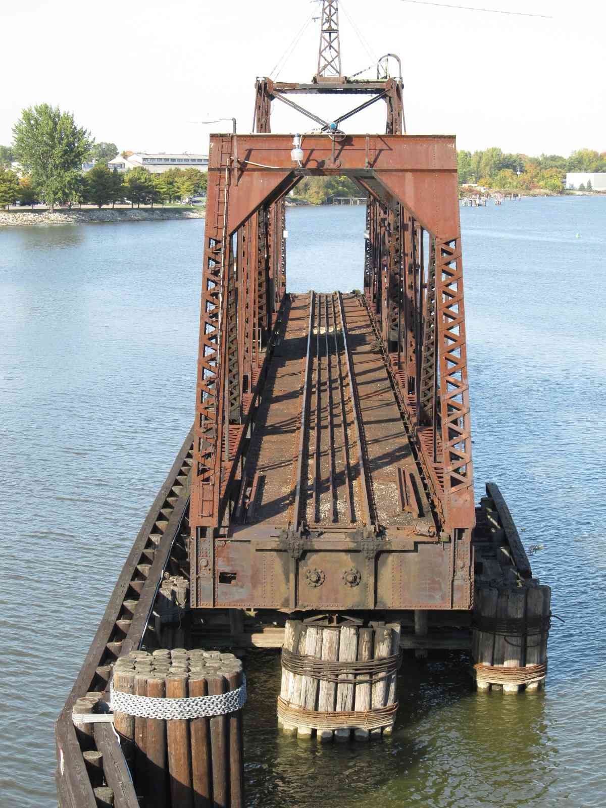
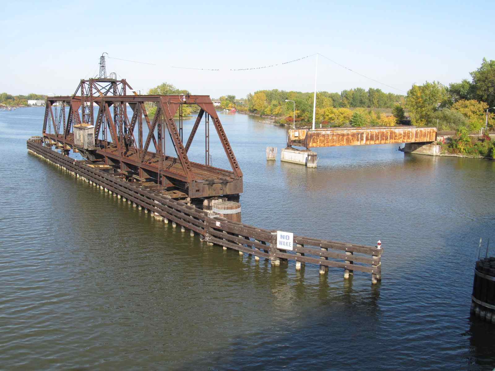
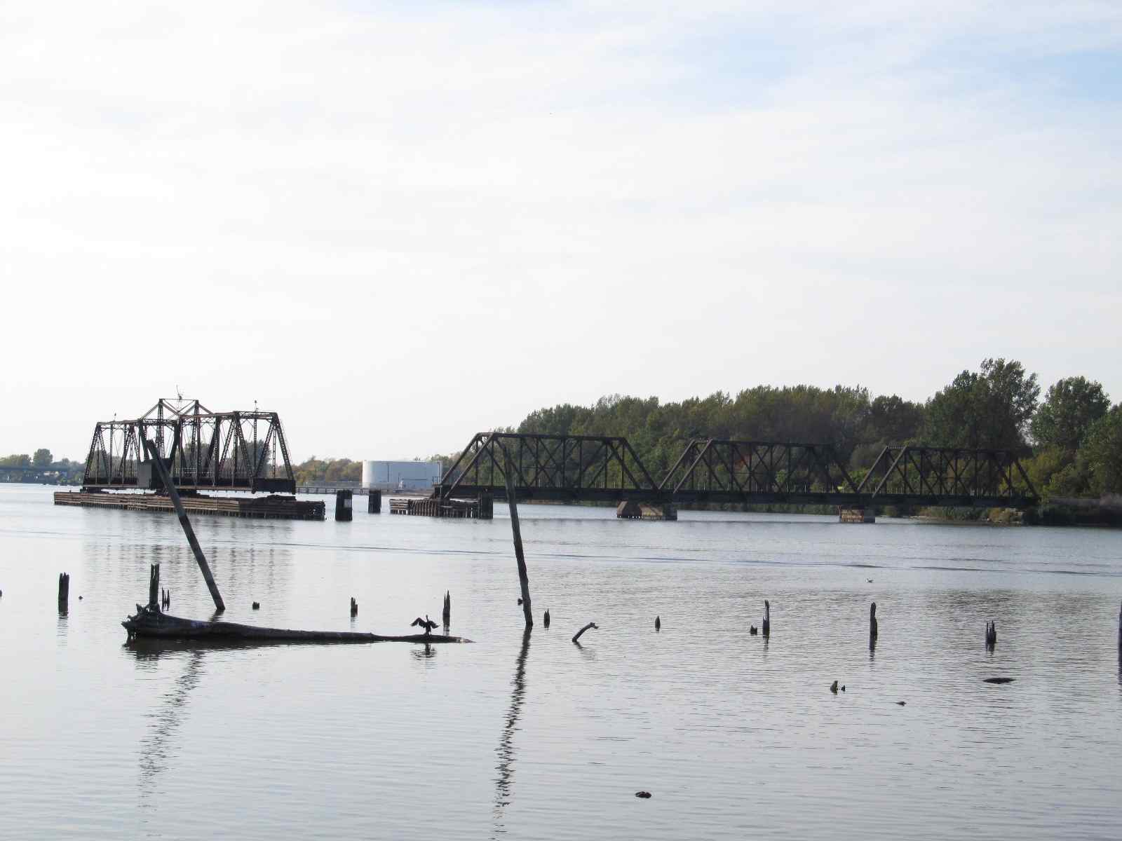
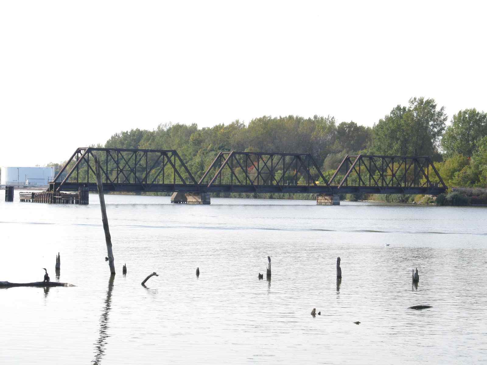
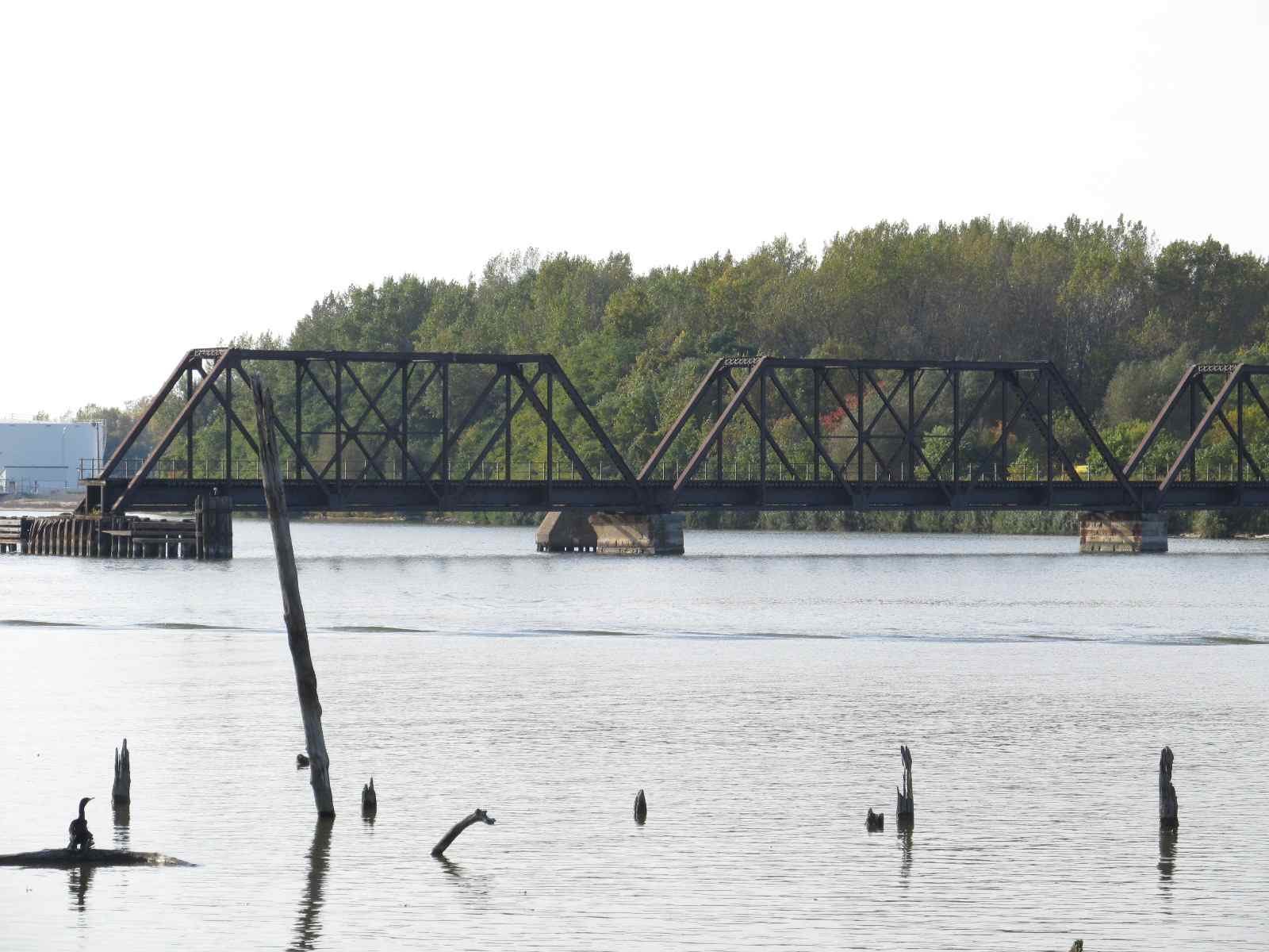
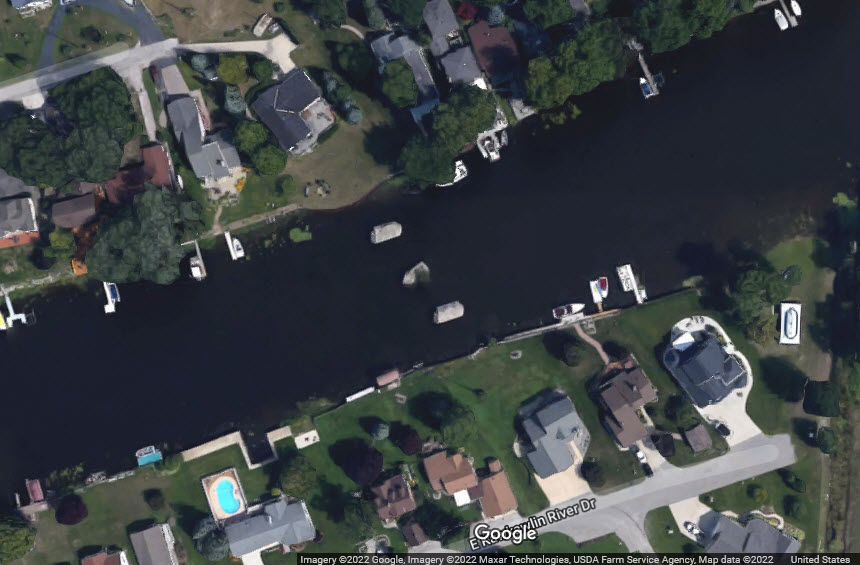
Two Swing Bridges
Data:
GPS Coordinates: as needed
Phone A/C: 989
ZIP: 48701
Access by train/transit:
None
The Scoop:
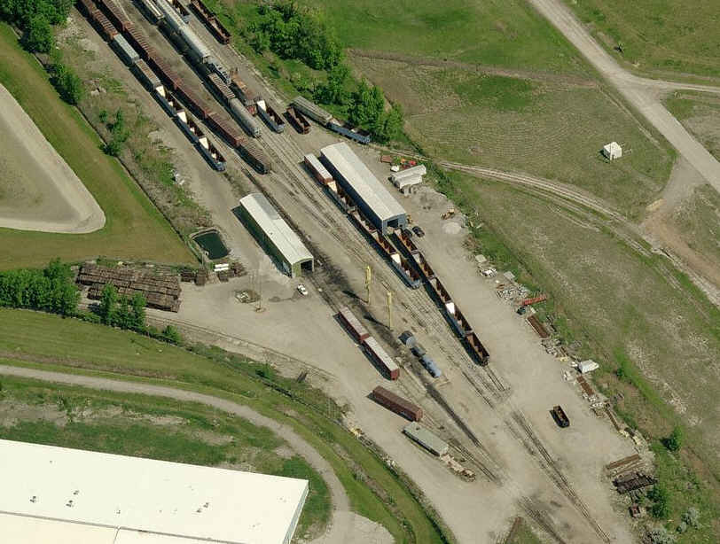
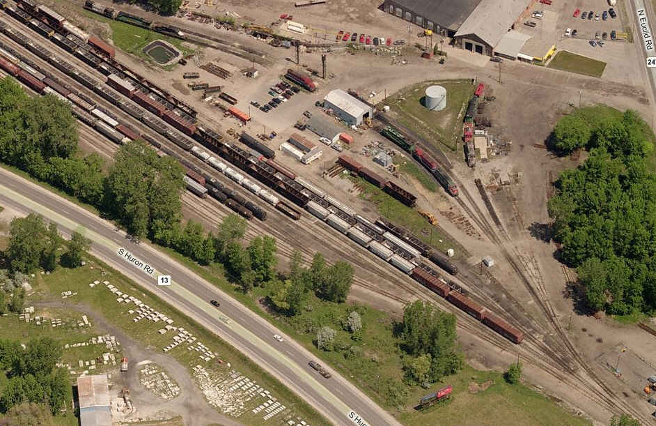
Bay City hosts three yards, two belong to the Lake State RR, and the other to the Huron and Eastern (formerly Central of Michigan).
There are also two swing bridges, and three wyes, altho one of them has had one of it's legs "cut" off.
Waiting for trains to go over the bridges may take more patience than you have, so a stop to the yards for some info may prove to be worthwhile - if anyone is around.
Note: Bing Maps no longer has a "birds eye view" for Bay City :-(
Acknowledgements:
Denver Todd
Google Maps
Bing Maps
Websites and other additional information sources of interest for the area:
https://www.lsrc.com/
Map
For the above map in a PDF format, click
here
https://www.lsrc.com/about/
I haven't caught anything running on the few trips I have been to Bay City, but then, for some reason, I almost always seem to come thru during the weekends.
From their website: Lake State Railway Company was created by the vision of the late Jim George in 1992 when he acquired the railroad lines previously operated by Detroit & Mackinac Railway Company (D&M). His passion for expanding the railroad and providing exceptional freight transportation services is what brought these lines from being nearly abandoned, to being a successful railroad.
In 2005, LSRC acquired rail property from CSX in the Saginaw, Michigan area. These lines were operated under the name Saginaw Bay Southern Railway (SBS) until January 2012, when LSRC merged these two companies together under the name Lake State Railway Company. In April 2012, SBS interchanges and railroad accounting practices were converted to LSRC, completing the consolidation. Consistent investment in rail infrastructure, equipment and facilities has positioned LSRC to continue to expand its' business. To drive this continuous improvement, LSRC has developed a rolling five-year track maintenance and improvement plan.
Grain, fertilizer, coal, chemicals, aggregates, cement, steel, and scrap metal are just a few of the commodities that are transported along the lines. LSRC continues to be a consistently profitable railroad and shows a high priority to maintaining and improving its' rail infrastructure. LSRC strives to maintain a proactive position towards safe operations.
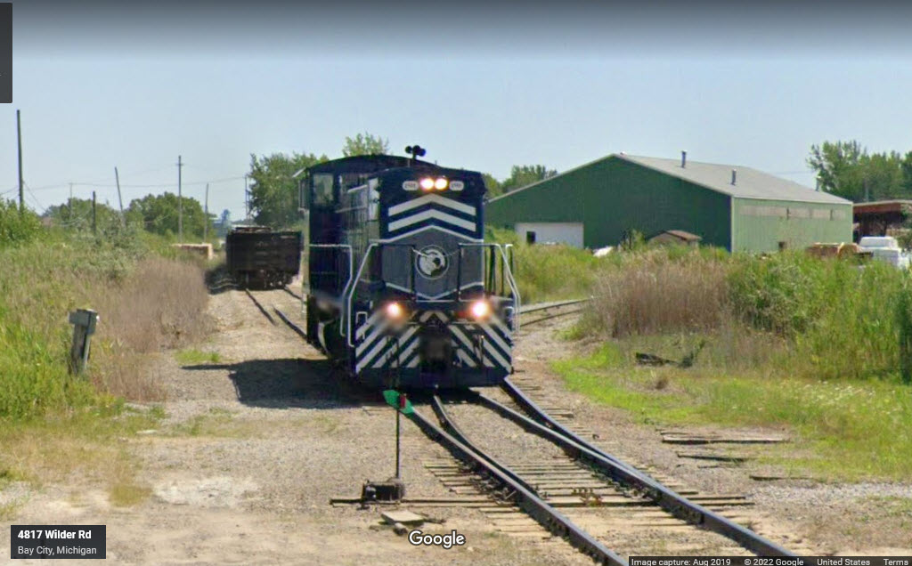
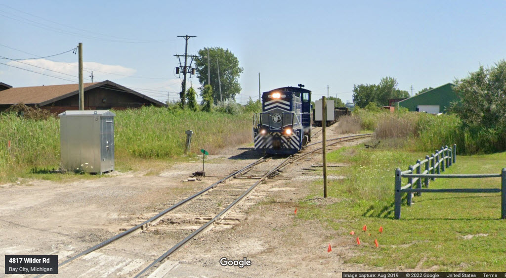
Above: Looking in from Wilder Road, and what you can see from there... Not much here, and their track ends on the other side of the yard... I guess they lost their customers up there. Below: The Lake State shops.
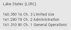 The Lake State radio freqs
A few pictures from Google Streetview, taken from Wilder Rd.
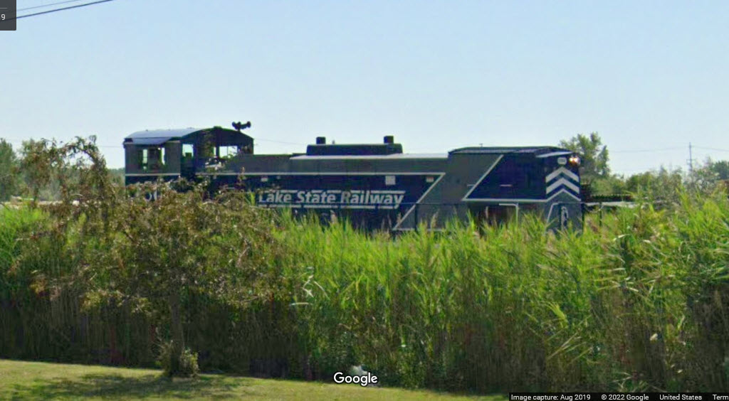
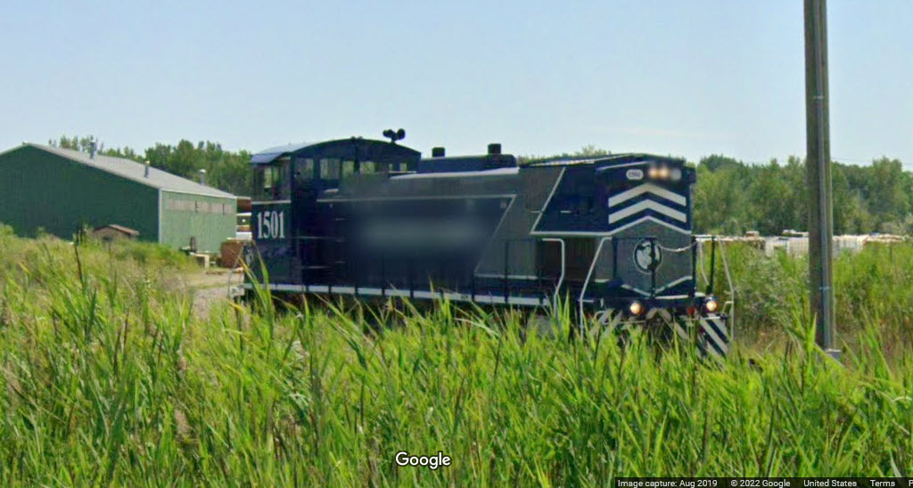
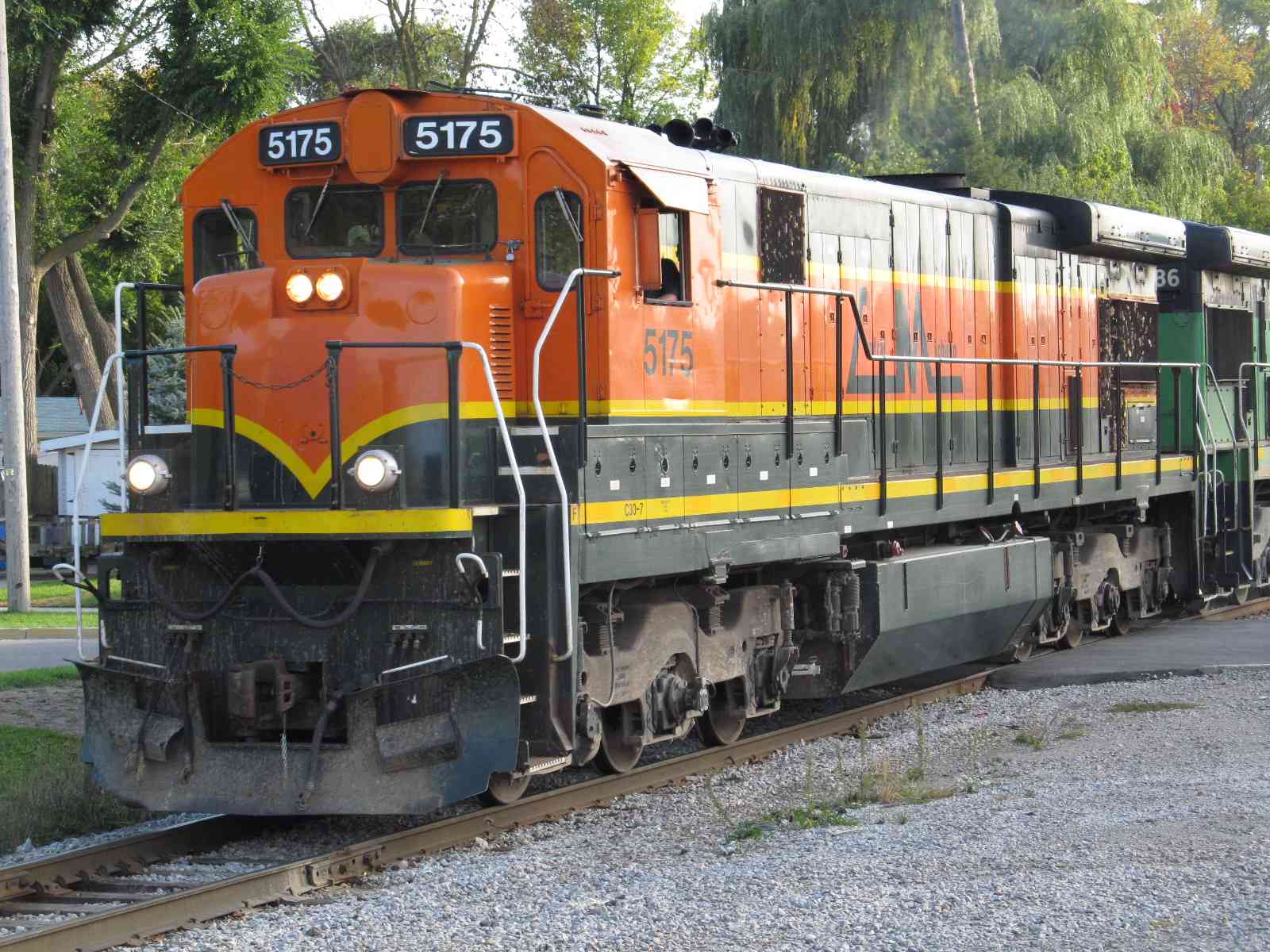
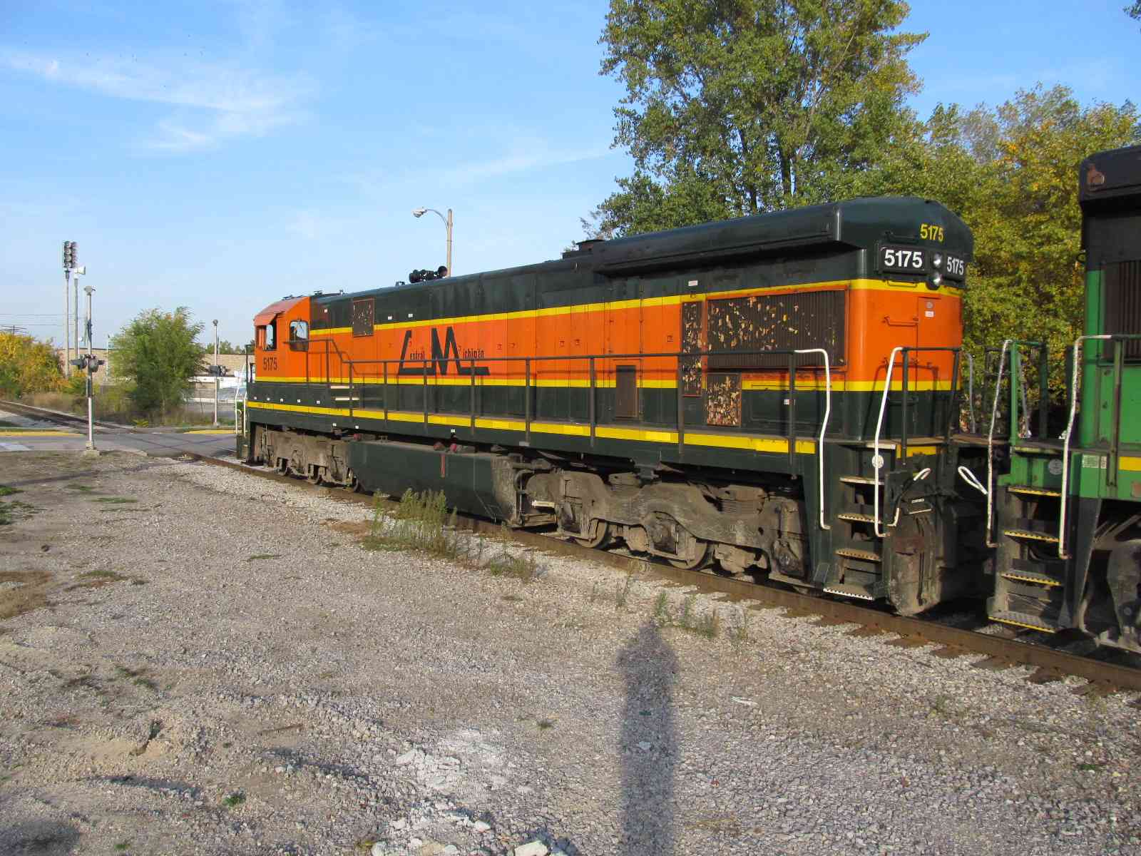
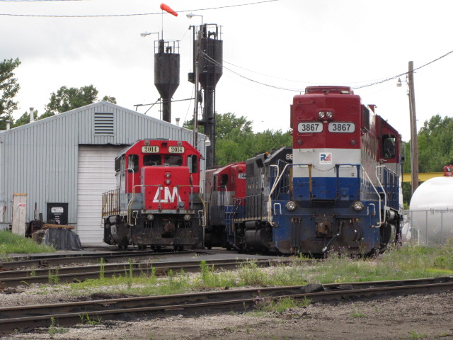
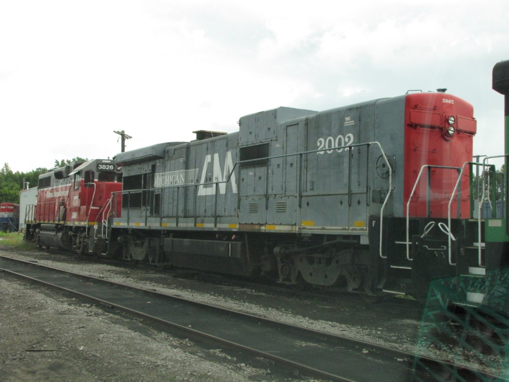
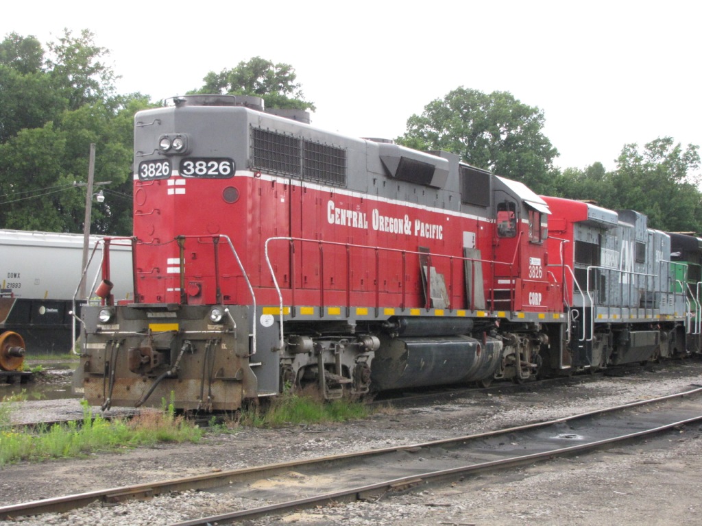
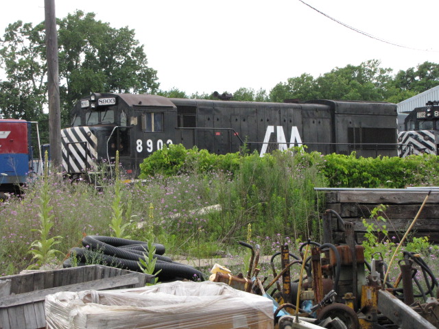
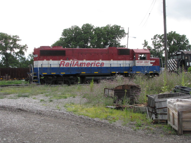
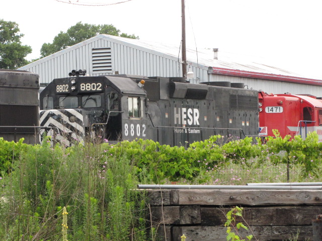
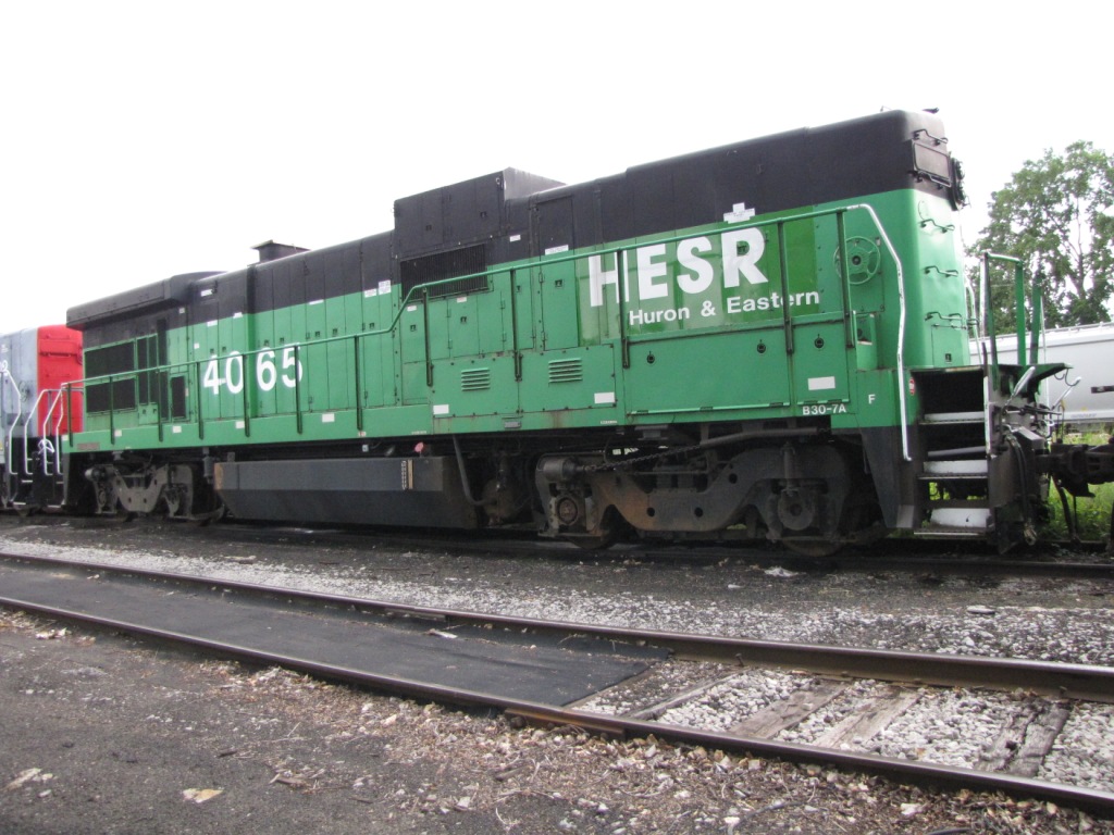
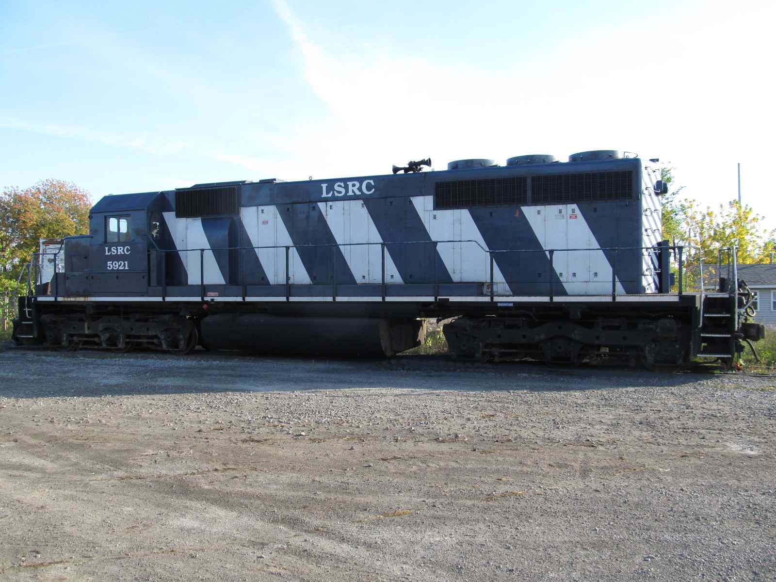
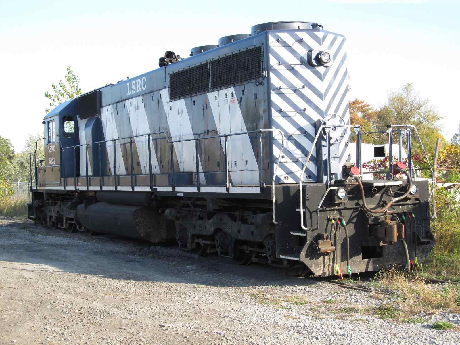
On the day we were there, there was quite a collection of equipment sitting around.... In addition to the H&E stuff, there were still a few geeps painted CM hanging around, as well as a few units in Rail America and Central Oregon and Pacific, and a couple of "B" units, which today are really rare.... A great break from the big class one's! NOTE: #4065 below is a cabless "B" unit - pretty rare these days - maybe it's a leftover from the Santa Fe?
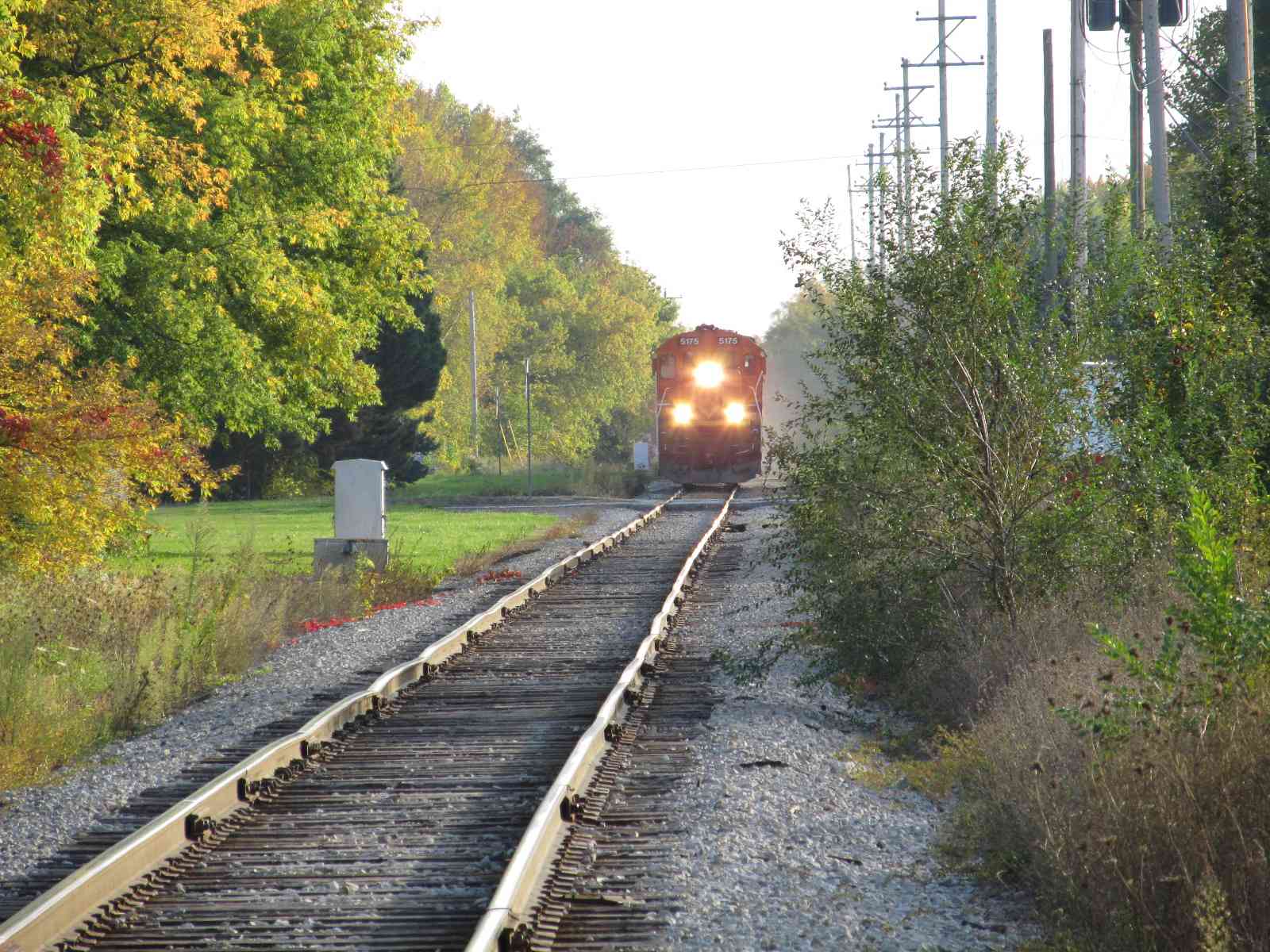
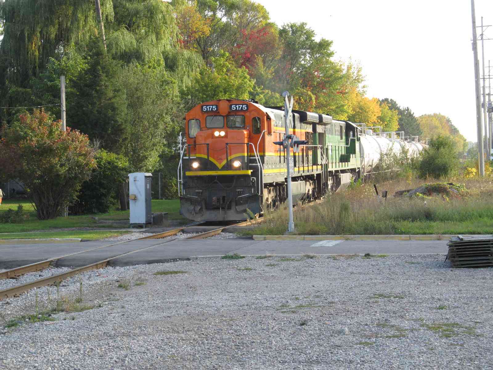
I finally managed to snag a train coming into town on my last visit in 2011. I was headed out of town filling the tank on truck when I heard the unmistakable sound of trains at a crossing (yeah, I know, it could be a truck), but I took a chance and drove back into the southern part of town where I was delightfully surprised by the train below.


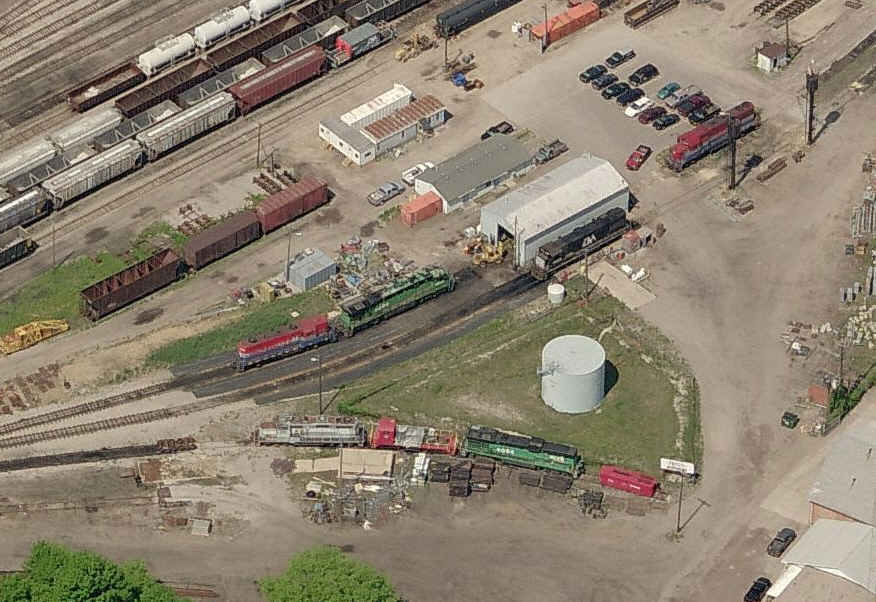
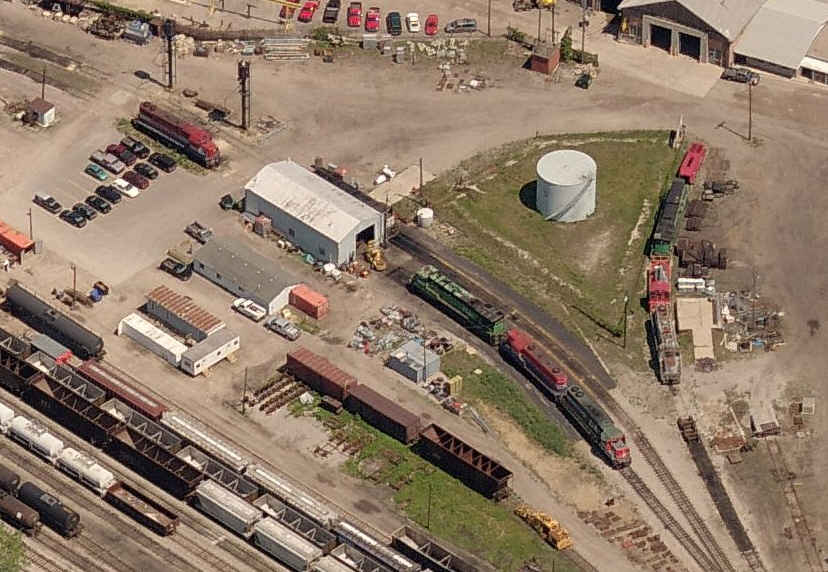

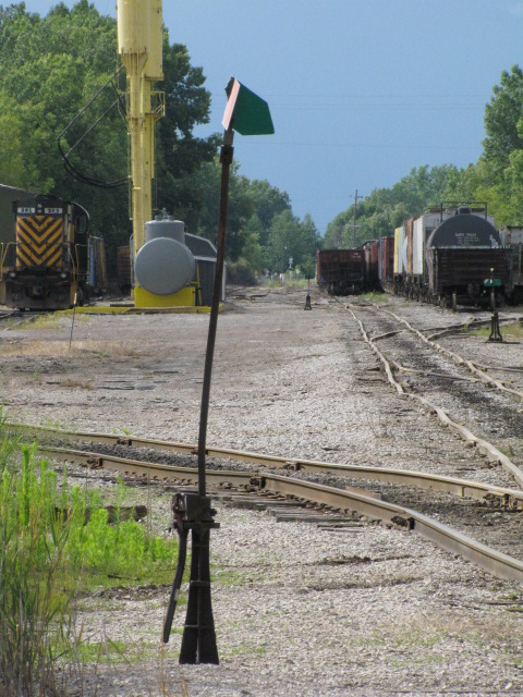
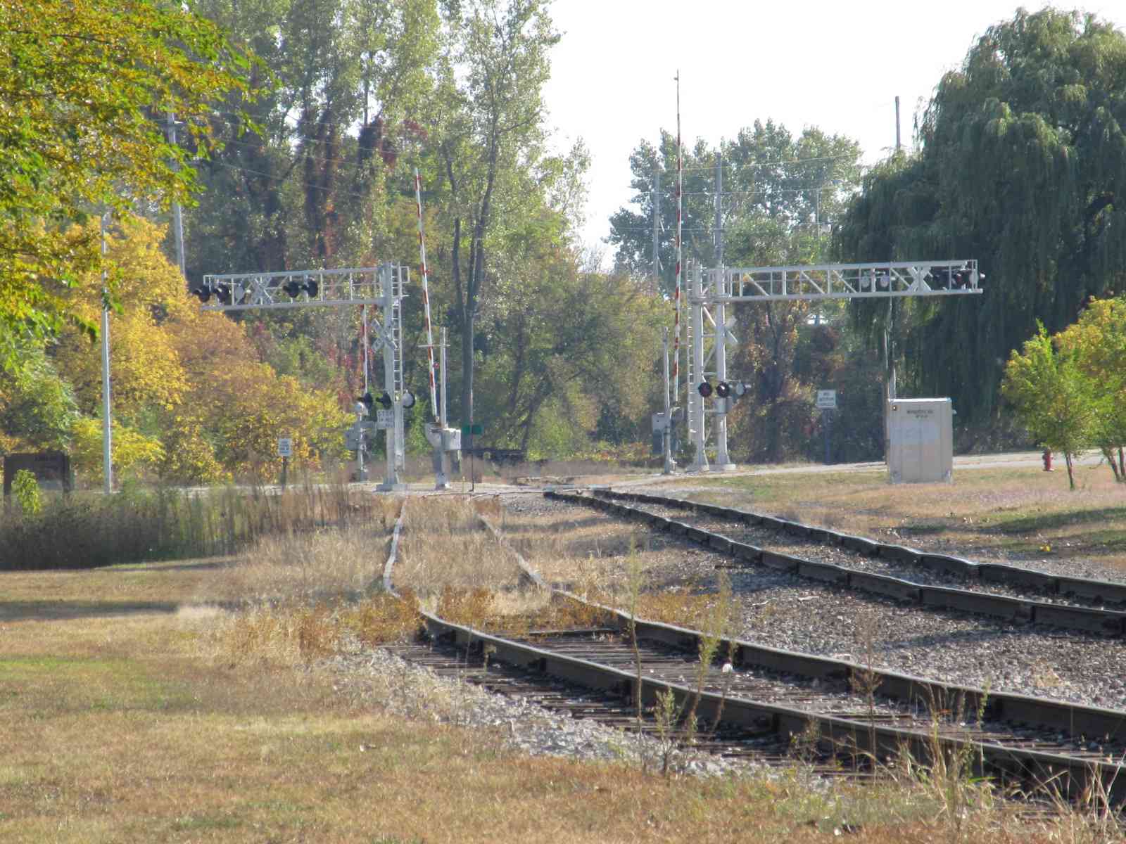
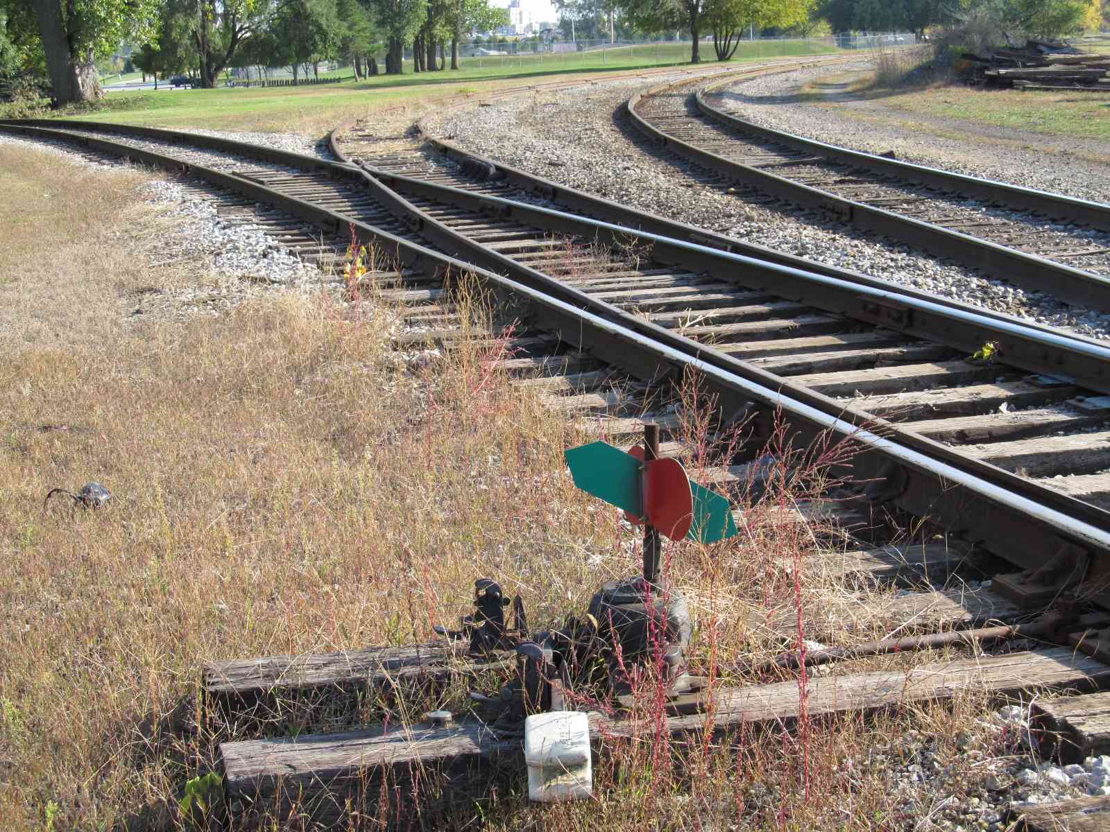
Three aerial views of the Huron & Eastern yard, and the frequencies.
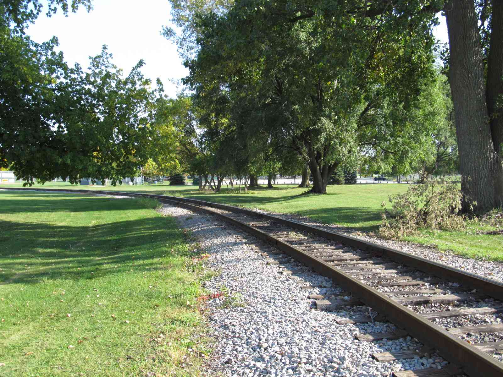
The park used to sport a wye, but one side of it has been removed. It must still be pretty cool to see a freight come through if you're there for a game (of course, the baseball fans might not think so :-)

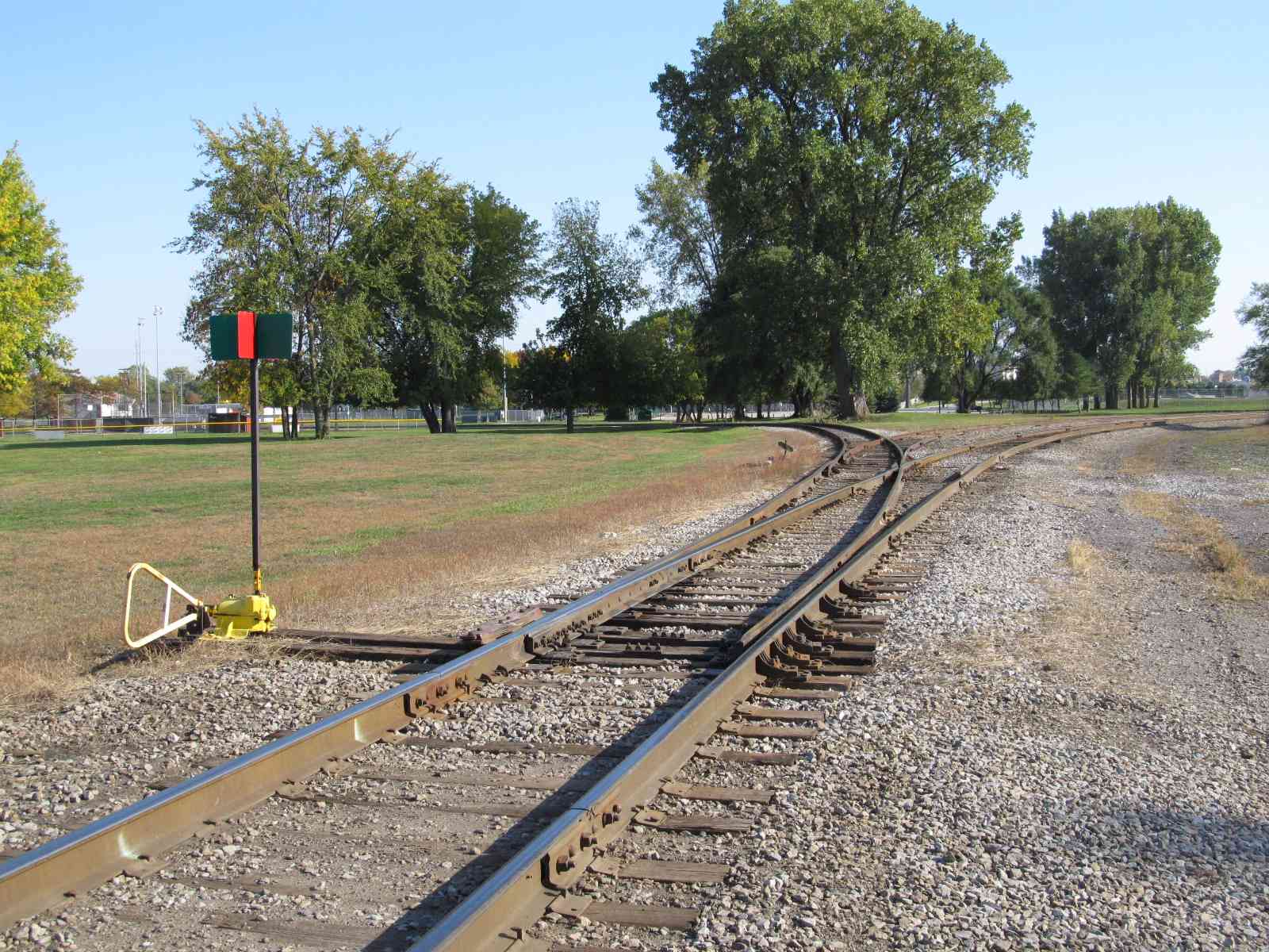
If you don't know where this yard is, you can go right on past it when driving down Woodside Ave. You can usually find a lone engine sitting here.

GPS Coordinates: 43.60536, -83.88964
Adjacent to Vermont Street / Woodside Avenue
The sidewalk on Liberty bridge affords an excellent view of the bridge and a train going over it if you can catch one!
GPS Coordinates: 43.61295, -83.85700
GPS Coordinates: 43.65395, -83.94407
GPS Coordinates: 43.65280, -83.89412
A couple of houses have been built on what used to be the right-of-way
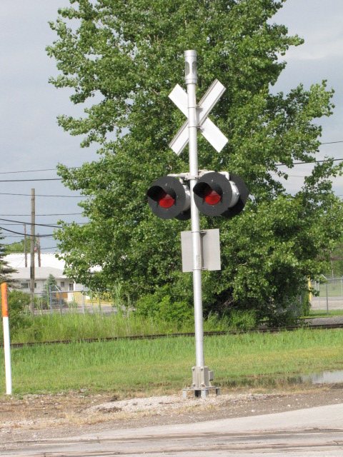
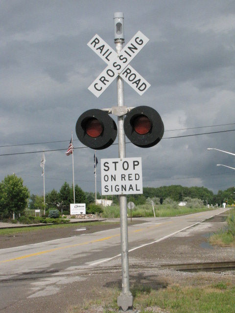
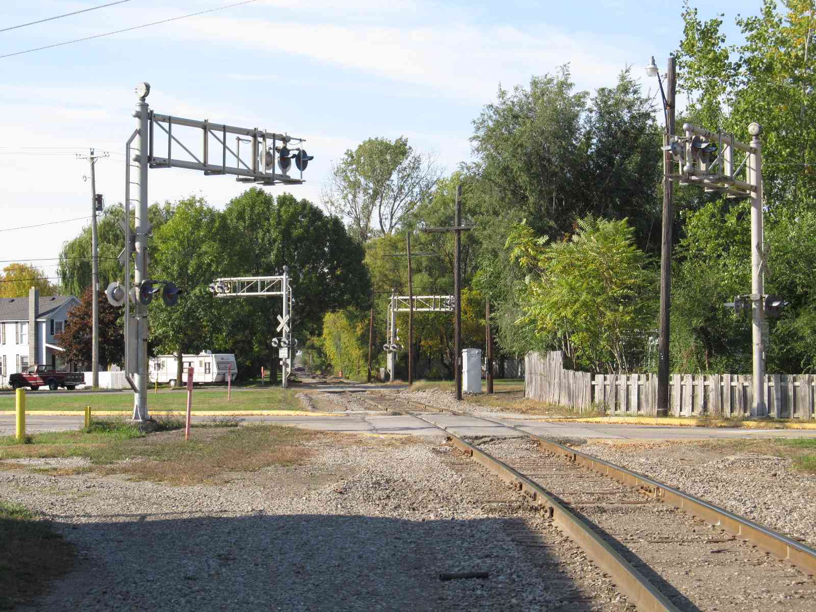
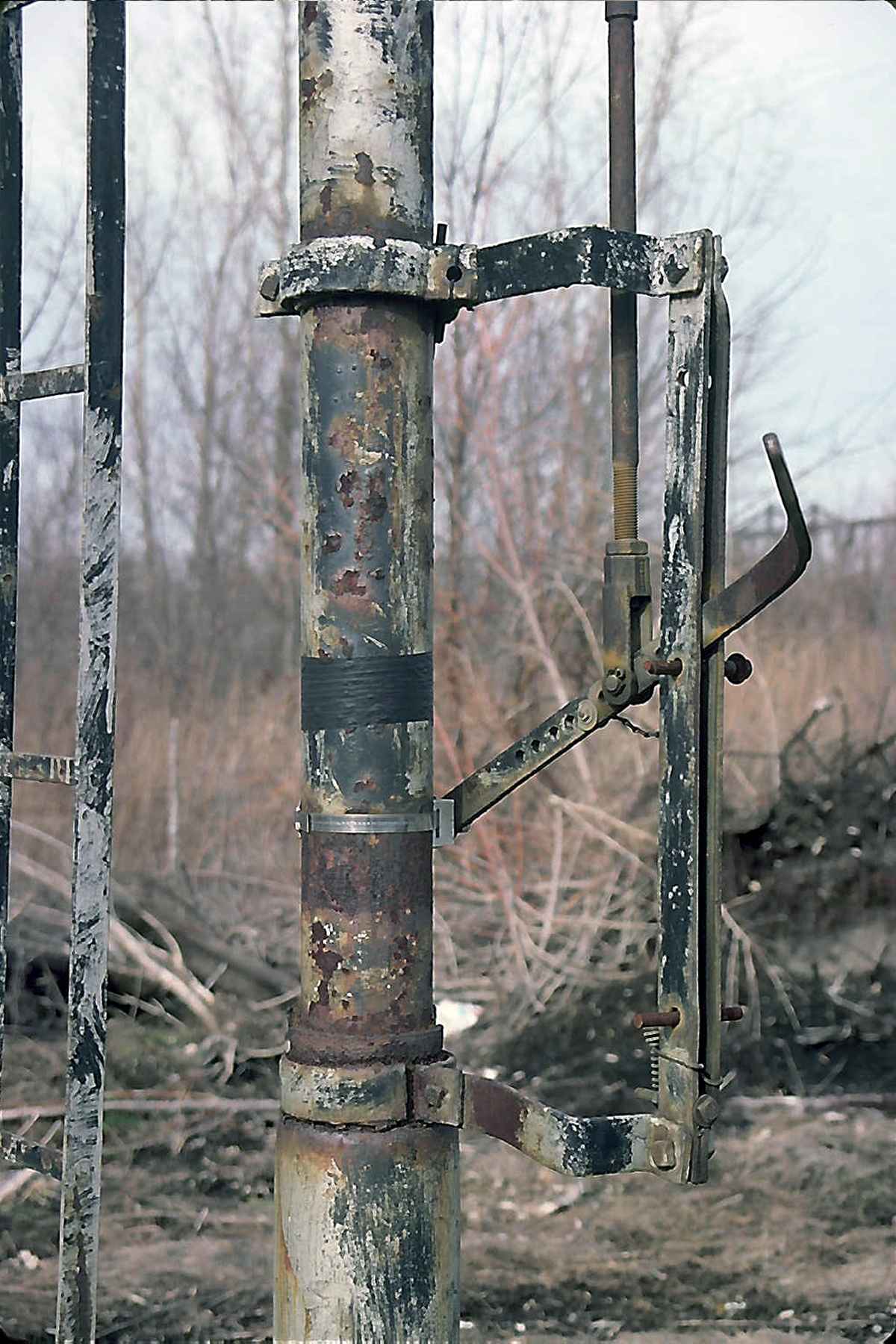
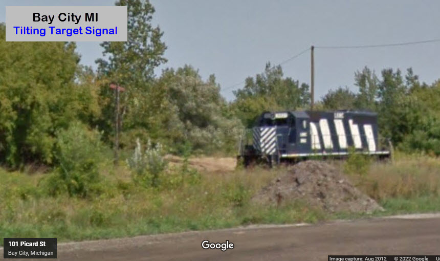
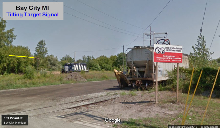
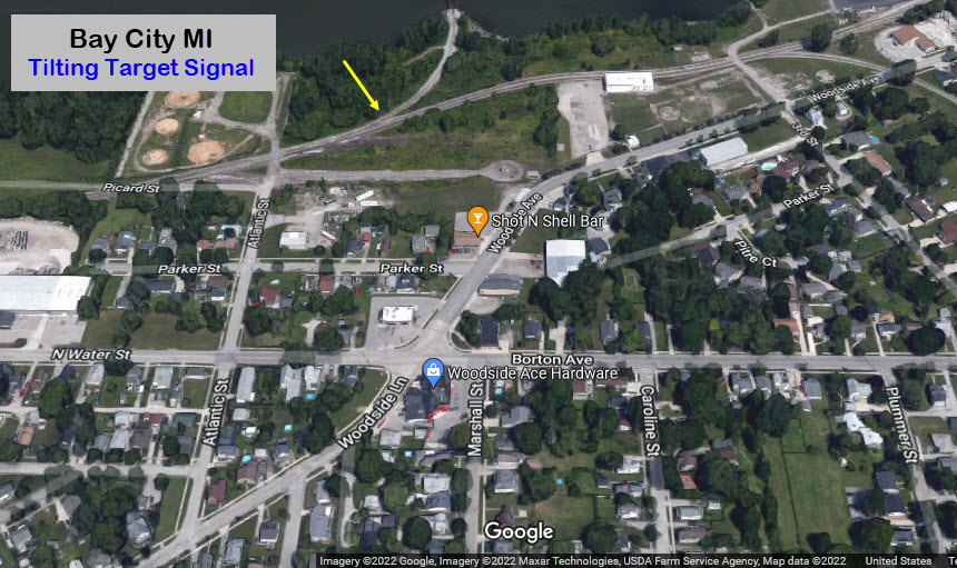
For the signal fan, sorry, not much happening in town :-( However, if we go back up to the small yard at #5, we can find what is leftover of a signal from days past..... A number of years ago, I had a gentleman in England send me a CD with pictures of Tilting Target signals he had taken here in the U.S. (click here for the page they are on). One of them was in Bay City. I looked all over for it, and never saw it until I emailed him, and he told me where it was. Well, if you look to the left in the picture on the left, you will just barely make out that very same signal. I need some new glasses I guess. Well, maybe next year I can stop by again and get my own pictures (dunno why, John did an excellent job).... All of the photos below are by John except for the one on the left.
GPS Coordinates: 43.61101, -83.85754
Off Atlantic St via Woodside Lane

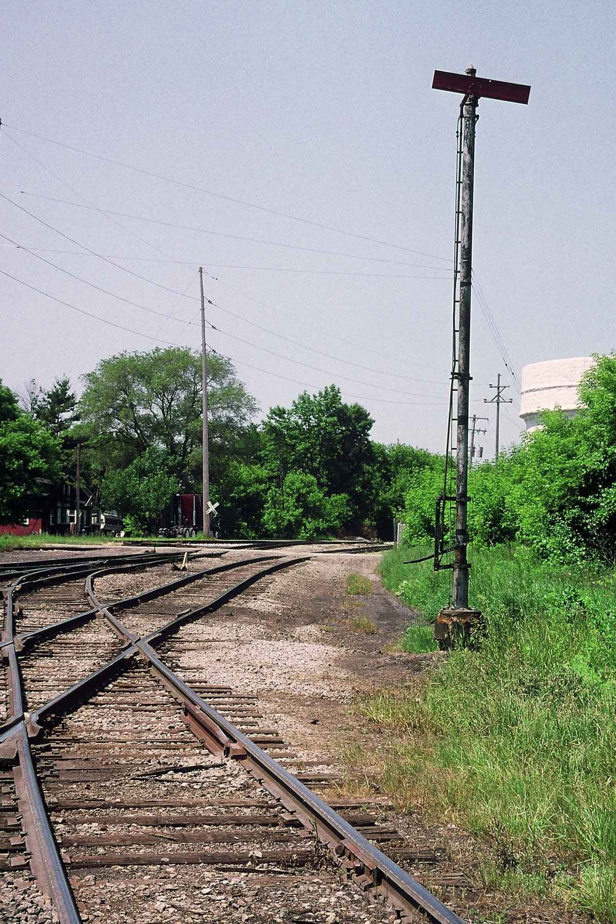

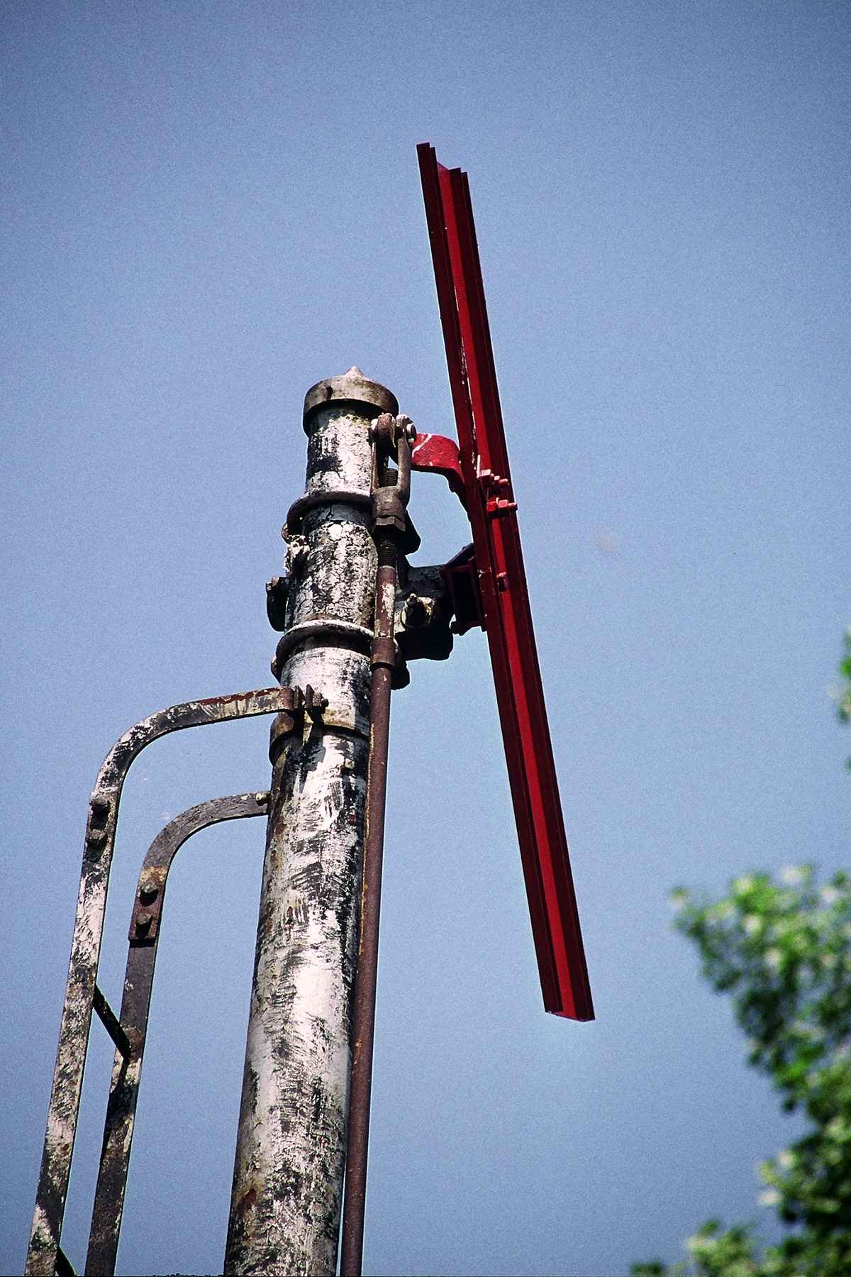

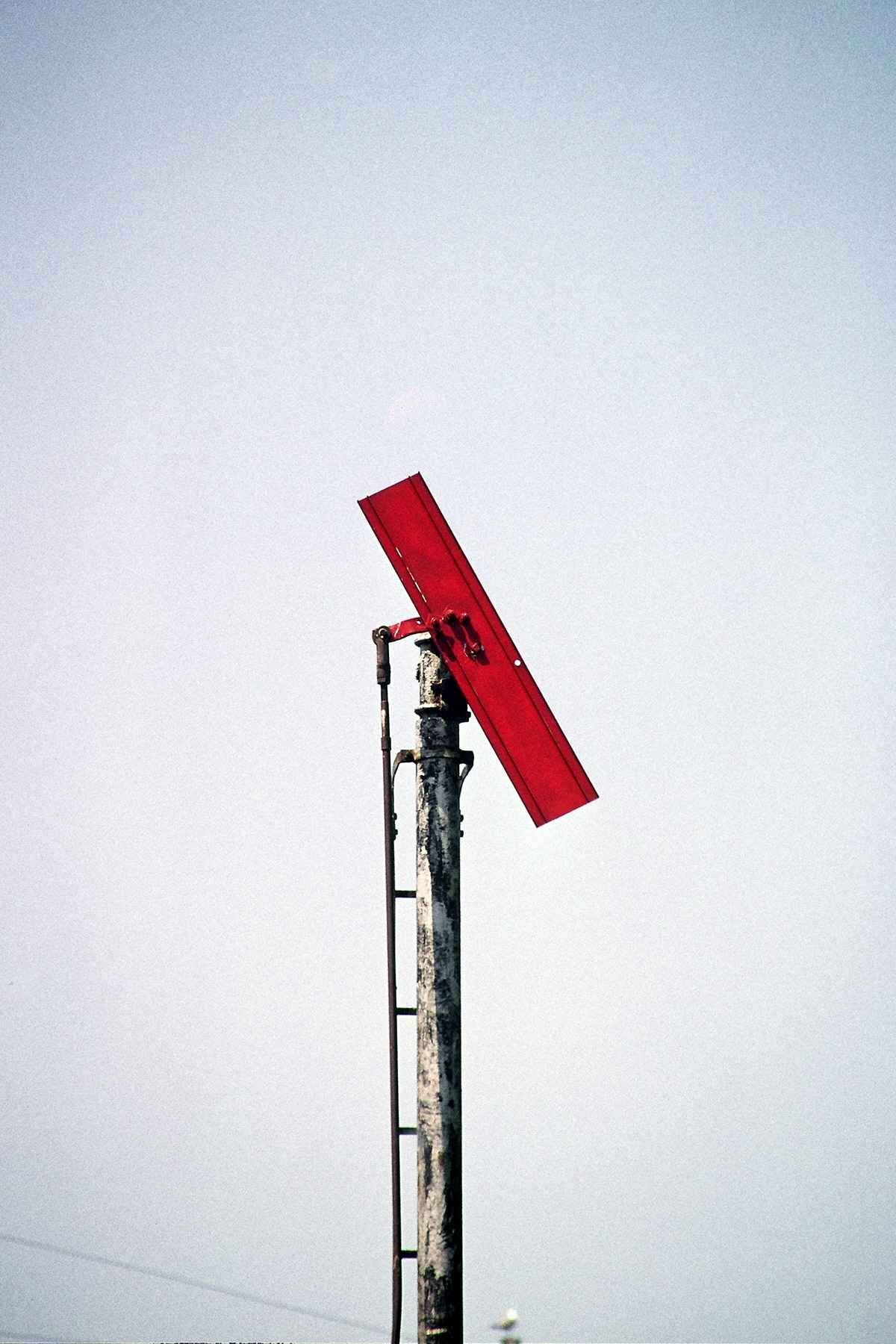
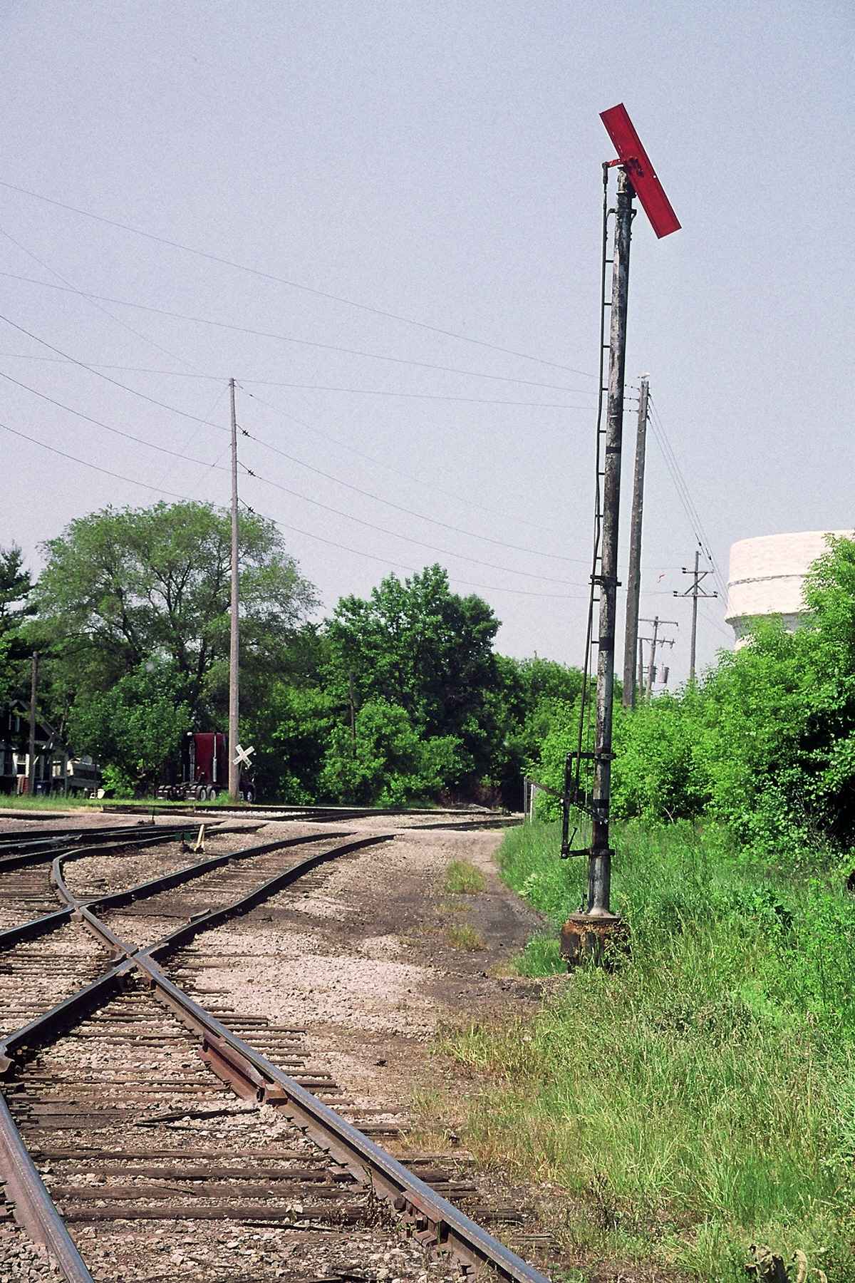
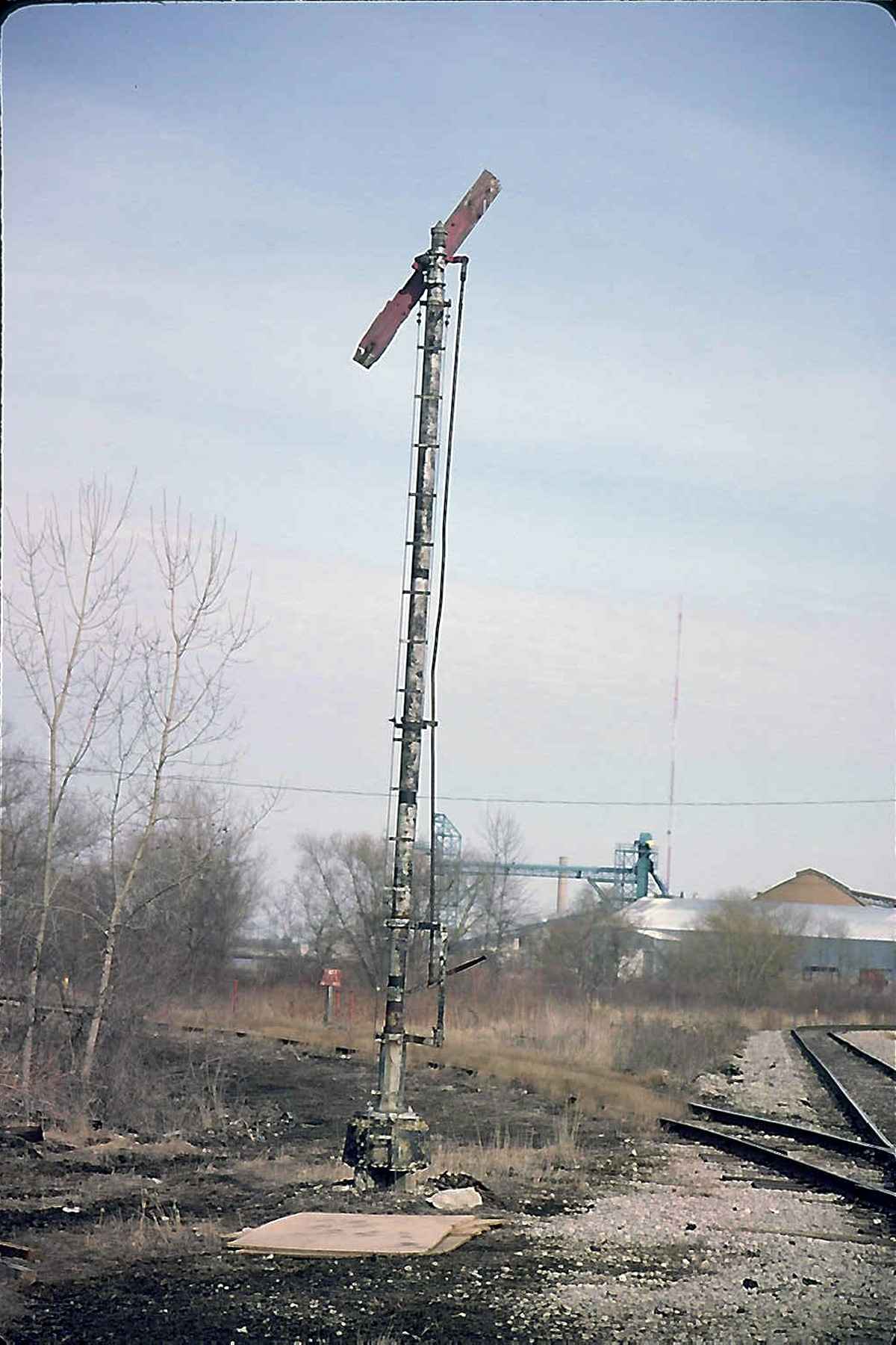
At least, as of 2012, the Tilting Target was still there.....
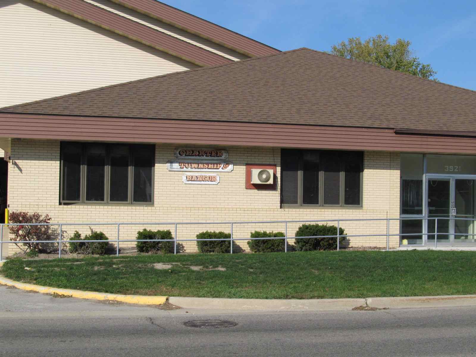
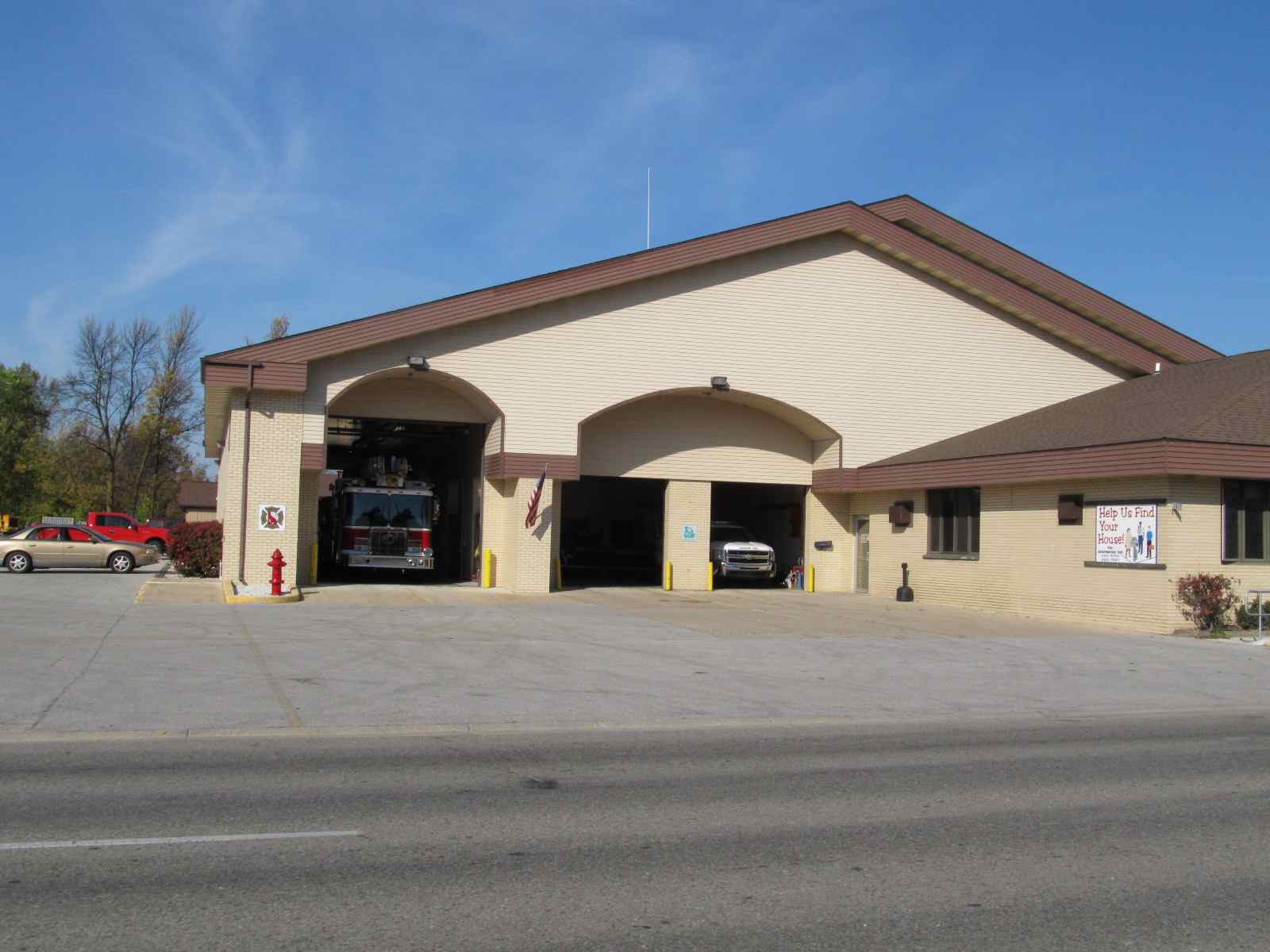
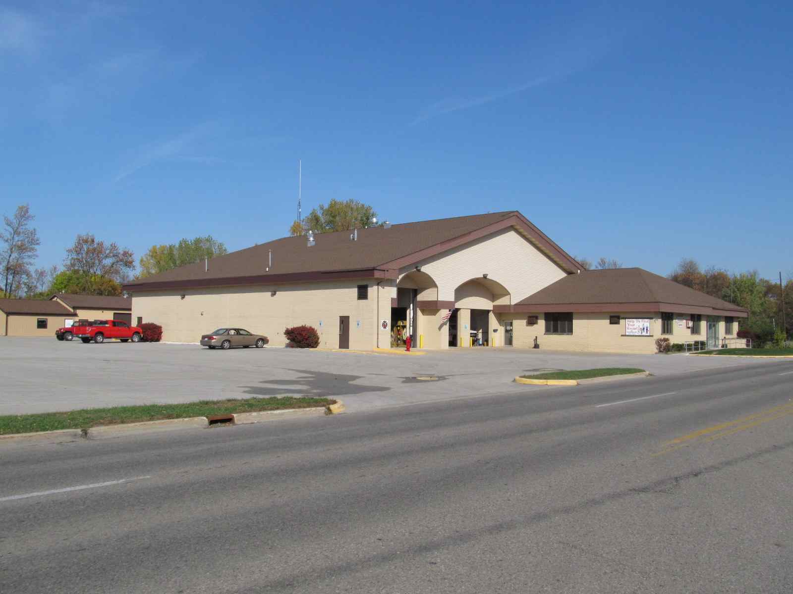
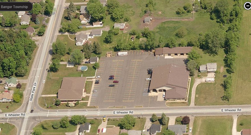
Charter Township of Bangor Fire Dept
This station is on E Wheeler Rd, at State Park Dr.
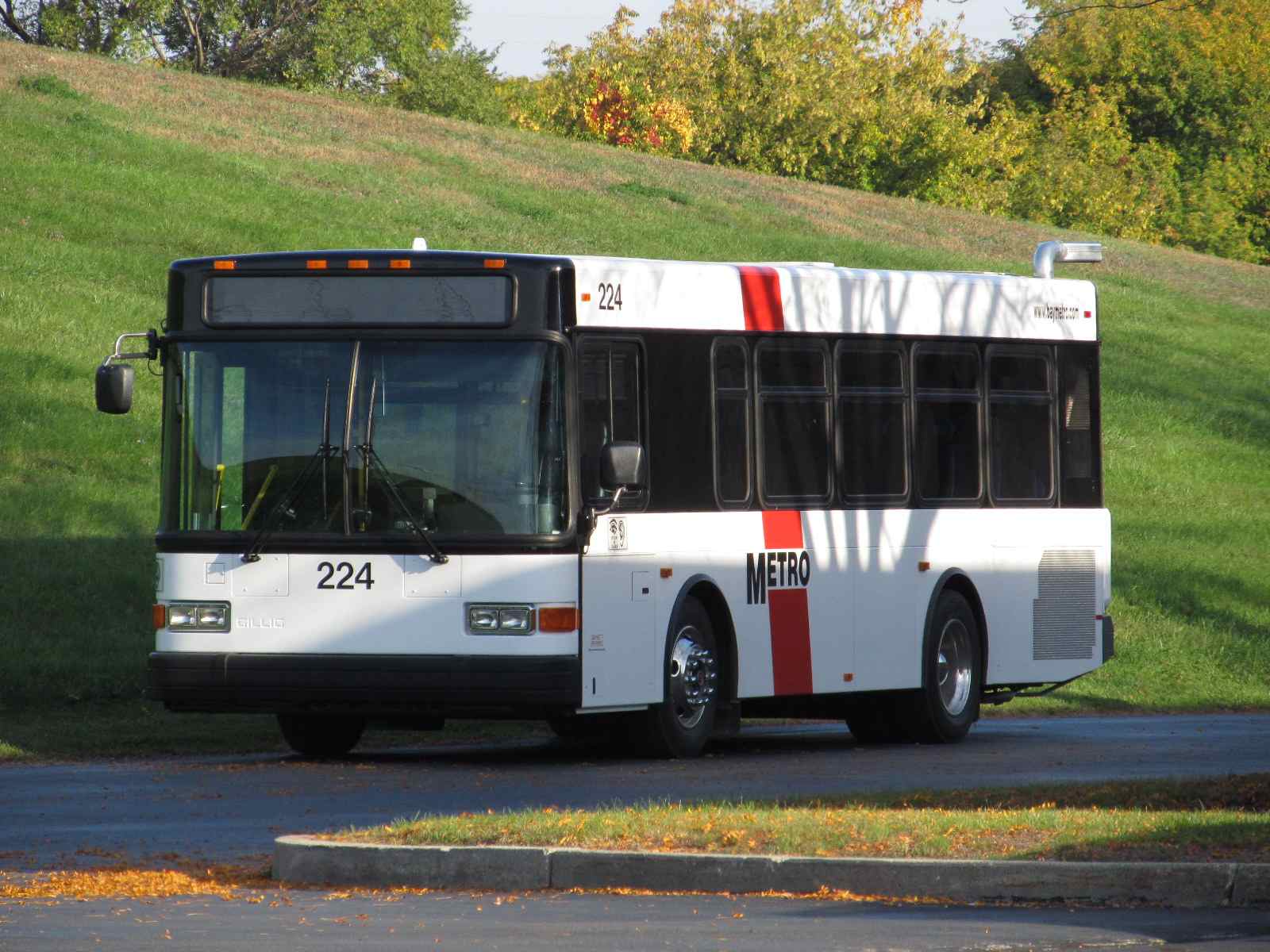
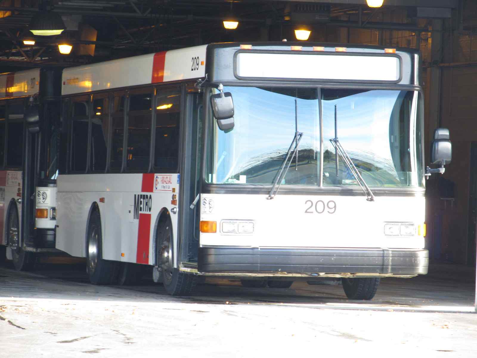
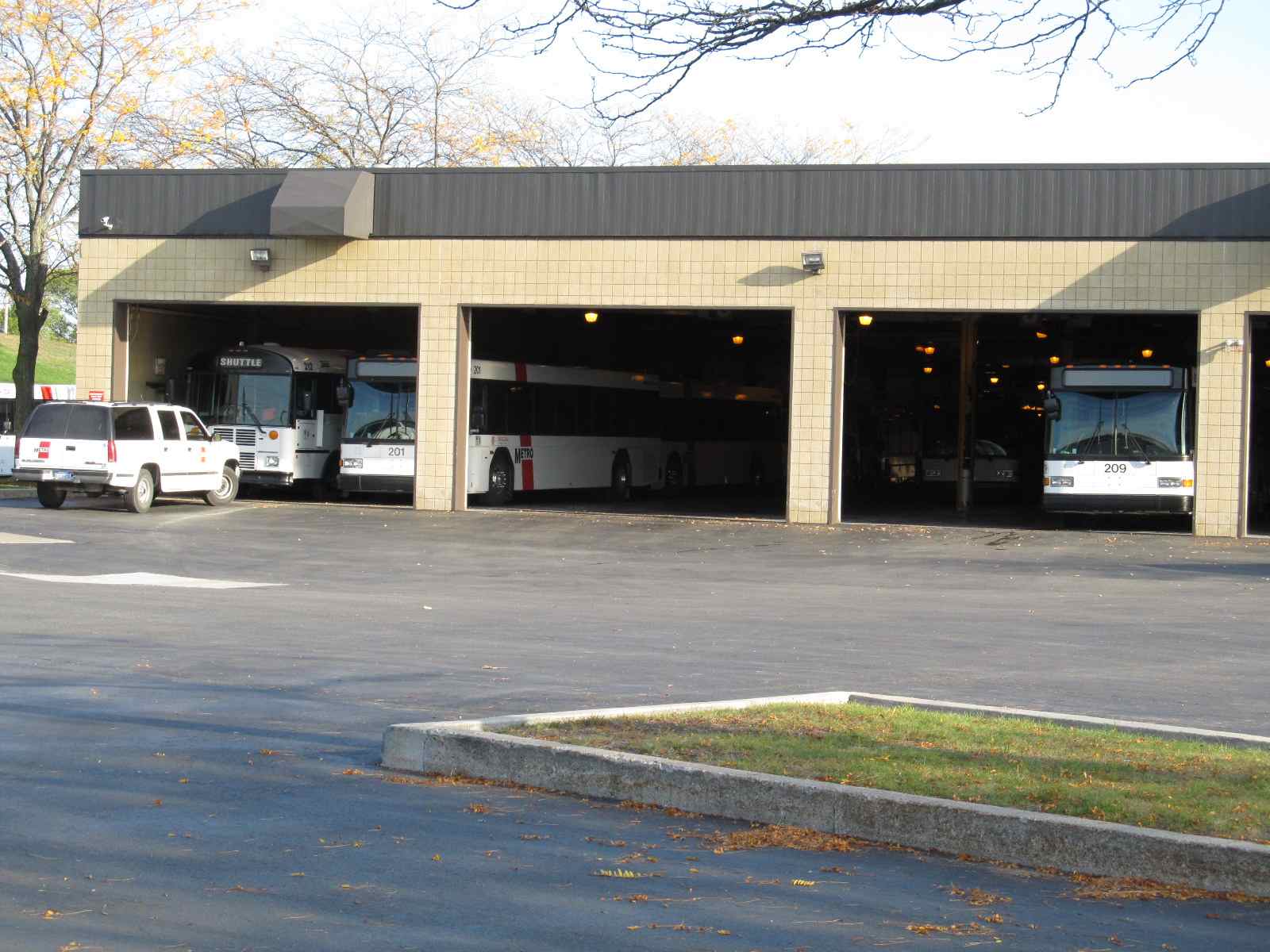
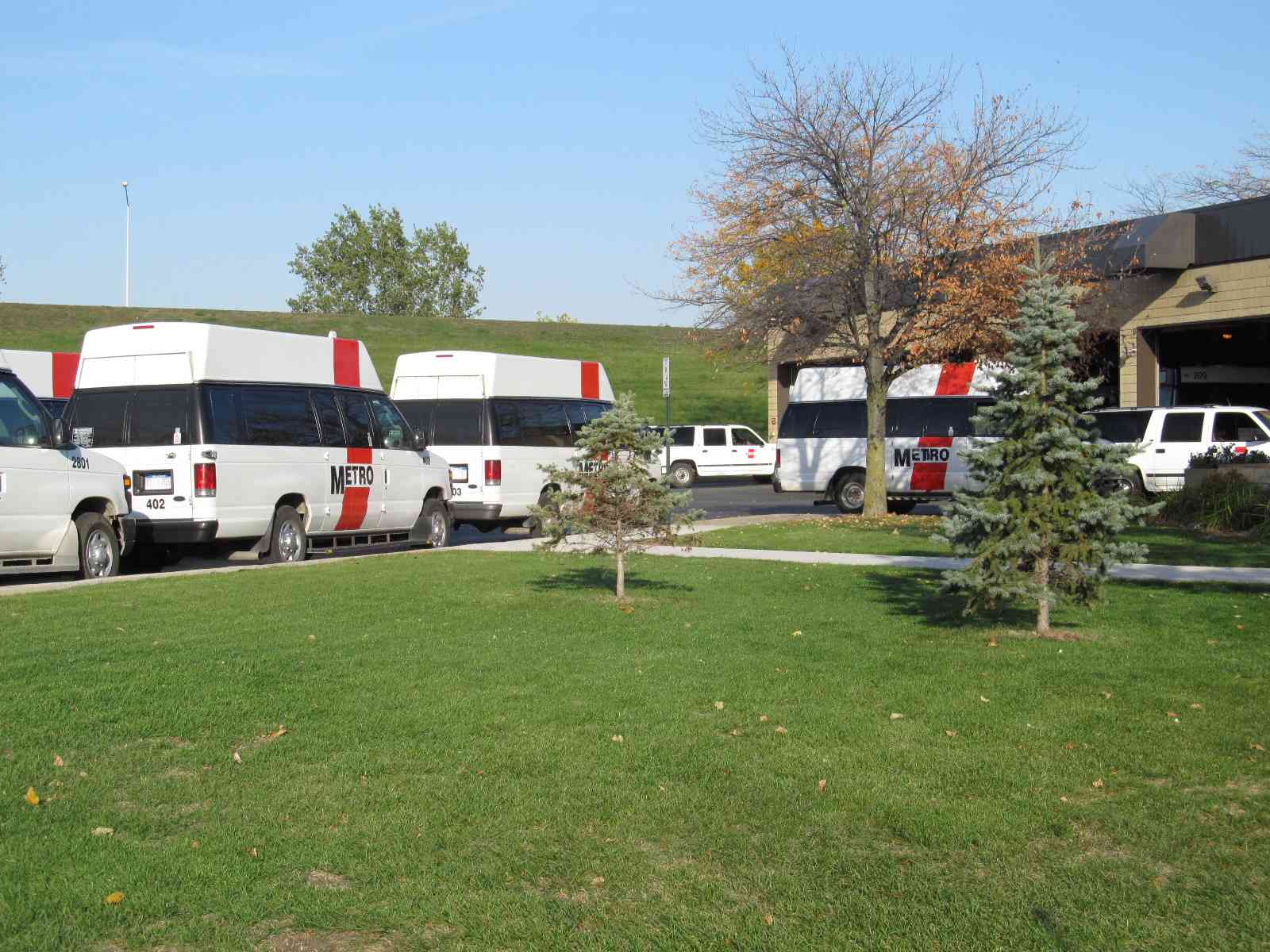
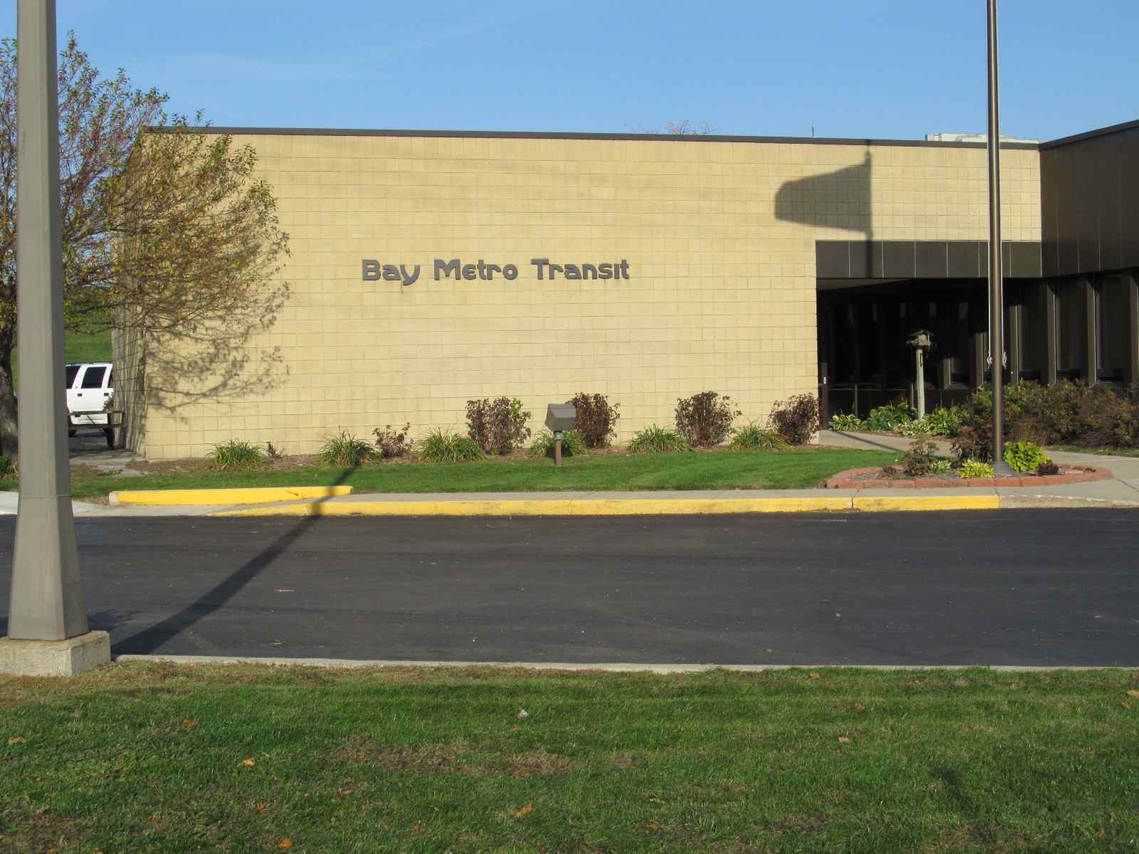
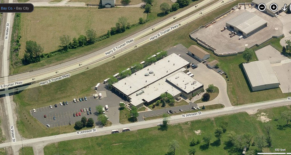
Bay Metro Transit Shops
I got lost and came across this by accident, I guess someone was watching over me..... I don't know if they have another facility or not. It is on N Johnson St, off Woodside where you come over the river on the Truman Pkwy.
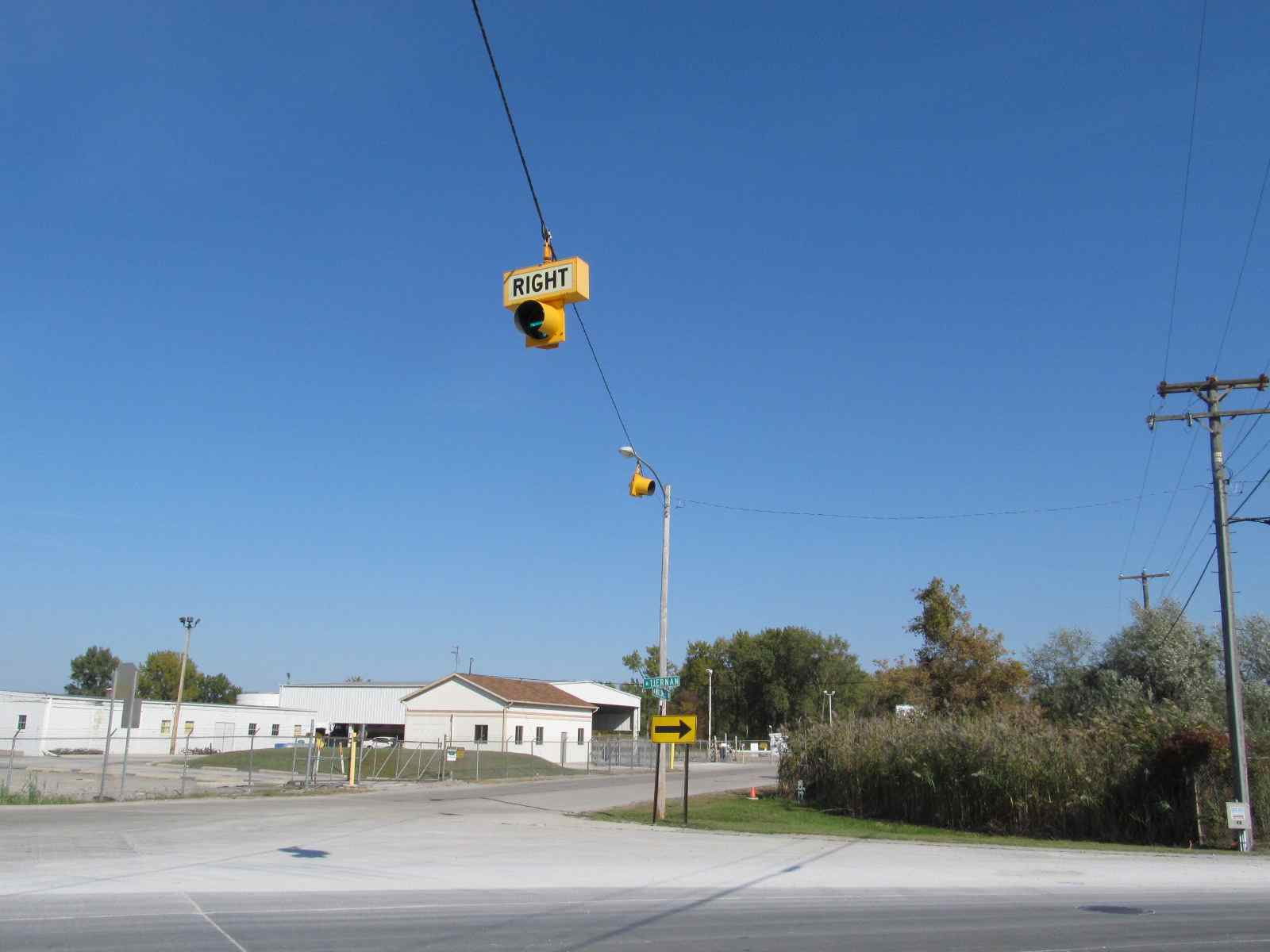
Unusual Turn Signals
These are at the junction of Tierman Rd and E Wilder Rd. Looks like things haven't changed in 10 years.

 2009
2009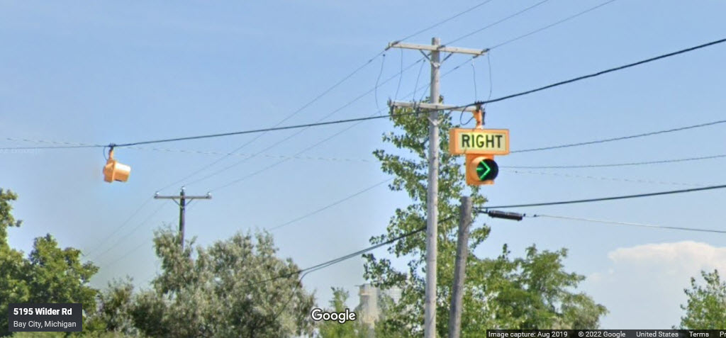 2019
2019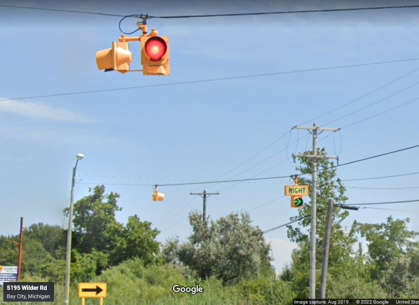 2019
2019Disclaimers:
I love trains, and I love signals. I am not an expert. My webpages reflect what I find on the topic of the page. This is something I have fun with while trying to help others.
Please Note: Since the main focus of my two websites is railroad signals, the railfan guides are oriented towards the signal fan being able to locate them. For those of you into the modeling aspect of our hobby, my indexa page has a list of almost everything railroad oriented I can think of to provide you with at least a few pictures to help you detail your pike.
If this is a railfan page, every effort has been made to make sure that the information contained on this map and in this railfan guide is correct. Once in a while, an error may creep in :-)
My philosophy: Pictures and maps are worth a thousand words, especially for railfanning. Text descriptions only get you so far, especially if you get lost or disoriented. Take along good maps.... a GPS is OK to get somewhere, but maps are still better if you get lost! I belong to AAA, which allows you to get local maps for free when you visit the local branches. ADC puts out a nice series of county maps for the Washington DC area, but their state maps do not have the railroads on them. If you can find em, I like the National Geographic map book of the U.S..... good, clear, and concise graphics, and they do a really good job of showing you where tourist type attractions are, although they too lack the railroads. Other notes about specific areas will show up on that page if known.
Aerial shots were taken from either Google or Bing Maps as noted. Screen captures are made with Snagit, a Techsmith product... a great tool if you have never used it!
By the way, floobydust is a term I picked up 30-40 years ago from a National Semiconductor data book, and means miscellaneous and/or other stuff.
Pictures and additional information is always needed if anyone feels inclined to take 'em, send 'em, and share 'em, or if you have something to add or correct.... credit is always given! Please be NICE!!! Contact info is here
Beware: If used as a source, ANYTHING from Wikipedia must be treated as being possibly inaccurate, wrong, or not true.
RAILFAN GUIDES HOME
RAILROAD SIGNALS HOME
NEW 07/06/2009,
SEP06/2016, FEB2/9/27/28/2022
Last Modified
28-Feb-2022