RAILFAN GUIDES of the U.S.
Todd's Railfan Guide to:
ANN
ARBOR
MI
In General
Getting Here
Map
Sights
Bridges/Overpasses
Signals
Floobydust
RAILFAN GUIDES HOME
RAILROAD SIGNALS HOME
Location / Name:
Ann Arbor MI, Washtenaw County/county seat
What's Here:
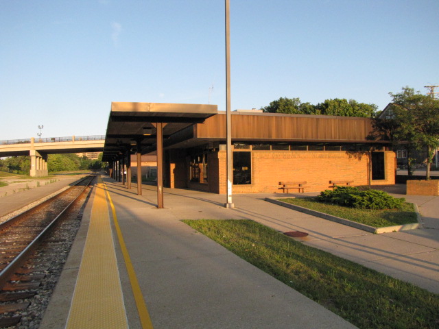
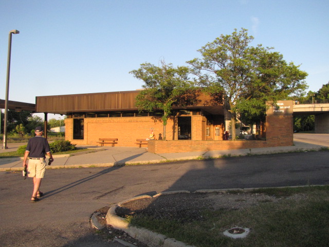
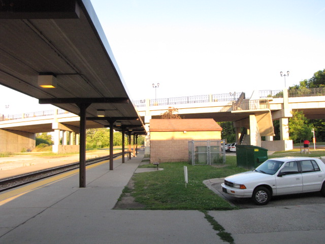
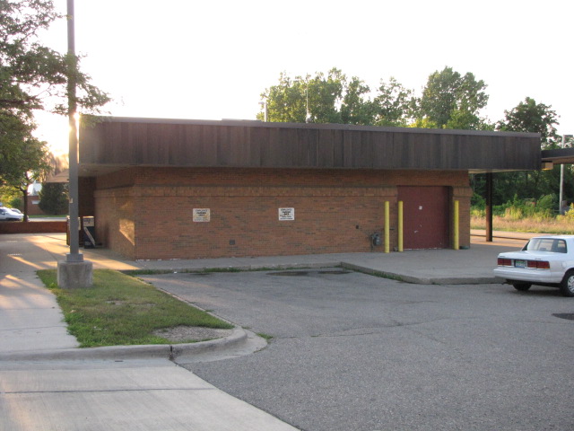
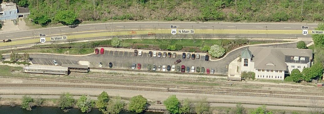
Amtrak Station
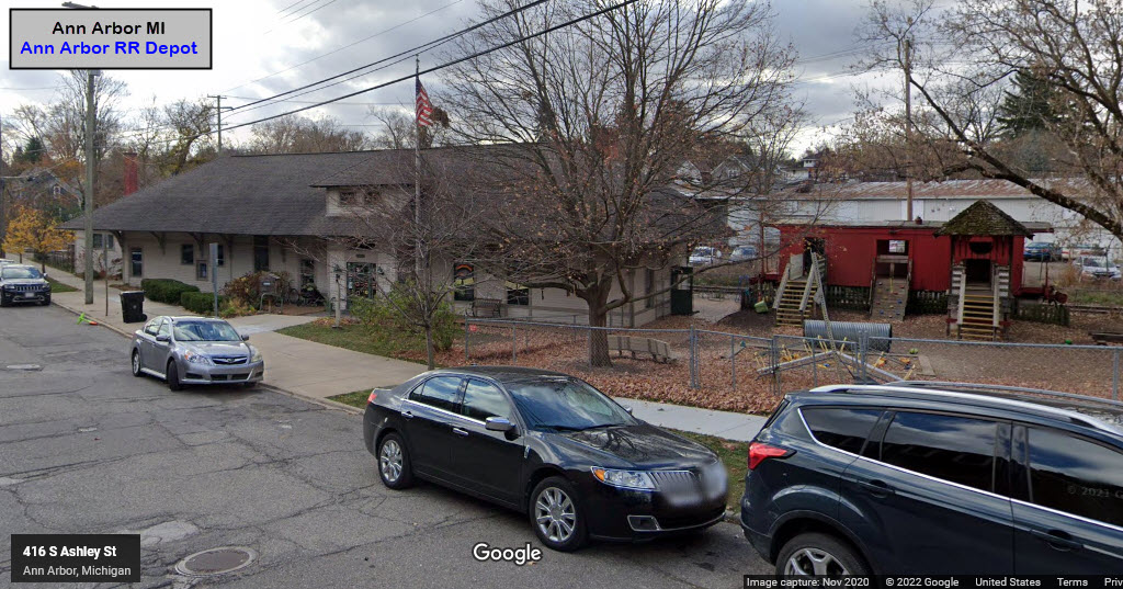
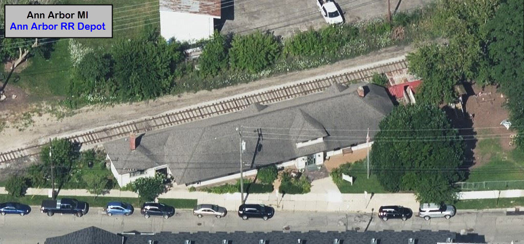
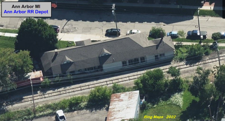
Former Ann Arbor RR Depot
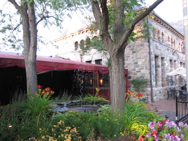
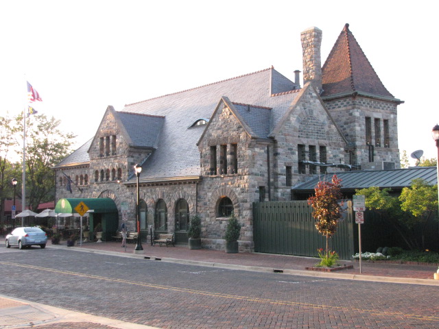
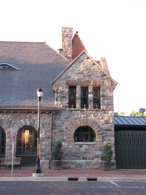
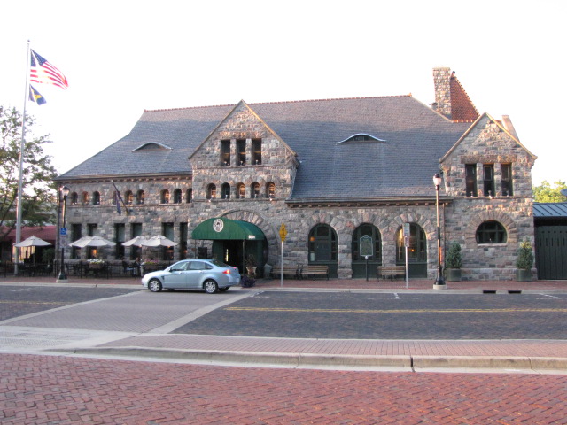
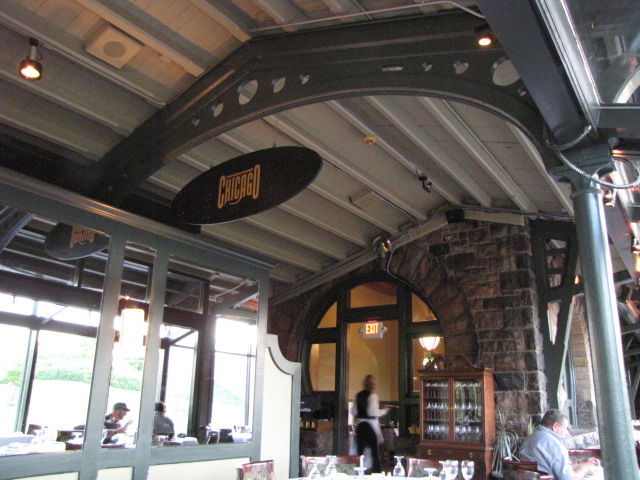
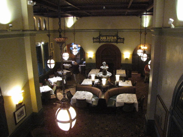
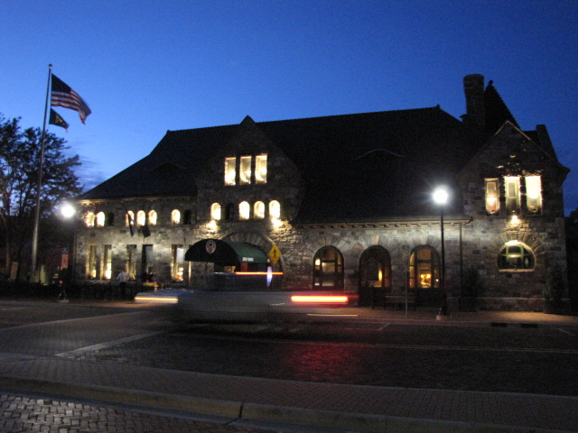
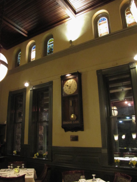
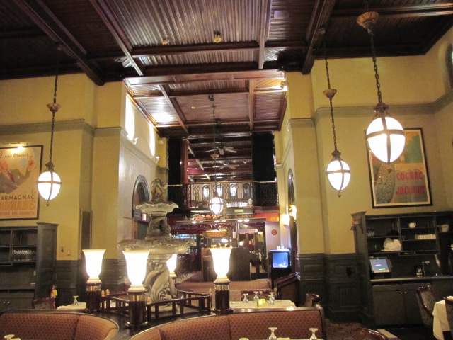
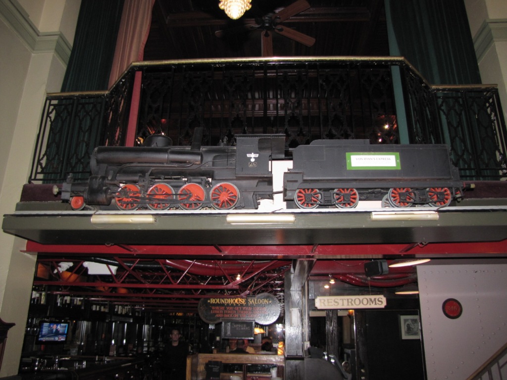
Former Michigan Central Depot (Gandy Dancer Restaurant)
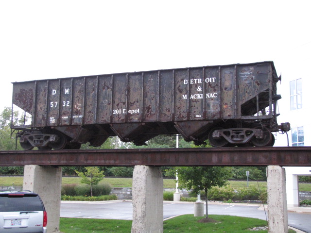
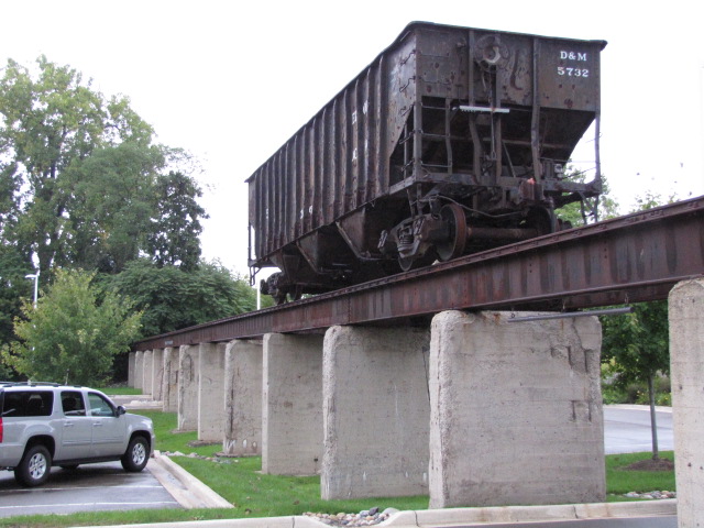
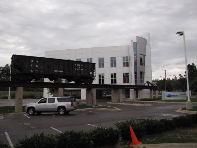
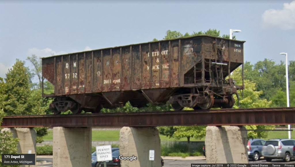
Coal hopper on preserved tipple
The ARTRAIN Institute
Data:
GPS Coordinates: as needed
Phone A/C: 734
ZIP: 48104 (at the Amtrak station)
Access by train/transit:
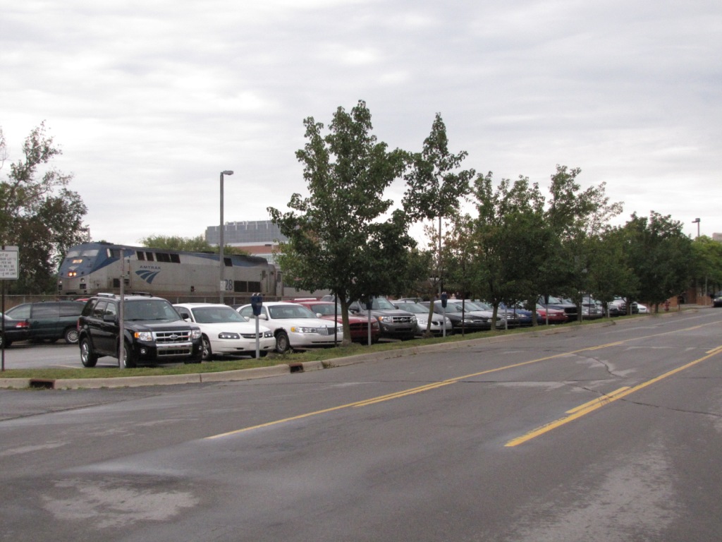
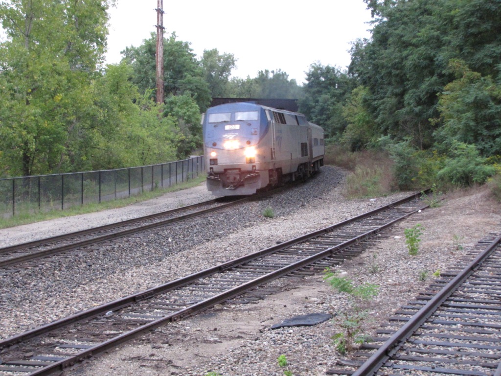
Amtrak Wolverine
The Scoop:
Ann Arbor has three train stations: an Amtrak station, a former Ann Arbor depot, and a former Michigan Central depot which is now the Gandy Dancer restaurant.
Amtrak, Norfolk Southern, and the Ann Arbor come thru, Amtrak does so on the NS line.
Also very nearby, is an old hopper sitting on top of a preserved coal tipple, and the ARTRAIN institute, which supports the arts, and used to have (until 2009), a train they toured the country with.
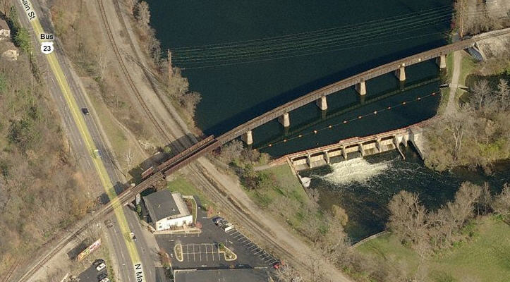
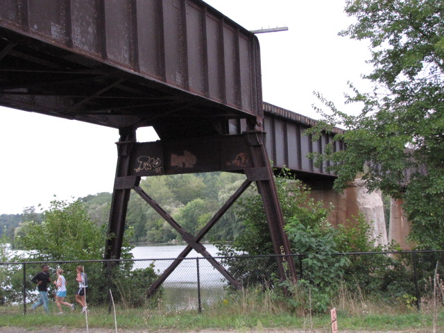
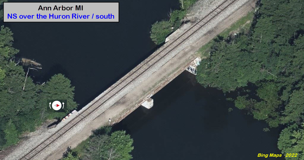
There is a nice Ann Arbor RR bridge crossing the Huron River, great spot for pictures....
Many thanks to Jon Baxter for information about Osmer Siding, where the Ann Arbor interchanges with the Great Lakes Central RR. He is active with putting videos on Youtube, and you can find his "homepage" below. He also has a fondness for "live steam" (1/8 scale, AKA as 7-1/2" gauge (7-1/4" on the west coast).
But Ann Arbor's biggest attraction is probably the University of Michigan and all of it's night life, even during the summer as we saw when driving thru town to get to the interstate. Well, if you didn't come here for that, I guess you'll just have to settle for the two depots on the north side of town, Amtrak and an ex Michigan Central. The old MC depot is beautiful, as evidenced by the photos, and the food is top notch. Please support these establishments as you tour the rail community, you could make the difference between them staying around or not, like the depot in Berea OH which closed about 8 years ago, but fortunately, was bought and re-opened.
Acknowledgements:
Jon Baxter
E Gross
Marcel Marchon
Roger Kirkpatrick
Denver Todd
Websites and other additional information sources of interest for the area:
http://www.railroadmichigan.com/rrdepots.html
https://www.youtube.com/user/criind
And as needed below
Getting to Ann Arbor is not too difficult, but there are as many ways to get to the depot as there are directions to come from:
1) From the south, you can come up US23 from the Toledo area, which is also another east/west funnel via I80, although getting between the two is tedious because of the lack of a direct interchange. If coming up from Toledo, exit 37 would probably be the best... Washtenaw Ave. Take the street into town, paying attention to stay on it as it bears a right and then a left. Finally hang a right onto Main street, and then another right onto Depot Street.
2) From the Detroit area, it's straight out I94 or I96. If doing the I94 thing, take exit 180 to get on US23 going north, to exit 37. If coming out on I96, look for the US23 exit going south, and take the Plymouth Road exit, exit 41.
3) From the west side of the state via I94 (Battle Creek, Kalamazoo), take exit 172, Business 94 into the center of town to Main Street, and then go north a hair to Depot St.
4) From Grand Rapids or Lansing, take I96 east, and then go south on US23 at Brighton to MI14 at exit 45. Take the Main St exit, exit 3, and go south till you pass under the railroad, and Depot Street is the next left at the light.
5) From northern Michigan, on the east side, come down US23 from the Flint area where US23 and I75 join (or split up, depending on which way you are going.) Then follow the second half of the directions from 4).
Food, restaurants, and gas..... The map above shows where the main places to find these things.
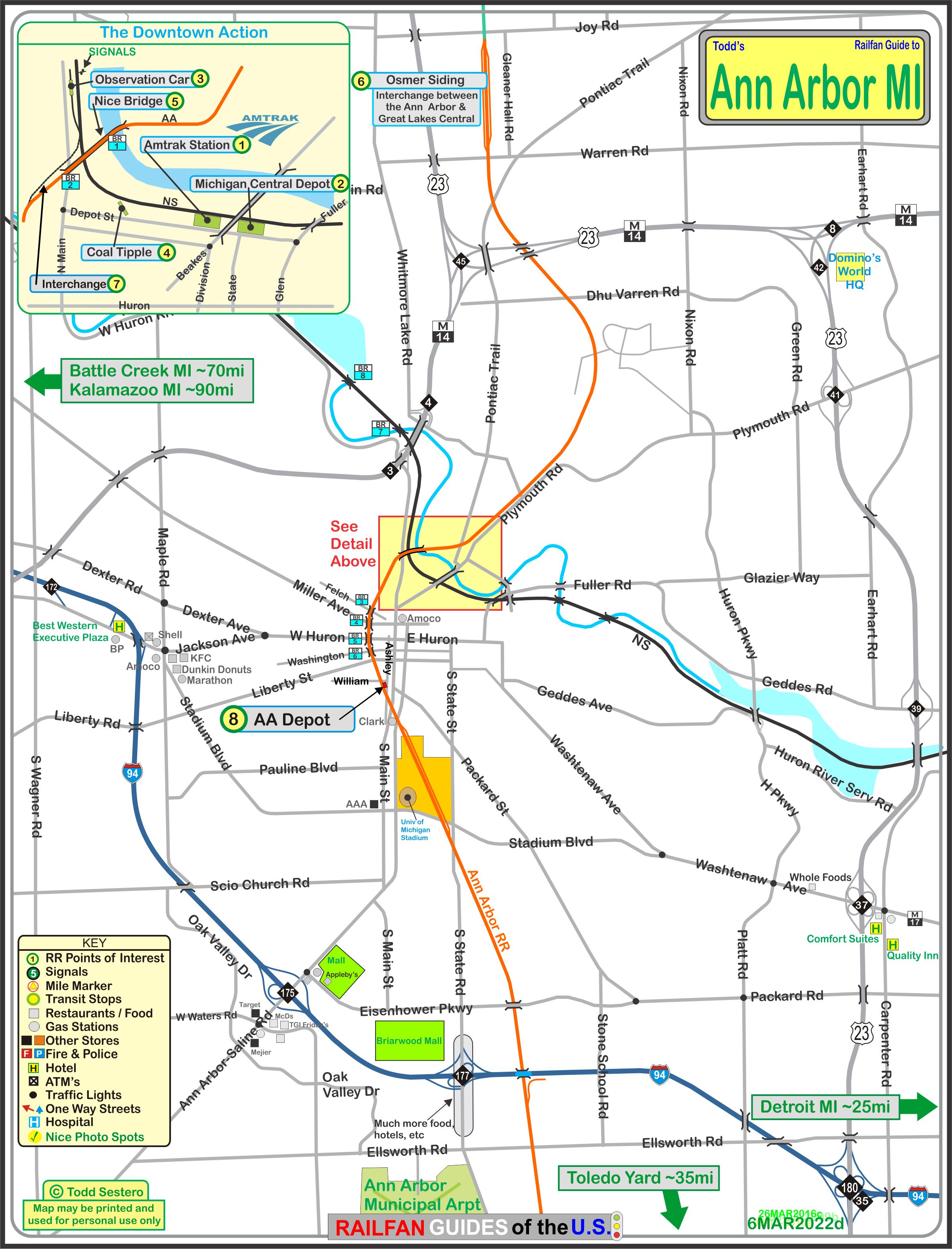
The above map in PDF format is
here
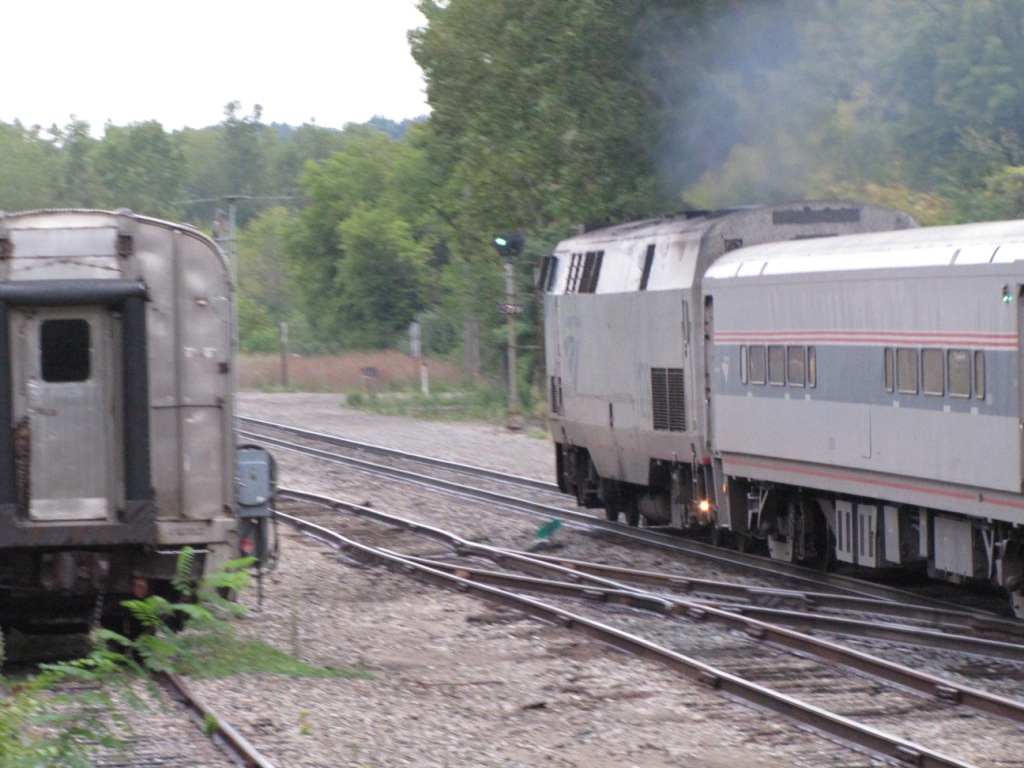
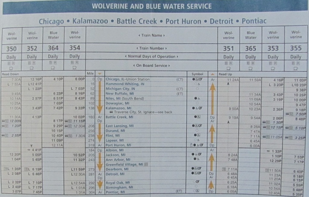
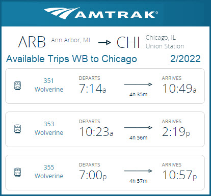
The WB Wolverine was caught around 7:40am, heading to Chicago. The group of three were caught around the corner from the depot adjacent to the observation car. The two other WB's are slated for 12:29pm and 7:17pm. The EB's coming thru Ann Arbor are scheduled for 1:04pm, 5:45pm, and 11:32pm.

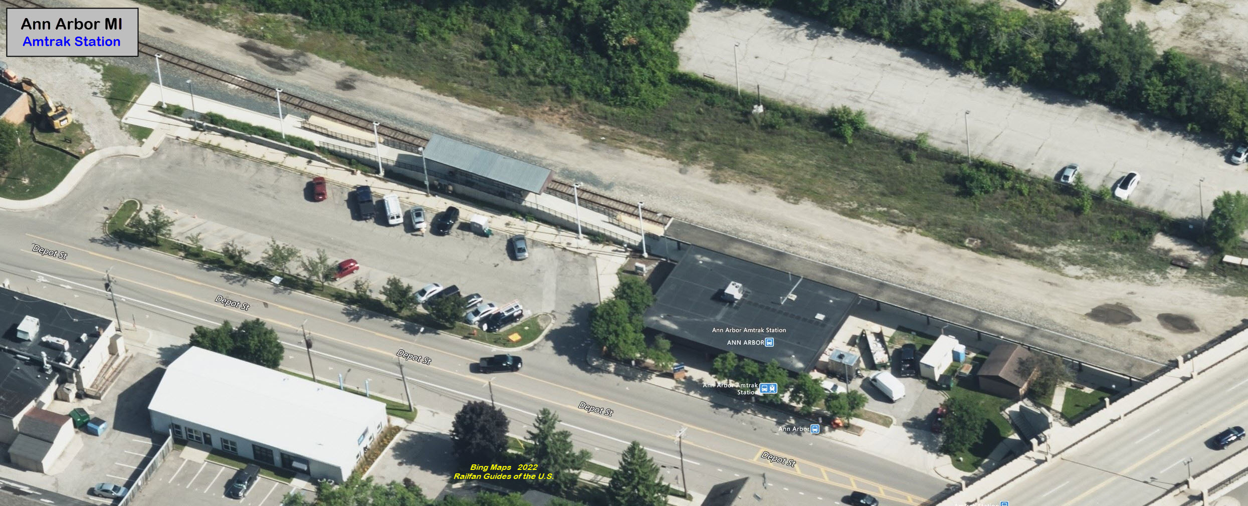
Not sure of the date on this schedule, but times have changed since I first posted it.
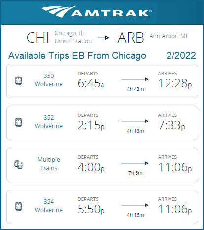
As of February 2022:


The food here is most excellent, the service is excellent too. I've eaten here twice for dinner, and have not been disappointed on either occasion. It is a worthwhile stop if you are travelling thru the area. The owners also own the train station restaurant in Pittsburgh that is along the water, and the menus look identical. Pictures were taken July 2009, except for the three on the bottom right, taken Sep 2010.


GPS Coordinates: 42.29320, -83.74671
1100 N Main St #106, Ann Arbor, MI 48104
734-747-8300
www.artrain.org
https://en.wikipedia.org/wiki/Artrain_USA
http://www.northeast.railfan.net/rolling35.html
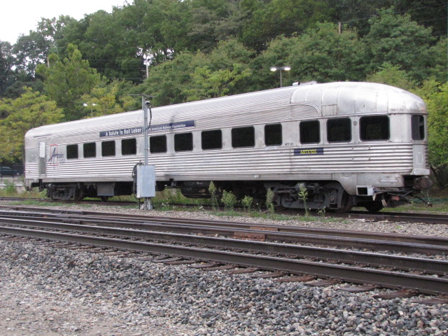
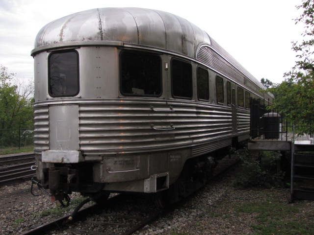
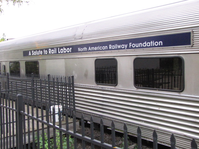
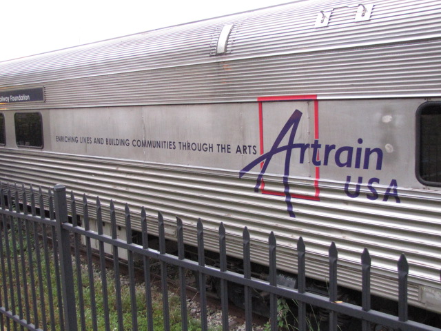
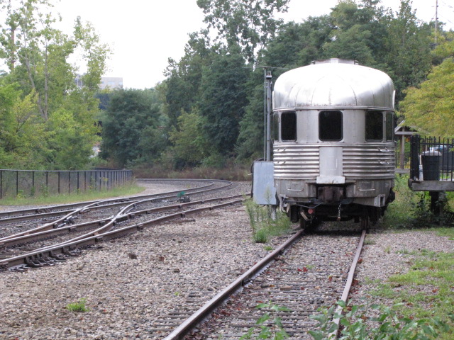
Headquarters for ARTRAIN, a non-profit for promoting art. They used to have an observation car on a siding. Don't know the history on it, but the reporting mark is ARTX105. I was there, and still not sure what the building is used for, but it is a recent build, maybe 40? years old. The car has a banner on it promoting the North American Railway Foundation, saluting railroad labor, and also has a logo for Artrain USA on the front end of the car. If this is car number 5, and an observation car which goes on the end, anyone know where the other four are? Wikipedia says that ARTX 1 is at the Illinois Railway Museum.
From their website: Vision – Artrain’s vision is that every person, classroom and community should have access to quality arts and cultural programs regardless of where they are located or their economic status. Mission – Artrain’s mission is to delivery discovery and – through the galvanizing power of arts and culture – transform lives, organizations and communities. Artrain serves as a community catalyst, utilizing cultural education and engagement to increase participation in and support for the arts. Artrain is headquartered in Ann Arbor MI; its programs have reached across the United States and Ontario, Canada.
In its first year, 191,000 visitors in 28 Michigan communities climbed onboard Artrain’s museum-on-a-train. The National Endowment for the Arts (NEA) took notice and asked Artrain to share its programs across the country. In 1973 sponsored by the NEA, Artrain headed out on its first national tour to eight-states in the Rocky Mountains. Artrain became an independent nonprofit in 1975. For the next four decades Artrain delivered arts-based community engagement and development programs on its museum-on-a-train traversing America’s rail system. In 2009, as the rail industry restricted access to its railways, Artrain retired and sold its museum-on-a-train. Though the train was gone, Artrain’s mission, experience, commitment to and success of strengthening the field of arts and creativity was not.
In the Birds Eye View from Bing Maps in 2022, we can see that the car is no longer there....

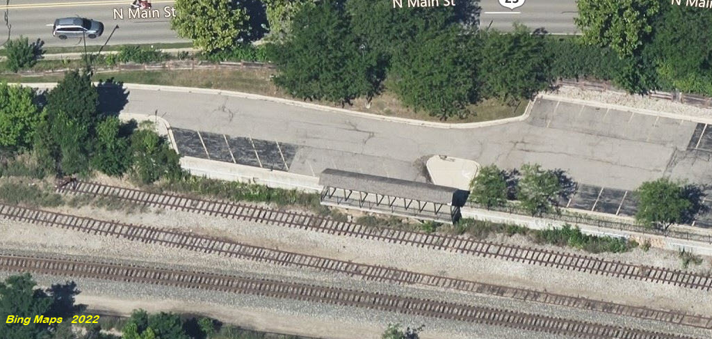
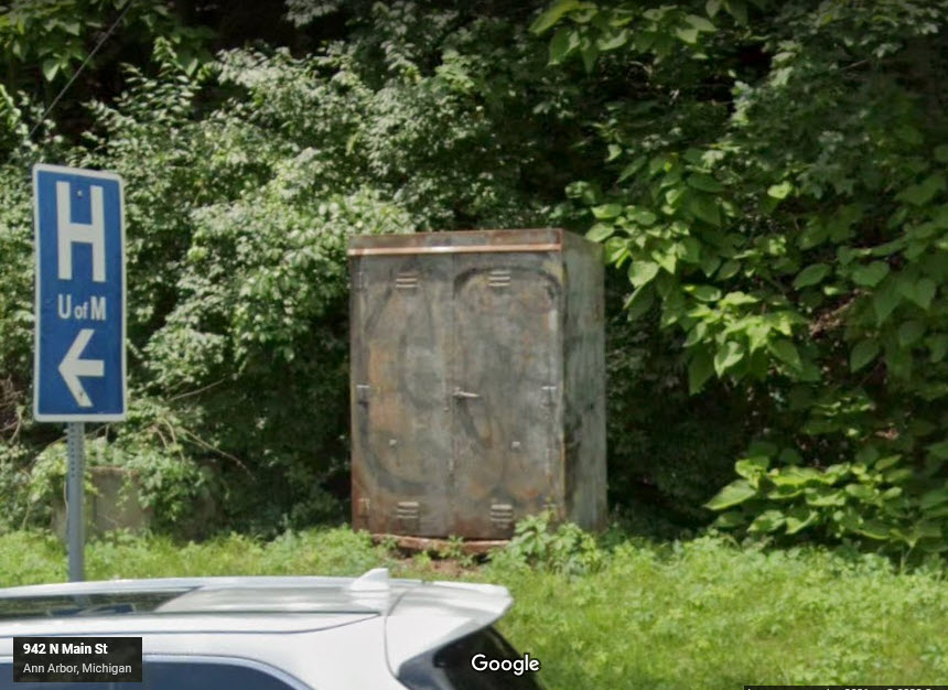
The building that looks like an old depot, switch and equipment cabinet, and a platform where good shots can be had.
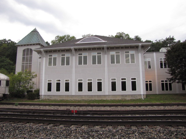
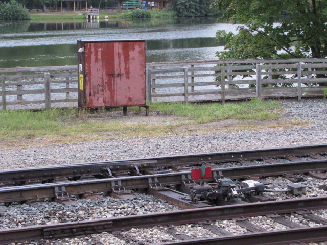
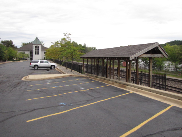

Photo by Marcel Marchon, via Wikipedia

Artrain Caboose #ARTX 5, in Cumberland MD, 1/31/2007, photo by Roger Kirkpatrick
GPS Coordinates: 42.28896, -83.74595
201 Depot St.
I have to give the owners of this building kudos for retaining this small piece of history, and using an old Detroit & Mackinac hopper to put on display...
This is just down the street from the Amtrak station and Gandy Dancer restaurant.

 still there...
See below, Bridge #1.
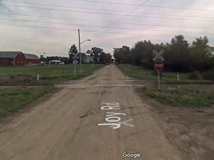
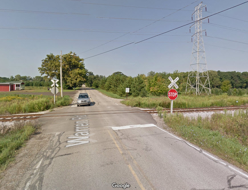
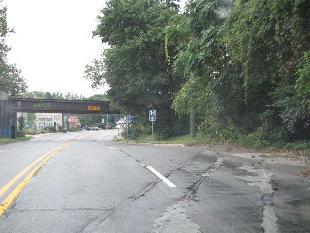
This is the northern end of Ann Arbor operations, and where it interchanges with the Great Lakes Central RR.
The pictures on the left of each pair are from the Joy Ave end of the siding (streetviews from 2009), the ones on the right are from Warren Rd (streetviews from 2011).
Joy Road appears to be a dirt road.


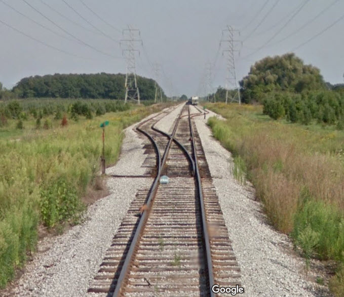
There was an interchange track between the two lines, which in 2009 looks like it hadn't seen any activity for many, many years. The grade crossing on Main Street has since been paved over, and the interchange switch on the AA track has been taken out, but the equipment cabinet for the Main St crossing still stands off to the side of the road. Looking back on Google Maps, which has views back to 2014, it looks like the crossing was replaced between July and September of 2016.
 in 2009
 July 2016
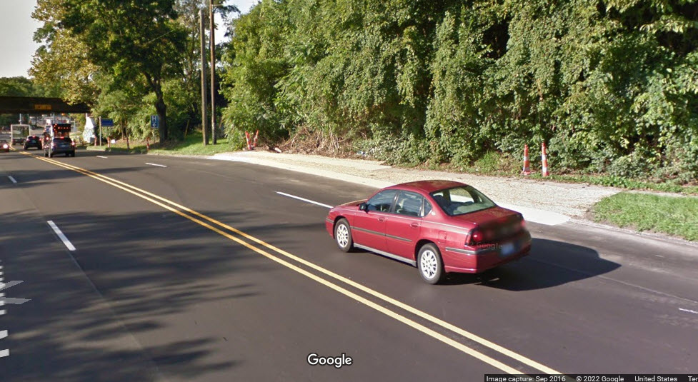 Sep 2016
 in 2022, notice the new curb
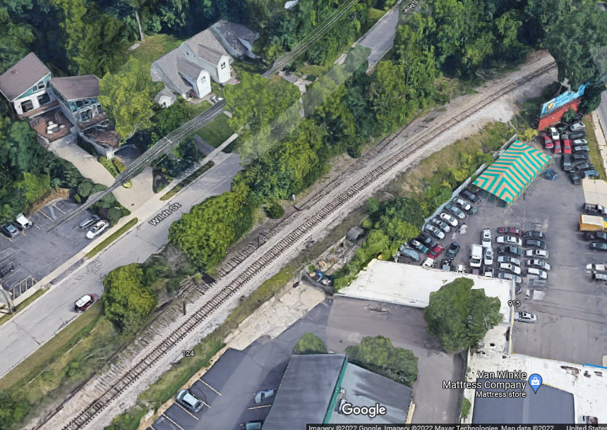 these Google shots are from 2022
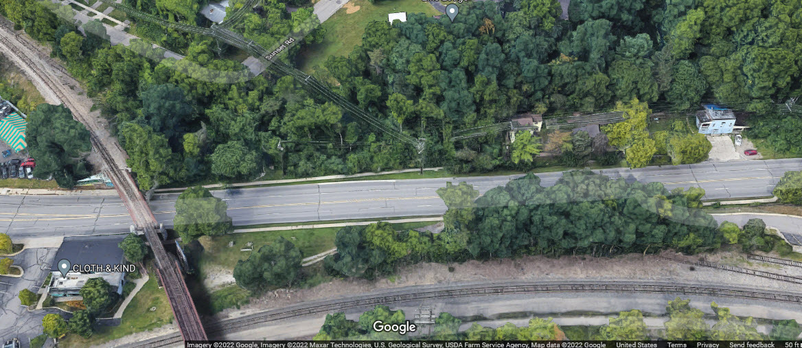
GPS Coordinates: 42.27719, -83.75020
416 South Ashley Street
http://www.railroadmichigan.com/rrd_abcd.html for more pictures
The station was built in 1889.


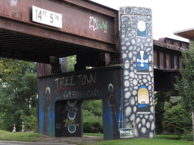
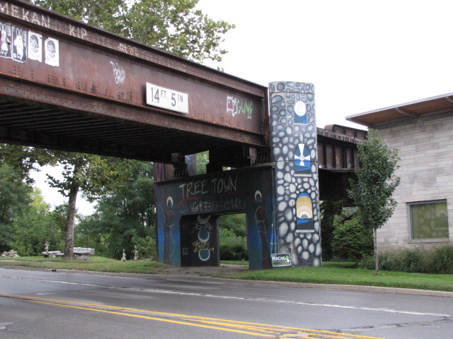
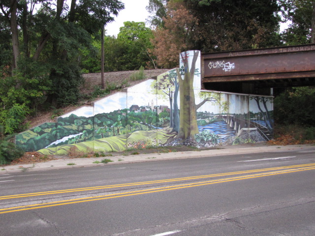
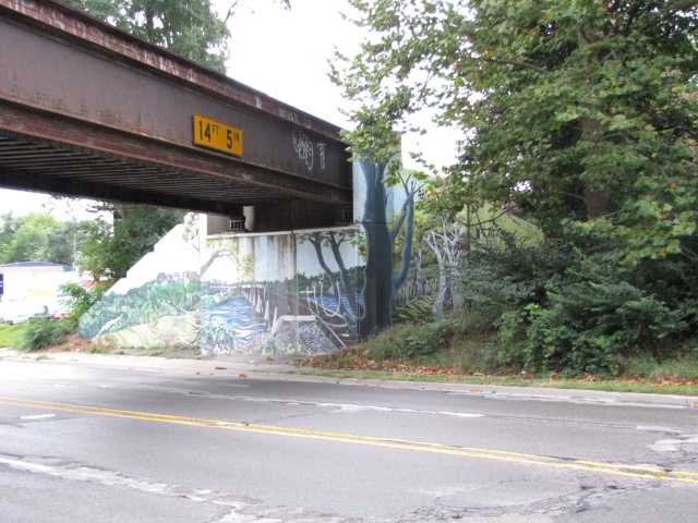
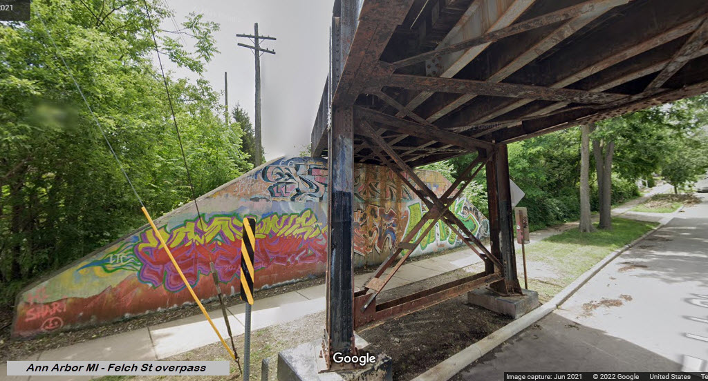
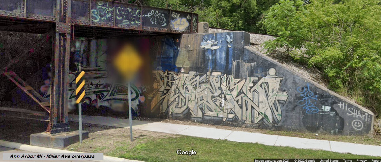
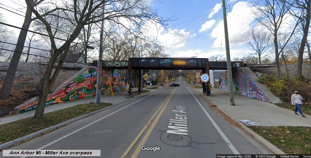
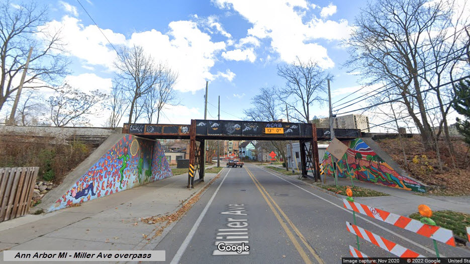
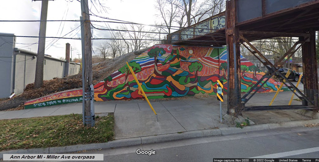
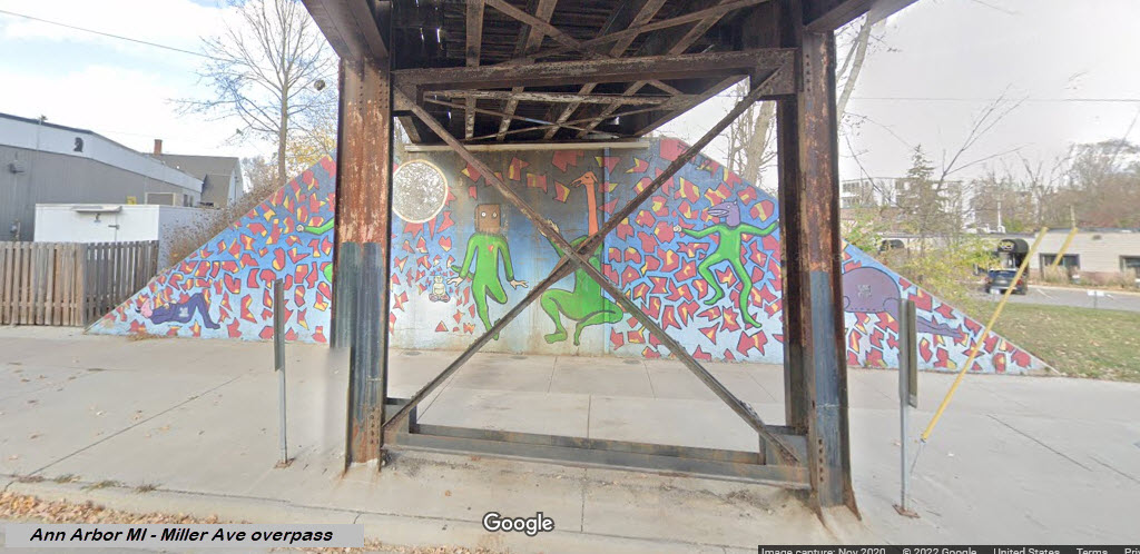
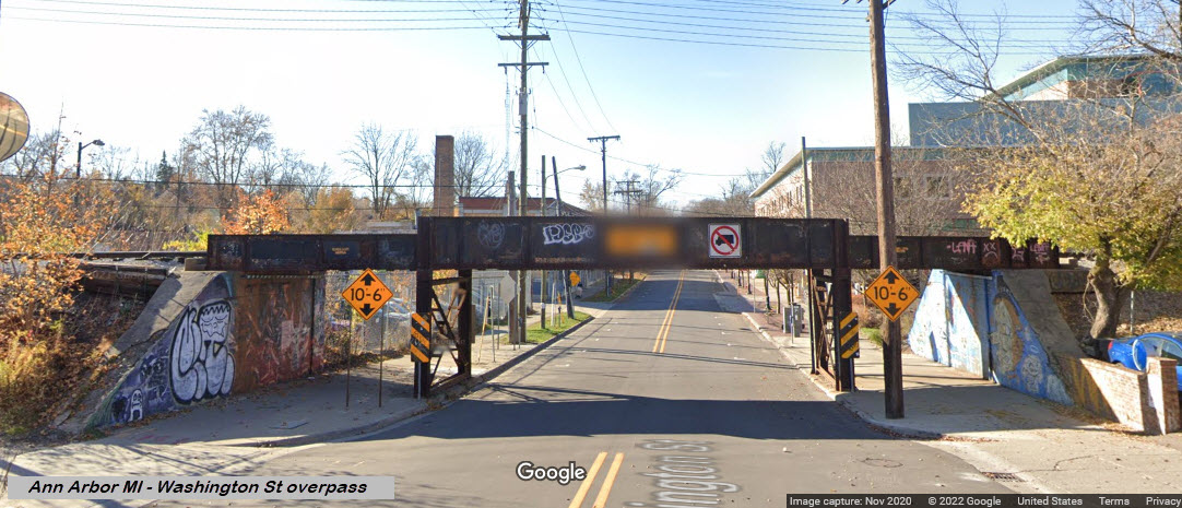
Bridges, Tunnels, and Overpasses
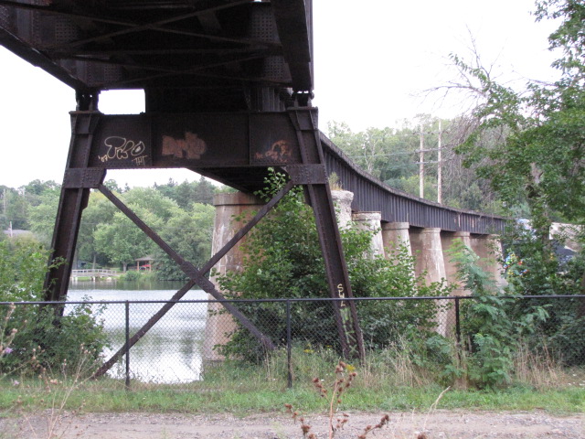
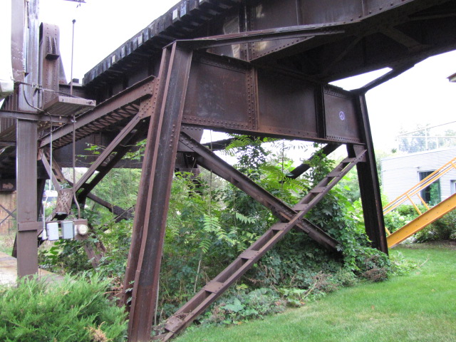
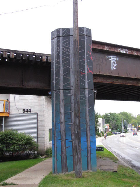
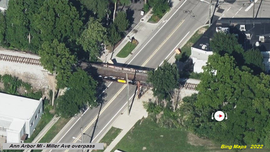
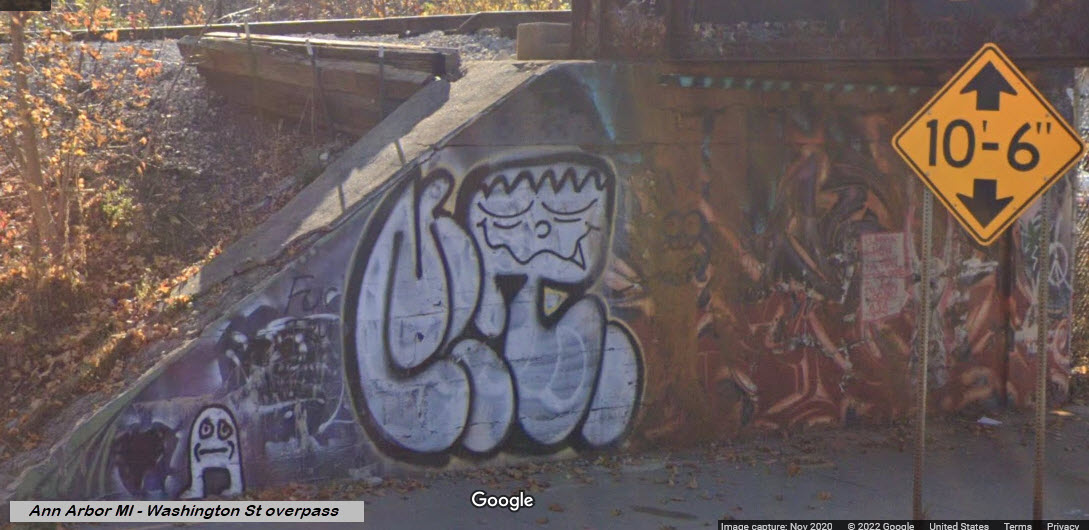
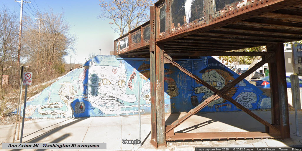
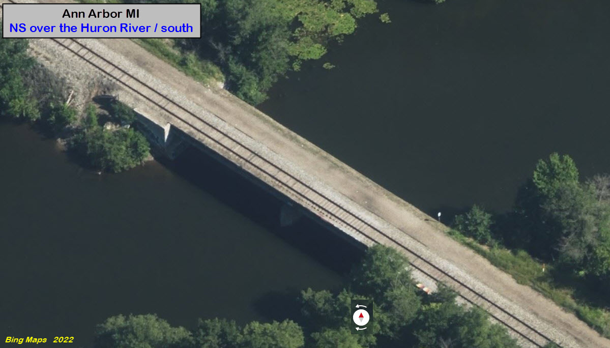
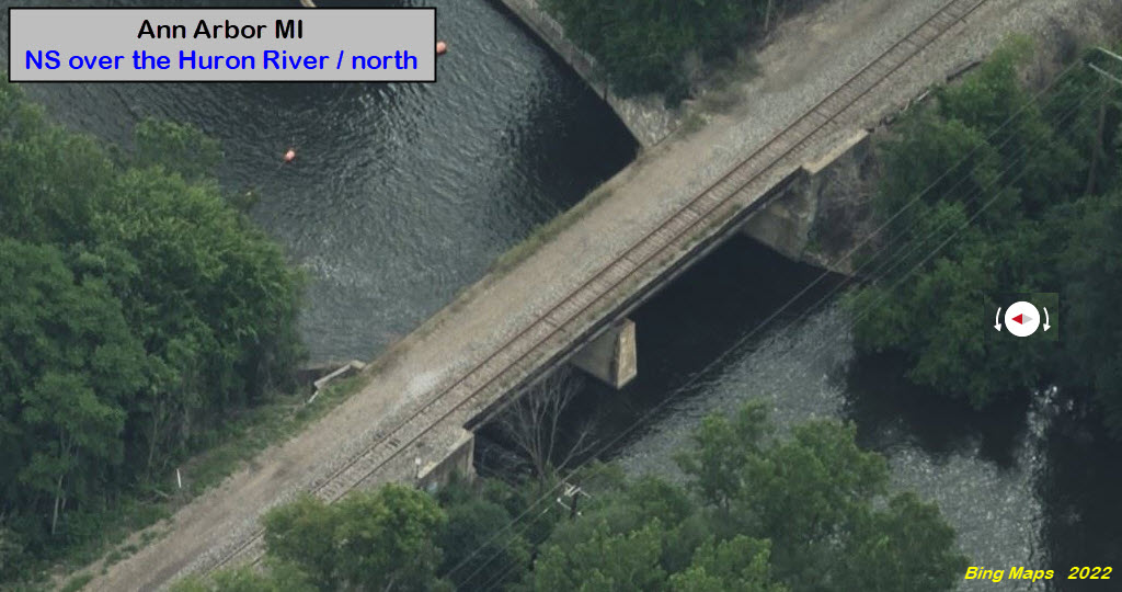
I don't know how often trains cross the water here, but I'm sure if you know ahead of time when they are supposed to come, and you have a bit of patience, great shots can be had from the jogging path on the small dam located next to the bridge. I took a lot of detail shots in case someone out there is interested in copying the design, which from ground level, is most interesting! Tetris anyone?
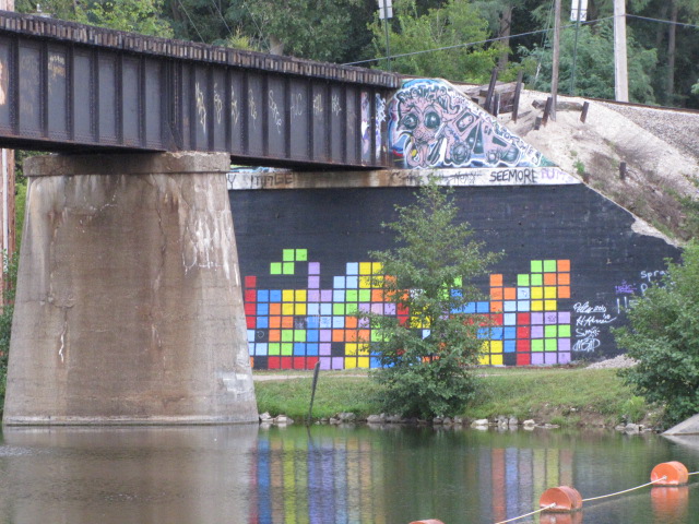
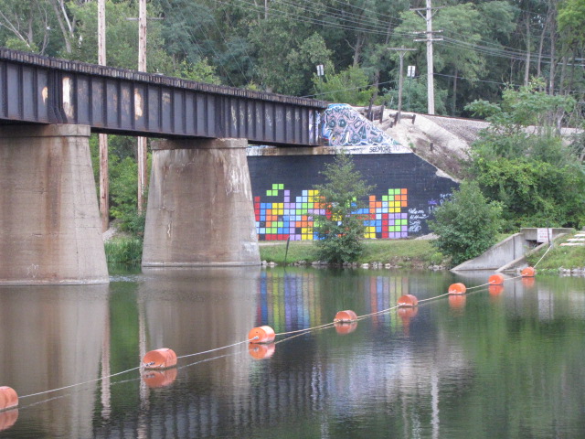


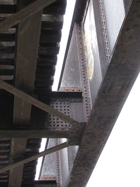
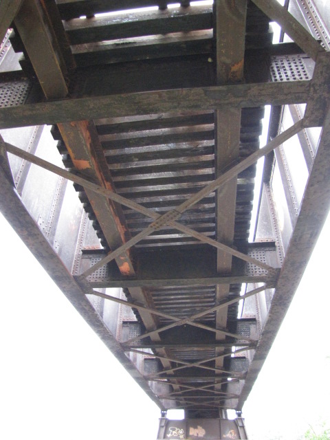
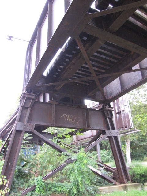
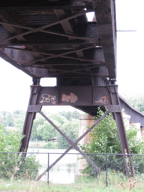

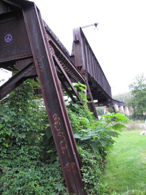


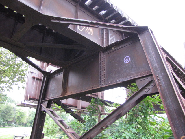
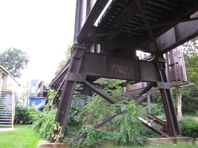 A bunch of detail shots.
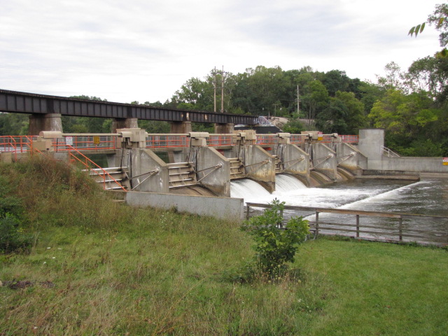
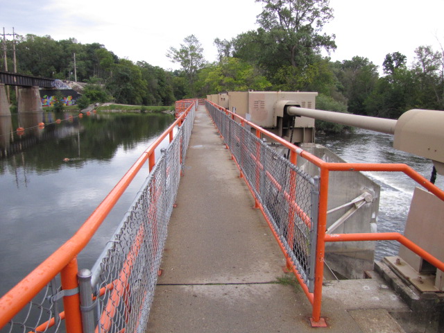 The flood control dam with a jogging path / walkway going over it.... good for train shots.
GPS Coordinates: 42.29034, -83.74720
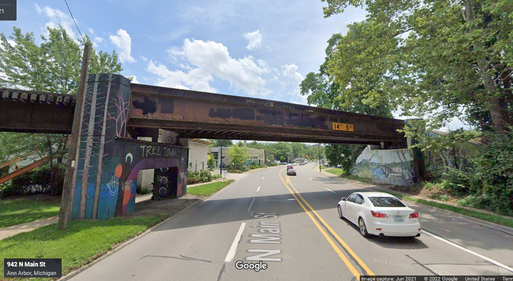
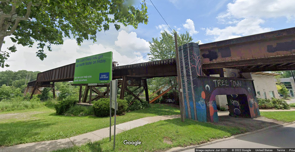
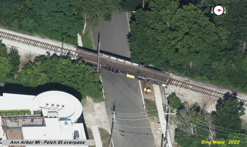
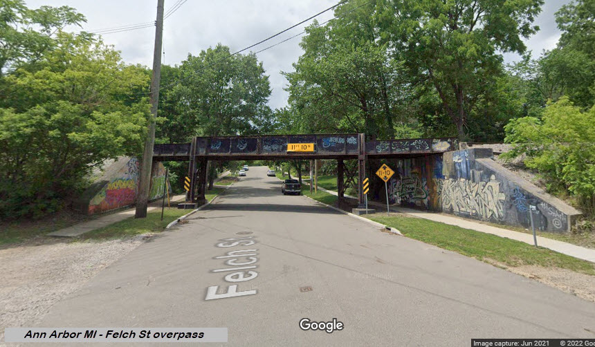
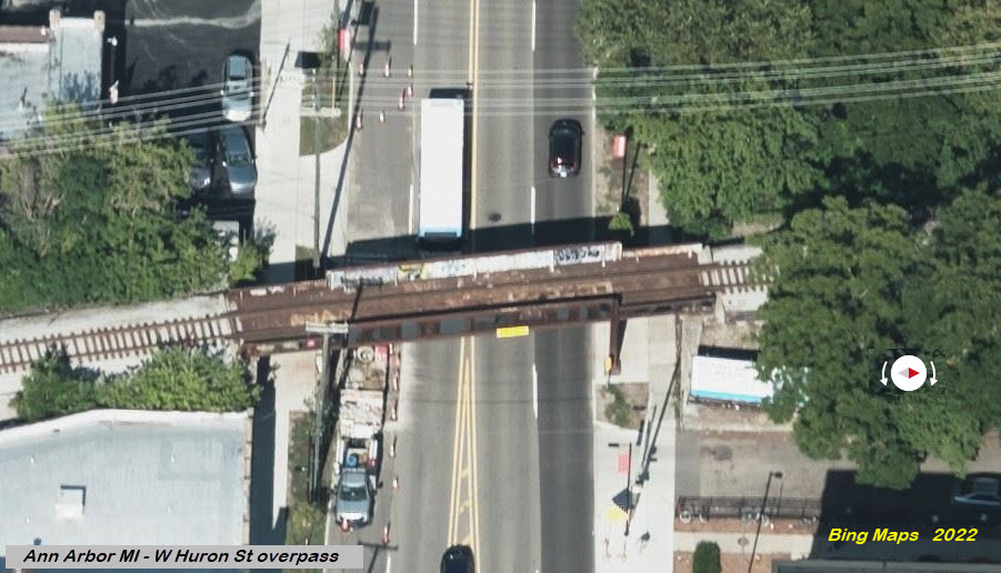
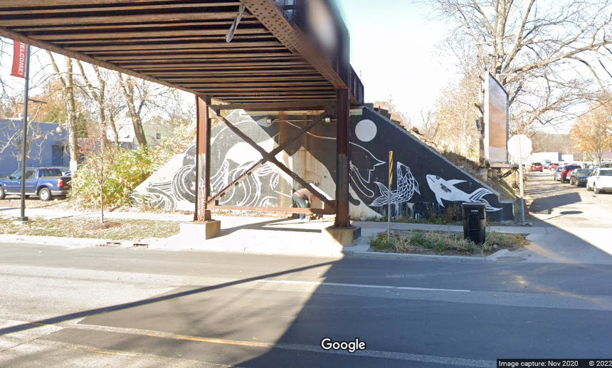
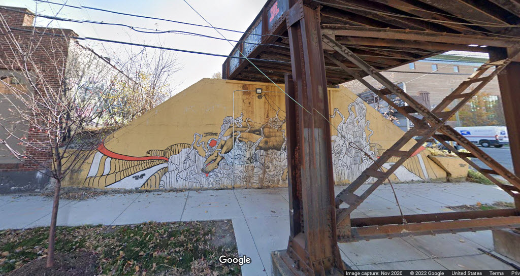
This is actually the last span of the bridge going over the river, it's a steel girder bridge.


GPS Coordinates: 42.28635, -83.75090

GPS Coordinates: 42.28361, -83.75200
GPS Coordinates: 42.28156, -83.75218


GPS Coordinates: 42.28060, -83.75190
GPS Coordinates: 42.30306, -83.74774
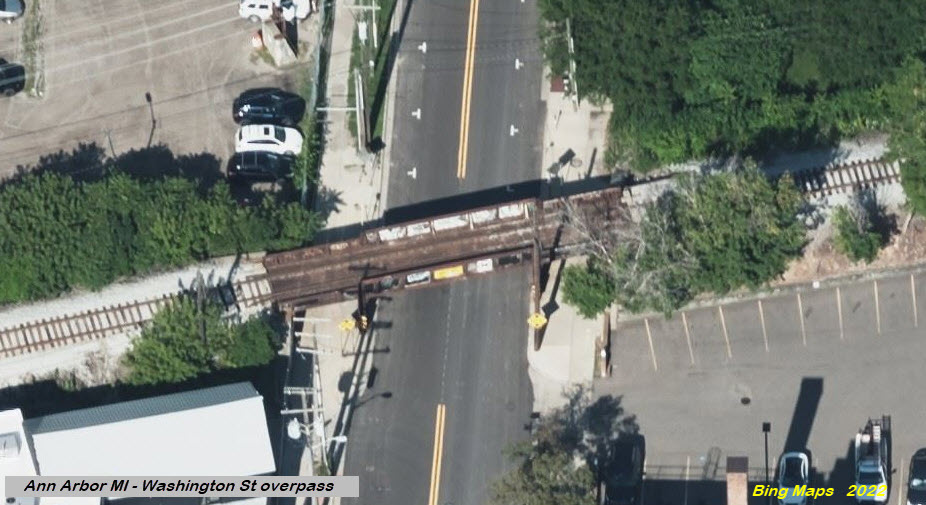
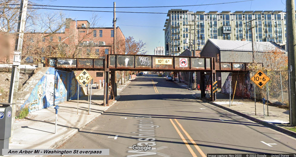
Crosses the river adjacent to where Business 23 goes over the river and railroad.
 from Business 23
GPS Coordinates: 42.30794, -83.75481

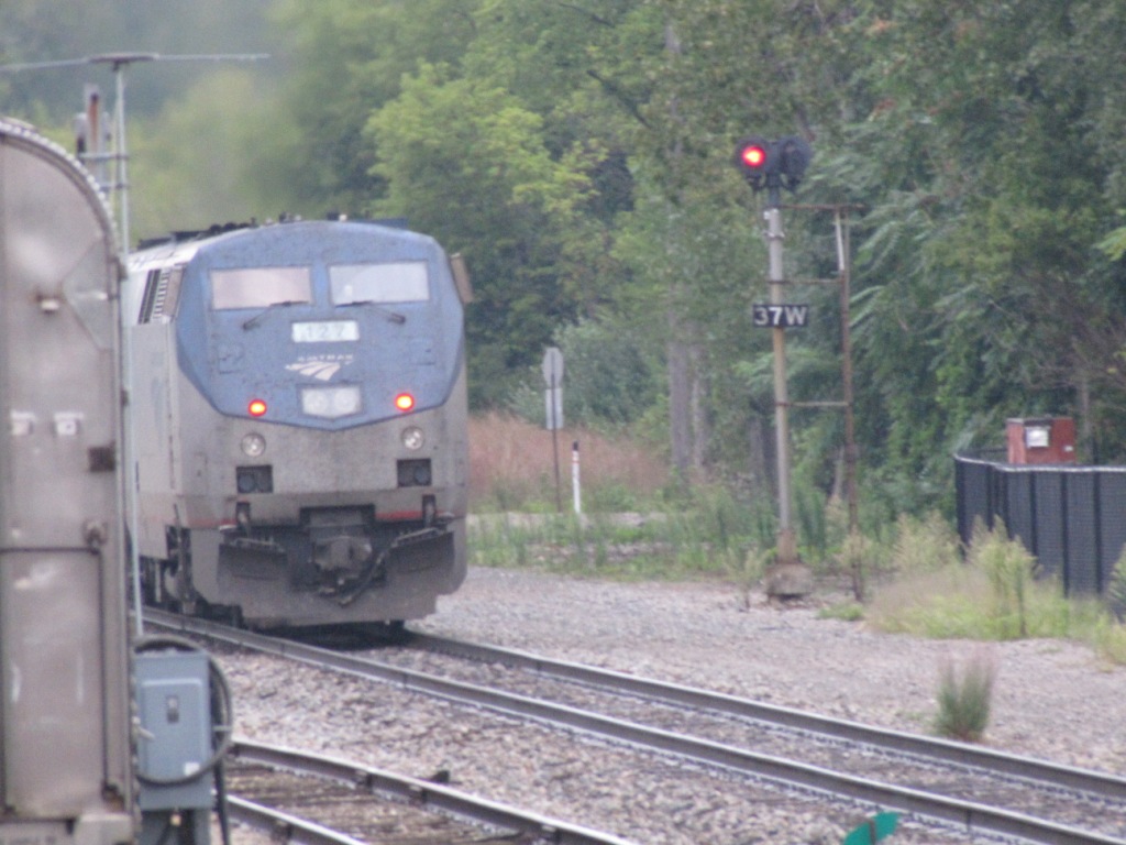
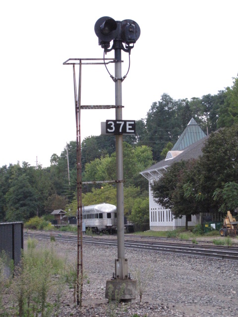
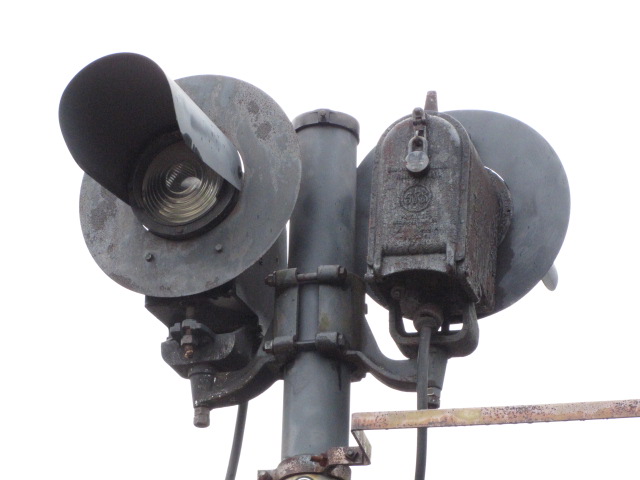
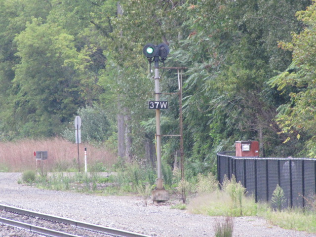
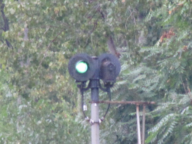
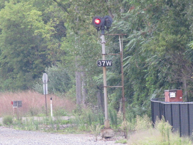
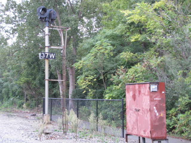
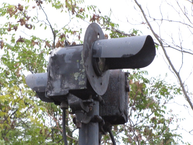
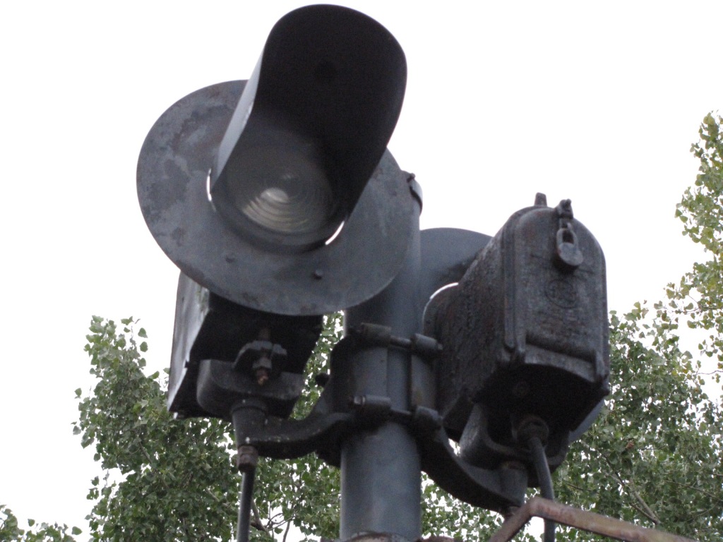
I didn't manage to find many signals around here, in fact, this is the only one I saw, and is west of the Amtrak station, across from the observation car. The mounting is kind of unique in the sense that they are located side by side, instead of being mounted one behind the other. Didn't have a chance to catch the signal going yellow, for the signals are approach lit.


 Sign in the vicinity of the observation car.
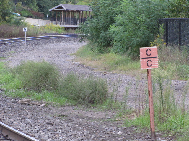 Track signs between the observation car and the Amtrak depot.
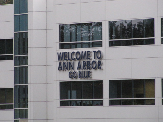 If you're coming into Ann Arbor from the west, you will
see this on the back of the 201 building.
If you're coming into Ann Arbor from the west, you will
see this on the back of the 201 building.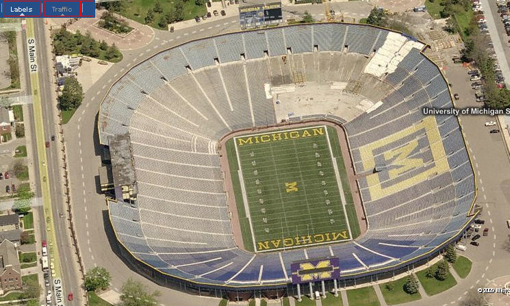 The University of Michigan stadium.
Disclaimers:
I love trains, and I love signals. I am not an expert. My webpages reflect what I find on the topic of the page. This is something I have fun with while trying to help others.
Please Note: Since the main focus of my two websites is railroad signals, the railfan guides are oriented towards the signal fan being able to locate them. For those of you into the modeling aspect of our hobby, my indexa page has a list of almost everything railroad oriented I can think of to provide you with at least a few pictures to help you detail your pike.
If this is a railfan page, every effort has been made to make sure that the information contained on this map and in this railfan guide is correct. Once in a while, an error may creep in :-)
My philosophy: Pictures and maps are worth a thousand words, especially for railfanning. Text descriptions only get you so far, especially if you get lost or disoriented. Take along good maps.... a GPS is OK to get somewhere, but maps are still better if you get lost! I belong to AAA, which allows you to get local maps for free when you visit the local branches. ADC puts out a nice series of county maps for the Washington DC area, but their state maps do not have the railroads on them. If you can find em, I like the National Geographic map book of the U.S..... good, clear, and concise graphics, and they do a really good job of showing you where tourist type attractions are, although they too lack the railroads. Other notes about specific areas will show up on that page if known.
Aerial shots were taken from either Google or Bing Maps as noted. Screen captures are made with Snagit, a Techsmith product... a great tool if you have never used it!
By the way, floobydust is a term I picked up 30-40 years ago from a National Semiconductor data book, and means miscellaneous and/or other stuff.
Pictures and additional information is always needed if anyone feels inclined to take 'em, send 'em, and share 'em, or if you have something to add or correct.... credit is always given! Please be NICE!!! Contact info is here
Beware: If used as a source, ANYTHING from Wikipedia must be treated as being possibly inaccurate, wrong, or not true.
RAILFAN GUIDES HOME
RAILROAD SIGNALS HOME
NEW 08/15/2009, MAR28/2016, MAR04/05/06/07/2022
Last Modified 07-Mar-2022