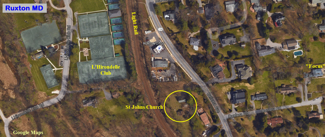
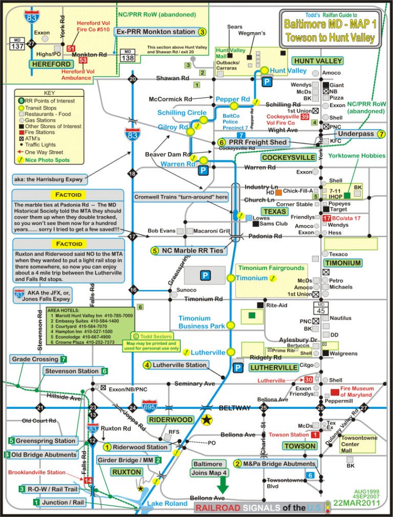
Location / Name:
Ruxton & Riderwood MD, Baltimore County
What's Here:
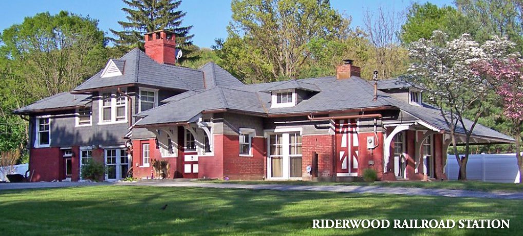
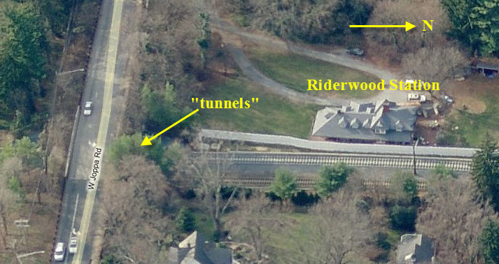
Riderwood Station (former Pennsy)
Twin Light Rail Tunnels
Site of former PRR Ruxton station
Data:
GPS Coordinates: as needed
Phone A/C: 410
ZIP: 21204
Access by train/transit:
None
The Scoop:
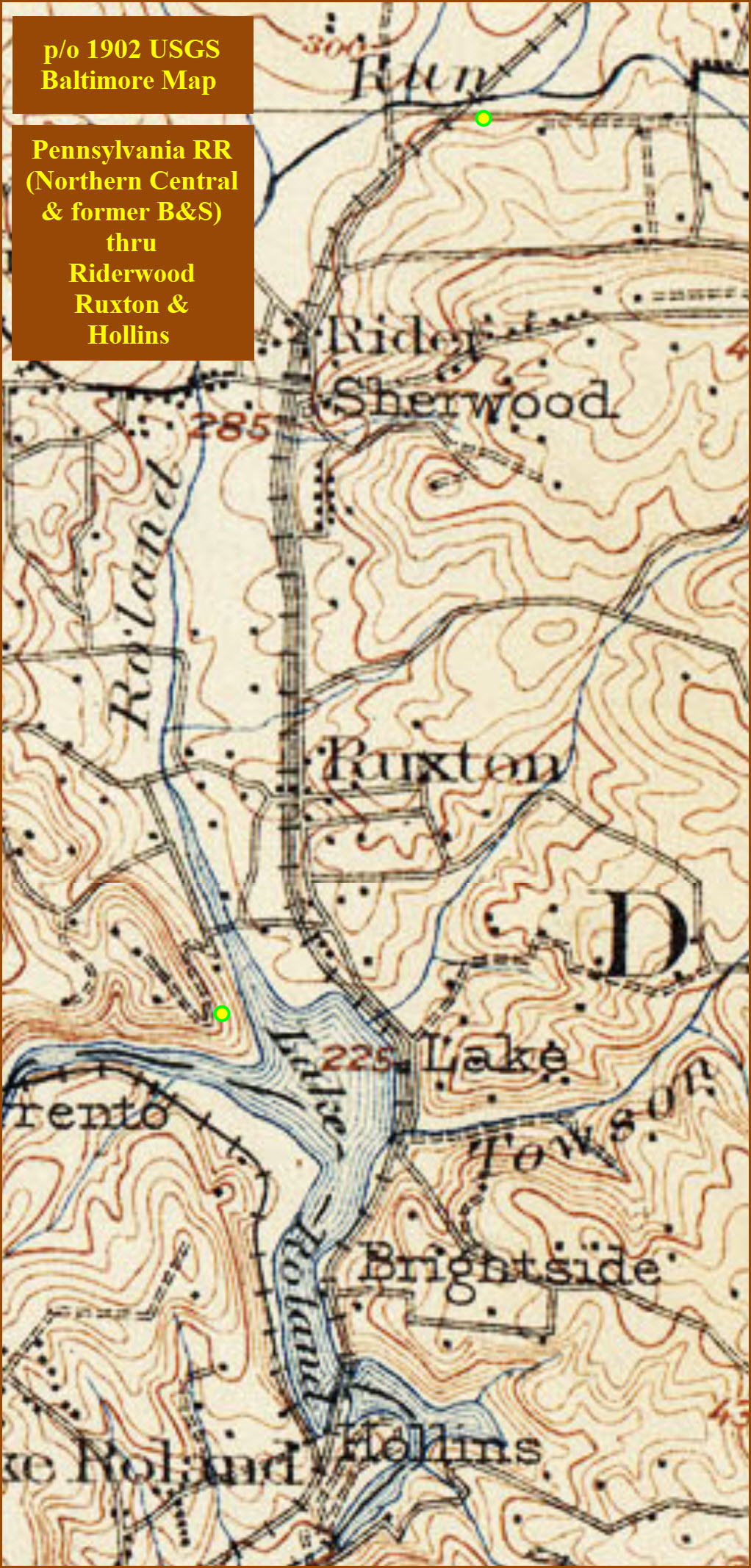
Ruxton and Riderwood are two historic communities in the north central part
of Baltimore County, just north of the city-county line. When there was
precious little out in the suburbs of Baltimore back in the 1800's, these two
areas sprang up as bedroom communities for the rich. Ruxton was the
original "rich" area of Baltimore County, and still retains a lot of that former
affluence.
Although this part of Baltimore happens to be blessed with quite a variety of
railroad "things", there is nothing here of
any real interest to the "hardcore" railfan looking for mainline action - you
will have to go downtown, or to the east or west of Baltimore for that. The second railroad of
Baltimore, the Baltimore & Susquehanna, later the Northern
Central, came through here in 1832 heading to York and
Harrisburg. They also built the Green Spring Branch, which the Western
Maryland used in the beginning before they had their own route out of the city.
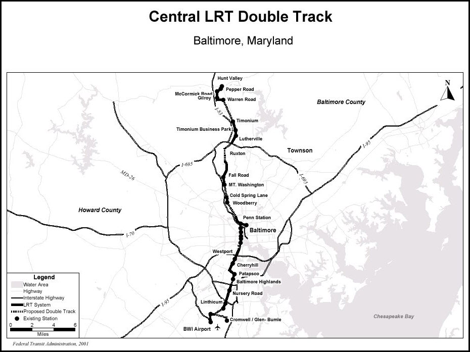
The northern part of the light rail system runs right up the middle of the
map, which was the original right-of-way of the B&S/Northern
Central. The original section opened in 1990 and went to
Timonium. The extension went to Hunt Valley in 1996.
Any part of it that wasn't, was double tracked in 2005, and the old marble ties (stringers) were
visible along the R-O-W for a short while. Above Cockeysville, the R-O-W is now
the NC hikey-bikey Trail, which is very popular with those types (sorry, nothing
personal, as I take walks and hikes around the lake quite often). The R-O-W
splits off at Warren Rd, and other than the stub that is still there, not much
remains visible. NS trains stopped running when the light rail closed the
track for the double tracking project at the beginning of 2005. They
applied for abandonment shortly thereafter.
Several old NC/PRR depots are still around to
check out. Riderwood is the only one in the neighborhood
(about a quarter of a mile down the tracks from me),
with the Ruxton station having been torn down in the early
1960's. Lutherville, Greenspring, Stevenson, and Monkton
are all fairly close - Three of them are used
as homes, and anyone wishing to take pictures of them should respect the privacy
of the homeowners! Monkton serves as the HQ for the Trail.
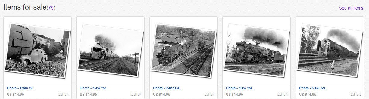
With the latest update of this page in May of 2021, I would like to thank Bill
Spicer for allowing me to use his father's pictures of the Riderwood depot, and
the shot of a SB steamer going under Joppa Road.... WAY before Joppa Road was
rebuilt and they put in the twin "tunnels". If you are looking for copies
of the pictures Harold S. Spicer took, visit Bill's EBay store at:
https://www.ebay.com/usr/spicerpro?ul_noapp=true . Here is a small
sampling of the pictures he is offering:
Towson is to the east, Brooklandville is to the west, Lutherville,
Timonium, Texas, Cockeysville, Hunt Valley, and Monkton
are to the north, and Mt Washington and Lake Roland are
to the south.
Neither Ruxton nor Riderwood have a fire or police station located
within. The closest fire stations are Lutherville
Volunteer Fire Company (station 33), Towson (station 1), and Brooklandville (station
14). The closest police station, precinct 6, is in Towson.
FYI - I currently live in Riderwood, and grew up in Ruxton on L'Hirondelle Club Rd, and
yes, there is actually a tennis club on L'Hirondelle Club Rd, wanna guess
the name of it? :-)
Acknowledgements:
Bill Kalkman
Bill Spicer
Terry Jo Miller
S. W. Wiley Jr.
the Baltimore Sunpapers newspaper
Google Maps
Bing Maps (sometimes)
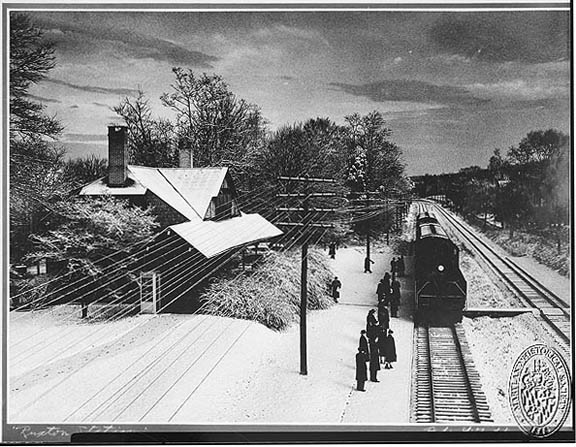
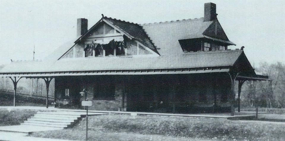
This station is privately owned. The Riderwood Station is of a Frank
Furness design. The station was sold to the station operator in
approximately 1964 after the Pennsy stopped running the Parkton Local.
Somewhere around 2002, the woman who owned it (the surviving widow of the
station operator), decided to sell it. I got a call while in Minneapolis
on business from a fellow named Mr. Coale of the Ruxton-Riderwood Improvement
Association asking me for help (don't know why he called me, or how he knew I
had an interest in trains). So I went to a monthly council meeting and petitioned
Baltimore County to put it on their historical list, which didn't look good at
the hearing, because the council was turning down similar requests.
But after two sessions and a little speech, it finally did make it onto the list, and the woman and her real estate agent got
really pissed at me because the best offer they had gotten was from a real
estate developer who wanted to tear it down and put up 4 or 5 houses on the acre
and a half it sits on. Score one for "us". The house sold for $175K
back in 2002, and recently sold for around $650K before the real estate bust.
It looks like a second fireplace was added sometime after the station was
originally built.
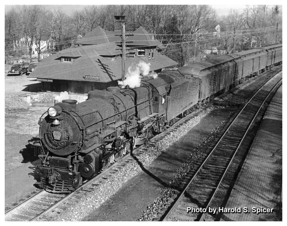
`
courtesy Bill Spicer.
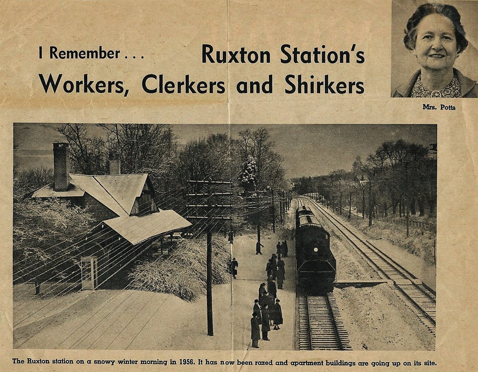
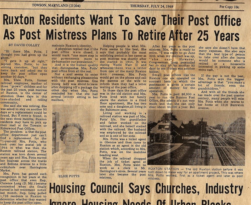
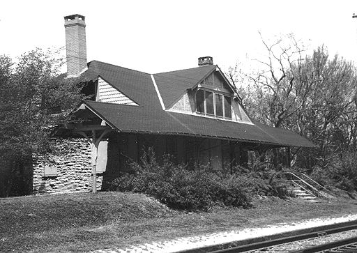
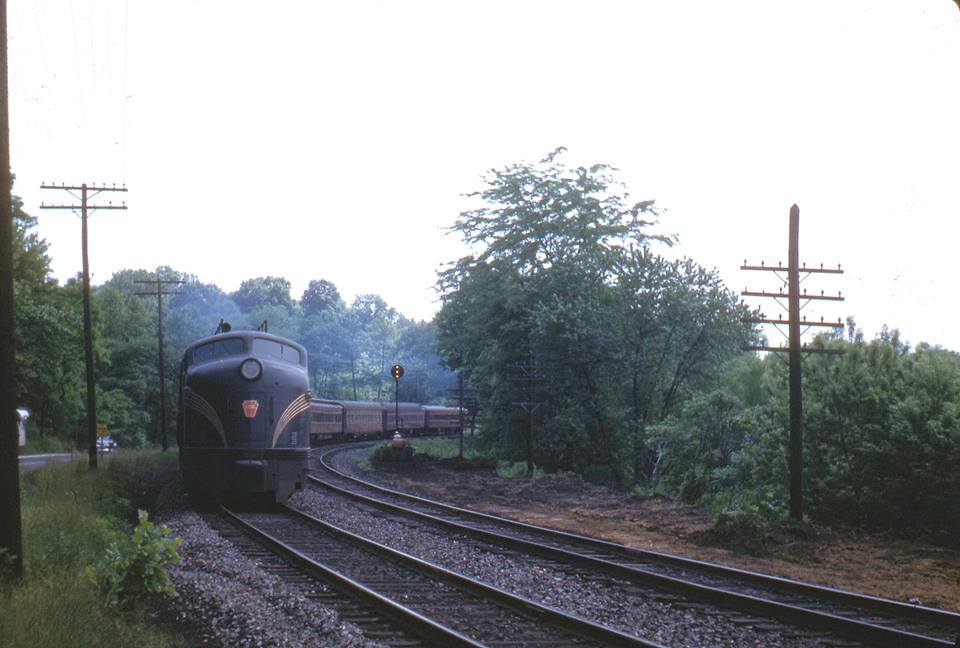
ex NC/PRR Ruxton Station
The Ruxton station was torn down in the early 60's after
passenger service ended in 1959, and an apartment building was put up in its place.
I cannot find any decent pictures of the Ruxton station, so far. The train
in the left picture below is using a diesel - you can also see a phone booth on
the corner of the depot, which is not in the steam picture. Maybe one day
I will find a better picture of the station, showing how they squeezed three
tracks in here - the picture appeared in the
Sunpapers back in the late 60's. The pavers used as the
platform used to still be in place, I'll have to go by and see if they are still
around.....
Living next to the light rail can have its
advantages. During the blizzard of 1996, traffic went no-where for two
days, so I called up Light Rail Control and had them stop behind my house at
this milepost to pick me up for work. Did this for two days. If you
read the Baltimore Light Rail section, you may remember I worked as an ET for
them between 95 and 98. Some of the operators will still blow the
horn when they pass by and see me in the yard.
A few winter shots from behind my house.
Looking north towards Lutherville. The jog in the track was/is for noise
reduction for Thorton residents! :-)??? I'm sure it does a LOT of good!
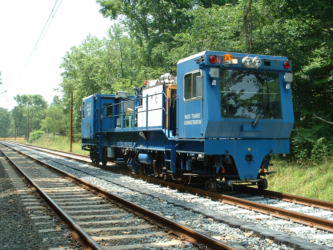
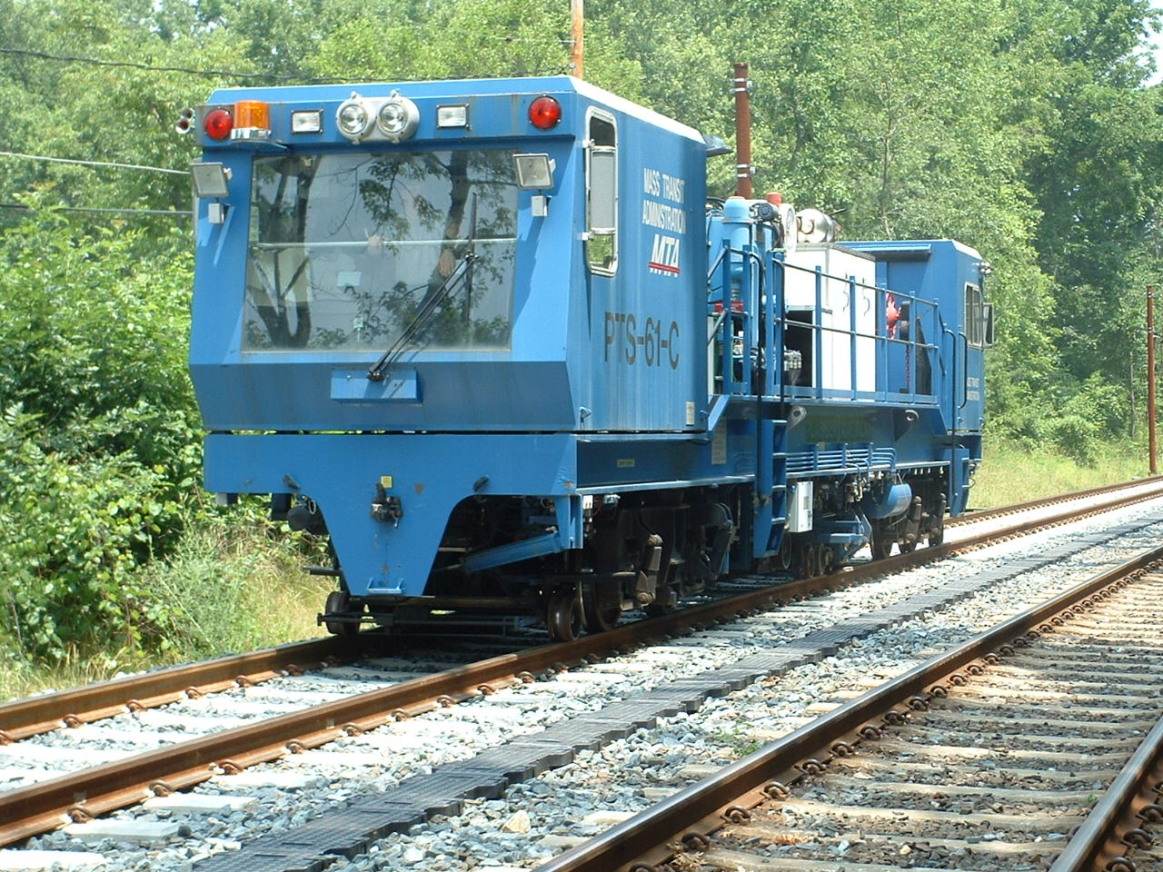
Double tracking the north end of the light rail
system started on January 1st, 2005, and took about a year. During the
construction time, the MTA used busses. I bet a lot of the suburbanites
drove their own car during that time! :-)
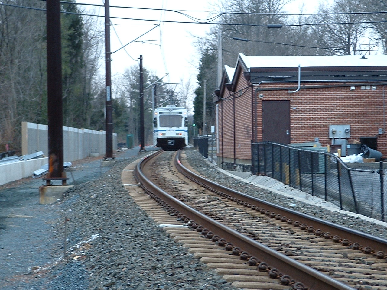
Double tracking reduced the number of signals in the Ruxton-Riderwood area.
There was a NB signal next to the Riderwood post-office (bottom two
pictures in the tunnel pics section below), and a SB signal just south of the
tunnels that were removed (the signal you can see when looking thru the
tunnels, with only one track before the double tracking project). In
addition, there were three signals used in the interlocking
along Bellona Ave adjacent to Grauls that were removed because they were no
longer needed. Signals are no longer used as intermediate signals,
especially since they have ATC installed on the cars.
As you can see from
the map below, the north end had way more single track than the south end.
One reason for this may have been the fact that when the MTA took on the task of
building the first section of light rail, which was the north section, they paid
for it completely without federal funds for a couple of reasons. One, it
was quicker, and secondly, they didn't have to go through the environmental
approval process required to get the federal money. So they took shortcuts
where they could, and one was to have a lot of single track. One of my
biggest beefs in the way they did things was to put TWO sets of poles on the
line, instead of one down the middle. Why would anyone who was thinking of
saving money double the installation costs? In addition, it saves in space
needed to lay down the R-O-W, and anyone who has been behind the Riderwood post
office knows what I mean, because they use hangers that span both tracks because
it is so narrow there!
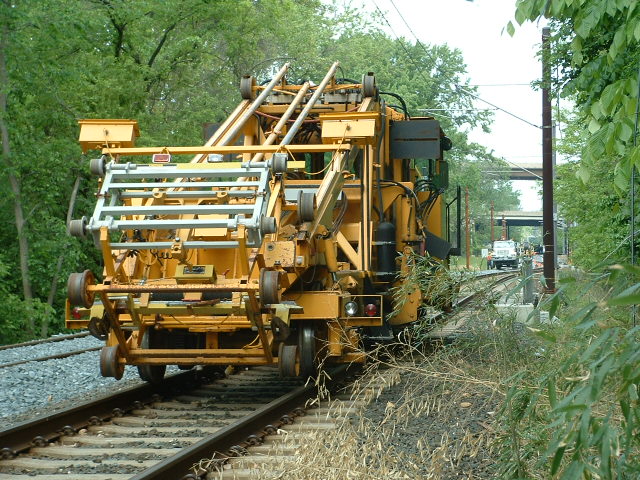
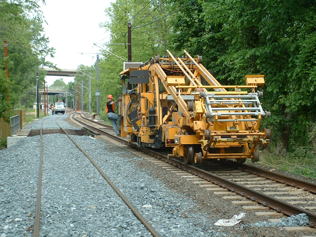
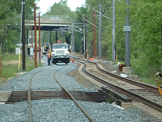
Installing the catenary support brackets.
Installing the catenary.
Fine tuning the catenary.
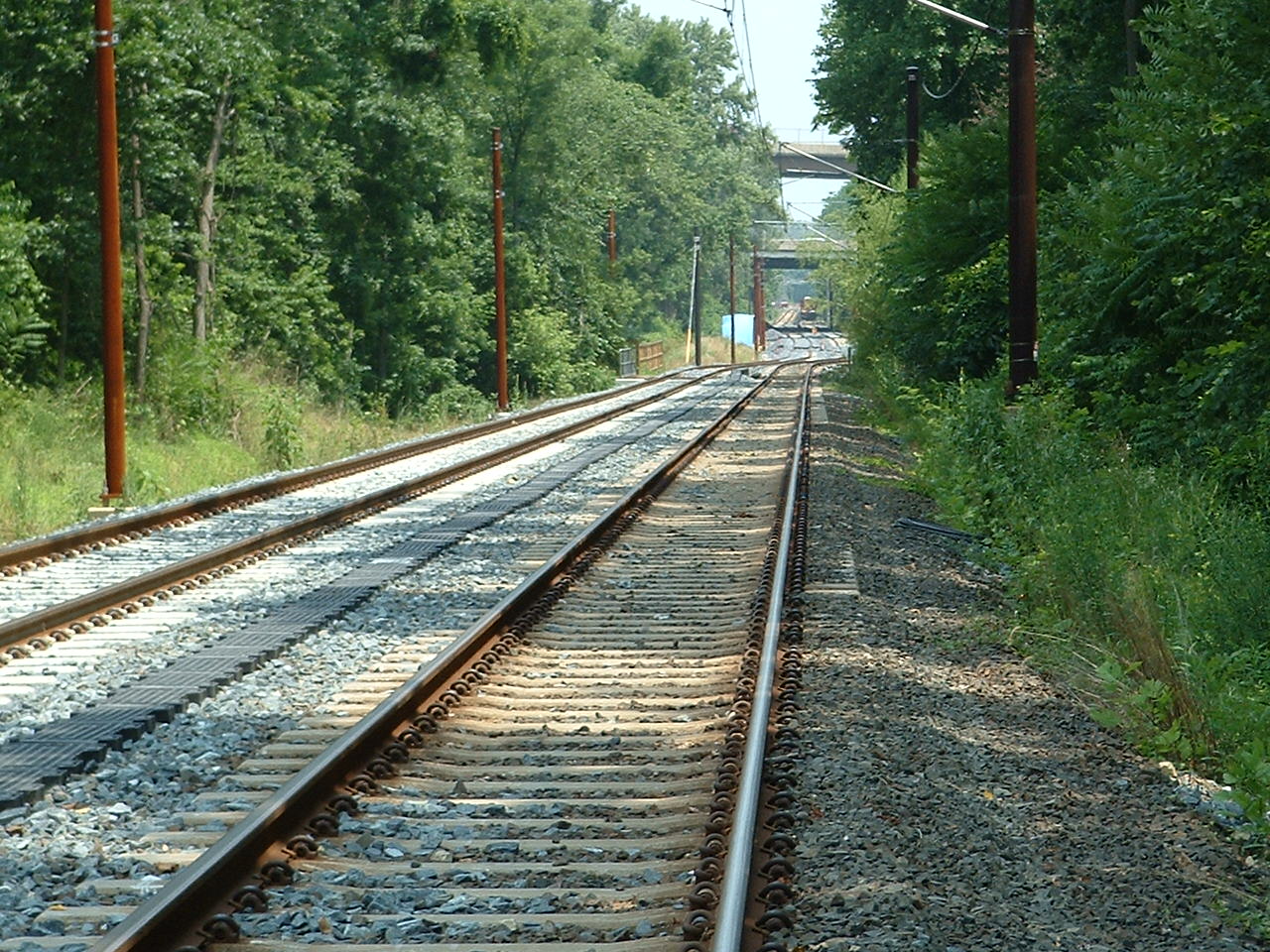
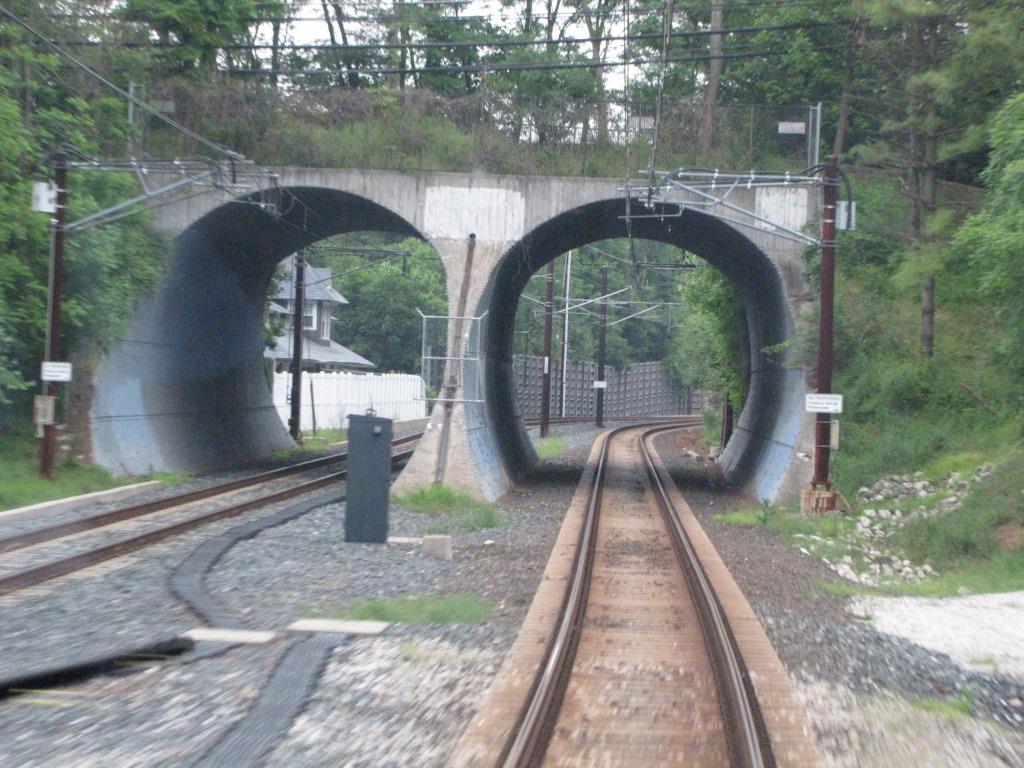
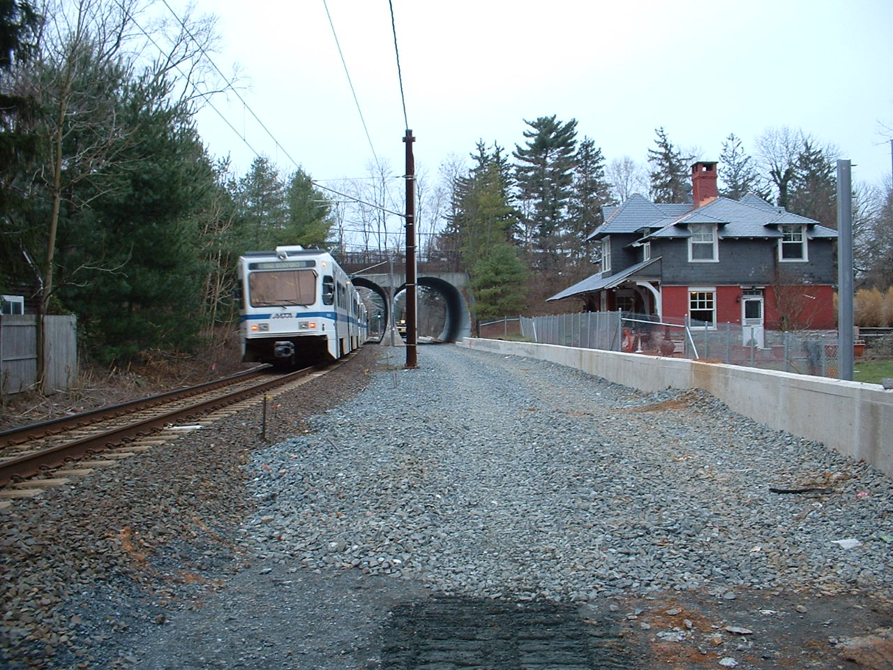
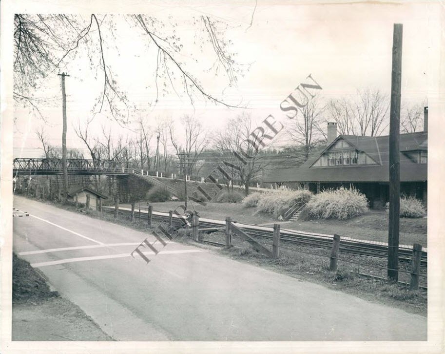
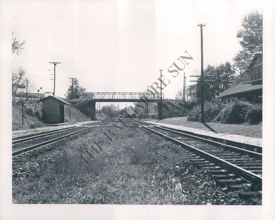
the Riderwood Tunnels
Shooting thru the cab of a northbound train, just before going thru the tunnel. You
can just barely see the Riderwood station thru the left portal.
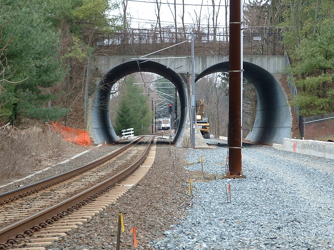
Looking southbound thru the tunnels, on 12/31/2004, the day before they shut down service on the "north
end" to start the double tracking project. The signal is no longer there.
With my back to the tunnels.
With my back to the tunnels.
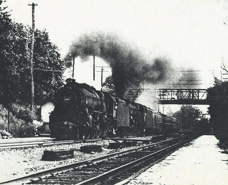
A long time ago, this is what trains looked like when they were going under
Joppa Road before the Tunnels were built.
~1955?, Warren E. Olt
A northbound passenger where Bellona breaks off from the tracks and goes up the hill to Charles Street.
I have the wiring diagrams for that signal.
A southbound passenger coming up on the Lake, Ruxton Road is just around the
curve in the distance.
The Baltimore & Susquehanna (1828-1854) [By Allen Brougham]
With this issue of the Bull Sheet, I take an opportunity to devote its
feature material space to a central theme. The Baltimore & Susquehanna (a
predecessor of the Northern Central) holds a very special place to me. I
grew up along the line. By devoting it to the B&S, a two-fold purpose is
served: First, this month marks the 35th anniversary of the last trip of the
famed Parkton Local, a train I rode many times in its final two years of
service. Second, on Saturday, June 4, the first mile and one-half segment of
the York County Rail/Trail along the former B&S right-of-way in Pennsylvania
will be dedicated.
The Baltimore & Susquehanna Railroad was chartered in 1828 and begun the
following year to connect Baltimore with the Susquehanna River near York,
Pennsylvania. It achieved that goal in 1840. It later completed construction
to the area of Harrisburg, with work to build further, but in 1854 the
company went bankrupt. It was then reorganized under the name of the
Northern Central Railway, a line that eventually reached Lake Ontario at
Sodus Point, New York. In 1914, the NCR became a part of the mighty
Pennsylvania Railroad through a lease arrangement.
The dedication of the Baltimore & Susquehanna to this issue of the Bull
Sheet is due to that line's geographical territory approximating the issue's
interest scope. The ultimate Northern Central's territory was much larger,
and the Pennsylvania's was larger yet. So while the names Northern Central
and Pennsylvania do figure extensively in the articles that follow, it is
actually the territory of the predecessor B&S that more directly intrigued
my fancy as a kid growing up in Monkton.
Special thanks go to Robert L. Williams and Martin K. Van Horn for their
assistance with material they provided for this issue.
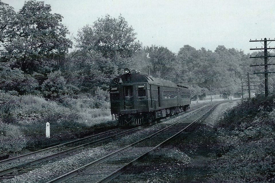
The Parkton Local [By Martin K. Van Horn]
Mention the Northern Central Railway to any railfan or resident of north central Maryland who knows
to which part of the Pennsylvania Railroad you refer, and several things come to
mind: a railroad that dates from the primitive days of transport mode, operating
on a roadbed that is less than 45% tangent track; a railroad that carried the
Washington-to-Chicago first-class passenger traffic of the PRR; in later years,
a nearly passenger-only railroad when that was the least lucrative part of
railroad business; and, most of all, the Parkton Local and the self-propelled
railcars that became synonymous with the name.
Not all Parkton Local trains were serviced by the "gas cars" - there were
just as many locomotive-hauled trains. It was only in later years, when
subsidized automobile competition on public highways cut deeply into revenues
that the economical railcars replaced many locomotive-hauled trains to hold down
operating costs.
In the early years, the Parkton Local was not even the Parkton Local; it was
the Cockeysville Local. Many commuter runs operated between Calvert Station in
Baltimore and the wye and terminal storage tracks that then existed at
Cockeysville, while only two accommodation trains terminated at Parkton. In fact
Cockeysville was 15 miles from Calvert Station, the same distance as Green
Spring Junction on the Green Spring branch. An intensive commuter service
thrived on this two-prong line in the years between the turn of the century and
World War I. The seven miles from Calvert Station to Hollins at the southern tip
of Lake Roland was thick with commuter trains. At Hollins, the Green Spring
locals turned west and operated 8.6 miles over the single-track Green Spring
branch to a junction with the Western Maryland Railway approximately one mile
south of Owings Mills. The Cockeysville trains continued north on the
double-track Northern Central mainline through Ruxton, Sherwood (Riderwood),
Lutherville, and Timonium to their terminus.
One interesting tradition of the "Gilded Age" were the "Owl" trains, midnight
commuter runs on the Main and Green Spring branch lines to take theatergoers
back to their homes after the curtain had fallen.
Ruxton-Riderwood provided most of the business for the locals and some trains
cut back at Riderwood through the agency of a mile-long siding central to both
tracks that stretched back to Ruxton. It was possible to cross over and run
around the cars of a train by means of this sidetrack thus reversing the train.
Trains could be held on this siding, also, until the demands of the schedule
required their reappearance on the mainline.
In the post-World War I period, the PRR, which had effected a 999-year lease
of the Northern Central in 1914, lengthened the commutation district to Parkton.
The PRR was possibly anticipating growth of the metropolitan area, and there
were existing facilities for locomotive service and train storage at the Parkton
yard. Eventually all local trains ran through to Parkton. In this same period,
Green Spring local service declined sharply as state-built tax-supported roads
replaced the dirt tracks of the 19th century. The Green Spring locals soldiered
on in diminishing numbers until the onset of the Great Depression. The last run
came on Thursday, August 17, 1933.
Surviving the doldrums of the Depression, the Parkton Local was given a new
lease on life by the tire and gas rationing of World War II. (There is a lesson
here for those who are farsighted enough to see the solution to the oil crisis,
air pollution problems, and balance of payments due to foreign nations.) During
this period, the "gas cars" were joined by pretty, high-wheeled "E" class
Atlantic-type locomotives that had hauled the grand mainline express trains 30
to 40 years earlier. They typically hauled three or four P54 commuter coaches,
which were identical to the MP-54 electric multiple-unit commuter cars used on
the electrified PRR lines except for the lack of motors, controls, headlights,
etc. They did have the distinctive porthole and windows the same as their
electric cousins that gave them their nickname "Owl-face." A single P-54 would
also serve as a trailer car for the self-propelled railcars. In the 1950's,
diesel road-switcher type locomotives that could also be used for more lucrative
freight business replaced the passenger steamers on the locals. The P54 coaches
went elsewhere, and longer P70 coaches from mainline service came to serve the
NC commuters.
The "gas cars" were always thus known, a short version of their real name:
gas-electric cars. Later, the gas-car appellation continued after more efficient
diesel engines had been installed and they had become "oil-electric" cars. In
either case, the internal combustion engines, known as the prime mover, drove an
electric generator which supplied 600 volts of direct current for electric
traction motors geared to the wheels of the front truck. The cars were
bidirectional when operated as single units, but the end with the engine,
generator and motors was nominally the front. When hauling a trailer car, the
trailer had to be turned at the end of the run so that the trainmen and
passengers could pass from car to car without having to pass through the engine
compartment.
Although the gas cars looked alike to the average layman, the fact that they
were built at different times and rebuilt over the years meant that only small
groups were identical or similar. For example, of the last three cars assigned
to the Parkton Local in 1957, nbr. 4662 had a low-arch roof, two small Cummins
diesel engines, and the trailer-end had no separate engineer's cab but rather
the engineer had to occupy the platform in front of the passenger door. On the
other hand, nbrs. 4666 and 4667 had high-arch roofs, one large Hamilton diesel
engine and a separate engineer's cab on the extension of the rear platform. On
these two "big" cars, the restroom was located on the opposite (left) side of
the platform extension.
The Parkton Local operated with a "status quo" existence through the early
1950's, but the handwriting was on the wall. In fact, it was right outside the
walls of Penn Station where the initial construction began on the Jones Falls
Expressway. The PRR took immediate steps to discontinue the Parkton Local,
knowing it would take some time to get the required permission from the Maryland
Public Service Commission. There was strong and organized opposition to service
cuts already being manifested by the Northern Central Railway Commuters
Association. The PRR began a process whereby the costs of operating the Parkton
Local were inflated by means of physical maneuvering and bookkeeping. The latter
was easy: the diesel road switchers were used in freight AND commuter service,
but ALL costs of operation were charged to the Parkton Local. One ploy that did
not work was the attempt to cut service back to Glencoe. This would have
eliminated some passenger revenue without any saving in operating costs since
Glencoe had no turning facilities or storage yard and the trains would have had
to have been deadheaded to Parkton anyway or brought all the way back to
Baltimore empty. This attempt was made in 1957, and was rejected by the Public
Service Commission.
It was well known by 1958 that the Parkton Local was on borrowed time. The
PRR petitioned to discontinue service. After the usual hearing and testimony,
permission was granted effective after the last trips on Saturday, June 27,
1959.
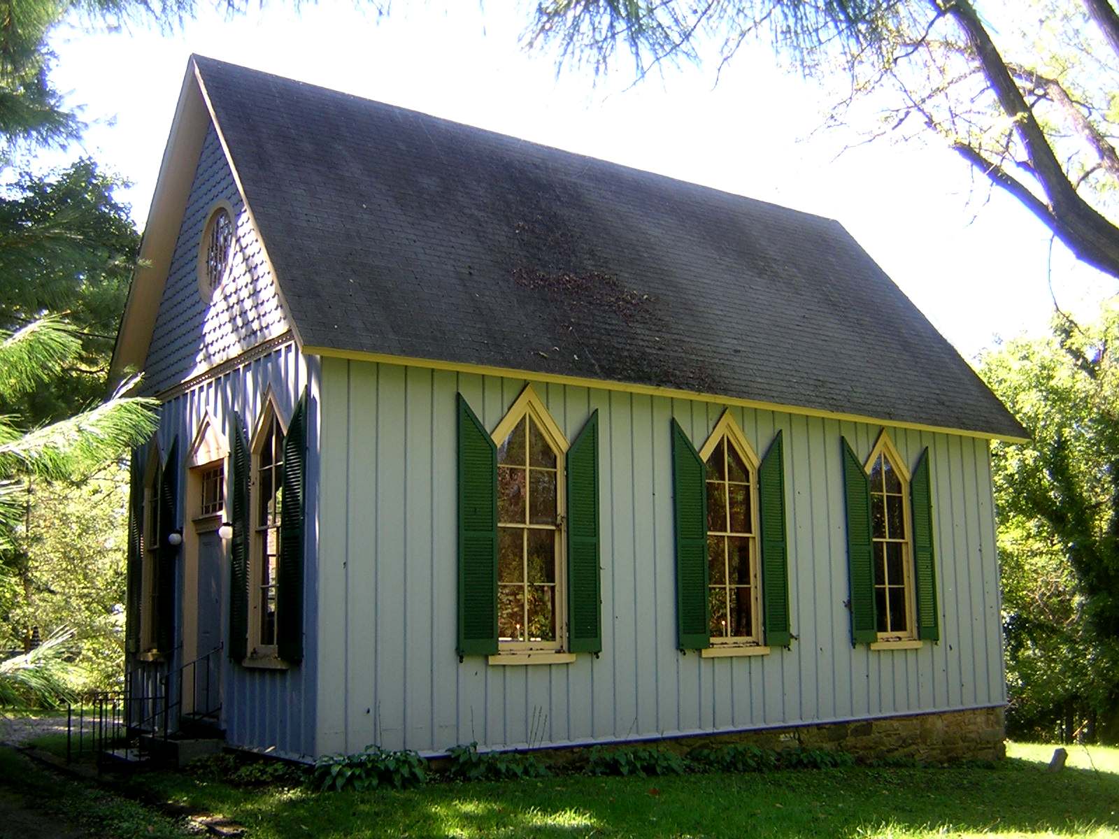
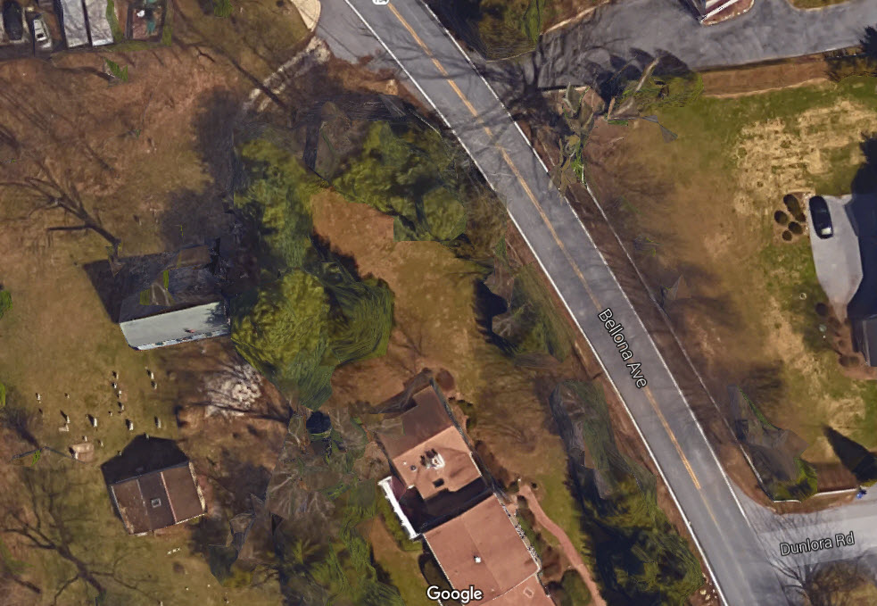
From Wikipedia: St. John's Church is a historic A.U.M.P. Church located in
Ruxton, Baltimore County, Maryland. It was built in 1886 as a successor to
the original log cabin church built on the site in 1833, and is a frame
Carpenter Gothic-style gable-roofed structure with board-and-batten siding,
stylized lancet windows and decorative detailing. Also on the property is
a 1 1/2 story stuccoed stone house, believed to date from about 1835, which was used as a
parsonage and has suffered significant fire damage, and a simple frame
rectangular social hall built about 1890. The Black congregation that
constructed this church was formed in the 1830s and they acquired this site in
1833. According to its National Register listing, "St. John's Church is
particularly important as an exceptional example of Black church building in the
late 19th century." Supposedly, the church is the oldest Black
church in Maryland.
Disclaimers:
I love trains, and I love signals. I am not an expert. My webpages reflect what I find on the topic of the page. This is something I have fun with while
trying to help others.
Please Note: Since the main focus of my two websites is railroad signals, the railfan guides are oriented towards the signal fan being able to locate them.
For those of you into the modeling aspect of our hobby, my
indexa page has a list of almost everything railroad oriented
I can think of to provide you with at least a few pictures to help you detail your pike.
If this is a railfan page, every effort has been made to make sure that the information contained on this map and in this railfan guide is correct. Once in a while,
an error may creep in :-)
My philosophy: Pictures and maps are worth a thousand words, especially for railfanning. Text descriptions only get you so far, especially if you get lost or
disoriented. Take along good maps.... a GPS is OK to get somewhere, but maps are still better if you get lost! I belong to AAA, which allows you to get
local maps for free when you visit the local branches. ADC puts out a nice series of county maps for the Washington DC area, but their state maps do not have the
railroads on them. If you can find em, I like the National Geographic map book of the U.S..... good, clear, and concise graphics, and they do a really good job
of showing you where tourist type attractions are, although they too lack the railroads. Other notes about specific areas will show up on that page if known.
Aerial shots were taken from either Google or Bing Maps as noted. Screen captures are made
with Snagit, a Techsmith product... a great tool if you have never used it!
By the way, floobydust is a term I picked up 30-40 years ago from a National Semiconductor data book, and means miscellaneous
and/or other stuff.
Pictures and additional information is always needed if anyone feels inclined to take 'em, send 'em, and share 'em, or if you have something to add or correct.... credit
is always given! Please be NICE!!! Contact info is here
Beware: If used as a source, ANYTHING from Wikipedia must be treated as being possibly inaccurate, wrong, or not true.
 courtesy Bill Spicer.
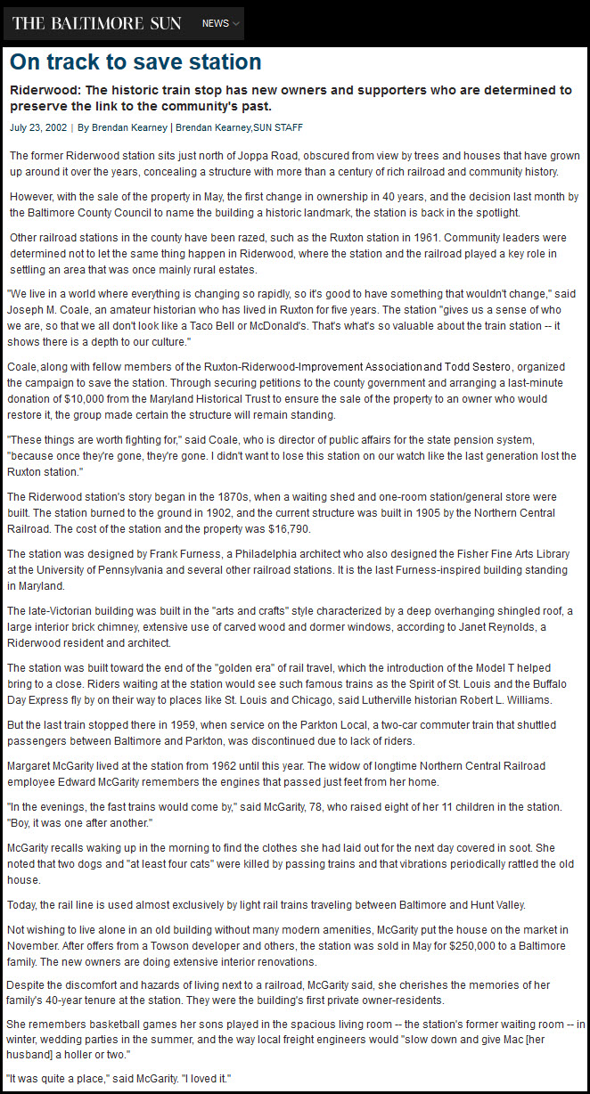
 1892, S. W. Wiley JR
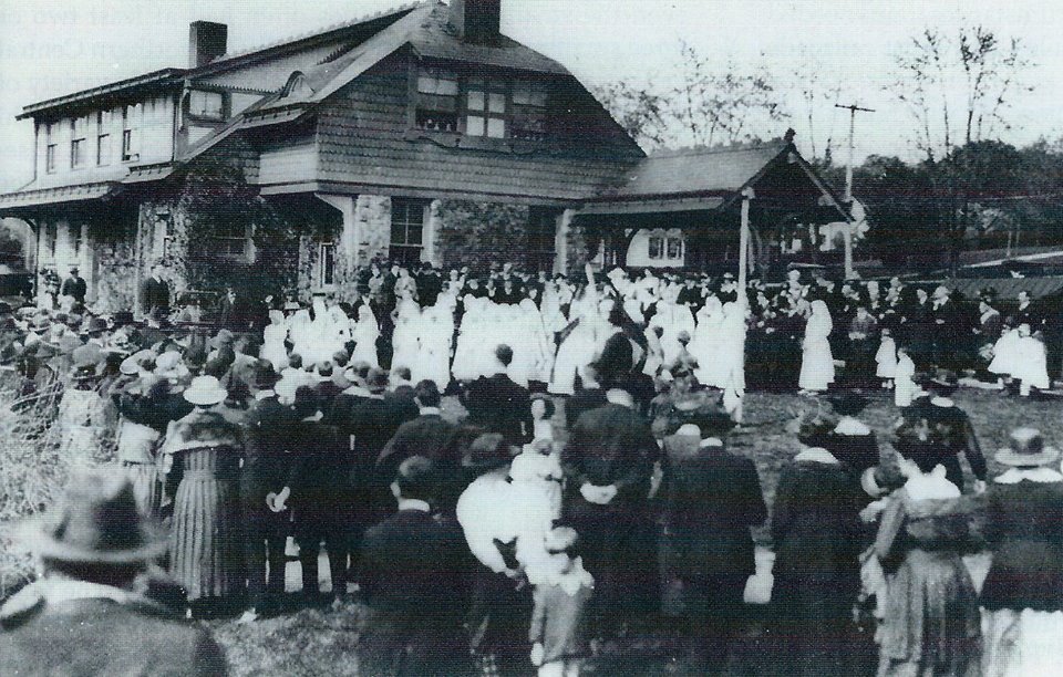
 from Terry Jo Miller collection
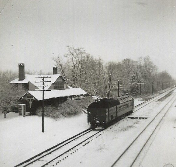 from Terry Jo Miller collection
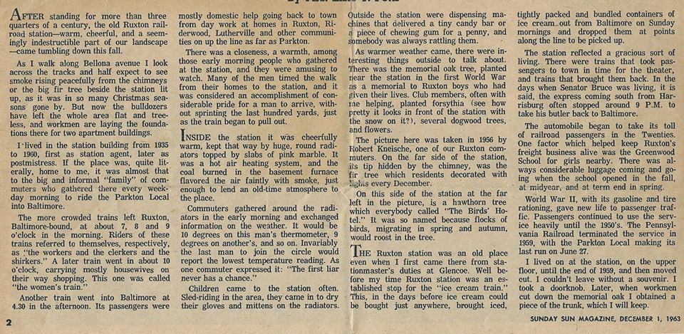
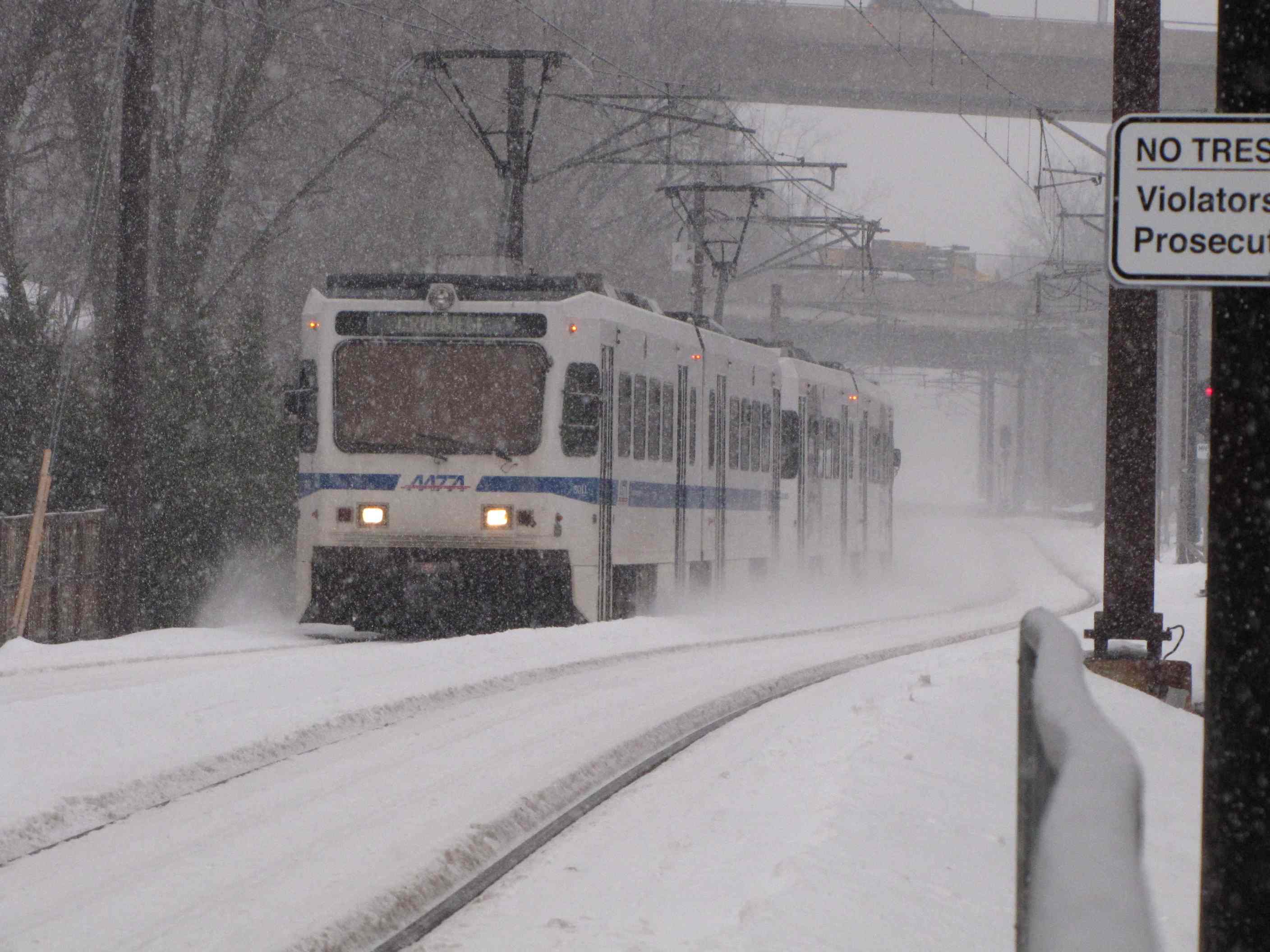
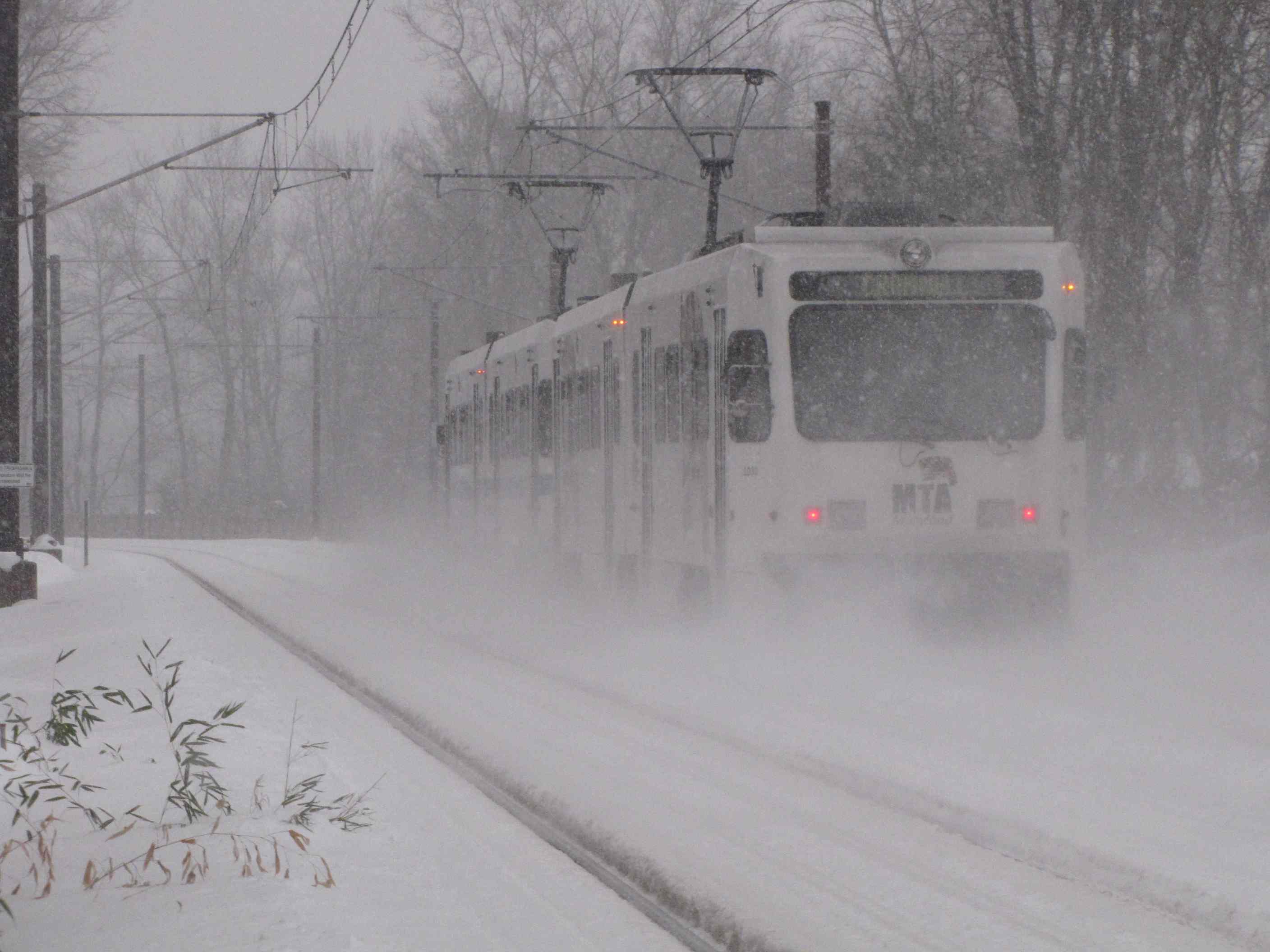
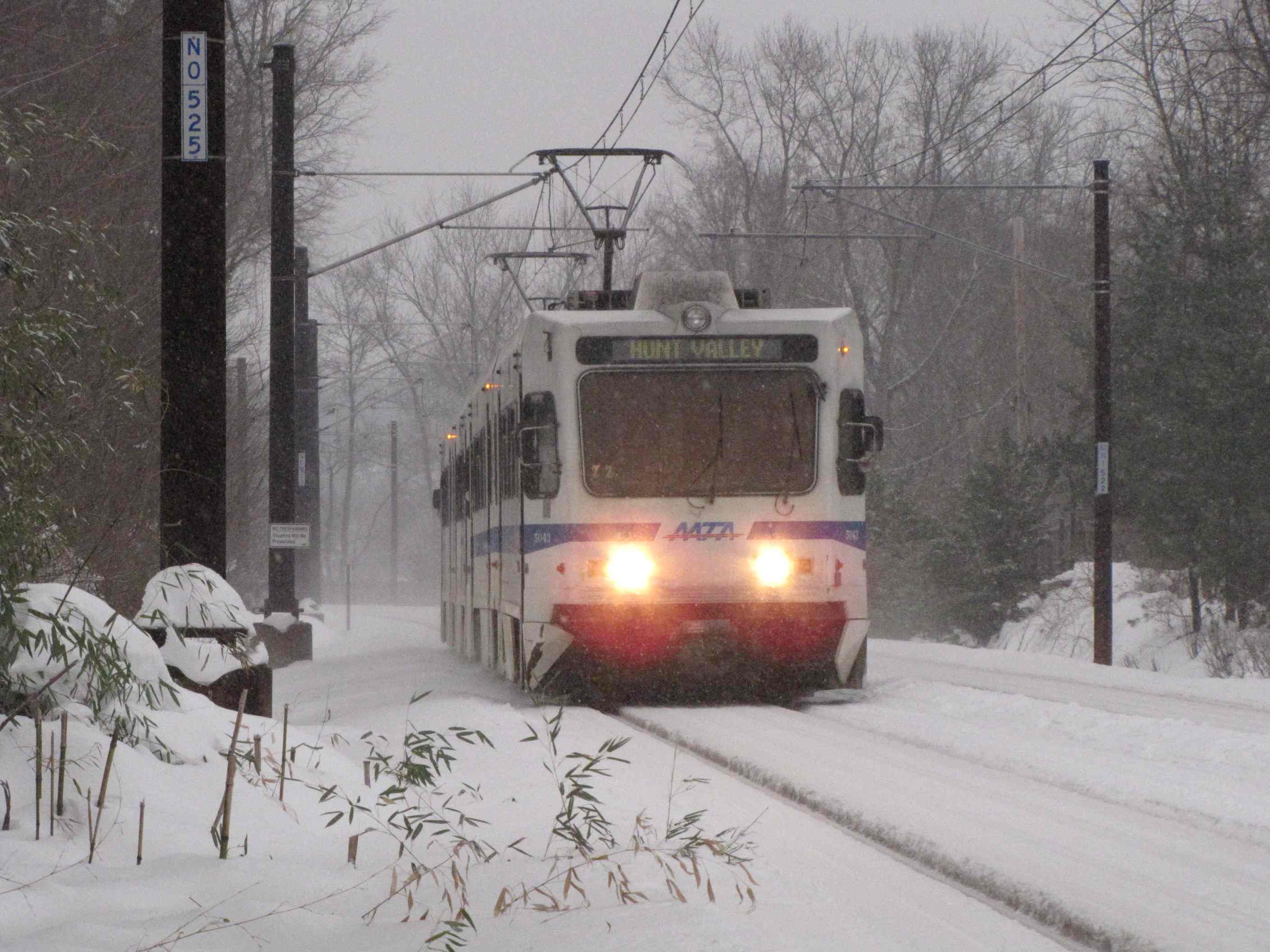 A few winter shots from behind my house.
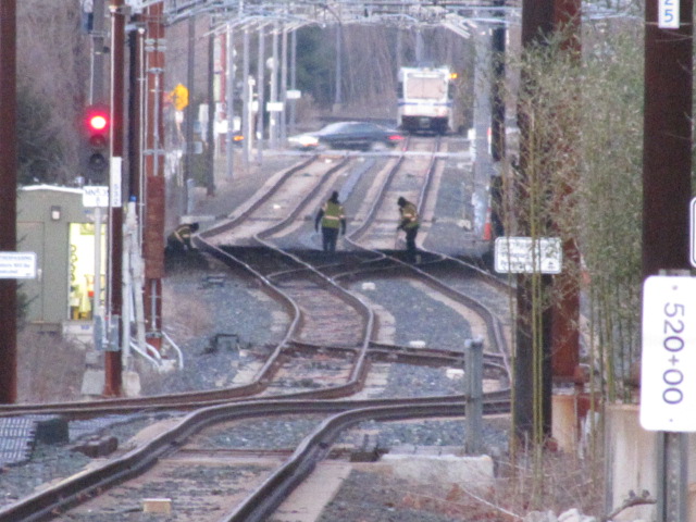
 Installing the catenary support brackets.
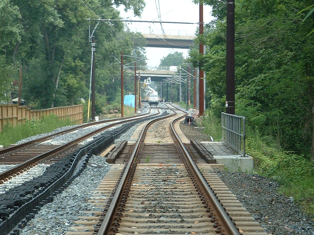 Installing the catenary.
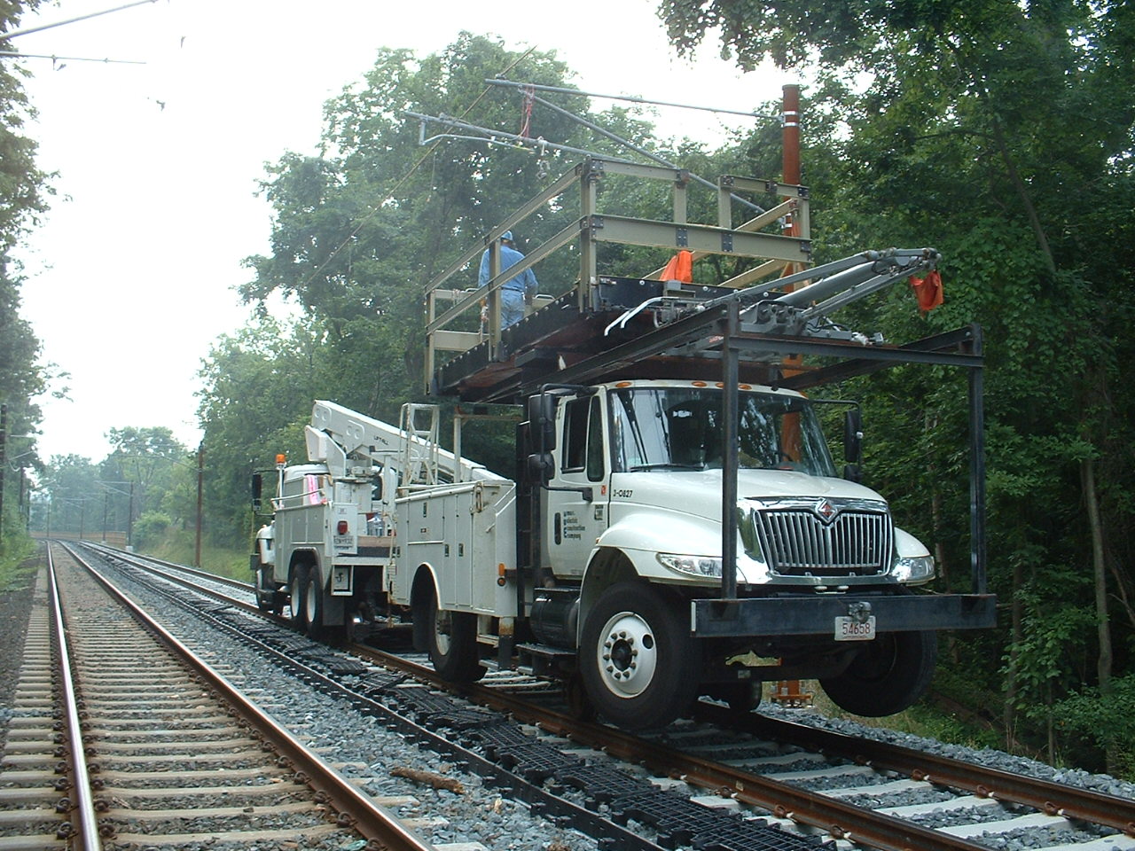 Fine tuning the catenary.
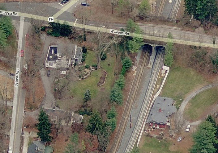
 With my back to the tunnels.
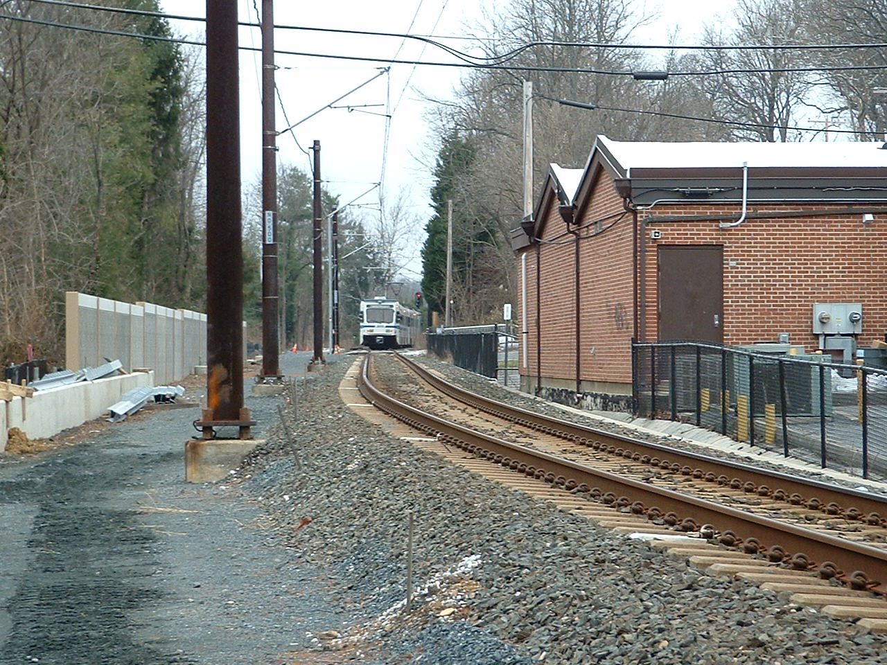 With my back to the tunnels.
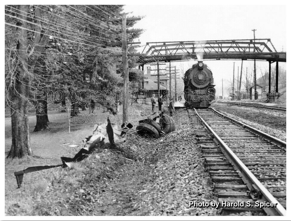 courtesy
Bill Spicer.
courtesy
Bill Spicer.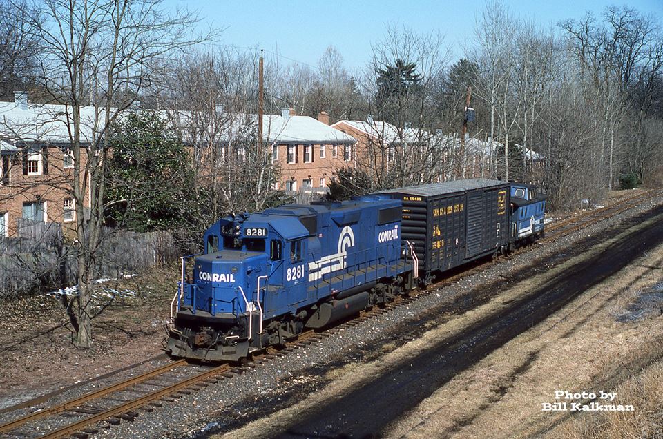 SB Conrail at Ruxton Rd, Mar 1st, 1986
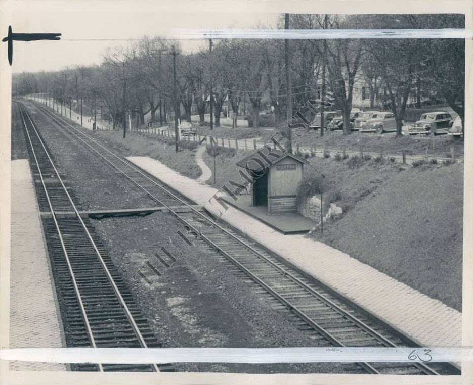 Late 40's???
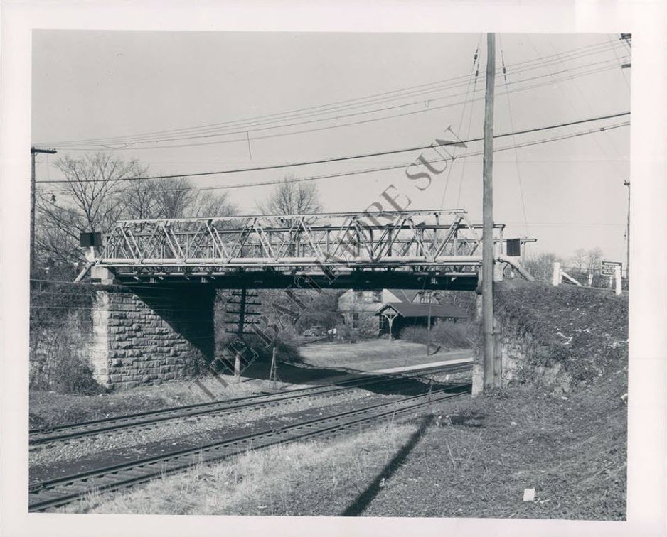
 ~1955?, Warren E. Olt
 1969
1969