
In General
Getting Here
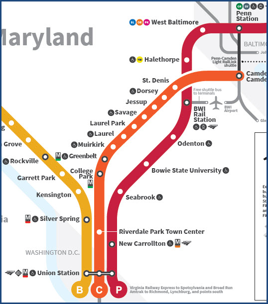
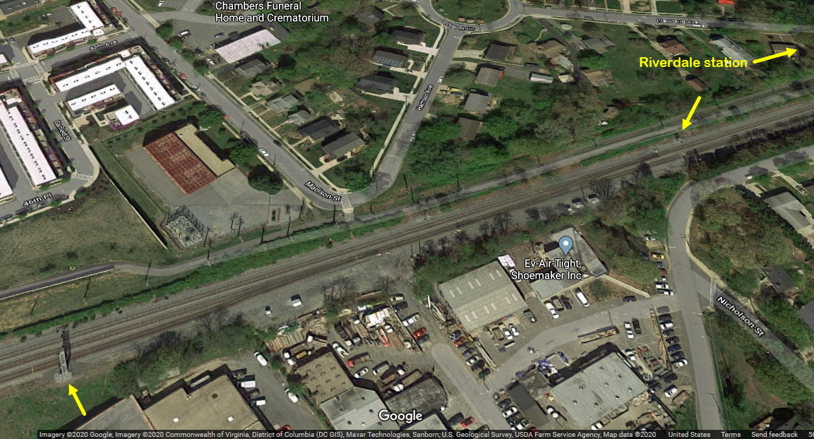
Map
Sights
Signals
RAILROAD SIGNALS HOME
Location / Name:
Riverdale MD, Prince Georges County
What's Here:
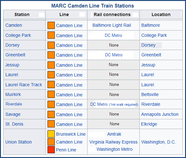
MARC Commuter Rail Station
Data:
GPS Coordinates: 38.963002, -76.934951
Phone A/C: 301
ZIP: 20737
Access by train/transit:
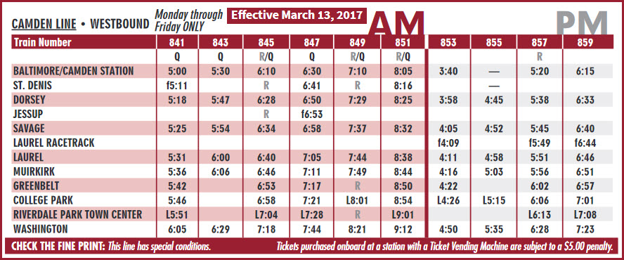
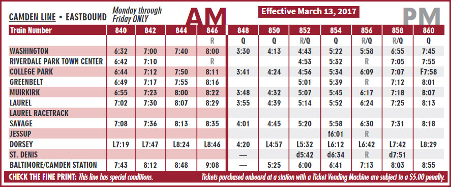
MARC Camden Line Trains
The Scoop:
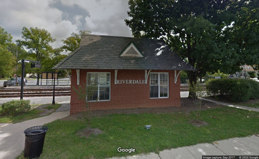
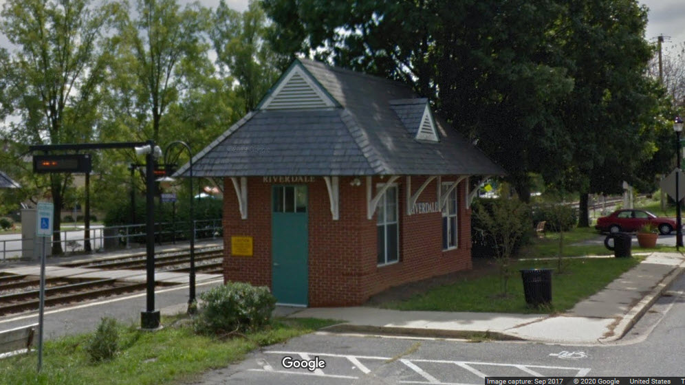
The Riverdale MARC station is the first station out of DC's Union station. It has a quaint little station, in a quaint little neighborhood. You have six trains a day in each direction stopping here. There are another four in each direction that do not stop here, see the schedules below.
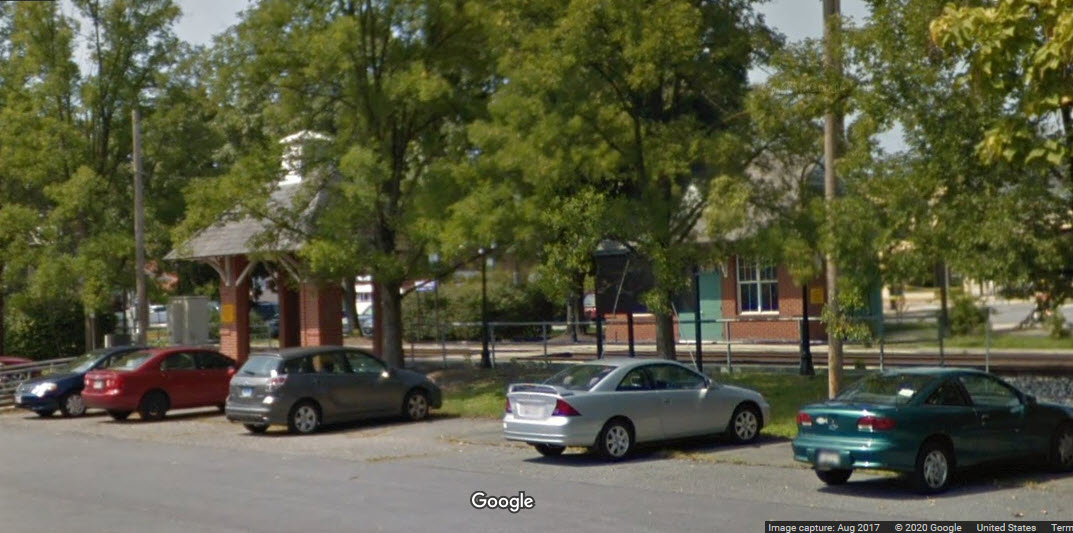
There is parking and station access from both sides of the tracks.
Since the station is on CSX's Capitol sub-division, you might see a couple of freights if you are waiting for a commuter train, or just hanging around to take pictures.
Trains coming through here SB (towards DC) are heading west or south. They would be heading west via the Metropolitan sub, going thru Point-of-Rocks MD, Brunswick MD, and Harpers Ferry WV among others.
Just south of Riverdale (less than a mile) is Hyattsville. Hyattsville has always been an important point for B&O/CSX trains, because it is where the trains heading into Northern Virginia (NOVA) take off from the Capitol Subdivision at "JD" Tower. If trains are heading south into Virginia, they would take one of the legs of the wye to get on the Alexandria Extension, and then take the Long Bridge over the Potomac River into NOVA and continue on down to Richmond VA. From there they would continue south on former Seaboard trackage into NC and further, or east into Newport News VA to service the docks on the former C&O.
Going EB (or NB) thru here, they would be headed to Baltimore MD, Wilmington DE, or Philadelphia PA, or points further north in NJ, NY, and MA.
There are about 20 freight trains a day going thru here.
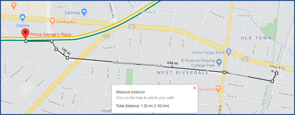
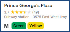
The station is also (kinda) accessible by the DC Metro via the Prince George's Plaza station on the GREEN and YELLOW lines. The walk is roughly 1.2 miles.
Acknowledgements:
Denver Todd
Websites and other additional information sources of interest for the area:
https://en.wikipedia.org/wiki/Riverdale_station_(MARC)
https://www.mta.maryland.gov/marc-station-information
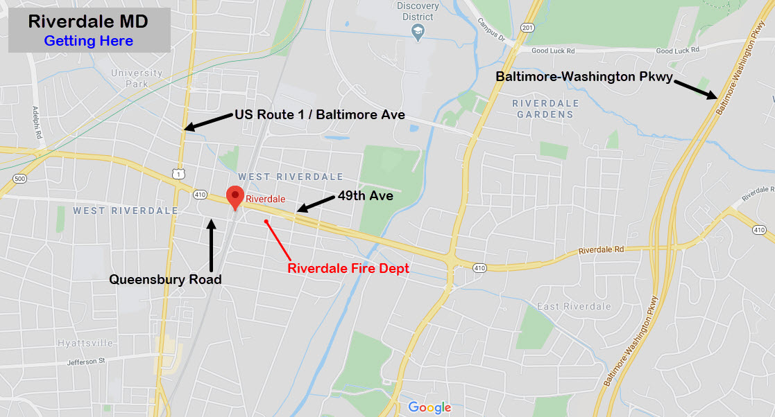
You can get here either by using the Baltimore-Washington Parkway, or by using US Route 1 (if you are trying to take in all of the stations of the Camden line)..
Using the B-W Parkway, take the 410 exit for New Carrolton & Hyattsville. Go west on 410/Riverdale Rd to Route 1, and take a left. Go one block to Queensbury Road, and take another left. The station and tracks are two blocks east.
Alternatively, you can take a left off of 410 onto 49th St, go one block to Queensbury Road, take a right, and that will take you to the Riverdale station, passing by the Riverdale Fire Station on your right.
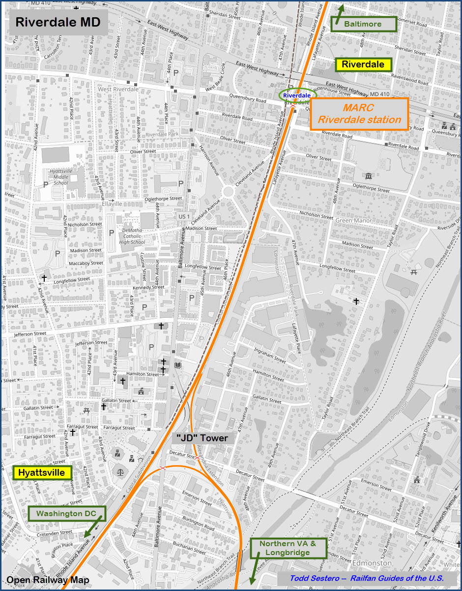

MARC Riverdale Station
GPS Coordinates: 38.963002, -76.934951
6200 Rhode Island Ave, Riverdale Park, MD 20737
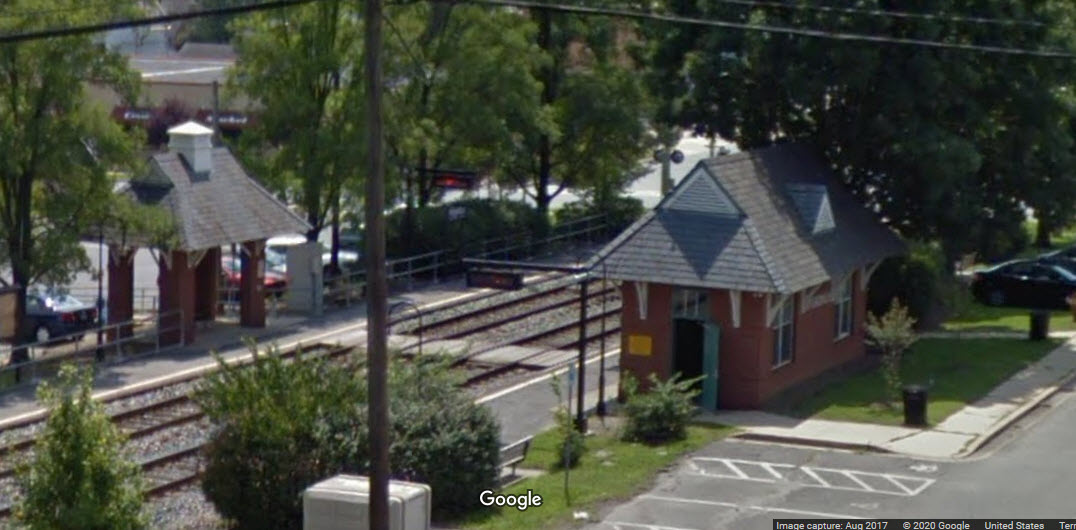
The EB (NB) signals for the 3 to 2 squeeze and the single crossover are about 500 feet south of the station.
The next set of signals to the north is 1.7miles away, just north of the College Park station.
Disclaimers:
I love trains, and I love signals. I am not an expert. My webpages reflect what I find on the topic of the page. This is something I have fun with while trying to help others.
Please Note: Since the main focus of my two websites is railroad signals, the railfan guides are oriented towards the signal fan being able to locate them. For those of you into the modeling aspect of our hobby, my indexa page has a list of almost everything railroad oriented I can think of to provide you with at least a few pictures to help you detail your pike.
If this is a railfan page, every effort has been made to make sure that the information contained on this map and in this railfan guide is correct. Once in a while, an error may creep in :-)
My philosophy: Pictures and maps are worth a thousand words, especially for railfanning. Text descriptions only get you so far, especially if you get lost or disoriented. Take along good maps.... a GPS is OK to get somewhere, but maps are still better if you get lost! I belong to AAA, which allows you to get local maps for free when you visit the local branches. ADC puts out a nice series of county maps for the Washington DC area, but their state maps do not have the railroads on them. If you can find em, I like the National Geographic map book of the U.S..... good, clear, and concise graphics, and they do a really good job of showing you where tourist type attractions are, although they too lack the railroads. Other notes about specific areas will show up on that page if known.
Aerial shots were taken from either Google or Bing Maps as noted. Screen captures are made with Snagit, a Techsmith product... a great tool if you have never used it!
By the way, floobydust is a term I picked up 30-40 years ago from a National Semiconductor data book, and means miscellaneous and/or other stuff.
Pictures and additional information is always needed if anyone feels inclined to take 'em, send 'em, and share 'em, or if you have something to add or correct.... credit is always given! Please be NICE!!! Contact info is here
Beware: If used as a source, ANYTHING from Wikipedia must be treated as being possibly being inaccurate, wrong, or not true.
RAILFAN GUIDES HOME
RAILROAD SIGNALS HOME
NEW FEB08/2020
Last Modified
17-Feb-2020