RAILFAN GUIDES of the U.S.
Todd's Railfan Guide to
In General Maps
the PURPLE LIGHT RAIL LINE
Suburban MD
Please note: This is an opinion page in
addition to being informative,
and may not reflect prevailing or common
opinions or ideology, comments welcome
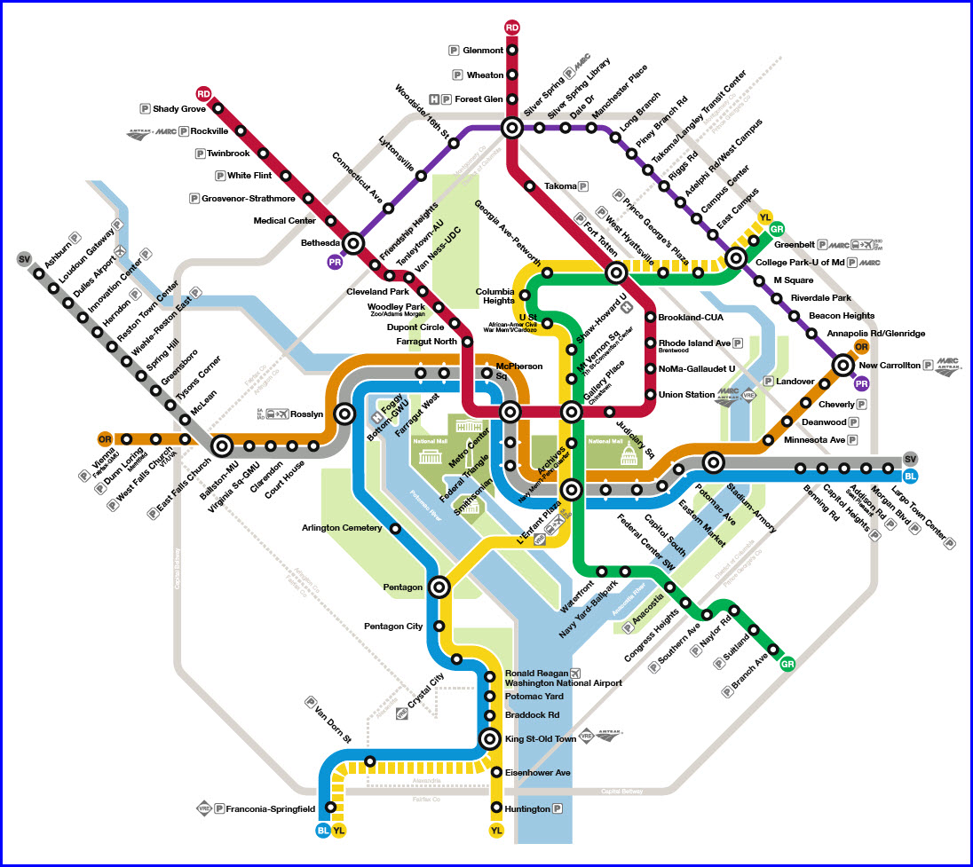
Map
Station by Station
Pictures
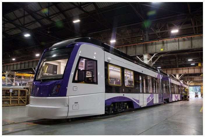
The LRV's
Signals
How NOT to Build The Line
Articles & Stories
Lawsuits
RAILROAD SIGNALS HOME
Location / Name:
Suburban Washington DC (north to east side)
Montgomery and Prince Georges Counties
Bethesda to New Carrolton MD
What's Here:
Yet to be built Purple Line light rail system
Data:
GPS Coordinates:
-- Bethesda: 38.982034, -77.094274
-- Silver Spring: 38.993886, -77.030690
-- College Park: 38.977109, -76.928459
-- New Carrolton: 38.948545, -76.872412
Scanner Frequencies:
We'll have to wait and see.
Access by train/transit:
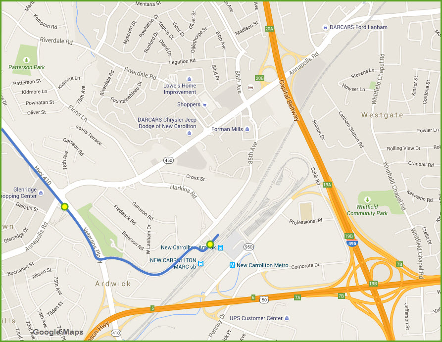
New Carrolton: MARC Commuter Rail, Amtrak, Orange Line Metro (east end of)
Silver Spring: Two light rail stops along the Metro Red Line and MARC stations
College Park: 1 block from a Green Line Metro station and MARC stations
Bethesda: 3 blocks from the Metro Red Line
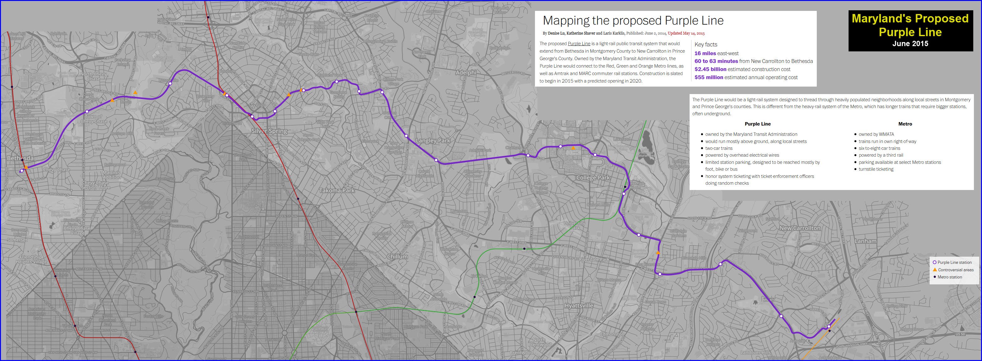
The Scoop:
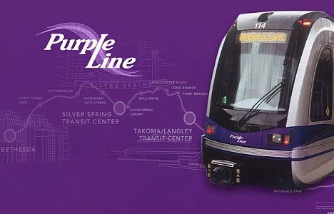
The Purple Line light rail system will be Maryland's newest light rail
system if ever constructed.
The expected start date for construction
is sometime in 2016. The route is as shown below.
Additional Information can be found on these pages:
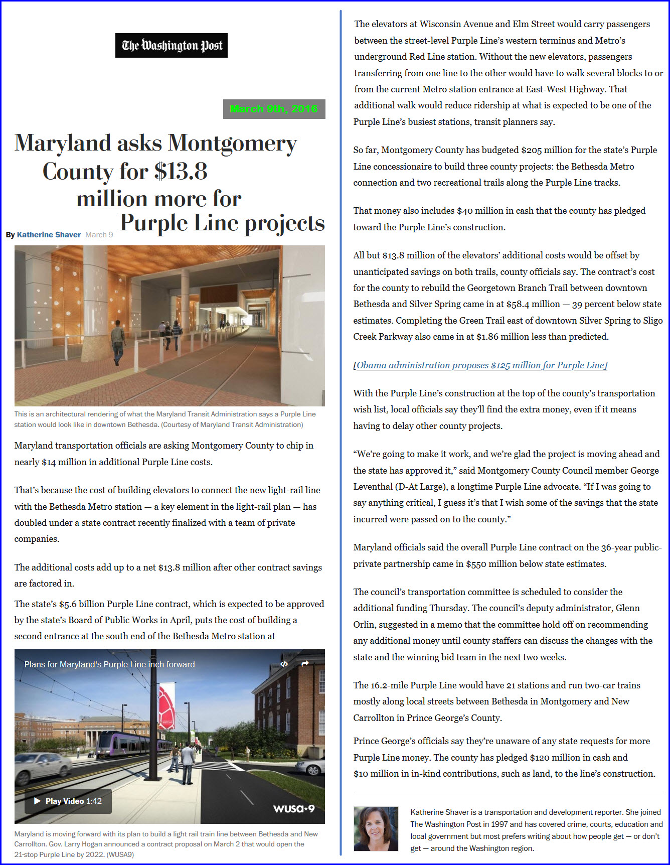
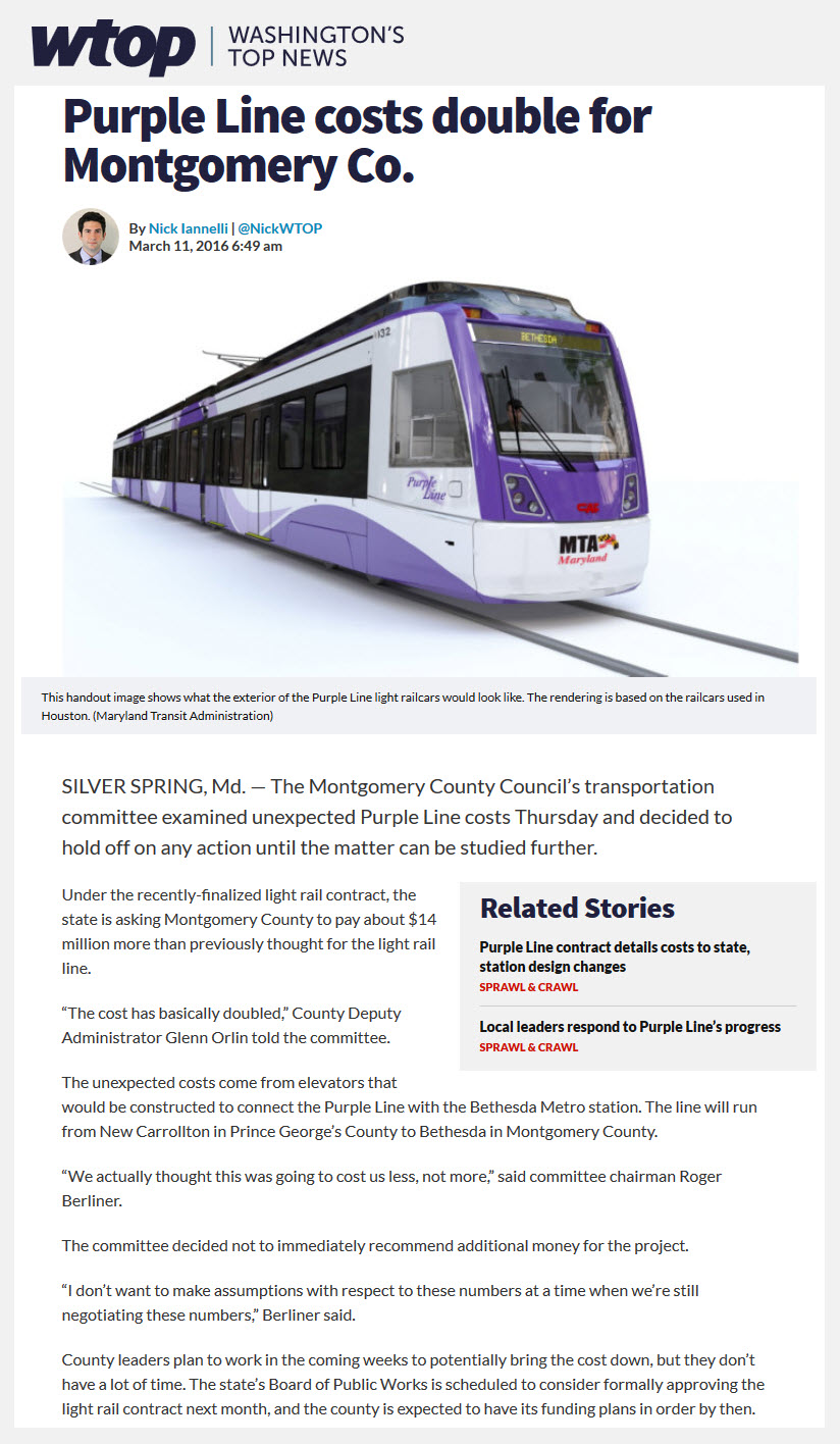
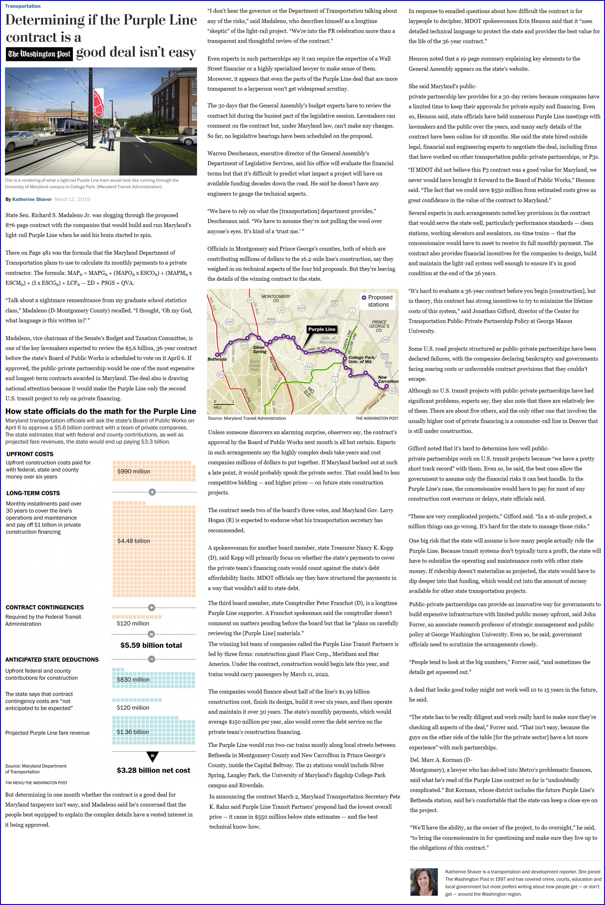
https://www.washingtonpost.com/local/trafficandcommuting/determining-if-the-purple-line-contract-is-a-good-deal-isnt-easy/2016/03/12/a31aa580-e586-11e5-a6f3-21ccdbc5f74e_story.html?tid=a_inl
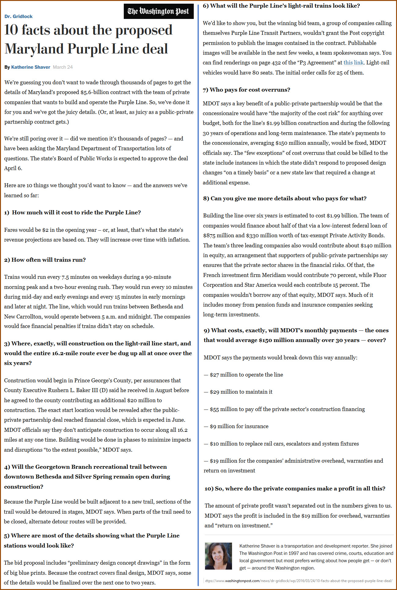
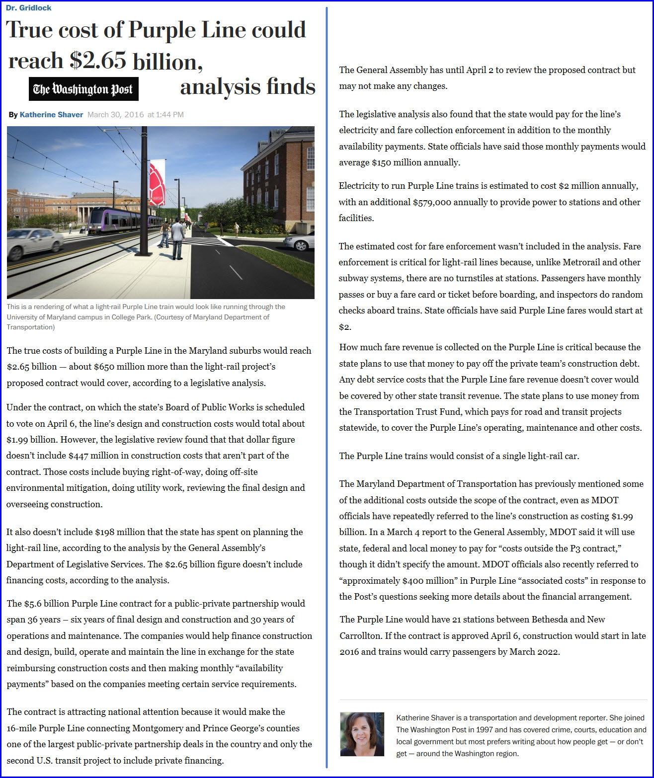
https://www.washingtonpost.com/news/dr-gridlock/wp/2016/03/30/true-cost-of-purple-line-could-reach-2-65-billion-analysis-finds/
https://www.washingtonpost.com/local/trafficandcommuting/maryland-chooses-private-team-to-build-operate-light-rail-purple-line/2016/03/02/d4dadd9e-d107-11e5-88cd-753e80cd29ad_story.html?tid=a_inl
Note, the map below was stitched together from numerous screenshots using SnagIt.
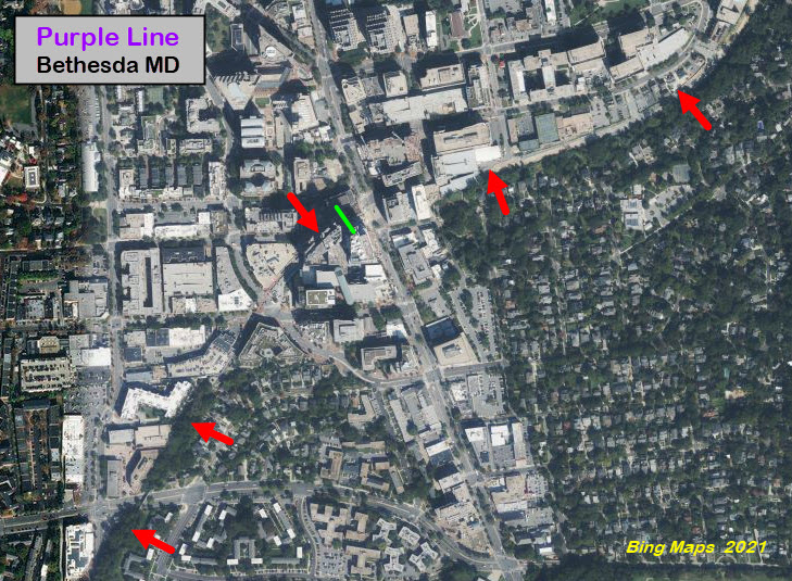
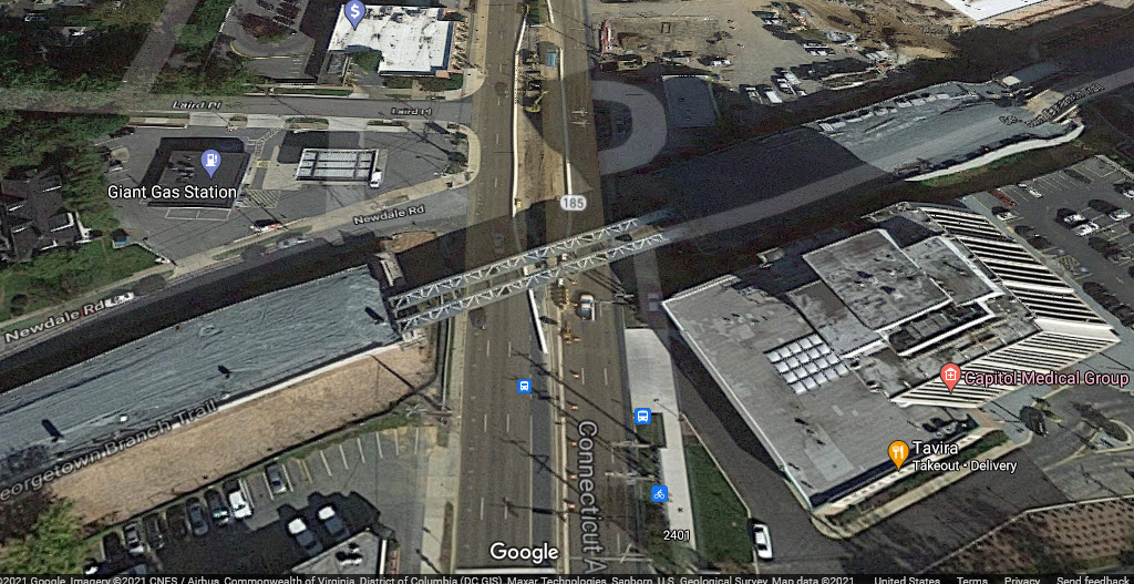
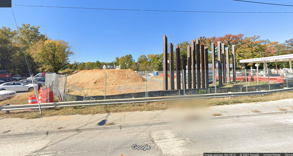
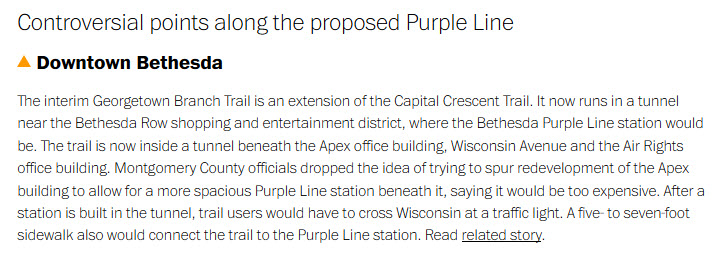
Bethesda
The red arrows point to the former right-of-way, the green line is supposed
to be where the Purple Line ends.
Not sure what the plans are since the "7315" building is in the path of the
trail/R-O-W.
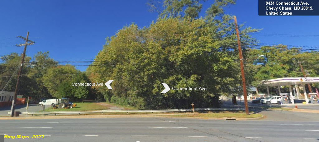
Chevy Chase / Connecticut Ave
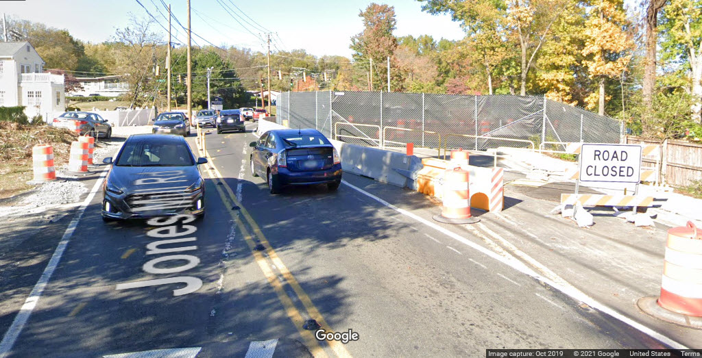
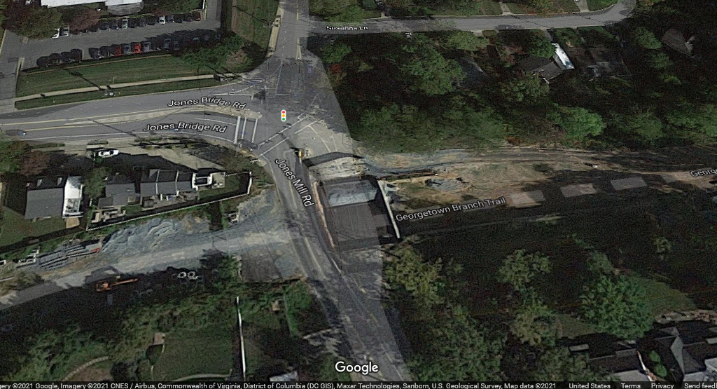
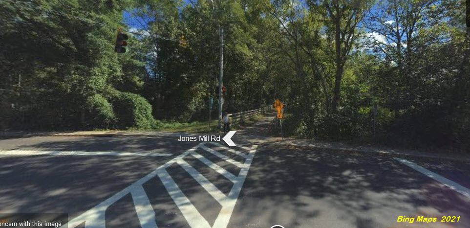
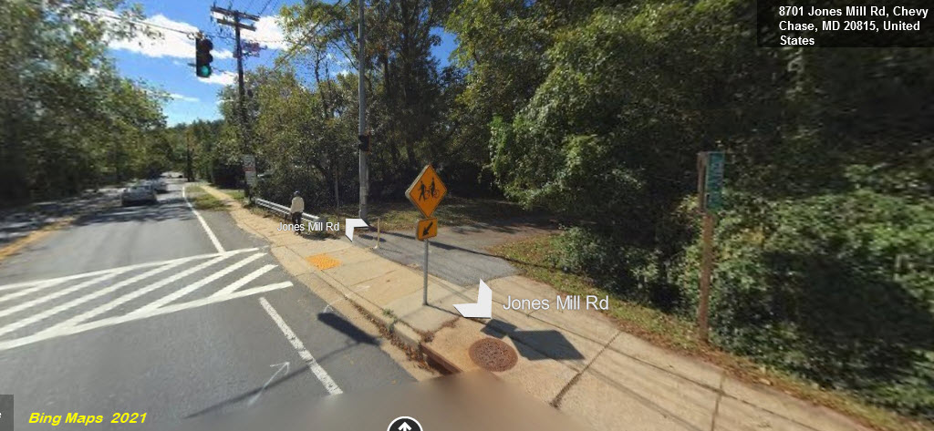
Jones Mill Rd
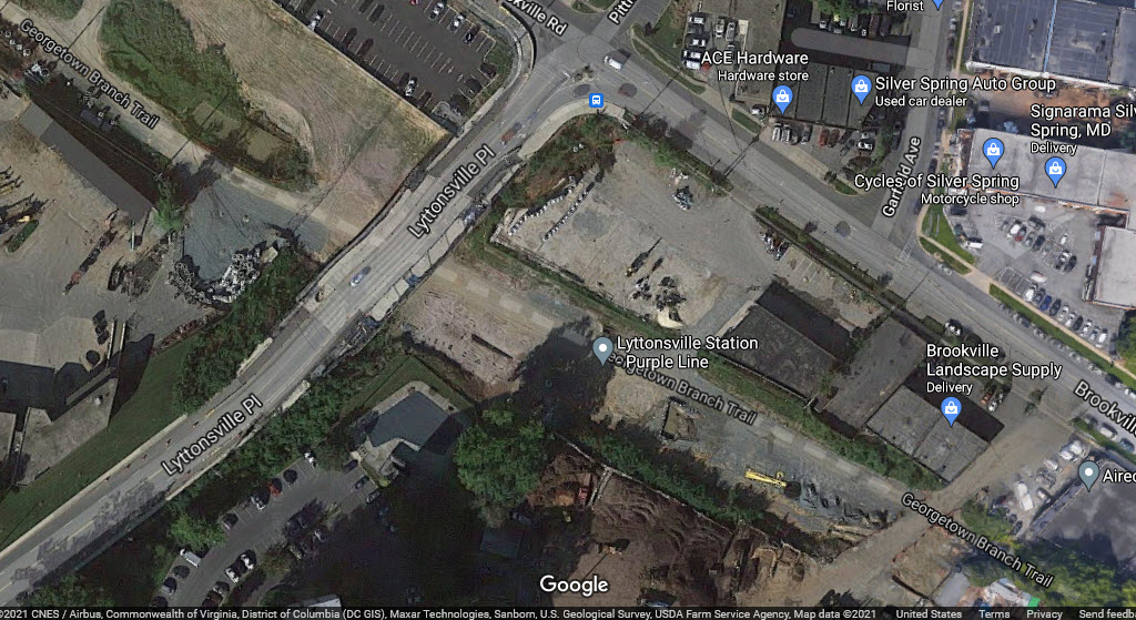
Lyttonsville
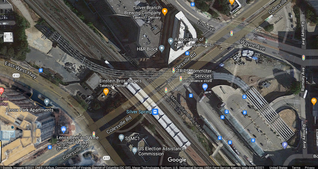
Silver Spring
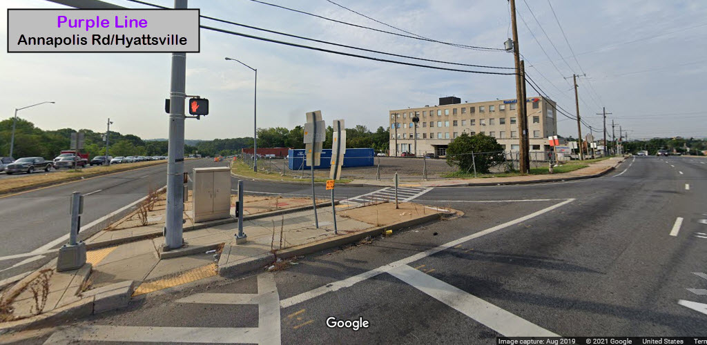
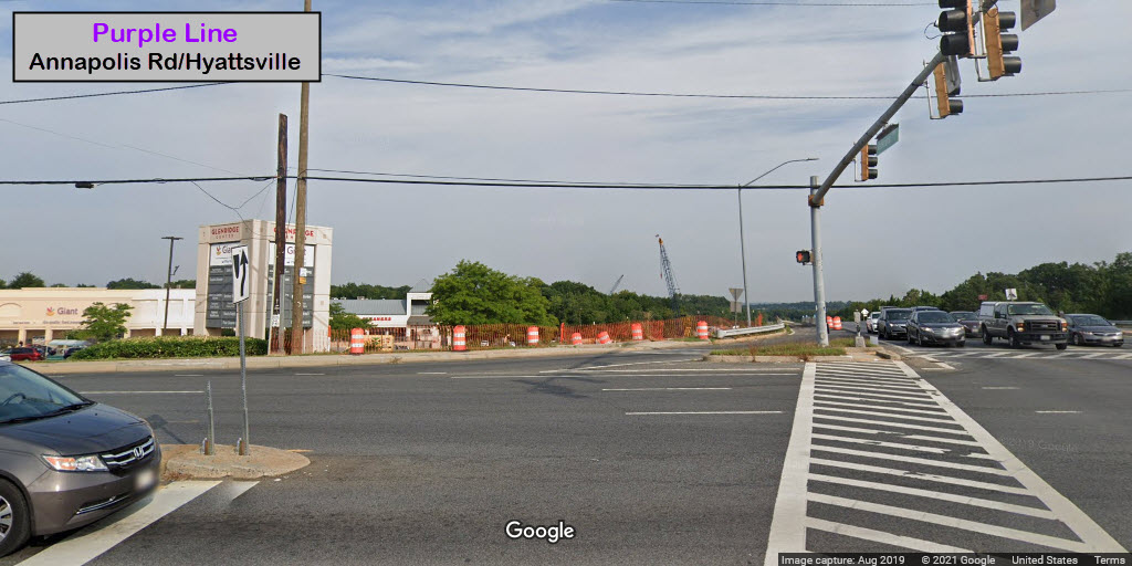
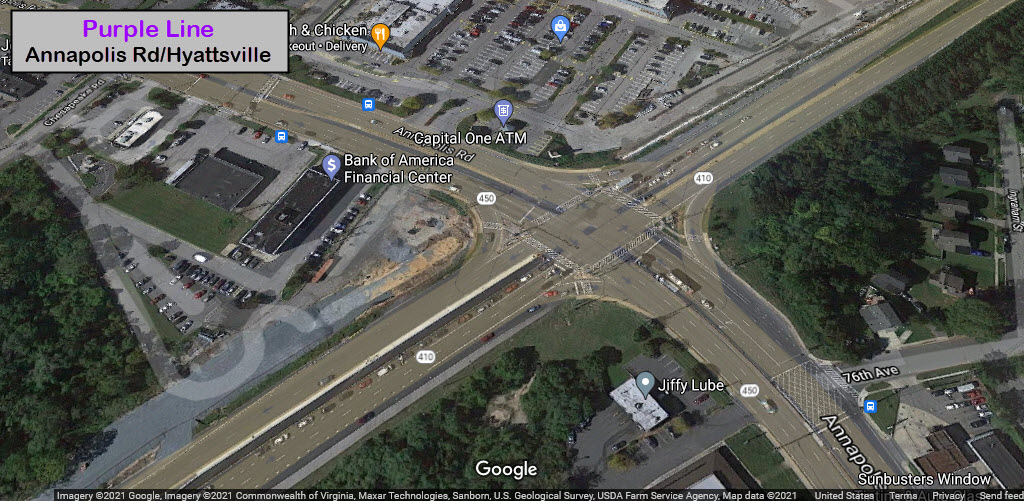
Anapolis Rd
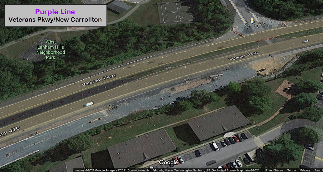
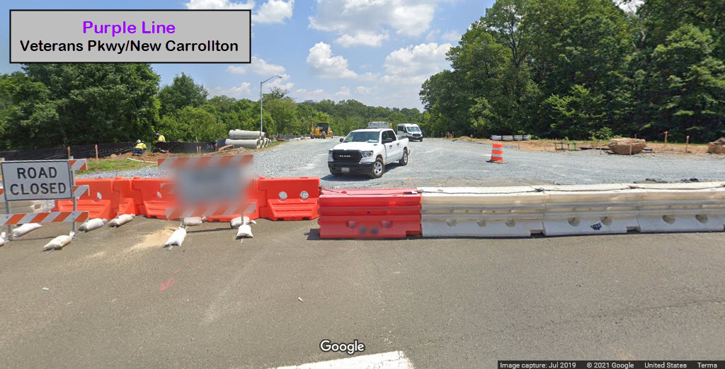
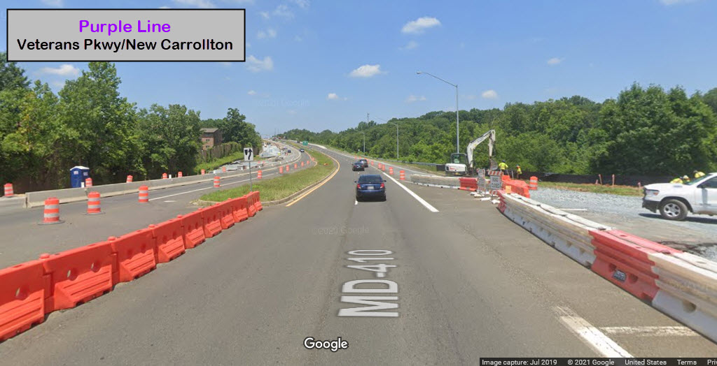
Veterans Pkwy / New Carrolton
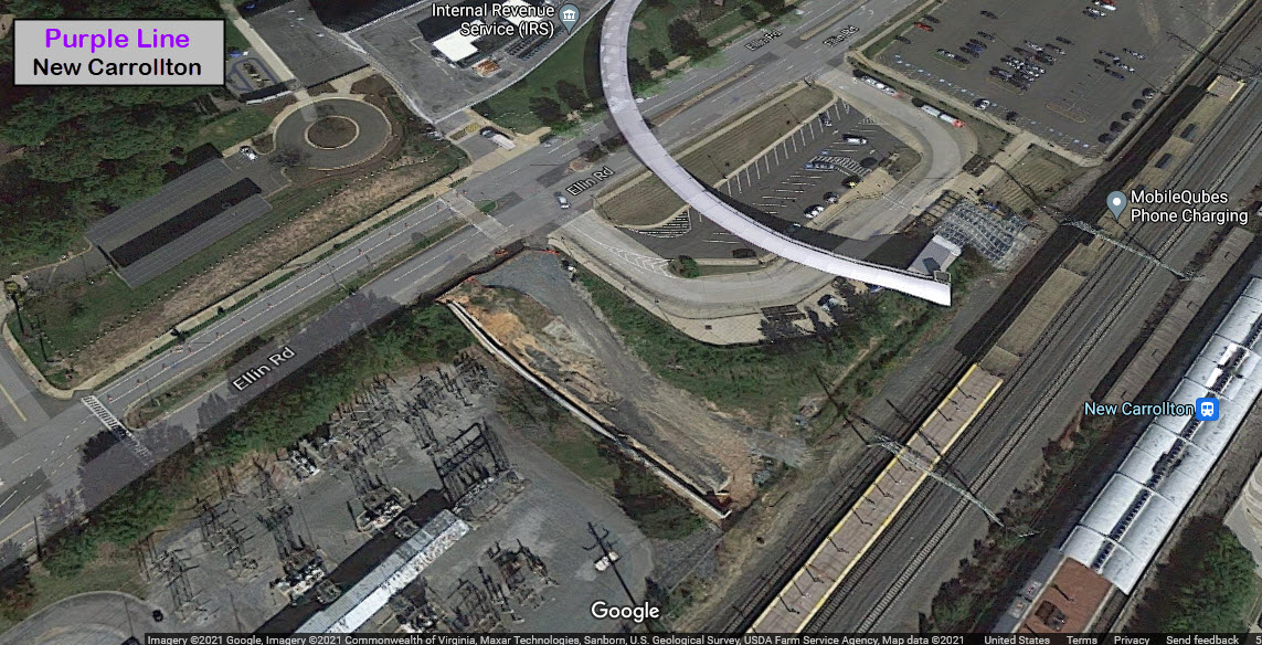
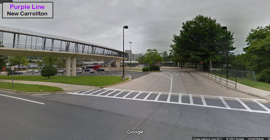
New Carrolton
Nothing yet.
No pictures yet.
I know a page in any respected website shouldn't
contain personal opinion, but I hope to have someone read this that can make
a difference and not make the same mistakes that have been made before, with
systems like the DC Streetcar and the Baltimore Light Rail System.
There are a whole slew of commonly made mistakes made,
stupid decisions made, that waste time and money to a rail project.
Over the years, I have gotten the impression that very
few of the people employed by transit companies OR rail design consultants,
really have no clue what they are doing.
My latest confirmation of this came in 2019 at a hearing for
Amtrak's B&P Tunnel that runs thru Baltimore. Although there were quite a few well informed
representatives there, several had ideas that in no uncertain terms were a
waste of time, and you couldn't convince them otherwise.
Bad ideas for design come in several forms. One is just a plain ole lack of
common sense. The other prevalent form is stupidity and getting their
training from other people who have very little REAL WORLD experience.
Transit companies, generally, in the old days when they were a private
venture, employed educated people that were responsible for their designs.
"They knew their stuff" and generally made good decisions,
BECAUSE, they had to make a profit! Now that almost everything is public
and run by the government, no-one cares because the public thinks "they"
(the government) will pay for everything, including their
mistakes. But in the end, WHO winds up paying for these mistakes?
You and I do, of course!
Another website that promotes common sense engineering:
http://citytransport.info/Lawn.htm.
Let's go over a few examples to illustrate what I'm talking about.
Most come from the Baltimore light and heavy rail systems, because they are
so plentiful with illustrations.
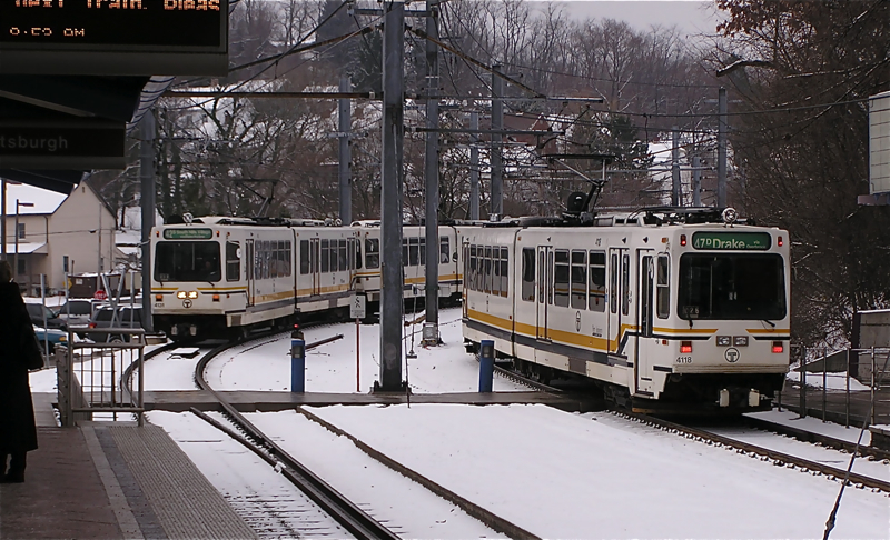
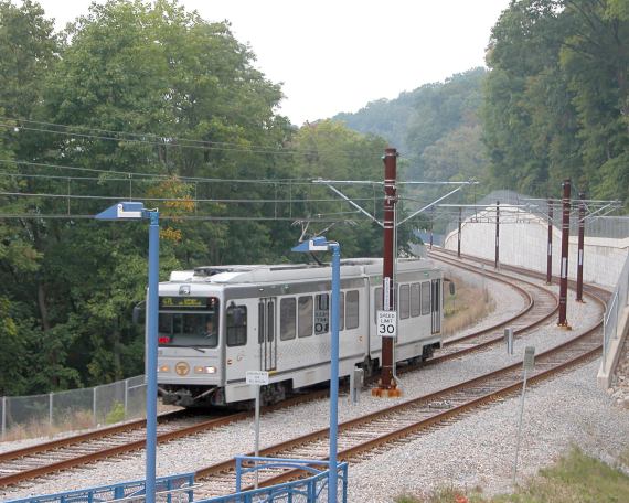
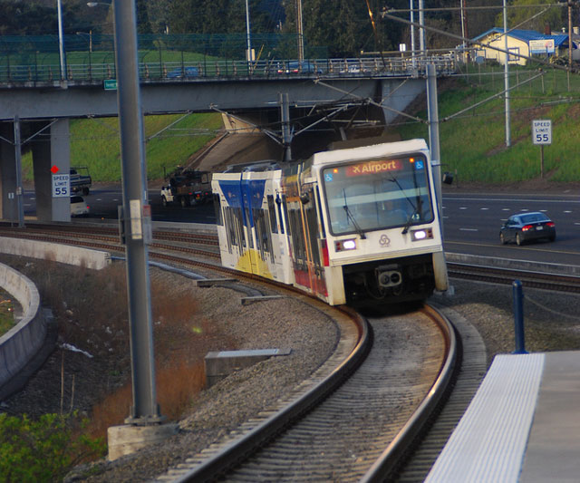
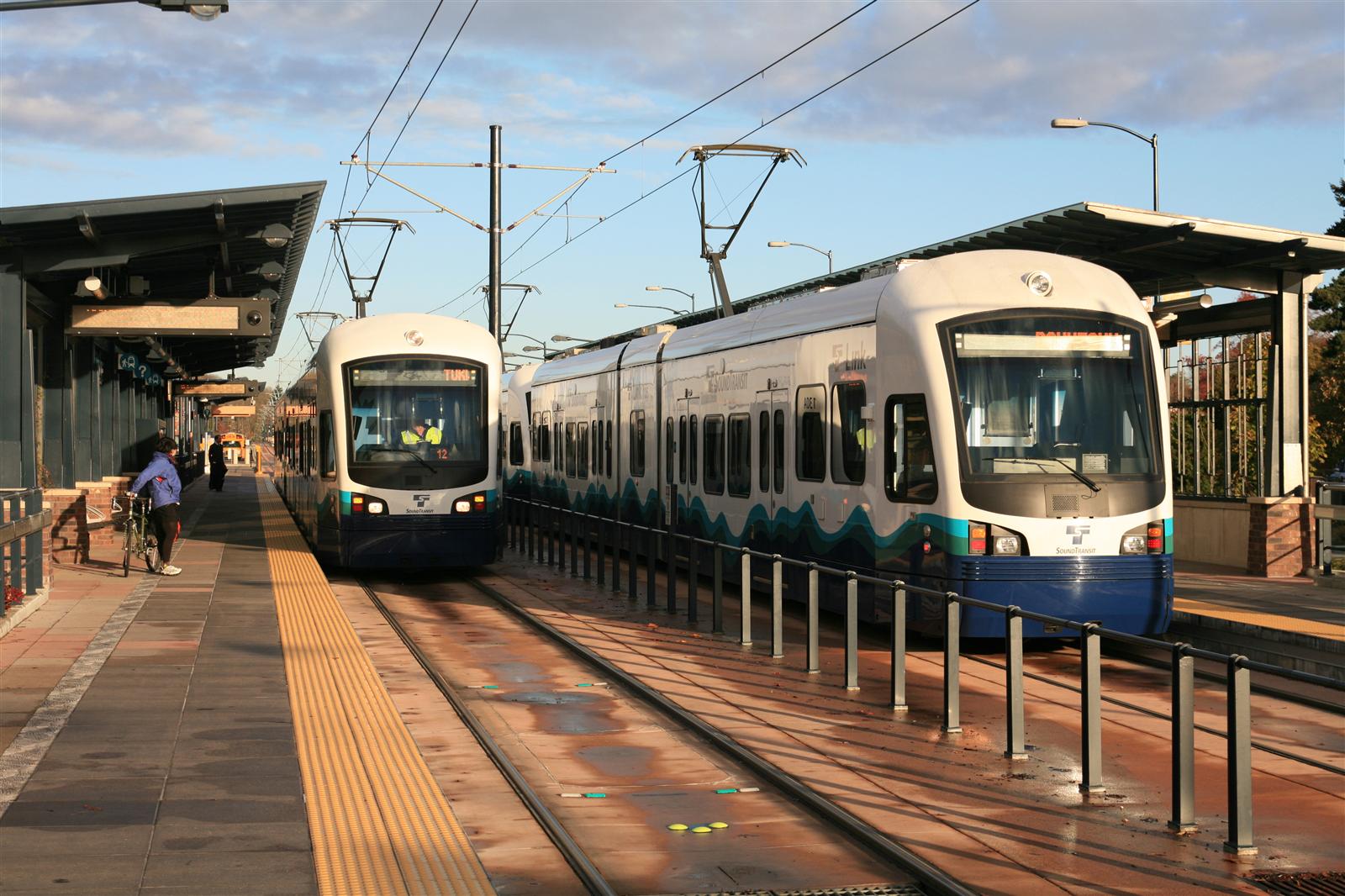
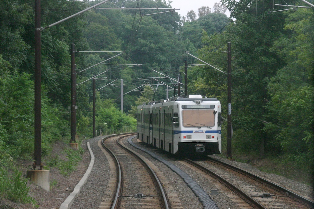
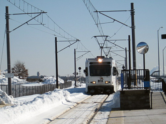
Common sense: If you put the catenary poles in the middle
of the two tracks, providing you are making the system a two track right-of-way, you
accomplish several things. One, it costs a whole lot less money than
it would if you put poles on the outside of the two tracks,
necessitating two footings, two poles, AND additional room for the R-O-W
(more land, much more money, etc, etc, etc). Below are two pictures
from the Pittsburgh Light Rail system, showing how they used a single pole
line in the middle of the double track right-of-way. It wasn't done
this way over the entire line, but where they could, they did. Below
that is Portland on the left, and Seattle on the right. Below those
four pictures is a couple from the Baltimore system where they did not do
this.
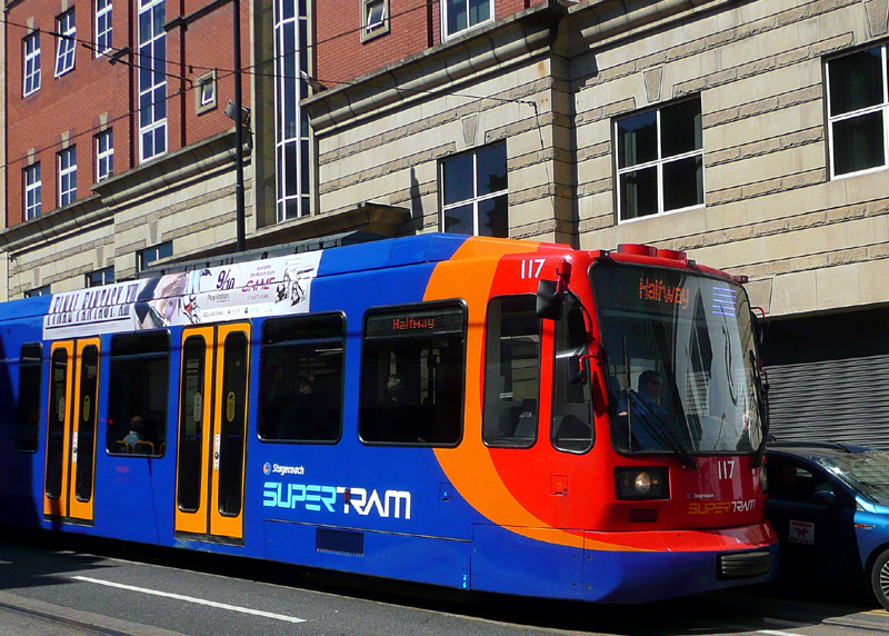
Common sense: Use existing buildings in a downtown environment to support the catenary
wires. Europe does this all over the place. Why they don't do it
here is anyone's guess.
Below: Sheffield, England -
Some street sections of the Supertram feature
overhead wiring supported invisibly from rosettes attached to building walls.
Common sense: When they whipped up the original plans for the Baltimore Light Rail system, the
consultants insisted on making the curves easier to traverse by
lessening their curvature. While this may have improved the wear on
the wheels and track, it did no service to the tax payers in 2005 when they
decided to double-track the north end of the system - EVRYTHING had to be
torn out - track, catenary supports - the whole enchilada. Then, it
all had to be put back in. This is because no-one had the common sense
to sit down and say, "what if". What if they decide to double track
the system at some point?
Common sense: Or is it? The Baltimore light rail system
"winds" its way down Howard Street, making it
confusing for (especially) visitors to the city to figure out where to drive
and what not to do. Pick a side to the street and stay on it.
Specifications and equipment: Check everything. Back when I worked for
the Light Rail system in Baltimore (1995-1998), they decided to update the
North Avenue yard. One of the "things" they decided to do to this end
was to give the yard its own sub-station, instead of using power from the
main line. Why did they want to do this? In the winter, when all
of the cars were in the yard overnight, a one megawatt sub-station could not
keep all of the cars operating when they had the heat on. They had
specified a two-megawatt sub-station. Instead, a one-megawatt
sub-station was delivered and installed. It was eventually fixed by
replacing it with one of the correct size, but
I never did hear who paid for that mistake.
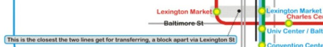
Common sense: The Baltimore rail transit system is often criticized for having one of the
worst, if not the worst, transfer systems between modes. What do I
mean by this? OK, how does one transfer between the light rail and
metro system? Answer: you can't without walking a block in the open
weather between the two Lexington Market stations. Another brilliant idea
conceived by the people at the MTA who designed the light rail system.
Since the Metro system came first, I pin this gross oversight on the MTA's light
rail people. To make matters worse, they were going to "do it" a
second time by not providing riders with a easy transfer between the
proposed RED LINE and either the existing light rail or metro systems.
Really? It's just as well, because the MTA already used red for the
Metro Subway system.
Common sense.
What is the reasoning behind the MTA's choice for the naming of the metro system: the
Metro Subway. Did they not
think that the citizens of Baltimore would know what it was if they called
it just the METRO or the SUBWAY?
Specifications and equipment:
Double-check everything. Another thing happened while I worked for
Light Rail. The MTA (without asking Baltimore City - I might add)
decided to use traffic light pre-emption. This is where the LRV's have
priority over the vehicular traffic in an effort to save a few minutes in
traversing the downtown area by setting the lights for the LRV's to green.
In order to accomplish this, their plan was to use GPS to report train
location. So the GPS units they ordered were supposed to have two
RS-232 ports on them so they could connect to a trunking radio and a data
processor. Guess what, the GPS units came in, and they only had ONE
port on them. NO-ONE had the kahuna's to return them and get the
proper units, so, the MTA ordered a second GPS receiver. After I left
in 1998, they ordered yet another (that's now THREE GPS units) for use
onboard the trains, this time to use as part of the automatic train control.
The last time I looked, you could see the three receivers above the
articulated section in the middle of each car. Aha, but the story does
not end there. In yet another tribute to incompetence with this story,
the MTA ordered new UHF trunking radios to use with the GPS receivers.
The idea was to replace the VHF radios with the new units, but the VHF
radios had to stay in use during the changeover. So the MTA removed
one of the clearance lights in order to mount the UHF antenna. None of
this stuff was ever used, because signal pre-emption was nixed by Baltimore
City, How many hundred's of thousands of dollars were wasted in this
effort?
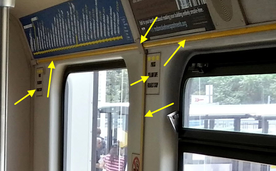
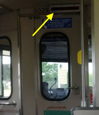
Common sense. Even though
the Baltimore cars stop at every station, they (the MTA) STILL had ABB
install a stop request system, which adds to the cost of the car, not only
initially, but as a regular maintenance item, when the tape, switches,
indicators, or intercom system malfunction. Brilliant idea.
Then, the MTA decided to make it painfully obvious that the yellow tape
switches needed to be pushed in order for the operators to stop at the next
station. WHAT WERE THEY THINKING? Everything pointed at in the
two pictures below are needed to support this brainiac idea.
Specifications and equipment: Double-check everything. Back in the
80's, the Maryland MTA wanted to extend the heavy rail system from
Reisterstown Plaza north to Owings Mills. Someone, in all their
infinite wisdom, designed the track on the north section a half inch
wider to a gauge of 4ft-9in. Just north of the Reisterstown Plaza
station, there is a 20-30ft section of track, on wooden ties, to go from
the standard gauge to the wide gauge tracks. Another boner designed
by ill-informed and poorly-educated consultants.
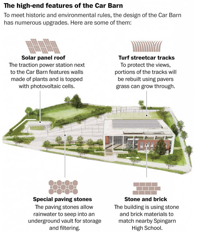
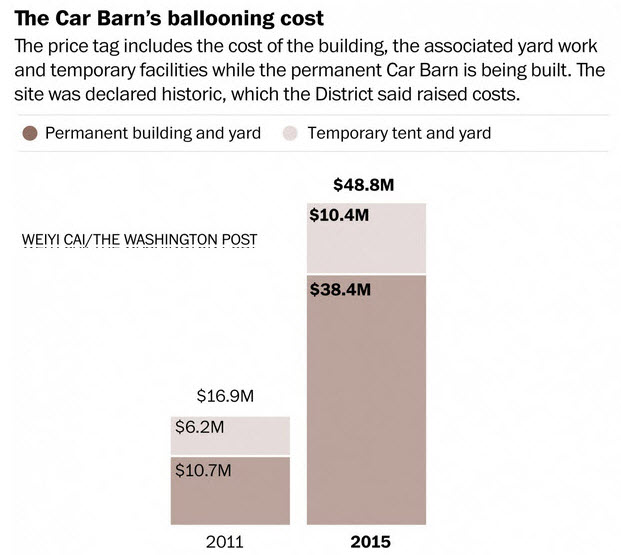
The KISS principle (keep it simple stupid). Down
in DC, someone decided the shops (maintenance facility) for the new 2.2mi
streetcar system should be a "show palace". And it
cost them dearly for the title. It cost roughly TRIPLE to construct
the car barn building of what it cost for a similar facility on other
properties. They wanted the curb appeal of the building to match that
of the neighboring school.... ca-ching!..... they wanted solar....
ca-ching..... they want greenery to make it feel like we're not in the
city.... ca-ching..... and so on, and so on.
I don't know what the solution to poor design is. The newest example
of a system so badly miss-managed from the beginning is the new H-Street
Streetcar system in Washington DC. It is like, the Holy Grail of
examples of what can go wrong when you have the wrong people in charge
giving out the wrong orders. It also doesn't help that Washington
DC is sort of like a free for all zone, where there are too many organizations
and governing agencies for anything to get done efficiently.
To support some of what I say, here is an article that appeared recently about the
DC Streetcar. The author criticizes the maintenance facility, and the route
the the city choose to put the streetcar on, saying it will not serve a sufficient
number of people to even come close to supporting the system.
Problem Spots.....
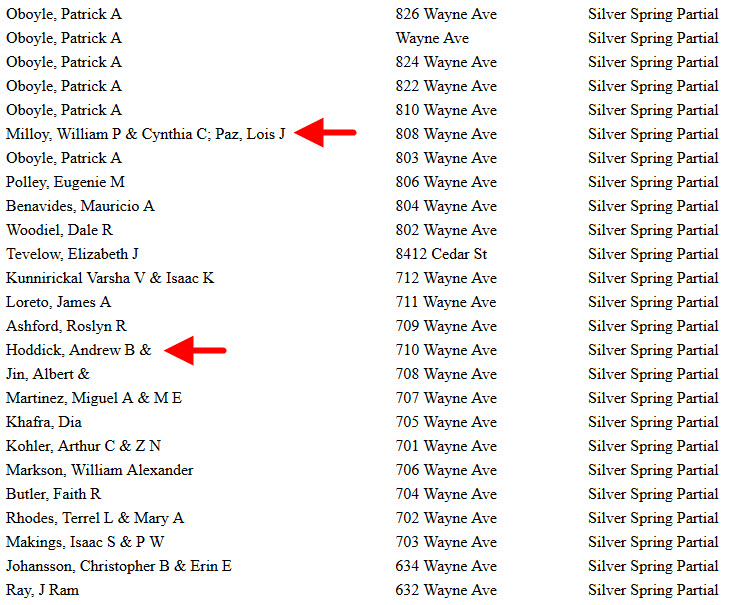
So here we go. This is one of the first lawsuits to hit
the books standing in the way of the Purple line.
Two families have sued
the state because they feel they are not getting enough for the land the state
wants from them to build the line.
They are suing the state for more than
what their house is worth. So I have a solution. Let the state
buy the houses for what the City Data value of the house is, and then the
state can put a substation in the house and no-one will ever know a
sub-station is there! :-)
The only reason these houses are as
expensive as they are, is because of there close proximity to the center of
Silver Spring, and they are inside the Beltway, where ALL house prices are
inflated. If these houses were in my suburban neighborhood of Towson,
they would be in the $400K range.
But because they ARE that close to
Silver Spring, let's go over another couple of facts....
Here are some of the arguments they are using:
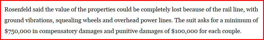
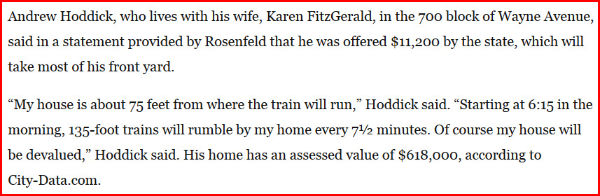
Wow, 850 grand for a house that's not even worth that much!
Phew! Are these people crazy? Really? Just move....
Well, first of all, they are not going to lose ALL of their value. I live 75 feet from a
light rail line, and the value didn't waver a bit because of it. So
that is a BOGUS claim rooted in fear and ignorance! The people in
Portland Oregon had the same fears prior to the Tri-Met light rail coming
through, and none of them came to fruition! Now, the majority of
residents like the fact that light rail is running in their back yards.
I have a way around this for now. Let's agree to wait for a period
of say, 5 years, and if, and only if, then, it has been determined that the
property values have gone down because of the light rail coming through,
then the state can make some sort of compensation. If the prices go
up, then the homeowners have to pay the state! I think that is fair.
Another solution, let a commercial developer come in and buy the houses
on the south side of Wayne Ave, and put in a nice shopping mall that would
be glad to have a light rail stop in front of their businesses.
Next, the vibration. Nope, no vibration. The trains are going to
be doing what, 20-30MPH through here, not the 45MPH they do when they go
behind my house. And I never feel any vibration from them. Maybe if you put
some earthquake measuring equipment in the ground at their house might you
measure something, but I have had cups sitting on a display shelf for the 20
years we have lived here, and they haven't budged a millimeter.
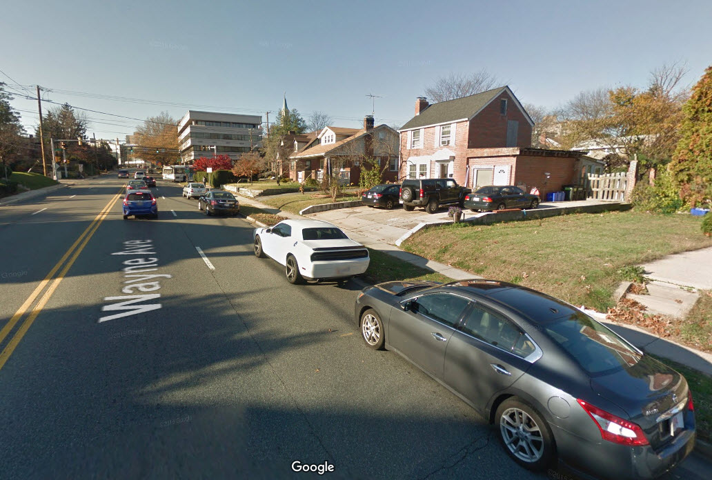
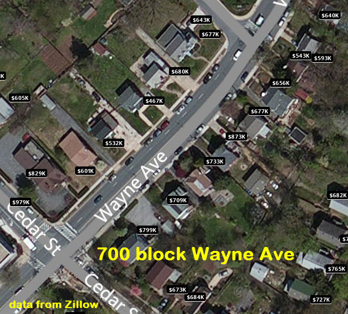
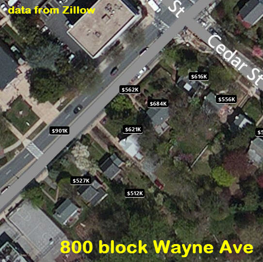
Squealing wheels. Again: NO. Especially in the 800 block, it is
a straight tangent, so there is nothing to make the wheels squeal.
Only in the 700 block do we start to get a slight curvature , but probably
not enough to make the wheels slip. The wheel profile should allow for
that. Maybe at the curve at Cloverfield, but not in the 700 or 800
block! This can be clearly seen from the aerial shot below.
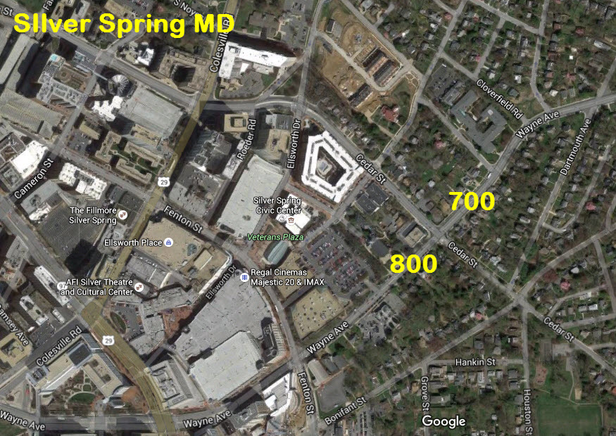
Overhead power lines. PLEASE. Have you looked at the power lines
already in place???? This would be a good opportunity for the MTA to
pay to have the utilities buried through here to help with the aesthetics.
And how can it get much uglier than having a separate pole for phone and electric???
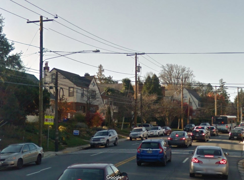
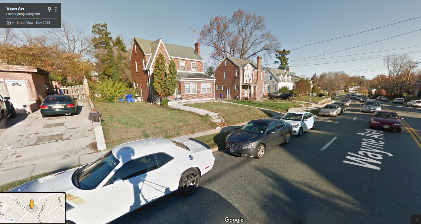
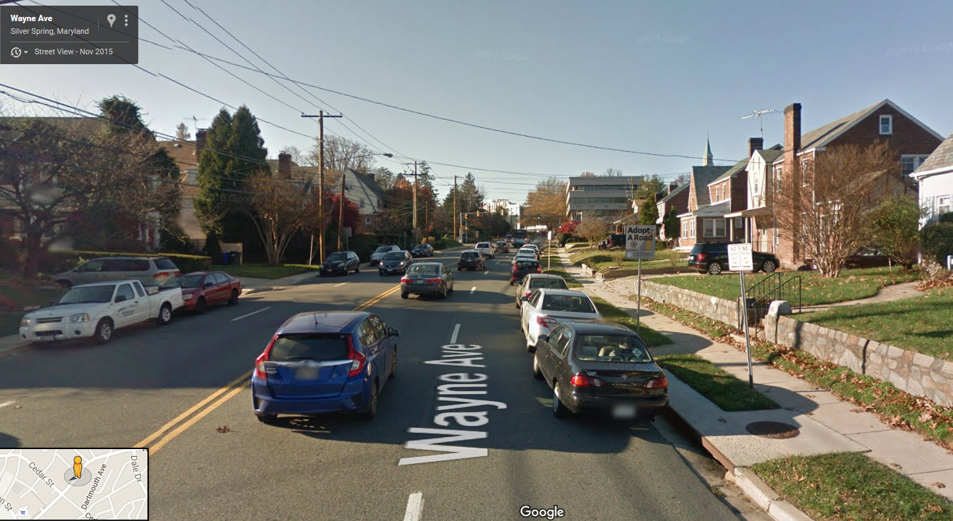
Now, let's go over a few things the residents haven't mentioned in their
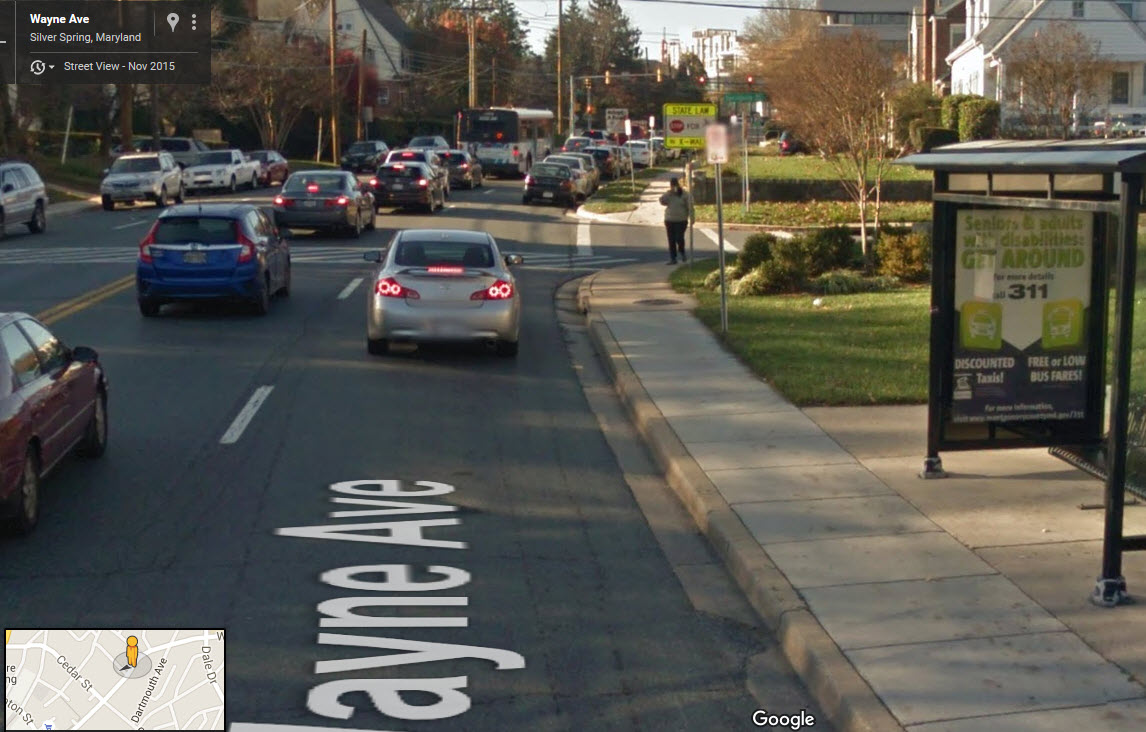
lawsuit. It looks like Wayne Ave is a major thoroughfare in and out of
Silver Spring. This means traffic, and wait, is that a bus I see on
Wayne Ave? Yep, sure is? So the guy is complaining about the
noise from the light rail starting at 6:15? Oy.
So can someone
please tell me how things could really get worse when the light rail come
through??? If they lived in a nice quiet, suburban setting on a quiet
side street with no traffic and immaculate lawns, I could understand the
residents concern. But they don't. They live on a bustling,
noisy thoroughfare. If they want quiet, move away from downtown Silver
Spring! If they win, I want to jump on the bandwagon and get some
money from the state for having to put up with the years worth of noise and
vibration from the double-tracking in 2005.
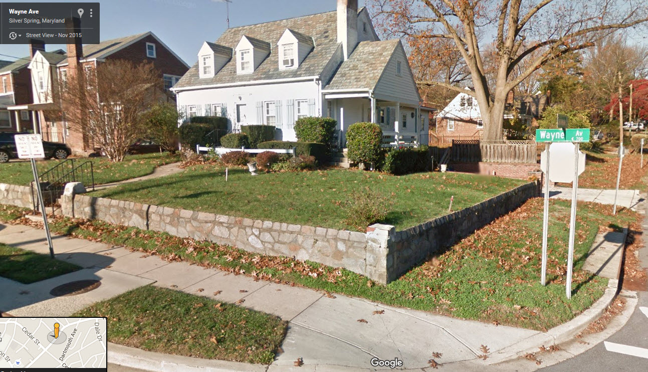
Here are some additional
street views from Google Maps:
http://www.washingtonpost.com/wp-srv/metro/data/purple-line-land.html
And finally the story....
https://www.washingtonpost.com/local/trafficandcommuting/silver-spring-homeowners-along-purple-line-sue-to-get-more-for-their-land/2016/05/09/91b0ad24-1611-11e6-aa55-670cabef46e0_story.html

Disclaimers:
I love trains, and I love signals. I am not an expert. My webpages reflect what I find on the topic of the page. This is something I have fun with while
trying to help others.
Please Note: Since the main focus of my two websites is railroad signals, the railfan guides are oriented towards the signal fan being able to locate them.
For those of you into the modeling aspect of our hobby, my
indexa page has a list of almost everything railroad oriented
I can think of to provide you with at least a few pictures to help you detail your pike.
If this is a railfan page, every effort has been made to make sure that the information contained on this map and in this railfan guide is correct. Once in a while,
an error may creep in :-)
My philosophy: Pictures and maps are worth a thousand words, especially for railfanning. Text descriptions only get you so far, especially if you get lost or
disoriented. Take along good maps.... a GPS is OK to get somewhere, but maps are still better if you get lost! I belong to AAA, which allows you to get
local maps for free when you visit the local branches. ADC puts out a nice series of county maps for the Washington DC area, but their state maps do not have the
railroads on them. If you can find em, I like the National Geographic map book of the U.S..... good, clear, and concise graphics, and they do a really good job
of showing you where tourist type attractions are, although they too lack the railroads. Other notes about specific areas will show up on that page if known.
Aerial shots were taken from either Google or Bing Maps as noted. Screen captures are made
with Snagit, a Techsmith product... a great tool if you have never used it!
By the way, floobydust is a term I picked up 30-40 years ago from a National Semiconductor data book, and means miscellaneous
and/or other stuff.
Pictures and additional information is always needed if anyone feels inclined to take 'em, send 'em, and share 'em, or if you have something to add or correct.... credit
is always given! Please be NICE!!! Contact info is here
Beware: If used as a source, ANYTHING from Wikipedia must be treated as being possibly inaccurate, wrong, or not true.
RAILFAN GUIDES HOME
RAILROAD SIGNALS HOME
NEW 07/14/2015, MAY11/2016, JUL24/2021
Last Modified
25-Jul-2021