
In General
Getting Here
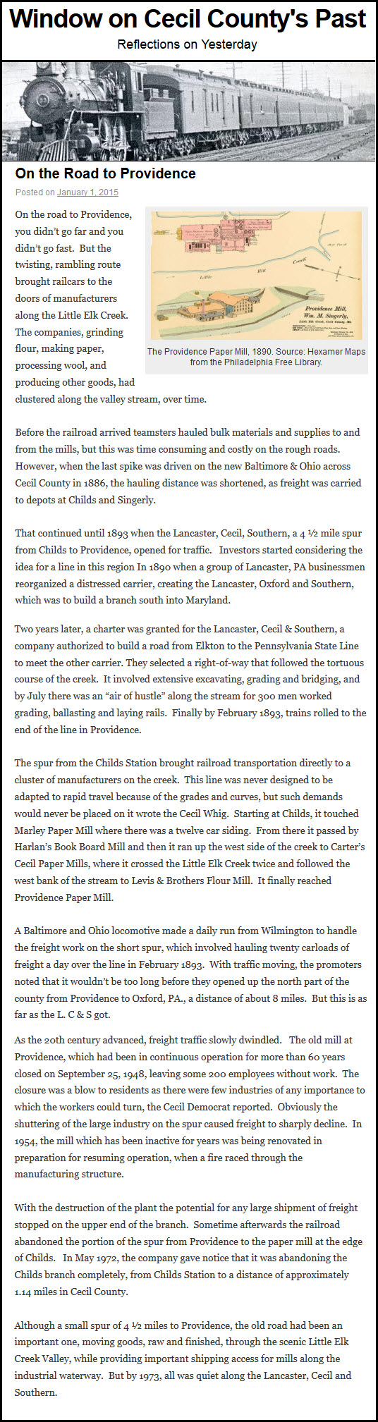
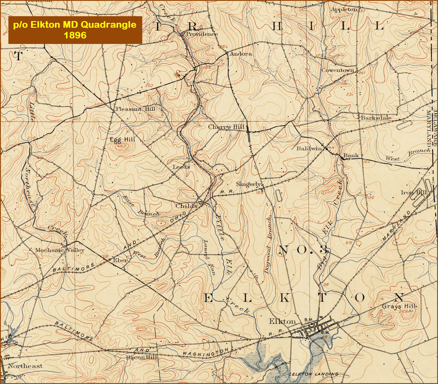
Map
Pictures
USGS Maps
RAILROAD SIGNALS HOME
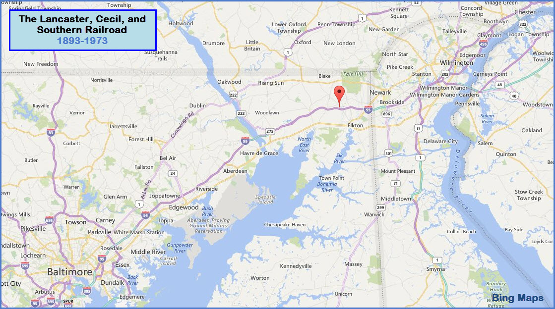
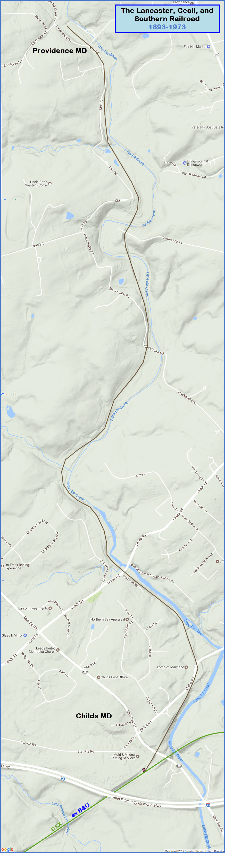
Location:
Childs MD to Providence MD, 4-1/2 miles
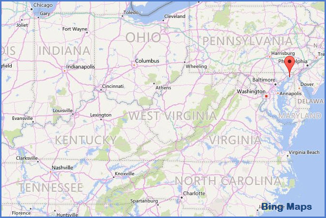
Cecil County, Northeastern MD
What's Here:
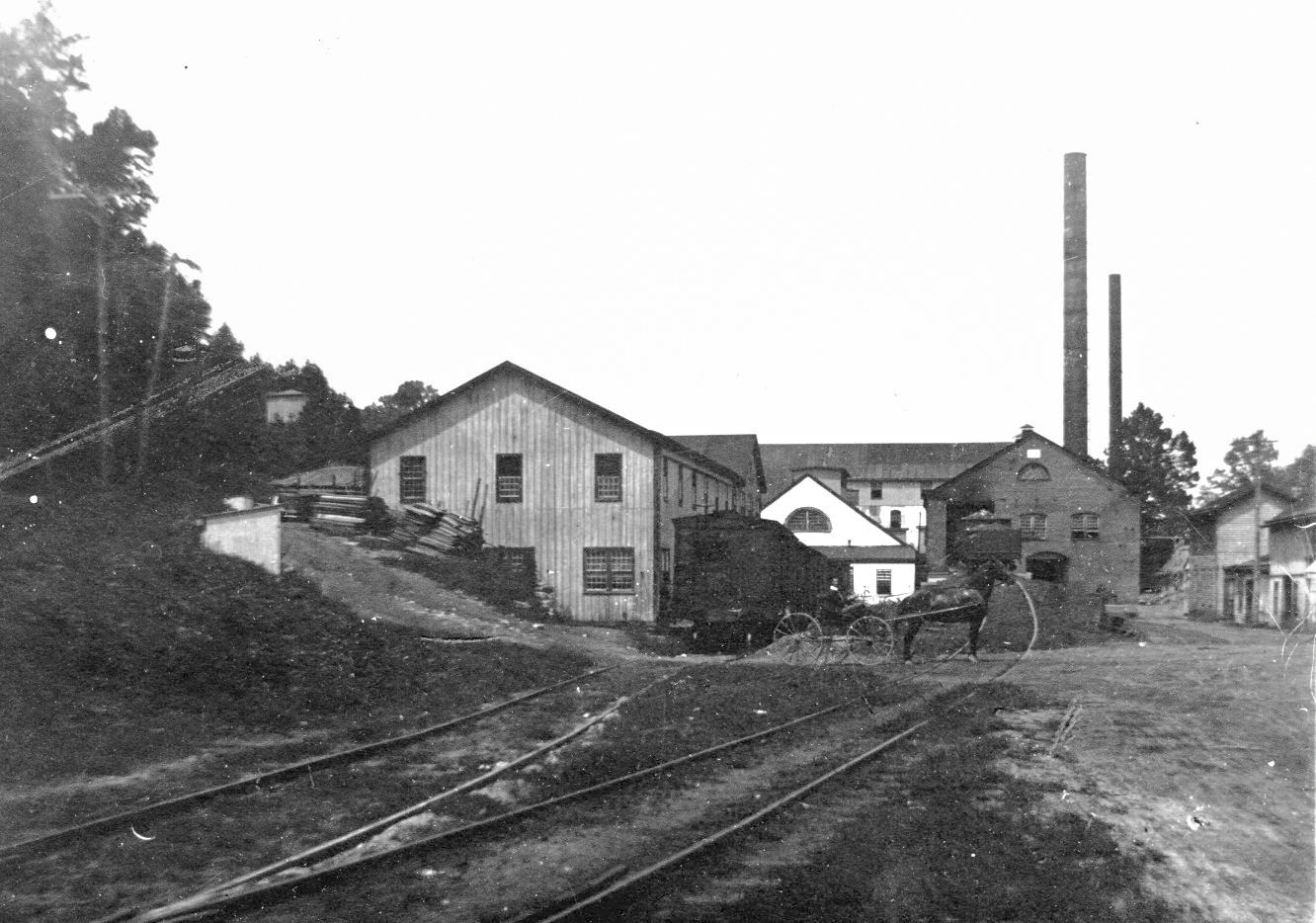
Former route of the Lancaster, Cecil & Southern RR
Data:
GPS Coordinates: 39.643667, -75.871828 (Junction with the B&O)
GPS Coordinates: 39.691928, -75.878080 (Northern end)
ZIP: 21921
Phone A/C: 410
Access by train/transit:
None
The Scoop:
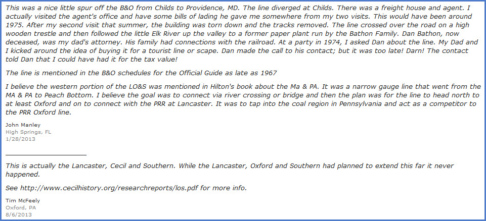
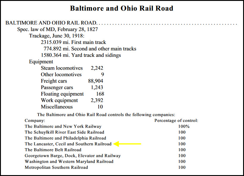
The Lancaster, Cecil & Southern RR was a railroad that connected with the Baltimore & Ohio RR at Childs MD, in Cecil County, in northeast MD, very close to the state line with Delaware. It ran between 1893 and 1972. The track was taken up sometime around 1973 or so. It does not appear that the railroad ever became a part of the B&O RR. For a complete history, please refer to the PDF mentioned below.
Acknowledgements:
The three sites below. The PDF is the most complete account of the railroad's history.
Websites and other additional information sources of interest for the area:
https://rrexplorer.wordpress.com/2012/12/12/lancaster-cecil-and-southern-railroad/
https://cecilcounty.wordpress.com/2015/01/01/on-the-road-to-providence/
http://www.abandonedrails.com/Lancaster_Cecil_and_Southern_Railroad
http://cecilhistory.org/researchreports/los.pdf
http://www.panoramio.com/photo/68660880
https://www.labellemodels.com/manuals/Baltimore%20and%20Ohio.pdf
https://books.google.com/books?id=Tvo6AAAAMAAJ&pg=PA143&lpg=PA143&dq=Lancaster,+Cecil+and+Southern&source=bl&ots=2OmyL-QwWo&sig=pAJIIKndHUB3ja-a9USM6MkdC8o&hl=en&sa=X&ved=0ahUKEwimzubrjYbSAhWE0YMKHaXqA3Y4ChDoAQgrMAM#v=onepage&q=Lancaster%2C%20Cecil%20and%20Southern&f=false
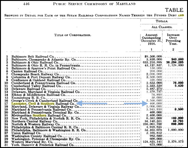
https://books.google.com/books?id=kPgbAQAAIAAJ&pg=PA446&lpg=PA446&dq=Lancaster,+Cecil+and+Southern&source=bl&ots=_HAJg3DfWP&sig=9pOPi5E8PWxofRrxsqZHAZCCUYg&hl=en&sa=X&ved=0ahUKEwimzubrjYbSAhWE0YMKHaXqA3Y4ChDoAQgzMAU#v=onepage&q=Lancaster%2C%20Cecil%20and%20Southern&f=false
Aerial shots were taken from either Google Maps or www.bing.com/maps as noted. Screen captures are made with Snagit, a
Techsmith product... a great tool if you have never used it!
The location is between exits 100 and 109 off of I-95 in the northeastern part of Maryland, next to the border with Delaware.
From exit 100, take North East Rd north toe Warburton to Hill Top Rd.
From exit 109, take Elkton Rd to the state line, hang a left onto Fletchwood Rd, then onto Elk Mills Rd in Elk Mills, which turns into Leeds Rd into Childs.
Take Blue Ball Rd south to get to where the junction used to be.

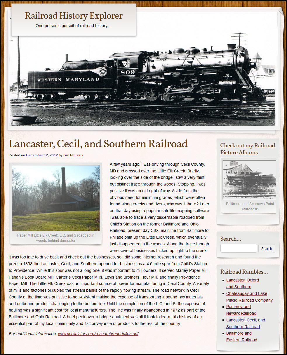

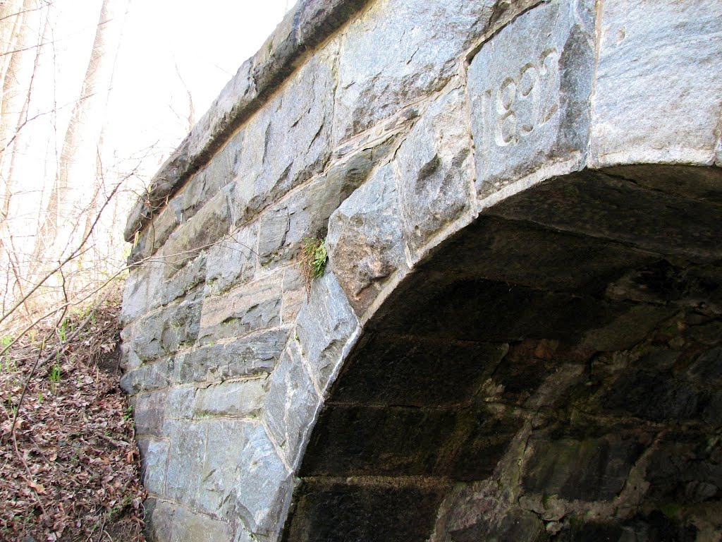
![]()
Stone viaduct from the LC&S with the date
1892 on it.... do not know it's location.
 photo
by spongyman100
photo
by spongyman100
Courtesy of the University of Texas Library, click here for their index page.
Disclaimers:
I love trains, and I love signals. I am not an expert. I do these pages because I love spending my time doing them - although I do a reasonable amount of research to make sure the information presented is accurate! :-) :-)
Please Note: Since the main focus of my two websites is railroad signals, the railfan guides are oriented towards the signal fan being able to locate them. For those of you into the modeling aspect of our hobby, myindexa page has a list of almost everything railroad oriented I can think of to provide you with at least a few pictures to help you detail your pike.
If this is a railfan page, every effort has been made to make sure that the information contained on this map and in this railfan guide is correct. Once in a while, an error may creep in, oooooooops, oh well! :-)
My philosophy: Pictures and maps are worth a thousand words, especially for railfanning. Text descriptions only get you so far, especially if you get lost or disoriented. Take along good maps.... a GPS is OK to get somewhere, but maps are still better if you get lost! I belong to AAA, which allows you to get local maps for free when you visit the local branches. ADC puts out a nice series of county maps for the Washington DC area, but their state maps do not have the railroads on them. If you can find em, I like the National Geographic map book of the U.S..... good, clear, and concise graphics, and they do a really good job of showing you where tourist type attractions are, although they too lack the railroads. Other notes about specific areas will show up on that page if known.
BTW, floobydust is a term I picked up 30-40 years ago from a National Semiconductor data book, and means miscellaneous and/or other stuff.
Pictures and additional information is always needed if anyone feels inclined to take 'em, send 'em, and share 'em, or if you have something to add or correct.... credit is always given! BE NICE!!! Contact info is here. Beware: If used as a source, ANYTHING from Wikipedia must be treated as being possibly being inaccurate, wrong, or not true.
RAILFAN GUIDES HOME
RAILROAD SIGNALS HOME
NEW
10FEB2017
Last Modified
10-Feb-2017