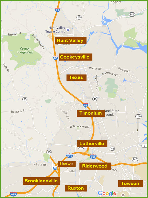
Northern Suburbs of Baltimore in Baltimore County
Northern Suburbs of Baltimore in Baltimore County
In General
Sights
Station by Station
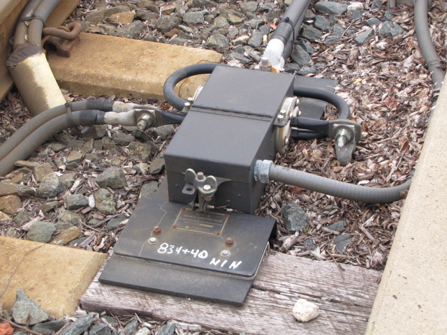
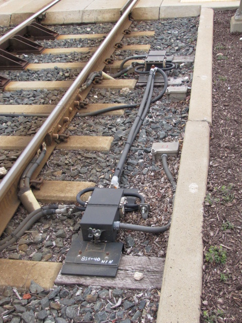
Signals
Fire and Police
USGS Map
Floobydust
Guide Home Maps Hiways Hotels Intro Railroad Sights Links Photos Busses Bio's
Location / Name:
Hunt Valley MD
Cockeysville MD
Texas MD
What's Here:
Former R-O-W of the Baltimore & Susquehanna RR
(the 2nd railroad in Baltimore), and later the Northern Central, Pennsy, PC,
Conrail, and NS
Former PRR freight shed
(Cockeysville)
5 Light Rail stations
B&S marble stringers (ties)
Fire stations - BaltCo
#17, Cockeysville Volunteers #390
Police station -
Precinct 7 - Cockeysville
Plenty of food, shopping,
movie theaters, and gas: Hunt Valley Towne Center, Walmart, and the usual other suspects
Data:
GPS Coordinates:
Hunt Valley station:
39.496293, -76.654531
Warren Rd station: 39.496288, -76.654164
ZIP/Cockeysville: 21030
ZIP/Hunt Valley: 21031
ZIP/Texas: 21093
Access by train/transit:
No Amtrak or MARC service
Light Rail Stops:
Warren Road
Gilroy Rd
McCormick Rd
Pepper Rd
Hunt Valley
Bus - Local - No 9 Route
Bus - Commuter - No 83S to York
My pages for the
nearby communities:
Brooklandville
Hereford and Monkton
Lutherville
Ruxton and Riderwood
Timonium
Towson
The Green Spring branch
And the "old" Map
1 page
The Scoop:
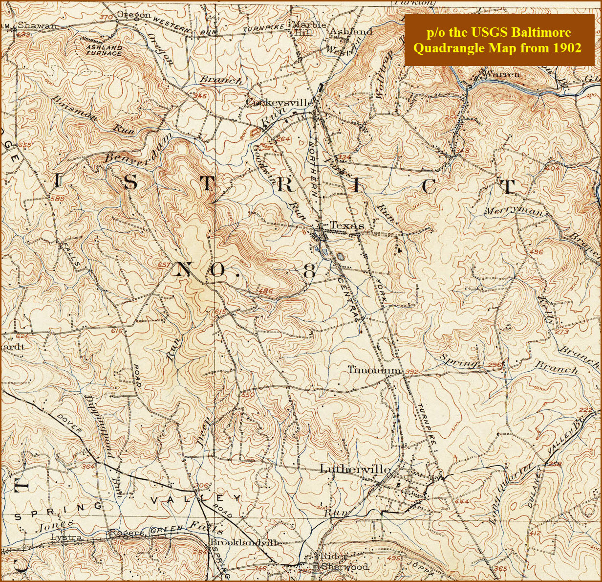
The map below shows the north suburban side of
Baltimore... Towson, Lutherville, Timonium, Cockeysville, and Hunt Valley.
It is a very busy, I am in the process of splitting it up into easier to manage
sections, this is part of that effort.
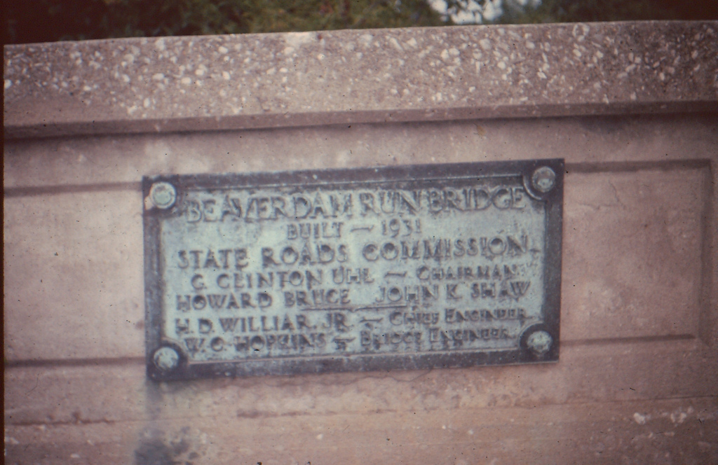
The second railroad of
Baltimore, the Baltimore and Susquehanna, came through here in 1831-32 heading to York and
Harrisburg. A fairly complete history is on the
Ruxton and Riderwood
page. The railroad was re-organized as the Northern Central Rwy
after a really bad accident in Ruxton/Riderwood killed 35 people, and the B&S
was prompted to reorganize in order to stave off bankruptcy. The B&S also built the
Green Spring Branch, which the
Western
Maryland used in the beginning before they had their own route out of the city.
They built this route as an alternate way out of Baltimore when the state of
Pennsylvania denied the Northern Central access to entering York County.
The R-O-W was double tracked and signaled by WW1. Local passenger service,
known as the Parkton Local, was discontinued in 1959. Soon after, the line
reverted to a single track with passing sidings. The last passenger train
came thru in 1971 with the start of Amtrak, and the last freight train came thru
on Wednesday, June 21, 1972, when hurricane Agnes hit and did its damage to the line. The
Penn Central could not afford to rebuild the line, and it was easier for them to have
freights go up to Perryville and use the Port Road to get to Harrisburg, than deal
with the grades and curves of the Northern Central anyways. Most of the
freights using the "Northern Central" line in the latter years were SB because of the grades.
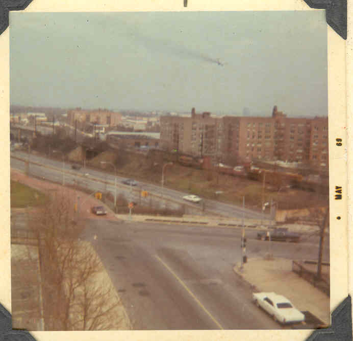
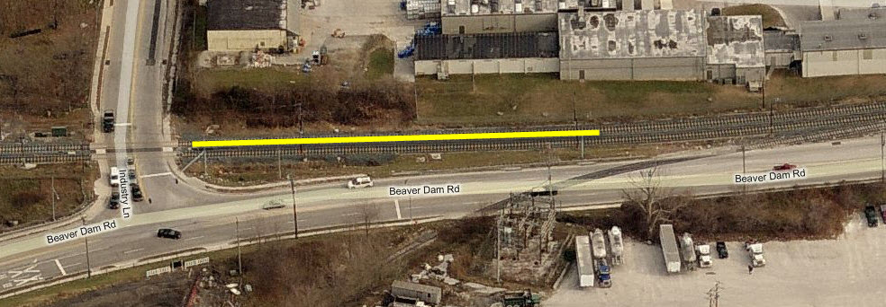
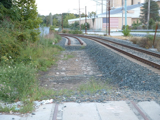
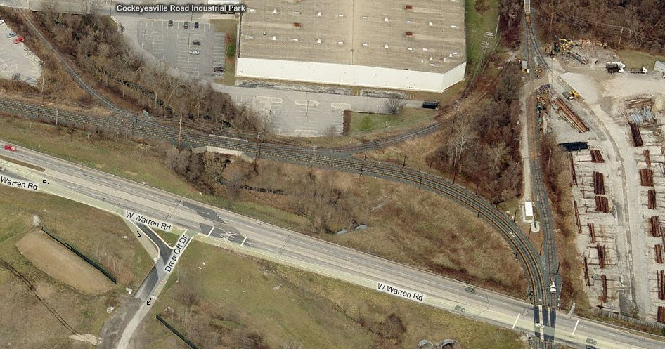
The two aerial shots below show where the
stones were uncovered and could easily be seen during 2005. The full size
picture is taken from Industry Lane looking south. In the picture, you cab
also see the back of a grade crossing signal that is no longer around.
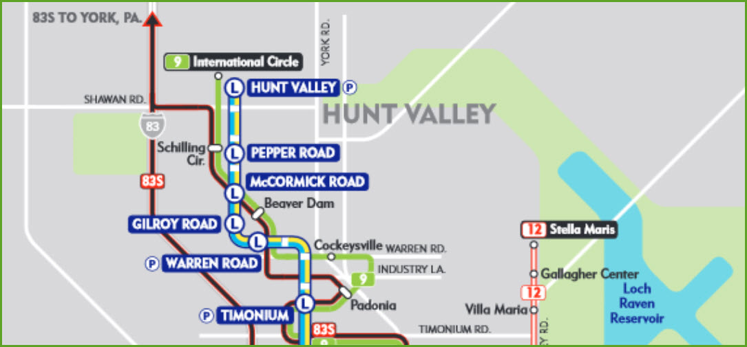
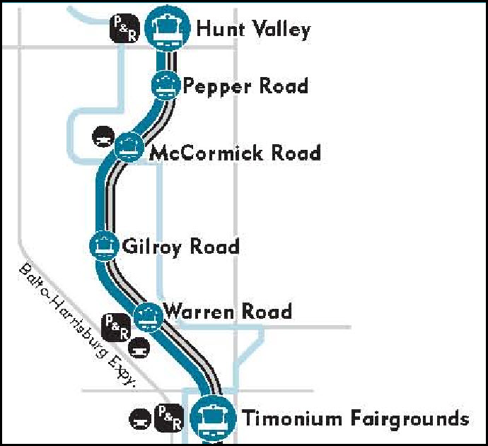
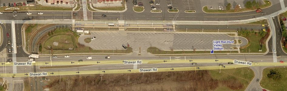
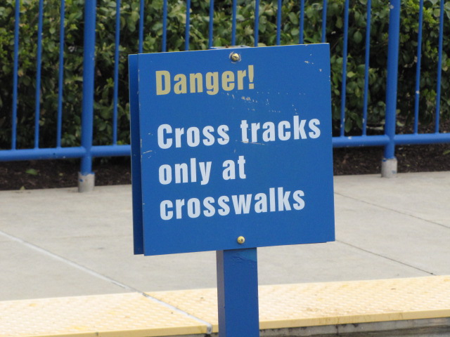
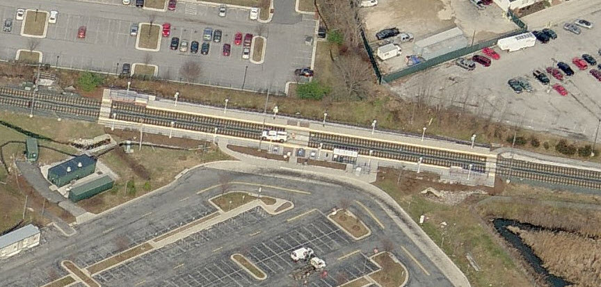
Light Rail - Station by Station The Baltimore Light Rail system starts/ends on
the northern part of the map in Hunt Valley, at the mall. Too bad for
riders, but by the time the current owner of the Mall told the MTA that they
would love to have the Light Rail come into the Mall, the MTA already had
started on building the station as it is now. This map covers the system from the northern
end down to the Twin Tunnels in Riderwood. The longest stretch of track
without a stop starts on this map at Lutherville, and goes about 4 miles to the
Falls Road station, and also takes in the best scenery of the entire system at
Lake Roland. Hunt Valley
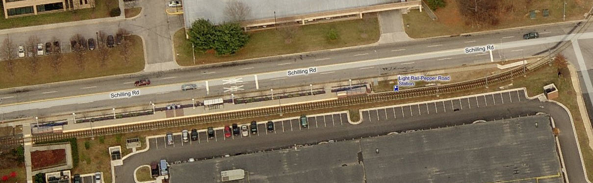
Pepper Road
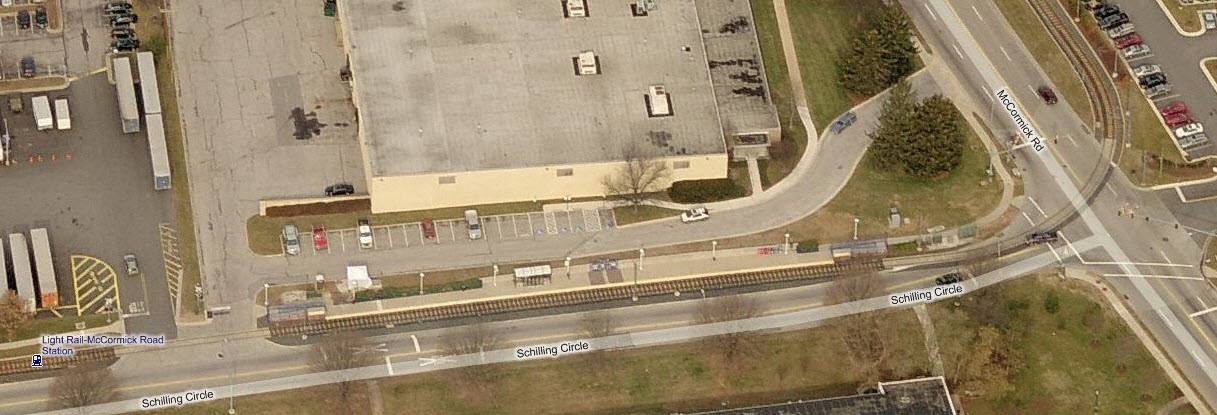
McCormick Rd
(on Schilling Circle)
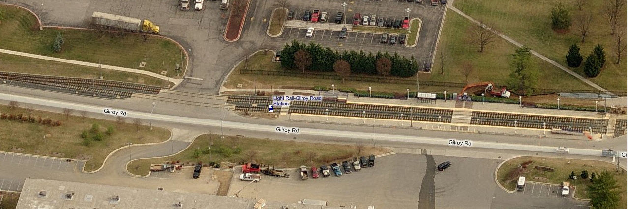
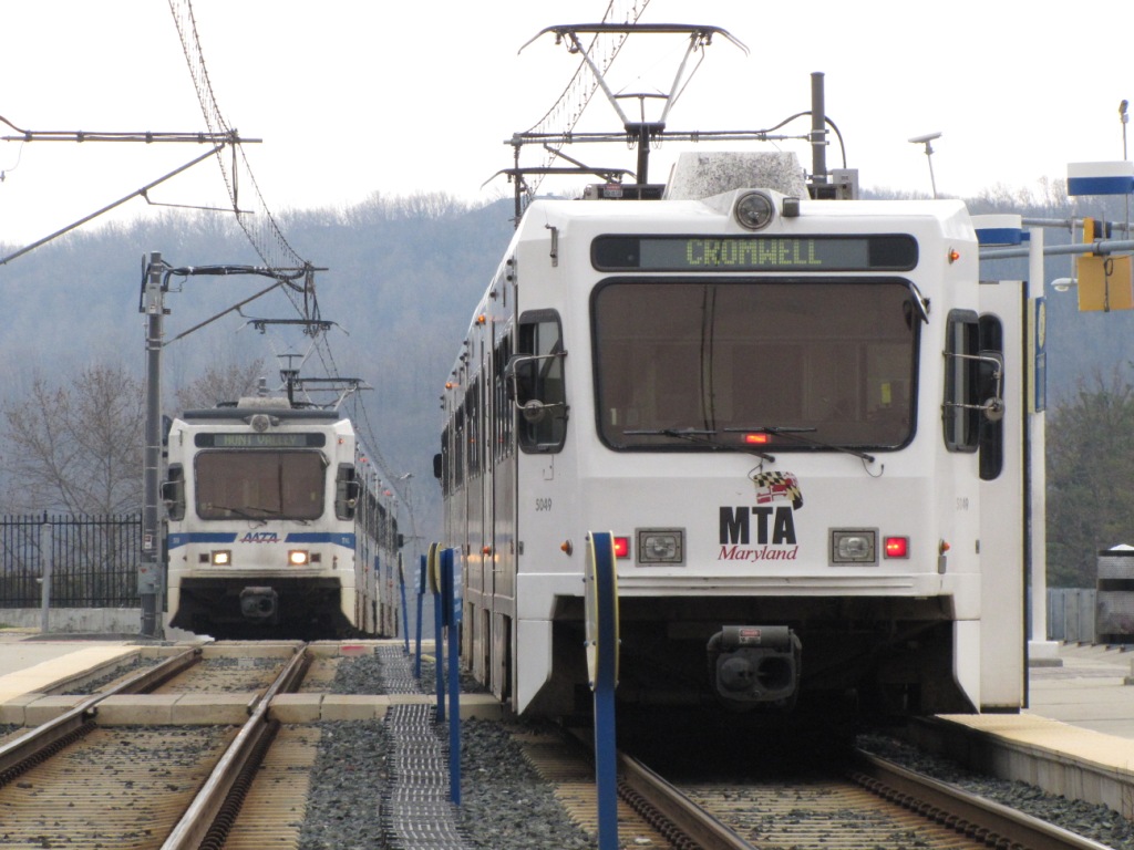
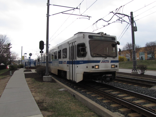
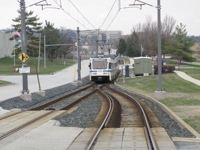
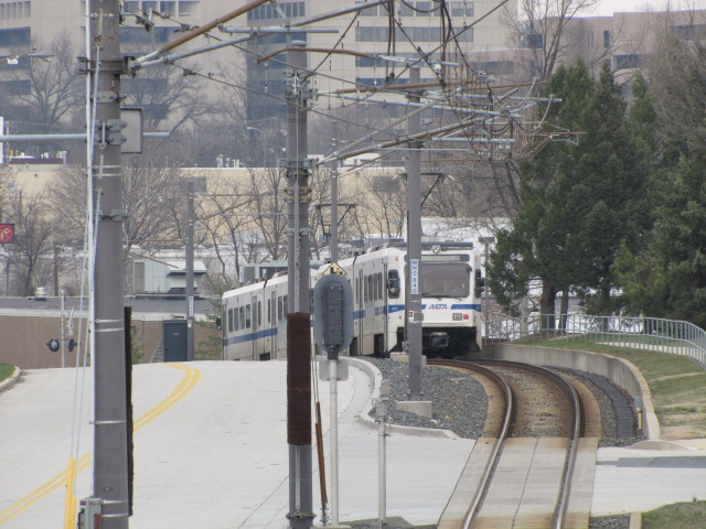
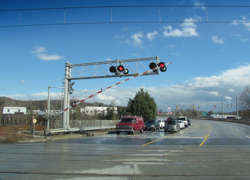
Gilroy Rd At Gilroy, the line goes into a single track
for its trip through most of the industrial park (it goes back into two tracks
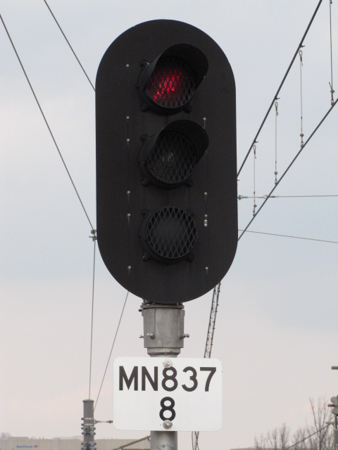
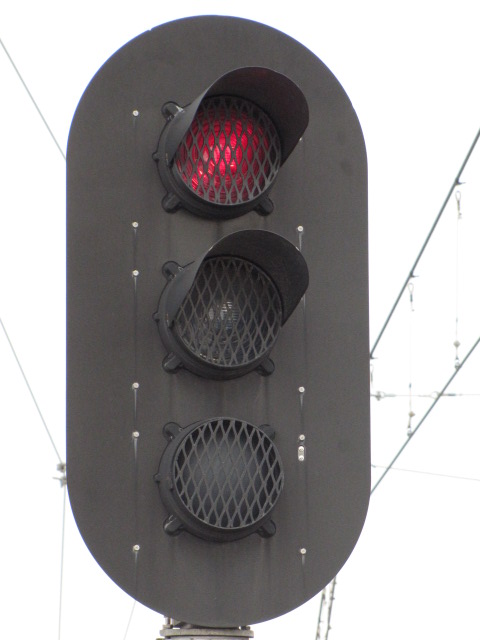
for the Hunt Valley station before crossing Shawan Rd). The NB signal for trains heading to Hunt
Valley is fairly unique in that it only displays two aspects as seen below.
Signals like this also show up at the Timonium turn around. You can almost always count on a meet here,
for trains going to HV have to wait for the SB train to clear the single track.
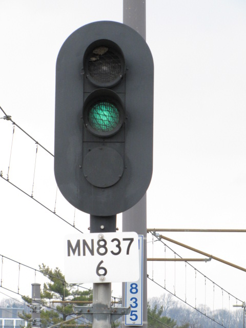
Warren Rd
Warren Rd Grade Crossing
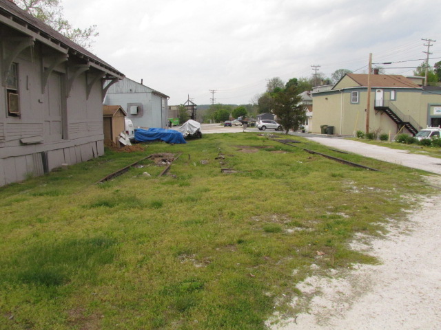
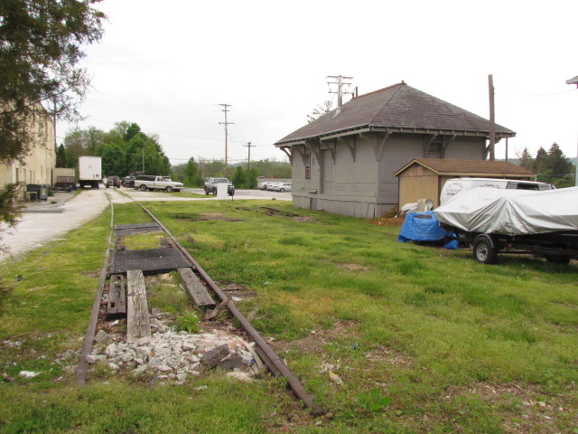
Cockeysville Siding
GPS: 39.489855, -76.641851 (close enough, but may not be exact)
GPS: 39.482510, -76.645411 NOTE:
If anyone from any of the stations or precincts wants better resolution photos for picture purposes, give me a hollar, contact info is
here
More info can be found at:
http://www.mdoe.org/north_central_rr.html
http://en.wikipedia.org/wiki/Northern_Central_Railway
http://wikimapia.org/7137695/Northern-Central-Railroad-Pennsylvania-Railroad-Abandoned
http://www.rrpicturearchives.net/archiveThumbs.aspx?id=1403&Page=2 surviving
railroad stations in Maryland
http://www.rrshs.org/Maryland/baltimoremd.htm
field check of many station sites in Baltimore County
The northern part of the light rail system runs right up the middle of the map, which was the original right-of-way of the Northern
Central. The original section which opened in 1990 and went to Timonium. The extension opened to Hunt Valley in
September of 1997. Any part of it that wasn't, was double tracked in 2005, and
because of the construction. the old marble ties (stringers) were
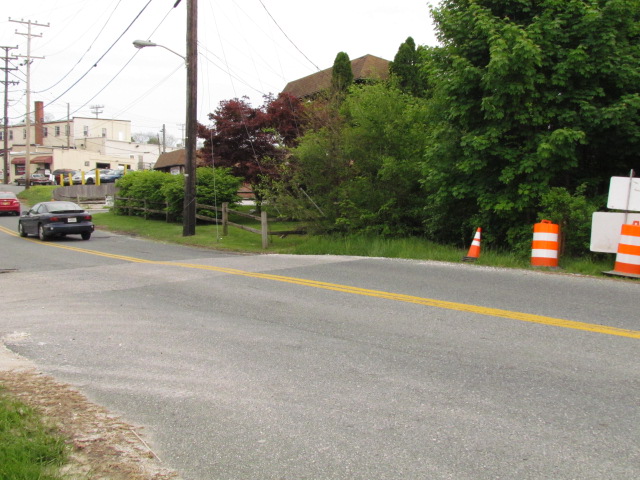
visible along the R-O-W for a few months. Above Cockeysville, the R-O-W is now the NC hikey-bikey Trail, which is very popular with those types. The R-O-W
splits off at Warren Rd., and other than the stub that is still there, not much remains visible. NS trains stopped running when the light rail closed the
track for the double tracking project at the beginning of 2005. They applied for abandonment shortly thereafter.
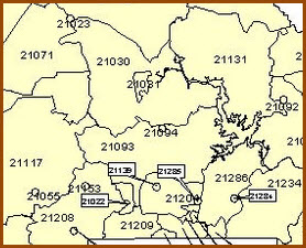
21030 or 21031? Most people will interchangeably use Cockeysville and Hunt Valley. To a
small degree, they are correct, but beware, there IS a HUGE difference.
Before there was a Hunt Valley, the whole area used to be considered
Cockeysville. With the advent of commercial development in the numerous
industrial parks of Cockeysville in the area around and below Shawan Road, the
post office decided they needed a way to differentiate between the areas, so
they created the 21031 ZIP code for Hunt Valley. In the map below, you can
see that the 21031 Hunt Valley area is a small segment in the much larger 21030
"Cockeysville" area.
It's kind of funny how, with the advent of light rail service, that the main line and siding functions of the track in
Cockeysville reversed roles. What is now the light rail's main line at
Warren Road, used to be an industrial siding, servicing business' in
Cockeysville and the Hunt Valley Industrial Park. What used to be the
Pennsy main line, became the siding. The line became a local line after
hurricane Agnes in June of 1972 and washed out many bridges and trackage
north of Cockeysville where it followed the river. The track went up to
the freight shed for many years, then when the MTA took over, ended the line
just shy of Cockeysville Rd. Today, the track goes up far enough to make a
usable wye, and you can barely see where the tracks were from Cockeysville Road.
Prior to the end of freight service, you could find a Norfolk Southern or
Conrail engine, and maybe a few cars sitting north of Warren Road because they
couldn't make it back to the interchange track back at the light rail shops
before the start of service.
Several old NC/PRR depots are still around in addition to the Cockeysville Freight Shed: Riderwood,
Lutherville, Greenspring, Stevenson, and Monkton. Three of them are used
as homes, and anyone wishing to take pictures of them should respect the privacy
of the homeowners! Monkton serves as the HQ for the Trail. Please
check those pages to view information on them.
More info at:
http://en.wikipedia.org/wiki/Baltimore_Light_Rail
Acknowledgements:
Elliott Plack - Pictures of still standing PRR PL signal and bridge
John S - additional info regarding hurricane Agnes

Portions of older and newer versions of the MTA's light rail map:
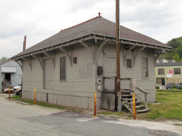
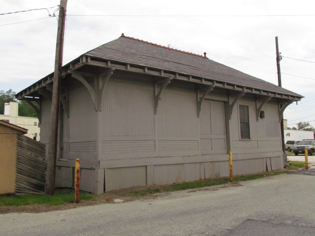
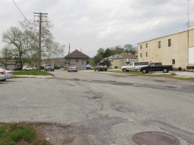
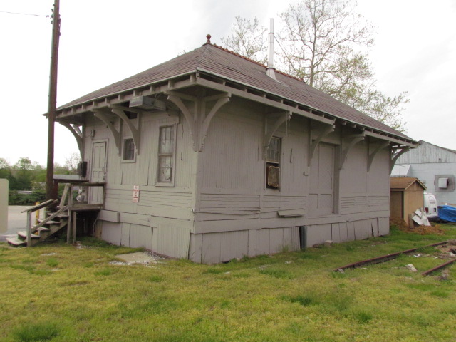
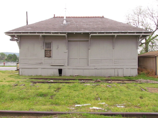
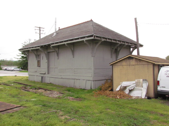
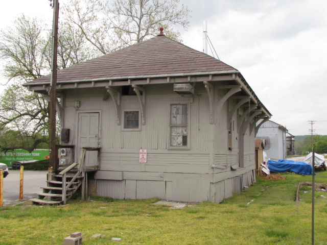
![]() ex PRR Freight Shed
ex PRR Freight Shed
Probably the most visible railroad feature, or fixture still
around these days. Many references I see on the internet are calling this
the Cockeysville station, which is
incorrect. The actual railroad station used to sit on "the other" side of
York Rd. These pictures are from May 2014, and as of 2018, it is still
around, altho in poor condition. The MTA is the current owner of the
building. Up until 2005 or so, the tracks from the light rail line
actually used to still connect to the track outside the shed, and the MTA kept a
speeder in a small shed they built over the tracks.
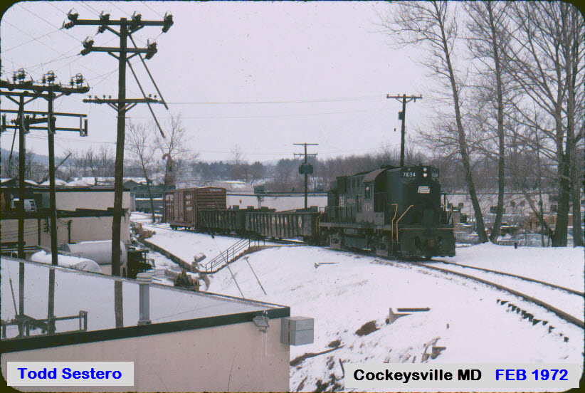
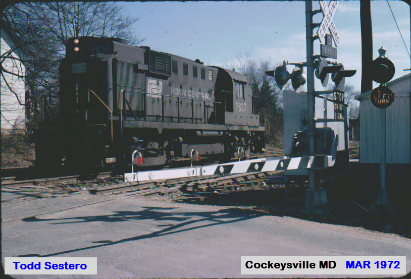
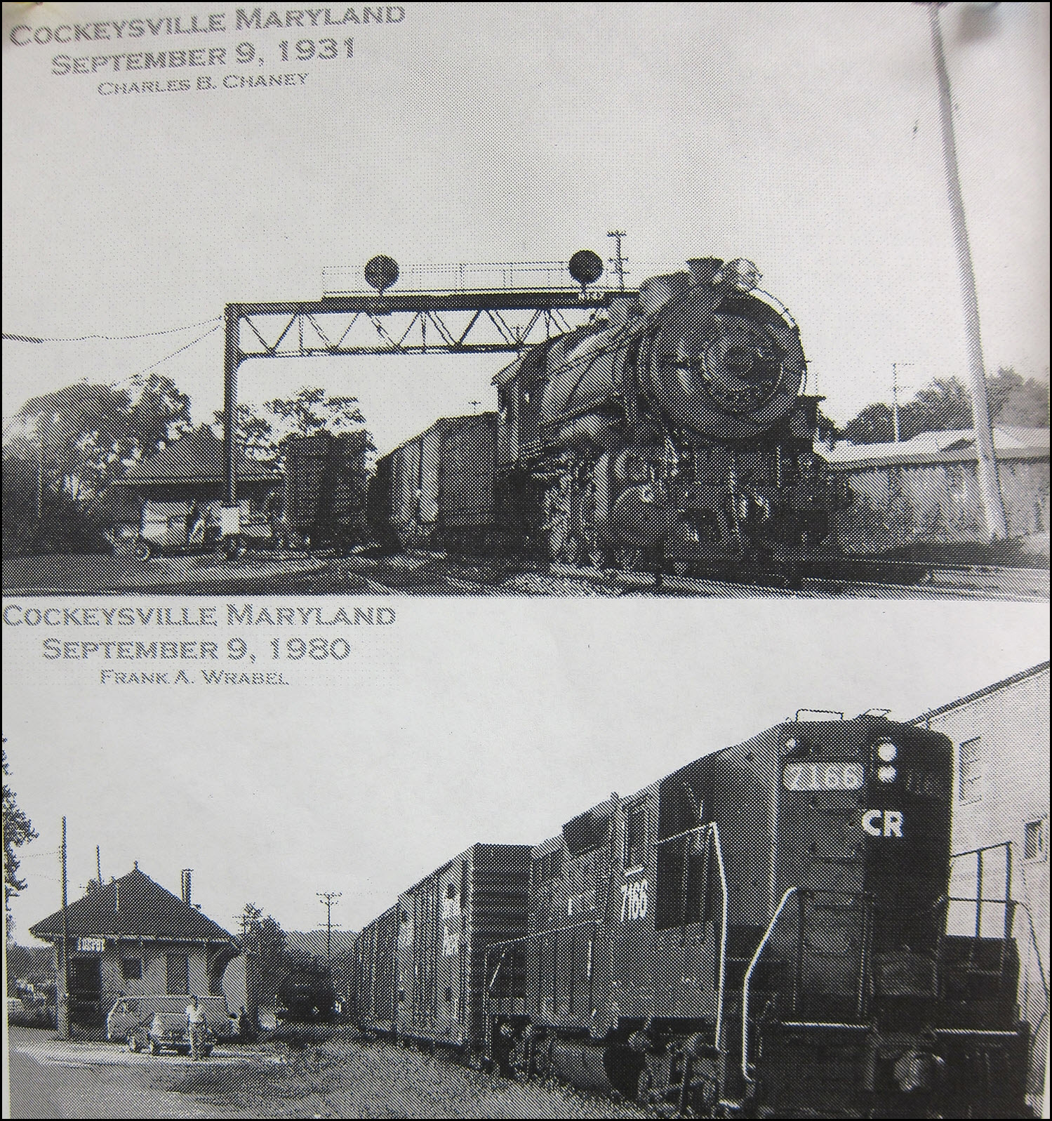
Taken in the early 70's a few months apart are the two
following pictures of the local working in Cockeysville, next to the Freight
Shed. The siding is still partially there. Would love to have gotten
the "no left turn" signal! Adjacent to where the shed stands,
come the two following pictures of a local working one of the Cockeysville
sidings. The engine, an Alco RS-11, or Dl-701, is one of
my favorites of the era. In NYC, they took over the duties in 1969 on the New
Haven when Penn Central took over, and stopped using the electric E-33's going
over Hell Gate bridge in Queens NY. The square picture is of the RS-11's
making their way north thru Queens next to where my grandparents lived in
Jackson Heights.
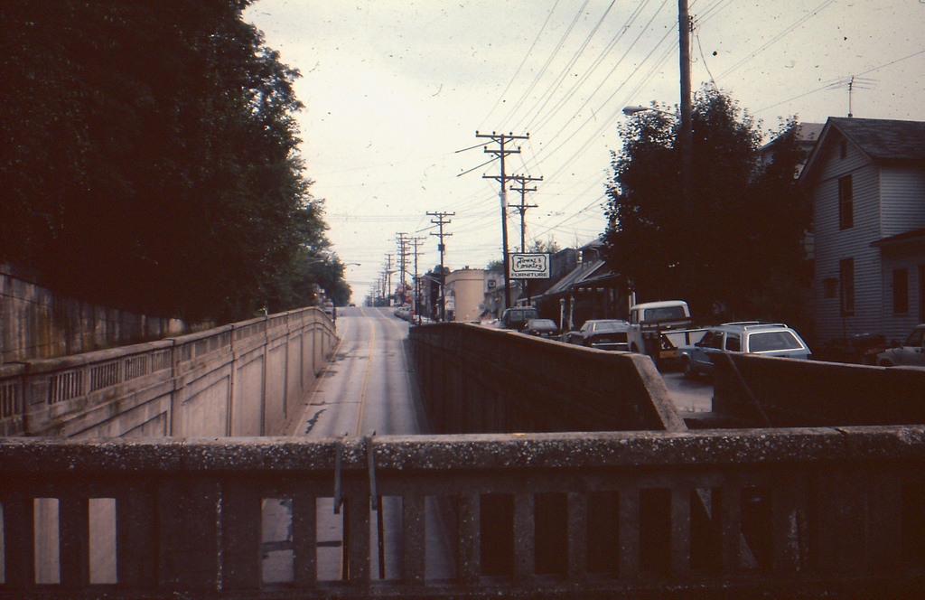
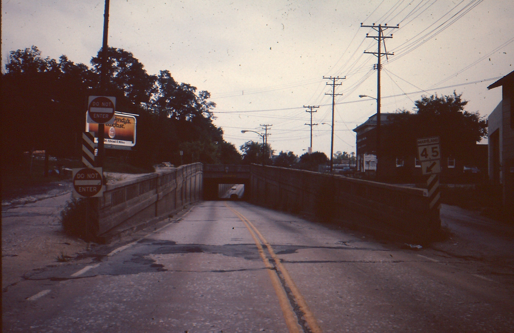
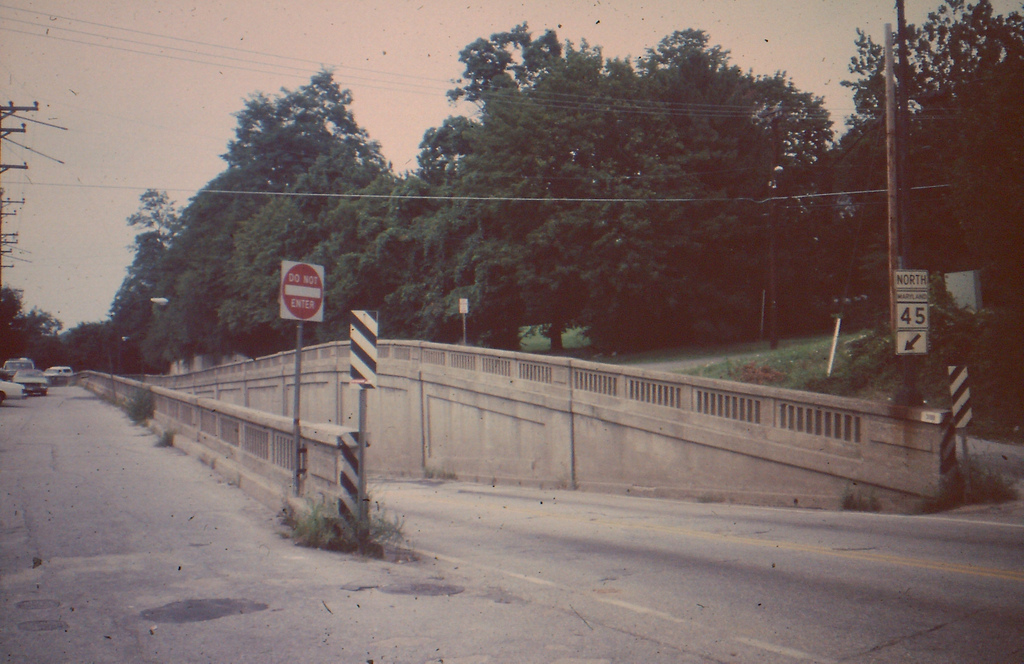
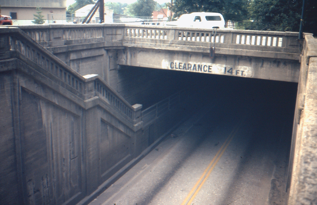
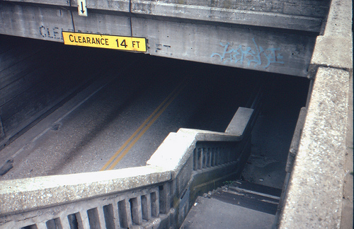
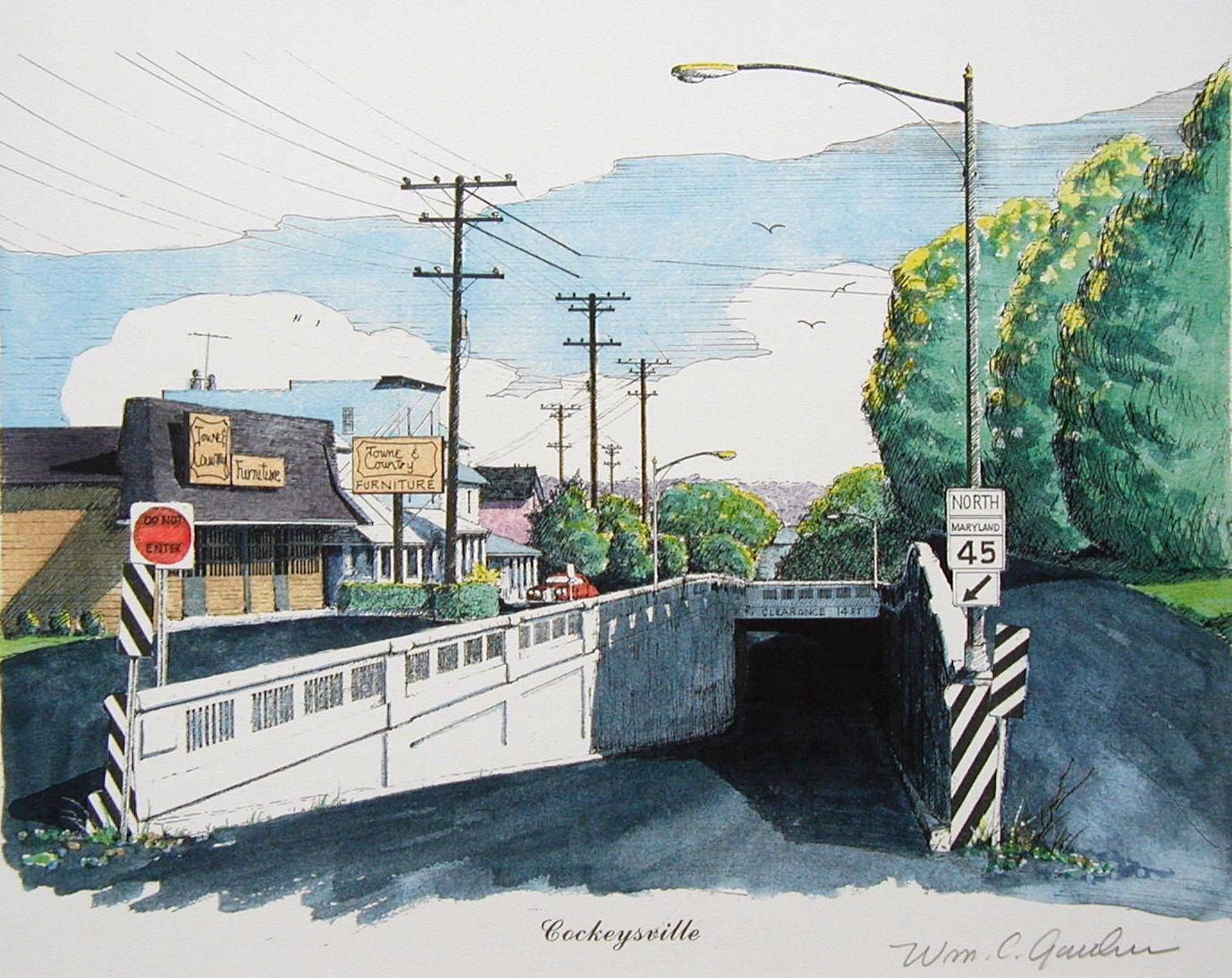
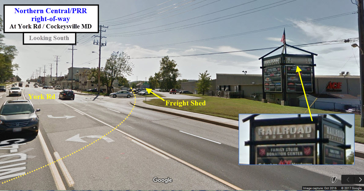
![]() the Cockeysville
Underpass
the Cockeysville
Underpass
How did the chicken get to the other side of the railroad tracks?
Simple. When there was still a right-of-way, York Road went under the
tracks in an underpass. Being only a two-lane affair, it was a choke point
in York Road, and filled up with water every time we had a severe storm.
It also included a walkway for pedestrian traffic. I'm sure Baltimore County and every driver around here praised the day it went
away! Most of the underpass is still there, they just filled it in with
dirt, and then paved over it.
![]() the former PRR
Cockeysville Station
the former PRR
Cockeysville Station
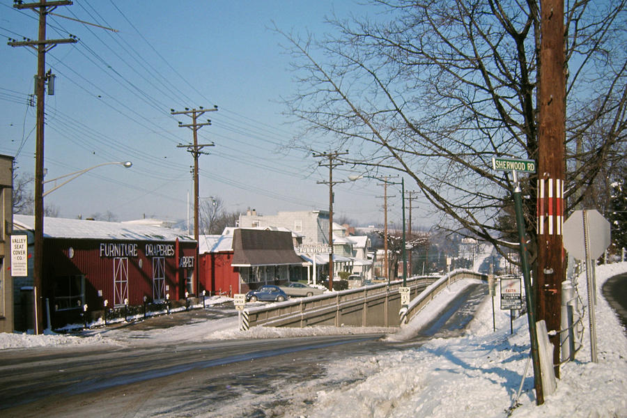
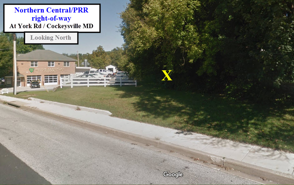
I don't know when they tore the station down, but it
was before 1970 when I first started driving up to Cockeysville to visit my
buddy Jim who lives a few blocks away. I also came up here hoping to get a glance of the local
engine working the industrial park,
or one of the thru SB Truc-Trains (the route between here and New Freedom PA was
uphill AND twisty-turny, so the Pennsy in later years, once they had the Port
Road open, really only used this track for southbound freights). It was well shaded by trees, and even on a
hot summer day, was a great place for train watching. Another thing that
made it nice to hang around, was the fact that the railroad had a radio repeater
at the south end of the station platform, and the technicians would usually leave the
speaker on, so you would know when there was something around. This was in
the days before scanners were common, if you can believe that! The brick
paved platform, on the right side of the tracks as you looked from York Road,
was around until the mid 80's.
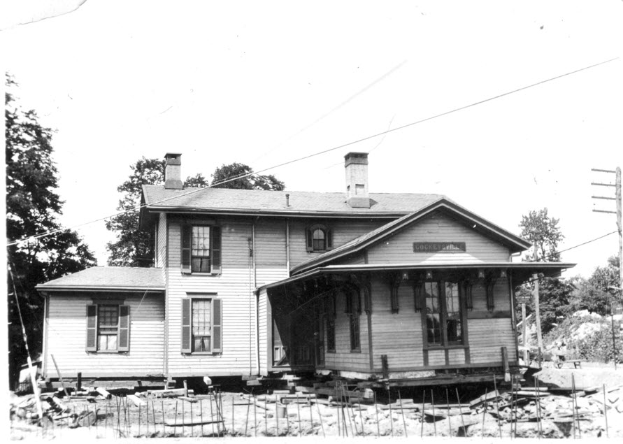
X marks the spot where the tracks used to be......
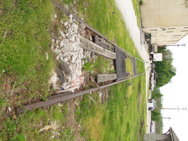
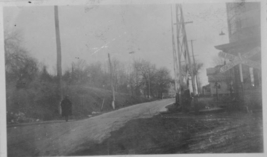
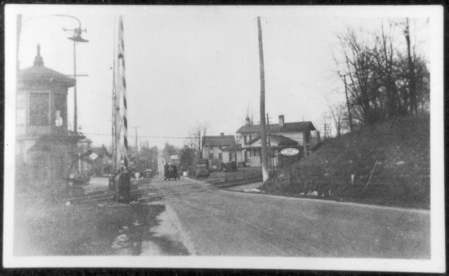
![]() Southern End of the
NCR Rail-Trail
Southern End of the
NCR Rail-Trail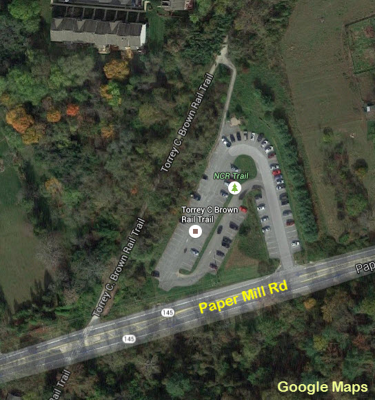
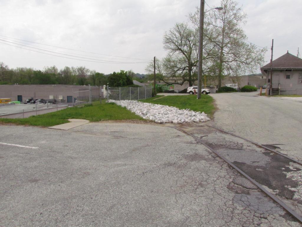
![]() NC Marble Ties
NC Marble Ties
These fine examples of marble railroad ties date back to when
the Baltimore & Susquehanna (Northern Central) was heading north out of Baltimore in the 1834 time frame.
When the MTA Light Rail was double tracking the northern section in 2005, they
"uncovered" many of the ones still left in the old right-of-way. There
were two sections that we saw, one was under Padonia Road going several hundred
feet to the south, the other section was at Industry Lane. I tried like a
bandit to get some of them saved, but neither the MTA nor the Maryland
Historical Trust wanted to do so, stating that they should be preserved for the
future when "we" will know more about discovering their secrets. The
letter I received also asked me if I knew anything about extracting historical
artifacts out of the ground without damaging them, but a couple of days after I
received that letter, people doing the R-O-W work came along and scraped the
top of several dozen of them with a bulldozer while clearing the way for the new track - so much
for the state being good guardians of our past. So, they all got buried
and none of us will ever see them again :-( 

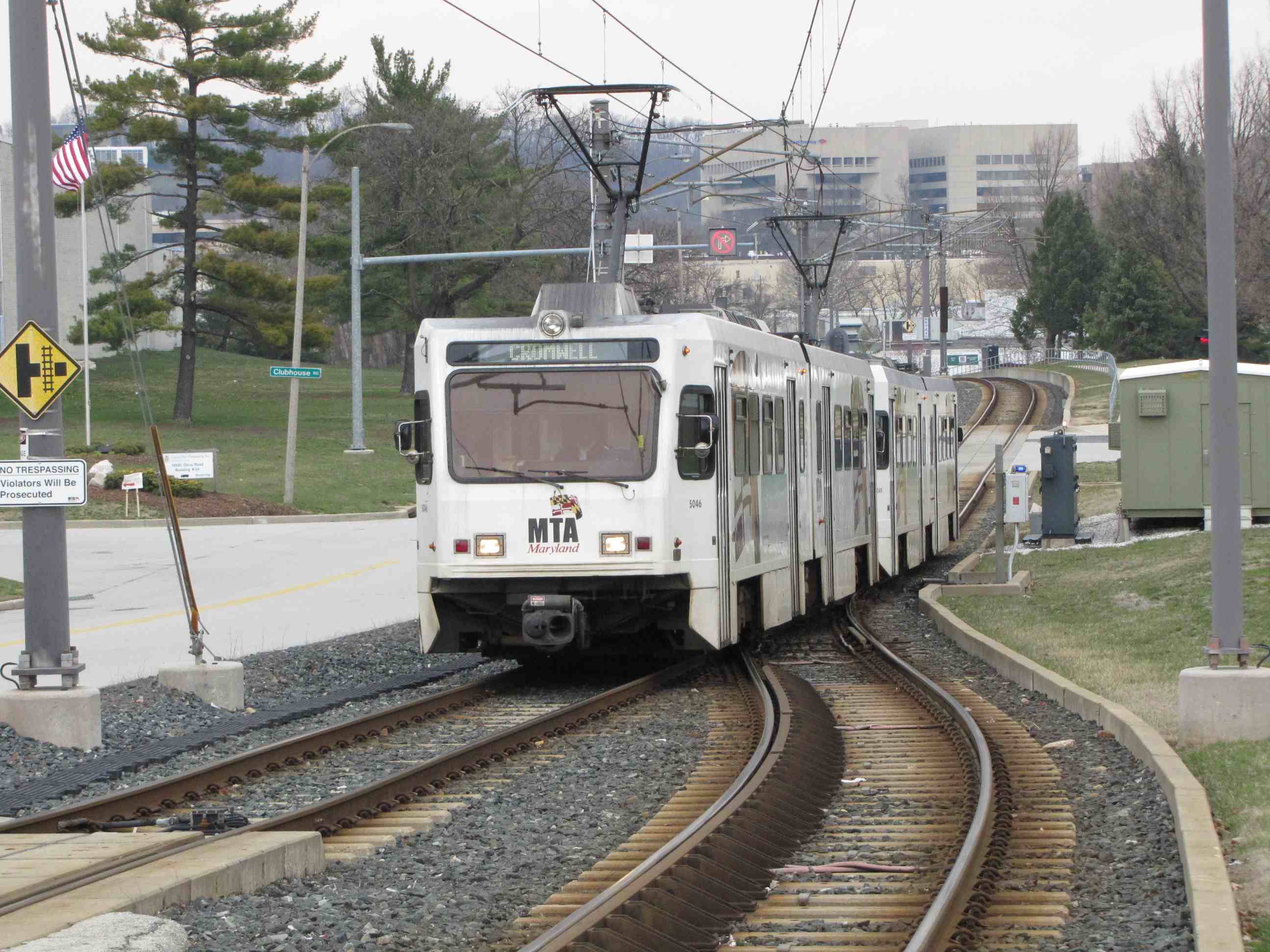
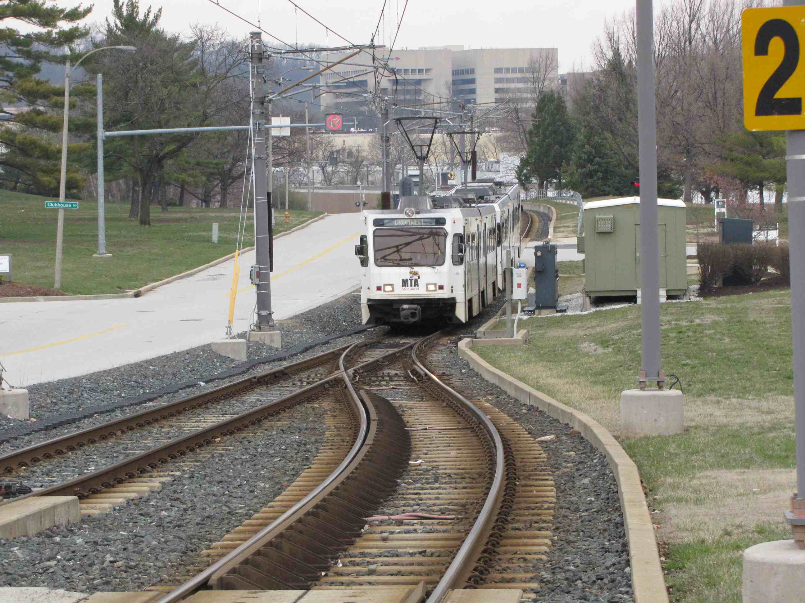
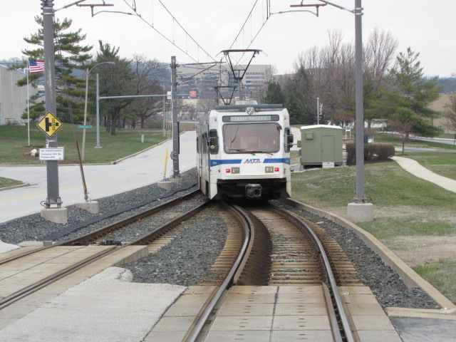
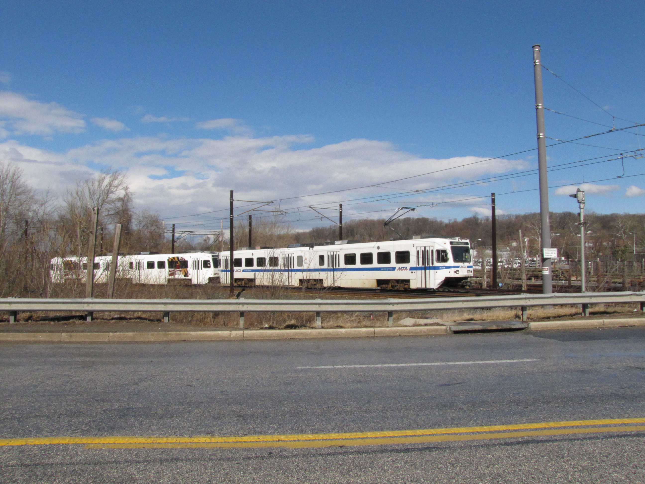
 A SB train coming into Gilroy
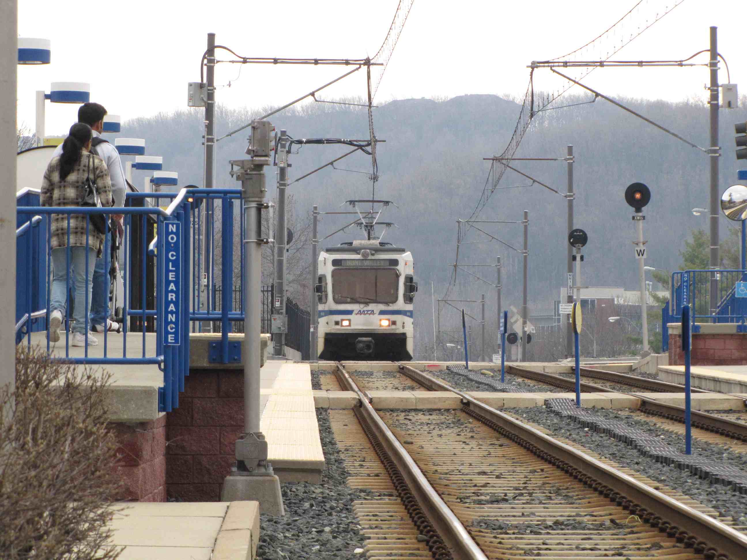
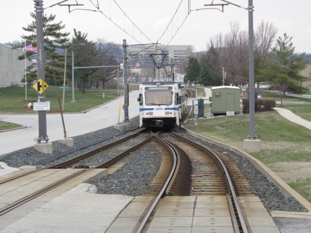
 A NB train coming into Gilroy and then heading to HV
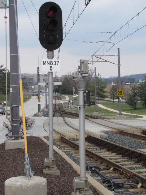

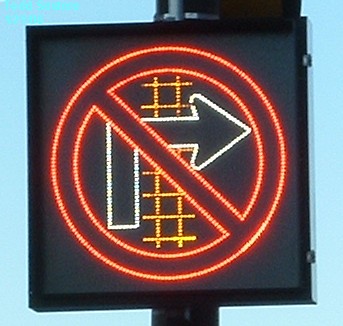
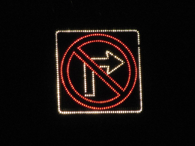
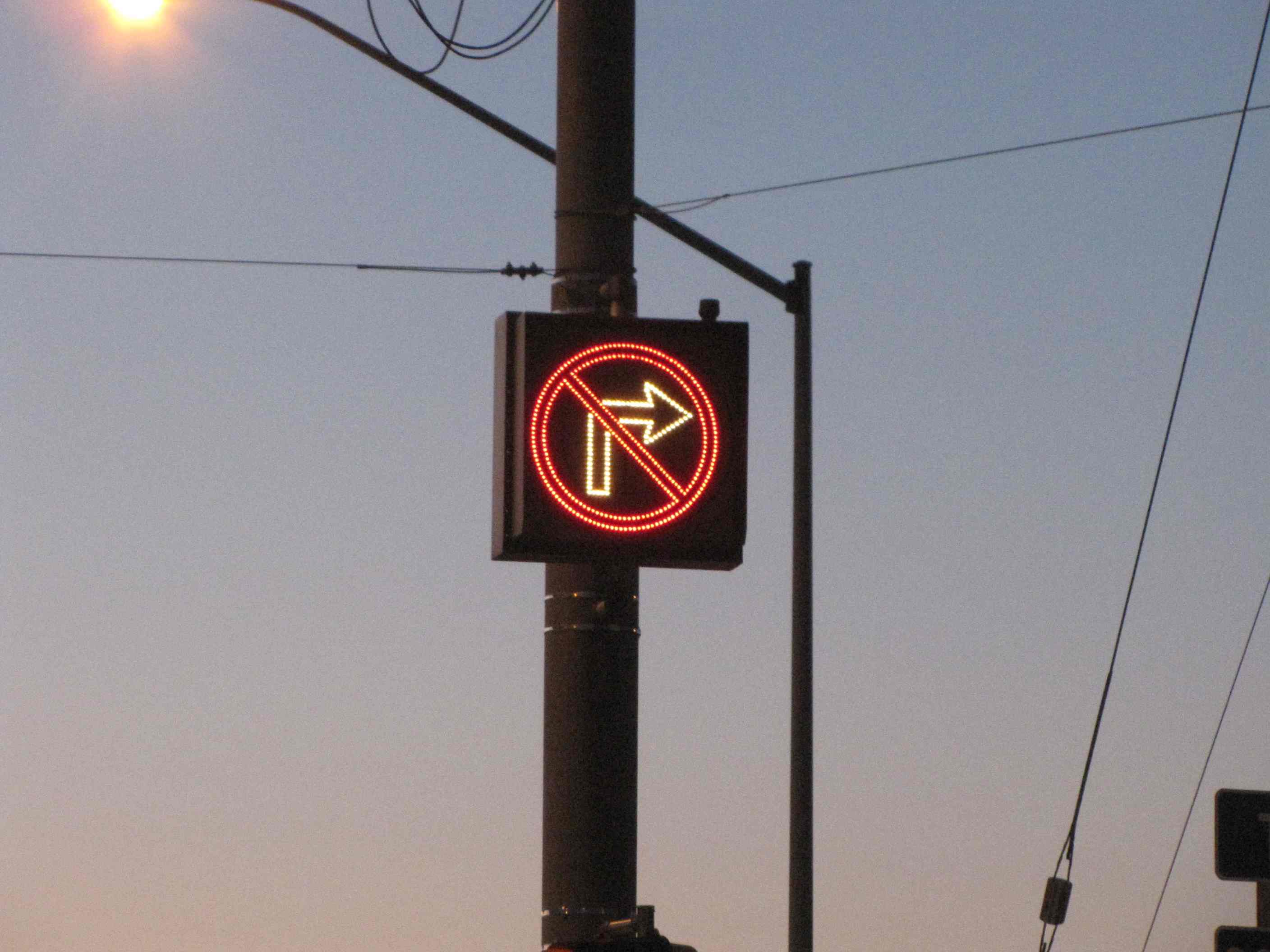 No right turn signs on WB Warren Rd when taking a right onto
Beaver Dam Road.
No right turn signs on WB Warren Rd when taking a right onto
Beaver Dam Road.
![]() Pennsy PL
Signals
Pennsy PL
Signals
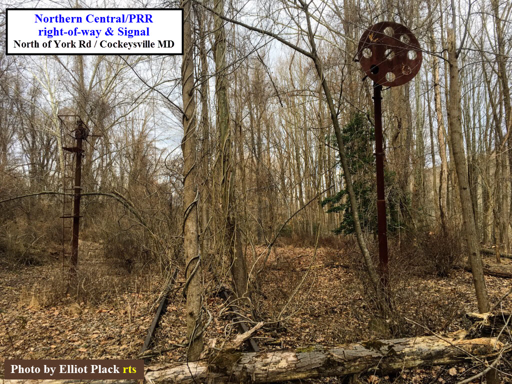
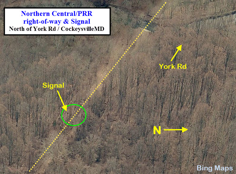
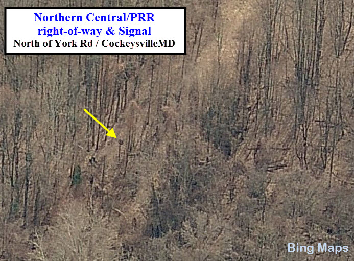
One of the few signals I saw on the line, it was maybe a
half mile down the track from where the former Cockeysville station used to
be. During the days when the station was around, the Pennsy and the
Penn Central also had a radio repeater station located here. I have a
picture of it, but it is a tiny little dot in the distance, because it was
taken with a Kodak Instamatic camera. I'm surprised it got any picture
of it at all considering it was totally dark! :-) The signal
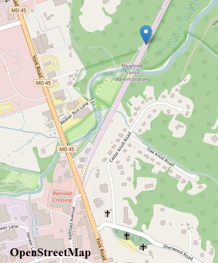
location is about 2500ft from York Rd, and if you want to visit it, the best
bet is to drive in on Beaver Run Lane and follow the stream around to the
right of way, and then go left, or north from where the bridge would have
been. I wonder if I can get my trailer in there? :-) :-) I'm
surprised that you can see the signal head in the Bing birds-eye view!
The picture at the bottom is what remains of one of the bridges along this
section of the track. The two photos are courtesy Elliot Plack.

![]() Pennsy PL Signal Bridge
Pennsy PL Signal Bridge
I have seen a picture of a SB train passing this location
with a signal bridge with 2 sets of Pennsy PL signals located on it, one for
both directions. I have no idea when the signal bridge was taken down,
but I would take an educated guess that it was shortly after the Pennsy
stopped running passenger service in 1959. Below is the best picture
of it I have found (so far) on the internet.
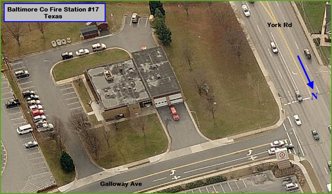
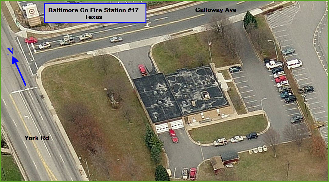
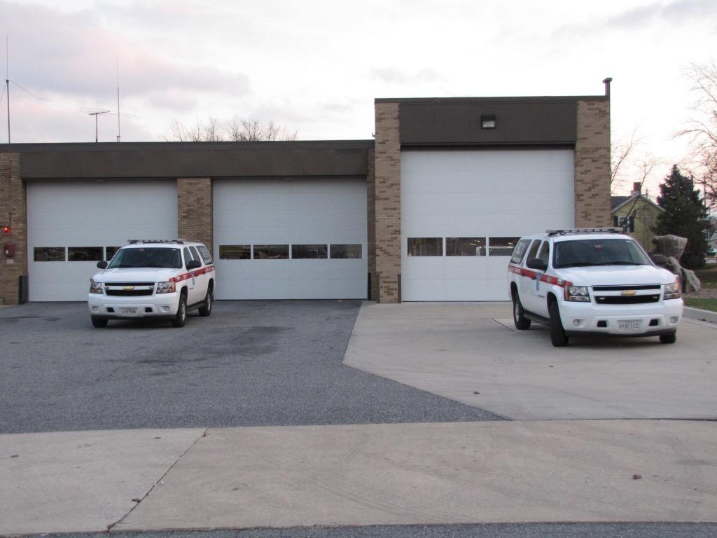
![]() Baltimore County Fire Station #17 - Texas
Baltimore County Fire Station #17 - Texas
GPS: 39.460536, -76.634168
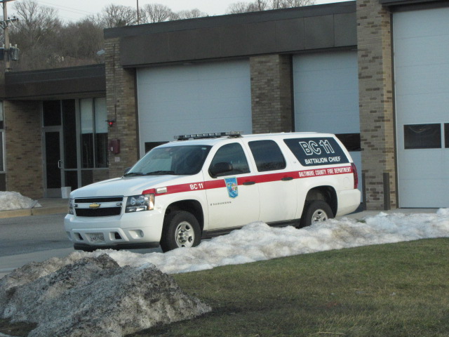
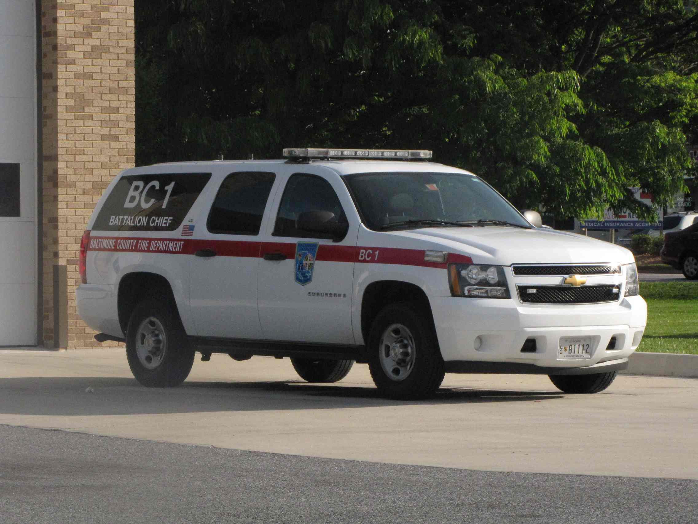 Battalion Chief 11 and 1 sitting outside the station.

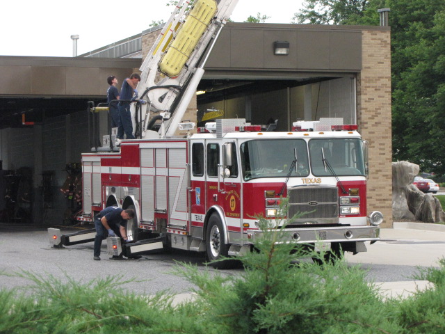
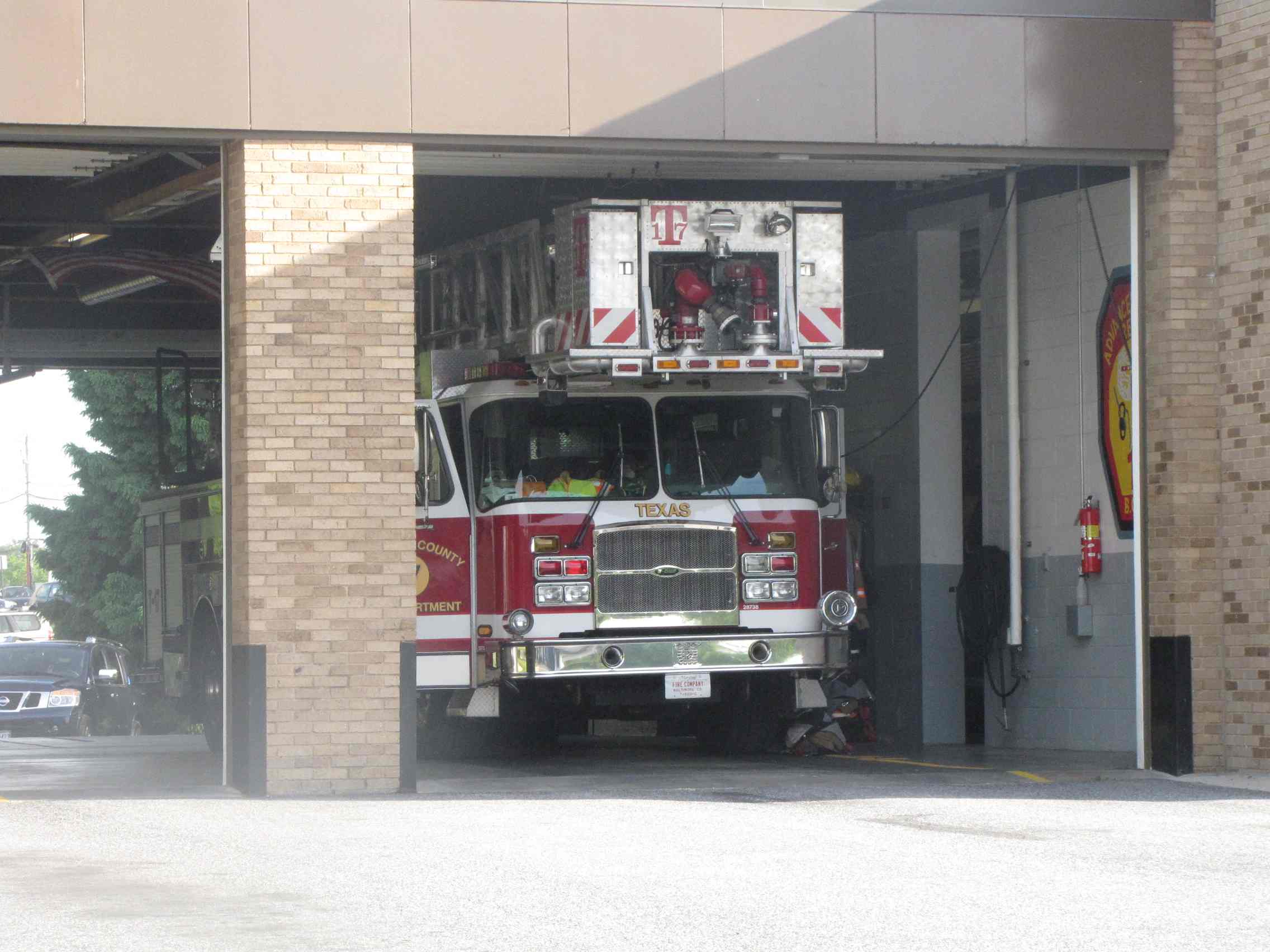
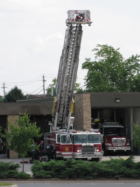
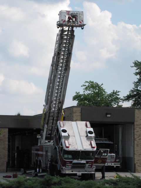 Truck #17.
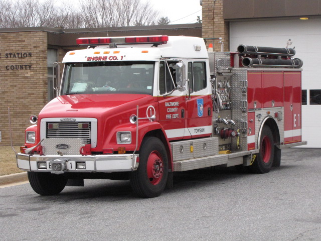
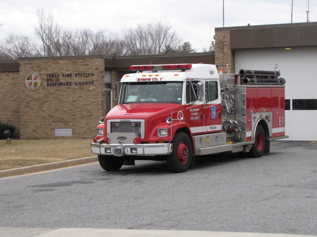 Engine #1 at Texas.


 Engine #17 caught on NB 83, and then at the station about 30
minutes later going down York Rd.
Engine #17 caught on NB 83, and then at the station about 30
minutes later going down York Rd.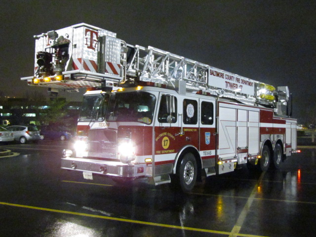
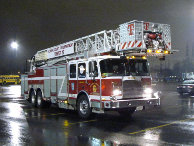
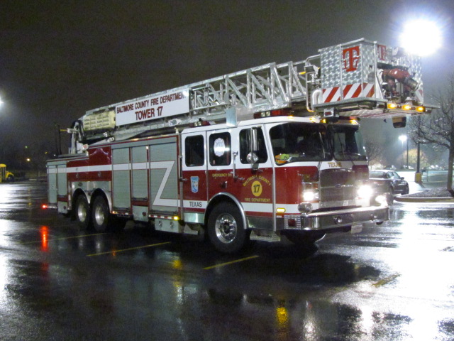
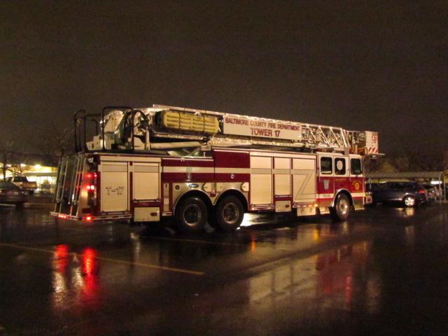 Tower 17 at Sam's Club on a rainy night in Texas (MD) on
11/30/2015.
Tower 17 at Sam's Club on a rainy night in Texas (MD) on
11/30/2015.
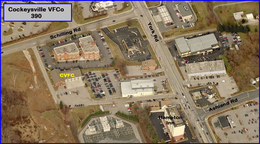
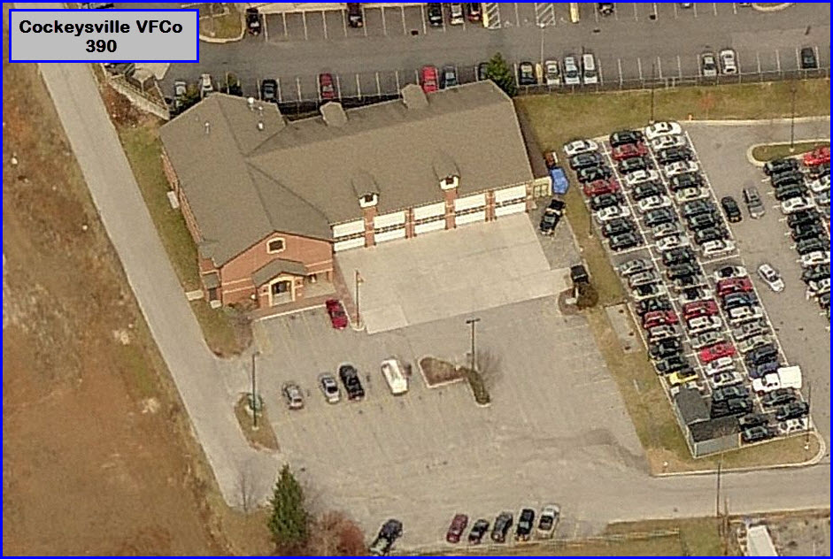
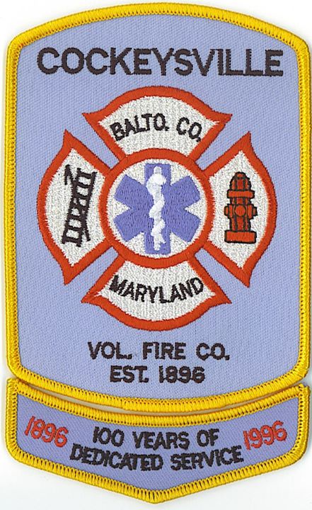
![]() Cockeysville Volunteer Fire Company
Cockeysville Volunteer Fire Company
GPS: 39.492298, -76.65065 http://cvfc39.org/
 Medic 395 in Timonium.
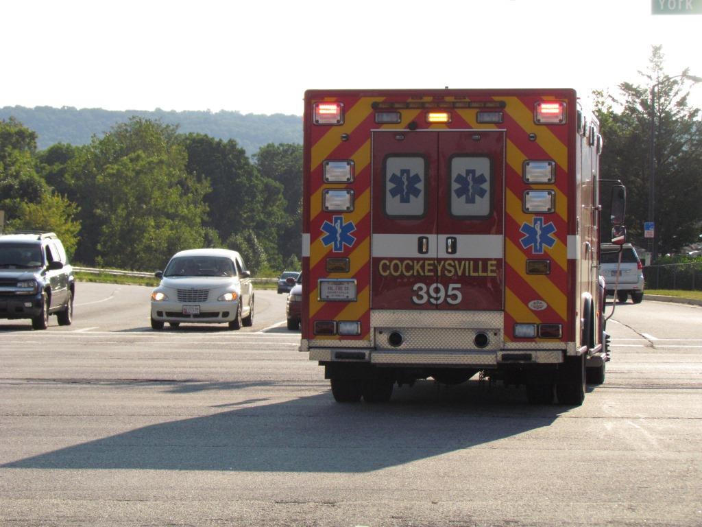
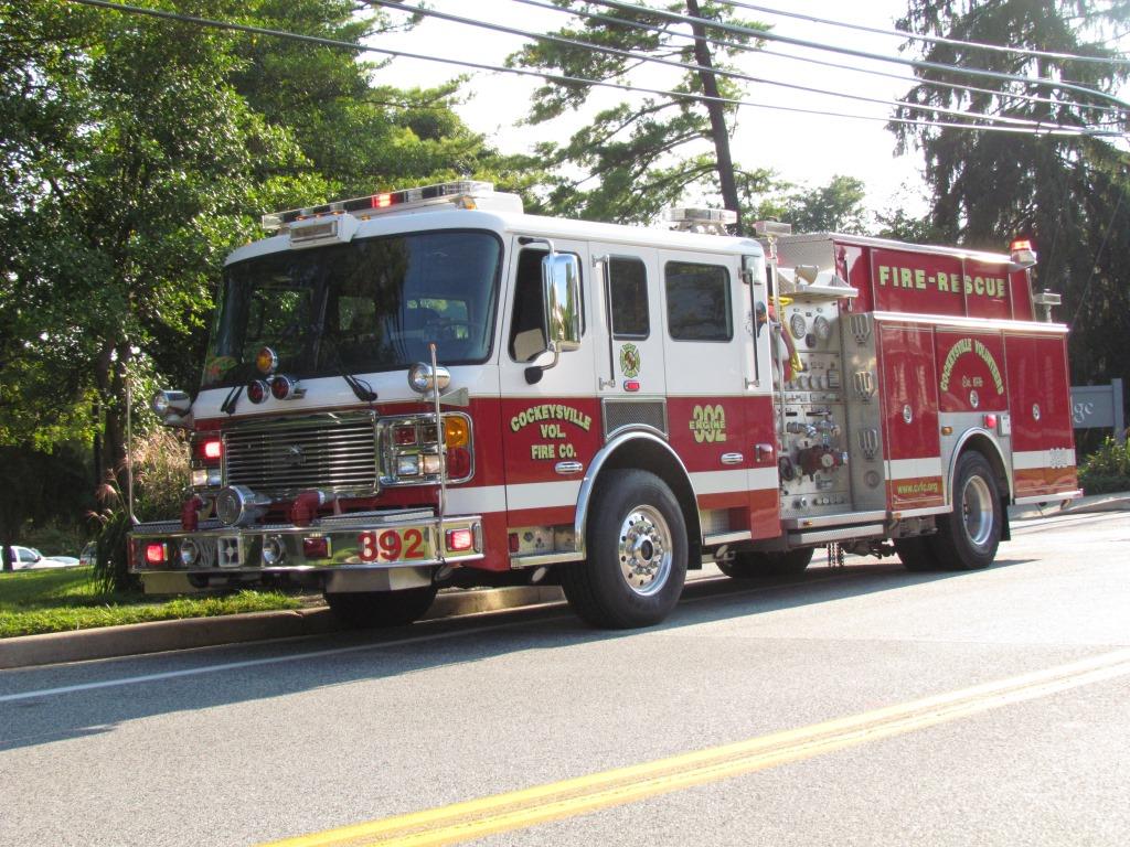 Medic 395 and engine 392 caught near the station off Schilling Road.
![]() Baltimore County Police Precinct 7 - Cockeysville
Baltimore County Police Precinct 7 - Cockeysville
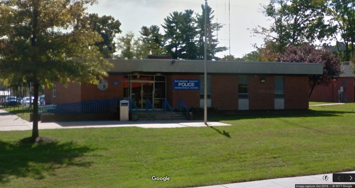
None so far.
New 09/04/2007,
02/17/2017
Last Modified:
09/04/2018