RAILFAN GUIDES of the U.S.
Todd's Railfan Guide to
CHESAPEAKE BEACH
and
ANNAPOLIS MD
and the Chesapeake Beach Rwy Museum
In General
Directions
Map
Sights
RAILFAN GUIDES HOME
RAILROAD SIGNALS HOME
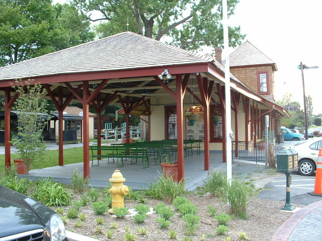
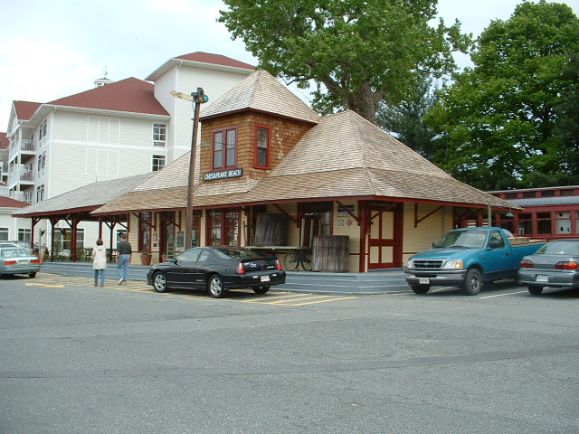
Admittedly, there is not much on the lower western shore of interest to the railfan. The Chesapeake Beach Rwy Museum is the one exception, and it is far out of the way to be a destination in and of itself.
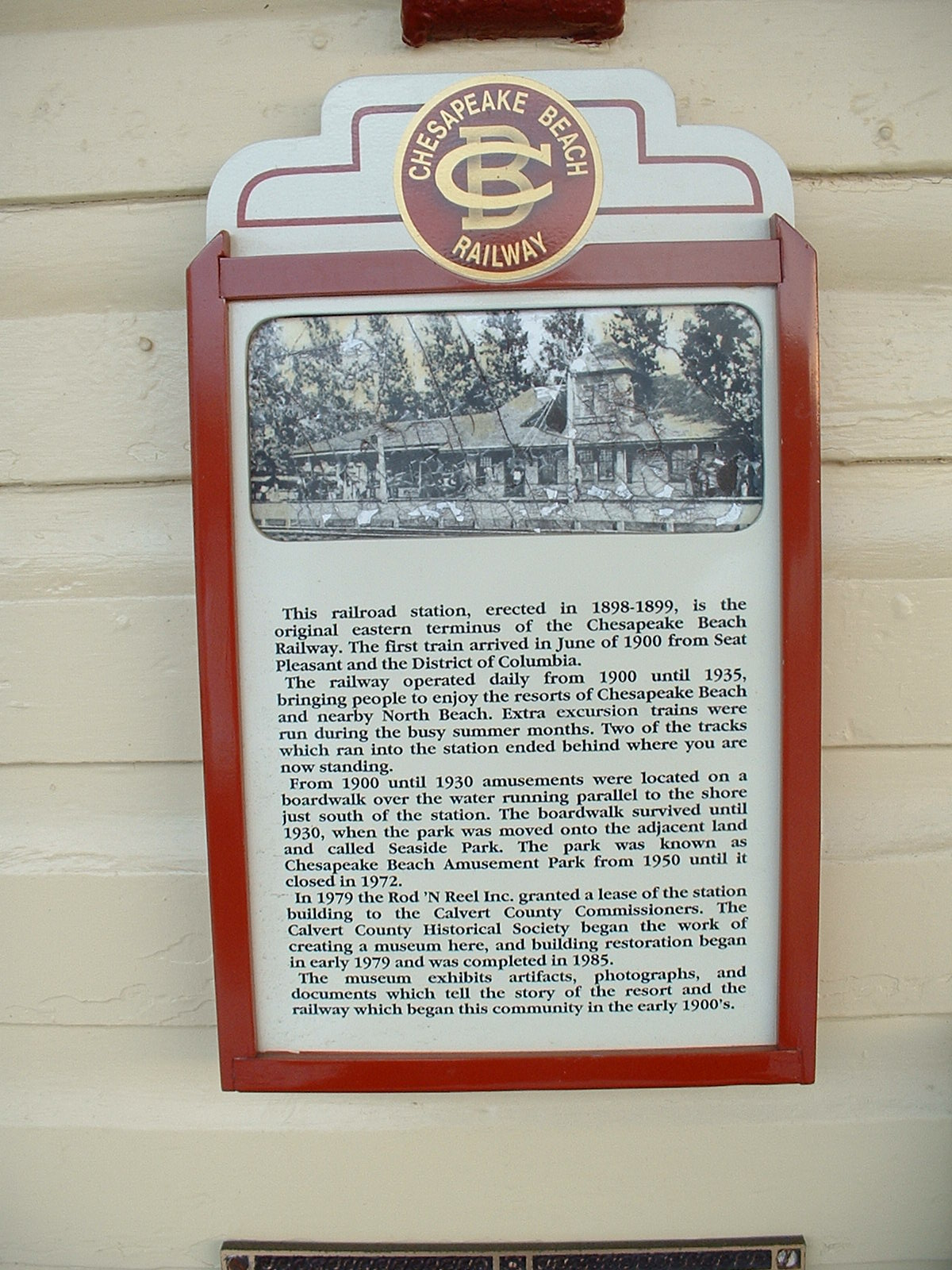
A Little History -- The Chesapeake Beach Railway was completed in 1899, but since the Belvedere Hotel in Chesapeake Beach was not yet completed, service to Chesapeake Beach did not start till June of the following year. The line never did well financially, and never paid the interest on the million dollar mortgage. The BCR took possession of the Southern Maryland RR's track in DC in 1898. The Southern Maryland went into bankruptcy, and when reorganized in 1901, emerged as the Washington, Potomac, and Chesapeake Rwy. In 1902, the new railroad sued the CBR saying that they still owned the track..... and they won. Highway construction around the area in 1921, and as a result, traffic on the CBR started a decline. They were hoping for an increase in traffic with a ferry going across the Chesapeake Bay, but the effort was blocked by an already establish ferry operator. In 1935, the railroad decided to replace train service with a bus, and the last train left Chesapeake Beach on April 15th, 1935.
What's Left? -- Part of the eastern end of Chesapeake Beach road uses the right-of-way. The base of the Lyons Creek trestle is still visible from the MD260 exit ramp off of MD4. The base of the swing bridge over the Patuxent River at Jug Bay Wetlands Sanctuary as well as the fill for the railroad bed on the both sides of the river. There are numerous other places where roads follow the ex right-of-way, Wikipedia has more info.
OK, onto the non-railroad stuff.....
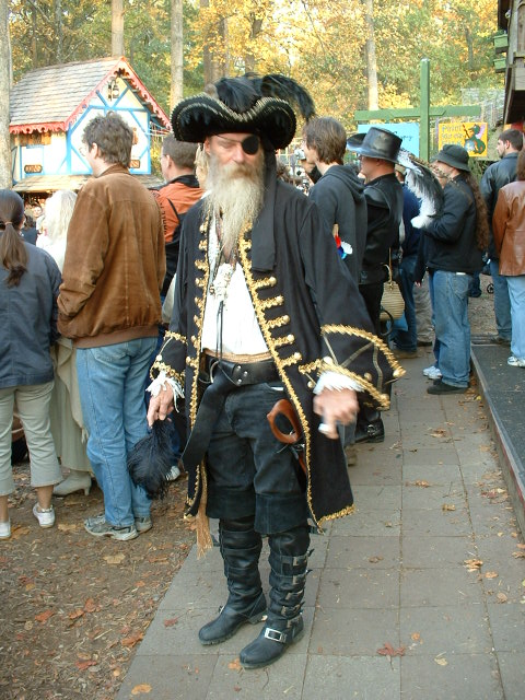
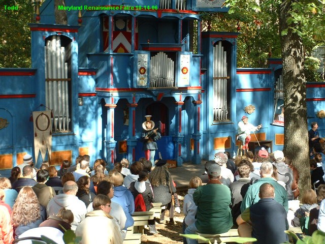
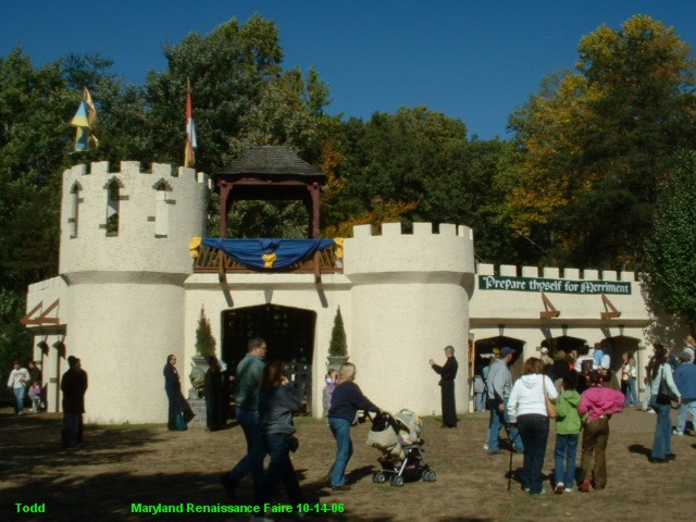
The Maryland Renaissance Festival is one of the larger and longest running Faires of it's kind. It runs from August thru the end of October. 2012 is their 36th season. Their website is here.
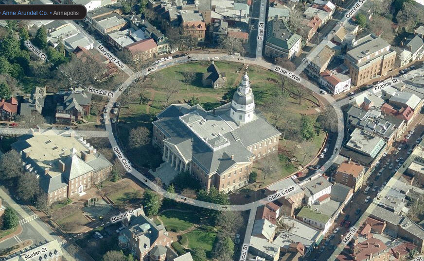
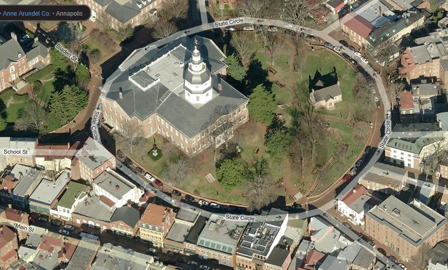
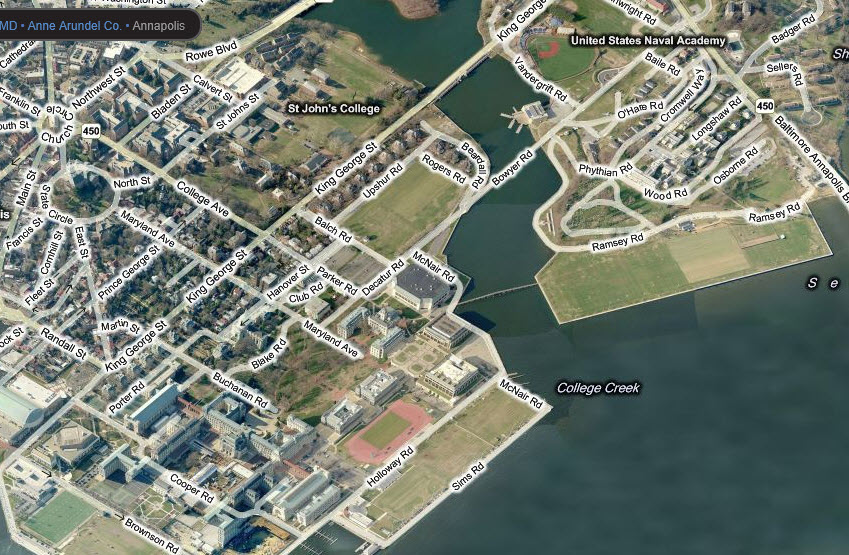
Annapolis, as you may know, is the capitol of Maryland, home to the Naval Academy, and is a popular summer destination for seafood lovers and boaters.
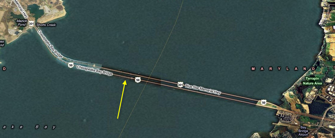
The Chesapeake Bay Bridge, a toll bridge, opened for
business on July 30th, 1952. It opened as a single bridge with two lanes
and cost $45 million to complete. The bridge had been in the works since
the late 20's, but something called the Great Depression got in it's way, as did
WWII. Construction finally got started in the late 40's. The second
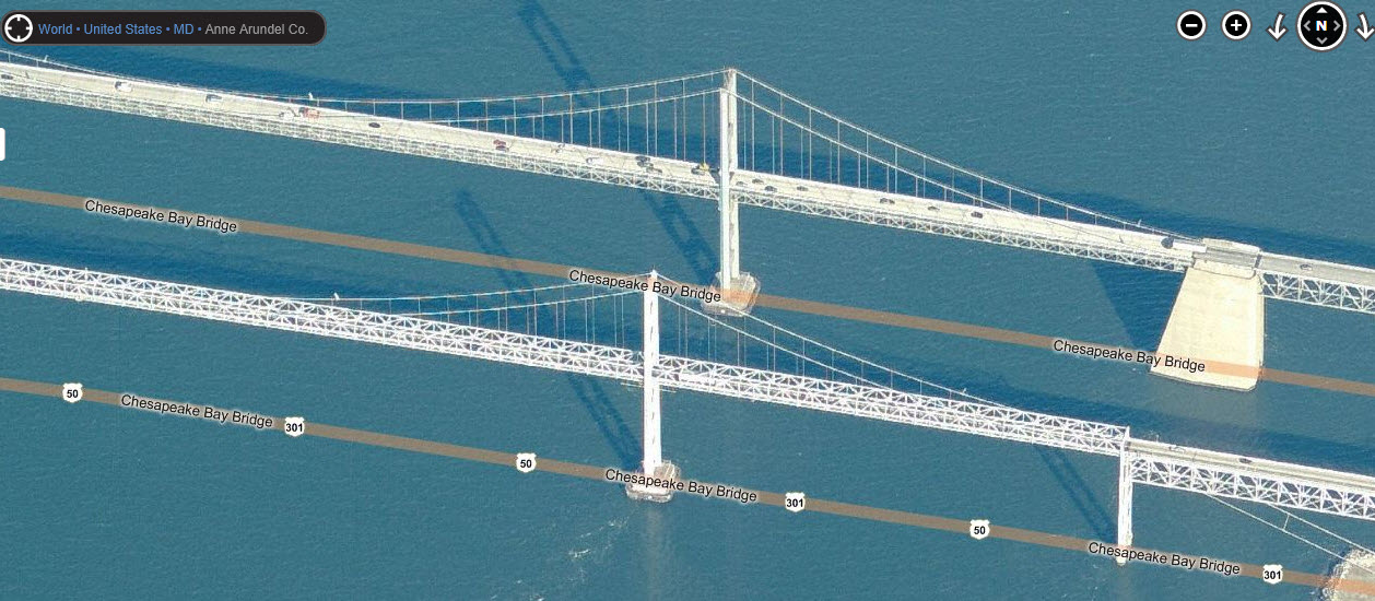
span, started in 1969, was completed in 1973, cost $148 million, and had three
lanes. Because of it's length, roughly 4 miles, it is always undergoing
painting.... when they get to the end, they start over at the opposite end.
The bridge has it's own website at:
http://www.baybridge.com/
Please Note: Since the main focus of my two websites is railroad signals, the railfan guides are oriented towards the signal fan being able to locate them. For those of you into the modeling aspect of our hobby, my indexa page has a list of almost everything railroad oriented I can think of to provide you with at least a few pictures to help you detail your pike.
My RSUS philosophy: Pictures and maps are worth a
thousand words, especially for railfanning. Text descriptions only
get you so far, especially if you get lost or disoriented. Take
along good maps.... a GPS is OK to get somewhere, but maps are still
better if you get lost! I belong to AAA, which allows you to get
local maps for free when you visit the local branches. ADC puts
out a nice series of county maps for the Washington DC area, but their
state maps do not have the railroads on them. If you can find em,
I like the National Geographic map book of the U.S..... good, clear, and
concise graphics, and they do a really good job of showing you where
tourist type attractions are, although they too lack the railroads.
From Washington DC, head east on US50 and take the MD3/US301 exit going south. About 10 miles south, hang a left onto MD4. Then, look for the signs for MD260, Chesapeake Beach Rd. About 6 miles later after passing MD2, you'll make a slight left where Mt Harmony-Parks Rd joins in. Stay on this till you come to a "T" and hang a right, the museum will be on your left after about half a mile.
From Baltimore, head down I-97 and get off at exit 7, which is MD3/US301, and follow the map as above for DC.
From Annapolis or the eastern shore, look for the MD2 exit and head south on it till you get to MD260 and take a left.
On coming out of town, make sure you bear to the right when Mt Harmony-Parks Rd goes straight and Chesapeake Beach Road goes off to the right.
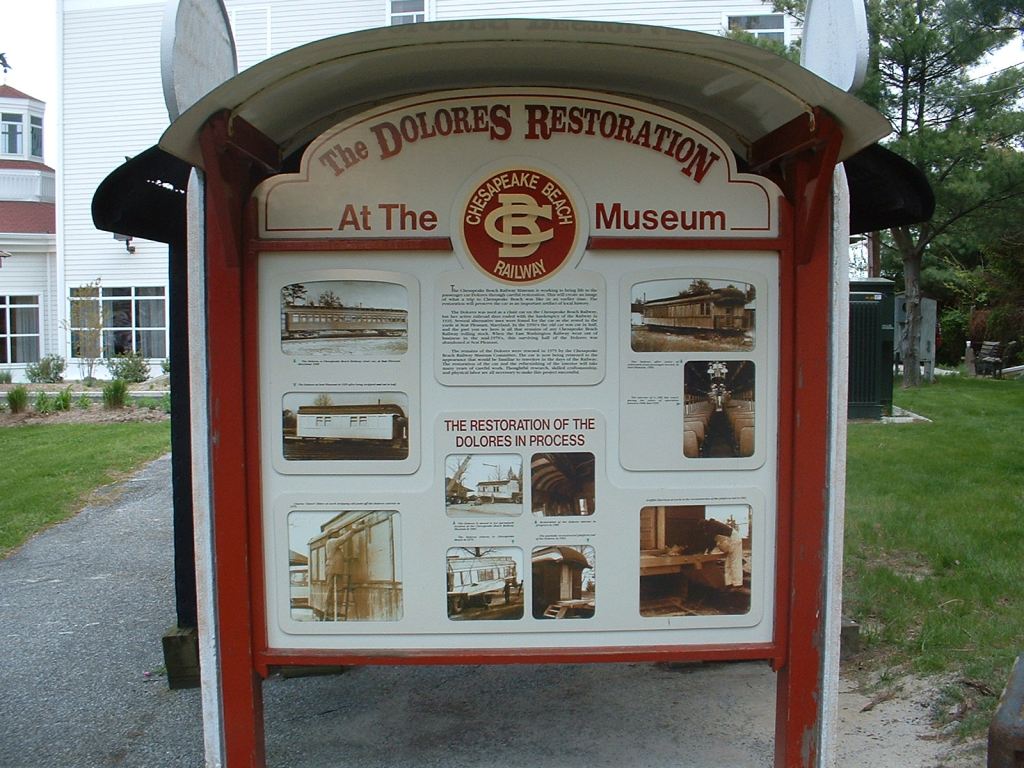
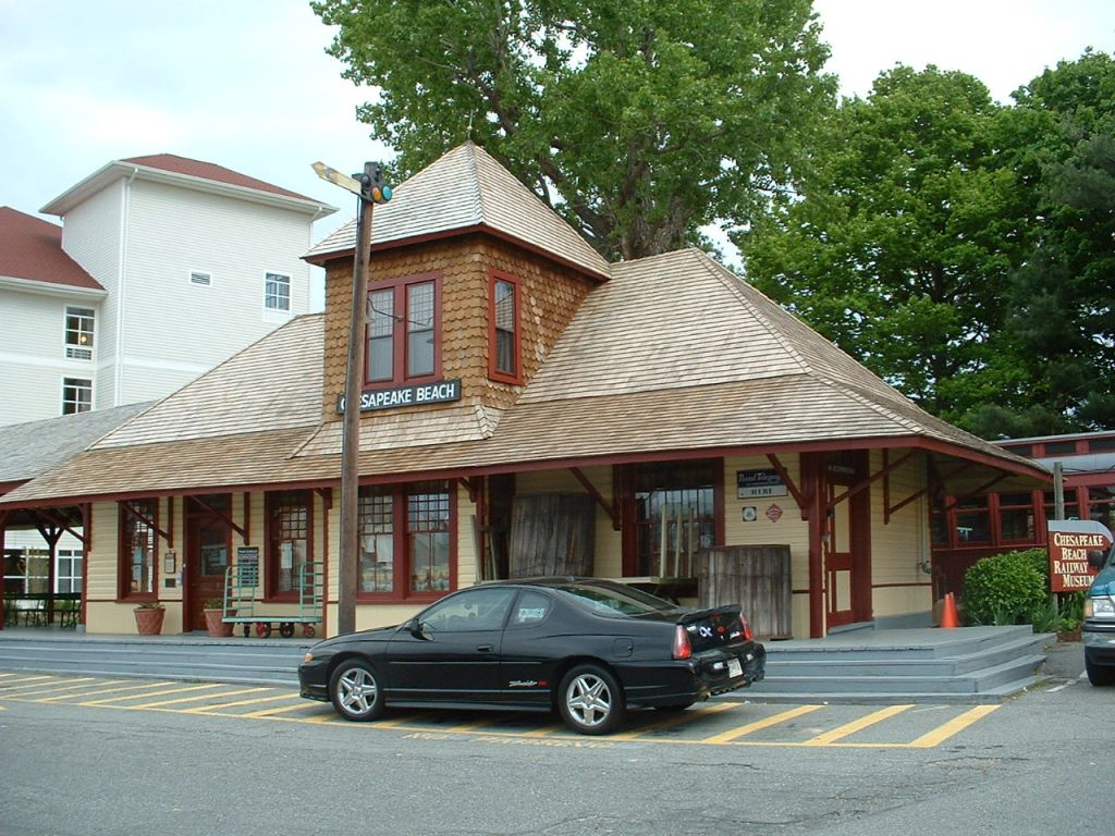
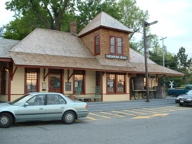
1 the Chesapeake Beach Railway Museum


2 the Maryland Renaissance Festival


3 the Maryland State Capitol Building
4 the Bay Bridge
I don't know why in their wide angle view they blank out the central suspended spans, because if you zoom in, they show them. The site for the bridge was picked because it is the narrow-most spot of the Bay this far south. The suspended spans would be at the dark spot the arrow is pointing to.
5 the Naval Academy
New 8-29-2008
Last Updated: 01/29/2014