
In General
Getting Here
Map
Sights
Bridges
Signals
Floobydust
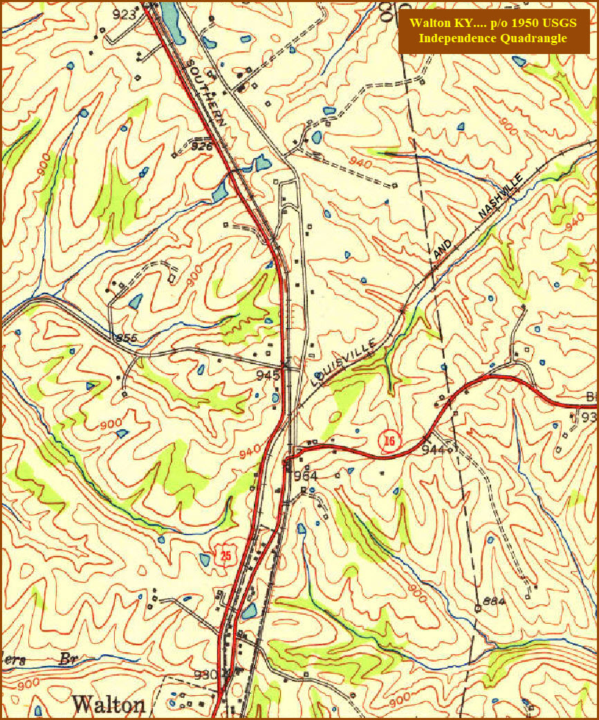
USGS Maps
RAILROAD SIGNALS HOME
Location / Name:
Walton KY, Boone County
What's Here:
NS and CSX
A couple of signals
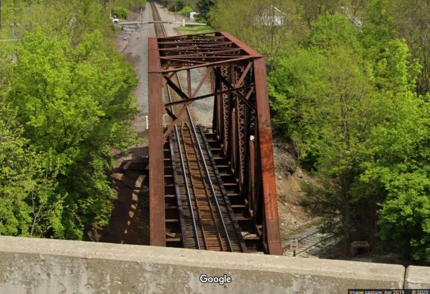
NS over CSX bridge
Data:
GPS Coordinates: as needed
Phone A/C: 859
ZIP: 41094
Access by train/transit:
None
The Scoop:
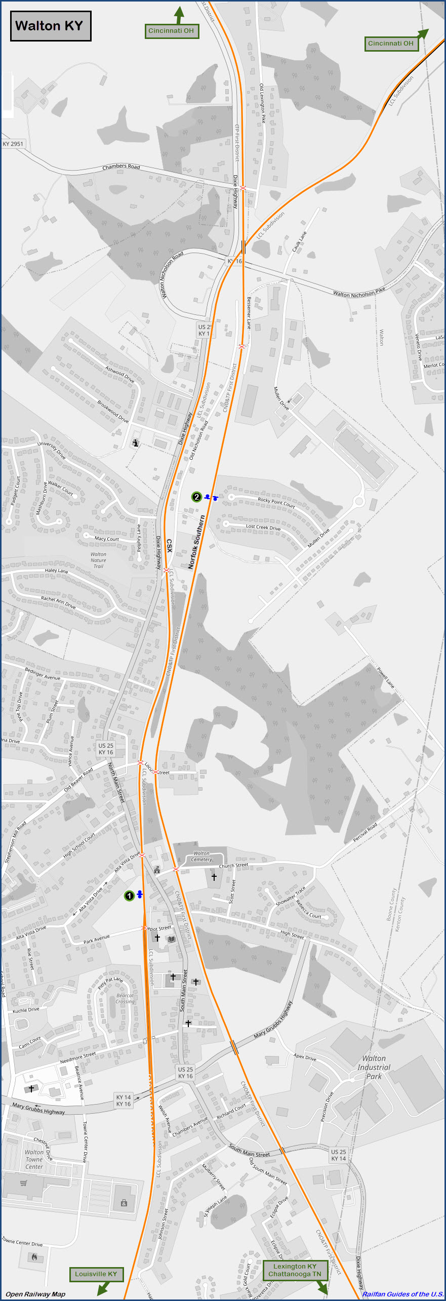
Walton KY has the two main railroads of the east running north-south thru town - CSX and Norfolk Southern.
It seems the big attraction for pictures is the NS bridge going over CSX on the north side of town, just under the Walton-Nicholson Road. As long as the local police don't give you a hard time for standing on the overpass (as some seem to take delight in chasing us off), you can manage to get some really nice photos as seen below.
There are a couple of signal locations in Walton, which should enhance the photo ops, especially for NB NS freights when they are near the gated grade crossing towards the end of Old Nicholson Rd and the SB signal is in the shot.
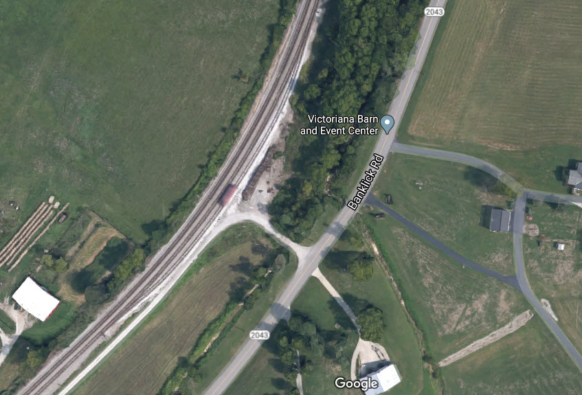
CSX has a two mile long siding about a half a mile north of the NS/CSX bridge. In the middle of the siding, is a smaller siding for loading and unloading. It is off of Banklick Road (KY 2043). I can't tell if there are signals for the third siding. Go about 1.5 east of the NS/CSX bridge on Walton-Nicholson Road, then take a left onto Banklick Rd.
Norfolk Southern goes to a double track mainline heading further south about 2 miles south of town. My signal location 3 is where this happens.
Acknowledgements:
Stephen R. Santangelo
Mark Chester Jr
J. E. Landrum
Joe Vittitoe
Denver Todd
Open Railway Map
Google Maps
Websites and other additional information sources of interest for the area:
https://www.nkyviews.com/boone/boone_walton_businesses_off_main.htm Vintage/historic pictures of Walton
https://www.trainorders.com/discussion/read.php?2,3903706
https://www.trainorders.com/discussion/read.php?2,2772472 lots of pix, 2012 era, only available if you're a train orders paid member
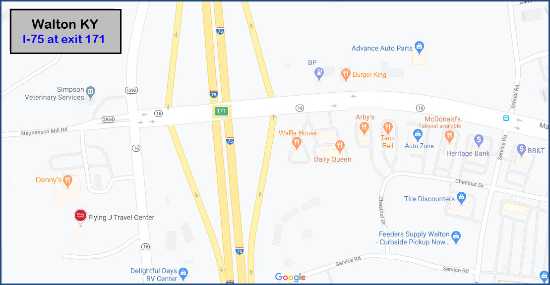
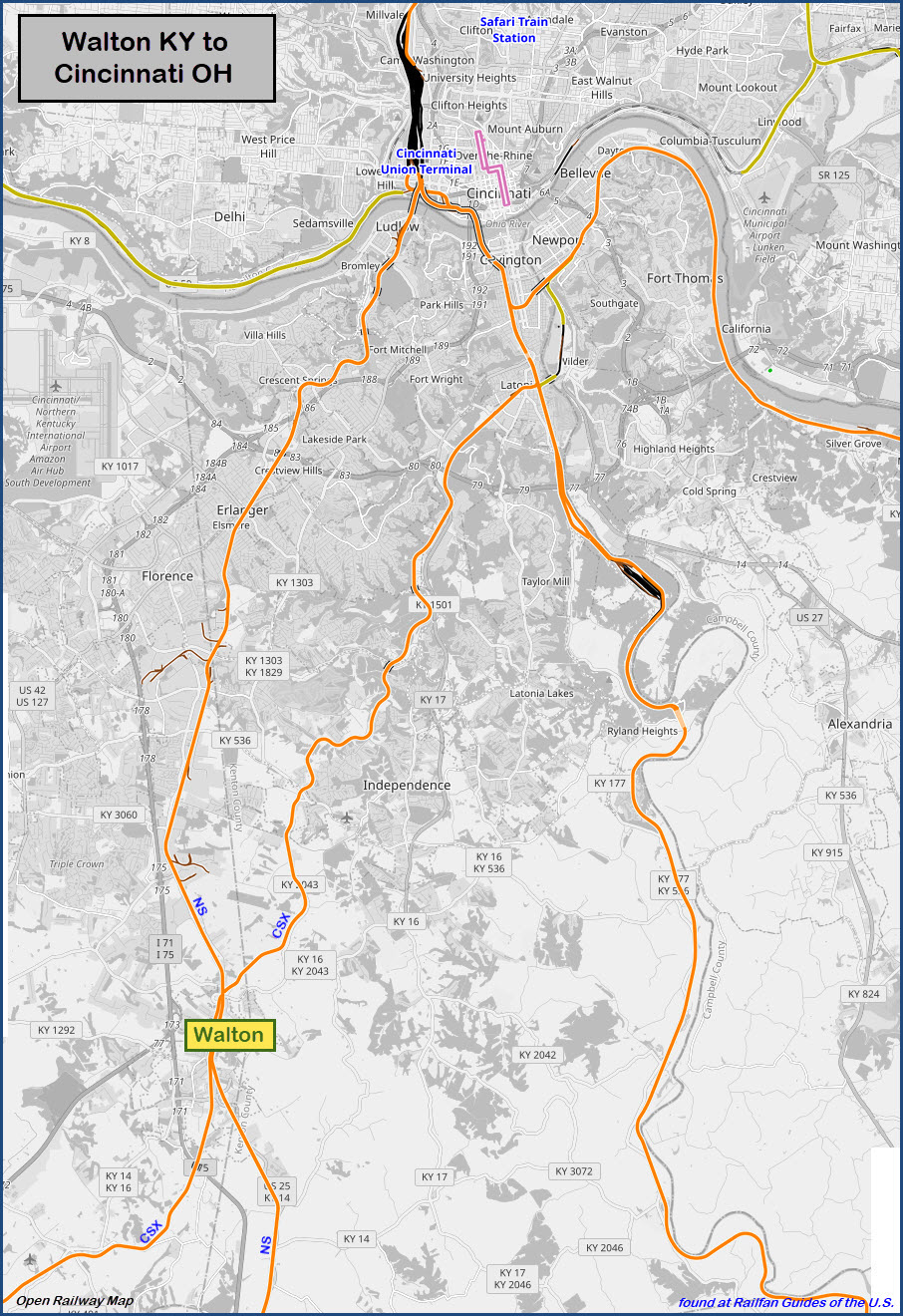
Getting here is pretty easy. It is roughly 16 miles south west of Cincinnati OH off I-75 (and I-71) exit 171.
The junction between I-75 and I-71 is nestled right in the middle of Walton, how convenient.
Exit 171 dumps you off on Stephenson Mill Road... go east, it turns into Mary Grubbs Hwy, and goes under both railroad R-O-W's.
In between the two tracks is Main St, which will take you to most of the photo spots of Walton.
At exit 171, you also have the standard assortment of gas stations, restaurants, and other services.
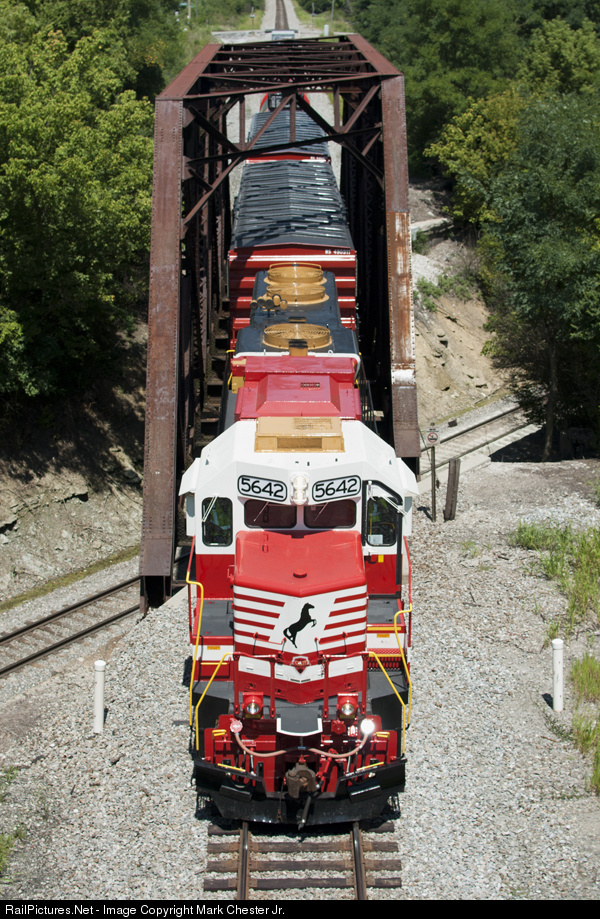
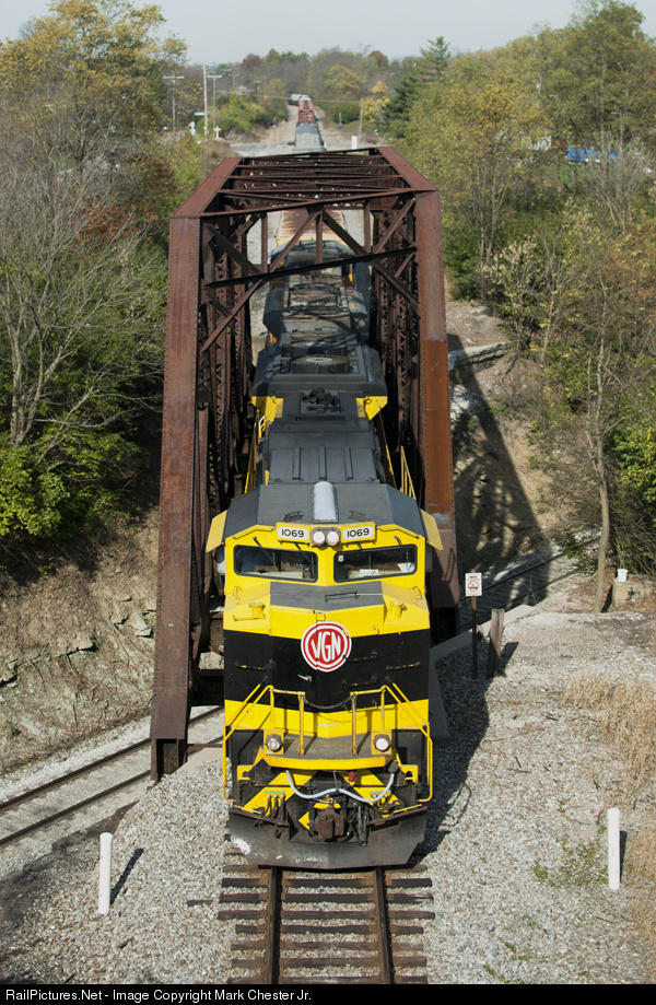
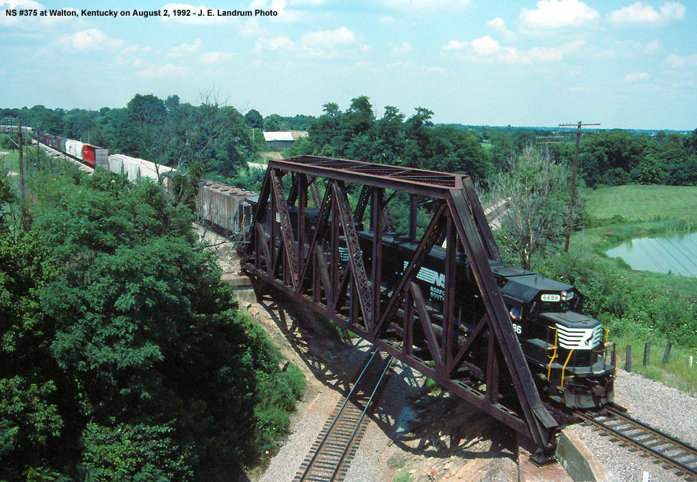
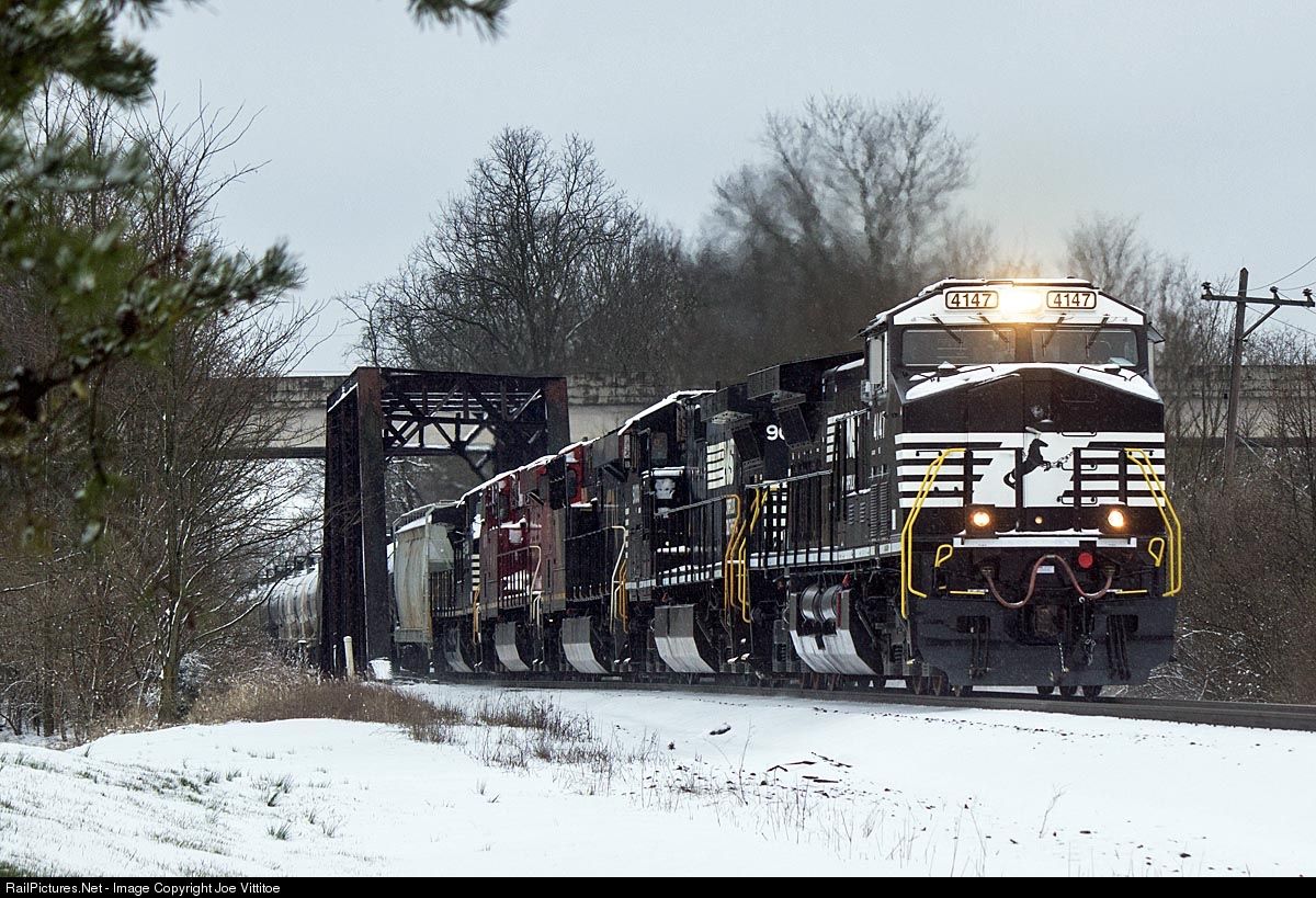
NS over CSX
The Norfolk Southern crosses over CSX in northern Walton, where Walton-Nicholson Road goes over both of them and the Dixie Highway.
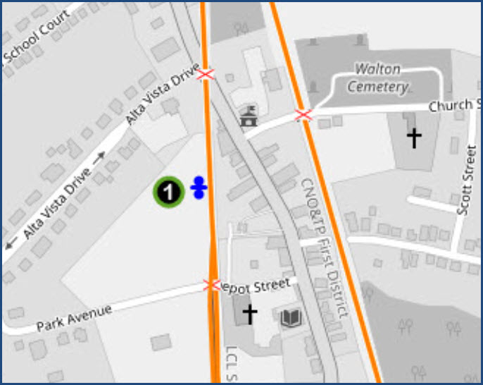
This signal is between Alta Vista Dr and Depot St, off of South Main Street, near where the tracks cross Main Street. This is a now typical standard signal installation for CSX appearing all over the system, as the signals at Lorton VA next to the AutoTrain facility looks the same.
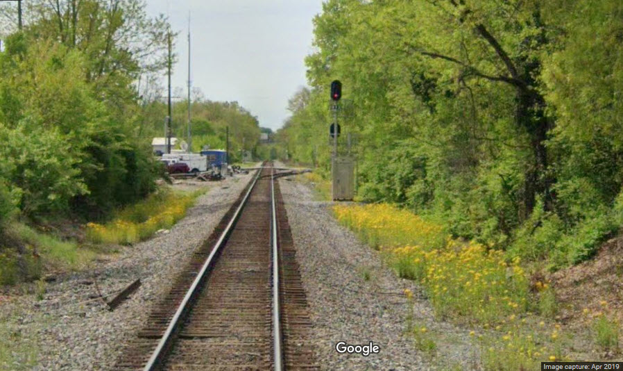
The signal we are looking at is a SB signal showing Approach Diverging, telling the engineer to prepare to take the diverging route after the next signal.
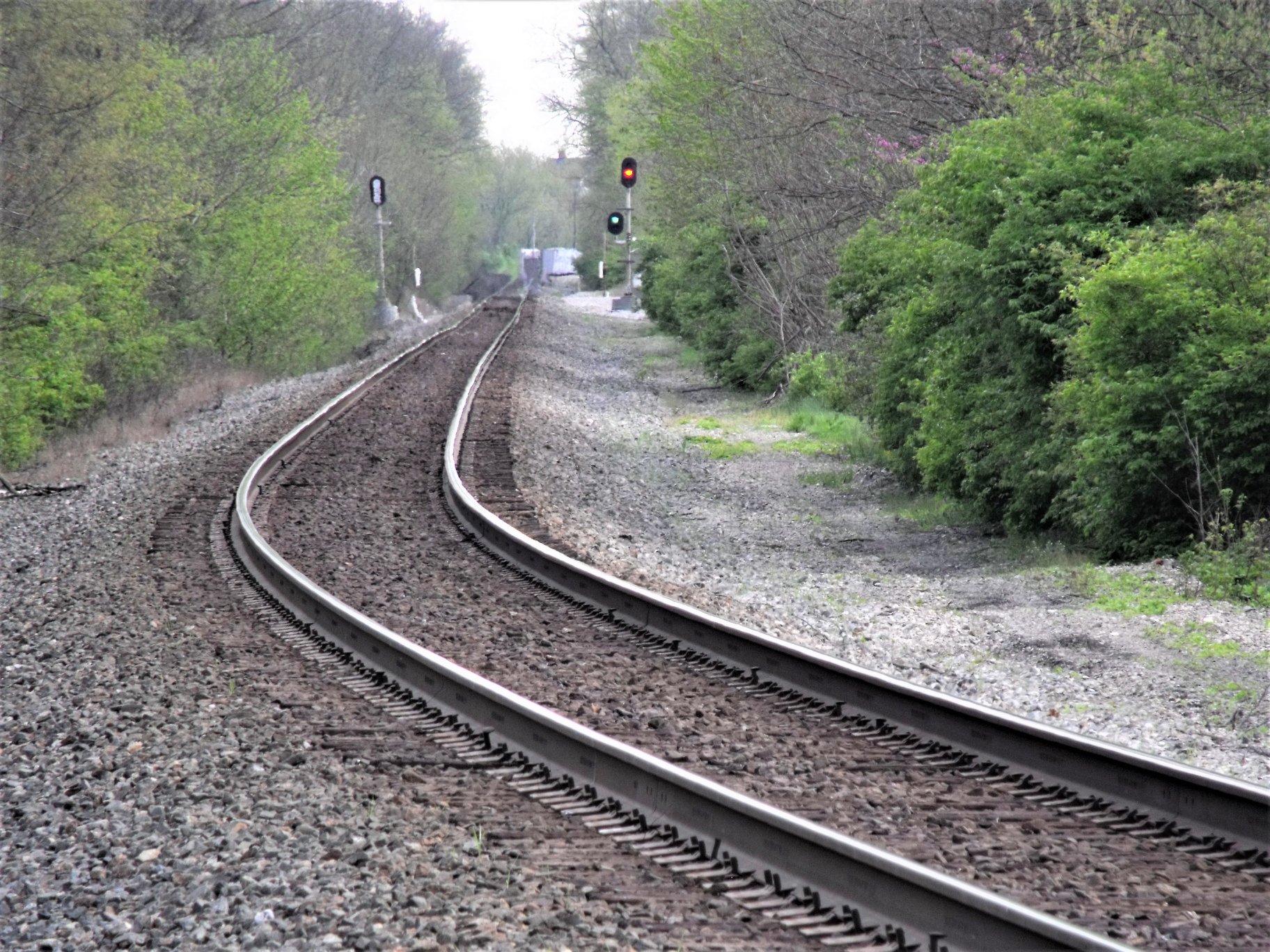 photo by Stephen Santangelo
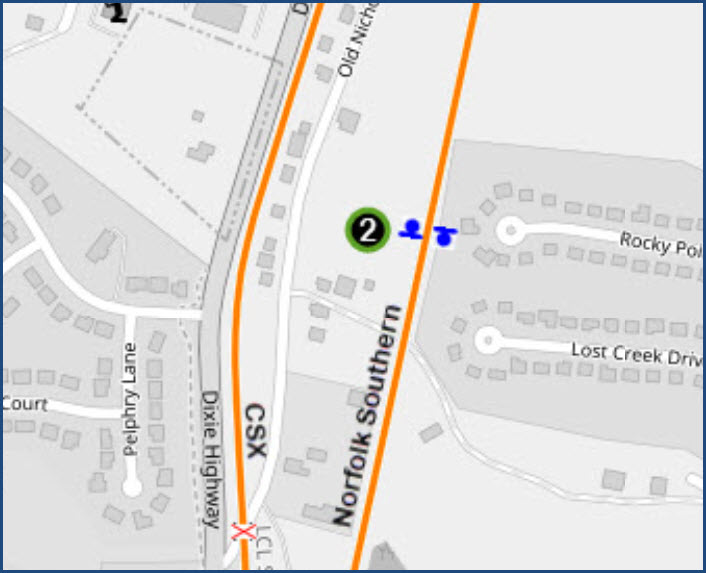
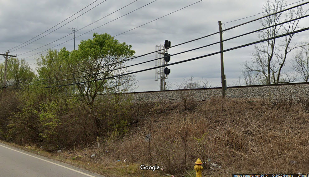
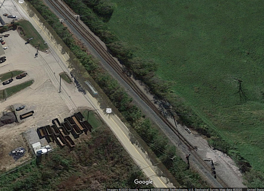
Two miles south of town is a fully signaled siding interlocking. Below is a picture of the SB signal at the entrance to the interlocking. In the aerial view, you can just make out the two NB signals.
Did U Know?
None for now......
Courtesy of the USGS: https://ngmdb.usgs.gov/topoview/
Disclaimers:
I love trains, and I love signals. I am not an expert. My webpages reflect what I find on the topic of the page. This is something I have fun with while trying to help others.
Please Note: Since the main focus of my two websites is railroad signals, the railfan guides are oriented towards the signal fan being able to locate them. For those of you into the modeling aspect of our hobby, my indexa page has a list of almost everything railroad oriented I can think of to provide you with at least a few pictures to help you detail your pike.
If this is a railfan page, every effort has been made to make sure that the information contained on this map and in this railfan guide is correct. Once in a while, an error may creep in :-)
My philosophy: Pictures and maps are worth a thousand words, especially for railfanning. Text descriptions only get you so far, especially if you get lost or disoriented. Take along good maps.... a GPS is OK to get somewhere, but maps are still better if you get lost! I belong to AAA, which allows you to get local maps for free when you visit the local branches. ADC puts out a nice series of county maps for the Washington DC area, but their state maps do not have the railroads on them. If you can find em, I like the National Geographic map book of the U.S..... good, clear, and concise graphics, and they do a really good job of showing you where tourist type attractions are, although they too lack the railroads. Other notes about specific areas will show up on that page if known.
Aerial shots were taken from either Google or Bing Maps as noted. Screen captures are made with Snagit, a Techsmith product... a great tool if you have never used it!
By the way, floobydust is a term I picked up 30-40 years ago from a National Semiconductor data book, and means miscellaneous and/or other stuff.
Pictures and additional information is always needed if anyone feels inclined to take 'em, send 'em, and share 'em, or if you have something to add or correct.... credit is always given! Please be NICE!!! Contact info is here
Beware: If used as a source, ANYTHING from Wikipedia must be treated as being possibly being inaccurate, wrong, or not true.
RAILFAN GUIDES HOME
RAILROAD SIGNALS HOME
NEW APR19/2020, MAY07/2023
Last Modified 07-May-2023