In General
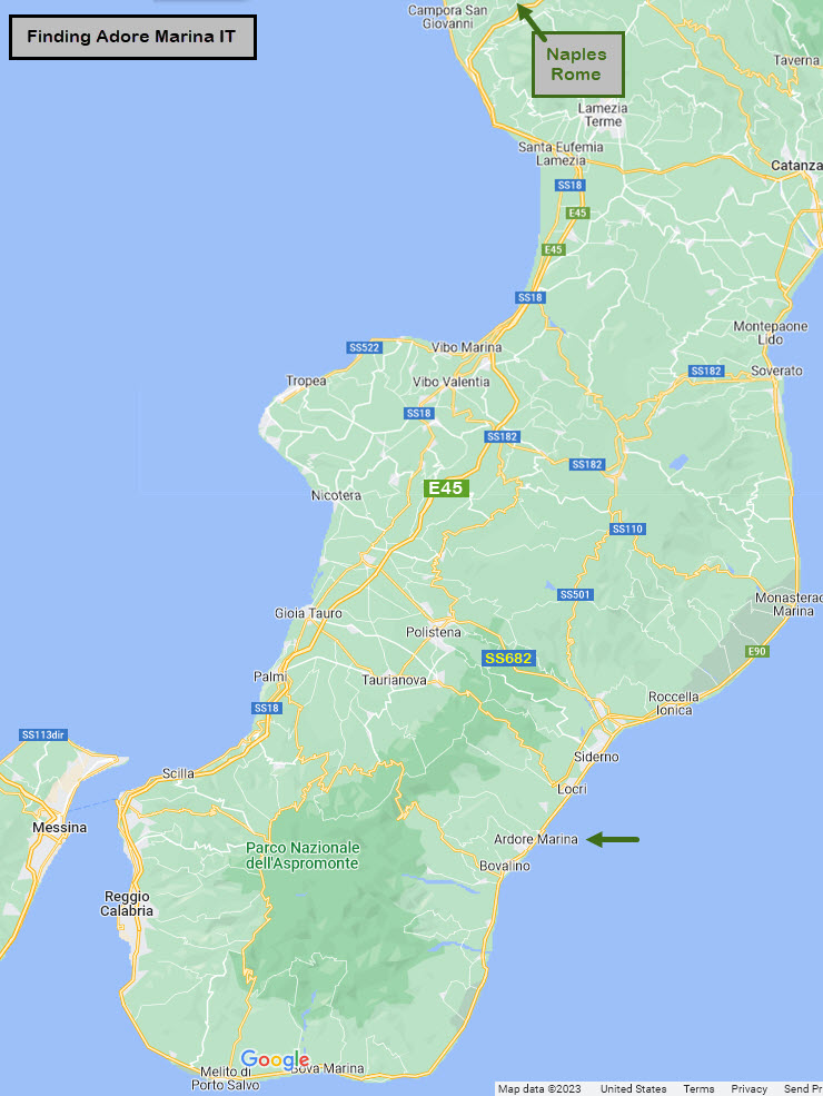
Getting Here
Map
Pictures
Bridges
Signals
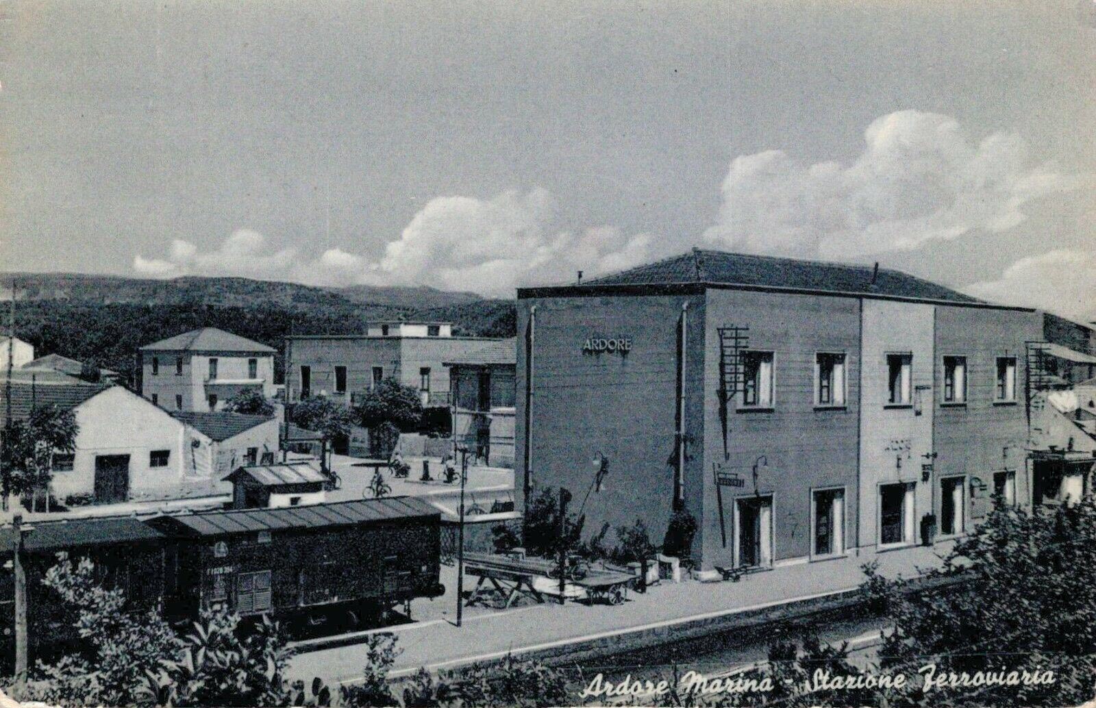
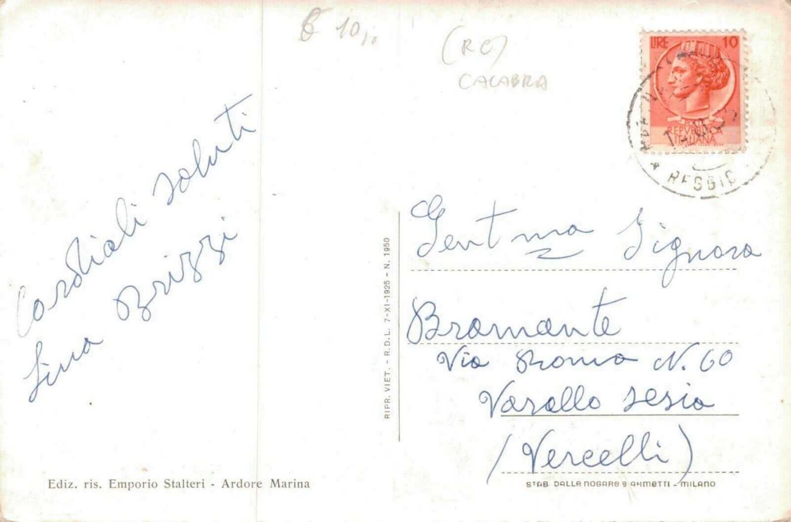
Postcards
Floobydust
RAILFAN GUIDES HOME
RAILROAD SIGNALS HOME
Location / Name:
Ardore, Calabria IT
What's Here:
Ardore Train Station
Signaled Interlocking for Siding Thru Station Area
Signals
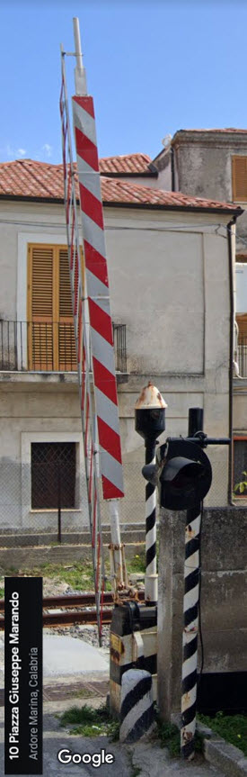
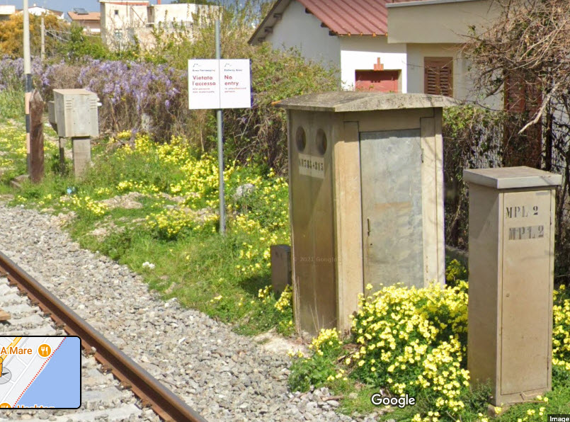
Interesting Grade Crossing Equipment
Data:
GPS Coordinates: as needed
Phone A/C: no clue....
ZIP: 89307?
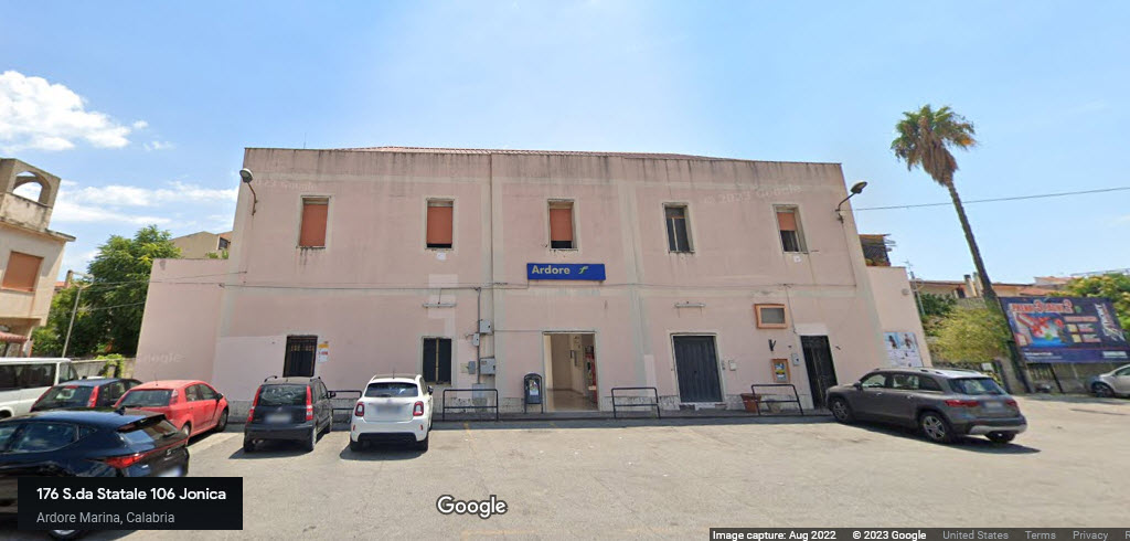
Access by train/transit:
RFI Train at the Ardore Station
Geography:
Flat
The Scoop:
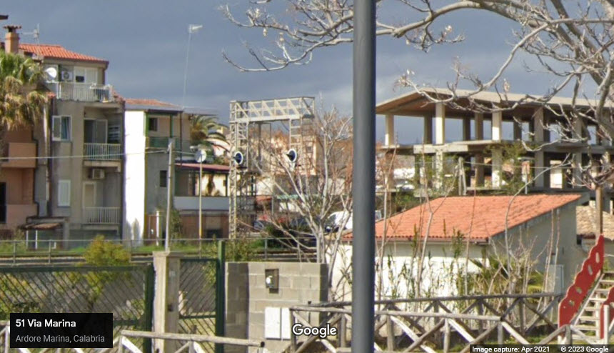
This page is another page that was sparked one solitary picture I came across while trolling Pinterest. The picture is down in the signal section. AND, fortunately for us, Google's streetview cameras came thru in 2021, and gives almost the same view. The signal at the northern end of the siding is not as accessible, so I do not have a picture of it, nor do I have a frontal view of this signal. Darn.
Ardore is on the Ferrovia Jonica line, that runs from Reggio Calabria on the west coast, around the southern coast, north thru Ardore to Catanzaro Lido (about 55mi/88km) north, and beyond. In both Catanzaro and Reggio Calbria there are substantial rail yards. Running north out of Reggio Calbria is another line called the Ferrovia Tirrenica Meridionale. Continuing north out of Cantanzaro another 181mi/292km, the Ferrovia Jonica line continues to Taranto IT.
Keep in mind that I know nothing of Italian railroads, so if someone wants to jump in here and lend a hand, you are most welcome! :-)
Riding this line looks like it provides some beautiful vistas of the Ionian Sea! If I was in Italy and had the time, I would book a trip.
The next station heading south is Bianco, about ~7.3 miles (11.7km), and heading north, it is Siderno, ~8.4mi (13.5km).
Since printed schedules seem to be almost non-existent these days, I can not find how many trains serve these coastal towns.
Meanwhile, back in Ardore, along the waterfront, there looks to be about six restaurants, some have good reviews, some have less than good reviews (for a variety of reasons), but all of the reviewers seem to like the food. The restaurants are located off a relatively new road called "via Marina", which is unfinished at both ends, and may have been put in just to serve the restaurants. It's only about 4,200ft long (1.29km), and a few lucky families have a seafront home on the non water side of the street.
From Wikipedia: RFI (Rete Ferroviaria Italiana, Italian Rail Network), is a state owned infrastructure manager which administers most of the Italian rail infrastructure. The total length of RFI active lines is 16,723 km (10,391 mi), of which 7,505 km (4,663 mi) are double tracks. Lines are divided into 3 categories: fundamental lines (fondamentali), which have high traffic and good infrastructure quality, comprise all the main lines between major cities throughout the country. Fundamental lines are 6,131 km (3,810 mi) long; complementary lines (complementari), which have less traffic and are responsible for connecting medium or small regional centers. Most of these lines are single track and some are not electrified; node lines (di nodo), which link complementary and fundamental lines near metropolitan areas for a total 936 km (582 mi). Most of the Italian network is electrified (11,921km (7,407mi)). Electric system is 3 kV DC on conventional lines and 25 kV AC on high-speed lines. The Italian rail network comprises also other minor regional lines controlled by other companies, such as Ferrovie Emilia Romagna and Ferrovie del Sud Est, for a total of about 3,000 km.
Trenitalia is the primary train operator in Italy. A subsidiary of Ferrovie dello Stato Italiane, itself partly owned by the Italian government, the company and partly from private investors group. It was established in 2000 following a European Union directive on the deregulation of rail transport.
If I can offer another bit of advice when touring Italy, and any other European country. Don't wear shorts and revealing or "crazy" t-shirts as we do in the states, it immediately sets you apart, and increases the chances of a thief heading your way. Wear what the locals wear. DON'T stick out! Keep anything that says USA back in your hotel room -or- better yet, at home!!! Don't use luggage tags that are overtly American, I learned this the hard way :-(.....
A little Background (from Google & Wikipedia):
Ardore is in the region (equivalent of an American state) of Calabria. I'm guessing that Ardore Marina is the part of Ardore that is near the water.... just a guess :-)
What is Calabria Italy known for? International Living Calabria is famed for its production of porcini mushrooms, bergamot orange, and olive oil. Calabria's cuisine is typically a mixture of pork, lamb, sausage, swordfish, sardines, cod, and eggplant, often preserved in olive oil.
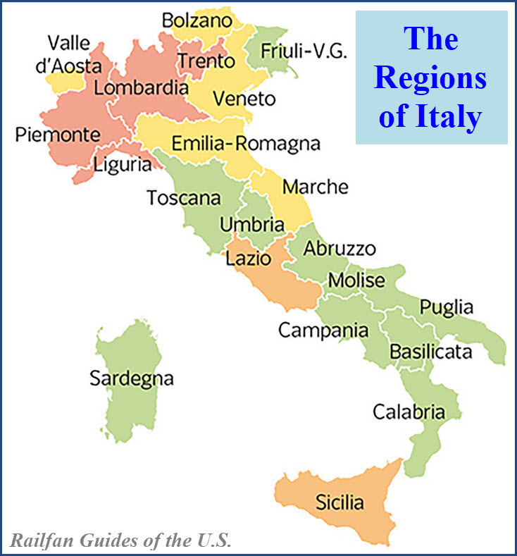
How many states are in Italy? 20. Italy is divided into 20 administrative regions (similar to our states here in the U.S.), which correspond generally with historical traditional regions, though not always with exactly the same boundaries. A better-known and more general way of dividing Italy is into four parts: the north, the centre, the south, and the islands.
Does Italy have provinces or states? The republic is divided into regions (regioni), provinces (province), and communes (comuni). There are 15 ordinary regions and an additional 5 to which special autonomy has been granted.
What states are inside Italy? Political Map of Italy - Nations Online Project Inside the Italian peninsula, there are two small political entities: the independent state of the Republic of San Marino, an enclave on the eastern side of the Apennine Mountains near the Adriatic coast; and Vatican City State, an enclave within the city of Rome and home to the Pope.
Is Calabria in Sicily or Italy? Calabria is in the southernmost part of mainland Italy and shares borders with the region of Basilicata as well as both the Tyrrhenian Sea and Ionian Sea. The island of Sicily is only two miles away across the Strait of Messina.
What language do they speak in Calabria Italy? The primary languages of Calabria are the Italian language as well as regional varieties of Extreme Southern Italian and Neapolitan languages, all collectively known as Calabrian (Italian: calabrese).
Is English spoken in Calabria Italy? You may need to brush up on some Italian as English is rarely spoken, though Tropea is one place they speak more English because there are a lot more tourists. But don't let the language barrier put you off – people in Calabria are incredibly nice and welcoming and you'll make yourself understood.
What airport do you fly into for Calabria Italy? The southern region of Italy has three airports which accommodate international flights to Calabria. These are Reggio Calabria Airport (REG) in the south-west, Lamezia Terme International Airport (SUF) in the central west, and Crotone-Sant'Anna Airport (CRV) in the central east.
Can you drink the water in Calabria Italy? The water is perfectly safe to drink all over Italy, and you can ask for tap water if you want. Oct 9, 2019
Does Calabria have good food? Calabria Food Guide: Typical Foods and 10 Traditional Dishes ... A culinary paradise for foodies, Calabria is the epitome of what the Italians call cucina povera, where modest ingredients are transformed into fabulous meals. Keep reading to learn all about the staple foods and the most famous and traditional Calabria dishes you have to look forward to! Jan 4, 2023
What city in Italy speaks the most English? After Rome, Milan and Florence are Anglophones' favourite city destinations. Milan is home to 4,500 native English speakers, with over half of them being originally from the UK, whereas Florence has 2,400 English-speaking residents. Mar 9, 2023
Is water at restaurants free in Italy? NO, you have to pay for water. (You can ask for “acqua dal rubinetto,” tap water, but it's often seen as a bit rude. Plus, those glasses of tap water will take ages to get refilled by your waiter, if they're refilled at all!).
Acknowledgements:
Sue McNevin
Roberto Galati
Giorgio Stagni
Google Maps
Open Railway Map
Wikipedia
Websites and other additional information sources of interest for the area:
https://en.wikipedia.org/wiki/Ardore
https://www.rfi.it/it/stazioni/ardore.html
https://en.wikipedia.org/wiki/Rail_transport_in_Italy
https://en.wikipedia.org/wiki/Catanzaro_railway_station
https://en.wikipedia.org/wiki/Ionian_Railway
https://www.walksofitaly.com/blog/food-and-wine/how-not-to-get-ripped-off-eating-in-italy
https://en.wikipedia.org/wiki/Calabria
Looks like there is no real easy way to get to Adore. It is one of MANY coastal towns along E90, which follows the railroad and the eastern coast of Italy.
SS682 looks like it may be one of the better routes to come from the western side of the country where you can pickup E45, which is a major N/S highway. Keep in mind that the majority of these highways, unlike the Interstates in the U.S., are toll roads.
Naples to SS682 via E45 is about 234mi, ~377km - a long ride!
Between E45 and E90, it is about 21mi or 37.4km, via SS682. Once on E90, going south to Adore Marina is about 10mi (16km).
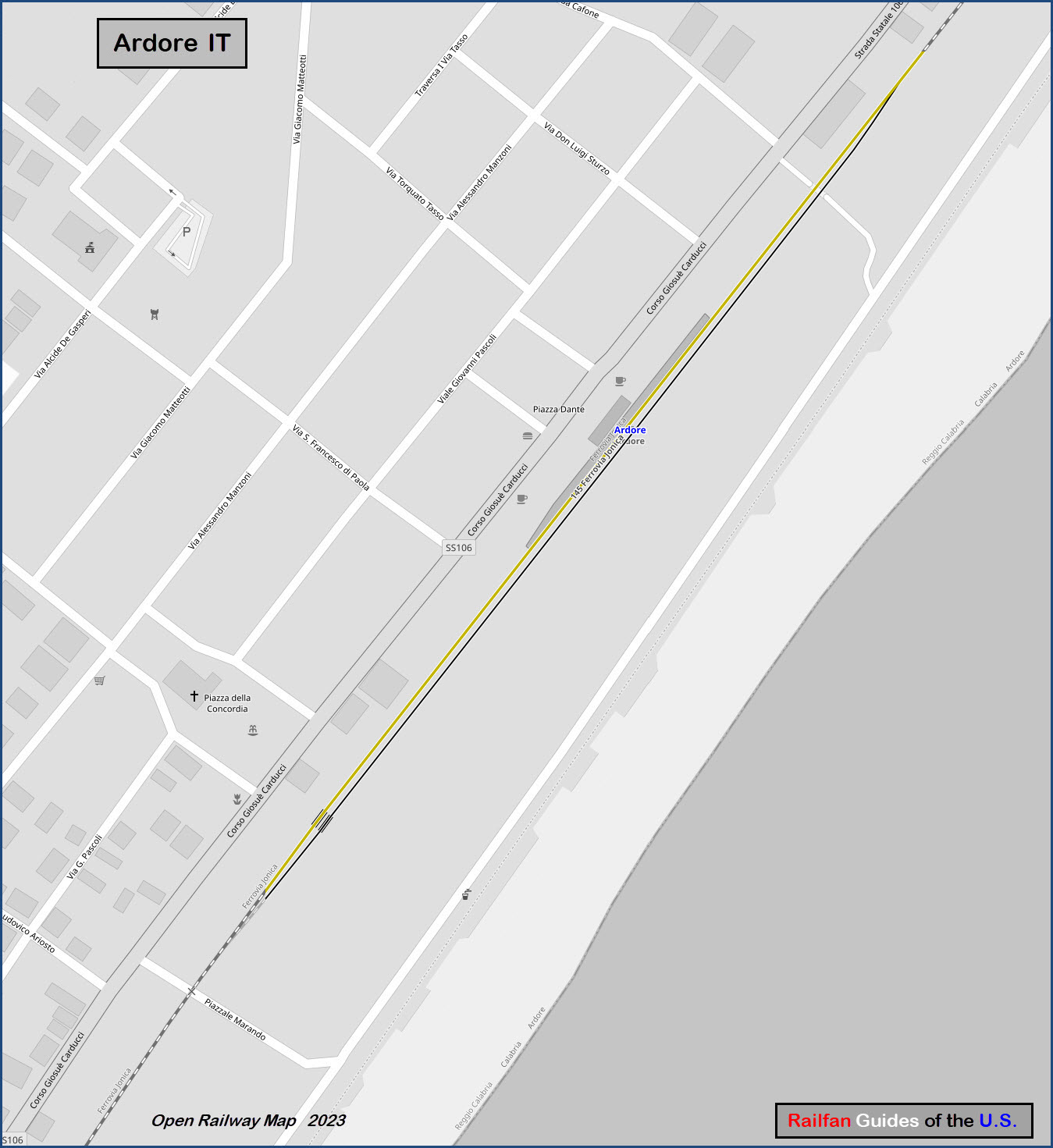
GPS Coordinates: 38.17577, 16.20723
Corso Giosuè Carducci 172 89037 Ardore Marina RC Italy, AKA, 89037 Ardore Marina, Metropolitan City of Reggio Calabria, Italy
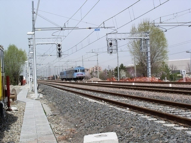
After much searching, this is one of the few pictures of a train not on a high speed rail line with an overhead line, that may be similar to the train that comes thru Adore.
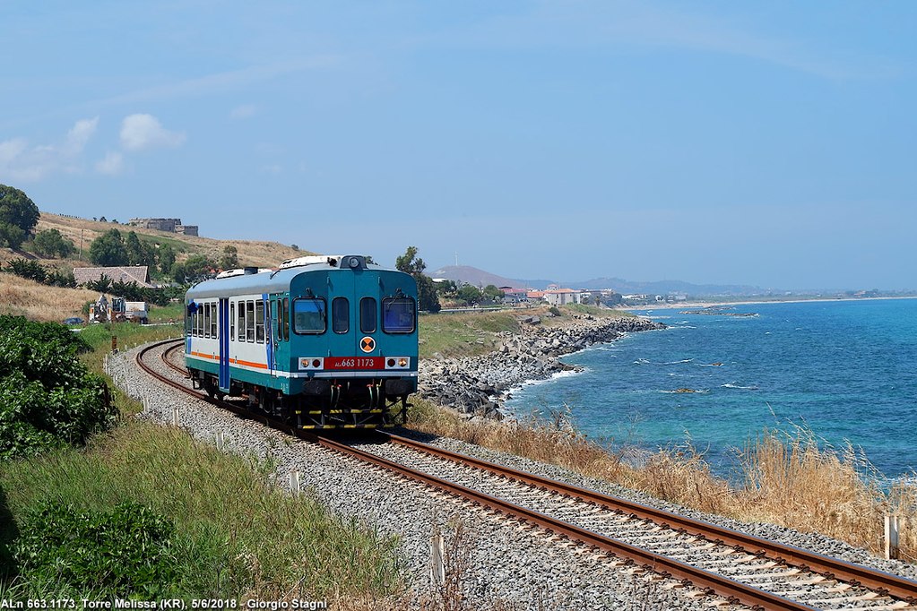 Giorgio Stagni
GPS Coordinates: 38.17361, 16.20525
A pedestrian underpass going under the double tracks.
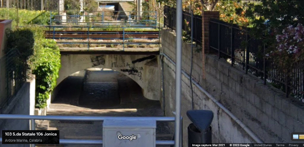
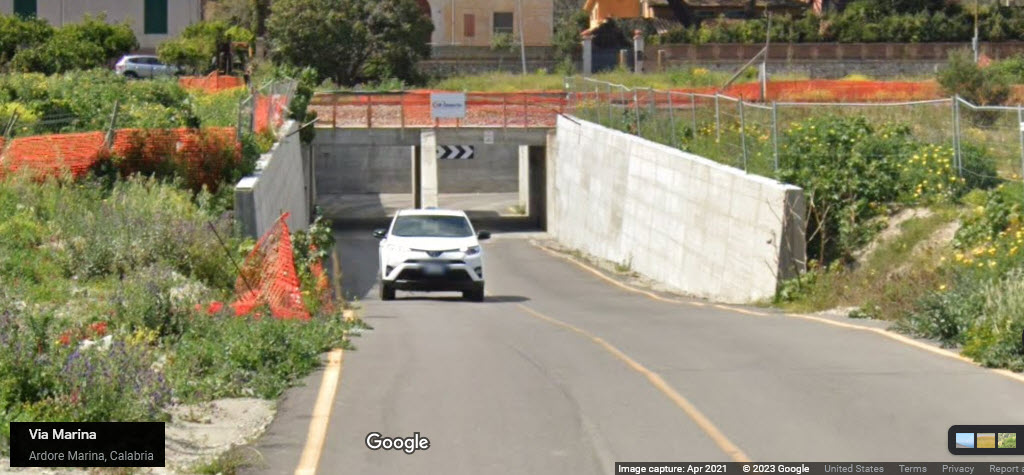
GPS Coordinates: 38.17093, 16.20283
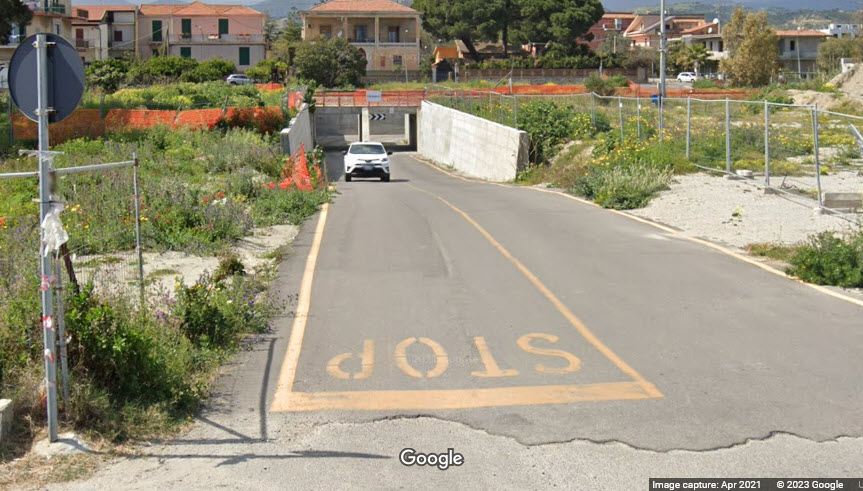
Un unnamed street going under the single track. I'm surprised they used the word "stop" at the intersection - that's not Italian, is it? :-)
GPS Coordinates: 38.17347, 16.20509
The signals seen in the picture below are for SB trains going back down to a single track.
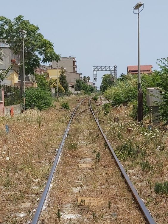 Posted by Sue McNevin on Pinterest
Below is a somewhat better picture of Italian signals, from the viewable side. Dunno why it is so hard to come up with decent pictures, of course, I'm probably not searching for the right thing since I was never taught Italian as a kid - my grandparents were from Bergamo and Savona.
GPS Coordinates: 38.17696, 16.20859
Likewise, on the northern end of the siding, we have a set of signals for NB trains going back into single track territory. Best I can do with Google Streetview, maybe someone can visit here and get better pictures? Do we have any local railfan of my website in Ardore?
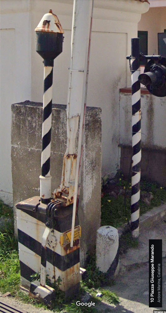
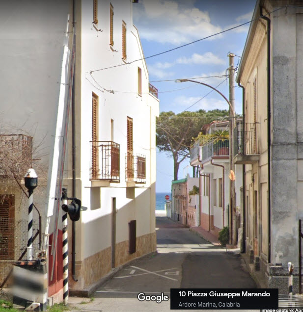
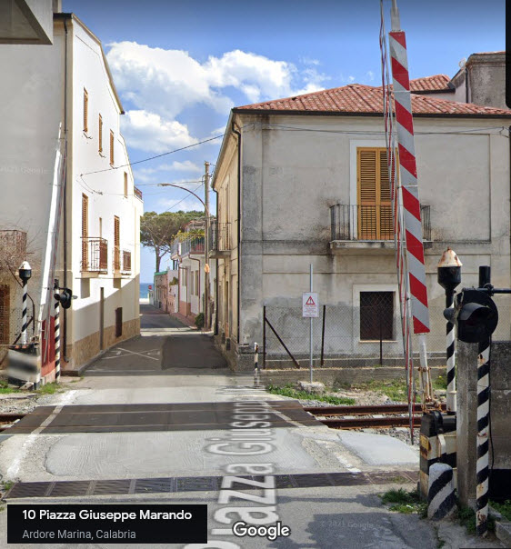
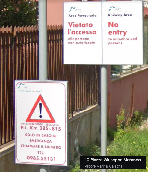
Grade crossing details at Piazza Giuseppe Marando
GPS Coordinates: 38.17268, 16.20430
I think I would have trouble getting my King Ranch down this street :-)
Disclaimers:
New format 10/26/23: Please check out my disclaimer page for my standard dribble and contact info here
RAILFAN GUIDES HOME
RAILROAD SIGNALS HOME
NEW 8/31/2023, SEP03/04/05/06/10/2023, SEP04/05/2024
Last Modified 05-Sep-2024