The city also has a long history of being a travel hub
for the region. In 1858 the Pittsburgh, Ft. Wayne, and Chicago Railroad
reached Valparaiso and connected the city directly to Chicago. By 1910 an
interurban railway had connected the city to Gary, Indiana. Today, while the
city no longer has a passenger train station, it is still very much a part
of the "Crossroads of America" due to its proximity to I-94, I-80, I-90, and
I-65.
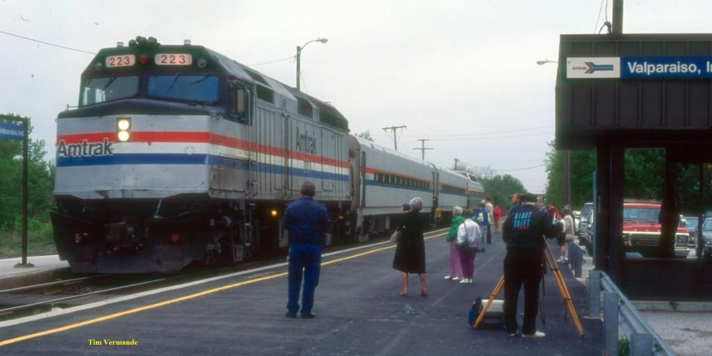
Until 1991 Valparaiso was the terminal of
Amtrak's
Calumet
commuter service. The links will take
you to Wikipedia pages on those railroads.
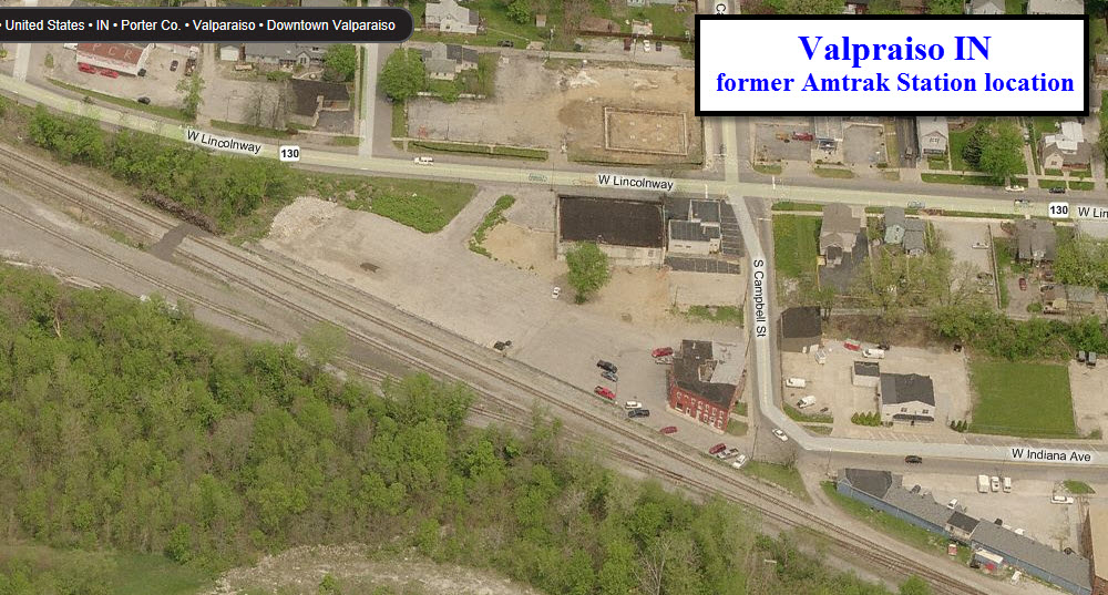
The Amtrak station in town is no longer in use.
The closest station looks to be in Michigan City.
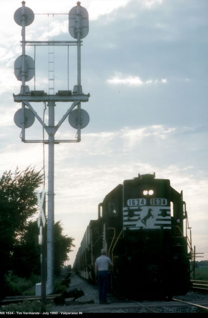
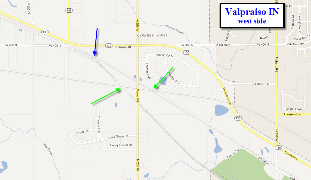
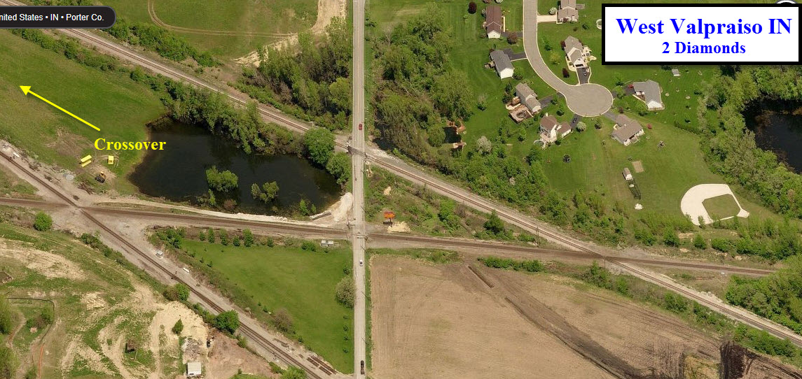
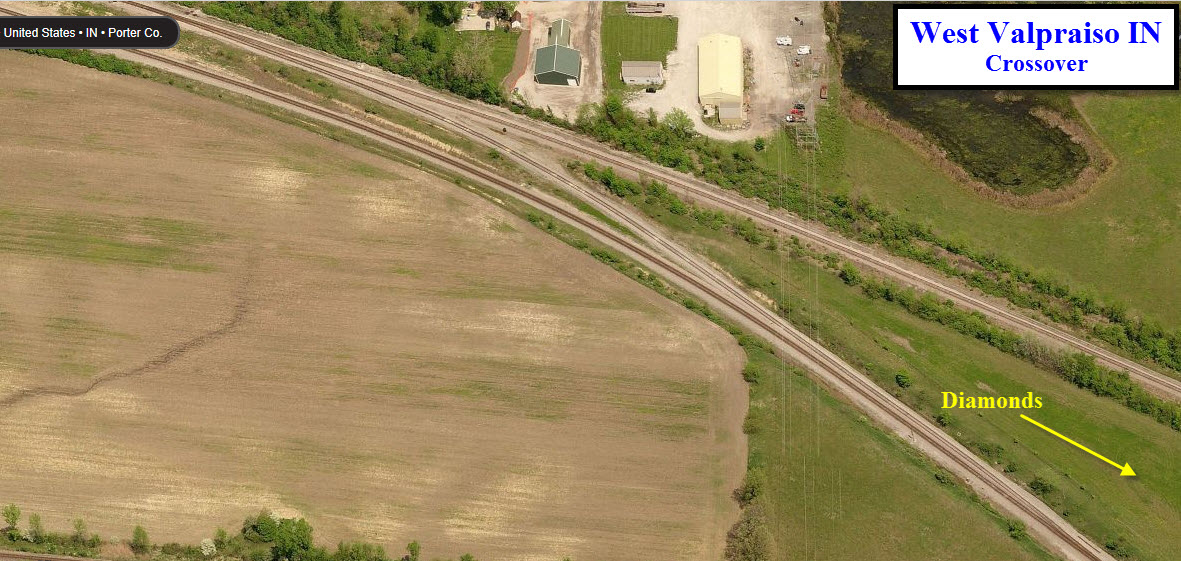
Over on the west side of town, you have a couple of
diamonds (green arrows), and a crossover (blue arrow).
If I ever get any additional information, maybe the
page will develop into a real guide.
Info AND pictures are always needed if anyone feels inclined to take
'em, send 'em, and share 'em, or if you have something to add or
correct....
credit is always given! Contact info is
here
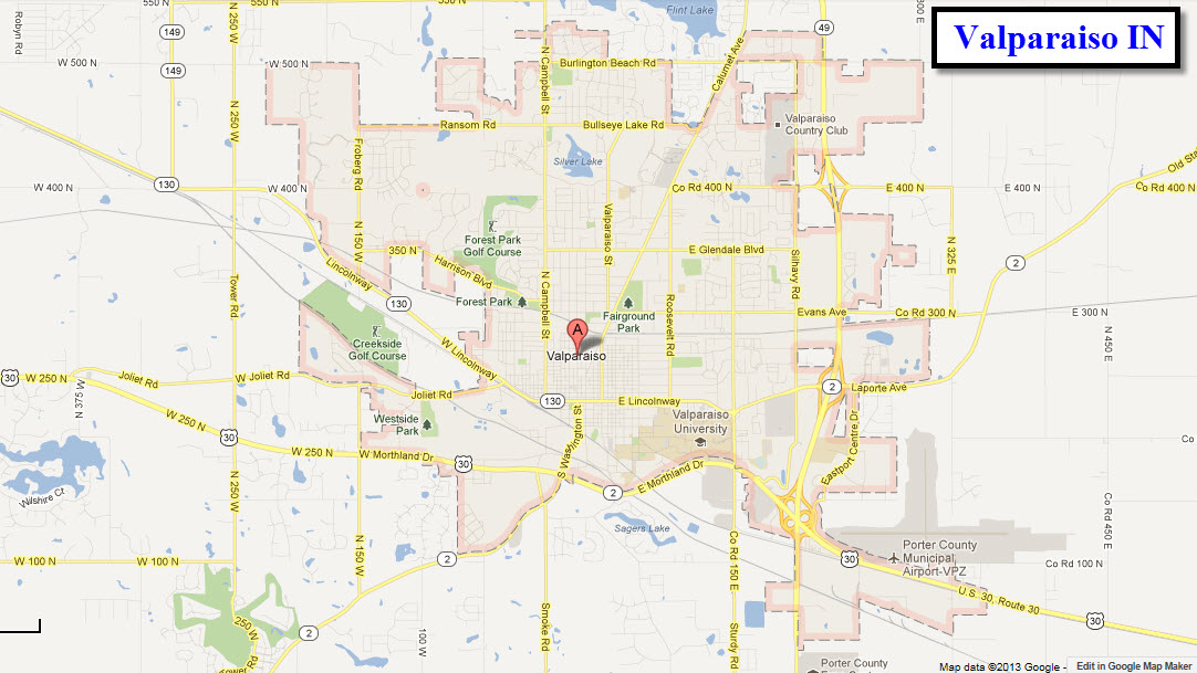
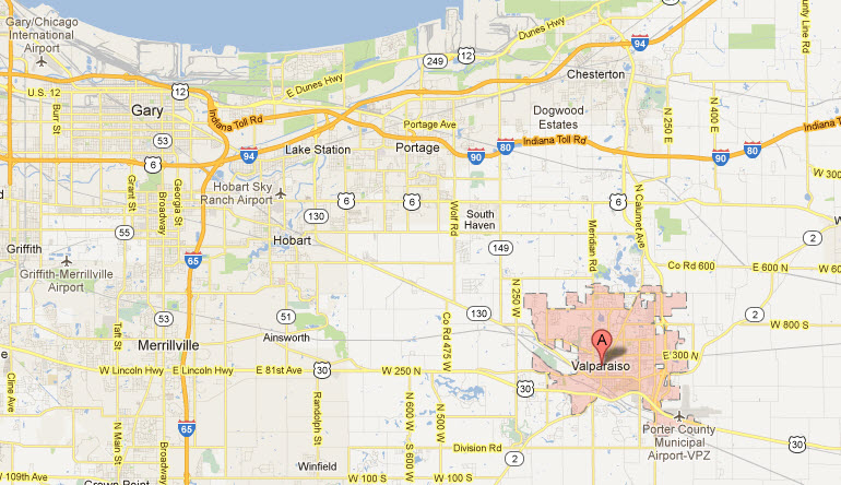
Valparaiso is about 20 miles southeast of Gary, and
about 50 miles from Chicago. There are no major roads leading into
town.
I-94 and I-80/90 are to the north, although I-80/90,
the Indiana Tollway, does not have a convenient exit for Valparaiso.
I-94 to the north does, it's exit 26, which you then take IN 49 south into
town.
From I-80/90 to the west of town, take exit 23 in
Portage, and then go south on Willowcreek Road till you hit US 6 - take a
left. Go a little over a mile and take a right onto Wolf Rd/N county
road 450 W. When you get to IN 130, hang a left and follow the tracks
into town.
From I80/90 on the east side, get off at exit 39, which
is US421, and head south. In about a mile and a half in Westville,
bear to the right onto IN 2, and take that into Valparaiso. It turns
in LaPorte Ave in town.
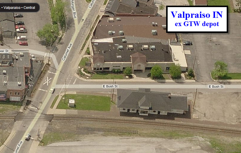
As of late 2012, the city was trying to figure out what
to do with the old GTW depot off of Calumet Ave, as CN has obtained a
demolition permit to tear it down. The full article from the blurb
below is
here
Passengers have long since stopped getting off
at the train depot next to the Canadian National
tracks on North Calumet Avenue, but
preservationists are hoping to save the
century-old station from the wrecking ball.
The city's Historic Preservation Commission is
meeting today in hopes of finding someone
interested in acquiring the building and moving
it. The railroad no longer needs the building
and obtained a demolition permit to remove it.
Those interested in saving the station have
called for the preservation commission's help.
The city's preservation ordinance can delay
demolition up to 45 days to seek ways of saving
any structure of historical significance. A 1991
survey of county buildings by the Indiana
Historic Landmarks Foundation and the state
Historic Preservation Office classified the
depot as "notable." Tiffany Tolbert, a
consultant to the foundation from the city
commission, said the railroad line was one of
the earliest in the city. Research by Larry
Clark, of the Valparaiso Public Library's
genealogy department, showed the depot was built
around 1904 after a fire that destroyed the
second depot at that location. It was
considered as the possible site of a depot for a
proposed extension of a South Shore commuter
rail line to Valparaiso before city officials
settled on the former Amtrak station location.
The railroad used the depot for storage for many
years, but now wants to tear it down before it
falls into disrepair. "We've been in talks
with the city since the issue of demolition came
up, and we're trying to come up with a plan to
find someone to buy it and move it," Tolbert
said. "The railroad has agreed to delay
demolition to at least the end of November. It's
in pretty good condition, but the railroad is
not using it and they would like to clear the
site." A spokesman for Canadian National
declined comment. Clark said the depot
originally served the Peninsular Railroad in the
1870s before it was bought by the Chicago and
Port Huron Railroad. A link ran past the former
Valparaiso Technical Institute to the Baum's
Hotel on the site of what is now the Franklin
House.
2
Location of the
former Amtrak Station
While there is nothing here anymore, it looks like a
nice spot to take pictures from.
3
2 Diamonds and
a Crossover
For a little more substance in your pictures, you might
want to check out these locations on the west side of town. They are
all signaled to some degree.
Courtesy of the University of Texas Library, click
here for
their index page.
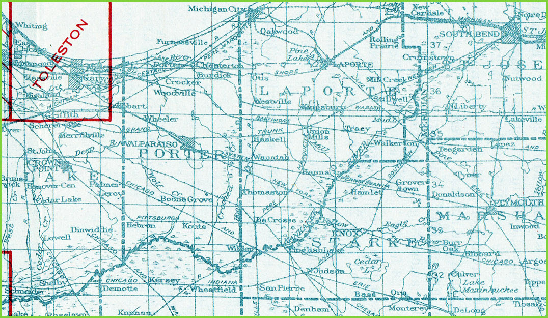
For Indiana back in the late 1800's and early 1900's,
the USGS did not have much of the state mapped out, so, this is the only
thing I could find: the 1925 index map for Indiana.
Walkerson, Plymouth, LaCrosse, Union Mills, and NJudson
look like they would have been terrific railfan spots back in the time, with
three roads hitting each town at the same spot!
Disclaimers:
I love trains, and I love signals. I am not an
expert. My webpages reflect what I find on the topic of the page.
This is something I have fun with while trying to help others. My
webpages are an attempt at putting everything I can find of the subject in
one convenient place. There are plenty of other good websites to help
me in this effort, and they are listed in the links section on my indexa
page, or as needed on individual pages. Please do not write to me
about something that may be incorrect, and then hound the heck out of me if
I do not respond to you in the manner you would like. I operate on the
"Golden Rule Principle", and if you are not familiar with it, please
acquaint yourself with how to treat people by reading Mathew 7:12 (among
others, the principle exists in almost every religion). If you contact
me (like some do, hi Paul) and try to make it a "non-fun" thing and start
with the name calling, your name will go into my spambox list! :-)
Please Note:
Since the main focus of my two websites is railroad signals, the railfan guides
are oriented towards the signal fan being able to locate them. For those
of you into the modeling aspect of our hobby, my
indexa page has a list of
almost everything railroad oriented I can think of to provide you with at least a few pictures to
help you detail your pike.
If this is a railfan page, every effort has
been made to make sure that the information contained on this map and in this
railfan guide is correct. Once in a while, an error may creep in,
especially if restaurants or gas stations open, close, or change names.
Most of my maps are a result of personal observation after visiting these
locations. I have always felt that a picture is worth a thousand words",
and I feel annotated maps such as the ones I work up do the same justice for the
railfan over a simple text description of the area. Since the main focus
of my website is railroad signals, the railfan guides are oriented towards the
signal fan being able to locate them. Since most of us railheads don't have just
trains as a hobby, I have also tried to point out where other interesting sites
of the area are.... things like fire stations, neat bridges, or other
significant historical or geographical feature. While some may feel they
shouldn't be included, these other things tend to make MY trips a lot more
interesting.... stuff like where the C&O Canal has a bridge going over a river (the Monocacy Aqueduct) between Point of Rocks and Gaithersburg MD, it's way cool to
realize this bridge to support a water "road" over a river was built in the
1830's!!!
My philosophy: Pictures and maps are worth a
thousand words, especially for railfanning. Text descriptions only
get you so far, especially if you get lost or disoriented. Take
along good maps.... a GPS is OK to get somewhere, but maps are still
better if you get lost! I belong to AAA, which allows you to get
local maps for free when you visit the local branches. ADC puts
out a nice series of county maps for the Washington DC area, but their
state maps do not have the railroads on them. If you can find em,
I like the National Geographic map book of the U.S..... good, clear, and
concise graphics, and they do a really good job of showing you where
tourist type attractions are, although they too lack the railroads.
Other notes about specific areas will show up on that page if known.
Pictures and additional information is always needed if anyone feels
inclined to take 'em, send 'em, and share 'em, or if you have
something to add or correct.... credit is always given! BE NICE!!! Contact info
is here
Beware: If used as a source, ANYTHING from Wikipedia must be treated as
being possibly being inaccurate, wrong, or not true.