
In General
Getting Here
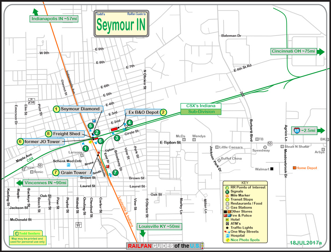
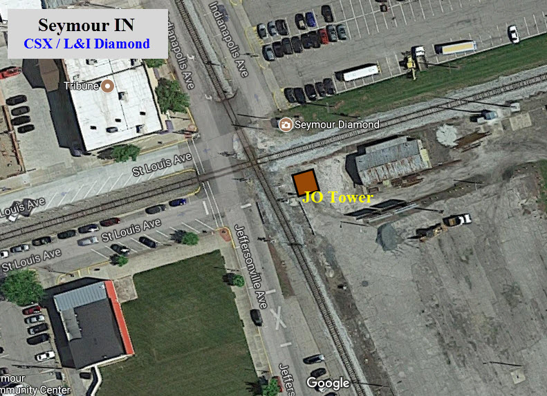
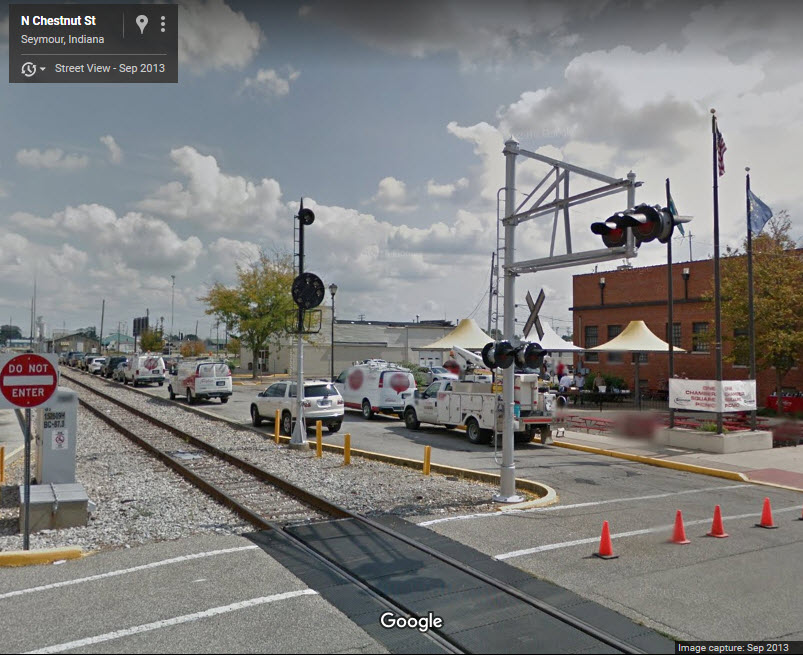
Map
Sights
Pictures
Signals
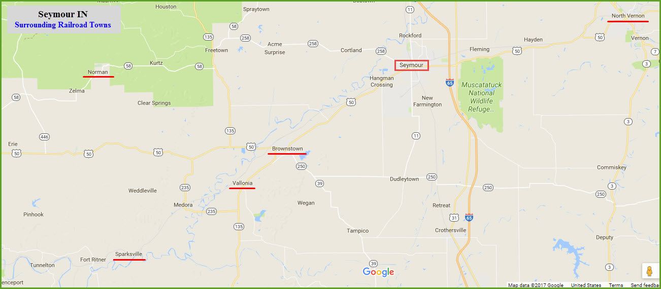
Other Nearby Cities
New Albany
Norman
Brownstown
Sparksville
Vallonia
Floobydust
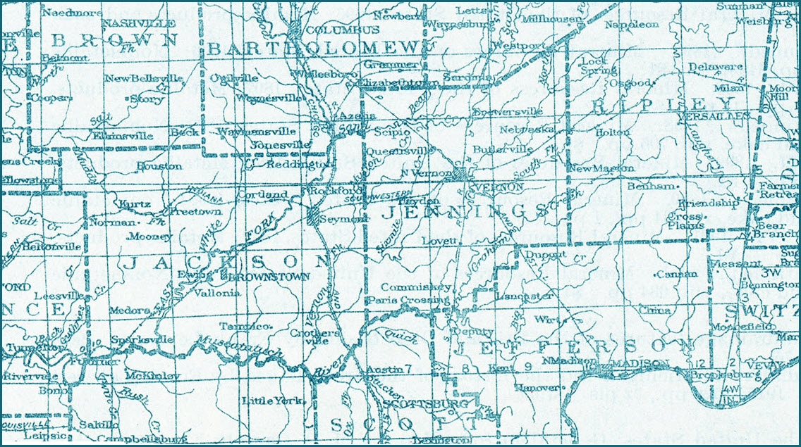
USGS Maps
RAILROAD SIGNALS HOME
Location / Name:
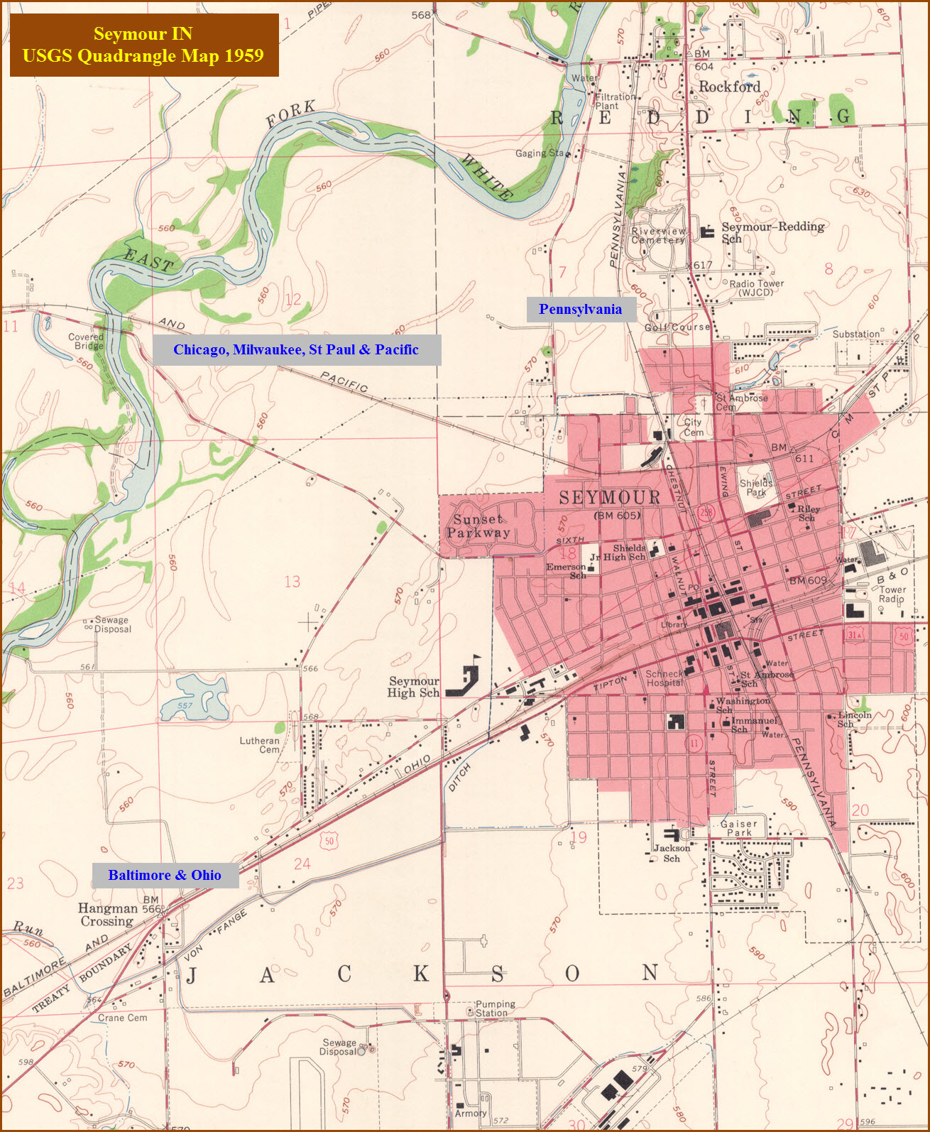
Seymour IN, Jackson Co.
What's Here:
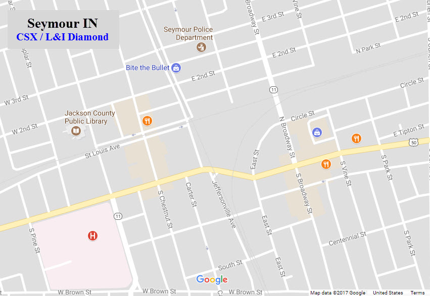
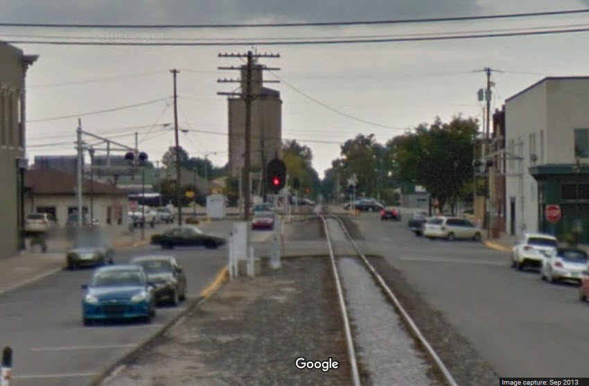
Diamond Crossing
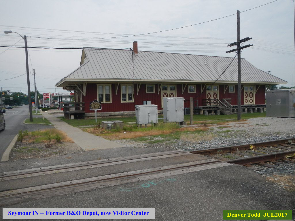
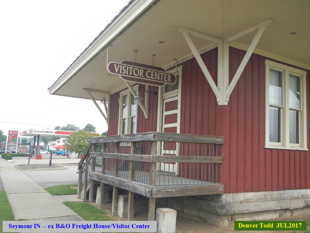
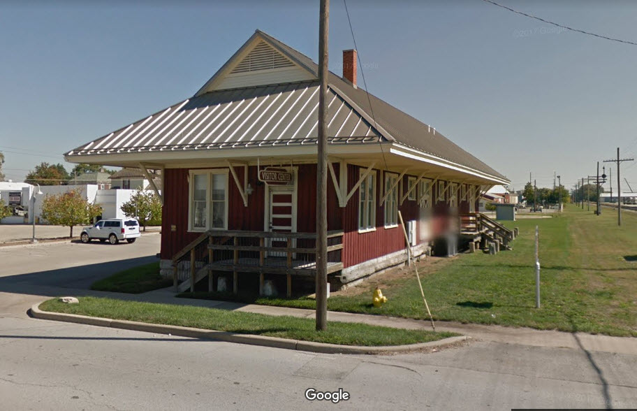
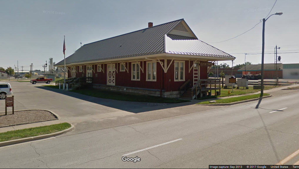
Former B&O Depot
The Louisville & Indiana RR
Data:
GPS Coordinates: 38.958587, -85.888585
Phone A/C: 812
ZIP: 47274
Access by train/transit:
None, closest Amtrak is in Louisville KY, about 50 miles south, or Indianapolis IN to the north, about 60 miles away
The Scoop:
At one time, the Pennsylvania RR, the Baltimore & Ohio RR, and the Chicago, Milwaukee, St Paul & Pacific RR (the Soo Line, and then the Milw) came into Seymour.
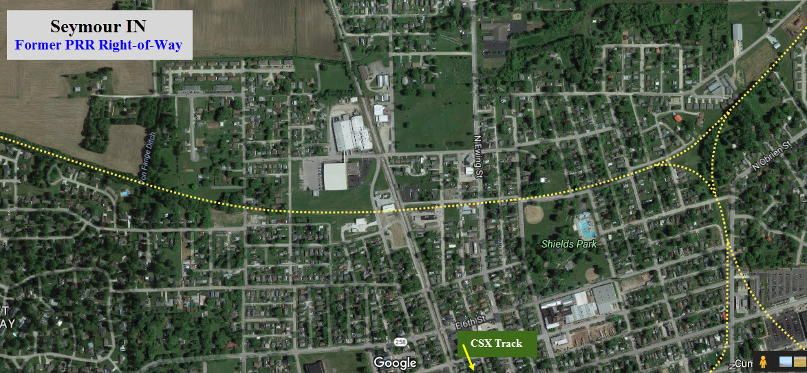
Today, CSX runs east and west (former B&O), and the Louisville & Indiana comes thru N/S on the former PRR trackage on their way between Louisville KY and Avon yard in Indianapolis IN. This is CSX's Indiana Sub-Division, which runs from Cincinnati OH west to Washington IN.
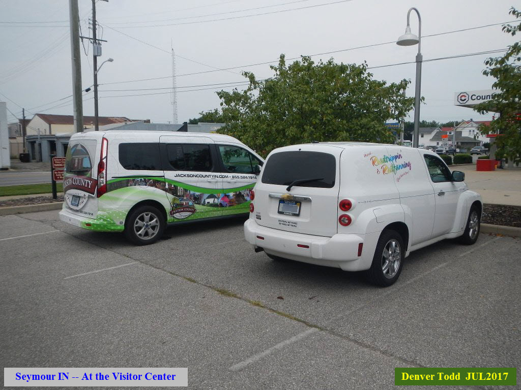
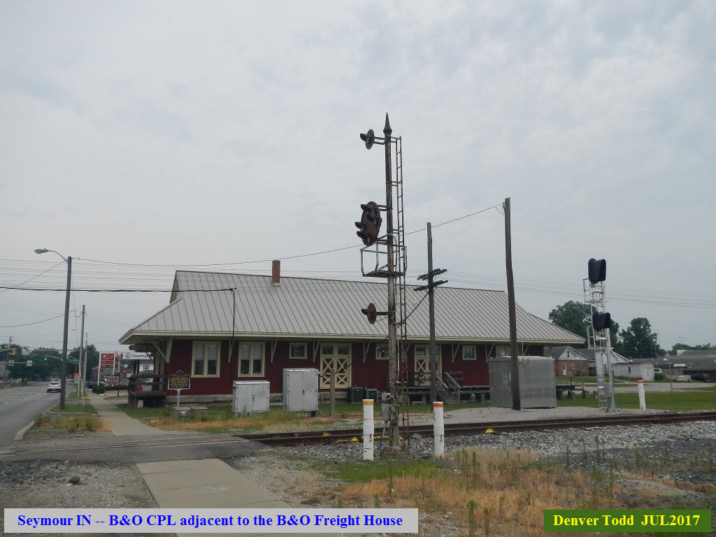
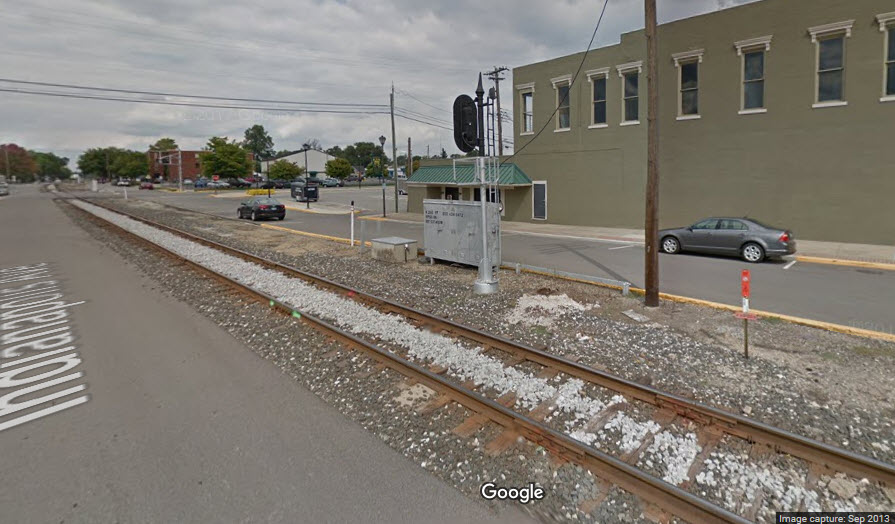
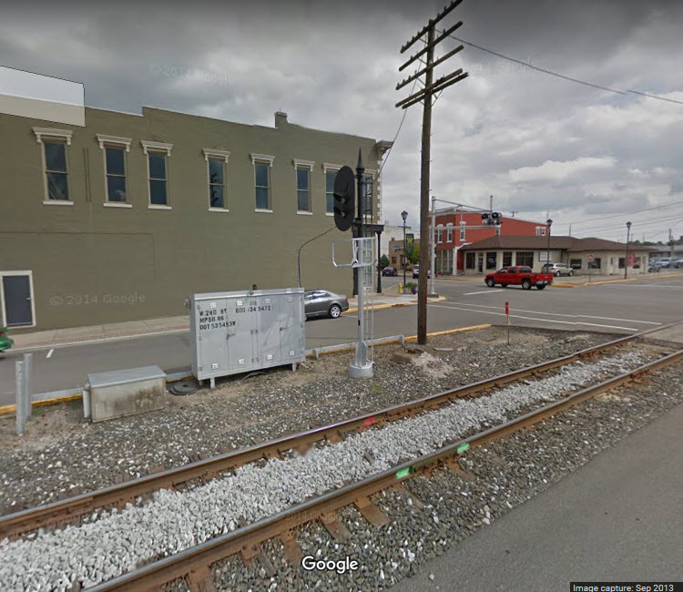
A block away from the diamond is a former B&O depot, now used by the Chamber of Commerce as their visitor center.
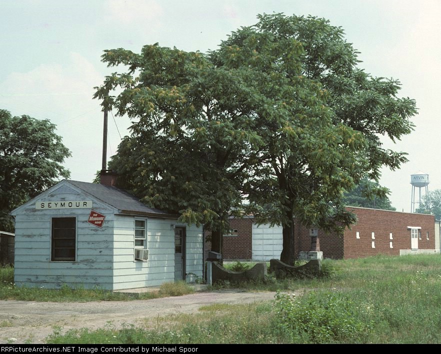
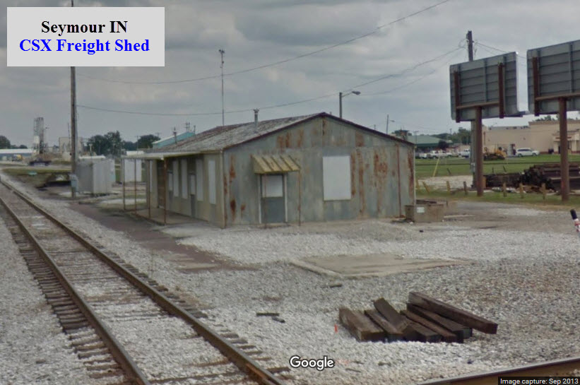
The town also had a number of other stations and freight sheds as can be seen below, most are a distant memory but shown here for historic purposes.
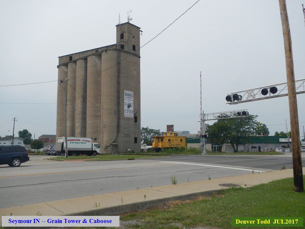
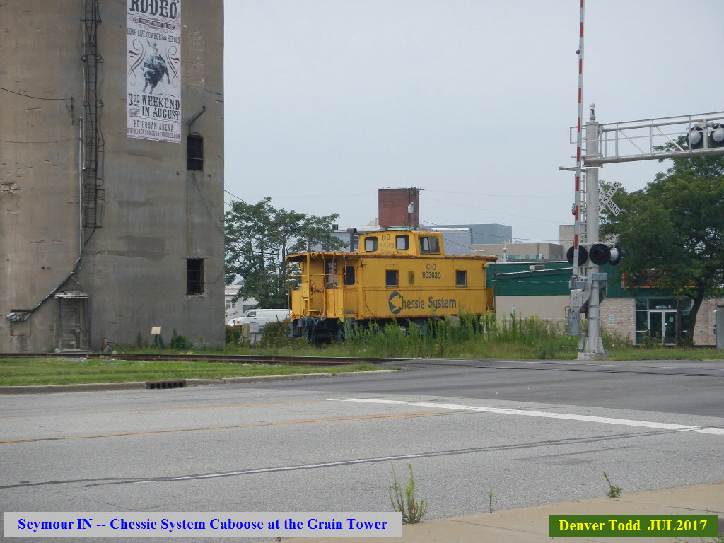
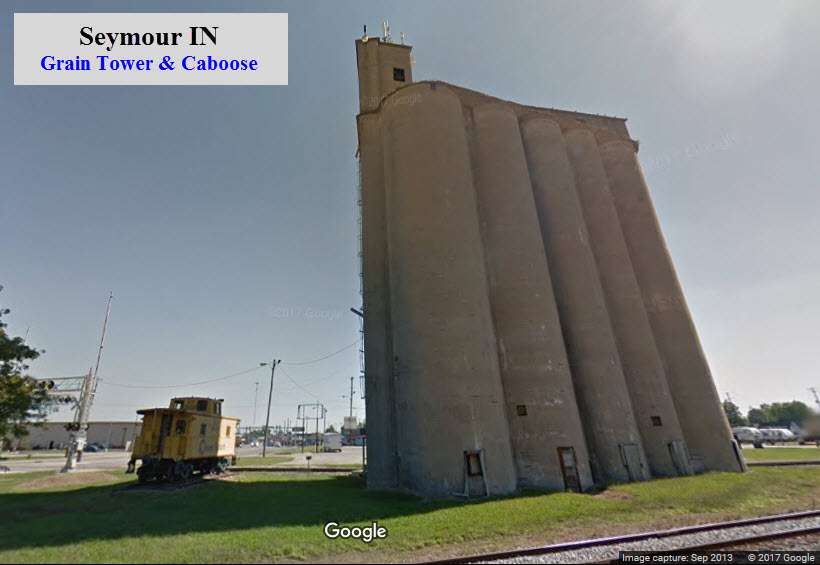
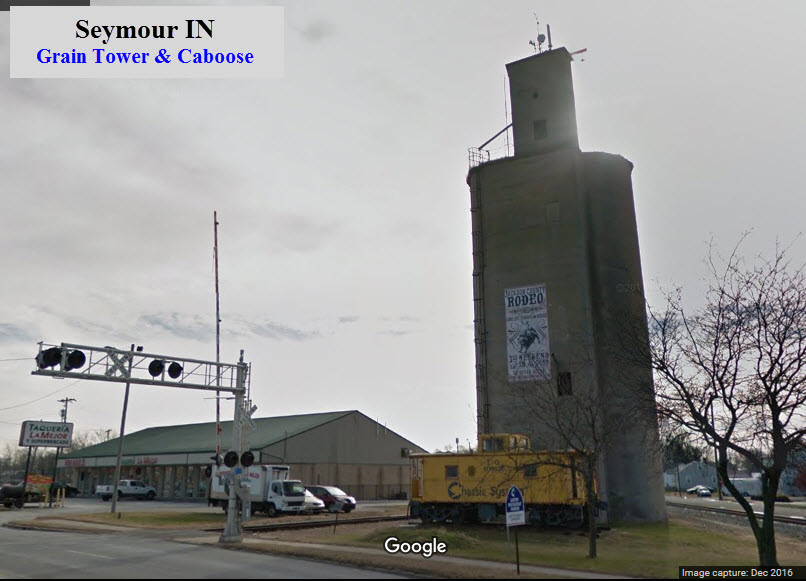
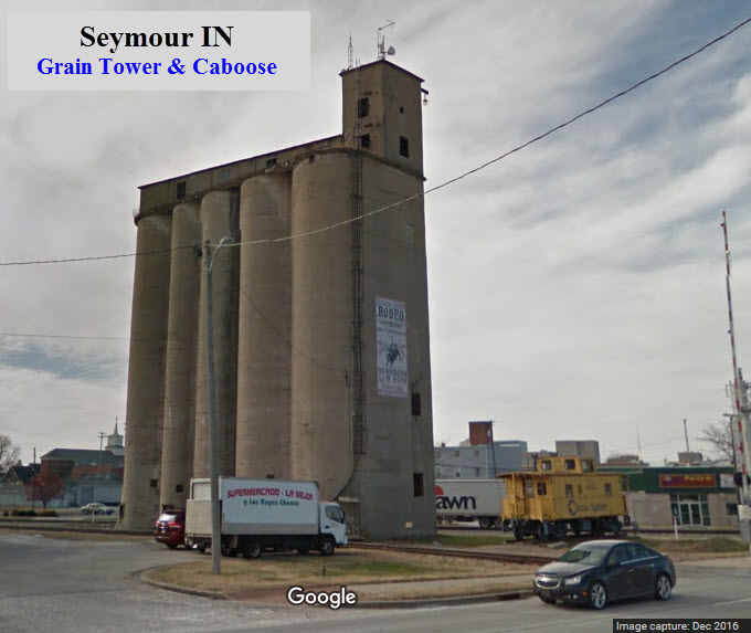
A little south of the diamond is a concrete grain silo, complete with a Chessie System caboose. A number of towns are setting these things up as tourist" sights, another one can be found in Grand Haven MI, and forms part of a very complete, very cool railroad park.
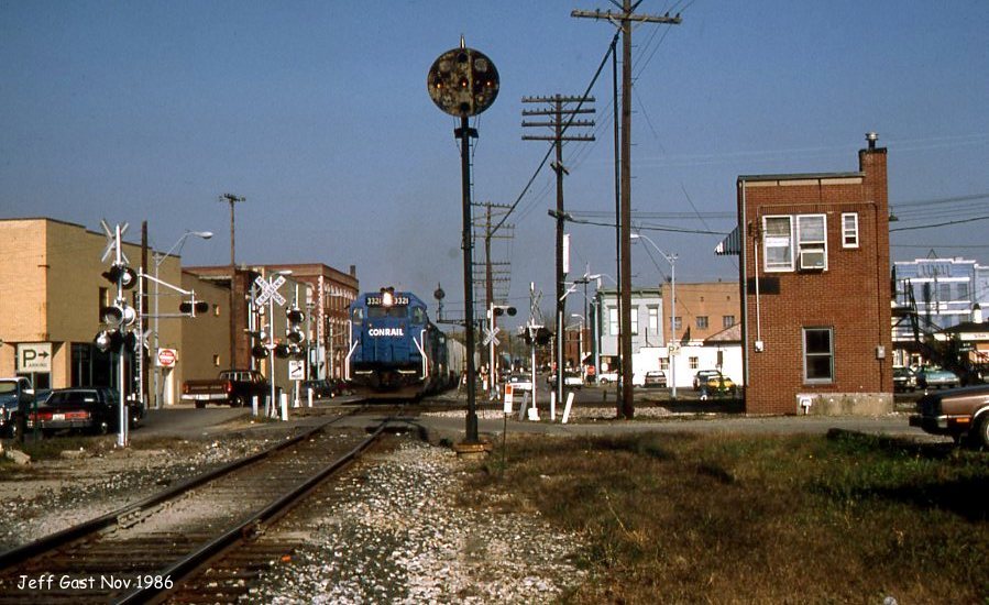
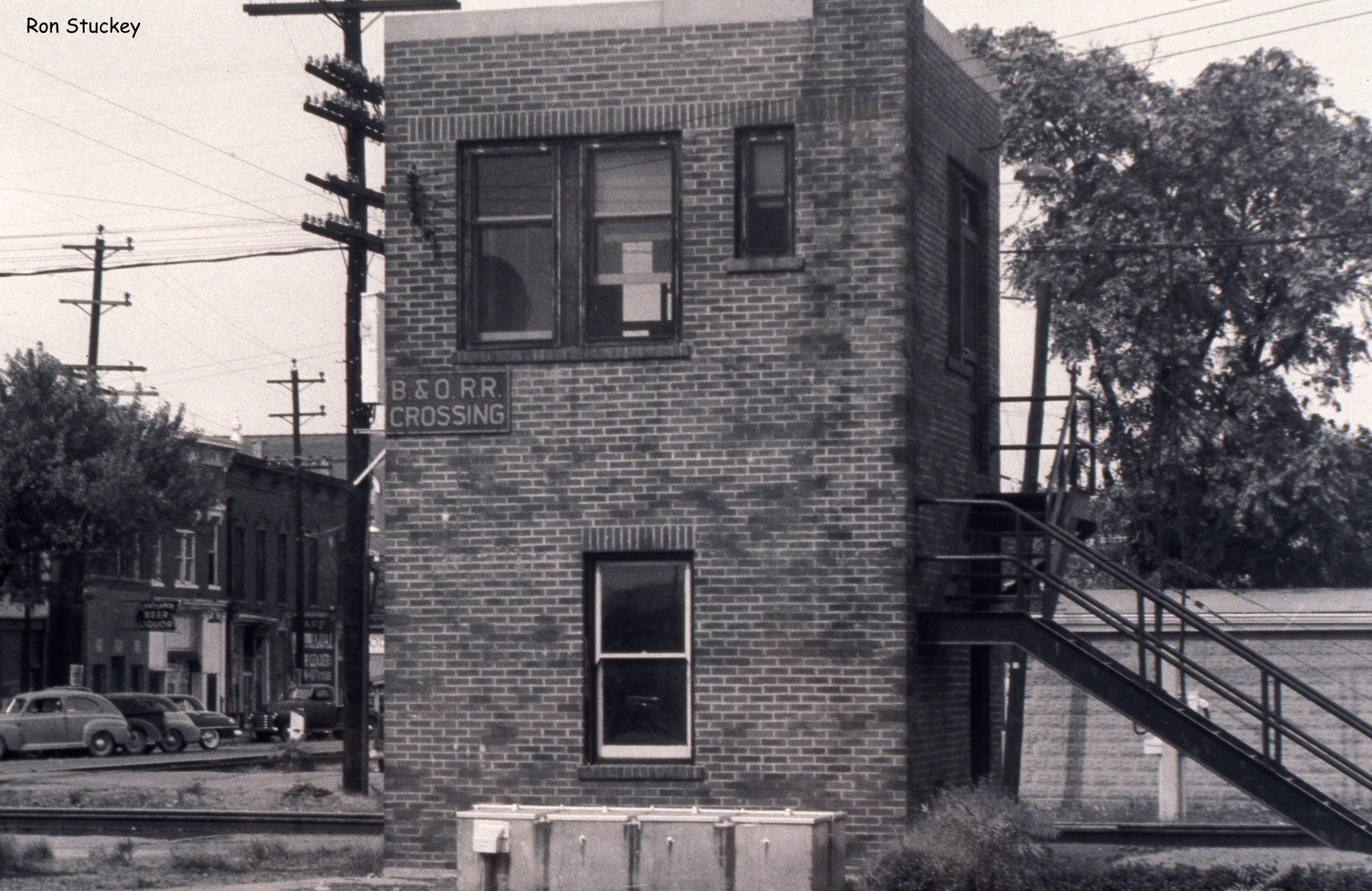
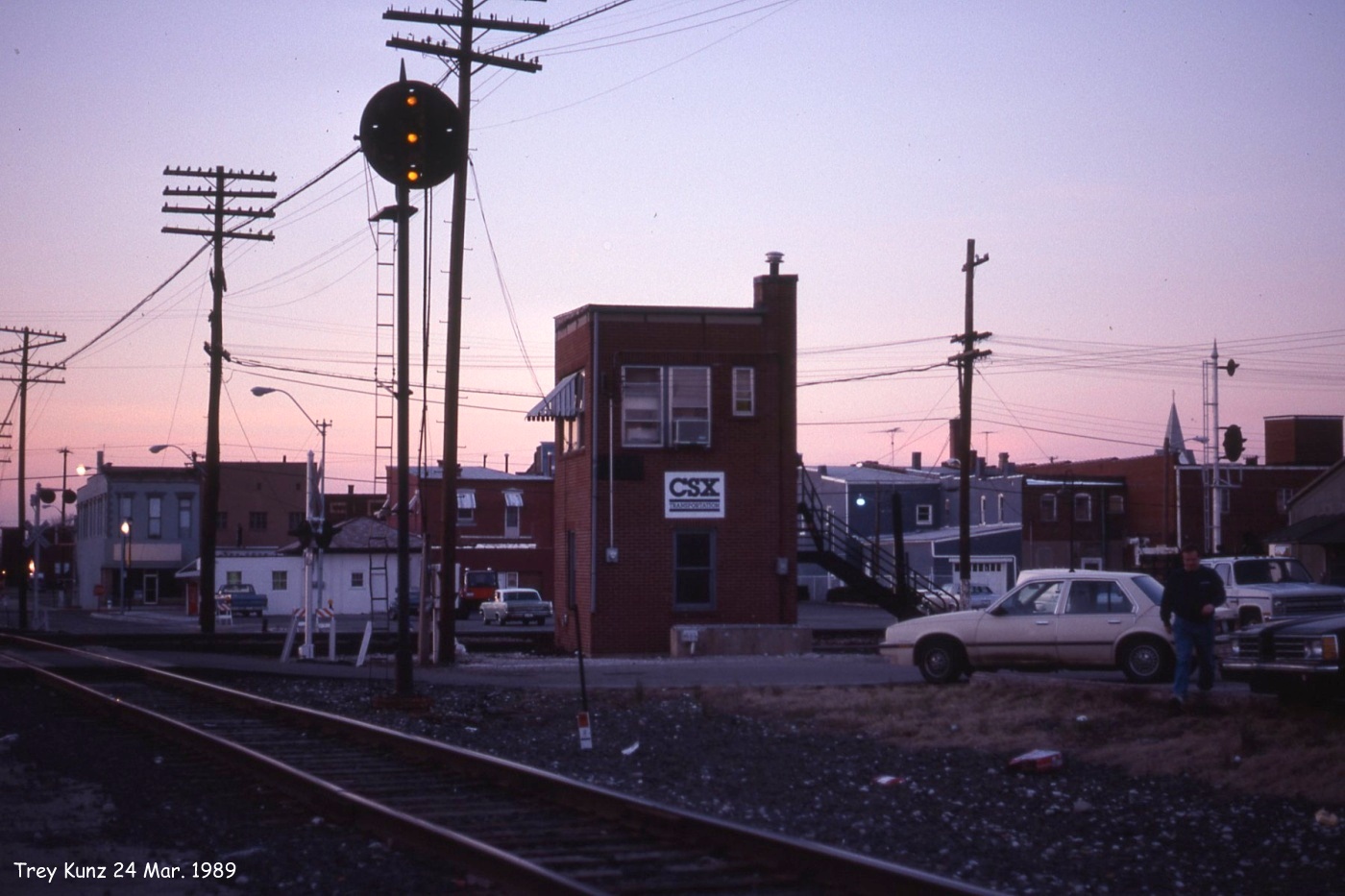
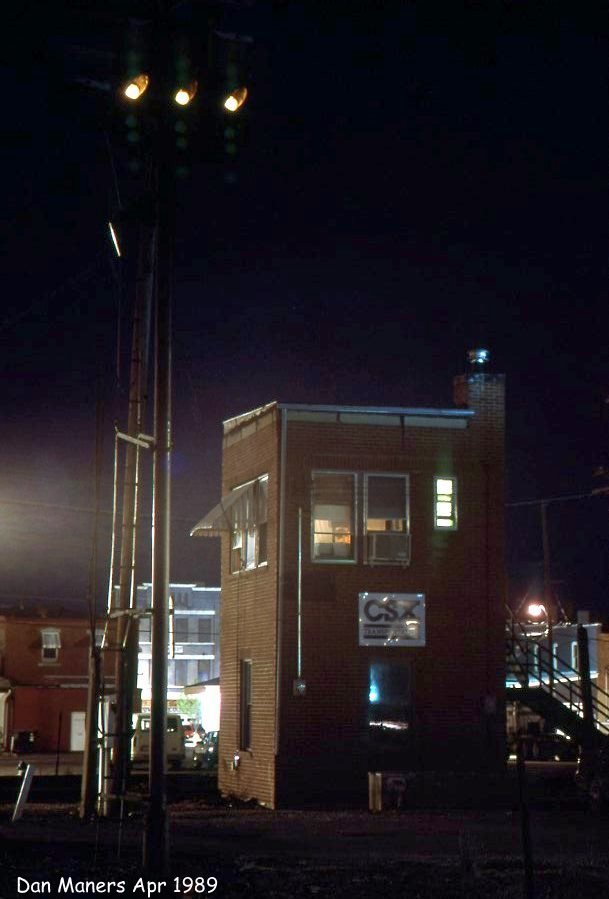
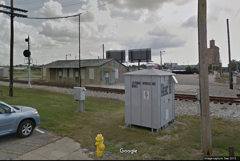
The B&O had a tower at the diamond, JO. Not sure when it was taken down.
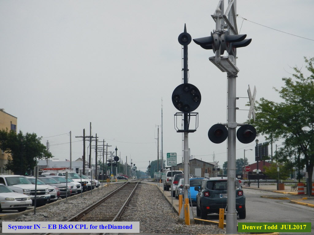
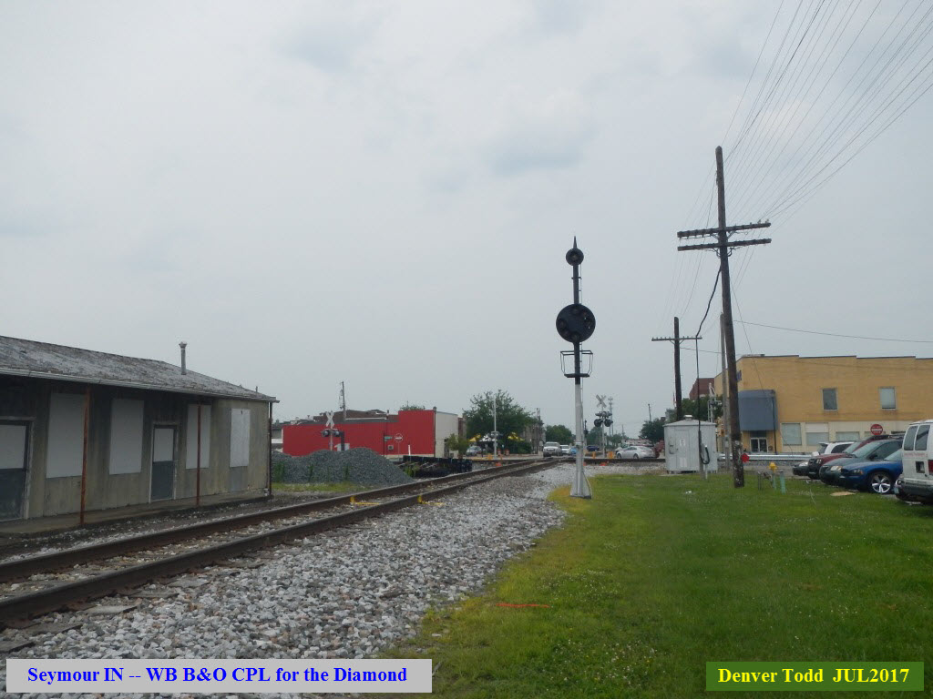
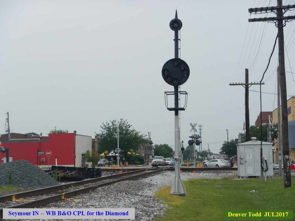
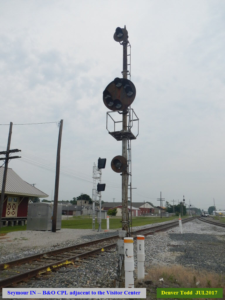
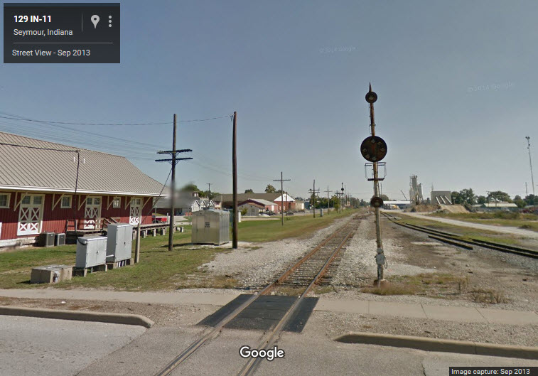
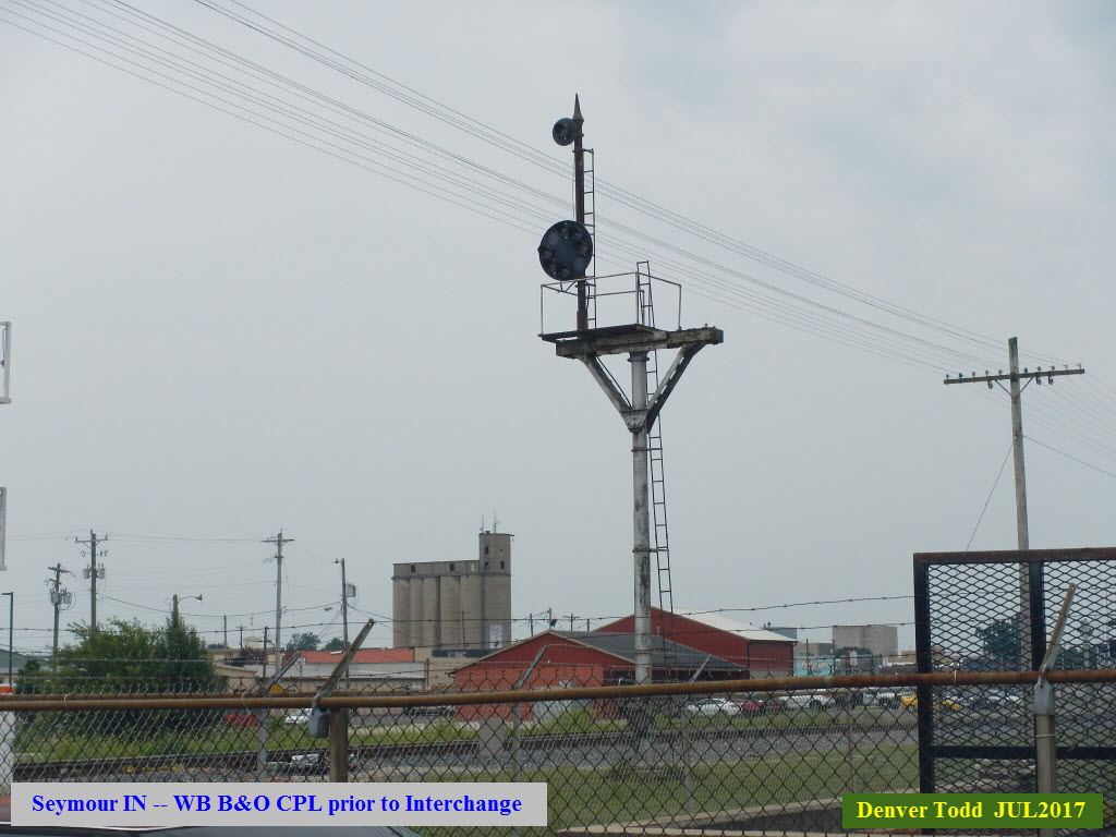
A quick note about signals, since that is the main reason I do my guides..... On the B&O we still have the infamous B&O CPL signals (which stands for Color Position Light). CSX has had a replacement program going on now for at least ten years, but probably closer to 15. They are replacing them with standard color light signals. It appears that the L&I is using color light signals when used, having replaced the Pennsy PL signals (Position Light). These can be seen in the photos down in the JO Tower section. If you want to find out more about signals, check here: http://position-light.blogspot.com/ or my railroad signals site.
A special thank you goes to Denver Todd for taking the pictures below. He had sent me just a GPS location for one of the signals in Seymour, and I took that number, looked it up on Google Maps, and took off runnin to make this page because of all of the CPL signals still there... BUT NOT FOR LONG!!! Then, after I got the page done, he volunteered to take a field trip to visit Seymour for some up close and personal pictures. We need more railfans like Denver!
If you are searching for additional information, be aware that there is also a Seymour CT and a Seymour in Australia.
Acknowledgements:
James Mischke
John Burkhart
Alicia Froedge
Joe Schneid
David Ingles
Dan Maners / North American Interlockings
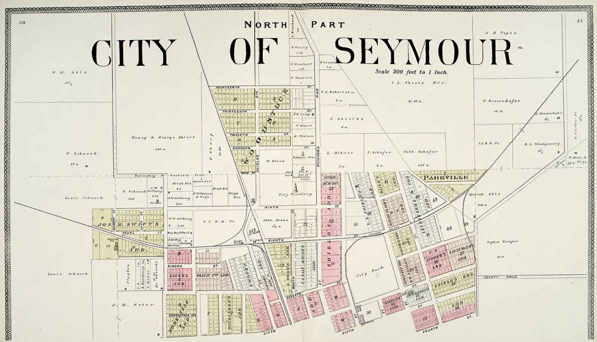
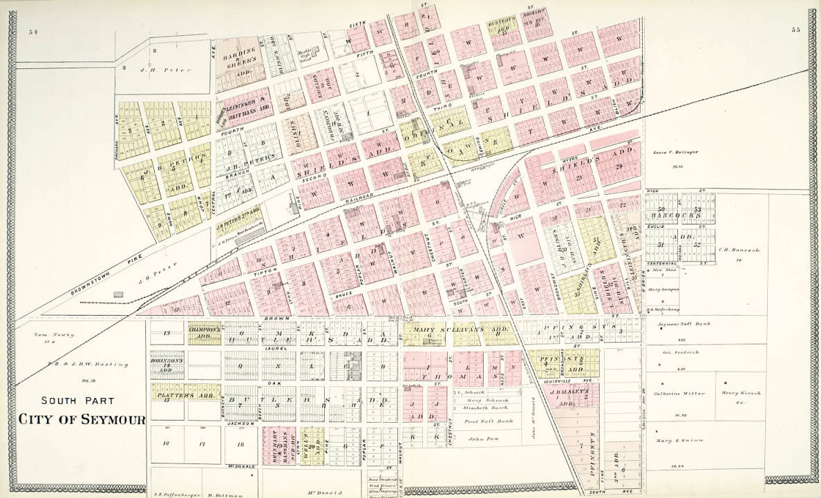
Indiana Historical Society (the two older City maps, north and south)
Jeff Wilson
Michael Spoor
Trey Kunz
Ron Stuckey
Jeff Gast
Sara Marling Thomas/collection of Seymour Public Library
Denver Todd
University of Indiana for their map collection
University of Texas for their map collection
Websites and other additional information sources of interest for the area:
http://condrenrails.com/JDI/Lexington-2011/index-6.html
http://northamericaninterlockings.com/index.html
https://en.wikipedia.org/wiki/Louisville_and_Indiana_Railroad
South out of Indianapolis on I-65. Take exit 50, and go west on US 50 about 2 miles into Seymour.
Above map in PDF format
here
GPS Coordinates: 38.958587, -85.888585
GPS Coordinates: 38.959479, -85.885807
http://www.jacksoncountyin.com/
http://www.jacksoncountyin.com/visitor-center/history/
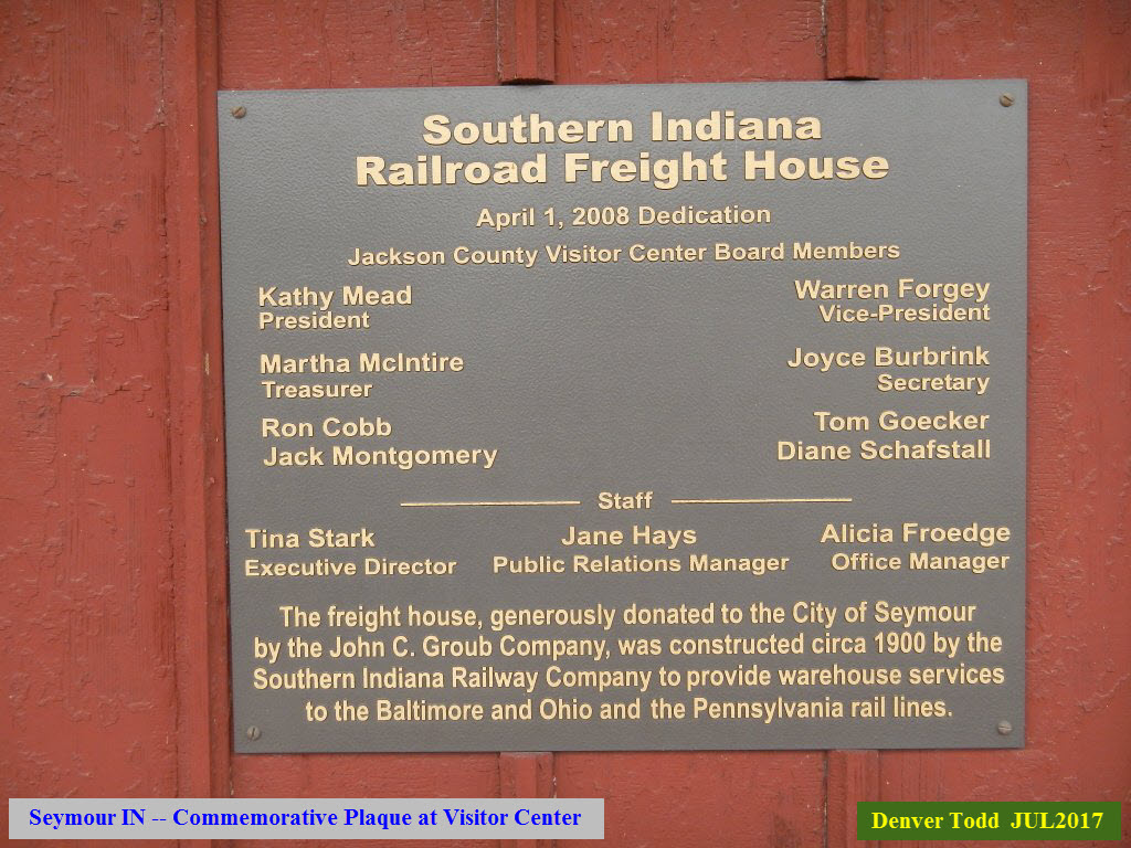
The former Freight House houses the Jackson County Visitor Center. On their website, there isn't much on the building (not that there is a whole lot to say about :-):
The Jackson County Visitor Center is located in a historic railroad freight house that was built in 1905. Part of a network of rail lines and depots owned by John Walsh, a Chicago banker and a Bedford IN native with ties to the limestone industry, the depot is a classic example of industrial transportation architecture. Located on approximately an acre and adjacent to downtown Seymour on land in the original plat, the freight house was placed on the National Register of Historic Places in June 22, 2003.
The railroad has a very rich history in Seymour and Jackson County and, at times, a shady one. It was here in October 1866 that members of the Reno Gang committed the first moving train robbery. Near the location of the freight house, three of the gang boarded the O & M train and robbed the Adam’s Express Messenger of between $12,000 and $18,000. The secret of the gang's ill-gotten gains in multiple robberies remains a mystery. The Reno brothers died in 1868 after they were caught, arrested, and hung; and are buried in the old Seymour Cemetery.
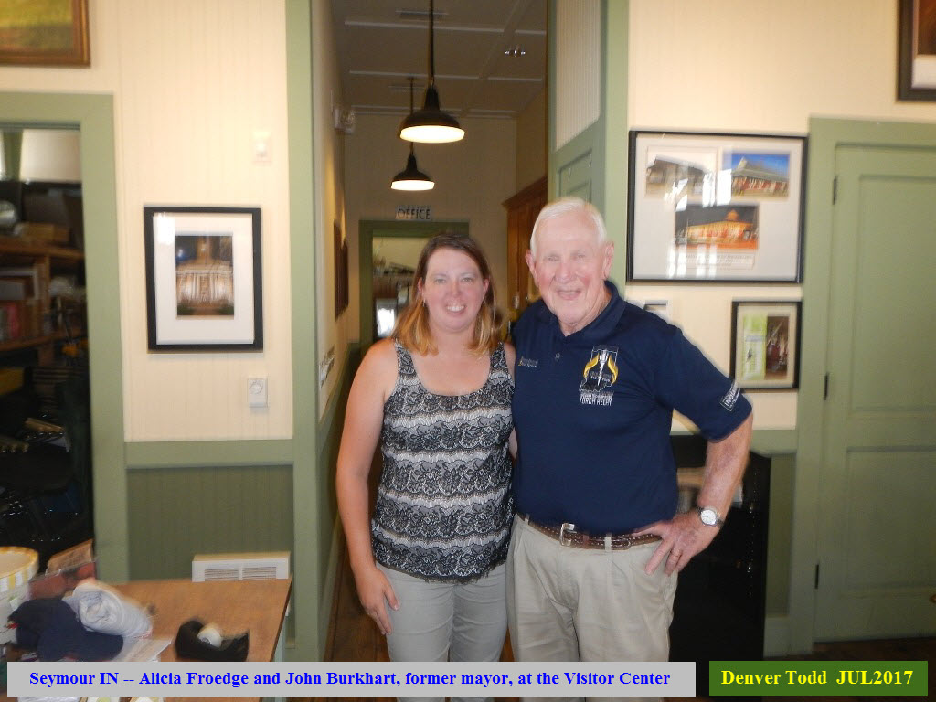
Thanks to Ms. Froedge and Mr. Burkhart for the information they provided Denver on his visit to the Visitor Center.
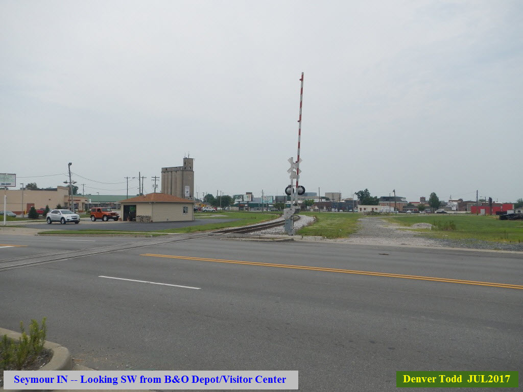
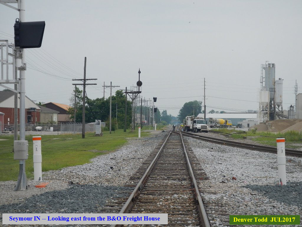
The following picture is looking SW towards the interchange track and the L&Irr.
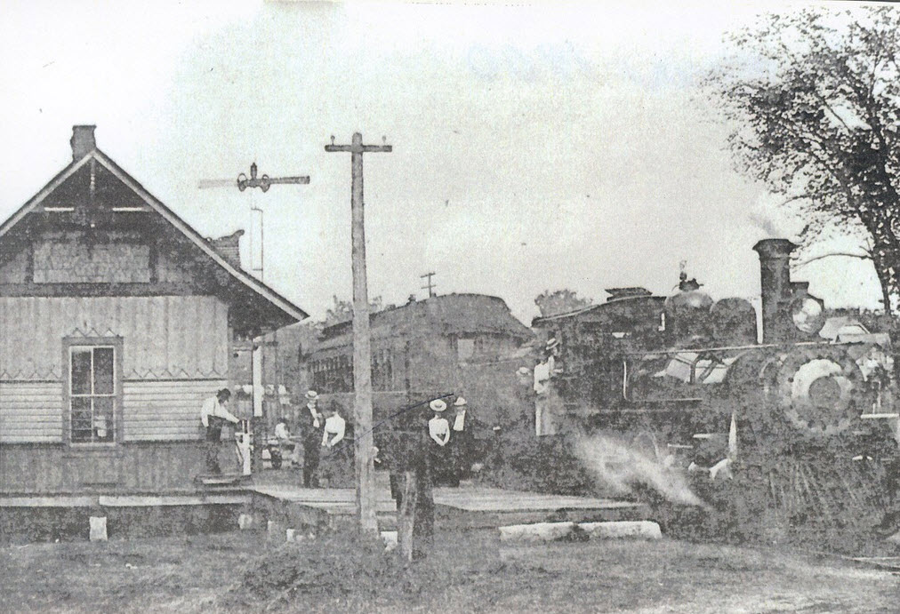
This photograph is in the Seymour Library collection, and was taken by Sara Marling Thomas in 1900.
These pictures come from Dan Maners' North American Interlockings website.
JO Tower was a B&O tower that watched over the diamond between the B&O and the Pennsy. The first shot below is looking north along the Pennsy with a SB Conrail freight - you can tell it's former Pennsy track because of the all yellow PL (position light) signals. Does anyone know when it came down???
GPS Coordinates: 38.957095, -85.887575
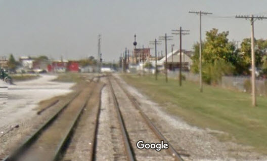
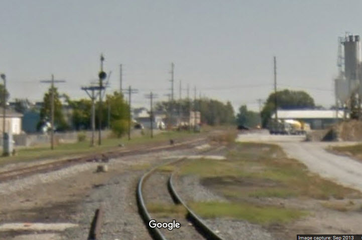
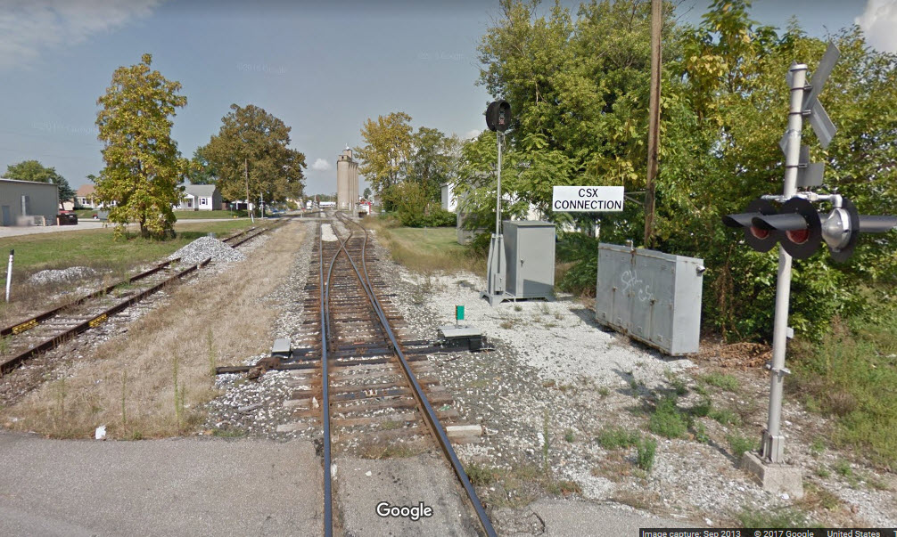
At the diamond....
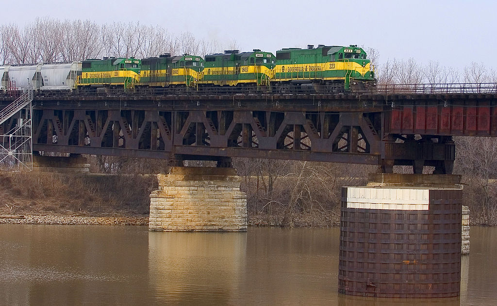
A Louisville and Indiana train crossing the Portland canal. The north bound train is shown immediately prior to entering the vertical lift portion of the Fourteenth Street Bridge. From left to right: LIRC #220 (GP38-2), #1802 (GP11), #1803 (GP11) and #223 (GP38-2).
 Joe Schneid
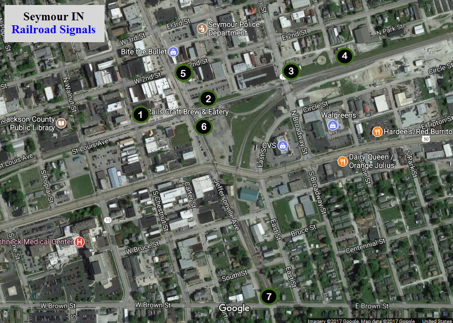
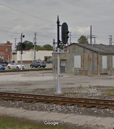
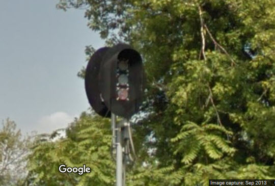
EB B&O CPL signal for the Diamond
WB B&O CPL signal for the Diamond
EB B&O CPL signal for the Interchange
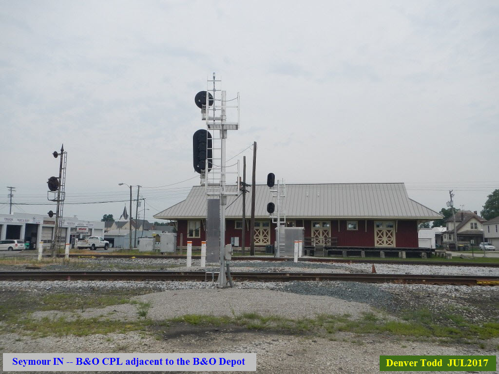
Here we have a high CPL on a bracket post installation, and HAD a dwarf CPL for the secondary/interchange track, before they did away with the secondary track and had the interchange track go right into the mainline.
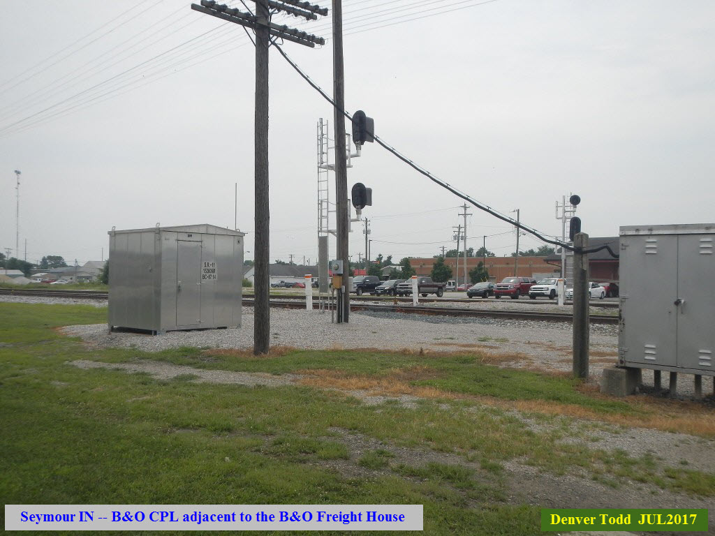
SB L&I Colorlight signal for the Diamond
NB L&I Colorlight signal for the Diamond
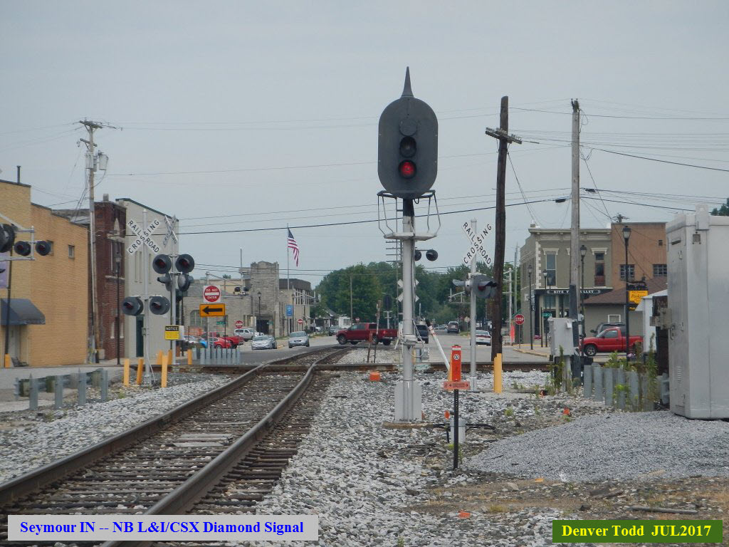
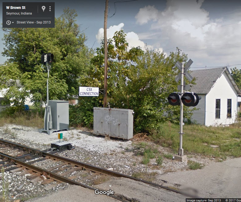
Dual Direction L&I Colorlight signal for the CSX Interchange. If you notice, this is a "small LED Colorlight" signal, the kind that seems to enjoy popularity with shortline railroads. I have also seen similar signals like these in Union Bridge MD on the Maryland Midland.
Dec 30th, 2024 - I received an email from Benjamin M. that these signals are what's called an SPI or Switch Position Indicator, which is not treated as a signal by railroad crews and is used as part of a radio-controlled switch setup. This tidbit is moot at this point as that setup was replaced sometime around 2019 to 2022 by a full-on Interlocker called Seymour Connection that uses CSX Standard "Darth Vader" color Lights. Thanks for writing in Benjamin and helping out with our understanding of American railroad signaling!
New Albany IN - Former B&O RR Depot
Another Sara Marling Thomas photo from the Seymour Library, with no date or railroad information.
From James M comes some information on the depot:
It is a former B&O Depot in New Albany IN, about 47 miles south of Seymour, but right across the Ohio River from Louisville.

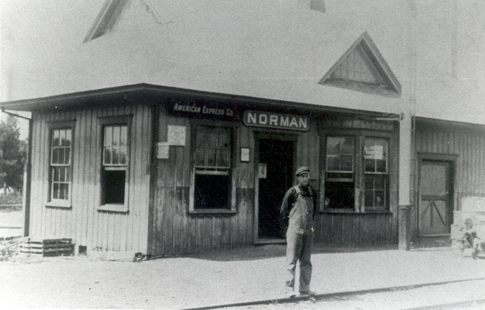
Norman IN
About 21 miles almost due west, give or take.
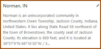
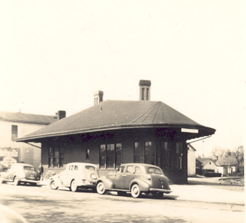
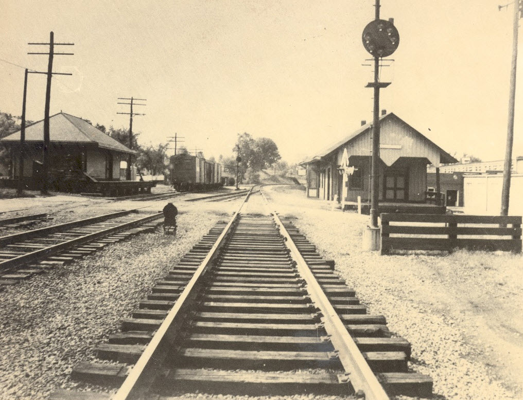
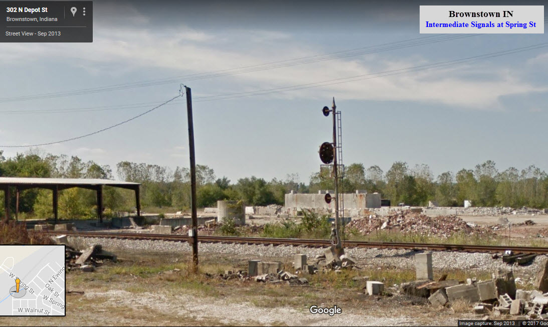
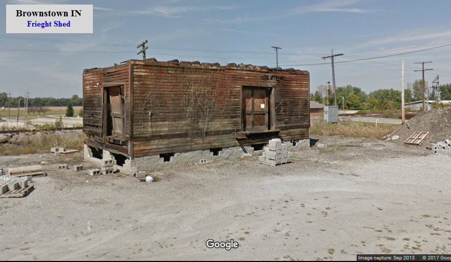
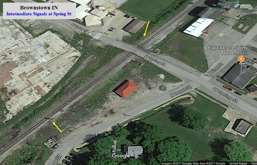
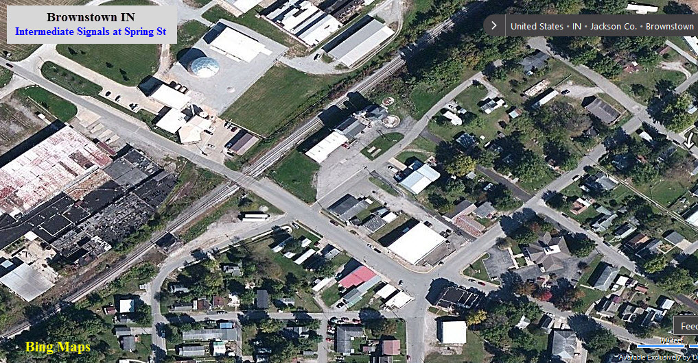
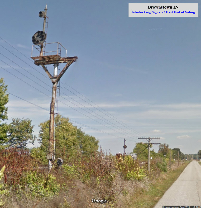
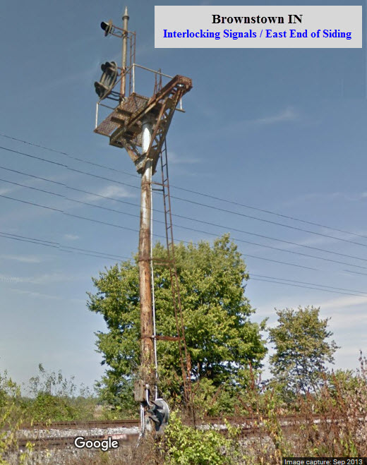
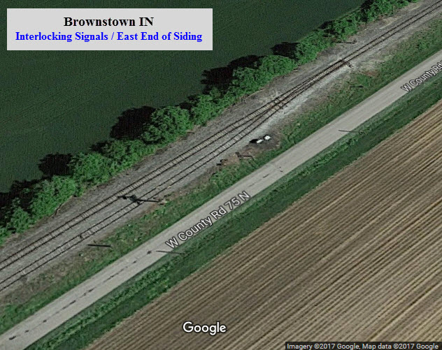
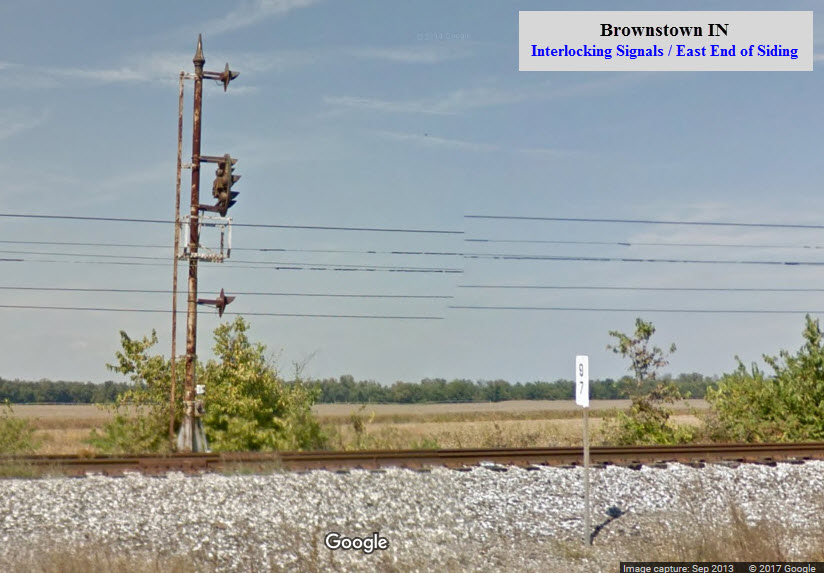
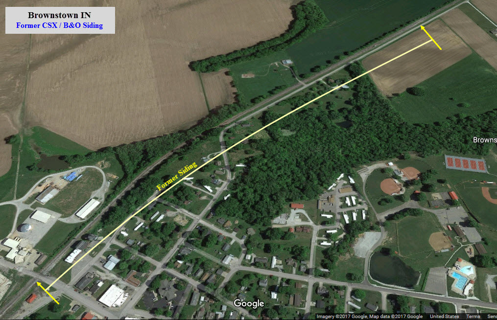
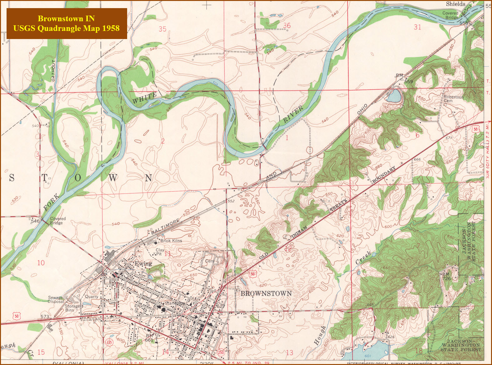
Brownstown IN
11 miles to the west. The CPL signals would date the depot scene to at least 1920 or so at the earliest - there is no date on the sepia tone photo. The B&W depot pic is dated the 1940's.
It looks like in 2013 someone was renovating the freight shed, and earlier, it appears that CSX removed the western switch for a siding, which, in looking at Google Maps, was about 4100 feet long. If we visit here today, there is a good chance most if not all of the signals are gone.
 Sara Marling Thomas
 Sara Marling Thomas
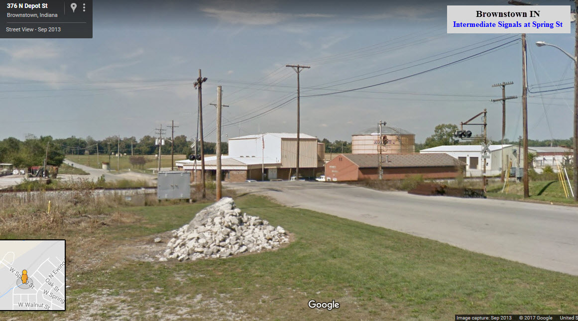
Sparksville IN
Sparksville is about 22 miles to the southwest.
 Sara Marling Thomas
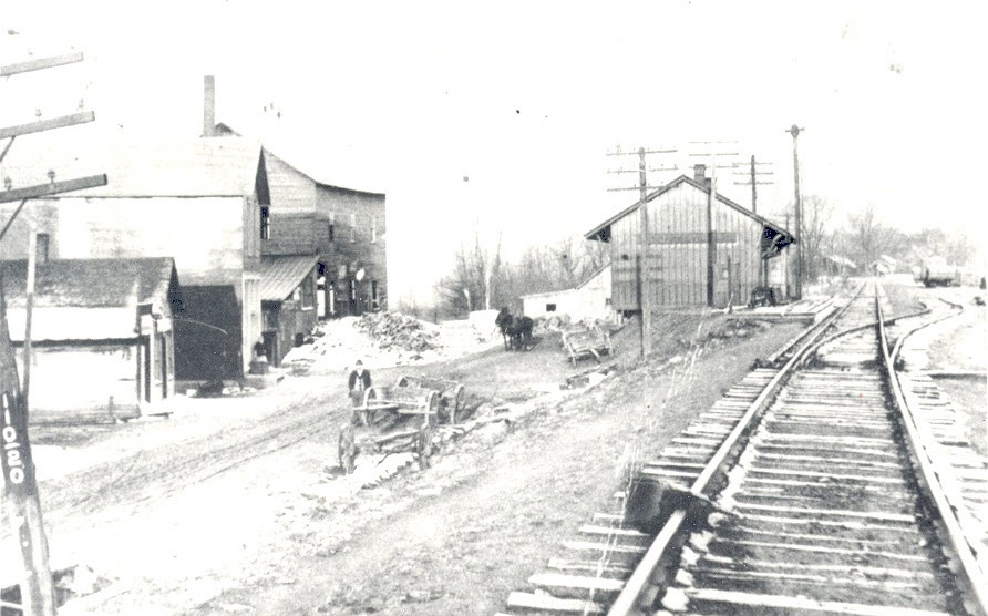
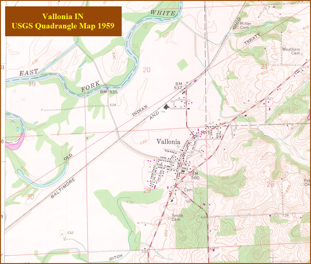
Vallonia IN
Vallonia is about 14 miles to the southwest.
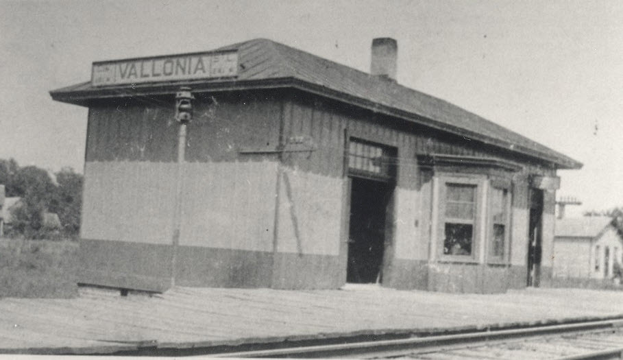 Sara Marling Thomas
Seymour, at the junction of two great railways (at the time), made its way into railroad history on October 6, 1866 when the Reno gang committed the nation’s first train robbery there. The historic incident was reported a week later in the Seymour Times. The Reno Gang boarded the Ohio & Mississippi train in Seymour and committed the robbery as it was moving, heading east out of town.
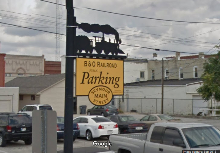
A parking lot sign adjacent to the Diamond
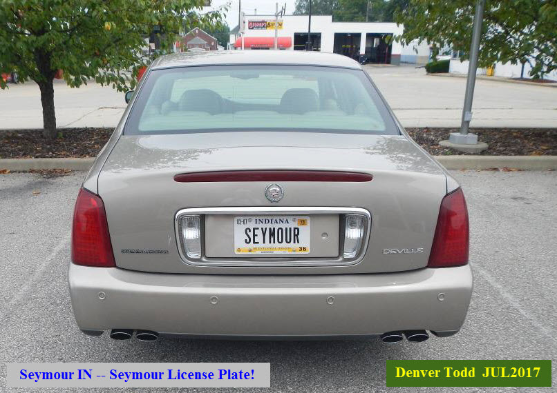 Seen around town....
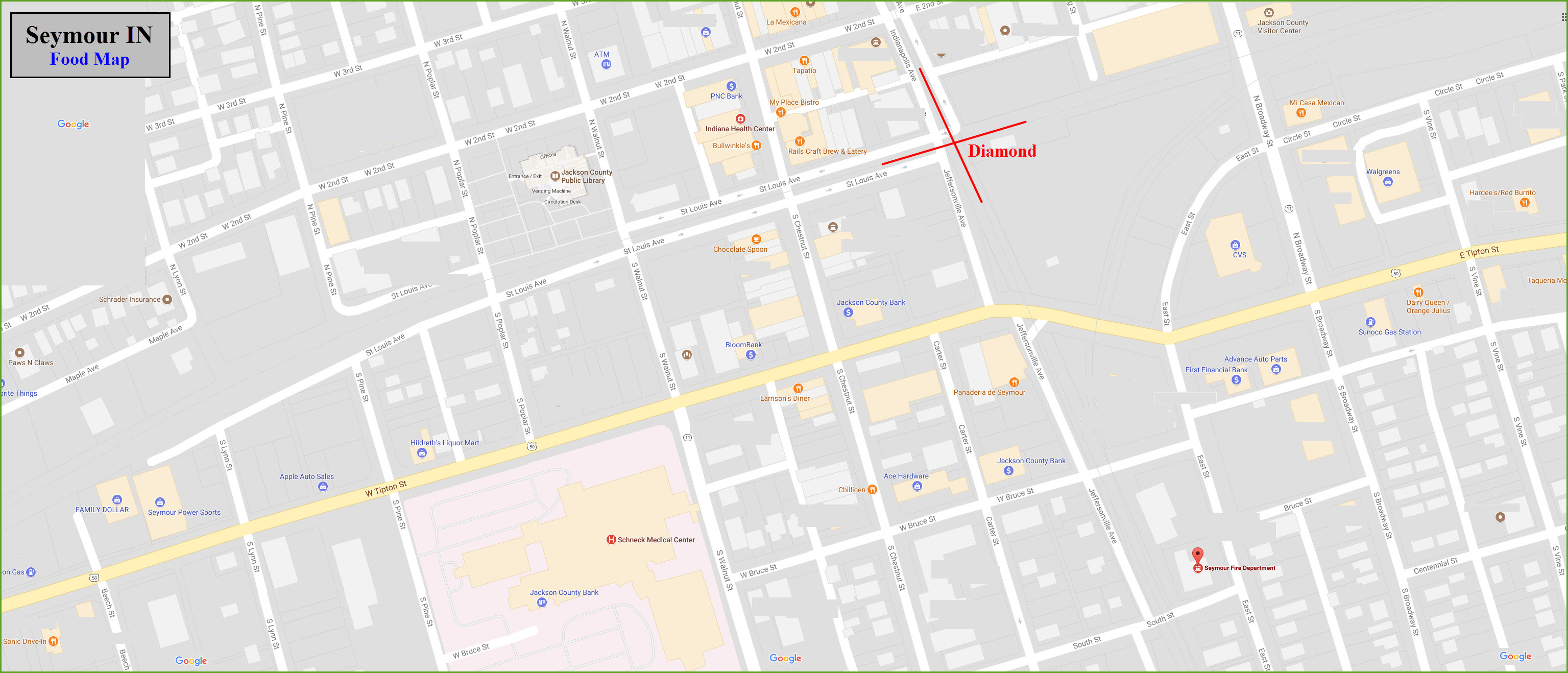
Courtesy of the University of Texas Library, click here for their index page.
Disclaimers:
New format 10/26/23: Please check out my disclaimer page for my standard dribble and contact info here
RAILFAN GUIDES HOME
RAILROAD SIGNALS HOME
NEW 07/17/2017, DEC30/2024, JUL19/2025
Last Modified 19-Jul-2025