RAILFAN GUIDES of the U.S.
Todd's Railfan Guide to
INDIANAPOLIS IN
Downtown
In General
Getting Here
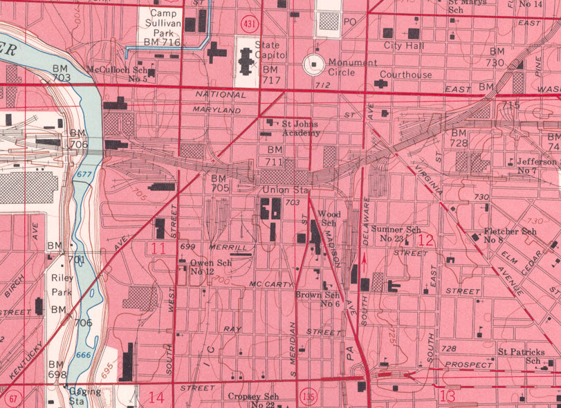
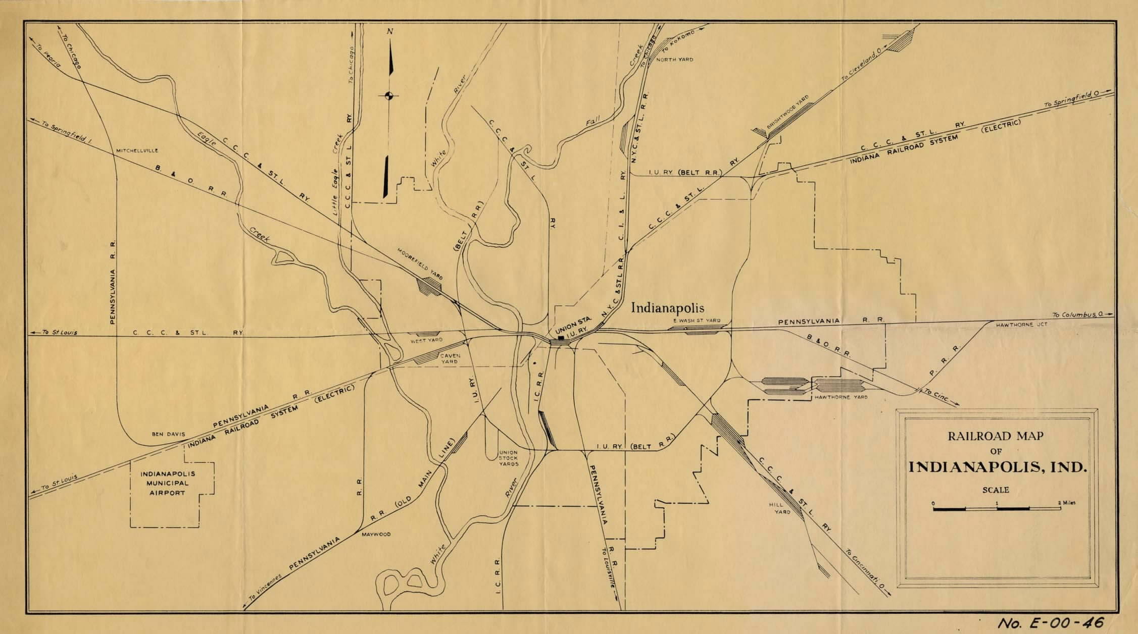
Map
Sights
What is Gone
Signals
Fire & Police
Floobydust
RAILROAD SIGNALS HOME
Location / Name:
Indianapolis IN - Westside
What's Here:
Amtrak Station
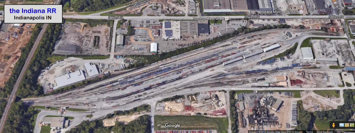
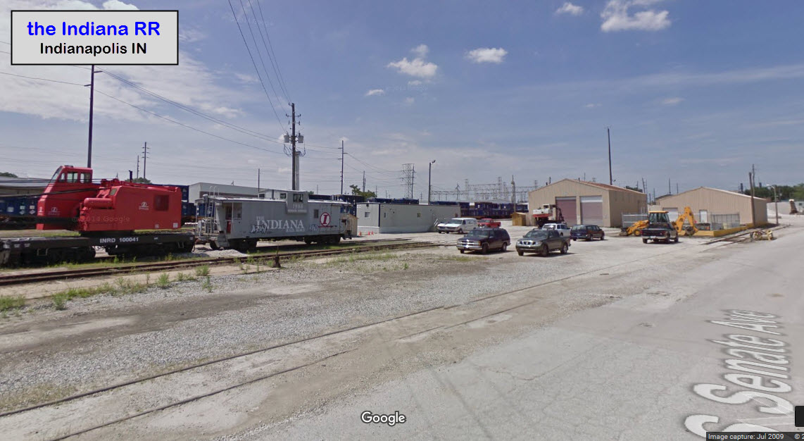
the Indiana Railroad
Data:
GPS Coordinates: 39.768497, -86.157995 (Soldiers Monument downtown)
ZIP: 46204
County: Marion
Phone AC: 317/463
Access by train/transit:
Amtrak - downtown
The Scoop:
Indianapolis was, and still is, a great town to railfan in and around. There is plenty to do, and plenty to see.
Indianapolis is central to so many other great places to railfan, it is hard to mention them all here. Kokomo is about 50 miles due north on US31. Ft Wayne is about 105 miles northeast via I-69. Lafayette is about 60 miles northwest. Champaign is about 115 miles west on I-74. Terre Haute is about 70 miles southwest, and has a couple of towers on display that have been moved. Cincinnati is 100 miles southeast via I-74. Gary is about 165 miles up I-65 to the northish west. Last, but not least, is the Linden Depot Museum about 53 miles away out I-74, then north on US231.
Acknowledgements:
Tim Vermande, Gary Vierk, Google Maps
Websites and other additional information sources of interest for the area:
http://www.nuvo.net/GuestVoices/archives/2012/07/20/photos-of-indianapolis-public-transit-1890-1940
http://monon.org/4thMononScan.html
http://evansvillerail.blogspot.com/2011/09/another-day-another-company-chooses-us.html Not really pertinent to Indianapolis, but......
Aerial shots were taken from either Google Maps or www.bing.com/maps as noted. Screen captures are made with Snagit, a Techsmith product... a great tool if you have never used it!
This is a new page, and I am soliciting contributions to make it better. Please send contributions to me via my contact page (below).
GPS Coordinates: 39.762449, -86.160028
The two pictures below were taken from the station parking garage.
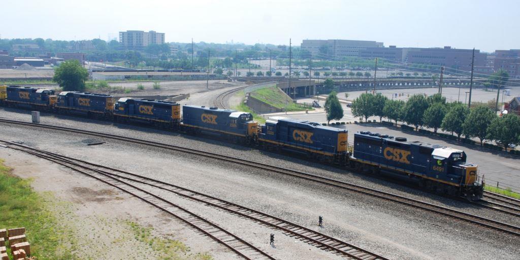 Picture courtesy Tim Vermande
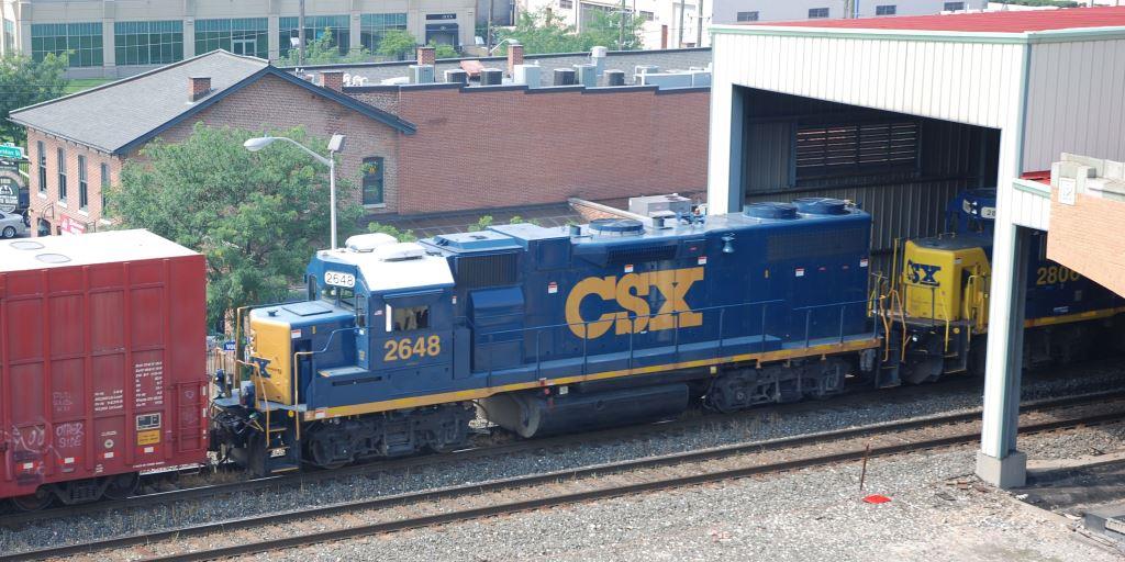 Picture courtesy Tim Vermande
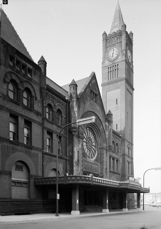
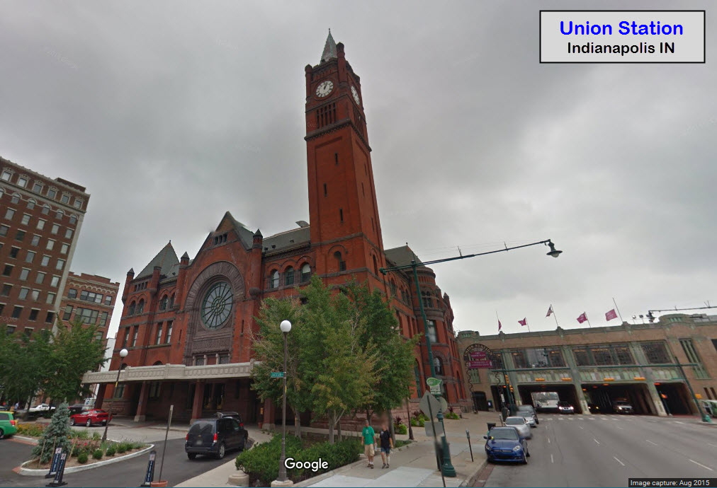
GPS Coordinates: 39.763058, -86.159590
The first station built here, opening on September 20th, 1853, Indianapolis' Union Station was the first such station to open and be called Union Station. It was built by the Indianapolis Union Railway. The building standing today was the second such structure, and was completed in September 1888. Indianapolis was also the first city to address the issue of multiple stations for each and every railroad by consolidating "it all" at one central place, Union Station.
https://en.wikipedia.org/wiki/Indianapolis_Union_Station
https://www.nps.gov/nr/travel/indianapolis/unionstation.htm
http://www.indianapolismonthly.com/city-buzz/who-killed-union-station/
 1970
1970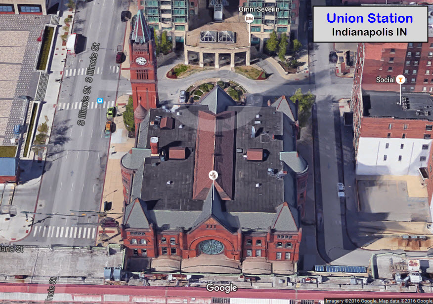
![]() A
A
Adja
![]() A
A
Adja
Here are a couple of maps to show you what has disappeared from Indianapolis over the past 50-60 years. Even when I was travelling to Indianapolis for business back in the 1998-2002 timeframe, you could still see old Pennsy and old B&O signals still standing, although not used (I saw ONE B&O CPL while driving on the highway one day, and could never figure out where it was when I went railfanning :-(. I'm sure they are long gone, as were most of the abandoned tracks portrayed in this section.
Indianapolis Fire Department
Engine 25
 Photo courtesy Tim
2
Disclaimers:
I love trains, and I love signals. I am not an expert. I do these pages because I love spending my time doing them - although I do a reasonable amount of research to make sure the information presented is accurate! :-) :-)
Please Note: Since the main focus of my two websites is railroad signals, the railfan guides are oriented towards the signal fan being able to locate them. For those of you into the modeling aspect of our hobby, my indexa page has a list of almost everything railroad oriented I can think of to provide you with at least a few pictures to help you detail your pike.
If this is a railfan page, every effort has been made to make sure that the information contained on this map and in this railfan guide is correct. Once in a while, an error may creep in, oooooooops, oh well! :-)
My philosophy: Pictures and maps are worth a
thousand words, especially for railfanning. Text descriptions only
get you so far, especially if you get lost or disoriented. Take
along good maps.... a GPS is OK to get somewhere, but maps are still
better if you get lost! I belong to AAA, which allows you to get
local maps for free when you visit the local branches. ADC puts
out a nice series of county maps for the Washington DC area, but their
state maps do not have the railroads on them. If you can find em,
I like the National Geographic map book of the U.S..... good, clear, and
concise graphics, and they do a really good job of showing you where
tourist type attractions are, although they too lack the railroads.
Other notes about specific areas will show up on that page if known.
BTW, floobydust is
a term I picked up 30-40 years ago from a National Semiconductor data
book, and means miscellaneous and/or other stuff.
Pictures and additional information is always needed if anyone feels
inclined to take 'em, send 'em, and share 'em, or if you have
something to add or correct.... credit is always given! BE NICE!!! Contact info
is here
Beware: If used as a source, ANYTHING from Wikipedia must be treated as being possibly being inaccurate, wrong, or not true.
RAILFAN GUIDES HOME
RAILROAD SIGNALS HOME
NEW
10/26/2016
Last Modified
29-Oct-2016