
In General
Getting Here
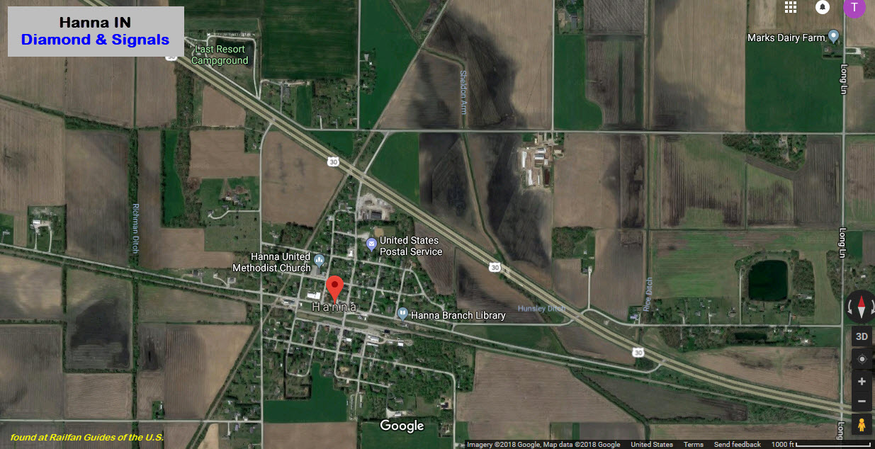
Map
Signals
Pictures
Floobydust
USGS Maps
RAILROAD SIGNALS HOME
Location / Name:
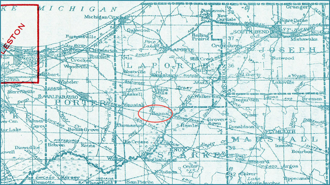
Hanna IN, LaPorte County
What's Here:
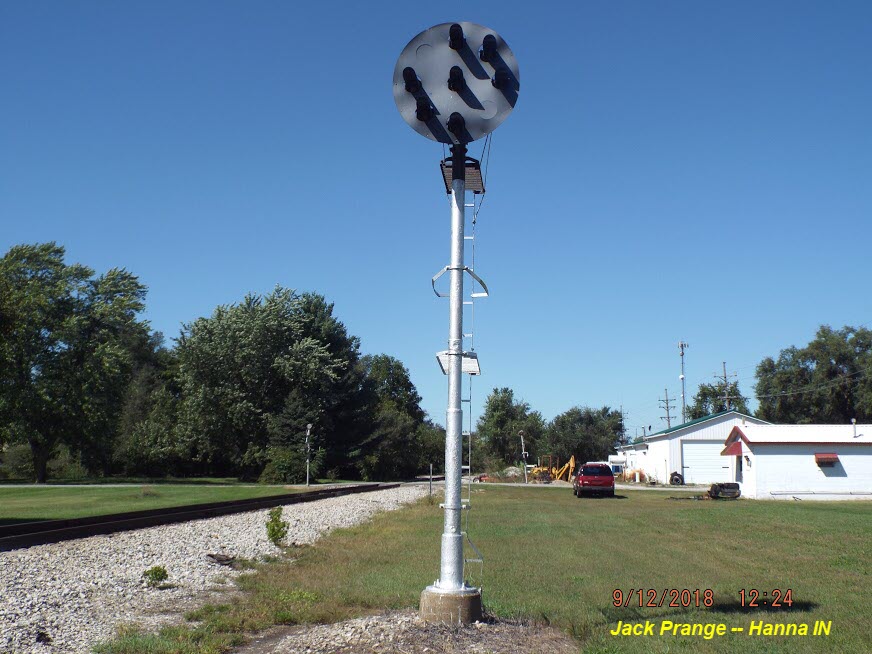
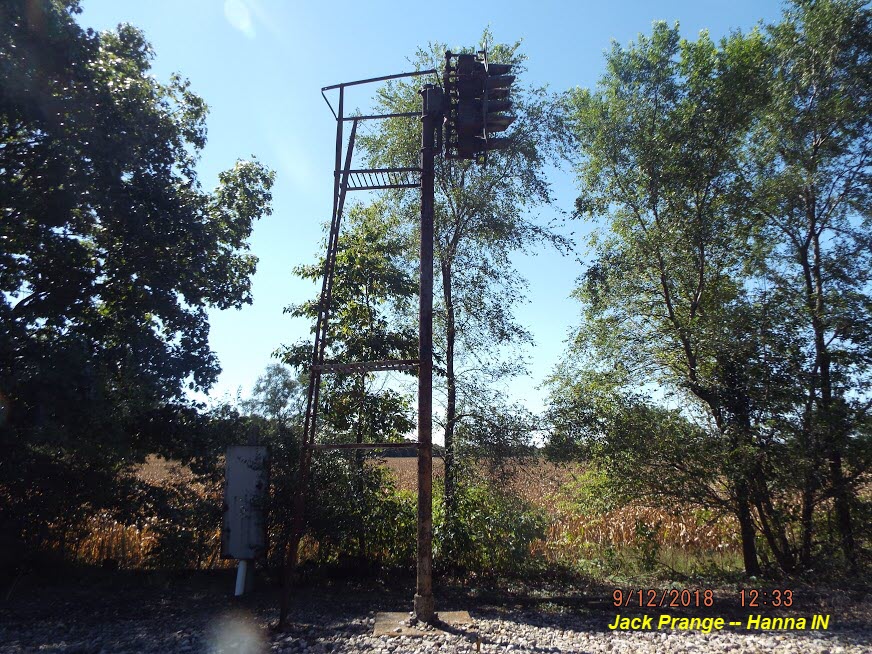
Diamond Crossing
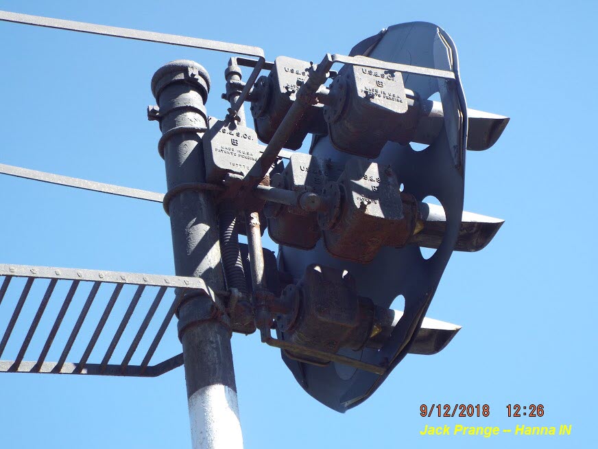
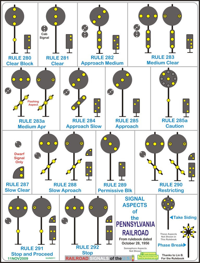
Pennsy PL Signals
Data:
GPS Coordinates: 41.412384, -86.784234 (at the diamond)
Phone A/C: 219
ZIP: 46340
Access by train/transit:
None
The Scoop:
This page exists only for the signals in town that protect the diamond.
All signal pictures and info are taken/provided by Jack Prange, except as noted. Thanks to Jack for taking the pictures and sharing them with everyone.
Hanna was a crossing between an east/west PRR line, and a north/south Pere Marquette line.
Today, the tracks belong to the Chicago, Ft. Wayne & Eastern Railroad (CF&E)(the Pennsy tracks) & Indiana Box Car Corporation (IBCX).
The frequency of trains thru town is pretty low, in the order of maybe 1 to 4 trains a day.
Acknowledgements:
Jack Prange
Michael Polk
Websites and other additional information sources of interest for the area:
None so far
Hanna is off US 30, about 16 miles east of Valparaiso IN, or about 85 miles west of Ft Wayne IN.
From Gary IN, Hanna is about 40 miles via 53 south out of Gary to US 30, then east going thru Valparaiso.
It is about 39 miles SW of South Bend IN, via 23 and then US 30.
From Indianapolis, there is no real easy way without either traveling a circuitous routes (~164mi), or by taking back roads (~150mi). The longer route is via I-64 to exit 253 (plenty of hotels and services, BTW) for US 30, and heading east. The slightly shorter (and slower) route is via exit 201 for US 231, heading east 5 miles to US 24, take that east 8.7 miles to US 421 where you will make a left and go north on 421 about 47 miles to Wanatah IN and US 30, where you will take a right to Hanna for the last 6-1/2 miles.


GPS Coordinates: 41.412165, -86.782321
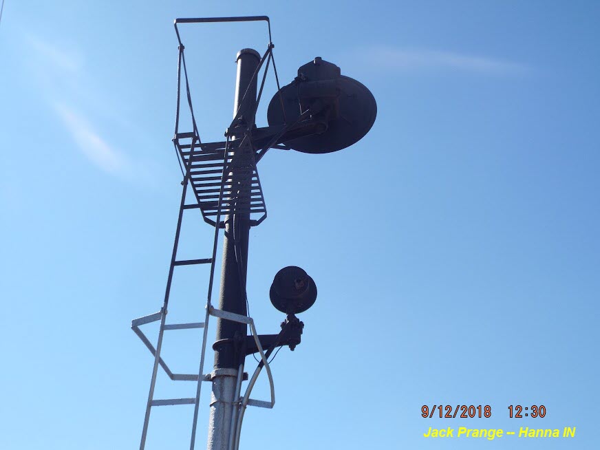
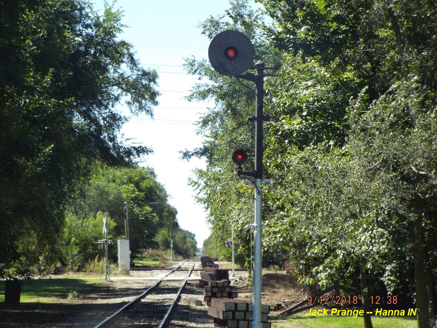
If you look at both of these Pennsy signals, you will notice a piece of tape (or something like that) covering a hole, and you will also notice that there is a platform adjacent to that hole. So I guessing, at one time, these two signals also had a lower head, like the one below that Michael captured pictures of.


GPS Coordinates: 41.412637, -86.786129
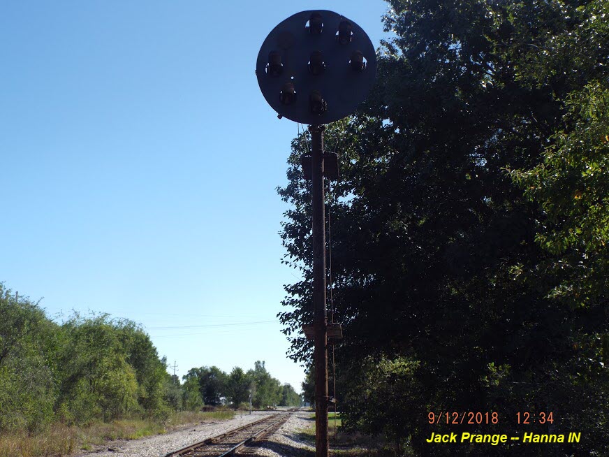
GPS Coordinates: 41.411447, -86.784910
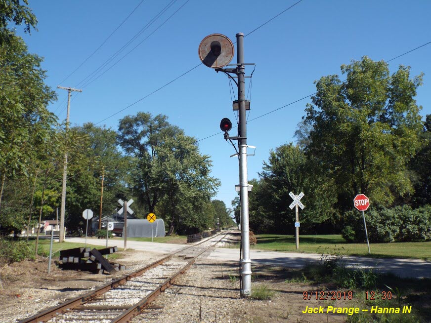
GPS Coordinates: 41.413377, -86.783520
The first picture by Michael Polks is said to be taken in Hanna IN, however, it must be at a signal outside of town, as it is not taken at one of the signals protecting the diamond - there is no way to get the signal on the side of the tracks, facing this direction, plus, the signal has the lower lamp plus an aspect on the reverse 45 (for CAUTION), which the signals at the diamond can not display....
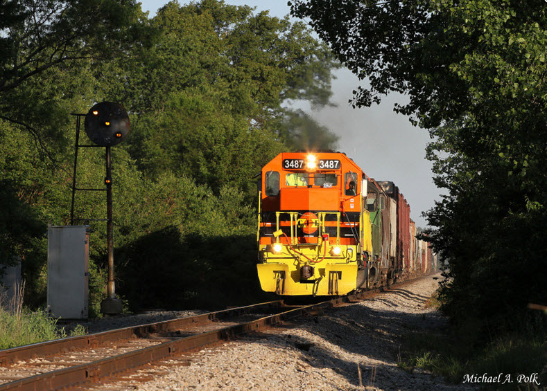
This picture is probably at the first signal location above.

And one for each direction on the IBCE....
None. I'm sure there had to be at least a station here in town at one point, but I'm not coming up with anything, so far.....
For those of you not familiar with the Pennsy PL signals, here is my chart of the indications:
Courtesy of the University of Texas Library, click here for their index page.
So far, this is all I can come up with, taken from the 1925 index map for Indiana.
Disclaimers:
I love trains, and I love signals. I am not an expert. My webpages reflect what I find on the topic of the page. This is something I have fun with while trying to help others.
Please Note: Since the main focus of my two websites is railroad signals, the railfan guides are oriented towards the signal fan being able to locate them. For those of you into the modeling aspect of our hobby, my indexa page has a list of almost everything railroad oriented I can think of to provide you with at least a few pictures to help you detail your pike.
If this is a railfan page, every effort has been made to make sure that the information contained on this map and in this railfan guide is correct. Once in a while, an error may creep in :-)
My philosophy: Pictures and maps are worth a thousand words, especially for railfanning. Text descriptions only get you so far, especially if you get lost or disoriented. Take along good maps.... a GPS is OK to get somewhere, but maps are still better if you get lost! I belong to AAA, which allows you to get local maps for free when you visit the local branches. ADC puts out a nice series of county maps for the Washington DC area, but their state maps do not have the railroads on them. If you can find em, I like the National Geographic map book of the U.S..... good, clear, and concise graphics, and they do a really good job of showing you where tourist type attractions are, although they too lack the railroads. Other notes about specific areas will show up on that page if known.
Aerial shots were taken from either Google or Bing Maps as noted. Screen captures are made with Snagit, a Techsmith product... a great tool if you have never used it!
By the way, floobydust is a term I picked up 30-40 years ago from a National Semiconductor data book, and means miscellaneous and/or other stuff.
Pictures and additional information is always needed if anyone feels inclined to take 'em, send 'em, and share 'em, or if you have something to add or correct.... credit is always given! Please be NICE!!! Contact info is here
Beware: If used as a source, ANYTHING from Wikipedia must be treated as being possibly being inaccurate, wrong, or not true.
RAILFAN GUIDES HOME
RAILROAD SIGNALS HOME
NEW 09/13/2018
Last Modified
15-Sep-2018