
In General
Getting Here
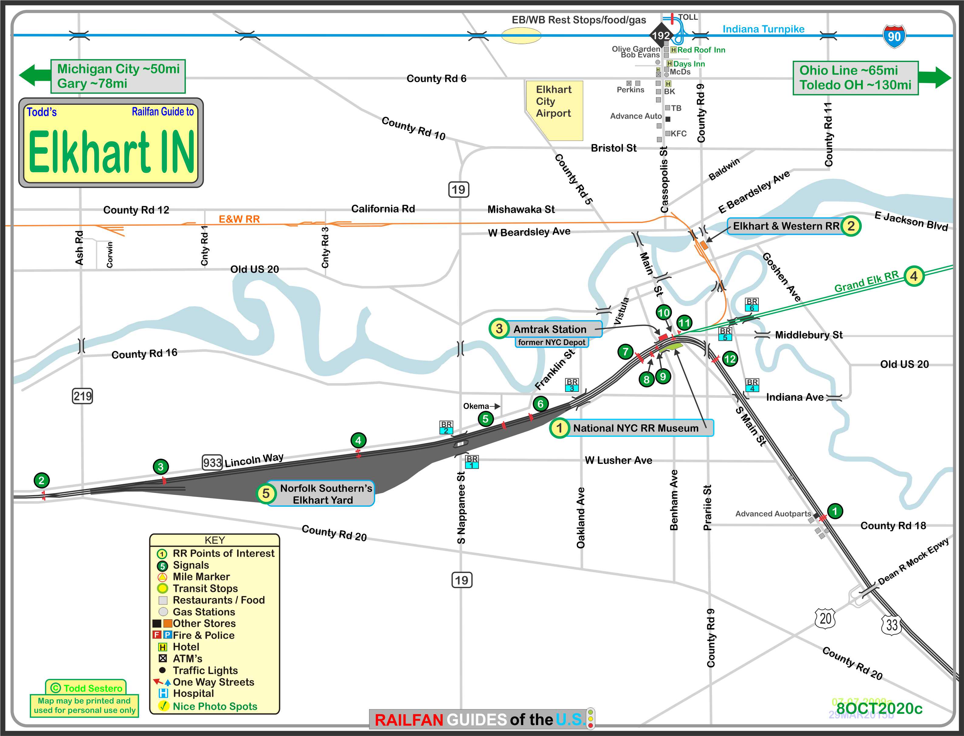
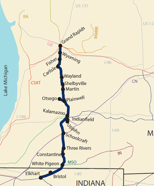
Map
Sights
Signals
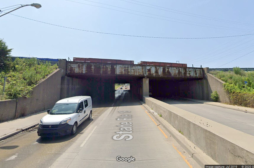
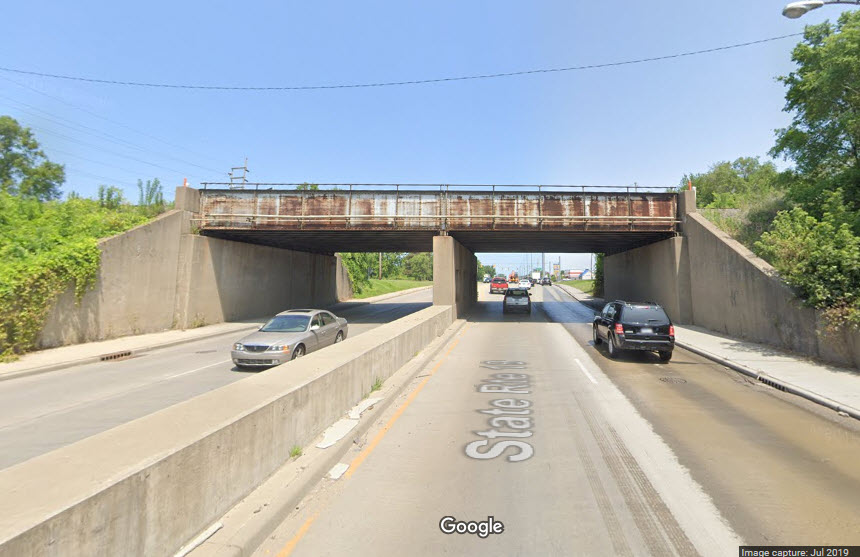
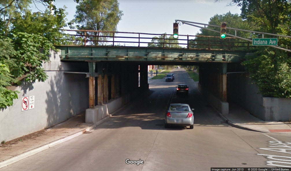
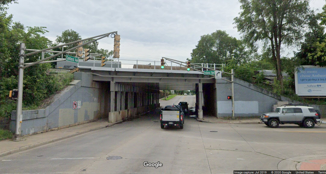
Bridges
Floobydust
USGS Maps
RAILROAD SIGNALS HOME
Location / Name:
Elkhart IN, County
What's Here:
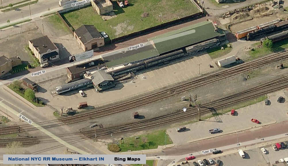
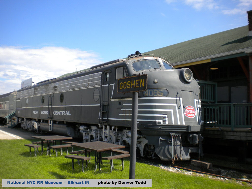
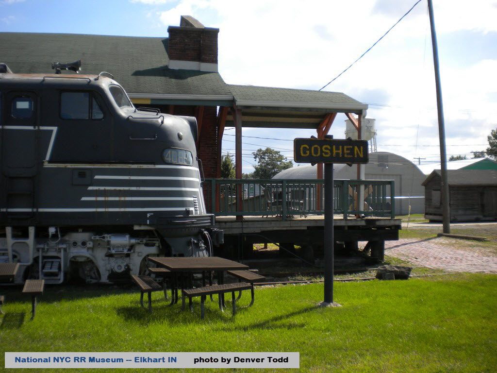
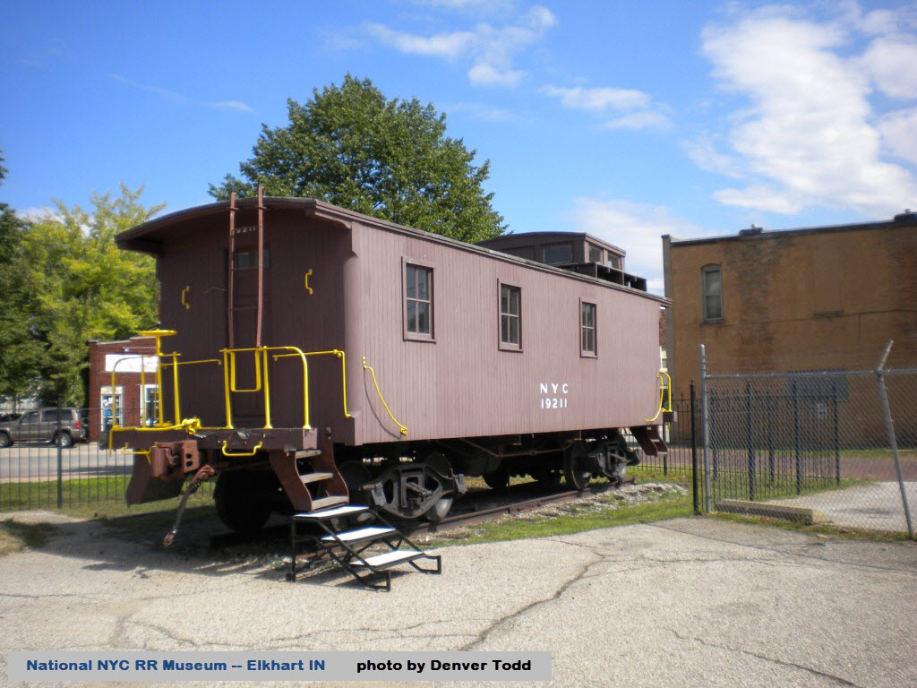
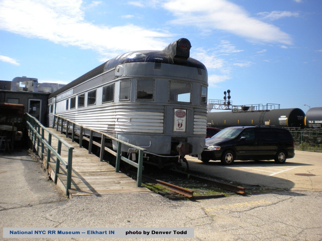
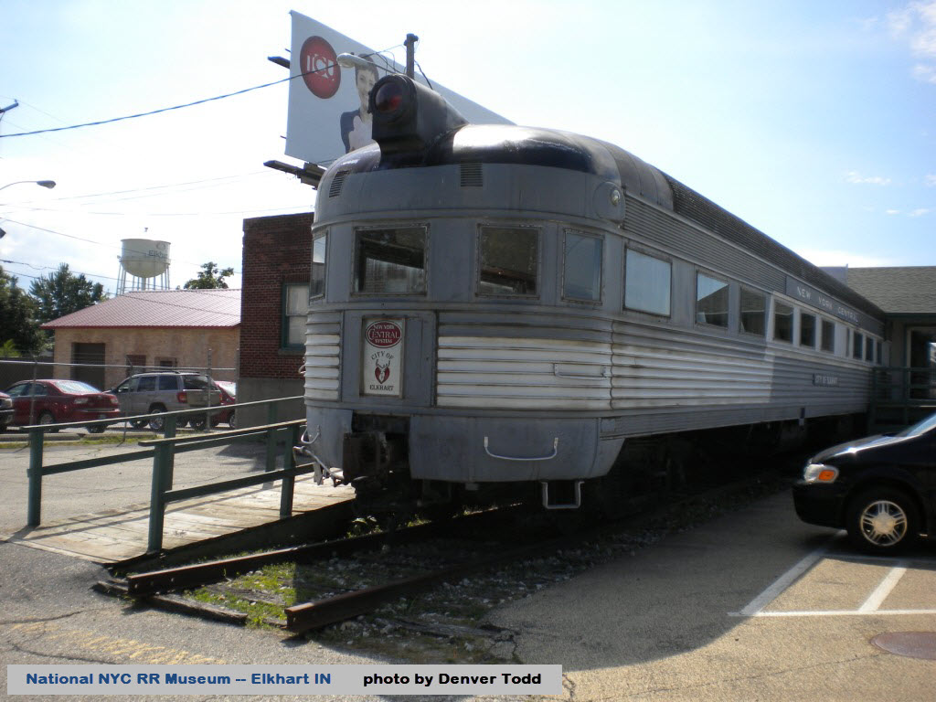
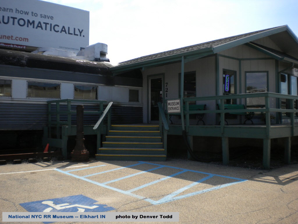
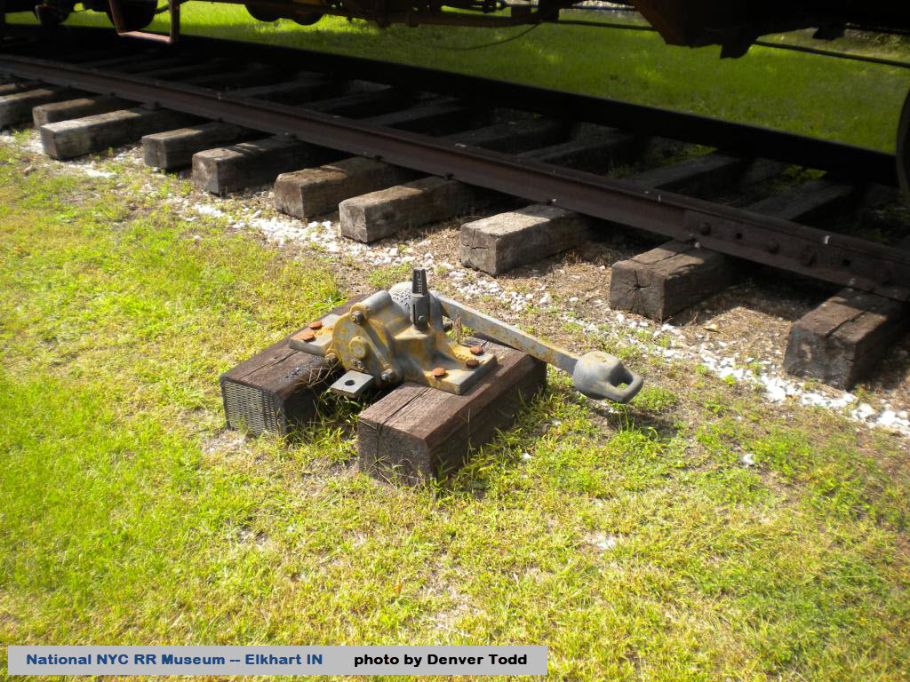
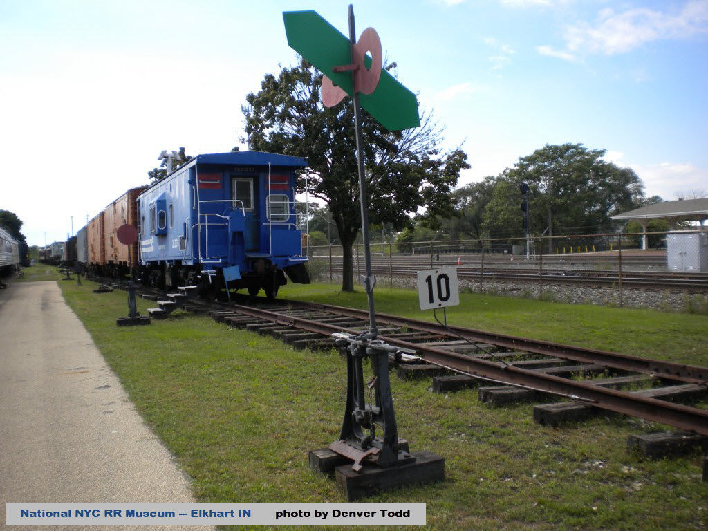
National New York Central RR Museum
Amtrak Station
Elkhart & Western RR
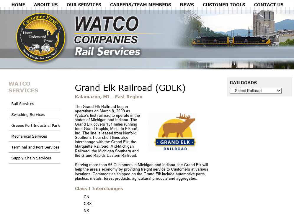
Grand Elk RR
NS Elkhart Yard
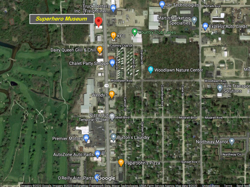
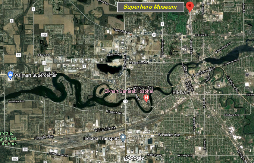
The Hall of Heroes Super Hero Museum
Data:
GPS Coordinates: as needed
Phone A/C: 574
ZIP: 46516
Access by train/transit:
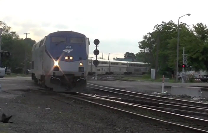
Amtrak
The Scoop:
Elkhart is a neat little town with a big yard. Furthermore, it is home to the National NYC RR Museum, the Elkhart and Western RR, and a newly formed road by the name of the Grand Elk RR, going from here to Grand Rapids over the leased Norfolk Southern line, a 122.9 mile run.
In 1851, the Michigan Southern & Northern Indiana Railroad Company built the first rail line through the city, and by 1852 the first passenger train passed through town. This, in turn, caused major population growth. Today, Norfolk Southern has the biggest railroad presence in town, although Elkhart has 2 other railroads (the shortline Elkhart and Western (operated by Pioneer Railcorp) and the regional Grand Elk RR (operated by Watco). Amtrak has two trains that stop in Elkhart: the Lake Shore Limited and Capital Limited. Canadian Pacific runs 6-8 trains through town on Norfolk Southern's trackage. From http://familypedia.wikia.com/wiki/Elkhart,_Indiana
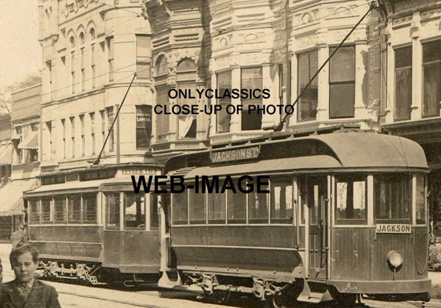
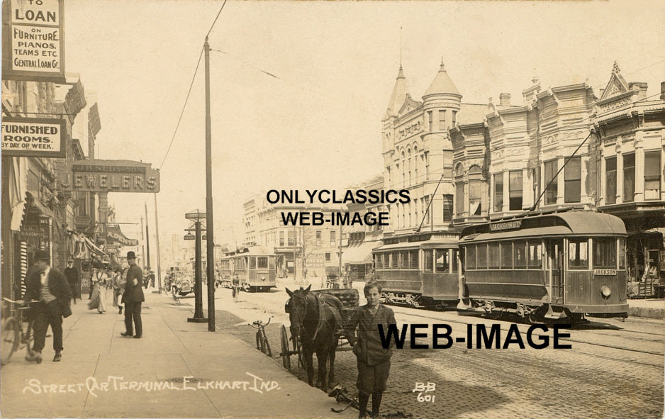
In 1889, the second streetcar system in the world opened on Elkhart, but was subsequently taken apart in the mid 60's as the bus revolution took place (as done in most U.S. cities).
If anyone has better pictures of the signals, please consider sending them to me.... thanks.
Acknowledgements:
Adam Lloyd, photos
Jack Prange II for tips and photographs
bnsf7562
spikedawg09
Denver Todd for pictures of the National NYC RR Musuem
Websites and other additional information sources of interest for the area:
Below as needed.
Getting here is easy, since it is right off of the Indiana Turnpike (I-90) at exit 192.
I-90 to the east splits at Cleveland into I-80 and I-90, I-80 takes you to NYC, and I-90 takes you to northern NY and the rest of the east coast via Boston.
I-90 to the west brings you in from Chicago way.
The closest north-south interstate is I-69, which goes north to Lansing MI and south to Indianapolis.
If your flying into the area, Chicago would be your best bet for cheap fares, it's about a 105 mile drive.
Michigan City is ~50 miles away, and Gary IN is about 75 miles away.
Click here for the map in PDF form.
Here are a couple of photo tips from Jack Prange II, who visits Elkhart about once a month to take pictures (please note, these locations do not reference my site locations below):
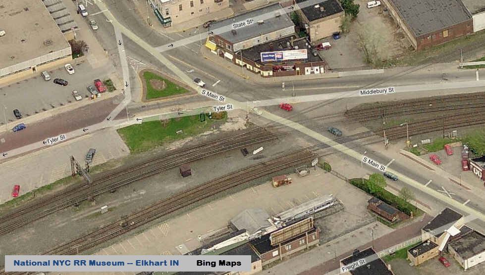
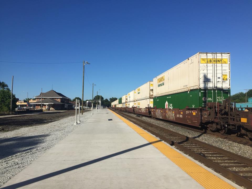
Location A: The Depot is still a good place to shoot from, although you might want to shoot from the side with the over hang since a new business went at the station and is using the parking on the left side of the building.
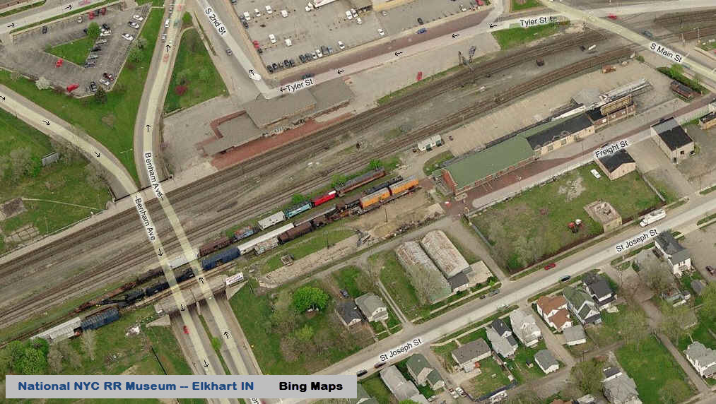
Location B: National New York Central Railroad Museum on the south side of the station.
Location C: At the west end of the yard on the north side, there is a former Green House/Garden Center that is now something else. On the right side there is access road to the business that is not used you can sit there and watch train leaving from the on the Westbound departure and come in on the Inbound Runner and not get run-off for trespassing.
Location D: The Gas Station in the same area but wouldn't really suggest it since it's always busy. And,
Location E(ish): Is the fuel pad right next to 933..... there is a business there that closes up after a certain time, and you can use the parking spots after they close.
We'll try to get him to take some signal pictures on his next visit :-) :-)
GPS Coordinates: 41.680434, -85.970299
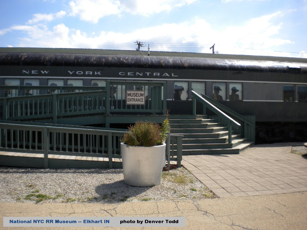
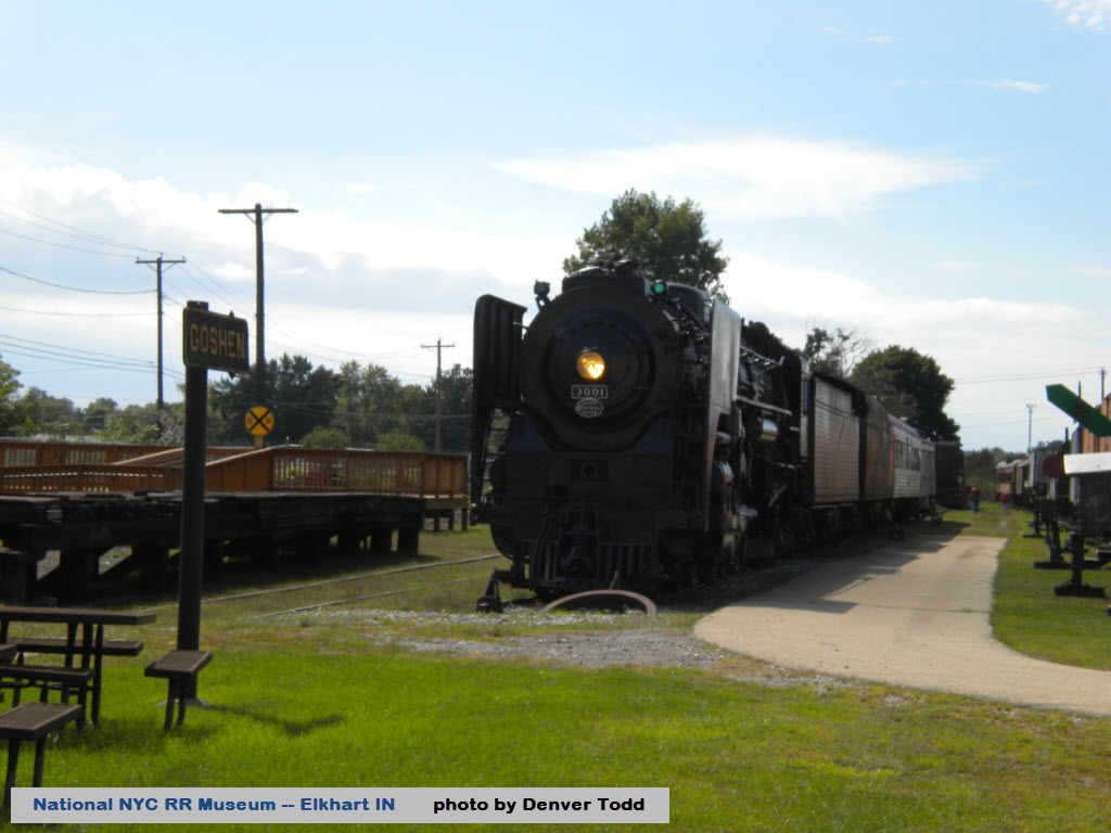
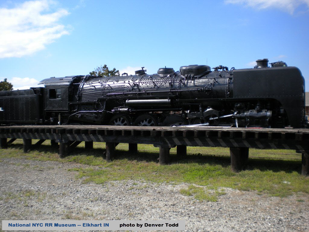
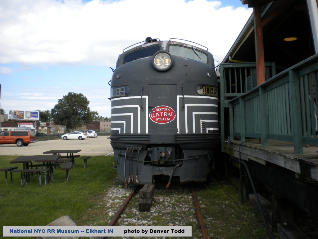
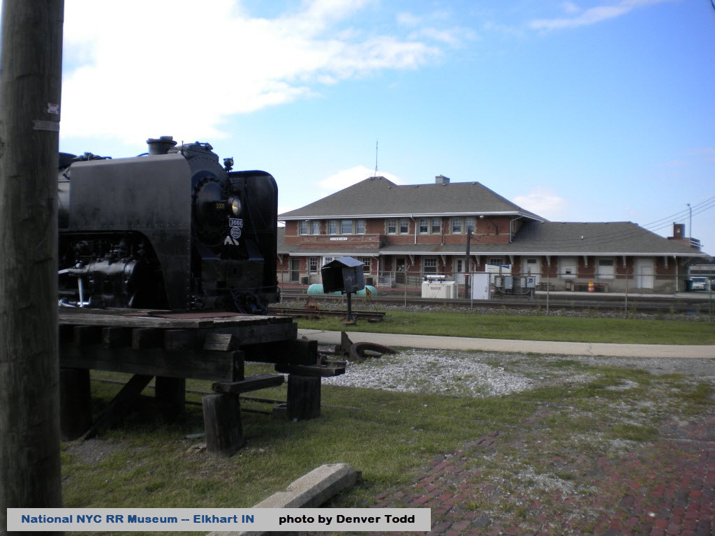
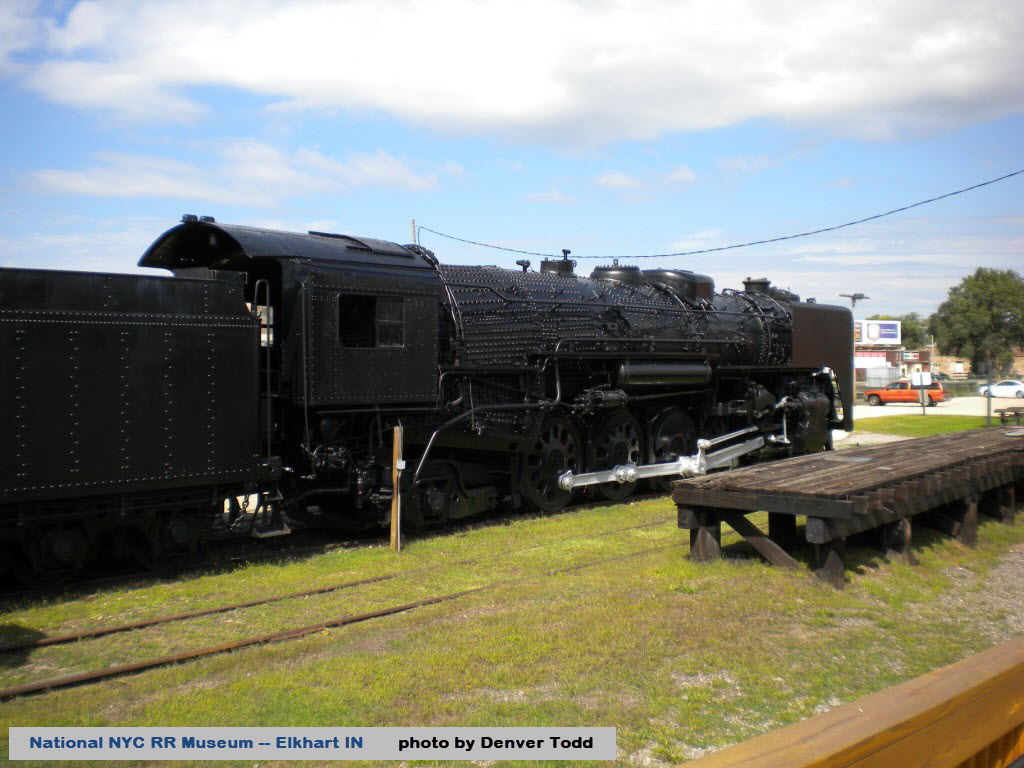
The museum is housed in a former New York Central freight warehouse, and sits across from the depot on the south side of the Norfolk Southern main line.
http://www.nycrrmuseum.org/
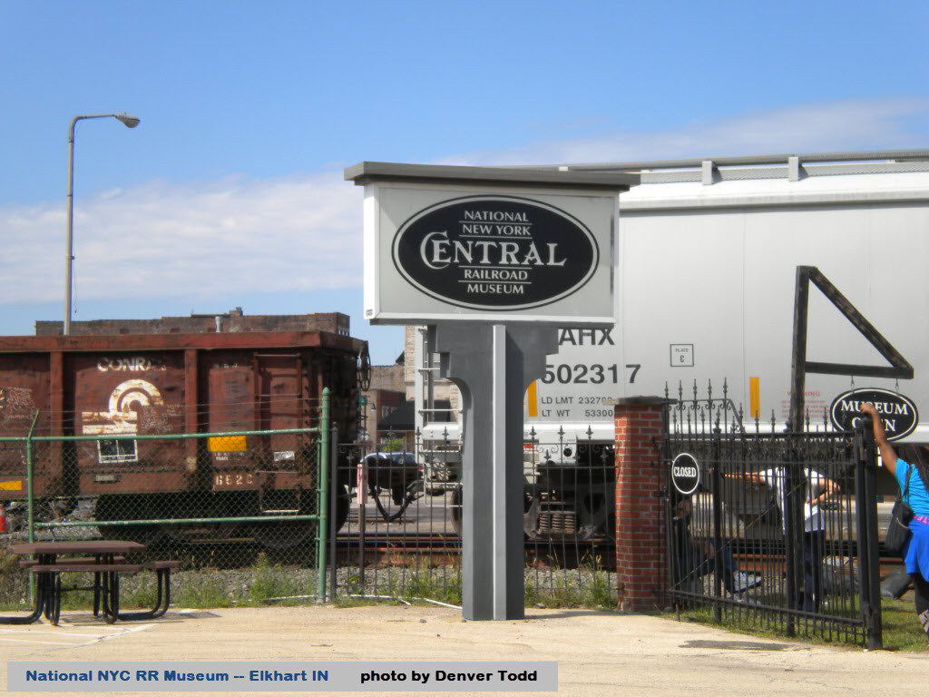
Three views of the National NYC RR Museum in downtown Elkhart.
All of the photos below are courtesy Denver Todd.


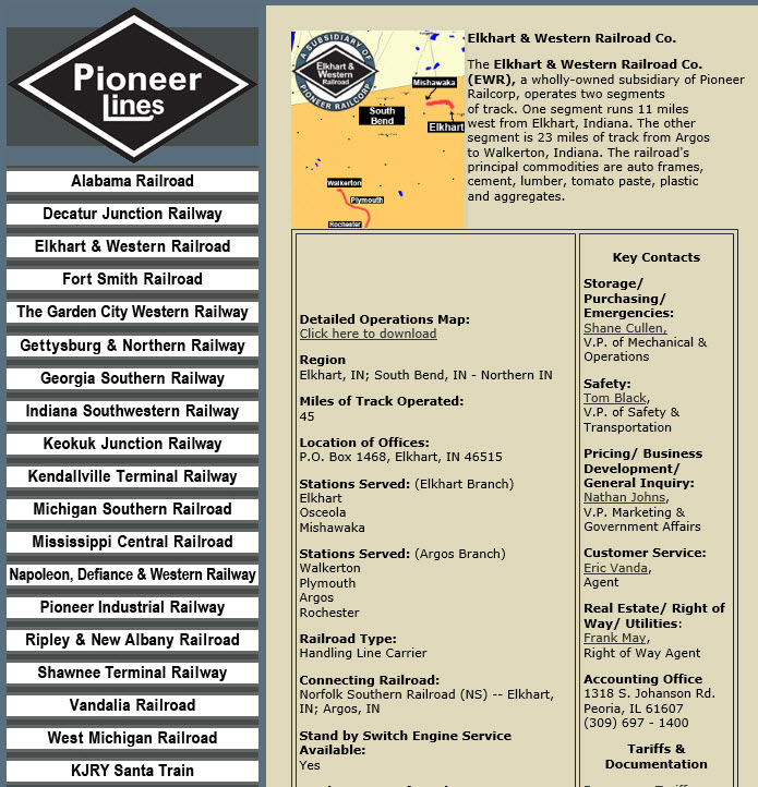
For more info, check out their page at: http://www.pioneer-railcorp.com/ewr.html
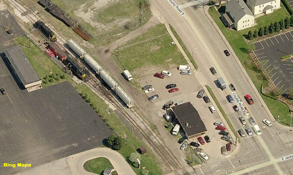
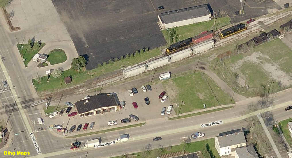
The office for the Elkhart and Western.
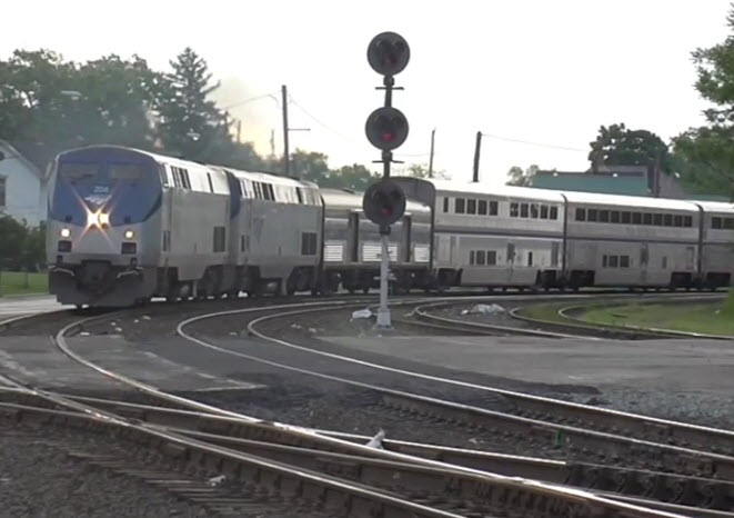
The Capitol Limited coming through, picture from video by bnsf7562
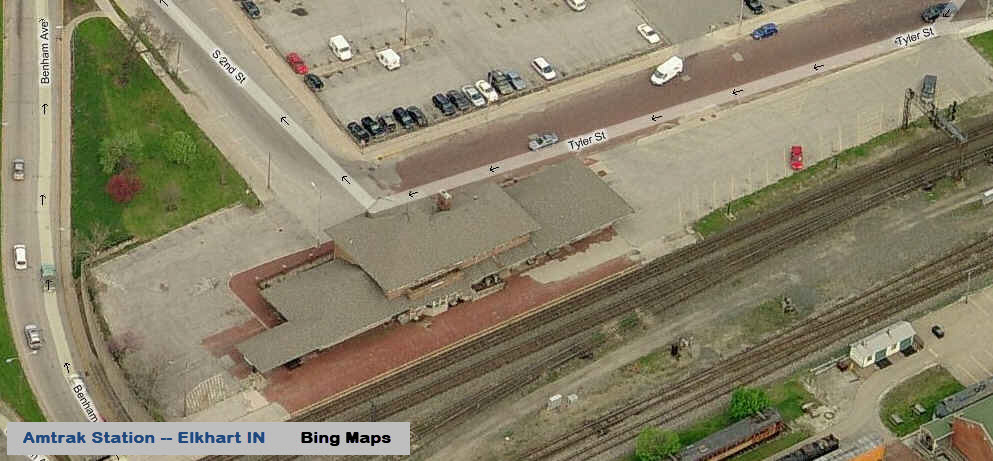
The Amtrak station is across the tracks from the NYC Museum.
After the track re-alignment.... Adam Lloyd, 2018
http://en.wikipedia.org/wiki/Grand_Elk_Railroad
http://grandelkrailfans.weebly.com/
According to sources found elsewhere, the Grand Elk RR started operation on March 7th or 8th of 2009.
Their headquarters is in Kalamazoo, but their engine work is performed in Grand Rapids.
Scanner frequencies:
160.800 - Switching/Road
160.860 - Hugart Yardmaster
161.070 - Switching/Road
161.505 - Amtrak Line Road
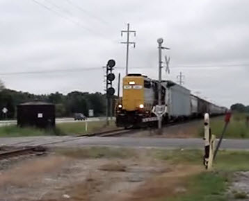
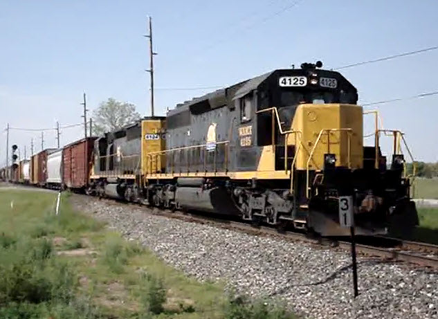 At MP31, Three Rivers at Main St, NB, picture from video by spikedawg09
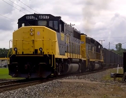 Also at MP31, Three Rivers at Main St, NB, picture from video by spikedawg09
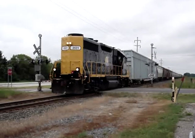
At Heimbach Rd, SB, also by spikedawg09, notice the signals
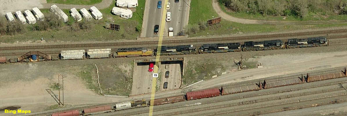
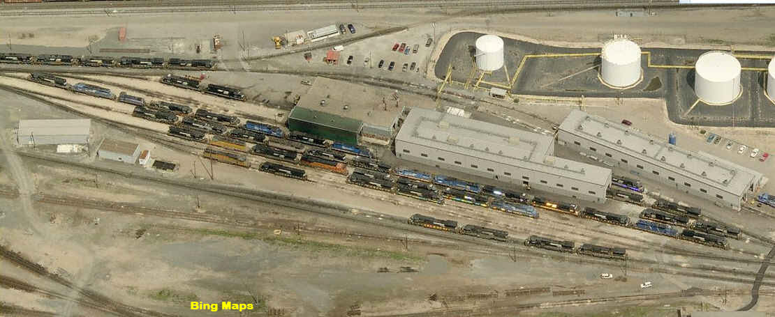
You never know what you will see coming in and out of Norfolk Southern's yard... When I was there years ago, I caught a couple of Susie-Q SD's on the lead of a freight!
Nice yard, too bad there isn't a good place to watch the operations from. NS cops are particularly nasty and efficient, and can and will arrest you for trespassing. The best yard I've come across for watching is the Norfolk Southern one in Roanoke VA, where they don't seem to mind if you watch from up on the hill where the yard tower is... great view from up there, BTW!!!!
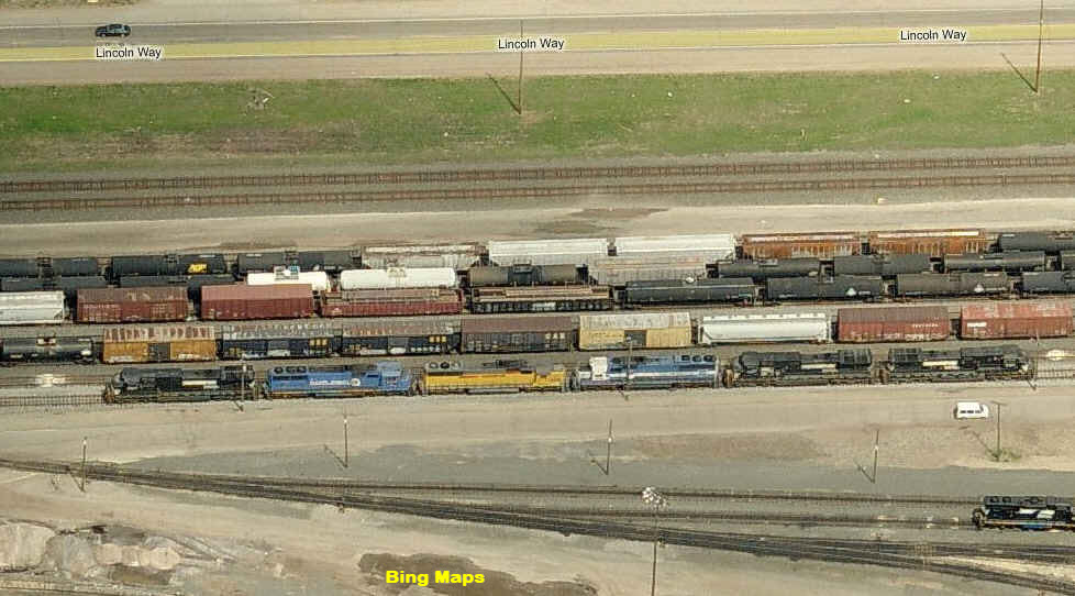
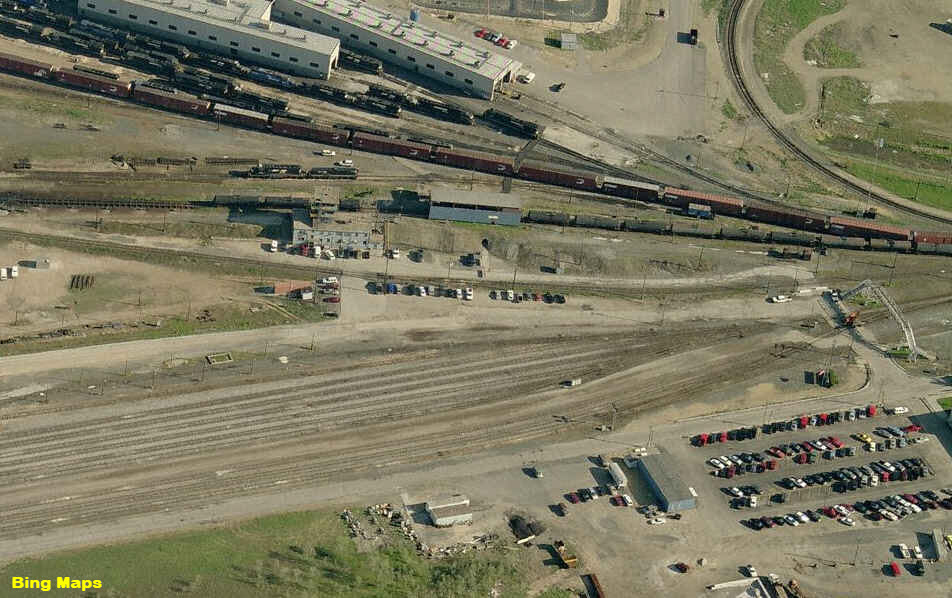
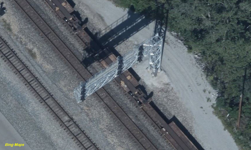
The NS yard is large enough that you can't fit it into one birds eye view, so I present an aerial shot for you.
GPS Coordinates: 41.06471, -85.97249
1915 Cassopolis Street, Elkhart, IN 46514
574-333-3406
M Tu Th F: 11:00-17:00 // Closed Wed // Sa: 10:00-17:00 // Su: 12:00–17:00
https://www.hallofheroesmuseum.com/
https://www.facebook.com/hohmuseum/
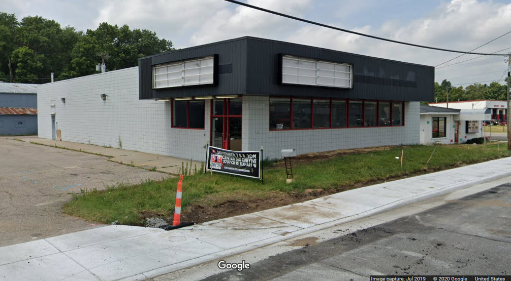
The Hall of Heroes Superhero Museum is nestled in the heart of the Midwest and offers fans of superheroes, film, animation and history in general an opportunity to gaze upon and interact with one of the largest collections of superhero memorabilia, art, and comics in the U.S., if not the world. Our collection is comprised of over 60000 comics, over 10000 toys and games, and over 100 pieces of animation and comic art. All of these fantastic pieces are located in a 5000 square foot facility on the north side of Elkhart, Indiana. This collection covers the 80 year history of superheroes in comics, toys, film, and animation. Among the items on display are several historically significant comic books, such as Captain America #1, Sensation Comics #1 (the first cover appearance of Wonder Woman), and an Amazing Fantasies #15 (the first appearance of Spider-Man) signed by Stan Lee. The picture below was taken a month or so before the museum opened at this location.
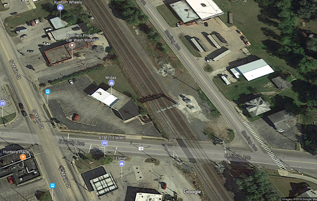
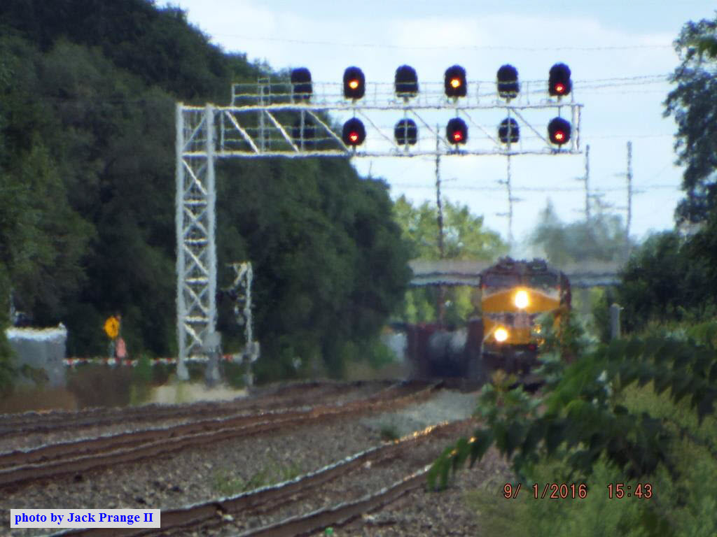
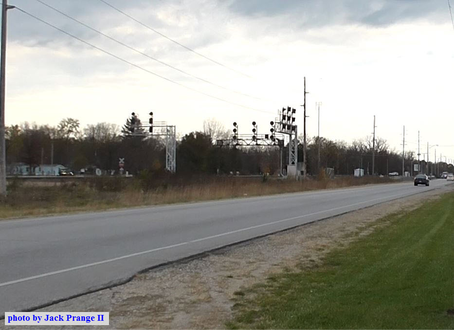
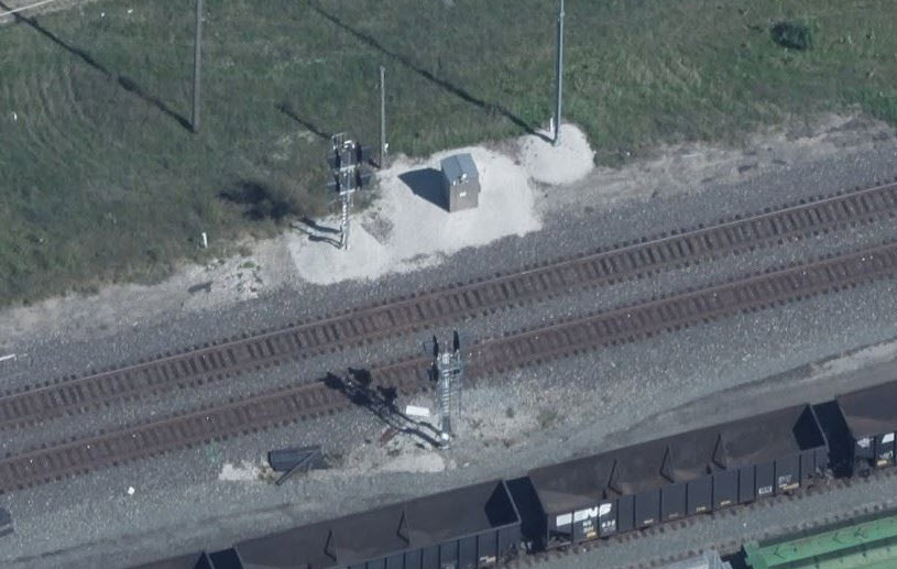
A signal bridge on the south side of town behind an Advance Auto, just above E Hively Ave/County Road 18.... There aren't as many signals in town as you would think.
These signals were replaced in early 2016? They used to be searchlight signals.
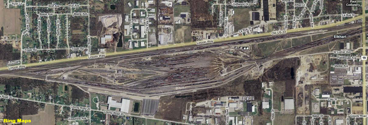
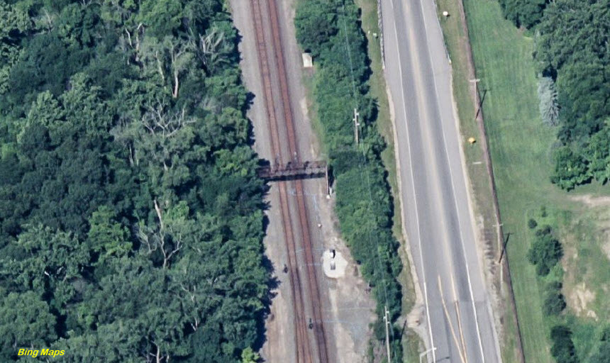
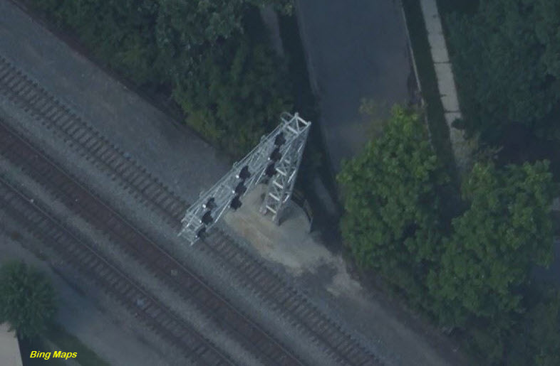
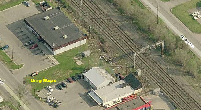 An older aerial shot.
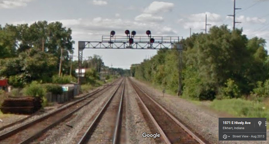
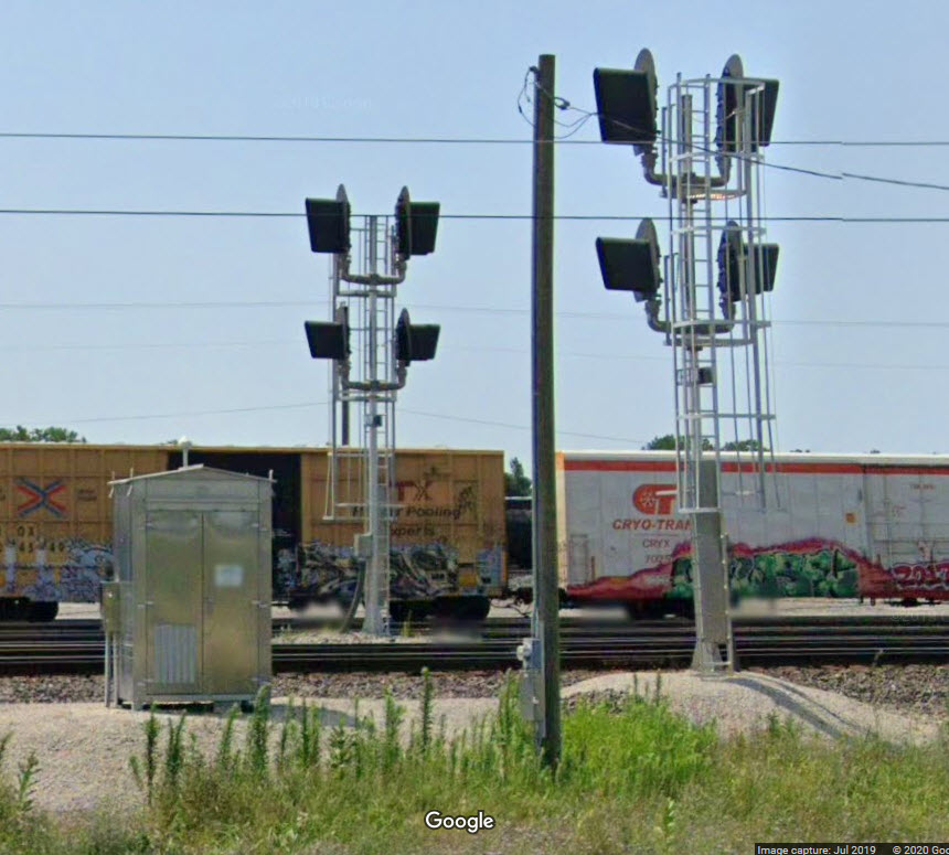
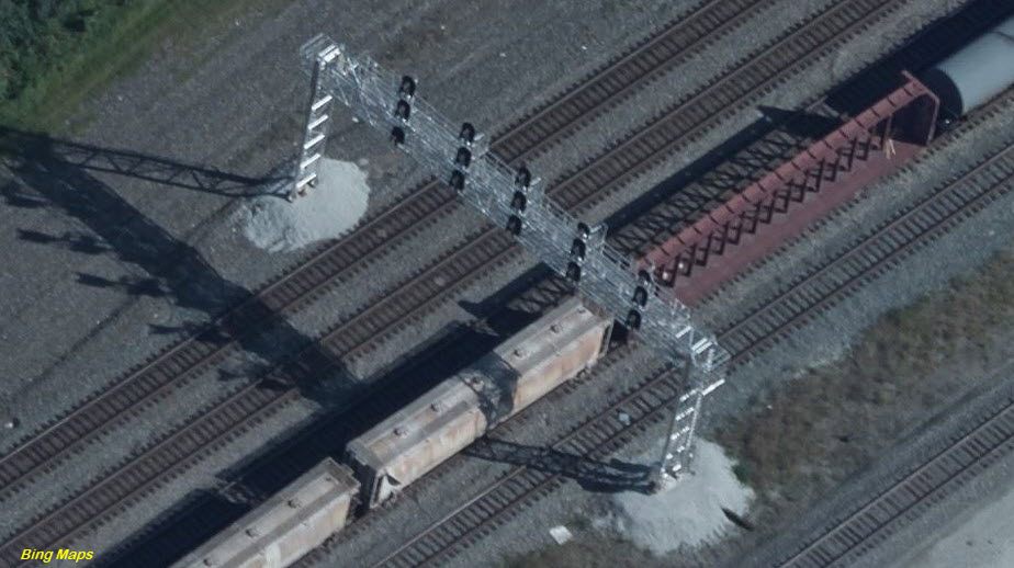
Above: A view from Hively Ave, taken by Google in 2013.
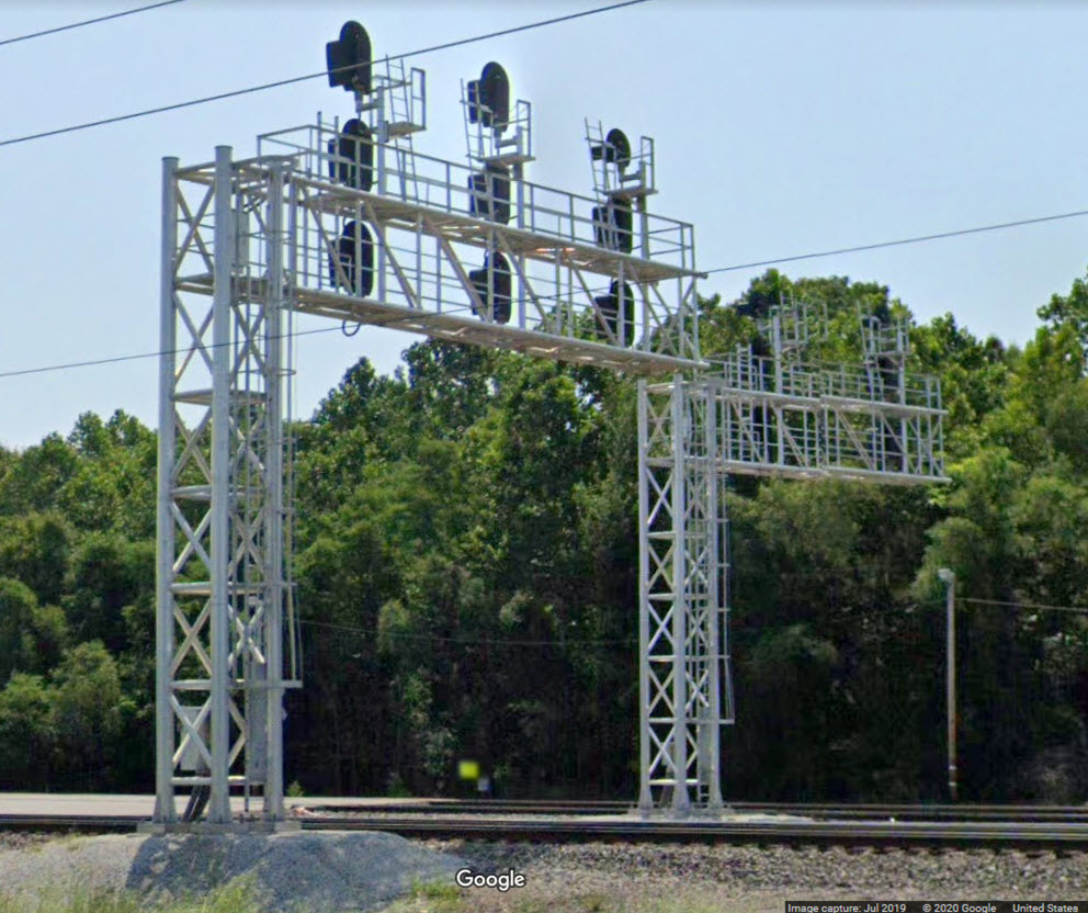
Below: an aerial view taken more recently, showing you the new cantilever signal bridge with colorlight signals.
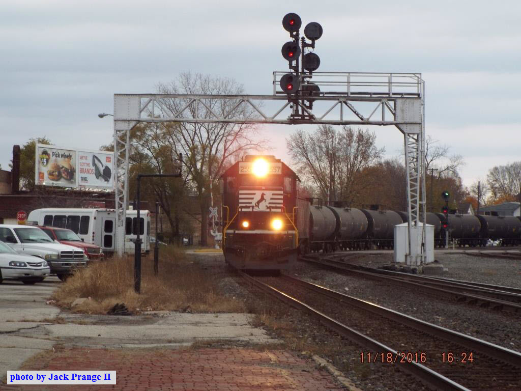
Shot from Lusher Rd is a NB NS freight with a Union Pacific engine on the head-end. Courtesy Jack Prange II.
These signals are hidden by the trees along Lincoln Way, so you will have to pull off the road and walk to get pictures of them.
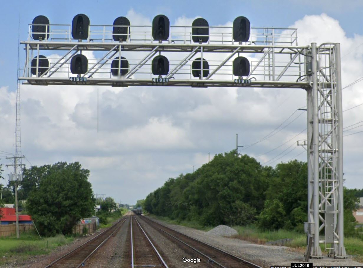
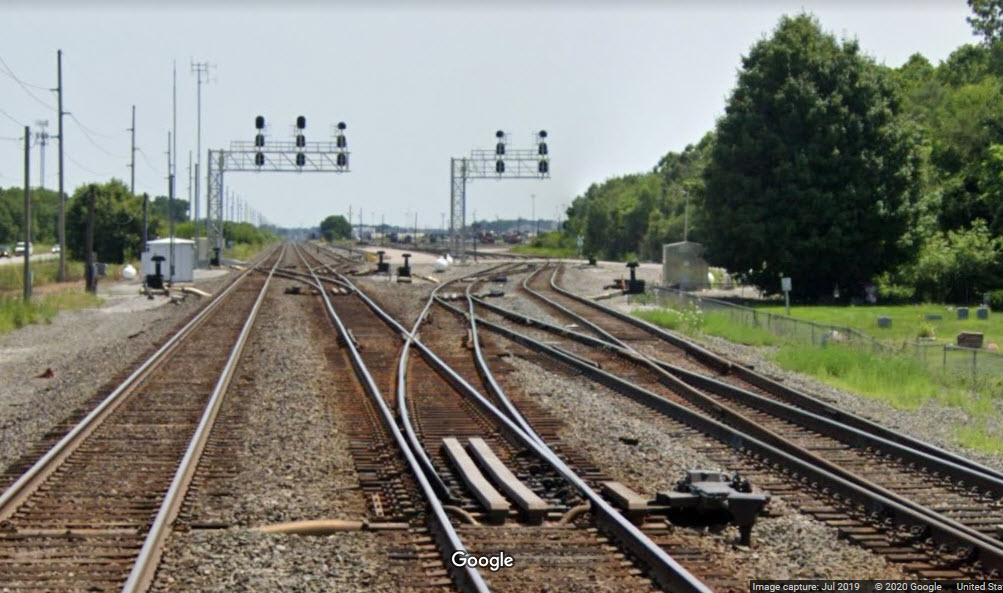
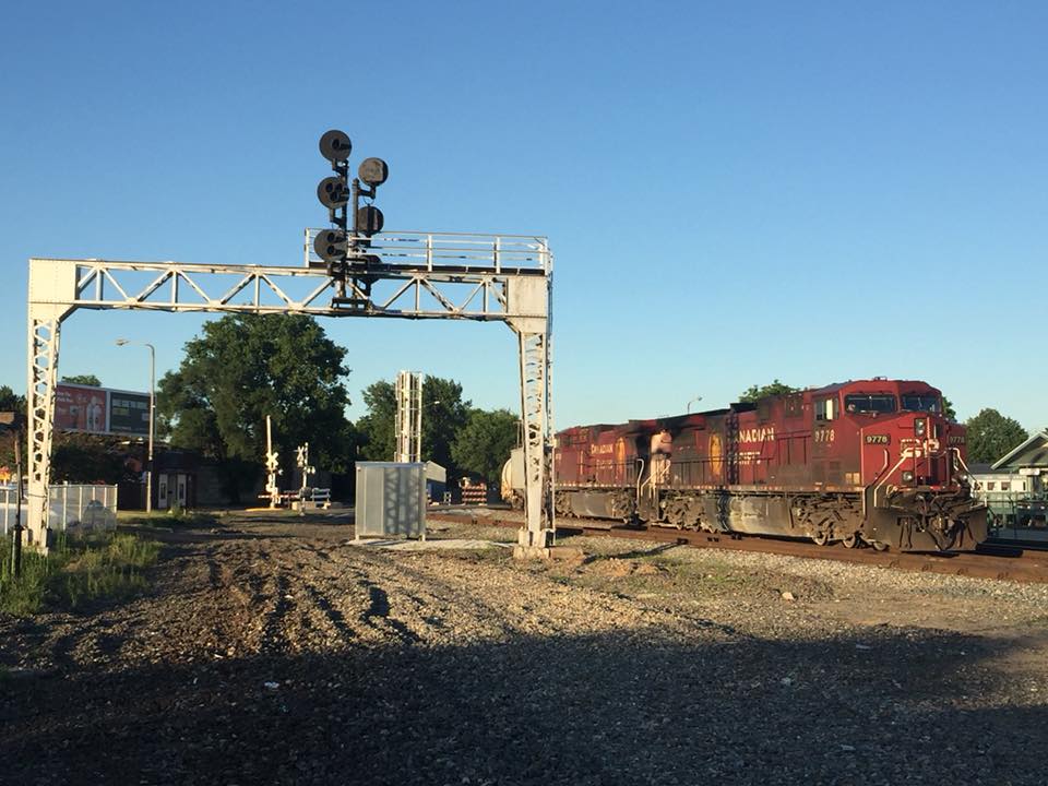
Mainline and yard exit signals along Lincoln Way.
 after
after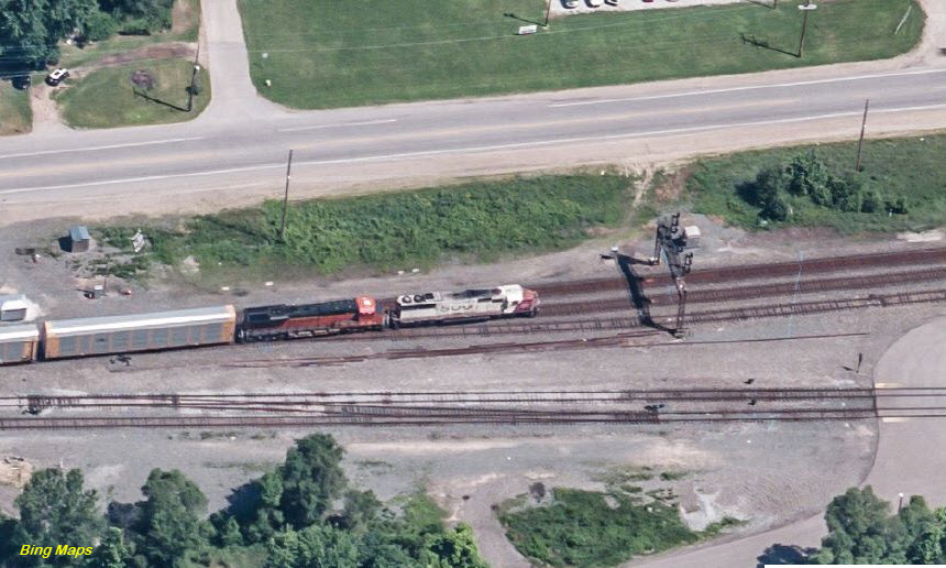 before
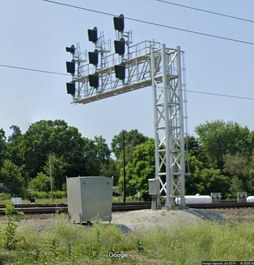
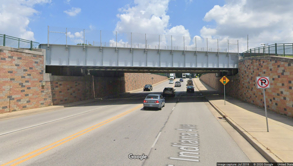
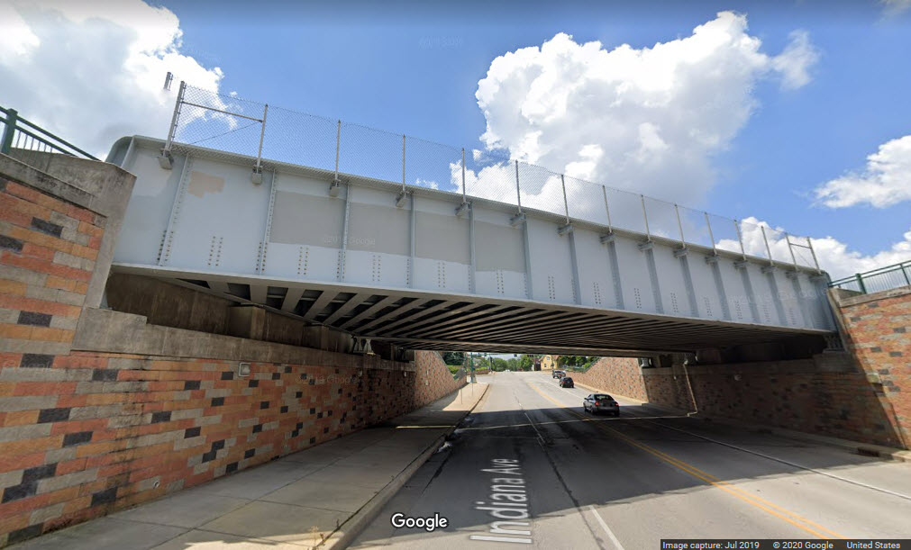
Along Lincoln Way E, a little west of U-Haul.
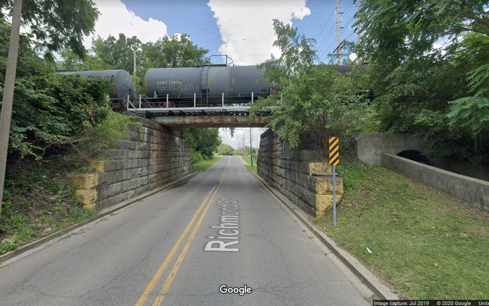
Along West Franklin St, across from Okema St.
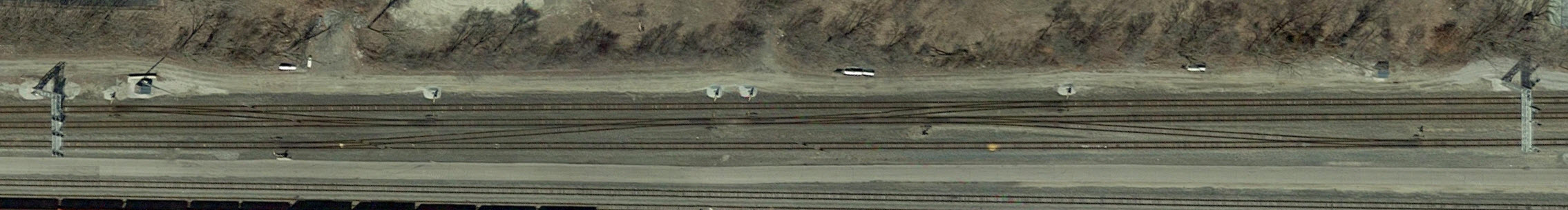
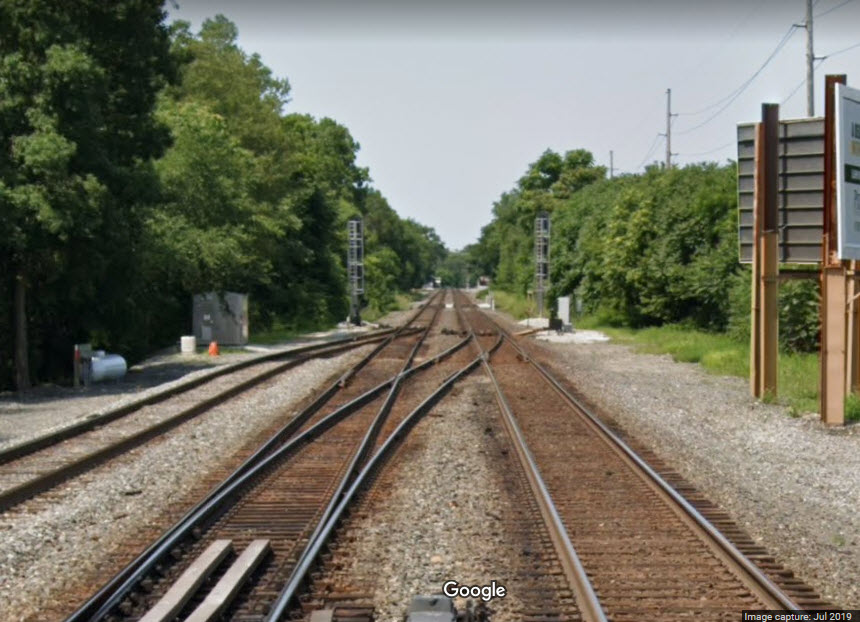
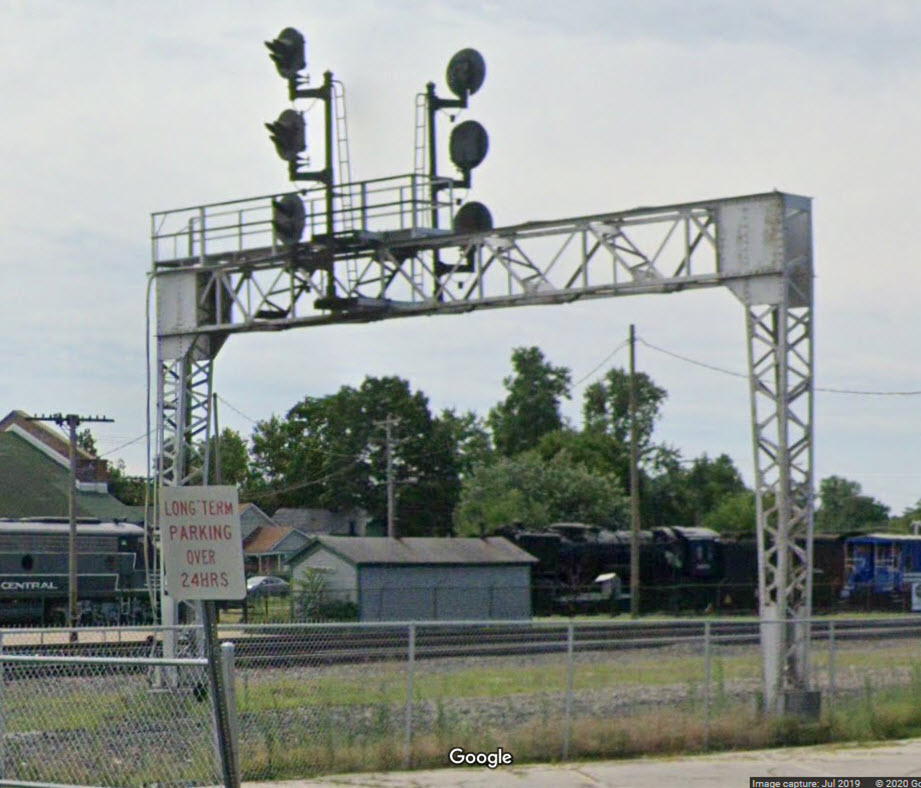
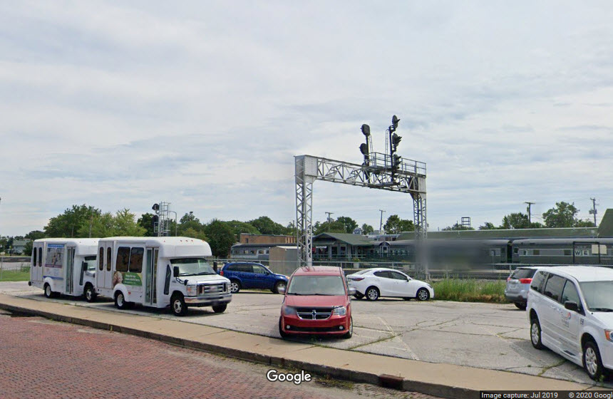
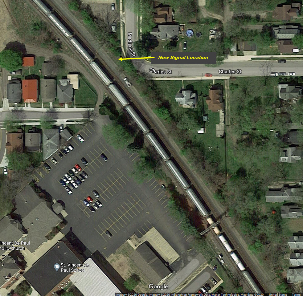
Signals in the area of the Amtrak/former NYC station were reconfigured when the track was realigned. Location 7 is a new signal bridge.
A pair of signals for interlocking that is "kind of" in front of the Depot/Amtrak station. These signals were removed with the track re-alignment.
Interlocking signal in front of the Depot/Amtrak station. This signal was removed with the track re-alignment.
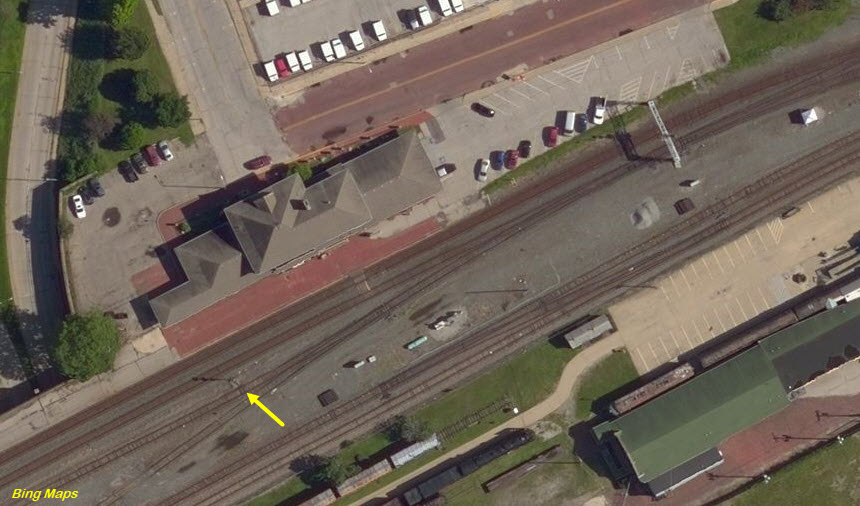
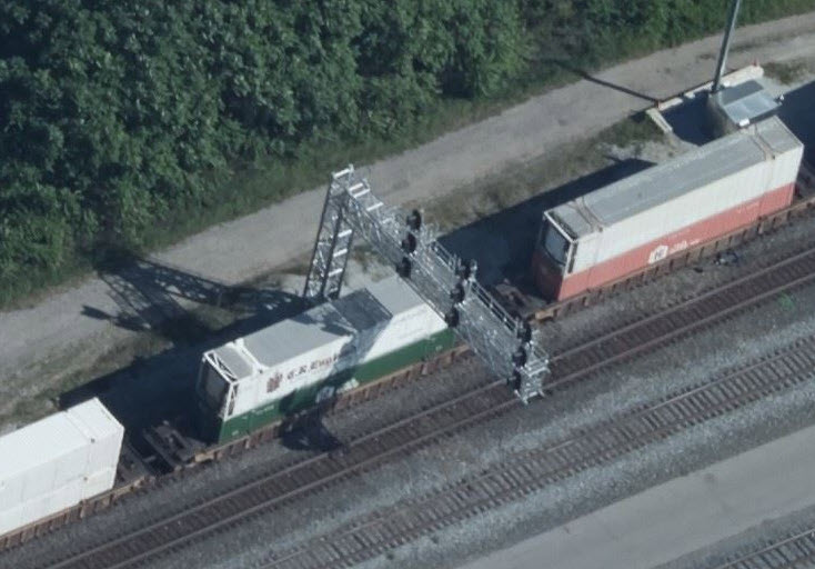
This signal bridge is no longer in use since the track re-alignment. The signals are scheduled to go to the museum.
 Adam Lloyd, 2018
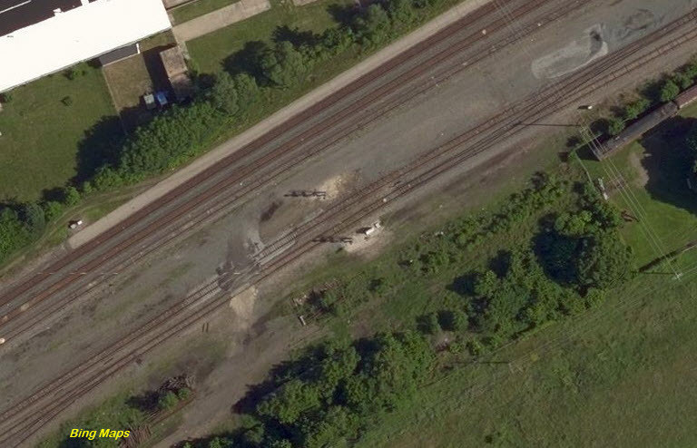
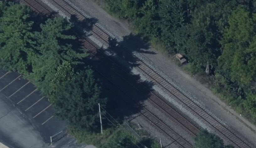 old signal bridge base
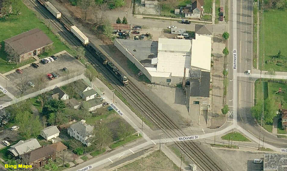
A SB/EB freight at McDonald St.... gotta love this photo service from Bing... sometimes...
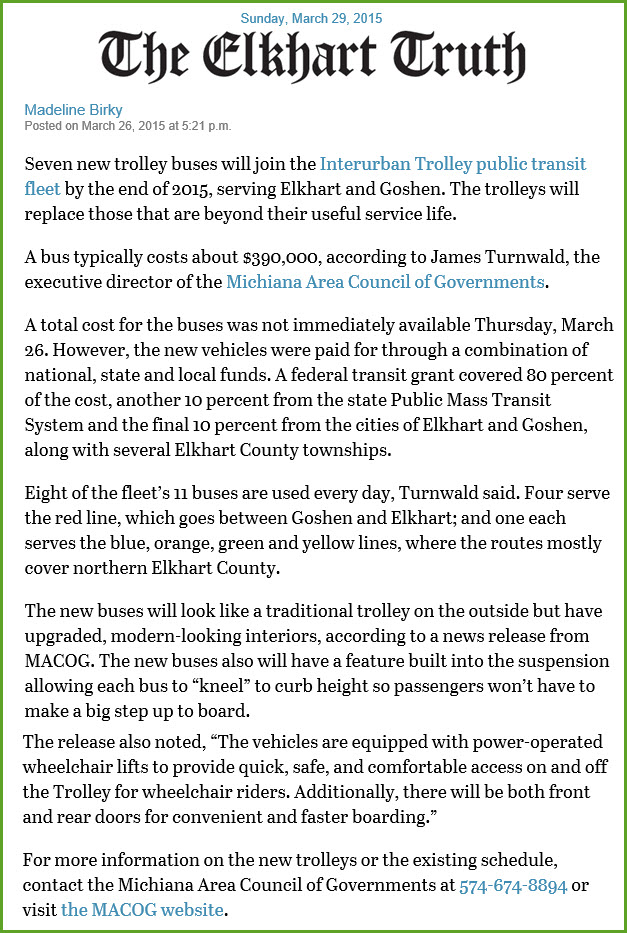
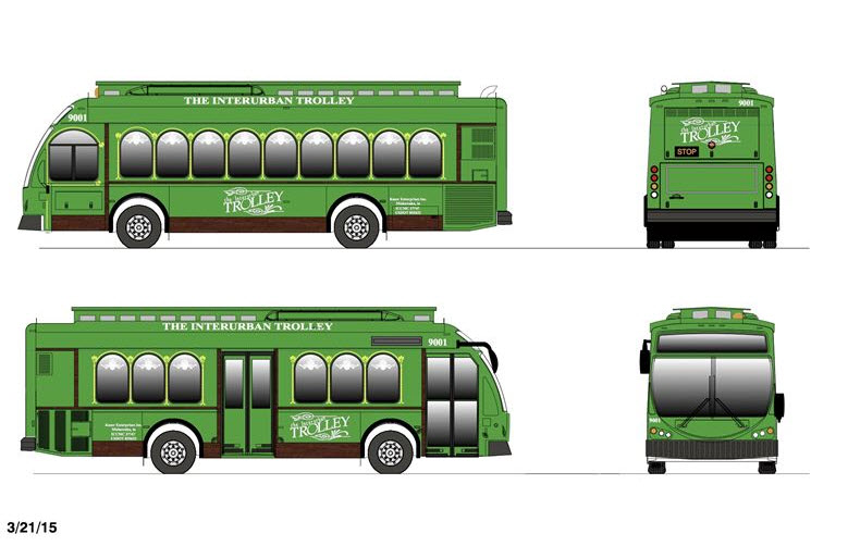
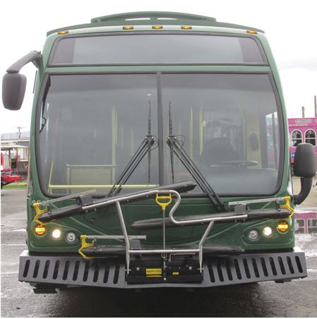
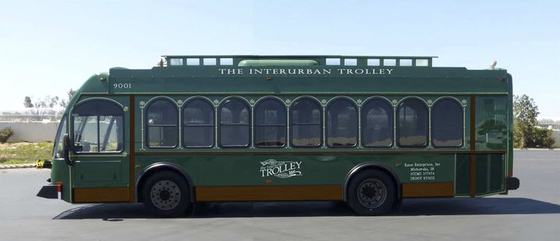
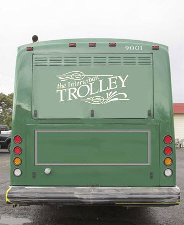
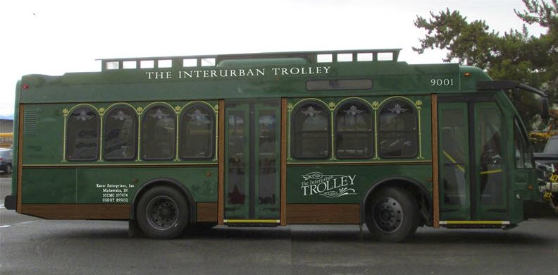
Proposed "trolley" busses coming
Elkhart is planning to buy seven new busses, designed from the ground up to replace aging equipment on their roster.
The following pictures and article came from here. (032915)
I guess by now, they should be running, if they did indeed buy them.
Old Streetcar Picture found on EBay
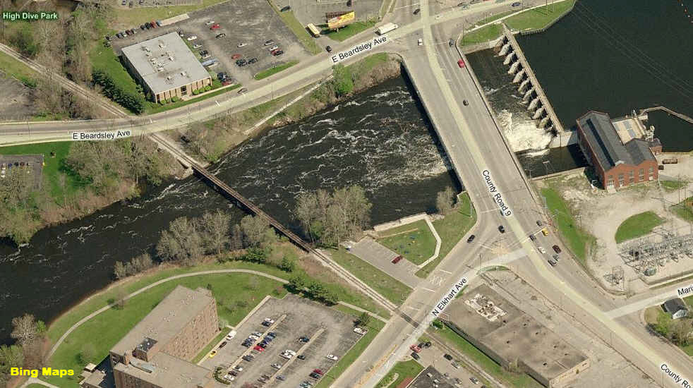
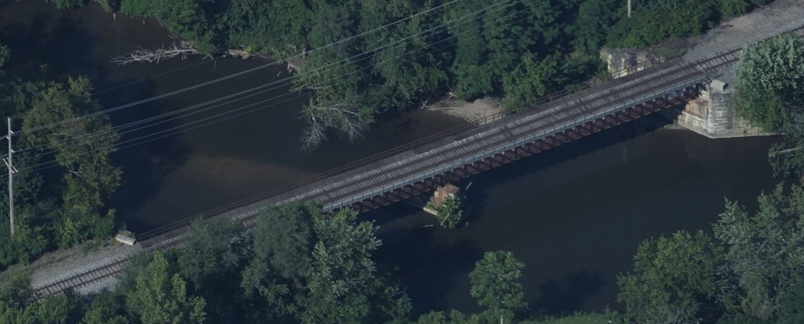
Just north of the EWR is this girder bridge adjacent to a small dam.
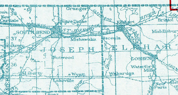
Courtesy of the University of Texas Library, click here for their index page.
So far, this is the only vintage map I can find for the area.
Disclaimers:
I love trains, and I love signals. I am not an expert. My webpages reflect what I find on the topic of the page. This is something I have fun with while trying to help others.
Please Note: Since the main focus of my two websites is railroad signals, the railfan guides are oriented towards the signal fan being able to locate them. For those of you into the modeling aspect of our hobby, my indexa page has a list of almost everything railroad oriented I can think of to provide you with at least a few pictures to help you detail your pike.
If this is a railfan page, every effort has been made to make sure that the information contained on this map and in this railfan guide is correct. Once in a while, an error may creep in :-)
My philosophy: Pictures and maps are worth a thousand words, especially for railfanning. Text descriptions only get you so far, especially if you get lost or disoriented. Take along good maps.... a GPS is OK to get somewhere, but maps are still better if you get lost! I belong to AAA, which allows you to get local maps for free when you visit the local branches. ADC puts out a nice series of county maps for the Washington DC area, but their state maps do not have the railroads on them. If you can find em, I like the National Geographic map book of the U.S..... good, clear, and concise graphics, and they do a really good job of showing you where tourist type attractions are, although they too lack the railroads. Other notes about specific areas will show up on that page if known.
Aerial shots were taken from either Google or Bing Maps as noted. Screen captures are made with Snagit, a Techsmith product... a great tool if you have never used it!
By the way, floobydust is a term I picked up 30-40 years ago from a National Semiconductor data book, and means miscellaneous and/or other stuff.
Pictures and additional information is always needed if anyone feels inclined to take 'em, send 'em, and share 'em, or if you have something to add or correct.... credit is always given! Please be NICE!!! Contact info is here
Beware: If used as a source, ANYTHING from Wikipedia must be treated as being possibly inaccurate, wrong, or not true.
RAILFAN GUIDES HOME
RAILROAD SIGNALS HOME
NEW 07/09/2009, DEC20/2016, OCT08/2020, NOV25/2020
Last Modified 25-Nov-2020