
In General
Getting Here
Maps
Sights
Pictures
Signals
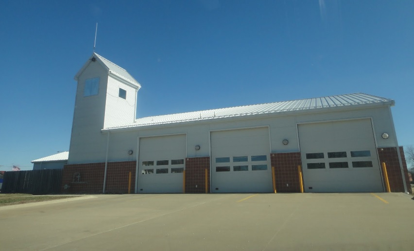
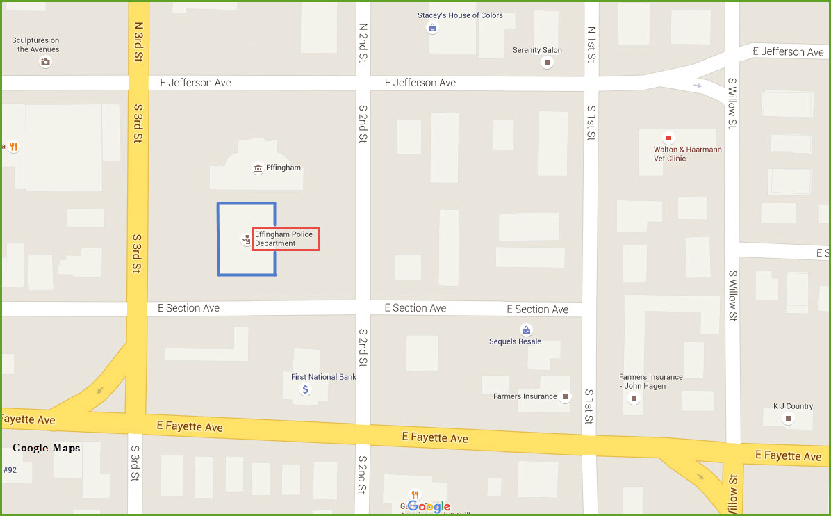
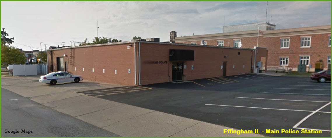
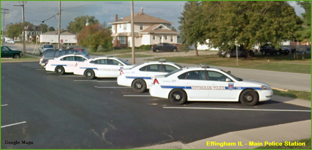
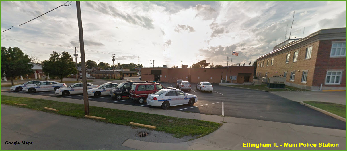
Fire & Police
Floobydust
USGS Maps
RAILFAN GUIDES HOME
RAILROAD SIGNALS HOME
Location / Name:
Effingham IL, Effingham County
What's Here:
the Effingham Railroad
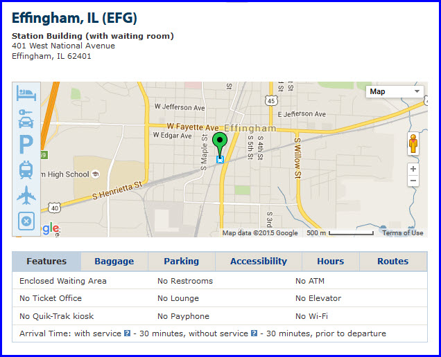
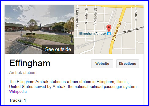
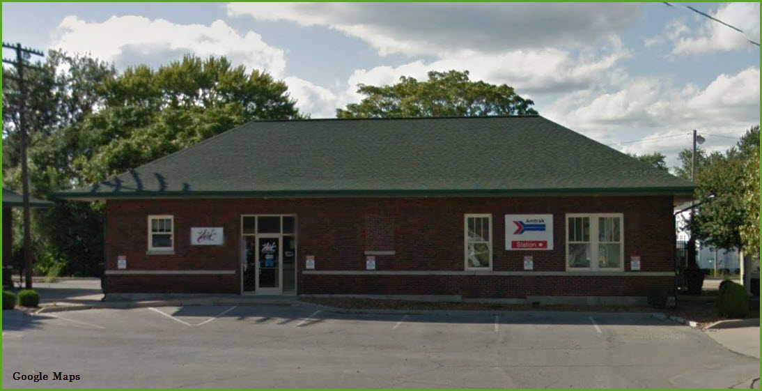
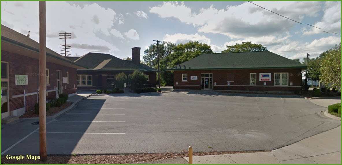
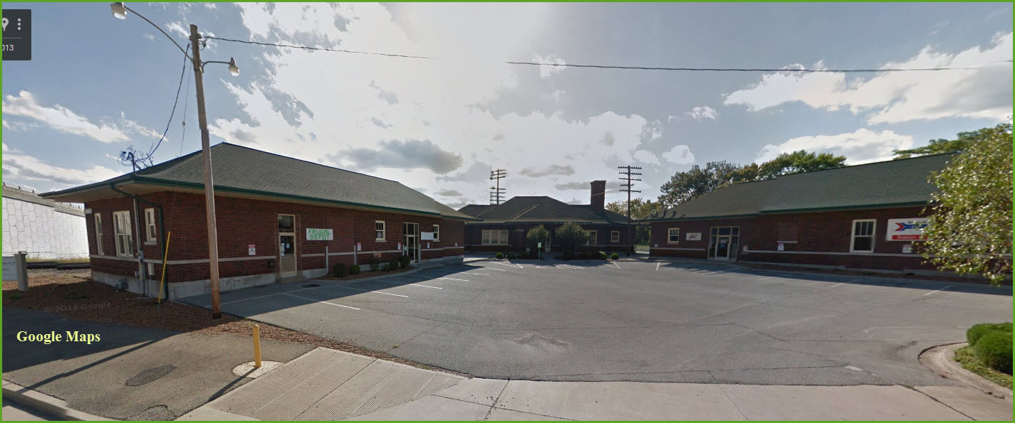
Amtrak Station (EFG)
CSX and CN
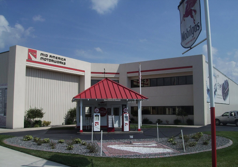
Mid America Motorworks
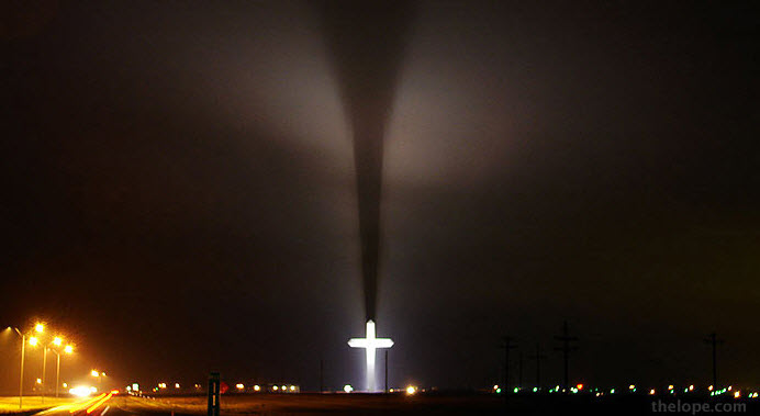
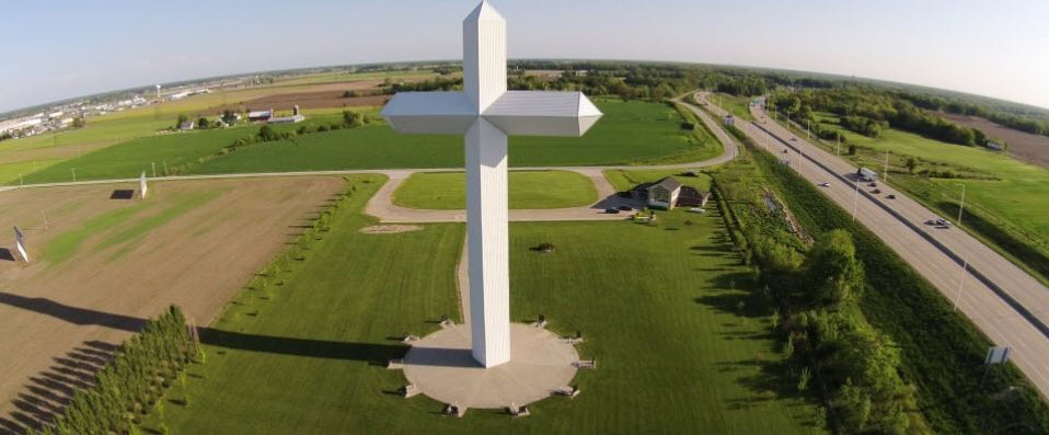
the Cross of the Crossroads
Data:
GPS Coordinates: 39.116503, -88.547655 (at the CSX/CN diamond)
Phone A/C: 217
ZIP: 62401 (at the station)
Access by train/transit:
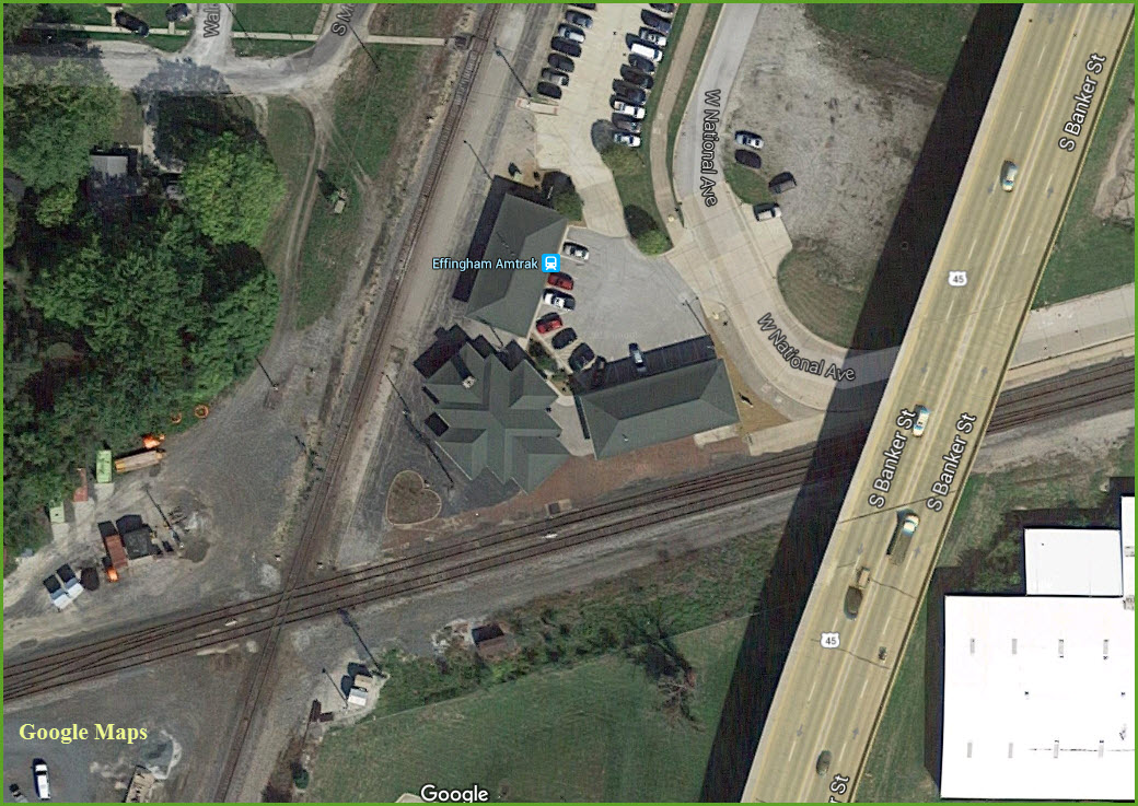
Amtrak Effingham Station
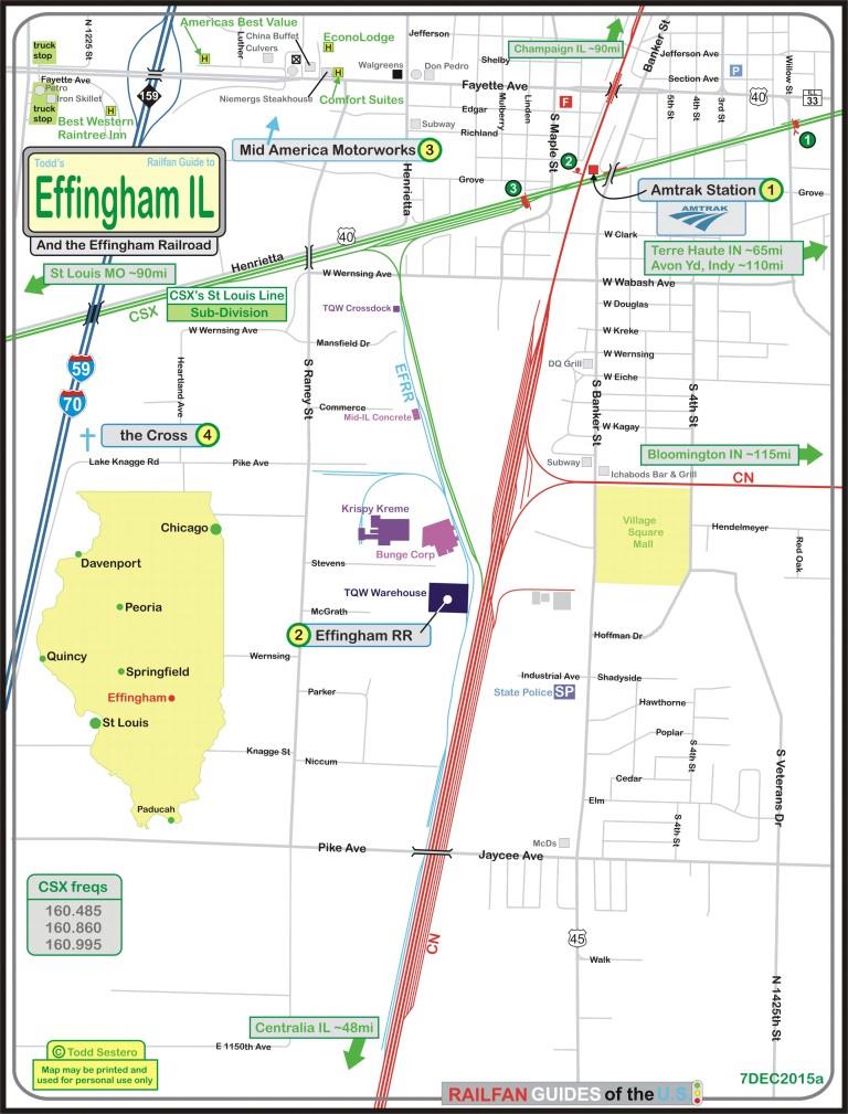
The Scoop:
Effingham is home to perhaps the shortest Short Line Railroad in the U.S., the Effingham RR.
The major players in town are the CN and CSX, and they have a diamond located adjacent to the Amtrak Station. CN (Ex IC) line sees about 25 trains per 24 hours (CN Central Division, Champaign Sub). The CSX (ex PRR & Conrail) line sees about 19 trains per 24 hours (CSX Great Lakes DIV, St Louis Line Sub). The BNSF (maybe, still?, as the BN did) has trackage rights over the CN/IC from Memphis.
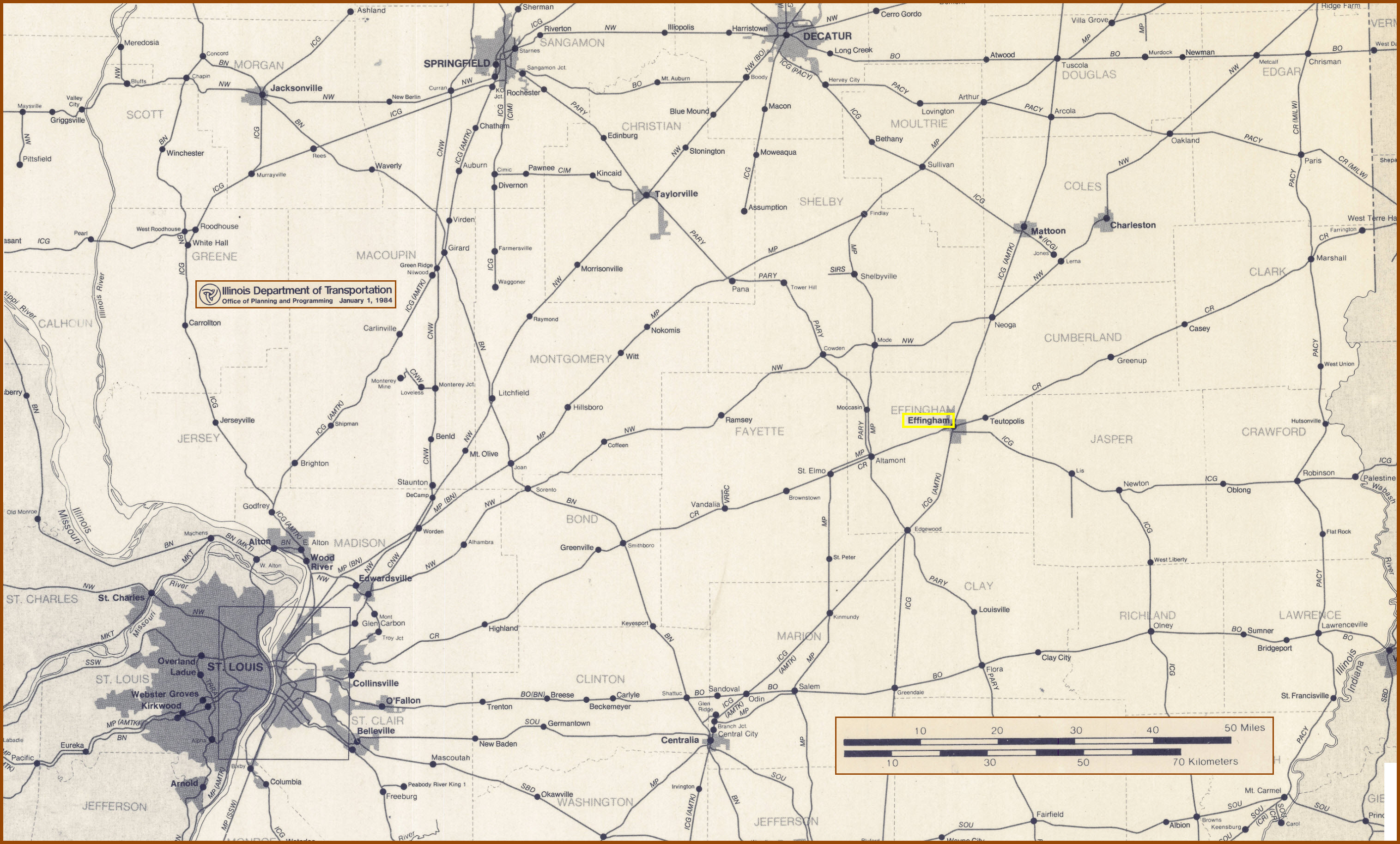
The map below by the State of Illinois, is part of their 1984 statewide map showing all of the railroad lines in Illinois - it's a thumbnail, so you can click on it to get to the full size area map I made (~1meg JPEG).
Acknowledgements:
Denver Todd
Websites and other additional information sources of interest for the area:
See below....
From Chicago IL, take I-57 south till you hit Effingham.
From St Louis MO, take I-70 east till you hit Effingham.
From Indianapolis IN, take I-70 west till you hit Effingham.
From Paducah KY, take I-24 and I-57 north till you hit Effingham.
From Baltimore MD, just head west on I-70 (where I-70 begins at the Social Security HQ), and just keep driving till you get tired, you should be near Effingham! :-)
See, isn't getting here really easy? :-)
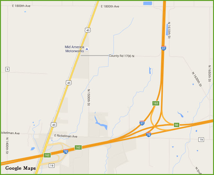
Maps
click here for the map in PDF form
GPS Coordinates: 39.117052, -88.547188
401 W National Ave, Effingham, IL 62401
GPS Coordinates: 39.100994, -88.554090
http://www.efrr.com/
Effingham IL is at the crossing point of highways I-57 and I-70, and the CN/IC and CSX railroads. This rare transportation center in a fast growing community was an excellent opportunity for a short line railroad. The Effingham Railroad was started in 1999 and designed as an economic development tool to attract new industries to the area. The railroad has opened Effingham to a new class of prospects which rely heavily on transportation for their success. The EFRR connects with the Canadian National/Illinois Central and CSX (formerly Conrail) Railroads. They claim to be the only new railroad to be built in the 20th Century ( http://www.agracel.com/listings/effingham-railroad/ ).
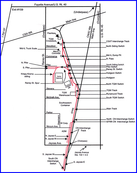
The City of Effingham, Illinois, is served by the Illinois Central Railroad (IC) and CSX (previously Conrail). In November 1996, Effingham Railroad Company (EFRR), a new carrier which had not yet begun operations, proposed to the Surface Transportation Board to operate approximately 206 feet of existing track, which it intended to acquire from Agracel Corporation within the Effingham Business Park. This existing track was part of a 490-foot track (called "the beer track" because it was used to transfer beer from rail cars to trucks) connected to Conrail's line. Effingham Railroad also proposed to construct 9,835 feet of new track within the industrial park. Ready-Mix, an existing shipper located in the industrial park, would be served by 1,867 feet of this new track, which would also serve new shippers that might locate in the industrial park.
What followed was an intense dispute between EFRR and the Union as to the classification of these tracks. However, the Union's petition for review of the determinations of the Board were denied, and the EFRR received Surface Transportation Board approval to begin operation in 1997 as a class III line haul common carrier railroad operating within the Effingham Business Park over an interchange with Conrail (now CSX). In the fall of 1998, TQW, a public warehousing operation, started construction on 1.4 miles of trackage mainline to serve new industry and also interchange with the Illinois Central. Today, EFRR's trackage totals 1.7 miles.
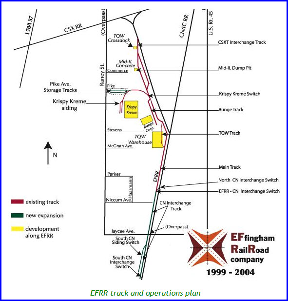
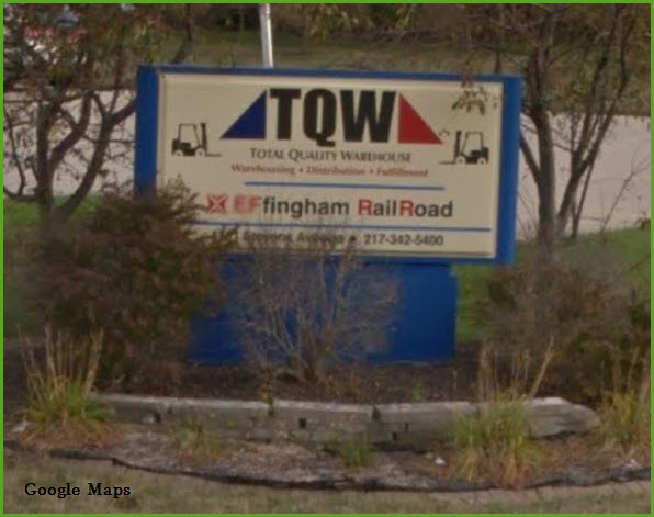
The commodities currently being hauled are crushed stone, printing paper, lumber, particle board and vegetable oil. In 2002, Krispy Kreme Doughnuts started utilizing the EFRR with a new spur to their new manufacturing and distribution facility, which produces prepared doughnut mixes for distribution to the Midwestern and Western regions of the U.S. The other clients that EFRR serves are Mid Illinois Concrete, Bunge Foods, Irving Paper, Fraser Paper, Pactiv, Stevens Industries, TQW crossdock and TQW's rail facility which has an inside rail dock.
Looking at the spurs marked as "existing track" in the plan, the Timesaver configuration is formed by the Bunge Track, the Krispy Kreme Siding, the Mid-IL Dump Pit with passing loop, and the CSXT Interchange Track. In terms of John Allen's layout plan, the two Krispy Kreme spurs are located on the wrong side, but this would not make any differenc ein operating terms and is as close to a prototype Timesaver as you will probably ever get. Even the short distances between track locations - something declared to be utterly unprototypical by the Timesaver's critics - are to be found at this location.
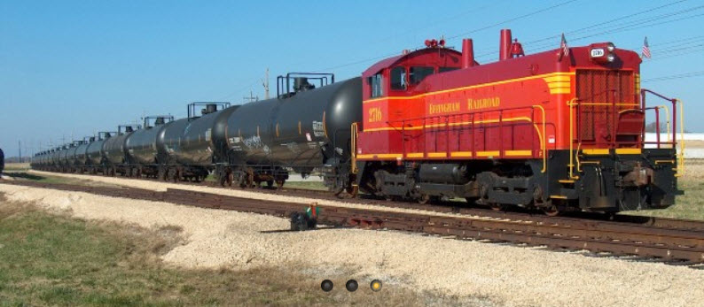
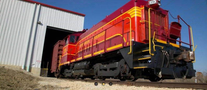
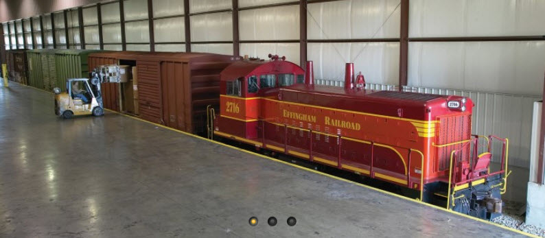
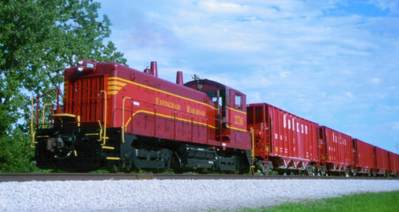
The Effingham Railroad has one locomotive on its roster, an EMD SW-1200 painted in EFRR's company colors and numbered 2716. The SW-1200 was the last EMD heavy switcher powered by the 1200 horsepower 567 engine and was produced from the mid 1950's through the mid 1960's. EFRR's SW was built in November 1963 as a switcher for the Reading (#2716) and then became Conrail #9316.
More Info at:
http://cs.trains.com/trn/b/fred-frailey/archive/2011/07/15/the-biggest-little-railroad-in-effingham.aspx
http://www.frontiernet.net/~kevinperkins/railroad.htm
http://www.wymann.info/ShuntingPuzzles/Timesaver/EFRR/timesaver-prototype-EFRR.html
http://www.rrpicturearchives.net/locoPicture.aspx?id=3350
http://www.mgengineers.com/content/effingham-railroad
GPS Coordinates: 39.164030, -88.524225
1 Mid America Place, Effingham IL 62401
Mid America Motorworks is an after market parts suppliers for Corvettes and air-cooled Volkswagens.
They have a "funfest" for both the VW's and Vettes, plus musical entertainment throughout the year!

GPS Coordinates: 39.107081, -88.571299
This is billed as the world’s largest cross at 196 feet tall. They had to make it under 200ft tall so as to avoid putting lights on the top for airplane avoidance per FAA regs.
It stands at the "south" junction of interstates 70 and 59, not far from the EFRR action!
http://www.roadsideamerica.com/story/10913
http://www.thecross-photo.com/The_Cross_in_Effingham_Illinois.htm


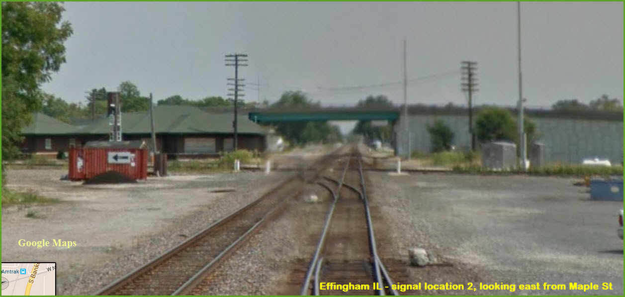
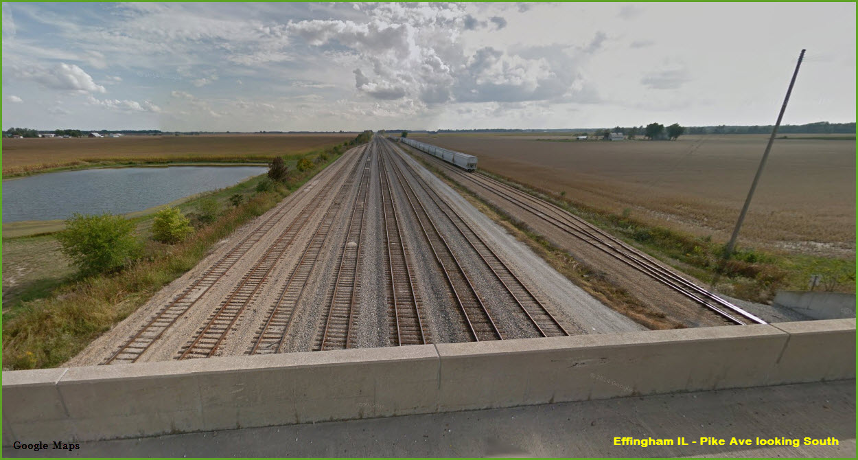
Two colorlight signals on a cantilever bridge.
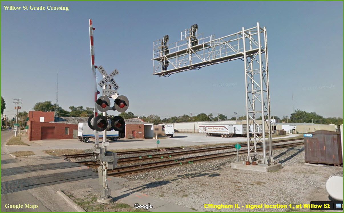
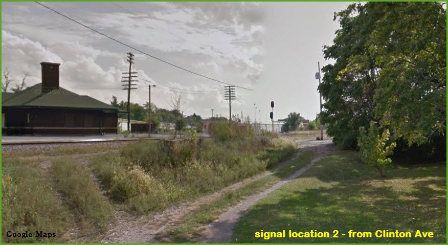
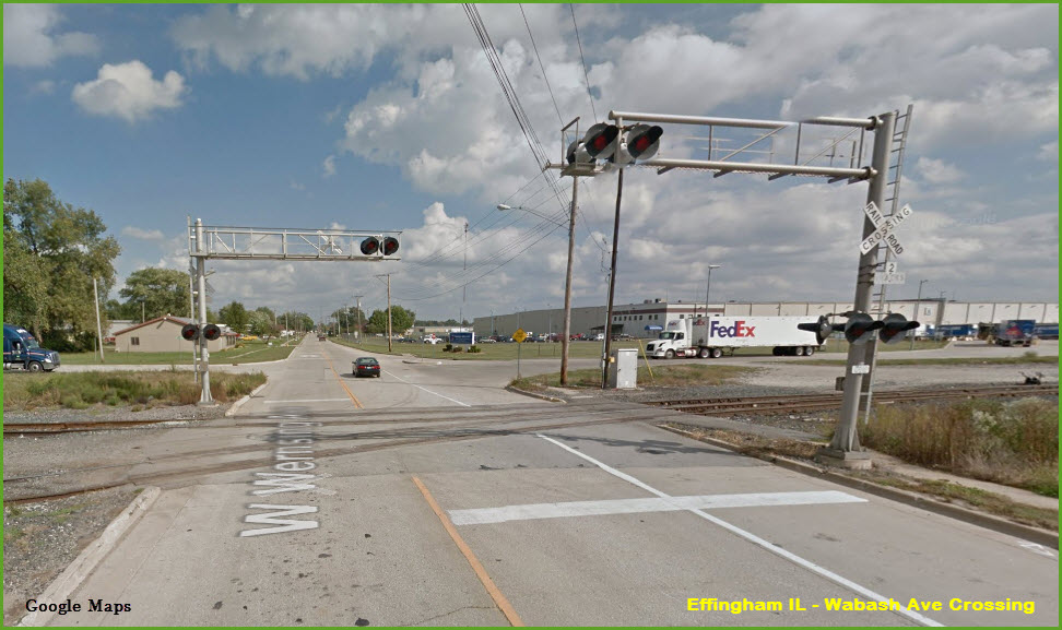
A colorlight signal protecting the CSX/CN diamond for SB traffic.
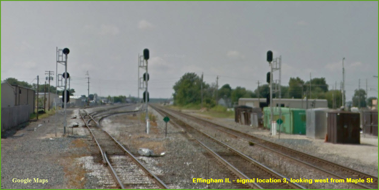
3 colorlight signals for EB traffic, from Maple St looking west.
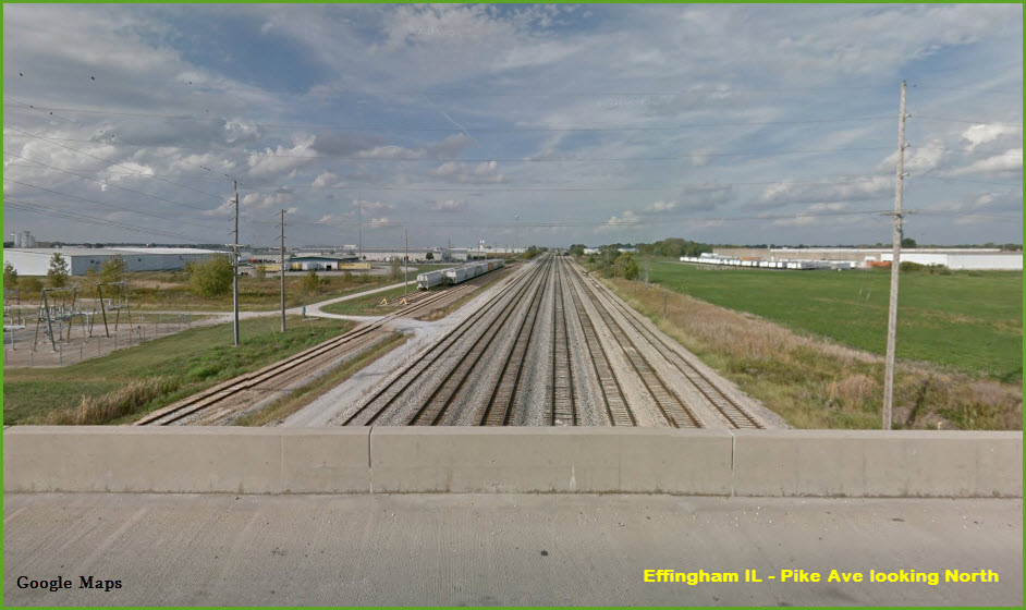
From Pike Street Overpass
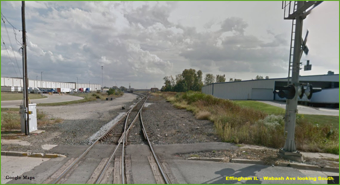
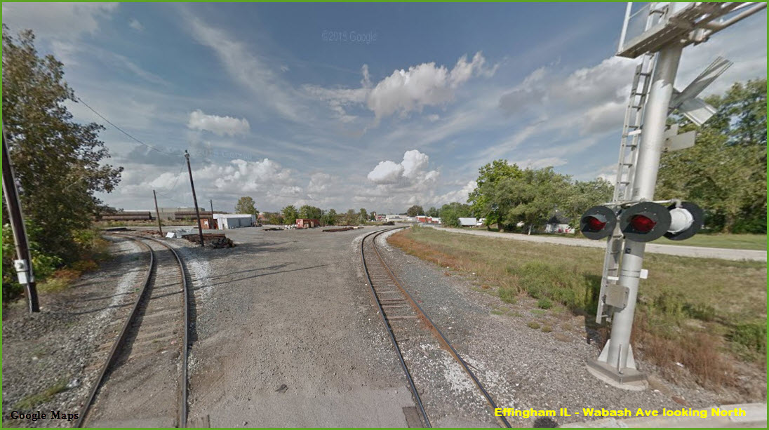
Wabash Ave Crossing
GPS Coordinates: 39.119620, -88.548483
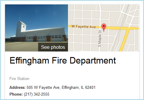
http://www.effinghamil/departments/fire_department/
GPS Coordinates: 39.120710, -88.540219
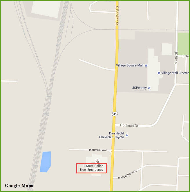
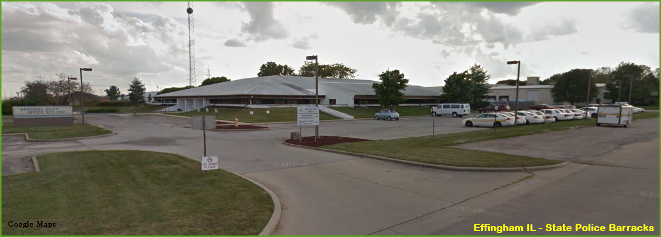
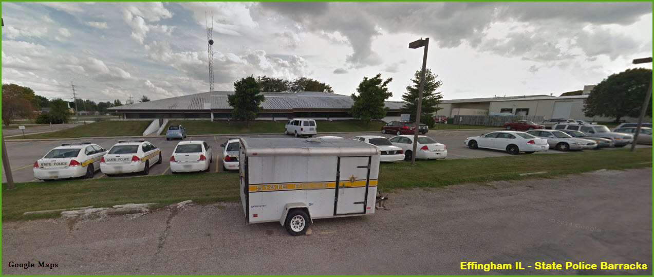
GPS Coordinates: 39.097231, -88.548428
Located in the Regional State Office Building off Industrial Ave.
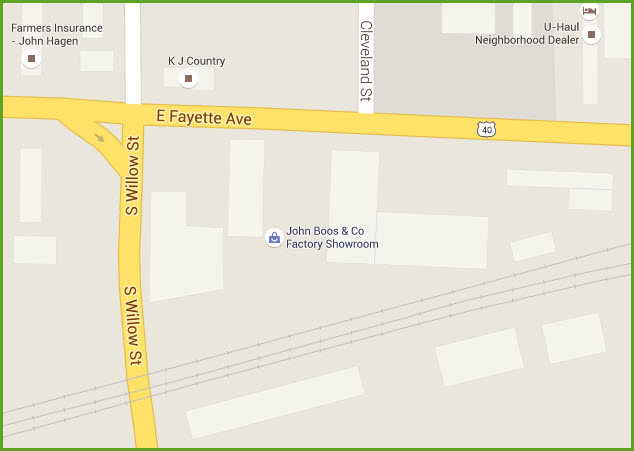
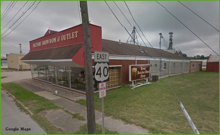
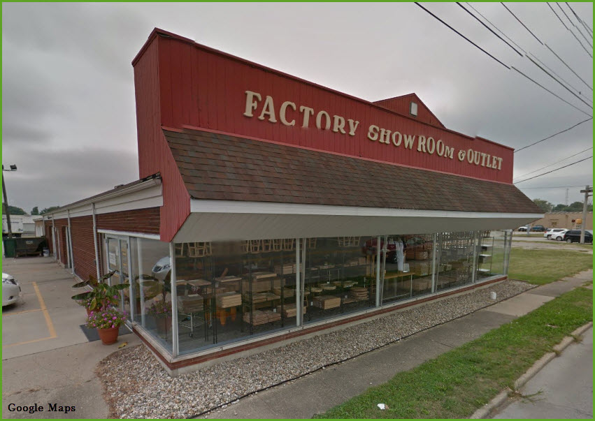
John Boos Cutting Boards
http://www.johnboos.com/Index.asp?s=r
Made in America cutting boards for the kitchen!
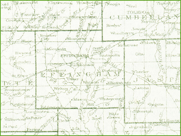
Courtesy of the University of Texas Library, click here for their index page.
This screen shot is from a 1926 index page, as this collection does not have a vintage quadrangle map for Effingham.
Disclaimers:
I love trains, and I love signals. I am not an expert. My webpages reflect what I find on the topic of the page. This is something I have fun with while trying to help others.
Please Note: Since the main focus of my two websites is railroad signals, the railfan guides are oriented towards the signal fan being able to locate them. For those of you into the modeling aspect of our hobby, my indexa page has a list of almost everything railroad oriented I can think of to provide you with at least a few pictures to help you detail your pike.
If this is a railfan page, every effort has been made to make sure that the information contained on this map and in this railfan guide is correct. Once in a while, an error may creep in :-)
My philosophy: Pictures and maps are worth a thousand words, especially for railfanning. Text descriptions only get you so far, especially if you get lost or disoriented. Take along good maps.... a GPS is OK to get somewhere, but maps are still better if you get lost! I belong to AAA, which allows you to get local maps for free when you visit the local branches. ADC puts out a nice series of county maps for the Washington DC area, but their state maps do not have the railroads on them. If you can find em, I like the National Geographic map book of the U.S..... good, clear, and concise graphics, and they do a really good job of showing you where tourist type attractions are, although they too lack the railroads. Other notes about specific areas will show up on that page if known.
Aerial shots were taken from either Google or Bing Maps as noted. Screen captures are made with Snagit, a Techsmith product... a great tool if you have never used it!
By the way, floobydust is a term I picked up 30-40 years ago from a National Semiconductor data book, and means miscellaneous and/or other stuff.
Pictures and additional information is always needed if anyone feels inclined to take 'em, send 'em, and share 'em, or if you have something to add or correct.... credit is always given! Please be NICE!!! Contact info is here
Beware: If used as a source, ANYTHING from Wikipedia must be treated as being possibly inaccurate, wrong, or not true.
RAILFAN GUIDES HOME
RAILROAD SIGNALS HOME
NEW 01/01/2014, NOV04/2021
Last Modified 04-Nov-2021