RAILFAN GUIDES of the U.S.
Todd and Denver Todd's Railfan Guide to
DOLTON IL
In General
Getting Here
Map
Sights
Pictures
Floobydust
RAILFAN GUIDES HOME
RAILROAD SIGNALS HOME
Location / Name:
Dolton IL
What's Here:
Dolton Junction - one of
the larger and busier
junctions in the Chicago
area.
Shots with signals in them can be had from the
immediate vicinity grade
crossings.
Data:
GPS Coordinates: N 41.6407, W 87.6105
14014 Park Avenue (City Hall)
ZIP 60419
Scanner Frequencies:
CSX: 160.230, 160.290,
160.230,
161.370
UP: 160.410,
160.470, 161.145,
160.665,
161.430
IHB:
160.980, 160.070,
1601.565
Amtrak uses UP
frequencies.
Access by train/transit:
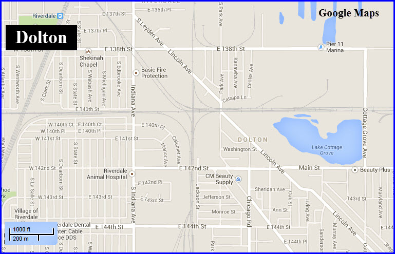
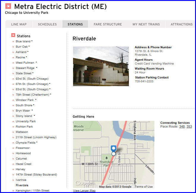
Riverdale stop on the Metra Electric line. It's about a 9 block walk to the baseball park from the station.
The Scoop:
Dolton
(population ~25,000) is a
working class suburb of
Chicago on the south
city limits of Chicago.
The biggest attraction
for railfans is Dolton
Junction.
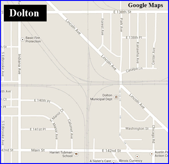
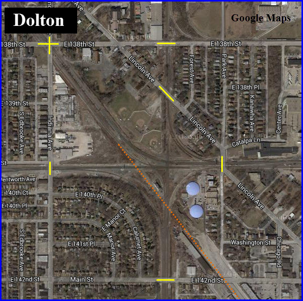
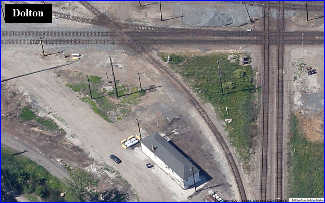
Dolton junction (N 41.6405, W 87.6124) is at the east end of Blue Island classification yard and is the Southern entrance of Chicago of the UP (former MP). The facilities are limited. Parking is in the municipal lot at Dolton City Hall, which is also the police station.
Do not stray onto railroad property!
NW across the diamond (N 41.6430, W 87.6125) there is a city park (softball fields) with a poorly marked entrance off Lincoln Ave. The grass is generally high by the tracks, but there is a better view of the trains from here in all quadrants of the diamond. All of the approaches to Dolton Junction are at grade level, so all of the intersecting streets provide for good photo ops too. The yellow lines indicate the grade crossings.
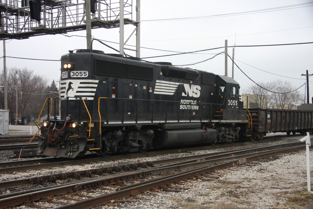
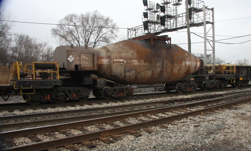
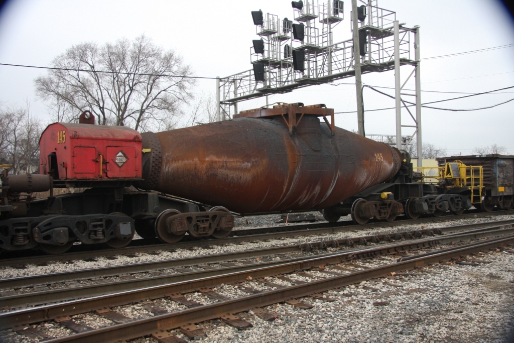
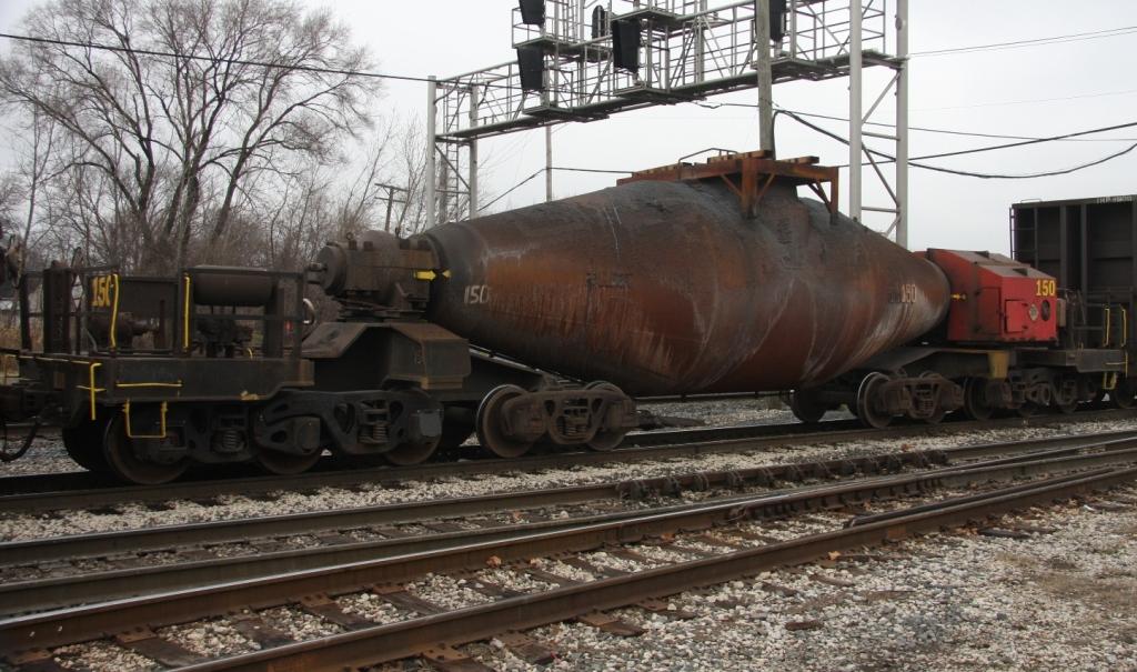
There are a lot of varied trains, including Amtrak, IHB yard movements, and UP and CSX manifest freights. IHB used to run their famous “bottle train”, carrying molten steel, through Dolton - which has been discontinued (although, it resumes on occasion when economic conditions warrant.). The UP running south is actually a joint line with the CSX for about 65 miles south to Woodland Junction, where the CSX splits to go east and the UP continues west.
There are not many good offerings for food, fuel or lodging, but you would not have to travel too far in south suburban Chicago to find these things. Still this is a great place to watch trains. In the warm weather, many railfans gather on weekends in the municipal parking lot, and they generally see over 100 trains a day.
Websites and other
additional information
sources of interest for
Dolton area:
Indiana Harbor Belt
RR
www.ihbrr.com/
The January 2009 issue of
Railfan & Railroad
Magazine,
in an article on the
Illinois Joint Line.
More pictures can be found here:
http://www.railpictures.net/showphotos.php?location=Dolton%20Crossing
From the downtown Chicago, take I-90 south (the Dan
Ryan Expy), then at the 90/94 split, take I-94 (still the Dan Ryan Expy).
At the 57/94 split, stay in I-94 the Bishop Ford Freeway.
Get off at exit 70, going west on Dolton Avenue. This turns into E
142nd Street/Main St. 142nd St will cross the south side of the
junction, crossing the joint UP/CSX tracks.

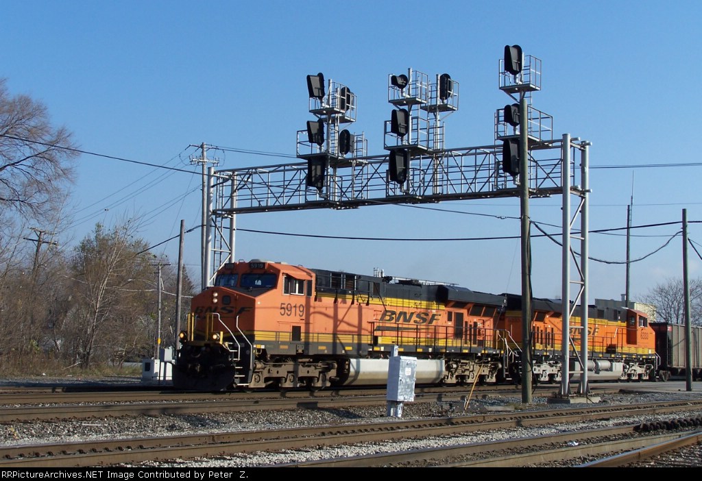
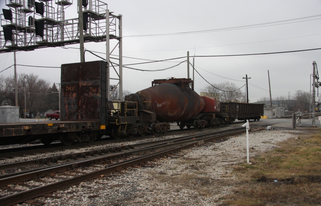
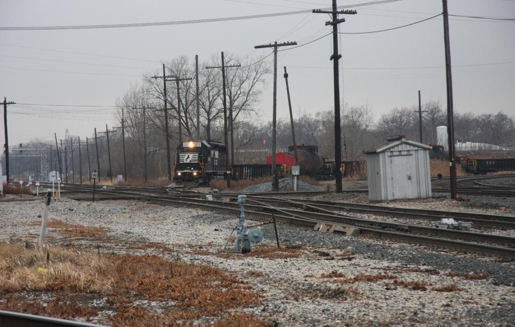
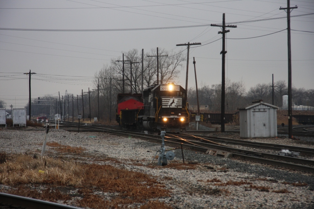
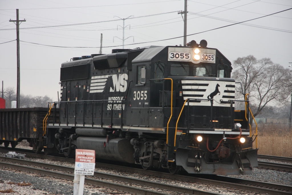
1 Dolton Crossing
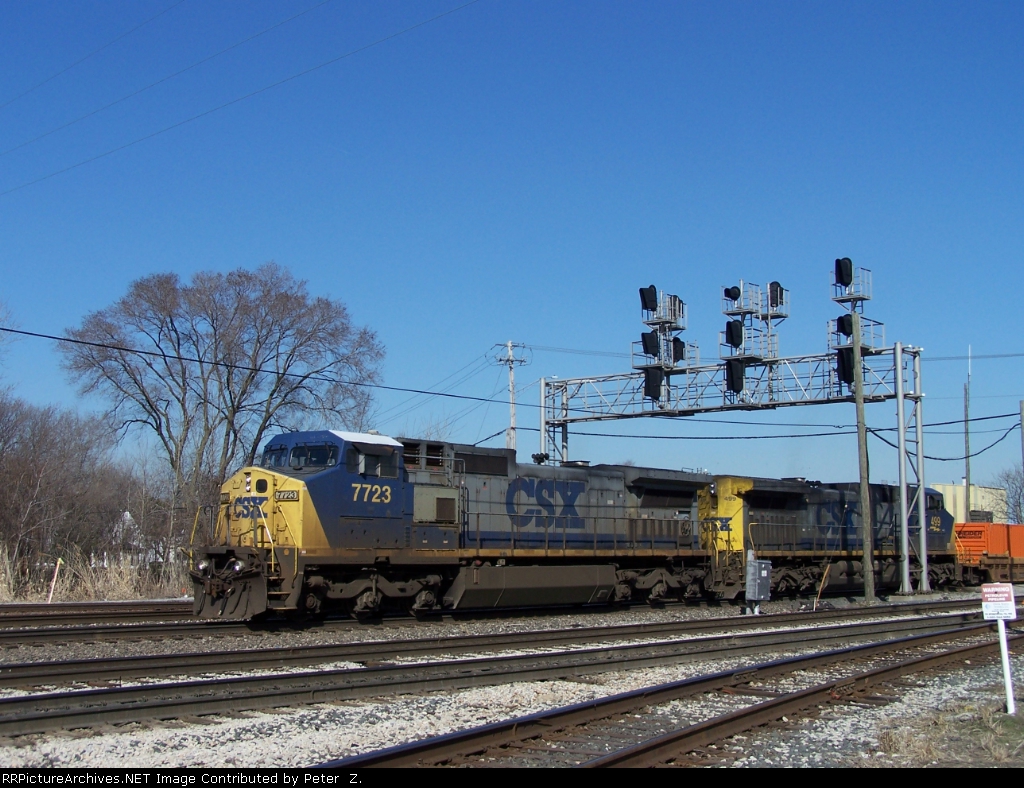
3/23/2010 Above picture from:
http://www.rrpicturearchives.net/showPicture.aspx?id=1990601
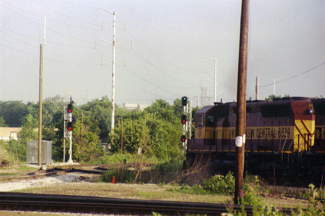
Above picture by Paul V Box, and found here:
http://www.flickr.com/photos/paulvbox/5403060659/
11/21/2009 Picture from
http://www.rrpicturearchives.net/showPicture.aspx?id=1841896
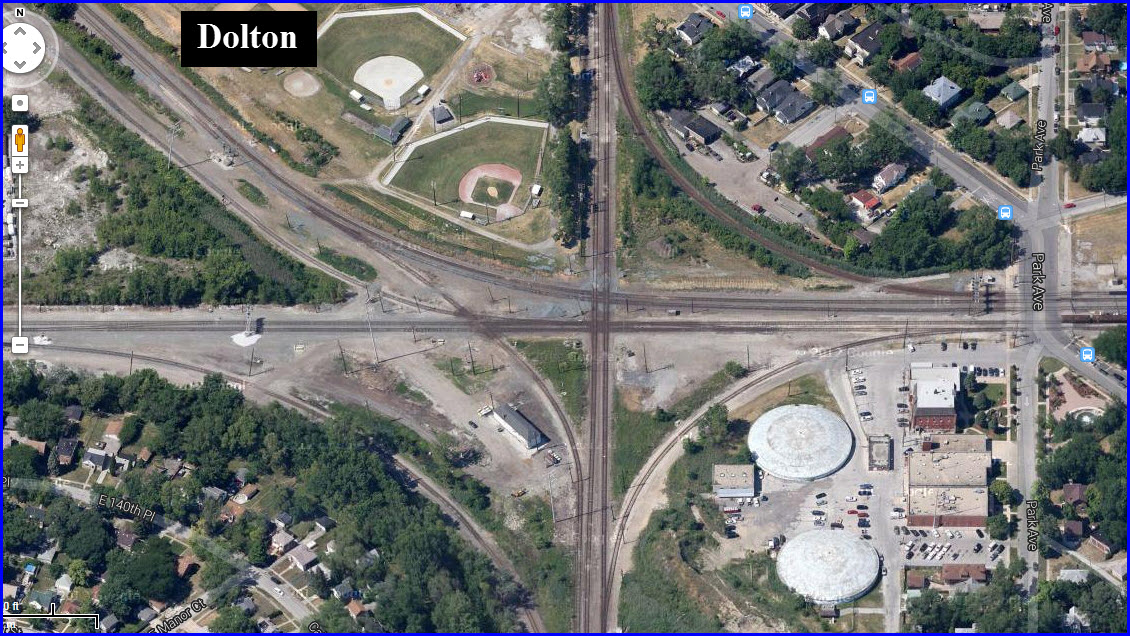
1 the Dolton Tower
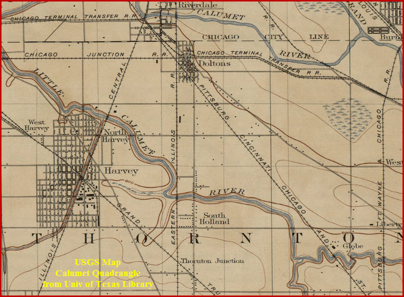
The tower is situated as such because there used to be another track coming thru this junction. The track can be seen in one of the aerial shots above with the red dotted line. In looking at the USGS map below, it was originally a Pittsburgh, Cincinnati, Chicago & St Louis track.
1 A
Adja
2 A
Adja
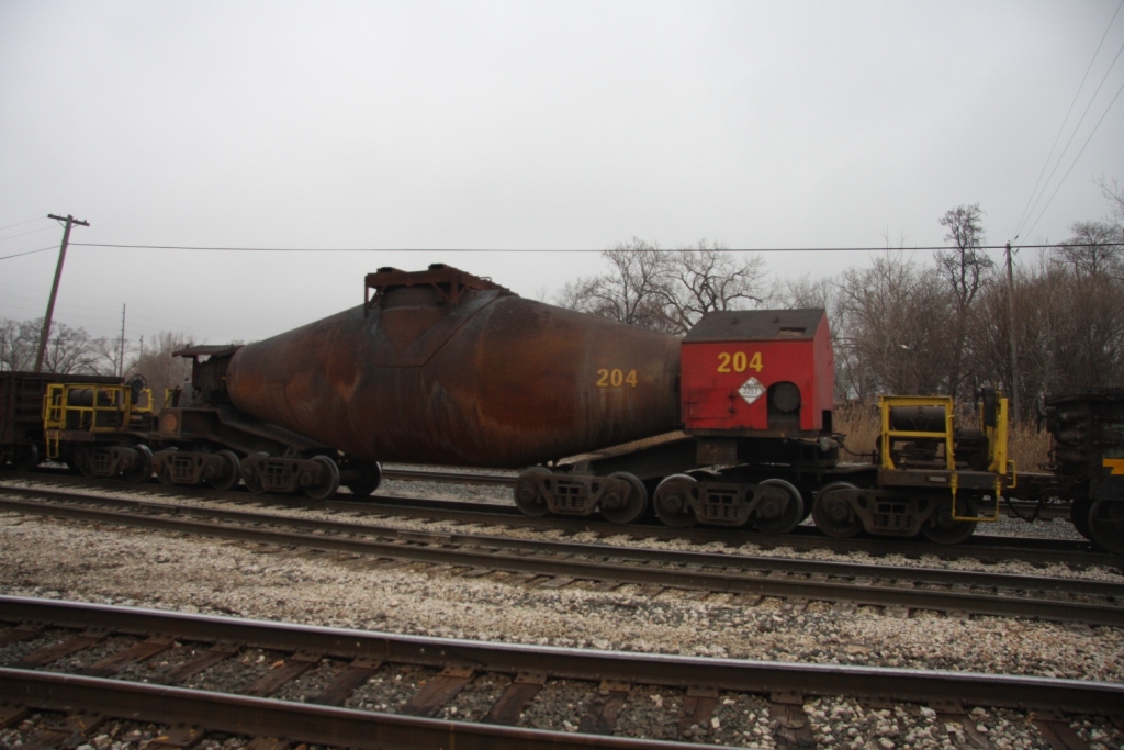
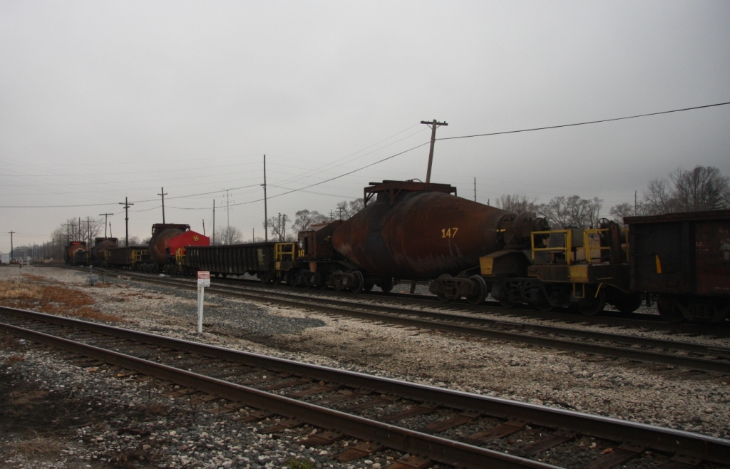
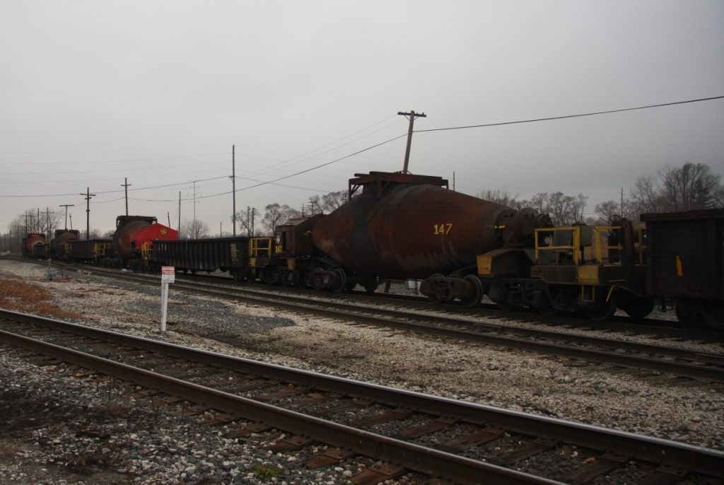
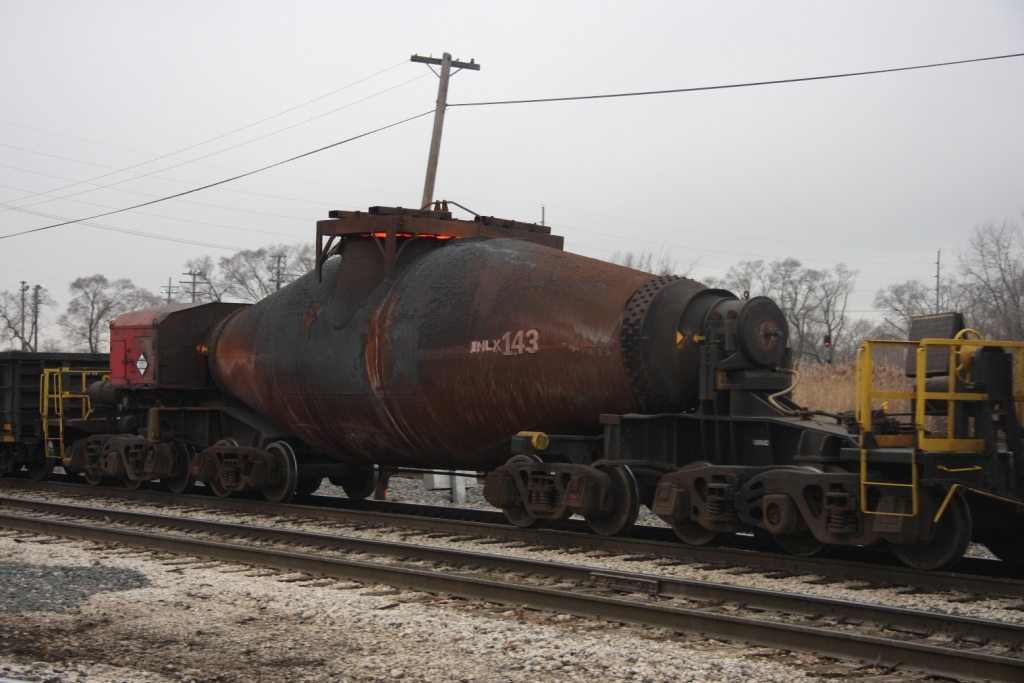
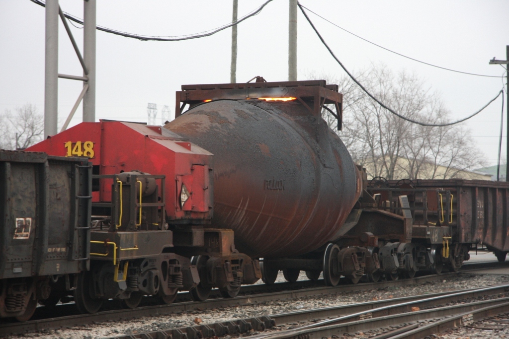
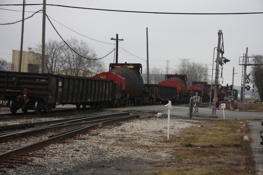
IHB Bottle Train
These pictures come from Denver Todd.


USGS Map from 1899
This is from the Calumet quadrangle. Many more excellent Illinois maps can be found here
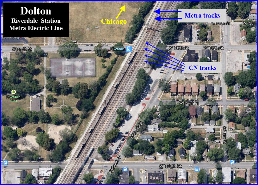
the Riverdale Station
Disclaimers:
I love trains, and I love signals. I am not an expert. My webpages reflect what I find on the topic of the page. This is something I have fun with while trying to help others. My webpages are an attempt at putting everything I can find of the subject in one convenient place. There are plenty of other good websites to help me in this effort, and they are listed in the links section on my indexa page, or as needed on individual pages. Please do not write to me about something that may be incorrect, and then hound the heck out of me if I do not respond to you in the manner you would like. I operate on the "Golden Rule Principle", and if you are not familiar with it, please acquaint yourself with how to treat people by reading Mathew 7:12 (among others, the principle exists in almost every religion). If you contact me (like some do, hi Paul) and try to make it a "non-fun" thing and start with the name calling, your name will go into my spambox list! :-)
Please Note: Since the main focus of my two websites is railroad signals, the railfan guides are oriented towards the signal fan being able to locate them. For those of you into the modeling aspect of our hobby, my indexa page has a list of almost everything railroad oriented I can think of to provide you with at least a few pictures to help you detail your pike.
If this is a railfan page, every effort has been made to make sure that the information contained on this map and in this railfan guide is correct. Once in a while, an error may creep in, especially if restaurants or gas stations open, close, or change names. Most of my maps are a result of personal observation after visiting these locations. I have always felt that a picture is worth a thousand words", and I feel annotated maps such as the ones I work up do the same justice for the railfan over a simple text description of the area. Since the main focus of my website is railroad signals, the railfan guides are oriented towards the signal fan being able to locate them. Since most of us railheads don't have just trains as a hobby, I have also tried to point out where other interesting sites of the area are.... things like fire stations, neat bridges, or other significant historical or geographical feature. While some may feel they shouldn't be included, these other things tend to make MY trips a lot more interesting.... stuff like where the C&O Canal has a bridge going over a river (the Monocacy Aqueduct) between Point of Rocks and Gaithersburg MD, it's way cool to realize this bridge to support a water "road" over a river was built in the 1830's!!!
My philosophy: Pictures and maps are worth a
thousand words, especially for railfanning. Text descriptions only
get you so far, especially if you get lost or disoriented. Take
along good maps.... a GPS is OK to get somewhere, but maps are still
better if you get lost! I belong to AAA, which allows you to get
local maps for free when you visit the local branches. ADC puts
out a nice series of county maps for the Washington DC area, but their
state maps do not have the railroads on them. If you can find em,
I like the National Geographic map book of the U.S..... good, clear, and
concise graphics, and they do a really good job of showing you where
tourist type attractions are, although they too lack the railroads.
Other notes about specific areas will show up on that page if known.
Pictures and additional information is always needed if anyone feels
inclined to take 'em, send 'em, and share 'em, or if you have
something to add or correct.... credit is always given! BE NICE!!! Contact info
is here
Beware: If used as a source, ANYTHING from Wikipedia must be treated as being possibly being inaccurate, wrong, or not true.
RAILFAN GUIDES HOME
RAILROAD SIGNALS HOME
NEW
12/21/2013
Last Modified
24-May-2014