
In General
Getting Here
Map
Radio Frequencies
Floobydust
RAILROAD SIGNALS HOME
HOME MAPS STATIONS CROSSINGS YARDS HOTSPOTS INTERLOCKING DIAGRAMS
the RAILROADS TOWERS BRIDGES Metra NICTD the EL Amtrak
Gee, what can you say about Chicago? It IS the best place in the states to railfan, without a doubt (and perhaps the world!?). It literally is, the crossroads of American rail service.
On the cover of Trains magazine's July 2003 issue, they have a banner that says "If you want to know railroads, you've got to know Chicago". I am going to modify that by saying you need to VISIT Chicago, for without experiencing Chicago in person, and what it offers the railfan, you really can't get a full grasp of "it".
Name anything related to railroading: stations, towers, yards, trains, crossings, signals, whatever, and Chicago has more of them than anywhere else.
There are currently SIX Class 1 railroads coming into Chicago these days, they are:
-- Norfolk Southern
-- BNSF
-- CSX
-- Union Pacific
-- Canadian National
-- Canadian Pacific
In addition, you also have the Iowa Interstate, and two locals: the Belt Railway of Chicago (the BRC), and the Indiana Harbor Belt (the IHB).
Amtrak, of course, provides interstate passenger service....
And the commuter railroads that service Chicago are METRA and the NICTD, formerly known as the South Shore. METRA provides service radiating out of Chicago, and the NICTD runs trains from western Indiana into Chicago.
Acknowledgements:
Denver Todd
Steven J Brown
Websites and other additional information sources of interest for the area:
Railfans of today, especially if you are under 60, please check out the following two videos, they hilight what you missed during the transitional era in the 1970's....
https://www.youtube.com/watch?v=juLJ9b5FhTs Chicago thru the eyes of a teenager in the mid 1970's
https://www.youtube.com/watch?v=Gz-SUeVdnik A second video of the same nature, good stuff!
Getting to Chicago is easy. Roads from everywhere converge onto Chicago.
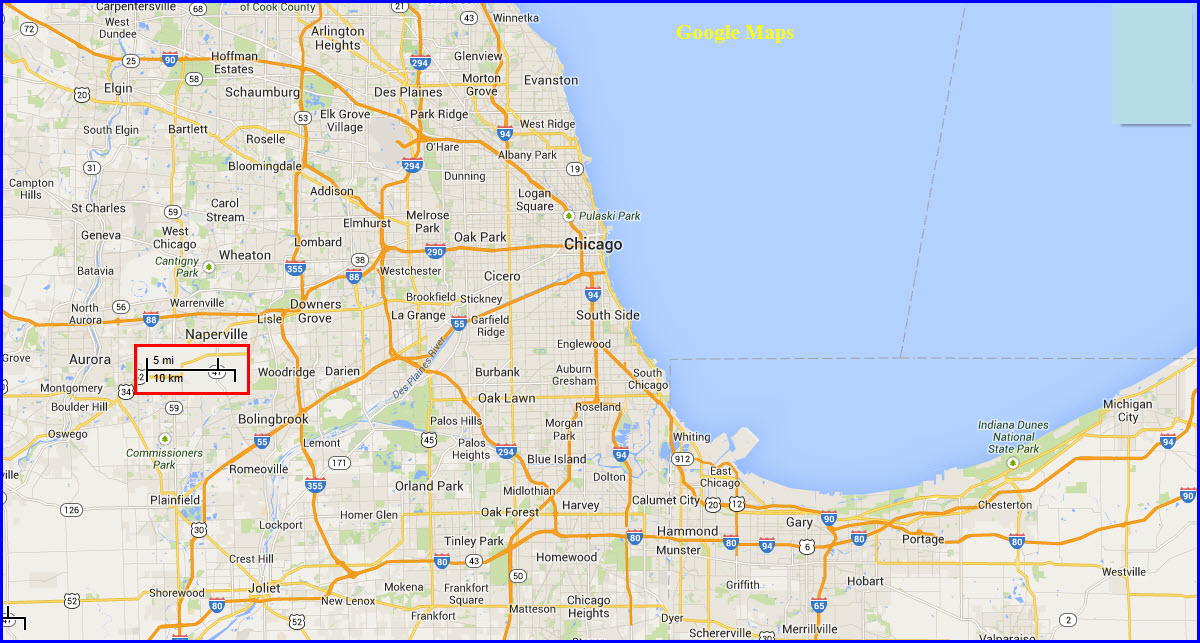
Since the Chicago area encompasses such a large area, it is difficult to have a detailed map in such a small place. The map above only gives you small idea of what it around, and where things are related to each other.....
When railfanning, one the things you should have with you (laws providing), is a scanner. A radio will let you in on what's happening, and where trains are. If you are not from the area, make friends with a local who can clue you in to the names and particulars you will hear on the radio.
Note: Trains of one railroad will usually use the host's channels to communicate with, if they are running on another's track.
Amtrak
Road AAR 13 - 160.305
Yard AAR 42 - 160.740 (14th St Yard)
BNSF
Road AAR 36 - 160.650
Road
Belt Railway of Chicago
Road AAR 26 - 160.500
Yard AAR 18 - 160.380 (Clearing Yard)
Canadian National
Road
Canadian Pacific
Road
Chicago Rail Link
160.035 (a non-AAR frequency)
Chicago Short Line
AAR 15 - 160.335
CSX
Road 1 AAR 08 - 160.230 (ex
Chessie lines, ex RI line west of Joliet)
Road 4 AAR 84 - 161.370
Road 5 AAR 94 - 161.520 (ex L&N lines,
dispatcher on UP line to Woodland Jct IL)
Indiana Harbor Belt
Road 1 AAR 58 - 160.980
Road 2 AAR 64 - 161.070
Yard AAR 97 -
161.565 (Blue Island Yard)
Iowa Interstate
Road AAR 99 - 161.610 (Blue
Island - Joliet)
Road AAR 08 - 160.230 (Joliet - Bureau)
Yard AAR 97 - 161.565 (Blue Island
Yard)
Manufacturers Junction
AAR 91 - 161.475
Metra
AAR 66 - 161.100 BNSF Line
(BNSF Road Channel 1)
AAR 61 - 161.025 Electric District
(University Park)
AAR 54 - 160.920 Heritage Corridor
(Joliet)
AAR 44 - 160.770 Milwaukee District
North (ex SOO & MILW)
AAR 94 - 161.520 Milwaukee District
West (Elgin)
AAR 62 - 161.040 Union Pacific North
(ex CNW to Kenosha WI)
AAR 52 - 160.890 Union Pacific
Northwest (ex CNW to Harvard)
AAR 62 - 161.040 Union Pacific West
(ex CNW to Geneva)
AAR 22 - 160.044 Southwest Service
(to Manhattan, NS road Ch 3)
AAR 99 - 161.610 Rock Island District
(to Joliet)
Norfolk Southern
Road 2 AAR 76 - 161.250 (ex NKP
line to Ft Wayne)
Road 3 AAR 22 - 160.440 (ex Wabash line,
Metra to Orland Park)
Union Pacific
Road 1 AAR 20 - 160.410
Yard AAR 69 -
161.145 (Dolton Yard)
Wisconsin Central
Road 3 AAR 79 - 161.295
Wisconsin & Southern
AAR 07 - 160.215
None for Now
Disclaimers:
I love trains, and I love signals. I am not an expert. My webpages reflect what I find on the topic of the page. This is something I have fun with while trying to help others.
Please Note: Since the main focus of my two websites is railroad signals, the railfan guides are oriented towards the signal fan being able to locate them. For those of you into the modeling aspect of our hobby, my indexa page has a list of almost everything railroad oriented I can think of to provide you with at least a few pictures to help you detail your pike.
If this is a railfan page, every effort has been made to make sure that the information contained on this map and in this railfan guide is correct. Once in a while, an error may creep in :-)
My philosophy: Pictures and maps are worth a thousand words, especially for railfanning. Text descriptions only get you so far, especially if you get lost or disoriented. Take along good maps.... a GPS is OK to get somewhere, but maps are still better if you get lost! I belong to AAA, which allows you to get local maps for free when you visit the local branches. ADC puts out a nice series of county maps for the Washington DC area, but their state maps do not have the railroads on them. If you can find em, I like the National Geographic map book of the U.S..... good, clear, and concise graphics, and they do a really good job of showing you where tourist type attractions are, although they too lack the railroads. Other notes about specific areas will show up on that page if known.
Aerial shots were taken from either Google or Bing Maps as noted. Screen captures are made with Snagit, a Techsmith product... a great tool if you have never used it!
By the way, floobydust is a term I picked up 30-40 years ago from a National Semiconductor data book, and means miscellaneous and/or other stuff.
Pictures and additional information is always needed if anyone feels inclined to take 'em, send 'em, and share 'em, or if you have something to add or correct.... credit is always given! Please be NICE!!! Contact info is here
Beware: If used as a source, ANYTHING from Wikipedia must be treated as being possibly inaccurate, wrong, or not true.
RAILFAN GUIDES HOME
RAILROAD SIGNALS HOME
NEW 11/4/2013, MAY28/2015, NOV02/2021
Last Modified 02-Nov-2021