
In General
Getting Here
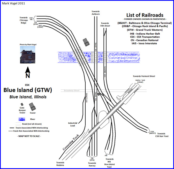
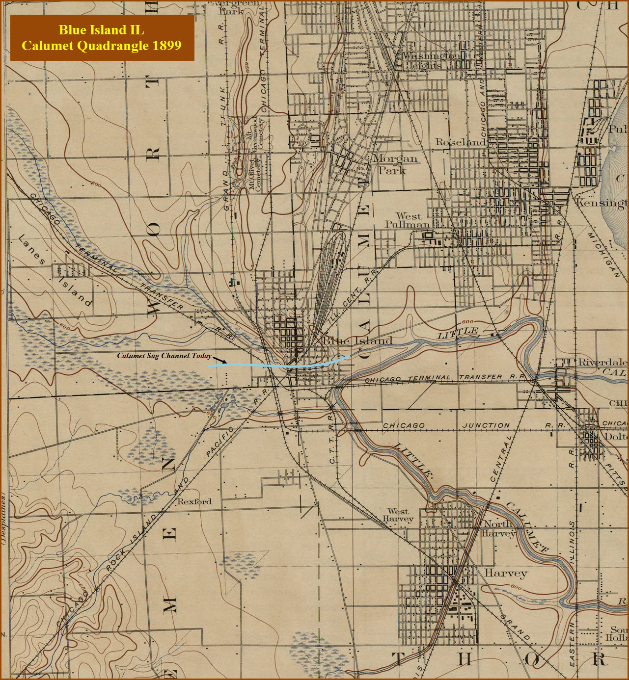
Map
USGS Maps
Floobydust
RAILFAN GUIDES HOME
RAILROAD SIGNALS HOME
Location / Name:
Blue Island IL, Cook County
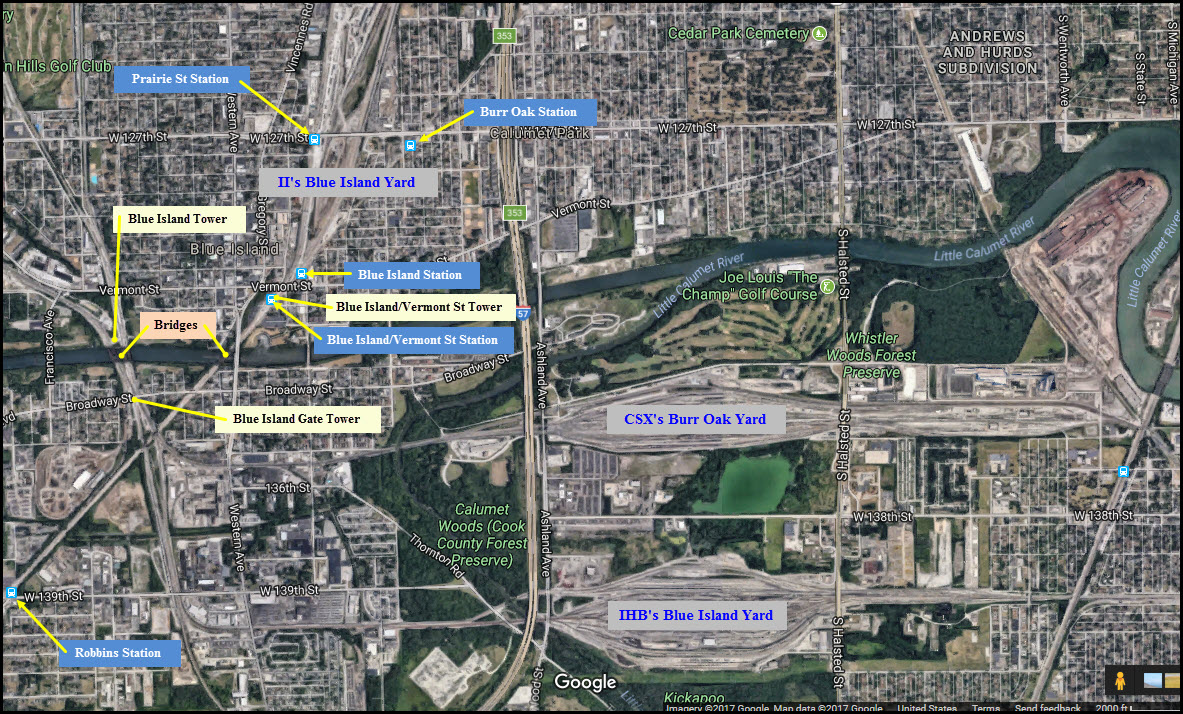
What's Here:
Action, action, action
5 METRA stations
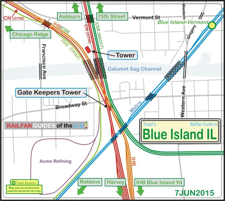
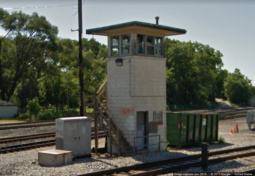
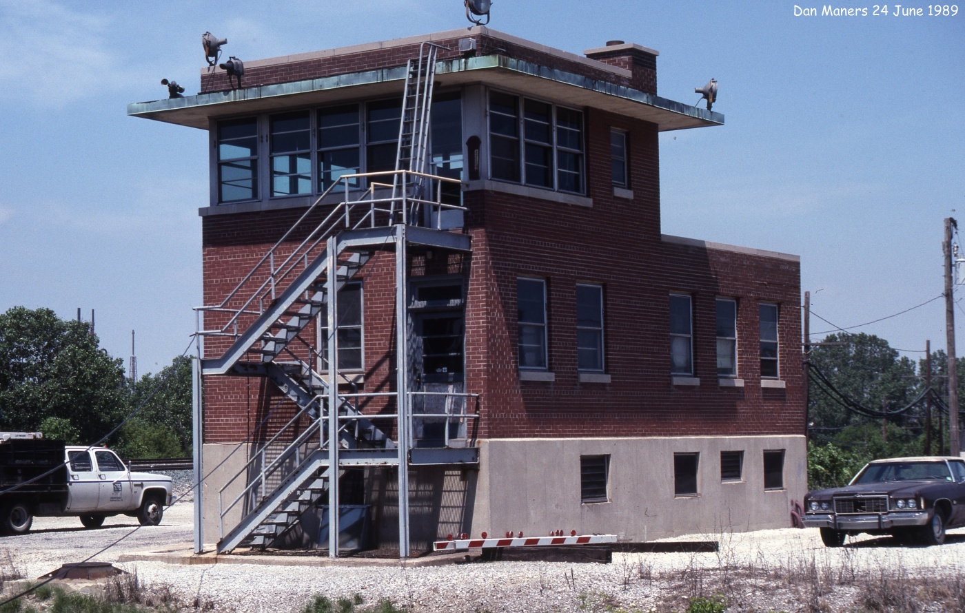
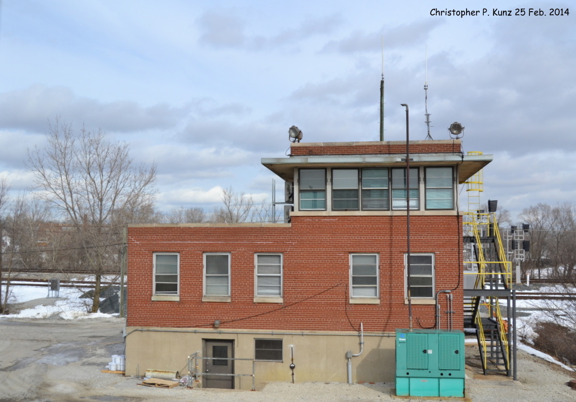
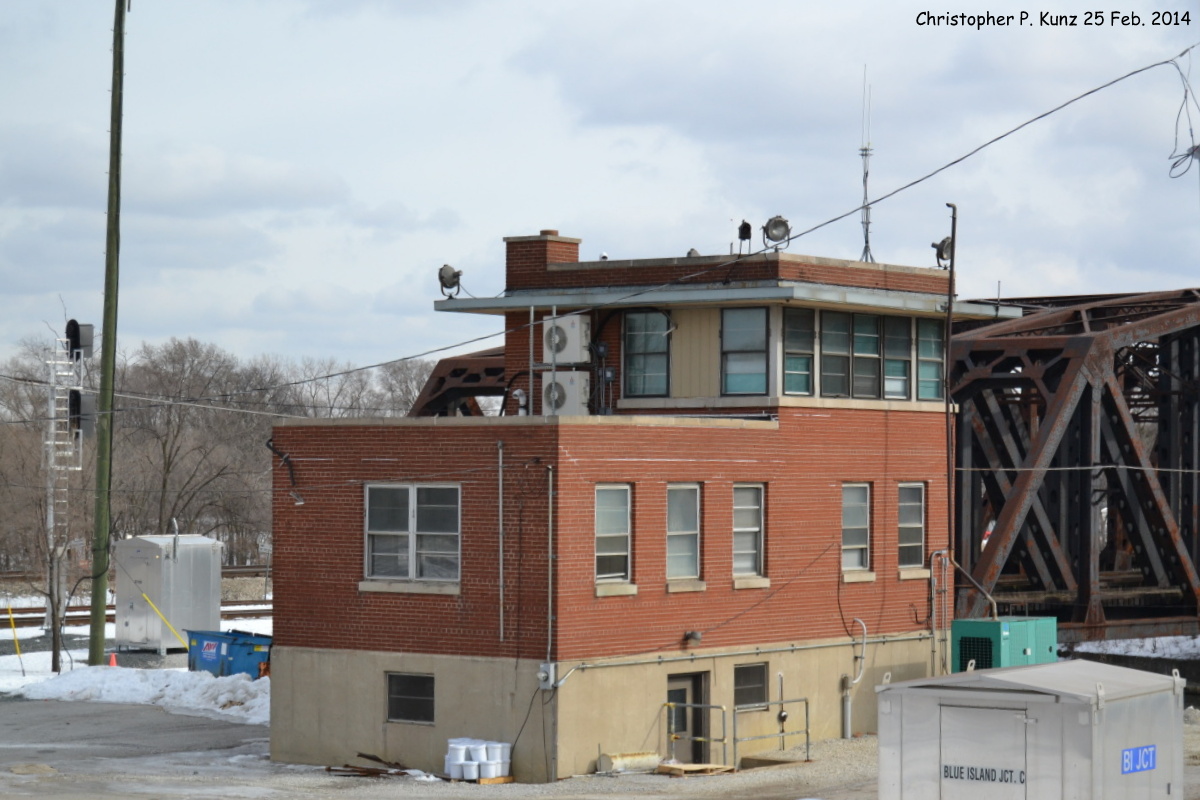
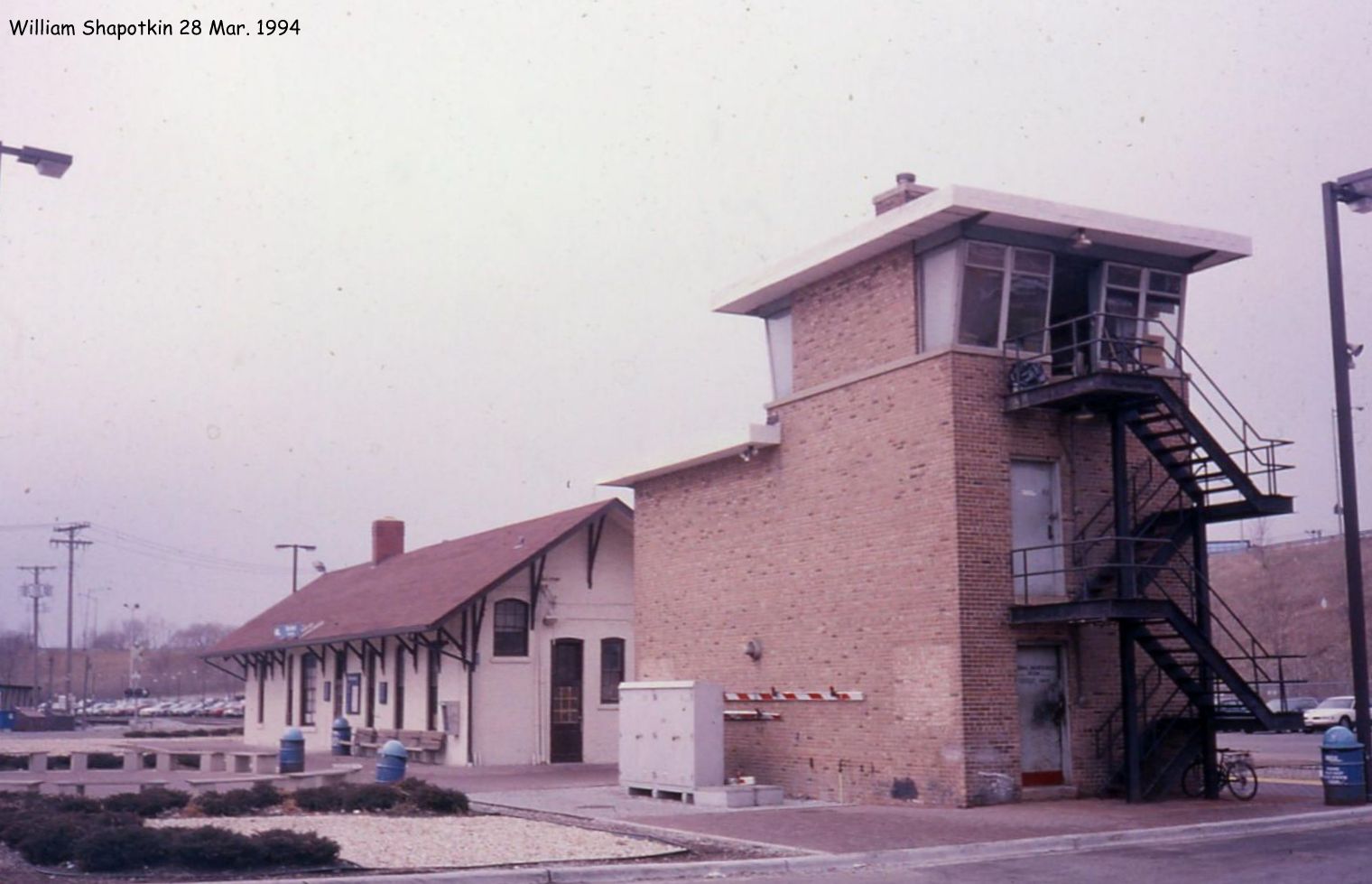
Three towers
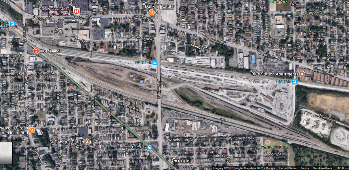
Iowa Interstate's Blue Island Yard
IHB's Blue Island Yard
CSX's Barr Yard
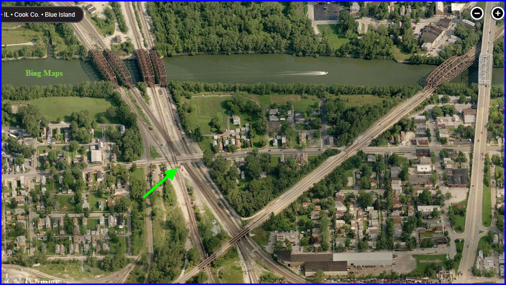
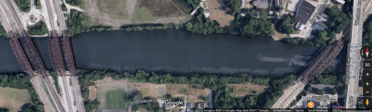
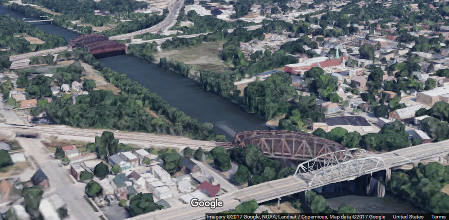
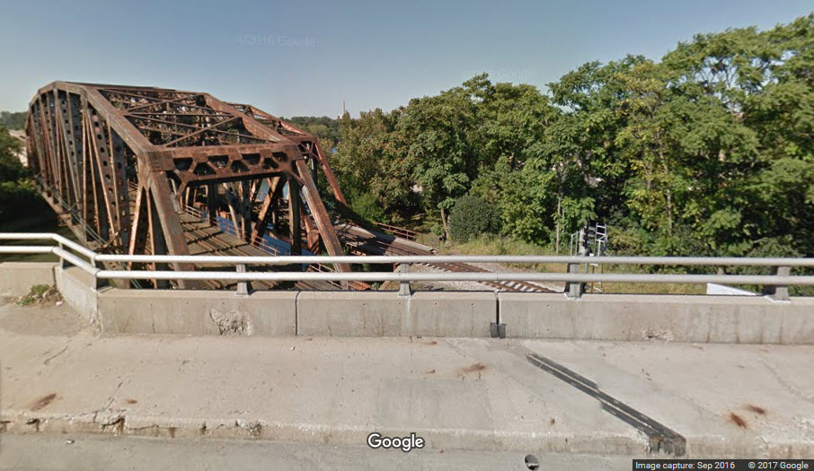
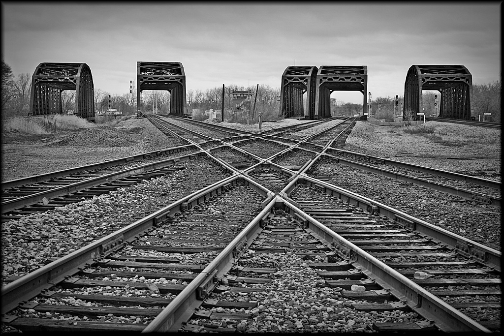
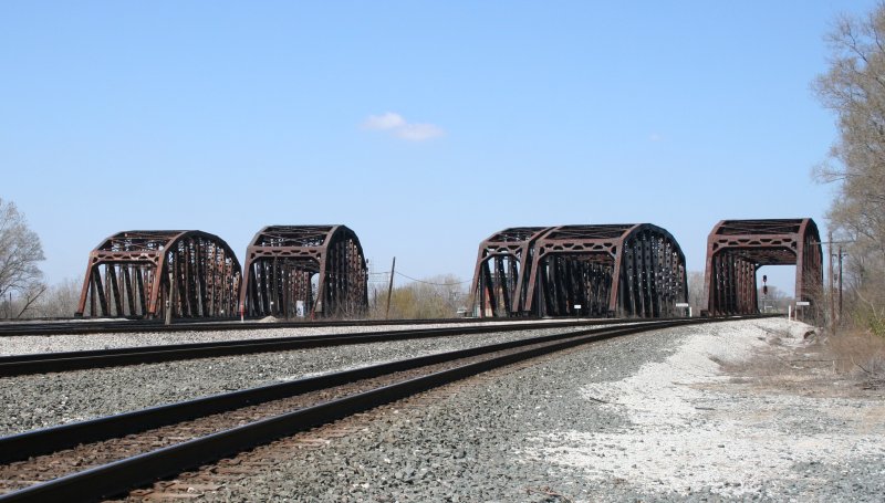
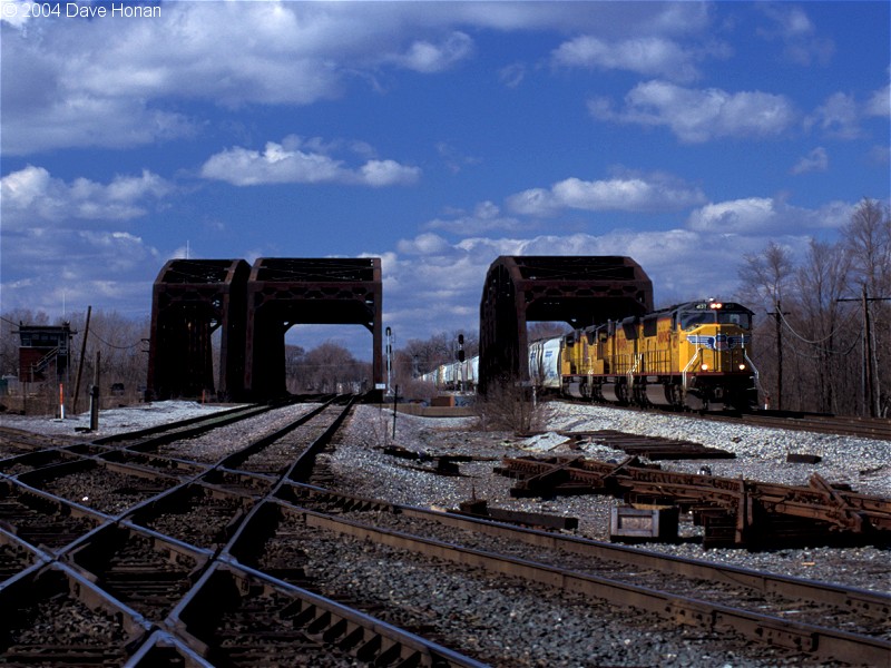
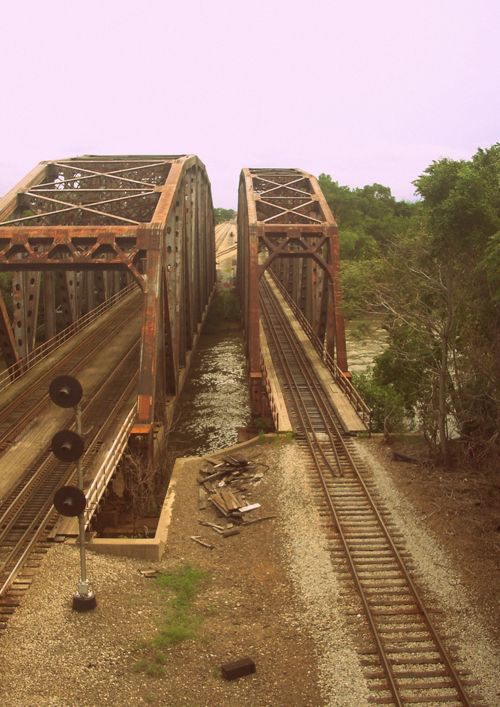
6 Bridges crossing the Calumet Sag Channel (7 if you count the unused one)
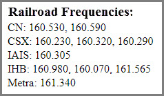
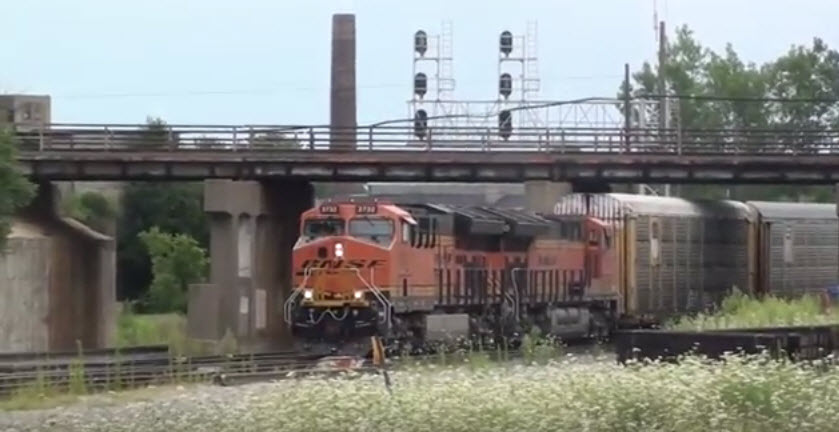
Signals galore!
Data:
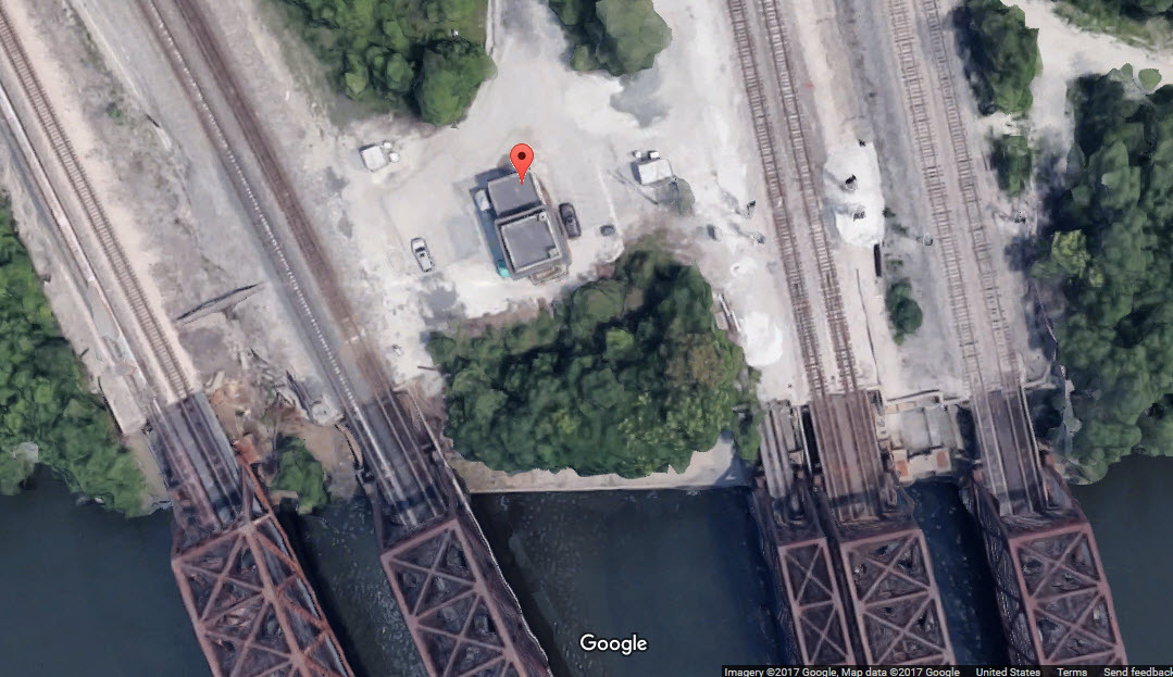
GPS Coordinates: 41.650235, -87.686514 (Broadway and the huge crossing)
Phone A/C: 708
ZIP: 60472
Access by train/transit:
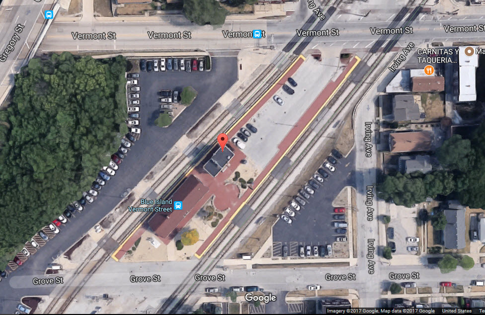
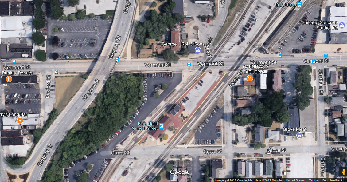
METRA Blue Island (Metra Electric District) and Blue Island/Vermont St Stations (Rock Island District), if you are willing to walk about a mile
The Scoop:
With Chicago being the railtown it is, and was, you can be sure it has more than it's fair share of towers to control all of those trains. Even with all of the consolidation and mergers that have taken place over the years, a great majority of them are still around to put into your pictures.
With Broadway St passing thru the thick of the action, there is really no need to be trespassing on railroad property. BE especially careful while taking pictures, and where you are standing, because it is very easy to get wrapped-up in taking pictures of one track, and be standing on another track, and while you are absorbed in getting the perfect picture, along comes another train on the track you are standing on.... I can't stress this enough!!!
While taking pictures from the METRA tracks used to be cool (looking down into the "bowl"), their track is also now posted no trespassing and off limits.
For additional info on the Blue Island area, check out these sources:
http://northamericaninterlockings.com/illinois_9.html
http://industrialscenery.blogspot.com/2016/05/rock-islands-blue-island-tower.html
http://www.flickriver.com/groups/1080817@N23/pool/interesting/ for a bunch of pictures in and around Blue Island
http://industrialscenery.blogspot.com/2016/06/ihbs-blue-island-yard.html lots of great photos from the vintage years
http://industrialscenery.blogspot.com/2017/06/illinois-central-randolph-street-tower.html
http://www.dhke.com/CRJ/blueisland.html
Acknowledgements:
Denver Todd for doing most of the legwork!
Mark Vogel
Jersey Mike
Dan Manners
Christopher Kunz
Sean Graham White
William Shapotkin
Dave Honan
Zol87
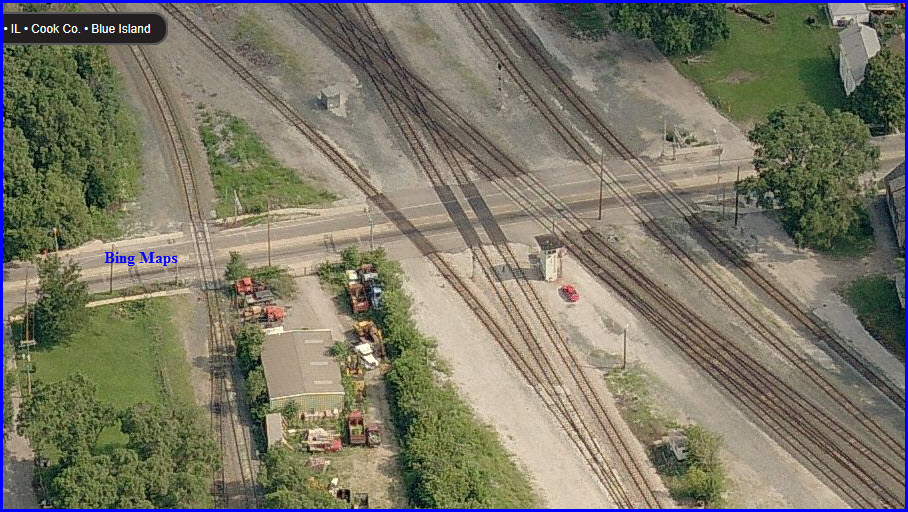
Aerial shots were taken from www.bing.com/maps. The screen-shots from Bing are made with Snagit, a Techsmith product... a great tool if you have never used it!
Pictures and additional information is always needed if anyone feels inclined to take 'em, send 'em, and share 'em, or if you have something to add or correct.... credit is always given! Contact info is here.
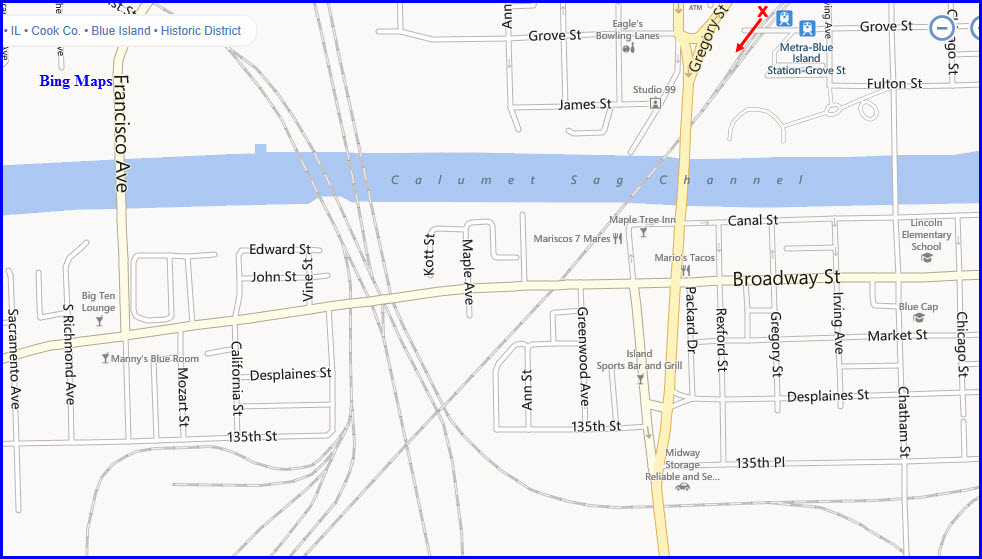
Getting here is easy. From the "dhke" website: From I-57, exit at Burr Oak Street (also called "127th Street"). Go east about a block to Ashland Avenue. Turn right and head south to Broadway (the first stoplight after crossing the Calumet Sag Channel). Turn right, proceed about a mile or so on Broadway to the junction. Cross all tracks at the junction and park on the first side street on the left (Vine Street). Note: there is a tempting parking area on the right just before the tracks - however, it is CSX property, and occasionally CSX security officers have asked visitors to leave the spot.
GPS Coordinates: 41.650204, -87.686548
Blue Island is a big railfan draw for the Chicago area. Lots of activity, lots of railroads. It's too bad the tower is closed and is at the mercy of vandals.
Even tho the safety and security of the area has improved a little over what it was in the early 2000's, make sure you still have a buddy to railfan with!
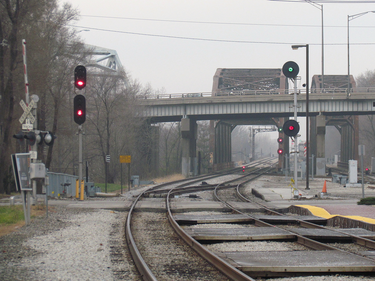
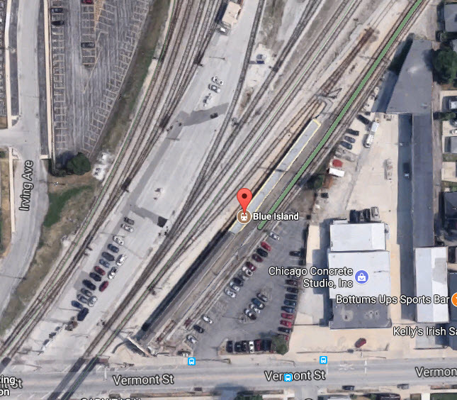
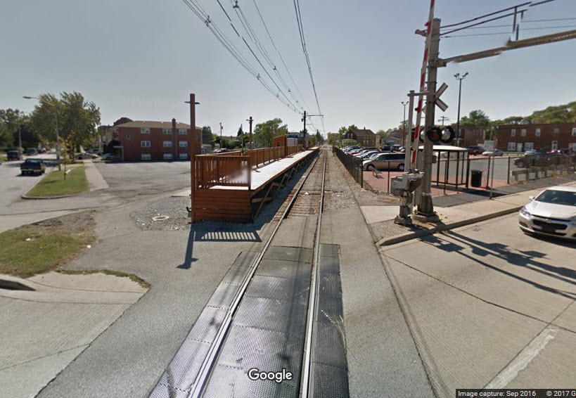
The following picture was taken from the Blue Island Vermont St METRA Station (the red "X" in the map above), courtesy Jersey Mike
Nice mix of searchlight, color light, and dwarf signals!
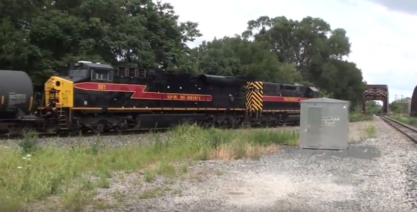
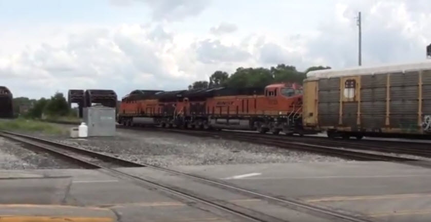
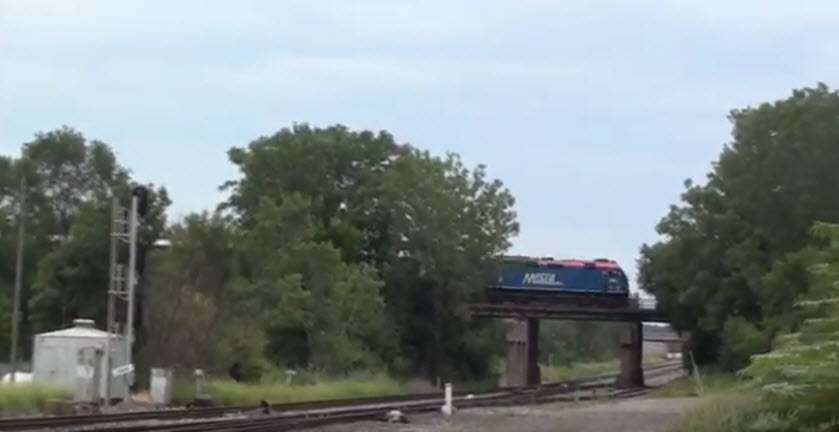
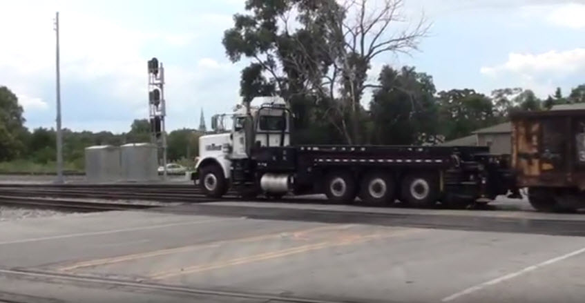
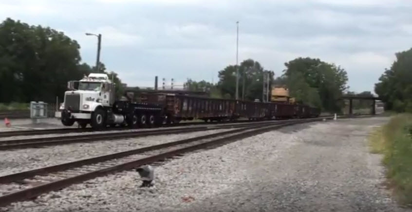
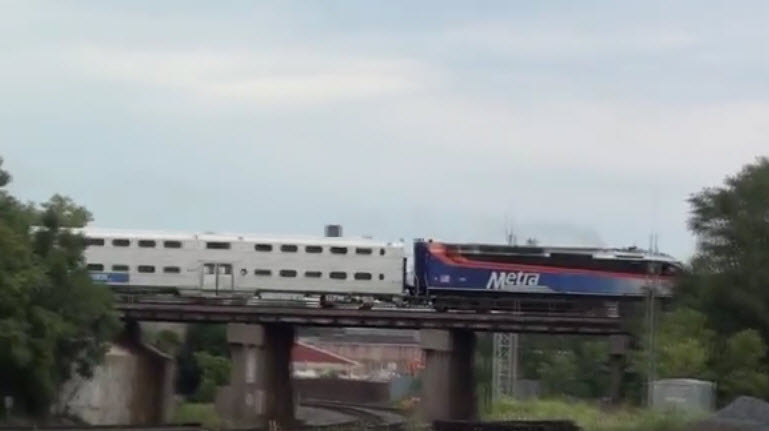
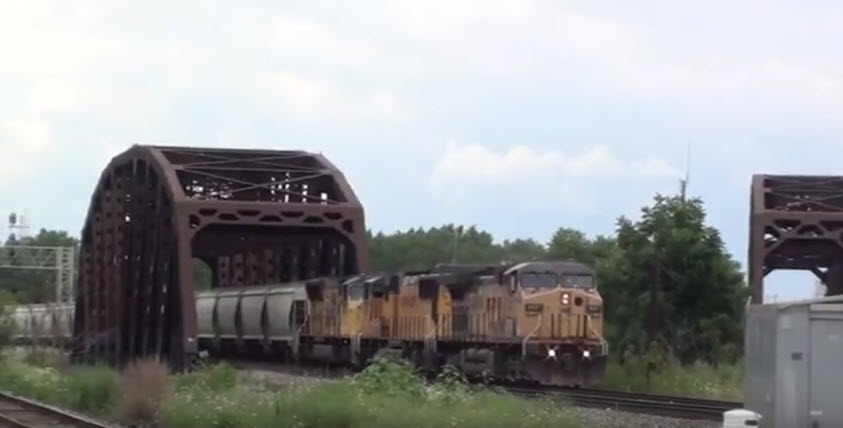
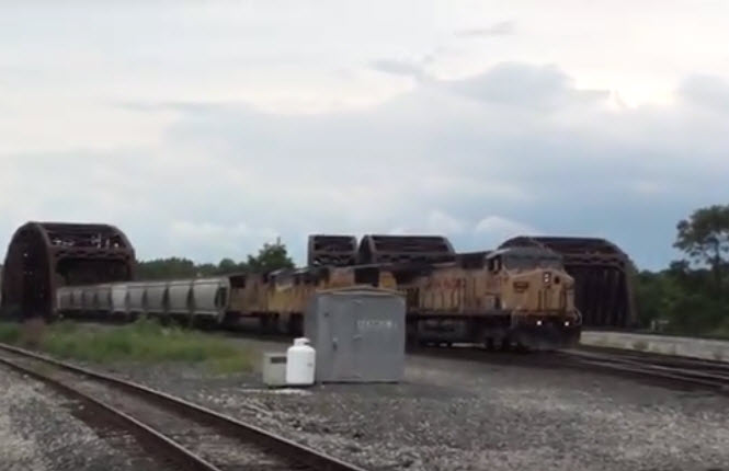
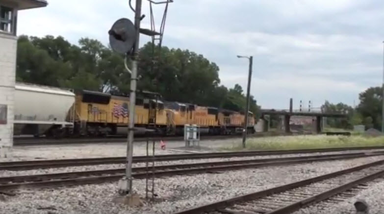
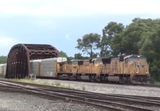
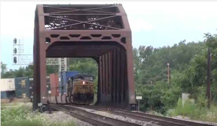
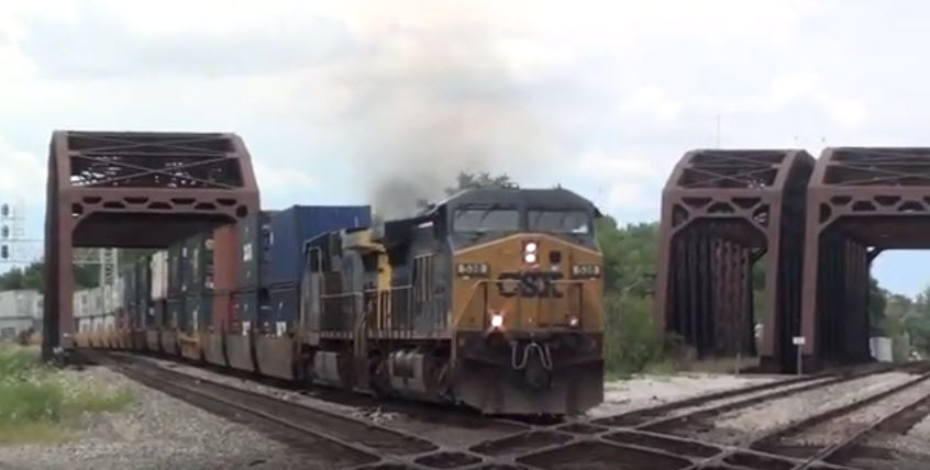
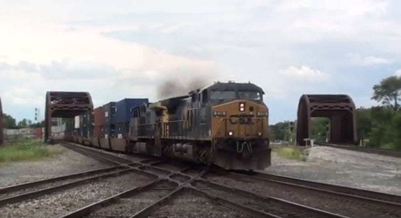
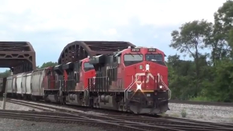
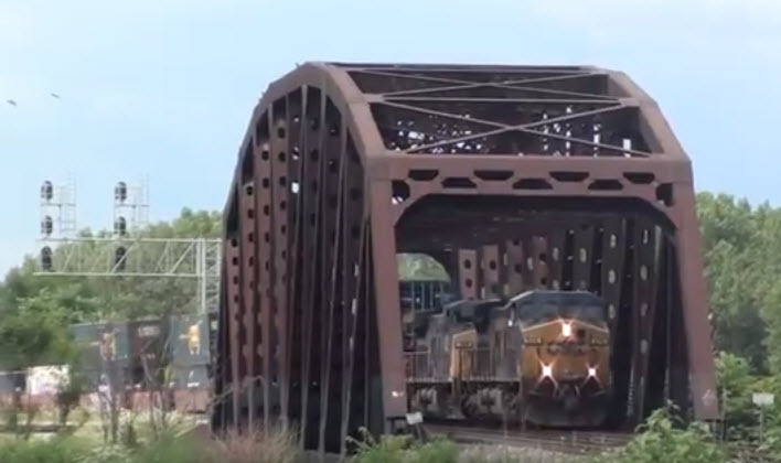
The following pictures are screenshots that come from the following video: https://youtu.be/OLLUlQbgkB4
GPS Coordinates: 41.652862, -87.687740
This is a place most of us should not be going, because to do so, we would be trespassing.....
One source has this as being a GTW tower on Broadway, but Broadway is on the other side of the channel where the actual junctions are.
GPS Coordinates: 41.655019, -87.677551
Blue Island is a big rail
GPS Coordinates: 41.650204, -87.686548
Blue Island is a big rail
GPS Coordinates: 41.654850, -87.677772
On the Rock island District line.
GPS Coordinates: 41.656107, -87.675832
This station is at the end of the METRA Electric District line.
GPS Coordinates: 41.662497, -87.674999
On the Rock island District line.
 from
Wikipedia
from
WikipediaGPS Coordinates: 41.662227, -87.668894
This station is on the METRA Electric District line, next to the last stop.
GPS Coordinates: 41.650204, -87.686548
Blue Island is a big rail
 Dave Honan
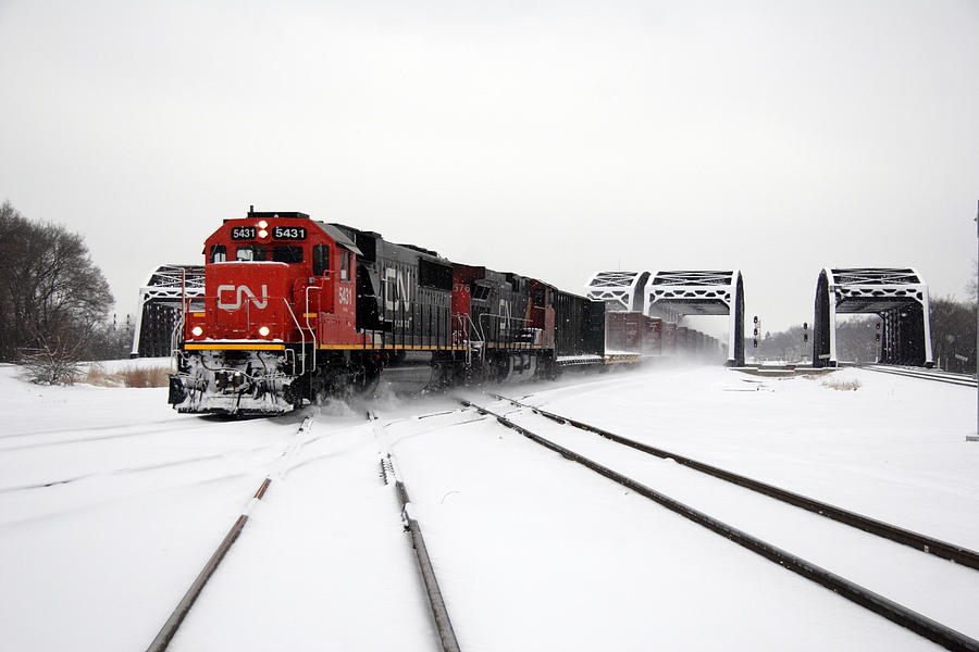 Sean Graham White
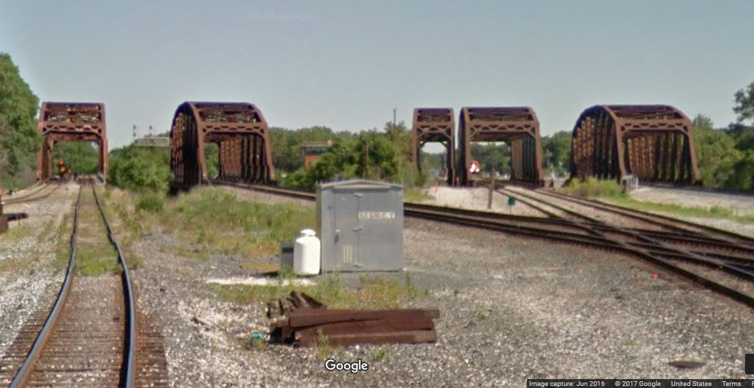
GPS Coordinates: 41.650204, -87.686548
Blue Island is a big rail
GPS Coordinates: 41.650204, -87.686548
Blue Island is a big rail
Courtesy of the University of Texas Library, click here for their index page.
N
CHICAGO RAILFAN GUIDE HOME
RAILFAN GUIDES HOME
RAILROAD SIGNALS HOME
NEW
12/01/2013, 12/02/2013
Last Modified
15-Aug-2017