In General
Getting Here
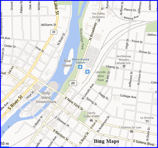
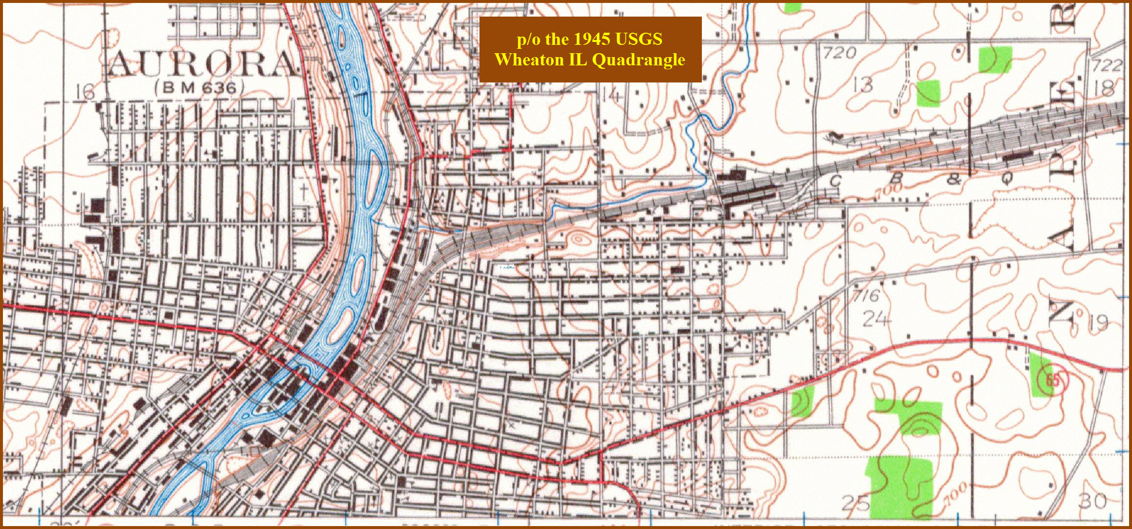
Map
Sights
Bridges
Signals
Pictures
Floobydust
RAILROAD SIGNALS HOME
Location / Name:
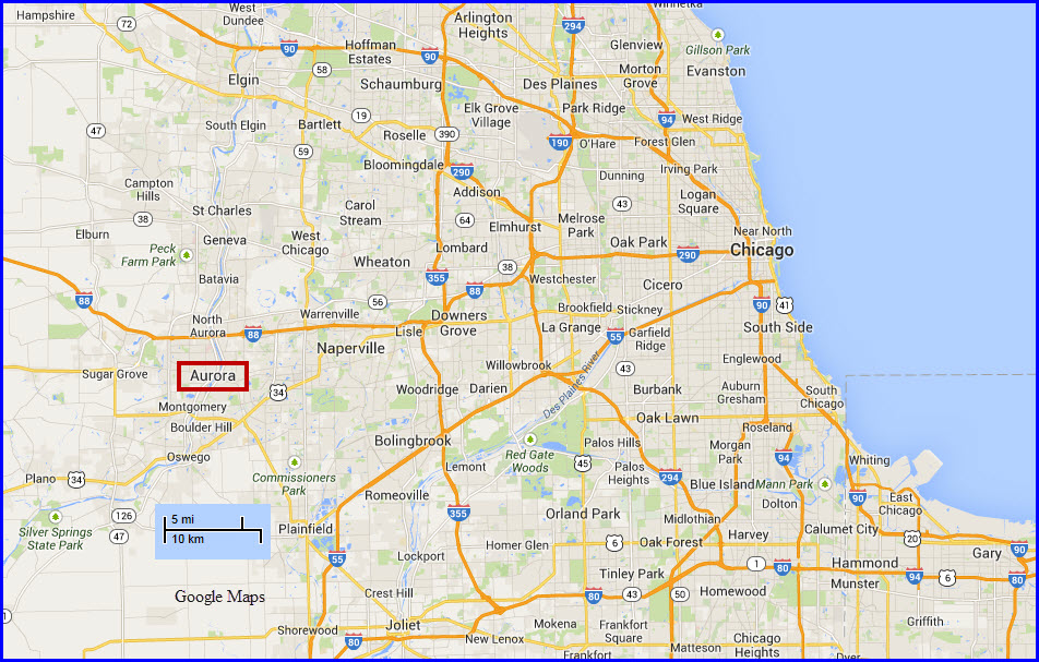
Aurora IL, Kane (and Kendall and Will) Counties
What's Here:
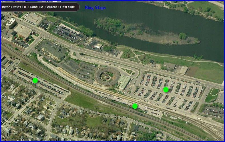
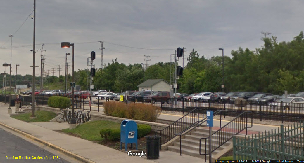
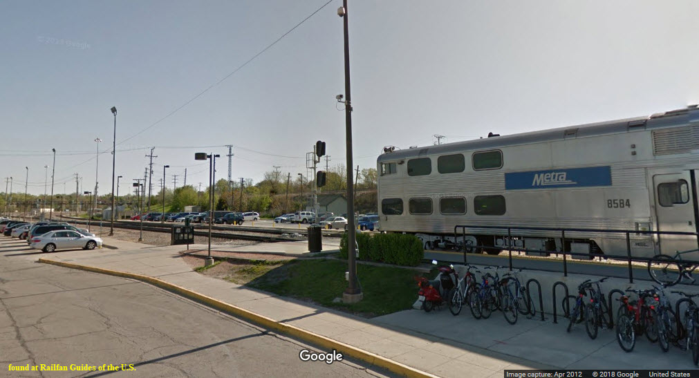
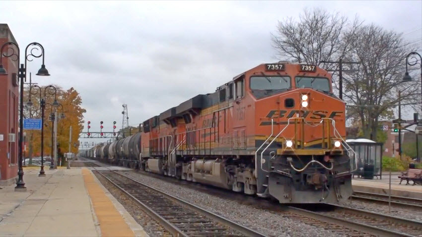
Aurora Metra Station - the end of the line
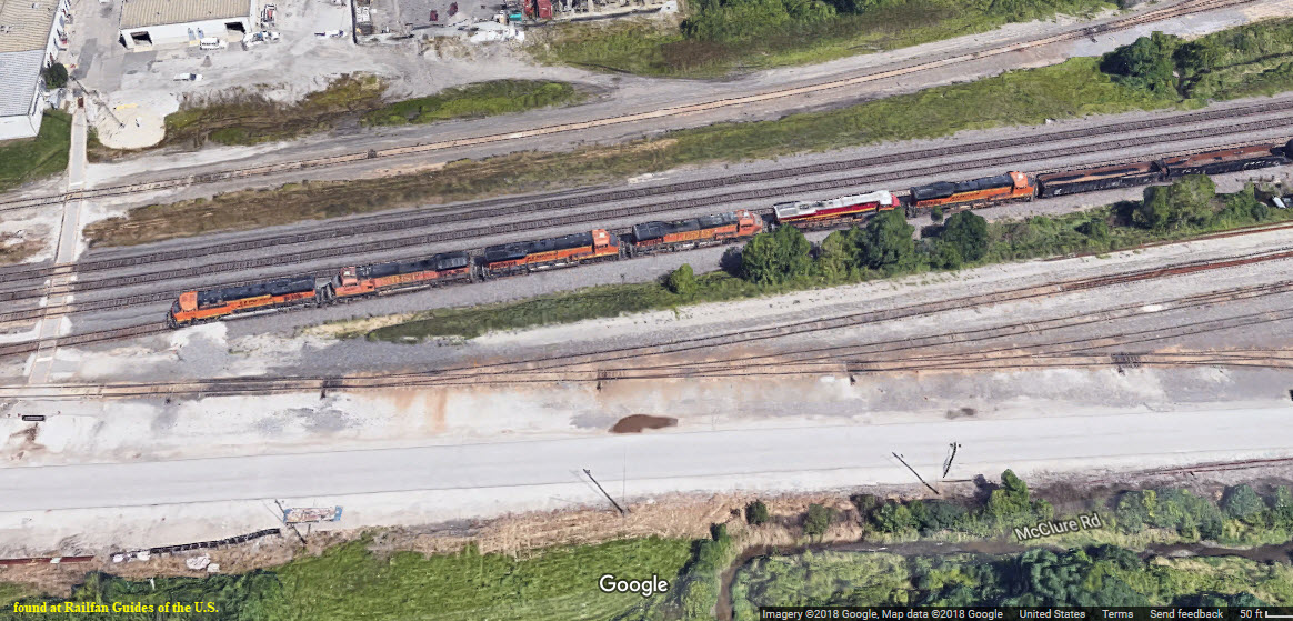
Metra Yard
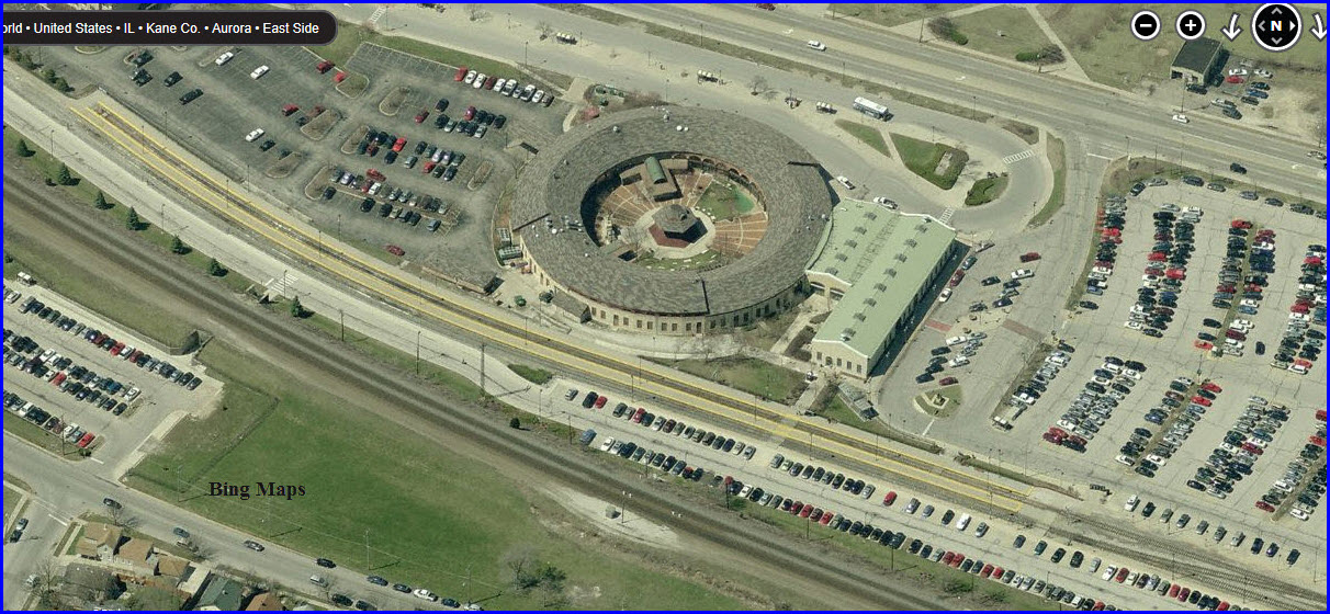
Former CB&Q Roundhouse
Abandoned railroad bridge just north of the North Ave Bridge
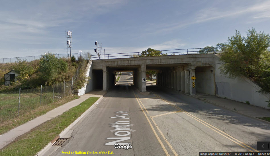
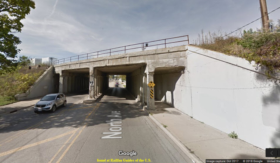
Viaduct
Data:
GPS Coordinates: as needed
Phone A/C: 630
ZIP: 60505
Access by train/transit:
Metra
The Scoop:
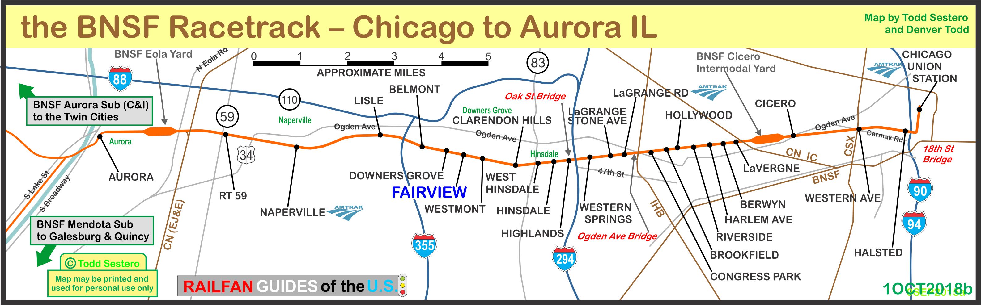
Aurora is the end of Metra's BNSF RR Line coming out of Chicago. The BNSF line is AKA (also known as): the BNSF Racetrack. A map of the line is below.
West of here the BNSF splits and continues west to Galesburg IL and beyond on the BNSF Transcon, on the Mendota Sub.
Heading to the northwest, it continues on the Aurora Sub to Savanna IL, and then on to Minneapolis/St Paul and the far Northwest: Portland OR and Seattle WA.
Acknowledgements:
Denver Todd
University of Alabama
Delayed in Block Productions
Websites and other additional information sources of interest for the area:
None yet.
From the downtown Chicago area, take I-290 west to I-88, continue on 88 till you reach Farnsworth Avenue, or Lincoln Highway. Remember that I-88 is a toll highway, and is AKA the Ronald Reagan Memorial Highway. The Lincoln highway heading south looks to be the better choice. You can cut over to Aurora Ave with either Indian Trail or Illinois Ave, and then continue south. Aurora Ave turns into Broadway St, which passes right by the station.
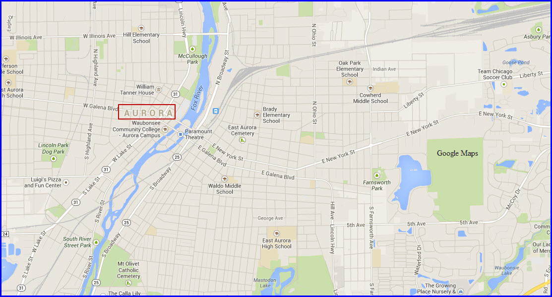
GPS Coordinates: 41.761806, -88.308743
Parking for the station is shown on the map below by the green dots.
There is a static display of a CB&Q Caboose at the station.
Right next to the station is Two Brothers Roundhouse Restaurant and Brew Pub, located in the old, former CB&Q Roundhouse.
Two Brothers Roundhouse (Brew Pub)
205 North Broadway Street
Aurora, IL 60505
GPS: 41.76047 -88.30906
http://www.twobrothersroundhouse.com/
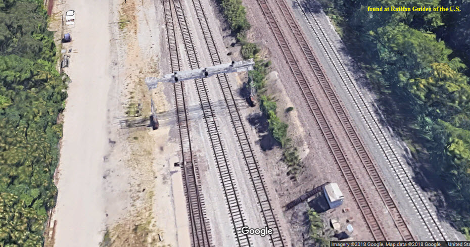
A 17 track yard, in addition to the two thru tracks leading into the station.
There are two huge signal type bridges span the yard. Looks like they probably support service drops for the engines.
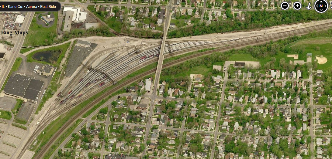
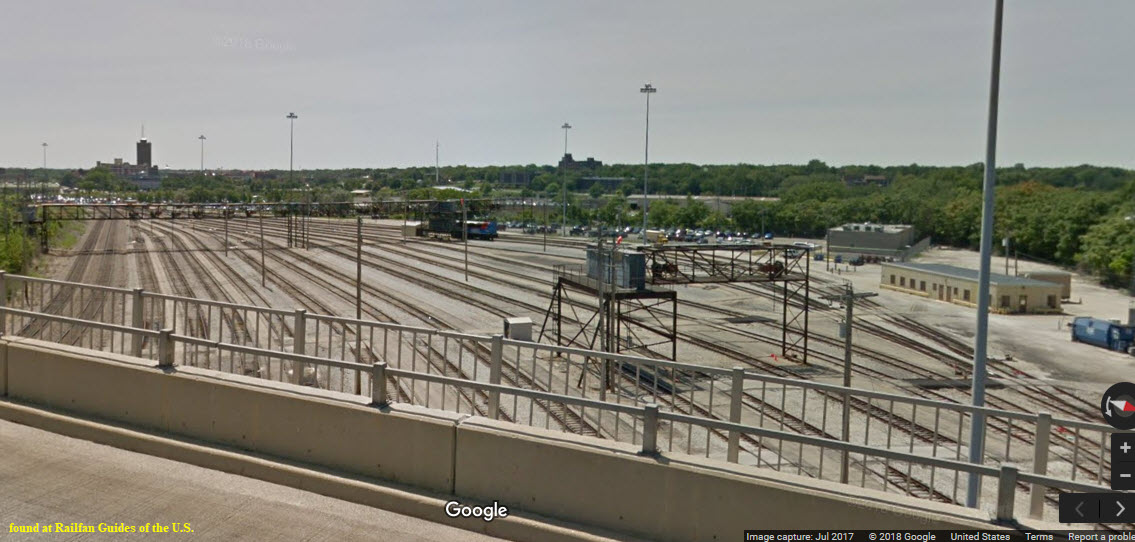
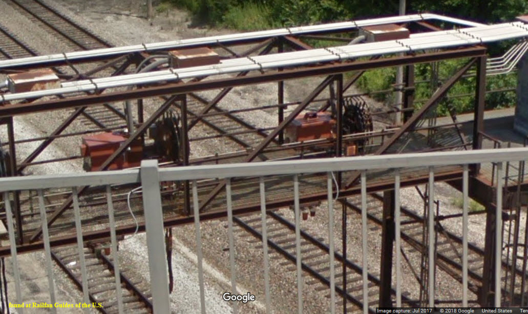
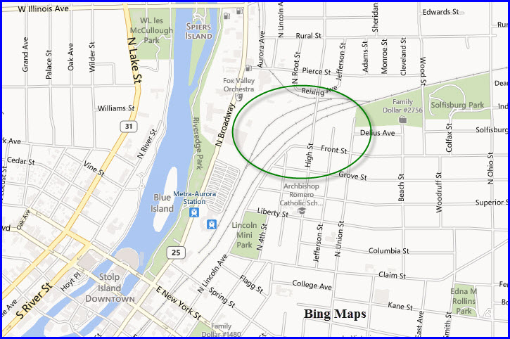
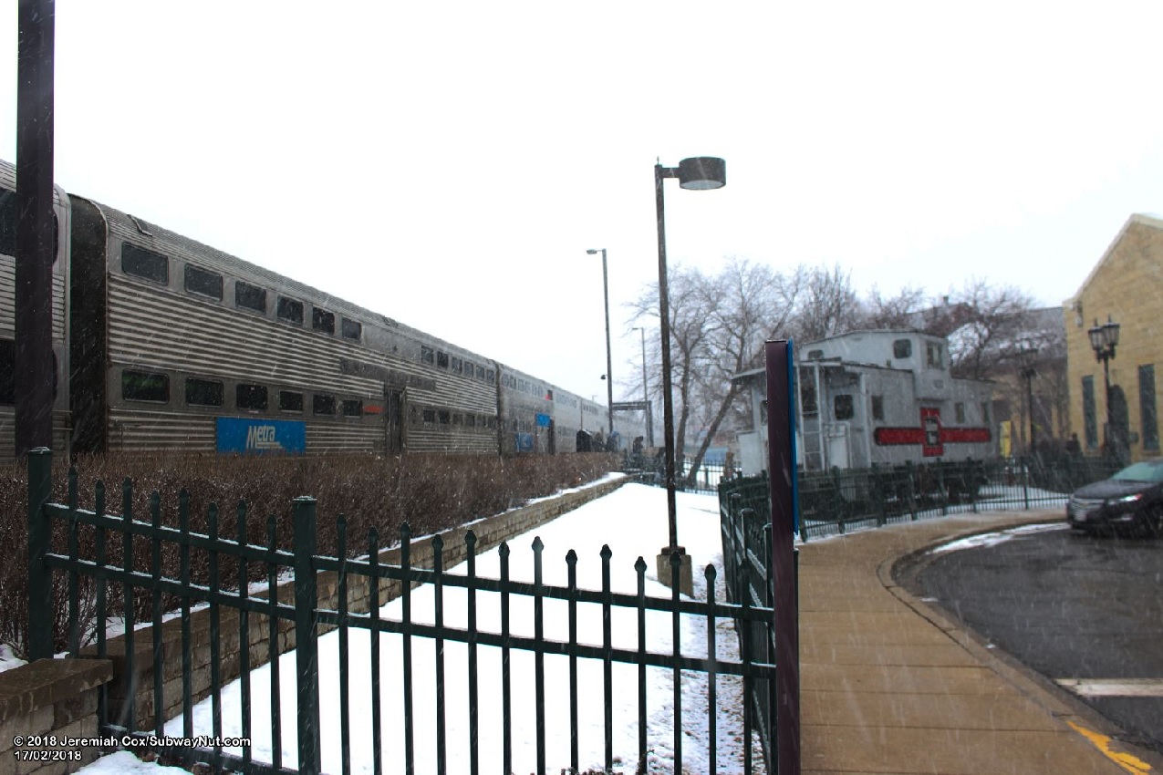 photo by Denver Todd
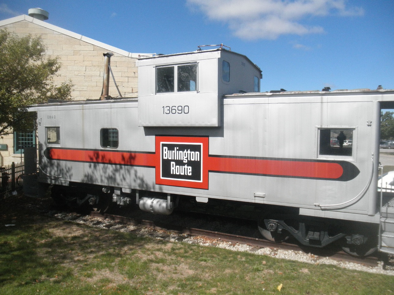 photo by Denver Todd
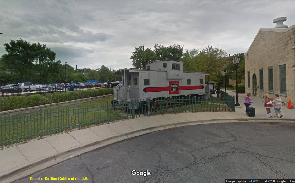
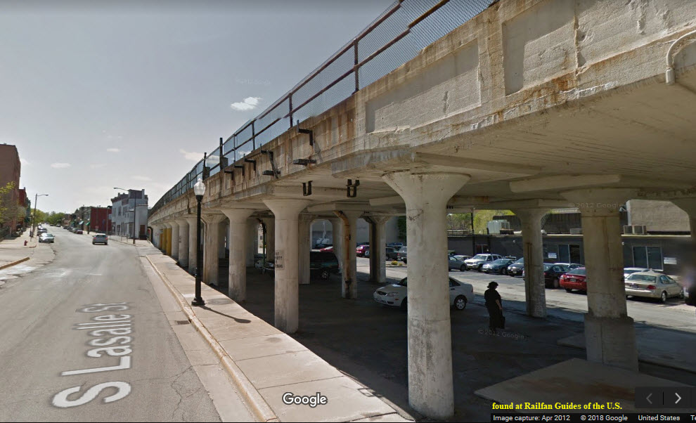
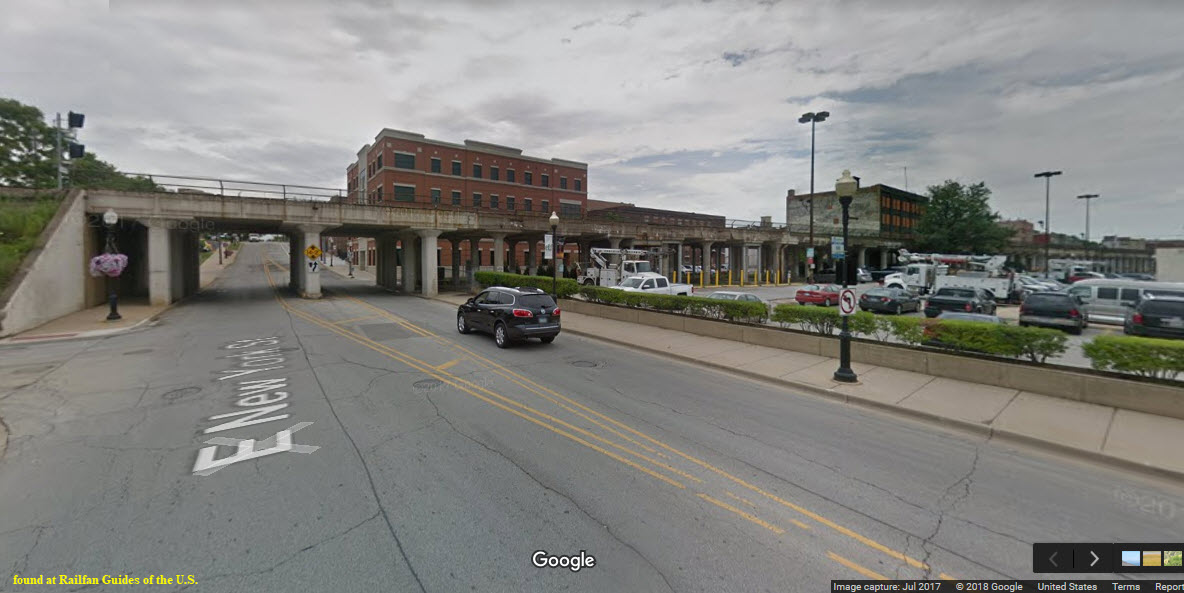
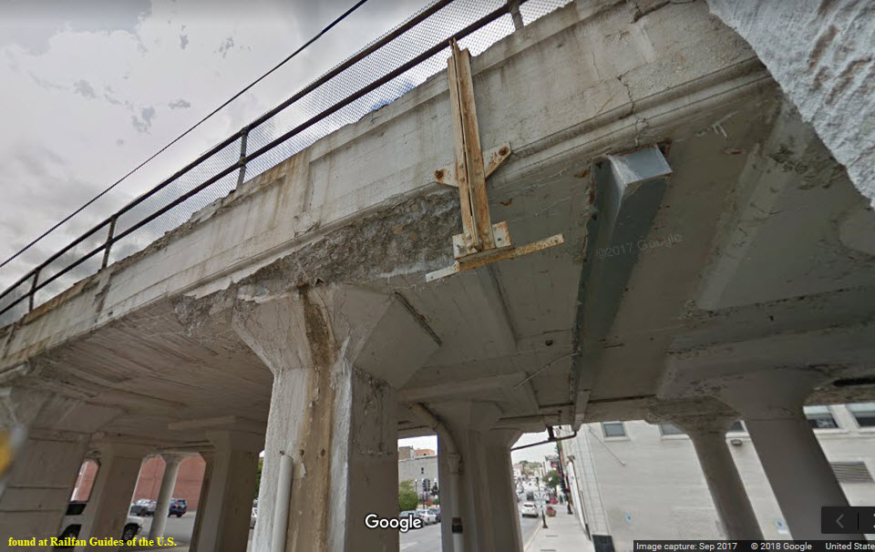
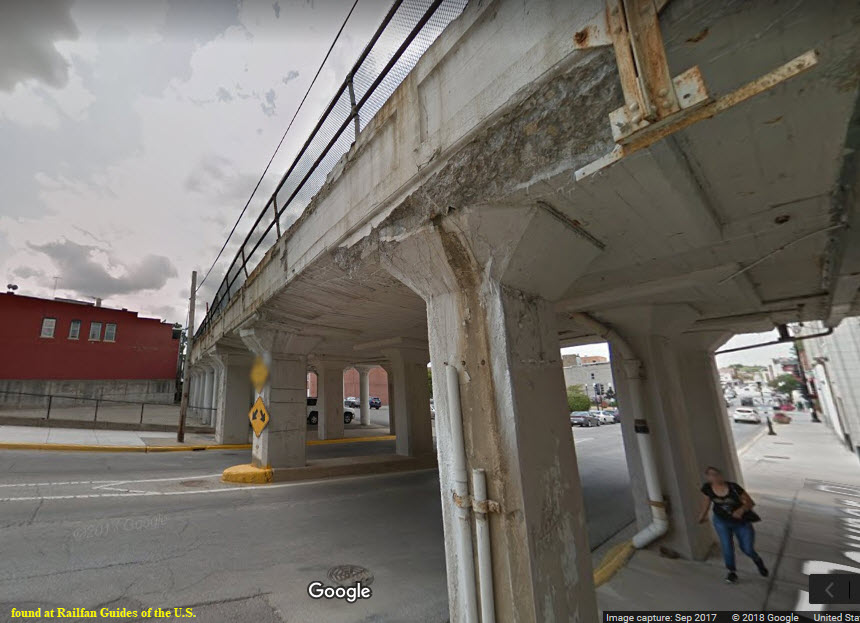
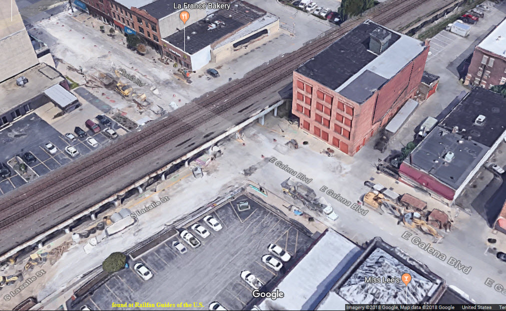
This elevated structure extends from Benton St on the south to New York St on the north end, a distance of 4 blocks or about 1900 feet if you include the giant overpass that starts at Clark St, or 1440 feet if you don't.
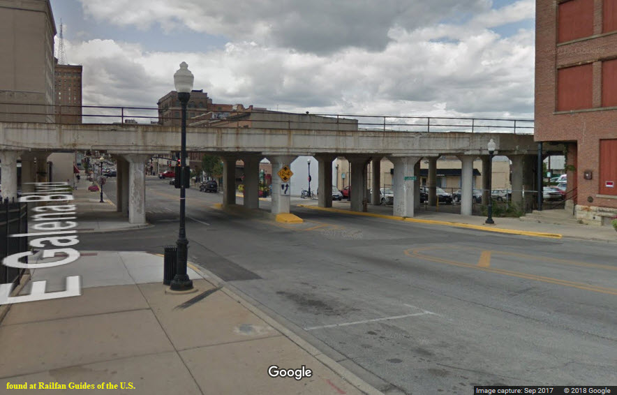
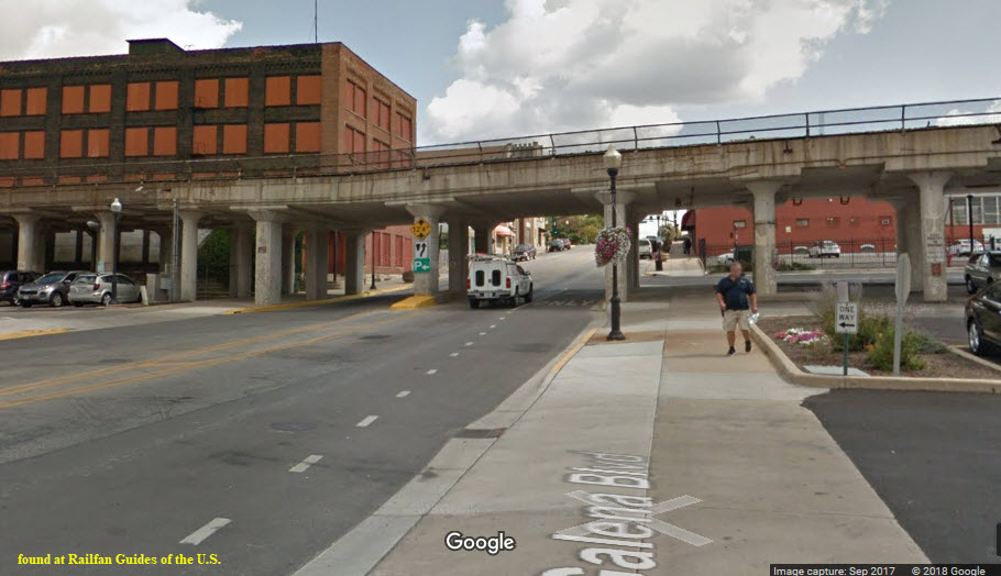
 from Galena Blvd
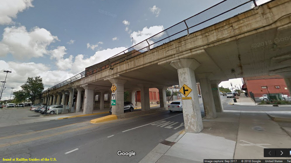 from Galena Blvd
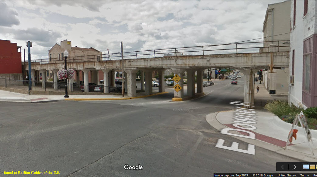
With the advent of drones, a lot of places which before would have been an impossible shot, are now routine, and the bridges going thru Aurora offer an unlimited number of cool opportunities for photo ops. Take advantage of Hurd Island for instance, and the interlocking that is taking place above you!
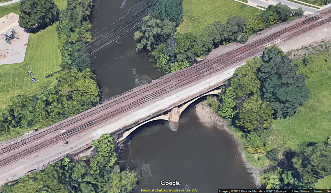
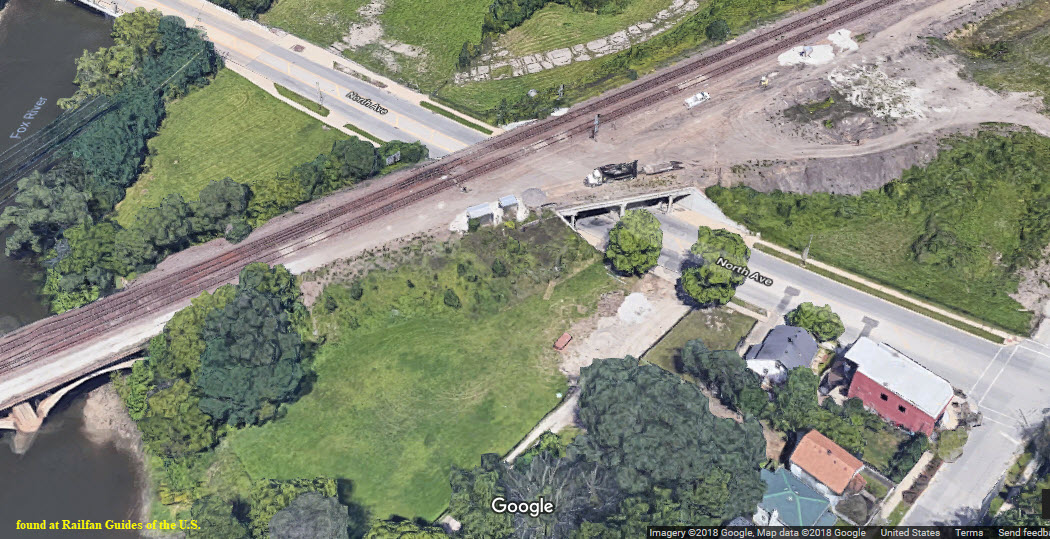
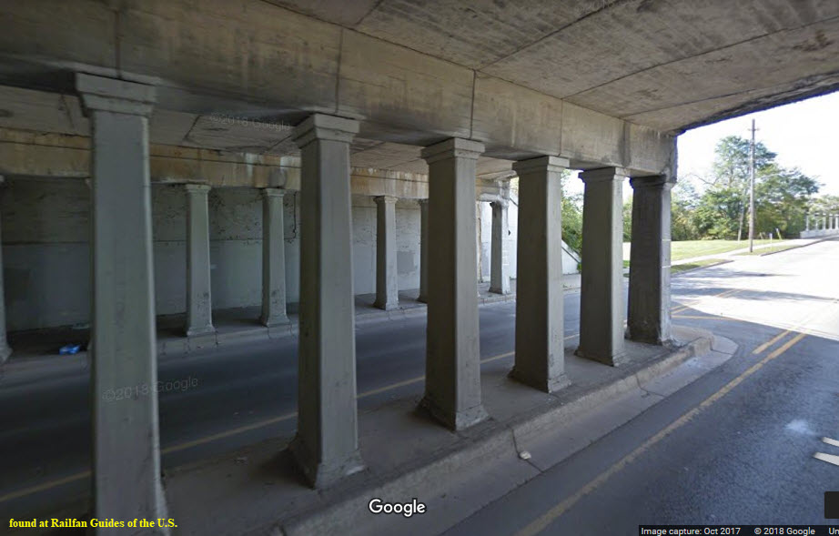
This one is just north of North Ave.


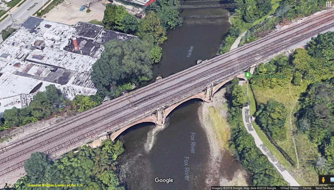
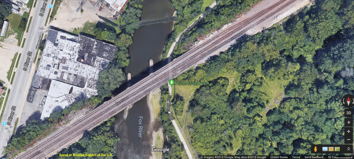
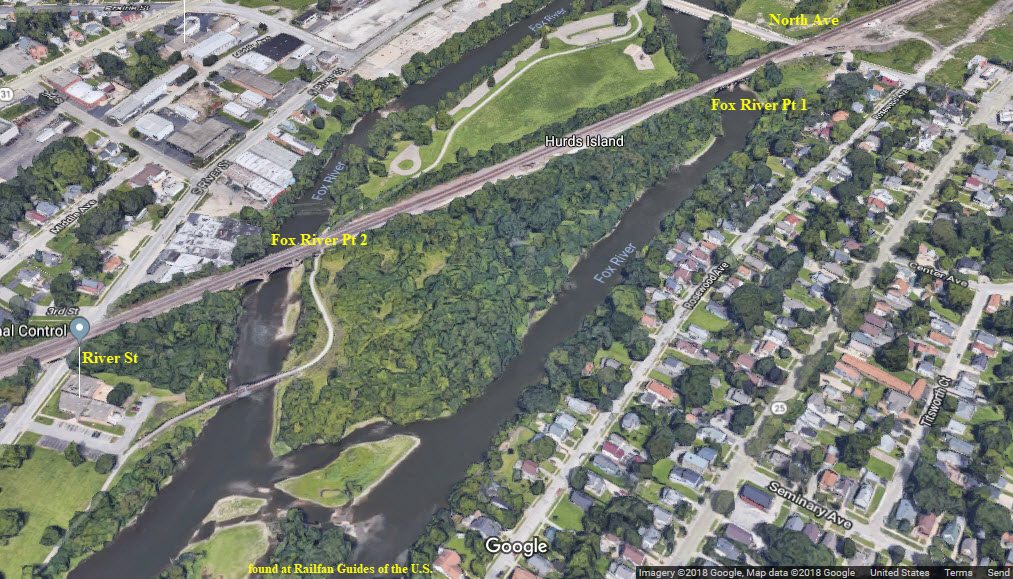
The railroad crosses the river twice, separated by a small island, Hurd Island. This is the eastern crossing of the two. You can gain access to Hurd Island via North Ave and get pictures from the Fox River Trail.
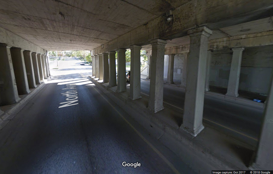
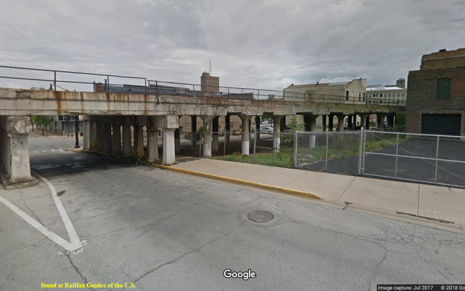
The bridge, or overpass, widens considerably. Looks like it was the southern end of a yard here at one time, maybe?
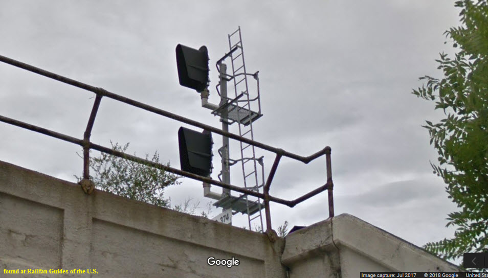
This overpass also has a set of signals off to one side.
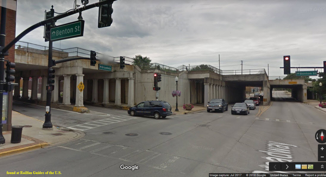
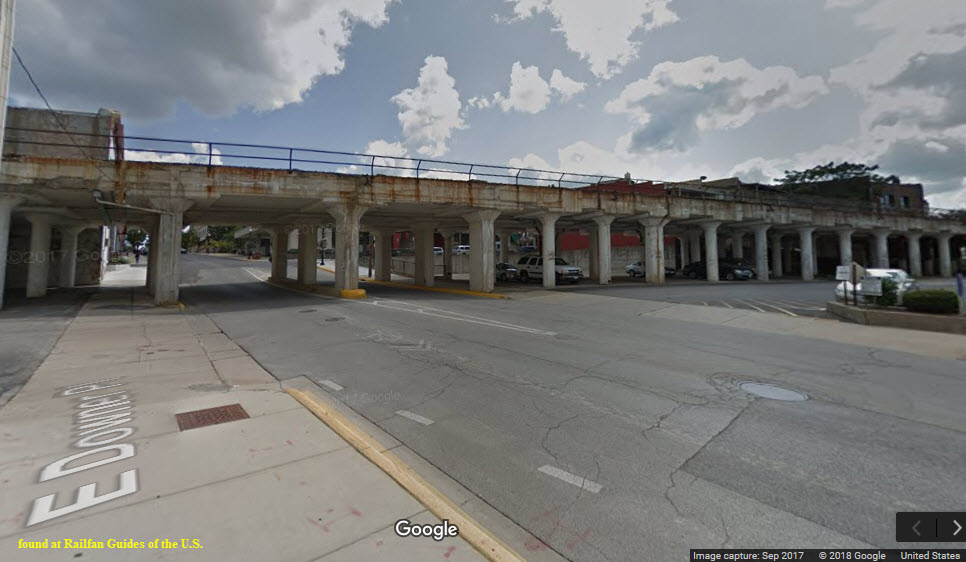
I guess the overpass over Broadway is the unofficial start of the viaduct going thru town..... It is quite a structural affair looking at it from the Broadway/Benton side!
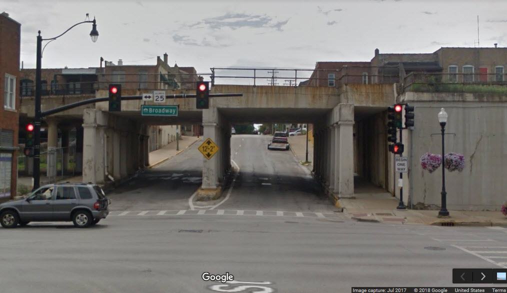
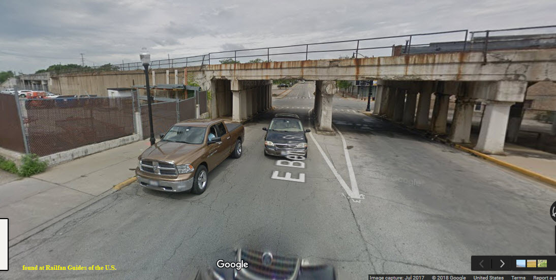
These pictures on Google appear to have been taken from the sidewalk instead of their usual car.....

More views from the sidewalk.
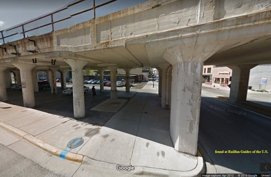
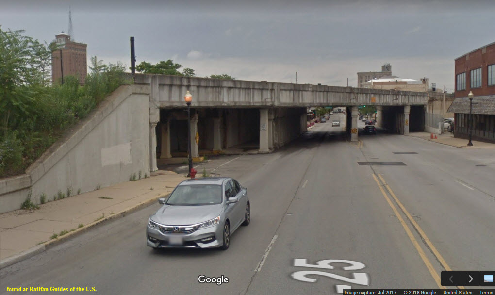
Is this an overpass, or the last part of the viaduct???
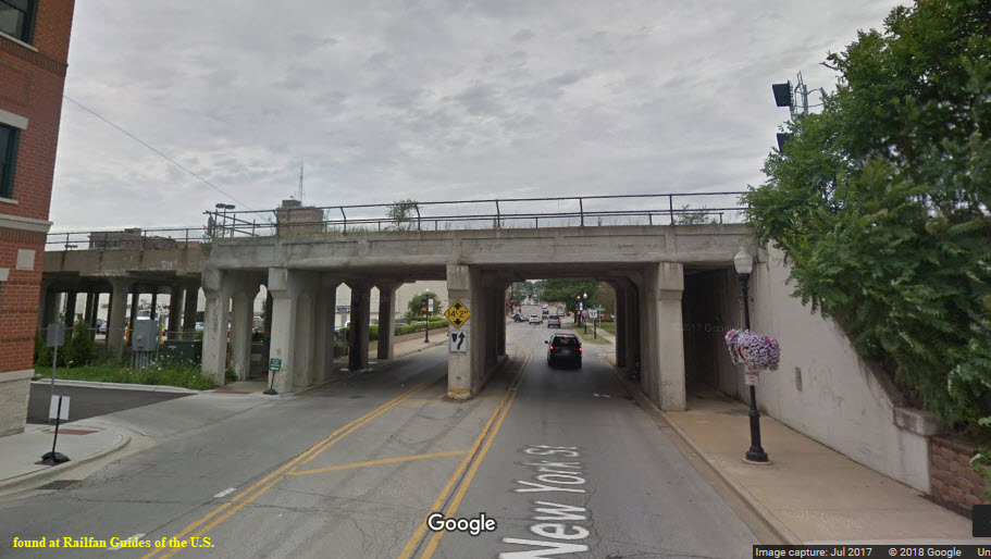
This is the last bridge going northbound thru Aurora before we hit the Metra station.
We also have NB and SB signals here.
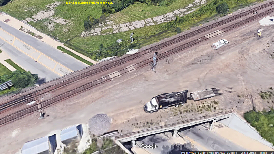
From here, the railroad goes under the roads at High St, Wood St, Ohio St, and Farnsworth Ave...... etc. We have signals at Farnsworth.
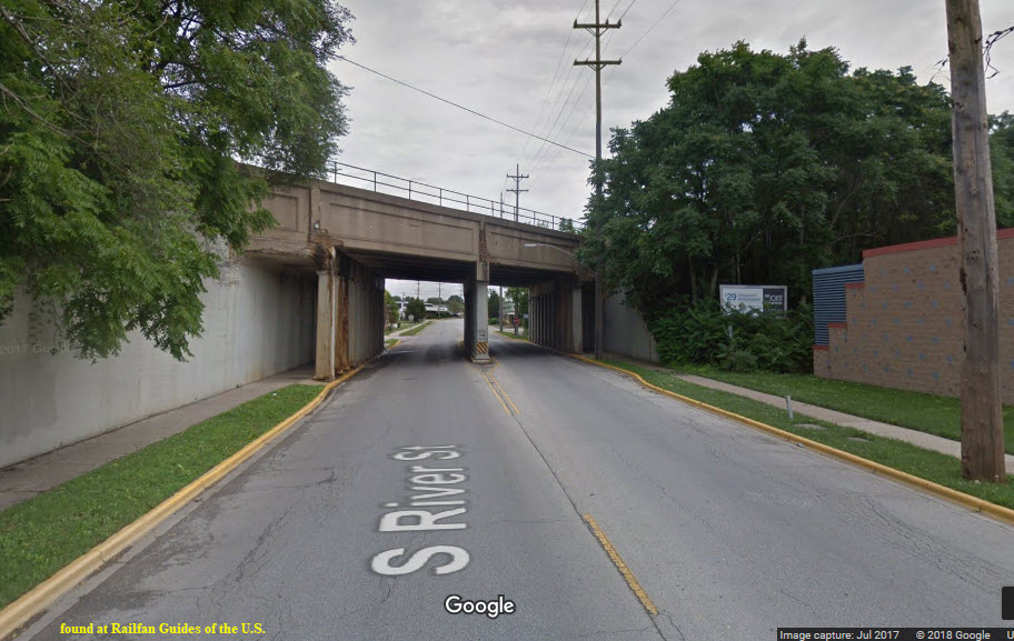
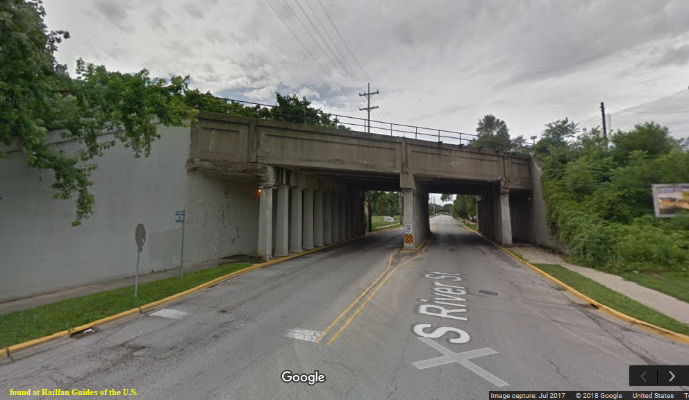
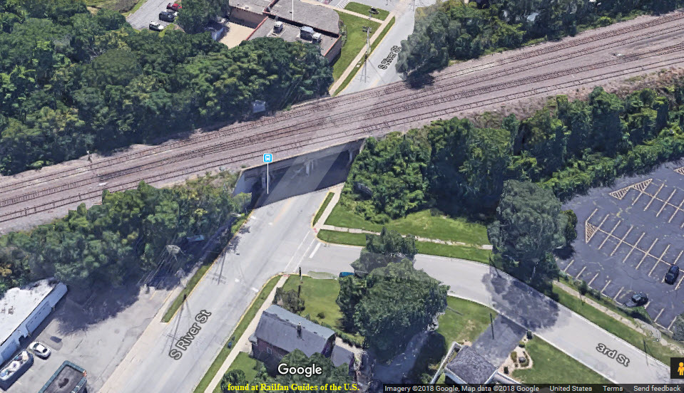
We will start covering the signals at the interlocking just south of the Fox River, where the tracks go over River St.

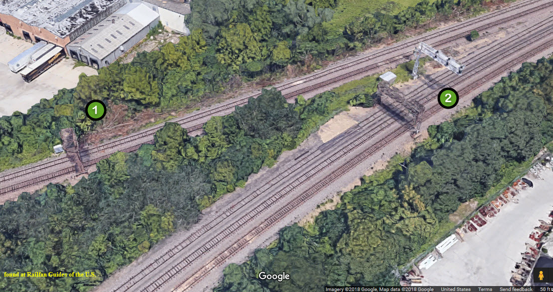
A cantilever bridge with a signal for each track on the right, and a mast mounted signal on one of the tracks coming in from the left - which may have replaced a bridge mounted signal a few hundred feet away at location 1.
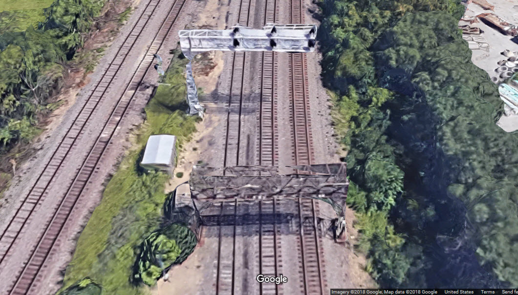
Mast mounted signals for two crossovers, a split, and going from 2 to 5 tracks between all of it.
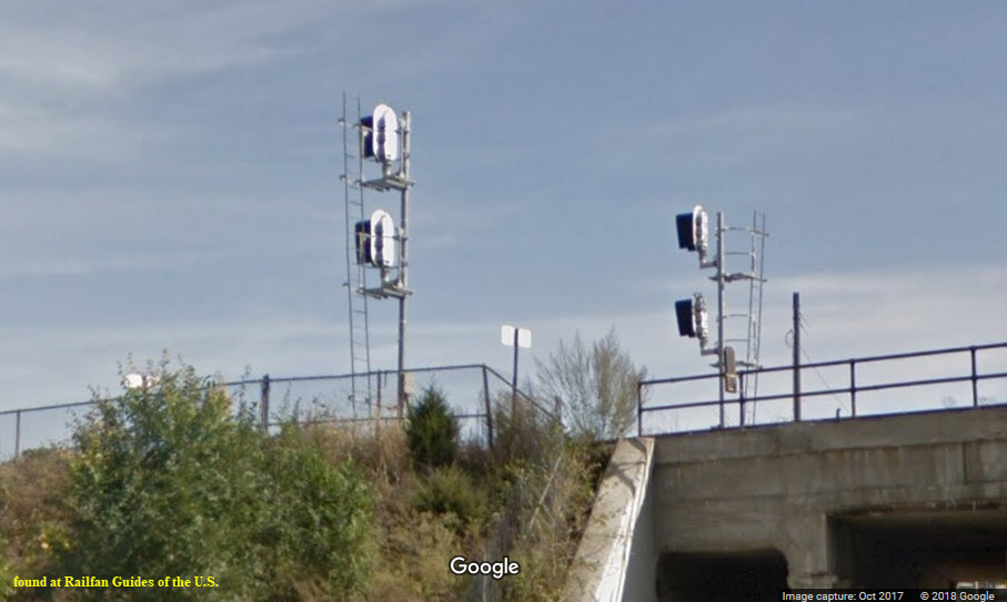
A single set of mast mounted NB signals where we go from 2 to 3 tracks. The third track remains with us and becomes part of the BNSF Racetrack.
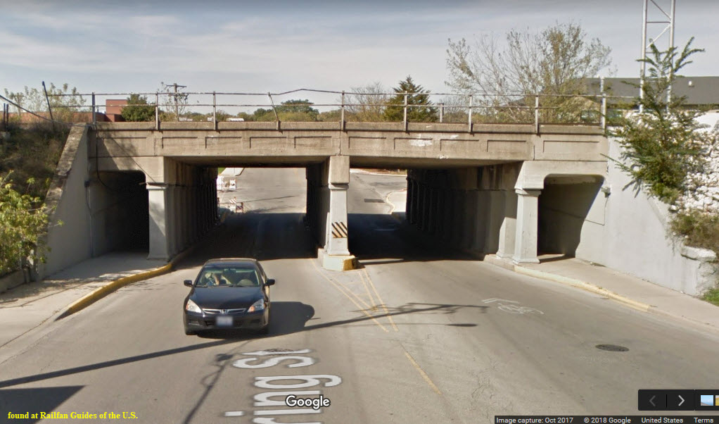
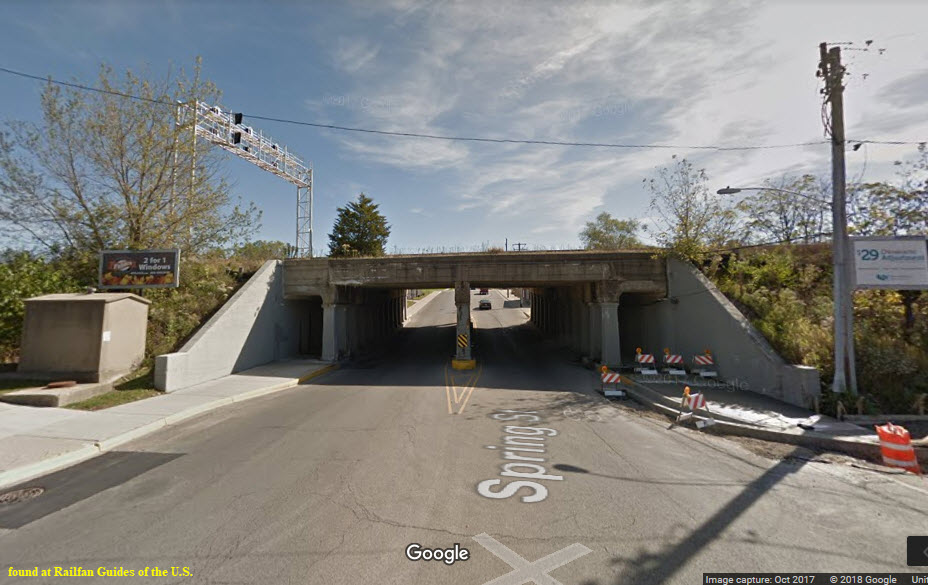
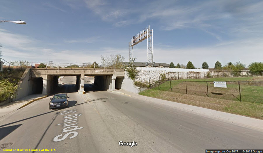
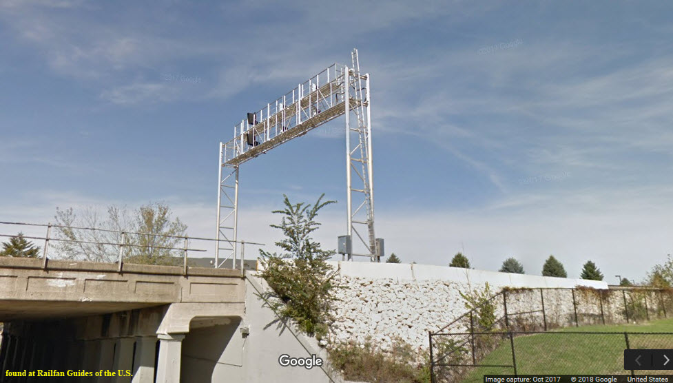
Located at Spring St, one set for NB's, two for SB's.
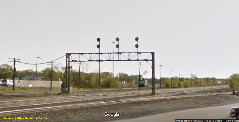
Three set of signals on a signal bridge for EB Racetrack freights, and 2 sets of mast mounted signals for the Metra trains leaving the Aurora station and yard.

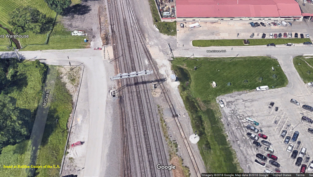
Well, gee whiz, Google's Streetview pictures are of the old set of signals that used to be east of the grade crossing -- there were only three sets of signals on a bridge spanning the tracks, and a single searchlight mast mounted for the northernmost track. The new set of colorlight signals are closer to McClure, but still on the east side, 4 of em, on a cantilever bridge.... Need pictures. Also looks like a good place to park and take pictures of action on the Racetrack!
 the old
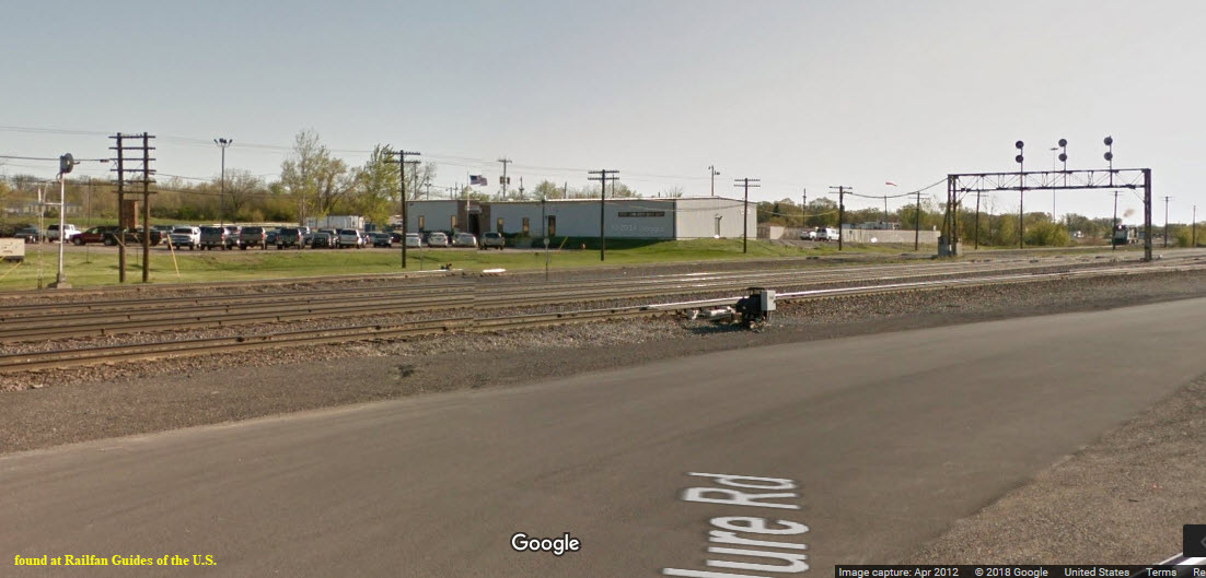 the old
 the old
 the old
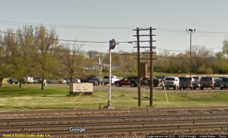
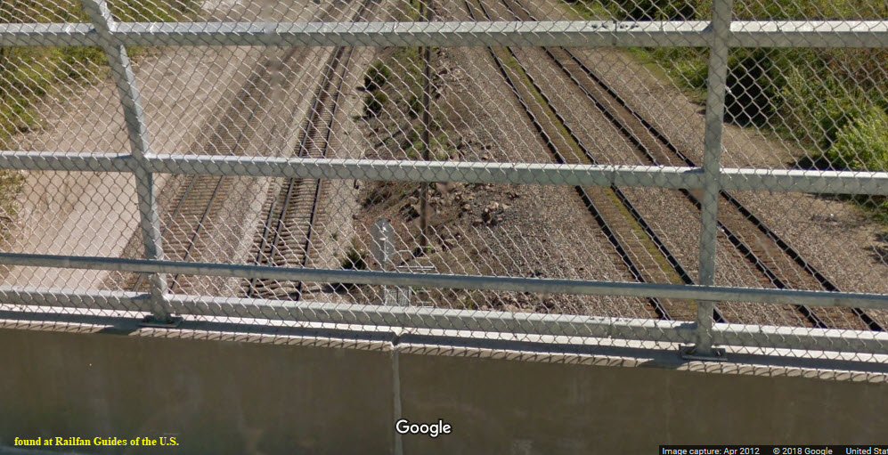
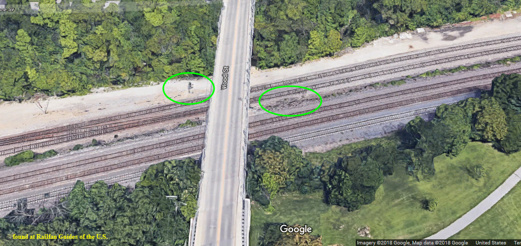
Crossover signals on both sides of Wood St, mast mounted.
Signal bridge spanning three tracks, for outbound traffic. Need better pictures.
Mast mounted signals for the two station tracks, for outbound traffic. Need better pictures.
 in Downers Grove
from Delayed in Block Productions, http://delayinblock.com/2017/06/cwrailsseries/
Nuttin to report :-)
Thanks to the University of Alabama: http://alabamamaps.ua.edu/historicalmaps/us_states/illinois/topo/index.html
Disclaimers:
I love trains, and I love signals. I am not an expert. My webpages reflect what I find on the topic of the page. This is something I have fun with while trying to help others. My webpages are an attempt at putting everything I can find of the subject in one convenient place.
Please Note:
Since the main focus of my two websites is railroad signals, the railfan guides
are oriented towards the signal fan being able to locate them. For those
of you into the modeling aspect of our hobby, my
indexa page has a list of
almost everything railroad oriented I can think of to provide you with at least a few pictures to
help you detail your pike.
If this is a railfan page, every effort has been made to make sure that the information
contained on this map and in this railfan guide is correct. Once in a while, an error may creep in :-)
My philosophy: Pictures and maps are worth a thousand words, especially for railfanning. Text descriptions only get you so far, especially if you get lost
or disoriented. Take along good maps.... a GPS is OK to get somewhere, but maps are still better if you get lost! I belong to AAA, which allows you to get
local maps for free when you visit the local branches. ADC puts out a nice series of county maps for the Washington DC area, but their state maps do not have
the railroads on them. If you can find em, I like the National Geographic map book of the U.S..... good, clear, and concise graphics, and they do a really good job
of showing you where tourist type attractions are, although they too lack the railroads. Other notes about specific areas will show up on that page if known.
Pictures and additional information is always needed if anyone feels inclined to take 'em, send 'em, and share 'em, or if you have something to add or correct.... credit
is always given! BE NICE!!! Contact info is here. Beware: If used as a source, ANYTHING from Wikipedia must
be treated as being possibly being inaccurate, wrong, or not true.
RAILFAN GUIDES HOME
RAILROAD SIGNALS HOME
NEW
12/20/2013, 6/13/2015
Last Modified
03-Oct-2018