
In General
Getting Here
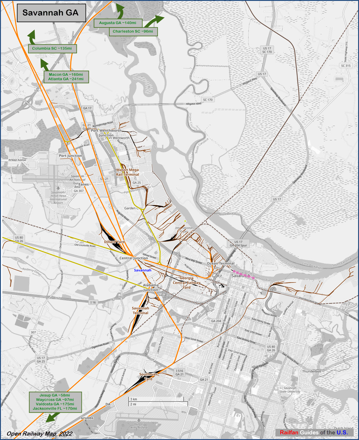
Map
Sights:
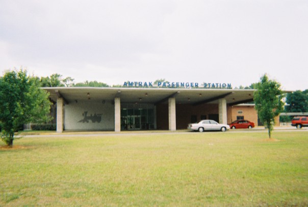
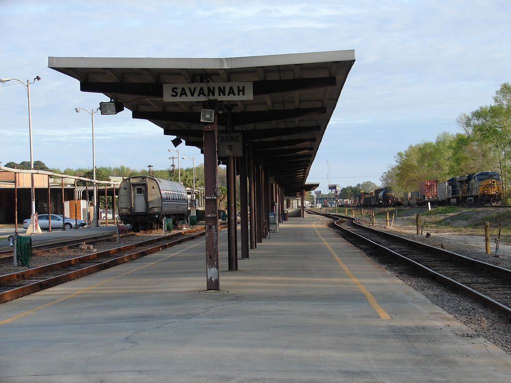
Amtrak Station
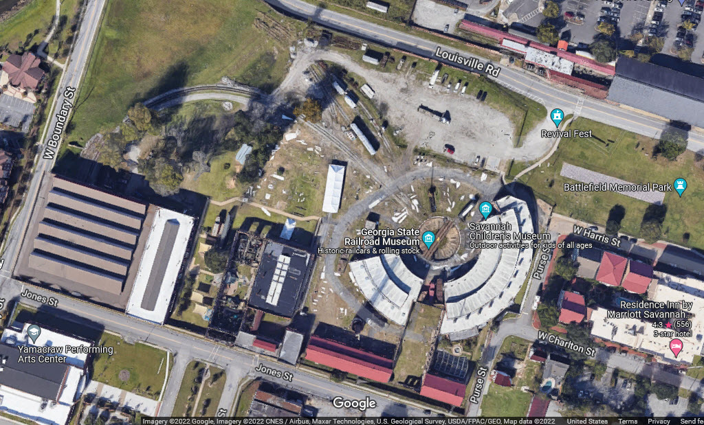
Georgia State Railroad Museum
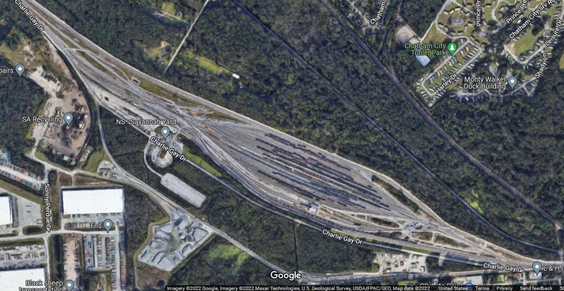
NS's Dillard Yard
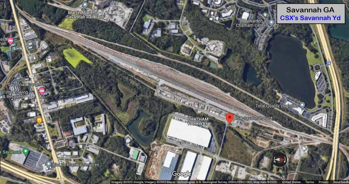
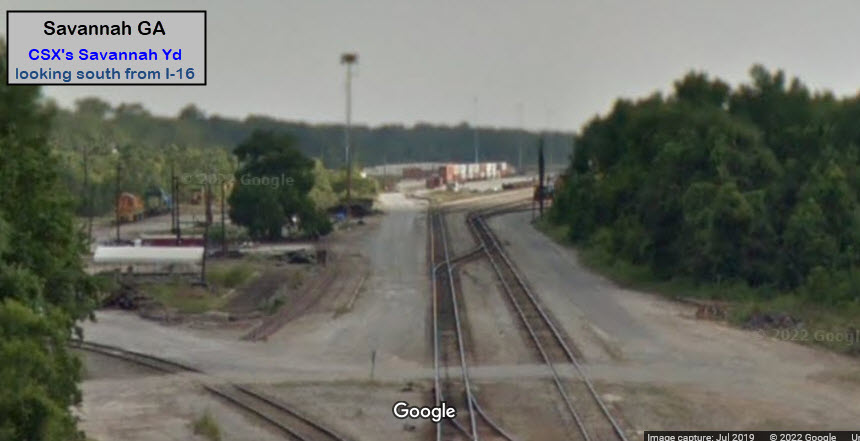
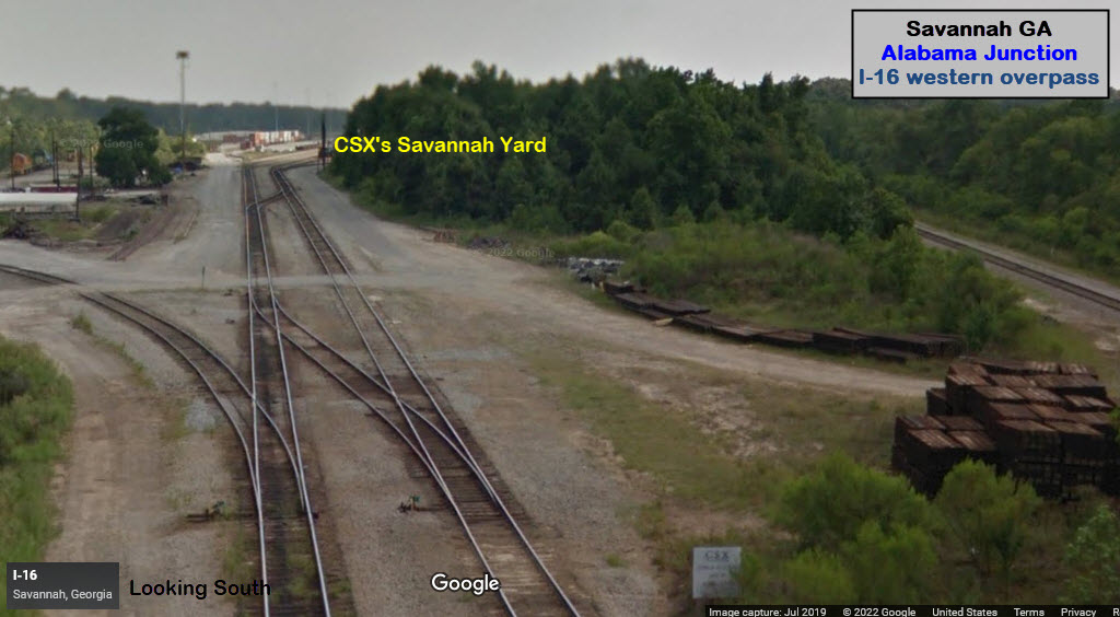
CSX's Savannah Yard
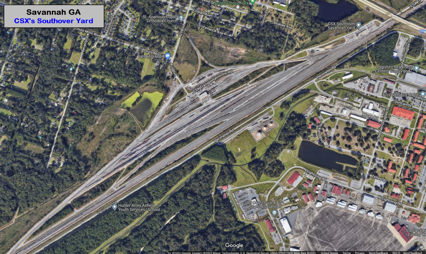
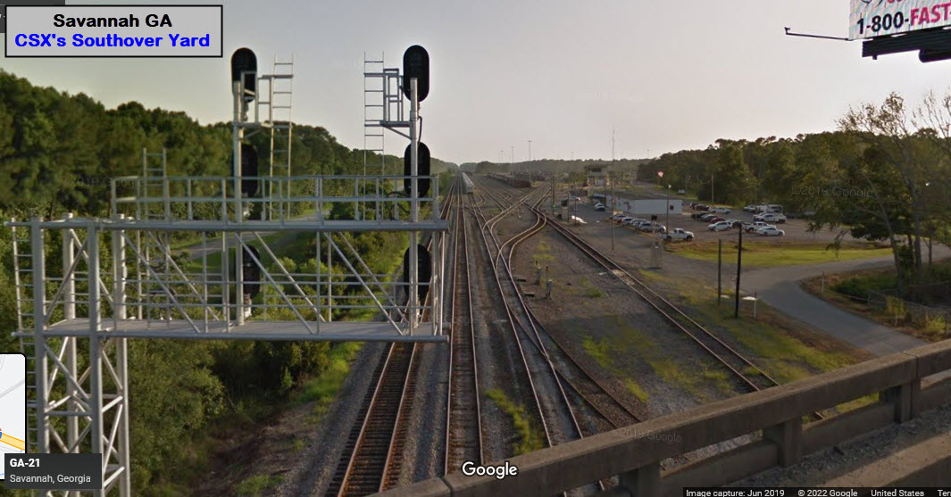
CSX's Southover Yard
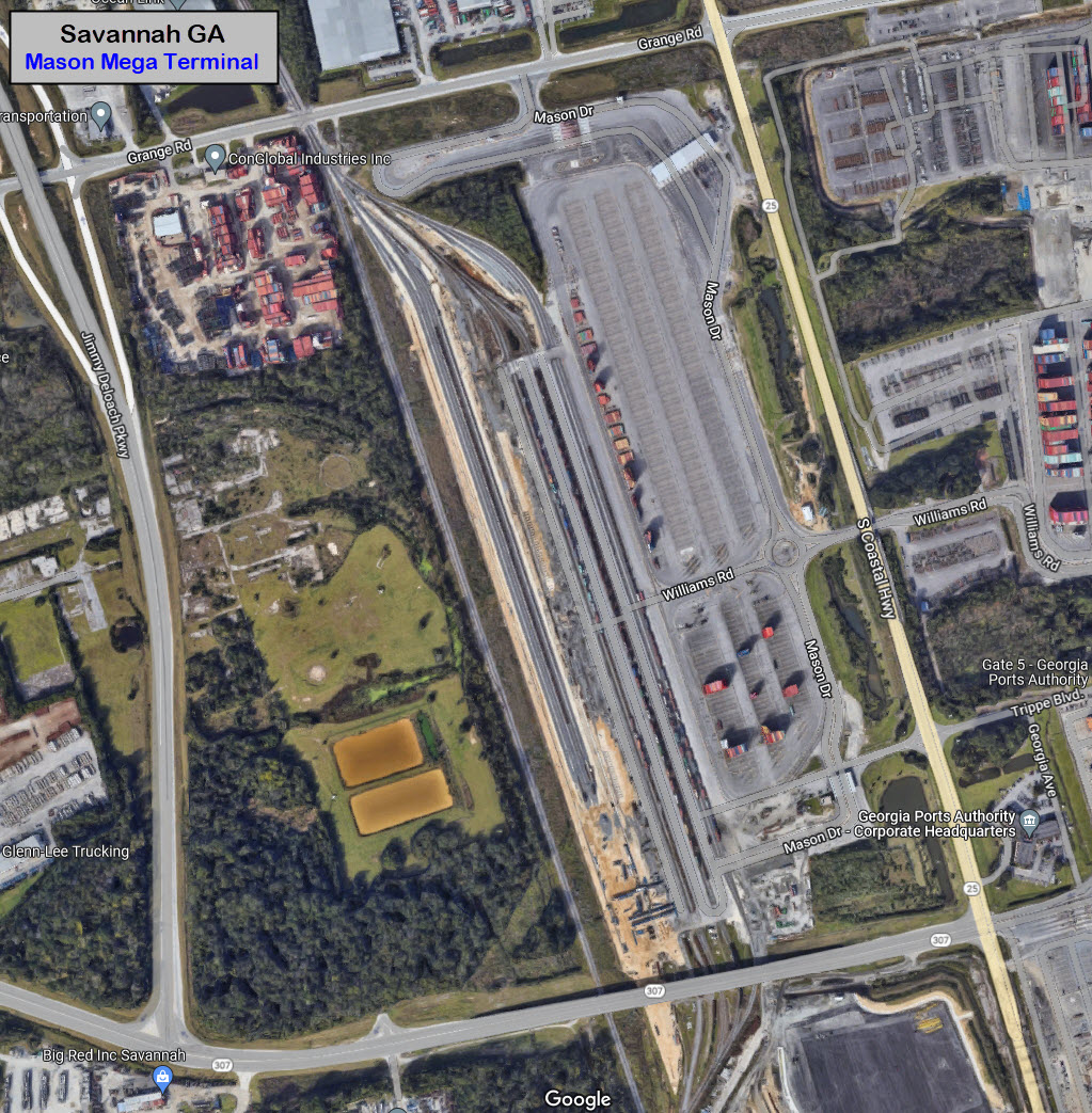
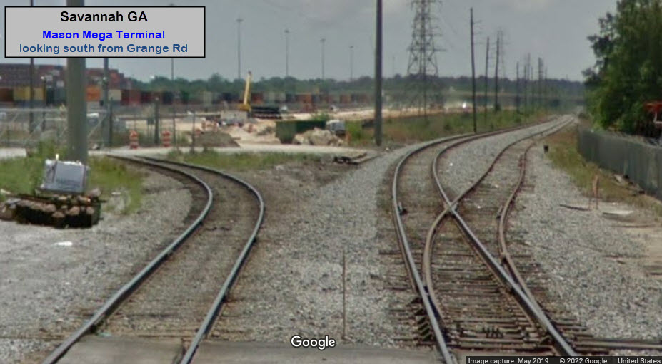
Mason Mega Terminal
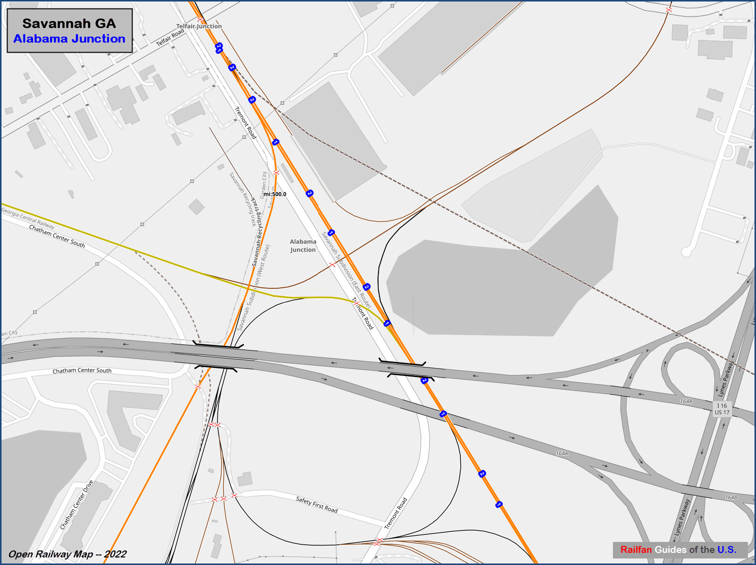
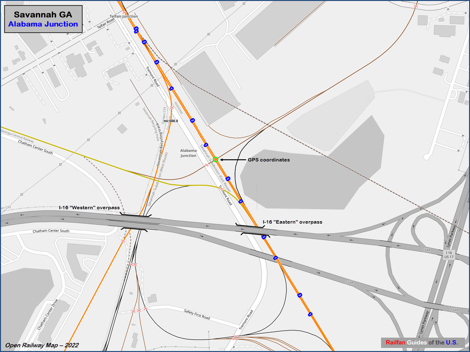
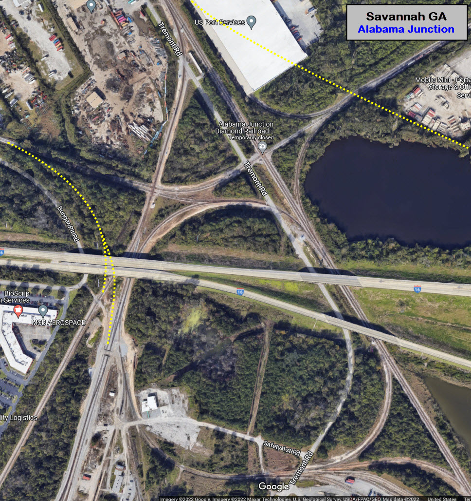
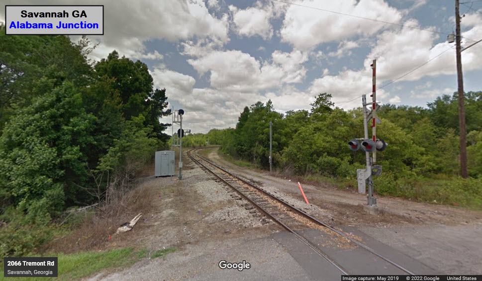
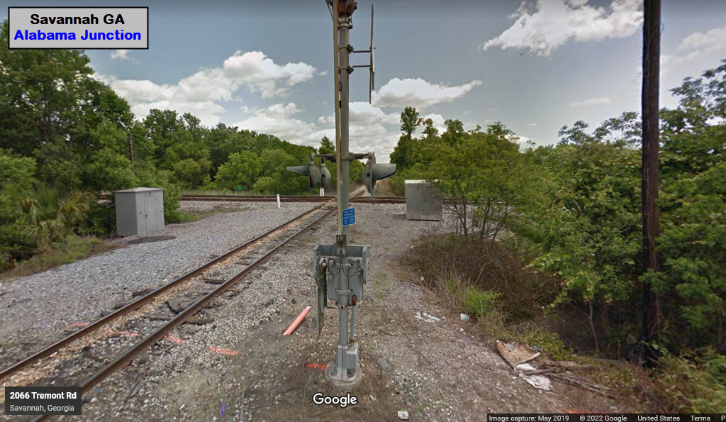
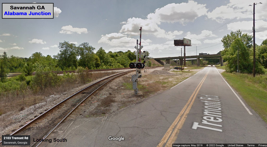
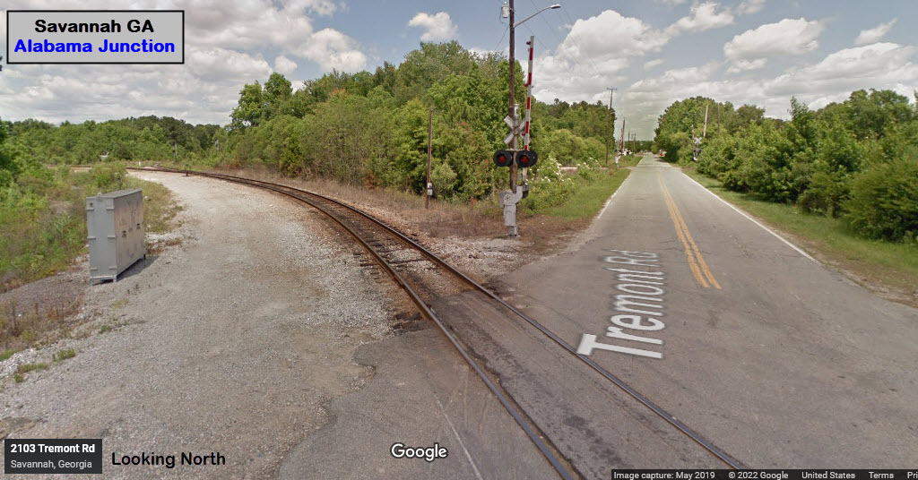
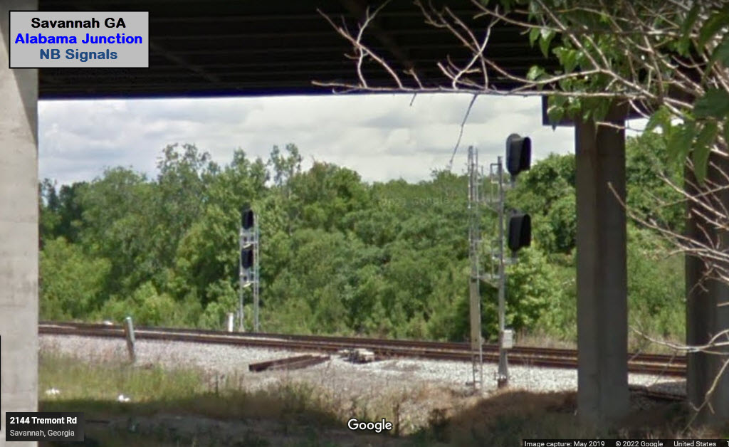
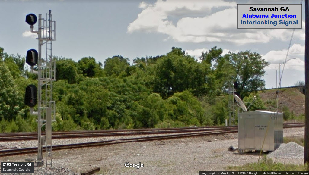
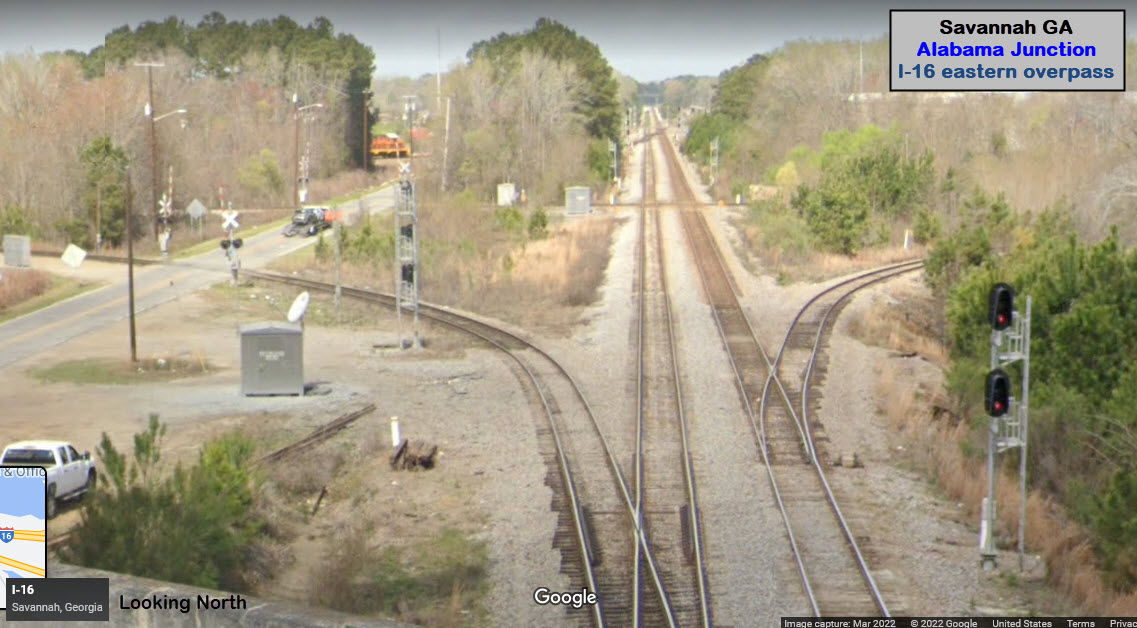
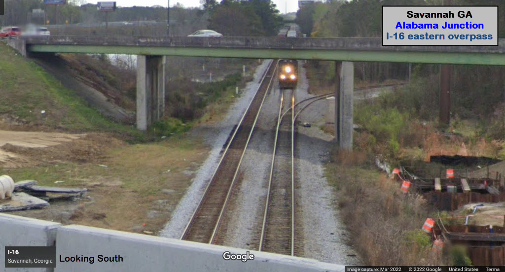
Alabama Junction
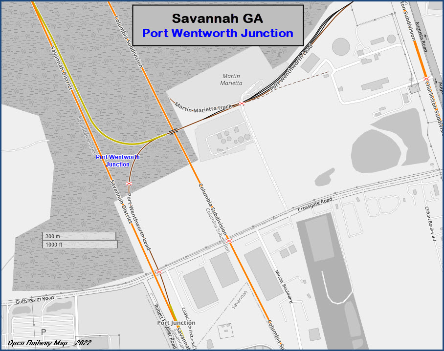
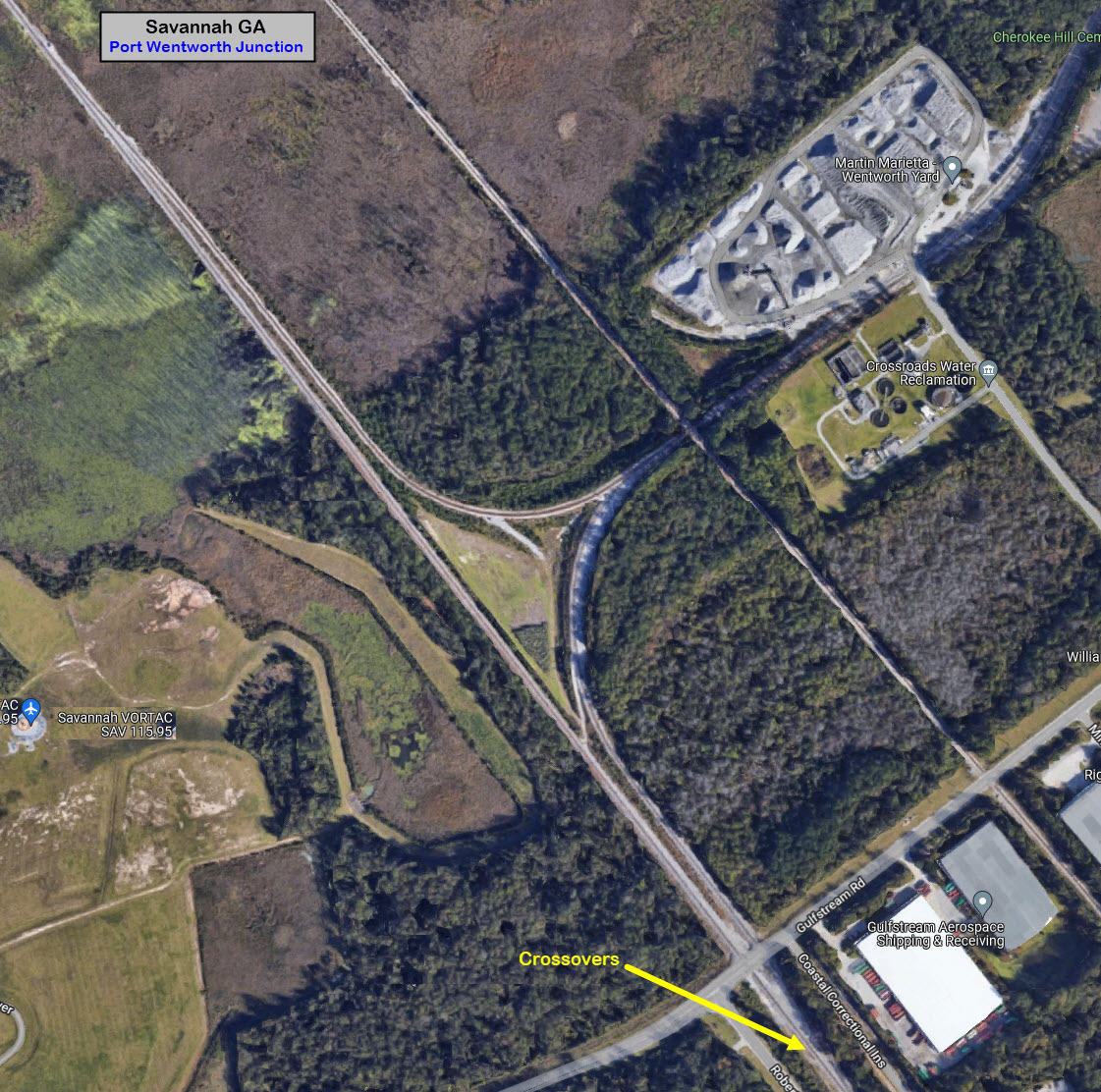
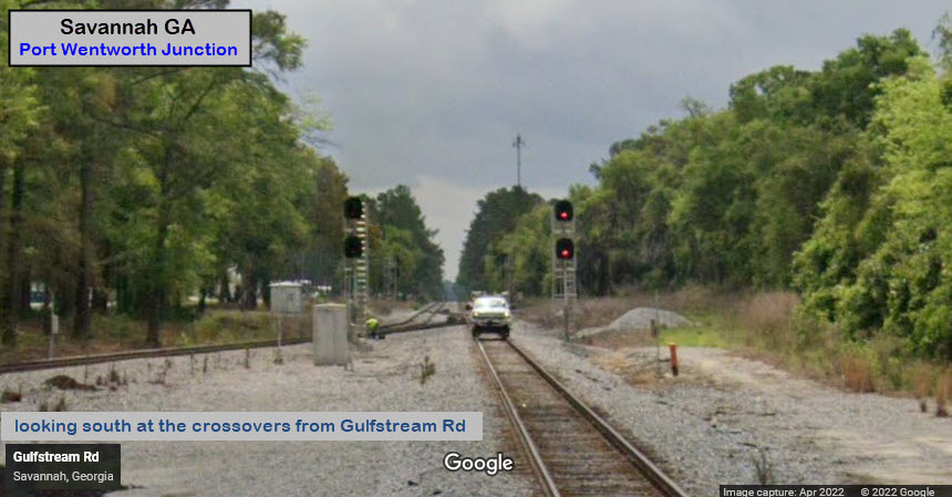
Port Wentworth Junction
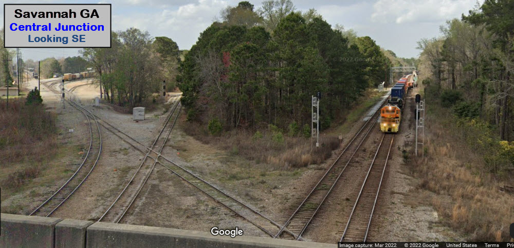
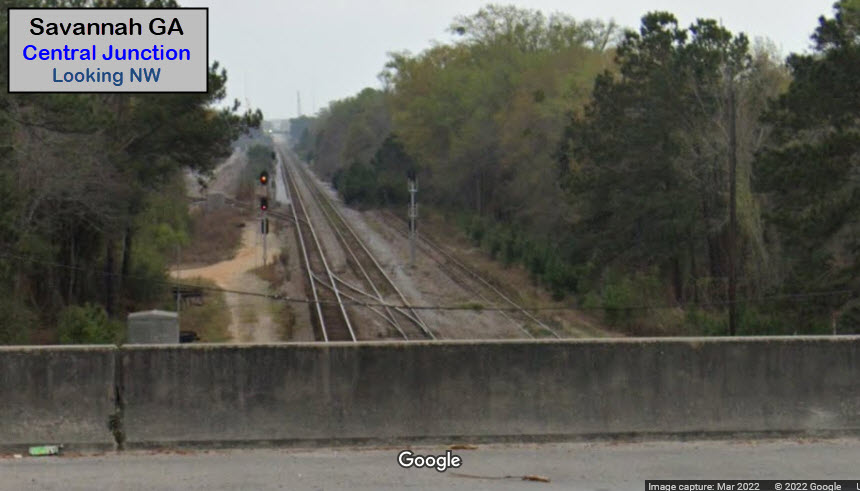
Central Junction
Central of Georgia Station and Train Shed
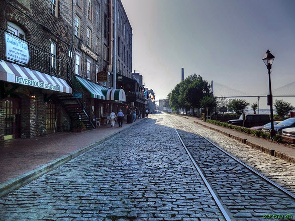
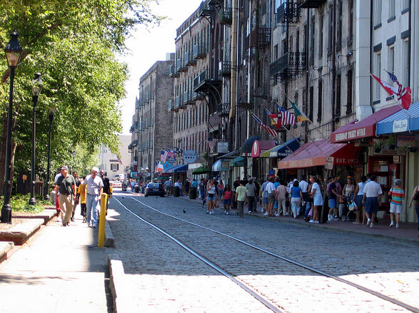
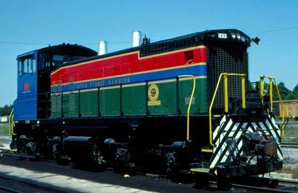
The River Street Rambler
Pictures
Bridges
Signals
Fire & Police
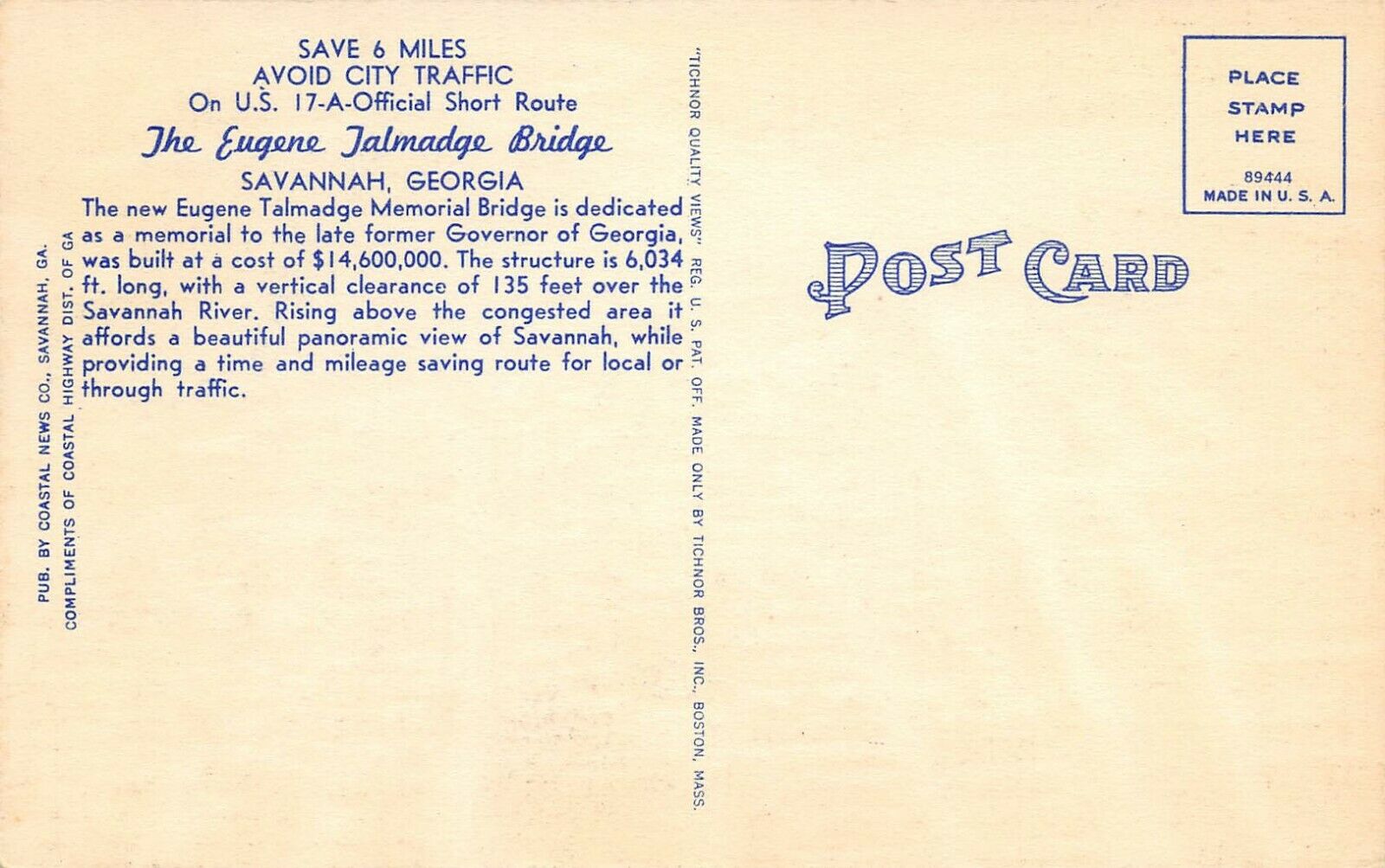
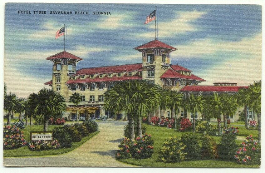
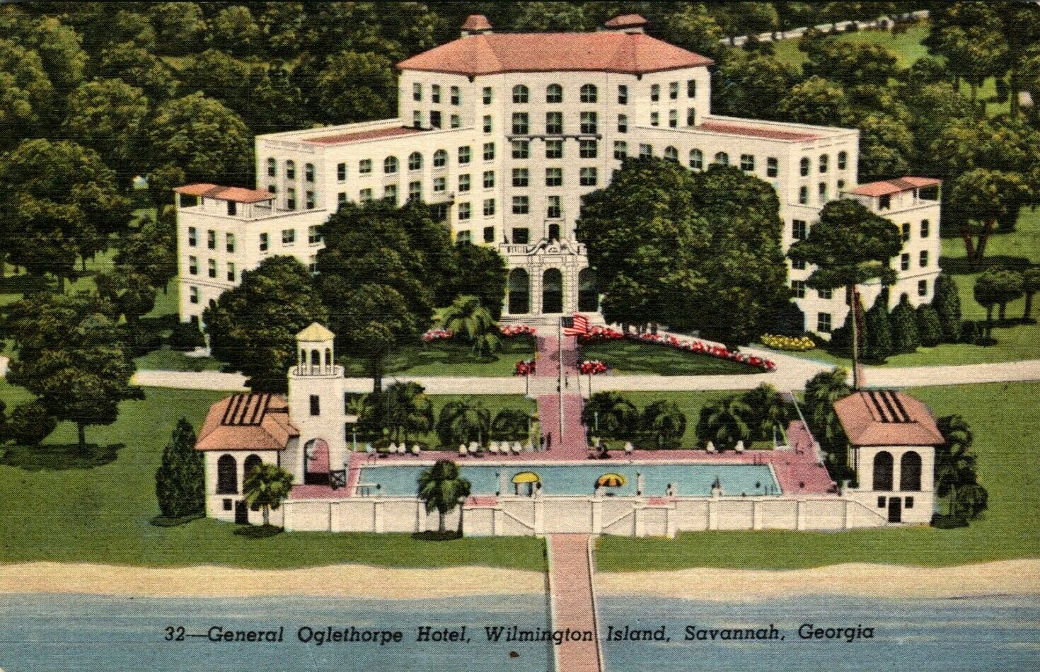
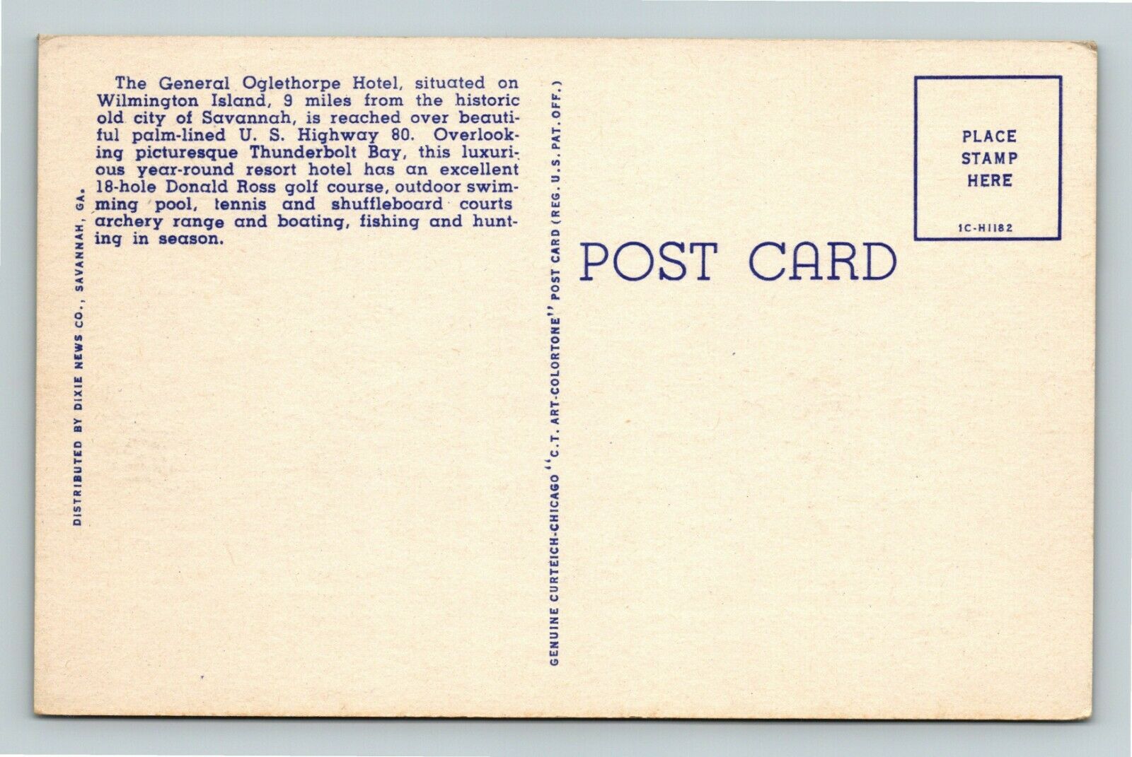
Postcards
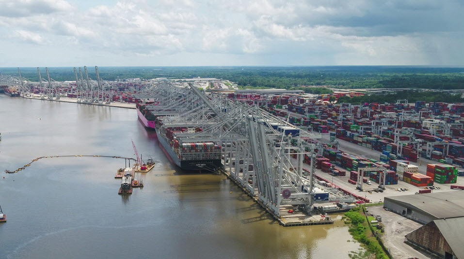
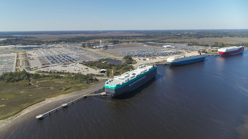
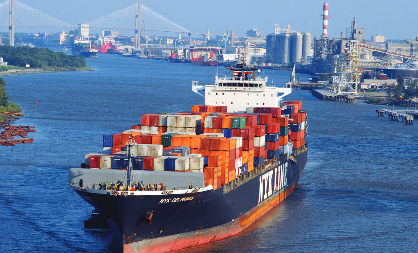
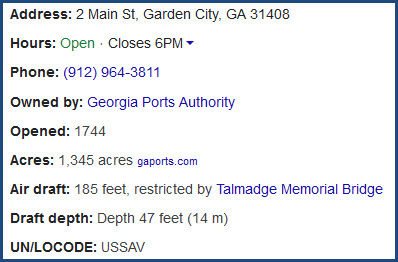
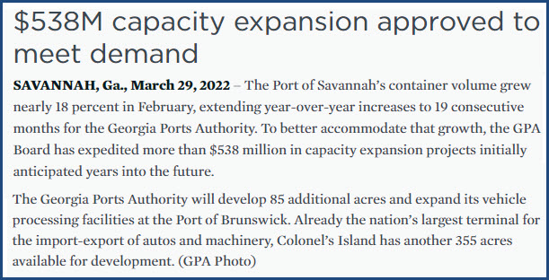
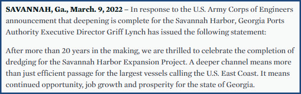
The Port of Savannah
Floobydust
USGS Maps
RAILROAD SIGNALS HOME
Location / Name:
Savannah GA, Chatham County (county seat)
What's Here:
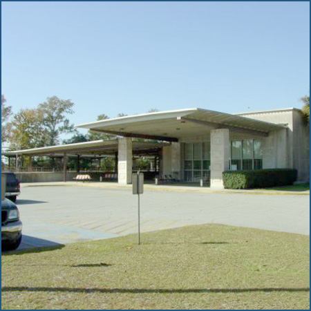
Amtrak Station (SAV)
CSX and NS
Georgia Central RR
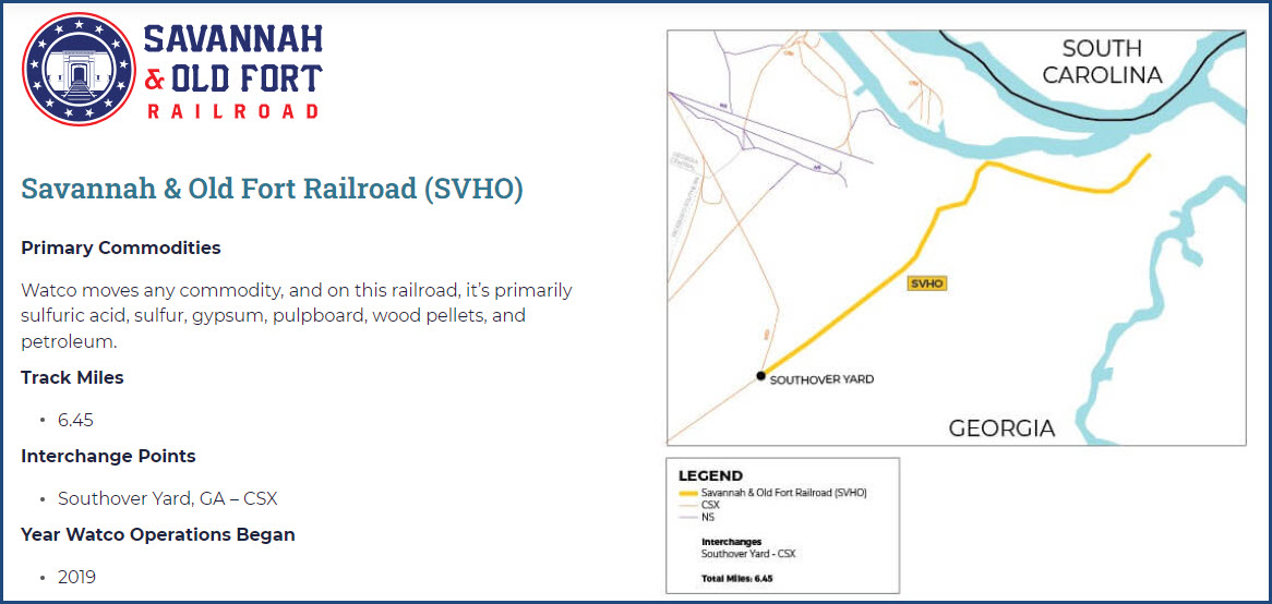
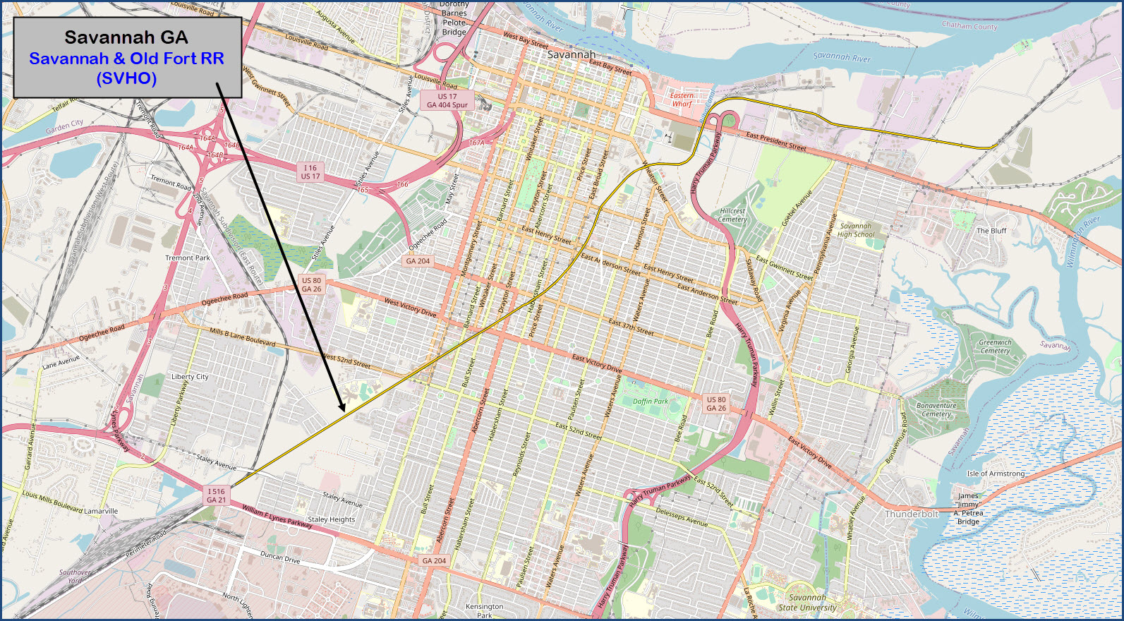
Savannah & Old Fort RR
Georgia State Railroad Museum (former CofG RR Yard)
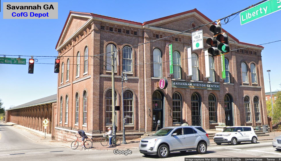
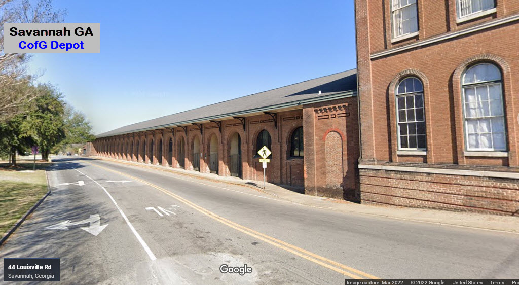
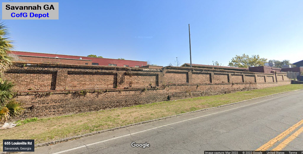
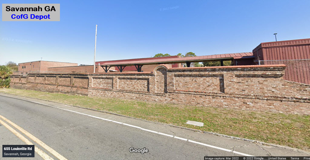
Former CofG Depot and Train Shed
CSX Savannah Yard
NS Dillard Yard
CSX Southover Yard
At least Four Smaller Yards
Mason Mega Rail Terminal
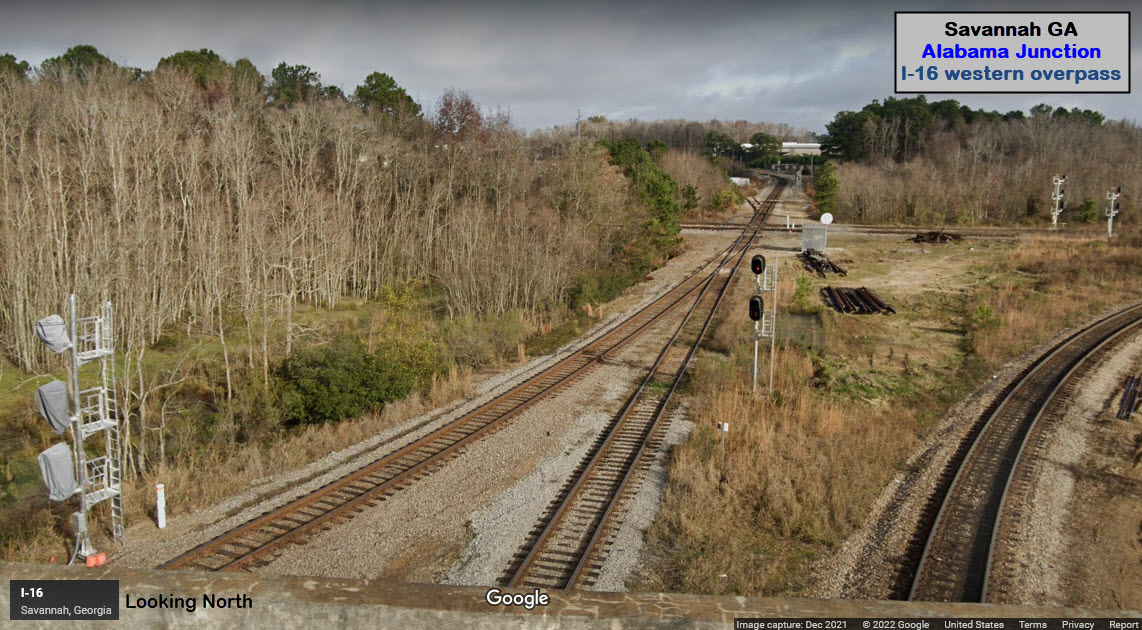
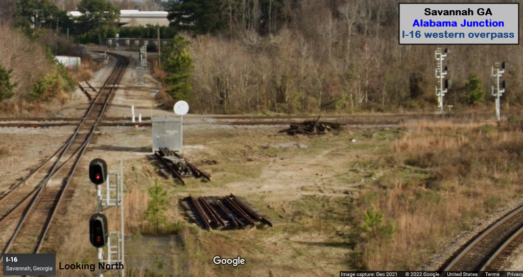
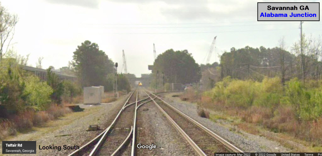
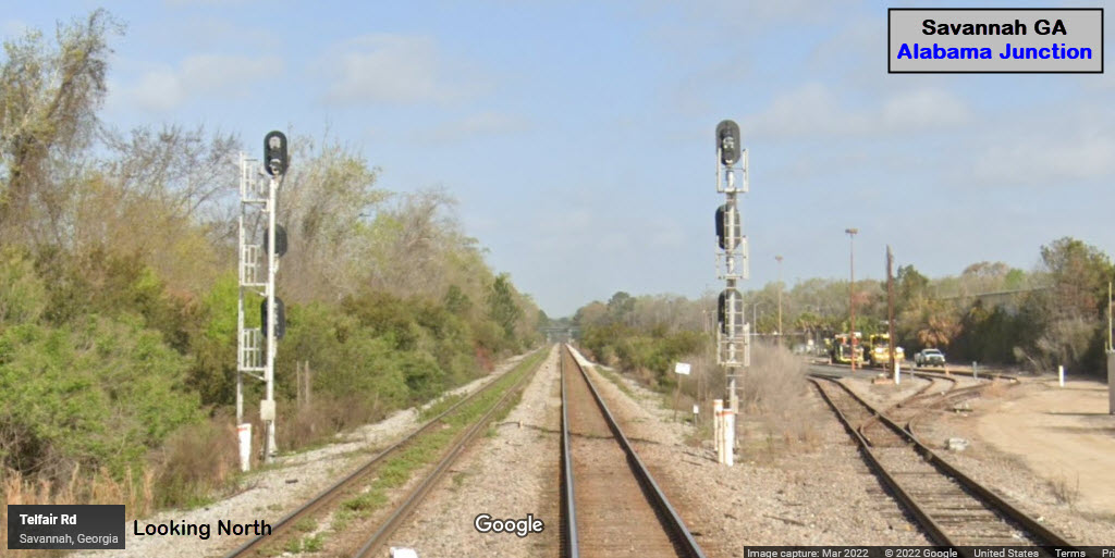
Alabama Junction (two diamonds)
Port Junction (wye)
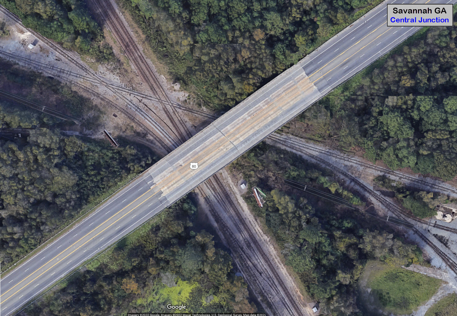
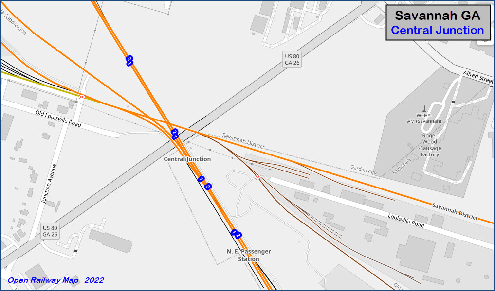
Central Junction (three diamonds)
Port Wentworth Junction
Data:
GPS Coordinates: as needed
Phone A/C: 912
ZIP: 31401 (River St)
Access by train/transit:
Amtrak Palmetto:
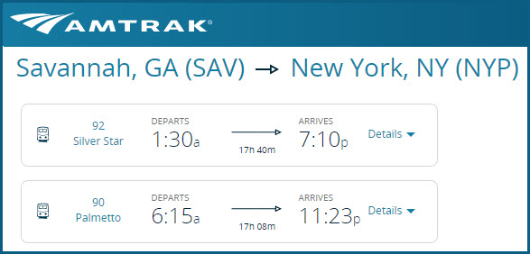
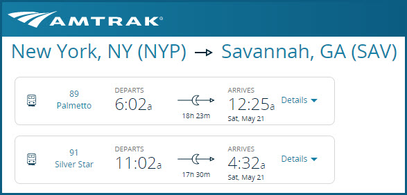
• Train #89 SB, Ar 00:25 (12:25am)
• Train #90 NB, Lv 06:15
Amtrak Silver Star:
• Train #91 SB, Ar 04:32
• Train #92 NB, Lv 19:10
The Scoop:
Savannah is a Port Town, and because of that, railroads serve almost every part of the town and is THE reason we have so much action! Savannah has an advantage over other ports in terms of accessibility. It is right on I-95 and I-16. It is on both CSX's and NS's mainlines of the eastern seaboard, and NS's to the west via Atlanta.
There is A LOT going on in Savannah, both past and present, although I give the past a little edge because of what used to be here, and the railroads that helped build Savannah to the city and port it is today. Be prepared to spend a great deal of time in Savannah if you come here for a vacation, or even a day or two.
Currently, Norfolk Southern CSX, Amtrak, are the railroads serving Savannah.
In the past, you had the Atlantic Coast Line, the Seaboard Air Line, the Central of Georgia, and the Savannah & Atlanta.
Acknowledgements:
Jukka Huotari
Denver Todd
Websites and other additional information sources of interest for the area:
https://gaports.com/facilities/port-of-savannah/
https://www.watco.com/system-map/ NICE!!!
https://www.loc.gov/item/2006635349/
https://www.greatamericanstations.com/stations/savannah-ga-sav/
https://mapcarta.com/N8218130544
https://hawkinsrails.net/mainlines/amtk/amtk_book_palmetto.html
Coming in from the west: I-16 does the honors from Macon GA.
Coming from Atlanta: use I-75 SE out of town to Macon, then use I-16.
I-16 takes you to within 2/3 of a mile from the waterfront and River Street. River Street is where all of the "action" is in the historic district.
Unfortunately, Savannah is "in the middle" of I-10 and I-20, so there is no easy way to get from either of them to Savannah - but, at least, I-20 is a little easier via the above routing via Atlanta.
From south or north along the east coast, I-95 is nearby. Use I-16 to get into downtown, it's at exit 99.
If you're going to the Amtrak station from I-95 or I-16, go east on I-16 from I-95 and get off at I-516, exit 164. You can go either north or south on 516. The red route below is shorter, but you don't get to go thru Alabama Junction, the longer blue route does.

Map
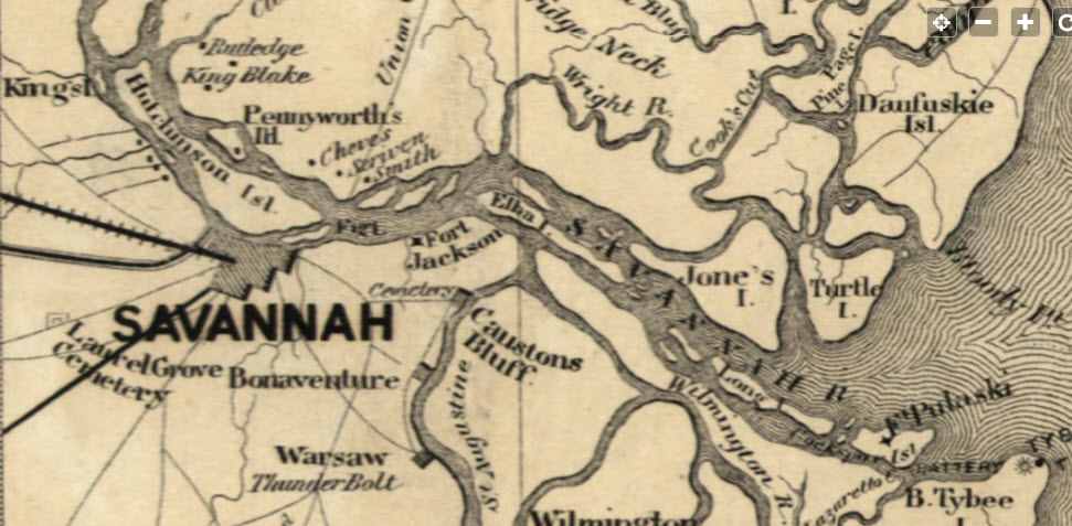
Part of a larger map found at the Library of Congress, of the area between
Savannah and Charleston SC in the 1860's:
Distances are approximate, measured "as the crow flies" from the Hyatt Regency hotel on River St (big building, easy to spot)
GPS Coordinates: 32.08371, -81.14834
https://en.wikipedia.org/wiki/Savannah_station_(Amtrak)
https://www.greatamericanstations.com/stations/savannah-ga-sav/
Distance: 3.3mi, due west
From Wikipedia: The station was constructed in 1962 by the Atlantic Coast Line RR, with funds channeled through the Georgia Ports Authority, to the City of Savannah, as part of the re-development requiring the removal of Savannah Union Station, to facilitate construction of Interstate 16 into the downtown area. The agreement provides for all tenant roads and/or successor carriers, use of the facility, in exchange for agreeing to the move. This would apply to carrier trains, like CSX inspection trains, occasional GrandLuxe tour trains, and even infrequent visits by the Sam Shortline Specials from Vidalia and Cordele.
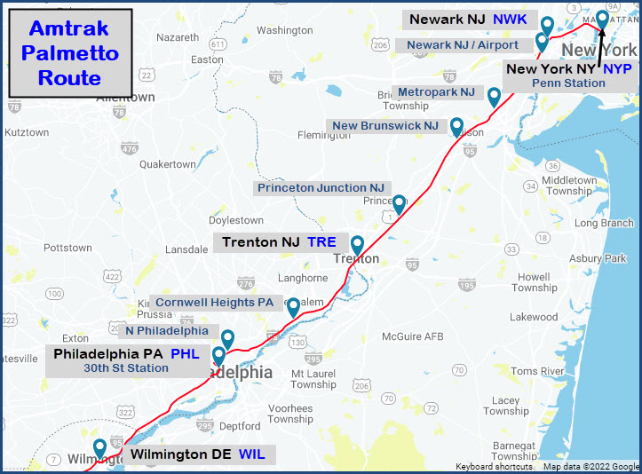
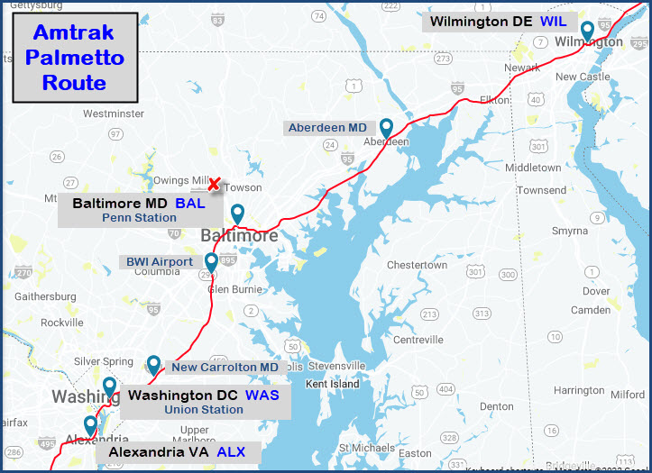
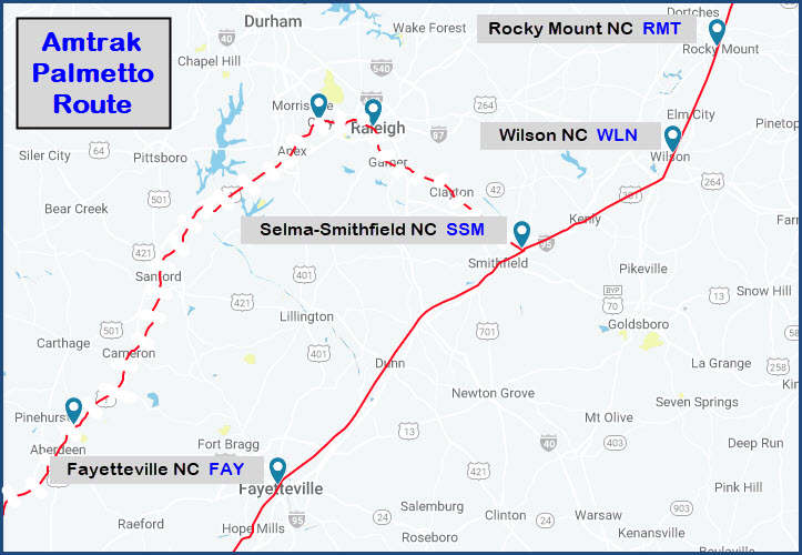
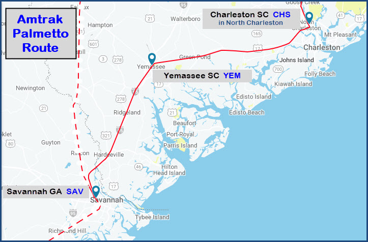
Savannah is served by the trains of Amtrak's Silver Service, as well as infrequent passage/parking of a variety of inspection, business, and excursion tour specials, and the occasional private car charter. It is the southern terminus of the Palmetto route and is along the Silver Star route. North of Savannah, the Palmetto route diverges from the Silver Star line. While the Silver Star turns inland to serve Columbia SC, and Cary and Raleigh NC, the Palmetto stays closer to the coast to serve Florence and Charleston SC. The trains do not converge again until Selma NC.
Unlike Savannah Union Station, this station does not require back-up moves, saving some operational time at the expense of having fewer tracks accessible to passengers. (end Wiki)
I don't know why, but even Amtrak can't get departure and arrival times right on their own website, as the following screen captures illustrate:
This is the latest version of the Atlantic Coast Services timetable I can find, I'm not sure when Amtrak discontinued printing them, but they will be sorely missed.
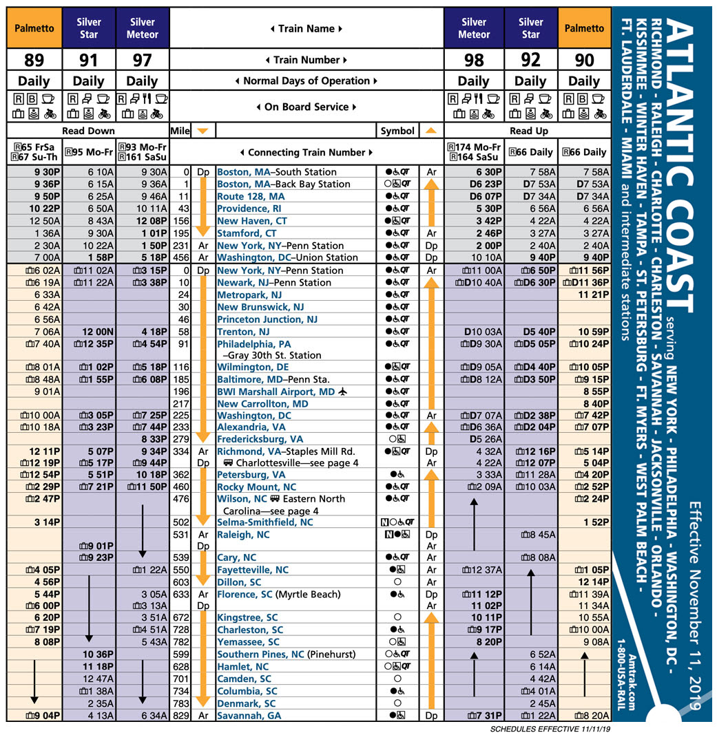
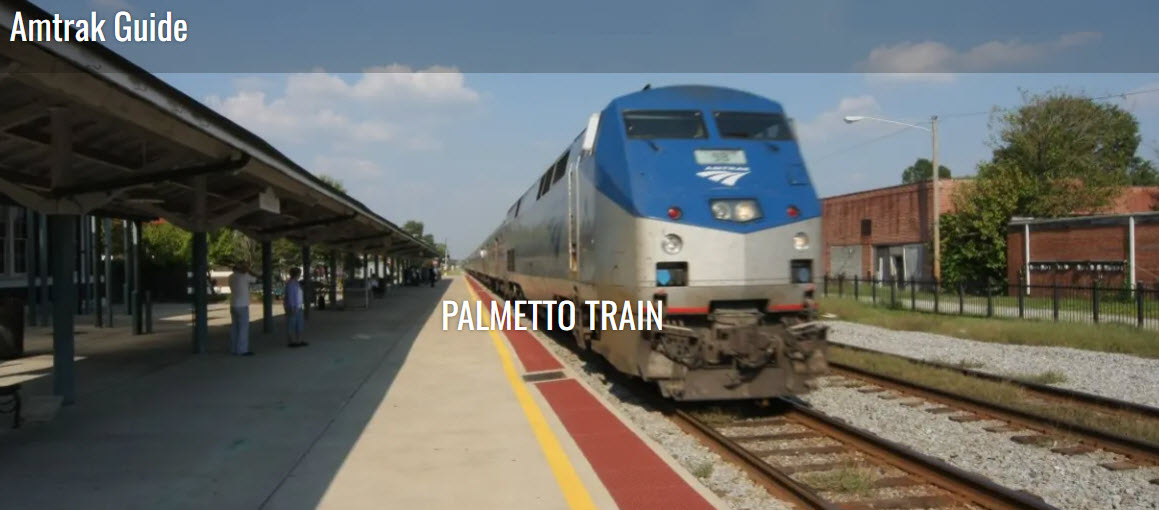
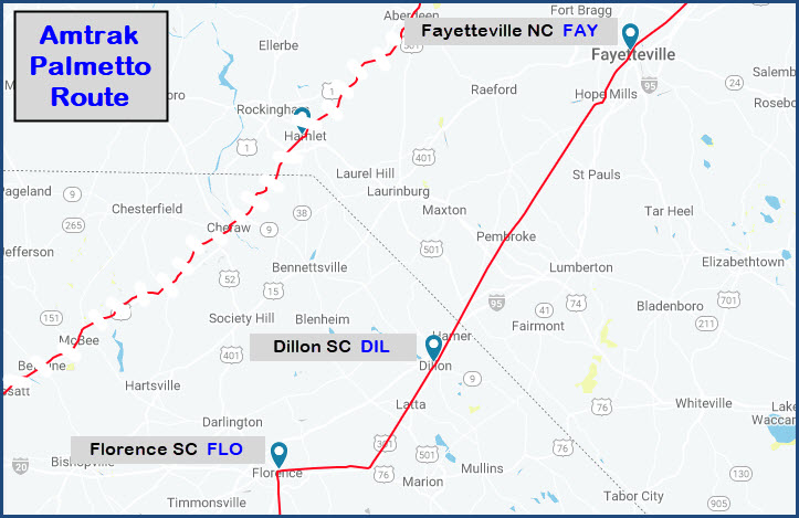
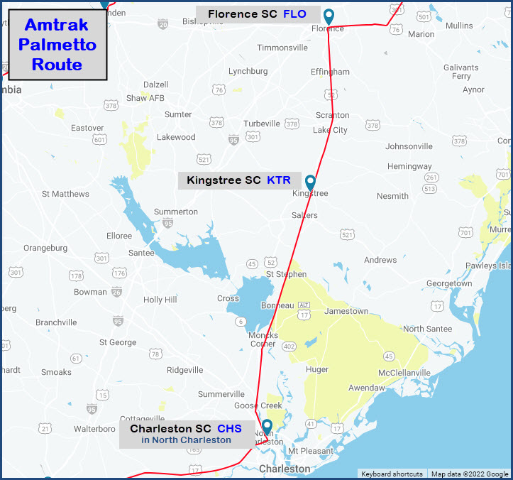
the Amtrak Palmetto
The Palmetto is an Amtrak train with service to New York AND Savannah as the end destinations.
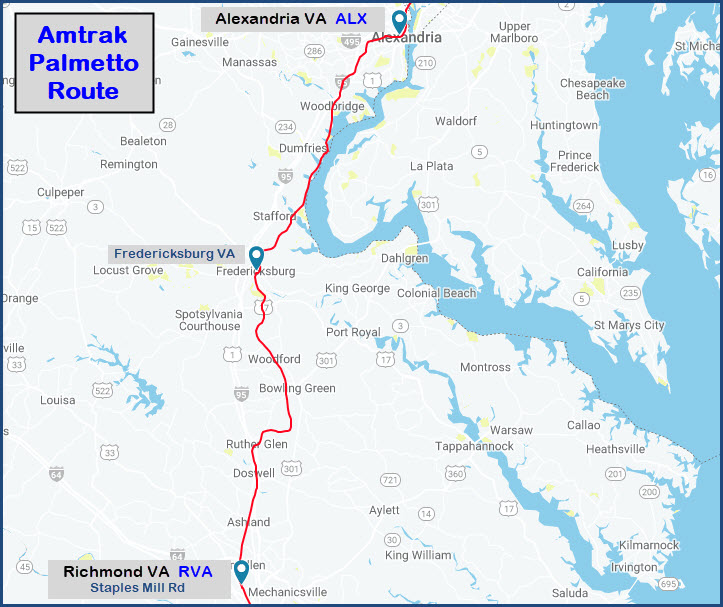
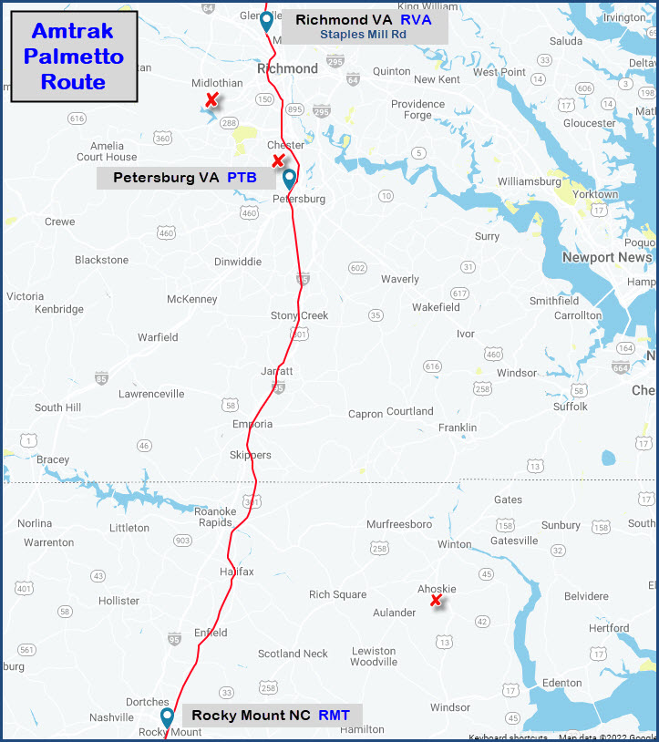
Here are the stations along the route, and some of the various sights Amtrak lists, although, the train doesn't stop in Fredericksburg, so scratch that one off the list.

GPS Coordinates: 32.07554, -81.10141
Distance: 0.6mi

GPS Coordinates: 32.09762, -81.16510 (center)
Distance: 3.9mi (to south end)
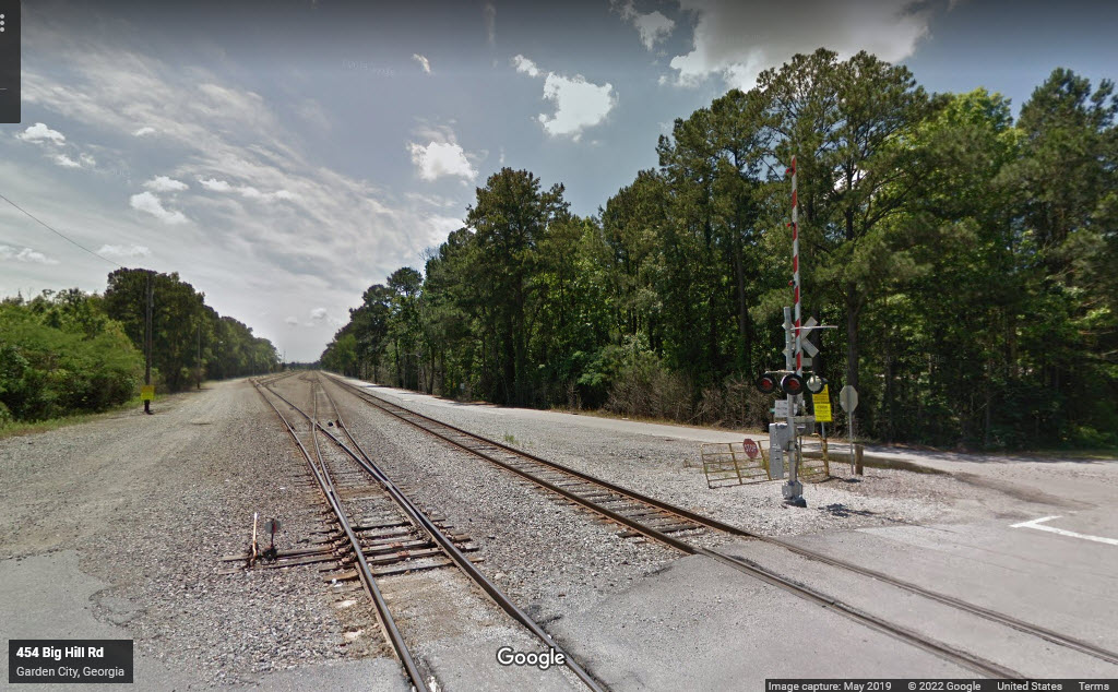 north end from Big Hill Rd
GPS Coordinates: 32.06376, -81.14972 (center)
Distance: 3.6mi SW
Inaccessible without trespassing :-(
GPS Coordinates: 32.03013, -81.14662 (center)
Distance: 4.8mi SW
GPS Coordinates: 32.13143, -81.15802 (center)
Distance: 5.2mi NW
The yard is inaccessible except for the grade crossing on the north end at Grange Rd, but it still doesn't give you a good shot of much of anything except for the thru tracks to the right, which goes down to one about midway thru the yard.
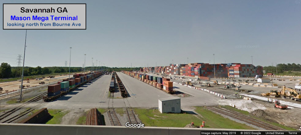
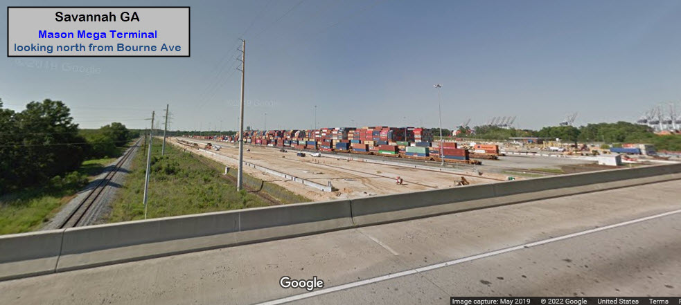
GPS Coordinates: 32.07492, -81.14278
Distance: 3.0mi west
A most interesting junction, would be nice to model if it wasn't so "all over the place". Tremont Road runs thru the middle of it, but because of the trees, photo sight lines are terrible.
GPS Coordinates: 32.14660, -81.19325
Distance: 5.5mi NW
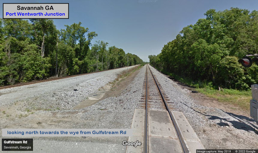
Port Wentworth Junction is a wye, with elongated legs on the north and south sides, and a double track line coming up from the south that includes a set of double crossovers. The only place to easily view anything happening is from Gulfstream Road on the south side of the wye, with the wye to your north, and the crossovers to your south. It's almost all inaccessible.....
GPS Coordinates: 32.09047, -81.15410
Distance: 2.34mi SW
GPS Coordinates: 32.07606, -81.09914
Distance: 0.6mi
The station is now the Savannah Visitor's Center.
https://www.wikiwand.com/en/River_Street_(Savannah,_Georgia)
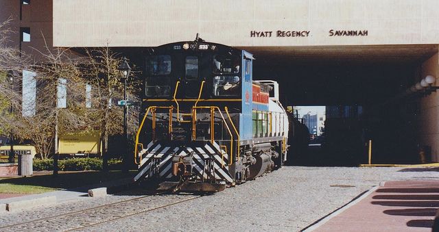
When my wife and I came through in 1996, the NS River St Rambler was still going down the waterfront line to service a few business' in the Ft Jackson area. I believe they used an SW-1500 for the train. That line has since been torn up from a point just west of the Talmadge bridge. If I remember correctly, it was also nicknamed "the River Rat".
From Wikiwand: The River Street Streetcar, a heritage streetcar line, served six stops between Montgomery Street and East Broad Street from 2009 to 2015. The lines were originally used by horsecars, then streetcars (between 1890 and 1946). The Norfolk Southern Railway had owned the River Street branch line for years, operating the River Street Rambler, a local freight train, until 2003. The City of Savannah purchased the River Street Branch line right-of-way from Norfolk Southern in 2004 for approximately $600,000. end Wiki
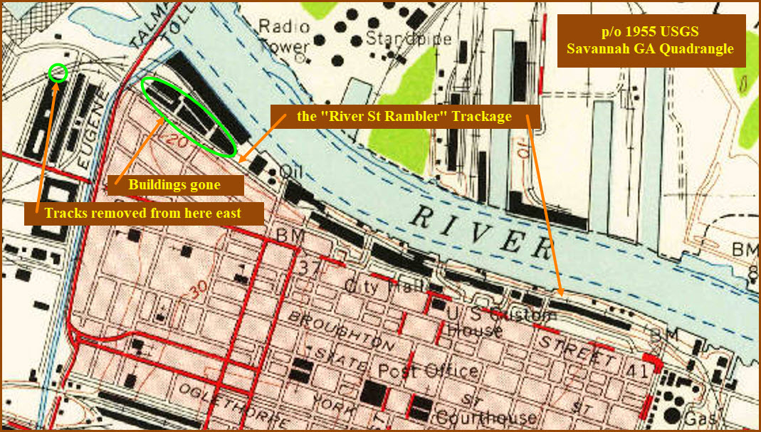
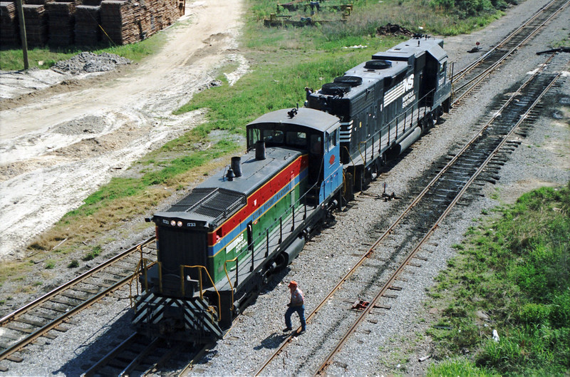
Photo by Jukka Huotari, 4/1/94, in the Bay Street Viaduct Area: https://www.flickr.com/photos/59960903@N05/5969354321
https://www.watco.com/service/rail/savannah-old-fort-svho/
https://www.watco.com/system-map/
The Savannah & Old Fort RR is a WATCO property. It started operation in 2019, and is a 6.45 mile long railroad operating between CSX's Southover Yard and points NE. The route it travels was formerly ACL trackage.
Their map (the 2nd link above), BTW, is an excellent overlay of the United States, and you can zoom in to almost street level!
GPS Coordinates: 72.07304, -81.10060
Distance: ~0.7mi
The station used to be where I-16 ends (or starts) at MLK Blvd.
The station was designed by architect Frank Pierce Milburn. Savannah Union Station was completed in 1902 at a cost of $150,000. It was an example of Spanish Renaissance and Elizabethan styles, the main feature of which was an octagonal rotunda measuring 80 feet in diameter that served as the general waiting room. Exterior walls were made of pressed brick with granite and terracotta trim. The station was torn down in 1963, a year after the current Amtrak station was completed by the ACL, to make room for I-16.
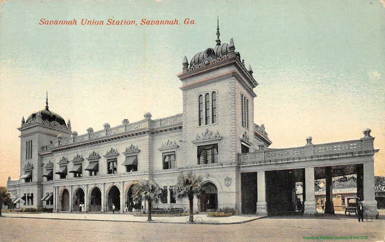
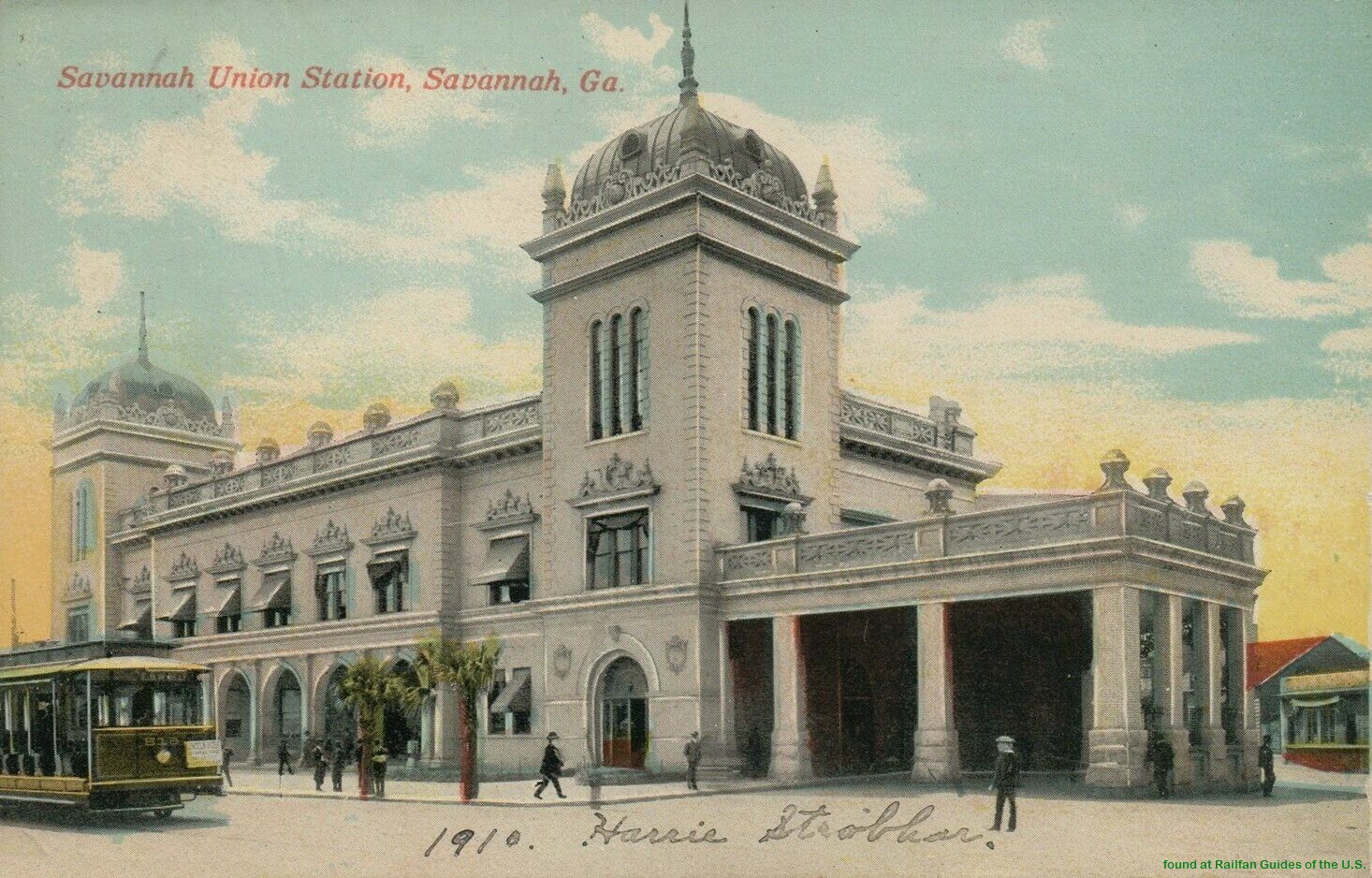
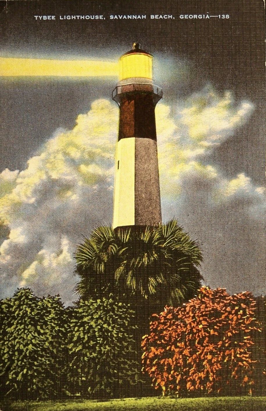
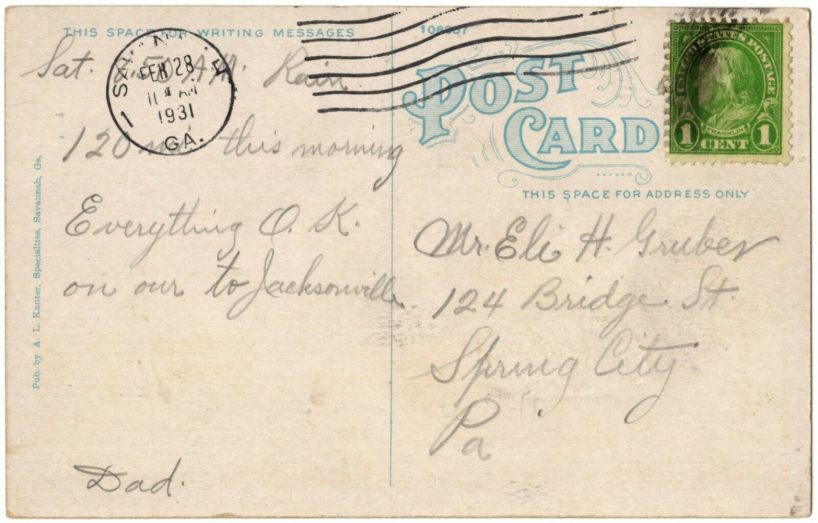
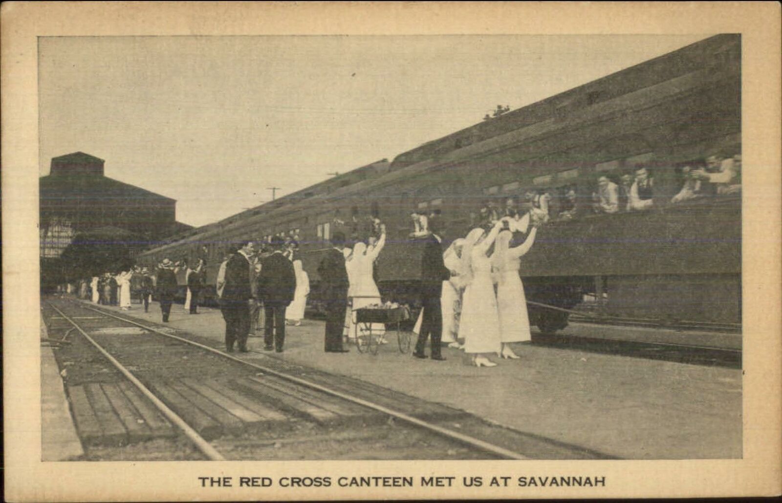 Postcard, unknown date
The
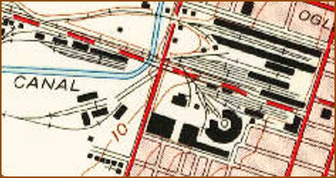
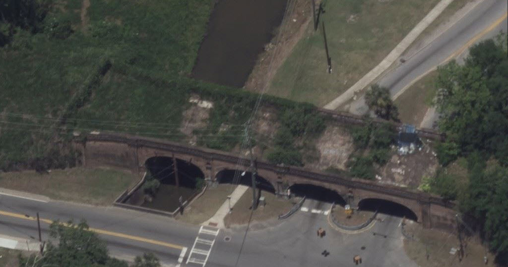
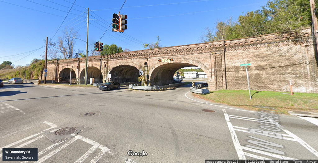
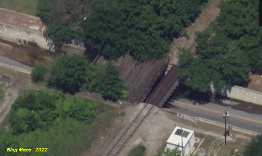
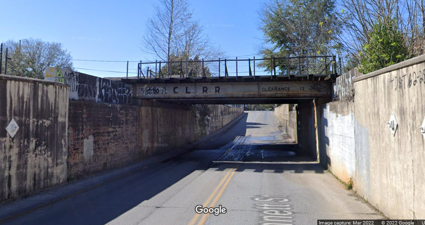
GPS Coordinates: 32.07726, -81.10352
West Boundary St and Louisville Road
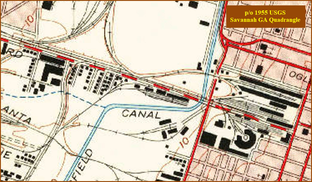
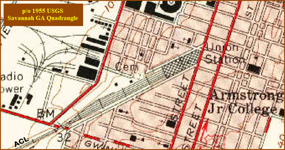
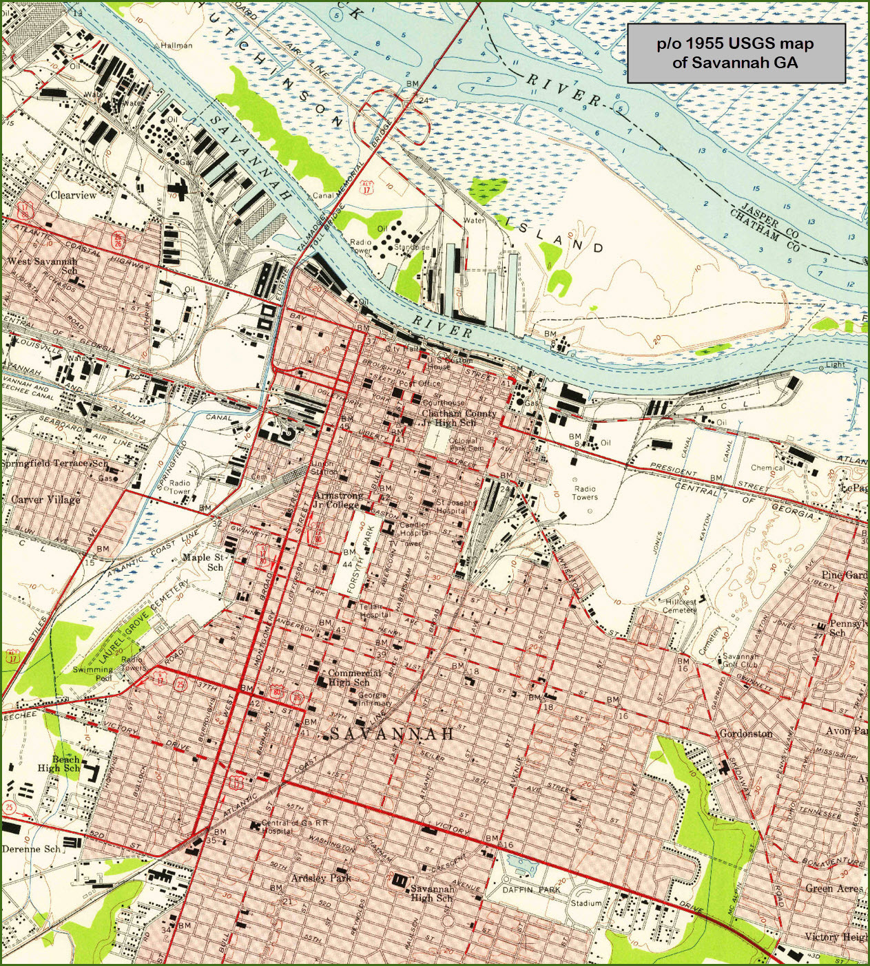
In looking at the USGS map from 1955, it's difficult to tell how many tracks this bridge had on it, I'm guessing two... Beautiful bridge! As is the brickwork along the train shed for the station and the yard, on both sides of Louisville Road.
GPS Coordinates: 32.06501, -81.08779
The
I don't have any dedicated locations for signal pictures.... anything I have so far will be mostly from Google's Streetview, and be with the sight it is associated with.
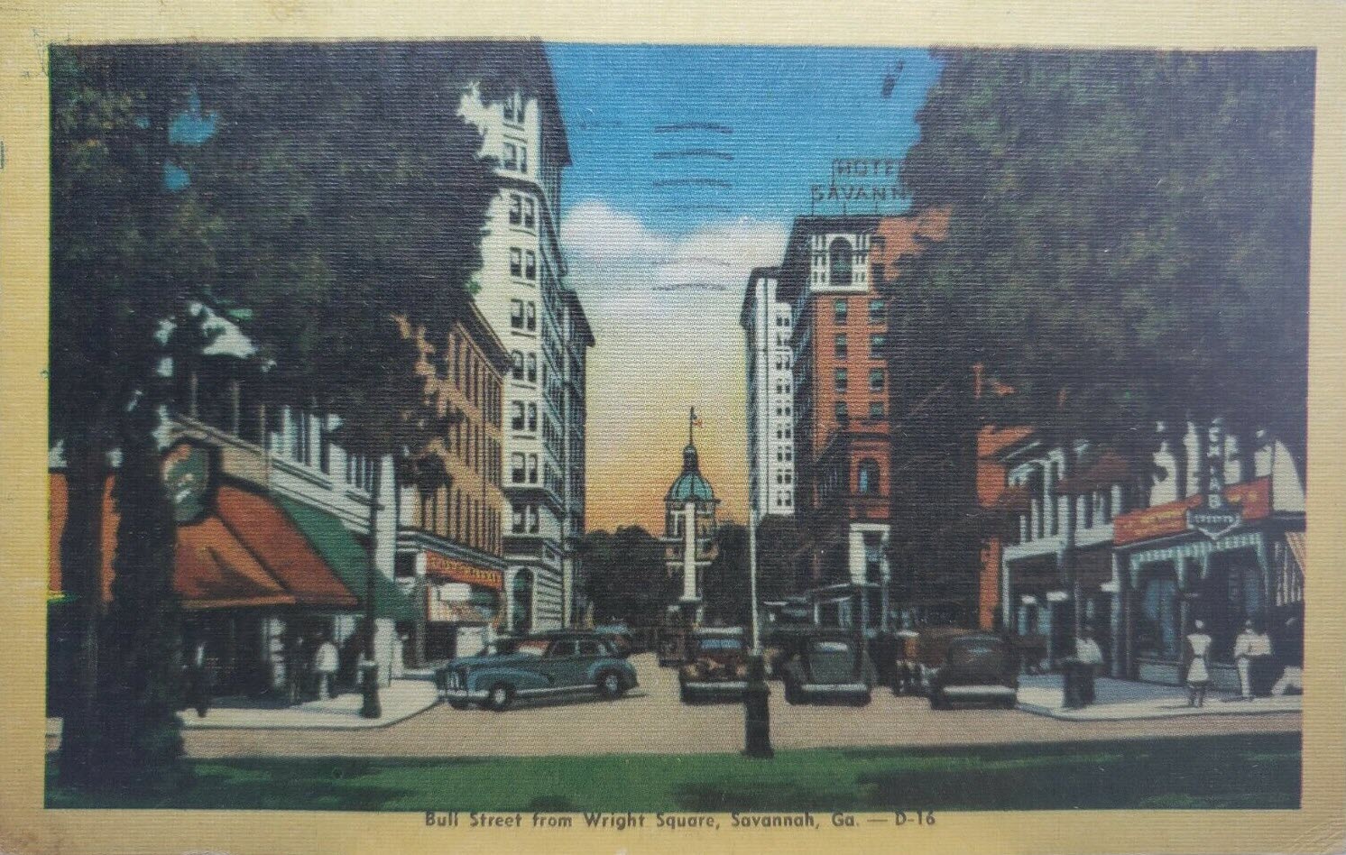
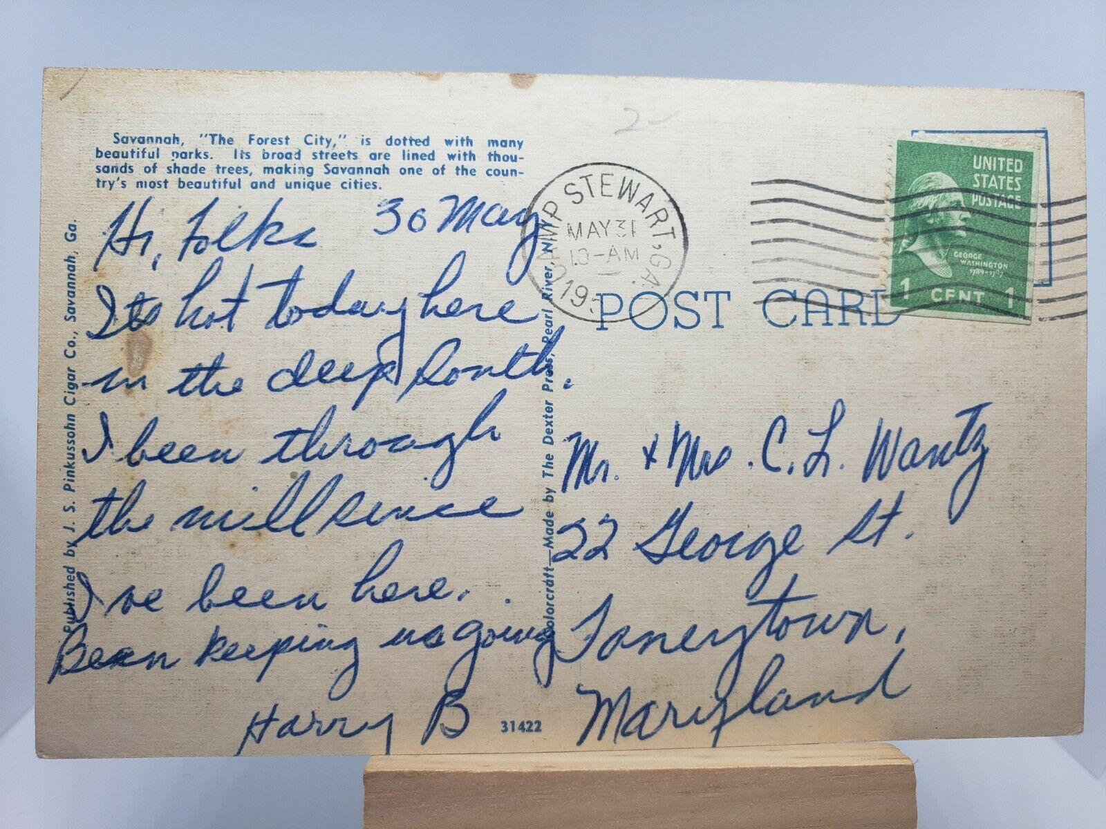
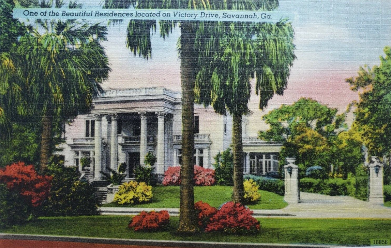
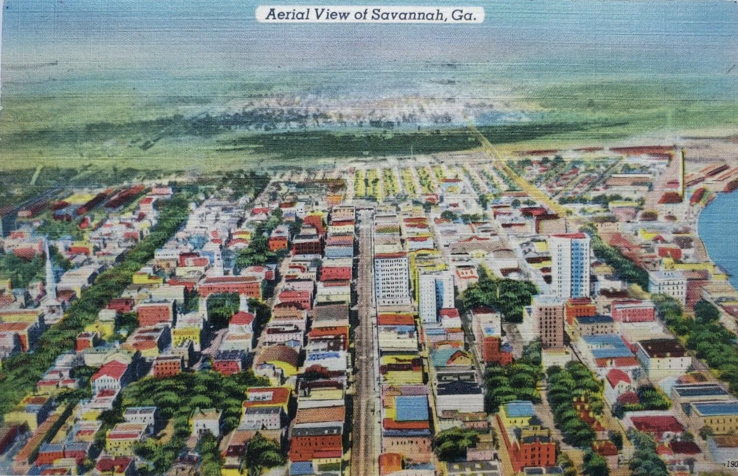
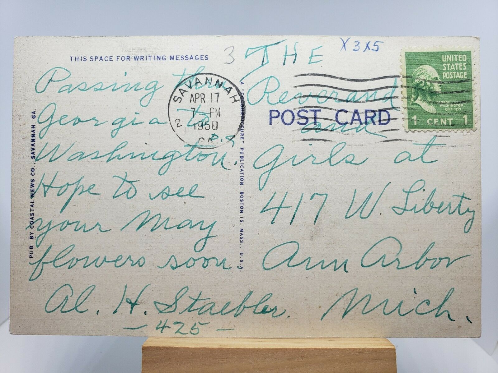
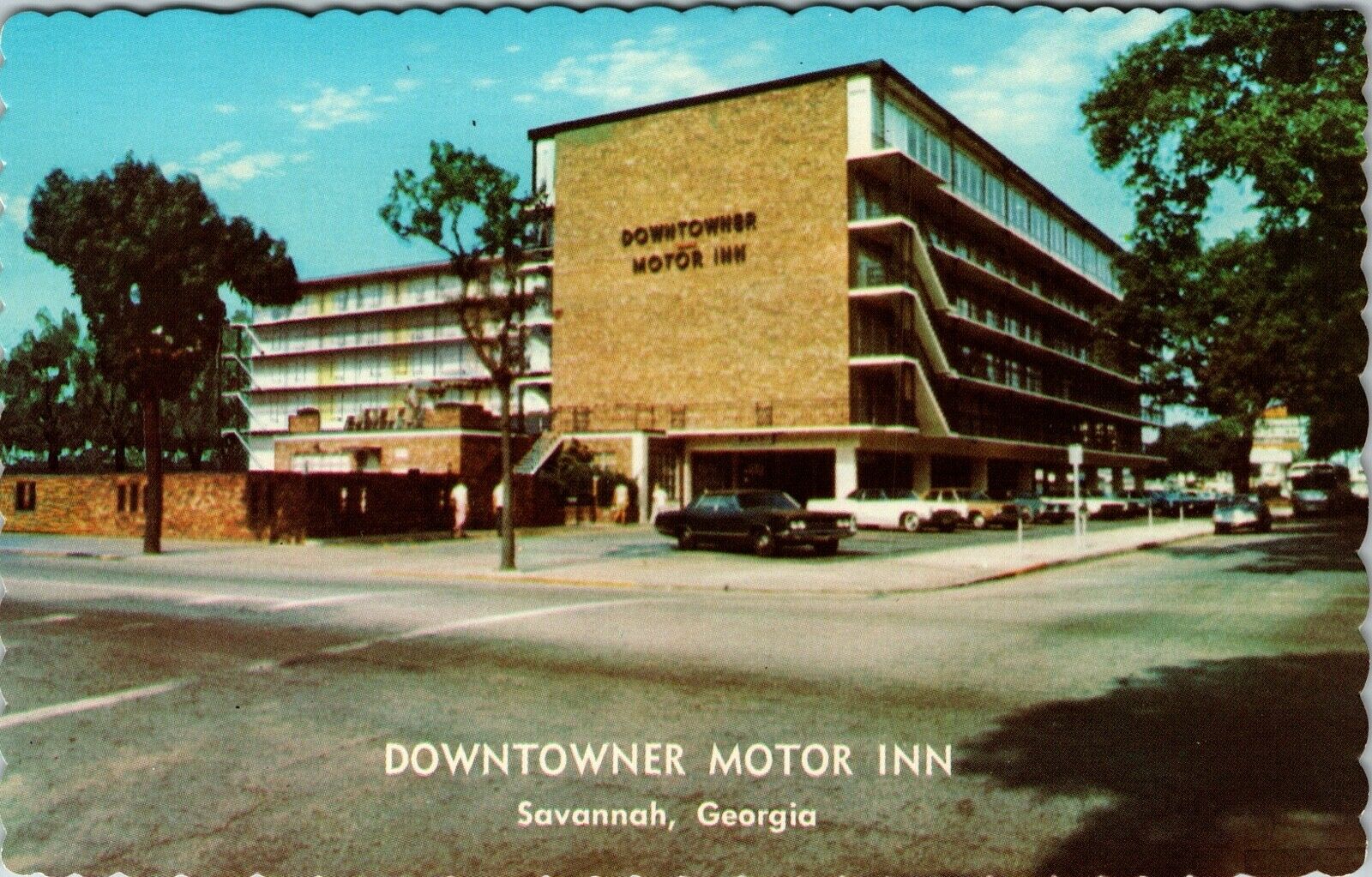
Cruising through Savannah's history via postcards.....

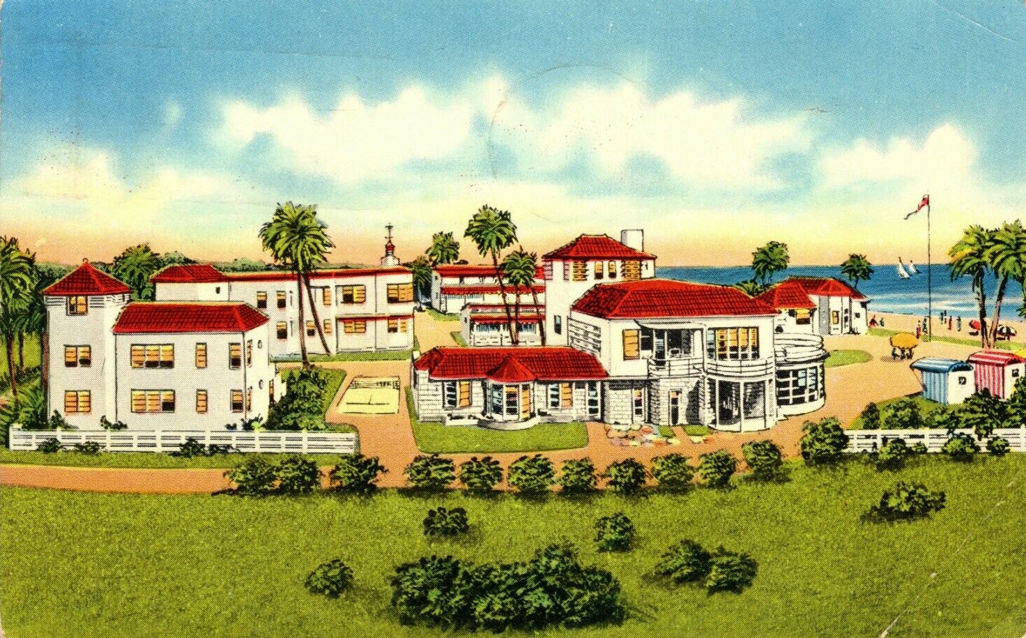
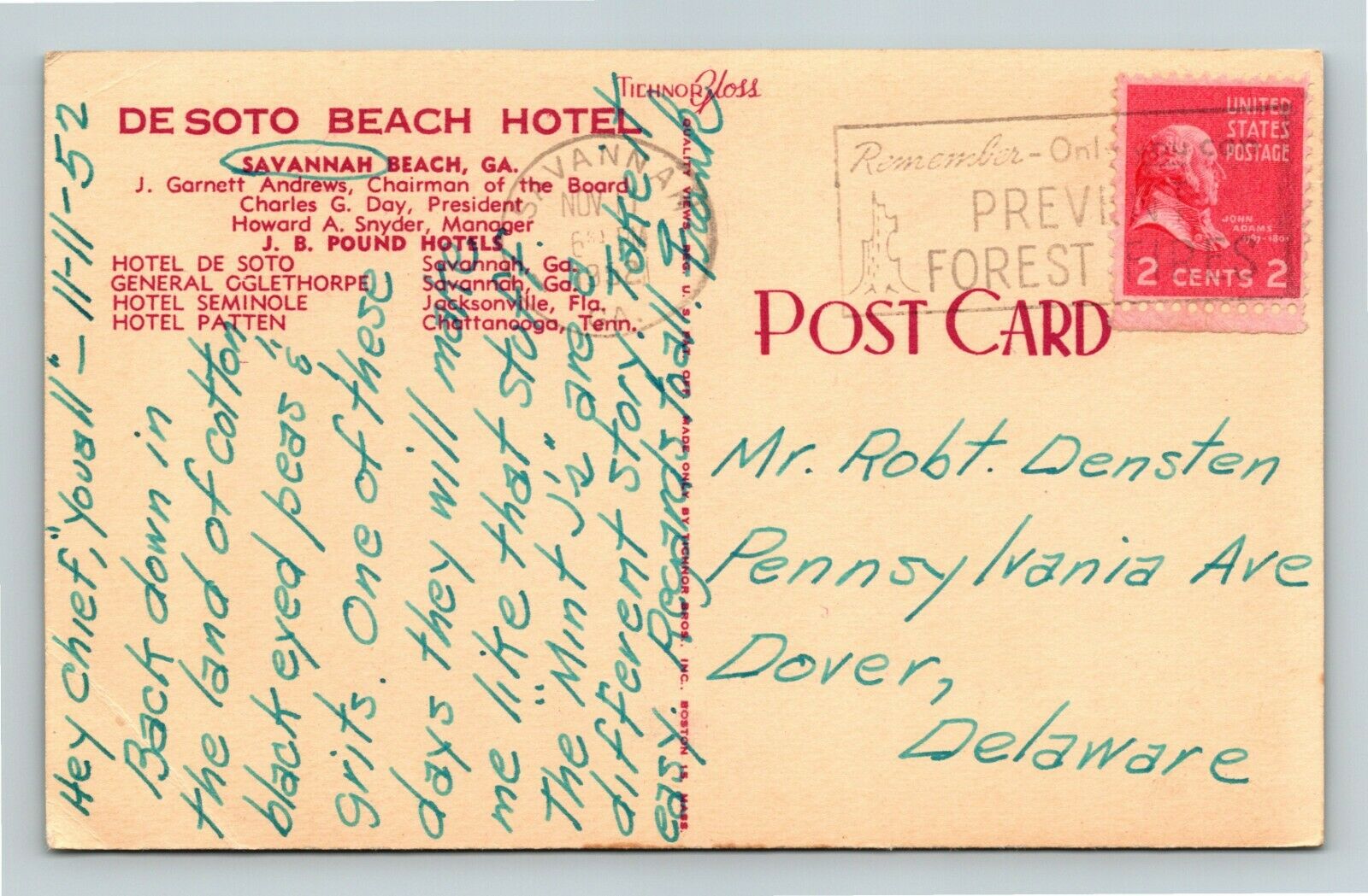 DeSoto Beach Hotel
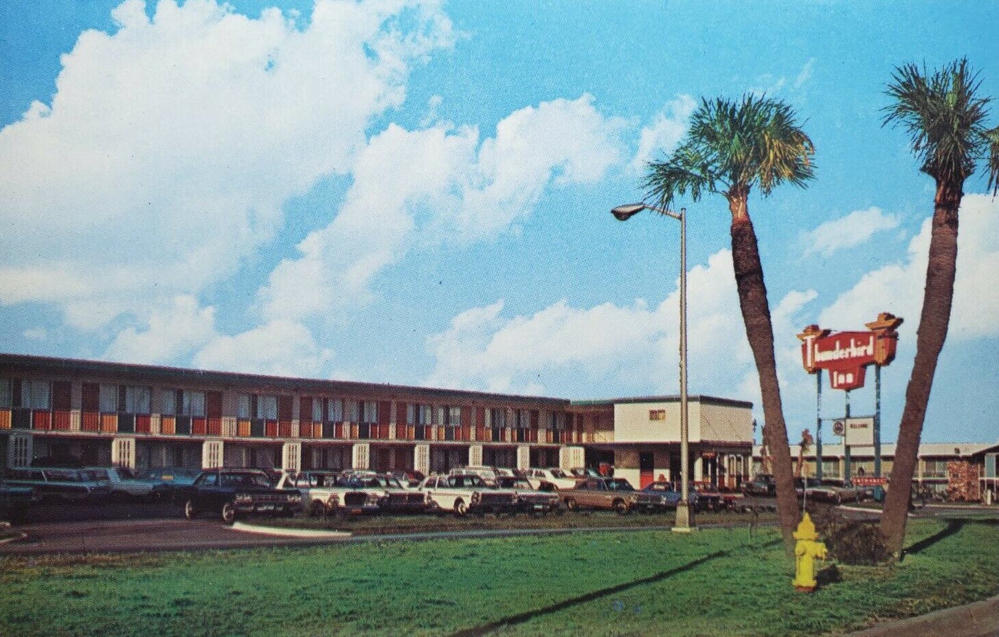
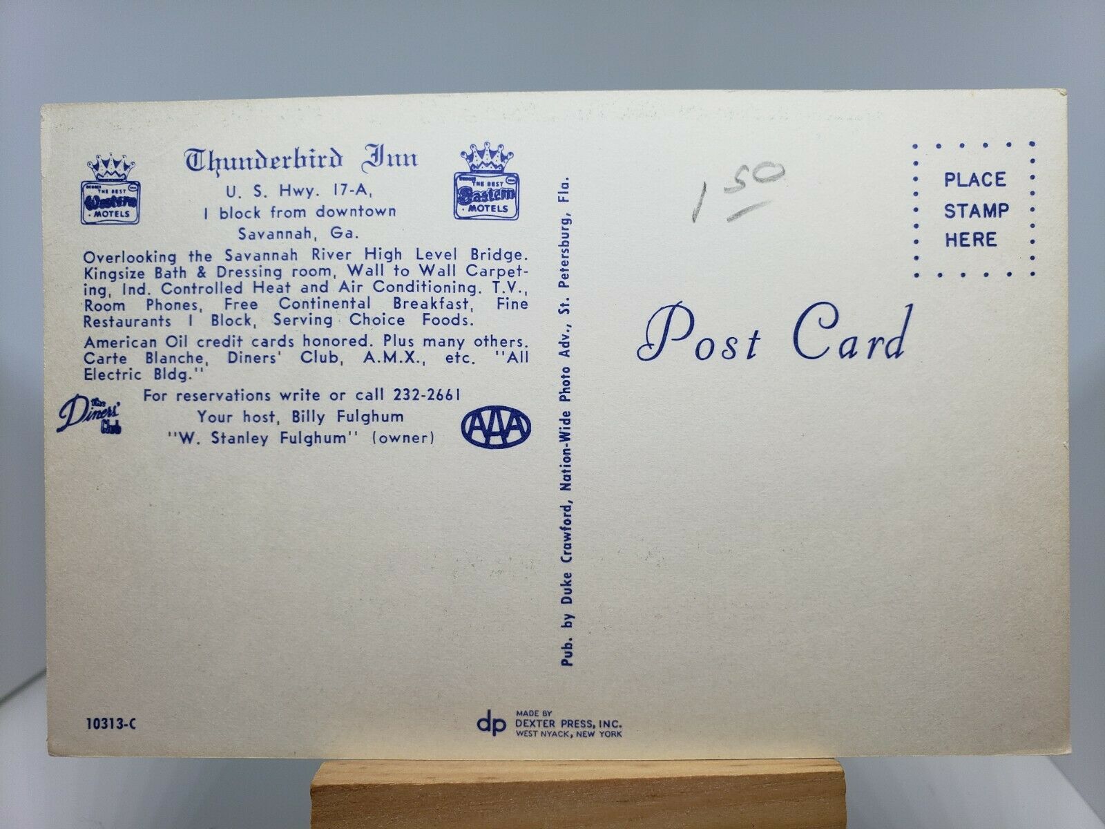 Thunderbird Inn
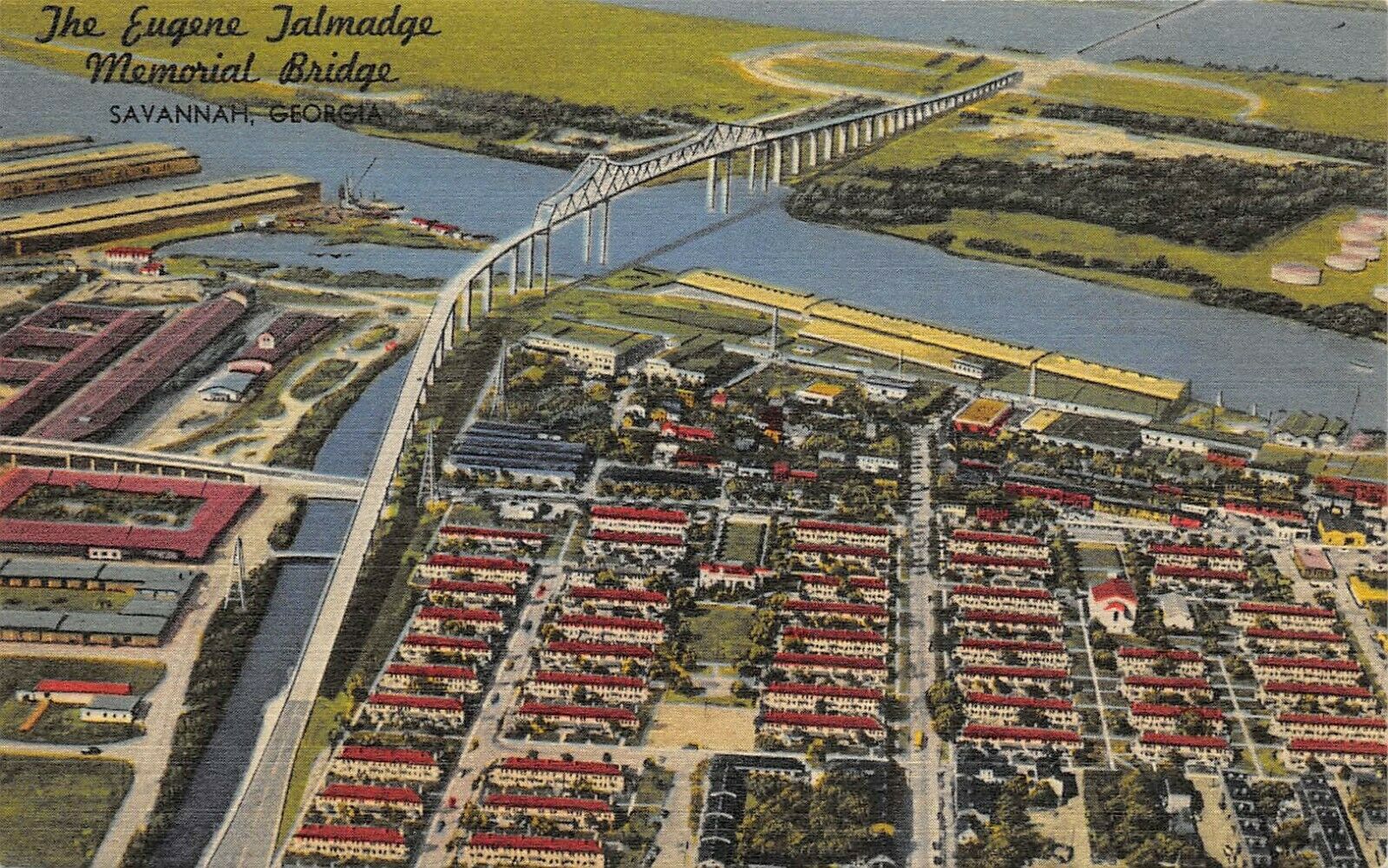
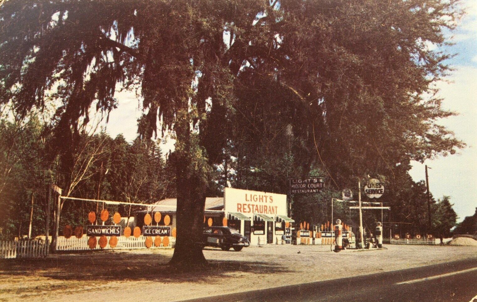
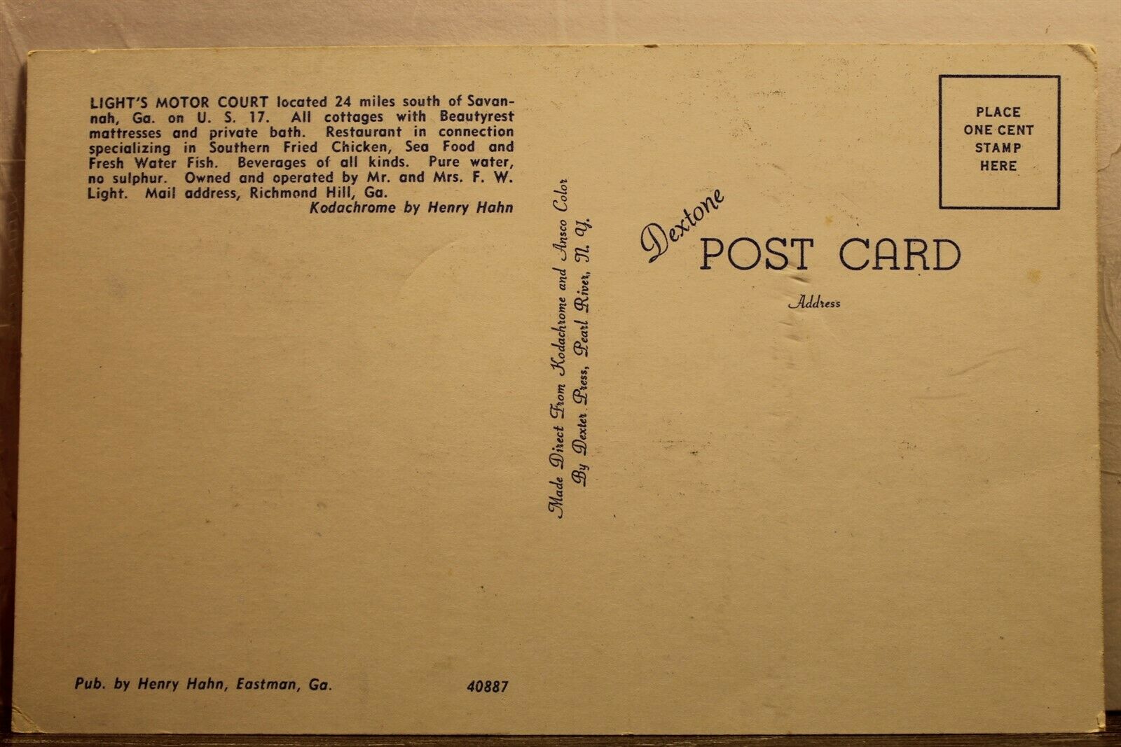 Lights Motor Court Restaurant
As of 2021, the port was the fourth busiest seaport in the United States. Its facilities for oceangoing vessels line both sides of the Savannah River and are approximately 18 miles from the Atlantic Ocean. Since the port is convenient to the Atlantic Ocean, compared to, say, Baltimore, where ships have a 5 hour "ride" up the Chesapeake Bay to get to the terminals once they leave the ocean. The port has nearly 10,000 feet of contiguous berth space, and is on the Savannah River. There are two major terminals under the auspices of the Georgia Ports Authority: the Garden State Terminal and the Ocean Terminal. Interstate highway connections provide access to major locations across the southeast and Midwest in 24 to 48 hours. According to a recent article in Business in Savannah, the port is one of the largest employers in the state. The Port of Savannah creates 350,000 jobs and does over $66 billion in sales every year, which also contributes significantly to Georgia's economy.
The city’s popularity as a tourist destination was solidified by the best-selling book and subsequent movie, Midnight in the Garden of Good and Evil, which were set in Savannah. My wife and I happened to stop in Savannah in 1996 on the way back from Atlanta, and was surprised by all of these people hovering around the park where they were filming the movie - they were waiting for a chance to get a glimpse of
The Girl Scouts of America was founded in Savannah in 1912 by Juliette Gordon Low. Her childhood home now serves as the Girl Scouts’ National Headquarters and is open for tours.
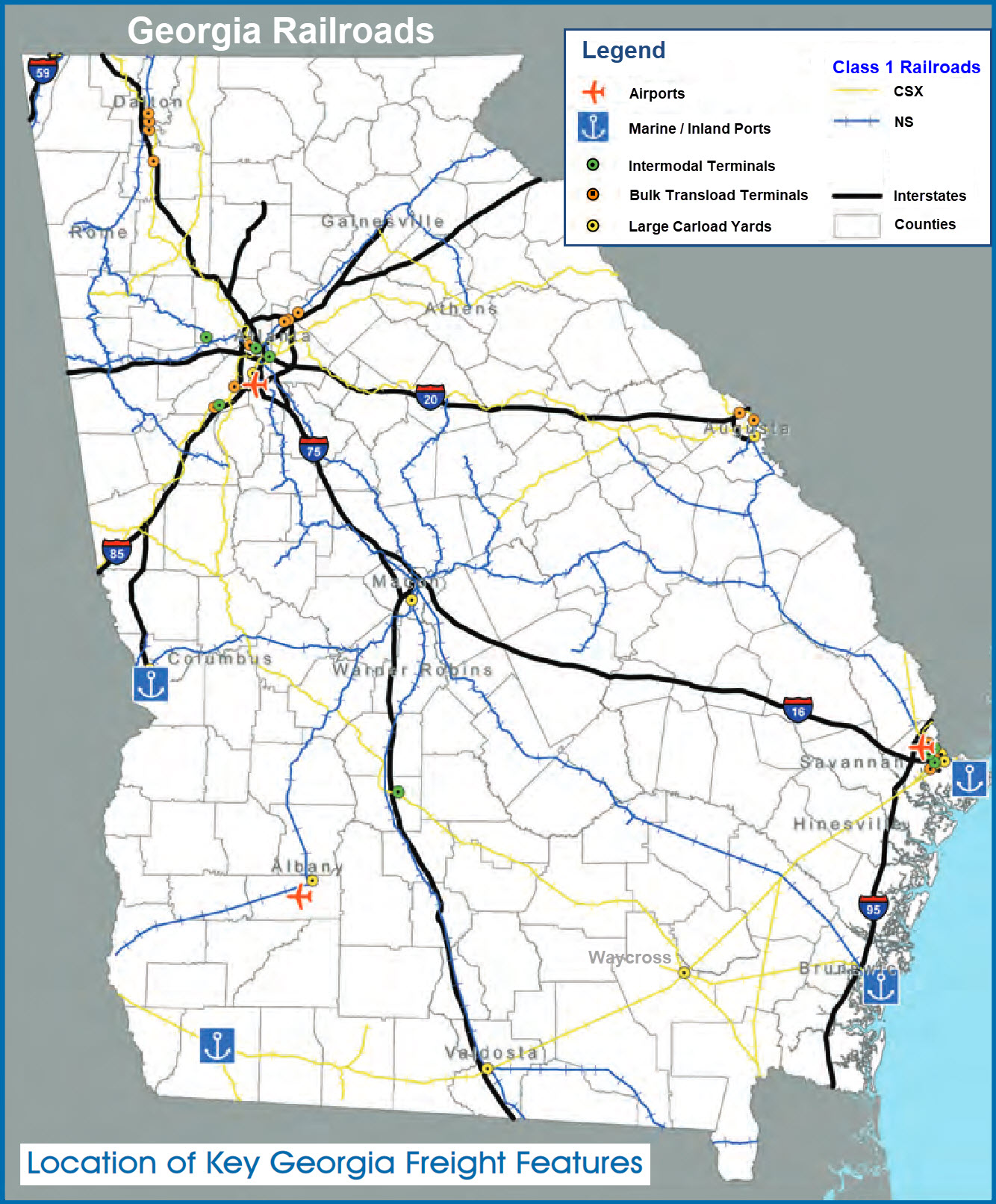
The map below is from the following PDF:
https://www.dot.ga.gov/InvestSmart/Freight/GeorgiaFreight/GAFreightLogisticsPlan%20ExecutiveSummary.pdf
Found at the USGS website
Disclaimers:
I love trains, and I love signals. I am not an expert. My webpages reflect what I find on the topic of the page. This is something I have fun with while trying to help others.
Please Note: Since the main focus of my two websites is railroad signals, the railfan guides are oriented towards the signal fan being able to locate them. For those of you into the modeling aspect of our hobby, my indexa page has a list of almost everything railroad oriented I can think of to provide you with at least a few pictures to help you detail your pike.
If this is a railfan page, every effort has been made to make sure that the information contained on this map and in this railfan guide is correct. Once in a while, an error may creep in :-)
My philosophy: Pictures and maps are worth a thousand words, especially for railfanning. Text descriptions only get you so far, especially if you get lost or disoriented. Take along good maps.... a GPS is OK to get somewhere, but maps are still better if you get lost! I belong to AAA, which allows you to get local maps for free when you visit the local branches. ADC puts out a nice series of county maps for the Washington DC area, but their state maps do not have the railroads on them. If you can find em, I like the National Geographic map book of the U.S..... good, clear, and concise graphics, and they do a really good job of showing you where tourist type attractions are, although they too lack the railroads. Other notes about specific areas will show up on that page if known.
Aerial shots were taken from either Google or Bing Maps as noted. Screen captures are made with Snagit, a Techsmith product... a great tool if you have never used it!
By the way, floobydust is a term I picked up 30-40 years ago from a National Semiconductor data book, and means miscellaneous and/or other stuff.
Pictures and additional information is always needed if anyone feels inclined to take 'em, send 'em, and share 'em, or if you have something to add or correct.... credit is always given! Please be NICE!!! Contact info is here
Beware: If used as a source, ANYTHING from Wikipedia must be treated as being possibly inaccurate, wrong, or not true.
RAILFAN GUIDES HOME
RAILROAD SIGNALS HOME
NEW 04/05/2022, May19/20/21/2022
Last Modified 31-May-2022