
In General
Getting Here
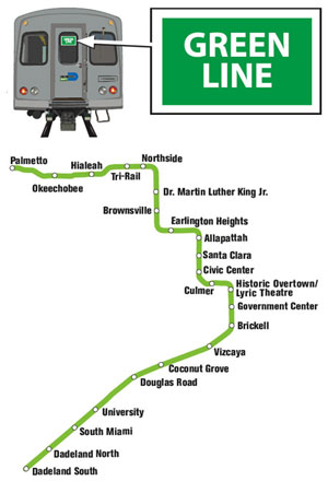
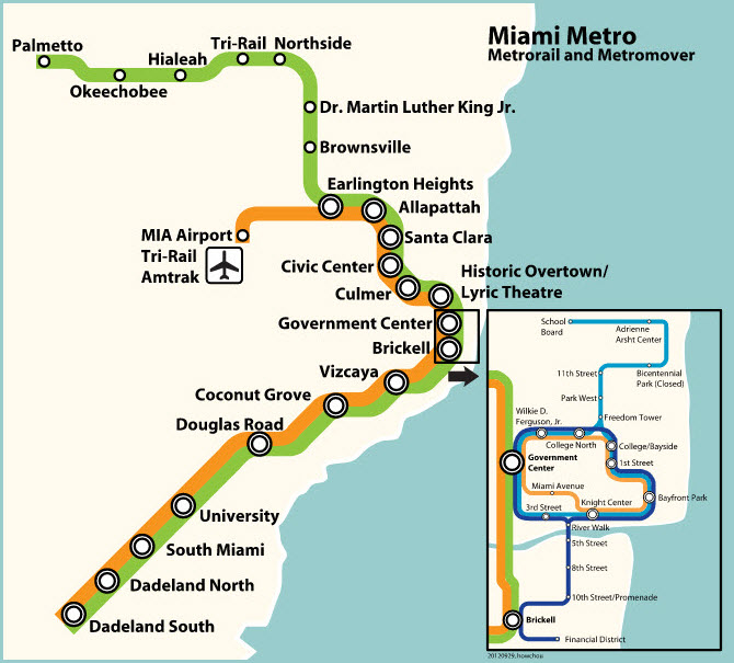
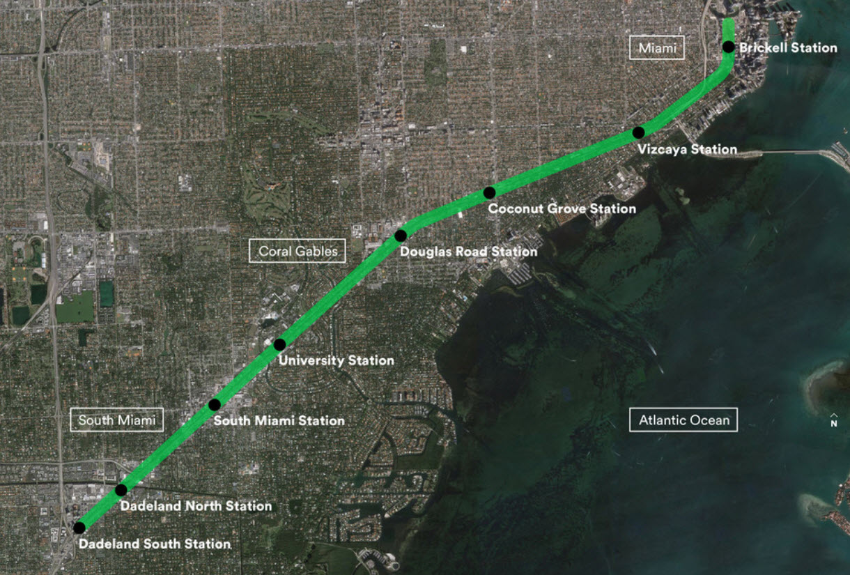
Map
Station by Station
Pictures
Signals
Floobydust
RAILROAD SIGNALS HOME
Location / Name:
Miami FL, Dade County
What's Here:
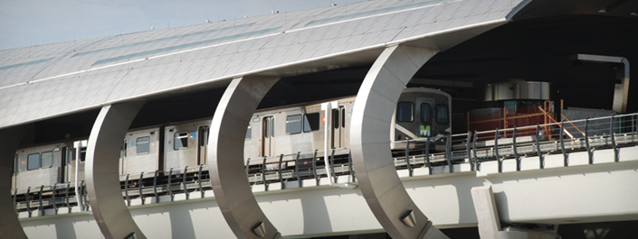
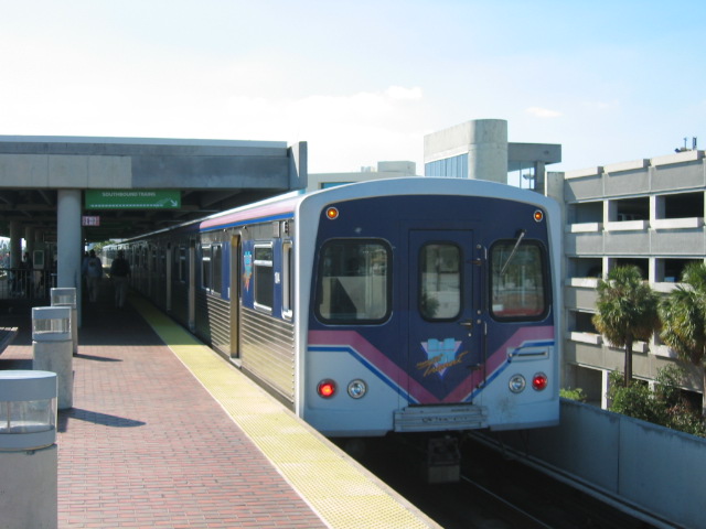
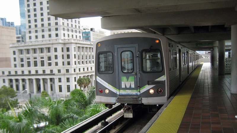
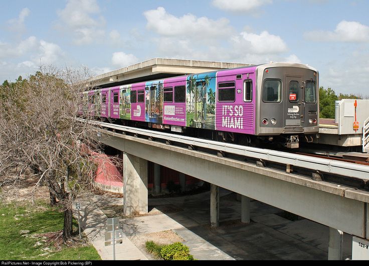
Metrorail, aka, the Metro
Data:
GPS Coordinates: as needed
Phone A/C: 305
ZIP: 33130
Access by train/transit:
Itself
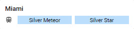
Amtrak Silver Meteor and Silver Star
8303 NW 37th Ave, Miami, FL 33147
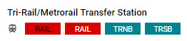
Tri-Rail/Metrorail Transfer
1125 E 25 Street, Hialeah, FL 33013
The Scoop:
From the Metrorail website:
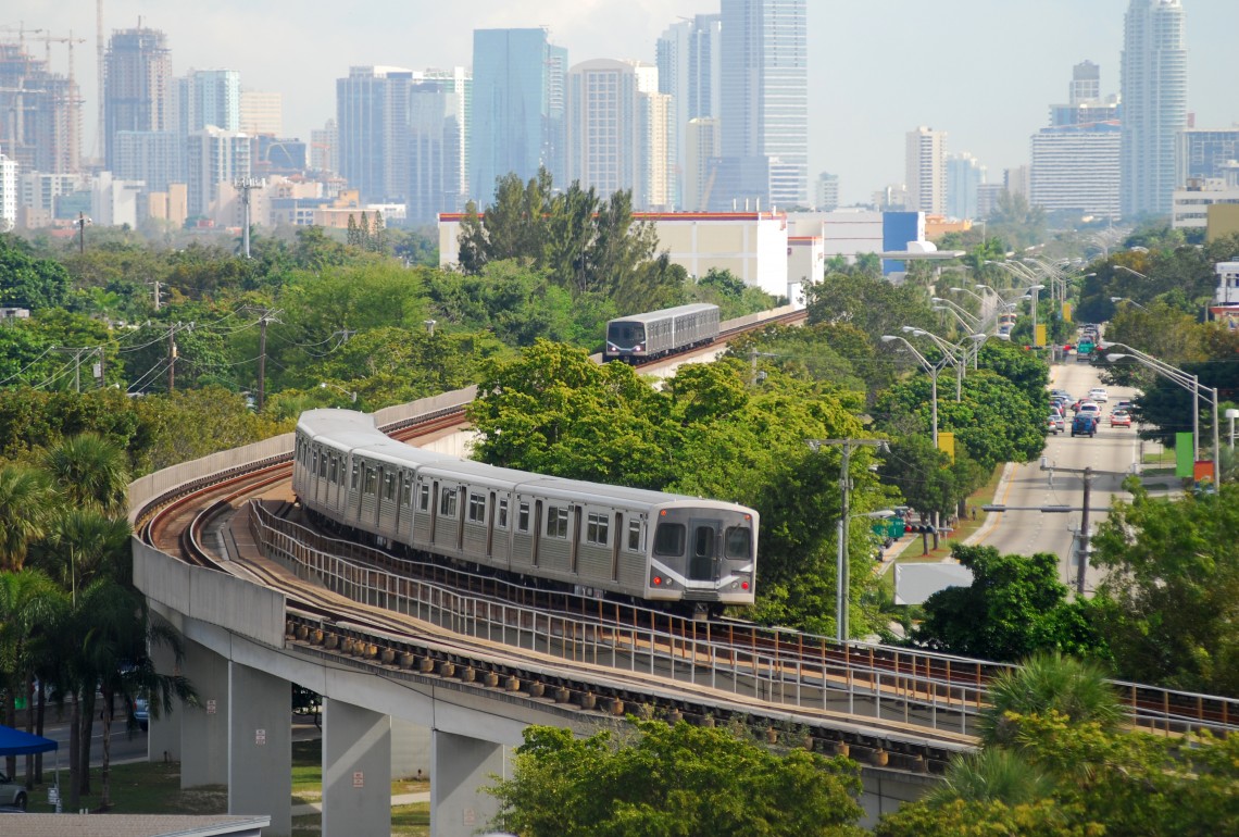
The Metrorail system is a 25-mile dual track, elevated rapid transit system that provides service to Miami International Airport (MIA) and runs from Kendall through South Miami, Coral Gables, and downtown Miami; to the Civic Center/Jackson Memorial Hospital area; and to Brownsville, Liberty City, Hialeah, and Medley in northwest Miami-Dade, with connections to Broward and Palm Beach counties at the Tri-Rail/Metrorail transfer station. The system currently uses 136 train cars. The 23 accessible Metrorail stations are about one mile apart, providing easy access for bus riders, pedestrians, and passengers who are dropped off and picked up.
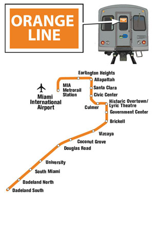
Metrorail’s new Orange Line service to MIA offers residents, visitors and airport employees a reliable and seamless Metrorail connection to and from the airport’s MIA Mover, which takes riders directly into the airport.
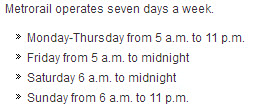
Park at any Metrorail surface lot or parking garage for just $4.50 a day seven days a week, including holidays, when you ride Metrorail. (Seems like they would cut you a break on the weekends, huh?).... end Metrorail info.
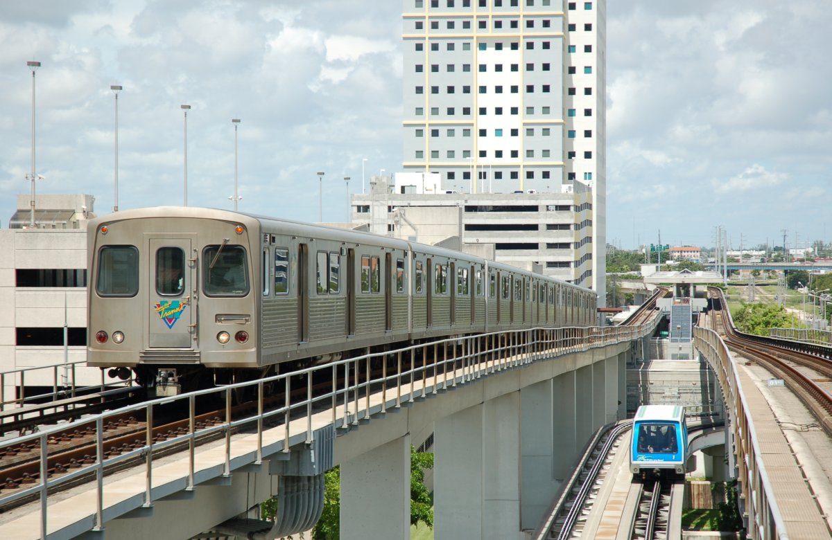
You can catch the Metromover at the Government Center and Brickall stations.
From Wikipedia:
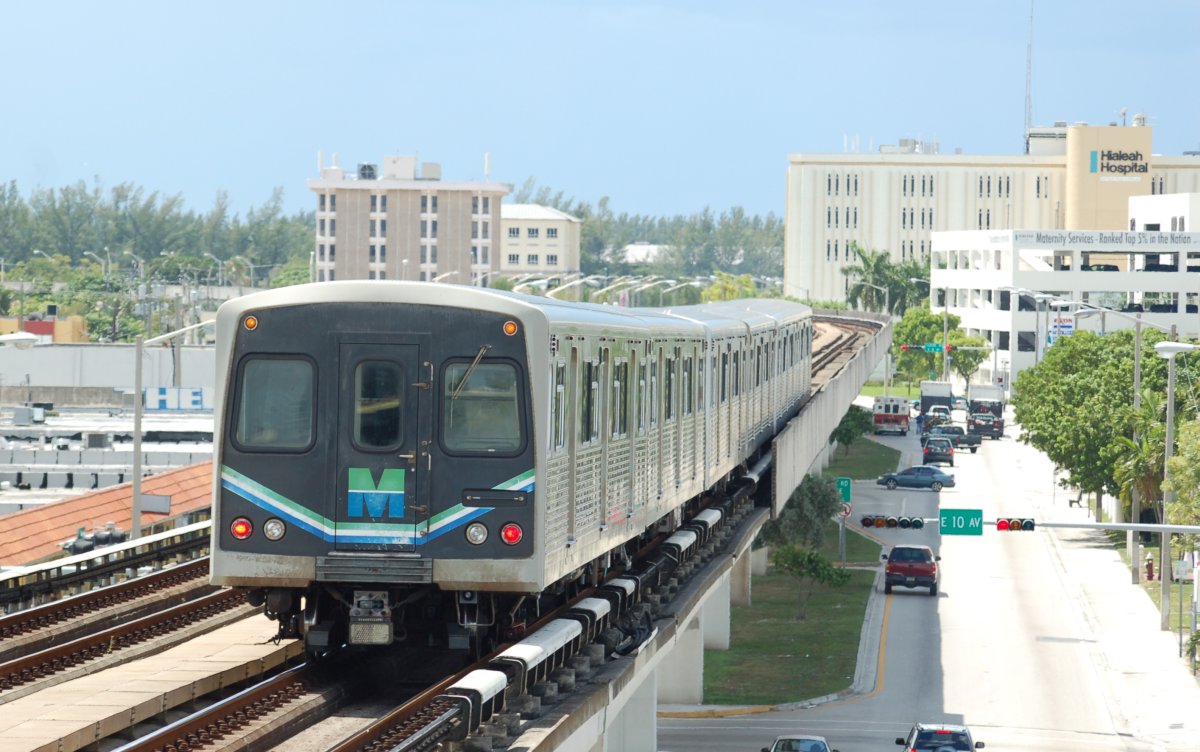
Metrorail, colloquially called the Metro, is the heavy rail rapid transit system of Miami and Miami-Dade County, Florida. Metrorail is operated by Miami-Dade Transit (MDT), a departmental agency of Miami-Dade County. Opened in 1984, it is Florida's only rapid transit metro system, and is currently composed of two lines of 23 stations on 24.4 miles (39.3 km) of standard gauge track.
Metrorail serves the urban core of Miami, connecting the urban centers of Miami International Airport, the Civic Center, Downtown Miami, and Brickell with the northern developed neighborhoods of Hialeah and Medley to the northwest, and to suburban The Roads, Coconut Grove, Coral Gables, and South Miami, ending at urban Dadeland in Kendall. Metrorail connects to the Metromover in Downtown, which provides metro service to the entirety of Downtown and Brickell. Additionally, it connects to South Florida's commuter rail system at Tri-Rail Station, as well as Metrobus routes at all stations. Together with Metromover, the system has seen steady ridership growth per annum, with an average of 105,500 daily passengers in 2013.
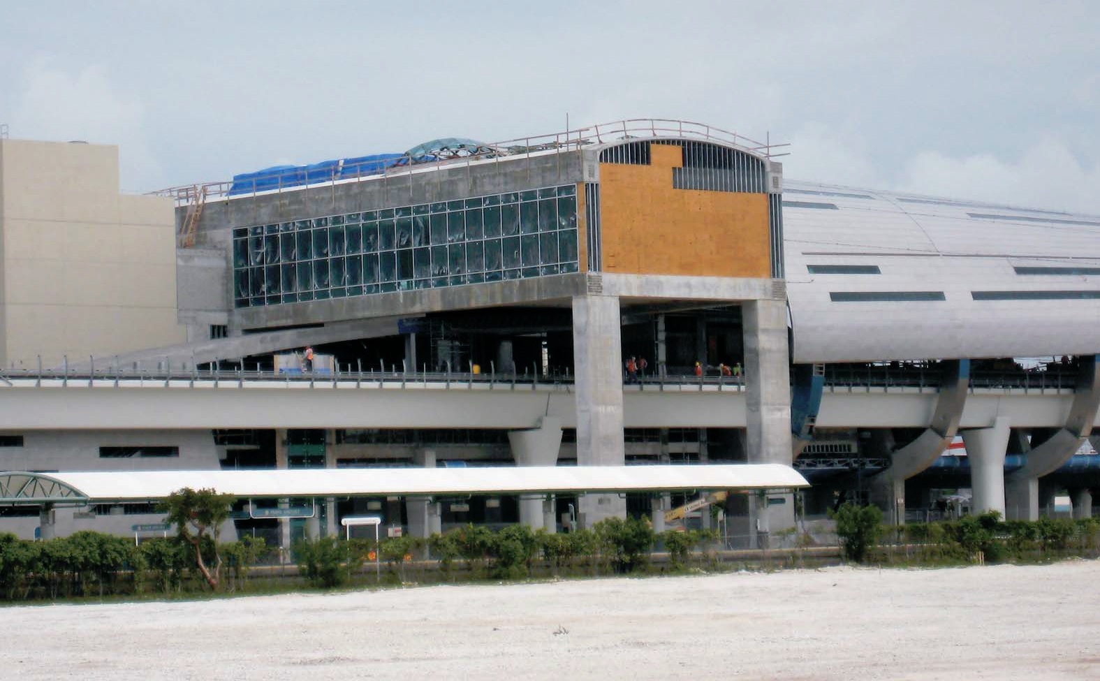
In 2012, Metrorail opened its 23rd station, Miami Central Station, at Miami International Airport (MIA), opening a 16-station newly created Orange Line between the MIA and Dadeland South stations. The new line is expected to increase ridership significantly, adding millions of riders per year, and allowing residents and visitors alike direct access from the MIA to Downtown Miami, and greater connectivity between various modes of transit throughout Miami-Dade County. Central Station provides direct service to Amtrak inter-city rail services, Tri-Rail commuter rail, Greyhound Lines intercity bus, and the Rental Car Center. Miami Central Station is expected to attract 150,000 daily commuters and travelers..... end Wikipedia info.
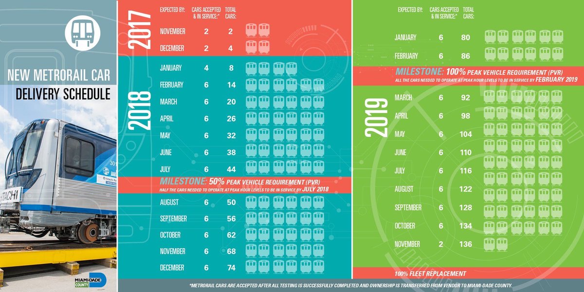
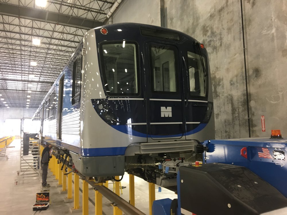
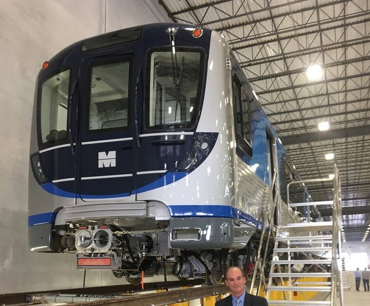
When the system was in the planning stages, the Baltimore Metro system decided to jump on the order for the Miami railcars, and purchased their railcars at the same time, thereby saving on design costs. This has also had the added side benefit, that if either system is out of parts, they just call each other up and say, hey, ya'll got part number such-and-such?
During a tour of the Metro-Subway shops in Baltimore in August of 2017, we learned that both Miami and Baltimore are getting ready to place an order for new cars, which should be delivered in (maybe) the 2020-2022 timeframe. Too bad other transit systems don't take a hint and do the same thing to keep their costs down. I am trying to get a couple of the married pairs saved and donated to either the Baltimore Streetcar Museum, or the B&O Railroad museum, which at this time, seems like a more likely candidate since their track is already standard gauge, whereas the BSM's track is not (it is wide gauge at 5ft 4-1/2in)
Acknowledgements:
Denver Todd
Brian Weinberg
Jeremiah Co
Bob Pickering
Florida Department of Transportation
Wikipedia
Websites and other additional information sources of interest for the area:
https://en.wikipedia.org/wiki/Metrorail_(Miami-Dade_County)
http://www.miamidade.gov/transit/metrorail.asp
http://www.miamidade.gov/transit/rail_schedules.asp
http://www.miamiherald.com/news/local/community/miami-dade/article90928402.html
http://www.miamiherald.com/news/local/community/miami-dade/article10716959.html
http://www.miamihal.com/hals-blog/2017/1/12/big-move-forward-for-south-dade-transit
Getting to G

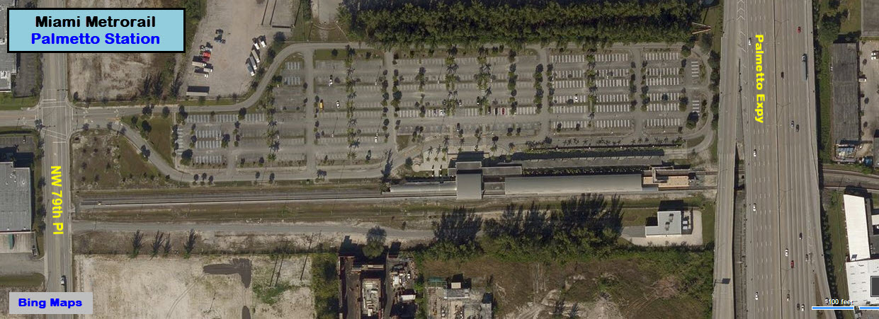
Palmetto
GPS Coordinates: 25.843494, -80.324621
This is the last station on the north end of the system on the GREEN LINE. The shops are nearby.
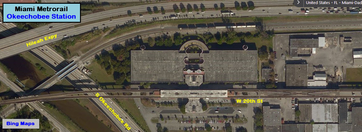
Okeechobee
GPS Coordinates: 25.839807, -80.301525
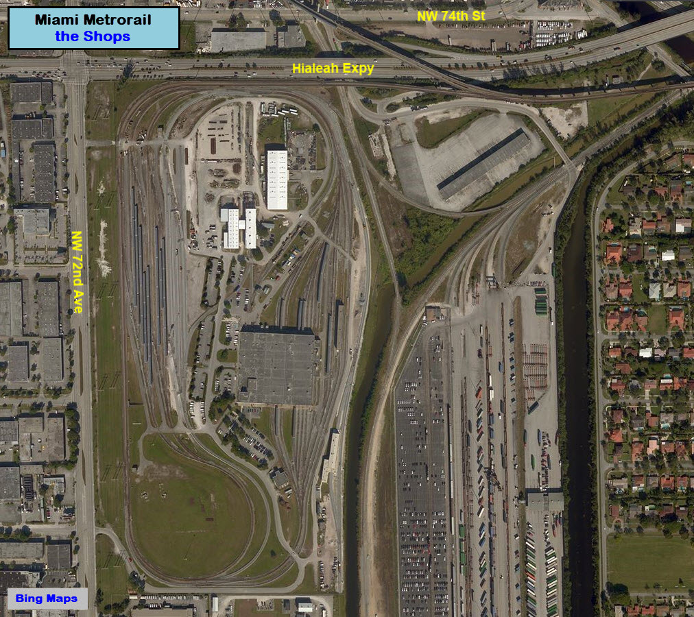
Shops - Lehman Rail Yard
GPS Coordinates: 25.835386, -80.310991
Hialeah
GPS Coordinates: 25.841176, -80.279057
Serves the racetrack and casino just to the north of the station.

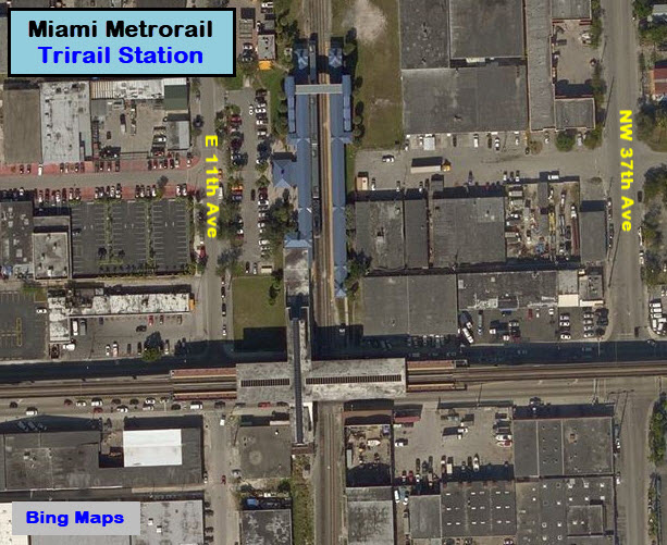
Trirail
GPS Coordinates: 25.845448, -80.259573
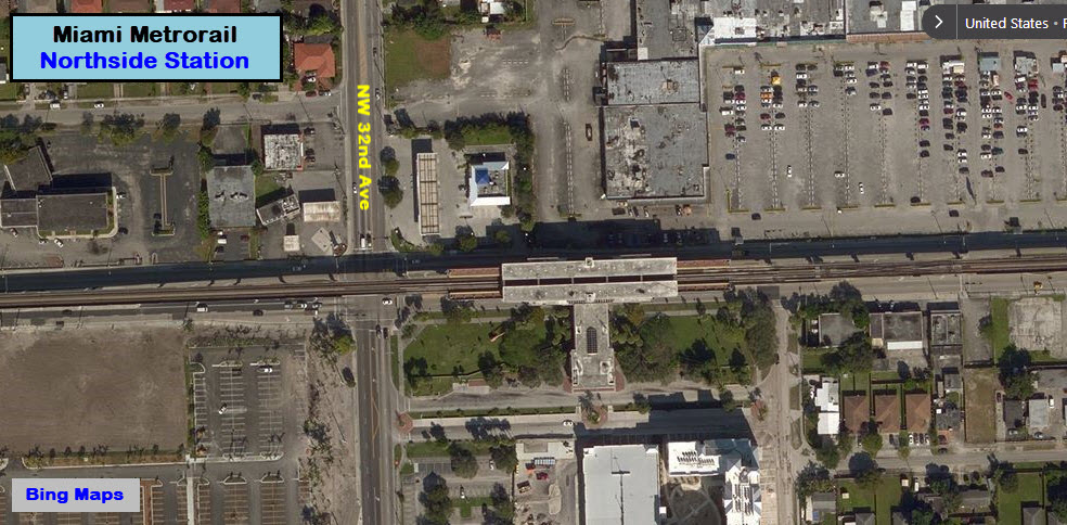
Northside
GPS Coordinates: 25.845835, -80.248835
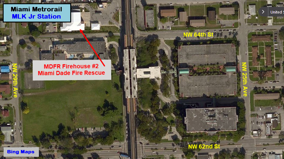
Martin Luther King Jr
GPS Coordinates: 25.832404, -80.241231
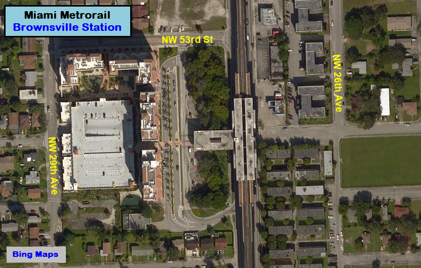
Brownsville
GPS Coordinates: 25.822016, -80.240731
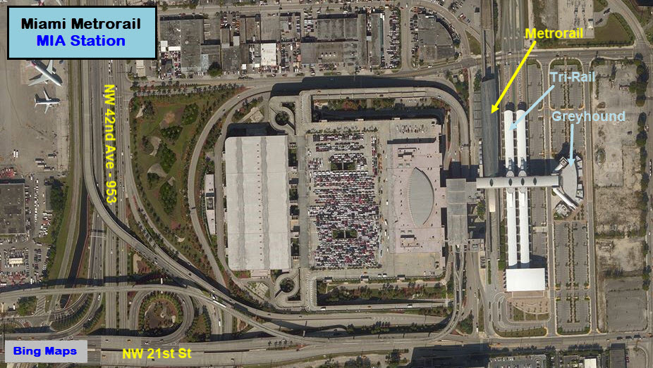
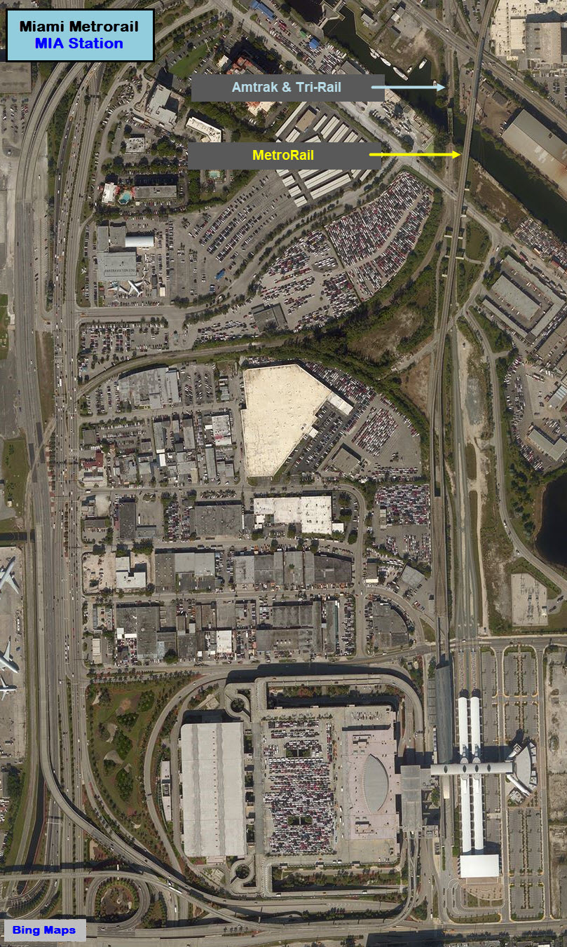
Miami International Airport
GPS Coordinates: 25.798009, -80.258659
This is the northern terminus of the ORANGE line, which opened in 2012. NOTICE: There is NO transit parking available here. Note that the TVMs at this station allow passengers to load $2.65 (one way) and $5.30 (round trip) on an EASY Ticket for those wishing to travel on the Miami Beach Airport Flyer - Route 150 .
 FLDoT, Wikipedia
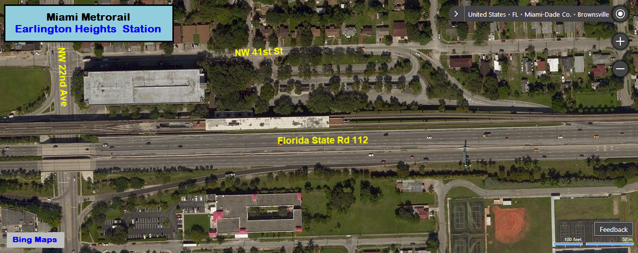
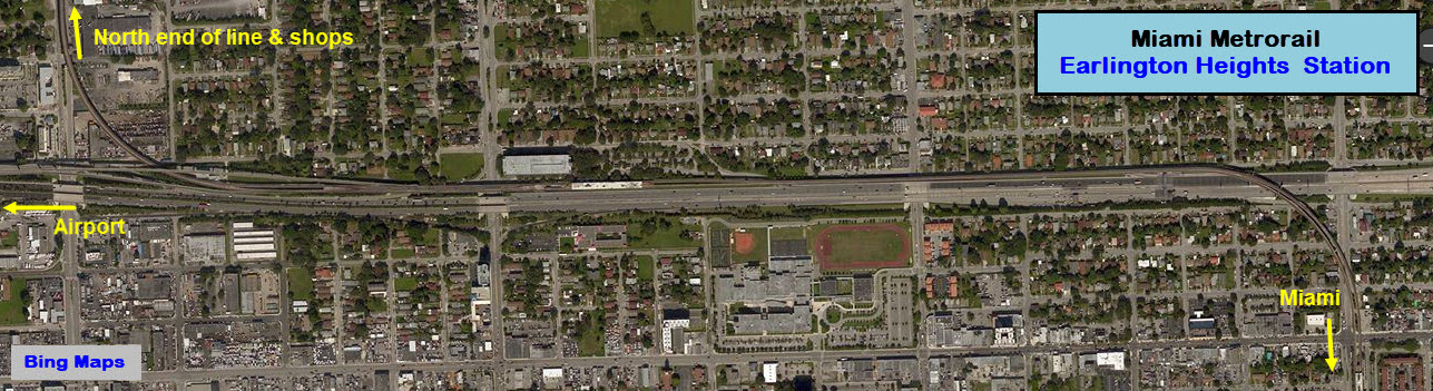
Earlington Heights
GPS Coordinates: 25.812456, -80.229948
This is the first station with both the ORANGE and GREEN lines (Going southbound).

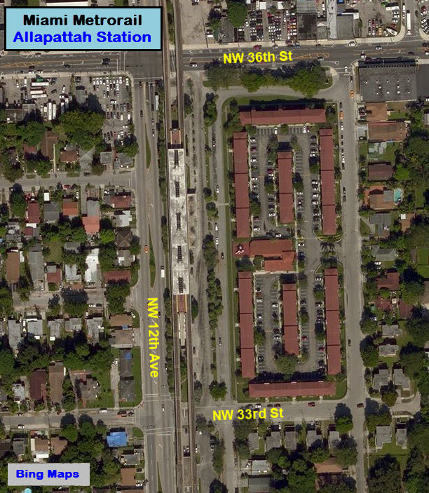
Allapattah
GPS Coordinates: 25.808725, -80.215481
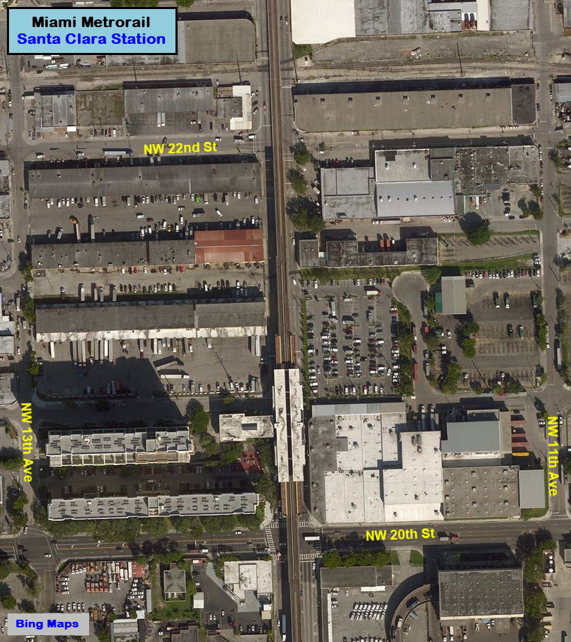
Santa Clara
GPS Coordinates: 25.795836, -80.215171
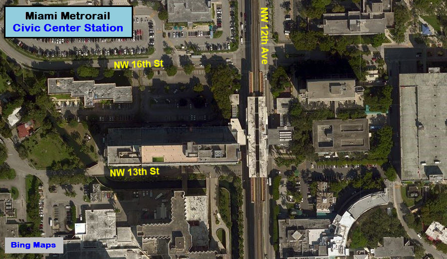
Civic Center
GPS Coordinates: 25.789723, -80215053
Places of Interest: Jackson Memorial Hospital, Bascom Palmer Eye Institute, Veterans Hospital, Miami-Dade County Jail, Miami-Dade Justice Building/Courts, Florida State Building, Cedars Medical Center, Miami-Dade County Health Department, University of Miami Hospitals and Clinics.
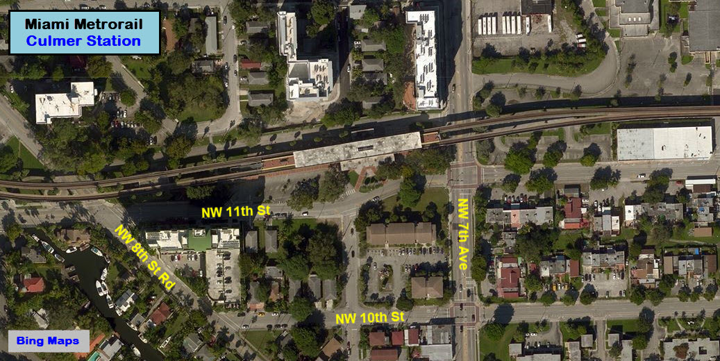
Culmer
GPS Coordinates: 25.784532, -80.207706
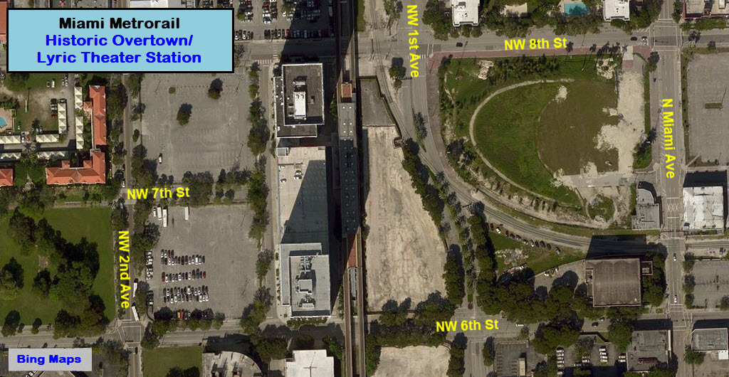
Historic Overtown/Lyric Theatre
GPS Coordinates: 25.780987, -80.196312
Places of Interest: Ninth Street Pedestrian Mall, Overtown's Historical Lyric Theatre
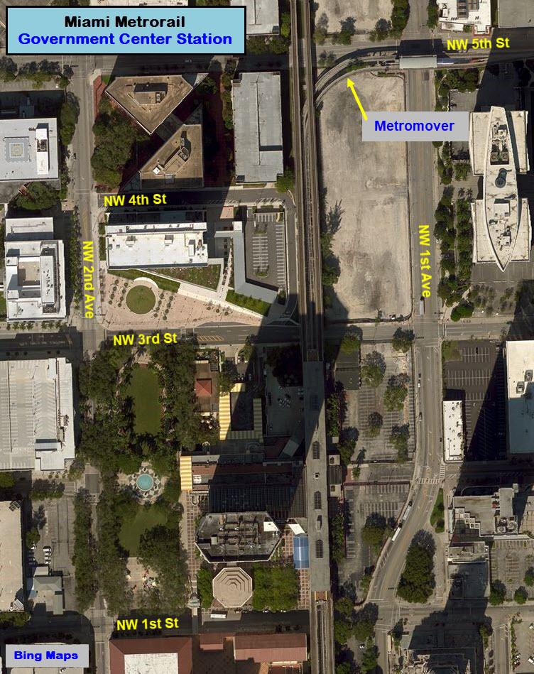
Government Center
GPS Coordinates: 25.776036, -80.196122
Places of Interest: Miami Art Museum, Historical Museum of Southern Florida, Miami-Dade Library System, Main Library, Stephen P. Clark Government Center, Miami-Dade County Courthouses, Federal Courthouse Square, Dade County Bar Association, Miami Parking Authority and Miami-Dade County Parking System, Downtown Bus Terminal, School Board Building (Exit Metrorail at Government Center Station; take Metromover to School Board Station via the Omni leg on the outer loop.)
 Brian Weinburg
Brickell
GPS Coordinates: 25.763841, -80.195456

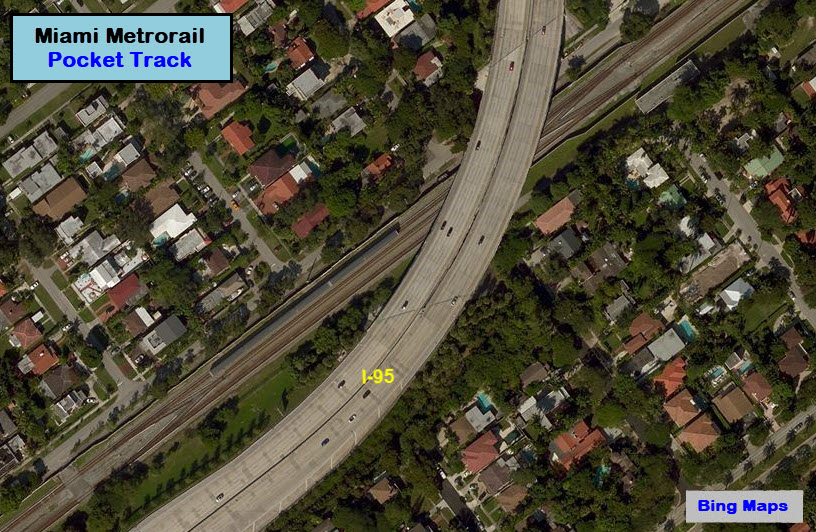
Pocket Track
GPS Coordinates: 25.756610, -80.200689
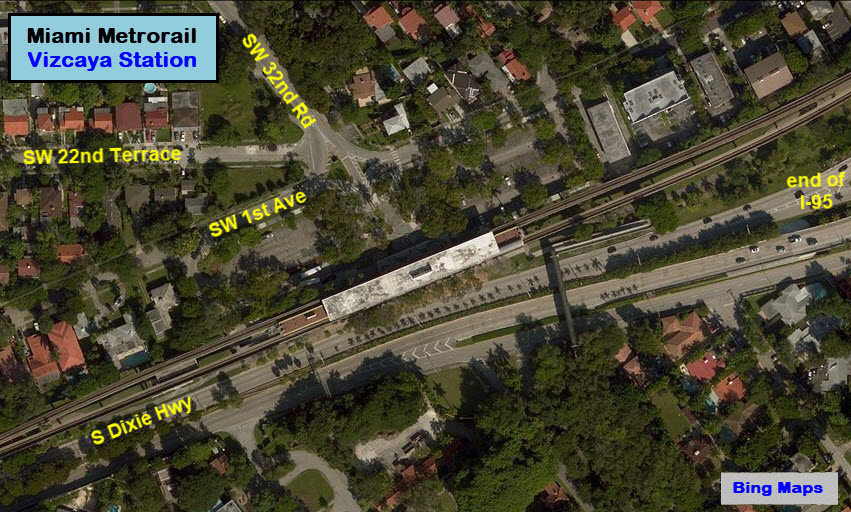
Vizcaya
GPS Coordinates: 25.749741, -80.211756
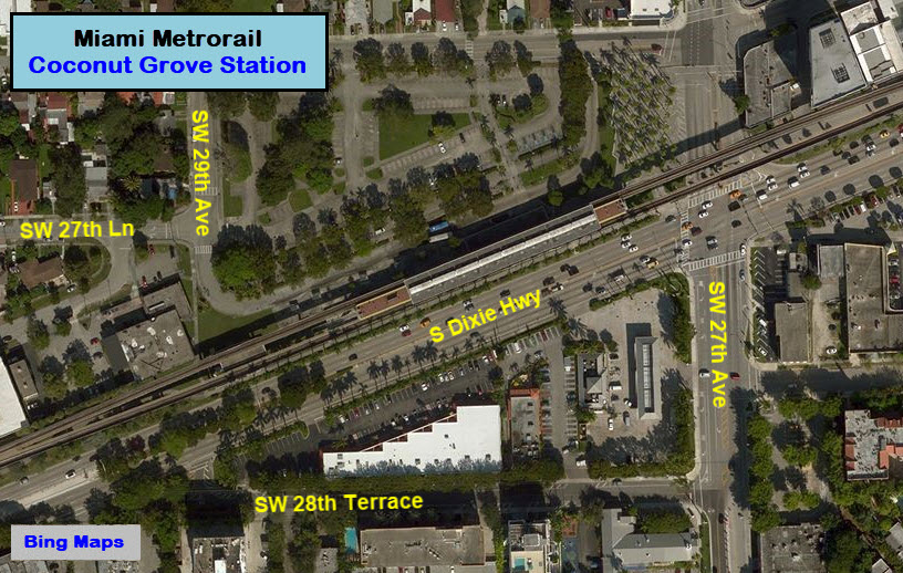
Coconut Grove
GPS Coordinates: 25.739802, -80.238918
Douglas Road
GPS Coordinates: 25.732816, -80.254769
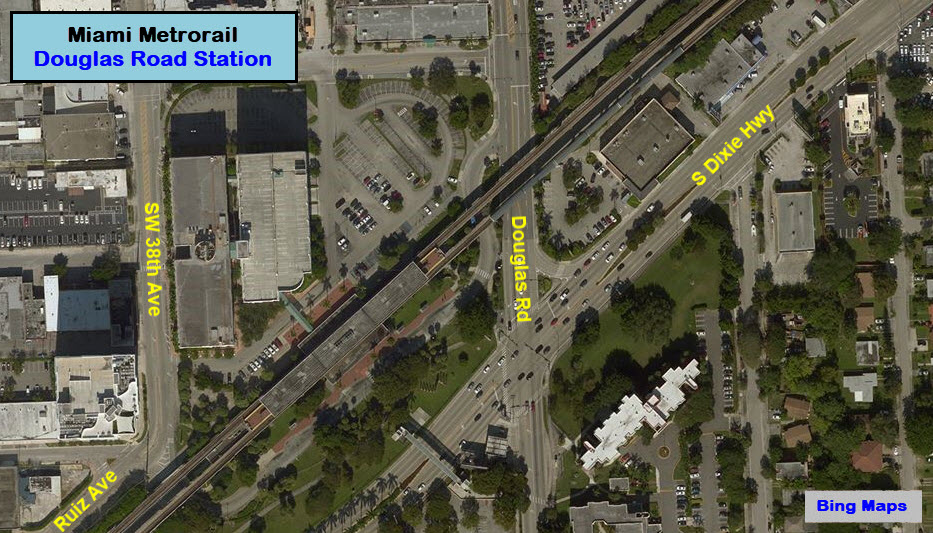
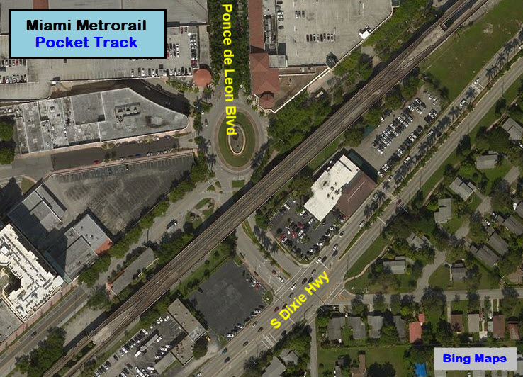
Pocket Track
GPS Coordinates: 25.730207, -80.258071
This pocket track is just south of the Douglas Rd station.
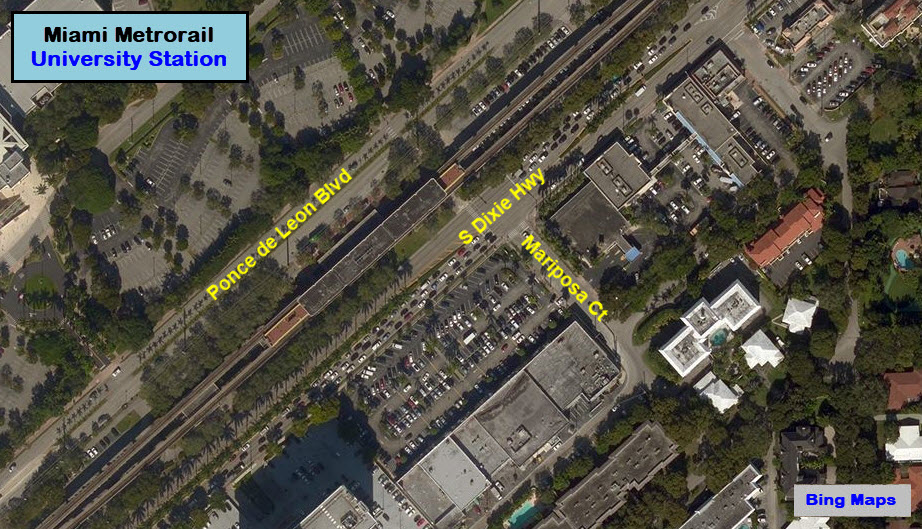
University
GPS Coordinates: 25.714825, -80.276969
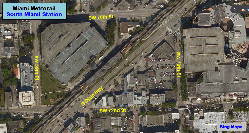
South Miami
GPS Coordinates: 25.705107, -80.289035
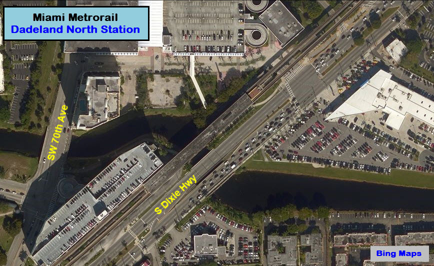
Dadeland North
GPS Coordinates: 25.691979, -80.305121
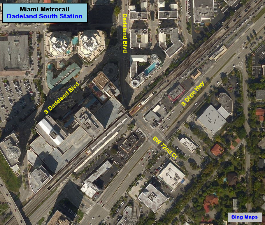
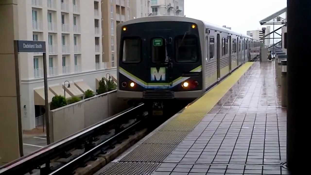
Dadeland South
GPS Coordinates: 25.685013, -80.313730
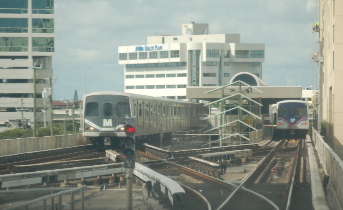 Brian Weinberg
 Brian Weinberg
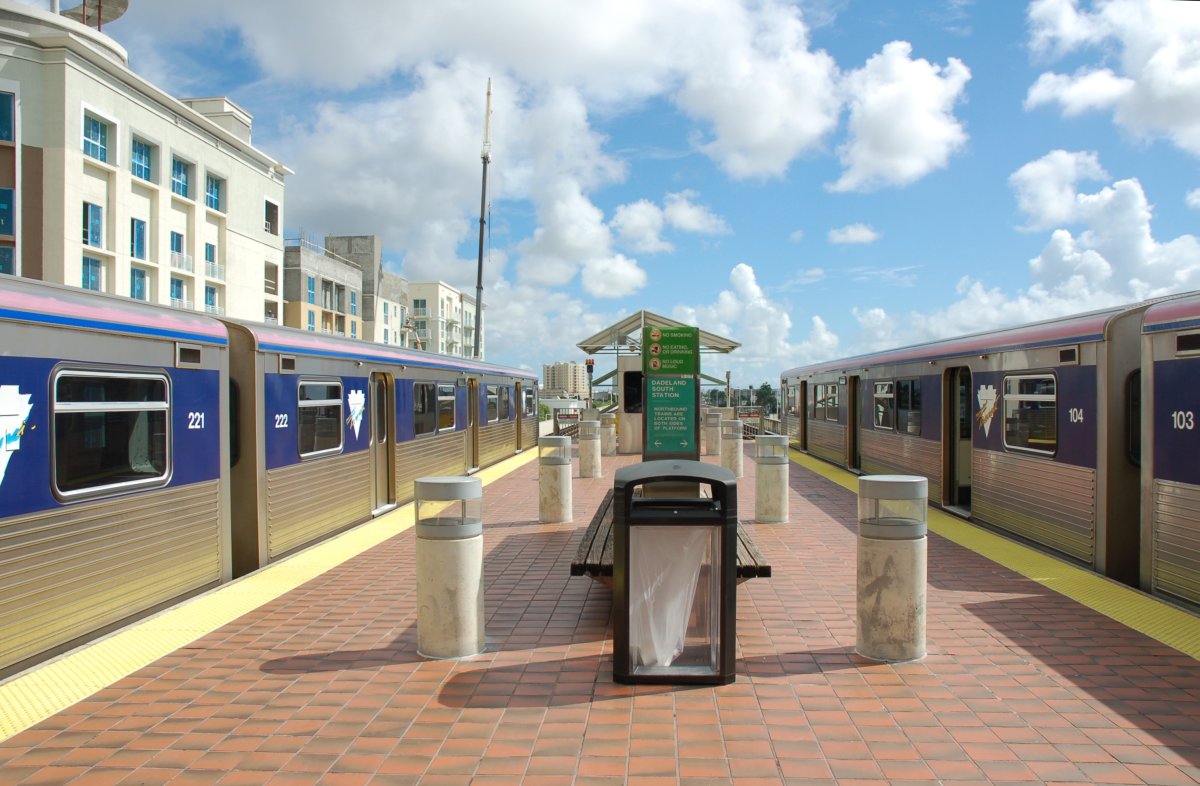
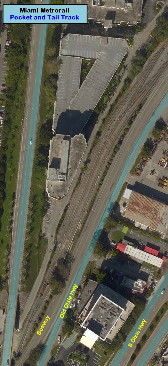
Pocket and Tail Track
GPS Coordinates: 25.680832, -80.317366
This is the south end of the current system. It is also at ground level.
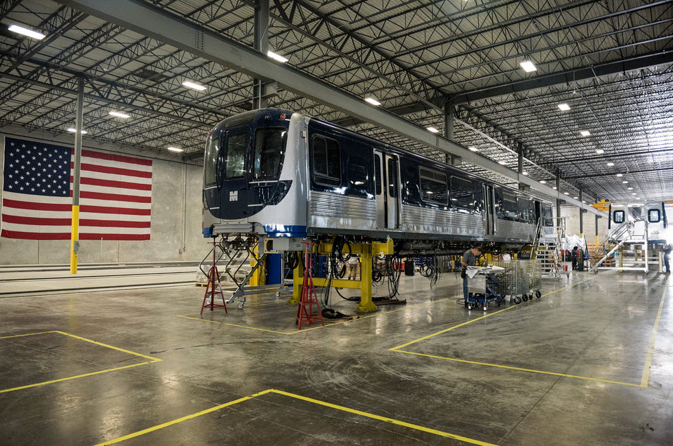 New Metrorail car at 2016 expo
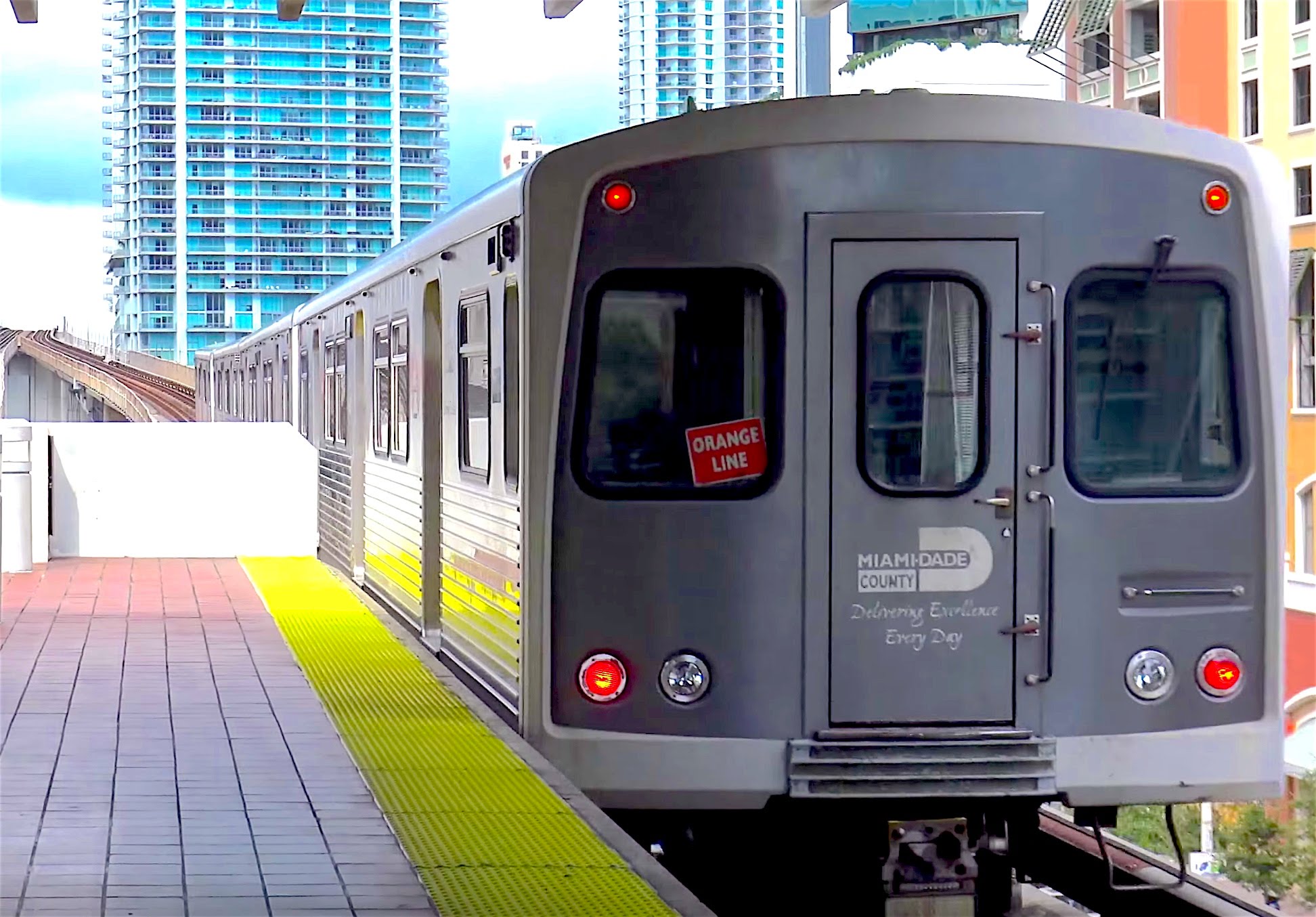
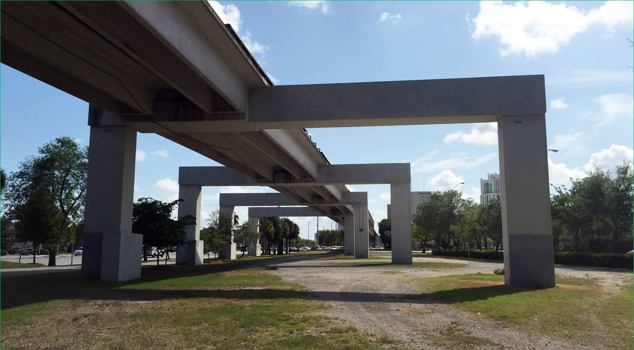
 Where are the hardhats and safety glasses?
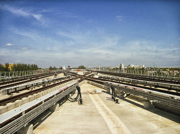 Orange/Green line split.
The UNDERLINE group wants to transform the ground under the Metrorail system into a 10 mile long park:
https://www.theunderline.org/
Disclaimers:
I love trains, and I love signals. I am not an expert. My webpages reflect what I find on the topic of the page. This is something I have fun with while trying to help others.
Please Note: Since the main focus of my two websites is railroad signals, the railfan guides are oriented towards the signal fan being able to locate them. For those of you into the modeling aspect of our hobby, myindexa page has a list of almost everything railroad oriented I can think of to provide you with at least a few pictures to help you detail your pike.
If this is a railfan page, every effort has been made to make sure that the information contained on this map and in this railfan guide is correct. Once in a while, an error may creep in :-)
My philosophy: Pictures and maps are worth a thousand words, especially for railfanning. Text descriptions only get you so far, especially if you get lost or disoriented. Take along good maps.... a GPS is OK to get somewhere, but maps are still better if you get lost! I belong to AAA, which allows you to get local maps for free when you visit the local branches. ADC puts out a nice series of county maps for the Washington DC area, but their state maps do not have the railroads on them. If you can find em, I like the National Geographic map book of the U.S..... good, clear, and concise graphics, and they do a really good job of showing you where tourist type attractions are, although they too lack the railroads. Other notes about specific areas will show up on that page if known.
Aerial shots were taken from either Google Maps or www.bing.com/maps as noted. Screen captures are made with Snagit, a Techsmith product... a great tool if you have never used it!
By the way, floobydust is a term I picked up 30-40 years ago from a National Semiconductor data book, and means miscellaneous and/or other stuff.
Pictures and additional information is always needed if anyone feels inclined to take 'em, send 'em, and share 'em, or if you have something to add or correct.... credit is always given! Please be NICE!!! Contact info is here
Beware: If used as a source, ANYTHING from Wikipedia must be treated as being possibly being inaccurate, wrong, or not true.
RAILFAN GUIDES HOME
RAILROAD SIGNALS HOME
NEW 08/26/2017
Last Modified
30-Aug-2017